Cloud Peak, Bighorn Mountains, Wyoming (7-19-16) – Part 1: The Mistymoon Trail to Base Camp

Lupe!  Stop that!  Be quiet!  You’re gonna get us in trouble.  People are still asleep!  Come on, it’s time to get going anyway!  (7:27 AM, 47°F)  Reluctantly, Lupe quit barking at the chipmunk, returning to SPHP with a huge smile on her face.  SPHP had promised her this was going to be a great day.  Lupe was already enthused, and she hadn’t even left the trailhead at West Tensleep Lake yet.

Lupe and SPHP headed N from the trailhead, quickly coming to a “Y” in the trail.  SPHP led Looper to the left down toward the E shore of West Tensleep Lake.  The day was starting off clear and cool.  There was hardly a ripple on the lake.

Lupe on the E shore of West Tensleep Lake. Photo looks N, the direction Lupe would take along the Mistymoon Trail.

Looks like we’re going to have perfect conditions, Loop.  We’ll reach base camp in plenty of time.  You can dilly-dally barking at squirrels all you want when we get farther from the campground.  This evening we might even have time to go take a look at Lake Solitude.

From the look on her face, it all sounded good to Lupe.  She trotted N along the Mistymoon Trail (No. 063), sniffing everything and expectantly checking the trees for squirrels.  It wasn’t long before she reached the N end of West Tensleep Lake.

Lupe quickly left West Tensleep Lake behind. Photo looks S.

A little N of the lake, Lupe suddenly growled, startling SPHP.  Right over there, SPHP!  A monstrous squirrel – taller than you!  Can I go get it?  Come and help me!  It will be a squirrel feast!  Hurry, hurry!  Don’t let it get away!

SPHP looked.  There was a monstrous squirrel, and it had heard Lupe growl!  It had moved a few steps over toward a small tree where it’s head was hidden from view.  Apparently the monstrous squirrel thought the rest of it couldn’t be seen either.  It was standing stock still, pretending to be invisible.  Lupe wasn’t deceived in the least.

The monstrous squirrel.

Hang on, Loop!  That’s no squirrel – it’s a moose!  You’ve seen them a few times before, remember?  And no, we can’t go chasing after it.

Moose or monstrous squirrel, it was mighty exciting to Lupe.  It was very close, and far from any tree big enough for it to climb.  Lupe stood quivering, hoping SPHP would let her go after it.  SPHP let her watch it quietly for a couple of minutes, but that was all.  Come on, Loopster, we have to let it be.

Are you serious!?  You know, SPHP, there’s something really screwed up about your instincts.  Sometimes I don’t think you know a darn thing about hunting or being in a pack!  If we ever starve to death on one of these mountain adventures, it will be your fault.

Shush!  I’m carrying your water and Taste of the Wild.  You have nothing to complain about.  Let’s carry on.

You’re a slow study, SPHP, a really slow study!

By now, the monstrous squirrel was ambling nonchalantly away, convinced that it really was invisible.  Lupe consented to continuing N on the trail.

Looking S back at some of the monstrous squirrel habitat in the West Tensleep Creek valley.

Less than half a mile N of West Tensleep Lake was a ford across West Tensleep Creek.  There wasn’t all that much water in the creek, this time of year.  Lupe and SPHP had no problem getting across.

Lupe at the ford in West Tensleep Creek. Photo looks WSW.

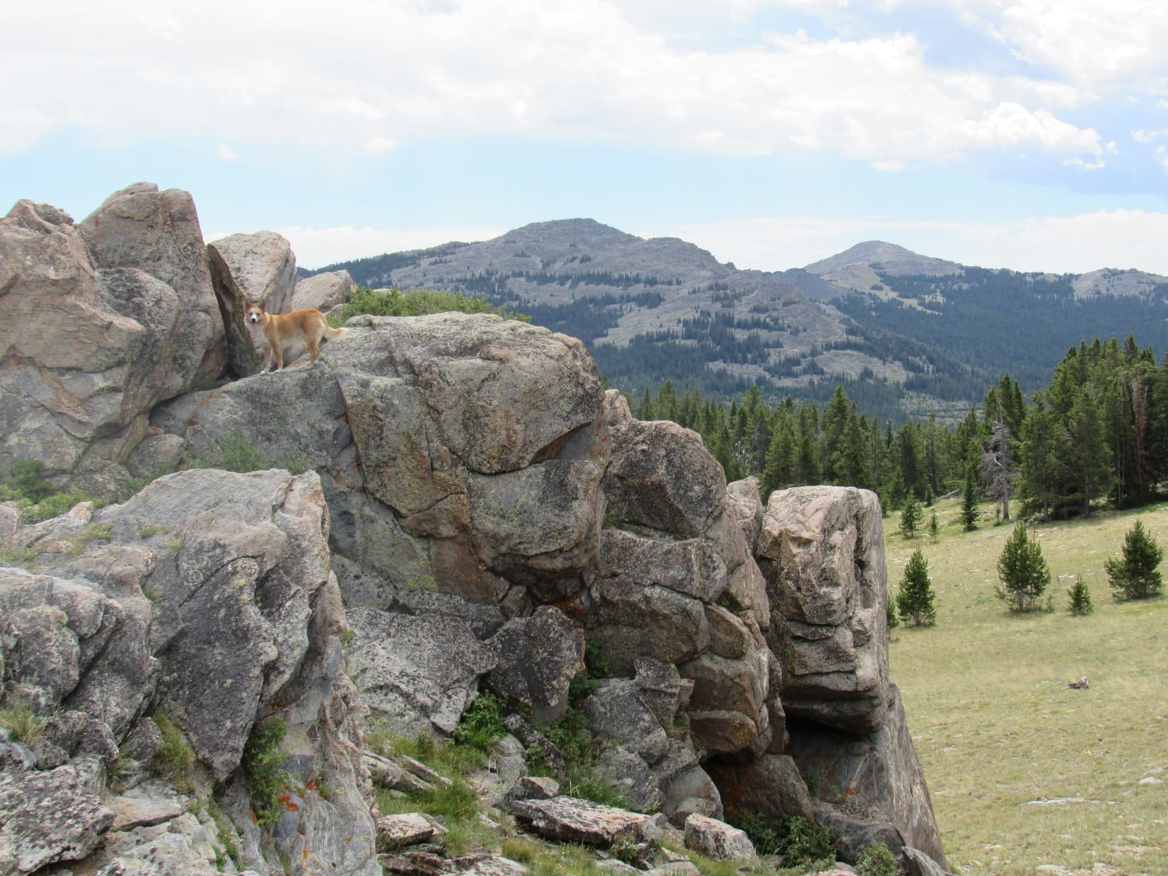
On the W side of the creek, the Mistymoon Trail angled NNW across a meadow.  Lupe followed the trail through the meadow and into the forest on the other side.  She arrived at a sign marking the start of the Cloud Peak Wilderness Area.

Lupe reaches the Cloud Peak Wilderness.

From here on, the Mistymoon Trail stayed mostly in the forest for several miles.  It headed N, roughly paralleling West Tensleep Creek, but well to the W and often considerably above it.  Lupe seldom saw the creek, but she frequently heard it.  She came to a few tiny trickling streams along the trail, but many more were dried up completely.

Lupe had some luck finding squirrels in the forest, and got to give a good barking to each one.  Sadly, these were all quite ordinary squirrels.  Lupe never saw another monstrous one or anything approaching it the rest of the day.

Lupe reaches by far the biggest clearing along the Mistymoon Trail on the way to Lake Helen. Most of the trail stayed in the forest. Photo looks NNE.

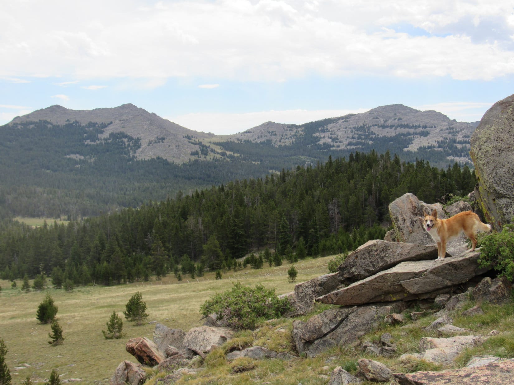
Most of the time, Lupe was gaining elevation at an easy to moderate pace.  There were even occasional downhill sections.  Eventually, though, she came to steeper areas where there were switchbacks.

When Lupe finally arrived at a junction with Trail No. 097 coming in from the SW, SPHP knew it wasn’t much farther to Lake Helen.  Within just a few minutes, Cloud Peak (13,167 ft.) came into view for the first time.  Cloud Peak was Lupe’s ultimate peakbagging goal on this trek, but she wouldn’t attempt the ascent until tomorrow.  Today all she had to do was get to base camp near Paint Rock Creek Falls.

Lupe’s first view of Cloud Peak (on the horizon L of Center) from the Mistymoon Trail. Photo looks NNE.

Once Lupe spotted Cloud Peak, it took her hardly any time at all to reach Lake Helen, the largest of three lakes she would come to along the Mistymoon Trail.

It was time for a break.  SPHP took off the boots and socks that had gotten wet fording West Tensleep Creek and laid them out to dry in the sun.  Lupe wasn’t too hungry yet, though she did nibble at some Taste of the Wild.  It was a gorgeous July morning in the Bighorn Mountains.  SPHP dangled feet in Lake Helen while sitting on a boulder.  Lupe preferred curling up and dozing in the shade of a little spruce tree.  Occasionally, she snapped at flies annoying her.

Lupe reaches the SW shore of Lake Helen. Photo looks NNE toward Cloud Peak.
Lupe at Lake Helen.
With the help of the telephoto lens, much of Lupe's eventual route up Cloud Peak is already in view beyond Lake Helen. The route starts below the high ridge on the L, and slopes up to the R above the biggest snow patch seen near Center, then follows the top of the near ridge the rest of the way R to the summit. Photo looks NNE.
With the help of the telephoto lens, much of Lupe’s eventual route up Cloud Peak is already in view beyond Lake Helen. The route starts below the high ridge on the L, and slopes up to the R above the biggest snow patch seen near Center, then follows the top of the near ridge the rest of the way R to the summit. Photo looks NNE.

Lupe had been making very good time along the Mistymoon Trail to Lake Helen, so SPHP took quite a long break there.  By the time, SPHP was ready to press on, the weather had changed.  The sky was clouding up.  Fortunately, it didn’t look threatening.  Lupe and SPHP hit the Mistymoon Trail again.  It wound around up above the W side of Lake Helen before returning to the shore farther N.

Flowers along the Mistymoon Trail.
Looking S back at Lake Helen as Lupe makes progress around the W shore on her way N.

The Mistymoon Trail passed through increasingly beautiful territory.  Lupe reached two more lakes in rapid succession.  Only 0.5 mile N of Lake Helen, she came to Lake Marion.  Another 0.5 mile N of Lake Marion brought Lupe to Mistymoon Lake.

Lupe with a scenic view of a pond between Lake Helen and Lake Marion. Photo looks NE.
Lupe nears Lake Marion, the middle and smallest of the 3 lakes in succession. Two parts of Lake Marion are in view from here. Cloud Peak is in view on the L. Photo looks NE.
The S end of Lake Marion. Photo looks E.
The N end of Lake Marion. Photo looks NE.
Lupe reaches Mistymoon Lake near its SW shore. The Mistymoon Trail ended near this point at its junction with the Solitude Trail. The Solitude Trail leading N along the W shore of Mistymoon Lake is seen here. Photo looks NE.

It was still early afternoon when Lupe reached the end of the Mistymoon Trail at its junction with the Solitude Trail (No. 038) near the SW shore of Mistymoon Lake.  Lupe only needed to go another mile or so N of Mistymoon Lake to reach her base camp near Paint Rock Creek Falls tonight.  She had a ton of time to get there.

SPHP paused to consider an idea.  Although the intention had been to press straight on to base camp, SPHP still felt full of energy.  No doubt Lupe was in even better shape.  Why not take the Solitude Trail E instead of N, just as a side excursion?  Lupe would get to see the Fortress Lakes and Gunboat Lake.  Sure, it was a bit of a climb, but even the more distant Gunboat Lake was less than 1.5 miles away.

Loopster, do you want to go see Fortress Lakes and Gunboat Lake?  We have plenty of time to do that, and still come back and continue on to base camp.

Lupe was in favor!  It did seem like a good idea.  Sometimes SPHP is so clever!  So instead of heading N on the Solitude Trail toward base camp, Lupe followed it E near the S shore of Mistymoon Lake on her way to Fortress Lakes and Gunboat Lake.

Lupe at Mistymoon Lake. Photo looks E along the S shore in the direction Lupe would follow the Solitude Trail to the Fortress Lakes and Gunboat Lake.

The climb on the Solitude Trail up to the largest of the Fortress Lakes was fairly steep, but adorned with lots of beautiful lupines.  It didn’t take too long to get up to where the trail leveled out and Lupe had a good view of the lake.

Lupines along the Solitude Trail on the way to Fortress Lakes.
Lupe nears the largest of the Fortress Lakes from the W. The Solitude Trail continues on past the lake along the S (Right) shore. Photo looks E.

Lupe continued E on the Solitude Trail until she was S of the W end of the largest of the Fortress Lakes.  Here, SPHP had another brilliant idea.  The maps showed another smaller Fortress Lake a short distance up the grassy slope to the S.  Why not go take a quick look at it?  Lupe really likes going off trail, so this idea met with quick approval, too.

It didn’t take Lupe long to reach the smaller Fortress Lake, which was quite pretty, tucked away in a spot sheltered by small mountains on three sides.

Lupe got up on an interesting big rock near the smaller Fortress Lake S of the largest lake. Photo looks SSE.
Lupe on the same rock, but this photo looks W toward part of the smaller Fortress Lake.
Lupe and SPHP both liked the looks of this smaller Fortress Lake. Photo looks WSW.

The micro-side excursion to the smaller Fortress Lake was a success!  Lupe and SPHP both liked the scenic little lake.  After enjoying the view, Lupe and SPHP went NE back down to the Solitude Trail.  Lupe continued E above the S shore of the largest Fortress Lake.

Lupe SE of the largest Fortress Lake. Photo looks back to the W the way Lupe had come here.

Lupe passed the Fortress Lakes, and started getting close to Gunboat Lake.  There were some minor rocky hills at the NE end of Gunboat Lake.  Lupe and SPHP climbed up on them to get a better view of Gunboat Lake.  SPHP thought Gunboat Lake was really gorgeous!

Lupe reaches the top of a rocky hill NE of Gunboat Lake. Photo looks SW.
Lupe at Gunboat Lake. The small mountain on the R at the far end of the lake is Peak 10860. Photo looks SW.
A beautiful American Dingo near beautiful Gunboat Lake. Photo looks SSW.

The original plan for Lupe’s side excursion from Mistymoon Lake was fulfilled.  Lupe had seen the Fortress Lakes and Gunboat Lake.  It was time to turn back.  However, Lupe was doing great, and SPHP was becoming ever more enthused about this beautiful territory!

SPHP checked the maps.  Another mile or so NE along the Solitude Trail would take Lupe to Florence Pass and Florence Lake.  Lupe probably would have gone on to Florence Pass, except for one thing.  At the far SW end of Gunboat Lake, SPHP saw a small mountain.  It was shown on the topo maps too, with an elevation of 10,860 feet.  It looked easy to get over there, easy to climb, and was sort of on the way back toward Mistymoon Lake.

Why not have Lupe climb Peak 10,860?  Lupe would love the off trail trek!  SPHP couldn’t resist.  Sorry, Florence Pass, Lupe is off to do a little peakbagging instead!

Peak 10860 beyond Gunboat Lake. Photo looks SW.

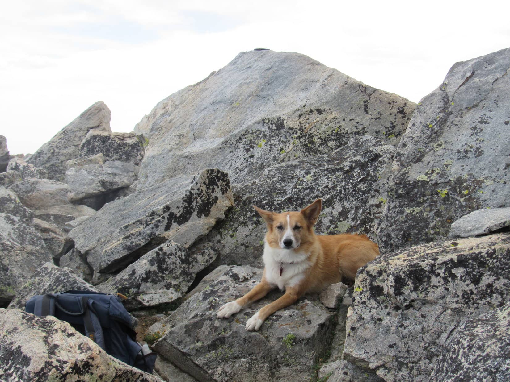
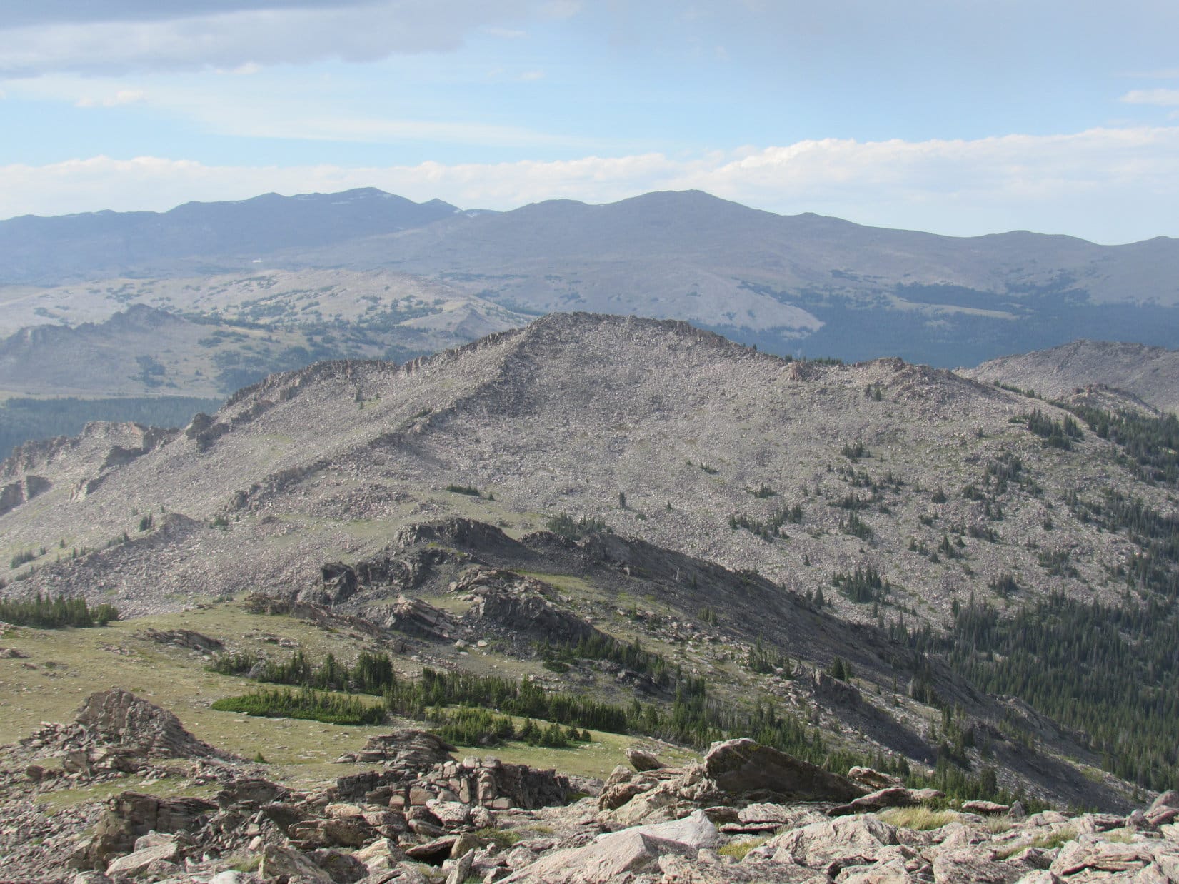
It all went well.  Lupe raced along ahead of SPHP sniffing and exploring.  For SPHP, it was a lovely stroll in a gorgeous setting.  The climb was fun and relaxing.  The views were marvelously rewarding.  Soon Lupe was at the top of Peak 10860.

Lupe partway up Peak 10860. Photo looks back to the NE toward Gunboat Lake and the Florence Pass area toward the L beyond it.
Piece of cake climb! Looking W up toward the summit of Peak 10860.
Lupe near the top of Peak 10860. A pretty unnamed lake is seen below on the L. Farther off in the distance on the R is Lake Helen. Photo looks SW.
Lake Helen from Peak 10860. Photo looks WSW.
Lupe at the very summit of Peak 10860!
Umm, SPHP, this Peak 10860 really isn't all that high. Are we going to do this other one, too? Sure thing, Loop. Just spread your wings and fly on up there. Remember to smile! I will stay here and take your picture. Photo looks ESE.
Umm, SPHP, this Peak 10860 really isn’t all that high. Are we going to do this other one, too? Sure thing, Loop. Just spread your wings and fly on up there. Remember to smile! I will stay here and take your picture. Photo looks ESE.
Looking NNE down on the largest Fortress Lake from Peak 10860.

It was great up on Peak 10860!  SPHP became so enthralled, anything seemed possible.  Looking back toward Florence Pass, it looked like there was a good route from that area up Bomber Mountain (12,840 ft.).  Why, after climbing Cloud Peak tomorrow, maybe Lupe should come back here the next day and climb Bomber Mountain, too!  The whole notion was exciting.

Looking NE back toward Bomber Mountain (L of Center) and the Florence Pass area (R of Center). Part of Gunboat Lake is on the lower R.

Well, Loopster, this side excursion has been a grand success, but time is moving on and we better, too.  We’d best get started back to Mistymoon Lake, and on over to base camp!

The Carolina Dog was ready to go.  SPHP decided to head NW off Peak 10860, in the general direction of Mistymoon Lake.  Lupe led the way.  Soon both Fortress Lakes were in view below off to the NNE.

Lupe started down Peak 10860 along a route that soon revealed both of the Fortress Lakes down below. SPHP should have headed down that way back to the Solitude Trail. Photo looks NNE.

SPHP now made a terrible decision.  It would have been very simple to just let Lupe lead the way back down to the Fortress Lakes and the Solitude Trail.  However, in the saddle between Peak 10860 and a lower peak to the NW, SPHP led Lupe around to the WNW instead.

At the time, it looked like there might be a more direct route to Mistymoon Lake going this way, but what initially appeared to be an easy way around to the NW side of the lower peak wasn’t.

The route Lupe ended up taking wasn’t awful, but it was sure a lot harder than the Fortress Lakes route would have been.  It was steep, proved to be every bit as long, and there was no trail.  The terrain forced Lupe to lose so much elevation, she was nearly back down to Lake Marion’s level before she could turn NW to start climbing back up toward the Mistymoon Trail and Mistymoon Lake again.

Lupe contemplates the silly route SPHP chose. Photo looks SW toward Lake Marion. The terrain forced Lupe almost all the way down to Lake Marion's level before she could turn NW to return to the Mistymoon Trail. She had to regain some of this lost elevation on the way back to Mistymoon Lake.
Lupe contemplates the silly route SPHP chose. Photo looks SW toward Lake Marion. The terrain forced Lupe almost all the way down to Lake Marion’s level before she could turn NW to return to the Mistymoon Trail. She had to regain some of this lost elevation on the way back to Mistymoon Lake.
Lake Marion again with the telephoto lens.

Well, the plucky American Dingo made her way back to Mistymoon Lake, of course, and in much better shape than SPHP.  Lupe continued exploring while SPHP trudged N along the Solitude Trail.  Beyond the lake, the trail gradually climbed NE toward the pass over to the Paint Rock Creek valley.  Cloud Peak loomed above.

Cloud Peak looms in the sunlight above the pass N of Mistymoon Lake over to the Paint Rock Creek valley. The areas in shadow and sunlight look connected in this photo, but they aren't. Photo looks NE.
Cloud Peak looms in the sunlight above the pass N of Mistymoon Lake over to the Paint Rock Creek valley. The areas in shadow and sunlight look connected in this photo, but they aren’t. Photo looks NE.

All that surplus energy and enthusiasm SPHP had earlier was gone.  Boy, I’ve done it again haven’t I, Looper?  We could have been at base camp hours ago, and all rested up for Cloud Peak tomorrow.  Right now, I feel like even a full night’s sleep isn’t going to revive me.  I’m running on empty.  Hah, Bomber Mountain the day after Cloud Peak!  I’m surprised you didn’t laugh out loud up there on Peak 10860, dear Dingo!

The Carolina Dog was too polite to respond.  SPHP made it over the pass.  Paint Rock Creek valley was beautiful.  There was the waterfall, and beyond it the ledge to the NW above the waterfall where Lupe’s base camp would be.

Paint Rock Creek valley. The waterfall isn't in view, but is toward the right edge of the photo near the cluster of stunted trees and bushes. Lupe's base camp would be set up on the grassy ledge just above that area. Photo looks NW.
Paint Rock Creek valley. The waterfall isn’t in view, but is toward the right edge of the photo near the cluster of stunted trees and bushes. Lupe’s base camp would be set up on the grassy ledge just above that area. Photo looks NW.
Lupe on the side trail off the Solitude Trail that leads over to the waterfall on Paint Rock Creek. Photo looks N.
Looking down Paint Rock Creek from near the base of the waterfall. Photo looks SW.

Lupe and SPHP crossed the valley and made it over to Paint Rock Creek Falls.  Lupe had a drink of the clear, cold water.  Then it was time to make the short, steep climb up to the grassy ledge above the falls.

Up on top, SPHP was surprised to find that there wasn’t another soul around.  This was the closest and best place anywhere for a Cloud Peak base camp.  Well that’s pretty awesome Loop, we have this glorious place all to ourselves!  At least we are well positioned for tomorrow!

SPHP set up Lupe’s “tiny house”.  There was still an hour and a half left before sunset, but even Lupe was ready to retire for the night.  Your a smart Dingo, Lupe!  Even though it would be fun to watch the sun go down, this time I’m following your lead!

Lupe's tiny house set up at the best base camp there is for an ascent up Cloud Peak. Photo looks NE.
Lupe’s tiny house set up at the best base camp there is for an ascent up Cloud Peak. Photo looks NE.
Lupe in her "tiny house".
Lupe in her “tiny house”.
Sweet dreams, Lupe! More adventures ahead tomorrow!

Links:

Next Adventure                         Prior Adventure

Cloud Peak, Bighorn Mountains, Wyoming – Part 2: Paint Rock Creek Falls Base Camp to the Summit (7-20-16)

Want more Lupe adventures?  Choose from Lupe’s 2016 Bighorn Mountains, WY Adventure Index, Dingo Vacations Adventure Index or Master Adventure Index.  Or subscribe free to New Lupe Adventures.

Hazelton Pyramid, Bighorn Mountains, Wyoming (7-18-16)

It wasn’t even noon yet, when Lupe concluded her successful visit to all three possible Washakie County, Wyoming high points (9,600 ft.).  There was still time in the day for Lupe to tackle her next peakbagging goal, Hazelton Pyramid (10,534 ft.), which was only 6 or 7 miles away to the SE.  Lupe and SPHP headed E on Hwy 16 in the G6.  After going just a couple of miles, SPHP parked at Powder River Pass.

Some sort of bicycling event was going on along Hwy 16.  There were lots of bicyclists at the big pullout, which was serving as a rest and refreshment stop.

Lupe near Powder River Pass. Photo looks NNE.

Lupe wasn’t here for the bicycle event.  A short stroll S of Hwy 16 were some big rock formations from which SPHP wanted to get a preliminary look at Hazelton Pyramid.

Lupe up on the rock formations near Powder River Pass. Hazelton Pyramid is the more distant peak on the R. Photo looks SSE.
Hesse Mountain (10,385 ft.) (L) as seen from Powder River Pass. Nearly 2 years ago, Lupe had climbed Hesse Mountain on 8-6-14. Photo looks SE.
Hesse Mountain (10,385 ft.) (L) could also be seen from Powder River Pass. Nearly 2 years ago, Lupe had climbed Hesse Mountain on 8-6-14. Photo looks SE.

The view of Hazelton Pyramid was encouraging.  Lupe also got a look at Hesse Mountain, which she had climbed on an intermittently foggy day almost 2 years ago.

Lupe and SPHP returned to the G6.  A mile E of Powder River Pass, SPHP turned S off Hwy 16 onto USFS Road No. 29.  No. 29 wound around for 4 or 5 miles in a generally SSW direction.  At a small turnaround loop where the road first reaches the North Fork of the Powder River, SPHP parked the G6 again (1:02 PM).  Hazelton Pyramid was about 2 miles away to the ESE.  Lupe would start for Hazelton Pyramid from here.

Hazelton Pyramid is the more distant peak on the R. The high ground at Center is in the area of High Point 10201 on the Peakbagger.com topo map. Photo taken from USFS Road No. 29 before reaching the North Fork of the Powder River. Photo looks SE.
Lupe cools off in the North Fork of the Powder River before setting out for Hazelton Pyramid.

A bridge near the turnaround loop got SPHP over to the N side of the Powder River where Lupe started off heading NE on 4WD Route 584111.  She soon turned E on Route 584116, which quickly leveled out and left open ground to enter the forest.  Before long, the road curved S and crossed a small creek.  Beyond the creek, Lupe and SPHP continued on the road, but not very far, since it started trending SW.

Lupe left the road to begin climbing ESE through the forest.  The forest featured great views of, well, trees.  Lupe was happy with that.  Trees meant squirrels!  The slope gained elevation at a moderate pace, making for a pretty pleasant shady trek.  Lupe had fun dashing this way and that winding along a maze of faint animal trails.  She did find a few squirrels to growl and bark at, while they taunted and hurled insults at her from the safety of the treetops.

After 0.5 mile or more going through the forest, Lupe reached the top of a relatively flat and broad ridge.  There was a large meadow here from which it was possible to see Hazelton Pyramid again, and some of the high ground above tree line leading to it.

Lupe reaches a big meadow on the first ridge. Hazelton Pyramid is the distant peak on the R. From here, Lupe headed toward the high rocky ridge on the L. She followed the base of that ridge to the minor pass and high point seen just L of Center. Photo looks E.

There were a couple of reasonable looking routes toward Hazelton Pyramid from here.  Lupe could either climb above tree line heading ENE to the base of a rocky ridge which she could follow up to high ground near High Point 10201, or stay lower and farther S while heading E in an area of scattered forest.

SPHP thought the route up near the rocky ridge looked more dramatic and interesting.  Lupe was quite certain the scattered forest would offer more squirrel possibilities, but she had no real objections to the rocky route.  After all, there might be marmots up there, and marmots are fun, too!  Either way was fine with Lupe.  In any case, there was still a bit of forest to go through even to get to the rocky route.

Above tree line, Lupe approaches the rocky ridge (L). She soon passed below it to reach the saddle seen R of Center, and then climbed the high point on the R. Photo looks E.

Lupe lost a little elevation going through the last section of forest on the way to the rocky route, but quickly regained it on a somewhat steep climb just beyond the forest.  Soon (well relatively soon, SPHP kept stopping for air) Lupe was approaching the area below the rocky ridge.  Here the climb was not so steep. The views got better and better as Lupe headed for a saddle near the E end of the ridge.

Looking back to the W along the rocky ridge as Lupe continues her climb.

When Lupe reached the saddle (a short distance SW of High Point 10201), she had a great view of Hazelton Pyramid ahead.  Lupe could also see the high ground she would follow as it swept around to the summit.

Lupe reaches the saddle SW of High Point 10201. Hazelton Pyramid is seen beyond her. Lupe would eventually follow the high ground on the L as it sweeps around toward the summit. Photo looks ESE.

Before continuing on to Hazelton Pyramid, Lupe checked out the views from the minor high point immediately SW of the saddle.

Lupe up on the minor high point SW of the saddle. Photo looks SW.
Looking NW over the rocky ridge toward some of the higher peaks of the Bighorns.
Looking W. USFS Road No. 29 is visible far below on the L. The G6 is parked down there, but not in view.

After a short rest break on the minor high point, Lupe and SPHP returned to the saddle.  It was time to follow the high ground leading over to the summit of Hazelton Pyramid.  Most of the time, Lupe was able to stay at or near the top of the long ridge.  A couple of times she was forced to lose some elevation to get around small cliffs.

Getting closer! Photo looks SE.
Looking back to the W along Lupe's route. This first part of the way from the minor high point was pretty easy. The high ground was wide, mostly grassy, and not steep at all. As Lupe got closer to the top of Hazelton Pyramid, the ground grew progressively rougher, rockier, and steeper.
Looking back to the W along Lupe’s route. This first part of the way from the minor high point was pretty easy. The high ground was wide, mostly grassy, and not steep at all. As Lupe got closer to the top of Hazelton Pyramid, the ground grew progressively rougher, rockier, and steeper.

The last part of Lupe’s climb up Hazelton Pyramid was the steepest and rockiest, but still easily manageable.  The true summit turned out to be along a ridge of boulders extending farther to the SE a few hundred feet beyond the apparent summit Lupe had seen while climbing up from the NW.  Lupe and SPHP stayed on the NE side of this ridge due to a steep drop off immediately to the SW.

On Hazelton Pyramid! The very highest boulder is seen still a little farther beyond Lupe. Photo looks SE.
Lupe reaches the highest boulder on Hazelton Pyramid! Photo looks SE.
Lupe at the summit. Note the survey benchmark clearly visible on top of the boulder. Photo looks SE.
The survey benchmark at the summit.

Naturally, Lupe and SPHP took a break up on Hazelton Pyramid for water, a bit to eat, and to spend some time admiring the splendid views.  Although it had been a beautiful, mostly sunny day during the entire ascent, a line of gray clouds was now approaching from the SW.  Streaks of rain trailed beneath the clouds.  SPHP eyed the clouds suspiciously, even though they didn’t look too threatening.

Fortunately, there wasn’t any thunder or lightning.  Lupe and SPHP stayed on the mountain.  A SW wind picked up and blew rather strongly for a little while as the clouds approached.  Lupe had to endure a rainstorm as they passed over Hazelton Pyramid, but it didn’t rain hard or last too long.  The day soon grew somewhat sunnier again.

Looking NNW from Hazelton Peak before the rain clouds arrived. The cairn seen next to Lupe is some distance NW of the true summit. Lupe originally passed by it on her way to the summit. High Point 10372 is the barren, somewhat lower peak 1.25 miles away in the foreground R of Center. Much higher peaks of the Bighorn range are seen on the far horizon.
Lupe went a little farther SE along the summit ridgeline beyond the true summit of Hazelton Pyramid (10,534 ft.) to get this view of Hazelton Peak (10,264 ft.) seen beyond Lupe another 1.33 miles farther to the SE.
Lupe went a little farther SE past the true summit of Hazelton Pyramid (10,534 ft.) to get this view of Hazelton Peak (10,264 ft.), seen beyond Lupe another 1.33 miles farther to the SE.
Looking WSW over the edge of the Hazelton Pyramid summit ridge.
Lupe in an Egyptian mood just below the summit of Hazelton Pyramid. Here she poses as the Dingo-Sphinx. SPHP did not dare request any riddle from the Dingo-Sphinx for fear of what might happen if SPHP couldn't answer the riddle correctly.
Lupe in an Egyptian mood just below the summit of Hazelton Pyramid. Here she poses as the Dingo-Sphinx. SPHP did not dare request any riddle from the Dingo-Sphinx for fear of what might happen if SPHP couldn’t answer the riddle correctly.

Eventually, of course, it was time to start down off Hazelton Peak to begin the trek back to the G6.  For a long way, Lupe and SPHP continued to enjoy the wonderful mountain scenery visible from the high ground above tree line.

Lupe starts back down off Hazelton Pyramid. She would retrace her route up along the high ground seen on the long ridge in the foreground, going first down toward the R, and then over to the L. Photo looks W.
Tiny blue flowers like these were abundant on the upper slopes of Hazelton Pyramid.
Looking NNW. High Point 10372 in the foreground on the R.
Looking W toward the minor high point (L of Center) Lupe climbed on the way to Hazelton Pyramid. The saddle is seen to the R of it. Somewhere in the cluster of rocky prominences to the R of center is High Point 10201.
High Point 10372 with higher peaks of the Bighorn Range in the distance. Photo looks NNW using the telephoto lens.
Looking back up at the apparent summit of Hazelton Pyramid from the NW. The true summit is out of sight 200 to 300 feet farther SE along a continuation of the ridge of boulders seen on the R which curves directly away from the camera at a point near the Center of this photo.
Looking back up at the apparent summit of Hazelton Pyramid from the NW. The true summit is out of sight 200 to 300 feet farther SE along a continuation of the ridge of boulders seen on the R, which curves directly away from the camera at a point near the Center of this photo.
Looking N. High Point 10372 (L) and double-peaked Hesse Mountain (R) with higher peaks of the Bighorn Range on the horizon.
Rock columns in the general area of High Point 10201. Photo looks N.
Lupe returns to the saddle area NE of the minor high point she climbed on the way to Hazelton Pyramid. Photo looks N.
Looking W back down along the first rocky ridge.

Lupe retraced her way up Hazelton Peak all the way back down below tree line.  Not too long after reaching the forest, SPHP tried to take a shortcut, heading WNW down off the ridge before reaching the big meadow.

The shortcut became a longcut and a Lupe adventure all its own, but one without photos as SPHP tried to hurry through the darkening forest.  At one point Lupe crossed a road which may have been 4WD Route 584113.  Lupe explored beautiful little clearings of swampy land near a tiny creek.  However, the forest seemed longer, denser, and more difficult to navigate than on Lupe’s original route.

All’s well that ends well, though!  Lupe finally emerged from the forest and swamps on open ground above and N of 4WD Route 584116.  SPHP recognized Route 584111 a little farther off to the W.  Lupe trotted happily along.  She was almost back to the North Fork of the Powder River and the G6 (7:37 PM).

Sunset in the Bighorn Mountains, 7-18-16

Well, Loopster!  That was a pretty good day wasn’t it?  Up before dawn barking at cows and horses on the way to the Bighorns, visiting all 3 of the Washakie County High Point candidates, and then climbing Hazelton Pyramid, too!

Yes, this was great, and about time, too!  What’s on the agenda tomorrow?

Tomorrow you start for Cloud Peak (13,167 ft.), the highest mountain in the entire Bighorn Range!  It’s so big and so far it will take us 2 days to get to the top.

Oh, sounds exciting!  Will there be squirrels?

I think you’re gonna like it, and yeah, there should be some squirrels.  Believe me, your summer of 2016 is going to be fantastic.  You haven’t seen anything yet, Looper!

Heh, I certainly hope so SPHP, until today that’s been just about literally true! 

Links:

Next Adventure                        Prior Adventure

Hazelton Peak, Bighorn Mountains, Wyoming 6-27-19

Want more Lupe adventures?  Choose from Lupe’s 2016 Bighorn Mountains, WY Adventure IndexDingo Vacations Adventure Index or Master Adventure Index.  Or subscribe free to new Lupe adventures.

The Washakie County High Point, Bighorn Mountains, Wyoming (7-18-16)

Huge sigh!  One of many at long intervals.  Dejected, Lupe lay bored on the floor.  Sometimes she stared out the window.  Sometimes just out into space.  After a promising start with a trip to the Laramie Mountains in Wyoming in late May, Lupe had returned to the Black Hills on June 1st expecting great things from the summer of 2016.  Instead, June immediately turned hot – too hot for her Black Hills expeditions.  June shot by, and Lupe didn’t get to go anywhere in the hills.

Early July started out a little better, with two short Summits on the Air outings (Custer Peak & Boulder Hill) with Joe and Dusty.  Then it was back to laying on the floor, forlorn and disappointed day after day.  The middle of July came and went.  Still Dullsville.

Lupe didn’t realize it yet, but great things were in the works.  Preparations for her fabulous Summer of 2016 Dingo Vacation were nearing completion.  Lupe would soon be on her way much farther than she had ever been before to visit beautiful places and climb some spectacular peaks!

One mountain on the list, however, wasn’t that far away.  Cloud Peak (13,167 ft.), the tallest mountain in the Bighorn range of north central Wyoming, was easily the highest peak Lupe would attempt to climb this year.  For Lupe and SPHP, Cloud Peak meant a 3 day/2 night backpacking trip.

Why not take Lupe to the Bighorns even before the start of her summer of 2016 Dingo Vacation?  Getting Cloud Peak out of the way beforehand would free up several days on her summer of 2016 Dingo Vacation she could use to climb much more distant peaks she might never otherwise have a chance to attempt.  It was a good idea, and high time for some action anyway.

SPHP checked the weather forecasts.  Starting July 18th, 4 consecutive days of 100°F heat with little or no chance of rain were coming to Buffalo, WY.  Perfect for adventuring in the high country, where it would be considerably cooler!  Much to her surprise and delight, Lupe was on the road headed for the Bighorns before dawn.

Lupe was already on her way to the Bighorn Mountains when the sun rose on July 18th.

Only a few hours later, Lupe was in the Bighorns!  Before tackling Cloud Peak, though, SPHP had a couple of other easier peakbagging objectives in mind for Lupe.  The first one was really easy – the Washakie County High Point (9,600 ft.).  At 9:48 AM (66°F), SPHP parked the G6 just S of Hwy 16 along USFS Road No. 25.  This intersection is in Washakie County only a short distance W of the Johnson County line.

Finally back in action! Lupe arrives in the glorious Bighorn Mountains of north central Wyoming. Here she is S of Hwy 16 ready for an easy trek to the Washakie County High Point. Two of the three possible high points are in the forest on the low hill beyond her. Photo looks SSW.

The only thing time consuming or unusual about the Washakie County High Point is that there are three candidates for the actual highest point.  Two of them are about 0.25 mile S of Hwy 16 on a low forested ridge.  The third candidate is about the same distance N of Hwy 16.  Lupe and SPHP headed across the field toward the S candidates first.  As a guide, SPHP had a copy of a trip report by Edward Earl dated July 30, 2002.

At the edge of the forest was a barbed wire fence.  The lower part of the fence was a wire mesh which Lupe could not get through.  Lupe and SPHP followed the fence W until Lupe reached a gate with orange posts where she was able to get by.  After that, Lupe sniffed around exploring the forest while making the climb to the first of the high points.

Lupe next to the summit cairn of the first of the Washakie County High Points she reached S of Hwy 16. This high point is NW of the other high point S of Hwy 16. Photo looks NW.
Another view looking NW toward the Washakie County High Point. (Still looking at part of the NW high point of the 2 candidates S of Hwy 16.)

Lupe visited the two Washakie County High Point candidates S of Hwy 16.  Both were very rocky.  They were only a few minutes walk apart, but due to the forest, not really visible from each other.  Neither had much in the way of views, although there were partial views to the S and E from the SE high point.  The most open views were actually from a lower rock outcropping a bit to the S of the area between the two high points.

Before visiting the Washakie County High Point candidate S of Hwy 16 that was the farthest SE, Lupe found this lower rock outcropping nearby, which actually offered the best views. Photo looks SSW.
Lupe at the SE candidate for Washakie County High Point S of Hwy 16. Photo looks SE.
The SE candidate of the 2 high points S of Hwy 16 was a line of slanting boulders. Photo looks WNW in the general direction of the NW high point, which could not be seen from here due to the forest, although it is only a few minutes walk away.
Another view of the SE high point candidate. Photo looks SE.
Still at the SE high point candidate. Although it wasn't possible to see the NW candidate from here, it was possible to catch a glimpse of both from some of the territory between them. Photo looks NW.
Still at the SE high point candidate. Although it wasn’t possible to see the NW candidate from here, it was possible to catch a glimpse of both from some of the territory between them. Photo looks NW.

Edward Earl’s trip report mentioned a cairn at both high point candidates S of Hwy 16, but Lupe only saw a cairn at the NW high point.  After visiting both of the S candidates, Lupe headed NE through the forest until she reached USFS Road No. 25 near a cattle guard providing an opening in the fence line.  Lupe is an expert at crossing cattle guards, which present no obstacle to her at all.

Lupe and SPHP proceeded across Hwy 16 a few hundred feet E of the Hwy 16/USFS Road No. 25 intersection.  Shortly after re-entering the forest N of the highway, Lupe came to another barbed wire fence.  It had 5 wires, and the lowest wire was dangerously close to the ground for Lupe.  SPHP lifted Lupe over the fence.  Lupe then continued N, once again up a gentle forested slope while looking for her final objective – the third and last Washakie County High Point candidate.

Edward Earl’s trip report mentioned a small summit, with perhaps 20′ of prominence just E of the Johnson County line in Johnson County.  Lupe came to a pile of boulders that looked likely to be this small summit.

When Lupe found this pile of boulders N of Hwy 16, SPHP figured it must be the 20' high summit mentioned in Edward Earl's trip report. Photo looks NNE.
When Lupe found this pile of boulders N of Hwy 16, SPHP figured it must be the 20′ high summit mentioned in Edward Earl’s trip report. Photo looks NNE.
Up on top of the 20' high summit. Photo looks S.
Up on top of the 20′ high summit. Photo looks S.

According to Edward Earl, the 3rd Washakie County High Point candidate was located on a small E/W running ridge 50 to 80 yards to the W of the small summit.  Only 100 feet W of the small summit there was supposed to be a 4 foot high boulder with a cairn on it and a log leaning against it.  Mr. Earl thought the true high point was 50 to 100 feet farther W of this boulder.

It sounded pretty easy to find.  Lupe and SPHP headed W from the small summit looking for the 4 foot high boulder and E/W ridge.  However, Lupe had no luck.  She went well beyond 100 feet without seeing the 4 foot high boulder.  There didn’t seem to be any sign of the E/W ridge either.  The forest in this area was all on gently sloping terrain.  A 4 foot high boulder or a ridge of any significant size should have been easy to spot.  Lupe and SPHP circled around the area several times, but found nothing of interest.

Puzzling.  Lupe and SPHP returned to the small summit with all the boulders.  Was it possible this wasn’t the summit Edward Earl had mentioned?  A short distance to the N, the forest sloped up toward higher ground.  Well, Loop, let’s go check it out.  I can’t think of anything else reasonable to try.

After going a little farther N, Lupe and SPHP arrived up on a ridge that was definitely higher than the small summit.  This ridge seem to go roughly E/W, although it was N of the small summit, not W of it.  Maybe Lupe was too far E?  Lupe and SPHP headed W along the ridge.  Lupe hadn’t gone too far, when there was a break in the ridge.  Not far away on the other side of the break was a small hill or continuation of the ridge.  Lupe headed for it.

Lupe arrives up on the W side of the break in the ridgeline. Was this actually the small summit Edward Earl had mentioned? Lupe did have to climb about 20 feet to get up here. Or was this rock with a cairn on it the 4 foot high rock? Was the rotting tree beyond it the log that had been leaning against the rock? Photo looks N.

On the W side of the break, Lupe did have to climb up about 20 feet to get up on a little hill from which the ridge continued on in an E/W direction.  Perhaps this was the small summit Edward Earl had mentioned?  There was another possibility, too.  The hill featured a rock several feet high with a cairn on it.  A rotting tree to the N of it might have been the log leaning against the 4 foot high boulder?

SPHP wasn’t completely certain where Lupe was in relation to Edward Earl’s directions, but this area did seem to fit the general description.  It seemed clear that Lupe should continue exploring farther W along the ridge for at least a few hundred feet in any case.  If this was Mr. Earl’s small summit, Lupe should find a four foot high boulder about 100 feet to the W.  If not, Lupe should still cross the 3rd high point candidate somewhere along the way.  Lupe and SPHP headed W.

Lo, and behold!  There it was!  Roughly 100 feet away Lupe did find a 4 foot high boulder with a cairn on it!  It was sitting off by itself in the forest, like a true landmark.  SPHP felt 90% certain this had to be the boulder Edward Earl was referring to.

Nice job, Lupe! This must be Edward Earl's 4 foot high boulder with a cairn on it. The final Washakie County High Point candidate is close by to the W!
Nice job, Lupe! This must be Edward Earl’s 4 foot high boulder with a cairn on it. The final Washakie County High Point candidate is close by to the W!

Since Mr. Earl thought the actual Washakie County High Point candidate was a point along the ridge 50 to 100 feet to the W of this boulder, Lupe and SPHP wandered over in that direction.  The ridge sloped gradually down toward the W, so the actual high point candidate was simply located along the ridge wherever the Washakie and Johnson County border crossed it.

There was no fence or other indication where the county line was.  Lupe went far enough to make certain she had crossed the third Washakie County High Point candidate somewhere along the way.  She then returned to the area about 80 feet W of the boulder.  Smile, Lupe!  As far as I’m concerned, you’ve done it and can claim another peakbagging success.  Congratulations on visiting all three candidates for the Washakie County, Wyoming High Point!

Lupe at the approximate location of the Washakie County High Point candidate N of Hwy 16, roughly 80 feet W of the 4 foot boulder. Although it was only a trivial peakbagging success, Lupe had visited all three Washakie County High Point candidates. Searching for this last one had been rather fun. Photo looks N.

Well, that really hadn’t been hard at all.  By 11:48 AM, Lupe was back at the G6.  Still plenty of time left in the day for another, more scenic and challenging adventure!  Hazelton Pyramid (10,534 ft.) was close at hand to the SE.  Lupe’s fun in the Bighorn Mountains was just beginning!

Hazelton Pyramid, Lupe's next Bighorn Mountains adventure as seen from the SE Washakie County High Point S of Hwy 16. Photo taken looking SE using the telephoto lens.
Hazelton Pyramid, Lupe’s next Bighorn Mountains adventure as seen from the SE Washakie County High Point S of Hwy 16. Photo taken looking SE using the telephoto lens.

Links:

Next Adventure

Want more Lupe adventures?  Choose from Lupe’s 2016 Bighorn Mountains, WY Adventure Index, Dingo Vacations Adventure Index or Master Adventure Index.  Or subscribe free to new Lupe Adventures.

Cloud Peak, Bighorn Mountains, Wyoming – Part 2: Paint Rock Creek Falls Base Camp to the Summit (7-20-16)

Light out.  Looked like for a while already.  Ugh!  Loopster, you awake?  Of course, she was, but even Lupe wasn’t looking too lively yet, still content to snuggle down on her sleeping bag.  Lupe gazed sleepily back at SPHP.  Is it time?

Uncharacteristically, Lupe had only wanted to go outside her “tiny house” once during the night to prowl around.  The scene, the mood, had been magical.  A full moon flooded Paint Rock Creek valley with ghostly light.  Close by, but out of sight below the grassy ridge on which Lupe’s tiny house was perched, came the soothing sound of Paint Rock Creek gushing over a 15 foot high waterfall.  Otherwise, silence prevailed beneath the night sky.  Nothing stirred.  Lupe and SPHP were utterly alone.

Now it was light out.  Yes, it’s time, Loop.  I wish it wasn’t – I’m not feeling it.  Sheesh, why do I always do this?  Bomber Mountain after Cloud Peak, indeed – what a joke!  I must be delusional.  Now I’ll be lucky to drag myself up Cloud today.  I hope you’re more ready for this than I am.  SPHP started preparations for the day’s climb.  Lupe watched, but didn’t move.  She made no comment.

Yesterday, Lupe and SPHP had made it from the trailhead at West Tensleep Lake to the junction of the Misty Moon Trail (No. 63) and the Solitude Trail (No. 38) SW of Misty Moon Lake in good time.  The sun had still been high overhead.  Lupe and SPHP could have made it to base camp on the ledge near Paint Rock Creek falls with many hours before sunset to relax and recuperate for the climb up Cloud Peak (13,167 ft.) today.

Hah!  That would have been too easy.  Instead, full of enthusiasm, SPHP had led Lupe E on the Solitude Trail off on a side excursion to see the Fortress Lakes and Gunboat Lake.  Lupe even left the trail to climb a minor high point, Peak 10,860.  From there, SPHP had seen what looked like a good route up Bomber Mountain (12,840 ft.) from the Florence Pass area.  Wouldn’t it be fun for Lupe to climb Bomber Mountain, too, the day after climbing Cloud Peak?

The side excursion was fun and beautiful, but also chewed up lots of time.  More importantly, it used up a lot of energy.  As a result, Lupe and SPHP had dragged into base camp on the low ridge NW of Paint Rock Creek falls only an hour and a half before sunset.  By then, the Bomber Mountain daydream was shattered.  SPHP was played out.  Even Lupe seemed tired.  As soon as Lupe’s tiny house was pitched, Lupe and SPHP had crawled inside and crashed.

OK, Loop, let’s go!  Yeah, yesterday’s side excursion may have been a mistake, but so what?  You’re gonna make it to the top, sweet puppy!  We still have lots of advantages.  We are starting from the best and closest possible base camp, the weather is ideal, and we saw yesterday that there’s almost no snow left up there to stop us.

Not gonna set any speed records, unless it’s for the slowest ascent ever, but who cares?  No one.  It’s just us.  We have all day.  We can rest as often and long as we want to.  There’s a reason for this SPHP tag, you know.  Even so, this is still going to be a glorious day.  Promise!

Lupe and her tiny house at base camp near Paint Rock Creek ready to leave for Cloud Peak. Photo looks NE.

Lupe was ready!  She grabbed a big stick and chomped it.  She snarled and barked.  She leaped around encouraging SPHP to please, finally, get on with it.  And then she was off, tearing NE along the trail up Paint Rock Creek valley above the falls.

The unmaintained trail was good, at first.  It paralleled Paint Rock Creek from a short distance to the NW.  Lupe and SPHP went down to the creek, so Lupe could get a drink.  Bluebells were growing in profusion along the banks.

Bluebells along Paint Rock Creek.

Lupe and SPHP returned to the trail.  Almost immediately, it veered N, leaving the creek behind.  Gradually, the trail became more intermittent and harder to follow.  Sometimes there were cairns to show the way.  There was no reason to worry.  It was just about impossible to get lost.  To the N was a giant ridge of solid stone sweeping up to the NE toward Cloud Peak’s summit.

Lupe and SPHP came to several big rock formations that had to be traversed.  Between the formations was much more level grassy ground.  SPHP grew careless about following the trail, losing it several times.  Lupe kept coming across it again.  Once, at one of the formations, Lupe came to a rock wall that was too high for her to scramble up.  SPHP lifted her up, but that was the only time she needed help.

One of the first grassy areas Lupe crossed after leaving Paint Rock Creek. Cloud Peak is glimpsed in the distance to the L of the prominent point at Center. Photo looks NE.
Lupe on her way up one of the rock formations. The trail went to the L of where Lupe is standing, not up the rubble filled ravine on the R.

Sometimes Lupe had to lose a little elevation leaving the rock formations to reach the next grassy section, but the elevation loss was never significant.  The last grassy section was the largest of all.  Several ponds were scattered around.  Directly ahead, beyond the grass, was a headwall.  Above it was a higher valley leading toward Cloud Peak.

The last, and largest, of the grassy sections between rock formations is seen ahead. On the L is the headwall, above which is an upper valley between the huge ridge on the L and the prominent point at Center.

After crossing the last big grassy area, Lupe was delighted to discover a big patch of snow in a cleft in the headwall.  She frolicked, slid, and rolled on it.  SPHP was happy for her.  Down on the sagebrush prairies surrounding the Bighorns it was supposed to be 100°F, but here was Lupe having a blast in the snow!

Lupe having fun on the first snowbank she encountered.

Above the headwall, the long upper valley stretched ahead.  There was a fair amount of grass in the center of the valley.  A tributary of Paint Rock Creek cascaded down from above.

Lupe reaches the top of the headwall. Behind her is the long upper valley extending away to the NE.

SPHP hadn’t really bothered to look for the route the intermittent trail took up over the headwall, but realized Lupe was probably SE of it.  The center of the valley near the creek looked like the easiest way up.  Unfortunately, instead of immediately working over to the middle, SPHP chose what looked like the easiest route from where Lupe had arrived on the headwall, which stayed SE of the valley center.

The route was full of boulders, but now and then there were short stretches of grass or dirt.  They all led higher up on the SE side of the valley.  Gradually, Lupe was getting farther away from the middle of the valley, instead of closer to it.  Lupe didn’t seem to mind all the rock-hopping too much, but for SPHP it was time consuming and exhausting.  Frequent stops were necessary to let heart and lungs catch up.

Lupe on the boulders up on the SE side of the upper valley. Lupe was doing OK, but for SPHP progress was tedious.

Eventually, Lupe was a long way up on the SE side of the upper valley.  By now, even short stretches of grass or dirt were non-existent.  Ahead was a seemingly endless boulder field.  Somewhere up there, SPHP knew Lupe would arrive at the edge of massive cliffs to the SE.

From below, the boulders above repeatedly gave the impression that Lupe was nearing the top of the ridge.  As Lupe scrambled ever higher, SPHP urged her to be careful.  However, each time Lupe reached the apparent ridgeline, all that was revealed beyond were more boulders and an even higher ridge.

Lupe nears the top of one of the false ridgelines. Beyond, all that was revealed was another long climb to a similar, even higher, false ridgeline. Photo looks E.

Slowly, Lupe and SPHP pressed onward and upward.  There was no other reasonable choice.  The floor of the upper valley was now much too far below to consider going back down looking for a better route.  Sorry, Lupe, looks like I’ve really screwed this up again.  We’re still going to make it, though.  This can’t go on forever.  On the way back down, we will find a better way.

By now, even Lupe was getting sick of all the rock hopping.  Each time SPHP stopped for a breather, she curled up at SPHP’s feet as best as she could.  SPHP tried to stop at tiny patches of grass, so she could be somewhat comfortable, but often there wasn’t anything resembling “comfortable” around.

Photo of the day! Want to know what climbing Cloud Peak is like? This is it! SPHP could have taken 1,000 photos looking like this one on the way.

Despite the horrible route SPHP had selected, there were still cairns scattered around here and there.  They were utterly meaningless.  SPHP did derive a little comfort from them.  Well, Loop, looks like we aren’t the only suckers to ever come this way!

Over time, SPHP could see Lupe was making progress.  She was gradually gaining on Elk Mountain (11,321 ft.), far off to the SW.  After a while, she was even with it.  Eventually, Elk Mountain was clearly below Lupe’s elevation.

At last, Lupe reached the edge of the cliffs!  Across a chasm to the ESE was an impressive view of Bomber Mountain (12,840 ft.).  To the NNE was Lupe’s first relatively close up view of “The Bridge”.  It was farther away than SPHP had hoped.  The entire intervening distance was still nothing but more boulders.  Beyond “The Bridge”, boulder fields rose 1,000 feet above Lupe’s current position.

Lupe reaches the edge of the cliffs. Bomber Mountain (12,840 ft.) is seen on the R. Lupe is somewhere very near the point marked 12,152 ft. on the Peakbagger.com topo map. Photo looks ESE.
Lupe at the edge of the chasm. "The Bridge" is in view on the skyline directly above Lupe. Photo looks NNE.
Lupe at the edge of the chasm. “The Bridge” is in view on the skyline directly above Lupe. Photo looks NNE.

What SPHP refers to as “The Bridge” is a narrow band of rock connecting much wider portions of the long SW ridge leading up to the summit of Cloud Peak.  If “The Bridge” didn’t exist, Cloud Peak would be a technical climb, the summit attainable only by those with genuine mountaineering skills and equipment.  Casual day hikers and backpackers like Lupe and SPHP would have no way to ever reach the summit.

Lupe and SPHP had no choice, but to continue on to “The Bridge”.  Lupe went N over the boulders along the edge of the chasm to the E.  As she got closer to the narrowest part of “The Bridge”, Lupe turned NE to cross it.  There were huge drop offs on both sides, with spectacular views, but “The Bridge” is plenty wide enough so that crossing it under favorable conditions isn’t a terrifying experience.

Lupe near the start of "The Bridge" before crossing it. Lupe got to this point coming up from the R to reach the edge of the near ridge seen above her in this photo. She then followed the edge up. This was not a good route. SPHP should have stayed to the R of this photo all the way up, so Lupe could arrive directly at this point from the R. Photo looks SSW.
Lupe near the start of “The Bridge” before crossing it. Lupe got to this point coming up from the R to reach the edge of the near ridge seen above her in this photo. She then followed the edge up. This was not a good route. SPHP should have stayed to the R of this photo all the way up, so Lupe could arrive directly at this point from the R. Photo looks SSW.
Lupe crossing "The Bridge". The W high point of the Cloud Peak summit area looms another 600 or 700 feet higher ahead. Photo looks NE.
Lupe crossing “The Bridge”. The W high point of the Cloud Peak summit area looms another 600 or 700 feet higher ahead. Photo looks NE.
Looking NW from “The Bridge”. Lakes W and NW of Cloud Peak are in view. The highest point seen beyond them is Peak 12473.
The same lakes using the telephoto lens for a better look at the waterfall. Photo looks NW.

While crossing “The Bridge”, Lupe gained little net elevation, if any.  The crossing was still slow, since “The Bridge” is all boulder field, just like the rest of the terrain.  There appeared to be a somewhat easier route toward the S side, but naturally, SPHP had led Lupe along the N edge to see the views in that direction.  Was it possible to go any slower?  It was hard to see how.

Beyond “The Bridge”, Lupe resumed her climb.  Only another 600 or 700 feet of elevation gain to the top!  Only?  SPHP was fading.  Lupe wasn’t, though!  There were many places where SPHP thought the Carolina Dog might need help over huge boulders.  Each time SPHP offered to lend her a hand, though, all on her own she appeared a moment or two later grinning down at SPHP from above.  Show off!

This high on the mountain, Lupe started coming to more snow.  The snow actually helped.  SPHP was able to trudge right on up it, where the snow wasn’t too steep.  Although it was warm out and the snow was melting at a good clip, it didn’t give way.  Crossing the snow was much faster than trying to negotiate the boulders.

Getting there!
Getting there!

Finally, less than 500 feet below the summit during one of SPHP’s innumerable rest breaks, SPHP saw something that had been expected for hours.  Below, and not terribly far away, someone was coming!  Two people and a white dog!  They were moving fast.  Soon they would overtake Lupe and SPHP.  Until now, Lupe and SPHP had been totally alone on the mountain.

Before long, Lupe and SPHP met Garrett, Ariel, and their dog Apollo!  They were from Casper, WY.  After a pleasant few minutes chatting, Lupe and SPHP were left behind.  Garrett, Ariel and Apollo blazed ahead, eventually disappearing high above.  Lupe and SPHP plugged along slowly.  At long last, from the SW, Lupe reached the summit area.

The summit area was quite large – a few hundred feet across or more.  The whole area was still all boulder fields, but they sloped much less dramatically.  There was a high point to the W, which had been visible at times on the way up.  The true summit was a large boulder with a cairn on it off toward the E edge of the mountain.  Huge precipices were to the E and S near the true summit, and W of the W high point.

Garrett, Ariel and Apollo were still at the true summit when Lupe and SPHP finally arrived.  Lupe was more than a little ill-mannered toward poor unoffending Apollo.  Apparently, SPHP had been moving so slowly, Lupe had spent enough time on Cloud Peak on the way up to start thinking of the mountain as her own territory.  Lupe repeatedly growled warnings at Apollo.  This mountain isn’t big enough for the two of us!

Come on now, Lupe, of course it is – behave!

This was it!  Success!  Despite the perfect weather, no one else was coming to climb Cloud Peak today.  Garrett and Ariel said it was already 3:15 PM.  (Good grief, had it really taken SPHP 8.25 hours to struggle up this mountain?  A lousy 3,000 feet of elevation gain from base camp?  Apparently so.  Record crappy ascent time secured!  No matter, it was still a successful ascent.)  Time for everyone to celebrate with a few photos!

Lupe on top of Cloud Peak with Ariel, Garrett & Apollo from Casper, WY.
Ariel and Garrett at the summit. Photo looks S.
Garrett, Ariel & Apollo. SPHP believes the highest of the nearby sharp points in the background are Black Tooth Mountain (13,005 ft.) and Mt. Woolsey (12,978 ft.). Photo looks N.

Garrett and Ariel stayed up at the summit talking with SPHP.  They were trail runners, and spent quite a bit of time in the mountains when they could.  They had only 2 days off work, and had come up to the Bighorns just to tag Cloud Peak.  Amazingly, they had hopes of being down off the mountain and back to Pizza Hut in Buffalo, WY before it closed at 10 PM!

It seemed impossible!  SPHP would be thrilled with stumbling back into Lupe’s base camp before it was pitch black.  SPHP talked with Garrett and Ariel so long, they probably never stood a chance of enjoying that pizza.  It was after 4 PM by the time Garrett, Ariel and Apollo took their leave, and disappeared off to the SW.

Alone again, Loop!  What a glorious place!  We did make it, didn’t we?  Lupe panted happily at SPHP.  Sure did!  You knew we would!  You’re with an American Dingo.  It was in the bag all along.  SPHP sat petting Lupe on the summit boulder for a while.  Yeah, but you gotta remember, I’m no American Dingo.  Lupe sighed and rolled over, paws in the air.  Good!  You can scratch my belly, then.  SPHP complied, while surveying the world from 13,167 ft.

Lupe stands alone on the Cloud Peak summit boulder. Photo looks SE toward Bomber Mountain.
Looking W toward the W high point. From the true summit, it looked nearly as high. However, when Lupe and SPHP went over to check it out, it was readily apparent the E boulder with the summit cairn was most definitely the true summit.
Looking E down on Glacier Lake.
Looking SSE along the spine of the Bighorn Mountain range.
A look at a forest fire to the NNW with help from the telephoto lens.
Looking SW back down the mountain. Lake Helen and Misty Moon Lake are in view below, as well as Elk Mountain (11,321 ft.) on the R.
Lupe at the W high point. Photo looks WNW.
Looking N from near the W high point. SPHP believes Lupe's ear seen on the L is pointing up at Black Tooth Mountain (13,005 ft.). Her ear seen to the R is pointing up at Mt. Woolsey (12,973 ft.).
Looking N from near the W high point.  Lupe demonstrates proper soft dingo ear positioning technique.  SPHP believes Lupe’s ear seen on the L is pointing up at Black Tooth Mountain (13,005 ft.). Her ear on the R is pointing up at Mt. Woolsey (12,973 ft.).
Seen from the N in this photo, Cloud Peak's W high point looks very different than when viewed from the E.
Seen from the N in this photo, Cloud Peak’s W high point looks very different than when viewed from the E.
Looking W. A small portion of Middle Cloud Peak Lake is in view (L), as well as most of a long unnamed lake NE of it (R).

It must have been approaching 5 PM, by the time Lupe and SPHP started back down.  Going down was easier, but still ridiculously slow.  SPHP did improve on route selection, which in some places made virtually no difference, but in others helped tremendously.

The big improvements came below “The Bridge”.  This time, Lupe stayed much farther to the N, heading W from “The Bridge”.  This eventually brought Lupe down to a big, nearly flat area that swept off to the S and then down around to the SW.  There were so few boulders here, that Lupe was free to run around exploring as she pleased.  It was like a Cloud Peak super highway compared to the way Lupe and SPHP had struggled up earlier!

Lupe on her way down, but still not far from the top. "The Bridge" can be seen above her head. On the far side of "The Bridge", going to the R down toward the big patch of snow brought Lupe to the Cloud Peak version of a superhighway. She actually reached the flats a little to the L of the patch of snow. Lupe perked up considerably when she was finally free of the boulder fields, and could actually roam and run again. Photo looks SW.
Lupe on her way down, but still not far from the top. “The Bridge” can be seen above her head. On the far side of “The Bridge”, going to the R down toward the big patch of snow brought Lupe to the Cloud Peak version of a super highway. She actually reached the flats a little to the L of the patch of snow. Lupe perked up considerably when she was finally free of the boulder fields, and could actually roam and run again. Photo looks SW.
A closer look at "The Bridge" (on the L) from above. Photo looks SW.
A closer look at “The Bridge” (on the L) from above. Photo looks SW.

Better route selection hardly mattered at first.  It took a long time just getting down to “The Bridge”.  The scenery was spectacular, though!

Another peek at the forest fire to the NNW.
An evening shot of the lakes to the W.
Cliffs along the W face of Cloud Peak. Photo looks NNE.
Nearing "The Bridge" from above. Photo looks SW.
Nearing “The Bridge” from above. Photo looks SW.
W face of Cloud Peak from near "The Bridge". Photo looks NE.
W face of Cloud Peak from near “The Bridge”. Photo looks NE.

By the time Lupe reached the Cloud Peak super highway, the sun was already very low, and the light was beginning to fade.  It was still a very long way back to Lupe’s base camp.  Fortunately, Lupe and SPHP could now make rapid progress for a while.

The big flat area gradually steepened, and eventually led down into the upper end of the valley above the headwall where the tributary of Paint Rock Creek was flowing.  There were lots more boulders again here, but Lupe was able to avoid most of them.  Successive trails marked by cairns went down long stretches of narrow, boulder-free paths of dirt or grass.

As Lupe got close to the stream, she found a lot more grass, plus big areas of relatively smooth exposed bedrock.  Staying on the SE side of the stream, but close to it, was a lot better than Lupe’s tortuous climb among the boulders higher up on the SE side of the valley in the morning.

As fast as Lupe’s progress was, by the time Lupe and SPHP managed to get down the headwall to the biggest grassy area with scattered ponds, the sun was long gone.  Twilight was fading fast.  Beyond the grass, SPHP had a hard time finding a decent route over the first of the rock formations that had to be traversed.  Once on the other side, nothing looked familiar, not that it was possible to see much.

SPHP brought out the flashlight and a headlamp.  Ahead to the SW, a wide valley of exposed bedrock sloped down into a deep dark hole.  Off to the SE was the outline of a dark ridge, but it wasn’t nearly high enough to be the ridge S of Paint Rock Creek.  Confusion set in.  SPHP couldn’t see much, but what was in view seemed wrong.

Did the map show the dark ridge to the SE?  SPHP didn’t remember it from earlier in the day.  A look at the topo map didn’t seem to show it either.  Was it possible to miss going right by Lupe’s base camp by simply continuing down the canyon?  Both the map and what SPHP could remember seemed to indicate that was impossible, yet the yawning black hole ahead looked totally unfamiliar.

Lupe, let’s go back up a way, maybe we are supposed to be on the other side of this dark ridge to the SE?  Lupe was fine with that.  For a few minutes, Lupe and SPHP headed back up to the NE.  Reason soon set in again.  SPHP stopped.  Let’s have another look at the topo map.

Little bulges to the SW in the topographic lines probably indicated the presence of the dark SE ridge.  SPHP probably hadn’t paid any attention to the ridge in the morning, because it wasn’t really as big as it looked in the dark.

Loop, we are turning around again to go back down into the dark hole.  If we persist in trying to reach the other side this SE ridge, we may find ourselves in a real jumble down along Paint Rock Creek way before it reaches the trail.  Keep an eye out for the trail, and sniff around for it, too.  We need to find it!

Cautiously, SPHP headed back down toward the dark abyss.  Lupe sniffed around.  She found the trail!  It was faint, but here was a little cairn.  This had to be it.  Across the grassy areas and over the rock formations, Lupe helped SPHP stay on the trail.  It had been intermittent and kind of hard to follow in the day.  In the dark, it was really tricky.

Whenever the trail disappeared, SPHP watched Lupe, in a minute or two she was usually on it again.  Several times SPHP disagreed with Lupe on which way to go.  Lupe was soon proven right almost every time.

The rock formations seemed much steeper and rougher in the darkness than during the day.  The way back seemed much longer than expected, too.  Darkness does that.  Time passes much more slowly than one thinks.  SPHP went on and on in the darkness, but with growing confidence.  The little cairns were helpful.  Lupe was helpful.  The trail gradually improved.

Finally, Paint Rock Creek could be heard not too far away.  The trail still didn’t go toward it for what seemed like a long time.  Eventually it did, though, and not long afterward, Lupe arrived back at her tiny house.  Ta da!  That was quite a day, Lupe!  Thanks so much for your help!  We are going to remember Cloud Peak for a long time.  Hungry?

Lupe was hungry.  Famished, actually.  She had hardly eaten anything all day.  She inhaled her Taste of the Wild.  Then she was ready to curl up on her sleeping bag.  SPHP pulled part of it over her.  Keep the puppy warm!  Lupe was asleep in no time.  SPHP was too weary to eat.  Out like a light.

Suddenly, it was morning again.  Bright and beautiful, but not a cloud in the sky.  It was going to be a scorcher, even way up here.  Now it was SPHP’s turn to eat.  Lupe hardly stirred, happy curled up on her sleeping bag.  SPHP wrapped it around her a little better again.  Hope you weren’t too cold in the night Loop, I never regained consciousness to check on you.

So do I win an "I survived Cloud Peak" T-shirt or anything for yesterday's exploits?
So do I win an “I survived Cloud Peak” T-shirt or anything for yesterday’s exploits?
Looking S across Paint Rock Creek valley from Lupe's base camp. Lupe would have to follow the Solitude Trail over the low pass on the L to Misty Moon Lake on her way back to the trailhead at West Tensleep Lake.
Looking S across Paint Rock Creek valley from Lupe’s base camp. Lupe would have to follow the Solitude Trail over the low pass on the L to Misty Moon Lake on her way back to the trailhead at West Tensleep Lake.

Well, Loopster, Cloud Peak was your toughest peakbagging success yet, but it’s time to go home today.  We are low on water, and even if we had gallons of it, I am totally out of energy to climb Bomber Mountain.  That was pure fantasy for this trip.  Not going to happen.  It wasn’t in the original plan, anyway.  Would you like to explore the ridge to the W for a little way, though, before we leave?

Lupe was fine with sniffing around to the W.  She climbed some low hills.  She saw a beautiful unnamed lake.  She drank from a tiny stream.  SPHP admired Paint Rock Creek valley, and all the wonderful sights in and around it.

The hidden lake W of Lupe's base camp. Photo looks W.
The hidden lake W of Lupe’s base camp. Photo looks W.
Looking back E up the Paint Rock Creek valley from the farthest point W on Lupe's morning exploration. Cloud Peak is seen on the horizon on the L.
Looking back E up the Paint Rock Creek valley from the farthest point W on Lupe’s morning exploration. Cloud Peak is seen on the horizon on the L.

Lupe and SPHP returned to base camp.  It was time to go.  SPHP took down Lupe’s tiny house.  Away went Lupe and SPHP, S across Paint Rock Creek valley, up the other side to the Solitude Trail, and over the pass.  Lupe went by Misty Moon Lake, reached the Misty Moon Trail, and proceeded S past Lake Marion and Lake Helen.

Misty Moon Lake from near the Solitude Trail. Photo looks S.
Lupe with a sly look on her face near Lake Marion. Photo looks S.

At 4:14 PM (81°F), Lupe’s 3 day/2 night adventure to Cloud Peak was over.  She was back at the trailhead at West Tensleep Lake ready to bark at cows and horses from the comfort of the G6 on her air-conditioned ride home to the Black Hills.

A couple days later, Lupe had an email from her mountaineer friend, Jobe Wymore, congratulating Lupe on her ascent of Cloud Peak.  By sheer coincidence, Sam Grant, a mountaineer buddy of Jobe’s had climbed Cloud Peak on 7-21-16, the day after Lupe did!  Had Lupe run into Sam by any chance?  Sam would have made the entire trip as a day hike in one day!

SPHP saw on Peakbagger.com that Sam had taken the Misty Moon Trail from West Tensleep Lake, too.  Lupe and SPHP almost certainly passed by Sam somewhere along the trail on the way back to the G6.  Jobe was soon able to confirm that Sam thought he might have actually talked to SPHP for a few minutes!  Fun stuff!  Too bad Lupe and SPHP hadn’t realized who Sam was.  Lupe could have gotten her picture taken with him, and added another genuine mountaineer to her collection of friends.

Just think, Lupe!  Sam Grant can do in one day what took me 3 days and 2 nights!  Maybe Garrett, Ariel and Apollo did get to Pizza Hut in Buffalo in time, after all?  I’m clearly holding you back.  Maybe you better consider an upgrade from SPHP?  You could get a lot more accomplished!

Aren’t we going on my wonderful, most stupendous ever Summer of 2016 Dingo Vacation in less than a week?

Of course!

Well then, I’m stuck with you, SPHP, at least for the time being.

Good thing, Lupe!  I’d sure miss you, if you ever left.  Now you are going to help me pack all this stuff, right?

Start without me SPHP, I’m kind of busy resting up for all the adventures I have to star in ahead!

Lupe near base camp the day after climbing Cloud Peak, seen in the distance. Her tiny house is on the R.

Links:

                Next Dingo Vacation                         Prior Adventure

             This Dingo Vacation                                 Prior Dingo Vacation

Cloud Peak, Bighorn Mountains, Wyoming – Part 1: The Mistymoon Trail to Base Camp (7-19-16)

Bomber Mountain, Bighorn Mountains, Wyoming – Part 1: The Solitude Trail to Gunboat Lake (7-14-18)

Want more Lupe adventures?  Choose from Lupe’s 2016 Bighorn Mountains, WY Adventure Index, Dingo Vacations Adventure Index or Master Adventure Index.  Or subscribe free to new Lupe adventures.