Xochitl flew in from Chicago to spend nearly a week in the Black Hills over Thanksgiving. Naturally, she wanted to spend a little time adventuring in the hills with Lupe. Steve had some time off, so he wanted to come along, too. So Lupe had quite a pack along with her when she set off on Black Hills, SD Expedition No. 146(a) on 11-22-15.
Since Xochitl needed a little time to acclimate to the elevation, Lupe started her off easy. Real easy – the first stop was at Cheyenne Crossing in Spearfish Canyon for buffalo burgers and dessert. Lupe got to sit waiting patiently in the G6 while Xochi, Steve & SPHP dined acclimated in cozy warm comfort.
Lupe at Cheyenne Crossing in Spearfish Canyon. Lupe had to wait in the G6 while Xochitl, Steve and SPHP acclimated inside the restaurant.
The buffalo burgers disappeared, and there wasn’t much left of Steve’s mountain medley berry pie and ice cream when the meal was over. However, Xochi had ordered carrot cake for dessert. It arrived drizzled with caramel, which she doesn’t really care for, so about 2/3 of the carrot cake was left over. The patient American Dingo was in luck! A big piece of carrot cake went into a Dingo box for later on.
From Cheyenne Crossing, Lupe’s pack headed N for Savoy farther downstream in the heart of Spearfish Canyon. Savoy is the site of the Latchstring Inn & Restaurant. Near Savoy are two waterfalls. From opposite ends of the Latchstring Restaurant parking lot, there is a short (0.5 mile?) loop trail that goes down to Spearfish Falls. Little Spearfish Creek enters Spearfish Creek at the base of the falls.
Limestone cliffs near the Latchstring Inn at Savoy in Spearfish Canyon.Lupe near the Latchstring Inn.
Lupe wasn’t going to Spearfish Falls, though. Instead, Lupe and her pack of humans were taking the trail to Roughlock Falls. Roughlock Falls is up the side canyon Little Spearfish Creek flows through. The trailhead is near the Latchstring Inn parking lot.
The Roughlock Falls trail is no more than about a mile long, and involves very little elevation gain. It was going to be a nice stroll, with views of the creek and limestone cliffs along the way.
Lupe was just happy to be on a snowy trail again.
Little Spearfish Creek a short distance upstream of the Latchstring Inn.Continuing up Little Spearfish Creek.Lupe on her way to Roughlock Falls.Steve, Xochitl & Lupe on the Roughlock Falls trail.Sunlit cliffs on the N side of the canyon.
In the summer, the Roughlock Falls trail is popular and busy. On this cool day in late November, Lupe & company had the trail to themselves. When Lupe reached the falls, it was time for some pictures with Xochitl and Steve.
Roughlock Falls on Little Spearfish Creek.Lupe, Steve & Xochi at Roughlock Falls.Years ago, it was possible to wade up Little Spearfish Creek right into Roughlock falls. The water was always cold, even on the hottest summer days. Now safety railings and signs prevent such adventures. November wouldn’t have been such a good time for it, anyway.
The Roughlock Falls trail continued on across a bridge over Little Spearfish Creek, and up to a picnic ground just above the falls. Various little walkways with railings led to a number of viewpoints along both sides of the falls and creek. Lupe, Xochi and Steve checked them out.
The main falls. Roughlock Falls is only a mile or so from the Latchstring Inn at Savoy in Spearfish Canyon.The brink of Roughlock Falls.
A look downstream from the falls.“Lupe, look, is moose & squirrel!” We interrupt this episode of The (Mostly) True Adventures of Lupe to bring you this scene from The Adventures of Rocky & Bullwinkle & Friends – starring Xochitl as Bullwinkle the Moose, and Steve as Rocky the Flying Squirrel. (Steve’s Rocky still needs a bit of work. Steve, how about a jet pack so you can zoom around in the air a bit, or if that’s too expensive, at least a pair of aviator goggles?)
At the picnic grounds upstream of Roughlock Falls, a dramatic love scene was re-enacted starring Lupeo & Xochiet.
LupeoXochiet“Lupeo, O’ Lupeo, wherefore art thou O’ Lupeo?”“Why, I’m sitting right in front of you, Xochiet, here right beside Little Spearfish Creek at the picnic grounds just above Roughlock Falls. To get here take Hwy 14A from Spearfish, SD to Savoy. Turn right at the Latchstring Inn and park at the Roughlock Falls trailhead, or just drive 1 mile up USFS Road No. 222. You can also get here by taking Hwy 85 SW of Lead, SD to Cheyenne Crossing. At Cheyenne Crossing take Hwy 14A going N to Savoy. On the other hand, if you’re coming from Cement Ridge(6,674 ft.) , take …. blah, blah, blah….” Xochiet is pretty sure Lupeo doesn’t know his lines….
Lupe and Xochitl had two different impressions of the Roughlock Falls picnic grounds. To Lupe, the place was a frozen wilderness full of exciting smells, danger and mystery. Here she conveys a feeling of being lost and alone in the 1.2 million acre Black Hills National Forest:
A lone, brave Carolina Dog sits lost in the vast Black Hills National Forest on a cold wintery day next to a wild, rushing stream.Along Little Spearfish Creek just upstream of the picnic ground.
Although Xochitl makes a good living as a computer engineer in Chicago, she is always ready to explore new opportunities. To her, the time spent in a different setting at Roughlock Falls along Little Spearfish Creek brought new possibilities to mind. She practiced auditioning for Vanna White’s job on Wheel of Fortune.
Xochitl auditions for Vanna White’s job on the TV game show Wheel of Fortune. Here she demonstrates what contestants who simultaneously buy the consonants S, T, R, M and vowels E & A will get. She does seem to be getting the hang of it. When she gets to where she can do this without Steve propping her up, Vanna White had better look out!
Down in the canyon, the sun disappears from view pretty early this time of year. Soon it was time for Lupe, Xochitl, Steve & SPHP to take the snowy trail back to the G6.
USFS Road No. 222 near Roughlock Falls.
Much later, back at home, SPHP offered Xochitl’s uneaten Cheyenne Crossing carrot cake to Lupe. Turns out Carolina Dogs love carrot cake AND caramel! A few nanoseconds later, Lupe was licking the Dingo box clean of any remaining morsels.
“Lupeo, O’ Lupeo, wherefore art my carrot cake, O’ Lupeo?”
On Sunday afternoon, 11-8-15, Joe and Dusty were free to join Lupe and SPHP for a little adventure in the mountains W of Arvada, Colorado. Joe suggested hiking some of the trails in upper White Ranch Park, which wasn’t too far away. Unlike the trails in the lower part of the park, the trails in upper White Ranch Park don’t lose or gain an awful lot of elevation. It would be a pleasant, relaxing afternoon outing.
Naturally, Lupe and cousin Dusty were both eager to go. Everyone piled into the G6. Even though the Broncos were playing, it was such a nice afternoon for November that lots of people were already at the park when Lupe and Dusty arrived. The parking lot closest to the old ranch headquarters was completely full. Luckily, Joe did find an empty spot for the G6 in the parking lot near the Belcher Hill trail.
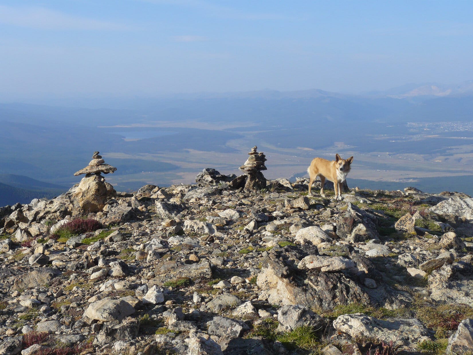
The first, and longest, trail that Lupe, Dusty, Joe and SPHP took was a clockwise circuit of the entire Rawhide trail, which makes a loop. At the far N end of the trail is a bench with a little roof over it. There was a view toward a high snow-capped peak far to the N from the bench.
Upper White Ranch Park from the Rawhide trail. Photo looks SE.A high, snow-capped peak is seen far away barely poking up over the ridge line. This photo was taken from in front of the bench at the N end of the Rawhide trail in upper White Ranch Park. The bench is about 2.5 miles from the parking lots. Photo looks N.
Joe and SPHP sat on the bench contemplating the view and munching apples, while water from a bit of melting snow on the roof dripped in front of them. Lupe and Dusty shared some Taste of the Wild, which Dusty devoured with special relish since she doesn’t ordinarily get it. Dusty polished off the apple cores, too, when they became available. As far as Lupe was concerned, Dusty could have the apple cores.
The E section of the Rawhide trail stayed more in the forest than the W part of the trail had. Along the NE section of the trail, there were occasional views across the deep Ralston Creek valley toward the high rocky ridge to the E. Lupe passed by another bench commemorating a visit by Princess Anne. Trees had grown up to mostly obscure the view from there.
Looking ENE across the deep Ralston Creek valley.The rocky ridge beyond Ralston Creek from the E portion of the Rawhide Trail in upper White Ranch Park. Photo looks ENE.
A little way S of the Princess Anne bench was a nice view to the SE toward North Table Mountain(6,566 ft.).
North Table Mountain from the Rawhide trail in upper White Ranch Park, Colorado. Photo looks SE.Lupe, Joe & Dusty on the Rawhide trail. Photo looks WNW.
Except near the N end, the Rawhide trail was pretty busy. There were hikers, runners, dogs, and especially mountain bikers. By the time Lupe was getting close to the parking lots again, though, the crowds were beginning to thin out.
Upper White Ranch Park from the Rawhide trail.Lupe near the Rawhide Trail not far from the parking lots.
When Lupe reached the parking lot again, the sun was starting to get low in the W. Since it would still be up for at least another hour, SPHP suggested taking the trail to Belcher Hill(7,949 ft.). Joe, Dusty and Lupe were all up for it. From the parking lot near the old ranch headquarters, Lupe took the Sawmill trail to the Belcher Hill trail. There were views of the ranch headquarters and North Table Mountain along the way.
Looking N at the White Ranch headquarters from the Sawmill trail.North Table Mountain from the Sawmill trail. Downtown Denver, CO is seen on the L.
From the Sawmill trail, the Belcher Hill trail headed WNW up a forested ridge. The trail eventually leveled out near the high point on the ridge. Lupe climbed up on the highest rocks on the ridge to claim another peakbagging success.
These highest rocks were in the forest, so there wasn’t much of a view from the top. However, back closer to the trail, there were some lower rocks along more open ground. From these lower rocks were pretty views from the S around to the W.
Lupe on the highest rocks on the Belcher Hill ridge.Looking WNW from rocks near the Belcher Hill trail.Looking SSW from Belcher Hill, Colorado.
From the high point on the ridge, it was a short pleasant stroll through the forest to the junction with the Mustang trail.
Lupe and Dusty at the trail junction.
From the junction with the Mustang trail, the Belcher Hill trail headed N down the ridge to the parking lot. There was just enough packed snow on the trail on the N side of the ridge to make things a bit slippery. It didn’t take long to reach the parking lot, but the sun was down behind the mountains by the time Lupe and Dusty got there.
Back at Dusty’s house in Arvada, it turned out that Lupe, Dusty, Joe & SPHP had a better afternoon at upper White Ranch Park than the Denver Broncos had in Indianapolis. The Colts defeated the previously unbeaten Broncos 27-24.
After climbing Flat Top Mountain(12,354 ft.) the previous day, August 22nd was a rest and repositioning day for Lupe. SPHP drove down to Leadville, CO. The very dusty G6 got taken to a car wash. SPHP got cleaned up, too. Lupe dined on roasted chicken from Safeway and an ice cream bar. She seemed quite content to spend a significant portion of the day snoozing in the G6.
Later in the day, there was a scouting trip down to a couple of trailheads in the Halfmoon Creek area SW of Leadville. (The gravel roads were fine, but very washboardy. It was Saturday, and the place was simply overrun with people and vehicles.) Lupe also visited Turquoise Lake.
Mount Massive from Turquoise Lake near Leadville, CO.
August 23rd, Day 15 of Lupe’s great Summer of 2015 Dingo Vacation, began as a complete disappointment. SPHP had planned for Lupe to get an early start on climbing Mount Elbert(14,433 ft.), the highest mountain in Colorado. (Only Mt. Whitney(14,498 ft.) in California is higher in the 48 contiguous United States.) When morning came, however, Mount Elbert was nowhere to be seen. The sky was completely overcast. Mount Elbert was lost in the clouds.
There was no point in Lupe climbing Mount Elbert just to see fog. A leisurely breakfast ensued. After a little while, though, it looked like there wasn’t as much fog as there had been. The trend continued. Suddenly SPHP realized the clouds were going to simply dissipate. It wasn’t going to be foggy for long. It was going to be a gorgeous day!
Lupe got a late start. It was Sunday. The weekend crowds were still here. The Mount Elbert trailhead was absolutely totally and completely full. Apparently SPHP had been the only one deterred by the early morning fog. It was 10:12 AM (54°F) by the time SPHP parked the G6 at a little pullout along USFS Road No. 110 in the Halfmoon Creek area. Lupe had to trot 0.25 mile along No. 110 just to get to the trailhead.
Mount Elbert from Road No. 110, which leads to the Halfmoon Creek area trailhead NE of Mount Elbert. Although the clouds had dissipated, there was still a smoky haze from distant wildfires. Photo looks SW.Mount Massive(14,421 ft.) is the 3rd highest mountain in the 48 contiguous United States, and only 12 feet lower than Mount Elbert. Mount Massive is just 5 miles NNW of Mount Elbert.Mount Elbert from the NE. SPHP managed to park the G6 closer to the TH than shown here. This was just a rare viewpoint at an opening in the forest along No. 110.
The first part of the climb up Mount Elbert was all in the forest, so there really weren’t any views. From the Mount Elbert TH, a short spur trail (0.50 mile?) leads up to the Colorado Trail. Lupe followed a somewhat longer segment of the Colorado Trail S to an intersection with the Mount Elbert Trail No. 1184.
Although the topo map on Peakbagger.com doesn’t show the Mount Elbert Trail No. 1184 going all the way up to the summit, it actually does. The trail works its way up the NE ridge and gets heavy use. Its route is unmistakable, except when covered with snow.
Other than a portion of the Colorado Trail which was close to level, Lupe’s entire route to Mount Elbert was a steady climb. Some parts were steeper than others, especially approaching the summit, but it was nearly all just going up.
Even though the Mount Elbert TH parking lot was full, at first there weren’t too many other people and dogs around. Only Lupe, SPHP and a few other stragglers were starting up the mountain this late in the day.
After a couple of hours, Lupe and SPHP started meeting the early birds coming back down the mountain. Some had started up in darkness as early as 4:00 AM. By the time Lupe reached tree line, a flood of people and dogs were coming down the trail. Not all had made it to the summit of Mount Elbert, but most of them had. There were social opportunities galore for Lupe, who sniffed the many dogs, and allowed herself to be petted by some of the friendlier people.
The passing parade included lots of dogs wearing backpacks. (American Dingoes don’t go in for that kind of drudgery, they bring human porters.) Some wore booties on their paws. (Carolina Dogs climb rocky mountains regularly, and aren’t a bunch of greenhorn tenderpaws.) There were large dogs and small ones representing a great variety of breeds.
The people were almost as varied as the dogs. Children under 10 years old had made it to the summit. There were tall, short, thin, and fat people. There were a few clearly in their 70’s. There were quite a number of nationalities and languages represented. The most unusual people, though, were three who came down the mountain riding unicycles. SPHP greatly regrets not having the presence of mind to take a couple of pictures of the unicyclists. The whole concept seemed suicidal, but there they were, having a great time.
In fact, everyone was having a good time. The weather was great. Only the ever-present smoke haze from distant wildfires dimmed the marvelous views above tree line.
Trail No. 1184 above tree line.Lupe climbing Mount Elbert. She is already well above tree line here. This photo shows the steepest part of the climb up Mt. Elbert on Trail No. 1184. Once up on the ridge ahead, the rest of the way to the summit is just an easy stroll gaining the final bit of elevation gradually. Photo looks WSW.Lupe gains the ridgeline. The summit is now in view. The rest of the way is easy, with spectacular views all along the way.
Only near the summit were there any difficulties at all climbing Mount Elbert. Near the very end, the trail climbed pretty steeply to reach the ridgeline that was the final leg to the summit. Many people reported being a bit scared of the loose rock and slippery hard-packed ground on the steep trail.
When Lupe and SPHP got there, it was as they said, but not anything Lupe hadn’t encountered many times before on other mountains. It was really more of a problem going down than going up. Taking it slowly and cautiously was all that was required. Of course, that applied only to SPHP. The Dingo romped around as usual, confident of her footing every inch of the way.
After gaining nearly 4,500 feet of elevation, Lupe was there – the summit of the highest mountain in Colorado, the state most famous for its high peaks. Lupe stood surveying the world from the top of Mount Elbert.
Lupe on the summit of Mount Elbert. SPHP believes the high mountain near the center of this photo is La Plata Peak(14,336 ft.). Photo looks SSW.A hiker holds up a rather nice Mount Elbert sign designed like a Colorado state license plate to commemorate the occasion. The sign had the elevation and numbers 8 and 15 on it for August, 2015. SPHP has no idea who produced and brought that sign up. Whoever did was kind enough to leave the sign there for everyone’s use. No doubt it eventually made a nice souvenir for someone.Mount Elbert – South Peak(14,134 ft.) is shown here on the left. It is an unranked peak connected to Mount Elbert by a ridge. The Black Cloud Trail No. 1480, an alternate route up Mount Elbert from the S, crosses Mount Elbert – South Peak on its way to Mount Elbert. La Plata Peak (R), 6 miles away to the SSW, is also in this photo.Mt. Cosgriff(13,588 ft.) (L) is another unranked peak. It is connected to Mount Elbert – South Peak (R) by a continuation of the same ridge from Mount Elbert. Photo looks S.Mount Massive(14,421 ft.) dominates the view to the NNW.Looking W at the upper South Fork of Halfmoon Creek basin. SPHP believes the peaks in the foreground are Casco Peak(13,908 ft.) (L of Center), Frasco Peak(13,876 ft.) (R of Center), and French Mountain(13,940 ft.) (Far R.).
Since the weather turned out to be perfect, there was a huge advantage to Lupe’s late start up Mount Elbert. By the time she reached the summit, there were fewer than a dozen people there. Most of those soon left. In the end, there was only one other group on Mount Elbert. There were two brothers and an uncle. They were waiting for a brother-in-law, who was still struggling up the mountain on the South Mount Elbert Trail No. 1481 (which actually approaches Mount Elbert from the E).
The brother-in-law was thinking about giving up, but the rest of the family was in contact via smart phones. They urged him onward. He came into view below, and was eventually greeted by the family as he approached the summit.
Two brothers and an uncle greet a brother-in-law as he reaches the NE end of the summit area.
When all four men reached the summit, Lupe joined them for a photo op. This was the brother-in-law’s first trip up Mount Elbert, but the rest of the family had made multiple trips up the mountain. The brother in the blue jacket and jaunty blue hat had been here six times.
Lupe with new friends on Mount Elbert. Photo looks NNW towards Mount Massive.From Left to Right: Carlos Holguin, Jose Holguin, Edgar Flores, Luis Holguin. Edgar, of course, is the brother-in-law savoring his first ascent of Mount Elbert. Luis is Carlos and Jose’s uncle. Lupe is the Carolina Dog, but you knew that already.
Lupe and SPHP remained up on Mount Elbert for a while longer after Edgar’s arrival. No one else came up the mountain. It looked like Edgar was going to be the last man up this day. SPHP was curious about a high mountain off to the SE far beyond the Twin Lakes. No one knew its name.
No one knew the name of the high mountain to the SE far beyond Twin Lakes.
By climbing Mount Elbert, both Lupe and SPHP set personal records for the highest mountain ever climbed. Unless Lupe and SPHP make it out to Mount Whitney in California some day, it’s likely Mount Elbert is the highest mountain Lupe and SPHP will ever climb.
Prior to Lupe’s great Summer of 2015 Dingo Vacation, Lupe’s personal best was Lonesome Mountain (11,399 ft.) on 8-3-14 in Montana, which she climbed during her 2014 Dingo Vacation. She had already set new records three more times during her 2015 Dingo Vacation: Medicine Bow Peak (12,013 ft.) on 8-10-15) in Wyoming, Mount Zirkel (12,180 ft.) on 8-17-15 in Colorado, and Flat Top Mountain (12,354 ft.) on 8-21-15 in Colorado.
SPHP hadn’t set a new record for highest mountain climbed in years. Until this day with Lupe on Mount Elbert, Cloud Peak(13,167 ft.) in Wyoming, a peak SPHP has climbed twice, was the highest mountain SPHP ever stood on.
So seeing the world from up on Mount Elbert was kind of a big deal. Before Lupe headed down, SPHP took a few extra photos of the view from the top of Colorado.
Mount Elbert – South Peak and the ridge leading to it from Mount Elbert.Twin Lakes from Mount Elbert. Photo looks SE.Mount Massive from Mount Elbert. Photo looks NNW.The view NW of Mt. Elbert.Looking NE along the summit.
And then it was time to start down. It turned out that Edgar Flores was not going to be the last one to reach the summit of Mount Elbert this beautiful day. Lupe met several small groups of people still heading up on her way down. Maybe they were going to enjoy sunset on Mount Elbert. They certainly could have. The weather was ideal. It hadn’t even been breezy on top.
The big crowds that had been present on the trail earlier in the day were gone. Nearly the entire trek down Mount Elbert, Lupe and SPHP were alone.
Lupe sniffs around still near the summit. The junction of Trails No. 1184 (straight ahead) and No. 1481 (heads to the right) is shown here. Lupe will go back down No. 1184, the same way she came up. No. 1184 is the N or NE route up Mount Elbert. No. 1481 is known as the South Mount Elbert Trail, even though it actually approaches the mountain from the E.Even though the climb up Mount Elbert doesn’t feature any dangerous parts, if you wanted to, you could still manage to fall off the mountain. This look down a steep slope to the N was taken while Lupe was still close to the summit.Mount Massive from Mount Elbert.
It was getting pretty dark by the time Lupe reached the G6 again at 8:19 PM (50°F). She wasn’t going to climb any mountains higher than Mount Elbert on the rest of her Summer of 2015 Dingo Vacation, or maybe ever. That doesn’t mean Lupe’s adventures are over though! She encourages you to subscribe to The (Mostly) True Adventures of Lupe for news of more Dingo Adventures coming soon!
Lupe on her way down Mount Elbert, 8-23-15. Turquoise Lake is seen far below at left center. Leadville, CO is near the right edge. Lupe, the American Dingo will be seen on more lofty peaks in the American West very soon!