Black Hills, SD Expedition No. 163 – Deerfield Trail No. 40: Silver City to Canyon City (3-23-16)

More than 4 years ago, when Lupe was just 13 months old, SPHP took her on her very first Black Hills, SD Expedition on 1-15-12.  Lupe got to explore Deerfield Trail No. 40 from the Silver City trailhead going W up Rapid Creek past Canyon City all the way to the confluence of Rapid Creek and Slate Creek.  Lupe had such a wonderful time, that Lupe and SPHP returned to repeat the journey again a week later on 1-22-12.

No photos exist from those earliest Black Hills, SD Expeditions, because SPHP hadn’t brought a camera along.  However, Lupe and SPHP have returned to this portion of Deerfield Trail No. 40 a couple of times since then, simply because it is such a pleasant, easy (virtually no elevation gain), and scenic path along the largest stream in the Black Hills.

On 3-23-16, Xochitl was back in the Black Hills.  She wanted to go on a hike somewhere with Lupe and SPHP.  Overnight, a spring snowstorm had dropped several inches of heavy, wet snow.   The initial plan was to head N from the Deer Creek trailhead of Centennial Trail No. 89, but when SPHP failed to notify Xoch in time to make the turn to the Deer Creek trailhead, it seemed like a good idea to just continue on to Silver City, anyway.

The sky was still gray and thickly overcast when Xochi, Lupe and SPHP reached the Silver City trailhead of Deerfield Trail No. 40.  The scene was a winter wonderland.  Fresh, clean, white snow clung heavily to the dark pines.  Lupe got to blaze the way along the pristine path, sniffing along with her nose and half of her face buried down in the cold, white stuff.

Lupe in a winter wonderland on Deerfield Trail No. 40, shortly after setting out from the Silver City trailhead.
Xochitl joined Lupe and SPHP on Expedition No. 163. It was really her idea to go!
Xoch looking good on the trail.

Deerfield Trail No. 40 crosses Rapid Creek a number of times on the way from Silver City to Canyon City.  Very nice sturdy bridges are at each crossing.  The bridges make it possible to go all the way to Canyon City and beyond to the confluence of Slate Creek and Rapid Creek without fording the stream.

Lupe on one of the sturdy, wide footbridges over Rapid Creek.
Rapid Creek from the bridge.

Xoch, Lupe and SPHP were in no particular rush.  It’s only a little more than 2 miles on the trail from the Silver City trailhead to Canyon City.  There was plenty of time to enjoy the quiet solitude and snowy scenes.Deerfield Trail No. 40, 3-23-16

Xoch in her new North Face coat and boots. She was plenty warm and comfortable. Temps were in the upper 20’s °F, not too far below freezing.
Another bridge over Rapid Creek.
Xoch sends greetings to SPHP and all of Lupe’s fans.

Xoch on bridge over Rapid Creek, 3-23-16

A look along the length of the bridge.
Loopster on the same bridge, but looking back the other direction.

Maybe half way to Canyon City, there is a lovely American Dingo cave right along Deerfield Trail No. 40.  The cave doesn’t look natural.  It was probably excavated in connection with some exploratory mining dig many years ago.  The cave only goes back 20 feet or so into the rock, but that’s plenty of room to keep a Dingo out of inclement weather.

Looking out from the American Dingo cave.
Lupe agrees this Dingo cave has lots of good features including 20 feet of solid rock protection from inclement weather, a beautiful view, and convenient location along Deerfield Trail No. 40, plus fresh running water year round from Rapid Creek! Even so, Lupe indicated she wanted to know a little more about the local squirrel population before deciding to move in.

Shortly before reaching Canyon City, there is one minor side channel of Rapid Creek to be crossed without the benefit of a bridge.  Once across, Canyon City is only another couple hundred yards upstream.

Xoch and Lupe arrive at the edge of the little side channel (L) of Rapid Creek prior to reaching Canyon City.
Lupe gets some love from Xoch. Carolina Dogs give lots of love, and enjoy being on the receiving end, too.

Although it might be tricky crossing the side channel when water levels are unusually high, there were plenty of snow-covered stepping stones providing an easy way across this day.  Xochi, Lupe and SPHP all crossed, and were soon at Canyon City.

There’s nothing really at Canyon City these days, except an intersection with a trail coming down to Deerfield Trail No. 40 and Rapid Creek from the end of USFS Road No. 142 about 0.25 mile to the N in Kelly Draw.  The confluence of Rapid Creek and Slate Creek was another 0.33 mile upstream, but Canyon City was as far as Xochitl, Lupe and SPHP went on Expedition No. 163.

Xochitl near a big rock formation at Canyon City.
Xochi and Lupe at Canyon City. Photo looks N along the trail to USFS Road No. 142 in Kelly Gulch.

Xochitl, Lupe and SPHP returned to the G6 back along the same route on Deerfield Trail No. 40.  Lupe found a bird or squirrel to bark at up in some trees along the way.  A little Carolina Dog barking echoing in the canyon helped make the day complete.

The trek back in the peaceful, secluded woods was both beautiful and relaxing.  Lupe, Xochitl and SPHP shared a great time together on the trail at winter’s end.  Lots of new changes, challenges and adventures were in store ahead, but for a little while, none of that mattered yet.Xoch on Deerfield Trail No. 40, 3-23-16Links:

Next Black Hills Expedition                      Prior Black Hills Expedition

Deerfield Trail No. 40

Want more Lupe adventures?  Choose from Lupe’s Black Hills Expeditions Adventure Index or Master Adventure Index.  Or subscribe free to new Lupe adventures.

Going Home & The Farm Near Beach, North Dakota (8-2-13 thru 8-4-13)

Lupe and SPHP were on the road before 6:00 AM on 8-2-13, Day 24 of Lupe’s 2013 Dingo Vacation to the Beartooths and Canadian Rockies.  It had rained steadily during the night.  It wasn’t raining now, but the low mountains of southern British Columbia were shrouded in fog.  Just S of Roosville, Lupe crossed the border back into the USA.  She really was on her way home now.

It was a long drive clear across northern Montana.  At first, it was scenic and damp.  There were mountains and intermittent rain.  Lupe headed SE to Whitefish on Hwy 93, and then cut across on Hwy 40 to Columbia Falls.  Hwy 2 took Lupe through the mountains around the S end of Glacier National Park.

The mountains disappeared in the rear view mirror first.  For a while, E of Glacier National Park, the rain did not.  In fact, Lupe went through two cloudbursts.  When it wasn’t raining hard where the G6 was, downpours could be seen scattered here and there in various directions.

An hour E of Shelby, the G6 finally got ahead of the rain.  Low gray clouds still stretched out to the horizon in every direction.  SPHP stopped the G6 twice to get out and stretch.  Lupe and SPHP took walks in the little towns of Chester and Chinook.

Neither Lupe nor SPHP had ever been in central or eastern parts of northern Montana before.  To SPHP, it was rather disappointing.  There were no mountains.  There wasn’t even anything noteworthy on the horizon most of the way.  The Bear Paw mountains could be seen in the distance S of Havre, and there were some ridges SE of Saco, but otherwise the land was gently rolling and featureless.

Lupe certainly wasn’t disappointed in northern Montana, though.  She was having a field day!  Cows were everywhere!  The dingy Dingo leapt wildly from window to window trying to bark at all of them at once.  It was exhausting, but clearly exhilarating, work.  Outside the G6 was a placid, pastoral scene.  Inside it was deafening almost non-stop action.  At least the American Dingo had to stop for water, and to catch her breath now and then.

It was evening by the time Lupe and SPHP paid a short visit to the Fort Peck dam on the Missouri River SE of Glasgow.  Fort Peck Lake was vast and stretched to the horizon.  It seemed lonely and remote.  No doubt it would have been fun to explore the huge lake by boat.  More fun than seeing it from the land, as Lupe soon found out.

Lupe near Fort Peck Lake. This view is of a smaller lake below the dam.
Lupe with a view from the dam of Fort Peck Lake on the Missouri River in NE Montana.
Lupe with a view from the dam of Fort Peck Lake on the Missouri River in NE Montana.  The lake was huge!  It stretched far away to the horizon and beyond.
Buildings along the Fort Peck Dam. SPHP presumes they were somehow related to power generation.
Lupe near Fort Peck dam shortly before the cactus incident.

While sniffing around in the weeds near a viewpoint, Lupe’s left rear paw stepped on a cactus.  She whirled around to bite whatever was biting her.  She got the piece of cactus off her paw, but was rewarded with a cactus spine stuck in the roof of her mouth.  SPHP had to use tweezers to remove it.  All evening, the poor Carolina Dog tried to lick her own mouth to sooth the sore spot.

Still in Montana, Lupe and SPHP called it a day in Wolf Point.  Before turning in, SPHP bought a milkshake at the local McDonald’s to help cool and provide some relief to Lupe’s sore mouth.  Lupe proved quite willing to take this medicine.  The milkshake was highly effective.  Lupe’s sore mouth was cured.

The next morning, Lupe and SPHP started out shortly after sunrise again.  Lupe was still going E across northern Montana on Hwy 2, but now she wasn’t far from North Dakota.  North Dakota was about to join the American Dingo nation, and become the 9th Lupe state!

While in North Dakota, SPHP planned to take Lupe on a little tour of Williston.  SPHP wanted to see what Williston looked like.  The once sleepy, very remote town had been transformed by the Bakken shale oil and gas boom, which was in full swing.  Lupe might also get a chance to visit her great Uncle Andy and Aunt Connie, meet King III, their old yellow lab, and see their farm near Beach, ND.

Before Lupe reached North Dakota, SPHP started seeing new housing subdivisions in tiny, formerly dying towns in NE Montana.  The first new subdivision was in Poplar.  There was a bigger one in Culbertson.  Lupe started seeing a few oil wells.  There were stacks of big blue pipes N of Hwy 2.  Then a big blue pipeline appeared, not yet buried.  Overall though, the effects of the oil and gas boom didn’t really look all that great, until Lupe crossed the border into North Dakota.

The first stoplight was 7 miles W of Williston.  From then on, there was heavy traffic, especially truck traffic.  Even though it was Saturday morning, Williston was a swarming hive of activity.  Everything on the W and N sides of town looked brand new.

There were rows of metal buildings housing energy related companies, both famous and unfamiliar.  Stacks of materials and lots of machinery were kept in adjacent fenced yards.  New houses, new apartments, new restaurants, new businesses, new roads, new everything was all over the place.  Williston was a genuine boom town.

Lupe and SPHP went and found a park in the old part of Williston.  There were big old trees here, and a lot less going on.  Lupe struck it rich, and found a squirrel in the very first tree she checked.  She made such a ruckus about it, SPHP decided it might be best to move on.  SPHP called Lupe’s great Aunt Connie in Beach.  Right away, Connie invited Lupe and SPHP to come on down to Beach for a visit.

So before Lupe got in trouble for disturbing what little peace there was in Williston, she and SPHP headed S for Beach, ND, a tiny town along I-94 barely across the border from Montana.

Connie and Andy had an old yellow lab named King.  Technically King was King III, the third in a line of yellow labs that Connie and Andy had.  When Connie opened the door at their house in Beach, King III was right there.  King III could hardly believe his eyes!  Here was a cute little Dingo wanting to come in for a visit!  King III loved the idea.  He wanted to play!  Lupe growled.  King III was mighty big!

SPHP was interested in seeing Connie and Andy’s farm, but didn’t even have to ask for a tour.  After visiting with Connie and Andy for a short while, they asked if Lupe and SPHP would like to see it.  Of course!  So everyone piled into Connie and Andy’s car, both dogs included, with SPHP between them to keep the peace.  The farm was 16 miles S of town.  Lupe and SPHP got the grand tour.

The G6 at Connie and Andy's house in Beach, ND.
The G6 at Connie and Andy’s house in Beach, ND.
Lupe’s great uncle Andy, great aunt Connie, and King III out at the farm.

Andy & Connie at the farm near Beach, ND 8-3-15

The farm S of Beach, ND. Wow, after crossing central and eastern Montana, that hill in the distance is a veritable mountain! Crops are looking good, too. Wheat and lentils.

Connie & Andy's farm S of Beach, ND 8-3-15

Lupe enjoyed the tour of the farm. She and King III got to get out and sniff around, and run after the car for exercise. King III was an old farm dog, but it was all a new and interesting experience for Lupe.

Connie, Andy and SPHP spent so much time visiting, that Lupe and SPHP got invited to spend the night in Beach.  The next morning, Lupe, King III, Connie and SPHP all took a walk to the edge of town.  After breakfast, it was time for Lupe to finish her trip home.  It was now 8-4-15, Day 26 of Lupe’s great Dingo Vacation to the Beartooths and Canadian Rockies, and time to get back to the Black Hills.

Of course, SPHP dawdled along taking roads never seen before, instead of just taking the most direct route home.  Lupe’s vacation continued all day.  Lupe went back into eastern Montana.  She went through Baker and Ekalaka.  She passed Medicine Rocks State Park.

A forested section of hills in the Custer National Forest looked very similar to Lupe’s Black Hills back home.  S of the Custer National Forest was a rather impressive long high ridge, topped with rock, which stretched far off to the SE.  The Little Missouri River valley was beautiful.  Cows and horses kept Lupe busy.  She took up the sport of barking at hay bales, too, just for good measure.

The 73rd annual Sturgis Motorcycle Classic (Sturgis Rally), a week long event that brings huge numbers of motorcycle enthusiasts to the little town of Sturgis, SD on the NE edge of the Black Hills every year, was just beginning.  Before Lupe even left Montana and entered Wyoming, there were bikers on motorcycles pouring in from all over.

Lupe dropped by the KOA campground just E of Devil’s Tower National Monument.  A couple of motorcyclists had the same idea.

SPHP had planned on getting Lupe a little blue ice cream at the store E of Devil's Tower National Monument. All the parking lots at the KOA campground were totally jammed with motorcycle enthusiasts here for the annual Sturgis Rally, held the 1st full week of August each year. SPHP decided Lupe would have to wait for ice cream.
SPHP had planned on getting Lupe a little blue ice cream at the store E of Devil’s Tower National Monument. All the parking lots at the KOA campground were totally jammed with motorcycle enthusiasts here for the annual Sturgis Rally, held the 1st full week of August each year. SPHP decided Lupe would have to wait for ice cream.

Actually, the place was packed.  There were hundreds of motorcycles.  Everyone seemed to be in good spirits and having a great time.  There was a big party going on.  The store was doing a brisk business.  Lupe got lots of compliments from the friendly bikers.  She was loving it and basking in glory.

Lupe at Devil's Tower, WY. She is looking pretty happy about it. She was basking in the glory of a lot of compliments from the friendly bikers.
Lupe at Devil’s Tower, WY. She is looking pretty happy about it. She was basking in the glory of a lot of compliments from the friendly bikers.

It has been a tradition with SPHP to buy blue ice cream at the store just E of the monument on each visit to Devil’s Tower.  SPHP had intended to get Lupe some.  This time, though, it looked like it was going to take a long time to get waited on.  It was too hot out to make Lupe wait in the G6 that long.

So Lupe didn’t get any blue ice cream at Devil’s Tower (5,112 ft.).  Lupe and SPHP headed S for Sundance, WY.  There were 6 bikers riding 2 abreast ahead of the G6.  They were taking their time enjoying the scenery while winding through forested hills W of the Black Hills of Wyoming, also called the Bear Lodge Mountains.  Before long there were 50 or 100 motorcycles following the G6.  It was fun!  It was like Lupe was leading a grand motorcycle parade!

Lupe and SPHP left the motorcycle parade at Sundance.  SPHP stopped at the grocery store there.  Since Lupe hadn’t gotten any ice cream at Devil’s Tower, SPHP was going to make it up to her.  SPHP came out with a box of 6 Eskimo pies.  Lupe was forced to help devour every last one of them as fast as possible, since they were soon melting fast.  She was completely up to the task.  She would have been willing to do more, if only the need had arisen.

Instead of heading home on I-90, SPHP took Lupe S on Hwy 585 from Sundance.  Lupe saw Inyan Kara (6,360 ft.) mountain.  She was soon back in the Black Hills of South Dakota.  In the Black Hills, Lupe went on the final exploration of her entire 2013 Dingo Vacation.  From Black Fox campground, she headed up the Rhoades Fork of Rapid Creek following USFS Road No. 233 for more than a mile.

Of course, she drank from the cool, clear stream!  Of course, she posed for the final pictures of her 2013 Dingo Vacation!

Lupe gets a drink in Rhoad's Fork of Rapid Creek upstream of Black Fox CG.
Lupe gets a drink in Rhoad’s Fork of Rapid Creek upstream of Black Fox CG.

A little more than an hour after returning to the G6, Lupe was home.  Her 26 day summer of 2013 Dingo Vacation to the Beartooths and Canadian Rockies was finally over.  It seemed like a long time since Day 1, when she went to the Elysian Fields of Puppy Happiness and spent the night on Bald Mountain (10,042 ft.).  It had been a wonderful trip, but it was still good to be home!

Lupe's final photo of her 2013 Dingo Vacation to the Beartooths and the Canadian Rockies. Here she is back in the Black Hills of South Dakota about a mile upstream of Black Fox campground.
Lupe’s final photo of her 2013 Dingo Vacation to the Beartooths and the Canadian Rockies. Here she is on 8-4-13 back in the Black Hills of South Dakota about 1.5 miles upstream of Black Fox campground.

Links:

Next Dingo Vacation                    Prior Adventure

This Dingo Vacation                              Prior Dingo Vacation

Want more Lupe adventures?  Choose from Lupe’s 2013 Beartooths & Canadian Rockies Adventure IndexDingo Vacations Adventure Index or Master Adventure Index.  Or subscribe free to new Lupe adventures.

Black Hills, SD Expedition No. 162 – Deadman Mountain, Red Hill & Granite Peak (3-20-16)

It did feel like spring!  With a Leap Day in 2016, spring had officially arrived on the calendar yesterday on March 19th, as early as it ever does.  Yesterday hadn’t felt like spring, though.  Squall lines blew through repeatedly trying to snow on the Black Hills.  The snow hadn’t amounted to much, just a skiff, but it was a cold, gray, hint of winter day.

Today, though, was different – crisp, clear, blue skies, with light breezes and perfect temperatures for a Lupe expedition in the Black Hills!  SPHP parked the G6 at the intersection of USFS Road No. 170.2B and Vanocker Canyon Road a few miles SW of Sturgis (10:23 AM, 41°F).  Lupe started following No. 170.2B toward her first peakbagging goal of the day, Deadman Mountain (4,943 ft.).

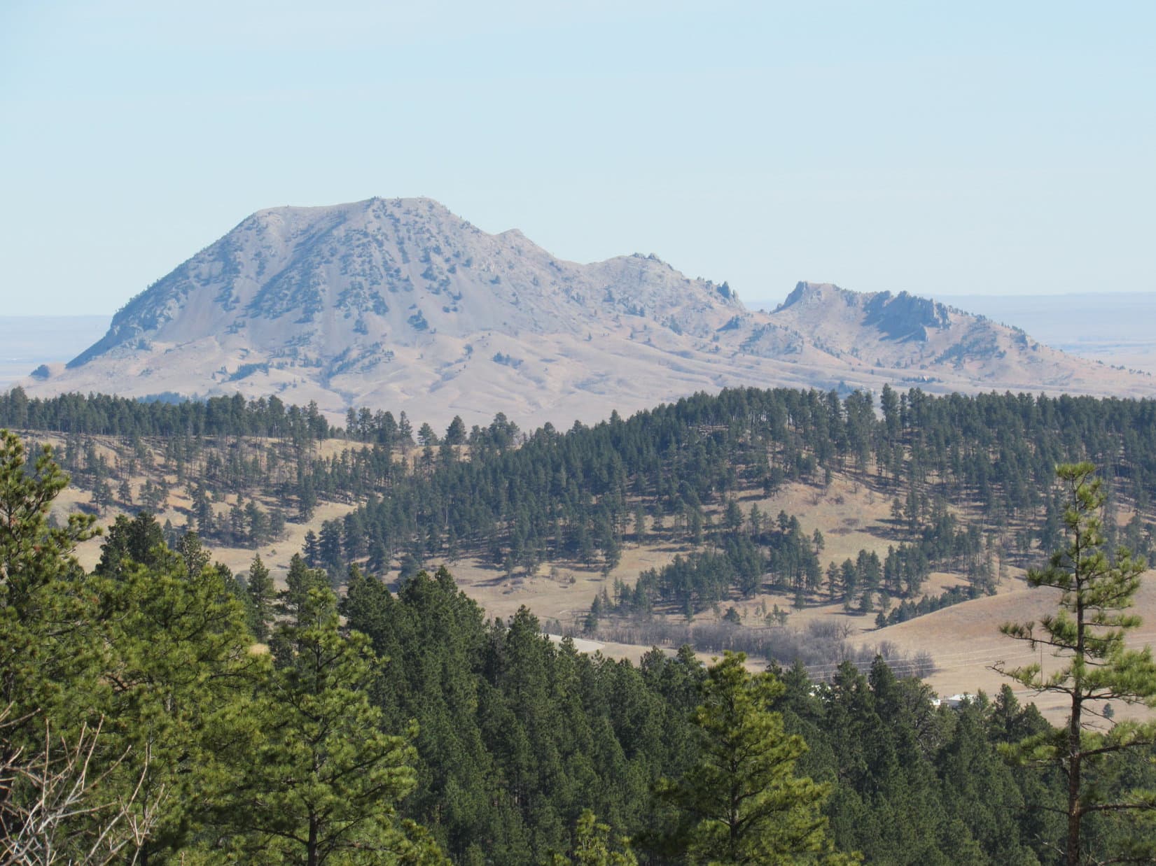
At first, No. 170.2B rose steadily at an easy to moderate pace.  After a little while, though, the road reached a meadow where it leveled out, and then started to wind its way N around several fingers of the mountain coming down from the W.  Almost as soon as the road leveled out, Bear Butte (4422 ft.) came into view off to the NE.

Bear Butte from the E slopes of Deadman Mountain along USFS Road No. 170.2B. Photo looks NE using the telephoto lens.
Lupe stands in the skiff of snow on USFS Road No. 170.2B on the lower E slopes of Deadman Mountain.

Following No. 170.2B as it wound around on the level was easy and fun, but it wasn’t going to get Lupe to the top of Deadman Mountain.  When No. 170.2B showed no sign of wanting to resume its upward climb after winding around several fingers of the mountain, Lupe and SPHP abandoned the road, turned W and resumed climbing.

Lupe went only a few hundred feet before coming across a faint jeep trail.  The jeep trail climbed aggressively right up the mountain.  Lupe and SPHP followed it through the forest.  For a road, the jeep trail was steep, but on paw and foot it was no problem.  The road eventually reached the top of a ridgeline.

Here, the jeep trail improved and leveled out.  It continued W along the N side of the mountain.  The ridgeline, however, angled SW continuing to gain a little elevation.  Lupe and SPHP stayed on the road after it leveled out for just a couple more minutes.  A rock outcropping near the top of the ridgeline a short distance S of the road looked interesting.  Lupe left the road to go check it out.

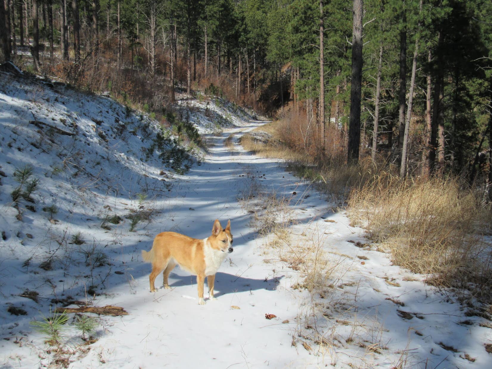
Lupe checks out the first rock outcropping up on Deadman Mountain. This was the first one she came to on her approach from the NE. Although it was only 10 to 15 feet high, it was the largest of several formations she encountered on her way to the summit.

Lupe on the NE rock formation up on Deadman Mountain, 3-20-16Lupe and SPHP continued SW along the ridgeline.  Along the way, Lupe came to a couple more rock formations, but the first one was the biggest.  The ridge was broad and almost flat, but did gain elevation slowly as it continued SW.  The entire area was forested, so there were no views in any direction.  Although there had been only scattered deadfall timber all the way up Deadman Mountain, there was more of it along the ridge, but not enough to impede progress for long.

After following the ridge for 5 or 10 minutes, Lupe came to what appeared to be the highest part of the mountain.  A stretch of the ridge 200 feet long was all at about the same elevation.  Toward the SW end were three big trees close together.  They seemed to SPHP to be standing at the true summit.

Lupe reaches the 3 tree true summit of Deadman Mountain! Photo looks SW.
Looking NW along the summit ridge. Yes, it all looks pretty much the same. Choose your own true summit point, if you don't like Lupe's!
Looking NW along the summit ridge. Yes, it all looks pretty much the same. Choose your own true summit point, if you don’t like Lupe’s!

It sure seemed like Lupe was at the true summit of Deadman Mountain, but SPHP wasn’t 100% certain.  After all, it had been a long trek up through the forest with no views since seeing Bear Butte way back down on USFS Road No. 170.2B.  Maybe there was another higher point around up ahead?  Lupe would have to do some more exploring to confirm her success.

SPHP studied the topo map.  From the summit of Deadman Mountain, there was supposed to be a saddle about 100 feet lower to the NW.  The saddle led to a slight rise along a wide level ridge that went N, and then NW to the edge of Deadman Gulch about 0.33 mile away.  Peering down between the trees, it did look like there might be a saddle to the NW.  It wasn’t very far away.  Lupe and SPHP went to investigate.

Before Lupe even got all the way down to the bottom of the saddle, she came to a clearing in the woods where there were views off to the W.  There was even a handy Carolina Dog display stump to facilitate the addition of extra beauty and grace to the scene.

Looking W from the N slope of Deadman Mountain, not too far from the summit.

Lupe and SPHP crossed the saddle.  An unmarked road coming from the W side of Deadman Mountain farther S went up a gentle rise (shown on the topo map), and continued on to the N.  A fainter road soon veered off to the NW.  Lupe and SPHP followed the fainter road along the nearly level ridge.  The road slowly lost elevation.

Lupe arrived at the edge of Deadman Gulch.  There was no question about it now.  It was clear that she really had been to the top of Deadman Mountain.  The forest pretty effectively hid the views of Deadman Gulch, although there were glimpses of it here and there.  Lupe and SPHP explored to the N near the edge of Deadman Gulch, but the ground kept losing elevation and the views didn’t open up.

Lupe and SPHP gave up on going any farther N, and doubled back to the S.  This time, SPHP noticed a narrow rocky point protruding out to the SW from where Lupe had first come to the edge of Deadman Gulch.  Lupe and SPHP went out on the point.  There were some views from here!

Looking W over Deadman Gulch.
Looking NW over Deadman Gulch. Lupe had recently been to Crook Mountain (4,930 ft.) (long high ridge R of center), and Whitewood Peak (5,140 ft.) (closest pointy hill in middle of L side of photo) on Black Hills, SD Expedition No. 160.
Looking S at Veteran Peak (5,333 ft.). Lupe visited Veteran Peak back on Black Hills, SD Expedition No. 155 on 2-6-16.
Lupe out on the point overlooking Deadman Gulch. Photo looks WSW.

Lupe had two more peakbagging goals for Black Hills, SD Expedition No. 162, but they were both on the other (W) side of Deadman Gulch.  To get over there, SPHP thought it best to return to the G6.  It would be a lot easier to drive over to a closer starting point, than try to find a long route on paw and foot around Deadman Gulch.

Lupe and SPHP returned to the summit of Deadman Mountain one more time.  It was practically on the way to the G6.

Lupe returned briefly to the summit of Deadman Mountain. Her 3 tree true summit point is near the center of this photo just to the right of the big bush in the background. Photo looks SW.

Lupe and SPHP took the same route back to the G6.  It was still early afternoon when Lupe arrived (1:33 PM, 50°F).  Plenty of time remained for more fun and adventures!  SPHP drove SW a few miles, and parked the G6 again (1:45 PM, 51°F).  This time, Lupe would start out from the intersection of USFS Road No. 170 and No. 171.1 (1:45 PM, 51°F).  Lupe and SPHP headed N on No. 171.1.  Lupe’s new peakbagging goal was Red Hill (4,690 ft.), more than a mile to the N.

By now it had been warm long enough so yesterday’s skiff of snow had melted almost everywhere, except in very shady spots.  The moisture made No. 171.1 soft and muddy.  Lupe soon passed a big open area where several roads met.  There was a lot of garbage strewn around here, including some broken glass.  Lupe and SPHP hurried on by.

Beyond the intersection, No. 171.1 continued N gaining a little elevation before leveling out.  This was actually the high point on Lupe’s journey to Red Hill.  Before long, Lupe came to some heavy equipment sitting idle along the side of the road.  Even though this area is all Black Hills National Forest land, a big thick underground power line is being installed along the road.  Three huge spools of cable were up on a truck trailer.  No one was around.  The equipment was idle.

Past the equipment, the road lost elevation gradually.  The equipment had recently been at work along this stretch.  The roadbed was freshly churned up and very soft.  So much mud clung to SPHP’s boots, that SPHP quickly gave up on the road.   Lupe and SPHP went through the forest.  Lupe liked going through the forest better than staying on road, anyway.

The road improved again by the time Lupe reached an intersection with USFS Road No. 171.1B.  Lupe and SPHP followed No. 171.1B W to an intersection with No. 171.1U.  This was the low point of Lupe’s journey to Red Hill.  From the intersection, No. 171.1B turned N and started regaining elevation.  Soon Lupe was getting close to one of two possible locations for the true summit of Red Hill.

Looking at the topo map, Red Hill is shaped like an upside down “U”, except that the bottom half of the SW side is “missing” – it’s not really part of the high ground.  Red Hill features two areas enclosed by the 4,680 foot contour.  The largest area is at the NE corner, and a smaller area is at the SW end of the high ground.  Lupe would have to visit both areas to be certain of reaching the true summit.

No. 171.1B stopped gaining elevation and turned NW.  Peering N through the forest, it did look like the terrain gained elevation in that direction.  Lupe and SPHP left the road.  Within 5 minutes, Lupe was standing on top of a small hill in the forest next to a fairly impressive cairn.

At the NE high point of Red Hill, Lupe found this well constructed summit cairn. Photo looks W.
Red Hill was Lupe’s 2nd peakbagging success of Black Hills, SD Expedition No. 162.

The impressive cairn seemed to indicate that Lupe was already at the true summit of Red Hill.  Just to make certain, Lupe and SPHP did go looking for the SW high point.  About 0.5 mile away, Lupe found it at a very flat piece of ground only marginally higher than the surrounding terrain.  There was no cairn here.

Lupe at the SW high point on Red Hill. There was no cairn here. Although definitely a little higher than the surrounding terrain, this did not feel like it was the true summit of Red Hill. Due to the forest, it was impossible to tell for certain. Photo looks NW.

The NE hill with the cairn definitely felt like the true summit of Red Hill.  Whether it was or not, Lupe had visited both the NE and SW high points.  Both high points were buried in the forest.  Nearby trees were the only views.  Lupe and SPHP went back to USFS Road No. 171.1B, and followed it back to No. 171.1.

The truth is, Red Hill is not an impressive mountain.  It hardly seemed like a mountain “peak” at all.  The whole area was an unremarkable part of the forest comprised of undulating terrain without any significant elevation changes.  It made SPHP wonder why Red Hill even had a name.  Not too far away are other higher and much more impressive hills that seem far more deserving of attention.  Nevertheless, Red Hill was shown on all the maps.

Lupe and SPHP turned N again on No. 171.1.  Granite Peak (4,424 ft.), more than 2 miles N of Red Hill, was Lupe’s 3rd and final peakbagging goal.  Getting there was basically just a road hike along No. 171.1.  Lupe came to a junction with No. 171.1C, but none of the junctions she came to after that were marked.  At the turn to the NW toward Granite Peak, big pieces of white limestone had been placed across the side road to block it.

The sun was getting low by the time Lupe reached the summit of Granite Peak at the top of a small wooded hill.  Leafless scrub oak mixed in with the pines made the forest less dark.  It was possible to see a little more here than at Red Hill, but there still weren’t any clear views.

Lupe was ready for a break.  She wasn’t hungry, even though she hadn’t eaten all day.  She just seemed a bit tired, or perhaps just bored?  Maybe she was just disappointed that she hadn’t found many squirrels in the forest?

Lupe reaches the summit of Granite Peak as the sun is casting long shadows. Photo looks SE.
Looking WSW from Granite Peak.
Lupe didn't want water or her usual Taste of the Wild. She seemed kind of sleepy up on Granite Peak actually, and just wanted to lay down for a while.
Lupe didn’t want water or her usual Taste of the Wild. She seemed kind of sleepy up on Granite Peak actually, and just wanted to lay down for a while.

Granite Peak was another unremarkable high point.  If it hadn’t been so late in the day, Lupe would have continued another 0.50 mile NW to a sharper edge of the mountain where there might have been some views.  A narrow look to the N was the best view from the summit of Granite Peak.

Looking N from Granite Peak using the telephoto lens.

Lupe and SPHP lingered up on Granite Peak for a little while.  SPHP ate an apple.  It really was a beautiful evening out.  The air was cool.  Yesterday’s snow squalls had cleared the air, and it was possible to get glimpses at buttes and very distant ridges far out on the prairie beyond the Black Hills to the N and E.  Crook Mountain was off to the NW.

It was probably close to 5 miles back to the G6 as the road went.  Lupe and SPHP returned to No. 171.1 and followed it all the way.  For a while, the high cliffs NW of Deadman Mountain were lit up by sunlight on the E side of Deadman Gulch.  SPHP kept busy collecting Lupe Treasures, crushing them in order to be able to carry as many as possible.  Lupe sniffed around in the woods near the road.

SPHP thought Lupe would be ready to jump right in the G6, when she reached it at 8:14 PM (45°F).  She wasn’t.  It was dark out.  Nearly a full moon was shining in the clearing.  As Lupe stood there sniffing the air in the moonlight, she was transformed into the ferocious and wily were-puppy!  The were-puppy attacked SPHP in mock battle, and then raced dizzyingly around and around the G6.

The were-puppy played in the moonlight with great energy and enthusiasm for more than 20 minutes.  It refused to be enticed into the G6.  Finally it found something valuable.  The were-puppy refused to let SPHP see what it was, but was suddenly seized with the desire to carry this glittering prize into the G6.  OK, fine, if that’s what it took to get Lupe to jump in.

Pie!  Ordinarily, SPHP is fond of pie, almost any kind of pie.  Almost, but not quite any kind.  In the light in the G6, it turned out the were-puppy’s glittering prize was a big chunk of dried cow pie.  Bleh!  Well, when in the wild, you have to be realistic and prepared to settle for the kind of pie there is.  Blueberry, cherry and apple pie are in short supply in the forest, but cow pies are plentiful.

Very true, but that didn’t change SPHP’s attitude.  When the were-puppy finally dropped the precious cow pie, out the window it went.  We can do a lot better than that Lupe, there’s Alpo with whipped cream waiting at home!

Lupe poses for a Dingo profile view on Deadman Mountain.

Note: Lupe Treasures collected on Expedition No. 162 included 43 aluminum cans, 8 plastic bottles, 3 glass bottles, and part of a dried cow pie.  (The dried cow pie was unceremoniously re-released to the wild.)

Links:

Next Black Hills Expedition                   Prior Black Hills Expedition

Want more Lupe adventures?  Choose from Lupe’s Black Hills Expeditions Adventure Index or Master Adventure Index.  Or subscribe free to new Lupe adventures.

Peyto Lake & Bow Summit, Banff National Park, Alberta, Canada (8-1-13)

5:30 AM.  Daylight already.  Lupe was wide awake.  Soon SPHP was, too.  It was August 1, 2013, Day 23 of Lupe’s 2013 Dingo Vacation to the Beartooths & Canada.  This was to be Lupe’s last full day in Canada.  Yesterday she had already started heading S from the Mount Robson area to begin the trip back home.  Before leaving Canada, Lupe and SPHP still had a few places to go and things to see.  It was good to be up early!

Shortly after 6:00 AM, SPHP was parking the G6 at the Peyto Lake parking lot near Bow Pass on the Icefields Parkway Highway No. 93.  Although the Peyto Lake observation deck at the end of a short paved path is a very popular tourist destination, no one else was around this early in the day.  The G6 was the only vehicle in the parking lot.  It wouldn’t stay that way for very long.  Lupe and SPHP took the short path to see Peyto Lake.

Peyto Lake in Banff National Park from the observation deck at Bow Pass.
Peyto Lake in Banff National Park from the observation deck at Bow Pass.  Mountains along the Mistaya River valley stretch out as far as the eye can see.  Peyto Lake is named after Ebenezer “Wild Bill” Peyto, a legendary early hunter, trapper, prospector, guide & outfitter in the Canadian Rockies.  Photo looks NW.

There used to be a lookout tower at Bow Summit.  After admiring the view of Peyto Lake and the Mistaya River valley from the observation deck, Lupe and SPHP went in search of the old fire lookout service road.  SPHP had brought along the following note summarizing instructions on how to get to Bow Summit from research done online:

“From the Peyto Lake overlook, take the right hand of two paved trails leading uphill.  After 100 meters, there will be a 3 way junction at an interpretive sign.  Continue on the middle branch angling uphill to the left of the sign (this is part of the upper nature trail).  In a few minutes, the paved nature trail will continue on to the right, but continue straight on the old fire lookout service road.”

Soon Lupe was trotting happily on up the road to the old fire lookout.  It was a gorgeous morning with views to match.  After gaining 760 feet of elevation, Lupe and SPHP reached the end of the road at Bow Summit.  There were wonderful views to the N back toward the Mistaya River valley and Waterfowl Lakes.  The best views to the S toward Bow Lake and beyond were a little farther on.

Looking SE from Bow Summit toward Bow Lake.
Looking SE from Bow Summit toward Bow Lake.  From L to R:  Mount Andromache (9,829 ft.), Mount Hector (11,135 ft.), Bow Peak (9,318 ft.), and Crowfoot Mountain (10,023 ft.).

L to R: Mount Hector, Bow Peak, Crowfoot Mountain as seen from Bow Summit.

Mountains along the Mistaya River valley, Banff National Park, Alberta, Canada from Bow Summit.
Looking NNW from Bow Summit at mountains along the Mistaya River valley.

The views at Bow Summit were wonderful, amazing and incredible.  It was hard not to feel sad that Lupe had to leave Canada.  The views weren’t the only thing that were amazing and incredible, though.  Amazing and incredible swarms of not-so-wonderful mosquitoes started plaguing Lupe and SPHP within just a minute or two of arriving at Bow Summit.

Although Lupe doesn’t like strong winds, a good stiff breeze would have been welcome.  As it was, Lupe and SPHP tired very quickly of serving as local blood banks.  The mosquitoes had been only a minor annoyance while moving on the way up, but they were intolerable staying put in any one place.  Definitely time to be moving on.  Two hours after leaving the G6, Lupe and SPHP were back at the now bustling Peyto Lake parking lot.

After Bow Summit, Lupe went on one more outing in the Canadian Rockies.  Near the high point on Hwy 93 heading W toward Kootenay National Park in British Columbia, there was a trailhead for Boom Lake.  The trail was only 5.1 km to Boom Lake, which was perfect for the limited time Lupe had to spend.

At the trailhead parking lot, Lupe met a skinny 7 month old black lab puppy named Geeko.  Lupe and Geeko played with each other in the parking lot, and each time they met along the trail.

SPHP met a Canadian biologist from Winnipeg along the way.  When SPHP learned the biologist had hiked more than 2,000 km of trails in the Canadian Rockies, SPHP asked for recommendations on day hikes.  The biologist recommended a trail quite near by, which goes to the Stanley Glacier.  Lupe didn’t have time to check it out this trip, but SPHP hopes some day she will.

By the time Lupe and SPHP reached Boom Lake, it was raining and foggy.  It looked like a beautiful spot, but Lupe would have to return under better conditions to explore further and get some photos worthy of the area.  Lupe had fun, but she was a rather soggy doggie by the time she completed the trek back to the G6.

Lupe and SPHP enjoyed a wonderful drive through scenic Kootenay National Park, but made no more stops until reaching Radium Hot Springs.  Lupe had to wait in the G6 at Radium Hot Springs, while SPHP went in to get cleaned up and bask in the warm mineral waters.

After so many days exploring the Canadian Rockies, Lupe was fine with spending a little time chillin' in the G6 while it rained outside and SPHP went to the Radium Hot Springs.
After so many days exploring the Canadian Rockies, Lupe was fine with spending a little time chillin’ in the G6 while it rained outside and SPHP went to the Radium Hot Springs.

SPHP returned from the Radium Hot Springs clean and refreshed.  Cleanliness always boosts SPHP’s spirits, especially while traveling.  It was time to get serious about making some progress getting home!  Lupe was in for a good time – after all, the cows and horses in Montana alone were going to provide at least 500 miles of frenzied Dingo barking pleasure!

Links:

Peyto Lake & Lupe’s Search for the Peyto Glacier (7-26-13)

Bow Lake & The Trail to Bow Glacier Falls (7-25-13)

Book Review: Ain’t it Hell, Bill Peyto’s Mountain Journal

Next Adventure                     Prior Adventure

Want more Lupe adventures?  Choose from Lupe’s 2013 Beartooths & Canadian Rockies Adventure IndexDingo Vacations Adventure Index or Master Adventure Index.  Or subscribe free to new Lupe adventures.

Black Hills, SD Expedition No. 161 – Mount Theodore Roosevelt, Polo Peak, Green Mountain & Elkhorn Peak (3-12-16)

Well, it happened again, and at the exact same spot.  Lupe was on her way to Mount Theodore Roosevelt, but the G6 wasn’t going to make it to the parking lot near the summit.  Even though temperatures have been way above normal in the Black Hills for weeks, snow and ice covered the road ahead.  The G6 would probably make it through OK, but probably wasn’t good enough.  Fortunately, there was a spot next to the road where SPHP could park (8:11 AM, 55°F).

Nearly a year ago, Lupe had come to Mount Theodore Roosevelt (5,680 ft.) on Black Hills, SD Expedition No. 123.  Back then, the snow was considerably deeper.  A red car had been abandoned on the road, high centered and incapable of moving.  Even though conditions were better now, they weren’t good enough.  SPHP didn’t want to chance it.  No harm in using paws and feet to go the extra 0.33 mile to the parking lot.

Lupe, freshly damp from rolling in the snow. Photo looks S from the ridge close to where the G6 was parked.
High clearance vehicles would have no problem, but the G6 wasn’t really made for this.

Along the way, Lupe came to a rare Mountain Dew colored snowfield.  There was even a plastic Mountain Dew bottle laying right there, left by the original artist.  The green snow looked kind of strange.  They say “Don’t you eat that yellow snow!”  What about green snow?  Green snow isn’t natural.  Lupe and SPHP just let it be.

Lupe at the greenish Mountain Dew snowfield. The Mountain Dew bottle is to her left, abandoned there by the original artist.

Lupe made it to the parking lot 0.25 mile from the summit of Mount Theodore Roosevelt.  A trail goes to the Friendship Tower at the top of the mountain.  Two plaques telling about the Friendship Tower were at the start of the trail.  The Friendship Tower was built in 1919 through the efforts of Seth Bullock to commemorate the life and death of his personal friend Theodore Roosevelt.Plaque on Mt. Roosevelt, 3-12-16Plaque on Mt. RooseveltNot far from the parking lot, the trail divides and makes a loop.  Lupe and SPHP took the SW part of the loop, which features a nice view of Deer Mountain (6,652 ft.) and Terry Peak (7,064 ft.) to the SW.

Lupe along the trail.
Deer Mountain (snowy peak at far L) and Terry Peak (far R) from the trail to the Friendship Tower on Mount Theodore Roosevelt.

A couple was just leaving the Friendship Tower as Lupe and SPHP approached.  They stopped to chat briefly with SPHP.  They commented on what a nice day it was, and then pointed at a discarded plastic water bottle on the snow.  What a shame it is that people have the energy to bring stuff up here, but don’t bother to take it with them when they leave!  SPHP agreed.

The couple then left empty-handed on their way back to their truck, leaving the water bottle behind.  Hmmm!  It wasn’t their fault the water bottle was there, of course.  They weren’t the problem, but then again, they weren’t the solution, either.  SPHP resolved to pick the water bottle up, if it was still there later in the day when Lupe returned.  No sense carting it all over the mountains.

Lupe and SPHP climbed up the steep, narrow circular staircase to the top of the Friendship Tower.

About to enter the Friendship Tower.
Lupe at the top of the Friendship Tower. She is sitting on the grate over the stairway, where she can see without risking a fall. In the distance, Bear Butte is seen beyond Crook Mountain. Lupe had been to Crook Mountain just a week earlier on Black Hills, SD Expedition No. 160.
Lupe at the top. She is sitting on the grate over the stairway, where she can see without risking a fall. In the distance, Bear Butte is seen beyond Crook Mountain. Lupe had been to Crook Mountain just a week earlier on Black Hills, SD Expedition No. 160.
Lupe looks back down the steep, narrow circular stairwell.
Custer Peak (6,804 ft.) (L of Center) from the Friendship Tower. Photo looks S.
Bear Butte (4,422 ft.) (in distance on L) and Crook Mountain (4,930 ft.) (long forested ridge at Center) from the Friendship Tower. Taken with the telephoto lens. Photo looks ENE.
Spearfish Peak (5,800 ft.) (L) using the telephoto lens. Photo looks NW.

Even from the top of the Friendship Tower, the forest blocked the views in some directions, but there were great views in many others.  At first, SPHP didn’t see Lupe’s next peakbagging objectives, Polo Peak (5,410 ft.) and Green Mountain (5,325 ft.).  They were supposed to be practically due N and just a couple miles away, but where were they?  SPHP saw nothing that looked right.

SPHP brought out the USFS map to try to figure it out, lining up known peaks with Mount Theodore Roosevelt.  There they were!  SPHP had been looking for Polo Peak and Green Mountain twisted around on directions by nearly 45°.  SPHP had been looking NW instead of N.  It still didn’t seem quite right, but the map insisted it was, and the map knew best.

Now that SPHP knew where Polo Peak and Green Mountain were, Lupe headed back down.

Leaving the Friendship Tower.

Lupe and SPHP followed a short path NW to the edge of Mount Theodore Roosevelt.  The path led to a wooden viewing platform with a grand view to the NW and N.  A field of boulders covered the NW side of the mountain just below the platform.  Lupe needed to go N, so she circled over in that direction, but the boulder field extended over that way, too.

Lupe near the top of Mt. Roosevelt. Polo Peak is the thinly forested hill at center. Green Mountain is the heavily forested hill just beyond Polo Peak and slightly to the R. Photo looks N.

Lupe had to go down the boulder field to get to Polo Peak.  The rocks were only of modest size.  Even some of the larger ones were loose and tippy.  It wasn’t hard going down, just a little slow.  Below the boulders, Lupe came to a fairly large snow field.  The snow was up to 2 feet deep in a few places, but only 1 foot deep on average.

Aspens were growing thickly at the lower end of the snow field.  Below the aspens, Lupe entered a Ponderosa Pine forest.  The N slopes of Mount Theodore Roosevelt are quite steep, but Lupe was able to follow a spine of the mountain that remained walkable for SPHP.  Lupe was losing elevation as fast as SPHP could go.  The going was steepest as Lupe neared the bottom of Polo Gulch.

Lupe on her way down the N slopes of Mount Theodore Roosevelt. She is getting closer to Polo Peak, seen in the background. Photo looks N.

Lupe found a dirt road at the base of the steep slopes down in Polo Gulch.  On the other side of the road was a 15 foot embankment leading down to a level area full of aspens, a few pines, and a great many leafless bushes and brambles.  Lupe and SPHP could hear running water.  A brief struggle through the nearly 2 foot deep snow and thick underbrush brought Lupe to Polo Creek.

Lupe reaches Polo Creek. Melting snow had Polo Creek flowing right along at a good clip on this very warm early March day. This part of Polo Creek may well be just a seasonal stream.

Polo Creek was in the sunlight where the snow had already melted.  SPHP thought Lupe might be thirsty by now, but she wasn’t.  She had been busy eating snow.  Lupe and SPHP crossed the stream.  Lupe climbed a 40 foot embankment on the other side.  It wasn’t too steep, but there was a lot of underbrush in the forest.  Even after Lupe reached flatter ground above Polo Creek, SPHP had to wind around through the dense vegetation.

Before Lupe could begin her climb up Polo Peak, it looked like she might have to lose some elevation again traversing a small valley up ahead.  It turned out she didn’t have to.  Instead, Lupe came to another dirt road.  Lupe and SPHP followed it, since the road was so much easier than going through the forest.  The road headed NE gaining elevation slowly, but steadily.

Before long, Lupe came to a very steep side road that went N.  A sign said this road was closed to motor vehicles to encourage re-vegetation.  Lupe and SPHP followed it.  The road started down in the forest, but as Lupe gained elevation, the forest thinned and finally gave way to scattered stands of pines.  Lupe entered sunny meadows with big views.

Lupe reaches the meadows on the S end of Polo Peak. Terry Peak (Center) is seen in the distance. Photo looks SW.

The top of Polo Peak is rounded and grassy.  As Lupe neared the end of her climb, the terrain became progressively less steep and more level.  The road gradually faded away.  Here and there, small rock outcroppings rose above the open ground.

Shortly before reaching the summit of Polo Peak, Lupe came to this rock outcropping. In the background are Mount Theodore Roosevelt (L), Deer Mountain (snowy peak on the far horizon R of Center), and Terry Peak (R). Photo looks SSW.
Lupe reaches the summit of Polo Peak! Photo looks SSW.
Looking W from the summit.

Polo Peak was sunny and warm.  The brilliant sunshine made Lupe squint whenever she looked S.  From the summit, Lupe and SPHP continued N.  It was a very easy stroll on gently sloping terrain.  Lupe was heading toward Green Mountain, her next peakbagging goal.

Spearfish Peak (5,800 ft.) (L) and Crow Peak (5,787 ft.) (R) from near the N end of Polo Peak. Photo looks NW using the telephoto lens.
Lupe reaches the N end of Polo Peak. Green Mountain is seen beyond her. Photo looks N.

Green Mountain is only 0.5 mile from the N end of Polo Peak.  The entire territory between the mountains is forested.  Lupe went down the N slope of Polo Peak staying a bit toward the W.  She crossed the saddle over to Green Mountain and started climbing again.

SPHP wasn’t certain Lupe would find any views up on Green Mountain.  From the S, it looked much more heavily forested than Polo Peak had been.  There was only one little opening visible among the trees near the top that had given SPHP at least a little hope that Lupe might find a view in some direction.

As Lupe neared the summit, it became clear that the top of Green Mountain was not completely hidden in a shady forest as SPHP expected.  Beyond the band of trees around the S end, the summit was flat and almost completely bare.  Lupe had sweeping, unobstructed 180° views to the N.

Part of the flat, bare top of Green Mountain. Although fringed with trees toward the S, most of the summit area was like this.
Lookout Peak (4,478 ft.) near Spearfish, SD from Green Mountain. Photo looks NW using the telephoto lens.
Elkhorn Peak (4,724 ft.) from Green Mountain. Photo looks NE using the telephoto lens.
Elkhorn Peak (4,524 ft.) is the big barren hill at Center.  Photo looks NE from Green Mountain using the telephoto lens.
Bear Butte (4,422 ft.) using the telephoto lens. Photo looks ENE.
Crow Peak (5,787 ft.) using the telephoto lens. Photo looks WNW.

The glorious views from the flat, barren expanse on top of Green Mountain were surprising.  Green Mountain had another surprise, too.  Someone had used rocks to spell out names and other words.  Not all of them were still legible, but SPHP could make out the following: Dannette, Trussell, Mexico, Seiler.

Green Mountain, with its sweeping views, was a great place to take a break.  Lupe wasn’t terribly hungry yet, but she was thirsty.  After a big drink, she rested on the ground near SPHP, panting in the warm sun.  Meanwhile, SPHP ate an apple while enjoying the incredible views extending far out onto the prairie beyond the Black Hills.

After a while, the time came for Lupe to leave.  She paused for a photo at the summit before heading out.

Lupe at the very summit of Green Mountain before starting her trek back to Polo Peak and Mount Theodore Roosevelt (both seen on the L). Terry Peak is seen on the horizon on the R. Photo looks SSW.

Lupe and SPHP took essentially the same route back to Polo Peak and Mount Theodore Roosevelt.  There was plenty of time, so Lupe stopped for a few photos along the way.

Although most of Green Mountain is rounded, there was a rather large craggy rock formation Lupe had to go by part way down the S slope. Lupe is seen here standing on a small portion of it. (It was easy to just go around these rocks.) Photo looks SE.
After summiting Polo Peak for a 2nd time, Lupe continued S to this jagged rock formation with a view toward Mount Theodore Roosevelt. Photo looks S.
Even though it was still early March, Lupe found one of the first signs of spring in the Black Hills on the sunny S side of Polo Peak. Bees were busy gathering nectar from these Pasque flowers (also called crocus). The Pasque is the state flower of South Dakota.

When Lupe got back to Mount Theodore Roosevelt, people were coming and going between the Friendship Tower and the viewing platform to the NW.  At least a dozen people came and went.  Lupe cooled off on the snow, while waiting for the crowds to leave.

SPHP hadn’t forgotten the discarded water bottle.  It was still there, plus a rusty beer can and some other trash near a picnic table.  SPHP picked it all up and put it in the backpack.  SPHP ate the last apple seated at the picnic table.  When everyone else had left, Lupe and SPHP returned to the top of the tower.

Lupe cools her jets on the snow near the Friendship Tower on Mount Theodore Roosevelt.
Lupe in the Friendship Tower.

On the way back to the G6, Lupe and SPHP reached the greenish Mountain Dew snowfield again.  SPHP had been picking up trash alongside the road and added the plastic Mountain Dew bottle to the collection.

Even though it was still early, Lupe must have figured Expedition No. 161 was over when she arrived back at the G6 (3:07 PM, 66°F), but SPHP had a surprise in store for her.  She was going to climb one more mountain today, one she had seen from Green Mountain.

SPHP drove Lupe to Elkhorn Mountain.  Lupe did seem surprised when SPHP parked the G6 again (3:30 PM, 76°F).  At first, she wasn’t sure if she was supposed to get out, or not.  When SPHP encouraged her, she jumped out ready for action.

Elkhorn Mountain looks like just a big rounded hill.  SPHP hadn’t appreciated how BIG it really was.  It took considerably longer to get to the top than anticipated.  Between the heat and the elevation gain, Lupe and SPHP went through the rest of the water supply.

Up above the forest, Elkhorn Mountain really was beautiful in the slanting rays of the late afternoon sun.  Some of the taller grass glowed an amazing orange.  The 360° views were wonderful.  A bit of a breeze helped counter the heat.  Lupe found what appeared to be a grave shortly before reaching the summit.

Lupe came to this gravesite very close to the summit of Elkhorn Mountain. There was no sign, marker or plaque telling who might be buried here. Photo looks WSW.

Lupe and SPHP spent a bit of time at the summit of Elkhorn Mountain.  It was a beautiful way to end the day, with a pleasant stroll back down to the G6 ahead.  When Lupe got back to the G6 (5:10 PM, 76°F), her peakbagging exploits on Expedition No. 161 were over, but SPHP still had a task in mind.

There was still time to return to the junction of Crook Mountain Road (USFS Road No. 176) and USFS Road No. 176.1A.  This was where the G6 had been parked a week ago at the start of Lupe’s Black Hills, SD Expedition No. 160 to Crook Mountain (4,930 ft.)  and Whitewood Peak (5,140 ft.).  The intersection had been strewn with all kinds of trash.  SPHP didn’t have anything to put it all in back then, but now had 2 garbage bags in the trunk of the G6.

Lupe barked enthusiastically at many deer, cows and horses on the way to USFS Road No. 176.1A.  Once there, though, she had to stay in the G6 while SPHP gathered up the trash.  There was broken glass around, and SPHP couldn’t be certain it had all been found.  It only took a little more than 1 overflowing garbage bag to hold all the trash SPHP could find.  It was almost dark out by the time Expedition No. 161 was really, truly over, and the American Dingo was on her way home.

Lupe at the summit of Elkhorn Peak. Photo looks W.

For those possibly interested in the surprising tale of Theodore Roosevelt’s last great adventure exploring Brazil after losing the 1912 U.S. Presidential election, Lupe recommends The River of Doubt – Theodore Roosevelt’s Darkest Journey by Candice Millard.

Note: Lupe Treasures gathered for disposal or recycling on Black Hills, SD Expedition No. 161 included: 57 aluminum cans, 15 glass bottles, 3 large plastic cups, 27 plastic bottles, 17 cigarette butts, a tin of Copenhagen snuff, part of a tailpipe, beer cartons, plastic bags, broken glass and assorted miscellaneous trash.

Links:

Next Black Hills Expedition                     Prior Black Hills Expedition

Want more Lupe adventures?  Choose from Lupe’s Black Hills Expeditions Adventure Index or Master Adventure Index.  Or subscribe free to new Lupe adventures.

Black Hills, SD Expedition No. 160 – Crook Mountain & Whitewood Peak (3-5-16)

Pathetic and disgusting!  There were beer cans, bottles, boxes and other trash scattered around the forest near the intersection.  SPHP had a couple extra plastic Wal-Mart bags in the backpack, but they weren’t nearly enough to tote away all this mess.  That would easily require a full size garbage sack or two.

It was all going to have to wait.  SPHP would save the Wal-Mart bags for what Lupe found during her explorations.  If there was any room left, SPHP might gather up some of this stuff when Lupe returned at the end of the day.  Lupe would be willing to curl up in the G6 for a rest then.  While SPHP collected Lupe Treasures, she would need to be in the G6 so she didn’t get hurt.  There was broken glass around, too.

The G6 was parked at the intersection of Crook Mountain Road (USFS Road No. 176) and No. 176.1A (9:54 AM, 55°F).  Lupe had two peakbagging goals ahead of her, Crook Mountain (4,930 ft.) and Whitewood Peak (5,140 ft.).  It was going to be another unseasonably warm day, close to record-setting again, in a winter that had hardly even been winter.  Only early March, and already SPHP was hoping it wasn’t going to be too hot!

Lupe and SPHP took off on up No. 376.1A.  There were a few patches of snow and ice, but nothing too major.  Clearly, there had been much more snow not too long ago.  The road was quite soft.  In some places, it was just a mucky red dirt mess.  No. 176.1A headed SW for a little way, then turned N.

Lupe had fun romping in the forest, but other than trees, there wasn’t much to see until No. 176.1A had gained a fair amount of elevation, and was starting to level out up on the E slopes of Crook Mountain.  Bear Butte (4,422 ft.) came into view rising up out on the prairie NE of Sturgis, SD.

Bear Butte NE of Sturgis, SD looks like a small volcano, but according to geologists, it never actually erupted. Photo looks ENE from USFS Road No. 176.1A on the E side of Crook Mountain. Taken using the telephoto lens.
On a day of record breaking heat in early March, Lupe kept cool rolling around in patches of snow still remaining in shady spots. Meanwhile, SPHP was shedding layers down to a T-shirt.
Without using the telephoto lens, Bear Butte looks quite some distance away. It is about 11 or 12 miles ENE of Crook Mountain.

Bear Butte from USFS Road No. 376.1A on Crook Mountain, 3-5-16Lupe and SPHP followed No. 176.1A as it wound around the E and then N side of Crook Mountain.  The road was fairly level much of the way, gaining elevation very slowly.  There were glimpses of lower hills and the prairie off to the NE, but there were enough trees along the road so there were seldom any really open views.  There was quite a bit more snow on the road on the shady N side of the mountain, much to Lupe’s delight.

Lupe loved the snowy road on the N side of Crook Mountain.

When Lupe was far enough around the N side of the mountain so that SPHP was starting to get glimpses of Crow Peak (5,787 ft.) off to the WNW, it was time to leave the road and start climbing the rest of the way up Crook Mountain.

The climb wasn’t the hard part about getting to the top of Crook Mountain.  The problem was more one of finding the true summit.  The mountain is pretty broad and level on top for about 0.5 mile N/S with a hook over to the E at the N end.  It is also all forested, so it is hard to see very far.  The topo map shows that there is a fairly large area contained within the 4,920 ft. contour toward the NW end.

Lupe’s explorations on Crook Mountain agreed with the topo map.  There was a pretty big area that was all about the same elevation toward the NW.  This was the highest part of the mountain, but not by much.  Lupe had her choice of little bumps and hillocks to declare the true summit.  No one spot looked clearly higher than all the rest.  With a flat, forested top, it wasn’t surprising there weren’t any views.

Lupe astride the receding glacier at the pinnacle of Crook Mountain. Well, OK, it was just a patch of snow, but this was the top of the mountain.
The best view at the summit of Crook Mountain was of Lupe herself. The Carolina Dog was looking pretty fine!

An unmarked dirt road went right over the highest part of Crook Mountain.  A bit farther N, one end of it turned E, while the other end went S.  Lupe and SPHP left the summit of Crook Mountain heading S along the road.  The road lost elevation gradually, and eventually came to a 4-way intersection.  None of the roads were marked, but Lupe’s next peakbagging goal was to the WSW, so Lupe and SPHP turned W.

As Lupe got toward the W side of Crook Mountain, there started to be bits of distant views toward the S and SW.  Although the forest wasn’t as dense as it had been at the summit, there still weren’t any nice open views.  Before Lupe lost too much elevation, SPHP wanted to get at least some kind of a look off to the W, hoping it would be possible to spot Whitewood Peak.  At a small clearing, SPHP saw a mountain ahead that might be it.

Was that forested peak toward the L Whitewood Peak? SPHP wasn’t certain, but it seemed to be the most likely candidate from what little Lupe could see from Crook Mountain.

Lupe and SPHP continued SW, sometimes on roads and sometimes off them.  Lupe lost quite a lot of elevation before coming to a fork in a road, where the branch going NW was marked No. 542.1F.  She took the other branch, which went SW.  Lupe had hardly left the fork behind, when she came to a nifty little rock outcropping suitable for an American Dingo display.

Lupe on the American Dingo display rock.

Lupe continued on.  The road gradually turned W and then NW, as it went around the SW side of a big field.  Going N was a problem.  The farther Lupe went N, the more elevation she would have to lose to cross Sandy Creek in the valley just to the W.  Lupe and SPHP doubled back a little before leaving the road to go down a steep slope to the bottom of the valley.

Sandy Creek wasn’t very big, but there was flow in it.  Lupe was quite happy to come across Sandy Creek.  It was the only stream she came to all day.  She hopped in for a drink and cooled off in a deep little Dingo-sized pool.

Lupe cools off in Sandy Creek.
Near the Dingo swimming hole on Sandy Creek.

After Lupe was all refreshed, Lupe and SPHP crossed Sandy Creek and started going W up the other side of the valley.  Lupe came to a couple of roads.  She followed them for only short distances, before leaving them to climb even higher directly up the slope.  She eventually got high enough to reach a road that SPHP suspected was USFS Road No. 699.  Lupe and SPHP followed No. 699 for quite a long way.

Eventually, Lupe came to a fork in No. 699, too.  One branch went SW (L) and was marked No. 699.1D.  The other branch was unmarked.  It circled around a thinly forested knob a few acres in size.  Since there weren’t many trees on the knob, it was possible to get a halfway decent look around.  Lupe was now much closer to the mountain that SPHP thought was probably Whitewood Peak.

Lupe near USFS Road No. 699.1D. She was definitely getting closer to the mountain SPHP suspected was Whitewood Peak. Photo looks NW.

Lupe and SPHP took the little circle route around the knob just to see what could be seen, then Lupe headed SW up No. 699.1D.  The road climbed steadily.  An unusually colorful little rock just a few inches wide was laying on the road, and caught SPHP’s attention.

The interestingly colored rock on USFS Road No. 699.1D.

A little farther on, there was a rock outcropping that featured much larger colorful rocks.  Lupe and SPHP stopped here for a little break.  SPHP had a few chocolate chip cookies.  Lupe took a piece of one, but she must not have been too hungry.  She buried it for future use, pushing grass and dirt over it with her nose.

As SPHP looked around from the colorful rocks rest stop, there was a peak to the WSW that looked higher than the peak SPHP had thought was Whitewood Peak.  Maybe this was the real Whitewood Peak?  SPHP studied the topo maps some more, but was having a hard time reconciling what was in view with what the maps showed.

The way the terrain was, Lupe would reach the new Whitewood Peak candidate before she reached the original one.  Maybe the situation would become clearer up there?

Lupe at the pretty rocks rest stop along USFS Road No. 699.1D. She has part of a chocolate chip cookie stashed here in case of a future emergency. The new possible Whitewood Peak candidate is seen beyond Lupe.

After the break, Lupe trotted onward continuing SW up No. 699.1D.  SPHP trudged along behind her.  The road was getting quite high up on the hill it was climbing and leveled off.  It bent S and then curled around to the NW, ending at a little viewpoint.  Lupe was now S of the mountain SPHP had originally thought was Whitewood Peak, and not too far E of the new candidate.

The original Whitewood Peak candidate from the viewpoint at the end of USFS Road No. 699.1D. Photo looks N.

The view from the end of No. 699.1D made SPHP again suspect that the original Whitewood Peak candidate was the real one.  It was still hard to tell for certain, though.  Lupe had to go down into a sizable ravine before climbing up the new Whitewood Peak candidate.  There was a dangerous downed barbed wire fence just to the S.  SPHP also saw homes nearby in the forest, and signs indicating that Lupe was just N of private property.

Lupe went directly W staying on USFS land.  She lost elevation going down into the ravine, and then had to start climbing.  On the other side of the ravine she found a narrow ATV trail that went very steeply up the mountain, staying just N of the dangerous barbed wire fence line.  SPHP had to keep stopping to pant for more oxygen, but eventually made it to the top.

Nope, this wasn’t Whitewood Peak.  It was hard to get a clear view through the forest, but SPHP could see enough to know that the original Whitewood Peak candidate was definitely higher than where Lupe was now.  After a few more minutes spent studying the topo maps, things were starting to make sense.  Yeah, SPHP was virtually certain the original Whitewood Peak candidate was the real deal.

Very conveniently, the narrow ATV trail continued on to the W.  To stay on high ground, Lupe and SPHP needed to circle around in that direction before turning N and then NE.  Lupe and SPHP pressed onward.  The terrain was much more level along in here.  It was really easy going, thanks to the presence of the ATV trail.

The ATV trail divided a few times, and then faded to the point where Lupe lost it for a short while.  By then she wasn’t far from the mountain.  Lupe entered a clearing on the ridge approaching the peak.  There she found a marker right out in the open.  It was a USGS benchmark!  The benchmark said Whitewood Peak, and had an arrow stamped into it pointing directly toward the mountain.

There was no doubt now!  Lupe was about to climb Whitewood Peak.  She was almost there!

Whitewood Peak from the SSW. Getting really close.
Lupe near the USGS benchmark in the clearing SSW of Whitewood Peak.
No doubt now! Lupe is on her way up Whitewood Peak.

The final climb up Whitewood Peak was sort of steep, but it wasn’t too long.  There were some clearings near the top providing some of the best views Lupe had seen all day.  Lupe found a second USGS benchmark at the top of the mountain.

The USGS marker at the top of Whitewood Peak.

The top of Whitewood Peak was rocky, but they were all small rocks.  The flattish area at the summit was only the size of a modest room in a house.  In most directions the ground dropped off pretty steeply.  There were clear views to the SE and S, and some pretty clear ones to the W.  Whitewood Peak would have had a commanding view off to the N and NE, but the forest blocked views in those directions.

Before SPHP even bothered taking any pictures, it was time for a break – a longer one than before.  This time Lupe helped SPHP eat chocolate chip cookies.  She had a little Taste of the Wild.  SPHP munched an apple.  SPHP sat there so long without stirring that Lupe fell asleep.  It was beautiful out.  Only a light breeze stirred.  The temperature was perfect, maybe close to 60°F, upper 50’s anyway.  SPHP saw other mountains Lupe had visited, and remembered being there with her.

Well, it was a long trek back.  The time at the top always seems so short compared to the time spent getting there.  SPHP took a final look around.  Lupe woke up and smiled for the camera.

Lupe wakes up after a Dingo nap on Whitewood Peak. Photo looks N.
Crook Mountain from Whitewood Peak. Photo looks ENE.
Pillar Peak (5,469 ft.) (just R of Center) and Bear Den Mountain (5,642 ft.)(R). Lupe has been to both of them.
Pillar Peak (5,469 ft.) (just R of Center) and Bear Den Mountain (5,642 ft.) (R). Lupe has been to both of them.  Photo looks SSE.
Deer Mountain (6,652 ft.) (L) and Terry Peak (7,064 ft.) (R) are both downhill ski resorts. Photo looks SW.
Mt. Theodore Roosevelt (5,680 ft.). Photo looks W.
Polo Peak (5,410 ft.) (L) and Crow Peak (5,787 ft.) (R in distance). Photo looks W.
Polo Peak (5,410 ft.) (L) and Spearfish Peak (5,800 ft.) (R in distance). Photo looks W.

 As far as Sandy Creek, Lupe and SPHP went back much the same way they had come up to Whitewood Peak, although now that SPHP had a better grasp of the road system, Lupe was able to stick to the roads almost all the time and avoid all the bushwhacking.

Lupe licks a little snow for moisture on the way back from Whitewood Peak.

However, upon reaching Sandy Creek, Lupe did things a bit differently.  She followed a road upstream, instead of just crossing the creek and heading directly for Crook Mountain.  The creek didn’t go too much farther upstream before it was reduced to a trickle.  There was a spot where there were a lot of Lupe Treasures down by the little stream.  SPHP picked them all up.

Oddly, SPHP found a completely intact Miller Lite Beer, in a 16 ounce can.  Less than a week ago, SPHP had found a completely intact beer on Lupe’s way back from Eagle Mountain (5,254 ft.), though that one had only been an 8 ounce can.  Despite all the many hundreds of Lupe Treasures gathered over the past few years, those were the only two that were intact.  SPHP also found a machete saw.

The machete saw collected from the headwaters of Sandy Creek.

For a while the road went E, but it eventually turned SE.  That was the wrong direction.  Before returning to the G6, Lupe was going to climb Crook Mountain for a second time, just for fun.  Lupe and SPHP took an old overgrown trail E and then turned NE.  There didn’t seem to be any roads going N up Crook Mountain.

It seemed like a much longer, tougher climb than the first time, but Lupe eventually made it back to the summit of Crook Mountain.  The sun was only minutes from setting, but there was still sunlight on some of the tree tops.

Lupe returns to the summit of Crook Mountain a second time near the end of the day.
Lupe on the road at the summit of Crook Mountain. Photo looks S.

Lupe’s explorations still weren’t quite done.  She followed the road at the top of Crook Mountain N.  It quickly turned E, and eventually went very steeply down the E side of the mountain.  It became more of a jeep trail than a road – narrow, rocky and rutted, but there were some great views of the lights of Sturgis starting to shine as twilight came on.

Eventually the jeep trail met up with No. 176.1A, the road Lupe had started out on in the morning.  Before she even got that far, Lupe heard the roar of a large truck.  The truck was somewhere way down below, probably not too far from the G6.  It sounded like it might be stuck in the mud, or going over rough terrain.  Suddenly, there was gunfire.  Several volleys of 8 or 10 shots.  Lupe was alarmed.  There hadn’t been any gunfire all day up until now.

SPHP wondered what was going on.  It was getting almost dark.  People wouldn’t be likely to start target practice this time of day.  Maybe it was poachers?  The gunfire continued sporadically.  Lupe begged SPHP to stop and hide.  SPHP kept encouraging her to keep on going.  She would get to the safety of the G6 before long.

The road was still a muddy, mucky mess.  Maybe even worse than in the morning.  SPHP tried to walk on grass at the side of the road, or on snow and ice whenever possible.  The gunfire gradually slowed down to just an occasional shot or two, but each one echoed loudly through the forest.  The source couldn’t be too far away.  Lupe kept jumping up on SPHP with muddy paws.  Don’t humans know anything?  It was imperative to find a place to hide!

It was almost completely dark now.  A final shot rang out.  Terrified Lupe gave up on SPHP and raced ahead, bolting out of sight into the night.  SPHP yelled, but she didn’t come back.

She hadn’t gone far, though.  Around a bend, and there she was waiting impatiently next to the G6.  She was anxious to get in.  There would be no dilly dallying around sniffing the air and looking at the stars tonight!  The Carolina Dog had had enough of adventures.  Expedition No. 160 was done, done, done!  Goodbye, Crook Mountain!  Goodbye, Whitewood Peak!  Time to go home (6:20 PM, 47°F).

The interestingly colored rock on USFS Road No. 699.1D.

Links:

Next Black Hills Expedition                Prior Black Hills Expedition

Want more Lupe adventures?  Choose from Lupe’s Black Hills Expeditions Adventure Index or Master Adventure Index.  Or subscribe free to new Lupe adventures.