Black Hills, SD Expedition No. 116 – Green Mountain, Northern Rainbows & High Point 5219 (1-24-15)

SPHP almost chickened out.  Even though the forecast was for an unseasonably warm 52°F, it was supposed to be windy with possible rain showers.  Rain showers are almost unheard of in the Black Hills of South Dakota in late January, but that was what the forecast said.  The rain showers were supposed to end by noon, but a little rain was not the problem.  The 35 mph NW wind in the forecast was.  Up on a mountaintop, 52°F, if it even reached that, might be less than wonderful when combined with a 35 mph gale.

Lupe was bored and restless, though.  She stared expectantly at SPHP with eager, pleading puppy eyes.  She knew SPHP had been considering taking her into the mountains, due to preparations that had been underway before checking the forecast.  Lupe was ready for action.  She was expecting to go, eager to go, and doing her Carolina Dog best to demand to go!

Well, it would probably be alright.  Lupe won out!  At 9:46 AM, Lupe and SPHP left the G6 parked along Duran Road (USFS Road No. 679.1) just across Box Elder Creek from Nemo Road.  It was already a very balmy 46°F.  There wasn’t any rain yet.  It was only partly cloudy, but those clouds were making good time across the sky.  The wind was roaring in the trees.  Fortunately, the breeze wasn’t too bad down at ground level.

Lupe had two peakbagging goals for the day.  The first one was Green Mountain.  No!  Not the Green Mountain (7,164 ft.) along the E edge of the limestone plateau country of the western Black Hills, but the Green Mountain (5,240 ft.) located a little under 2 miles S of better known Steamboat Rock.  Lupe’s second goal was Hat Mountain.  No!  Not the Hat Mountain (6,779 ft.) S of Deerfield Reservoir, but a much more diminutive Hat Mountain (4,883 ft.) located about 3 miles SE of Lupe’s Green Mountain goal.

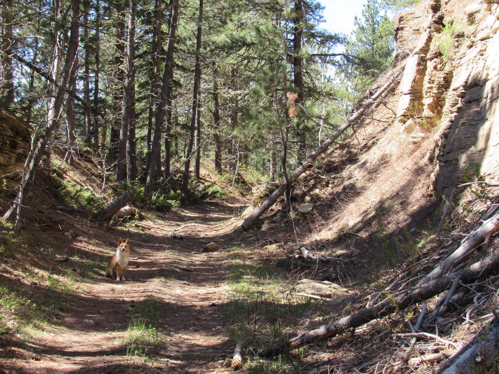
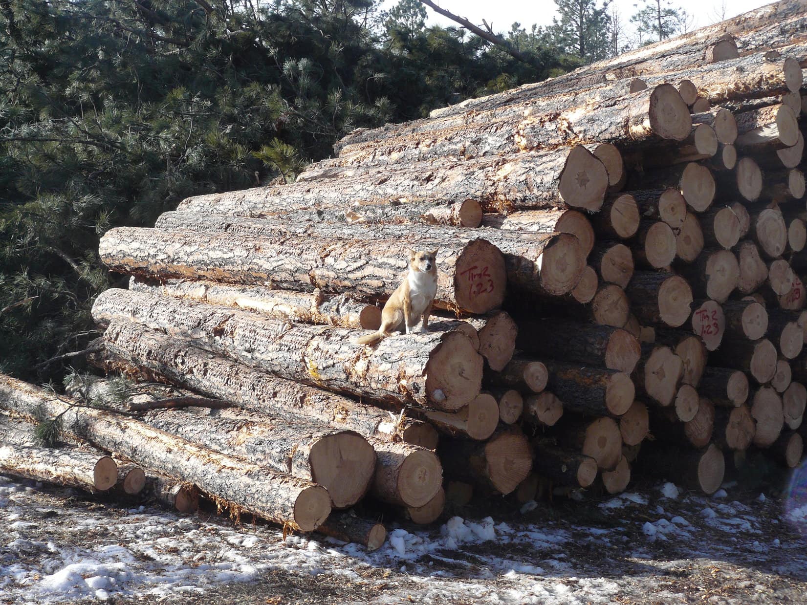
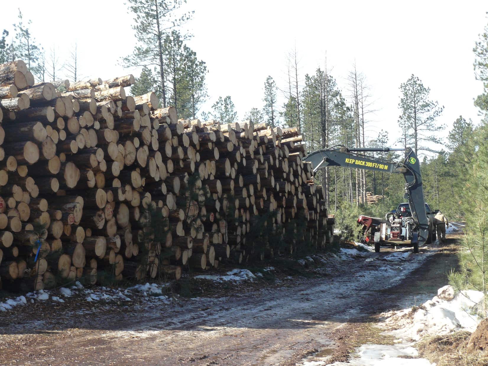
USFS Road No. 679.1 was covered with snow and ice.  It wound around a lot, but steadily gained elevation while working its erratic way W.  After Lupe had gone nearly 2 miles along the road (just 1 mile as the crow flies), she came to a huge pile of logs.  A couple of loggers were there getting ready to go to work.  The loggers had the interesting news that they had seen a mountain lion right there the previous day.

Lupe on the pile of logs along USFS Road No. 679.1 on her way to Green Mountain.
Approaching the loggers.

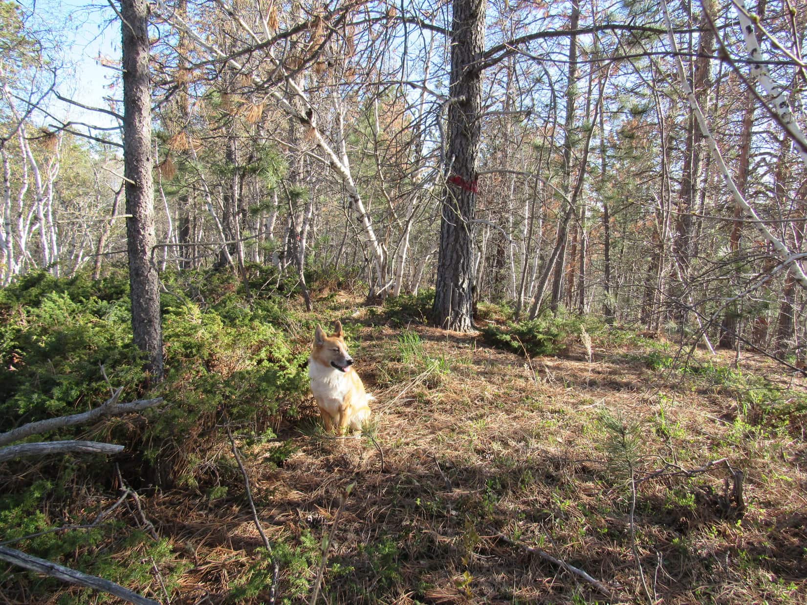
Lupe had scarcely passed the loggers when the ridge to Green Mountain came into sight to the SW.  Lupe and SPHP left the road to head up through an area where the forest had been greatly thinned to reach the top of the ridge.  The top of the ridge was still forested.  Lupe followed a faint path SE along the ridge.

Lupe on the forested ridge leading to Green Mountain. Photo looks SE the direction would take to the summit.

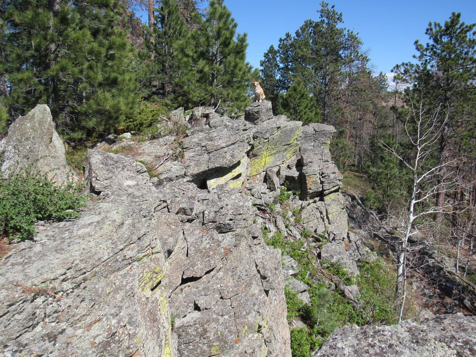
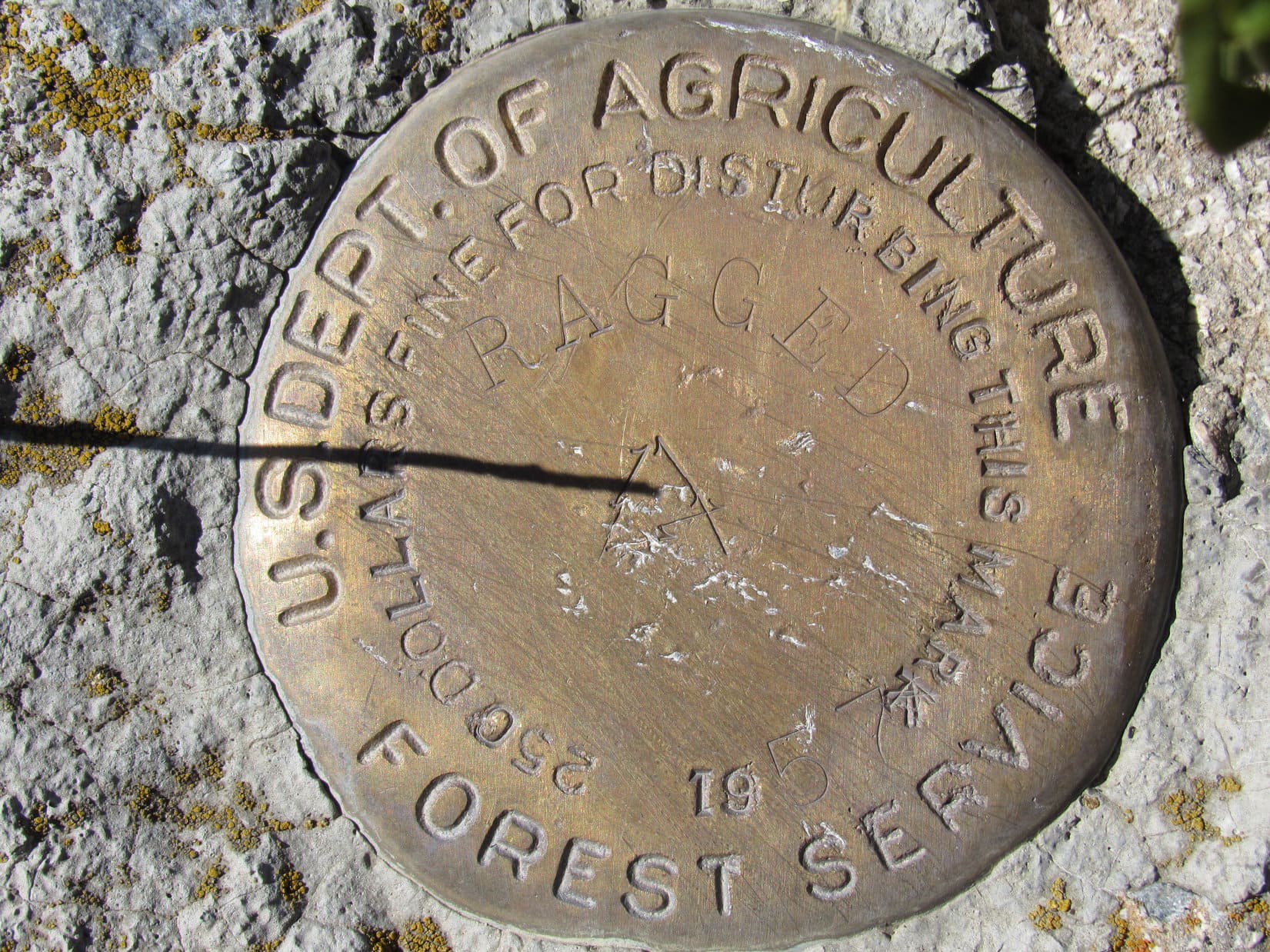
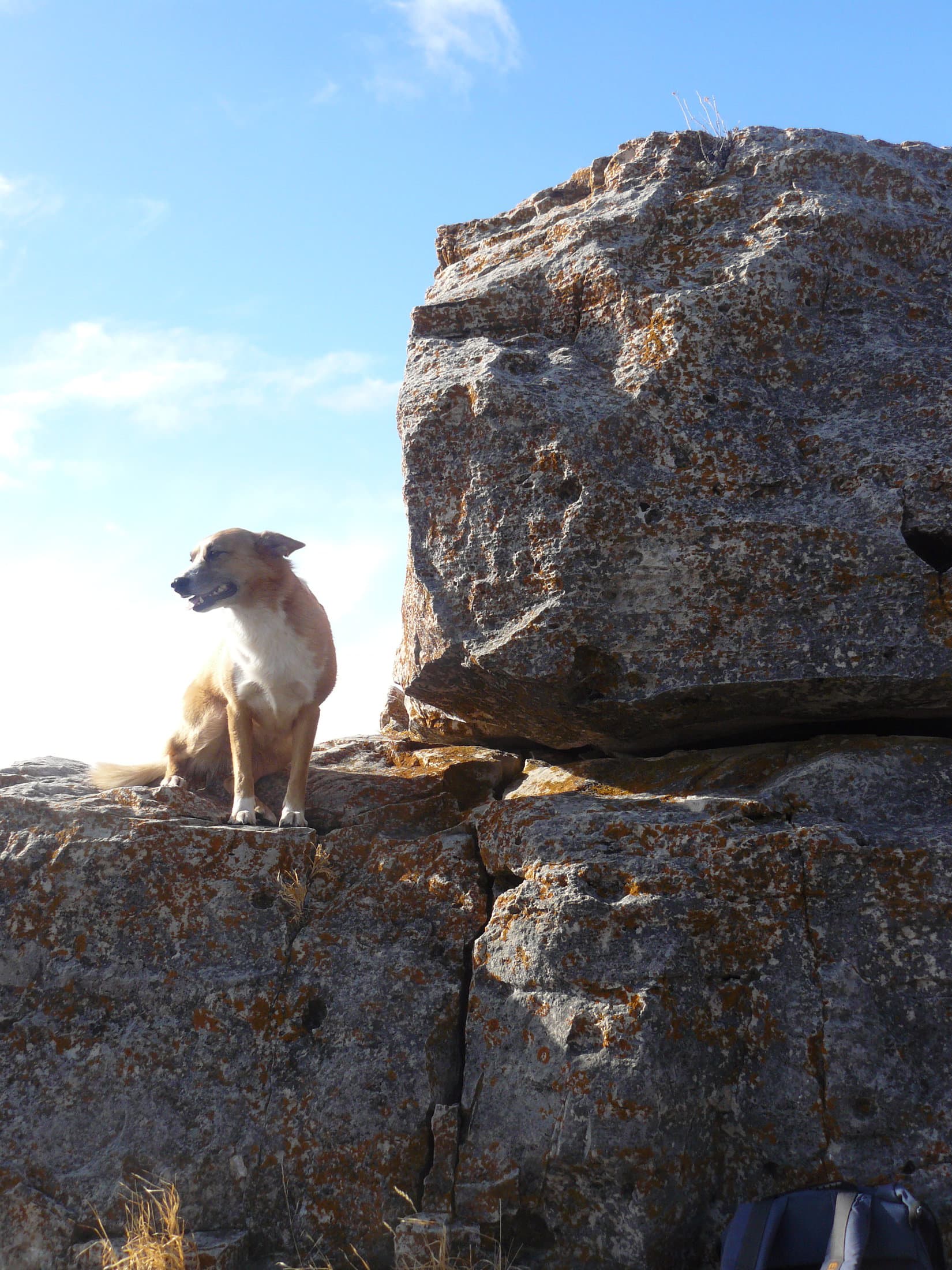
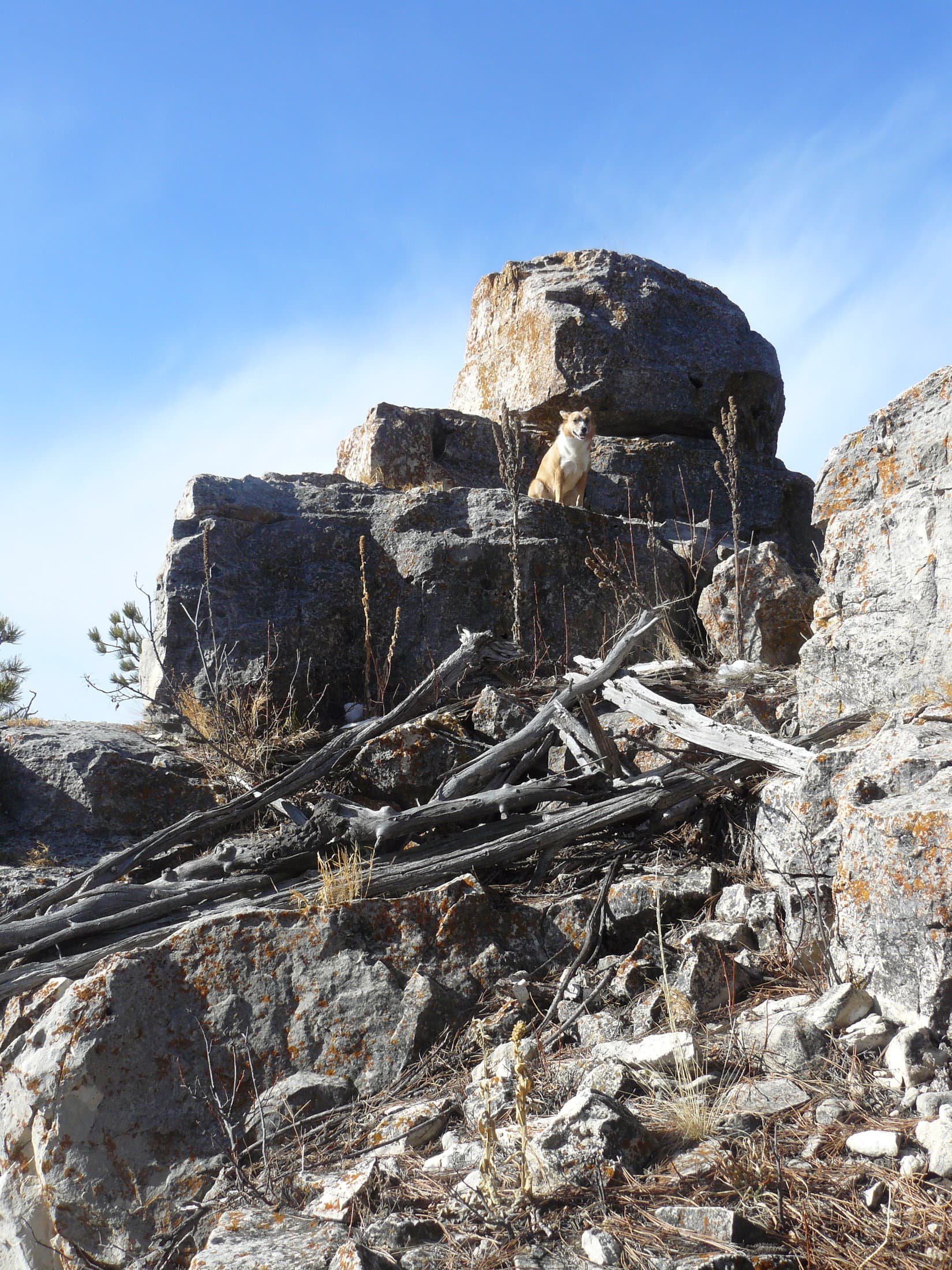
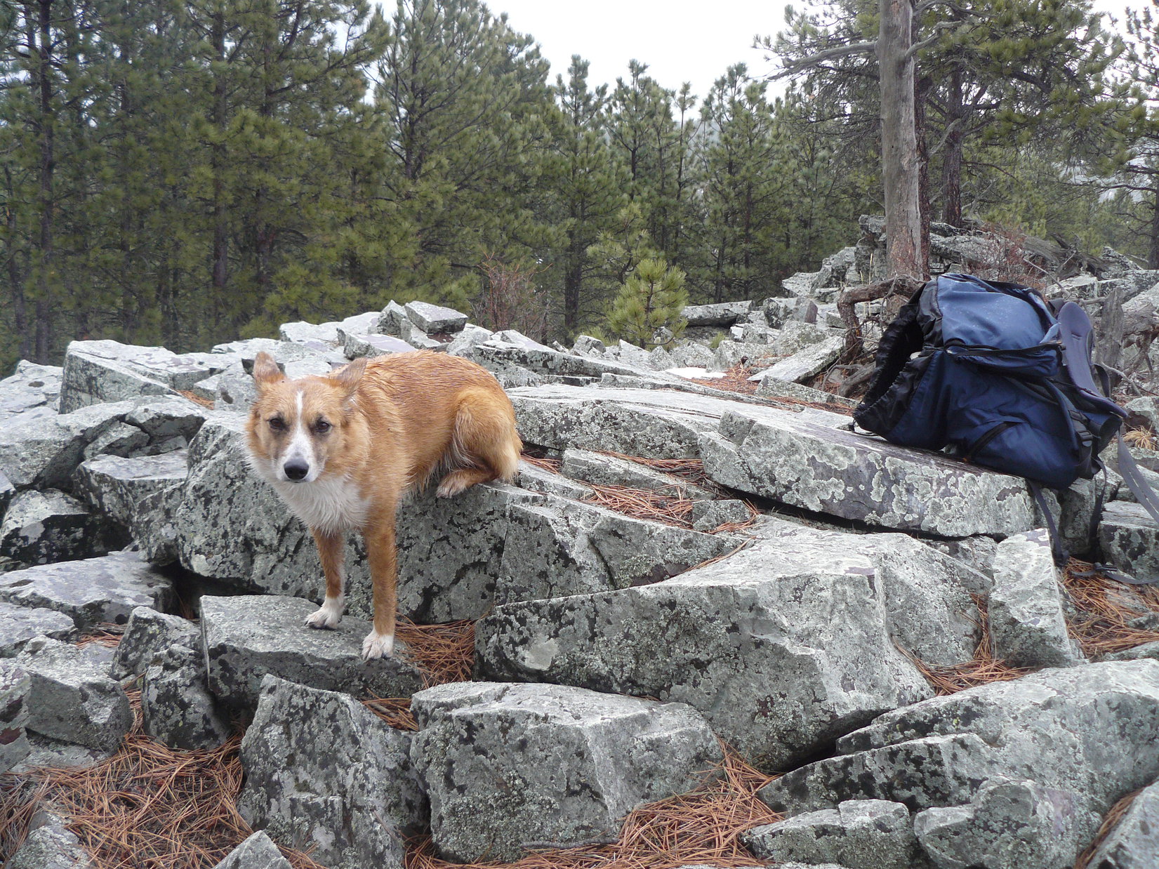
As Lupe got close to the summit of Green Mountain, she started to encounter rock outcroppings.  At the summit, there was a small area of limestone jutting sharply up above the surrounding terrain.  The limestone formation was about 20 – 25 feet high.  It was pretty easy to climb almost all the way to the top.  In order for Lupe to reach the very top, though, SPHP had to lift her up onto the highest rock.

Lupe didn’t like it up on the highest rock on Green Mountain.  It was high enough to be a little scary.  Mostly, though, she didn’t like the wind.  The wind hadn’t been much of a problem, so far, but up on top of Green Mountain, Lupe felt its full force.  SPHP wanted Lupe to stay up on the highest rock long enough for SPHP to climb down and get a good picture of her sitting up there.

The only picture SPHP got of Lupe on the very top of Green Mountain was one taken while still right beside her.  As soon as SPHP moved away, despite SPHP’s protestations, Lupe leaped down.  She wasn’t staying up there in that gale!  No way!  American Dingoes have lots better sense than that!

Lupe started to encounter limestone rock outcroppings as she got close to the summit of Green Mountain.
Lupe sitting up next to the highest rock on Green Mountain. SPHP had to climb up there, too, in order to lift a reluctant Lupe up to the very top.
Lupe was fine sitting next to the highest rock on Green Mountain. It was to her N and shielding her from the strong wind.
This is the only photo SPHP would get of Lupe on the highest rock on Green Mountain. She did not like it up there in the wind! She jumped down at her first opportunity.

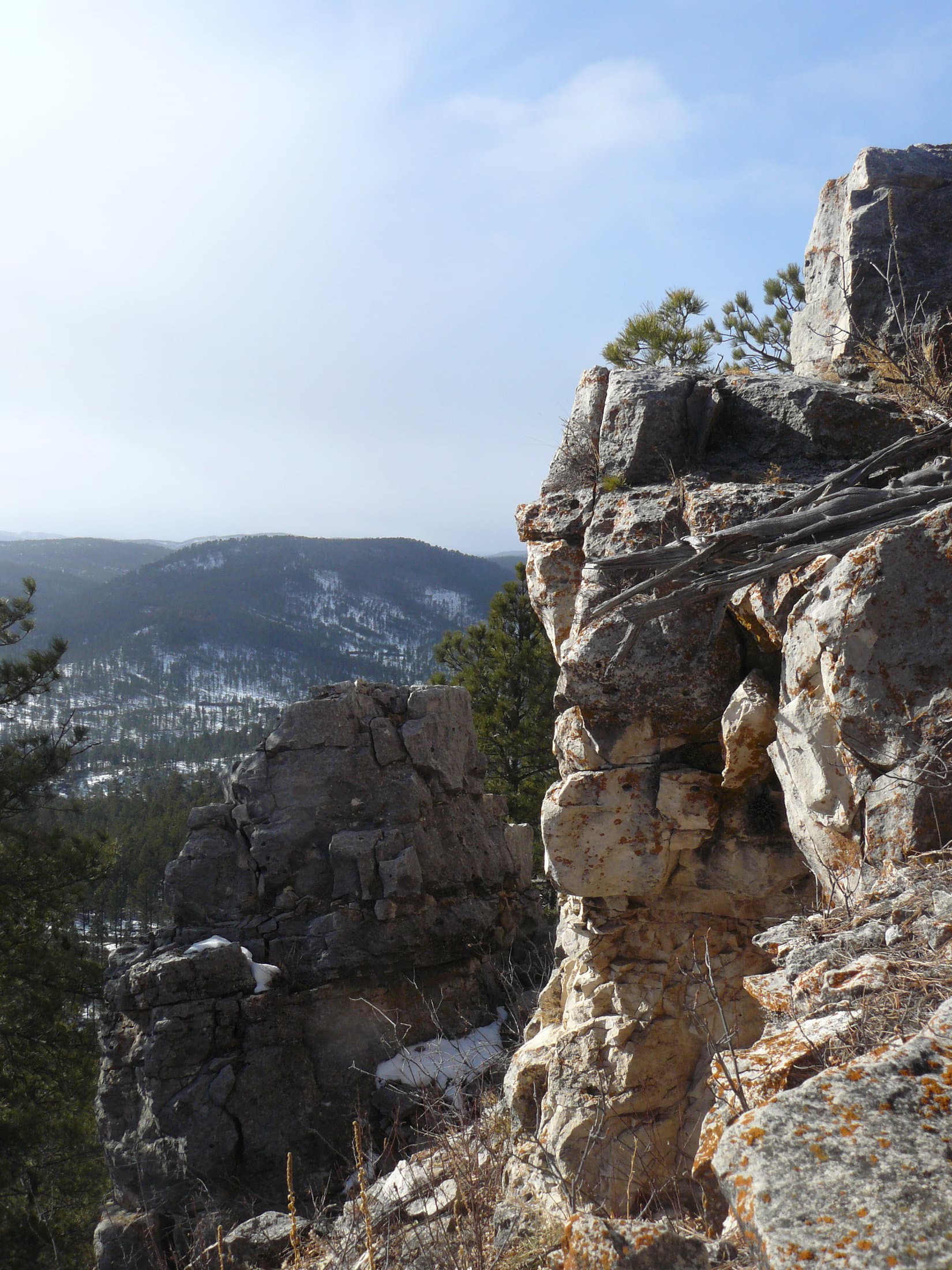
SPHP knew it was pointless to lift Lupe back up onto the top rock again.  She would just jump down again.  The 30+ mph N wind was just too annoying.  Instead, Lupe and SPHP retreated maybe 20 feet down to the SE of the summit, where it wasn’t so breezy.  There were some nice views to the S and E from here.

Lupe likes it better here. She's just SE of the summit of Green Mountain, but much better protected from the wind. Photo looks SE toward forested High Point 5136.
Lupe likes it better here. She’s just SE of the summit of Green Mountain, but much better protected from the wind. Photo looks SE toward forested High Point 5136.
Looking E toward a burned area E of Nemo Road from Green Mountain.

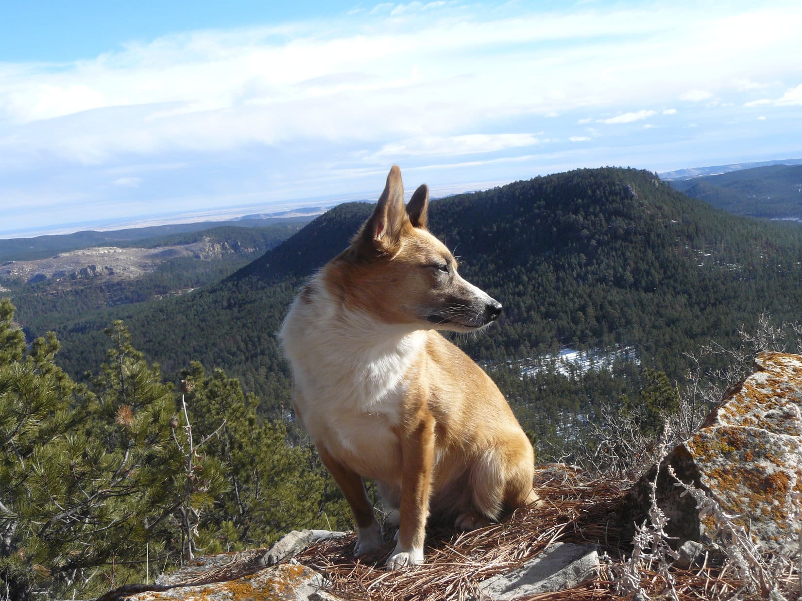
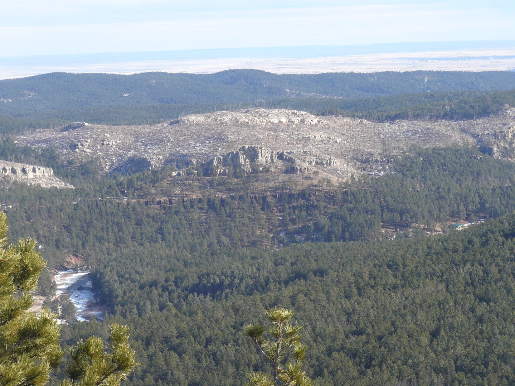
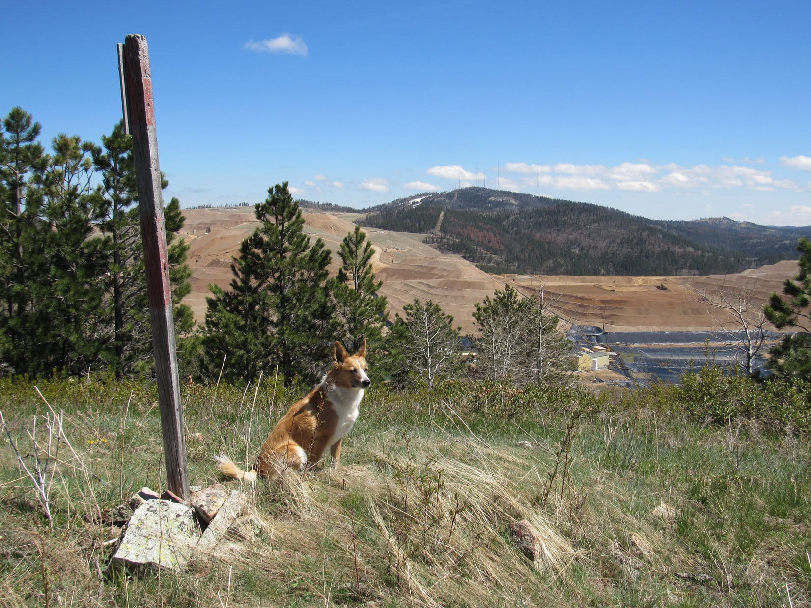
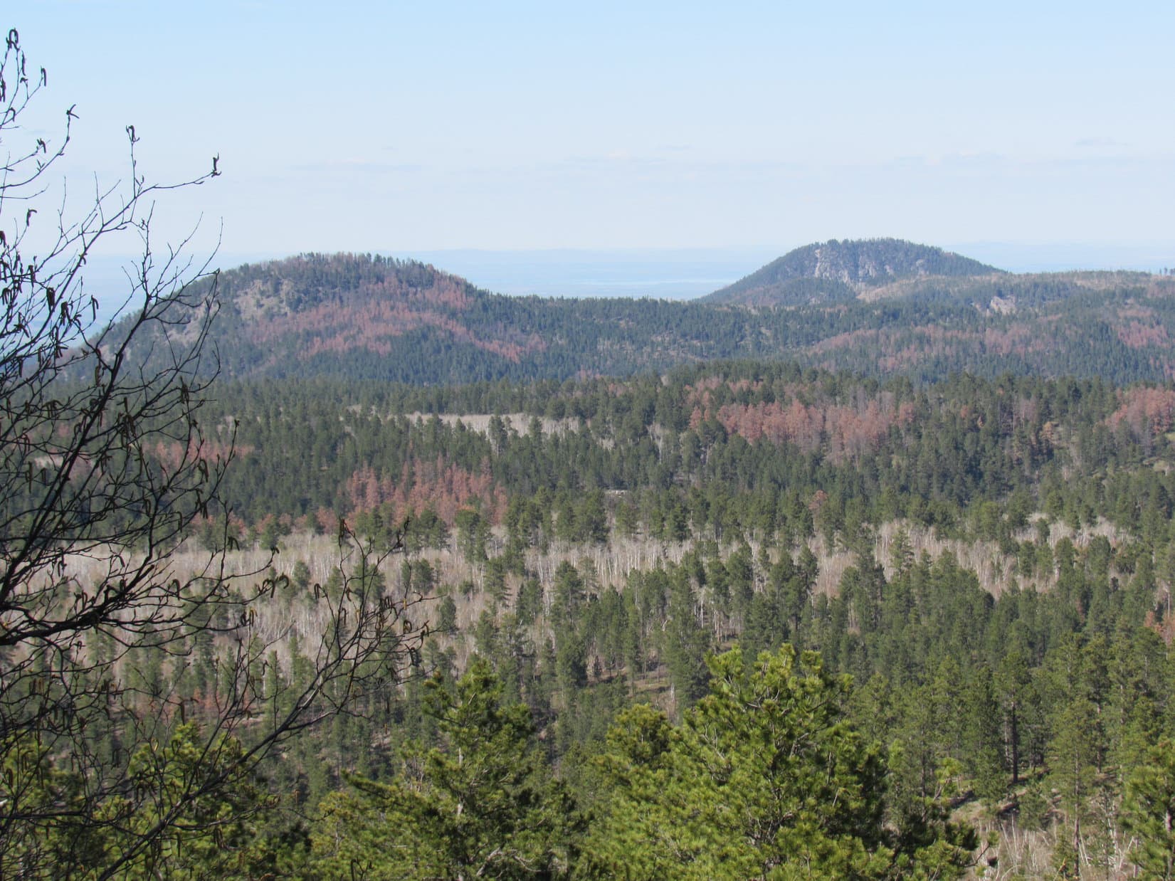
The views were great from Green Mountain from the E around to the S, and all the way over to the WSW.  SPHP tried to spot Hat Mountain, Lupe’s next objective, which was about 3 miles off to the SE.  There was a clear view of a lot of territory in that direction, but SPHP had no success identifying Hat Mountain.

SPHP persuaded Lupe to go back up toward the summit of Green Mountain again.  Lupe agreed to cooperate, but only if she didn’t have to sit way up on top getting blasted by the wind.  She was fine with being just a little below the summit, sheltered from the wind by the rocks.

Lupe just below the summit of Green Mountain. There was a considerably larger drop off on the other side of the rocks. Photo looks NW.

Lupe on Green Mountain, 1-24-15

Looking W from Green Mountain.

To get to Hat Mountain, Lupe’s next peakbagging goal, she needed to go SE.  However, Green Mountain dropped off very steeply in that direction.  The easiest way down was to go back to the NW along the ridge far enough to where the sides of the mountain weren’t so steep.

Lupe and SPHP were about to leave Green Mountain heading NW, when a series of squall lines started moving in from the N.  Blown by the strong N wind, they came fast and left just as fast, spitting rain as they passed over.

Lupe caught a glimpse of the first of several rare Northern Rainbows that she would see during the day as she left Green Mountain.  All the rainbows that SPHP could remember had always been in the E or the W, when slanting rays of the sun shone through raindrops in the air.  These rare Northern Rainbows were due to the date, time, and unusually warm weather.

The January sun just isn’t all that high above the S horizon, even during the middle of the day.  Ordinarily any precipitation this time of year would have been in the form of snow, not rain.  The combination of the sun’s rays coming slanting in from the S, and shining through the rain squalls blowing in from the N, caused the Northern Rainbows.

Some of the rainbows were quite brilliant for a few moments, but they didn’t last long as the wind pushed the squall lines through quickly.  Unfortunately, Lupe and SPHP were never where there was a clear view to the N when the rainbows formed.  It was still fun to catch glimpses of them now and then.

Lupe caught a glimpse of this Northern Rainbow as she left Green Mountain. She saw several others during the day, too, but never had a good clear view of them.

As soon as the sides of Green Mountain’s NW ridge were less steep, Lupe and SPHP started heading S down off the ridge.  When the ground eventually leveled out, Lupe turned more SE in the direction of Hat Mountain, still 3 miles away.

Soon Lupe and SPHP found themselves at the edge of a long limestone cliff above the Bogus Jim Creek valley.  Even if there had been a way down, the land below was nearly all privately owned.  Homes on acreages were scattered sparsely in the valley below.

Lupe and SPHP searched for a way down and around the private land.  Finally, Lupe found a way, but it involved a long detour to the W.  Lupe reached USFS Road No. 201.2J, and eventually made it to the main gravel road near Bogus Jim Creek.  Now down in the valley, Lupe headed E on the main road.  SPHP kept an eye out for USFS Road No. 201.1B.

Lupe trots along USFS Road No. 201.2J. This detour to the W took a lot of time, but did ultimately lead Lupe on down to County Road No. 270 (Bogus Jim Road), the main gravel road near Bogus Jim Creek.

When Lupe finally made it to USFS Road No. 201.1B, SPHP was still optimistic that Lupe would find and climb Hat Mountain.  A lot of time had been lost on the detour way around to the W, but all Lupe had to do was follow No. 201.1B up over a big ridge on the S side of the Bogus Jim Creek valley, and then turn ESE until she came to Hat Mountain.

Lupe takes a break 100 yards from USFS Road No. 201.1B on the S side of the Bogus Jim Creek valley. Green Mountain, where Lupe had been just a couple hours ago, looms to the N. Only a few minutes earlier, there had been a bright Northern Rainbow, but by the time Lupe and SPHP got to this opening in the forest for a photo, the sky clouded over and the rainbow disappeared.

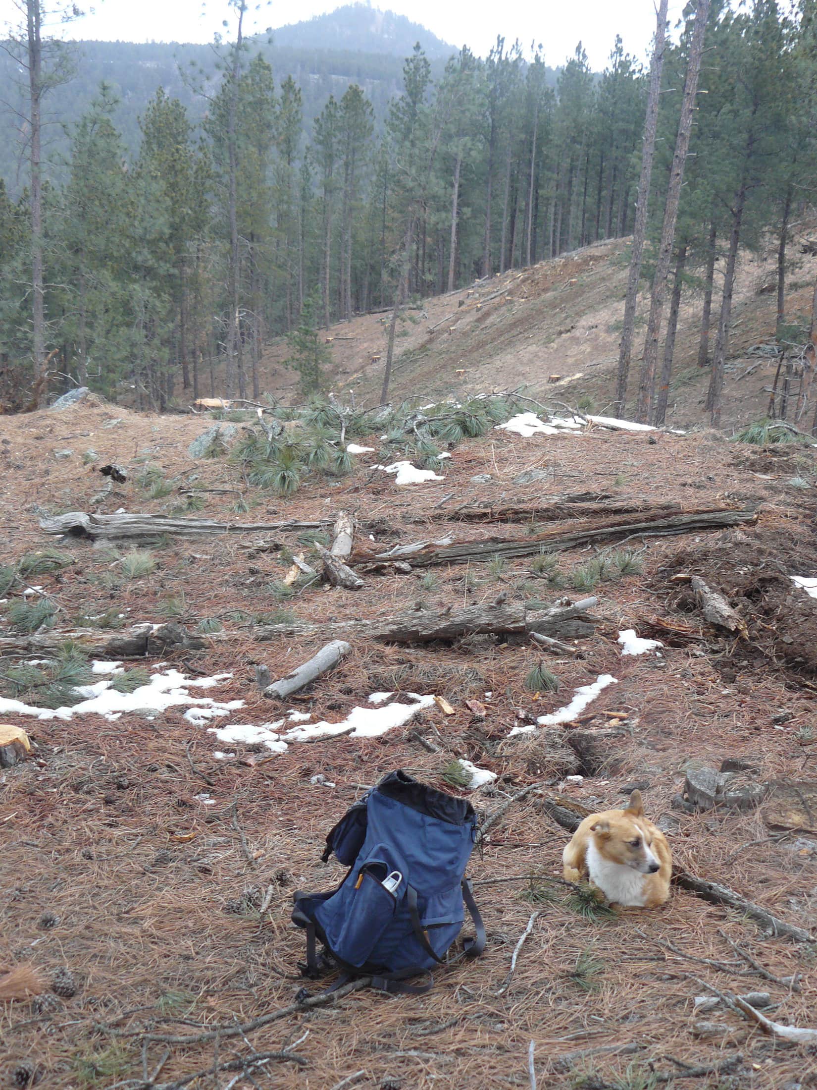
It sounded easy, but it wasn’t.  No. 201.1B turned E before it got up over the ridge.  Lupe and SPHP tried a side road, which may have been No. 201.1H, but it soon turned W.  Lupe and SPHP abandoned the roads to climb directly up the slope, and ultimately succeeded in reaching flatter ground above.  There Lupe and SPHP encountered a maze of little roads in the forest.  Some of the roads were marked with ATV Trail Numbers, but they meant nothing on SPHP’s old USFS map.

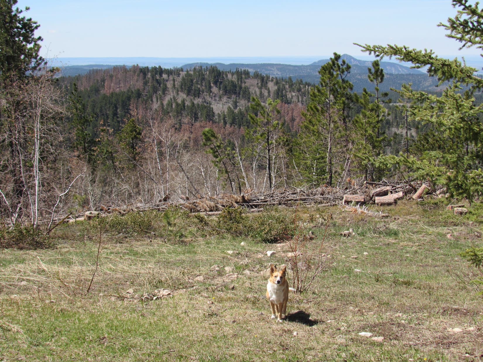
Lupe and SPHP had by now crossed over the S ridge, and out of the Bogus Jim Creek drainage area.  Hat Mountain was likely no more than 1.5 miles away, and probably less, but the weather was deteriorating.  The sky was clouded over nearly all the time now.  Although the rain showers were supposed to have ended by noon, the rain was really just getting going.  The wind continued to roar in the trees.  Occasionally the sun still made a brief appearance, but increasingly the low clouds and rain were closing in.

Without being able to see the sun, orientation became difficult.  The relatively level forest provided no views.  SPHP led Lupe on a series of little roads heading SE, but Hat Mountain did not appear.  Finally, through the forest, SPHP saw a small rocky high point that looked like it would offer a view.  Lupe and SPHP were soon there.

Lupe arrives at High Point 5219.

The little rock outcropping yielded a view alright, but not the view SPHP was expecting.  SPHP expected to see Hat Mountain, or perhaps Norris Peak (4,982 ft.) or even Thrall Mountain (5,091 ft.).  Hat Mountain was nowhere to be seen.  Neither was Norris Peak.  Much farther off to the E than it should have been, was a mountain that looked like it might be Thrall Mountain.  It was hard to tell in the rain and clouds.

Just a glance was enough.  SPHP knew instantly that Lupe was nowhere near Hat Mountain.  Lupe and SPHP had been heading SW instead of SE.  Far below, SPHP could see a short stretch of Hwy 44W that looked familiar.  Lupe was well W of Johnson Siding, or even Pine Cliff.  Miles off to the SW was a mountain that SPHP recognized.  The Seth Bullock Lookout Tower was barely visible on Scruton Mountain (5,922 ft.).

Looking SW from High Point 5219. This view, which disappeared in the clouds minutes later, enabled SPHP to quickly figure out where Lupe was.

Time to look at the maps.  Lupe sat uncomfortably on the rocks while SPHP tried to pinpoint where Lupe might really be.  The wind continued blowing.  It was raining, not hard, but enough so Lupe was gradually becoming a pretty soggy doggie.  SPHP glanced up for another look at the view to the SW.  It was gone.  Now there was just fog.

Lupe sat uncomfortably on the rocks getting wetter and more miserable looking as SPHP checked the maps.
A rather soggy doggie Lupe at High Point 5219. Why she chose to sit perched so strangely is a mystery.
"Come on, SPHP, figure it out! You told me we were going to Hat Mountain. If this isn't it, where in the world are we?"
“Come on, SPHP, figure it out! You told me we were going to Hat Mountain. If this isn’t it, where in the world are we?”

It was OK.  SPHP had seen enough.  From the maps, the only thing that made sense was that Lupe and SPHP had inadvertently arrived at High Point 5219.  Hat Mountain was now nearly 2 miles to the ENE.  No way Lupe and SPHP were going to find it today.  There wasn’t time, even if the weather had been better.

It was late, the weather wasn’t so hot, Hat Mountain had eluded Lupe, and it was a long way back to the G6.  Time to start making tracks!  Actually, time to start following tracks back the way Lupe and SPHP had come.  It was a good thing there was some snow on the ground.  SPHP set off from High Point 5219 at a lively pace retracing Lupe’s path in the snow.  SPHP was making great progress until…..

Until SPHP turned around.  Lupe wasn’t there!  She wasn’t following, and SPHP hadn’t seen her up ahead for a few minutes either.  SPHP was alone in the windy, rainy, almost foggy forest.  Raindrops on SPHP’s glasses made it difficult to see clearly.  Where had Lupe gone?  She always stays close.  She never runs off for more than a few minutes, without coming back to check on SPHP.

SPHP went back.  Soon SPHP spotted Lupe.  She was at the end of a dead tree trunk, digging furiously.  Clouds of reddish brown dirt and rotten wood went up around her.  SPHP was amazed to see her start ripping the old tree trunk apart with her teeth.  Clearly, Lupe was convinced something mighty interesting was in that old log.

Lupe had forgotten all about SPHP and was digging furiously at the end of a hollow log.

Clouds of rotten wood flew; Lupe ripped big chunks of the old log off with her teeth.  Lupe kept hard at it.  When Lupe loosened a particularly big piece of wood, SPHP helped her break it off.  She continued digging like a Dingo possessed.

Suddenly a bunny streaked out of the other end of the log, and made a mad dash through the forest.  Lupe yipped and was after it.  They were both out of view in a flash.  SPHP ran after them.  Lupe’s frustrated yipping led SPHP to her.  The bunny knew this forest, and every hollow log in it.  It was now hiding in Hollow Log No. 2.  No telling how many hollow logs that rabbit was familiar with!

Lupe hadn’t lost an ounce of enthusiasm.  She was digging furiously again, now at the end of Hollow Log No. 2.  Well, this couldn’t go on.  Time to leave the bunny alone.  Lupe was plenty disappointed when SPHP made her leave.  No doubt the American Dingo thought SPHP had absolutely no idea how to fend for oneself in the wild.  Here was a perfectly good fresh rabbit dinner being passed up for a long trek in the wind and rain on an empty stomach.  Humans have no instincts worthy of the name!

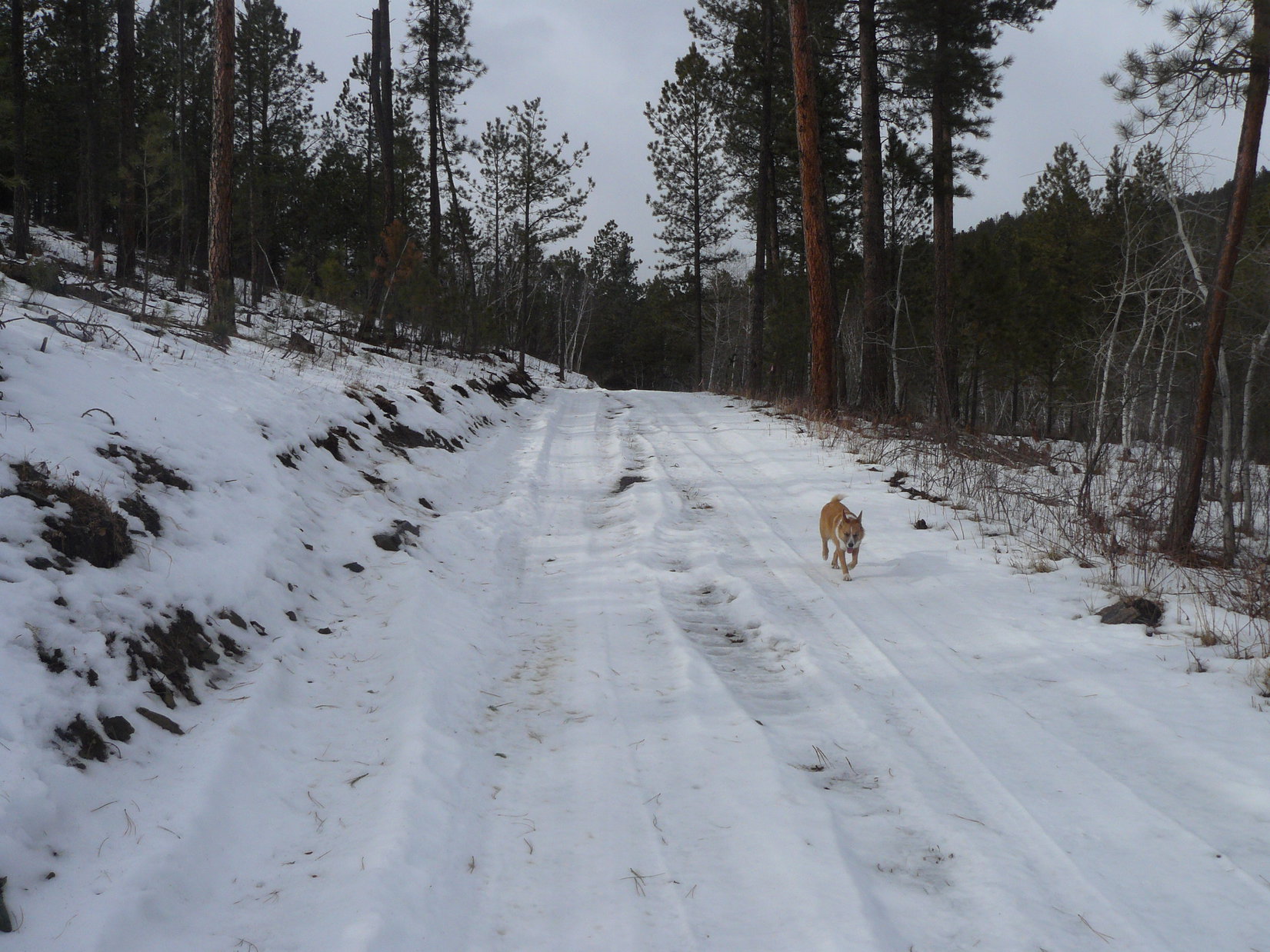
It was a long way, hours, back to the G6.  Lupe and SPHP made it back to the main gravel road in the Bogus Jim Creek valley while there was still some light.  The rain had stopped.  The wind even died down somewhat.  The sky partially cleared.  Lupe and SPHP trudged onward.

Along USFS Road No. 679.1, the darkness came.  It should have been easy to follow the road back, but SPHP got lost.  More than once.  Several times SPHP took wrong side roads, not realizing they were side roads.  Lupe waited patiently while SPHP stopped to study maps with a flashlight each time it became clear something wasn’t right.

Orion was blazing brightly in the night sky by the time Lupe and SPHP reached the G6 again.  It was 7:54 PM, and still 36°F when Lupe hopped into the G6 for the ride home.  Back home, Lupe and SPHP feasted on spaghetti and chocolate cake.  It was good, but SPHP suspected Lupe would have much preferred rabbit.

Near High Point 5219, Lupe rips apart Hollow Log No. 1 with her teeth in her anxiety to get at the bunny hiding inside!

Links:

Next Black Hills Expedition                    Prior Black Hills Expedition

Want more Lupe adventures?  Choose from Lupe’s Black Hills Expeditions Adventure Index or Master Adventure Index.  Or subscribe free to new Lupe adventures.

Spotted Horse, The Giant Mushroom & Shell Creek, Wyoming (8-8-12)

Day 1 of Lupe’s 2012 Dingo Vacation to the West Coast.

Something different was happening.  Lupe didn’t know what it all meant.  She was 1 year and 7 months old, so the world was still pretty new.  A couple days before, Lanis had arrived from Indiana in his Honda Element.  Now Lanis and SPHP were carting the rear seats out of the Element, and into the living room.  Lots of gear got stuffed into the back of the Element.

Lupe wondered what was going on.  She had no idea what was coming.  She didn’t know she was about to set out on her first ever Dingo Vacation.  Even Lanis and SPHP had only a vague idea where Lupe was ultimately going to go.  For starters, the Bighorn Mountains in Wyoming, then probably to the Beartooths, Yellowstone, and Glacier National Park.  After that, well, who knew?  It was an adventure!

Shortly after 10:00 AM on 8-8-12, Lupe, Lanis & SPHP headed out.  Lanis drove, SPHP was navigator, and Lupe was perched on a pile of camping gear and supplies covered with blankets and pillows.

When Lupe was a little puppy, she hated riding in the car.  It made her sick.  Her ears drooped at just the mention of the car.  It took a long time, but Lupe had outgrown her car sickness.  She finally realized riding in the car meant that something fun was about to happen.  Still, SPHP wondered how she would fare on a long trip.

Lupe sets out on her first ever Dingo Vacation in Lanis' Honda Element perched comfortably on a pile of blankets.
Lupe sets out on her first ever Dingo Vacation in Lanis’ Honda Element perched comfortably on a pile of blankets.

Lupe did great in the Honda Element!  She was getting attention, and having a good time looking out the windows.  Soon Lupe was in Wyoming heading W on I-90.  She was going to the big mountains for the first time ever.  Her first big mountain range would be the Bighorns in north central Wyoming.

At Gillette, WY, Lupe left I-90.  She went N to Spotted Horse on Hwy 14/16.  This was a slightly longer route than just staying on I-90, but SPHP was curious to see what was there.  Spotted Horse turned out to be just a wide spot in the road.  However, there was a little store.  More importantly, there actually was a spotted horse!

Lanis went into the store to see what they had.  Meanwhile, Lupe met a white and black dog.  Lanis returned with ice cream bars, the first treat of the trip.  Lupe was quite enthusiastic about this turn of events.  She eagerly helped SPHP out.

Lanis at Spotted Horse, WY. Lupe met a white and black dog here, and helped SPHP devour an ice cream bar. Her first ever Dingo Vacation was off to a good start.

By the time Lupe reached Sheridan, WY, it was getting to be time for something a little more substantial than an ice cream bar.  Lanis and SPHP stopped, and got Subway sandwiches.  Lupe would have her Taste of the Wild.  At Dayton, WY, there was a park on the Tongue River.  Lupe, Lanis and SPHP stopped at the park for a peaceful picnic along the clear running stream.

At least it started off as a peaceful picnic, but after a few minutes, there was the sound of machinery.  It seemed to be coming from upstream.  It got louder.  In a couple of minutes, the source of the noise appeared – a front end loader came right down the middle of the stream carrying a boulder.  Back and forth it went.  The front end loader was busy retrieving and rearranging boulders in the Tongue River.  Apparently nature had placed them in the wrong spot.

Lanis was rather amazed and amused by the front end loader charging up and down through the river.  Somehow it just didn’t seem right.  Lupe, Lanis and SPHP went farther downstream to escape the noise, but the clear running river wasn’t clear any more, at least not during the picnic.

A front end loader moving boulders around in the Tongue River attended Lupe's picnic in Dayton, WY.
A front end loader moving boulders around in the Tongue River attended Lupe’s picnic in Dayton, WY.  Even Lupe looks like she thinks it’s funny.

From Dayton, Lupe headed up into the Bighorn Mountains on Hwy 14.  SPHP suggested going to Dead Swede campground, which is situated in a beautiful location on the Tongue River.  At Dead Swede, Lupe and SPHP stayed at a campsite to claim it, while Lanis went to get a registration slip.  Campground hosts came by patrolling on an ATV.  They saw Lupe and SPHP standing at the empty campsite.

Right away they stopped and launched into a speech about how Lupe couldn’t be off leash, we had to pay within 30 minutes, we couldn’t do this and couldn’t do that.  We had to do this and had to do that.  The campground hosts claimed to be here to help us enjoy OUR national forest and wilderness experience.  Then they left.

Yeah, right!  SPHP has no use for Washington bureaucrats, and certainly doesn’t need them to enjoy a “wilderness” experience.  Lanis was back within a few minutes with the registration slip.  SPHP told him to forget it – Lupe was leaving!

Looking NE out at the high plains from one of the turnouts along Hwy 14 heading up into the Bighorn Mountains.

Lupe, Lanis and SPHP went on to check out the Giant Mushroom area.  There were some nice views from up on a ridge there to the SE toward Cloud Peak (13,167 ft.), the highest mountain in the Bighorns.  There were interesting dolomite rock formations, including the Giant Mushroom.  Lupe had fun exploring.  The ground was pretty lumpy for camping, though.  Lupe, Lanis and SPHP went on to Shell Creek campground.

Lanis at the giant mushroom in the Bighorn Mountains.

SPHP had a chat with the campground hosts at Shell Creek.  They were pretty cool and laid back.  They didn’t care too much what happened, as long as no one complained and everyone acted responsibly.  That was fine.  Lanis and Lupe also approved of Shell Creek campground, which was in a beautiful spot in the upper end of Shell Canyon.

So Lanis and SPHP reserved site No. 11.  Like all the other sites, it was right next to Shell Creek.  Lanis and SPHP set up the tent, or Lupe’s “tiny house”.  Lupe, Lanis, and SPHP all went for a walk along Shell Creek.  For the first time ever, Lupe saw a moose.  The moose had a calf.  Mama and baby were down along the creek getting a drink.  They soon sauntered off into the woods.

The moose at Shell Creek, Bighorn Mountains, WY.
Mama moose at Shell Creek, Bighorn Mountains, WY.

Back at the campsite, Lanis and SPHP made a late dinner.  Lupe had some Alpo.  By the time dinner was done and cleaned up, it was 10:00 PM.  Lupe, Lanis and SPHP all piled into the tent.  Lupe was pretty excited.  She was going to spend the night out here?!  This was new and different.  It took her a while to settle down.  She finally fell asleep to the soothing sound of the rushing waters of Shell Creek.

Now and then as she dreamed, she still twitched in excitement.

Links:

Next Adventure

Want more Lupe adventures?  Choose from Lupe’s 2012 West Coast Adventure IndexDingo Vacations Adventure Index or Master Adventure Index.  Or subscribe free to new Lupe adventures.

Black Hills, SD Expedition No. 172 – Elk Mountain, Ragged Top Mountain & Twin Peaks (5-14-16)

A little downstream (N) of the sign for the cabin community of Elmore in Spearfish Canyon, SPHP stopped the G6 on a small pullout next to Hwy 14A.  USFS Road No. 215.1 was supposed to be around here somewhere.  Finding it was critical to Lupe being able to complete her peakbagging goals for the day.

SPHP checked the maps again.  Either No. 215.1 wasn’t much farther ahead, or SPHP had already missed it.  Let’s go a little farther Loop, if we don’t see it, we will have to turn around and make another pass.

The G6 had hardly gotten going back on Hwy 14A again, when a street sign saying Annie Creek Road appeared on the R next to a very rocky side road.  That was it!  Very carefully, SPHP crawled the G6 up the first little hill.  This wasn’t G6 territory!  As soon as the terrain flattened out, the G6 got parked along a wide spot in the dirt road (10:33 AM, 41°F).

Lupe and SPHP started off heading N on Annie Creek Road.  It was narrow, kind of rocky, but almost level.  An easy hike to start the day!  Last weekend, Lupe had found a similar road leading out of Spearfish Canyon farther N on her way to Little Crow Peak (5,885 ft.).  That road had been steep for over a mile, though.  This was a piece of cake!

The thick haze that had persisted all day on Expedition No. 171 was gone.  The air was a crisp, crystalline blue.  Not a cloud was in the sky.  Lupe and SPHP were both in high spirits, making good progress along the road.  The first point of interest came as the road angled NE.  A cold, clear rivulet poured down the steep hillside SE of the road between mossy banks.

The mossy-banked rivulet next to Annie Creek Road. Lupe wasn’t thirsty yet.

Lupe wasn’t thirsty yet, so she just went on.  She was surprised when a big mud puddle covering most of the road turned out to have a thin coat of ice.  Lupe passed several big iced-over puddles.  Near one of them, SPHP spotted a Lupe Treasure.  The aluminum beer can turned out to be heavy.  It was full of ice, too.  SPHP decided to move it from the ditch into a sunnier spot where the ice would melt.  Lupe could claim her treasure on the way back to the G6 at the end of the day.

Annie Creek could now be heard down in the deep forested valley to the NW.  Lupe was more than 1.5 miles from the G6 by the time the road curved N, and went over a high embankment above Annie Creek.  Lupe saw Annie Creek, which had surprisingly good flow, but did not leave the road to run down to it.

The road divided on the NW side of the creek.  The main road went NE following Annie Creek upstream.  A lesser, but still good road went W.  The topo map showed that this road would gain elevation slowly while working around the W end of a big hill to the N.  Eventually, it would turn E, arriving after 2 miles at a point less than 0.5 mile S of Lupe’s first peakbagging goal, Elk Mountain (6,422 ft.).  Lupe and SPHP left the main road heading W on the lesser road.

Lupe on the lesser road after leaving Annie Creek Road. Photo looks W.

Everything was going great!  It was all so easy.  The lesser road started curving around to the NW.  Suddenly it ended.

Lupe reaches the sudden end of the lesser road. Photo looks NW.

Looking down into the steep ravine ahead, it was possible to see a couple of big old cement foundations and some collapsed timbers.  The road didn’t use to end here, there must have been some kind of trestle bridging the gap.  Trees kind of hid the other side, but it did look like the road still continued NW on the other side of the gap.

Going down the S end of the gap seemed easy enough, but climbing up the N end looked pretty steep.  It didn’t appear too bad, though.  Lupe and SPHP went down into the gap to get a closer look.

Lupe on one of the cement foundations down in the gap. Photo looks N up the steep slope Lupe would have to climb to get to where the road would continue NW.
Looking WNW from the bottom of the gap.

Lupe and SPHP climbed up the steep N side of the gap.  It wasn’t too bad going up, and less than a 50 foot climb, but SPHP hoped there weren’t any more gaps in the road ahead.  SPHP didn’t relish the prospect of going back down this way, if Lupe had to turn around.

The road did continue NW from the N side of the gap, but the view wasn’t entirely encouraging.  This part of the road was full of rocks and boulders that had fallen down the steep slope to the NE.  Trees were growing on the old roadbed.  It didn’t look like this part of the road got used at all any more.

The road continued on N of the gap, but didn't look very encouraging. Photo looks NW.
The road continued on N of the gap, but didn’t look very encouraging. Photo looks NW.

Lupe didn’t have to go very far N before SPHP’s fears were confirmed.  Another gap was dead ahead.  This one was even bigger, steeper, deeper and wider.  One look at it, and SPHP knew Lupe couldn’t continue on this way.

The 2nd, even bigger gap wasn’t far N of the 1st one. No way Lupe and SPHP could get across this one!

SPHP didn’t want to back down that N slope of the 1st gap, but crossing the 2nd gap wasn’t an option at all.  Lupe and SPHP had to turn around.  SPHP searched the steep slope to the NE.  Was there a way up there?  It was the only other possibility.

The NE slope was steepest down right next to the road where part of the hillside had been carved out during road construction.  About 50 feet up, the slope wasn’t quite as steep.  Only one spot offered a possible reasonable route up.  From the very top of the steepest part of the bank, a fallen tree slanted down at an angle for about 30 feet.  The upper end of the trunk was wedged against a big living pine.  The lower end was firmly wedged between big rocks.  This tree trunk looked very stable, and getting to the lower end of it appeared relatively easy.

So, Lupe and SPHP tried going up the steep NE slope using the fallen tree for support.  No problems!  It worked just fine.  SPHP still had to crawl up the higher slope for quite some distance.  Very gradually, it became less steep.  Near the top, SPHP was able to walk again.  After gaining 200-300 feet of elevation, the ground finally leveled out.  Whew!  Lupe and SPHP took a breather at a rock outcropping at the edge of the slope.

Lupe at the rest point after climbing up the long steep slope unseen just beyond the edge of the rocks behind her. SPHP was quite glad to reach this point. Photo looks WSW.

Lupe had some Taste of the Wild and water.  SPHP checked the topo map.  From here Lupe needed to keep climbing while following the sweep of the ridge.  However, it wouldn’t be nearly as steep from here on.

SPHP had not planned for Lupe to ever be on this ridge, but now she was.  Everything went fine, though.  At first Lupe went SE climbing the now gently sloping ridge.  Before long, the ridge turned NE.  Lupe continued gaining a little elevation.  Somewhere far below to the SE was Annie Creek.  Lupe was so high above it, SPHP couldn’t even hear the creek.

Close to a mile from where Lupe and SPHP had reached the top of the steep slope, Lupe could see a huge pile of mine tailings up ahead.  It looked like a completely barren mountain.

Lupe draws near a mountain of mine tailings up ahead. Photo looks NE.

Lupe reached a dirt road as she got closer to the mine tailings.  Lupe followed the dirt road N.  The top of Elk Mountain was now in view up ahead.

The top of Elk Mountain came into view. Photo looks N.

The dirt road quickly dead-ended.  Lupe continued NNE through the forest.  Elk Mountain looked like it would be easiest to climb from the E.  Lupe reached a fence at the edge of the mining property.  She stayed W of it, still trying to head NNE.  A constant sound of machinery in operation was getting louder and louder.

A big area covered with a black liner came into view.  A small pond of water was at the lower end.  Trucks could now be heard.  The mine was definitely in operation.  Lupe and SPHP stayed away from it in the forest.  Lupe had to cross a little valley to get to where she could start climbing Elk Mountain.  There were a few unmarked roads along in here, but Lupe didn’t follow any of them very far.  She climbed Elk Mountain (6,422 ft.) from the S and then E.

Lupe at the summit of Elk Mountain. Photo looks SE toward the mine and Terry Peak (7,064 ft.) in the distance.

Although SPHP’s old USFS map showed Elk Mountain to be in the Black Hills National Forest with private property nearby, there were plenty of signs of human habitation near the top.  At the summit, a tall post stuck up out of a small pile of rocks.  Nearby was a short building with windows.  The building was shaped like it might house a hot tub.  SPHP peered inside.

Lupe near the strange little building on Elk Mountain. SPHP thought it might contain a hot tub, but it didn’t. It appeared to be a child’s playhouse. Photo looks SSW.

There was no hot tub.  The strange little building appeared to be a child’s playhouse.  In a way, it was sort of a glorified tree fort with the lofty summit of Elk Mountain substituting in lieu of a treetop.  Sadly, it looked like no child had played here in a long time.

Lupe and SPHP took another rest break up on Elk Mountain.  SPHP had an apple.  Lupe had Taste of the Wild.  Water for all, of course.  Lupe shared a peanut butter granola bar with SPHP.  American Dingoes love granola bars!

There were clear views toward the S.  The most impressive view was SE toward the nearby mine.  Terry Peak (7,064 ft.) and Deer Mountain (6,652 ft.) were both in view farther off in the same direction.  Trees blocked most of the views to the N and W, although it was possible to get a glimpse of Cement Ridge (6,674 ft.) in Wyoming to the W.

The mine was kind of pretty in a devastated human way from the top of Elk Mountain. Terry Peak (L) and Deer Mountain (6,652 ft.)(Center) were in clear view beyond it. Photo looks SE.
The mine was kind of pretty in a devastated by humans way from the top of Elk Mountain. Terry Peak (L) and Deer Mountain (6,652 ft.) (Center) were in clear view beyond it. Photo looks SE.

Lupe’s next peakbagging goal, Ragged Top Mountain, was about a mile away to the NW as the crow flies.  Lupe and SPHP had to go farther than that to get there.  Lupe went down the NE slope of Elk Mountain.  On the way she spotted the greatest hoard ever of Lupe Treasures!  It was a veritable aluminum mine!  SPHP left the vast glittering riches where they were.

Ragged Top Mountain (6,200 ft.) has two high points of nearly equal elevation. The E high point is seen here from Elk Mountain. Photo looks NW.
Ragged Top Mountain (6,200 ft.) (L) has two high points of nearly equal elevation. The E high point is seen here from Elk Mountain. Photo looks NW.

Farther down the mountain, Lupe came to a road.  She followed it NW down to Preston, where there were a couple of decaying buildings.  From Preston, Lupe and SPHP headed back into the forest, and up the SE ridge to the top of Ragged Top Mountain (6,200 ft.).

A forlorn old building at Preston, SE of Ragged Top Mountain. Photo looks N.

Ragged Top Mountain has two highpoints, both areas enclosed by the 6,200 foot contour.  The topo map showed the E high point had a much larger area enclosed by the contour.  SPHP consequently expected the true summit would probably be found here.  Lupe reached the E high point first.  She found a ridge of rock that dropped steeply off to the S.

Lupe on top of the E high point of Ragged Top Mountain. This might have been the true summit. Photo looks ESE.

Lupe on the E high point of Ragged Top Mountain, 5-14-16

Lupe on another high rock, though not the highest one, in the area of the E high point on Ragged Top Mountain. Photo looks WNW.

SPHP had caught a glimpse of the W high point from Elk Mountain.  It looked far more rugged, or perhaps “ragged” than the E part of Ragged Top Mountain.  After visiting the E high point, Lupe and SPHP enjoyed an easy stroll most of the way over to the W high point.

Actually getting to the top of the W high point involved a steeper, more peak-like climb.  It was still an easy scramble, but left both Lupe and SPHP more impressed with the W high point than the E one.  The W summit also featured a rock ledge dropping steeply off to the S.  However, the W high point had superior open views from the SE around to the W.  Right away, Lupe found a survey benchmark on a rock next to the very highest one.

This survey benchmark saying "Ragged" was located up on the W high point of Ragged Top Mountain. The W high point was certainly more impressive and a better viewpoint than the E one. However, even after Lupe visited both, SPHP remained uncertain which high point is actually the true summit.
This survey benchmark saying “Ragged” was located up on the W high point of Ragged Top Mountain. The W high point was certainly more impressive, and a better viewpoint than the E one. However, even after Lupe visited both, SPHP remained uncertain which high point is actually the true summit.
Lupe on the W high point of Ragged Top Mountain. The survey benchmark is underneath her just in front of her rear paws. Cement Ridge in Wyoming is seen in the distance on the L. Photo looks W.
Lupe on the W high point of Ragged Top Mountain. The survey benchmark is underneath her just in front of her rear paws. Cement Ridge (6,674 ft.)  in Wyoming is seen on the horizon on the L. Photo looks W.
Elk Mountain (Center) and more distant Terry Peak (L of Center) from the W high point of Ragged Top. Photo looks SE.
Forest generally hid the views to the N, but SPHP caught this glimpse between the trees of Crow Peak (5,787 ft.) (L) W of Spearfish, SD. Photo looks N.
Forest generally hid the views to the N, but SPHP caught this glimpse between the trees of Crow Peak (5,787 ft.) (L) W of Spearfish, SD. Photo looks N.  Taken with the telephoto lens.
Lupe tried to get comfortable here while taking a rest break up on the W high point. It was rather rocky, though, and not entirely suited to Lupe's purpose. Photo looks W.
Lupe tried to get comfortable here while taking a rest break up on the W high point. It was rather rocky, though, and not entirely suited to Lupe’s purpose. Photo looks W.

The views were so nice, the sky so clear, and the temperature so pleasant, that Lupe and SPHP spent quite a while relaxing up on the W high point.  Lupe had her Taste of the Wild, and part of another peanut butter granola bar.  SPHP polished off the orange.  Lupe tried to doze in the sun, but didn’t look too comfortable on the rocks.

Eventually, it was time to press on toward Twin Peaks (6,000 ft.), Lupe’s final peakbagging goal of the day.  On the way down the W high point of Ragged Top, there was a spot where SPHP could see the two peaks Lupe had climbed a week ago on Black Hills, SD Expedition No. 171 – Little Crow Peak (5,885 ft.) and Spearfish Peak (5,800 ft.).

Lupe lingers up on the W high point of Ragged Top Mountain. Photo looks WSW.
Little Crow Peak (5,885 ft.) (L) and Spearfish Peak (5,800 ft.) (R) from Ragged Top. Photo looks N using the telephoto lens.

Lupe and SPHP returned briefly to the E high point of Ragged Top Mountain.  From there, Lupe continued E to the edge of the high ground.  Twin Peaks is about 1.5 miles NE of Ragged Top as the crow flies.  SPHP wanted to get an idea what it looked like before leaving Ragged Top, but forest partially blocked the view.

Located at the N end of a ridge almost as high, Twin Peaks didn’t really stand out.  SPHP checked the topo map pretty carefully, comparing it to what could be seen of the view.  SPHP still wasn’t entirely certain which forested bump out there was Twin Peaks.  Well, Lupe, it isn’t that far away, and the intervening ground isn’t all that rugged.  We may as well just head NE.  We will find it!

After a little trek N along the E edge of Ragged Top, Lupe headed E down into the forest.  Reaching the valley floor, she crossed the road in the grassy field N of Preston.  Lupe went ENE up the next forested ridge and crossed it, too.  Down into another small valley, which had to have been Long Valley, and up the next ridge.  A road led E to a better dirt road where Lupe turned N.  Twin Peaks could now be seen up ahead.  Even this close, it wasn’t very impressive, just a comparatively small hill on the ridge.

Lupe came to the S peak first.  The top was covered with low bushes.

Lupe reaches the top of the S peak of Twin Peaks. Photo looks N.

There wasn’t much to see on the S peak.  Lupe paused there only long enough for her summit photo before continuing on to the N peak, which was only a few minutes hike away.  The N peak was more interesting, and definitely a little higher than the S peak.  This was the true summit of Twin Peaks (6,000 ft.).

The views would have been better from the N peak, but it was buried in a dense forest.  Once again, Lupe remained only long enough for her summit photo and a few minutes of sniffing around.  SPHP had seen a rather nice view back to the S toward Elk Mountain while walking up the S peak.  Lupe and SPHP went back there for another look.

Lupe on top of the N peak and true summit of Twin Peaks (6,000 ft.). Photo looks S.
Elk Mountain (R) from the upper slopes of the S peak of Twin Peaks. Photo looks S.

Lupe had now achieved all of her peakbagging goals for the day.  It was already early evening, but the sun would still be up for a while longer.  It was time for Lupe to start back toward the G6.  Lupe and SPHP went S from Twin Peaks, and got on the dirt road heading that direction.  Lupe started regaining elevation slowly, but steadily.

Off to the NE, there was a view of a big hill that SPHP had earlier thought might be Twin Peaks.  Now SPHP knew it wasn’t.  Lupe and SPHP stopped briefly to take a photo of it.  A check of the maps later revealed it had to be Richmond Hill (6,040 ft.).  Lupe had never been there.  Maybe she will some day!

Richmond Hill (6,040 ft.) from near the road S of Twin Peaks. Photo looks NE.

The sun was getting sort of low, but it looked like Lupe should have time to return to the top of Elk Mountain one more time.  SPHP hoped the road Lupe was on would eventually turn SW toward Elk Mountain, but it didn’t.  Instead the road came to a high point where it turned sharply E.

Well, E was no help at all.  Lupe and SPHP left the road going WSW toward Elk Mountain.  Lupe lost quite a bit of elevation again crossing a valley.  On the other side of the valley, she started regaining it.  Lupe and SPHP climbed up the ENE side of Elk Mountain, making it to the top for the 2nd time.  The views were even prettier in the evening light.

Lupe returns to the summit of Elk Mountain. The views were even prettier in the evening light. Photo looks SSW.
Lupe near day's end on Elk Mountain. Photo looks SSE at some of the nearby mine tailings, which resembled ancient pyramids.
Lupe near day’s end on Elk Mountain. Photo looks SSE at some of the nearby mine tailings, which resembled ancient pyramids.

Lupe and SPHP couldn’t stay very long.  The sun was getting low, and Lupe had to find a new route back to the G6!  There was no way she was going back by way of the steep terrain she had to climb on her way to Elk Mountain the first time.  There was one more thing to do, though, first.

On the way down Elk Mountain, Lupe and SPHP stopped by the big hoard of Lupe Treasures!  SPHP stuffed three plastic grocery bags full of them.  Five times the amount SPHP could carry had to be left behind, but there wasn’t any choice.  One of the bags got stuffed in the backpack.  SPHP found a stick to use as a handle for carrying the other two.

By the time Lupe was down in forest W of the big mining operation again, a fiery orange sun was glowing on the horizon.  Lupe reached the road N of the Annie Creek valley as twilight was already starting to fade.  SPHP hoped the road would take Lupe down into Annie Creek valley, but didn’t bother to check the maps when the road forked.

One branch of the road went E.  The other went S.  SPHP took the road S, since it was the most direct route to Annie Creek.  Wrong move!  After losing modest elevation, the road dead-ended at the edge of a steep slope.  Annie Creek could be heard, but not seen far below.

SPHP scouted around.  There was a glimpse of Annie Creek Road down below!  It wasn’t far away, but a lot of elevation had to be lost to get to it.  The forested slope was steep, but looked reasonable.  Lupe and SPHP started down, hoping cliffs weren’t hidden below.

The slope got steeper, but Lupe didn’t come to any cliffs.  SPHP did have to go ever more slowly and carefully.  Lupe wandered this way and that.  She had no problems traversing this kind of stuff.  She was having a good time sniffing around.  Meanwhile, twilight was fading fast.  With each step, SPHP sent little showers of rocks cascading down the mountain.  The terrain forced SPHP toward a steep ravine.

Suddenly, one of the sacks full of Lupe Treasures caught on something, ripping loose from the stick.  Lupe Treasures spilled out as the sack tumbled 20 feet down before coming to rest.  Just lovely!  SPHP went carefully down to the damaged sack, gathering the Lupe Treasures back up again.  The loose sack was too badly damaged to be used now.

SPHP pulled the sack in the backpack out, and attached it to the stick.  All the Lupe Treasures from the damaged sack went directly in the backpack.  By the time SPHP had gathered up all the scattered Lupe Treasures, it was dark enough to have to use a flashlight.  Lupe and SPHP resumed the steep trek down.  SPHP had to stay in the ravine navigating through loose rocks, juniper bushes, trees and occasional deadfall.

In the darkness, Lupe trotted easily back and forth across the ravine, her tail waving happily, as if to show SPHP how to do it.  SPHP couldn’t.  Advantage, Carolina Dog!  Finally, however, the ravine got a little less steep.  Looking down, SPHP saw Lupe standing on Annie Creek Road.  Sweet!  SPHP joined her in just a couple of minutes.

The rest of the way back was easy, or should have been.  All Lupe and SPHP had to do was follow nearly level Annie Creek Road the entire way.  However, carting all of the Lupe Treasures, while holding the flashlight, plus trying to keep the camera from swaying wildly on its strap with each step, took both of SPHP’s hands.

Thoughtlessly, SPHP rubbed an itchy right eye with a finger, cleverly placing three molecules of sunscreen in the eye.  The result was a stinging sensation, and subsequent release of a cascade of tears from the offended right eye which insisted on closing tight.  One-eyed SPHP lost all depth perception of the faintly lit road.  It didn’t help that the left eye wanted to close in sympathy with the right one, too.

Lupe trotted happily on ahead in the darkness.  SPHP trudged slowly along Annie Creek Road, weeping from the right eye and trying to avoid the big mud puddles, while still managing to hang on to everything.  When Lupe found the aluminum can that had been full of ice where SPHP had left it to melt in the morning, SPHP stopped to add it to Lupe’s Treasure collection.

Unfortunately, draining the water out of the can released a ghastly, putrid odor.  As Uncle Peanut used to say, it was “enough to gag a maggot”.  SPHP almost abandoned the can right then and there, but thought better of it and managed to stuff it in one of the sacks on the stick.  Yuck!  SPHP didn’t like the idea of putting it in the G6, even in the trunk.

Lupe and SPHP continued on in the darkness – Lupe sniffing along as happy as ever; SPHP carting a clanking collection of dreadfully stinking Lupe Treasures, weeping from one eye, and trying not to stumble on rocks on the road due to a lack of depth perception.

When Lupe raced ahead, SPHP knew it was finally over.  She had seen the G6 (10:02 PM, 32°F).  SPHP was busy loading all the gear into the G6, and Lupe’s stinking treasure hoard into the trunk, when suddenly an owl hooted close by.  Lupe reacted like she had seen (or heard) a ghost, immediately leaping into the safety of the G6.  To SPHP, though, the owl just seemed to be laughing.

Lupe on the W high point of Ragged Top Mountain.

Lupe Treasures collected: 2 glass bottles, 2 plastic bottles & 204 aluminum cans.

Links:

Next Black Hills Expedition                       Prior Black Hills Expedition

Want more Lupe adventures?  Choose from Lupe’s Black Hills Expeditions Adventure Index or Master Adventure Index.  Or subscribe free to new Lupe adventures.