Warbonnet Peak, the Converse County, Wyoming High Point (5-31-16)

In the wee hours of the morning, Lupe wanted out.  SPHP opened the door of the G6, and she bounded into the night.  No stars.  A light mist explained why.  Hours later, dawn came.  Low hanging clouds hid the mountains.  There wasn’t a speck of blue sky anywhere.  Maybe it was time to move on?

The plan had been for Lupe to explore nearby Twin Mountain (8,831 ft.) and the Sherman Benchmark area in the Laramie Mountains SE of Laramie, WY.  Now there didn’t seem to be much point, unless the clouds were going to burn off soon.

Lupe had spent the last 2 days peakbagging in these mountains.  Most of her goals had been achieved, or ruled out as too difficult.  The more SPHP thought about it, the more it seemed like a good idea to move on, whether the sky cleared or not.  Warbonnet Peak (9,414 ft.) was calling.

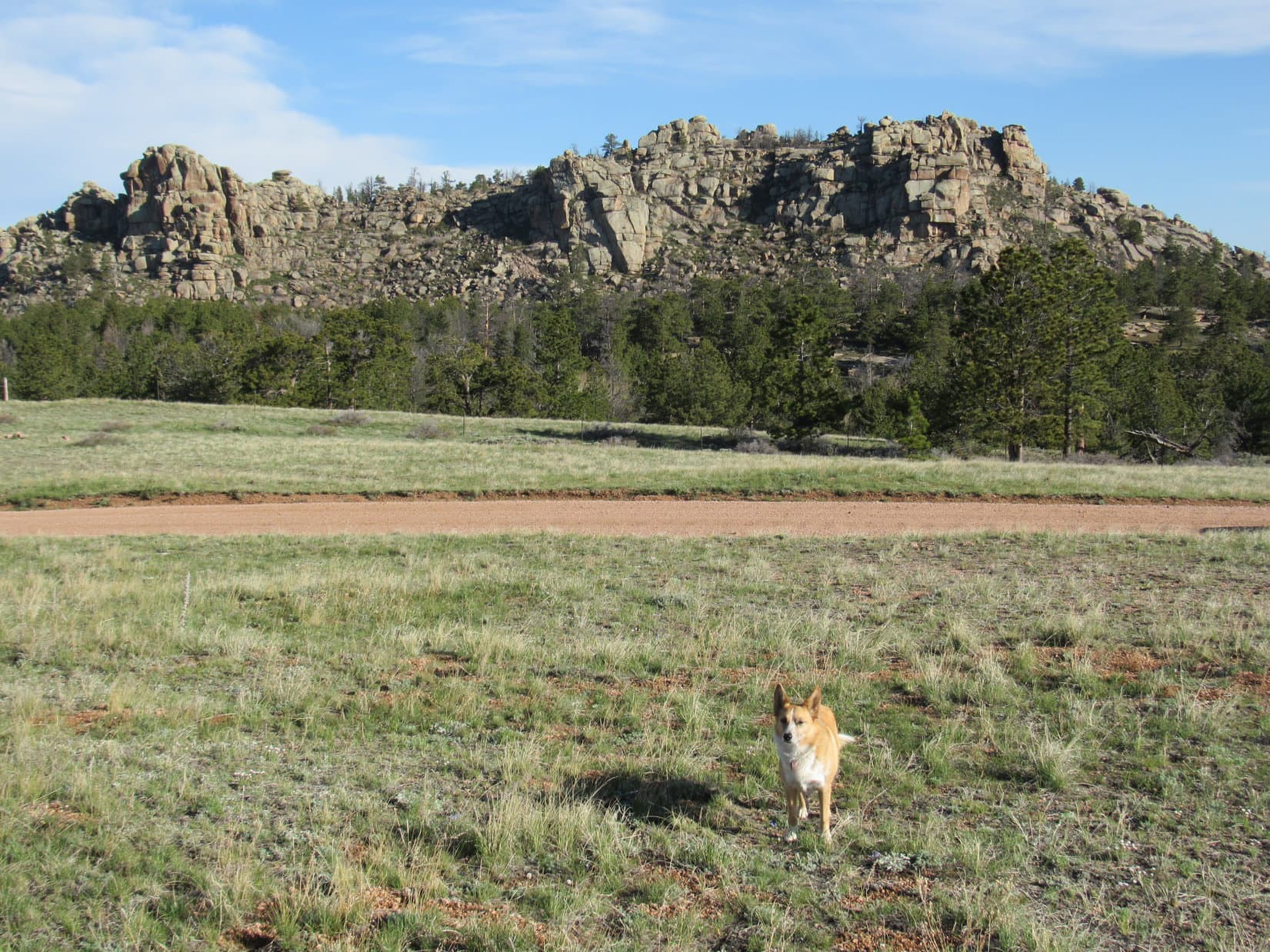
Warbonnet Peak was in the Laramie Mountains, too, but far away in the NW part of the range.  It was a beautiful drive.  The farther NW Lupe went, the more beautiful and remote the scenery became.  N of the town of Medicine Bow, Lupe and SPHP left Hwy 487, taking Little Medicine Road for miles through high rolling plains where there were more pronghorn antelope than cows for Lupe to bark at.

The gravel road slowly deteriorated.  There was almost no signage.  At least not that meant anything unless you knew the names of the local ranchers.  SPHP made a wrong turn onto Holaday Road.  Almost 10 miles later, a red pickup truck appeared going the opposite direction.  Turned out the lady driving it was lost, too.  However, she had a great road atlas showing every little dirt road in Wyoming.

A couple minutes later, it was all figured out.  The red pickup truck raced W out of sight.  Lupe and SPHP turned around and followed it, but there was no way the poor G6 could keep up with a pickup on these roads.  SPHP turned N onto Little Medicine Road again.  Lupe enjoyed a spectacular ride up into the Laramie Mountains.

Little Medicine Road is shown on Wyoming state road maps.  In combination with other roads, there was supposed to be a route through the Laramie Mountains here going all the way N to Douglas, WY.  The creek crossings were mighty rough, though, for a road shown on the official state map.  One might think an official state map would only show principal routes.  In Wyoming, one would be wrong.

Lupe had already been going downhill again for miles when SPHP saw a couple of people.  Did they know where the Campbell Creek campground was?  They sure did.  This was it!  Heavy rains and flooding 3 weeks ago had washed out roads in the area.  The county had just patched them enough to be passable.  The two people were park service employees putting the campground sign back up.  The campground was closed for a few days yet, but it was OK to stay here.  No fees or services until the campground opened.

Perfect!  That was a deal.  Lupe and SPHP took the very last of the six campsites, No. 6 at the upstream end of the campground.

Lupe arrives at the Campbell Creek campground.

After a few minutes of preparation, Lupe and SPHP struck out for Warbonnet Peak (12:15 PM, 50°F).  A wide trail led upstream on the W side of Campbell Creek.  Lupe hadn’t gone very far when she reached a creek crossing.  The creek was still swollen with melting snow.  SPHP didn’t want freezing cold wet feet this early in the trip.  There was a narrow spot just downstream.  Maybe SPHP could jump across?

Lupe is a great jumper!  SPHP, not so much.  SPHP decided maybe it would be better to go upstream looking for a better spot.  Lupe and SPHP explored the W bank a bit farther up.  Nothing.

The first stream crossing over Campbell Creek. Lupe is a bit upstream looking for a better way across for SPHP.

Turn back, jump across the narrow spot, or ford the icy cold creek?  Those were the choices.  SPHP threw the backpack across the creek.  Then SPHP jumped.  Made it!  Good thing Campbell Creek wasn’t any wider, though.

Lupe and SPHP continued upstream along the trail.  The ground was marshy.  The trail itself was part trail, and part mucky little streams.  Almost everywhere, the ground was sopping wet.  Lupe and SPHP had to weave through the forest, on and off the trail, to avoid deadfall timber and particularly wet spots.  Lupe hadn’t gone much farther, when she came to a stone fire ring.  It was right on the trail at a rare dry spot.

Edward Earl had written about taking this trail up Campbell Creek on the way to Warbonnet Peak more than 7 years ago on May 24, 2009.  SPHP had a copy of Mr. Earl’s trip report in the backpack.  In it, Mr. Earl described a long slog with creek crossings, deadfall, brush, swamps and occasional deep snow.  Conditions didn’t seem like they had changed for the better since then.

Even before Lupe had left home more than a week ago, Edward Earl’s trip report had SPHP thinking maybe there was another way to Warbonnet Peak from Campbell Creek?  The topo map showed a long, broad ridge to the E of the creek that eventually wound its way past high points all the way to Warbonnet Peak.  There wouldn’t be any roads or trails – just forests, fields, rocks and whatever else Lupe might encounter.

The first problem, of course, was how to climb 500 ft. up out of the Campbell Creek valley to get onto the ridge?  Directly ahead, just past the fire ring, was a steep rocky spine coming all the way down to the trail from the NE.  Climbing near the spine didn’t look that bad, though it was impossible to say how far up things would remain that way.  Forests hid the slope.

Lupe wasn’t far from the campground yet at all.  Nearly the entirety of Edward Earl’s miserable slog along Campbell Creek lay ahead.  Whatcha, think Loop?  Long, miserable slog along a questionable trail down by the creek, or try pioneering a new American Dingo route?

American Dingoes are high spirited and adventurous.  Lupe was not only ready, but eager, to trail blaze an all new Lupe route to Warbonnet Peak.  Lupe and SPHP left the trail, climbing NE along the rocky spine.  Up and up.  A forested hill came into view over on the W (opposite) side of the creek valley.  Lupe and SPHP were gaining on it.  Before long, Lupe was as high as it was.

The slope continued up.  Lupe came to small rock outcroppings.  The climb was steep, but steady.  There were always manageable ways higher.  Multiple ways, actually.  SPHP had to stop for breathers, but leg and lung power were the only real limitations.  When Lupe was clearly higher than the forested hill across the valley, things started leveling out.  Lupe had made it up onto the ridge E of Campbell Creek!

Lupe found a snowbank to cool off on in the forest.  While Lupe was chillin’, SPHP consulted the topo map.  Time to change direction.  From here the ridge sloped gently up toward the SE.  When Lupe was sufficiently cooled down, Lupe and SPHP turned S or SE wandering through the forest.  The going was much easier now.

Lupe found this snowbank to cool off on up on the ridge E of Campbell Creek.

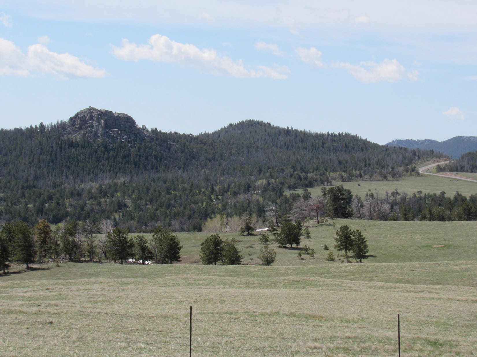
Before too long, SPHP saw an opening in the forest.  A small, partially sunlit hill was nearby off to the SW.  It looked like the hill was on the edge of a drop off.  Lupe and SPHP headed over to climb the little hill.  A view would be great.  SPHP could get oriented properly.

Lupe saw a high forested ridge to the SE.  The ridge was situated beyond a big gap over much lower ground SPHP realized must drain W toward Campbell Creek.  The SW end of the long ridge featured a towering cliff.  Take a break, Lupe!  Time to figure out where we are.

SPHP studied the topo map for several minutes, comparing it to the view from the little hill.  It seemed pretty clear.  OK, Loopster.  This little hill is most likely High Point 8585.  That high forested ridge to the SE has got to be High Point 9180.  About 0.25 mile to the E should be High Point 8590.  We will have to go over there to get around this big drainage before we can continue SSE to High Point 9180.

Lupe at the High Point 8585 viewpoint. High Point 9180 is the big forested ridge on the L. High Point 9254 is seen in the distance on the R. Photo looks SSE.
Lupe waits on High Point 8585 for SPHP to figure out which way to go next.

Lupe and SPHP left High Point 8585 going E near the edge of the drainage to the S.  Lupe’s immediate objective was to get to High Point 8590.  It didn’t take Lupe long to get there.

Lupe arrives at High Point 8590. The SW portion of the High Point 9180 ridge is seen on the L. Photo looks S.
Lupe at High Point 8590. High Point 8585, where she had just come from, is the little hill with the rock outcropping slightly to the L beyond her. Photo looks W.

From High Point 8590, Lupe faced another big climb, 590 feet of elevation gain, up the forested NNW slope of High Point 9180.  The topo map showed that Lupe might not have to climb all the way to the top.  Maybe she could skirt around to the NE of the high point.

Lupe about to leave the High Point 8590 area to start the big climb up to High Point 9180 directly ahead. Maybe she could climb only partway up and skirt around to the NE (L)? Photo looks SSE.

Soon after Lupe entered the forest to begin the climb up High Point 9180, it became apparent a tougher climb was in store than anticipated.  As expected, the slope was moderately steep, and there was the usual deadfall timber.  That wasn’t the problem.  The problem was Lupe found snow.  Lots of it.  Almost everywhere.

The snow was soft and melting.  Around the bases of most tree trunks, little or none remained.  Between the trees, though, snow was stacked in drifts 2 to 4 feet high.  Lupe was light enough to travel over the snowdrifts.  SPHP was stuck post holing.  The climb became a relentless endurance struggle.

Going around the NE side of High Point 9180 wasn’t going to be possible.  Sheltered by the mountain’s shadow, the snow was deepest over there.  Lupe and SPHP worked over more to the W, close to the edge of the drainage.  Better exposure to the sun meant less snow.  SPHP was able to climb faster.

It wasn’t until Lupe was on the upper portion of the slope that she started angling back farther E.  Just below the ridgeline were the biggest snow drifts yet, 6 to 8 feet high.  Lupe trotted up the snow to the top.  A few minutes later, SPHP was able to join her.  SPHP had to stop to breathe.

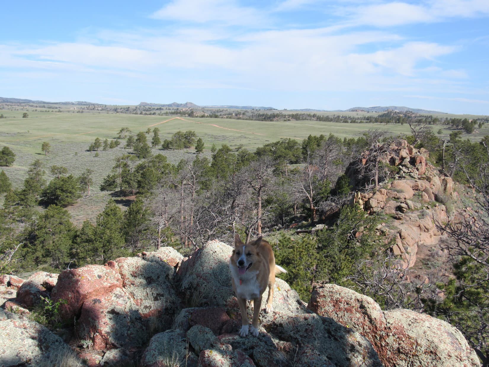
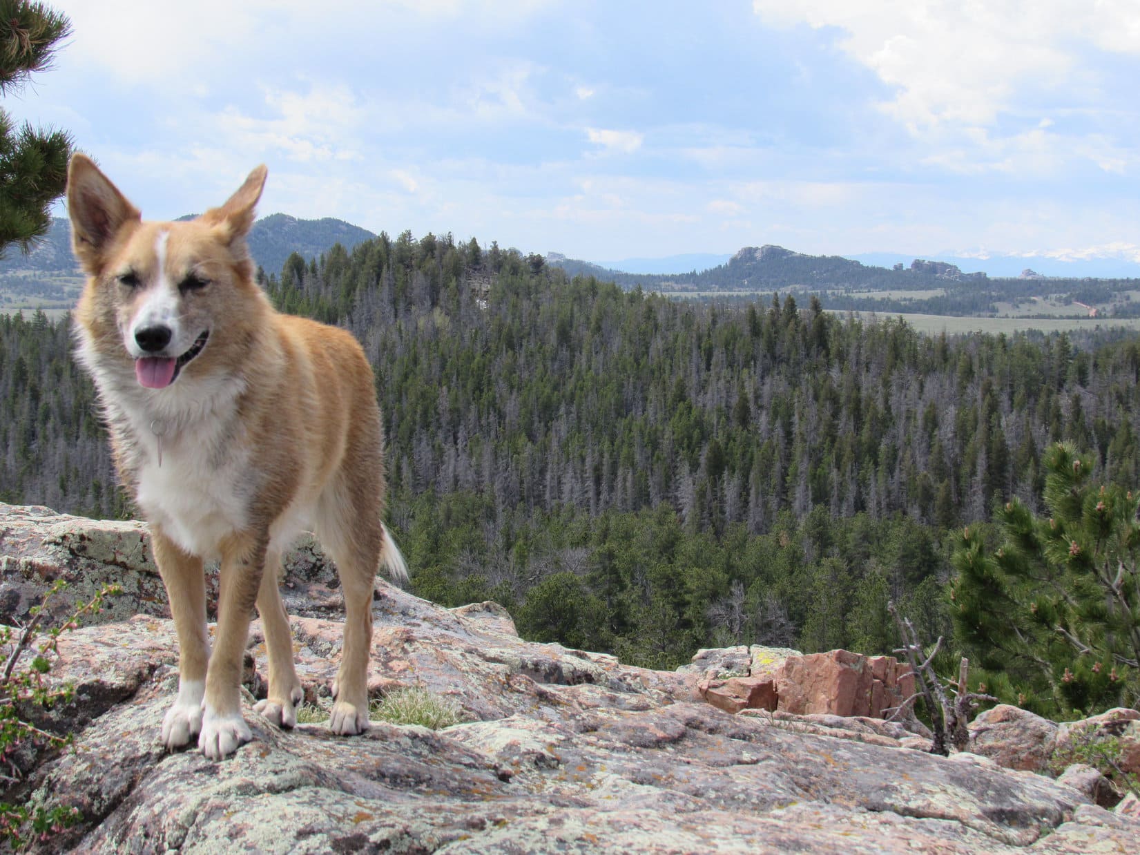
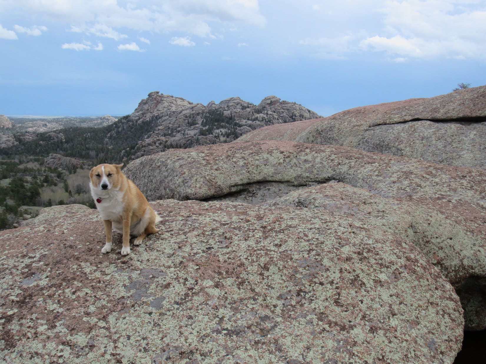
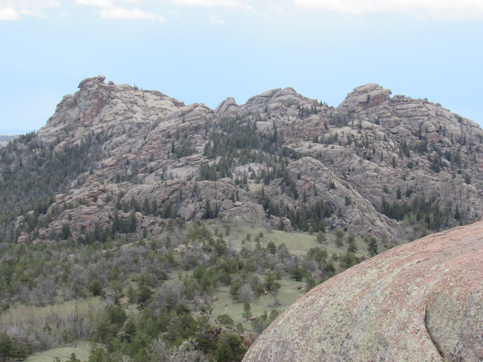
When SPHP could move again, Lupe and SPHP set out SW exploring along the ridgeline.  Lupe had come up at the NE end of the highest part of the High Point 9180 ridge.  Lupe appeared to be at the true summit.  There wasn’t any snow on the exposed rocks near the edge.  Lupe found a glorious view off to the NW, only 50 – 100 feet from where she had reached the ridgeline.

The glorious view to the NW from up on High Point 9180. The low forested hill seen straight up from the stump to the L of Lupe is High Point 8585, now far below.
Lupe found this cool rock with a water basin in it up on High Point 9180. It was very close to the true summit, near the edge of the ridge where the fabulous views were. This water basin rock was only 50 feet from where Lupe reached the ridgeline in the area beyond her toward the R.

The fabulous view to the NW made High Point 9180 seem like a great objective in and of itself.  Lupe and SPHP liked the rocky ridge with numerous viewpoints.  Lupe had to press on, though.  Warbonnet Peak was still a more than 1.5 miles to the SE as the crow flies.  So far, Lupe and SPHP hadn’t even seen it yet.

Lupe and SPHP left the edge of the ridge behind and turned SE, immediately disappearing into the forest again.  The ground was sloping gently downward now, but the way forward was still a struggle.

Despite a southern exposure, even this part of the forest was full of snowdrifts.  To make things worse, the deadfall timber was thicker than before.  If the rest of the way was going to be like this, Lupe wouldn’t make it to Warbonnet Peak – not through this kind of stuff.  Maybe Lupe and SPHP should have stuck to Edward Earl’s route?

SPHP was thinking these gloomy thoughts, when suddenly the forest ended.  Ahead was open ground!  And off to the SE was a high peak, Warbonnet Peak!

Lupe breaks out of the forest SE of the High Point 9180 summit. Off in the distance is her ultimate objective – Warbonnet Peak! Photo looks SE.
Objective Warbonnet Peak (L) and next obstacle High Point 9310 (R) from the open ground SE of High Point 9180. Photo looks SE.
When Lupe emerged from the forest SE of the High Point 9180 summit, her next major obstacle on the way to Warbonnet Peak was High Point 9310. This large solid rock knob was in view to the S between High Point 9310 and High Point 9254. Open ground led almost all the way down to it. Photo looks S using the telephoto lens.
Lupe on the open ground after emerging from the forest SE of the summit of High Point 9180. High Point 9254 is in view. Lupe's route to Warbonnet Peak didn't take her close to High Point 9254, but Edward Earl's trip report mentioned it. Photo looks S.
Lupe on the open ground after emerging from the forest SE of the summit of High Point 9180. High Point 9254 is in view. Lupe’s route to Warbonnet Peak didn’t take her close to High Point 9254, but Edward Earl’s trip report mentioned it. Photo looks S.

Reaching the open ground and finally seeing Warbonnet Peak was most encouraging!  Lupe still faced obstacles, however.  The biggest obstacle was High Point 9310.  It was directly ahead.  SPHP could see quite a bit of snow up on it.  Once again, SPHP consulted the topo map.

The topo map contours suggested the possible existence of cliffs on the far (SE) side of High Point 9310.  Climbing to the top made no sense.  Skirting High Point 9310 to the NE would definitely be shortest.

Lupe and SPHP made excellent time over the open ground heading down the slope toward High Point 9310.  However, as Lupe approached the area NE of High Point 9310, the view was not encouraging.  The area was heavily forested.  Big snowbanks were near the trees.

Lupe and SPHP made only a short foray into the forest.  The snow was deep.  Like 5 or 6 feet deep, in many places.  Staring further into the dark, dense forest, with snow piled so deep it looked like winter, prospects seemed simply ominous.  Battling through for any significant distance looked impossibly slow and difficult.  Lupe and SHP beat a hasty retreat.

From higher up, where Lupe had first broken out of the forest SE of High Point 9180, she had seen a huge knob of solid rock to the SW of High Point 9310.  Open ground led almost all the way to it.  Lupe would have to try going around High Point 9310 from somewhere over there.  Lupe and SPHP turned S looking for the huge rock knob.  Being a huge rock knob near open ground, it wasn’t hard to find.

The open ground ended a short distance before Lupe reached the big rock knob SW of High Point 9310, but she had no problem finding it. Photo looks S.

Lupe and SPHP went over a small saddle to the NE of the huge rock knob.  On the other side was a forested valley coming up from the SW.  Lupe could see plenty of snow down below, but there wasn’t any up on the slope where Lupe and SPHP were.  Lupe and SPHP tried to head NE on the slope between High Point 9310 and the valley to the SE.  Lupe’s goal was to maintain elevation as much as possible while avoiding the snow.

Looking back at the huge rock knob from the SE after crossing the saddle to the NE (R) of it. Photo looks NW.

For a while, Lupe and SPHP had no problem maintaining elevation, but as Lupe drew closer to the area right below the High Point 9310 summit, the terrain grew more rocky and steep.  Progress slowed.  Finally, it was time to give it up.  Lupe would be better off going down to face the snow in the valley.

Lupe maintaining elevation trying to get around High Point 9310, which looms above. Photo looks NE.
Lupe below High Point 9310. She gave up trying to maintain elevation here and headed SE (toward the camera and to the R) down into the snowy forest in the valley. Photo looks N.

It wasn’t terribly far down to the valley floor.  This valley had a SW exposure.  Although there were snow drifts, they were only 2 to 3 feet high.  SPHP had seen some open ground to the SE somewhere on the opposite side of the valley.  Lupe and SPHP tried to find it.

Lupe and SPHP passed to the SW of some higher ground before beginning the climb out of the valley.  On the way up, Lupe did find open ground, although she was already well up the slope by then.  Soon Lupe was astride a boulder in a wide saddle on a ridgeline leading SE.  The next obstacle, another forest with snow in it, was just ahead.  A quick glance at the topo map, and SPHP decided the ridge ahead was High Point 9223, the last major obstacle on the way to Warbonnet Peak.

Lupe reaches open ground SE of High Point 9310. SPHP assumed the ridge ahead was the final obstacle on the way to Warbonnet Peak, High Point 9223. SPHP was wrong! Photo looks SE.

High Point 9223 didn’t look that high.  It looked like Lupe could easily climb it.  However, there didn’t seem to be any point in doing so.  The topo map showed it should be possible to go around either end of the ridge.  By now SPHP had figured out what that meant.  The NE side would be dense forest with deep snow.  The SW side was the way to go.  Lupe and SPHP took the easy way, following open ground around to the SW.

Lupe climbed out of the snowy valley S of High Point 9310 coming up from the L. She arrived near the top of this little hill (Center). Lupe then followed the open ground down to the camera’s location. SPHP mistakenly thought Lupe was on her way around the SW end of High Point 9223. Photo looks N.

As expected, the open ground ended.  Lupe entered the forest again, as she neared the SW end of the High Point 9223 ridge.  Lupe climbed a little and made it over the lower part of the ridge, but the ground ahead dropped off surprisingly steeply.  The terrain was so steep, that SPHP decided Lupe had better climb higher up to find easier ground on which to get around High Point 9223.

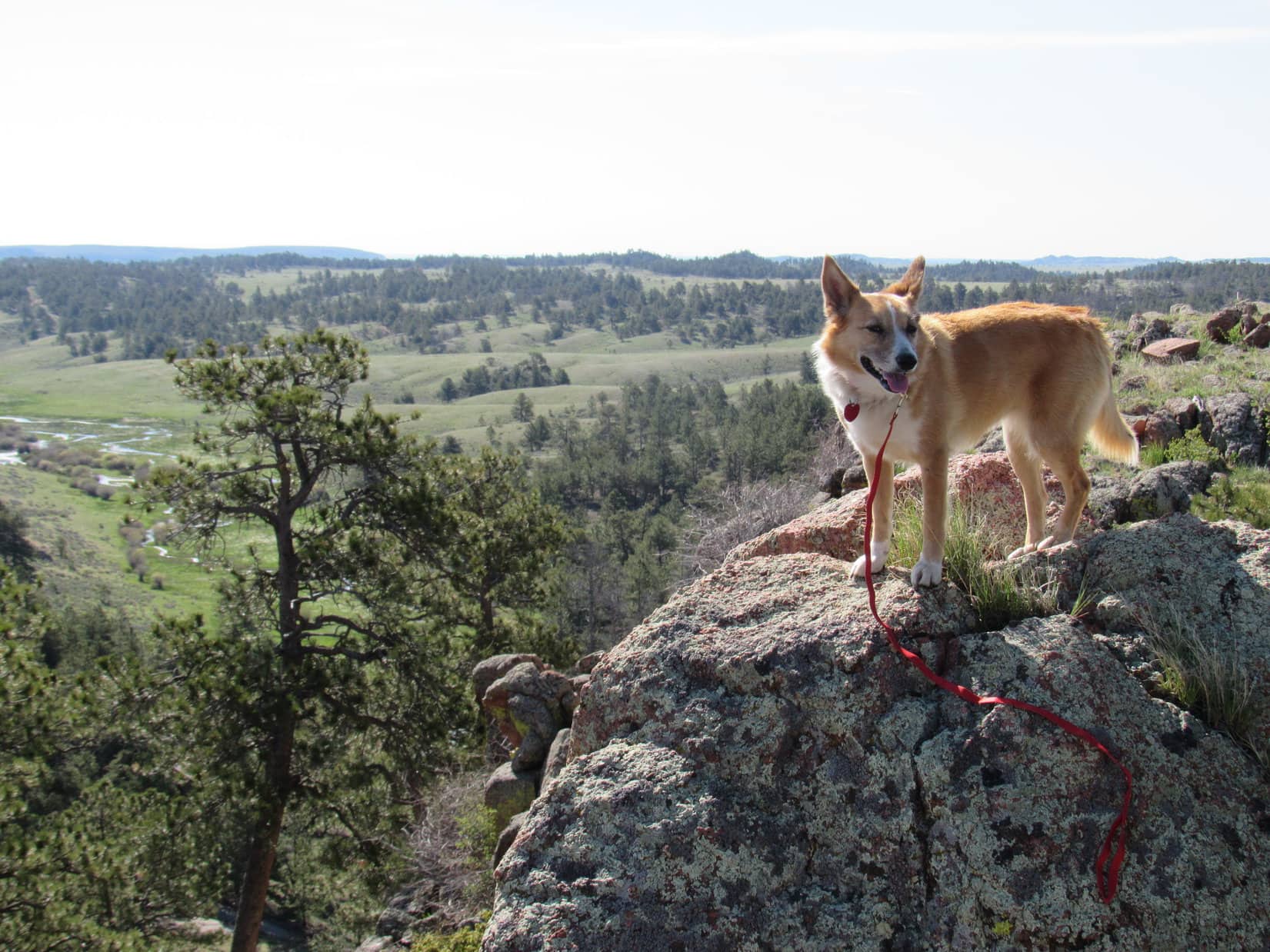
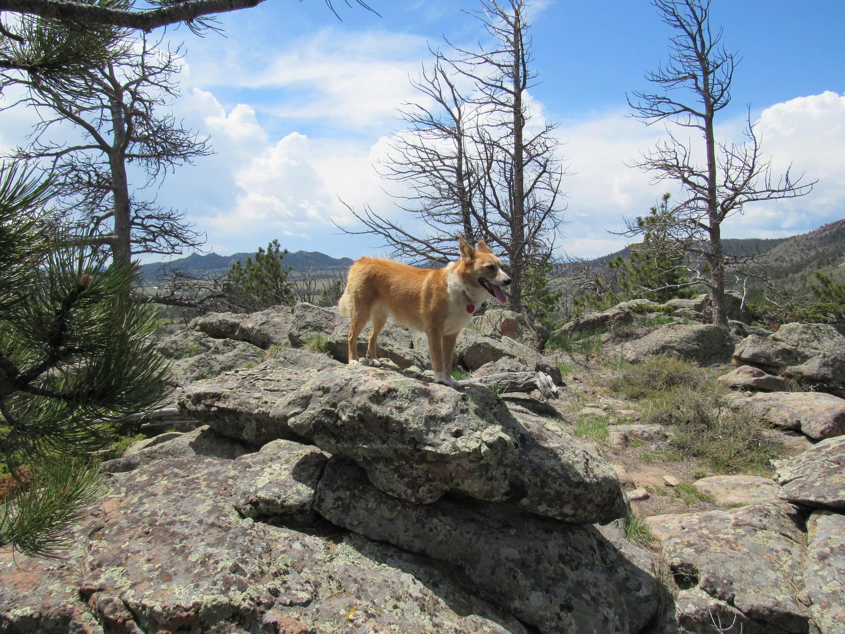
Lupe made a short, but very steep climb to the E up a rocky ridge along the N side of a narrow ravine.  She arrived up on a platform of rocks along the spine of the ridge.  The rocks presented a good view back to the NW toward High Point 9310.  Ahead to the E was more level ground as SPHP had expected.  Beyond the level ground was a high spot that SPHP was still thinking must be the top of High Point 9223.  Lupe wasn’t that far away from it.  There were too many trees to see much to the SE, where SPHP was expecting Lupe would soon see Warbonnet Peak.

Lupe made a short steep climb to arrive up on this rock platform with a view back to the NW. High Point 9310 (Center) is in the shadow of a cloud. At the time, SPHP thought Lupe was W of High Point 9223 here. She wasn't. High Point 9223 is the closest lower forested ridge seen on the R. Photo looks WNW.
Lupe made a short steep climb to arrive up on this rock platform with a view back to the NW. High Point 9310 (Center) is in the shadow of a cloud. At the time, SPHP thought Lupe was W of High Point 9223 here. She wasn’t. High Point 9223 is the closest lower forested ridge seen on the R. Photo looks WNW.
This relatively level ground Lupe came to after her short steep climb up the rocky ridge featured lots of exposed rock. Pictured not too far ahead is what SPHP still believed was the top of High Point 9223. Lupe and SPHP went toward it, but tried angling around to the R (SE) to get beyond it without climbing it. Photo looks E.

SPHP hadn’t consulted the topo map in a little while, but remembered it showed relatively flat ground on the SE side of High Point 9223.  If Lupe could break out into the open beyond High Point 9223, Warbonnet Peak ought to be visible less than 0.5 mile away!

There was no reason to climb all the way to the top of High Point 9223.  Lupe could now go around it on this relatively level terrain.  Lupe and SPHP proceeded in the general direction of the top of High Point 9223, but angling 45° to the R (SE) to bypass it.

For a few minutes, Lupe and SPHP progressed quickly enough through a somewhat thinly forested area over and around big flat rocks.  The slope began to steepen toward the S as the rocks gave way to more typical, denser forest.  Everything seemed to be going fine.  Any minute now, Lupe would see Warbonnet Peak up ahead!

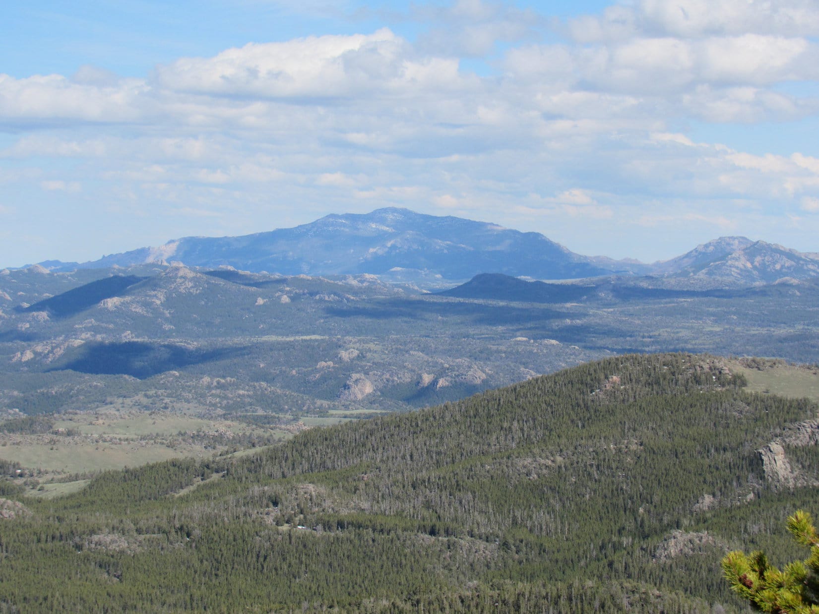
Suddenly, there was trouble.  The ground started dropping off sharply.  Between the trees, Lupe and SPHP did see the blue outline of a massive peak.  It was very far away, however.  It wasn’t Warbonnet Peak, but SPHP recognized it.  Lupe had been there before, last summer.  Miles and miles away was the unmistakable shape of the highest peak of the Laramie Range – Laramie Peak (10,272 ft.).

Well, that wasn’t so surprising.  What was surprising was that the easy, relatively level terrain the topo map showed SE of High Point 9223 wasn’t there!  And where on God’s green earth was Warbonnet Peak?  It was nowhere in sight!  Something was wrong.

Maybe SPHP was just turned around a bit?  Whatever the case, the ground now dropped off very steeply this way.  Lupe would have to try going around the NE side of High Point 9223.  She would have to backtrack some to do so.  Fortunately it wasn’t far.  Lupe and SPHP turned around.  Before long, Lupe was in position.  SPHP wasn’t looking forward to a difficult trek through dense forests and deep snow, but expected that was what was in store.

Lupe had hardly gotten started trying to go around the NE side of High Point 9223 when she came to a stunning view, once again seen only partially between the trees.  The terrain dropped steeply for hundreds of feet.  Far lower mountains were seen just a few miles away.  Lupe wasn’t going to be able to go around High Point 9223 this way either!

She wouldn’t have to.  The truth hit SPHP like a bolt out of the blue.  Lupe wasn’t on the slopes of High Point 9223.  She must have circumvented it to the S while on the way through the snowy valley SE of High Point 9310.  This was great news, actually!  SPHP now knew where Lupe was.  She was already high on the upper slopes of Warbonnet Peak (9,414 ft.).  The summit was only a short climb away!

Lupe high on the upper W slope of Warbonnet Peak. The summit was now only a few minute's short rocky climb away! Photo looks ENE.
Lupe high on the upper W slope of Warbonnet Peak. The summit was now only a few minute’s short rocky climb away! Photo looks ENE.

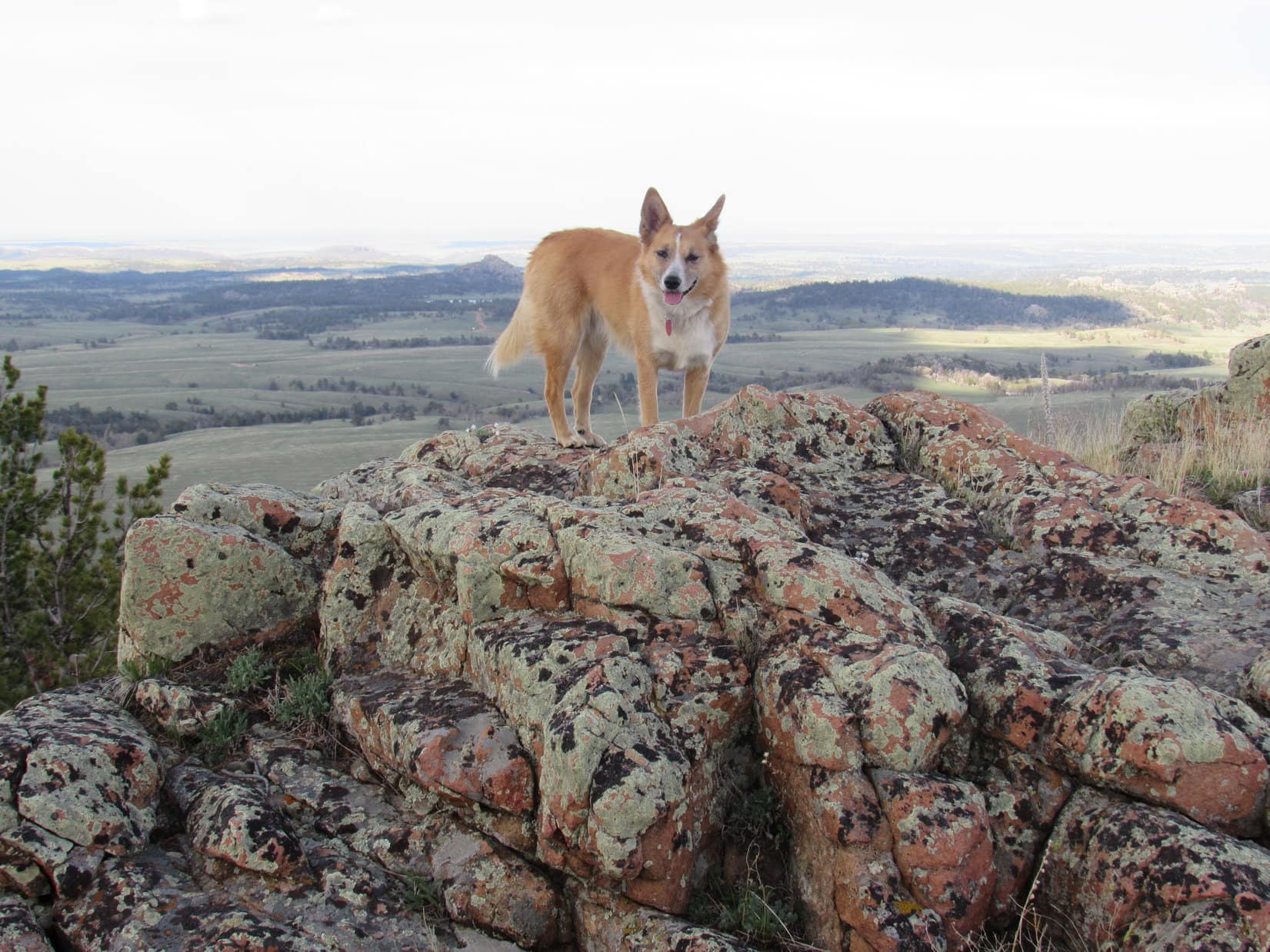
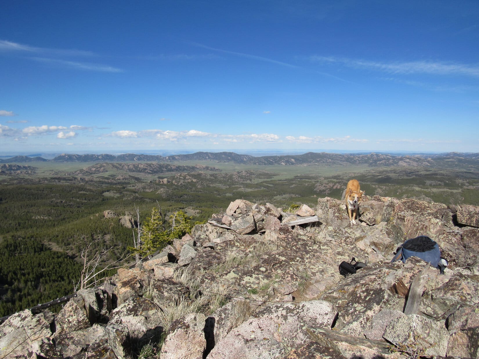
Within minutes, Lupe was attacking the last part of the steep, rocky W slope just shy of the summit.  Suddenly she was there, standing atop Warbonnet Peak (9,414 ft.), the Converse County, WY High Point!

Lupe atop Warbonnet Peak (9,414 ft.) the Converse County, WY High Point. Photo looks ESE.
Lupe on Warbonnet Peak. Laramie Peak (10,272 ft.), the highest mountain in the Laramie Range is seen in the distance on the R. Photo looks SE.
The survey benchmark on Warbonnet Peak. SPHP was a little disappointed it didn't even say "Warbonnet" on it.
The survey benchmark on Warbonnet Peak. SPHP was a little disappointed it didn’t even say “Warbonnet” on it.

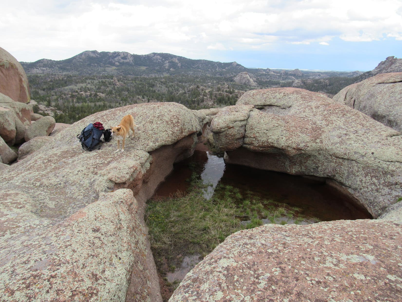
The summit of Warbonnet Peak was virtually all rock, with little vegetation.  Consequently, Lupe had fabulous 360° views.  There were still quite a few hours of daylight left – plenty of time for Lupe and SPHP to take a long break relaxing, sharing chocolate coconut granola bars, and enjoying the world from such a terrific vantage point.

The summit area wasn’t terribly big, maybe 10 to 20 feet wide and three times that much long, but there was room to walk around a bit on the jumbled rocks and decide on a favorite perch.

"View

Lupe on Warbonnet Peak, Laramie Mountains, WY 5-31-16

SPHP found a plastic jar with a green lid (about the size of a medium-sized peanut butter jar) tucked down among the rocks near the survey benchmark.  Inside was a green plastic Indian Chief, and a red and white round plastic souvenir left by a winehead chick and an ex-drunk.

It was good to see that the green Indian chief was appropriately equipped with his war bonnet on.

There was also a single sheet of paper, on the back of which was a climber’s log with only 4 entries on it, the first one dating back to 9-23-2011.  The other side of the log was a copy of the same trip report by Edward Earl that SPHP had a copy of in the backpack.  Unfortunately, there was nothing to write with in the jar, and SPHP hadn’t brought a pen along.  Lupe’s ascent did not get recorded on the log.

This climber's log with only 4 entries on it was written on the back of a copy of the same trip report by Edward Earl that SPHP had a copy of in the backpack. Lupe hadn't taken Edward Earl's route, though. She had blazed her own trail here!
This climber’s log with only 4 entries on it was written on the back of a copy of the same trip report by Edward Earl that SPHP had a copy of in the backpack. Lupe hadn’t taken Edward Earl’s route, though. She had blazed her own trail here!

Lupe was a bit bored with the climber’s log and assorted associated paraphernalia.  While SPHP fiddled around with it, she found a very small grassy spot on which to curl up for a snooze.

Lupe curls up on a tiny patch of grass and tries to get in a few winks up on Warbonnet Peak. In the background L of Center is a prominent forested ridge with high points at each end. The high point at the R end of the ridge is High Point 9254. The solid rock knob Lupe went past on her way around High Point 9310 is seen on the R. Lupe had passed just to the R of it. Photo looks WSW.

SPHP put the climber’s log and other items back in the plastic jar with the green top, returning the jar to its original resting place.  While Lupe tried to snooze, SPHP took more photos of the views before discovering a larger Simply Orange plastic bottle a few feet away from the jar with the climber’s log.

Inside the Simply Orange bottle were a $1 bill, a penny, a folded newspaper article yellowed with age, and a photograph.  SPHP had no way to get the photo or newspaper article out through the narrow neck of the bottle.  SPHP left the cash inside, too.

Squaw Mountain (9,313 ft.) (ridge on L) and Buffalo Peak (9,387 ft.) (Center). Photo looks NW from Warbonnet Peak using the telephoto lens.
Laramie Peak (10,272 ft.) (Center). Photo looks SE using the telephoto lens.
The photo in the Simply Orange plastic bottle.

Despite what had seemed like a long trek to reach Warbonnet Peak, Lupe had arrived at the summit with what SPHP estimated to be 4 to 5 hours of daylight remaining before sunset.  Lupe and SPHP were in no rush to leave.  After an hour or so, though, the sun had clearly made progress across the sky.  Lupe was starting to revive from her nap, and showed signs of being ready for action again.

Lupe still dozing, but she soon woke up ready for action again!

It was a long way back, and without any trails to follow, SPHP didn’t want to take a chance on not leaving enough time for Lupe to find her way back to Campbell Creek while it was still light out.  A few more photos at the top, and it was time to bid a reluctant farewell to the fabulous views from Warbonnet Peak.

Looking E.
Looking E.
Lupe about to leave Warbonnet Peak. She was going to take the same way back to Campbell Creek, and would have to go past High Point 9310 (Center) and High Point 9180 (R) again. Photo looks WNW.
Lupe during her final moments atop Warbonnet Peak. Photo looks E.

Lupe and SPHP took the same route Lupe had just pioneered on the way back to Campbell Creek.  Now that the route was known, Lupe made faster progress than before.  It helped that the return trip was mostly downhill, Lupe now knew a few shortcuts, and this time SPHP didn’t have to keep stopping to check the topo map.  It was still a long trek. The sun made steady progress on its way to the horizon.

Lupe back down to the area W of Warbonnet where SPHP had earlier mistakenly thought she was near High Point 9223. The top of Warbonnet Peak (NOT High Point 9223) is partially hidden in the trees behind her. Photo looks E.
A wily American Dingo prowls the snowy forested valley S of High Point 9310.

Once around High Point 9310 again, Lupe found a shortcut on her way back to the NW edge of the High Point 9180 ridge.  She followed more open ground just a little farther to the W, instead of heading NW through the trees directly toward the actual summit.

This enabled Lupe to avoid the fairly short, but difficult trek through the snowy woods full of deadfall timber.  When she reached the NW edge of the ridge, Lupe had a slightly longer trek back to the NE to the High Point 9180 summit.  However, this was all much easier terrain.  The view was terrific, too!

In fact, the highlight of the trip back was High Point 9180.  If anything, the views were even prettier in the slanting light of early evening.  Once again, Lupe and SPHP were impressed!

Lupe at the NW edge of the High Point 9180 ridge again. Photo looks NW.

Although Lupe was fearless, and greatly enjoyed her second round of exploration along her newly blazed Warbonnet Peak route, there were two places that were a bit worrisome to SPHP.

The first one was the trek down from High Point 9180 to High Point 8590.  Once Lupe was off the top of the High Point 9180 ridge, the entire route down was endless forest, with snowdrifts several feet deep between the trees almost the whole way.  The forest was so dense, there were no viewpoints anywhere along the way.  It was hard to tell whether Lupe was on course, or not.

SPHP started off just fine, following tracks left in the snow earlier in the day, but eventually lost them at one of the rare places with little snow.  From then on, SPHP had to worry about staying on the ridgeline to High Point 8590.  Uncertain of the correct direction, Lupe and SPHP wandered back and forth as Lupe continued down the slope, hoping to find either Lupe’s old tracks again or a glimpse of High Point 8590.

The concern was that SPHP might be unwittingly leading Lupe down into one of the big drainages to the E or W instead of to High Point 8590.  The way down the mountain seemed longer than SPHP remembered, which added to the concerns.  When the forest ended with the clear ground to High Point 8590 straight ahead, exactly as planned, it was a relief.

SPHP was glad when Lupe finally broke out of the forest near High Point 8590 again. Photo looks back to the SE toward High Point 9180. The dense forest had yielded no views to orient by coming down. Lupe had started her descent from the highest ground near the L side of this photo.

The second worrisome part of the return trip came almost at the end.  SPHP couldn’t remember exactly where Lupe first reached the ridge above Campbell Creek before she had turned toward High Point 8585.  SPHP’s recollection was that it hadn’t taken Lupe very long to reach High Point 8585 after gaining the ridgeline.

Upon reaching High Point 8585 again, Lupe and SPHP went NNW not too far from the W side of the ridge until Lupe reached some small clearings.  These seemed vaguely familiar.  SPHP had Lupe start down the steep W slope of the ridge right after passing by the last of these clearings.

SPHP was soon convinced that this was NOT the exact place Lupe had come up earlier in the day.  It just wasn’t as rocky.  Once again, the way down seemed farther than SPHP remembered.  However, the steep forested slope didn’t come to any cliffs or get treacherously steep, so Lupe and SPHP just kept going down.  Sooner or later Lupe would reach Campbell Creek!

Lupe did reach Campbell Creek.  Conveniently, the trail was right there on the near side of the creek.  SPHP still wasn’t certain if Lupe was upstream or downstream of where she had left both creek and trail many hours earlier.

Lupe reaches Campbell Creek again near the end of her journey. SPHP didn't recognize the spot, and wasn't certain if Lupe was upstream or downstream of where she had first left the creek much earlier in the day.
Lupe reaches Campbell Creek again near the end of her journey. SPHP didn’t recognize the spot, and wasn’t certain if Lupe was upstream or downstream of where she had first left the creek much earlier in the day.

One thing was for certain, Campbell Creek campground was downstream.  Lupe and SPHP started following the trail downstream.  Almost immediately, Lupe came to the stone fire ring where she had first left the trail.  Lupe and SPHP had come down the ridge less than 100 feet from it.

The only remaining excitement on the way back was when SPHP had to leap across that first creek crossing one more time.  Campbell Creek was visibly a little higher now due to all the snow that had melted in the afternoon.  Once again, SPHP pitched the backpack across Campbell Creek.  Once again, SPHP made the leap successfully.

At 8:16 PM (41°F), Lupe arrived back at the G6.  Warbonnet Peak had been quite a day!

SPHP noted it had taken Lupe 8 hours to go from Campbell Creek campground to Warbonnet Peak and back.  Edward Earl’s trip report indicated it had only taken him 6 hours.  Of course, Lupe and SPHP had stayed up at the summit for at least an hour, probably somewhat longer than Mr. Earl had been there (he didn’t say exactly how long he stayed).  Still, it had taken Lupe longer on her new route.

Lupe looked at SPHP.  Hey, we had a fabulous day, and made it there and back in one piece.  What more do you want?  The Carolina Dog was too polite to mention that unlike Edward Earl, she was stuck with waiting for SPHP all the time.

Now how about some Alpo?  I’m famished!Lupe on Warbonnet Peak, Laramie Mountains, WY 5-31-16Lupe’s route to Warbonnet Peak would, of course, be easier and faster when there is little or no snow.  Save time going around the NE side of High Point 9310, instead of SW near the huge rock knob, to reach the high ground near High Point 9223.  Take a more direct approach up Warbonnet Peak itself from the NW, instead of going so far around to the W or SW.

Lupe would still climb to the top of High Point 9180.  The views are worth it!

Links:

Next Adventure                   Prior Adventure

Want more Lupe adventures?  Choose from Lupe’s 2016 Laramie Mountains, WY Adventure IndexDingo Vacations Adventure Index or Master Adventure Index.  Or subscribe free to new Lupe adventures.

Point Crawford & Bennett Hill, Laramie Mountains, Wyoming (5-30-16)

Yeah, that had to be it.  That was the same semi-barren big hill that SPHP had suspected was Point Crawford (8,840 ft.) at lunch time down at the defunct Wallis picnic ground.

Lupe and SPHP were in the G6 a mile E of I-80 on USFS Road No. 705 (Blair-Wallis Road) on the way back from Lupe’s almost successful ascent of Poland Hill (8,480 ft.).  From up on this treeless ridge, there was a good view to the NE.  The big semi-barren hill was clearly the last real high spot at the S end of a long, high, otherwise more heavily forested ridge.  That had to be Point Crawford.

Point Crawford (Center) as seen from USFS Road No. 705 a mile E of I-80. Photo looks NNE.

Point Crawford was Lupe’s next peakbagging goal.  She would also visit nearby, but much lower, Bennett Hill (8,440 ft.), provided SPHP could figure out exactly where it was.

Lupe and SPHP abandoned the G6 at the Wallis picnic ground (4:20 PM, 61°F).  Lupe went N on No. 705 a short distance, then left the road heading up the first big grassy slope going NE.  The slope grew steeper as Lupe entered the forest.

From below, it had looked like Point Crawford would be easiest to climb along a ridgeline approaching the mountain from the WNW.  Lupe and SPHP tried to trend N to get there.  Lupe successfully crossed several ravines without losing much elevation.

The terrain grew more challenging.  Getting to the WNW ridge wasn’t going to be worth the effort.  It was easier to simply keep climbing NE.  SPHP should have continued 0.5 mile farther N on the road, if Lupe meant to attack Point Crawford from the WNW.

The climb became progressively steeper.  Finally, Lupe managed to get up on the SW ridgeline.  A dangerous downed barbed wire fence followed the spine of the ridge.  SPHP lifted Lupe over the fence, then paused to admire the beautiful view to the SSE.  Lupe had already gained more than half the elevation required to reach the top of Point Crawford.

Upon reaching the ridgeline SW of Point Crawford, Lupe found a dangerous downed barbed wire fence (which SPHP helped her over), and this great view to the SE. Turtle Rock (8,600 ft.) is seen in the distance on the R.

Lupe and SPHP resumed the climb, staying a little E of the spine of the ridge.  The barbed wire fence on the ridgeline soon disappeared.  It was replaced for a short distance by a log rail fence, but it ended before long, too.

Lupe reached a knoll along the ridge.  Ahead was a rocky high point.  SPHP suspected it might be the summit of Point Crawford.  At the very least, it couldn’t be far from the summit.

Lupe on the knoll on the SW ridge. Ahead is a rocky high point that SPHP thought might be the summit of Point Crawford. It wasn’t, but the actual summit wasn’t much farther. Photo looks N.

Beyond the knoll, Lupe found a trail.  The trail led up to the base of the rocky high point, and then curved around the E side of it.  The trail continued climbing toward the NNE until it was even higher than the rocky high point.  To the N, a line of rock 5-10 feet high formed the summit ridge of Point Crawford.

The summit ridge ran E/W for about 300 or 400 feet.  The trail faded away before reaching the E end.  Lupe continued up for a look around.  The ridge was strewn with good-sized rocks, but there wasn’t any clear highest point.  Lupe and SPHP explored out to the W end of the summit ridge looking for the true summit, but finally concluded the highest points toward each end of the ridge were really about the same elevation.

Lupe on the highest rocks at the W end of the Point Crawford summit ridge. Photo looks NW.

Lupe and SPHP returned to the E end of the summit ridge.  The best views were here.  Lupe had a grand panoramic view of a huge amount of territory from the NE around to the S.

Lupe on the E high point of the Point Crawford (8,840 ft.) summit ridge. Photo looks NE.
Turtle Rock (8,600 ft.) from Point Crawford using the telephoto lens. Photo looks S.
Lupe on the Point Crawford summit. Photo looks SW at the somewhat lower rocky high point that marks the start of the SSW spine of the mountain.

Point Crawford was one of the more spectacular mountains Lupe had climbed while in the Laramie Mountains SE of Laramie, WY.  Only the Leg Benchmark and Pole Mountain had been better.  Naturally, Lupe and SPHP hung around for a while, taking a break and gazing at the terrific views.

Before leaving the summit area, Lupe climbed the false summit to the SW.

Lupe on the false summit. Photo looks SW.

On the way down, Lupe and SPHP followed the trail that Lupe had found on the way up.  SPHP stopped occasionally to take photos of the views, but mostly concentrated on trying to figure out exactly where Lupe’s next peakbagging goal, Bennett Hill, was.

A series of solid rock high points could be seen below to the S.  None of them looked like anything Lupe could climb.  Despite consulting the topo map repeatedly, SPHP wasn’t certain which, if any of them, might be Bennett Hill.

A series of solid rock outcroppings was in view to the S coming down Point Crawford. SPHP wasn’t certain which, if any of them, was Lupe’s next peakbagging goal, Bennett Hill. None of them looked climbable for Lupe. USFS Road No. 705 (Blair-Wallis Road) is seen on the R. Photo looks S.
The view to the SE toward Twin Mountain (8,831 ft.) and the Sherman Benchmark while heading S down Point Crawford. Lupe planned to explore this area the next day, but weather prevented her from doing so. Photo looks SE.
Looking SSE toward the Brady Rock area. Part of Turtle Rock is seen on the R.

At first, the trail coming down from Point Crawford was easy to follow.  However, when Lupe reached a field N of the biggest of the rock formation to the S, it simply faded away.  Lupe and SPHP went around to the W, where Lupe found the trail again.  The trail went clear around to the SE end of the rocks, before turning S again.

Lupe on the faint trail now S of the first big rock formation below Point Crawford. Photo looks N.

SPHP kept losing the trail.  Lupe kept finding it again.  The trail headed S for a while, eventually angling over to a N/S running fence to the E.  For a short distance, the trail followed the fence line before turning SW to go up over a little rise in the forest.  To SPHP’s surprise, beyond the rise the trail angled more and more to the W.

Following the trail W, Lupe caught a glimpse of Point Crawford back to the NNE.  The trail came to a small high point, which it skirted to the N, before starting to lose serious elevation as it continued WSW.  It seemed certain the trail was on its way down to USFS Road No. 705 somewhere close to, or a bit S of, the abandoned Wallis picnic ground where the G6 was parked.  SPHP hadn’t noticed a trailhead anywhere along the road, and didn’t know exactly where it would come out.

"Heading

Lupe wasn’t going back to the G6 yet!  Leaving the trail, Lupe and SPHP got up on the small high point to the S.  In the distance, Lupe could see Poland Hill, where she had discovered a hidden grotto with water in it earlier in the day.  Much closer, she could also see a small, forested hill.

By now, SPHP had stared at the topo map enough times to conclude that none of the rock formations Lupe had seen from up on Point Crawford were Bennett Hill.  The map showed Bennett Hill farther SW, very close to a bend in USFS Road No. 705 around its W slope.

There was no mistake.  The small forested hill Lupe saw was Bennett Hill (8,840 ft.)!  It wasn’t far away, and looked easy to climb.  Lupe was going to have her Bennett Hill peakbagging success, after all!

Lupe at the top of the small rise S of the faint trail. Poland Hill (8,480 ft.) where Lupe had been earlier in the day is seen on the horizon slightly L of Center. Bennett Hill is the small forested hill on the R. Photo looks S.

Lupe and SPHP struck out into the forest for Bennett Hill.  Lupe went around the E end of a small valley draining to the W to avoid losing much elevation on the way.

Soon Lupe was around the valley, and approaching Bennett Hill from the E.  A clearing in the forest exposed much of the E slope.  Lupe could see the highest rocks at the top of Bennett Hill ahead.  Why, there might even be a bit of a view from Bennett Hill!

Lupe reached the summit.  SPHP lifted her onto the highest boulder.  The intrepid Carolina Dog had made it!  Another peakbagging success!

A Carolina Dog balances a little precariously on the highest boulder of Bennett Hill (8,440 ft.). Photo looks S.

Lupe on Bennett Hill, Laramie Mountains, WY 5-30-16

The sun would still be up for more than an hour, but it had already been a long day.  Lupe had 5 peakbagging successes, and 1 near-miss failure to show for it.  She also had a ravenous appetite.  While SPHP relaxed, Lupe chowed down on Taste of the Wild.

Lupe chows down on Taste of the Wild! An American Dingo gets simply famished climbing all these mountains!
Lupe chows down on Taste of the Wild. An American Dingo gets simply famished climbing all these mountains!
Point Crawford from Bennett Hill. The closest rocky high point in the R half of the photo is where Lupe and SPHP first spotted Bennett Hill for certain. The often faint trail to the top of Point Crawford is right on the other side of it. Photo looks N.
Lupe next to the highest rock on Bennett Hill. Photo looks W showing the short summit ridge.

Lupe exhausted the Taste of the Wild supply.  As she digested it, SPHP came up with a new idea.  It was still more than an hour until sunset.  The G6 had to be moved from the defunct Wallis picnic ground due to a goofy little “No Overnight Camping” sign.  Why not go get the G6, drive around to a place SPHP had seen to the E along USFS Road No. 707, and return to make a 2nd ascent of Bennett Hill at sunset?

Lupe is always ready for almost anything.  Lupe and SPHP left Bennett Hill heading down the steep, forested NW slope.  The Carolina Dog reached No. 705 a little S of the Wallis picnic ground.  She crossed a green field near Middle Crow Creek that turned out to be rather marshy, arriving at the G6 at 7:18 PM.

Bennett Hill from the defunct Wallis picnic ground. Photo looks SE.

There was enough time left before sundown so SPHP could grab something to eat.  SPHP served Lupe some Alpo, too.  After a quick dinner, Lupe and SPHP jumped in the G6.  SPHP drove S on No. 705, turned L on No. 707 (Headquarters Road) S of Bennett Hill, and drove NE going uphill.

Just past a cattle guard was a little side road leading down into a gully.  It looked like the perfect place NOT to park the G6 during a flash flood, but would do for tonight.  SPHP parked, and Lupe and SPHP set out for Bennett Hill for a 2nd time, this time from the E (7:53 PM, 53°F).

The G6 had gained enough elevation coming up USFS Road No. 707 so that Lupe wouldn’t have to gain much on her way to Bennett Hill.  There was still some up and down along the way.  Lupe headed W, skirting around the S side of a tall rock formation.  Lupe loves both dawn and dusk.  She was having a great time exploring paths between the sagebrush, and looking for squirrels in the trees.

Lupe passed to the S (R) of this rock formation on her way to Bennett Hill for the 2nd time. Photo looks ENE from Bennett Hill using the telephoto lens.

Lupe reached Bennett Hill again 15 minutes before sunset.  Together, Lupe and SPHP watched and waited.  The sky overhead was clear and blue, but in almost every direction there were big clouds on the horizon.  Slowly they turned pink or golden, but the colors were subtle, not dramatic.

Unfortunately, the one direction where there weren’t many clouds was toward the setting sun.  A brilliant display wasn’t in the cards.  As the sun sank below the horizon, Lupe leaped back onto the highest rock on Bennett Hill.Lupe on Bennett Hill, Laramie Mountains, WY 5-30-16A flight of bats flew over zig-zagging toward the sunset.  A few minutes later, a flock of small birds flew after them.  Even after the sun vanished, Lupe and SPHP stayed on Bennett Hill, watching the colored clouds fade to gray (8:42 PM).Sunset from Bennett Hill, Laramie Mountains, WY 5-30-16

Links:

Next Adventure                   Prior Adventure

Want more Lupe adventures?  Choose from Lupe’s 2016 Laramie Mountains, WY Adventure IndexDingo Vacations Adventure Index or Master Adventure Index.  Or subscribe free to new Lupe adventures.

Pitcher Hill, Bisbee Hill, Markley Hill & Poland Hill, Laramie Mountains, WY (5-30-16)

Morning, and a glorious new day from the looks of it!  Lupe, of course, was already awake.  She was eager to dash outside the G6.  SPHP let her out.  While Lupe sniffed around the boulders and searched the trees for squirrels, SPHP consumed peach yogurt.  Nearby, the rugged high points of Eagle Rock (8,320 ft.) were lit up by the sun.  Lupe had been up there just yesterday evening.

The yogurt disappeared.  Time to go!  Lupe and SPHP headed E on USFS Road No. 714, but stopped briefly 0.33 mile SE of Eagle Rock.  The whole SE face of the mountain could be seen from here.  SPHP still wondered if the middle high point or one farther to the N was the true summit.  From this vantage point, it looked like the high point to the N was slightly higher.

Eagle Rock (8,320 ft.) from the SE.
Flowers in the fields SE of Eagle Rock. The orange ones were unusually shaped. SPHP had no idea what kind of flower they were.

Lupe’s next peakbagging goal was Pitcher Hill (7,840 ft.) located less than 5 miles ESE of Eagle Rock.  SPHP expected no trouble finding it.  In fact, SPHP had seen a big hill from Eagle Rock that was probably it.  The stony top of the hill looked like something Lupe wouldn’t even be able to climb.  SPHP hoped Lupe could find a way up.

USFS Road No. 714 curved S, as expected.  Then it curved W.  Any time now, the intersection with No. 712 should appear.  It didn’t.  SPHP drove on.  Finally, it was clear something was wrong.  Eagle Rock was again off to the N, and not that far away.  SPHP stopped to check the maps.  This had to be No. 712 already, but where had No. 714 turned into No. 712?  SPHP was supposed to have turned E, not W, on No. 712 there.

SPHP turned the G6 around.  A couple of miles later, it all became clear.  SPHP found the junction.  No. 712 going W was a good gravel road, just like No. 714.  Going E though, it was only a minor dirt side road.  That was why the junction hadn’t even looked like a junction.  Fortunately, No. 712 going E was still good enough to be passable for the G6, provided SPHP drove very slowly.

The G6 crawled along No. 712 going E.  A side road to the S marked as No. 712.D appeared.  Just beyond it was No. 710.  This all looked right according to the map.  No. 710 passes 0.25 mile N of Pitcher Hill.  SPHP turned onto No. 710, but went only a short distance further before parking the G6.  Lupe would start from here, even though she was still 0.75 mile NW of Pitcher Hill.

There was one problem.  Where was Pitcher Hill?  This was open rolling grassland.  Lupe had a good view of what was around, but Pitcher Hill was missing!  The big stony hill that SPHP had been assuming was Pitcher Hill was in sight, but it seemed to be a long way off to the S.  Could that really be it?  It didn’t seem right at all.  Lupe and SPHP went up a gentle rise to the SE for a better look.

SPHP stopped up at the top of the gentle rise to study the maps.  It was for certain Lupe wouldn’t be able to climb Pitcher Hill, if SPHP wasn’t even able to figure out where it was!  Lupe wondered what was going on.  Why are we stopping here?

SPHP had two maps of the area.  They both showed Pitcher Hill, but they didn’t agree on its location!  At least it was clear that the prominent stony hill SPHP had thought was Pitcher Hill couldn’t possibly be it.  That hill was too far away to the S.  It was almost certainly where the Russell Benchmark (8,227 ft.) was.

The stony mountain in the distance was the one SPHP had thought was Pitcher Hill. However, it was clear from the maps that it was too far away and in the wrong direction. So where was the real Pitcher Hill? Photo looks S.

The old Medicine Bow National Forest map showed Pitcher Hill was 0.5 mile SSW of where Lupe was on the opposite (S) side of Lodgepole Creek.  Although the creek wasn’t in view, Lupe could see a gap that the creek must be flowing through in that direction.  If the Medicine Bow National Forest map was right, Pitcher Hill had to be the modest looking hill on the far side of the gap.

SPHP’s old Medicine Bow National Forest map placed Pitcher Hill on the S (opposite) side of Lodgepole Creek. If the map was correct, Pitcher Hill was the hill shown on the L in this photo.

The Peakbagger.com topo map showed Pitcher Hill was 0.75 mile to the SE and on the N (same) side of Lodgepole Creek.  A low forested ridge was seen in that direction, but it didn’t look very impressive at all, hardly even worthy of a name.  Was that Pitcher Hill?

According to the Peakbagger.com topo map, the unimpressive forested ridge in the background was Pitcher Hill. USFS Road No. 710.A is seen in front of it. Photo looks SE.

For a minute or two, SPHP pondered, still uncertain.  In the end, SPHP concluded the Peakbagger.com topo map had to be right.  The topo map was much more detailed than the old Medicine Bow National Forest map.  The topo map showed that Pitcher Hill didn’t boast much elevation gain.  Small wonder it didn’t look very impressive.

Well, Lupe was out peakbagging, and if Peakbagger.com said that low ridge to the SE was where Pitcher Hill was, that was the hill Lupe was going to climb!  Lupe was happy when SPHP finally made a decision and started moving again.  Lupe and SPHP crossed USFS Road No. 710.A and entered a scraggly pine forest, approaching Pitcher Hill from the NW.

Lupe and SPHP skirted around the NE side of the first rocky high point.  It was clear there was higher ground a short distance beyond it.  Soon Lupe was up on top of the NW end of the Pitcher Hill (7,840 ft.) summit ridge.

Lupe up on the NW end of the Pitcher Hill summit ridge. A lower rocky point she went around the NE (R) side of is shown on the R. Photo looks NW toward the junction of USFS Road No. 710.A (L) and No. 710 (R).
Lupe up on the NW end of the Pitcher Hill summit ridge. A lower rocky point she went around the NE (R) side of is shown on the R. Photo looks NW toward the junction of USFS Roads No. 710.A (L) and No. 710 (R).

Looking SE along the narrow summit ridge, SPHP saw that the true summit was farther SE.  It was only a matter of a few feet higher than where Lupe was already, but of course Lupe would go over there.  SPHP also saw something else.  Lupe’s nemesis was here!  Cactus!

Although SPHP hadn’t seen any cactus at all in the Laramie Mountains until now, and none on the way from the G6 to Pitcher Hill, there was plenty of it along the summit ridge.  Lupe understood it was there, too.  She became very cautious.  SPHP put her leash on her to better help her avoid injury.  After a short break at the NW end of the summit ridge, Lupe and SPHP started SE for the true summit.

Part of Lupe's cactus-infested route to the true summit of Pitcher Hill, seen just ahead. Photo looks SE.
Part of Lupe’s cactus-infested route to the true summit of Pitcher Hill, seen just ahead. Photo looks SE.

The Pitcher Hill summit ridge was quite narrow, very rocky and somewhat discontinuous.  Cactus was abundant.  Lupe and SPHP had to scramble up and down the rocks.  It would have been fun, if the cactus hadn’t been around to make the whole process worrisome.  Lupe made it, though!  A tricky little climb brought Lupe to the true summit of Pitcher Hill.

Lupe reaches the true summit of Pitcher Hill (7,840 ft.)! Lodgepole Creek is seen below on the L. Photo looks SE.

The true summit wasn’t very far from the SE end of the summit ridge.  Lupe went all the way to the end of the ridge.  The views from Pitcher Hill were amazingly good, considering how unimpressive this ridge had seemed when Lupe and SPHP first saw it.  The SE end of the ridge was sunny and open, offering a panoramic view.

The Russell Benchmark from the real Pitcher Hill. Photo looks SSW.
Lodgepole Creek from the SE end of Pitcher Hill. Photo looks E.

There was an easier way up to the summit of Pitcher Hill than Lupe had taken.  It looked very easy to come up from the SW almost right to the summit.  Lupe couldn’t go down that way, though.  SPHP had left the backpack back at the NW end of the summit ridge.

Lupe and SPHP made one more scramble back over to the NW end of the ridge to retrieve the backpack, dodging cactus again all along the way.  Scraggly pines provided some shade there, so Lupe and SPHP took another short break.  For a minor objective, Pitcher Hill had made things rather interesting.  The views, though not spectacular, had been surprisingly worthwhile.

Lupe and SPHP returned to the G6 (9:49 AM), staying on the road once Lupe reached No. 710.  SPHP saw only one cactus down off the Pitcher Hill summit, but didn’t want to take an unnecessary chance of Lupe getting injured.  Pitcher Hill was lower than any of the other peaks Lupe climbed in the Laramie Mountains on this trip.  Perhaps that was why it was the only place Lupe encountered any cactus.

Lupe’s next two peakbagging goals, Bisbee Hill (8,480 ft.) and Markley Hill (8,520 ft.), were a pair of hills close to each other that Lupe had seen the day before from the top of much higher Pole Mountain (9,040 ft.).  At least SPHP knew how to find them!  Lupe and SPHP set out in the G6 to find a place from which Lupe could start her climbs.

Bisbee Hill (L) and Markley Hill (Center) from USFS Road No. 712 (Telephone Road). Happy Jack Hwy No. 210 where SPHP ultimately parked the G6 is seen on the R. Photo looks SSE.

Almost straight W of Bisbee Hill, SPHP found a perfect place to park the G6 at the S end of a long pullout along the W side of Happy Jack Hwy No. 210 (10:30 AM, 57°F).

While SPHP had complete confidence Lupe would have no problems climbing Markley Hill, Bisbee Hill was another matter.  It looked very rocky and steep.  Bisbee Hill was only 0.25 mile away, so Lupe and SPHP crossed the highway and headed for it first.

Bisbee Hill wasn't that high, but the huge rock knob of a summit looked rather daunting for a Carolina Dog. Would Lupe find a way up? Photo looks E from Happy Jack Hwy No. 210.
Bisbee Hill wasn’t that high, but the huge rock knob of a summit looked rather daunting for a Carolina Dog. Would Lupe find a way up? Photo looks E from Happy Jack Hwy No. 210.

Lupe and SPHP had an easy climb up the forested slope to the long saddle between Bisbee and Markley Hills.  As the ground leveled out, Lupe turned N toward Bisbee Hill.  When SPHP first saw the W half of the S face of the mountain, hope almost disappeared that there would be any way for Lupe to get up on Bisbee Hill.  It was a sheer cliff!

Getting a little closer, though, the E half of the S face came into view.  It looked much more promising.  Lupe began her climb of Bisbee Hill (8,480 ft.) from there.  Lupe’s route was kind of steep and rocky, of course, but the way up was surprisingly easy.  Soon Lupe was perched on the highest rocks near the W end of the summit!  Success!

Hah! Piece of cake! Lupe sits on the true summit of Bisbee Hill (8,480 ft.). Photo looks W. The G6 is parked along Happy Jack Hwy No. 210 on the L.
Looking SSW from Bisbee Hill. Pole Mountain (9,040 ft.) (Center R) and Leg Benchmark (9,055 ft.) (Far R) where Lupe had been just the day before are in view. Happy Jack Hwy No. 210 is seen below on the R, too.
Thickly forested Markley Hill, Lupe's next peakbagging objective, is seen not too far away beyond Lupe's rump. Photo looks S from Bisbee Hill.
Thickly forested Markley Hill, Lupe’s next peakbagging objective, is seen not too far away beyond Lupe’s rump. Photo looks S from Bisbee Hill.

Lupe and SPHP shared water and a couple of chocolate coconut granola bars to celebrate Lupe’s successful ascent of Bisbee Hill.  After a little while spent relaxing and enjoying the views, it was time to go.  SPHP started down first.  Lupe waited for the signal that she could come, too.

Lupe waits on top of Bisbee Hill for SPHP’s signal that it’s OK for her to begin her descent. Photo looks NNE.

Lupe and SPHP went back down the E half of the S face of Bisbee Hill.  It seemed to be the only possible safe route down, and left Lupe and SPHP at a good point from which to start the trek along the long saddle going S to Markley Hill.

Once down off Bisbee Hill, Lupe continued losing elevation slowly as she explored the forest for 0.33 mile on her way to Markley Hill.   Arriving at the lowest part of the saddle N of Markley Hill, Lupe discovered a little clearing and a nice surprise.

A big snowdrift was on the S edge of the clearing!  Lupe was excited!  She frisked on the snow, cooling off and having a great time.

Overjoyed Lupe frisks on the snow drift at the base of Markley Hill. Anyone want to play with a really cool American Dingo?

The climb up Markley Hill was straightforward.  Lupe and SPHP went up a long moderately steep slope through the forest.  When Lupe reached the top of a broad ridgeline coming up from the NW, she turned SE following the ridge higher.  More rocks and boulders appeared as Lupe got close to the summit, but they presented no serious obstacle.  Soon Lupe was on top.

Lupe on the true summit of Markley Hill (8,520 ft.). Photo looks S.

Markley Hill had appeared heavily forested from a distance, so SPHP wasn’t anticipating there would be much in the way of views.  However the summit area was rockier than expected, and there were fewer trees than SPHP had thought.  Lupe actually did have partial views toward the S and SW.

Pole Mountain (9,040 ft.) (R) from Markley Hill. Photo looks SW.
Although there were partial views to the S and SW, not much could be seen to the N except trees. Here Lupe is on the highest rock on Markley Hill. Photo looks NNE toward the forest.

Lupe and SPHP didn’t dilly-dally too long up on Markley Hill before starting back to the G6.  Lucky Lupe got to frisk around briefly on the big snow drift one more time.  By 11:59 AM, Lupe and SPHP were back at the G6.

SPHP started driving S on Happy Jack Hwy No. 210.  The plan was for Lupe to climb Point Crawford (8,840 ft.) and Bennett Hill (8,440 ft.) next.  SPHP knew they were only a few miles away to the SW.  Lupe and SPHP left Happy Jack Hwy to take USFS Road No. 707 (Headquarters Road).  No. 707 goes by both peaks less than 0.5 mile to the E of them.

After driving by on No. 707, SPHP still wasn’t quite certain exactly which high points were Point Crawford and Bennett Hill.  SPHP turned N on USFS Road No. 705 (Blair-Wallis Road).  It was getting to be lunch time, and despite a lack of rain in the forecast, clouds seemed to be building up fast in the SW.  Maybe it was time for Lupe to eat, and take a little break from peakbagging?  A sign at the intersection had indicated the Wallis picnic ground was only 0.5 mile N.

It turned out there weren’t any signs at the Wallis Picnic Ground itself.  SPHP drove right on by.  When the picnic ground didn’t materialize farther up the road, SPHP turned around and went back.

The Wallis picnic ground appeared to be defunct.  A wooden rail fence enclosed a big flat round parking area next to Middle Crow Creek.  Across the creek, tucked next to the shady forest, was a small building and a couple of picnic tables.  Rather inconveniently, the bridge to that side of the creek was gone.  The only sign around was a small one nailed to a wooden fence railing saying “No Overnight Camping”.

Lupe next to Middle Crow Creek at the defunct Wallis picnic ground. The bridge across the creek to the old picnic tables was out.

Clouds sprinkled rain, but didn’t accomplish much. While having lunch in the G6, SPHP studied the topo map.  SPHP suspected that a somewhat barren big hill in view to the NE was Point Crawford, but was less certain about the location of Bennett Hill.  A small forested hill in view to the SE might be it, or Bennett Hill might have been one of the high rock outcroppings that had been in view from the E on USFS Road No. 707.

The light rain stopped, but there were still big clouds around.  It felt cooler out.  Instead of tackling a big hill like Point Crawford, SPHP decided Lupe should go farther S and check out Turtle Rock (8,600 ft.) and Poland Hill (8,480 ft.).  It meant another little drive, but that was OK.

Lupe and SPHP had seen Turtle Rock before from a distance.  Turtle Rock was a dramatic looking mountain.  Rock walls forming a giant horseshoe shape rose up from the surrounding grasslands.  Several distinct high points were spread out along the ridge.  The maps showed that Vedauwoo Glen campground was hidden inside the horseshoe, surrounded by the giant rock walls except at the only entrance from the S.

In truth, SPHP didn’t think there was any way Lupe could climb Turtle Rock.  From a distance, the nearly solid rock mountain looked too steep and unforgiving.  As the G6 approached Turtle Rock from the SW on USFS Road No. 700, climbing Turtle Rock seemed even less feasible than before.

Turtle Rock from USFS Road No. 700. It really didn't look like anything Lupe and SPHP could climb. Photo looks NE.
Turtle Rock from USFS Road No. 700. It really didn’t look like anything Lupe and SPHP could climb. Photo looks NE.

Some sort of event must have been going on at Turtle Rock.  SPHP drove on No. 700 all the way to the intersection with No. 720, which leads to Vedauwoo Glen campground.  Vehicles were coming and going.  More than 50 were parked in the fields near the intersection.  A big sign said this was a fee area.

Hmm.  Crowds, fees and an unclimbable mountain.  Not exactly the combination Lupe and SPHP normally seek out.  Mentally, SPHP crossed Turtle Rock off Lupe’s list of peakbagging goals.  Turtle Rock looked awesome, but climbing it wasn’t gonna happen!

On the way to Turtle Rock, Lupe and SPHP had driven by S of Poland Hill.  Poland Hill hadn’t looked all that promising either, but at least it was a much smaller rocky crag.  Maybe Lupe could get to the top?  SPHP doubted it, but it seemed worth a try.  Lupe and SPHP drove back W on No. 700.  Shortly before reaching I-80, SPHP parked the G6 at the start of USFS Road No. 700.G (2:01 PM, 54°F).

Poland Hill (8,480 ft.) is a mile W of Turtle Rock. SPHP didn't take this photo until Lupe was on her way back to the G6. Photo looks NNE.
Poland Hill (8,480 ft.), seen here, is a mile W of Turtle Rock.  Photo looks NNE.

Lupe and SPHP began the journey to Poland Hill heading NW on No. 700.G near a fence line.  The road came to a low spot, climbed a small hill, and started losing elevation again as it turned NE toward Poland Hill.  When the road curved farther E on its way to a pond that was now in view, Lupe and SPHP left the road.

A wide marshy area filled with tall bushes and aspen trees was directly ahead.  Lupe had no problems going right on through it all, but SPHP had a much trickier time trying to find a way over 3 separate small streams and a lot of wet, mucky ground.  SPHP finally managed to get across without getting too wet and muddy.

Lupe and SPHP continued N up a much drier grassy hillside, and arrived on flatter, very thinly forested ground strewn with scattered boulders and odd rock outcroppings W of Poland Hill.  The view of the rest of the way up was not the least bit encouraging.

Lupe on one of the odd rock outcroppings near Poland Hill. This view of the rest of the way up wasn't very encouraging. Photo looks NE.
Lupe on one of the odd rock outcroppings near Poland Hill. This view of the rest of the way up wasn’t very encouraging. Photo looks NE.

Lupe and SPHP scouted out the W side of the line of rocks at the top of Poland Hill.  It was clear there wasn’t any feasible way up for Lupe from any other direction.  Poland Hill had two high points.  A huge rock at the N end was definitely the true summit.  Some big rocks near the S end formed the second highest point.  The S high point appeared to be 5 to 10 feet lower than the N summit.

In between the high points was a line of huge, rounded rocks.  Near the top of the hill, the rocks were so huge, and the sides so steep, it didn’t look possible to go over or around them.  If there was any way up, Lupe would have very limited mobility along the ridge.  It wouldn’t be possible to maneuver from the N summit toward the S high point or vice-versa.

At first glance, SPHP didn’t see any way up at all.  However, a little scouting around revealed a way up some boulders that brought Lupe all the way up onto the ridgeline.  She arrived at a point very close to the S high point.  SPHP considered getting even this high a victory for Lupe.

Lupe reaches the ridgeline on Poland Hill a little way N of the S high point (not pictured). Photo looks NE.

Close to where Lupe came up, she discovered a secret, hidden grotto.  The rocks just N of the S high point contained a depression several feet deep and a dozen feet wide.  At the bottom was a cool pool of water with green plants growing in it.

Lupe perches above the secret hidden oasis on Poland Hill. Turtle Rock can be seen in the background. Photo looks E.

Although it had been mostly sunny on the way to Poland Hill, clouds were now moving in again.  What had been a light W breeze, became a strong W wind.  The air felt colder.  Lupe didn’t enjoy the wind at all.

Lupe sits exposed to a strong W wind up on Poland Hill. Turtle Rock is again visible in the background. Photo looks E.
The true summit of Poland Hill at the N end of the ridge is the big boulder seen beyond Lupe. Lupe stands above the N rim of her secret oasis. Photo looks N.

Lupe had come up quite close to the S high point.  Lupe and SPHP could both see it.  It was right there!  So close, and yet so far.  SPHP explored a big crack between boulders, but it soon became apparent there simply wasn’t any practical way up.  Lupe posed for a photo of the S high point on the highest rock she could reach safely.

Almost there, but not quite! Lupe on the highest rock she could get up to on Poland Hill (8,480 ft.). The close, but unattainable, S high point looms over her. Photo looks S.

Lupe never did get to the top of Poland Hill, not even to the top of the S high point.  She was probably 25 feet +/- short of the true summit, considerably closer than that to the top of the S high point, but still not close enough to claim success, even for Dingo work, on such a small mountain.

Lupe didn’t care.  She’d crossed streams and marshes, climbed high boulders, discovered a secret hidden oasis, and gazed upon distant mountains while exposed to the wild and free W wind!  Speaking of which, Lupe was entirely ready to get down out of the annoying wild and free W wind.  SPHP took a couple more quick photos of the views, and Lupe began her descent.

Looking NE toward Twin Mountain (8,831 ft.) and the Sherman Benchmark from Poland Hill.
Turtle Rock from Poland Hill. Photo looks E.

Lupe and SPHP ventured much farther W toward a house and private property near the edge of the Medicine Bow National Forest on the way back to the G6.  This allowed Lupe (actually SPHP) to avoid the worst of the marshy land to the S.  Sadly, there were lots of Lupe Treasures along the way.  SPHP gathered up as many as possible, but wasn’t truly prepared to carry much.

The W wind was still blowing briskly when Lupe reached the G6 (3:46 PM, 54°F).  Lupe hopped right in the G6 ASAP to escape it, leaving SPHP struggling to keep the Lupe Treasures from blowing away.  From a peakbagging standpoint, Lupe’s journey to Poland Hill had been a near miss, but still a failure.  As an adventure, though, it was a complete success!

Lupe at her hidden grotto on Poland Hill.
Lupe at the hidden grotto on Poland Hill.

Lupe Treasures gathered: 13 aluminum cans, assorted pieces of Styrofoam.

Links:

Next Adventure                              Prior Adventure

Want more Lupe adventures?  Choose from Lupe’s 2016 Laramie Mountains, WY Adventure IndexDingo Vacations Adventure Index or Master Adventure Index.  Or subscribe free to new Lupe adventures.