Black Hills, WY Expedition No. 185 – Sweetwater Mountain (12-4-16)

N of Newcastle, Lupe and SPHP stopped at the Salt Creek Overlook.  There was a little snow here in Wyoming.  Not much, but enough to brighten the scene.  Lupe perched precariously on a guard rail post for her souvenir shot, a cliff a few feet behind her.  As soon as she heard the click of the camera, she jumped off the post.  The photo was taken into the sun, but didn’t turn out too badly.

Lupe perches precariously on the guard rail post at the Salt Creek Overlook along Hwy 85 N of Newcastle, WY. Photo looks SE.

Lupe was back in wonderful Wyoming for the last time in 2016 to complete her peakbagging tour of Black Hills peaks W of the South Dakota border.  Only one peak remained on her list – Sweetwater Mountain (6,440 ft.).

Three weeks ago, on Expedition No. 182, Lupe had climbed nearby Mount Pisgah (6,380 ft.).  There had been time enough left in the day for Lupe to climb Sweetwater Mountain, too.  However, the owner of the ranch Sweetwater Mountain is situated on couldn’t be found right away.  He suddenly showed up on an ATV, as SPHP was writing a note to leave at his house requesting permission for Lupe to be on his land.

The rancher’s name was Bart Roberts, as SPHP had learned from a trip report on Peakbagger.com written by Edward Earl, the only Peakbagger.com account holder to have previously climbed Sweetwater Mountain.  Mr. Roberts refused Lupe permission to climb the mountain.  He leased out hunting rights to the property, and didn’t want the hunters disturbed.

Would it be acceptable for Lupe to return after hunting season?  Mr. Roberts considered that for a few minutes.  Yes, that would be fine, but Lupe couldn’t come back until after elk season was over at the end of November.  SPHP could park over by the old barn.

Now it was early December.  A long stretch of much colder weather starting tomorrow was in the forecast.  If Lupe was ever going to climb Sweetwater Mountain, today was the day.

As Edward Earl’s trip report mentioned, the entrance to Mr. Robert’s ranch is 12.5 miles N of Newcastle, or 5 miles S of Four Corners, on the W side of US Hwy No. 85.  SPHP drove N from the Salt Creek Overlook until Red Butte came into view, unmistakable on the E side of the highway.  Lupe was almost to Mr. Robert’s ranch.  SPHP soon saw the mailbox on a barrel mentioned by Edward Earl.  Lupe had arrived!

Lupe arrives at the entrance to Bart Robert’s ranch on 12-4-16 ready to climb Sweetwater Mountain, having already secured permission from Mr. Roberts to do so. The old mailbox on a barrel mentioned by Edward Earl’s May 2009 trip report was still here. Photo looks NW.

As previously agreed, SPHP drove only about a mile onto the ranch, parking the G6 near an old barn (8:59 AM, 14°F).  Nearby was a light green house.  This wasn’t Bart Roberts’ personal home (already passed by on a short side road to the R on the way in), but is on his land and occupied by his brother.

SPHP parked the G6 near this scenic old barn a mile or so onto Mr. Robert’s ranch. Lupe was ready to start her climb of Sweetwater Mountain! Photo looks WNW.
Lupe on today’s road to adventure! The green gate mentioned by Edward Earl’s trip report on Peakbagger.com was standing open. Photo looks WNW.

Lupe and SPHP passed through an open green gate, starting toward Sweetwater Mountain on a dirt road.  At only 14°F, it was noticeably colder here in Wyoming than back home in South Dakota, but the day would warm up.  Lupe didn’t even seem to notice the cold.  She rolled and frisked in the snow by the road.

The old barn wasn’t even out of sight yet, when Lupe came to a barbed wire fence across the road.  The gate was so firmly fastened, it was easiest to simply crawl under.

Past the firmly fastened barb wire gate, an American Dingo looks forward to fun and adventure on Sweetwater Mountain. Photo looks SE.

In only a few minutes, Lupe arrived at an intersection at the base of Sweetwater Mountain.  The main road went straight, then curved L (S) to begin winding up the mountain.  The other road branched off to the R (N), going downhill a short distance to what appeared to be a small frozen pond.  (Later in the day, Lupe returned along this side road.  The pond, if that is what it was, had no water in it.)

Lupe quickly reached an intersection at the base of Sweetwater Mountain. She followed the main road going straight, not the side road to the R.
A look down the side road. It wound around what appeared to be a frozen pond at the bottom of the drainage. Later Lupe learned there wasn’t any water or even ice there, just some snow.

Lupe stayed straight (W) on the main road, which quickly curved S (L) to start climbing the E face of the mountain.  The road wound around making a series of switchbacks.  After several switchbacks, Lupe came to a larger frozen pond on the SW (L) side of the road.  This was likely the 2nd pond mentioned in Edward Earl’s trip report.

Lupe reaches a frozen pond SW of the road. This is likely the 2nd pond mentioned by Edward Earl. Photo looks SW.

Lupe continued NW on the road past the pond.  The road turned S again.  The intention had been to follow this road all the way up onto the Sweetwater Mountain plateau, but suddenly there was a noise.  A vehicle was coming up the road!  It would be here momentarily.

Maybe hunters were coming?  Mr. Roberts had mentioned the possibility of hunters seeking other game being on the mountain after elk season.  Lupe had permission to be here, but maybe it was best to stay out of sight?  No sense causing any friction between Mr. Roberts and his paying customers.  Lupe and SPHP scrambled up the forested bank, getting off the road.

Within seconds, an ATV appeared, passing quickly by below.  Three men had been in it, dressed as hunters.  They hadn’t noticed Lupe or SPHP.  The ATV looked like the one Bart Roberts owned, but SPHP hadn’t gotten a good look at any of the men.  Whether Mr. Roberts had been among them wasn’t clear.

Yes, maybe it was best to simply stay out of sight.  Mr. Roberts hadn’t said anything about how he wanted SPHP to react, if hunters were present.  He most definitely hadn’t wanted the elk hunters disturbed.

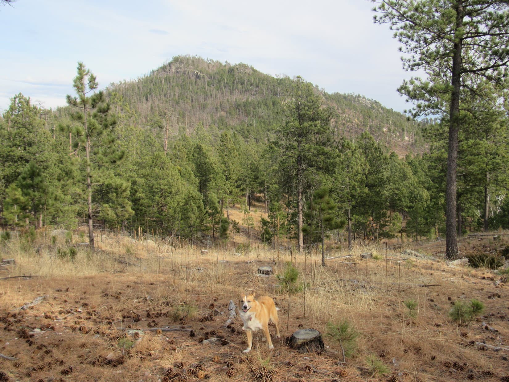
Lupe didn’t return to the road.  The Sweetwater Mountain plateau wasn’t all that much farther up.  Lupe and SPHP angled NW through the forest, climbing a fairly steep slope.  There was a lot more snow here than down below, several inches.  The snow made the slope slick, but Lupe made it up onto the E edge of the plateau.

Even though she had permission to be here, after seeing hunters go by in an ATV, Lupe stayed off road in the forest while completing her climb up onto the Sweetwater Mountain plateau. There was much more snow up here than down below by the old barn. Photo looks NW.

The Sweetwater Mountain plateau is irregularly shaped, but runs roughly 3 miles N/S, and 0.5 to 1.0 mile E/W.  Lupe had arrived about mid-way along the E edge of the mountain, somewhere a bit S of High Point 6402 on the topo map.  Lupe’s primary objective was to reach the true summit, located along the N edge of the plateau 0.33 mile out on a section of the plateau protruding to the E.  The summit was still nearly 2 miles away.

The Sweetwater Mountain plateau turned out to be forested, gently rolling terrain.  That was fortunate.  Lupe shouldn’t have a hard time staying out of the hunters’ way.  She saw no sign of them.  Lupe and SPHP started N staying very close to the E edge of the plateau.

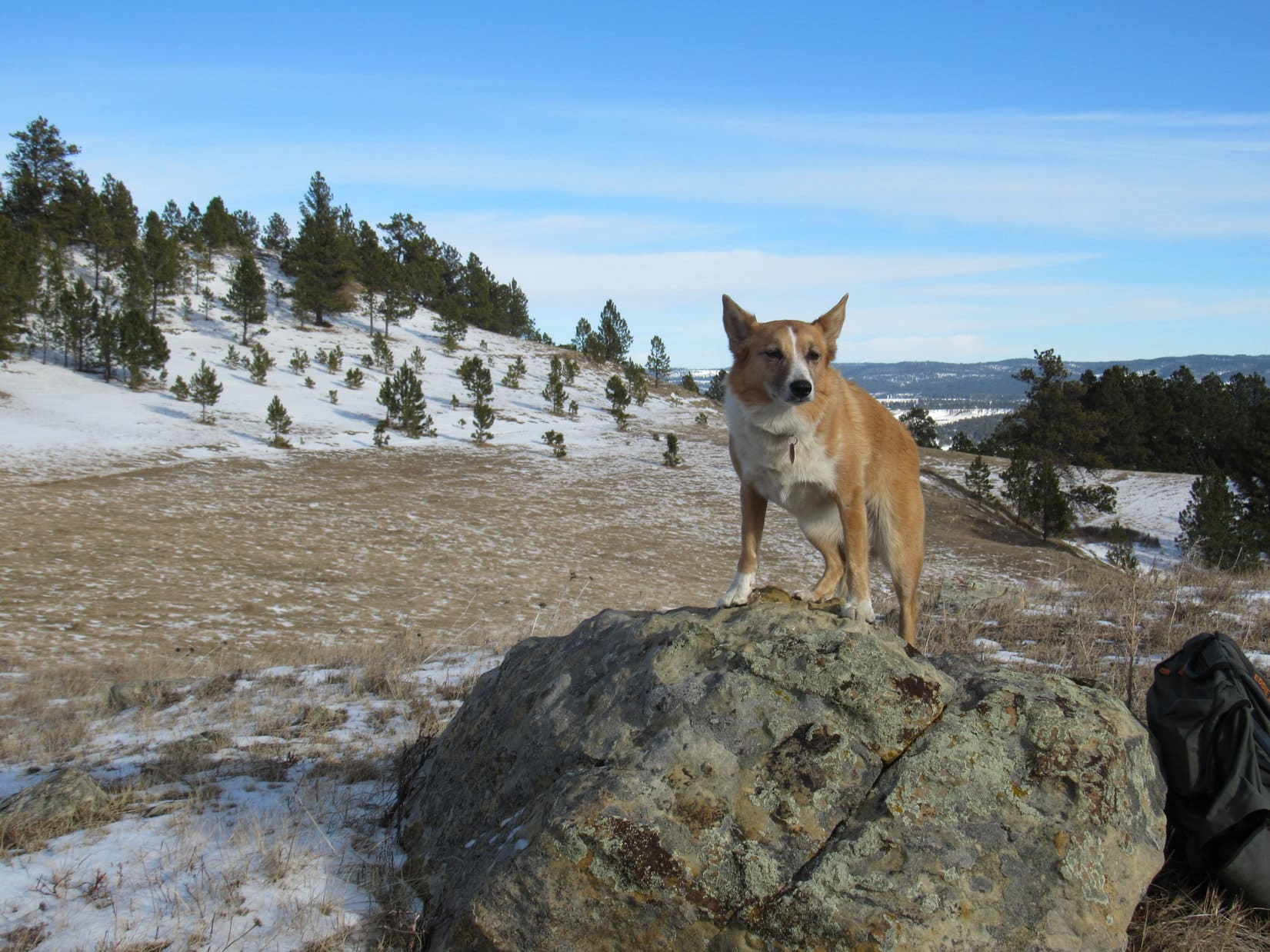
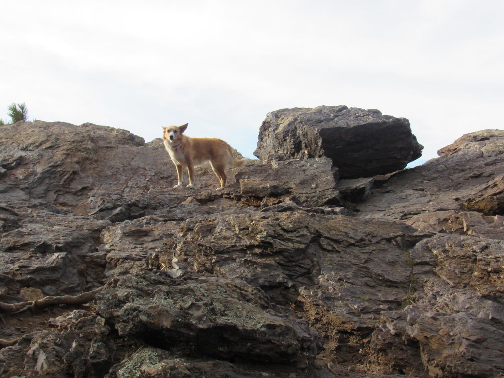
Although the N face of Sweetwater Mountain is the highest and steepest, the E face is only moderately less so.  Lupe quickly arrived at rock formations near the top of a line of small E-facing cliffs.  She had a good view to the E toward the main body of the Black Hills in South Dakota.

Lupe comes to the first rock formations along the E edge of the Sweetwater Mountain plateau. Photo looks E.
Lupe found this wall of rock in the forest a little SW of the highest and best viewpoint she reached along the E edge of the plateau. Photo looks NW.

The best views Lupe came to along the E edge of the plateau were from a couple of roomy rock platforms, the S one being a little lower than the N one.  SPHP wasn’t entirely certain where Lupe was on the map.  This may have been High Point 6402, or somewhere N of it.  Wherever Lupe was, she sure had a terrific sweeping view of everything off to the E!

Dingo with a view! The S edge of the highest platform of rock Lupe came to along the E face of Sweetwater Mountain (possibly High Point 6402) is visible on the L. Photo looks NE.
Lupe on the lower rock platform. The long forested ridge on the horizon is the W side of the Black Hills range in South Dakota. Photo looks ESE.
Part of Mount Pisgah, where Lupe had been 3 weeks ago, is visible as the more distant ridge on the R. Photo looks SE from the highest rock platform.
The true summit of Sweetwater Mountain is on the ridge seen on the L. The rounded, forested hill on the R is High Point 6423. Lupe eventually left Sweetwater Mountain by traveling down to the saddle seen between them. She then proceeded back to the G6 along the open snowy slopes seen below High Point 6423. Photo looks NNE.

After passing by some of the more dramatic E-facing cliffs, Lupe continued N through the forest.  Down at the old barn, where Lupe had started her trek, there had only been 0.5″ of snow on the ground.  Up here, the snow was 3″ to 5″ deep.

Lupe seemed to be enjoying the day, but she was puzzled when SPHP repeatedly warned her not to bark at the squirrels she occasionally spotted in the trees.  So far, there hadn’t been any sign of the hunters.  Wherever they were, SPHP didn’t want Lupe alerting them to her presence.  Five minutes of shrill Dingo barking action would be a dead give-away!

SPHP encouraged Lupe to stay reasonably close.  A real danger lurked in the forest.  Now and then, Lupe was coming to downed barbed wire fences.  Whether the barbed wire was all part of one continuous fence, or several different fences, wasn’t clear and hardly mattered.  SPHP tried to keep a close watch for this danger, made worse by the fact that it was often partially hidden by the snow.  Lupe cooperatively allowed herself to be carried over each downed fence.

Lupe was approaching the N end of the Sweetwater Mountain plateau.  She crossed a road going E/W in the forest.  Only a little farther on, another road came this way from a snow-filled meadow off to the W, the first open ground Lupe had seen up on the plateau.  Lupe got on this second snowy road, following it E.  The mountain’s summit was still 0.33 mile away.

Where Lupe reached it, the road was very close to the high ground along the N edge of the mountain.  Edward Earl had mentioned a secondary objective on Sweetwater Mountain, the Cambria survey benchmark.  He’d written that he found it near a bright yellow wand on a hill.  The benchmark itself had been among a pile of rocks, also spray-painted bright yellow.

From Earl’s description, the Cambria survey benchmark was well W of Sweetwater Mountain’s true summit.  Lupe was probably already quite close to it.  She should find it before reaching the summit.  SPHP kept an eye out for the bright yellow wand.  Lupe had hardly gone any distance on the snowy road at all, when there it was!

The yellow wand (a single metal fence post) was no longer as bright as it was 7.5 years ago when Edward Earl was here in May 2009, but it was still here.  So were the now fading yellow rocks around the benchmark.  Lupe found that even the Cambria survey benchmark itself had been spray-painted yellow.

Lupe at Edward Earl’s yellow wand marking the location of the Cambria survey benchmark. Photo looks E.
The yellow wand was only a few feet from the drop-off along the N face of the mountain. From this angle, the yellow rocks and Cambria benchmark are right behind the wand. Photo looks N.
Even the Cambria survey benchmark had been painted bright yellow, though the paint was faded and flaking away by the time Lupe arrived more than 7.5 years after Edward Earl had been here.

Edward Earl had been right at this very spot!  Now Lupe was here.  Tragically, Earl had drowned in Alaska nearly 1.5 years ago while attempting to cross the Jago River N of the Arctic Circle.  Lupe had been in Alaska for the first time only a few months ago on her fabulous Summer of 2016 Dingo Vacation.  SPHP was thinking such thoughts when, suddenly, there was a noise, an engine noise, approaching from the W.

The ATV!  The hunters were coming!  They were nearly here.  Lupe would surely be spotted in the snowy open forest S of the road, yet she was pinned only a few feet from the near vertical drop-off along the N face of the mountain.  Where to?

Quickly, Lupe and SPHP went E down a small slope to a depression along the N rim.  The depression was a little farther from the road, and low enough to be barely out of sight.  A moment later, the ATV could be heard going by.  Lupe and SPHP caught only a glimpse of it, as the hunters drove off to the E.  That had been a close one!  By now, staying out of the hunters’ way had evolved into a game, a game Lupe had just narrowly avoided losing.

What now, though?  The hunters were headed E out on the ridge protruding from the summit plateau.  Soon they would reach the end of it.  It seemed likely they would have to come back this way before too long.  For 10 minutes, Lupe remained hidden at the depression, while SPHP listened for the ATV’s return, pondering her best course of action.  In the meantime, Lupe certainly had a tremendous view to the N from here!

From the little depression E of the Cambria survey benchmark along the N rim of Sweetwater Mountain, Lupe had a great view to the N. Inyan Kara(Center) is on the horizon. Photo looks NNW.

If Lupe had to hide out for a bit, this depression really was a good place to do it.  Lupe could see both Inyan Kara (6,360 ft.), and even more distant Warren Peaks (6,650 ft.) on the N horizon.  Beautiful western scenery was off to the NW, too.  Lupe and SPHP were perfectly happy to take a little break right here.

Inyan Kara using the telephoto lens. Photo looks NNW.
Warren Peaks (Center). Photo looks N using the telephoto lens.
Western scenery to the NW using the telephoto lens.
Looking NW. Inyan Kara(R) is on the horizon.

After 10 minutes, the ATV and the hunters had not returned.  What were they doing?  Were the hunters on foot now?  SPHP could hear nothing.  Lupe gave no sign of hearing anything unusual either.  Lupe couldn’t stay here forever.  Cautiously, she started E along the N edge of the mountain looking for the true summit.

The terrain did gain some elevation going E.  As Lupe approached the highest ground, two big bucks bounded away to the S.  Like Lupe, they had been hiding along the very N edge of the mountain.  If the hunters had been peakbaggers, too, they would have come right to them!  How odd, and ironically funny!

Lupe arrived at the true summit of Sweetwater Mountain, so recently vacated by the two bucks.  The summit was an unremarkable level area in the forest.  For the most part, trees blocked the views.

A Carolina Dog arrives at the true summit along the N edge of Sweetwater Mountain shortly after it was vacated by two large bucks. Photo looks WNW at the best view available from here.
Lupe on the true summit. The immediately surrounding ground was quite level. The oddly curved pine tree trunk in the background is a landmark that should last for some years yet. Photo looks ENE.
Stealth Dingo Lupe succeeds in reaching the true summit of Sweetwater Mountain without being detected by a roving band of hunters, despite 2 close calls! Would she be able to escape the mountain unseen? Photo looks WNW.

Having now been to both the Cambria survey benchmark and the true summit of Sweetwater Mountain, Lupe could have just called the day a success and headed back to the G6.  However, it was still relatively early.  Over toward the NW end of the mountain the topo map showed High Point 6410, only a few tens of feet lower than the true summit.  Maybe it would be fun for Lupe to see what was over there?

Lupe felt up to it.  She left the true summit heading W.  As she drew near her depression-with-a-view E of the Cambria benchmark, there was that noise again!  An engine, somewhere to the W.  How had the hunters gotten past Lupe way over there?  Was there a second group of them?  Better wait here again.  Lupe and SPHP enjoyed the view to the N from the depression.

Lupe and SPHP paused a 2nd time at the depression E of the Cambria survey benchmark, while waiting to see if the hunters were about to make another appearance. Strangely enough, this American Dingo refuge seemed to have the best unobstructed view to the N from anywhere along the mountain’s N rim. Photo looks NNE toward Inyan Kara Mountain.
Inyan Kara using the telephoto lens. Photo looks NNW.

The engine noise faded.  No hunters or ATV’s appeared.  Lupe resumed her trek W, passing by the Cambria benchmark again.  She was bold enough to follow the road W out into the big, snowy meadow.

Lupe followed the road from Cambria benchmark W out into this big snowy meadow. Photo looks W.

On the far side of the meadow, Lupe took a side road NW back into the forest.  She eventually abandoned this road to return to the N rim of the plateau.  Lupe followed the N rim going W.  She reached NW High Point 6410.  It turned out to be just another nearly level area near the N rim where the forest blocked the view.

Lupe reaches High Point 6410 on the NW part of the Sweetwater Mountain plateau. There wasn’t much to see here. More flat, snowy forest was about it. Photo looks W.

High Point 6410 hadn’t provided much excitement or drama.  A little farther NW, the topo map showed a point along the plateau edge jutting out to the N.  Lupe might as well continue on over there.  Maybe she could get a view to the W?

Lupe continued NW.  She reached the end of the N point.  There was a view to the W, but she had to travel a little SW along the edge of the plateau to reach a place where there was enough of an opening in the forest to permit a reasonably clear look.

Looking W from a small cliff near the NW end of Sweetwater Mountain.
Scenery WNW of Sweetwater Mountain.

Lupe still hadn’t explored the W or S sides of Sweetwater Mountain.  She would have done so, if there hadn’t been any hunters around.  There hadn’t been any further sign of them lately, but maybe it was time to call it good.  Lupe had done what she came to do.

So Lupe began her trek back to the G6.  She stayed along the N rim of the plateau.  Once again, she visited High Point 6410, the snowy meadow, the Cambria survey benchmark, and the true summit of Sweetwater Mountain along the way.  She found a road that led E steeply down to the saddle between Sweetwater Mountain and High Point 6423.

At the saddle, Lupe turned S.  Lupe and SPHP went through a gate in a barbed wire fence.  Now Lupe was on open ground heading S down into a valley.

The valley to the S of the saddle. Lupe is already past the barbed wire fence. Photo looks S.

Lupe was in no rush.  She had time to explore this valley.  It wouldn’t take long to get to the G6.  In fact, this route through the valley would have been a much more direct route to the summit than the one she had taken earlier in the day.  The valley had some pretty sights.  Lupe had a good time here.

Cliffs along the E face of Sweetwater Mountain. Lupe had been up above them heading N (R) on her way to the true summit earlier in the day. Photo looks WSW.
The large ridge on the horizon is Mount Pisgah. Photo looks SSE from a hillside SW of High Point 6423.
Loopster up on a boulder on the hillside SW of High Point 6423. Photo looks E.
The wily, elusive Snow-Dingo of Sweetwater Mountain.

No hunters or ATV’s ever made another appearance.  After a pleasant trek down the valley, Lupe was back at the G6.  Lupe’s adventures on Sweetwater Mountain were over.  (1:54 PM, 32°F)

There were still a couple of hours of daylight left.  Lupe took a roundabout way home.  She stopped by Four Corners.  A sign near the junction of US Hwy 85 and Wyoming Hwy 585 told of a stagecoach robbery back in the days of the Old West.Lupe and SPHP enjoyed a beautiful drive from Four Corners going first E on Mallo Road, then S on Beaver Creek Road.  Lupe rode with her head out the window of the G6, happily barking with all her might at herds of cows and horses.  At her last stop of the day, Lupe climbed a small hill overlooking LAK reservoir on Beaver Creek.  The lake was nearly completely frozen over.

The small hill(L) Lupe climbed for a view of the LAK reservoir. Photo looks SW.
Lupe near LAK reservoir. This small lake is 5 miles E of Newcastle, WY less than a mile N of US Hwy 16 along Beaver Creek Road. Photo looks NW.
Lupe’s 2016 adventures in Wyoming ended here, at LAK reservoir, after her successful climb of Sweetwater Mountain. Photo looks SW.

Soon after leaving LAK reservoir, Lupe was back in South Dakota.  Her 2016 adventures in Wyoming were over.  The Carolina Dog’s ascent of Sweetwater Mountain marked the successful conclusion of her fall of 2016 peakbagging tour of Black Hills and Bear Lodge Mountain peaks in NE Wyoming.

Cold weather was coming.  For the next couple of months, Lupe’s opportunities for outdoor adventures might be limited.  But, hey!  Both her birthday and Christmas would be here soon.  For high-spirited American Dingoes, there’s always another adventure of some sort right around the next bend!

Thank you to rancher Bart Roberts for granting Lupe and SPHP permission to enter his beautiful eastern Wyoming ranch to climb Sweetwater Mountain!

The wily Snow-Dingo, E of Sweetwater Mountain.

Links:

Next Black Hills Adventure                  Prior Black Hills Adventure

Want more Lupe adventures?  Choose from Lupe’s Black Hills Expeditions Adventure Index or Master Adventure Index.  Or subscribe free to new Lupe Adventures.

Lupe’s 6th Birthday (12-14-16)

Lupe’s 6th birthday was a rather cold day, as December birthdays are apt to be.  However, it wasn’t cold enough to prevent the day from starting with a little flying disc action in the backyard.

Lupe’s birthday got off to a good start with some flying disc action in the backyard.

Lupe had received the flying disc as part of a PupJoy gift box at Thanksgiving.  She used to play with Frisbees when she was less than two years old, but she wasn’t used to the flying disc now.  SPHP wasn’t the best at throwing it, either.

Still, Lupe had some success at catching the flying disc in mid-flight when SPHP managed to get in a decent toss.  Short practice sessions were held throughout the morning and early afternoon, with increasing success as the day wore on.

Around mid-afternoon, it was time to brave the Christmas crowds at Wal-Mart.  Lupe went along for the ride in the G6.  SPHP bought a Dingo’s food chocolate cake mix and marshmallow vanilla frosting.

At home, SPHP baked the cake.  It was supposed to cool for a while before being frosted.  SPHP was in a bit of a hurry, so the cake got put outside in 10°F weather for 20 minutes.  It was plenty cool to frost then!  SPHP added sprinkles on top of the frosting.  Then it was time to go.

Every year, Lupe has her birthday party at Grandma’s house, and this year was no exception.  Lupe raced in to surprise Grandma wearing her party hat.  Although this happens every year, Grandma still manages to be surprised and glad to see the birthday Dingo.

Lupe arrives at Grandma’s house wearing her party hat, ready to surprise Grandma!
Grandma was glad to see the birthday Dingo, and Lupe was glad to see Grandma!

Lupe’s birthday party was poorly attended this year.  Only Grandma, SPHP and Lupe were there.  Even Butterfly, Grandma’s 3-legged cat, didn’t bother to come out to wish Lupe a happy birthday.

Lupe wasn’t worried about the attendance, though.  What worried her was a new addition to her birthday cake.  SPHP had added candles!  Whether she was afraid of the flaming cake, or how many Dingo years gone by those candles represented wasn’t entirely clear, but after a few minutes, Lupe got used to them.

Lupe seemed a bit scared of her flaming birthday cake at first. She’d never had a cake with candles on it before! Whether she was worried about being so close to the flames, or about the number of Dingo years gone by those candles represented wasn’t entirely clear.

Grandma and SPHP sang Happy Birthday to Lupe.  She liked being the star of the party!  When Grandma and SPHP told her the candles meant she could make a wish before they were blown out, Lupe liked that idea a lot!

I get to make a wish!? Maybe these candles are a good thing!

Lupe thought and thought about what she should wish for.  The candles burned so low on the cake, they were about to light the frosting on fire.  Finally, when Lupe had had enough time to settle on what her wish would be, SPHP blew out the candles for her.

SPHP succeeded in blowing out all 6 candles in one breath.  Lupe was very happy!  That meant her wish was going to come true!  She was careful not to let anyone know what she’d wished for, so her wish didn’t get jinxed.

Lupe was very happy that her secret birthday wish is going to come true!

Next it was time for Lupe’s birthday presents.  She got 4 presents, because she is loved so much!  Lupe received a package of Nudges brand jerky cuts chicken treats, a new Kong squeaker ball, an Ol’ Roy long-lasting chew stick, and a bottle of Alaska Naturals wild Alaskan salmon oil.

Lupe with all her birthday loot and her birthday cake.

After Lupe got to see all her new presents, it was time for cake and ice cream.  Lupe normally loves cake and ice cream, but she went for the new Ol’ Roy long-lasting chew stick instead.

Lupe chomps away on her new long-lasting Ol’ Roy chew stick.

Long-lasting turned out to mean about 3 minutes.  By then, Lupe had devoured the whole chew stick!  At least it must have been satisfying and filling.  Lupe decided not to eat any cake or ice cream.  SPHP put her cake and ice cream in the freezer to save it for later on.

Full of Ol’ Roy 3 minute long-lasting chew stick, Lupe decided to pass on the cake and ice cream. SPHP saved it for her in the freezer for later on.

When SPHP and Grandma had finished their cake and ice cream, SPHP asked Lupe if she wanted to go to the cul-de-sac.  Lupe loves to go to the cul-de-sac!  Even though it was pretty cold out, Lupe wanted to go.

Lupe was excited about the prospect of going to the cul-de-sac! It’s one of her most favorite things to do at Grandma’s house. She was anxious to go on a moment’s notice.

This time of year, there is a house near the cul-de-sac that always has the most beautiful Christmas tree.  Lupe stopped by to see it on the way back from the cul-de-sac.

Lupe dropped by to see the most beautiful Christmas tree on her way back to Grandma’s house from the cul-de-sac. It was pretty chilly outside, but Lupe was glad she came. The brightly decorated tree really was a wonderful sight under a frosty full moon.

When Lupe got back to Grandma’s house, her big 6th birthday bash was over.  SPHP gathered up her 3 remaining undevoured presents to take home.  Lupe didn’t see any deer or cows to bark at on the way home, but she did get to bark at the gas pipeline.  That gas pipeline never lets her down!

Lupe hopes not to let you down, either.  Being 5 is going to be tough to beat, but the 6 year old Carolina Dog promises more new Dingo adventures on the way!

May your birthday dreams and wishes come true, Lupe!

Related Links:

Lupe’s 5th Birthday (12-14-15)

Lupe’s 7th Birthday (12-14-17)

Want more Lupe adventures?  Choose from Lupe’s Dingo Tales Index or Master Adventure Index.  Or subscribe free to new Lupe Adventures.

Black Hills, SD Expedition No. 184 – Iron Mountain & Peak 5688 (11-28-16)

Windy.  Not all that cold out, but not terribly warm, either.  SPHP dithered.  Lupe was due for another of her Black Hills expeditions, but what were conditions going to be like up in the hills?  Lupe was anxious to go.  SPHP checked the forecast again.  Not much of a change expected all day long.  It would probably be OK.  Lupe won out, Expedition No. 184 was a go!

After a bit of a late start, SPHP parked the G6 at the parking lot on top of Iron Mountain (10:38 AM, 34°F).  Lupe’s first peakbagging success of the day was going to be a super easy, trivial one.  A short paved path curved NW toward an official viewpoint at the NW edge of the large, forested summit area.

Expedition No. 184 started with Lupe already almost at the top of Iron Mountain. The rocky ridge seen between the trees is the true summit at the W end of the mountain. Photo looks W.

The big view from Iron Mountain (5,446 ft.) is off to the W toward Harney Peak (7,242 ft.), the highest mountain in South Dakota.  The main attraction for most people, however, is closer by to the NW.  Mount Rushmore (5,725 ft.) can be seen only 3 miles away.

Lupe didn’t go to the official, safely-fenced, tourist viewpoint.  She made the 20 foot climb up onto the short, scenic rock ridge where the true summit is to claim her pathetically easy Iron Mountain peakbagging success.  Once on top at the edge of the mountain, she had no interest in sticking around for the views.  Every blast of the N wind, gusting 30-35 mph, was hitting her full force.  Not Lupe’s idea of a good time!

Lupe, partially protected from the roaring N wind, at the base of the solid rock summit ridge on Iron Mountain. Photo looks SW.
Almost at the top. Photo looks SW.
Harney Peak from the summit of Iron Mountain. Photo looks W.

Of course, Iron Mountain wasn’t Lupe’s real peakbagging goal for Black Hills, SD Expedition No. 184.  Simply driving practically to the top of the mountain would have been a poor excuse for an expedition.

Eight days ago, on Expedition No. 183, Lupe had made it from Lakota Lake to nearby Woodpecker Ridge (5,680 ft.).  Her route traveling SW along the length of the ridge had been so difficult and taken so long, Lupe had run out of time to go on to Peak 5688.  Lupe was back to find and climb Peak 5688 on Expedition No. 184.

Lupe stayed on the windy summit of Iron Mountain for only a moment or two.  She wanted down out of that gale!  Lupe and SPHP left the Iron Mountain summit area heading first S, then W down to the Iron Mountain Picnic Ground along Iron Mountain Road (Hwy 16A).  From the picnic ground, Lupe took Centennial Bypass Trail No. 89B going SW into the Black Elk Wilderness.  The wind wasn’t much of a problem down here.

Image result for black elk wilderness trail systemBefore long, Lupe came to a sign along the trail.  SPHP intended for Lupe to take Iron Mountain Trail No. 16 going S to Iron Creek, but the sign didn’t mention that trail.  The sign was actually at the intersection, but deadfall timber hid Trail No. 16 from view.  SPHP failed to look carefully enough to find it, and missed the turn.

Lupe was a lot farther along Centennial Bypass Trail No. 89B before SPHP stopped to check the maps and realized the mistake.  No matter, Trail No. 89B was one of the few trails Lupe had never been on before in the Black Elk Wilderness.  She was having fun exploring it.  Soon Lupe would reach the junction with the main Centennial Trail No. 89.  She could turn S there.

Lupe near the junction of Centennial Bypass Trail No. 89B and Centennial Trail No. 89. Photo looks E back along the bypass trail she had just traveled.

Back in 2012, when Lupe first started her Black Hills, SD Expeditions, she explored virtually the entire length of the 111 mile long Centennial Trail No. 89 over the course of the year, one section at a time.  It seemed like a long time ago.  When Lupe turned S on Centennial Trail No. 89, at first SPHP didn’t recognize anything.

On Centennial Trail No. 89. Lupe had explored virtually the entire length of this 111 mile trail back in 2012, one section at a time. Even so, SPHP didn’t recognize this part of the trail. Photo looks S.

As Lupe headed S on Centennial Trail No. 89, she started seeing huge granite rock formations a little E of the trail.  Before long, Lupe arrived at an intersection that did look familiar.  SPHP remembered being confused back in 2012 as to which way to go from here.  The correct choice had been to turn E, so Lupe did so again.

On Centennial Trail No. 89 just after turning E at the intersection where SPHP had been confused back in 2012. Photo looks E.

Very shortly after turning E, the trail started curving S again, arriving almost immediately at yet another intersection.  Centennial Trail No. 89 went S staying to the W of the huge rock formations.  If Lupe went that way, she would arrive at the Iron Mountain Horse Camp near Iron Creek.

There was a faster way to get to Iron Creek, though.  Lupe left Centennial Trail No. 89 taking Grizzly Bear Creek Trail No. 7 (unmarked at the junction) instead.  Trail No. 7 went SE between towering walls of solid granite.  Lupe followed Grizzly Bear Creek Trail No. 7 all the way down to a trailhead at USFS Road No. 345 near Iron Creek.

In the Black Elk Wilderness on the way to Iron Creek via Grizzly Bear Creek Trail No. 7. Photo looks NNE.

From the trailhead along USFS Road No. 345, Peak 5688 was about 2 miles to the SSE as the crow flies.  It had taken Lupe quite a while to reach Iron Creek on the route she had taken, but there was still plenty of time to search for Peak 5688.  No road or trail led to it from here.  Lupe would have to make her way to Peak 5688 by exploring the forest, but she loves doing that!

The first task was to cross Iron Creek, which was S of the road.  Lupe crossed USFS Road No. 345, went to the creek, and quickly found a way over it.

Newly formed ice crystals on Iron Creek. 8 days ago, on Expedition No. 183, there had been an inch of snow down along Iron Creek. The snow had melted, but apparently it had been cold again recently.
About to cross Iron Creek. Photo looks upstream (W).

Beyond the creek, Lupe continued S, climbing up onto a small ridge.  She could see massive granite formations typical of this part of the Black Hills back to the N.

Looking N from the small ridge at massive granite rock outcroppings typical of this part of the Black Hills.

Lupe and SPHP wandered through the forest, trying to travel S in the general direction of Peak 5688.  For a while, it was hard to keep one’s bearings.  The rumpled terrain kept forcing Lupe in different directions.  There were no clear landmarks in view.  Lupe had never been here before.

Lupe wanders looking for Peak 5688. Photo looks S?

After wandering around for a while, Lupe finally saw a high hill ahead.  The high hill was part of Woodpecker Ridge, where Lupe had been 8 days ago on Expedition No. 183.

Still looking for Peak 5688, Lupe discovers the high hill in the background. SPHP correctly surmised it was part of Woodpecker Ridge, not too far from the summit where Lupe had been 8 days ago on Expedition No. 183. Photo looks SE?

Lupe continued her explorations, eventually entering an area of deadfall timber and thistles that looked vaguely familiar from Expedition No. 183.  She came across a primitive road that led up to some high ground.  Studying the topo map, SPHP became convinced this road was part of a route shown on the map a little W of Woodpecker Ridge.

Looking E at Woodpecker Ridge.

Lupe saw a long forested ridge off to the SSW.  That ridge almost certainly had to be Peak 5688.  Lupe was closest to it’s NNE end.  She headed S toward it, crossing High Point 5428 on the topo map along the way.

In the forest N of High Point 5428. Photo looks S.
Loop reaches the top of High Point 5428. Photo looks NE.

Lupe crossed a dirt road in the saddle between High Point 5428 and the NNE end of Peak 5688.  Instead of heading for the very end of the ridge, Lupe climbed up its NW slope to gain the ridgeline a little farther S.  This part of the ridge was narrow, forested, and strewn with boulders.

Lupe makes it up onto the Peak 5688 ridgeline a little S of its NNE end. This part of the ridge was relatively narrow, strewn with many boulders and some deadfall timber. Photo looks NNE.

Lupe was still about 0.5 mile from the summit of Peak 5688, which is near the SSW end of the ridgeline.  Lupe followed the ridge toward the summit, gaining elevation gradually along the way.  She started coming to places with big views again, especially toward the N and W.

Wherever there were openings in the forest, Lupe had views again from the Peak 5688 ridgeline. Photo looks NW toward the Cathedral Spires(L) and Harney Peak(R).

Although the wind hadn’t been a problem since leaving the summit of Iron Mountain, it was still blowing just as hard now as it had been earlier.  Up on the Peak 5688 ridgeline, Lupe was increasingly exposed to the wind again as she progressed toward the summit.  She often stayed a little E of the ridgeline to avoid the worst of it.

The strong wind was a problem again up on Peak 5688. It was very windy where Lupe is seen here up on the little wall of rocks, or anywhere to the R (NW). It was much less windy just a few feet to the L (SE). Photo looks SW.
The biggest rock outcropping on the horizon at center is Mt. Rushmore. The tall, thin dead tree to Lupe’s L is pointing almost straight up at George Washington’s head. The wind made it hard to hold the camera steady enough for a clear shot. Photo looks N.

Lupe came to a higher, broader, more open part of the ridge.  At first, SPHP thought this might be the summit.  There were great views from this area, but with only a few trees to slow it down here, the wind was exceptionally strong.

Looking NW from the open area. Harney Peak in view R of Center.
Lupe in the gale up on a rock that SPHP thought for a little while might be the true summit of Peak 5688. It turned out the summit was still a little farther S. Photo looks NE.

From the high open ground, a more heavily forested area was partially in view to the SSW.  Uncertain whether Lupe had already reached the top of Peak 5688 or not, Lupe and SPHP continued on to check it out.  In a few minutes, Lupe came across a small cairn on larger rocks.

Stuffed in a crack in the rocks right below the cairn was a small, torn, zip-lock plastic bag.  It contained a few crumpled pieces of aluminum foil, some damp rotten paper, and a plastic toy of two dogs water skiing.  There was also a piece of paper with the names William Wade & Charles Wade Johnson on it.  It was dated 8-13-12, and signed CWJ.

Another Carolina Dog peakbagging success! Lupe stands on the highest rocks of Peak 5688. Photo looks S.
Lupe discovered this plastic toy in a little plastic bag tucked into a crack in the rocks beneath the summit cairn. SPHP left the toy in the plastic bag along with a paper signed 8-13-12 by CWJ where Lupe had found it, but packed out the small amount of trash the bag contained.
Lupe takes a break at the summit of Peak 5688. Photo looks S.

After a short break near the cairn, Lupe and SPHP toured the general area to make absolutely certain Lupe had reached the true summit of Peak 5688.  She had!  Although the summit was mostly hidden by trees, there were nice views available close by.

Harney Peak from within a few feet of Peak 5688’s true summit. Photo looks NW.
Looking NNW using the telephoto lens.
View to the SE.
Looking N toward the true summit during a brief exploration Lupe made to the S.
Cathedral Spires using the telephoto lens. Photo looks NW.

The days are short near the end of November.  Even though it wasn’t all that late, the sun was low.  It would be down within the hour.  Lupe still had a long way to go to get back to the G6.  She at least needed to reach USFS Road No. 345 near Iron Creek before it got dark.  It was time to leave Peak 5688.  Lupe was tired of the wind, anyway.

Lupe in a nice little flat area next to the summit rocks. (The small cairn is visible on the L.) She would stay here on Peak 5688 only a few more minutes before leaving to head back to the G6. Photo looks N.

Lupe started back to the G6 going NNE along the Peak 5688 ridgeline.  She didn’t follow the ridge nearly as far back as she had originally come up along it.  As soon as she could, she headed NW down off the ridge.  Within 20 minutes of leaving the summit, Lupe was out of the wind in a beautiful grassy valley.

Lupe on her way down. Here she’s still in the high open area NNE of the summit. Woodpecker Ridge(R) can be seen in the distance between the trees. Photo looks NNE.
Lupe reaches the beautiful grassy valley NW of Peak 5688. Photo looks SW.

The sun sank down behind the hills.  Lupe found a fairly good dirt road on the other side of the beautiful valley which led N.  She followed it for a little way.  When it turned toward the W, she left the road.  Lupe and SPHP wandered N in the forest.  Well before twilight faded, Lupe reached Iron Creek again at a small frozen pond.

Lupe nears a frozen pond along Iron Creek. USFS Road No. 345 is in view beyond the pond. Photo looks NW.

Beyond Iron Creek and the frozen pond, Lupe returned to USFS Road No. 345.  She followed the road NE two miles to the Iron Mountain Trail No. 16 trailhead.  Along the way, she passed Camp Remington and the Grizzly Bear Creek Trail No. 7 trailhead.  She went by old cabins scattered along the road.  Everything was quiet and deserted.  Not a soul was around.

Lupe at Camp Remington. No one was around at any of the cabins here, or anywhere else along her route.

Twilight was almost gone by the time Lupe started up Iron Mountain Trail No. 16.  The flashlight had to be put to use.  Wind still blew in the trees.  Faint stars appeared in the sky.  It was that last quiet hour of darkness Lupe often experiences at the end of her Black Hills expeditions while traveling back to the G6.

Uncharacteristically, SPHP decided to try a few night time shots using the camera’s flash.  What would they show?

The first shot SPHP took in the dark using the flash was the best. It revealed a scary wide-eyed American Dingo on Iron Mountain Trail No. 16.
The spooky Dingo of the Night.

Lupe finally arrived at the intersection with Centennial Bypass Trail No. 89B.  No wonder SPHP had missed the intersection earlier in the day!  A huge amount of deadfall timber was strewn all over Iron Mountain Trail No. 16 in this area.

Lupe took Trail No. 89B back to the Iron Mountain Picnic Ground.  She crossed Iron Mountain Road.  Lupe returned to the summit of Iron Mountain.

The wind had died down only a little.  Tiny snowflakes whipped by in the gusty breeze.  SPHP fumbled around trying to get a photo of Lupe on top of Iron Mountain in the dark.  Success was limited.

Oh, well.  Lupe’s Black Hills, SD Expedition No. 184 to Iron Mountain & Peak 5688 was over.  At least, Lupe had been successful!  Time to go home.  (5:52 PM, 31°F)

An American Dingo loses patience, leaving the Iron Mountain summit a moment before the flash.
Carolina Dog on Iron Mountain – perhaps a little underexposed?
Overexposed rocks at the summit of Iron Mountain. The American Dingo is either cloaked, or has already grown disgusted and left.
Blurry Carolina Dog at the summit of Iron Mountain after dark. OK, we’re calling this one good as good as it gets! Let’s go home Loopster, its cold and windy here!

Links:

Next Black Hills Adventure                     Prior Black Hills Adventure

Want more Lupe adventures?  Choose from Lupe’s Black Hills Expeditions Adventure Index or Master Adventure Index.  Or subscribe free to new Lupe Adventures.