Black Hills, SD & WY Expedition No. 91 – Peak 6888, Bald Hills, the Weston County, Wyoming High Point, Peak 6645, & Laird Peak (6-1-14)

There’s nothing so rare as a day in June, and June had just arrived!  Both Lupe and SPHP were raring to go, even though scattered thunderstorms were in the afternoon forecast.  The plan was to head way out into the high country of the NW Black Hills for some peakbagging fun.  First up were Peak 6888 and the Bald Hills (6,690 ft.), both within a few miles of the Wyoming border.

Although there were already clouds around, the sun was still shining when SPHP parked the G6 more than 0.5 mile W of County Road No. 117 along USFS Road No. 109 (Parmlee Canyon Road) at 9:39 AM (59°F).  Lupe and SPHP started out taking Bear Canyon Road S from No. 109.  Bear Canyon Road was just a dirt road that looked like it seldom gets any traffic.  It passed through a field in a shallow valley and then entered the forest, winding its way up a low ridge at a pretty decent clip.

The climb was a short one.  Bear Canyon Road soon leveled out, and reached a clearing where there was an intersection with more faint roads.  Several whitetail deer ran off into the forest as Lupe approached the intersection.  Peak 6888 is about 0.75 mile S of Parmlee Canyon Road.  SPHP figured Lupe still had to go a bit farther S to get there.  The road continuing S was marked as USFS Road No. 117.5J.

Lupe followed No. 117.5J up a couple of little rises.  The road leveled out again after each one.  When the road seemed to be at its highest point, SPHP stopped to check the topo map.  The summit of Peak 6888 was supposed to be a little W of the road.  The entire area looked quite level, although the forest did look a bit higher off to the NW.  Lupe and SPHP left the road exploring the forest to the NW, while searching for an obvious high point or marker.

Lupe found neither.  A big area was almost as flat as a pancake.  Nothing seemed discernably higher or lower than anywhere else.  Lupe saw more deer, but summits were scarce.  Well, Loop, looks like this is all the summit!  SPHP encouraged Lupe to hop up onto a big log.  This can be your summit photo, Lupe!  Might as well call it good, and go on to the Bald Hills.

Lupe seemed happy enough to call this log the summit of Peak 6888. There were no views in any direction, just more flat forest extending all around.

Peak 6888 was now in Lupe’s bag, but it hadn’t been too exciting.  At least there was a little excitement when Lupe and SPHP returned to No. 117.5J.  Lupe saw a female elk crossing the road.  The elk saw Lupe and SPHP, too.  It took off running, but seemed confused on which way it wanted to go.  It finally disappeared off to the SE.

Lupe and SPHP continued S on No. 117.5J.  Almost right away, Lupe came to a big square mud puddle where the road started angling SW.  Lupe ran over to wade around and get a big drink of mineral water.

Lupe discovers the mineral water pond on Peak 6888.
Lupe discovers the mineral water puddle on Peak 6888.
The mineral water pond looked like it could have been milk chocolate flavored.
The mineral water puddle looked like it could have been milk chocolate flavored.

From the milk chocolate colored mineral water puddle, No. 117.5J started losing elevation slowly, but steadily, as it went SW for about 0.75 mile.  The road appeared to end in a small valley near a couple of stock ponds.  There were several barbed wire fences in the area.   Lupe and SPHP headed S across the little valley, and climbed up the next low ridge ahead.  Up on top, Lupe found USFS Road No. 113 at a green gate.

By now the sky was completely overcast, and it began to rain steadily.  SPHP wore a blue plastic rain poncho, but Lupe was doomed to become a progressively more soggy doggie.  Lupe and SPHP marched W on No. 113 in the mud and rain.  The clouds grew darker.  The downpour strengthened, and the woods filled with fog.

Although Lupe ordinarily loves to get wet playing with the garden hose on warm, sunny days, the dreary downpour seemed to dampen her spirits.  For 2 miles, Lupe and SPHP slogged W on No. 113.  SPHP began to wonder what ever happened to the “scattered” part of the scattered T-storms in the forecast.  It looked like it could rain buckets all day.

After going 2 miles, Lupe started passing by minor side roads that SPHP was expecting to see, and No. 113 gradually turned S.  The road had been fairly level most of the time, but now began to lose some elevation.  That didn’t last long.  It was soon gaining the elevation back.  Lupe reached a high spot on the road as it turned W.  The road continued W, but it was clear it was about to lose serious elevation in that direction.

About this time, the rain stopped.  Suddenly the sky was getting brighter again.  SPHP stopped to check the maps.  The little green hill on the N side of the road had to be the summit of Bald Hills.  Lupe was practically there!

The remains of a campfire were on the N side of the road, too.  Unfortunately, trash was scattered all around it.  While SPHP collected trash, Lupe sniffed around, encouraged by the rapidly clearing sky.

Lupe just S of the summit of Bald Hills. The top was just up this little green hill. Photo looks N.
A rather damp Lupe among pretty yellow flowers S of the summit of Bald Hills.

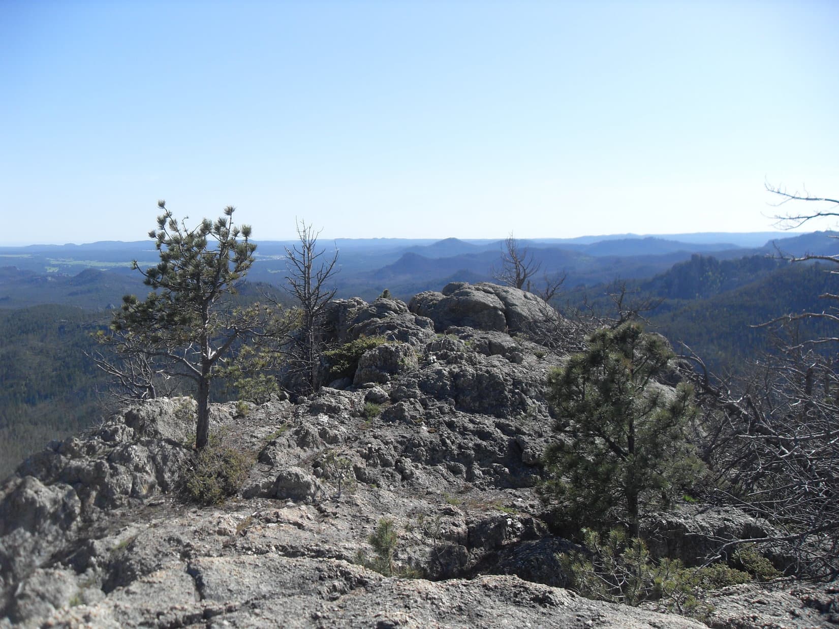
When the trash was all gathered up, Lupe and SPHP climbed the little green hill to the summit.  The summit area was a bit surprising.  It was a big flat open field, completely surrounded by pine trees.

Trees killed by pine bark beetles were still standing along the W edge of the meadow.  When they eventually fall over, the view will improve dramatically.  As it was, Lupe and SPHP could only get glimpses of Mount Pisgah (6,380 ft.) five miles away in Wyoming.

Lupe in the big flat meadow at the summit of Bald Hills. Photo looks W. The sky is beginning to clear!
Looking W.
Looking W.
Lupe starting to dry out in the sunshine. Photo looks NE.

The meadow on Bald Hills was quite pretty and full of little flowers.  It was kind of a shame there wasn’t a more open view anywhere, but that’s the way it was.  As Lupe and SPHP ambled around the field, the last of the storm clouds drifted away to the E, and the sun began to shine.

Lupe and SPHP left the summit taking what was supposed to be a shortcut back to No. 113 by heading directly E.  There proved to be a fair amount of deadfall timber to deal with in the forest.  While Lupe might have saved some distance, it was debatable how much time was really saved.

Once on No. 113 again, Lupe and SPHP followed it back E.  Where dark clouds, rain and fog had prevailed only a short time ago, now a sunny, fresh, bright green Dingo Paradise existed.  Lupe’s spirits soared!  She dashed through the damp woods sniffing excitedly at every tree and bush.  Lupe came to a series of small pools scooped out along the road.  She made frequent use of them.

One of several pools of rainwater along USFS Road No. 113. The day was warming up rapidly. Lupe made frequent quick stops at the pools for refreshing drinks.

When Lupe reached the green gate across No. 113 again, she turned N leaving the road.  Lupe and SPHP went down off the ridge into the small valley, this time passing above (E of) the higher pond.  Lupe returned to No. 117.5J.  Soon Lupe and SPHP were back up on Peak 6888 again.

Lupe took a Taste of the Wild break while resting under a fallen tree trunk.  SPHP sat on the tree trunk eating an apple and looking at the maps.  After the break, Lupe and SPHP once again wandered around on Peak 6888, still looking for an obvious high point, but with the same negative results.  Lupe chose a bright green meadow for her 2nd Peak 6888 summit shot of the day.

Lupe near the upper pond on her way back to Peak 6888. This area is a little W of the Beaver Creek Cow Camp on the USFS map.
Lupe takes a Taste of the Wild break while resting under a fallen tree on Peak 6888.
Lupe chose this bright green meadow to commemorate her 2nd ascent of Peak 6888 of the day. Photo looks WSW.

SPHP had noticed while looking at the maps that 0.33 mile to the NE of Peak 6888 there was a small area enclosed by a 6,900 foot contour line.  Since that was somewhat higher ground, Lupe and SPHP crossed over No. 117.5J to go check it out.

NE of No. 117.5J, Lupe did seem to gain a little elevation, but it didn’t amount to much.  Lupe still found no obvious high point.  There weren’t any big views anywhere over here either, just more forest.  Lupe and SPHP went W back to Bear Canyon Road and turned N.  By 1:48 PM (65°F), Lupe was back at the G6.

Lupe’s next two peakbagging goals were both located 10 miles to the NNW.  Lupe and SPHP jumped in the G6, and enjoyed a very scenic drive through gorgeous Black Hills high country near the Wyoming border.  The last part of the drive was along another USFS Road No. 109.  (Not the No. 109 that leads to Parmlee Canyon.)  This No. 109 led N out of the Beaver Creek valley.  It eventually turned NW toward the Wyoming border.

SPHP was really hoping there would be some kind of a sign and a fence at the border.  Lupe’s third peakbagging goal of the day was the Weston County, Wyoming High Point (6,620 ft.).  The high point is located about 0.375 mile S of where No. 109 reaches the Wyoming border.  The whole key to finding the Weston County High Point was knowing where the border was.

The luck of the Dingo prevailed!  There was a Wyoming sign at the border.  There was also a cattle guard, a fence, and a convenient level place to park on the South Dakota side (2:28 PM, 57°F).  Lupe and SPHP left the G6, crossed the cattle guard into Wyoming, and headed S along the border fence.

The entire area was forested and rolling, but without significant elevation changes.  Logging trails ran this way and that through the woods.  When it seemed easier, Lupe and SPHP just followed the logging trails, but never got very far from the border fence.  Pretty soon, Lupe came to two high points right along the state line.  One of them had to be the Weston County High Point.

The two high points were close enough to each other so it was possible to see both at the same time.  However, they were so similar in elevation, SPHP wasn’t certain which was truly the highest point.  The first one Lupe came to, the one to the N, seemed like it was highest, but it was hard to tell for sure.  Naturally, Lupe visited both high points.

Lupe at the N candidate for the Weston County, WY high point. She is sitting just past the border fence on the South Dakota side of the border. SPHP believes this is the true high point, but there was another possible candidate in view a short distance to the S. Photo looks E.

From the N high point, a small, nearly level ridge extended W about 100 feet into Wyoming.  It was possible the Weston County High Point was actually somewhere along this ridge instead of right on the border with South Dakota.  Lupe explored the W ridge out to where it ended at 10 foot high limestone outcroppings.  SPHP was of the opinion the actual high point was back at the WY/SD border, rather than anywhere along the ridge.

Lupe seemed to enjoy looking for the Weston County High Point. Here she is looking happy while exploring the small ridge W of the border and the N high point candidate.
Although Lupe explored this entire ridge W of the N candidate on the WY/SD border for Weston County, WY High Point, SPHP didn't believe the actual high point was anywhere out on this ridge. To SPHP, the land seemed marginally higher right at the border. Lupe never did really come out and say what she thought.
Although Lupe explored this entire ridge W of the N candidate on the WY/SD border for Weston County, WY High Point, SPHP didn’t believe the actual high point was anywhere out on this ridge. To SPHP, the land seemed marginally higher right at the border. Lupe never did really come out and say what she thought.
The W end of the ridge ended at these 10 foot high limestone outcroppings. Photo looks SE.

After exploring the W ridge, Lupe and SPHP went over to the S high point candidate along the Wyoming/South Dakota border.  A small area on the Wyoming side near the S high point had been clear cut.  There were slash piles laying all around.  The S high point was a limestone outcropping right at the border.  There wasn’t any ridge extending out to the W here.  The ground went downhill immediately W of the high point.

Lupe at the S candidate along the WY/SD border for Weston County, WY High Point. Photo looks S.

Wherever the actual Weston County High Point truly was, Lupe had now been there, having explored both possible candidates, plus the W ridge.  The forest blocked any views, so there was no reason to linger.  A short distance up a little hill to the E just inside the South Dakota border was Lupe’s fourth peakbagging goal of the day, Peak 6645.

Why Peak 6645 is on Peakbagger.com’s official list of Black Hills 6500-foot Peaks is completely beyond SPHP.  There are numerous other higher points close at hand that are not on the official list.  A little over 0.1 mile to the NE is High Point 6651, a mile to the SE is High Point 6807, and a little farther E is High Point 6906.  The topo map shows many other examples of higher points close at hand, too.  Nevertheless, Peak 6645 is on the official list and the others aren’t.

Since Peak 6645 was on the official Black Hills 6500-foot Peaks list, Lupe was going to visit it.  At least it had the great virtue of being located very conveniently close to the Weston County, WY High Point.  Lupe and SPHP made the short trek up the hill.  Between the trees was a hint of a view off to the WSW, but that was all.  Nevertheless, Lupe seemed completely happy with Peak 6645.

One cheerful Carolina Dog on Peak 6645! Photo looks WSW at a little meadow. Lupe is about 30 feet W of the actual highest point on the hill, but it was only 4 or 5 feet higher than where she is here.

Lupe on Peak 6645, 6-1-14

Lupe on the very highest part of Peak 6645. Photo looks NE.

The actual summit of Peak 6645 was an otherwise unremarkable 5 foot high mound in the woods.  Lupe sniffed around for a couple of minutes, but even she didn’t find anything particularly fascinating.  While Lupe was sniffing around, clouds were moving in again.  Thunder started rumbling off to the NW.  Lupe and SPHP hurried NE on to High Point 6651.

From High Point 6651, Lupe was able to see USFS Road No. 109 just below to the NE.  Instead of going right on down to the road, though, Lupe and SPHP turned NW, following the ridge.  The ridge soon played out, and sloped on down to No. 109 closer to the G6.  A quick 0.25 mile road trek, and Lupe was back at the G6 (3:17 PM, 57°F).

Hwy 85 near Buckhorn was only a couple of miles NW on USFS Road No. 809 (the road number changes from No. 109 at the Wyoming border), but it was already raining again by the time Lupe reached the highway.  Another  thunderstorm was passing through.  SPHP stopped in at the Buckhorn Bar & Grill to grab a hamburger.  Lupe stayed in the G6, entertained by barking at black cows across the road.

Lupe sniffs around outside the Buckhorn, WY Bar & Grill.

The owner and the cook/waitress were the only people in the Buckhorn Bar & Grill.  They were both friendly, and after a reasonable delay produced a pathetic-looking over-priced hamburger, which didn’t even come with fries or chips.  SPHP took the sad little thing out to the G6 to share it with Lupe while waiting for the rain to stop.  Lupe’s opinion of the hamburger was far different from SPHP’s.  She greeted it with enormous enthusiasm, and would have eagerly consumed far more than her fair share, if SPHP had permitted.

The hamburger was gone in a flash.  Lupe retired to the back seat of the G6 for a nap, while the rain continued outside.  SPHP munched an apple and looked at the maps.  Lupe’s 5th and final peakbagging goal for the day was Laird Peak (6,906 ft.), which was only 6 or 7 miles to the NE, and less than a mile from Hwy 85.  Climbing Laird Peak wouldn’t take long.  Gradually a new plan came to mind.  Lupe could go on into Wyoming to Inyan Kara (6,360 ft.), a more isolated and interesting peak!

However, the rain went on and on.  Thunder rumbled repeatedly from very dark clouds overhead.  Lupe snoozed contentedly full of hamburger.  The windows of the G6 fogged up.  SPHP finally decided that if the storm didn’t end by 6 PM, Lupe would have to forget about Inyan Kara.

At 5:30 PM, a tiny white spot appeared in the clouds to the NW.  For a few minutes, the white spot grew.  A little patch of blue appeared.  Maybe the storm was about over?  SPHP started the G6 and drove SW on Highway 85.  Within a few miles, it was clear that the storm was passing.  By the time Lupe reached Four Corners, the rain had stopped.  Growing patches of blue sky were off to the W.  SPHP turned NW on Hwy 585.

The drive toward Inyan Kara was gorgeous.  The sun broke through the clouds to shine on the mountains and high plains, all fresh and green from the rain.  Inyan Kara was still shrouded by dark clouds, but they were likely to dissipate soon.  SPHP initially missed the turn W on County Road No. 198, but came back to it.

A lot of rain had fallen.  County Road No. 198 was muddy.  Despite the mud, the G6 made it 1.5 miles W of the highway to an intersection.  SPHP took the sharp turn N and drove down a hill.  From the G6, Lupe barked at cows grazing in the green fields.  The road turned W again at some corrals shortly before disappearing beneath an enormous puddle.  Beyond the puddle, SPHP could see deep muddy ruts in the road.

No way the G6 would get through this!  SPHP parked near the corrals.  Lupe and SPHP began a march W around the huge puddle, and then along the mucky road.

Inyan Kara is dead ahead! Lupe is on the muddy access road, which goes to two private ranches. Photo looks W.

It was a longer march that it looked like at first.  Even where the road looked good, it was very soft.  It was a beautiful evening, though.  Lupe and SPHP enjoyed the trek, despite the mud.  When Lupe finally got close to Inyan Kara, she reached a fork in the road.  To the W were some buildings and a “No Trespassing” sign.  Lupe and SPHP tried the other fork going NNW down a hill first.

Lupe hadn’t gone very far, when she came to a sign saying the county road ended here.  It also said “No Trespassing without Owner’s Permission”.  A yellow house was in view not much farther down the road.  Lupe and SPHP continued on to beg the owner’s permission to cross the private ranch to Inyan Kara.

A bluish dog about Lupe’s size started barking as Lupe and SPHP got close to the fenced yard around the house.  The bluish dog was all excited.  He whined and wanted to play with Lupe.  SPHP petted him, but Lupe just growled.  No one came out of the house.  SPHP yelled a few helloes, but there was no response.  Too bad, this was the best place to gain access to Inyan Kara.

Lupe and SPHP left the disappointed bluish dog behind to go back and try the W fork of the road.  The results were much the same.  Two dogs were at the house at the end of that road, but again no people.  A fat little Corgi stayed up on a deck and barked.  A white and black dog barked as it came running up to meet Lupe.  As soon as it got close enough, the white and black dog promptly peed on SPHP’s boot.  Lupe growled again, this time with more justification.

Sigh.  That was it.  No one was around at either place to grant permission to access Inyan Kara.  So much for that idea.  Lupe and SPHP headed back on the muddy road toward the G6.  It was still a beautiful trek.

Lupe E of Inyan Kara on her way back to the G6. Looking N from the county road.
Looking SW.
Looking SW.

As Lupe and SPHP neared the corrals where the G6 was parked, there was a bit of a surprise.  A herd of 30 or 40 black cows was congregated on the road near the G6.  Lupe would have to go right past them.  SPHP put Lupe on the leash.  Lupe tried to be good, but it was just too much temptation.  When she got very close to the cows, she started barking.  She felt amazingly powerful and ferocious when the whole herd stampeded away.

Well, not quite the whole herd.  One cow was unfazed by Lupe.  When Lupe and SPHP went right on by, the bold cow decided to follow.  In fact, the bold cow had apparently decided that SPHP must have something good to eat.  It started trotting along eager to partake of whatever delicious repast SPHP had stuffed in the backpack.  The cow completely ignored Lupe, who was somewhat startled by the notion that barking at this cow made it want to come toward her instead of running away.  Up close, it was an awful lot bigger than the noisy Carolina Dog!

Even more startling, was the reaction of the rest of the herd.  When the other cows saw that the bold cow was not being devoured by an American Dingo, but was actually anticipating a delicious treat from SPHP, they suddenly decided they were about to miss out on something good.  The whole herd came thundering back, anxious to partake in whatever happy event was about to unfold.

SPHP wasn’t too keen on being crushed by a herd of overly enthusiastic hungry cattle.  Lupe and SPHP made a run for the G6, barely getting inside before being completely surrounded.  Whew!  Back inside the safety of the G6, Lupe regained her confidence and resumed barking furiously at the herd pressing in on every side.  By now, though, the cows were totally unimpressed.  They went back to munching grass, feeling a bit put out.

Slowly and cautiously, SPHP eased the G6 through the herd, stopping every few seconds to wait for another opening a little farther forward.  Lupe continued having her fruitless conniption fit the whole time.  Nearly all the cows continued totally ignoring her.  After a few minutes, the G6 broke free of the herd.  Lupe and SPHP escaped back to the highway.

The Inyan Kara jaunt had been a failure.  There was still time, though, to return to the original plan.  Lupe and SPHP headed for Laird Peak.  A mile W of O’Neil Pass on Hwy 85, SPHP turned N on USFS Road No. 106.  Less than a mile from the highway there was a big open area on the E side of No. 106, shortly before reaching a junction with Willow Springs Road coming in from the W.  SPHP parked the G6 in the open area (8:04 PM, 47°F).

Lupe and SPHP started out going E up a little valley along a grassy road.  Lupe passed a small stock pond on the S side of the road, and soon came to a water tank.  Water was overflowing the tank, creating a small muddy stream that ran down to the stock pond.  One of SPHP’s maps showed Tom Spring in this location.

Beyond Tom Spring, the grassy road disappeared for a stretch.  Lupe soon found it again, now angling NE up into the trees.  The road climbed until it reached a flat area where a number of roads converged.  Lupe was already quite high here.  Despite the forest, it was possible to get a glimpse over the other side of the mountain toward the SE.

At the intersection, Lupe took a good road N until it passed a fence.  She then left the road to follow the fence E toward a 50 foot rise where SPHP expected to find the summit of Laird Peak.  Near the top, Lupe and SPHP caught a last look at the fiery sun about to drop below the horizon.

Sunset on Laird Peak.

The sun sank below the horizon within minutes, but Lupe had no problem finding the survey marker and benchmark at the summit of Laird Peak to complete her 5th and final peakbagging success of the day.

The Laird Peak survey marker and benchmark.

Lupe reached the G6 again at 9:00 PM on the dot (47°F).  She’d had quite a big day in the NW Black Hills.  Four mountains climbed for the first time, plus a Wyoming county highpoint reached!  Perhaps the most memorable mountain, though, was Inyan Kara, the one she didn’t get to climb!

Lupe on Laird Peak at dusk.

Links:

Next Black Hills Expedition                      Prior Black Hills Expedition

Want more Lupe adventures?  Choose from Lupe’s Black Hills Expeditions Adventure Index or Master Adventure Index.  Or subscribe free to new Lupe adventures.

Black Hills, SD Expedition No. 92 – Peak 6735 (6-9-14)

After rain and fog all weekend long, Monday had dawned clear and bright.  Rain wasn’t at all unusual this time of year.  In fact, today was the 42nd anniversary of the Black Hill’s June 9, 1972 flood, when 238 people lost their lives.  Nothing remotely close to that dramatic and tragic was going to happen today.  SPHP registered at the entrance to the Black Elk Wilderness near the Horsethief Lake trailhead (10:36 AM, 59°F).

Lupe and SPHP took off heading SSW on Horsethief Lake Trail No. 14.  The normally pleasantly bubbling little creek was gushing right along, overflowing its banks and parts of the trail.  Most of the time, it wasn’t hard to get over or around the wet spots.  The rushing creek in the leafy canyon between towering granite spires was actually rather cheerful and beautiful.

A leafy side channel of the creek along Horsethief Lake Trail No. 14. Ordinarily, this would have been dry ground.

The creek was left behind by the time Lupe reached a junction with Centennial Trail No. 89 about 0.75 mile from the trailhead.  Lupe and SPHP turned right, taking a short stretch of trail going W that is part of both Horsethief Lake Trail No. 14 and Centennial Trail No. 89.  When the trails separated again, Lupe turned left, staying on Horsethief Lake Trail No. 14.

As Lupe continued SSW, she started encountering a fair amount of deadfall timber fallen across the trail.  Huge numbers of ponderosa pine trees infested with pine bark beetles have died in the Black Hills in recent years.  Over time, high winds blow over increasing numbers of the dead trees.  Lupe and SPHP had to spend quite a lot of time off the trail going around the deadfall.

After about 2 miles, Lupe reached the S end of Horsethief Lake Trail No. 14 at a “T” intersection.  Lupe turned right, following Grizzly Bear Creek Trail No. 7.  The trail wound around heading generally W or NW.  Lupe didn’t need to follow Grizzly Bear Creek Trail No. 7 very far, only about 0.375 mile.  Lupe’s peakbagging goal for the day was Peak 6735, more than a mile to the SW.  There is no trail to Peak 6735.

SPHP started looking for a way across Grizzly Bear Creek, a larger stream than the one near the start of Horsethief Lake Trail No. 14.  Naturally, Grizzly Bear Creek was also running high.  Fortunately, it didn’t take too long to find a place where a few boulders enabled SPHP to jump over.  The American Dingo, of course, had no problem getting across.

On the SW side of Grizzly Bear Creek, Lupe found herself in a meadow that sloped gradually up to the W.  Parts of the meadow were soggy and marshy, but by the time Lupe and SPHP reached the trees again, Lupe was back on dry ground.  An old dirt road headed S around the E side of the mountain ahead.  Lupe and SPHP followed it S for a little way.

The road gradually gained elevation, but reached a high point.  From here, the road turned SE.  Lupe needed to go SW, and she didn’t need to lose elevation.  Lupe and SPHP left the dirt road, and started climbing the mountain.

The first part of this climb was about the only place all day where Lupe didn’t have to contend with a lot of deadfall timber.  She raced this way and that sniffing around in the forest, while SPHP trudged ever upwards.  Before too long, the mountain began to narrow.  Deadfall and a series of large granite rock formations appeared.  The climb became progressively steeper and more difficult.

Happy Lupe enjoying the climb.

As Lupe and SPHP continued up, the rock formations were larger and closer together.  Most of the time it was easier to go around to the S of them, although occasionally it was easier to make forays to the N.  Lupe was able to climb up on top of a few of the rock formations.  Eventually, SPHP was able to see that Lupe was getting up in the world.  Huge granite walls were visible on nearby mountains, especially in the area to the N leading up to Harney Peak.

From each rock formation, another higher one came into view up ahead.  Finally, it looked like Lupe was getting close to the top of the mountain.  SPHP expected Lupe to emerge up on Peak 6710, about 0.25 mile NW of her Peak 6735 goal.  When Lupe reached the high point, though, the view was disappointing.  Things didn’t look right at all.  There was no way Lupe was on Peak 6710.

Actually, the scenery was great!  The trouble was that SPHP could see another mountain ahead to the SW.  It was several hundred feet higher!  So, if Lupe wasn’t on Peak 6710 now, where was she?  SPHP already had a pretty good notion, even before checking the maps.

Sly Dingo Lupe arrives up on a high point looking like she knows something SPHP doesn't!
Sly Dingo Lupe arrives up on a high point looking like she knows something SPHP doesn’t!

Yes, the depressing news was true.  That higher mountain to the SW had to be Peak 6710.  Despite how long it had taken to get here through all the wretched deadfall timber and toiling around the big rock formations, Lupe hadn’t gone nearly as far as SPHP had thought.  She wasn’t as high up, either.  Lupe was on top of Peak 6411, still 0.33 mile NE of Peak 6710.

Lupe on High Point 6411. She is still 0.33 mile NE of Peak 6710 seen on the L.

It was time for a rest.  SPHP had intended for Lupe to bypass Peak 6411 to the N.  Instead, Lupe and SPHP had climbed SW up the spine of the mountain to get here.  Lupe still had to continue on to Peak 6710, or at least close to it, on her way to Peak 6735.  To get there, she was going to have to lose over 100 feet of elevation going down to a saddle before she could resume climbing.

The task of getting to Peak 6710 looked daunting.  More rock formations, an exhausting maze of deadfall timber, and another steep climb were still ahead.  As discouraging at it was, there was nothing to do, but get on with it.  One step at a time.  The rest break was over.  Lupe and SPHP headed slowly down into the saddle SW of Peak 6411.  Nothing had changed.  The way forward was a lot like Lupe’s climb up Peak 6411.

Finally, it was over.  Lupe and SPHP were close to the top of Peak 6710.  The summit was a big, high steep granite rock formation.  Lupe and SPHP got to within 10 feet of the top.  SPHP could probably scramble up on top, but there was no way for Lupe to get up there, even with SPHP’s help.  The granite was just too vertical.  SPHP couldn’t quite see the top, but it felt like the summit might be a scary high place.  Getting back down safely didn’t look very easy, either.

Well, it would have been nice to reach the absolute summit of Peak 6710, but Lupe’s real goal was Peak 6735.  If she could reach the top of Peak 6735, that would just have to be good enough.  SPHP gave up on Peak 6710.  Lupe and SPHP headed SE down toward the saddle over to Peak 6735.

Lupe lost nearly 250 feet of elevation crossing the saddle.  Due to the deadfall, it was all miserably slow going.  The true summit of peak 6735 is more toward the S end of the summit area.  Lupe and SPHP skirted the N end of the high ground to the W.  Lupe had another steep climb, but eventually it got easier.  There was somewhat less deadfall timber near the end.  Lupe and SPHP started making faster progress.

The top of Peak 6735 was much easier to navigate than Peak 6710 had been.  The whole area was rocky, but it was easy to approach the very highest rocks at the true summit by circling around a bit to the S.  After a long, hard struggle, Lupe had done it.  She stood on top of Peak 6735!

Lupe on top of Peak 6735! Harney Peak (L) is the highest point on the horizon. Peak 6710 is closer and can also be seen on the L. The cliffs on the SW (L) side of Peak 6710 are in clear view. Lupe and SPHP hadn't been able to see the cliffs ahead coming from the NE (R). It may be a good thing SPHP didn't climb the last 10 feet to the top of Peak 6710!
Lupe on top of Peak 6735! Harney Peak (L) is the highest point on the horizon. Peak 6710 is closer and can also be seen on the L. The cliffs on the SW (L) side of Peak 6710 are in clear view. Lupe and SPHP hadn’t been able to see the cliffs ahead coming from the NE (R). It may be a good thing SPHP didn’t climb the last 10 feet to the top of Peak 6710!

Peak 6735 featured marvelous 360° views.  As annoyingly difficult as it was to get here, SPHP was pretty certain Peak 6735 must not be visited very often.  Not many people or American Dingoes have ever been treated to these views.  Lupe and SPHP were glad to be here!

It had been a long, exhausting climb through rugged territory.  By far the worst obstacle, though, had been the shattered dead forest.  Lupe and SPHP needed a rest break, a much longer one than Lupe had taken on High Point 6411.  Rest, water, snacks and big views were all part of a most welcome respite.

The Cathedral Spires (6,840 ft.) (L) are behind the dead tree, Little Devil's Tower (6,960 ft.) (L) is just to their right. Peak 6920 (Center) is directly above Lupe's ear. Harney Peak (7,242 ft.) is the high peak on the R, with Peak 6710 seen below and slightly to the R of Harney. Photo looks NW.
The Cathedral Spires (6,840 ft.) (L) are behind the dead tree, Little Devil’s Tower (6,960 ft.) (L) is just to their right. Peak 6920 (Center) is directly above Lupe’s ear. Harney Peak (7,242 ft.) is the high peak on the R, with Peak 6710 seen below and slightly to the R of Harney. Photo looks NW.
Looking NW with the same peaks in view as in the photo above.
Looking S from the summit of Peak 6735. The fact that so many of the dead trees hadn't fallen over yet made it relatively easy to move around on Peak 6735. Clearly it will get harder in the future!
Looking S from the summit of Peak 6735. The fact that so many of the dead trees hadn’t fallen over yet made it relatively easy to move around on Peak 6735. Clearly it will get harder in the future!
Harney Peak and Peak 6710 using the telephoto lens. Photo looks NW.
A Carolina Dog takes a well-deserved break on Peak 6735. Photo looks NE.

After the rest break was done, it was time to do some exploring of the summit area.  A big granite arm of the mountain extended off to the SW without losing too much elevation.  Lupe had clear sweeping views to the S from this granite ridge.  Nothing she saw to the S was as high as Peak 6735!

A beautiful green carpet of kinnikinnick was growing on parts of the summit area. Here Lupe is enjoying the kinnikinnick just below the true summit.
The SW arm of Peak 6735. Northeast Cicero Peak (6,240 ft.) is the highest point on the horizon just L of Center.
View to the SW from the SW ridge.
Looking SE.
Looking SE.
Looking back to the N toward the summit. Harney Peak is on the L.

After a leisurely exploration of the SW arm of the mountain and around to the SE, Lupe and SPHP returned to the summit of Peak 6735 for a final look.

Lupe was in dazzlingly bright sunshine on Peak 6735, but it wasn't going to last. It was already getting late in the afternoon.
Lupe was in dazzlingly bright sunshine on Peak 6735, but it wasn’t going to last. It was already getting late in the afternoon.
A final look WNW from the summit at the Cathedral Spires (L) and Little Devils Tower (R), both near the center of this photo.

It would have been nice to explore the high ground N of where Lupe had come up the mountain, but it had taken a very long time to get up here.  The slanting rays of the sun gave notice that it was already late afternoon.  Lupe’s time on Peak 6735 was running out.  The N ridge wasn’t quite as high as where Lupe had already been, anyway.

Although the world was beautiful from up on Peak 6735, it was time to move on.  When darkness fell, SPHP didn’t want to be lost wandering in a wilderness of steep terrain, deadfall timber, cliffs and huge rock formations.  Lupe and SPHP left Peak 6735 heading N.

Looking NE just before leaving Peak 6735. (Note Lupe down in the shadows on the lower L.)

It was now a race against time to get back to a trail before darkness fell.  There was no need to go back up Peak 6710 again.  This time, after crossing the saddle to Peak 6710, SPHP led Lupe N along the E side of the mountain aiming for the saddle over to High Point 6411.

Upon reaching the saddle, Lupe and SPHP crossed it continuing N.  Lupe wasn’t going back to High Point 6411, either.  The plan was to go directly down to Grizzly Bear Creek Trail No. 7.  The terrain started dropping steeply.  SPHP feared Lupe would lose hundreds of feet of elevation only to find herself at the top of a cliff.  If she did, there would be no choice but to climb all the way back up before trying another route.

The steep descent went on for what seemed like a long time.  Close by to the E, a huge wall of granite appeared.  Across the valley to the N, SPHP could see similar steep declines that ended in sheer cliffs below.  Lupe was losing a lot of elevation.  Luckily, the terrain wasn’t getting any steeper.  Lupe forged ahead of SPHP.  She could maneuver on the slope much better than SPHP could.

At last, looking down from above, SPHP saw Lupe sitting motionless, panting happily.  Lupe had found it!  She was sitting right on Grizzly Bear Creek Trail No. 7.  SPHP joined her on the trail.  Good work, Lupe!  SPHP praised her.  Lupe beamed.  The shortcut had worked, and there was plenty of daylight left, even though the trail was in the shadow of the mountains.  Lupe and SPHP set off heading E down the trail.

It was much farther, and took much longer, than SPHP anticipated to get back to Horsethief Lake Trail No. 14.  There was the usual deadfall timber plus half a dozen creek crossings to deal with along the way.  SPHP managed to find a way to jump over the high-flowing creek each time.  For Lupe, the stream crossings were a piece of cake.  She leaped across with ease.

By the time Lupe and SPHP made it back to Centennial Trail No. 89, it was getting dark.  The flashlight had to come out for the last stretch of Horsethief Trail No. 14 after leaving the Centennial Trail.  In the darkness, it was much harder to avoid all the water flowing over the trail.

Lupe’s long adventure to Peak 6735 and back ended at 9:53 PM (52°F).  Nearly 11.5 hours had gone by, most of it spent in rugged terrain choked with deadfall.  Lupe didn’t complain.  She never does.  She hopped in the G6 and curled up for the ride home.

SPHP didn’t complain either.  The views from Peak 6735 had been splendid.  The sense of remote isolation, complete.  In truth, it had been a fun and challenging day.  So much fun that SPHP thought Lupe should return to Peak 6735 some day.  Maybe some day, she will.

Harney Peak from Peak 6735.

Links:

Next Black Hills Expedition                  Prior Black Hills Expedition

Want more Lupe adventures?  Choose from Lupe’s Black Hills Expeditions Adventure Index or Master Adventure Index.  Or subscribe free to new Lupe adventures.

Crazy Peak, Montana – On the Verge of EPIC with Mountaineer Jobe Wymore (7-22-17)

Day 15 of Lupe’s 2017 Dingo Vacation to the Wind River Range, Wyoming & Select Peaks in Montana

Dawn.  Lupe sat bright-eyed on SPHP’s lap listening to Morning Dew by the Grateful Dead.  She gazed intently out the window of Jobe’s silver Jeep Rubicon.  Jobe was expounding on Jerry Garcia’s musical talents as he drove.  Lupe listened politely as Jobe & SPHP chatted.  In truth, she was more interested in the possibility of seeing cows, deer, or squirrels along the 4WD road.

The sun was above the horizon by the time Jobe parked his Rubicon at a 6,900 foot elevation saddle on Crazy Peak’s SE ridge.  An old pickup truck was already parked nearby, but no one was around.  Good.  This was it!  Lupe’s big chance to climb Crazy Peak (11,209 ft.) with Jobe had arrived!  Crazy Peak wasn’t just any mountain.  With Crazy Peak done, Jobe would be on the verge of EPIC!

Sunrise from Crazy Peak’s SE Ridge.
Jobe leads the way as Lupe sets off for Crazy Peak. Photo looks WNW.

This opportunity to climb Crazy Peak with Jobe had been set in motion a couple of months ago.  While looking at the results of Jobe’s week long mid-May 2017 trip to the East Coast on Peakbagger.com, SPHP discovered Jobe was now very close to completing a huge peakbagging feat – one he had been working on for more than 20 years.  Jobe was only 2 peaks away from completing the EPIC List for all 50 US states!

Millions of people have enjoyed a hike to the top of the highest mountain in one or more US states.  In fact, it’s not that hard to reach the highest point in quite a few states.  However, only the truly dedicated ever seriously dream of climbing the highest mountain in all 50 states – in addition to the travel time and expense involved, that list contains some difficult peaks requiring equipment and technical climbing skills.  Yet those 50 highest peaks are only part of what we’re talking about here.  Jobe had already been to the top of the highest mountain in every state.  The EPIC List goes way beyond that.

Elevation is only one statistical measure of a mountain’s claim to grandeur.  There are others.  The EPIC list also considers Prominence and Isolation.  Prominence is a measure of the minimum elevation one would have to lose from a mountain’s summit to travel to a higher peak by any route, no matter how long, difficult or impractical.  Isolation measures how far away it is in a direct line to the closest higher mountain.

In 19 US states, the highest mountain is also the most prominent and has the most isolation.  The same mountain ranks 1st in all three categories.  However, in the other 31 states, 2 or 3 different peaks can claim to be either the highest, most prominent, most isolated, or some combination thereof.  Consequently, the EPIC List for the 50 US states includes not just 50, but 96 different peaks.

Only Bob Packard among all Peakbagger.com account holders has climbed all 96 peaks on the EPIC List.  Now Jobe was only 2 peaks away!  What caught SPHP’s eye was where those remaining unclimbed peaks were.  Both were in Montana, a state that borders South Dakota where Lupe lives.  Mount Cleveland (10,466 ft.) with 98.18 miles of isolation is the most isolated peak in Montana.  Located in the far NW part of the state in Glacier National Park, anti-Dingo regulations prevent Lupe from ever doing anything there.

The other summit Jobe was lacking was Crazy Peak (11,209 ft.).  With 5,709 ft. of prominence, Crazy Peak is the most prominent mountain in Montana.  Located in S central Montana in the Gallatin National Forest, it wasn’t nearly as far away as Mount Cleveland.

Crazy Peak has a spot on a lot of peakbagging lists, not just the EPIC list.  Early in 2017 SPHP had considered including Crazy Peak among the mountains Lupe might want to climb this summer.  A little research on Peakbagger.com had squelched that idea.  Every trip report was on the same ascent route, and most mentioned Class 4 terrain on the way to the summit.  SPHP didn’t know much about the rating system, but knew enough to realize that Lupe needed to stay far away from anything approaching Class 4.

Now a new idea crept into SPHP’s noggin.  Even if Lupe couldn’t climb Crazy Peak, wouldn’t it be fun to go there when Jobe with his superior skills climbed it?  Lupe and SPHP could still go partway up the mountain, and congratulate Jobe on his success when he returned from the summit on his way back down.  Lupe could still bask in her friend Jobe’s glory!

Well, maybe.  Lupe and SPHP didn’t really know Jobe very well.  In response to an email from Jobe, Lupe had scouted out conditions on Odakota Mountain (7,200 ft.) in the Black Hills back in late March of 2016 prior to a trip he was planning to western Nebraska and possibly South Dakota.  When Jobe subsequently arrived in the Black Hills on April 2nd, 2016, Lupe went with him to Odakota Mountain.

Lupe and SPHP had even followed Jobe all the way to the Wildcat Hills of Nebraska for an adventure down there that same day.  Jobe had treated Lupe very kindly the whole time.  When Lupe’s paws got sore, Jobe carried her to safety past the painful cactus that grew in profusion all over those desolate Nebraska hills.  Since then Jobe had occasionally stayed in touch via email.

Jobe was a great guy, but perhaps he had other plans for Crazy Peak with more experienced and capable climbers, or maybe he’d rather go solo than bother with a Carolina Dog?  Nothing ventured, nothing gained.  Didn’t hurt to ask.  On 5-23-17, SPHP sent Jobe an email.  When was Jobe planning on taking on Crazy and Cleveland?  Which would he tackle first?

A response came within a couple hours.  Jobe would likely take on Crazy Peak first.  The unique permitting process for climbing Mount Cleveland in Glacier National Park might cause an attempt on that peak to be delayed longer than Jobe would like.

On 5-25-17, SPHP sent another email.  This one popped the big question.  Lupe would be gone all of August, 2017, but if Jobe was planning on climbing Crazy Peak before then, would he mind if Loop and SPHP tagged along partway up?  Loop and SPHP had no delusions of reaching the top, and promised not to hold Jobe back from getting there himself.

Again came a quick response – an unexpected one.  All Jobe said was “Here’s some forwarded pics of Victor Zhou’s solo ascent of Crazy’s East Ridge from last summer.”  Eleven photos were attached.  SPHP got excited.  Those photos showed a big long ridge that got progressively rockier approaching Crazy’s summit.  The first part of the ridge was cake!  Lupe could get way higher on Crazy Peak than SPHP had thought.  Maybe she could even reach the summit!  It was hard to tell from the last few photos just what dangers might lurk among all that rock?

What was this, though, about an East Ridge route?  All the trip reports on Peakbagger.com mentioned coming up the W ridge.  Some mentioned going down the N ridge.  None of the reports or GPS tracks showed an attempt from the E.  Victor Zhou had climbed Crazy Peak on 7-20-16, but like most climbers, had not submitted a trip report or GPS track.  There were two E ridges, too.  One to the NE and one to the SE.  Which one did Victor climb?  After a look at the topo map, SPHP concluded Victor must have gone up the SE ridge.

SPHP fired off another email to Jobe expressing these thoughts.  Again Jobe responded quickly:

The route Victor climbed is unconventional and I have no idea why others haven’t climbed it with more regularity in the past.  It’s almost like everyone reads a particular trip report that mentions a specific route and that automatically becomes the only option?  The “normal” route is Class 4 where Victor’s is no more than Class 3 tops.  Might get a little sharp but not scary.  It’s definitely not the NE Ridge he ascended but I can ask him the definitive route (start location) and get back to ya.  He calls it the “East Ridge”.  If you want to meet and take a crack at it somewhere around July 22nd, I’m all in.

That’s all it took.  Crazy Peak was a go!

Now Lupe was really here!  Her chance to climb Crazy Peak with Jobe via Victor Zhou’s route had arrived!  Jobe led the way.  SPHP trailed behind, with Lupe bouncing back and forth between.  The first part of the trek was through forest.  Jobe headed WNW staying toward the S edge of the ridge.  Below was the deep canyon of the South Fork of Big Timber Creek.

An early glimpse to the SW down into the canyon of the South Fork of Big Timber Creek.

Progress through the forest was good.  A steady, but unremarkable climb.  After a little while, the forest began to give out.  Lupe and Jobe reached a minor high point where it was possible to get a good look at the first stretch of open terrain ahead.  Nothing fancy, or anything to be the least bit concerned about was in view, just a continuation of the steady climb minus trees.

The forest eventually gave out. From this minor high point Loopster has a good view of the open terrain ahead. Pretty easy to tell which way to go from here! Photo looks NW.
Jobe assesses the situation. The ridge on the R is also part of Crazy Peak’s massive SE ridge. The high point in view where the terrain converges is likely HP 8448. Photo looks NW.

Two “minor” sub-ridges, both part of Crazy Peak’s massive SE ridge converge near HP 8448.  (See the Peakbagger.com topo map.)  Lupe, Jobe and SPHP had been following the S one.  This caused no issues on the way up, but would be important to remember on the way down.

Jobe now beyond HP 8448. The terrain is still easy. Photo looks NW.
A better look from higher up at the South Fork of Big Timber Creek canyon. Photo looks SW.
Jobe leads the charge up. Lupe looking good not far behind.

Some distance beyond HP 8448, Jobe led Lupe and SPHP around to the N side of the ridge.  For a while, the terrain was a little easier here.  The slope down into the canyon to the N wasn’t as steep.  On the way to HP 9761, the summit of Crazy Peak came into view, still more than 2 miles to the WNW.

On the way to HP 9761, the summit of Crazy Peak came into view, still more than 2 miles to the WNW.
Jobe leads the way again after a stop to let SPHP catch up.

Even before the ridge became really rocky, SPHP was having a hard time keeping up with Jobe.  Lupe could easily enough, but the effects of the climbs of the past 2 days, and Lupe’s long adventures earlier in the Wind River Range were taking a toll on SPHP.  Though Jobe repeatedly stopped and waited, or went slowly for him, SPHP was falling farther and farther behind.

This came as no surprise.  Jobe is in far superior condition.  A mountaineer with tremendous experience and dedication to staying fit, he didn’t even look like he was trying.  Effortlessly, Jobe glided over terrain that SPHP trudged or stumbled through.  Jobe made it look so easy!  Meanwhile SPHP was having to stop repeatedly to catch breath.

The faithful American Dingo stuck mostly with SPHP as Jobe forged ahead.  SPHP’s slower pace gave her plenty of time to sniff around and relax.  She could even take short Dingo naps.

Lupe takes a little Dingo nap while SPHP pauses to catch breath. SPHP couldn’t go at the pace Jobe & Lupe were capable of, but so far, things were still looking good.

Despite falling behind, even SPHP was making reasonable progress.  Things were still looking good for reaching the summit of Crazy Peak!  The situation gradually changed, though, as the big ridge steadily narrowed and became rockier.

Getting closer, but as Lupe approached HP 9761, the ridge was already getting considerably narrower and rockier. Photo looks WNW.

By the time Looper made it to HP 9761, the ridge had narrowed down a lot.  Vegetation was nearly gone.  The ridgeline was rocky and uneven.  Both sides of the ridge were steep, and comprised of a lot of loose rock.  Here, the S side of the ridge wasn’t as bad as the N.

Jobe’s superior strength and stamina were now augmented by superior balance, too.  No contest at all now.  Jobe managed to simply walk the ridgeline in lots of places where SPHP felt compelled to down climb to get around rough spots.  That burned a lot of extra time.

The agreement all along had been that Jobe should not wait for SPHP.  While conditions were favorable, he really needed to get to the top of Crazy Peak.  Time to check this one off the EPIC List!  It would be great if Lupe and SPHP could get to the top, too, but there wasn’t the same degree of urgency.  Lupe could still try to summit a little later than Jobe.

As the ridge became more difficult for SPHP, Jobe surged ahead.  Lupe watched him go.  Of course, her best bet for getting to the top of Crazy Peak would have been to just go with Jobe.  Maybe she would have liked to, but she wouldn’t abandon SPHP.

Lupe watches as Jobe surges ahead. He’s now just a red spec on the ridge.
Lupe’s best bet for reaching the summit of Crazy Peak would have been to go with Jobe, but she wouldn’t abandon SPHP. She would still get there, if SPHP could make it.
Looking back. Here Lupe is past HP 9761 seen in the distance on the R. Photo looks E.

Looper and SPHP continued on, following Jobe who was getting farther and farther away.  Eventually Jobe paused at a high point and looked back, checking on Lupe’s progress.  For a moment he stood there, looking small, far away, and already much higher.

Jobe pauses and looks back to check on Lupe & SPHP a final time before disappearing from view. He was already a lot higher and quite a long way off. The telephoto lens makes Jobe look much closer than he really was. Photo looks WNW.

Jobe knew what he had to do.  A moment later, he was gone.  Lupe and SPHP were alone.  There was nothing else to do, but keep chugging along.

Lupe presses on, still optimistic, though Jobe has disappeared from view. Photo looks S.
Looking back down the SE ridge. HP 9761 in view. Photo looks SE.
A long way to go yet. That high point ahead isn’t even the summit. Photo looks WNW.
Looking SW.

Lupe was still making progress up Crazy Peak’s big SE ridge, but SPHP was frustrated with the pace.

Oh, Looper, I’m sorry, but maybe you should have gone with Jobe!

What!  Why?

I’m just too slow on this steep, loose stuff.  Our pace isn’t exactly scintillating, as you may have noticed.

Yes, but we’re getting there.  We’ll just keep going like we always do.

True.  So far so, good.  Nothing’s stopped us yet, but I’m afraid we’ll run out of time.  We can’t be coming back in the dark like we often do.  Jobe has a 14 hour drive back home after this.  He needs to hit the road so he can get back to work.  Besides, this doesn’t seem to be getting any easier and who knows how bad the terrain is up ahead?  Those last photos that Victor Zhou took looked questionable.  We might not even be able to get there.

So Jobe might not get to the top of Crazy Peak?  That would be terrible!

No, no.  Don’t worry about that.  Victor Zhou made it.  Jobe will make it, too.  But I’m not Victor or Jobe, not by a long shot.  I’m not saying we won’t get there, but it seems like we’ve already been at this quite a while, and there’s no sign we’re anywhere near the top yet.

Well, hurry it up then!

I’m coming, sweet puppy.  Lead on!

Lupe encourages SPHP up the next steep section. Photo looks WNW.

The summit of Crazy Peak had been out of view now for a while.  It was hard to tell how encouraged or discouraged one should be.  Lupe led the way up a couple of steep sections that went pretty well.  The rocks were larger and more stable here.  SPHP managed to make the climbs fairly rapidly.  Maybe there still was enough time for Lupe to reach the top of Crazy Peak?  Hope rekindled.  It sure looked like Lupe was getting high!

After a spurt up a couple of steep sections, hope was rekindled that Lupe would still have time to reach Crazy Peak’s summit. The views were already terrific! Photo looks SE back down the ridge.
Progress, but was it enough? Photo looks SE.

When the summit of Crazy Peak came into view again, it was a sobering sight.  Despite SPHP’s spurt, Lupe remained a long way from the top of the mountain.

When the summit of Crazy Peak (R) came back into view again, it was a sobering sight. Lupe was still a long way from the top. Photo looks WNW.

Ugh!  The summit’s still way over there, Looper.

Don’t give up!  We’re getting closer.

Yah, keep going, but seems like Jobe’s been gone quite a while now.  Sooner or later he’s going to reappear.  Probably sooner I would think, and we aren’t going to be close enough to justify continuing on then.

Jobe didn’t appear, though.  Lupe and SPHP carried on.  Unfortunately, the ridge was messier again.  SPHP kept down climbing to get around troublesome spots.  Slow, slow, slow!  Not good at all.

LOL, SPHP. We aren’t ever going to make it if you can’t stay up here! Lupe has a chuckle at SPHP’s endless down climbing.

Onward, bit by bit.  Time ticked by.  Though SPHP didn’t realize it then, the next big high point Lupe could see up ahead was 10,900+ feet.  The ridge was ragged, but Lupe could get there!  The summit would only be another 300 feet higher.

The high point on the L is 10,900+ feet, only 300 feet lower than Crazy Peak’s summit (seen beyond a little to the R). It looked like Lupe could at least get that far! Photo looks NW.

Pretty soon, though, a red dot appeared.  A red dot headed this way.  Jobe was returning!  Had he made it to the summit?  He’d been gone quite a long while – surely he’d made it?  What news would he bring?

A red dot appeared on the ridge ahead. Jobe was returning! Had he made it to the summit?

There’s Jobe, SPHP!

Yes, I see him, too.

Aren’t we going to go meet him?

No, let’s wait here Looper.  Jobe’s moving fast.  He’ll be here soon enough.  Let’s see what he has to say first.

Lupe and SPHP waited as Jobe worked his way back along the ridge.

A look through the telephoto lens at Jobe with Crazy Peak’s summit in the background. Photo looks NW.

As Jobe drew steadily nearer, SPHP took a few pictures of the views from this point Lupe had reached.  It wasn’t completely clear yet if she would be going any farther.

Crazy Lake is seen below from the point Lupe reached on Crazy Peak’s SE ridge. Photo looks W.
Big Timber Peak (10,795 ft.) (R) is connected to Crazy Peak by the sheer jagged ridge seen on the L. Probably the most challenging and technical route possible to Crazy Peak. No one goes that way. Photo looks N.
Looking back the way Lupe had come. Photo looks ESE.

Jobe arrived all smiles.  Success!  Yes, he’d made it to the top.  Crazy Peak was finally done.  Only Mount Cleveland was left to do on his 50 states EPIC List!  He graciously accepted congratulations from Lupe and SPHP.

Jobe returns all smiles! Yes, he’d made it to the top of Crazy Peak. Photo looks E.
The grand view from Crazy Peak’s summit. Photo by Jobe Wymore.
Jobe signed the Crazy Peak register. He had now completed the 50 US state most prominent peak list! Photo by Jobe Wymore.
Lupe and Jobe celebrate Jobe’s success. Photo looks E.

Surprisingly, Jobe had met 3 young women at the summit who came up from yet another route.  They’d camped overnight down at Crazy Lake, and had made a long trek on a steep, loose scree slope directly up the mountain.  They were concerned about the prospect of the impending rather scary trip back down to camp.  Jobe had spent some time talking to them, which was part of why he had been gone as long as he had.

So what was the rest of the route like?  Jobe said there were a few spots that were kind of sketchy with some exposure.  He’d gotten through just fine, though.  He wasn’t sure what SPHP might think, or how Lupe would fare.  A bit scary perhaps?  Jobe nodded his head indicating Lupe and SPHP were free to go on and take a crack at it.  Evidently he must have thought it was at least possible for Lupe to succeed.  It was very kind of him to be willing to wait.

First – two more key questions.  Jobe’s smart phone would have the answers.  What time was it, and what elevation had Lupe reached here?

Early afternoon.  Lupe is at 10,400 feet.

The summit of Crazy Peak looked a long way off.  (It was actually only a little over 0.5 mile away.)  Another 800 feet of elevation gain left, including some rough, sketchy territory with exposure ahead.  Most importantly, it was now afternoon.  Seven hours gone by already?  At the pace SPHP was going it would take Lupe another two hours to reach the top of the mountain.  By then it would be mid-afternoon.  That meant part of the return trip would be in darkness.

There had been plenty of time to think about things while Jobe was gone.  The terrain hadn’t stopped Lupe yet, but as much as SPHP would have liked for Lupe to succeed at climbing Crazy Peak, SPHP hesitated only a moment.

No, Jobe, we’ve timed out.  Let’s head down.

Right decision.  Lupe was happy.  Jobe was happy.  It was a relief to be going back down.  The day was a big success!  Jobe had made it to the top of Crazy Peak.  Lupe and SPHP had shared in the joy, and kept their promise not to delay him – at least not by too much.  Only Mount Cleveland to go!  Jobe indicated he might take on Mount Cleveland sometime in early August, only 2 or 3 weeks away.

Well before the sun went down, Lupe and SPHP were back in Jobe’s air-conditioned Jeep Rubicon, bouncing along comfortably.  Morning Dew and Terrapin Station by the Grateful Dead were playing.  Jobe resumed his enthusiastic dissertation on Jerry Garcia’s musical talents.  A good time, a really good time.

All too soon, Lupe was back at the G6, giving Jobe’s hand a final shake next to the Rubicon.

Pals Lupe and Jobe.
Lupe extends final congratulations to Jobe on his great success at Crazy Peak.

Brief good-byes and well wishes, then onward!  Jobe roared off in the Rubicon.  Minutes later, Lupe and SPHP were in the G6 going down the same dusty road.  Lupe resumed her usual watch for cows and horses to bark at.

After a fun day on Crazy Peak, Lupe resumes her watch for cows and horses to bark at.

SPHP soon stopped the G6 for a last look back.

Lupe’d had success climbing several nice peaks with Jobe on the previous two days.  Nevertheless, Crazy Peak (11,209 ft.) would always be the one that stood out from the others.  There it was, that long tantalizing SE ridge, forever leading skyward to the joyful moment when Lupe had stood with mountaineer and friend Jobe Wymore on the verge of EPIC!

Crazy Peak from the ENE.
Lupe and Jobe Wymore on the verge of EPIC. Crazy Peak, Montana – July 22, 2017.

Thanks to Victor Zhou for sharing the route on the SE ridge that Jobe used to summit Crazy Peak, and gave Lupe some hope of doing the same.

Epilogue

Although Lupe and SPHP were confident Jobe would be successful climbing Mount Cleveland in early August, 2017, Lupe wouldn’t know for certain how Jobe fared until she returned from her Summer of 2017 Dingo Vacation in September.

Lupe arrived home on 9-13-17, to find an email from Jobe waiting for her entitled “Mount Cleveland denial.  Weep, weep.”   Jobe had arrived at the National Park visitor center only to be turned away due to forest fires that had started only the evening before.  All backcountry permits via Goat Haunt had been cancelled.

So at the time of this post’s publication, Jobe remains on the verge of EPIC, only short Mount Cleveland from completing the 50 States of the USA EPIC List.  Of course, in due time Jobe will be back.  Lupe and SPHP wish him a speedy, successful and safe ascent! – 9-22-17

August, 2018 Update

Jobe eventually did complete the USA 50 States EPIC List more than a year after his adventure with Lupe on Crazy Mountain with a successful ascent of Mount Cleveland on 8-16-18.  Congratulations, Jobe!

Links:

                 Next Dingo Vacation                    Prior Adventure

            This Dingo Vacation                           Prior Dingo Vacation

Jobe Wymore on Peakbagger.com

EPIC List – States of the USA (showing all peaks and dates of Jobe’s ascents)

EPIC List – States of the USA  (showing front runners with the most ascents)

To the Wildcat Hills of Nebraska with Mountaineer Jobe Wymore (4-2-16)

Mount Powell, Montana with Mountaineer Jobe Wymore (7-20-17)

Naya Nuki Peak & Sacagawea Peak, Montana with Mountaineer Jobe Wymore (7-21-17)

Want more Lupe adventures?  Choose from Lupe’s 2017 Wind River Range, Wyoming & Select Peaks in Montana Adventure IndexDingo Vacations Adventure Index or Master Adventure Index.  Or subscribe free to new Lupe adventures.

Black Hills, SD Expedition No. 95 – Peak 6720 & Medicine Mountain (9-13-14)

SPHP wanted to park the G6 at the start of Tree Draw on the W side of Newton Creek Road (USFS Road No. 304), but there wasn’t any place to park there.  Lupe and SPHP had to abandon the G6 at a wide spot along the road about 0.25 mile farther S (11:04 AM, 53°F).  Lupe trotted ahead of SPHP on No. 304 back down to Tree Draw.

The side road going W across Newton Creek was marked as ATV trail No. 6918, but SPHP’s old map showed it as USFS Road No. 304.1B.  Whatever its proper designation these days, Lupe and SPHP followed it W up Tree Draw.

It was a beautiful, clear, bright morning.  Less than 72 hours earlier, on the night of September 10/11, the Black Hills had experienced its earliest measureable snowfall on record.  The records went all the way back to 1888.  Parts of the Black Hills had received up to 8″ of snow.  Lupe, of course, was delighted!  She had a blast frolicking in big patches of snow still melting in shady spots.

Lupe loved the rapidly melting snow along USFS Road No. 304.1B going up Tree Draw.

No. 304.1B went W for 0.5 mile, then turned SSW for another 0.5 mile.  The road ended at a barbed wire fence shortly before reaching the top of a saddle along a high ridge.  Lupe and SPHP got past the fence, and continued up to the saddle.  On the other side of the saddle, a herd of black cows was grazing in the upper reaches of a wide grassy valley.

Lupe’s first peakbagging goal of the day, Peak 6720 was in sight about 0.25 mile to the SSE along the ridgeline.  A fair amount of deadfall timber laying across the ridge looked like the only obstacle in the way of an otherwise easy stroll up to the summit.

Lupe's route up Peak 6720 from the NNW. The deadfall timber was the only real obstacle to an otherwise easy climb.
Lupe’s route up Peak 6720 from the NNW. The deadfall timber was the only real obstacle to an otherwise easy climb.

At the top of Peak 6720, Lupe found 3 separate high points strung out along the ridge.  Each high point featured a rocky outcropping.  The middle rock outcropping was the true summit, but fewer standing trees made the views better from the N and S high points.

Although the rock formations at the high points weren’t all that large, they were somewhat tricky to navigate.  The presence of significant amounts of deadfall timber, and an annoying bumper crop of thistles didn’t help.  Lupe and SPHP spent at least half an hour up on Peak 6720.  Part of that time was used up just moving around between the high points.

Peak 6720 is the highest point along a long ridge that runs for several miles in a NNW/SSE direction.  Although there are a number of other points nearly as high along the ridge, Lupe and SPHP had good views over a wide swath of territory in most directions.

Medicine Mountain (6,878 ft.) from Peak 6720 using the telephoto lens. Photo looks SSW.
Lupe on Peak 6720.
Lupe on Peak 6720.
A splendid view to the WNW from Peak 6720. Gillette Prairie is seen in the distance on the R. Copper Mountain (6,920 ft.) and Green Mountain (7,164 ft.) are in view along the high distant ridge on the L.
Lupe on the true summit of Peak 6720. Odakota Mountain (7,200 ft.), the 2nd highest mountain in South Dakota, is the high point along the far ridge near the center of the L side of this photo. Photo looks WSW.
Harney Peak (7,242 ft.) is the high point on the far ridge. Photo looks SE from the S high point on Peak 6720.

Lupe visited all 3 of the high points on Peak 6720 before heading NW down the mountain into the long valley SSW of the saddle to Tree Draw.  Well down the slope, Lupe passed to the N of a tall rock formation, turned SW, and proceeded down to the bottom of the valley.

A dirt road went along the W side of the valley.  Black cows were grazing near it, but moved off up the valley as Lupe and SPHP approached.

Medicine Mountain from the valley W of Peak 6720. Photo looks SSW.
These cows W of Peak 6720 decided it was best to trot on up the valley to avoid meeting Lupe and SPHP.

Lupe and SPHP followed the road, which was probably USFS Road No. 297.3E, going SSW down the valley.  SPHP knew there would be more cows ahead, having seen several herds from up on Peak 6720.  When the next herd came into view, Lupe and SPHP crossed a tiny stream on the W side of the valley and headed up into the trees.

After going high enough to avoid disturbing the cows while passing by, Lupe and SPHP tried going SSW along the side of the hill.  For a while it worked out OK.  In fact, it was a rather interesting trek.  The hillside had some interesting geology.  Very shiny fine-grained rocks and nice specimens of white quartz formed part of the rock formations Lupe came to.  There were even some pieces of rose quartz.  SPHP wondered what made the shiny rocks so glittery?

The hillside became steeper.  A deep, narrow side ravine coming down from the NW blocked Lupe’s way forward.  Lupe and SPHP had to go down off the hillside.  At the base of the hillside, Lupe found the tiny creek again.  However, it wasn’t so tiny as it had been upstream.  It still wasn’t all that large, but there was quite a bit of black mucky marshy ground around it.

Finding a way across the marshy creek took a little while, but Lupe and SPHP managed to get across out into the main part of the valley again.  The road had disappeared.  The valley was full of tall grass and scattered stands of trees.  Even though this was all Black Hills National Forest land, Lupe came to several barbed wire fences.

At the lower end of the valley, Lupe found a faint road (a remnant of USFS Road No. 297.3E?) again.  It soon led Lupe and SPHP to USFS Road No. 297, a major gravel road.  Not too far away, a pond on Negro Creek was on the other side of No. 297.  Lupe’s next peakbagging goal, Medicine Mountain (6,878 ft.) could be seen beyond the pond.

The faint road in the lower part of the valley SW of Peak 6720 shortly before it reached USFS Road No. 297. Photo looks SW.
The pond on Negro Creek near USFS Road No. 297. Medicine Mountain, Lupe's next peakbagging goal, is seen almost a mile beyond the pond. Photo looks S.
The pond on Negro Creek near USFS Road No. 297. Medicine Mountain, Lupe’s next peakbagging goal, is seen almost a mile beyond the pond. Photo looks S.

To get around some private property (the pond was part of it), Lupe and SPHP followed USFS Road No. 297 S less than 0.25 mile.  Lupe then bounded over Negro Creek, and went W across a field to the edge of the forest.  A rather striking hill with two big rock outcroppings at the top was back to the SE across No. 297.

This striking hill with 2 big rock outcroppings at the top was SE of where Lupe started her climb up Medicine Mountain.
Looking SE using the telephoto lens.

Lupe and SPHP started climbing Medicine Mountain from the NNE.  There was no road or trail.  At first there was quite a bit of deadfall timber to contend with, and the going was slow.  About 1/3 of the way up, Lupe came to a meadow.  Lupe and SPHP headed W across the meadow, still gaining elevation.  At the end of the meadow, Lupe turned S climbing again through the forest.

The mountain got steeper higher up, but fortunately there wasn’t as much deadfall.  Medicine Mountain has two high points separated by a large saddle several hundred feet long.  The N high point is somewhat lower than the S one.  Near the end of the climb, Lupe and SPHP arrived at the base of cliffs at the N end of the N high point.

Lupe and SPHP couldn’t climb the cliffs.  A short exploration to the E revealed discouragingly steep terrain littered with deadfall timber.  The W side of the mountain looked more encouraging.  The cliffs forced Lupe and SPHP to lose some elevation going around to the W, but then there was a place where it might be possible to climb up.  Lupe and SPHP managed to scramble up without much difficulty.

Even though the N high point wasn’t the true summit of Medicine Mountain, Lupe was already here.  It made sense to explore the N high point first.  The views from the cliffs at the very N end were great.  An unobstructed 180° panorama was on display.  It seemed like a terrific place to take a break.  SPHP filled Lupe’s bowl with Taste of the Wild, and then sat down to eat an apple while admiring the scene.

Green Mountain (L Center), Copper Mountain (Center), and Gillette Prairie (R) from the N end of Medicine Mountain. Photo looks N.
Odakota Mountain (Center) from the N end of Medicine Mountain. Photo looks NW.
The tallest branch of the dead white tree points straight up at Peak 6720. To the left is the valley that Lupe came down. Near the end of it, there is a glimpse of the pond on Negro Creek down by USFS Road No. 297. Photo looks NNE.

Lupe was too busy to eat her Taste of the Wild.  A chipmunk scurrying around on the rocks had her bamboozled, but she remained very interested in its sudden appearances and disappearances.  The entertainment went on for several minutes.  SPHP wasn’t paying any attention when suddenly Lupe made a low “woof”.

Lupe searches for the Houdini chipmunk up at the N end of the N high point on Medicine Mountain. Bear Mountain (7,166 ft.) is the high ridge on the horizon. Photo looks SW.

Glancing over at Lupe, SPHP saw that she was standing stock still.  She had forgotten all about the chipmunk.  Now she was staring intently at some low juniper bushes close to SPHP.  The fur on the back of her neck and all along her spine was standing on end.

Lupe didn’t move a muscle.  For a couple of minutes she stood staring at the bushes.  She made several deep, menacing “woofs”.  What the heck was it?!  SPHP hardly dared to move.  Had Lupe caught wind of a mountain lion?  Had it stalked Lupe and SPHP clear to the top of Medicine Mountain?  The idea seemed preposterous, but something sure had Lupe’s attention.

Suddenly the menacing creature broke from the juniper bushes making a mad dash.  It disappeared in a flash.  A white bunny rabbit?!  That was the fur-raising threat?  Well, no doubt it was for the best that there hadn’t been a mountain lion, but a white bunny rabbit seemed ridiculously disappointing.  Couldn’t there at least have been a bobcat or something?

SPHP laughed at Lupe.  Seriously, Lupe, a bunny rabbit?  I’ve never seen you react that way before to such a harmless creature!  What a big, brave American Dingo!  You almost had me believing there was a mountain lion or some ferocious predator.

Oh, I see.  This is Medicine Mountain and the white bunny was full of bad medicine, right?  It really wasn’t what it seemed when it dashed away.  Probably transformed by old Indian magic and evil spirits from its true form!  SPHP laughed again.

Lupe paid no attention to SPHP’s teasing.  She knew what she knew.  Lupe gave up on disappearing rabbits and chipmunks.  Now that the bunny was gone, she relaxed.  Things were back to normal.

Lupe suddenly realized how hungry she was.  She devoured her Taste of the Wild.  SPHP shared part of an energy bar with her.  When Lupe was fueled up again, it was time to go explore the true summit at the S end of Medicine Mountain.

The saddle to the S high point was easily crossed.  A faint trail led up to the summit from the NW.  The S end of the summit area was grassy and open.  Once again, Medicine Mountain provided an unobstructed 180° panorama, this time to the S.

Harney Peak (7,242 ft.) (L) and Little Devil's Tower (6,960 ft.) (R) from Medicine Mountain. Photo looks SE.
Harney Peak (7,242 ft.) (L) and Little Devil’s Tower (6,960 ft.) (R) from Medicine Mountain. Photo looks SE.
Lupe on Medicine Mountain. Photo looks SW.
Peak 6680 is the rounded forested hill in the foreground below the high ridge on the L. Odakota Mountain is seen on the R. Photo looks W.
Peak 6680 is the rounded forested hill on the L in the foreground below the high ridge. Odakota Mountain is seen on the R. Photo looks W.
Looking S.
Looking S.
Looking SE.
Looking SE.
Looking NNE at Peak 6720 (Center).

Lupe and SPHP dawdled for more than half an hour on Medicine Mountain.  When it was time to go, Lupe took the faint trail NW down to the saddle area.  From the saddle, Lupe and SPHP went W down the slope.  It was slow going.  Deadfall timber lay strewn in every direction.  To avoid some of it, Lupe and SPHP turned SW, finally reaching some open ground.

Lupe lost elevation rapidly and came to a road.  SPHP led her W across the road to a little hill with a view toward Peak 6680.  Peak 6680 was supposed to have been Lupe’s 3rd peakbagging goal of the day.  It was only a mile to the WNW, but there was a big valley between here and there.  The fields down in the valley would have been easy to cross, but they were private property.

Gunfire started up off to the N.  Lupe didn’t want to go anywhere.  She wanted to stop and hide.  SPHP did stop to pet and reassure her.  The sun was starting to get kind of low.  OK, Lupe, no more mountains.  Let’s get away from the gunfire, instead.  Lupe and SPHP went back to the road and followed it SW.  The road reached a “T” intersection with another road.

SPHP didn’t know it at the time, but this was USFS Road No. 297.3M.  Lupe and SPHP followed No. 297.3M going SE, and then S about 0.75 mile down a long valley.  The road then turned E and wound around the S end of a low ridge.

Looking NE back up at the S end of Medicine Mountain shortly after reaching USFS Road No. 297.3M.

Looking NE at the S end of Medicine Mountain from USFS Road No. 297.3M, 9-13-14

A last look back to the N at Medicine Mountain from USFS Road No. 297.3M.
A little squirrel found safety from an overactive barking American Dingo up in a dead tree along USFS Road No. 297.3M.

When Lupe reached the main gravel road, SPHP mistakenly assumed she was a little farther S than she really was.  SPHP turned N thinking this was County Road No. 317, which Lupe could follow several miles to USFS Road No. 304, and then several more miles back to the G6.

In reality, No. 317 was a little bit farther S.  Lupe was actually on No. 297.  SPHP kept watching for a turn to the E that never came.  It didn’t take too long to figure out what had happened.  It was OK.  Lupe could just keep going N on No. 297 until she got close to the pond on Negro Creek.  Then she could go back up the valley of black cows to the saddle over to Tree Draw.

Along the way, Lupe came to a striking hill to the E of No. 297.  It looked similar to the one she had seen just before starting her climb up Medicine Mountain.  This one had three big rock outcroppings at the top.  SPHP guessed that the two rock outcropping hill must not be much farther N.  Pretty soon, Lupe saw the two rock outcropping hill, and then the pond on Negro Creek.

The 3 rock outcropping hill E of USFS Road No. 297. Photo looks N.
Looking N along USFS Road No. 297 at the 3 rock outcropping hill. The 2 rock outcropping hill was still a little farther ahead, and beyond it the pond on Negro Creek.

The sun was already down, and the light was fading by the time Lupe had traversed the valley of black cows to reach the saddle to Tree Draw.  Lupe and SPHP went over the saddle and followed No. 304.1B back down to Newton Creek Road and the G6 (7:46 PM, 44°F).  Stars were shining above.  Lupe wanted to linger and sniff the air near the G6.  Well, why not?  It was a gorgeous evening.

Sunset from the saddle N of Peak 6720 to Tree Draw.

Thirty minutes later, all twilight had faded from the night sky.  Myriad stars glittered in the blackness above.  Lupe was finally ready to go home.  On the drive N along Newton Creek Road back to Deerfield Road, Lupe and SPHP both saw it!  A big white animal dashed across the road heading E.  It was gone in a flash.  A huge white coyote, a ghost coyote!

Lupe’s hackles were up.  The fur on the back of her neck and all along her spine was standing on end.  The rabbit up on the N high point of Medicine Mountain had been white, too.  You, don’t think?

Nah, no way, couldn’t be!

Links:

Next Black Hills Expedition             Prior Black Hills Expedition

Want more Lupe adventures?  Choose from Lupe’s Black Hills Expeditions Adventure Index or Master Adventure Index.  Or subscribe free to new Lupe adventures.

Black Hills, SD Expedition No. 97 – Harney Peak & Little Devil’s Tower (9-25-14)

Mush and David were in the Black Hills on vacation.  Before they went back to Indiana, they wanted to hike up Harney Peak (7,242 ft.), the highest mountain in South Dakota.  Naturally, Lupe and SPHP were eager to join in on the fun!

It was going to be a hot day, in the 90’s °F out on the western South Dakota prairies.  Even Harney Peak would get pretty warm.  A relatively early start would help make the trek more pleasant.  By 8:00 AM, David was parking the Honda Fit near Sylvan Lake Lodge.  The morning was totally clear, calm, and a still pleasant 60°F.

Harney Peak is located in the Black Elk Wilderness, which features a fairly extensive trail system.  The most popular, and one of the shortest routes up Harney Peak, is Trail No. 9 from Sylvan Lake.  The trail starts at the SE corner of Sylvan Lake in Custer State Park and climbs pretty steadily for most of the 3.5 mile (one way) trek.

Fairly early in the hike, not too long after passing by a junction with Lost Cabin Trail No. 2, there is a flat granite outcropping near Trail No. 9.  This granite outcropping offers views off to the N, and a first good look at Harney Peak up ahead.

Mush and David stop by the granite outcropping near Trail No. 9. Photo looks N.
Harney Peak (Center) is the highest point in the distance. The summit won't be this clearly visible again from the Sylvan Lake route until almost at the top.
Harney Peak (Center) is the highest point in the distance. The summit won’t be this clearly visible again from the Sylvan Lake route until almost at the top.

There were plenty of hikers on the trail on this beautiful, warm early fall day.  A small crowd was already at the lookout tower on Harney Peak by the time Mush, David, Lupe and SPHP arrived at the summit.  A woman named Vera and her friend, Marsha, took a liking to Lupe right away.  Lupe basked in the attention showered on her.  Vera and Marsha were here with their husbands Emil and Stan from the Washington D.C. area.

After checking out the views from the tower’s observation deck, and the tiny platform at the top of the steep narrow stairs inside the tower, it was time to make somewhat of an escape from the crowd by heading out onto the massive granite W shoulder of Harney Peak.  David relieved Lupe of most of her usual photographic duties.

David on the W shoulder of Harney Peak. Photo looks W.
Sylvan Hill (7,000 ft.) is the high point on the R on the closest ridge. Photo looks SW.
An American Dingo was sighted on the massive granite W shoulder of Harney Peak! It was a very healthy-looking, bright-eyed, and energetic specimen.
Cathedral Spires (6,840 ft.) (L), Little Devil's Tower (6,960 ft.) (R), and Peak 6920 (R edge) from Harney Peak. Photo looks S.
Cathedral Spires (6,840 ft.) (L), Little Devil’s Tower (6,960 ft.) (R), and Peak 6920 (R edge) from Harney Peak. Photo looks S.
Looking E back toward the lookout tower at the summit of Harney Peak.

David on Harney Peak, 9-25-14David on Harney Peak, 9-25-14David on Harney Peak, 9-25-14It was warm and breezy up on Harney Peak.  Lupe had fun watching chipmunks, and barking at a helicopter that flew by giving tours.  After a leisurely break for snacks and soaking in the views, it was time to go.  Mush and David intended to just return to Sylvan Lake by the same route along Trail No. 9.  SPHP, however, suggested making a loop past the Cathedral Spires over to Little Devil’s Tower.

Mush and David were a little leery of the idea, especially when SPHP admitted there was a bit of scrambling required to get to the top of Little Devil’s Tower.  SPHP assured them the loop wouldn’t add too much time and distance to the return trip, and that the scrambling was pretty easy.  With just a bit of caution, there was little or no risk.  The views up on Little Devil’s Tower would be worth the effort!

Mush and David agreed to at least try the loop trail, but they weren’t certain about actually scrambling up Little Devil’s Tower.  That would depend on what the scramble really looked like up close and personal.

After leaving Harney Peak, Lupe led the way on the loop by leaving Trail No. 9 to follow a short stretch of Norbeck Trail No. 3.  Norbeck Trail No. 3 linked up with Trail No. 4 to Little Devil’s Tower.  The trail passed near some of the Cathedral Spires along the way.

Mush and David nearing part of the Cathedral Spires.
Photo looks SW.
Cathedral Spires from Trail No. 4. Photo looks SE.

Taking a short (0.33 mile?) spur trail off Trail No. 4 is necessary to actually reach Little Devil’s Tower.  Sometime in the past few years, the spur trail has been re-routed.  The new route is shorter, easier, and more scenic than the old route.  The spur trail now leaves Trail No. 4 at a high point with a view of the Cathedral Spires to the E.  Good signage makes the turn hard to miss.

Most of the spur trail is gently rolling as it passes along the top of a ridge.  Nearing Little Devil’s Tower, the trail dips down briefly, and then climbs steeply up a short badly eroding section featuring a lot of loose rocks.  Above the loose rocks, the trail levels out at a little pass between large granite formations.  A sharp turn to the left reveals a narrow cleft in the granite.  The scrambling begins here.  White or blue diamonds painted on the granite show the way.

David had no problems, but Mush was rather apprehensive during the scramble.  With just a little encouragement, she made it to the top.  Although there are some pretty high cliffs off the edge of Little Devil’s Tower, the summit area features fairly large areas that are quite level.  Mush was able to relax on Little Devil’s Tower, and seemed glad she’d made the trip up.

Shortly after Lupe reached the summit, Lupe’s new friends Vera, Marsha, Stan and Emil appeared on Little Devil’s Tower, too!  Lupe got more loving attention, and had a good time posing with them.

L to R: Emil, Stan, Vera and Marsha from the Washington D.C. area pose with Lupe on top of Little Devil's Tower. Photo looks SE toward the Cathedral Spires.
L to R: Emil, Stan, Vera and Marsha from the Washington D.C. area pose with Lupe on top of Little Devil’s Tower. Photo looks SE toward the Cathedral Spires.
Mush and Lupe on Little Devil's Tower.
Mush and Lupe on Little Devil’s Tower.
Lupe shows off her Black Hills.

Mush had relaxed so much up on Little Devil’s Tower, that by the time she was on the way down, she was busy pointing out the route and encouraging others who were still on their way up.  The side trip to Little Devil’s Tower was a big success.  Both Mush and David enjoyed it.

Lupe returned to Trail No. 4 using the same spur trail.  From there, Mush, David, Lupe and SPHP all continued on Trail No. 4 toward the Little Devil’s Tower trailhead on Hwy 87/89.  This was an easy downhill hike through a scenic valley all the way.

Mush on Trail No. 4 nearing the Little Devil’s Tower trailhead on Hwy 87/89.

Lupe was disappointed that the little creek near the Little Devil’s Tower trailhead was dried up this time of year.  However, it was only another 0.25 mile or so from the Little Devil’s Tower trailhead to the picnic ground at Sylvan Lake.

Used to Indiana elevations, Mush and David were pretty tired by the time they reached Sylvan Lake again.  It was hot out.  Mush and David went wading at the Sylvan Lake beach.  Carolina Dogs aren’t allowed on the beach, so Lupe and SPHP hung out along a nearby stretch of shoreline.  A bright orange stand of grassy reeds by the shore made for a colorful shot of the lake.

Lupe at Sylvan Lake.

When Mush and David were done wading at the beach, everyone continued N on the Lakeshore Trail along the E side of Sylvan Lake.  Mush went down close to the shore again when the area near the dam came into view.  Here it was OK for Lupe to go wading and get a drink.  Lupe was happy to take her turn cooling her hot paws off.

Mush at Sylvan Lake. The small dam is in the far corner of the lake near the center of this photo. Photo looks W.
Lupe gets a drink and some relief for her hot, tired paws.

Lupe, Mush, David, and SPHP continued on the Lakeshore Trail around to the area below the dam N of the lake.  From there, Lupe took a very short stretch of the Sunday Gulch trail.  By 4:40 PM, Lupe was back at the Honda Fit.

Everyone agreed that the loop to Little Devil’s Tower on the return trip had been a really nice scenic addition to the hike up Harney Peak.  It really hadn’t added that much distance or difficulty to the day, although it did add some time spent up on Little Devil’s Tower.  Lupe’s Black Hills, SD Expedition No. 97 had been a success!

The Sunday Gulch trail on the way to the Honda Fit from Sylvan Lake.

Links:

Next Black Hills Expedition               Prior Black Hills Expedition

Want more Lupe adventures?  Choose from Lupe’s Black Hills Expeditions Adventure Index or Master Adventure Index.  Or subscribe free to new Lupe adventures.

Black Hills, SD Expedition No. 98 – The Northern Hills Day of Deterioration (10-2-14)

About 5 miles SW of Lead in the northern Black Hills, SPHP found a spot to park the G6 (9:59 AM, 45°F).  Lupe started Expedition No. 98 along the E side of USFS Road No. 194 a short distance N of Hwy 85.  The skies were blue, the air was calm, and the cool morning air felt good.  The forecast called for a high in the low 60’s °F (although at lower elevations) with an outside chance (20%) of rain.

Deer Mountain (6,652 ft.), site of a local downhill ski resort, was only 0.5 mile away.  Lupe and SPHP followed No. 194 N gaining elevation, but soon left the road to turn NE and head up through the forest toward the summit.  The climb was moderately steep, but not terribly long.  The day had hardly started when Lupe and SPHP arrived on top of Deer Mountain.

Lupe arrives at the chair lift on top of Deer Mountain.
There was quite a view to the NE toward the town of Lead, SD from the top of Deer Mountain. The view might be particularly impressive when conditions are all white and right for skiing. Since Carolina Dogs hardly ever go skiing, Lupe was happier with this beautiful, sunny morning. The only thing disappointing about Deer Mountain to Lupe was that there weren’t any deer. However, she did see a jackrabbit. Lupe now thinks of Deer Mountain as Jackrabbit Mountain.
Although Deer Mountain at 6,652 ft. is a pretty high peak for the Black Hills, Terry Peak 2 miles to the N is even higher at 7,064 ft. Photo looks N.

Lupe and SPHP left Deer Mountain heading N back down to USFS Road No. 194.  Terry Peak (7,064 ft.), site of another downhill ski resort just 2 miles N of Deer Mountain, was Lupe’s next peakbagging goal.

Lupe on the N slopes of Deer Mountain with Terry Peak in the background. Photo looks N.
Terry Peak using the telephoto lens.

Lupe and SPHP followed No. 194 almost all the way up to the top of Terry Peak.  It would have been possible to drive up, although the road did deteriorate some toward the end.

Looking SSE from USFS Road No. 194 a little below the summit of Terry Peak. Custer Peak (6,804 ft.) is the pointy peak on the L. Harney Peak (7,242 ft.) is on the far horizon near the center. Deer Mountain is the rounded hill in the foreground on the R.

The top of Terry Peak is cluttered with assorted towers, metal buildings, and power lines.  The ski facilities are a bit lower down toward the NE.  An apparently abandoned lookout tower sits at the very summit.  A huge observation deck with 2 different stairways up to it crowned the entire building.

The lookout tower’s appearance was suffering from a lack of maintenance, but there wasn’t anything wrong with the views from the platform on top!

Lupe up on top of the Terry Peak lookout tower. Photo looks S.
Low gray clouds were starting to pass over the Terry Peak lookout tower while Lupe was up on the observation deck. It became quite windy and cool as each cloud sailed by overhead. This photo looks WNW. The long distant ridge on the R is part of the Black Hills in Wyoming known as the Bear Lodge Mountains.
Looking N at the Terry Peak lookout tower after Lupe came down off the viewing platform. Some of the clouds were starting to look pretty dark.

Lupe and SPHP enjoyed 360° views from the huge observation deck.  Lupe and SPHP lingered up there for a while, but the weather started to deteriorate.  The skies had been mostly clear earlier in the morning, but now puffy white clouds were sailing by.  Some of them were pretty big.  Each cloud brought a cold wind with it.  The sky started to darken.  The clouds kept getting bigger and grayer.

Lupe wanted to get down out of the wind.  SPHP finally agreed.  Lupe and SPHP left the observation deck, and wandered over to the base of a tall tower to the N for a look at a couple of Lupe’s next peakbagging goals without towers in the way.

Foley Mountain hardly even looks like a hill looking down from Terry Peak. The top of Foley Mountain was in the trees beyond and to the R of the white building near the center of this photo. Photo looks NNW.
Bald Mountain at least looked like a hill from Terry Peak. It is the rounded hill with all the dead trees on it just R of center in the foreground. The hill beyond it is Mount Theodore Roosevelt (5,680 ft.). Photo looks NE.

SPHP had originally planned for Lupe to head down the N slope of Terry Peak to Foley Mountain (6,640 ft.), but there appeared to be a lot of private property in the area.  The weather continued to deteriorate, too.  Maybe it was best not to get too far from the G6.

Lupe and SPHP returned to USFS Road No. 194, and followed it all the way back to the G6 (1:24 PM, 54°F).  Along the way, Lupe was pelted a number of time with crusty, round snow granules.  None of these snow showers lasted very long, and there was no accumulation.  The snow granules all melted as they hit the ground.

SPHP had been gathering Lupe Treasures along No. 194.  After depositing them in the trunk of the G6 for future recycling, Lupe and SPHP got in and headed NW on Hwy 85 to Nevada Gulch Road.  SPHP drove all the way up to the Barefoot Resort, which had been visible from Terry Peak.

The Barefoot Resort seemed to be quite close to the top of Foley Mountain.  SPHP found an empty parking lot behind a long, low building and parked the G6 (1:41 PM, 45°F).  Almost as soon as Lupe and SPHP left the car, someone started shooting guns close by.  Lupe bolted back into the safety of the G6.  Fortunately, the gunfire didn’t last long.  After a few minutes of silence, SPHP managed to persuade the doubtful Dingo to come back out.

The long building seemed to be abandoned.  Although there was a nice big gravel parking lot behind it, when Lupe and SPHP went around to the front to get a look at Terry Peak, the yard was nothing but thistles and tall weeds.  There was a pretty good close-up view of Terry Peak from the NNW, though.

Terry Peak from the NNW.

Lupe and SPHP went back behind the building.  A gravel road headed uphill going N out of the parking lot into the forest.  After about 100 yards, the road ended near more buildings.  There was still slightly higher ground to the N, so Lupe left the road and went on through the forest.

After about 5 minutes, Lupe reached a fairly big rock outcropping.  This appeared to be the summit of Foley Mountain.  Lupe and SPHP scrambled up easily enough.  From up on top, it was clear that this rock formation was, indeed, the summit.  A 3″ diameter capped pipe stuck up out of the ground at the very highest point.  Lupe got up next to it to claim her 3rd peakbagging success of the day.

Lupe at the summit of Foley Mountain. The summit area was all forested, so there weren't any views.
Lupe at the summit of Foley Mountain. The summit area was all forested, so there weren’t any views.

Since the top of Foley Mountain was all forested, there weren’t any clear views.  There was little reason for Lupe and SPHP to linger.  After peering between the trees as much as possible, it was time to go.  Lupe scrambled back down off the rock formation.  Within 10 minutes, she was back at the G6 (2:16 PM, 44°F).

Lupe on her way down the rock formation at the top of Foley Mountain. Photo looks NE.

By now the sky was overcast.  A chill breeze blew.  Lupe still had a 4th peakbagging goal, Bald Mountain (6,617 ft.).  Bald Mountain was only a mile to the E, but Wharf Resources had gold mining operations between Bald Mountain and Foley Mountain.  SPHP would have to drive to a better access point.  Along the way, Lupe and SPHP stopped at a pullout along Nevada Gulch Road with a good view of Bald Mountain.

Bald Mountain from a pullout near Foley Mountain along Nevada Gulch Road. Photo looks E.

SPHP had to drive quite a distance down Nevada Gulch Road to find a decent place to park the G6.  Lupe and SPHP started back up Nevada Gulch Road on paw and foot.  It wasn’t too far to a side road with a sign for Lost Miner’s Lodge.  After a short trek along this side road, Lupe turned N climbing up the forested S slope of Bald Mountain.  Lupe crossed a couple more roads along the way, but they appeared to be seldom, if ever, used.

The drive down Nevada Gulch Road had lost a lot of elevation.  Lupe had to gain over 850 feet to reach the summit of Bald Mountain.  As Lupe neared the top of the mountain, the terrain started to level out.  Meanwhile, snow showers started in again.  This time they were heavier and lasted longer than the ones after Lupe left Terry Peak.  There still wasn’t any accumulation, however.

Finally, Lupe reached the top of Bald Mountain.  It really hadn’t been a bad climb.  Although traffic could be heard from down on Nevada Gulch Road, Bald Mountain still seemed much wilder than anywhere else Lupe had been this day.  Quite a few trees on the summit had fallen over, killed by mountain pine bark beetles.  Consequently, it was possible to get a bit of a view in some directions.

Lupe on top of Bald Mountain. She collected a lot of burrs in her tail on the way up! Photo looks NE.
Lupe seems to have thought of something absolutely hilarious, but she didn't let SPHP in on the joke.
Lupe seems to have thought of something absolutely hilarious, but she didn’t let SPHP in on the joke.
The top of Bald Mountain also featured a 3" diameter pipe. This pipe was taller than the one on Foley Mountain, painted white, and uncapped. Photo looks SW toward Terry Peak.
The top of Bald Mountain also featured a 3″ diameter pipe. This pipe was taller than the one on Foley Mountain, painted white, and uncapped. Photo looks SW toward Terry Peak.

The summit area on Bald Mountain was large and flat.  It was hard to tell where the exact highest point might be.  Lupe found a pipe sticking up out of the ground.  Just like on Foley Mountain, the pipe seemed to be at about the highest point around.

The views from Bald Mountain weren’t the greatest.  Too many trees were still standing.  Pretty soon, it was time to leave.  Lupe and SPHP started back down the S slope again.

Lupe shortly after starting back down the S slope of Bald Mountain. Photo looks S.

The snow showers held off while Lupe was up on top of Bald Mountain, but shortly after she started back down, the snow started in again.  This time the snow showers persisted much longer.  The ground started to turn white.

As Lupe lost elevation, though, the snow turned to rain.  Lupe was cold and soaking wet by the time she got back to the G6 (4:33 PM, 39°F).  SPHP turned on the heater full blast, and put a jacket over Lupe to help her warm up.

The burrs in Lupe’s tail must have been bugging her.  As SPHP drove to Lead, Lupe started tearing burrs out of her fur with her teeth.  SPHP found a place to park in Lead, and commenced to help Lupe get rid of the pesky burrs.  Lupe had a few hundred burrs in her fur, so it took quite a while.  By the time de-burring operations were over, the windows of the G6 were all fogged up.  De-fogging operations began.

It was still raining.  Lupe and SPHP stopped by a Subway in Lead.  After sharing a sandwich, despite the conditions, Lupe and SPHP made a quick trip up one more mountain.  It was cold, windy and snowing hard when Lupe left the G6 at 5:45 PM (32°F).  The mountaintop wasn’t far away, but by the time Lupe reached it, blizzard conditions had set in.

Snow was piling up fast.  The wind absolutely howled.  Fog and developing darkness made it hard to see, especially while being pelted by the driven snow.  Lupe flattened her soft ears and posed for one last peakbagging photo.  Lupe and SPHP were both freezing.  A mad dash back to the G6 ensued (6:16 PM, 32°F).

Well, Loopster, that was quite a day!  Five peaks climbed!  Think we will call this one the Northern Hills Day of Deterioration!

A cold, sodden Carolina Dog stared back at SPHP.  Think I’ll just call you nuts!Lupe on Green Mountain, 10-214

Links:

Next Black Hills Adventure                    Prior Black Hills Adventure

Want more Lupe adventures?  Choose from Lupe’s Black Hills Expeditions Adventure Index or Master Adventure Index.  Or subscribe free to new Lupe adventures.