Day 4 of Lupe’s 2017 Dingo Vacation to the Laramie Range, Wyoming & Beyond!
SPHP got the spare pair of Realtree shoes out of the trunk of the G6. They were old and in bad shape. SPHP muttered while putting them on.
Should have brought these along yesterday, and none of this would have happened!
None of what?
Oh, you know Loop, losing my new boots in La Bonte Creek. The whole purpose of bringing these old Realtree shoes on this trip had been to use them as water shoes for creek crossings. Instead, I forget all about them, then yesterday I manage to lose my brand new 3 day old boots in the creek while trying to be clever and keep them from getting wet.
Well, at least you still have shoes. We’re still going mountain climbing, right?
Nope. Blacktail Peak (8,675 ft.) is out. Not going to risk these old shoes completely disintegrating on me, and having to saunter back barefoot again. Besides, I’m no longer in any mood to ford La Bonte Creek. It looks easy, but the water is too high. You nearly got swept away yourself yesterday. Twice!
So what are we going to do?
Get water at Curtis Gulch campground, then head for Casper so I can buy another pair of boots. Don’t worry, you’ll have a riot barking at all those cows, horses, and antelope again on the way out of here. Come on, let’s get going!
On the drive to Casper, SPHP realized Lupe actually could go mountain climbing today, just not to Blacktail Peak as originally planned. S of Casper was the huge, long ridge of Casper Mountain(8,200 ft.). Lupe had already been to the summit of Casper Mountain once before. However, on the other side of Casper Mountain was another big ridge the American Dingo had never been to – Muddy Mountain(8,300 ft.).
SPHP hadn’t expected Lupe would get to Muddy Mountain (8,300 ft.) so soon on this trip. However, the unforeseen need for new boots was bringing her to the vicinity, so why not do it now? She’d have plenty of time to visit the mountain this afternoon.
After new boots were procured, and lunch was consumed in Washington Park, Lupe and SPHP drove S over Casper Mountain on Casper Mountain Road. The long, partially forested ridge of Muddy Mountain came into view.
The long, high ridge of Muddy Mountain comes into view from the S slope of Casper Mountain. Photo looks S.
SPHP had seen on the topo map that a road went all the way to the top of Muddy Mountain. Driving to the summit wasn’t the plan, however. Too easy. So lame for a peakbagging Carolina Dog! To enjoy the trek and get to really experience Muddy Mountain, Lupe would climb it from the low point in the valley between Casper and Muddy mountains.
This way, Lupe would get to enjoy a remote, lonely backroad trek up Muddy Mountain while gaining over 1,000 feet of elevation. At least, that was what SPHP expected. Reality was rather different. Driving down the S slope of Casper Mountain, SPHP was surprised by how much traffic there was. Casper Mountain Road turned to gravel and became Circle Drive, yet vehicles still passed by at regular intervals.
Not good. The wind was blowing. Getting a face full of dust every time a vehicle went by wasn’t the least bit appealing. The gravel road was no minor backcountry lane, either. Big, wide, and busy, it wasn’t a terribly charming place for a stroll. Lupe was going to have to leave the road and wander up Muddy Mountain through the fields and forests, if this was going to be much fun. No worries, though, that looked easy enough.
SPHP parked the G6 at the low point between the big ridges. A few other vehicles were parked here, too, but no one was around. Nearby, Circle Drive turned W, while Muddy Mountain Road continued S on up Muddy Mountain’s N slope. As SPHP got everything ready to go, more vehicles streamed by raising clouds of dust (2:34 PM, 67°F).
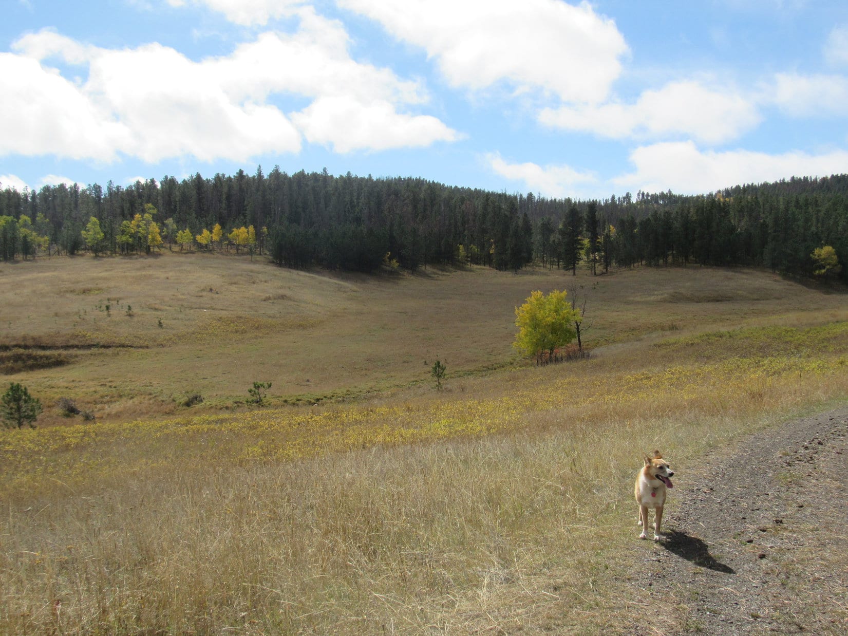
Lupe and SPHP crossed over Muddy Mountain Road entering a giant green field full of purple lupines. The sun was shining. The lupines danced in a lively breeze. Loopster took the lead, sniffing happily. Her destination was 4 or 5 miles away, somewhere along the N rim of the long ridge. Muddy Mountain was going to be fun after all!
NO, IT WASN’T! That sound! Lupe must have passed within 4 or 5 feet of where it was coming from. She was scarcely 25 feet from Muddy Mountain Road when an angry buzzing started as she went by. SPHP looked cautiously around for the deadly source. Oh, yeah. There it was, still rattling down in a small depression, ready to strike. A fairly big one.
Lupe had scarcely started on her way up Muddy Mountain when she passed close by this fairly large rattlesnake hidden in a small depression.
Lupe was already a good 15 feet beyond the rattler. She was fine.
Loopster! STAY, SIT! Don’t move! Good girl! Stay right there!
Lupe waits for SPHP to come and guide her safely back around the rattlesnake. Her trek up Muddy Mountain was over almost before it began. This was as far as she got, not much more than 40 feet from Muddy Mountain Road. Photo looks SE.
SPHP sounded so serious, Lupe obeyed instantly.
Umm, what’s up? What’s wrong?
A rattlesnake, a pretty big one, you just went right by it. This hike is over, sweetheart! Wait there, I’ll lead you back around the evil serpent. It’s poisonous and very dangerous, even for an American Dingo.
We’re not going to Muddy Mountain?
Yes, yes we are. But suddenly I’ve been seized with a desire to drive every inch of the way to the top. Easy, squeezy-like, and hopefully serpent-free.
Only 10 minutes after starting out, the Carolina Dog was back at the G6 (2:44 PM, 67°F). A nice dusty drive clear to the top of Muddy Mountain ensued. To SPHP’s great surprise, a campground was right at the summit, complete with a big deck overlooking the view to the N. It turned out there was a fairly extensive trail system in the area, too. No wonder the road was so busy! The old topo map hadn’t shown all this.
Lupe and SPHP checked out the view of Casper Mountain from the observation deck.
Although not shown on the old topo maps, Lupe discovers Rim campground at the summit of Muddy Mountain. SPHP had expected Muddy Mountain to be lonely and remote. Instead it’s a popular spot!Near Rim campground, right along the N rim of Muddy Mountain, is this big observation deck with a view of Casper Mountain to the N. Photo looks NNW.Part of the huge Casper Mountain ridge as seen from the observation deck. (Summit not pictured to the L of this photo.) Photo looks NNW.The observation deck was sunny and bright.
A couple of large rocks sat a short distance E of the observation deck. They appeared to be the absolute highest point around. The American Dingo strolled over for a super easy peakbagging success. Peakbagging Muddy Mountain turned out to be scarcely any more effort than Prairie Dog Hill(6,400 ft.) had been yesterday.
Another cheap peakbagging success. Lupe stands on the natural summit of Muddy Mountain. Part of the observation deck is seen on the L. Photo looks NW.Hey, it wasn’t a cheap peakbagging success! I braved a huge rattlesnake to get here!Wildflowers near the summit rocks.
Checking out the view from the observation deck and tagging the summit hadn’t taken long. Lupe still had one more task to perform up on Muddy Mountain, though. She could go look for the Muddy Mountain survey benchmark. The topo map showed it wasn’t actually at the summit, but at another slightly lower high point about 0.75 mile W.
SPHP drove over that way, parking the G6 along the road slightly E of where it seemed the survey benchmark ought to be. Lupe hopped out. She headed W exploring a narrow strip of open ground between the road and N rim of the mountain. SPHP followed, nervously keeping an eye out for rattlesnakes, while searching for the benchmark.
As Lupe sniffed her way along, she came to a nice view to the WNW.
While searching for the Muddy Mountain survey benchmark, Lupe came to this pretty view to the WNW. Circle Drive is seen on the R.
Lupe went about 600 feet from the G6. No sign of the survey benchmark. The terrain was gradually dropping now, too. The benchmark wouldn’t be any farther W than this. Might as well turn around.
The Carolina Dog headed back E. Again SPHP followed, trying to search more thoroughly. Nothing. Lupe arrived back at the G6. Now what? SPHP checked the topo map again. It was possible the benchmark was a bit E of here.
SPHP had parked the G6 a little W of a few pine trees close to the N side of the road. Beyond them to the E was a nearly level field rimmed by pines to the N. The field, which was full of purple and yellow wildflowers, widened out to the E in the shape of a long triangle. Better go look over there, too.
Lupe scarcely got past the first few pine trees when she found it! The survey benchmark was right there, fixed in concrete, barely 50 feet from the G6 and only 10-12 feet N of the road. Sweet!
This what you’re looking for SPHP? …… Oh, yeah! That’s it Looper. Good job!The Muddy Mountain survey benchmark is only 10-12 feet N of the road about 0.75 mile W of Rim campground.
Well, that was that. What now? Maybe it would be fun to go take a look at the map of the trail system on Muddy Mountain. The main trailhead was nearly 0.5 mile E at an intersection on the S side of the road. Lupe was fine with going back to check it out, so SPHP drove over to the trailhead. A large map was on display.
This map of the trail system on Muddy Mountain is on display at a trailhead on the S side of the road about 0.25 mile W of the turn for the Rim campground.
The trail system map revealed that Muddy Mountain Road made a big loop from here. A little S of this trailhead was another campground, Lodgepole campground. Several different trails offered a variety of possible loops between Lodgepole and Rim campgrounds. The trails were all relatively easy. None involved more than a couple hundred feet of elevation change, if that.
No doubt there was little danger, but that rattlesnake was still too fresh on SPHP’s mind. Loop was going to skip any exploration of the Muddy Mountain trail system. More challenging things would soon be in store for the Carolina Dog, anyway. In the meantime, she could stop and look at some of the views from Muddy Mountain on the way back to Casper.
Loop along the N rim of Muddy Mountain on the way back to Casper. Photo looks NW.At another rock along the N rim. Photo looks NE.Checking out some rocks S of Muddy Mountain Road. Photo looks SW.Rockin’ Muddy Mountain
On the way up Casper Mountain(8,200 ft.), Lupe stopped for a final look back at Muddy Mountain(8,300 ft.). In the late afternoon sun, the views were beautiful. Off to the SW, light rain showers were seen in the distance. More mountains could be seen beyond the Laramie Range.
Lupe would eventually be headed that way, but not quite yet.
The lower W end of the long Muddy Mountain ridge is seen on the L. Beyond it are mountains of the Shirley Range. Photo looks SW.A final look back at Muddy Mountain from Circle Drive on the lower S slopes of Casper Mountain. Photo looks SE.
In Casper, SPHP grabbed a couple of cheeseburgers. Lupe shared in the cheeseburger feast on the drive E back to Douglas along I-25. Day ended with a gorgeous evening drive once again SW of Douglas on Hwy 91. Ahead Lupe could see where she would be adventuring next.
Tomorrow Lupe would try to climb both Squaw Mountain(9,313 ft.) and Buffalo Peak(9,387 ft.). Hopefully it was going to be a fabulous day!
Approaching La Prele Reservoir on Hwy 91 SW of Douglas, WY. Photo looks WSW.Squaw Mountain(9,313 ft.) (slightly L of Center) and Buffalo Peak(9,387 ft.) (R) come into view SW of La Prele Reservoir.Loop on the way to her next adventure in the Laramie Range. Photo looks N.Adventure dead ahead! Squaw Mountain (L) and Buffalo Peak (Center). Photo looks SW.Squaw Mountain (L) and Buffalo Peak (R) from Cold Springs Road. Bear Rock in the foreground. Photo looks SW.
Lupe’s visit to Muddy Mountain hadn’t been long or hard, but it had been plenty exciting. Too exciting, actually!
Muddy Mountain rattlesnake, Laramie Range of Wyoming 6-11-17
Start – 10:57 AM, 52°F, intersection of South Rapid Creek Road (USFS Road No. 231) & USFS Road No. 191.
Lupe’s summer of 2017 adventures were over. Her friend, Australian adventurer Luke Hall, who had recently paid her a visit here in the Black Hills, was gone. Things were finally back to normal! For the first time since early June, it was just Loopster and SPHP setting out on a Black Hills, SD expedition.
This expedition was looking promising, too! Cows, so many beautiful cows, were right here near the start! Lupe was thrilled. The cows less so. In fact, they looked on with deep concern. Wasn’t that one of those ferocious American Dingoes?!
Expedition No. 209 was getting off to a promising start. Look at all those beautiful cows! Lupe was thrilled! Photo looks E.Looking the opposite direction from the cows up the valley of the South Fork of Rapid Creek. USFS Road No. 231 is seen on the R. Photo looks W.
The cattle needn’t have worried. They didn’t get chased, barked at, or devoured. Instead, SPHP started SSW on USFS Road No. 191, leading Lupe up Long Draw. When Lupe reached an intersection 0.5 mile later, she turned W on No. 191.1A.
At the start of USFS Road No. 191.1A in Long Draw. Photo looks W.
In the next 0.5 mile, No. 191.1A curved S, then W again. Lupe reached another junction. She had been this far once before over 2 years ago on Expedition No. 138. That time she’d stayed in Long Draw, continuing W on No. 191.1A. This time, just for something different, she turned SSW up Lessering Draw on No. 191.1C.
Near the start of Lessering Draw. Looper yawns waiting for SPHP to get on with it and snap the shot! Photo looks SSW.
Lupe had seen a small stream in Long Draw. A tiny, trickling tributary of it was here in the lower end of Lessering Draw. When the road entered a pine forest, Lupe spotted an abandoned cabin near the tiny stream. The Carolina Dog went to investigate.
Checking out the old cabin in Lessering Draw. Photo looks SSW.
SPHP wouldn’t let Looper go inside the old cabin for fear of rusty nails or broken glass, but she did peer in to see what it was like. “Dilapidated” pretty much sums it up. Clearly, many years had passed since this cabin was inhabitable, even in the most rustic sense of the word.
Lupe returned to No. 191.1C continuing SSW.
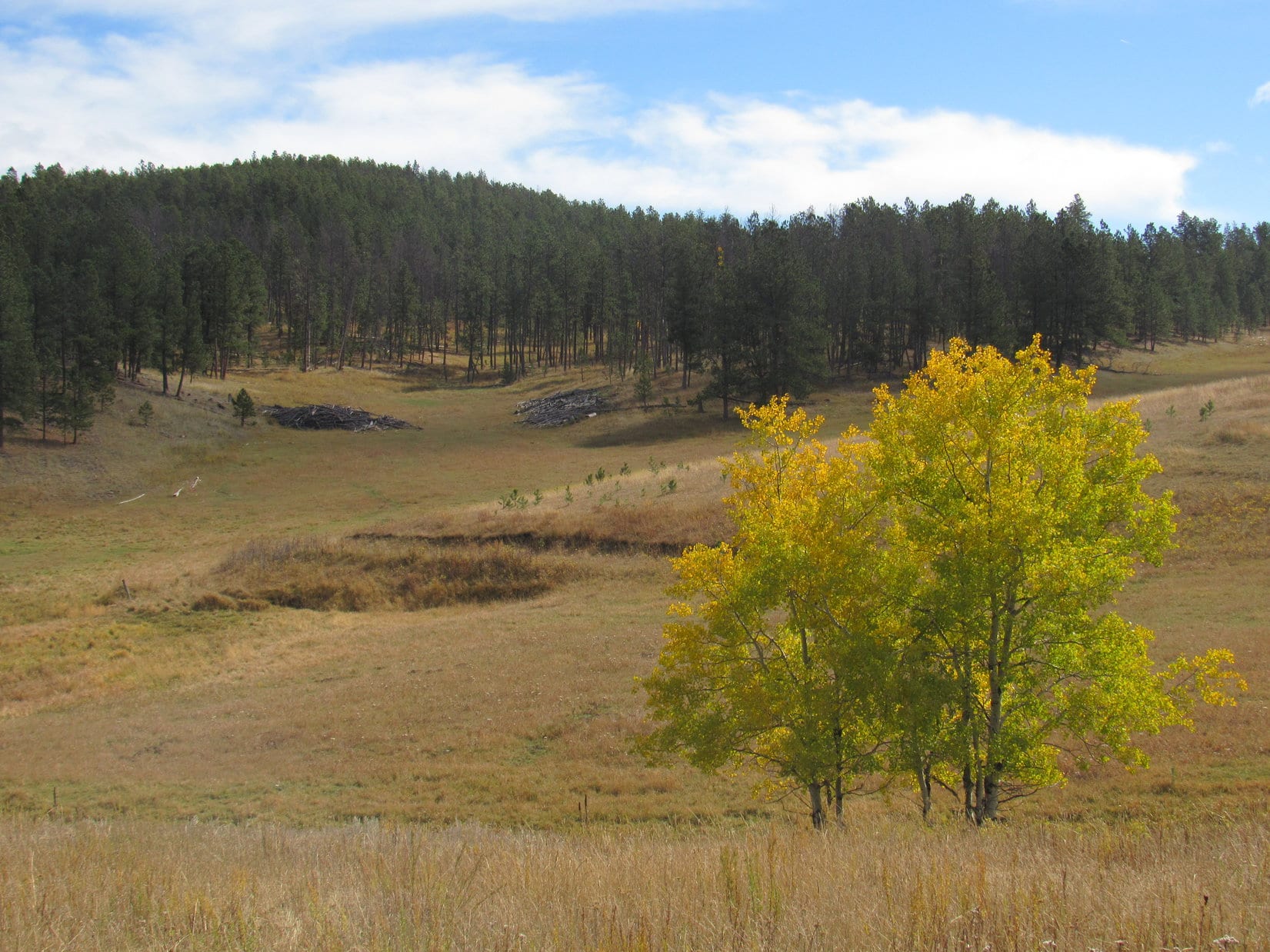
Not far from the old cabin, Lupe re-emerged from the forest. The road curved W passing through a lovely large meadow surrounded by low forested hills. Aspen trees, greatly in the minority along the edge of the pines, were showing a bit of fall color.
Beyond the old cabin, Lupe reaches a large meadow. Aspen trees were beginning to show a little fall color. Photo looks SW.A bit farther on, another view of the same meadow. Photo looks ESE.
As Lupe proceeded through the meadow, No. 191.1C faded away to little more than a grassy track. At the far end was a barbed wire fence. An opening in the fence brought Lupe to USFS Road No. 125.
Lupe reaches USFS Road No. 125. The big meadow she had come through in Lessering Draw is still in view on the L. Photo looks ESE.
The Carolina Dog and SPHP continued W on No. 125. The road passed through a narrow, forested part of upper Lessering Draw, which soon divided. Lupe stuck with No. 125, as it curved N up one of the ravines to a minor pass.
Right at the pass was a barbed wire fence running roughly SW/NE. Lupe went over a cattle guard to get past it. (American Dingoes are highly skilled at crossing cattle guards!) From here, No. 125 went N down the other side of the pass. SPHP surmised it was heading for Maitland Draw.
Lupe needed to go more W than N. White Tail Peak(6,962 ft.), her objective for the day, was 1.5 miles WNW of the pass. Lupe left the road to follow the fence line WSW up a forested slope. Upon reaching a ridge, she abandoned the fence to follow the ridge NW toward High Point 6346. On the way, White Tail Peak came into view.
Nearing High Point 6346, Lupe gets her first view of White Tail Peak on Expedition No. 209. The summit is on the R. The mountain’s long SE ridge extends all the way to the L. Photo looks WNW.Loopster astride High Point 6346. Peak6962 is seen in the distance. Photo looks SW.
Loop easily leapt up onto the rock formation at the top of the ridge. She stood astride High Point 6346. That done, she pressed on to the NW toward White Tail Peak. She was looking for the easiest way to get there with minimal elevation loss. As it turned out, she could soon turn W toward the mountain without having to lose much at all. She even came across a road leading W. The road soon forked at Point 6424.
The road Lupe had been following was USFS Road No. 190, which angled NNW from here. A side road going SW was marked No. 190.1A. Lupe and SPHP had been on No. 190 before on prior expeditions to White Tail Peak. Lupe could eventually work up and around to the summit that way. A more direct route, though, would be to scale the mountain’s SE slope. Today, Lupe had a special reason for doing so.
It looked feasible. Lupe and SPHP left both roads behind, heading NW up a grassy slope of open forest. Scattered deadfall provided the only obstacles. The Carolina Dog purposely headed for the area between the mountain’s short and long SE ridges. After traveling some distance, Lupe arrived at the edge of a golden forest.
Lupe arrives at the golden forest SE of White Tail Peak.At the edge of the golden forest (R). The ridge beyond Lupe is part of White Tail Peak’s long SE ridge. Photo looks W.Happy Lupe in the forest of gold.
Lupe happily sniffed her way through the magical forest of gold. Above the golden forest, her climb steepened. Would she would encounter a blocking line of limestone cliffs? SPHP knew cliffs rimmed large portions of the upper E and S sides of White Tail Peak.
No cliffs appeared. The American Dingo’s ascent didn’t even get all that steep before the terrain started leveling out again. Lupe came to a faint road. She followed it a little S, reaching a line of ragged limestone outcroppings. This had to be it! The spine of White Tail Peak’s long SE ridge.
Lupe reaches the limestone spine of White Tail Peak’s long SE ridge. Photo looks S.
This was Lupe’s 4th Black Hills, SD Expedition to White Tail Peak. Yet to SPHP there had always been something lacking on her prior visits. Long ago, so long ago it had been before there was a Carolina Dog, SPHP had been here alone. Tattered, cobwebbed memories existed of a grand viewpoint at the end of a long march S.
To SPHP those memories were the essence of White Tail Peak. SPHP had always wanted Lupe to see those sweeping views, but she had never run across them again. Were the memories real, dreams, or confused with some other place?
On all of her prior expeditions here, Lupe had visited a limestone ledge SE of the summit where she’d enjoyed some very nice views. However, they had never seemed as dramatic as SPHP’s old memories of White Tail Peak. A sense of disappointment always lingered.
On one occasion, Lupe had specifically gone looking for the site of SPHP’s old memories. Somewhere W of her usual limestone ledge, she’d found a much longer ridge going S. Her exploration of it revealed some different vantage points. However, none seemed familiar or measured up to SPHP’s expectations. This wasn’t the place, either.
Today the plan was for Lupe to find out the truth. SPHP had never allowed her to do a truly thorough search before. And most helpfully, for the first time, SPHP had brought along a topo map.
The topo map revealed that White Tail Peak has 3 ridges protruding to the S – a short SE ridge, a long SE ridge, and a long SW ridge. Studying it had convinced SPHP that Lupe had never been to White Tail Peak’s long SE ridge. The long ridge she had visited must have been the long SW ridge. The other times she had only been to the limestone platform near the end of the short SE ridge.
Her successful ascent from the SE up a visible gap between ridges made SPHP confident Lupe now stood on the long SE ridge’s limestone spine right at this very moment! All that remained was to follow the ridge however far S or SE it went.
It was exciting to think Lupe was on the verge of discovery! First, though, SPHP thought it best to go find White Tail Peak’s non-descript summit. May as well make certain of locking in a successful full ascent before doing anything else. Peakbaggers think like that. Instead of going S, Lupe followed the faint road N.
Within minutes, the American Dingo reached a junction. Ahh, so this was the turn SPHP had always missed or dismissed before! Lupe was practically at the summit, it was only 100 feet to the NW. She went up to claim her peakbagging success.
Lupe reaches the flat, non-descript true summit of White Tail Peak. It’s possible to drive right to it from the N on an ATV. Photo looks N.
Lupe had visited the short SE ridge every other time she’d come to White Tail Peak. Though the views didn’t completely measure up to SPHP’s old memories, they were still impressive for the Black Hills. It wasn’t far away. Lupe might as well go take another look at them while she was here. It was tradition now!
On the winding road leading from the summit to the viewpoint at the end of the short SE ridge.
Looper and SPHP followed a familiar winding road SE through an immature pine forest. A few minutes brought Lupe to her usual White Tail Peak viewpoint. Time for a break and a look around. This was still a favorite place!
The view to the NE from the short SE ridge.
SPHP relaxed munching an apple. Lupe devoured Taste of the Wild. Water for all, though it wasn’t much needed. The day had gone from mostly cloudy to overcast and noticeably cooler than before. While Lupe and SPHP watched, even lower clouds streamed in from the NW. A chill breeze blew way up here. The incoming clouds were low enough so wisps of fog sailed by.
The low gray clouds were all part of one huge one. The monstrous cloud fanned out rapidly, spreading gloom across the Black Hills. Sunshine fled its influence, retreating far to the SE. The apple gone and Lupe satisfied, it was time for a few photos.
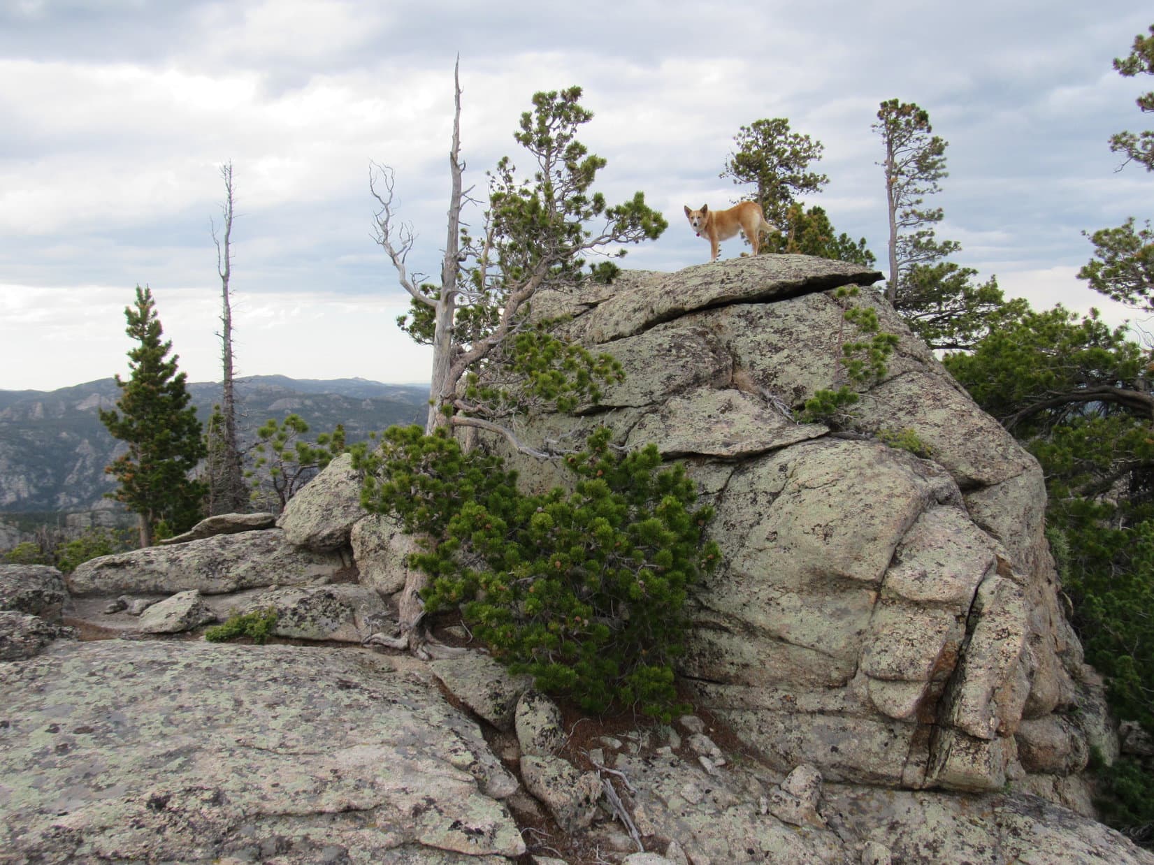
Looking N from the short SE ridge.Looking SW. Lupe had come up somewhere over on the now somewhat foggy ridge seen here, which had to be part of White Tail Peak’s long SE ridge.Lupe stands on a narrow rock pathway leading to the last limestone platform at the end of White Tail Peak’s short SE ridge. Photo looks SE.At the very end of the short SE ridge. Photo looks SE.Same view with a little help from the telephoto lens.
The photo session over, Lupe and SPHP left the short SE ridge, retreating NW back to White Tail Peak’s summit. Enveloped in a thickening fog, the mountain was growing colder and gloomier by the minute.
Good grief! After coming all this way, suddenly there wasn’t any point in exploring the mountain’s long SE ridge. Even if it led to the views SPHP remembered, Lupe wasn’t going to be able to see a thing. Disappointment reigned.
Nothing could be done about it. May as well forget about the whole thing. Another time. Would have had some nice fall colors, too. Should have gone there first! Sigh.
Reluctantly, SPHP led Lupe on the road N, away from the still unexplored long SE ridge. May as well head for USFS Road No. 190. It would take her E down off the mountain. Maybe Lupe could explore some sort of an interesting loop on the way back to the G6?
Lupe went all the way N to No. 190, and began following it E. She’d already lost some elevation, and was about to lose a bunch more, when suddenly the sky brightened. Uncertain, Lupe and SPHP paused. The trend continued.
Apparently conditions weren’t going to continue deteriorating after all. It wasn’t going to be so bad. The monstrous cloud wasn’t as dark or low as before. The breeze was dying down and the air felt warmer. Maybe Lupe could see something from the long SE ridge after all?
Worth a shot. Back Lupe went. To the summit again and beyond. Lupe made the turn onto the faint road, which wasn’t so faint near the intersection. She reached the limestone spine of the long SE ridge where she’d been before.
OK, this was it! The moment of discovery was at hand. Lupe explored S. Up and down, onto and off of the discontinuous limestone spine. Multiple times. For a while, the forest hid everything. Lupe went on, now heading SE. She lost elevation, but not too fast. Didn’t this have to be it?
Then there it was. A first small limestone ledge with a view to the SW, a view worthy of what SPHP remembered. Lupe was on the right track! Naturally, she went over to see this glorious sight.
Lupe reaches the first small limestone ledge along the long SE ridge with a view like SPHP remembered from long ago.
To the SW, Lupe saw a broad canyon, created over eons by the North Fork of Castle Creek. The creek wasn’t visible, but far below aspen trees glowed with the fleeting glory of early autumn.
Across the gaping canyon was Peak6962, a remote mountain so alike to White Tail Peak(6,962 ft.), the summit was even the exact same elevation. Just below its forested upper reaches, limestone cliffs extended around the N and E edges of the mountain. Cliffs like those Lupe now perched above.
Peak 6962 (L) is the long, forested cliff-rimmed ridge on the far side of the gaping canyon of the North Fork of Castle Creek. Far below Lupe’s perch, millions of dying aspen leaves go out in a blaze of glory. Photo looks SW.
Looking SE along the edge of the long ridge Lupe was on revealed a series of similar viewpoints nearby.
Looking along the SW edge of White Tail Peak’s long SE ridge. Plenty more viewpoints were ahead for Lupe to check out before she would reach the end! Photo looks SE.
Traveling onward, Lupe checked out viewpoints along both sides of the long SE ridge.
At another viewpoint a little farther SE. Same basic view with Peak 6962 on the L. Photo looks SW.Another look from farther back at Lupe’s vantage point. Photo looks SW.Now out at the very end of the same vantage point. Photo looks WSW.Still there with Peak 6962 on display across the entire background. Photo looks SW.Now on the opposite (NE) side of the long SE ridge. White Tail Peak’s short SE ridge, which Lupe had always gone to before, is in view. Photo looks N.Looking NE toward Custer Peak(6,804 ft.) (Center).Custer Peak with help from the telephoto lens. Photo looks NE.
At the far SE end of the long ridge, Lupe finally found the big, nearly flat, open viewpoint SPHP remembered. Even on an overcast day, the panoramic views were fabulous!
Out at the very end of the long SE ridge. Reynolds Prairie is the large grassland far beyond Lupe. Black Elk Peak(7,231 ft.) (L), Green Mountain(7,164 ft.) (R), and many other mountains Lupe has been to are seen on the horizon. Photo looks SSE.Black Elk Peak (L) on the horizon. Photo looks SE.Flag Mountain(6,937 ft.) (L) and Peak 6962 (R). Photo looks S.Canyon of the North Fork of Castle Creek. Photo looks SW.Looking NW along the ridge.
Perhaps on some bright sunny day, Lupe will return to White Tail Peak for a 5th time to see it all again beneath crystal blue skies. For now, though, SPHP was content. Lupe had rediscovered this glorious vantage point overlooking a vast portion of the central Black Hills. White Tail Peak was everything dim memory had credited and cherished it as.
A cool breeze still blew. Hours had flown by. Time for the intrepid Carolina Dog to move on. Puppy ho! Lupe headed NW, back the way she had come.
On the way back, still on the long SE ridge. Green Mountain (L) is far on the horizon. Flag Mountain (Center) and Peak 6962 (R) in view closer by. Photo looks S.
As soon as practical, SPHP looked for a way for Lupe to get down off the long SE ridge. She soon came to one. Safely down, Lupe roamed the long slope to the SE, passing the same golden forest on her way back to the junction of USFS Roads No. 190 & 190.1A.
Heading down.Passing the golden forest again.
Lupe had fun on the way back to the G6. SPHP led her N on USFS Road No. 190 hoping to make a nice loop. The American Dingo wound up going much farther N than anticipated. A trail or road shown on the topo map failed to materialize. An unmarked side road SPHP did try did not turn E as hoped. Instead it began to fade away somewhere W of High Point 6217.
Enjoying the colorful woodlands.Heading NNW on USFS Road No. 190. A road or trail shown on the topo map that SPHP was counting on to go E failed to materialize. Photo looks NNW.A side road off No. 190 that SPHP did have Lupe try kept going N. Here it threatens to fade away completely. Photo looks N.
The failing road had to be abandoned. Lupe bushwhacked E a long way. Deadfall slowed progress considerably. The sun must have set or was close to it. Light was fading. Hurry, hurry!
Yes! A road! Good deal, and none too soon. SPHP quickly figured out that it was leading toward Long Draw. Immediately overconfident again, SPHP had Lupe take a turn into Maitland Draw instead.
In the dim light, Lupe saw, sniffed, or otherwise sensed a presence before SPHP realized it was there. Cows! Way out here. Enthusiastic Lupe streaked off barking.
The American Dingo returned before long, panting hard and apparently well satisfied with her romp. Certainly more pleased than the annoyed cows had been.
No more of that, Loopster! It’s getting dark anyway. Better stay close.
Just grand. The road didn’t go all the way through Maitland Draw like the map showed! It turned S instead of staying E. Maybe that wasn’t so bad? SPHP suspected Lupe was on USFS Road No. 125. Sure enough, she reached the cattle guard back up at the minor pass. The rest of the way to the G6 was known. Lupe had come this way earlier. She would soon be back in Lessering Draw.
A curious, and perhaps very sad thing had happened shortly before Lupe reached the minor pass. At first it seemed simply strange and unexpected. Lupe had quit barking at the cows some time ago, when suddenly there was an answer! A wild barking or howling, from off to the NW.
A coyote? Maybe. Lupe listened, but showed little interest and did not respond. After a few minutes, it was not heard any more. On the long dark trudge back to the G6, SPHP reflected, and eventually felt guilty and sad. Glittering stars in an ink black sky shone down with a cold, cruel light.
Maybe an answer should have been made?
The more SPHP thought about it, the more that wild sound had seemed desperate. Perhaps desperately searching. What if it hadn’t been a coyote? A poor lost or abandoned dog way out here? Maybe it had heard Lupe and thinking salvation was at hand, had come running a great distance with soaring hopes looking for her? If so, the disappointment at not hearing a response, and not knowing which way to turn, must have been crushing.
White Tail Peak had been a great and successful day for Lupe, but the accusatory thought persisted. Perhaps the day had also needlessly ended as a bitterly cruel one for an innocent, lonely creature in need of help? The uncertain truth remained somewhere out there, shivering alone in darkness, now miles away beneath eternally uncaring silvery stars. (End – 7:40 PM, 35°F)
Day 3 of Lupe’s 2017 Dingo Vacation to the Laramie Range, Wyoming & Beyond!
SPHP drove slowly. Ahead Eagle Peak(9,167 ft.) was lit up by the early morning sunshine. The E face of the mountain looked tough. Not that it mattered now. Yesterday Lupe had come close to reaching the top of the mountain from the SE and SW sides. She hadn’t quite made it, though, and there wasn’t going to be another attempt today.
Eagle Peak in the early morning sunshine. Yesterday Lupe had nearly reached the top of the mountain, but failed to find a way up the last few tens of feet. She wasn’t going to make another attempt today. Photo looks WNW.
I hope we have better luck today at South Sawtooth, Loop.
SPHP spoke without much conviction. Those contours on the topo map were as tight near the top of South Sawtooth Mountain(8,723 ft.) as they were at Eagle Peak. Success was far from guaranteed.
Success was guaranteed at Prairie Dog Hill(6,400 ft.) a mile N of Esterbrook. County Road No. 5 went practically right over the top of it. Lupe sniffed her way through a nearly flat field. Elevation gain to what seemed to be as much the high point as anywhere else was trivial, less than 10 feet. Whoop-de-doo! At least there was a bit of a view.
Lupe on Prairie Dog Hill, a trivial peakbagging accomplishment. It was so flat it was hardly even a hill. At least she had a distant view of Laramie Peak(10,272 ft.) (L) and Eagle Peak(9,167 ft.) (R). Photo looks SW.
Although South Sawtooth Mountain is only 9 miles NNW of Eagle Peak as the crow flies, it was many times that far by road. Lupe first had to go clear to Douglas, WY. While in town, SPHP picked up a few supplies. At very small Locomotive Park where the Douglas Railroad Interpretive Center is located, Lupe got to visit a very large Jackalope.
Lupe visits the giant Jackalope at Locomotive Park in Douglas, WY. Douglas is the Jackalope capital of the world!
Lupe was disappointed to find that the Jackalope was merely a statue, but as large as the Jackalope was, perhaps that was for the best. In any case, the Carolina Dog was soon ready to move on.
The long drive out Hwy 91 SW of Douglas is one of SPHP’s favorites for gorgeous western scenery. Lupe likes it for all the cows and horses to bark at along the way. The highway eventually ends and turns to gravel. Many more miles of dusty road eventually brought Lupe to the Curtis Gulch campground along La Bonte Creek.
SPHP parked the G6 near the campground entrance. Lupe set out for South Sawtooth Mountain (10:36 AM, 68°F) heading SW on USFS Road No. 658. On the way in, SPHP had seen a sign for Big Bear Canyon about 0.33 mile away. Lupe soon reached this side road (USFS Road No. 657.01), which almost immediately led to a ford of La Bonte Creek.
Almost as soon as Lupe reached USFS Road No. 657.01 to Big Bear Canyon, the road led to this ford of La Bonte Creek. Photo looks SW.
The water was high this time of year. Although the surface looked calm, La Bonte Creek was wide at the ford, and over Lupe’s head. Upstream and downstream, the current was clearly strong. American Dingoes like wading, not swimming, but SPHP knew Lupe could swim if necessary. She ought to be able to manage this crossing.
Still, SPHP wasn’t thrilled to see the ford. Only 3 days ago, SPHP had bought new boots for this Dingo Vacation, and they weren’t waterproof. To keep from getting the new boots soaking wet, SPHP decided to take them off and wade the stream barefoot. SPHP stuffed a sock inside each boot, laced them together, and draped a boot over the back of each shoulder with the knotted laces across the throat.
While Lupe watched from shore, SPHP waded into La Bonte Creek. The current was fairly strong, and the water as much as thigh deep. Rocks on the bottom were loose and sometimes slippery. Concentration was required to maintain balance, but SPHP managed to get most of the way across uneventfully.
Was Lupe following? Yes and no. SPHP turned around to see the Carolina Dog still near the opposite shore. She wanted to come, and had waded chest deep into La Bonte Creek, but was reluctant to go any deeper.
Lupe waded chest deep into La Bonte Creek, but was afraid to go any deeper.
Loopster was going to need some encouragement. SPHP waded the rest of the way across, then turned around again to call to her.
Meanwhile, desperate not to be left behind, all on her own Lupe had decided to try crossing La Bonte Creek on the downstream side of the ford. The water wasn’t as deep here, but the current was powerful. SPHP was alarmed to see Lupe neck deep struggling to cross without being swept downstream. Fortunately, her legs were just long enough for her paws to touch bottom. Lupe clawed her way forward despite the current.
In a flash, Lupe was past the moment of danger. She reached much shallower water, and came trotting across just fine.
Lupe trots the rest of the way across La Bonte Creek after clawing her way past a dangerous deeper part on the downstream side of the ford. Photo looks NE.
Glad that’s over with Loop! Good girl! You did great, but maybe we can find a safer way across on the way back? Not looking forward to doing that again.
SPHP put socks and boots back on again. The trek along USFS Road No. 657.01 resumed. Lupe reached two more creek crossings in quick succession.
Lupe in lower Big Bear Canyon between creek crossings. The rocky mountain seen in the background is on the N side of La Bonte Canyon close to Curtis Gulch campground. Photo looks NE.
Fortunately, La Bonte Creek had already forked by the time these next stream crossings were reached. Flow was less than half of what it had been at the first ford. Lupe had no problems crossing now. SPHP again crossed barefoot each time, the creek still being too large to leap over.
USFS Road No. 657.01 now went steadily SSE up Big Bear Canyon. Lupe came to no more creek crossings for more than 0.5 mile. When she did reach more crossings, the creek was considerably smaller than before. SPHP could now leap across, avoiding the tedious necessity of removing the precious new boots each time.
The day was sunny and warm. Lupe was now enjoying cooling off and getting drinks from the stream.
Lupe enjoys cooling off in the diminished stream on the way up Big Bear Canyon.
Big Bear Canyon was heavily forested most of the way. Sometimes there were views of large rock formations hundreds of feet higher up along the E side of the canyon. Farther on, high forested mountainsides were visible on the W side of the canyon, too. Mostly though, the views were only of the forest along USFS Road No. 657.01.
Lupe on her way up Big Bear Canyon on USFS Road No. 657.01. Photo looks SSE.About halfway up Big Bear Canyon, Lupe reached this pond. The creek flowed through it. Photo looks SW.
Lupe followed USFS Road No. 657.01 for more than 3 miles all the way up Big Bear Canyon. The road gained elevation more quickly toward the end. About the time the rate of climb began to diminish again, SPHP spotted a mountain off to the NE. The view was partially obstructed by trees, but what could be seen was concerning.
Was that South Sawtooth Mountain? If so, Lupe wasn’t likely to have much luck reaching the summit. The rocky upper slopes looked nearly vertical. Sigh. Not another defeat! Nothing to do, though, but carry on. Maybe that wasn’t South Sawtooth, or there actually was a way up. Hard to tell from here. The mountain was still a couple miles away.
The terrain completely leveled out as the road left the upper end of Big Bear Canyon. Lupe soon arrived at a 3 way junction. A sign identified the road Lupe needed to take as Sawtooth Road. On the topo map it was USFS Road No. 615, which started out heading ENE from here.
Lupe reaches a 3 way junction at the flat, forested saddle beyond the upper end of Big Bear Canyon. USFS Road No. 615, which Lupe would need to take partway to South Sawtooth, is seen winding away into the forest. Photo looks E.
Before taking No. 615 toward South Sawtooth, Lupe explored another road leading a short distance SW to USFS No. 610. She passed a sunny meadow full of lupines along the way.
Lupe among the lupines.
Lupe went far enough to have some views of mountains off to the SW and NW before turning around. She then returned to the first junction, and started along USFS Road No. 615.
Before long, No. 615 emerged from the forest. The road began climbing steadily up a draw which was mostly meadow. At the upper end of the draw, Lupe re-entered the forest. The road wound around to the E and NE, but after a mile or so, turned N. The topo map showed that right after reaching a crest, No. 615 would turn W and start losing elevation. Ultimately it would dead end in a canyon.
Lupe reached the crest of USFS Road No. 615. Time to leave the road! Lupe and SPHP turned NE, and started climbing a heavily forested hillside. Little could be seen except trees until Loop reached the top of a broad ridge. Here there were big rocks and some open ground. From one of the higher rocks, the American Dingo had a view of the mountain SPHP had seen earlier.
From a rock on the broad ridge, Lupe catches sight of South Sawtooth Mountain! Photo looks N.Lupe reaches the broad ridge at a perfect point! She had arrived up on the ridge just far enough NE to avoid having to go over High Point 8401, seen behind her. The open ground on the gently sloping ridge was easier to traverse than going through the forest. Photo looks SSW.
Up on the broad ridge, there was enough open ground to make travel much easier than in the dense forest Lupe had left behind. Lupe and SPHP continued NE, skirting a series of rock formations along the NW side of the ridge.
Another large ridge could soon be seen. It trended NW to join the ridge Lupe was on. Beyond the junction, the combined ridge went N and narrowed somewhat. Lupe came to a rock formation larger than any of the others she had passed to this point. South Sawtooth Mountain was now less than a mile away.
Beyond the ridge junction, Lupe came to a larger rock formation (L of Center) than any of the others she’d been passing by. She got around the SW (L) side of this one. South Sawtooth Mountain is seen in the distance now less than a mile away. Photo looks N.
Beyond the first large rock formation, Lupe came to some beautiful open ground leading to a second, even grander rock formation.
Approaching the 2nd, even larger, rock formation (R). South Sawtooth Mountain is now on the L. Photo looks N.
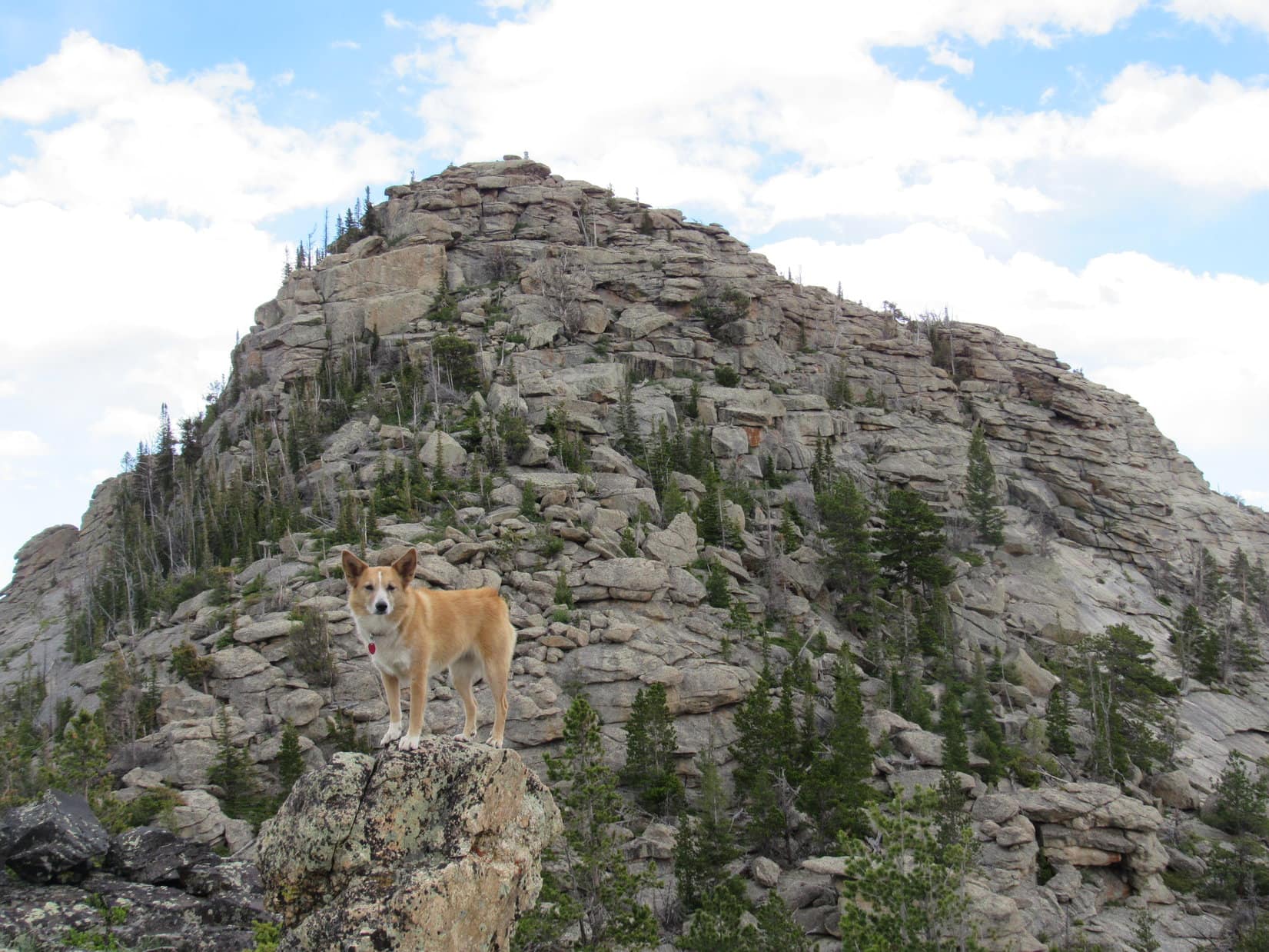
From the W side of the second rock formation, Lupe had the best view of South Sawtooth Mountain she’d seen yet. However, the sight caused SPHP to lose all hope that Lupe would succeed in reaching the top. The mountain was simply too vertical and rough. Most disappointing!
Maybe Lupe could still reach the top of the high point on the lower W ridge, though? That looked easy enough. At least the Carolina Dog had a new objective to pursue. Who knew, maybe things would look different from up there?
At the second and largest rock formation Lupe reached on the ridge, she had her best view yet of South Sawtooth Mountain. The daunting S face crushed hopes that Lupe could reasonably expect to reach the top. The high point of the lower W ridge (L), became Lupe’s new reduced objective. Photo looks N.
Lupe and SPHP tried to get around the E side of the second rock formation, but a long wall of rock blocked the way. Lupe was forced to retreat back to the W. What could be seen of the rest of the ridge leading to South Sawtooth looked forbidding. The ridge dropped sharply beyond this rock formation, before rising again and continuing N as an impossibly rough series of huge rock outcroppings. No way!
A grassy opening was visible to the W down at the bottom of a valley about 150 feet lower than where Lupe was now. Time to abandon the ridge. Lupe and SPHP started W down a fairly steep forested slope. As the ground began leveling out near the bottom, there was movement. Instantly, Lupe dashed away in hot pursuit!
SPHP never had a clear view of what she was after. Whatever it was had a huge lead, and bounded S through the forest at very high speed. Loop never got anywhere close, and soon gave up. SPHP got only tree-broken glimpses. The creature was gray and bounded like a rabbit, but it was far, far larger than any rabbit. Even Lupe was tiny by comparison.
A bear? Are bears still found in the Laramie Mountains? SPHP didn’t know. Maybe. Lupe returned with a huge grin on her face, panting hard. That was fun!
So what was it, Loop? A bear, or one of those giant jackalopes?
Lupe kept smiling, but didn’t say. Hardly mattered now. It was gone. Puppy, ho! Onward!
Lupe and SPHP reached the meadow at the bottom of the valley, crossed it to the W, and went over a small rise to another valley. This valley was mostly forested, and looked like it would take Lupe up to the saddle between South Sawtooth Mountain and the high point on the ridge to the W. Lupe turned N and began to climb.
Lupe on her way up the valley leading to the saddle between South Sawtooth Mountain (R) and the high point on the ridge to the W (L). Photo looks N.
Lupe made it up to the saddle with no problem at all. The whole W face of South Sawtooth Mountain was now in view. Unfortunately, no matter what route SPHP considered from here, there just didn’t appear to be a way for Lupe to reach the top. She could have climbed somewhat higher, but every possible path to the summit looked blocked by boulders or vertical rock walls somewhere along the way.
Defeat again! First at Eagle Peak, now here. No use fretting about it. The sky was clouding up. Rain showers looked like a possibility in some directions. If Lupe was going to reach the high point on the mountain’s W ridge, she had better get there before the weather deteriorated.
The W face of South Sawtooth Mountain. Although Lupe could have climbed partway up, SPHP couldn’t see any safe route to the top. There were too many large boulders and vertical rock walls. Photo looks E.
Piece of cake! Lupe was soon up on the W shoulder of South Sawtooth Mountain. A half acre of relatively flat ground contained two distinct high points. They were so close to each other in elevation, Lupe would have to climb both to be certain she’d reached the highest one.
Before Lupe climbed up on either high point, she took a general look around at some of the views available from various other vantage points.
South Sawtooth Mountain from a rock on the W shoulder. Photo looks E.Laramie Peak(10,272 ft.) is seen beyond Lupe. Photo looks SE from the same rock.Blacktail Peak (8,675 ft.) is the highest mountain seen straight up from Lupe’s head. Photo looks WSW.View to the NW. Warbonnet Peak(9,414 ft.) is the high point on the horizon L of Center. Also on the horizon straight up from Lupe are Squaw Mountain(9,313 ft.) (L) & Buffalo Peak(9,387 ft.) (R).
Although not as good as they would have been if Lupe had been able to reach the summit of South Sawtooth Mountain, the views from the W shoulder were really quite nice. Lupe could see a lot of territory from up here.
After looking around some, Lupe got up on top of the N high point first, since it seemed easiest.
Loop climbed up on top of the N high point of South Sawtooth Mountain’s W ridge first. Photo looks NW.South Sawtooth Mountain from the N high point. Photo looks ESE.
The best views of Middle and North Sawtooth Mountains were from rocks near the N high point. Though equally rugged, neither mountain was as high as South Sawtooth. Even here on South Sawtooth Mountain’s W shoulder, Lupe was higher than either Middle or North Sawtooth.
Lupe had a great view of Middle Sawtooth (R) and North Sawtooth (L). Neither of them looked like anything Lupe could climb, but she was already higher than either one right here. Photo looks NE.Middle Sawtooth Mountain (8,502 ft.). Photo looks NE with help from the telephoto lens.North Sawtooth Mountain (8,306 ft.) (R). Photo looks NNE.South Sawtooth Mountain(8,723 ft.) is the highest of the 3 Sawtooths in the area. Photo looks E.
Shortly after visiting the N high point, Lupe went and climbed the S one. Even after being up on both, it wasn’t clear which was the highest.
Lupe completes her peakbagging for the day up on the S high point. Photo looks SSW.South Sawtooth Mountain from the W ridge’s S high point. Photo looks E.Another look from the S high point.American Dingoes can occasionally be spotted in the Laramie Mountains of Wyoming.
Lupe and SPHP lingered up on South Sawtooth Mountain’s W Ridge for 30 or 40 minutes before starting back. The plan was to retrace the same route, except Lupe would try to cut through the forest and find USFS Road No. 615 again without getting up on the broad ridge S of South Sawtooth Mountain.
High Point 8401 on South Sawtooth Mountain’s long S ridge is seen straight up from Lupe. She had followed the broad ridge from there over to the meadows seen on the L on the way to the mountain. On the way back S, she would stay down in the forest on the near (W) side of the same ridge. Photo looks S.
Loop left the W ridge going down to the saddle next to South Sawtooth Mountain. She then turned S traveling down the same valley she had originally come up. This valley would turn and take her too far W before long, so she soon had to make a jog to the E over a minor ridge into the next valley over.
Lupe starts back down the same valley she had come up on the way to South Sawtooth Mountain. She had a great time exploring the forest again. Photo looks SSE.
After losing considerable elevation, Lupe gradually started regaining some as she traveled S through the forest. She was somewhere not too far W of the broad ridge she had reached N of High Point 8401 on the way to South Sawtooth, but it was hard to tell exactly where she was, or how much farther it might be to the road.
After a while, the terrain became a little rougher and rose more steeply. Some things looked vaguely familiar. Lupe continued S and eventually reached a meadow up on the ridgeline again. Now it was possible to see that Lupe was only a little SW of High Point 8401. That was good news! It meant that USFS Road No. 615 was close by.
Lupe headed SW down a forested slope. She soon reached No. 615. Now all she had to do was follow the road back to No. 657.01, which would take her back down Big Bear Canyon.
Lupe finds USFS Road No. 615 again SW of High Point 8401. All she had to do now was follow this road back to No. 657.01, which would take her back down Big Bear Canyon. Photo looks S.
The sun had set and light was fading by the time Lupe made it all the way back down Big Bear Canyon. She was now approaching the last big creek ford across La Bonte Creek. As promised earlier, SPHP searched upstream of the ford for an easier place for Lupe to cross, but found nothing. Lupe was going to have to brave the ford one more time.
Once again, SPHP went barefoot with boots tied together and dangling behind the neck. Lupe wanted to cross the same downstream side of the ford where she had made it across before. SPHP went with her to keep a better eye on how she was doing. The water wasn’t as deep here as in the main part of the ford, but the current was far stronger.
Once again, it was alarming to see how close the Carolina Dog came to being swept downstream. As Lupe fought and clawed her way across La Bonte Creek, barely able to hang on against the swift current, SPHP started having problems, too. The creek bottom was covered with larger, slippery rocks here. They weren’t visible in the dim light. One of the rocks moved unexpectedly.
SPHP gyrated wildly trying to maintain balance. The American Dingo had made it! She stood safely on the opposite shore. SPHP recovered and avoided a fall, but out of the corner of an eye saw something hit the water. The new boots were bobbing away downstream! In seconds, they vanished from view.
Gone for good. Sheesh!
It was a good thing there wasn’t more gravel on USFS Road No. 658. The 0.33 mile barefoot trek back to the G6 was slow and painful enough as it was. Lupe ran back and forth on the road wondering what was wrong with SPHP? She was hungry! C’mon, hurry it up! Stars were shining by the time Alpo was served. (9:43 PM)
Although Lupe initially seemed tired out from the long trek to South Sawtooth Mountain, the Alpo soon revived her. She couldn’t sleep. SPHP finally let her out of the G6. She sniffed around in the night for a while, then laid down on the ground near the G6.
For a long time the Carolina Dog stayed out there alone, bathed in moonlight beneath the starry sky, watching the dim forest and listening to the soothing sound of the flowing waters of boot-eating La Bonte Creek.
Sometime after midnight, a tuckered out Dingo finally snoozes peacefully in the G6 after her South Sawtooth Mountain adventure.


 Well, that was that. What now? Maybe it would be fun to go take a look at the map of the trail system on Muddy Mountain. The main trailhead was nearly 0.5 mile E at an intersection on the S side of the road. Lupe was fine with going back to check it out, so SPHP drove over to the trailhead. A large map was on display.