
January 10, 2015, 10:32 AM, 32°F. The first day since New Year’s Day 2015 that wasn’t too cold or windy. SPHP parked the G6 at the Pactola Reservoir overlook next to Hwy 385 at the N end of the dam. This time Lupe wasn’t fooling around. She was going to climb Thrall Mountain (5,091 ft.)!
Back on New Year’s Day, SPHP had parked the G6 at the visitor center at the S end of the Pactola Reservoir dam. From there, Lupe and SPHP had gone on a round about route on the way to Thrall Mountain. Due to navigation errors made by SPHP, Lupe’s route had been so round about that she hadn’t even seen Thrall Mountain all day, much less climbed it, even though it was only a little over 2 miles away from Pactola Reservoir.
On the way back to the G6, though, Lupe and SPHP had scouted out a much more direct route to Thrall Mountain from Pactola. Now Lupe was going to take that direct route back to a point only a mile or so from the mountain. From there, Lupe would find and climb Thrall Mountain before doing anything else. If there was additional time left for roaming around exploring, she could do it after claiming her peakbagging success.

Across Hwy 385 from the viewpoint at the N end of the dam, is a road that winds down below the dam to the Rapid Creek trailhead of Centennial Trail No. 89. If it hadn’t been so icy and snow-packed, SPHP would have just driven down to the TH. Instead, Lupe and SPHP went down the road on paw and foot. Just before reaching the TH, the road crossed Rapid Creek.
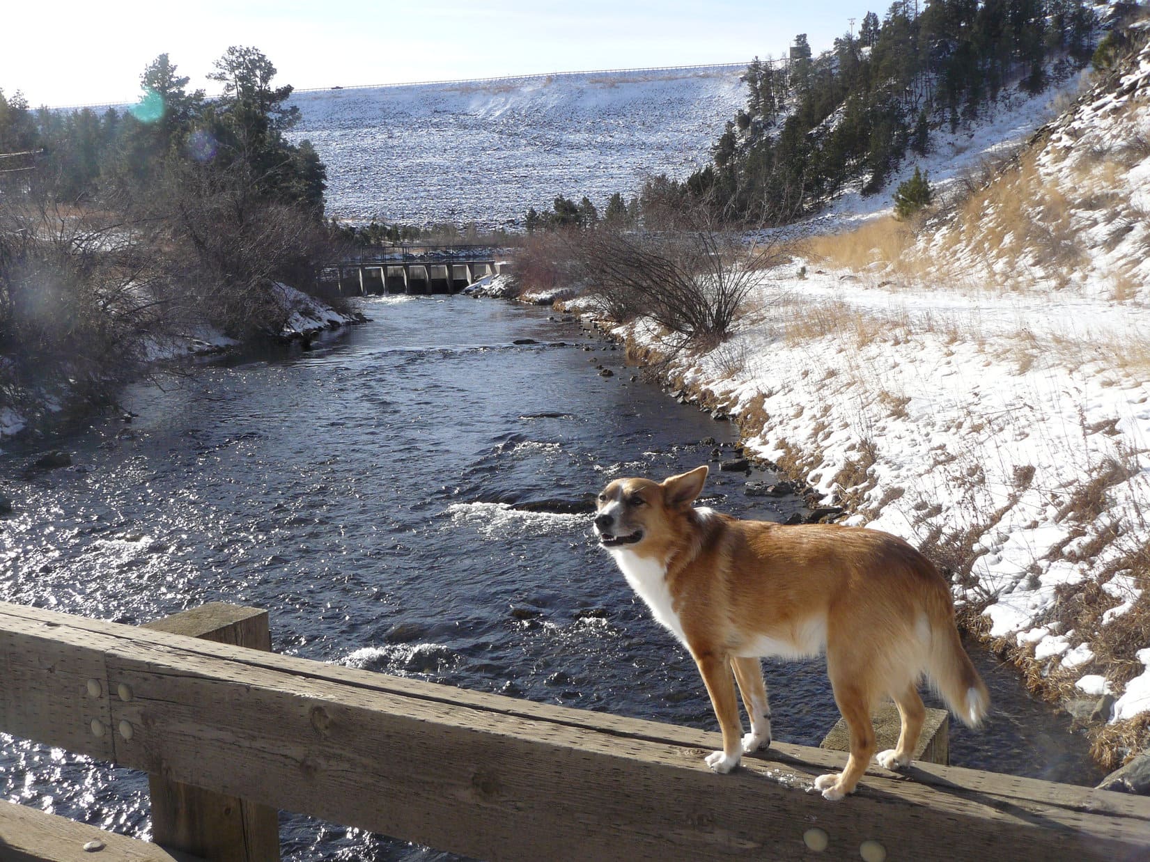
From the Rapid Creek trailhead, Lupe and SPHP followed Centennial Trail No. 89 heading ESE through the big flat meadow below the dam. Rapid Creek meanders through the meadow, and the trail had several nice footbridges crossing it. Lupe and SPHP paused on each bridge to see if there were any trout down in the creek, but saw none.
It didn’t take long to reach the Tamarack Gulch trailhead at the SE end of the meadow. Lupe and SPHP continued SE. Centennial Trail No. 89 climbed a little hill, and reached USFS Road No. 772.1B, a road Lupe had been on back on New Year’s Day. For a short distance, Centennial Trail No. 89 followed this road, but soon left it to continue S up a side road. Lupe left Centennial Trail No. 89 staying on No. 772.1B, which turned E.
Lupe and SPHP were now retracing the route Lupe had scouted out before on New Year’s Day. The snowy road made a long gradual climb up a valley. When it reached a saddle, there was a junction with another road coming in from the N. Lupe stayed on USFS Road No. 772.1B. She followed it down into a snowy little valley where SPHP had taken her picture on Expedition No. 113, and on up to another higher saddle at the upper end of Powerhouse Gulch.
At the saddle was an intersection with another road. SPHP hadn’t seen any marker the last time Lupe was here, but this time saw one identifying the side road as USFS Road No. 772.1C. In a sunny spot where there was no snow, Lupe and SPHP took a brief break. SPHP wanted to check the maps.
No. 772.1C was the right road to take. It would lead Lupe out of the upper end of Powerhouse Gulch over a saddle, and down into a smaller valley SW of Thrall Mountain. Lupe and SPHP set out on No. 772.1C. It climbed NW, turned N and soon reached the saddle. From the saddle, Lupe finally got to see Thrall Mountain, now less than a mile away to the NE.
No. 772.1C started down the N side of the saddle, passed under a power line, made a loop to the N, and then returned S to follow the power line E. As the road drew near Thrall Mountain, it started gaining elevation again. Lupe passed an unmarked minor road that headed off to the NW, but didn’t take it. Near the road’s highest point along the power line, Lupe left No. 772.1C to start climbing toward Thrall Mountain from the SSW.

The climb grew progressively steeper. Snowy boulder fields forced Lupe around to the SSE side of the mountain. Lupe and SPHP had to climb up through a short section of boulders, but made it without mishap. Lupe was now almost at the top of Thrall Mountain. Just short of the summit, Lupe reached the E viewpoint, one of three good viewpoints on or near the summit of Thrall Mountain.
From the E viewpoint, Lupe and SPHP could see Turkey Ridge and Prehistoric Ridge to the NE. To the E, Rapid City could be seen on the edge of the Black Hills. Beyond the town, the yellow plains of western South Dakota stretched to the far horizon. Lupe and SPHP also saw human tracks in the snow! By not reaching Thrall Mountain on New Year’s Day, someone else had beaten Lupe to becoming the first one to climb Thrall Mountain in 2015.
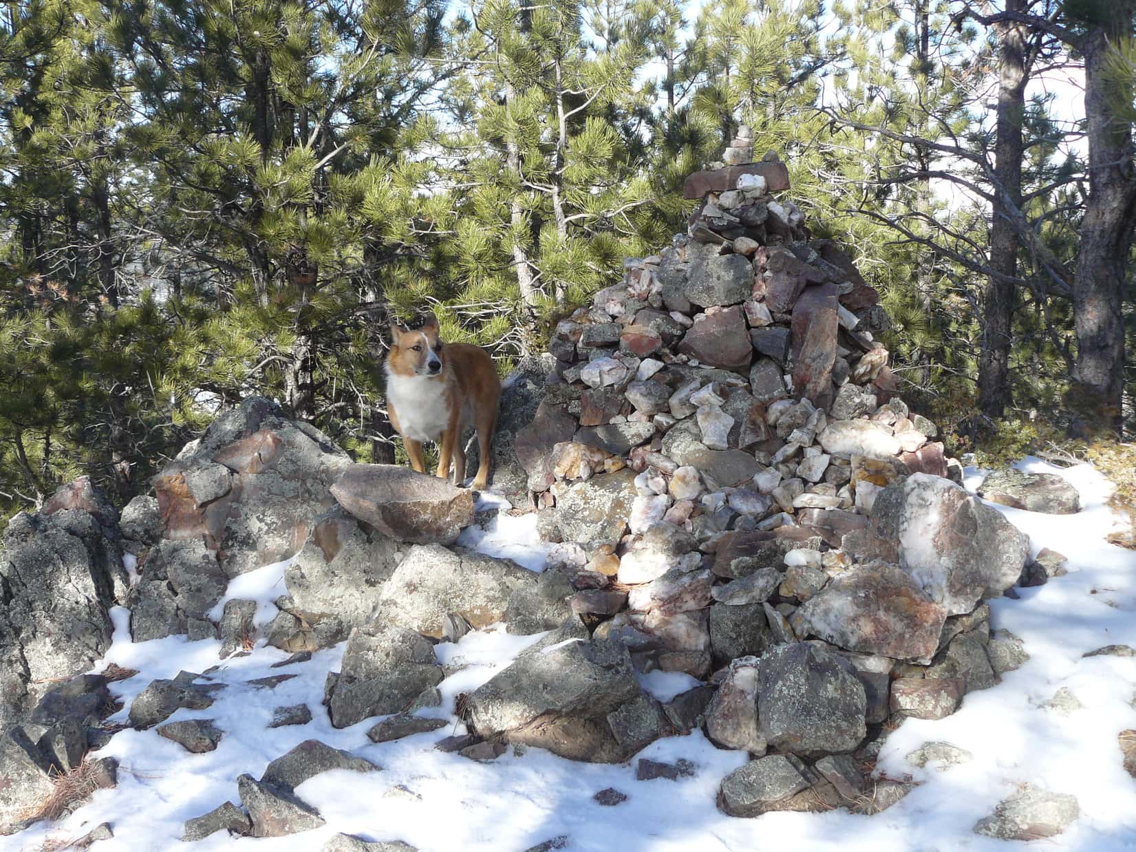
The summit was just 10’s of feet away. Lupe and SPHP strolled over to the summit to claim her Thrall Mountain peakbagging success! Whoever beat Lupe to the summit in 2015 was no longer around. Years ago, there had only been a very small cairn on top of Thrall Mountain. Now the cairn is easily 4 feet high. It is comprised of many small rocks. SPHP wanted Lupe to pose for a couple of photos at the cairn.
Normally Lupe is very cooperative, but coming up the mountain, Lupe had heard gunfire to the S. Gunshots continued to be heard occasionally from that direction. Lupe hates even the faint sound of gunfire. She stuck to SPHP like glue. Finally, the worried Carolina Dog relaxed enough for a couple of quick photos.

Lupe and SPHP left the summit to return to the Prehistoric Ridge viewpoint. There were still gunshots going on to the S. Lupe put her paw down. She refused to leave SPHP’s side for another photo. It was simply too dangerous!


Lupe and SPHP returned to the summit. Lupe was very nervous due to the gunfire. SPHP found a dry spot to sit down. Lupe snuggled right up, looking for reassurance. Together Lupe and SPHP stayed there for a while looking out at the view of Harney Peak (7,242 ft.) to the S. SPHP chatted with Lupe and stroked her, while she gave SPHP a good licking. SPHP ate an apple.
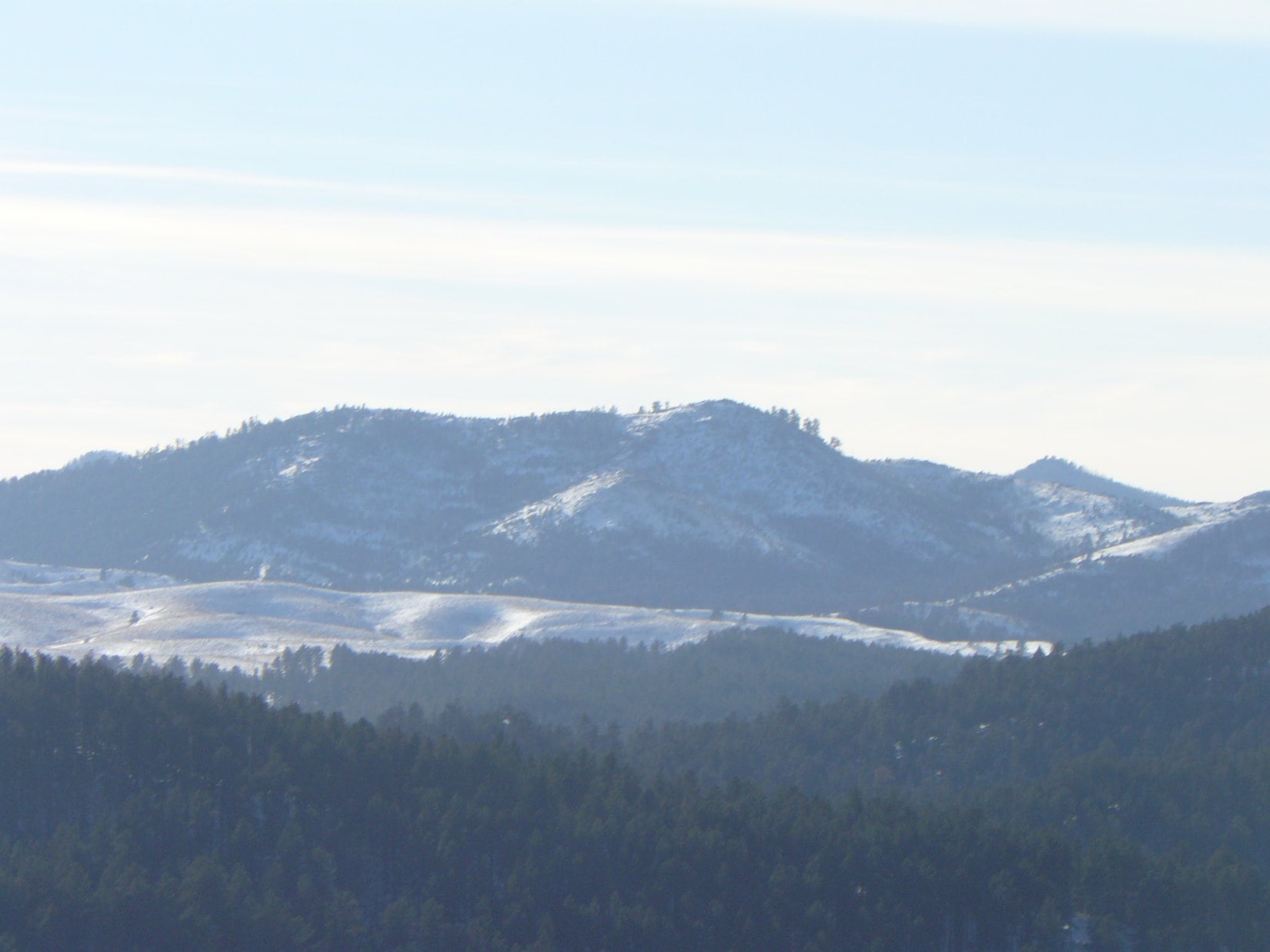
The best views to the S from Thrall Mountain are obtained just S of the summit. SPHP took one photo looking SW at Peak 5800. On a couple of prior occasions, (Expedition No. 77 on 2-16-13, and Expedition No. 80 on 3-23-14) Lupe and SPHP had gotten close enough to Peak 5800 to think about climbing it, but hadn’t actually done so. Seeing Peak 5800 from Thrall Mountain, SPHP resolved that Lupe would climb it someday. (Note: Lupe did eventually climb Peak 5800 on Expedition No. 150 on New Year’s Day 2016!)
One of the best views from Thrall Mountain is from a rocky ledge located on a slightly lower ridge a short distance NW of the summit. From the rocky ledge is a view to the NW toward nearby Johnson Siding, and the hills beyond all the way to Custer Peak (6,804 ft.). Lupe was still a bit nervous, but she got up on the rocky ledge despite it all.


By now, Lupe and SPHP had visited all three of the best viewpoints on Thrall Mountain. Lupe finally had her 2015 Thrall Mountain peakbagging success! It was time to move on.
Lupe and SPHP went back down the mountain pretty much the same way they had come up. While still near the top of the mountain, Lupe stepped on a cactus. There was a brief intermission while SPHP pulled a few small cactus spines out of her paw. Fortunately, she seemed none the worse for the wear.
Lupe returned to USFS Road No. 722.1B at the upper end of Powerhouse Gulch via No. 722.1C. Lupe and SPHP could have just returned to the G6, but there were still at least a couple of extra hours of daylight left for exploring around, if Lupe wanted to. She did! Lupe and SPHP went SE a little way into Powerhouse Gulch to a side road that SPHP had by now figured out was USFS Road No. 722.1. This was the road Lupe and SPHP should have taken on New Year’s Day to get from Gold Standard Gulch to Powerhouse Gulch.
Lupe and SPHP explored No. 722.1 heading SW. Lupe passed by a junction with No. 722.1E, she reached a high ridge where she could look back at Thrall Mountain, she went on to Gold Standard Gulch and Centennial Trail No. 89 again. Just roaming around exploring the back roads without any goal in mind was rather fun. Of course, the sun eventually sank toward the SW horizon. Time to start heading back to the G6.
The sun was down, but it was still somewhat light out when Lupe reached the G6 at 4:48 PM (27°F). Black Hills, SD Expedition No. 114 to Thrall Mountain was over, but Lupe’s fun wasn’t! Back at home, SPHP gave Lupe a big ham bone left over from a Christmas ham Guille had bought. There was still plenty of good ham, fat and gristle attached to it. Lupe’s eyes grew big as she gingerly accepted this treasure.
For several hours, Lupe gnawed energetically away on the precious ham bone. She stripped it of every shred of ham, fat and gristle. Her gnawing fangs reduced most of the ham bone itself to rubble. She ate almost the entire bone. During this time of Carolina Dog bliss, Lupe growled if SPHP got too close. She still loved SPHP, but some things are just sacred, ya know!?
Links:
Next Black Hills Expedition Prior Black Hills Expedition
Want more Lupe adventures? Choose from Lupe’s Black Hills Expeditions Adventure Index or Master Adventure Index. Or subscribe free to new Lupe adventures.
Great adventure with the adorable Lupe! Thanks for sharing 🙂
Lupe reminds me of my dog and I’m going to take her here this weekend!
Hi, Andrea! Did you and your dog make it up to Thrall Mountain, OK? What route did you take, and what did you think of the views? What kind of dog do you have?