Leaving the Yukon & Northern British Columbia, Canada (9-3-16 & 9-4-16)

Days 36 & 37 of Lupe’s Summer of 2016 Dingo Vacation to the Canadian Rockies, Yukon & Alaska

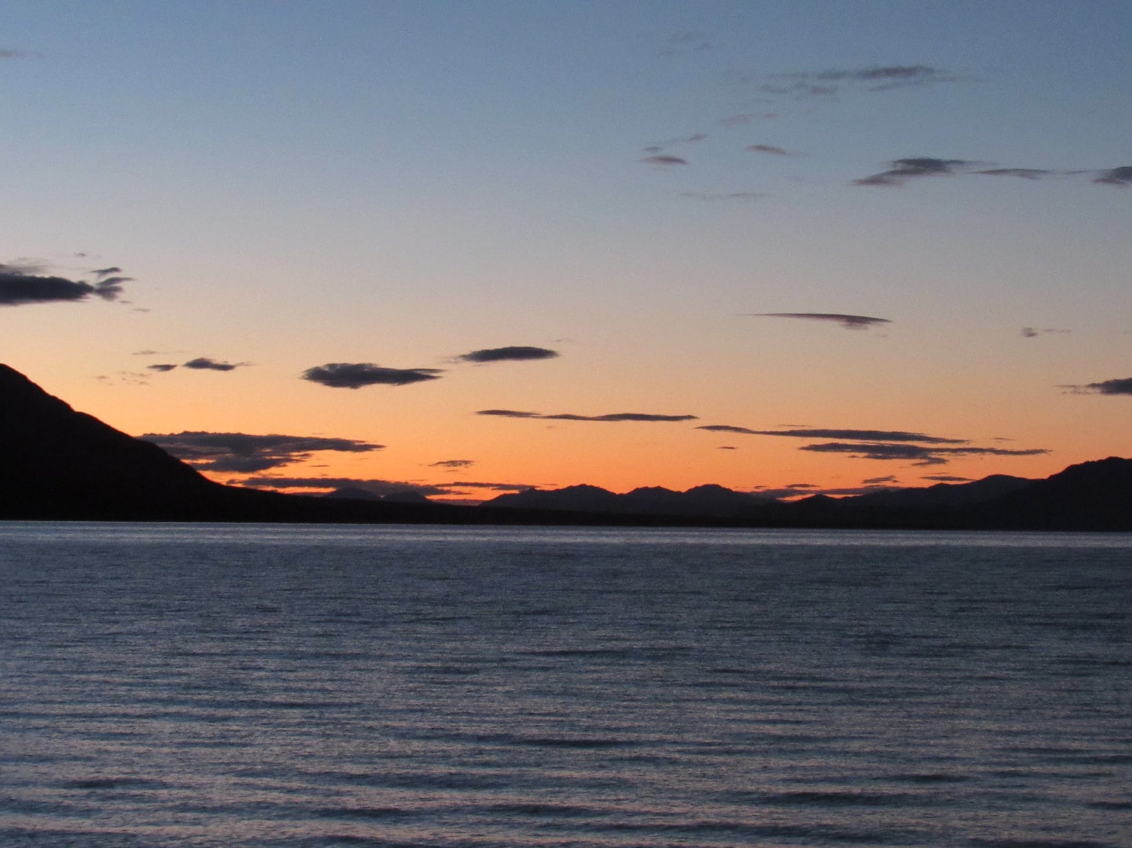
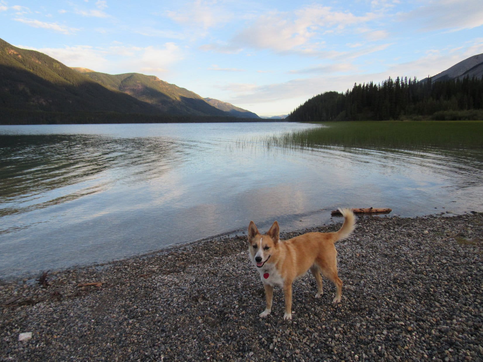
Day 36, 9-3-16, 6:40 AM, 32°F – Time for Lupe’s last walk down to the shore to say farewell to Kluane Lake.  As soon as the G6 defogged, Lupe would be leaving.  Another 450 miles to go today.  By the end of the day, she would leave the Yukon and reach extreme northern British Columbia.

The huge lake was calm, the smoothest Lupe had ever seen it.  More exciting adventures remain for Lupe in Kluane National Park in this wild, remote corner of Yukon Territory, but not on this Dingo Vacation.  Who knew when, or if, Lupe would ever return to do them and see fabulous Kluane Lake again?  No matter.  It was time to go.

Last moments near fabulous Kluane Lake. Photo looks SW.

The sun wasn’t even above the horizon yet, as Lupe and SPHP started S in the G6, but would be illuminating the Kluane front range peaks of the Saint Elias mountains before long.

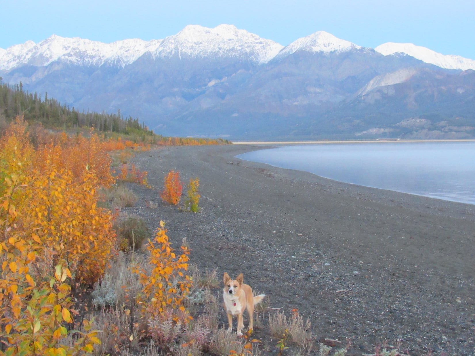
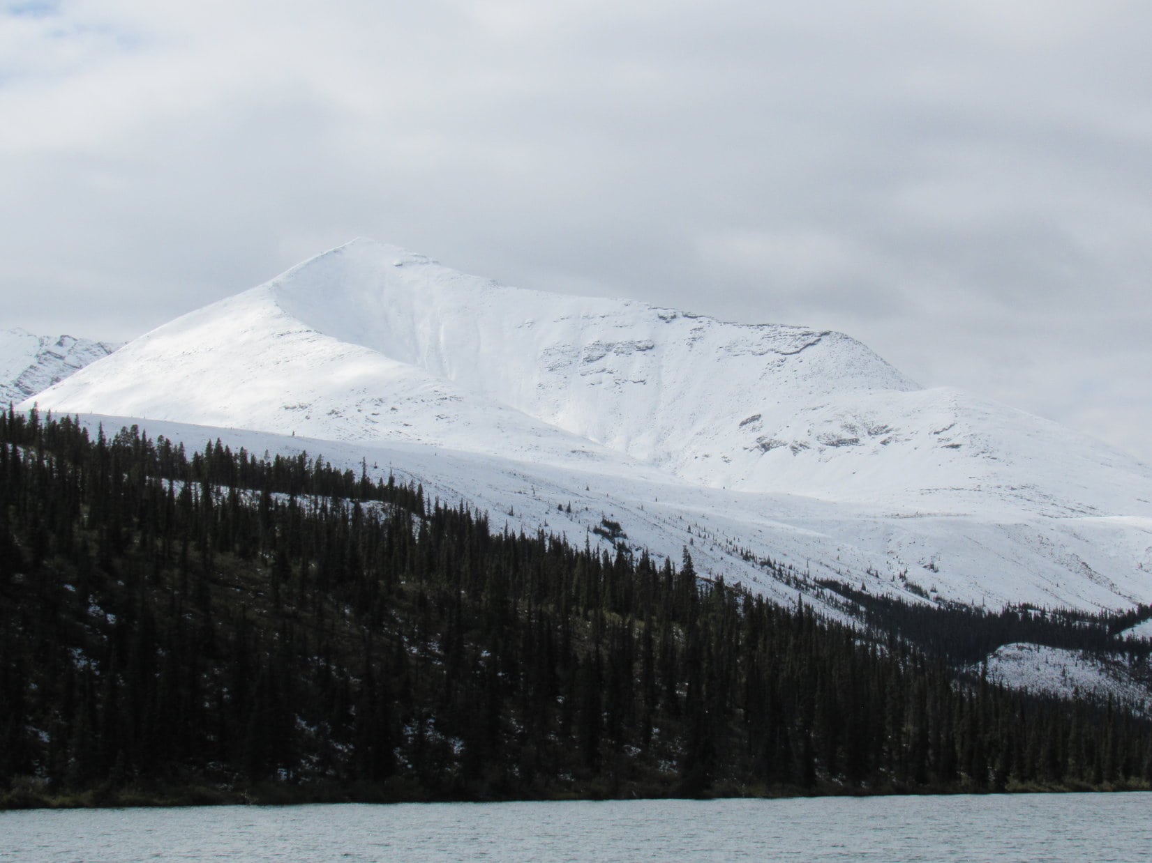
Yesterday evening, SPHP had seen Mount Decoeli (7,650 ft.) from afar.  Lupe climbed Mount Decoeli earlier on this Dingo Vacation.  What a tremendous adventure that had been!  Now Decoeli was sporting a cap of new snow.  The Alaska Highway would soon take Lupe only a few miles E of the mountain.  She wasn’t too many miles from Kluane Lake, before there it was, looking majestic, clean and white!

Lupe wasn’t too many miles away from Kluane Lake, when Mount Decoeli(L) came into view, now sporting a clean, white snowcap. Photo looks SE.
Mount Decoeli is the sharper peak on the L. Photo looks SE with a little help from the telephoto lens.

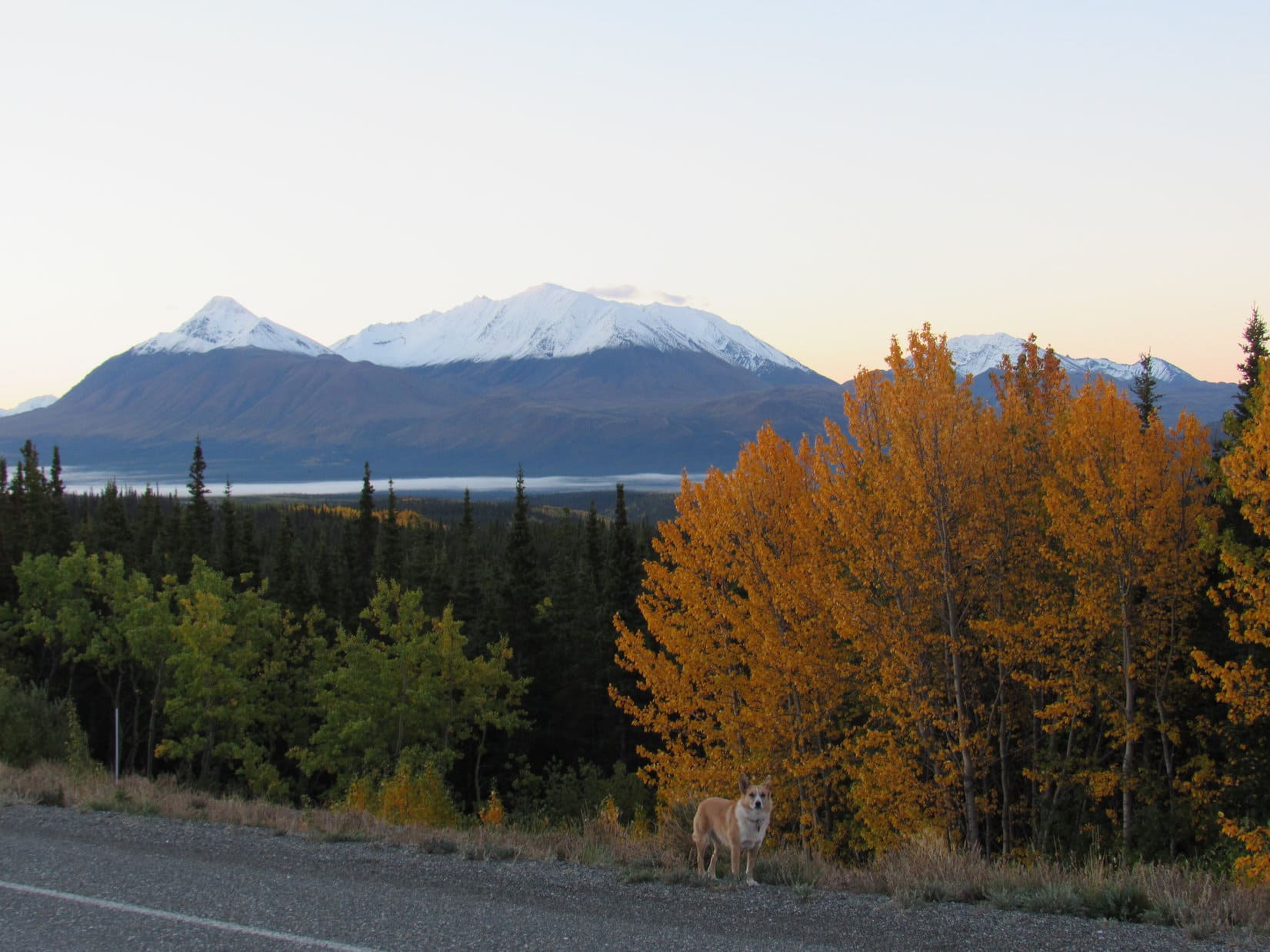
The Kluane front range mountains all looked even more impressive with snow on them, than when Lupe had been here in early August.  SPHP stopped frequently for photos.  These were the biggest, most gorgeous mountains Lupe would see all day!

Lupe enjoyed all the stops.  She didn’t mind posing for pictures.  Each stop was another chance, however brief, to explore fields and forests near the Alaska Highway.

Early light on the Kluane front range. The high point on the L is possibly Mount Cairnes (9,186 ft.). Photo looks SW.
Daybreak on Lupe’s last day in the Yukon.
Getting closer to Mount Decoeli (L). Photo looks SE.
Much closer now. Looking SW at Mount Decoeli.
Loop and Decoeli. She’d stood on top of the mountain earlier on this Dingo Vacation.
Mount Decoeli on the R. The white peak on the L in the distance is either Mount Archibald (8,491 ft.) or a peak very near it. Photo looks SW.
View along the Alaska Highway from E of Decoeli. Photo looks S in the general direction of Mount Martha Black (8,241 ft.) possibly one of the peaks seen here.
Come on! Let’s go! Lupe was ready to climb Decoeli(R) again! Sadly, there was no longer time for a repeat performance. Photo looks WSW.
Again looking S in the general direction of Mount Martha Black, likely pictured somewhere among these high peaks. The morning light on the tundra was amazing!
Mount Decoeli from the E.
Lupe in Yukon Territory still E of Mount Decoeli. Everything was ablaze with color in the early morning light! Photo looks SSW.
The Yukon was so beautiful, it was enough to make an American Dingo think about becoming a Yukon Dingo!

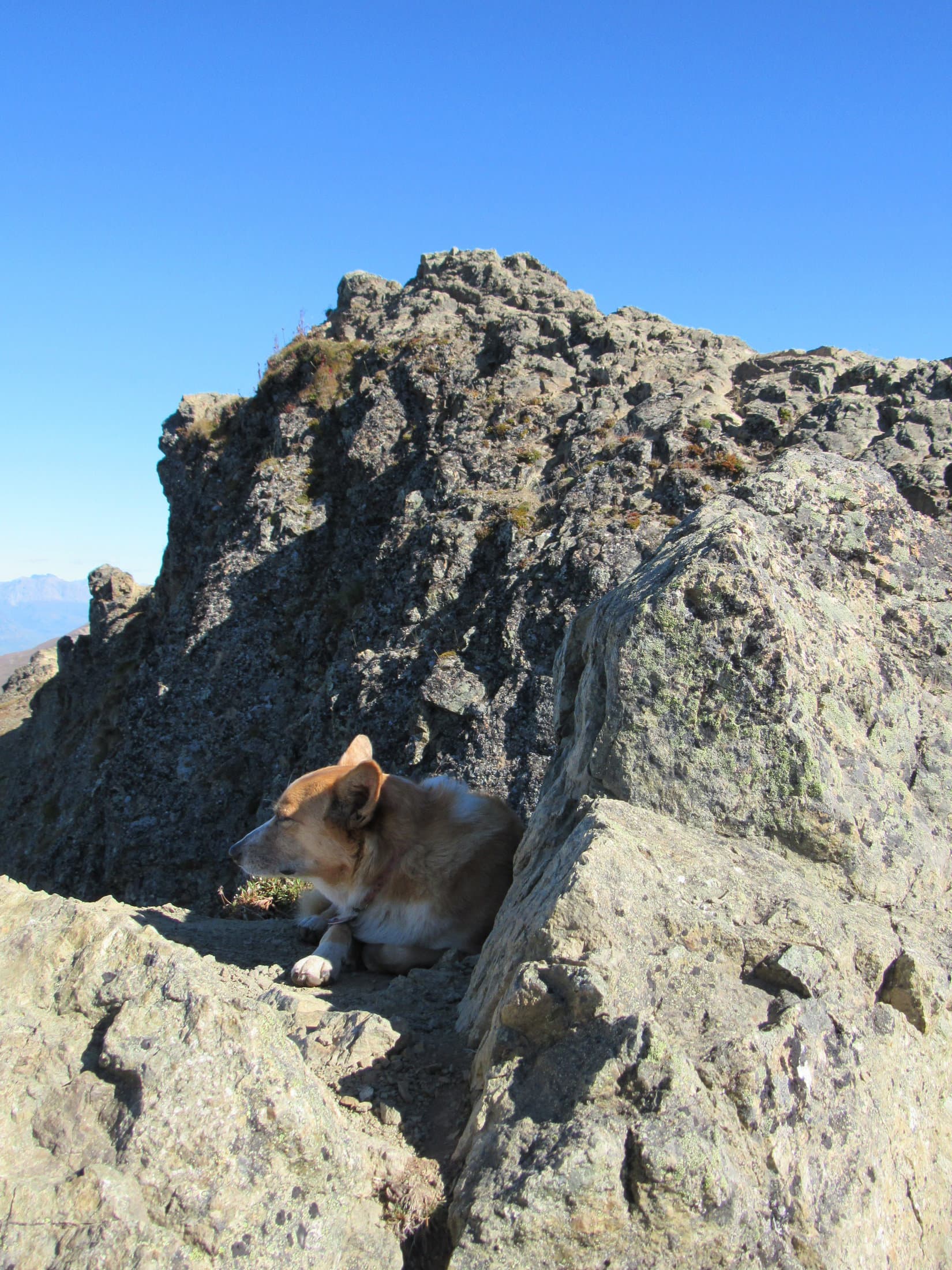
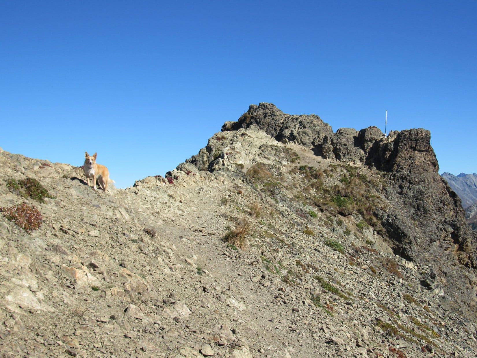
On the way to Haines Junction, SPHP decided Lupe ought to take the 14 mile (one way) detour S to have a look at King’s Throne (6,529 ft.) and Kathleen Lake.  King’s Throne was the first mountain Lupe had climbed in Kluane National Park, and another super adventure!  Maybe Lupe could get a great photo of King’s Throne covered with new snow and shining brightly in the morning light?

Lupe only got 10 miles S of Haines Junction, though, before it was apparent there wasn’t much point in going farther.  Clouds already screened King’s Throne from the sunlight, and more clouds were moving in fast.  From what could be seen, King’s Throne hadn’t received any of the recent new snow either, perhaps because it is lower than Decoeli.

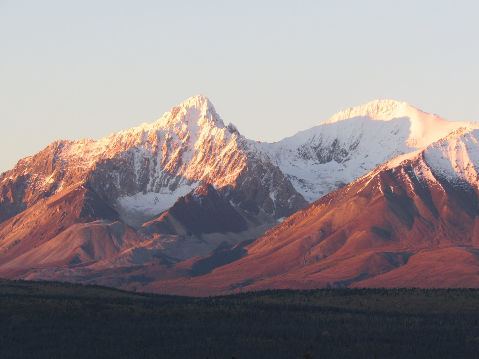
Near Quill Creek, Lupe and SPHP turned around to head back N.  The mountains here were still in brilliant sunshine.  However, large clouds were moving in from the SE.  Lupe’s best bet was to enjoy these gorgeous mountains while they were still in view.  All the way back to Haines Junction, Lupe and SPHP stopped frequently to gaze upon the beautifully sunlit Kluane front range.

Lupe at Quill Creek, S of Haines Junction. Photo looks SW.
Looking up Quill Creek using the telephoto lens.
Although only a few miles N of King’s Throne, this distinctive pyramid-shaped mountain near Quill Creek was still in brilliant sunshine. King’s Throne was already cloaked in the gloom of a cloud bank. Photo looks SW using the telephoto lens.
Lupe S of Haines Junction, but N of Quill Creek. The Kluane front range is in dazzling sunshine to the SW.
Crisp, clean peaks on the way back N to Haines Junction. Photo looks SW.
Another fantastic peak of the Kluane front range.
Snow certainly adds a great deal of grandeur to almost any peak. Gorgeous!

At Haines Junction, Lupe headed E on the Alaska Highway.  The dazzling splendor of the Kluane front range of the Saint Elias mountains receded in the rear view mirror.  Within a few minutes, the mountains disappeared entirely as Lupe entered a dense fog bank.

For miles SPHP drove slowly in the fog.  Lupe finally emerged from the fog bank, but the mood of the morning was different here.  The sky was overcast.  The dull, gray clouds weren’t dark or threatening, but the cheerful sunshine was gone.  Lupe snoozed as the miles rolled by.  E of Whitehorse, Lupe crossed the Yukon River again.  By now it was 11:15 AM, and even SPHP was drowsy.

Lupe and SPHP stopped at a rest area on the E bank of the Yukon River.  Even though it was practically the middle of the day, and the Alaska Highway was busy, SPHP took a nap.  An hour later, feeling better, it was time to press on.  Before leaving, Lupe was ready for a short stroll down to the river.

Lupe checks out the Yukon River one more time before continuing E. Lupe had crossed the Yukon River much farther N, too, back when she was on the Dalton Highway before crossing the Arctic Circle. Photo looks W.

The clouds were lighter and starting to break up as Lupe continued E on the Alaska Highway.  After a slow start in the morning, Lupe was behind schedule on reaching her mileage quota for the day.  She needed to keep rolling.  She was allowed fairly frequent short stops at rest areas, but other than that, Lupe had little to do but continue dozing or watch the scenery go by.

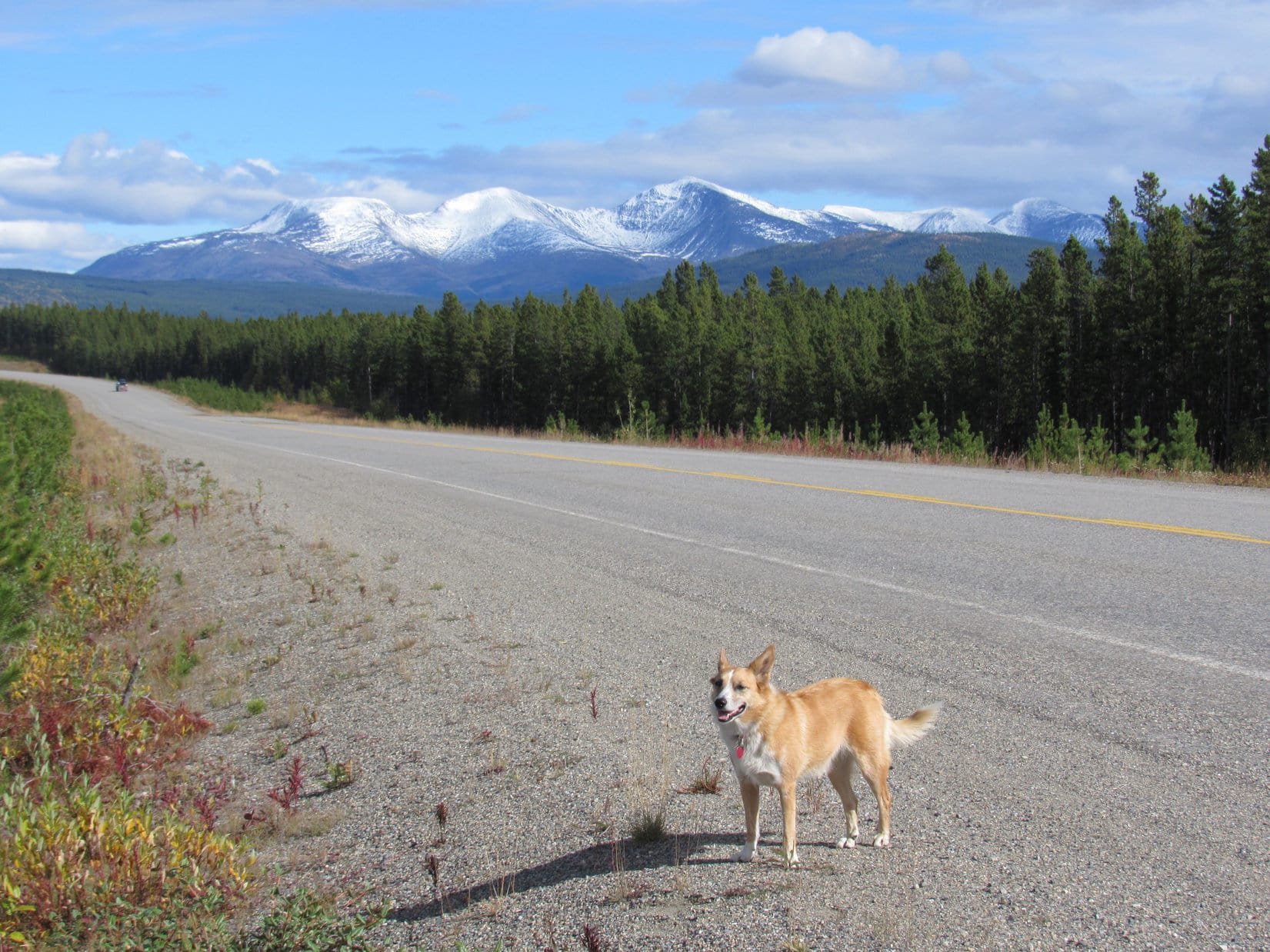
Forests were everywhere.  Lupe saw many lakes and streams.  Although Lupe saw lots of mountains, too, they weren’t nearly as large or rugged as the ones back at Kluane National Park.  Hours went by.  Finally, a cluster of higher, more impressive mountains appeared in the distance ahead.  They had a good dusting of snow and were quite beautiful.

After hours heading E on the Alaska Highway, a small range of more impressive snowy peaks came into view. Photo looks E.
SPHP has no idea what mountains these are, but driving the speed limit they were about 3 hours E of the Yukon River on the S side of the Alaska Highway. They looked like something Lupe could climb easily enough some day. The views from the top must be amazing. These mountains were the highest around for a long, long way!

On the way to the Yukon near the start of her Summer of 2016 Dingo Vacation, Lupe had traveled up the Cassiar Highway (Hwy 37).  This time, when she reached the junction, Lupe stayed on the Alaska Highway going E instead of turning S.  This was an alternate route home.  Lupe was going to see a lot of new territory!

The new territory featured forests.  Trees stretched from horizon to horizon.  Mile after mile.  Not that there hadn’t been plenty of vast forests before.  Here, though, there were hills, ridges, and deep river valleys, but no real mountains, not like Lupe was used to seeing up to this point.  Everything was forested.  Nothing was above treeline.

E of Watson Lake, the Alaska Highway left the Yukon for good.  Lupe was now back in far northern British Columbia.  The highway wound around near the Liard River valley.  In many places, the forest was clear cut for 50 to 100 feet and mowed on both sides of the highway.  The resulting miles long skinny clearings proved attractive to wildlife.

Lupe sprang to life when she realized there were animals out there!  She’d been mostly resting in the G6 for two whole days.  The American Dingo was bursting with energy and enthusiasm.  Time for the barkfest to end all barkfests!  Many buffalo, 3 bears, and 1 fox were all cause for ear-splitting excitement.

Lupe near the Liard River. E of Watson Lake, Lupe left the Yukon for good when the Alaska Highway entered far northern British Columbia. The highway wound SE in or close to the Liard River valley for many miles.
Oh, yeah! Buffalo roamed the narrow clear cut strips of land along the Alaska Highway E of Watson Lake. Lupe was beside herself with joy! She barked like a Dingo-possessed, watching eagerly for the next buffalo to appear as she cruised by in the G6. She was seldom disappointed for long. SPHP wondered where else these buffalo would ever find any open ground? Except along the highway, trees extended horizon to horizon.
Bears! Lupe saw three small black bears in addition to the buffalo. They were every bit as exciting as the buffalo! In all her time in the Yukon and Alaska, Lupe never saw a single bear. She did see a few black bears in British Columbia both on the way N and going home.

A little after 8 PM, with light fading fast, Lupe arrived at Liard Hot Springs Provincial Park(Note:  The 6.5 minute video on the front page of this link is worth watching.  Be sure to expand it!)  SPHP drove in at the entrance finding no one at the entry booth.  It was Saturday night and lots of people were around.  SPHP parked the G6, and Lupe was happy to get out.

The main attractions at Liard Hot Springs are a couple of hot water bathing pools along a flowing stream.  A wide boardwalk led off toward the hot springs.  Lots of people were coming and going on the boardwalk, so Lupe and SPHP took it, too.

The boardwalk went through a forested swamp.  It was far longer than SPHP expected – 700 meters!  Lupe did get to see the hot springs, although, sadly, it was already too dark for pictures.  A couple of wooden changing rooms were next to a deck overlooking the hot springs, which had significant flow.  A warm fog rose from the waters where bathers were enjoying soaking in two natural pools.

SPHP asked around how this all worked?  As it turned out, there is normally a seasonal day use fee ($5.00 adult, $3.00 child, $10.00 family) charged for park admission at the entry booth at the front gate.  A camping spot costs $26.00.  However, the entry booth closes at 8 PM, and no day use admission is collected after that.  Somewhat oddly, the gates close at 10 PM, after which no entry or exit is permitted.

Of course, Lupe couldn’t go in the hot springs, but there was still time for SPHP to enjoy them.  Back to the G6, where Lupe was sad and worried about being abandoned.  SPHP tried to cheer her up, promising to return before too long.

The changing rooms at the hot springs were rustic, with only benches and hooks.  No lockers, showers, restrooms or anything like that.  Not even electricity or any lights.  The upstream pool was too hot for SPHP, but the downstream pool was great.  Despite the excellent flow, the water cooled off quickly going downstream, so it was easy to choose the temperature zone that felt best.

Liard Hot Springs was totally awesome!  Where else can you relax in soothing warm (hot, if you like!) waters outdoors in the middle of a boreal spruce forest in a giant swamp?  SPHP soaked and chatted with people, who were mostly from Fort Nelson.

At 9:15 PM, someone came to announce the time, and that the park’s gates closed in 45 minutes at 10:00 PM.  SPHP soaked for 10 more minutes, then got out into the chilly night air to get changed and return to Lupe.  After a joyous reunion, Lupe and SPHP left the park at 9:48 PM with 12 minutes to spare.  Onward!  But only for a little way.  Lupe had already made 500 miles today.

Day 37, 9-4-16, 6:19 AM, 35°F – Beneath a bright blue sky with thin little clouds, Lupe was underway early.  She was in far northern British Columbia, only a little S of Liard Hot Springs.  The terrain rapidly became increasingly mountainous as Lupe headed SE on the Alaska Highway.  For a while, a long stretch of road construction slowed progress to a crawl.

The morning sky held promise of a beautiful day ahead.
The terrain grew more mountainous S of Liard Hot Springs. Lupe was approaching Muncho Lake Provincial Park.

The road construction ended, and progress resumed at a normal pace, but not for long.  Lupe soon entered Muncho Lake Provincial Park.

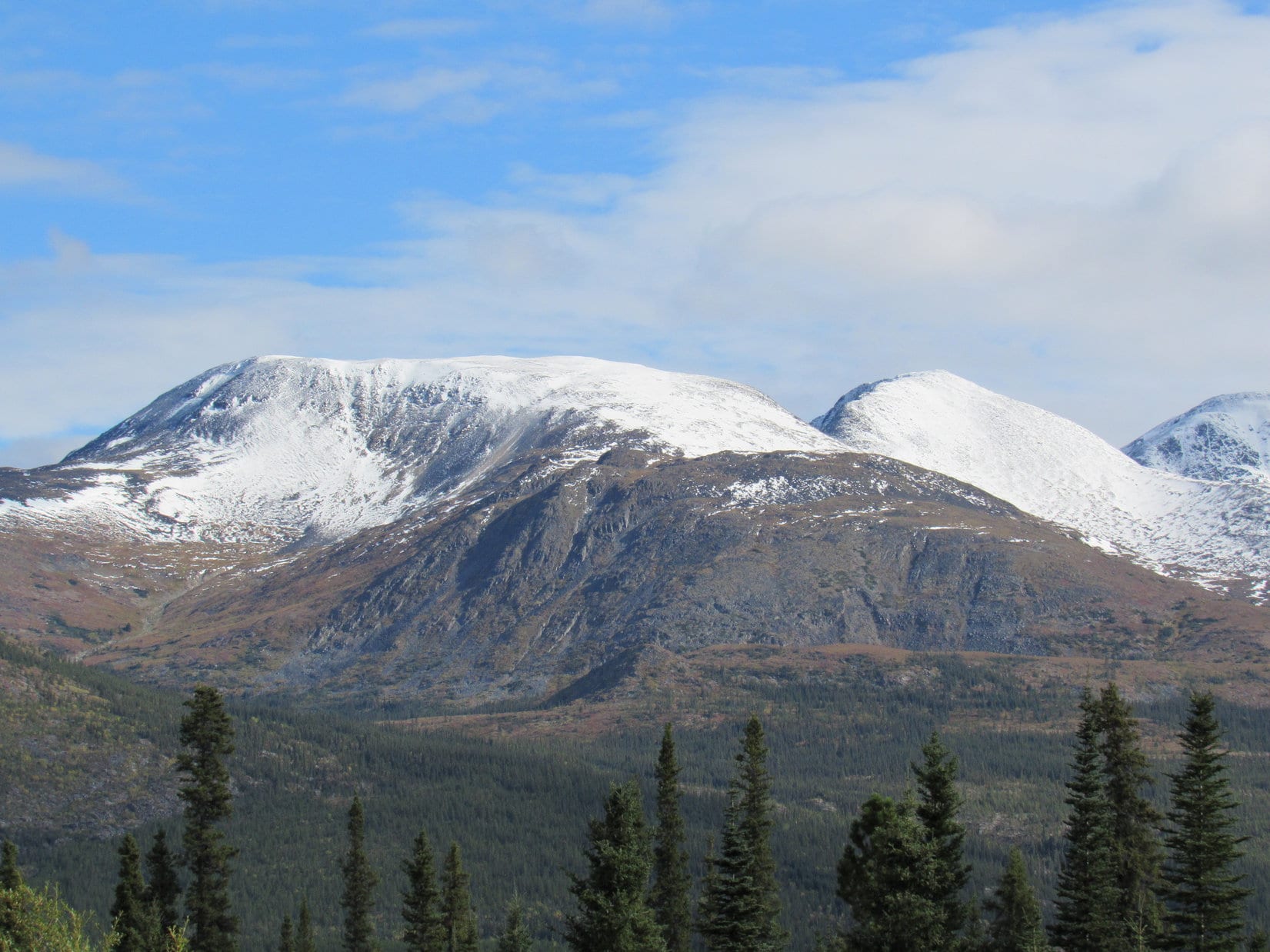
SPHP hadn’t done a bit of research during pre-Dingo Vacation planning on Muncho Lake, and it was a real surprise.  This was an area of unspoiled, remote snow-capped peaks.  The Alaska Highway went right through it all, and hugged the E shore of beautiful Muncho Lake for miles.  Lupe was thrilled to see more buffalo, and even another black bear.

Lupe’s day was off to a thrilling start with lots more buffalo near the Alaska Highway in Muncho Lake Provincial Park. She even saw another black bear.

Such beauty was cause for several stops.  Lupe was only too glad to get out of the G6, if even only for a short time.  Too bad Lupe’s time was so limited now.  Muncho Lake Provincial Park was surely worth exploring!

Lupe in gorgeous Muncho Lake Provincial Park. She was very happy to get out of the G6 to see the sights here, if only for a little while.
Looper at Muncho Lake.
Lupe at Muncho Lake with a splendid peak in the distance. Photo looks SSW.
Muncho Lake Provincial Park in far NE British Columbia.
Wow! Now we’re talking adventure! This float plane was parked near a lodge on the E shore of Muncho Lake. Lupe loves to bark at airplanes, and especially helicopters. Not sure how she might react to flying away in one? Photo looks NNW.
Hmmm. The more SPHP pondered this glorious peak, the more it looked like something Lupe might be able to climb. Maybe some day? Photo looks SSW.
Wonder if there’s a trail? SPHP will have to look into it.

S of Muncho Lake, the Alaska Highway lost elevation and entered the beautiful Toad River valley.  Although it was still early in the day, SPHP was overcome by drowsiness.  Lupe and SPHP wound up taking a nap at a pullout along the highway.  Nearly two hours slipped by before SPHP woke up again, feeling much revived.

However, Lupe hadn’t needed reviving.  By now she was so bored, she was desperate to get out of the G6.  For the next half hour she had a great time sniffing around a young forest near the pullout while SPHP picked up copious amounts of trash.  People!  Trash containers were provided right at the pullout, yet way too many people don’t bother using them.  Totally disgusting!

A little farther on, Lupe left Muncho Lake Provincial Park.  Before long she crossed a bridge over another wonderful stream, the Racing River.  SPHP parked the G6 again at a pullout near the bridge.  Lupe found an old road leading through the forest.  The primitive road paralleled the Racing River downstream for a little way.  Evidently this route is sometimes used for dispersed camping.  Lupe passed several old campfire sites before the road turned and ended at the river.

The Alaska Highway bridge over the Racing River. Photo looks SW.
The Racing River was this incredible icy blue color, and certainly lived up to its name. The river did race right along.
Lupe was in great spirits. She enjoyed her visit to the Racing River! After all, she’d found a squirrel to bark at in the forest nearby!

After 25 minutes near the Racing River, Lupe and SPHP continued on.  The Alaska Highway quickly left the Racing River valley, going around the N side of a mountain into another big valley.  The highway now followed the course of McDonald Creek upstream toward impressive white mountains.  Lupe was nearing Stone Mountain Provincial Park.

Shortly after entering Stone Mountain Provincial Park, Lupe saw something she had never seen before.  A small herd of caribou were trotting across an open field toward a forest!  By the time SPHP could stop and turn around, they had vanished into the trees.  The field the caribou had crossed was at quite an elevation above McDonald Creek, and offered a good lookout point toward the mountains.  Lupe and SPHP got out of the G6 to take a look.

As Lupe approached Stone Mountain Provincial Park, impressive white mountains were visible ahead.
Lupe at the edge of the big field where she had seen caribou for the first time ever only a few minutes ago. This viewpoint overlooks the McDonald Creek valley. Photo looks SE.
The McDonald Creek valley. Mount Saint George (7,402 ft.) is on the R. Photo looks SE.
Mount Saint George using the telephoto lens. Photo looks SE.
A tower is seen at far R on the N flank of Mount Saint George. A trail leads to the tower from the Summit Lake area. Photo looks SE.
A little farther S on the Alaska highway from where Lupe saw the caribou, she made another quick stop for this grand view of the McDonald Creek valley. Photo looks S.

After getting a little exercise and seeing the grand view of Mount Saint George (7,402 ft.) and the McDonald Creek valley from Caribou Point, Lupe and SPHP drove on.   The Alaska Highway turned NE and in only a few miles reached Summit Lake at the top of a pass.  At the NE end of Summit Lake were a campground and picnic area.  Lunch time!  Lupe and SPHP pulled into the picnic area.

Lupe at Summit Lake in Stone Mountain Provincial Park. Photo looks SW.
Looking SW over Summit Lake using the telephoto lens.

Soup, sardines and crackers were on the menu.  While SPHP was heating the soup up, Lupe found a new friend.  A big dog arrived to sniff and wag tails with her.  A young woman from Fort Nelson came over to retrieve Grommet, which was the big dog’s name.  She stayed chatting with SPHP while Lupe and Grommet did dog stuff – sniffing, playing and growling.

The friendly young woman mentioned a trailhead over on the opposite (N) side of the Alaska Highway.  When lunch was over, Lupe and SPHP went over to check out the trailhead.  A map showed a 2.5 km (one way) trail going to Summit Peak (6,611 ft.) on the N side of the Alaska Highway, and several other trails S of Summit Lake.

Looking up toward a couple of white peaks N of the Alaska Highway from Summit Lake. The high point on the L is likely Summit Peak (6,611 ft.).  Photo looks N.

It all looked very interesting, but Lupe didn’t have time to explore any trails.  In fact, it was 2 PM already.  Lupe hadn’t even gone 100 miles yet today!  Definitely time to get underway again.

E of Summit Lake, the Alaska Highway lost elevation again on the other side of the pass.  Soon Lupe was out of Stone Mountain Provincial Park, leaving the big, snowy peaks of the Muskwa Ranges behind.  At Fort Nelson, the Alaska Highway turned S again.  Off to the W, Lupe could still see high mountains with snow.  The highway got close to them at one point, but then veered away.

After a great morning and early afternoon, with lots of little hikes and scenic stops along the way, the rest of the afternoon and evening proved disappointing for the intrepid American Dingo.  She spent nearly all of her time stuck in the G6, traveling through the endless forest.  The road wound over and around high ridges.  Sometimes the Alaska Highway dropped down into big valleys to cross rivers, but it never took Lupe back to the high mountains.

Lupe spent much of the rest of the day in the G6 traveling S along the Alaska Highway. The road wound along high ridges, and sometimes went down into big valleys to cross rivers. Off to the W were high snowy mountains, but the road never took Lupe up into them again.

Lupe had few chances to get out of the G6 again, but by evening she did make her 450 miles for the day.  Most of northern British Columbia was now behind her.  That feeling Lupe’d had for most of the past month of being in the far N, in Arctic lands, was fast slipping away.

Lupe in NE British Columbia leaving the far N on her way home.

Links:

Next Adventure                       Prior Adventure

Want more Lupe adventures?  Choose from Lupe’s 2016 Canadian Rockies, Yukon & Alaska Adventure Index, Dingo Vacations Adventure Index or Master Adventure Index.  Or subscribe free to new Lupe adventures.

Leaving Alaska & Lupe’s Return to Yukon Territory, Canada (9-1-16 & 9-2-16)

The end of Day 34, plus Day 35 of Lupe’s Summer of 2016 Dingo Vacation to the Canadian Rockies, Yukon & Alaska

Day 34, 9-1-16, 4:00 PM, 72°F – Well, it was over.  After 7,500+ feet of elevation gain in the past 31 hours, Lupe was back at the Lazy Mountain Recreation Site trailhead.  Blisters and a pulled muscle in the front right leg, suffered yesterday while coming down Pepper Peak, caused SPHP to hobble slowly onto the parking lot behind her.

Make that almost over.  A tall, lanky, young guy immediately struck up a conversation.  Both Lupe and SPHP just wanted to go the remaining 50 feet to the G6 and sit/lay down.  Instead this complete stranger launched into a monologue about mountains and trails.  He talked with a strange accent, or maybe a lisp, and seemed kind of, well – “off”, somehow.

Remind you of anyone, SPHP?

Oh, please!  Silence, wisecracking Dingo of mine!

Actually the friendly stranger’s conversation would normally have been of great interest.  He was a wealth of knowledge about Alaska, and what there was to do outdoors around here.  Moreover, he was eager to share his experiences.

Where had he been for the last 3 weeks?  Off or not, any other time SPHP would have enjoyed talking to him for hours, but not now.  Not his fault, but his timing was atrocious.  No need for his insight now.  Lupe had just returned from Lazy Mountain (3,740 ft.), the last mountain she would climb in Alaska in 2016.  Recuperation at the G6 was priority one.

After a seeming eternity, a brief lull came in the one-sided conversation.  SPHP used the opening to wish the stranger well, and encourage his speedy enjoyment of the Lazy Mountain trail.  Off he went, happy as a clam.  SPHP limped 50 feet and unlocked the G6.  Lupe eagerly leaped in.  Now it was over!  No more climbing mountains in Alaska.  Sad, tragic really, but paws, feet, legs, and lungs all advised getting over it.  Wow, it did feel good to rest!

With the G6’s windows down on this beautiful, warm afternoon so Lupe could sniff the air, SPHP drove the few miles back to Palmer.  Brief stops for groceries and gas.  A trip to McDonald’s.  Lupe ate only one bite of cheeseburger.  Surprising, but she knew how she felt.  She seemed cheerful and perfectly fine.

At long last, off with the boots.  What a relief!  So much better!  In stocking feet, SPHP drove E out of Palmer on the Glenn Highway, marvelously equipped with cheeseburgers, fries and a Coke.  Lupe panted happily, looking out the window at the splendid scenery of the Matanuska River valley going by.  A relaxing, astonishingly beautiful evening drive was ahead.  After 22 unforgettable days in Alaska, Lupe was starting for home.

In a sense, Lupe had already been going home for 5 days, ever since she left Grace Ridge (3,136 ft.), back near Homer on the Kenai Peninsula.  So far, though, every day had been mostly filled with adventures.  She hadn’t really gotten all that far.  The Carolina Dog was still more than 3,000 miles from home in the Black Hills.  Time to make tracks.  450 miles per day for the next week should about do it.

The return trip would be fabulous!  Endless forests, mountains, rivers, lakes, sky and clouds.  A road trip made in heaven.  Lupe’s Summer of 2016 Dingo Vacation to the Canadian Rockies, Yukon and Alaska had been a huge success!  Time to kick back and enjoy the road home.  Lupe would still have a chance for a few adventures along the way, if they weren’t too long, and there would be plenty of stops to stretch, sniff the air, and admire the world.

Lupe’s first stop this evening was to see the Matanuska Glacier again.  She’d had absolutely fabulous views of it earlier on her Summer of 2016 Dingo Vacation when she’d climbed Lion Head (3,185 ft.).

The Matanuska Glacier from the Glenn Highway (Alaska Route 1).
Lupe stops for a quick look at the Matanuska Glacier again. She’d had absolutely fabulous views of it earlier on her Summer of 2016 Dingo Vacation when she’d climbed nearby Lion Head (3,185 ft.). Photo looks S.
Snowy peaks near the Matanuska Glacier. Photo looks S using the telephoto lens.

Matanuska Glacier, Alaska

Lupe didn’t make it much beyond the Matanuska Glacier this evening, stopping near Gunsight Mountain (6,441 ft.) for the night.  Gunsight Mountain was the highest peak in Alaska that Lupe had climbed.  She had met Laura from Montana, and Luke Hall from Australia up there.

The best views from the highway near Gunsight Mountain were to the S.  The peaks in that direction appeared to have fresh new-fallen snow.

Looking S from the Gunsight Mountain area.
Last light.

Day 35, 9-2-16, Predawn, 32°F – Orion hung low in the E.  The pale light of dawn hadn’t arrived yet, but there was a hint of it on the horizon.  The North Star was high overhead.  Northern lights, not a great display, but easily seen, streamed from the N toward the coming sun.

With the G6’s right headlight not working, it was still too early to leave the Gunsight Mountain area.  Lupe and SPHP walked W along an abandoned stretch of the old Glenn Highway.  Chilly out, but Lupe was in fine form, sniffing like mad among the bushes lining the old road.  A mile, maybe a mile and a half later, it was time to turn around.

The were-puppy attacked SPHP!  Once the were-puppy was fended off, the Carolina Dog showed off how fast and agile she was, racing up and down the road, running circles around SPHP.  Ahh, to feel like that!  So much energy and joy of living!  Shrill Dingo barking filled the air for a couple of minutes before Lupe returned to sniffing.

On the way back to the G6, sunrise was on its way.  Soon time to depart.

Sunrise approaches.
Looking E from the Gunsight Mountain area on Lupe’s last morning in Alaska.
First light hits the peaks S of Gunsight Mountain. Photo looks S.

Heading E toward Glenn Allen, Mount Drum (12,010 ft.) came into view.  Lupe hadn’t seen it before.  When she’d first arrived in Alaska, the towering white monsters of the Wrangell Range were all shrouded by clouds.  Now they basked in brilliant sunshine.  Lupe saw them from various angles as SPHP followed the highway beyond Glenn Allen around to the Tok Cut-Off.

SPHP meant to stop at the same viewpoint overlooking the Copper River where Lupe had stopped before, but somehow missed it.  The white monsters were far from the highway, but could be seen for many miles.  After a while, though, they receded from view as the miles clicked by.

One of the white monsters of the Wrangell Range SE of Glenn Allen. SPHP didn’t know their names, but they were spectacular peaks covered in huge quantities of snow and ice.
One hell of a sledding hill! Kind of a rough ending, though.

After being in view for many miles as Lupe circled them to the N, the huge white Wrangell Mountains began to recede in the rear view mirror.

After all her many Alaskan adventures, Lupe was feeling pretty relaxed on this first full day of driving on her way home.E of Tok, Lupe crossed the Tanana River.  She was happy to get out of the G6 to stretch her legs a bit.

Lupe stretches her legs after crossing the Tanana River, which flows all the way NW to Fairbanks. The Tanana is ultimately a tributary of the Yukon River.
Lupe near the Alaskan Highway bridge over the Tanana River E of Tok. Photo looks downstream toward the NW.

With the majestic high peaks of the Wrangell Mountains now far behind, Lupe traveled through an area of lower hills, ridges and distant mountains.  Fall was coming to Alaska, as Lupe was leaving.  There were many hills with colorful displays of fall colors.

Lupe stops along the Alaska Highway for a photo with the fall colors.
A brilliant hillside.

Lupe left Alaska, returning to Yukon Territory in Canada around 2 PM Alaska Time (3 PM Pacific Time).  Soon she was seeing bigger mountains closer by again.  She crossed the White River without stopping.  A few weeks earlier, it had been wide and impressive, but now it was mostly dried up.

After Lupe left Alaska entering Yukon Territory, she began to see higher mountains near the Alaska Highway again.
Yukon Territory from the Alaska Highway.

By the time Lupe reached the Donjek River, it was getting to be late afternoon.  The Donjek was running low, too, but it seemed like a good time to get out of the G6 to stretch and walk around a bit.  Lupe went for short walks on both sides of the scenic river, spending about 45 minutes in the area.

Lupe near the NW bank of the mighty Donjek River. Of course, the river was running low this time of year. Photo looks SW.
The Donjek River is a major tributary of the White River. Both are part of the Yukon River’s drainage area.
Most of the Donjek was mud flats when Lupe was here, but the river must be gigantic during the spring runoff when the snow melts.
The beautiful mountains and impressive river bed of the Donjek invite exploration, but away from the Alaska Highway this is true wilderness.

The Alaska Highway bridge over the Donjek River. Although the mountains to the SW looked high, remote and dangerous, this one to the E looked like something Lupe could climb if she’d had enough time. Photo looks E.
Loopster on the mud flats of the Donjek. Photo looks W.
The Donjek has a braided floodplain. This was only one small channel. Love that big cloud boiling up over the far ridge!
Lupe on the SE bank of the Donjek now. There was more flow over here. Photo looks WSW.

Lupe’s time along the Donjek River was a wonderful break. The whole area was so beautiful and remote. Lupe and SPHP were lucky to be here to see it. There are still amazing places in the world far beyond casual exploration. The Donjek and White Rivers capture the imagination, but few ever glimpse more of them than Lupe was seeing from near the highway.

A little S of the Donjek River, a mountain with new snow on top caught SPHP’s fancy.

This striking mountain with new snow on it some miles S of the Donjek River caught SPHP’s fancy, and gave Lupe another opportunity to sniff around for a few minutes out of the G6.

For the last 5 or 6 days Lupe had been in Alaska, the sky had been almost totally clear.  However, there were quite a few clouds here in the Yukon.  Near Destruction Bay on Kluane Lake, Lupe and SPHP drove through rain showers.  Lupe saw a rainbow.

Rainbow near Destruction Bay on Kluane Lake.

In Kluane National Park, Lupe and SPHP stopped again at the Tachal Dahl visitor center in the Slims River valley at the S end of Kluane Lake.  The visitor center was closed.  Not a soul was around.  SPHP made use of one of the picnic tables to prepare dinner.  Lupe was eager to help SPHP make the last can of beef stew and remaining cheese disappear, but she buried a cracker with her nose.

The mood had changed remarkably since Lupe had been here in early August.  Back then, there had been activity.  It hadn’t been crowded at all, but people had been around.  The Alaska Highway had lots of traffic.  The days were warm and bright, and the sun stayed up late.  Dust had been blowing dramatically down the Slims River valley toward Kluane Lake.

Now there was new snow on the mountaintops.  The air was chilly.  The Slims River valley was still dry, but no dust blew.  No one at all was around.  Traffic on the Alaska Highway was only a trickle.  The whole place felt deserted, like late fall with early winter knocking on the door.  SPHP ate while watching two large herds of wild sheep high up on Sheep Mountain (6,400 ft.).  Lupe sniffed around nearby.

Lupe returns to the Slims River valley in Kluane National Park in the Yukon near the Tachal Dahl visitor center. The mood had changed since early August when Lupe had last been here. The mountains had new snow on them. A chill was in the air. Dust no longer blew down the still parched Slims River valley toward Kluane Lake. Photo looks SW.
Although it was only September 2nd, new snow on the mountains already hinted of the approach of another deadly cold, dark winter.

Lupe was more than 500 miles from Palmer, Alaska now.  She’d made her 450 miles for the day from where she’d left Gunsight Mountain this morning, so it was time to stop for the night.  As the light of day faded much earlier than it had only 3.5 weeks ago, Lupe got to spend time playing and sniffing around the S shore of Kluane Lake once more.

Lupe at the S shore of Kluane Lake. Photo looks W.

Sheep Mountain from Kluane Lake. Photo looks NW.
Kluane Lake
Lupe spent the rest of the evening playing and sniffing around the S shore.
A dramatic sky near evening’s end.

One thing hadn’t changed.  Beyond Kluane Lake, a line of mountains marched endlessly away to the N horizon toward the Arctic.  The remote peaks were part of a vast wilderness only a little less mysterious than before, and as beautiful and romantic as ever.

Looking N.

Links:

Next Adventure                        Prior Adventure

Want more Lupe adventures?  Choose from Lupe’s 2016 Canadian Rockies, Yukon & Alaska Adventure Index, Dingo Vacations Adventure Index or Master Adventure Index.  Or subscribe free to New Lupe Adventures.


Lazy Mountain, Chugach Range, Alaska (9-1-16)

Day 34 of Lupe’s Summer of 2016 Dingo Vacation to the Canadian Rockies, Yukon & Alaska

Pepper Peak (5,381 ft.) had been a stupendous day and a glorious summit, but Lupe and SPHP hadn’t really recovered yet from yesterday’s huge 4,500 feet of elevation gain.  No matter.  Feeling it or not, Lupe was climbing one more mountain today.  The calendar now said September.  After 3 fabulous, unforgettable weeks in Alaska, this was the American Dingo’s last full day in the Land of the Midnight Sun.

Lazy Mountain (3,740 ft.) was destined to be the last peak Lupe and SPHP would climb together in Alaska in 2016, or maybe forever.  Tired or not, it was time to begin (9:55 AM, 48°F).  At least Lupe had another clear, bright day.  She was guaranteed some great views of Palmer, the Matanuska River valley all the way to the Knik Arm off Cook Inlet, and mountains in all directions.

Right away, Lupe had a choice to make.  Two trails diverge near the trailhead parking lot.  They both go about halfway up Lazy Mountain to where they meet again near a picnic table situated on a point with a view.  A single combined trail goes the rest of the way to the summit.  The old Lazy Mountain approach was supposed to be the steepest.  The newer Lazy Moose trail is an easier climb, but winds around a bunch on switchbacks that add considerable distance.

Even though energy levels were low, Lupe and SPHP started straight up the Lazy Mountain trail.  The reports were no joke.  The trail started out steep.  It didn’t stay that way long.  It soon got steeper, and then stayed that way.  Whoever named Lazy Mountain must have realized what they were in for, and decided they were too lazy to even attempt it.  Otherwise, the name makes no sense at all.

As usual in most of Lupe’s Alaskan trail experiences, the Lazy Mountain trail started in a forest.  Gradually the forest thinned, and tall bushes started to dominate.  The forest had thinned out considerably, by the time Lupe reached the picnic table near the intersection with the Lazy Moose trail.  It had been a long, hard climb with frequent rest breaks, but Lupe was halfway up the 3,000 feet of elevation gain needed to reach the summit.

At the picnic table, SPHP chatted for a little while with a guy who came running (yes, running!) up the same Lazy Mountain trail Lupe and SPHP had just staggered up.  He said he lives in Palmer, and runs this far up Lazy Mountain 3 times a week.  He plays in a Christian music band, and was very surprised to hear that Lupe lives in South Dakota.

Why he was flying to Sioux Falls, SD tomorrow to play in a big concert there!  He had been with his band to South Dakota many times, including Pine Ridge and Lupe’s Black Hills.  South Dakota was a hot spot for his kind of music.  He wished Lupe and SPHP well, before running off down the longer Lazy Moose trail.

Small world.  Sort of.  Lupe still had another 1,500 feet of mountain climbing left to do in Alaska.  Somehow it still loomed large, not small.  Lupe’s trek resumed.  Still steep, but perhaps not quite as steep as before.  Tall bushes dominated, but most of the trees were gone.  On and on.  Up and up, for a while longer.

Finally, Lupe was past the bushes.  She was up in the tundra zone.  Some places were devoid even of the tough, beautiful, little tundra plants.  Bare dirt and small rocks were exposed.  Lupe had made a lot of progress up the mountain by now.  For a while, the trail leveled out.  There was even a completely flat section!  A high point that might be the summit was in view ahead.

Getting there! Lupe climbing Lazy Mountain. She’s already up above tree line here. Only scattered clumps of bushes and tundra remain. Photo looks NE.
For a while, SPHP wasn’t sure which high point might be the true summit of Lazy Mountain. It turned out to be the one on the L that the trail is heading for. Photo looks NE.

The trail soon started climbing again, but never as steeply as earlier on.  Below a ridge, Lupe passed a second picnic table.  The built-in benches were in good shape, but nearly all the boards forming the table part were missing.  Lupe did not stop.  She kept on going.  Her final climb in Alaska was dead ahead.

Lupe on her final climb in Alaska. The top of Lazy Mountain is in view only a short way ahead. Photo looks NE.

Lupe gained the summit ridge.  It wasn’t terribly long, maybe 100 feet.  At the far NE end, was a smaller ridge of solid lumpy-looking rock.  The true summit of Lazy Mountain was perched at the far end of the little ridge, perhaps an extra 20 feet above the main ridge.

Lupe rests in the shade at the base of the lumpy rock ridge at the far NE end of Lazy Mountain’s main summit ridge. Matanuska Peak is the high point in the background. Photo looks SE.

Lupe scrambled up to the highest point at the far end of the lumpy rock ridge.  She was done mountain climbing in Alaska!  This was it, the true summit of Lazy Mountain (3,740 ft.)!

Lupe perched at the true summit of Lazy Mountain, having just completed all of her mountain climbing in Alaska in 2016. Photo looks NNE.

Lupe could not be persuaded to stay up at the highest point on Lazy Mountain when SPHP tried to back down off the lumpy ridge for a more distant shot of her at the summit.  There was quite a bit of exposure up there, and not a lot of room to maneuver.

It was OK, she had made it to the top for a good close up.  Not to mention all the many other dramatic peaks she had climbed on her Summer of 2016 Dingo Vacation!  If the Carolina Dog felt better a little lower down, she had certainly earned a reprieve from posing at the top of precipices.

Lupe on the lumpy rock ridge. The true summit of Lazy Mountain is on the L. Lupe couldn’t be persuaded to remain at the high point long enough for SPHP to scramble back down for a more distant photo of her up there. The high point had a lot of exposure and not a lot of room. Photo looks ENE.
Matanuska Peak from Lazy Mountain. Photo looks SE.

Mountain climbing in Alaska was over.  Time to take a look around at what Lupe could see from her last Alaskan mountain.  Unlike most of the mountains Loop had climbed, where the most impressive views were of other mountains, Lazy Mountain’s most dramatic views were down toward the Matanuska River valley.

More than 3,000 feet below Lazy Mountain, the braided confluence of the Matanuska River and Knik River could be seen to the SW near the start of the Knik Arm of the North Pacific Ocean off Cook Inlet.  Bodenburg Butte (886 ft.) rising more than 600 feet above immediately surrounding terrain, looked like a little hill.

The Matanuska River (Center) flows toward the Knik River (L). They have a braided confluence near the Knik Arm seen on the upper R. Bodenburg Butte(L) looks like a little hill from Lazy Mountain. Photo looks SW.

The most dramatic mountains Lupe could see from Lazy Mountain were very far away to WSW, in the direction of Mount Susitna (4,396 ft.), also known as Sleeping Lady.  (The Legend of Sleeping Lady)  Well beyond Mount Susitna were impressive white mountains on the edge of vision.

Mount Susitna (Sleeping Lady) is the long blue ridge, subject of a local legend. Photo looks WSW from Lazy Mountain using the telephoto lens.
High, white mountains could be seen faintly very far away beyond Mount Susitna. Photo looks W using the telephoto lens.

Considerably closer, it was possible to see several smaller peaks with snow and ice on them in other directions.

Unknown peak with snow in view from Lazy Mountain. Taken using the telephoto lens.

Matanuska Peak (6,093 ft.) to the SE was easily the most impressive of the nearby mountains.

Matanuska Peak (L) was easily the most impressive of the mountains nearby. Photo looks SE.
Matanuska Peak through the telephoto lens.

Even including the larger summit ridge, and not just the small, final lumpy rock part leading to the true summit, there wasn’t much exploring to be done up on Lazy Mountain.  Lupe could see virtually the entire summit area at a glance.  However, there was plenty of room to move around some from one end to the other, gaining slightly different vantage points.

Except for the highest lumpy rock part where the true summit is, most of Lazy Mountain’s summit area is in view here. The town of Palmer is below, mostly on the far side of the Matanuska River. Mount Susitna can be made out on the far horizon. Part of the Talkeetna Range is seen on the R. Photo looks W.

Lupe found a shady spot close to the lumpy rock ridge where she could doze a bit.  SPHP relaxed gazing off first in one direction, then another, seeing dazzlingly beautiful Alaska, possibly for the last time, from the top of a mountain Lupe had climbed.

Lupe dozes a little below the true summit. Photo looks NE.
Looking NNE toward the Talkeetna Range.

Lupe stayed up on Lazy Mountain for 45 minutes.  The time came to start thinking about moving on.  Despite the rigors of the steep trail up, the perfect day and wonderful views at the top had made Lupe’s final climb in Alaska a lovely, memorable experience.  Now only the return trip down the mountain remained.

Lupe ready to leave the mountaintops of Alaska. The lumpy rock ridge and true summit of Lazy Mountain are on the R. Photo looks NE.
Looking down on the town of Palmer, situated mostly on the far side of the Matanuska River. Photo looks WSW.
The Matanuska flows away toward the Knik Arm. Photo looks SW.
Starting down the trail. Several peaks of interest are seen along the far ridge. Straight up from Bodenburg Butte, the little hill in the valley at (Center), are 3 dark wavy peaks. The two on the L are East Twin Peak (5,840 ft.)(L) and West Twin Peak (5,472 ft.)(R). To their L across a gentle saddle is a seemingly unimpressive hill in sunlight. That hill is actually Pepper Peak (5,381 ft.) where Lupe had such a tremendous adventure only a day earlier. The high point of the dark peaks to the L of Pepper Peak is Pioneer Peak (6,398 ft.). Photo looks SW.

When Lupe got down close to the first picnic table, she took the Lazy Moose trail instead of the Lazy Mountain trail.  The Lazy Moose trail was considerably longer, but not nearly so steep.  The trail had markers along it, which seemed to represent feet traveled along the trail, starting from the lower end.

The first marker Lupe came to said 15,800, implying that Lupe was about 3 miles from the trailhead.  The markers were about 1,000 feet apart on the higher part of the trail.  Lower down, they were consistently 200 feet apart.  The Lazy Moose trail had lots of switchbacks and general winding around.  The markers told the story of Lupe’s progress down her last Alaskan mountain.

Lupe enjoyed trotting and sniffing along the easier trail.  Late afternoon on the first day of September was comfortably sunny and warm.  Lupe led SPHP down Lazy Mountain, exploring for only a little longer the fabled Land of the Midnight Sun (4:23 PM, 72°F).

Loop on the Lazy Moose trail, Lazy Mountain, Chugach Range, Alaska.

Directions to the Lazy Mountain Recreation Area trailhead:  From the Glenn Hwy in Palmer, go E on Arctic Road (Old Glenn Highway) for 2.5 miles.  Take a L on Clark-Wolverine Road, 0.5 mile after crossing the Matanuska River.  Proceed 0.5 mile to a T intersection.  Take a R on Huntley Road, following it to the end.  Stay to the R going down to the trailhead parking lot.

Links:

Next Adventure                        Prior Adventure

Matanuska Peak, Chugach Range, Alaska (9-5-19)

Want more Lupe adventures?  Choose from Lupe’s 2016 Canadian Rockies, Yukon & Alaska Adventure Index, Dingo Vacations Adventure Index or Master Adventure Index.  Or subscribe free to New Lupe Adventures.