Whiskey Peak, Wyoming (6-16-17)

Day 9 of Lupe’s 2017 Dingo Vacation to the Laramie Range & Beyond!

Though shown on the road map, Lamont didn’t even seem to be a town.  Sagebrush, a few cattle, and a highway intersection was about it.  After turning W off Hwy 287, SPHP found a place to park.  Lupe got out for a look around.  Off to the NW, she could see her next peakbagging objective, Whiskey Peak (9,225 ft.), the highest point in the Green Mountains.

Whiskey Peak from Lamont, Wyoming. Photo looks NW.

The view was encouraging.  Whiskey Peak looked like an easy climb for the Carolina Dog.  The big question was access.  If Lupe could get to Whiskey Peak, SPHP was certain she could climb it.  The only roads into the area that the G6 might be able to manage were NW of the town of Bairoil.  Even those roads might quickly deteriorate to high clearance or 4WD vehicles only.

Hwy 73 was paved all the way to Bairoil.  So far, so good.  Bairoil didn’t really seem to be much of a town either, but there was a lot more here than at Lamont.  Bairoil appeared to be more of an energy-related industrial center.  Metal buildings, industrial equipment, and vehicles were widely scattered along a network of dirt and gravel roads.  There didn’t seem to be a whole lot going on right now.  Maybe because energy prices were still relatively low in 2017?

A pronghorn antelope in the thriving industrial metropolis of Bairoil, Wyoming.

The street layout in Bairoil didn’t seem to match up very well with what was shown on the old topo map.  SPHP drove NW through town, staying mostly to the L at turns, and continued this same practice once Lupe was N of town.  A number of gravel roads headed out this direction, none marked in any way that meant anything to SPHP.

After bumping along for 2 or 3 miles, SPHP parked the G6 near an intersection on relatively flat, sparsely vegetated ground.  There hadn’t been any signs indicating private property or prohibiting public access on the way here.  Close enough!  Situation excellent!  This was about as far as SPHP had dared hope the G6 would be able to make it, anyway.  Lupe could start for Whiskey Peak from here.  (10:35 AM, 62°F)

Lupe a few miles NW of Bairoil about to start out for Whiskey Peak. Part of the Abel Creek drainage is seen in the foreground. Photo looks NE.

A strong breeze was blowing out of the W as Lupe set out.  She didn’t head straight for Whiskey Peak, which was now to the NE, but followed a road leading NW from the intersection.  This road, which was in such good condition the G6 might easily have followed it farther, appeared headed for a ridge a few miles away.  The ridge was mostly bare, but dotted with scattered pines or junipers.

A fairly strong W wind was blowing as Lupe began following this road. The road headed toward Whiskey Ridge, but Lupe didn’t follow it very far. Photo looks NW.

A fence ran parallel to the road, not too far off to the R (NE).  Lupe stuck with the road only until the fence ended.  Staying on the road would have taken Loop up to Whiskey Ridge, but a more direct route to Whiskey Peak appeared to be an option.  Up on more heavily forested slopes along a higher part of Whiskey Ridge straight N from here, another road could be seen.

Lupe followed the road she started out on only to this point where the fence turned. A different road, which was a much more direct route to Whiskey Peak, is seen at upper L going up the ridge. Lupe headed for it from here. Photo looks NNE.

Lupe abandoned the road she’d been following, and headed NE avoiding the fence.  She crossed the Abel Creek drainage, which was dry and fairly shallow here.  A faint, grassy road led out of the drainage to a better road that headed for Whiskey Ridge.  Loop followed it N across high prairie toward the forest, gradually gaining elevation all the way.

On the way N to Whiskey Ridge. The high ridge on the L is Stratton Rim. The small high point seen straight up from Lupe’s back is Stratton Rim North (8,740 ft.). The less uniform ridge on the R is part of Whiskey Ridge. Photo looks W.

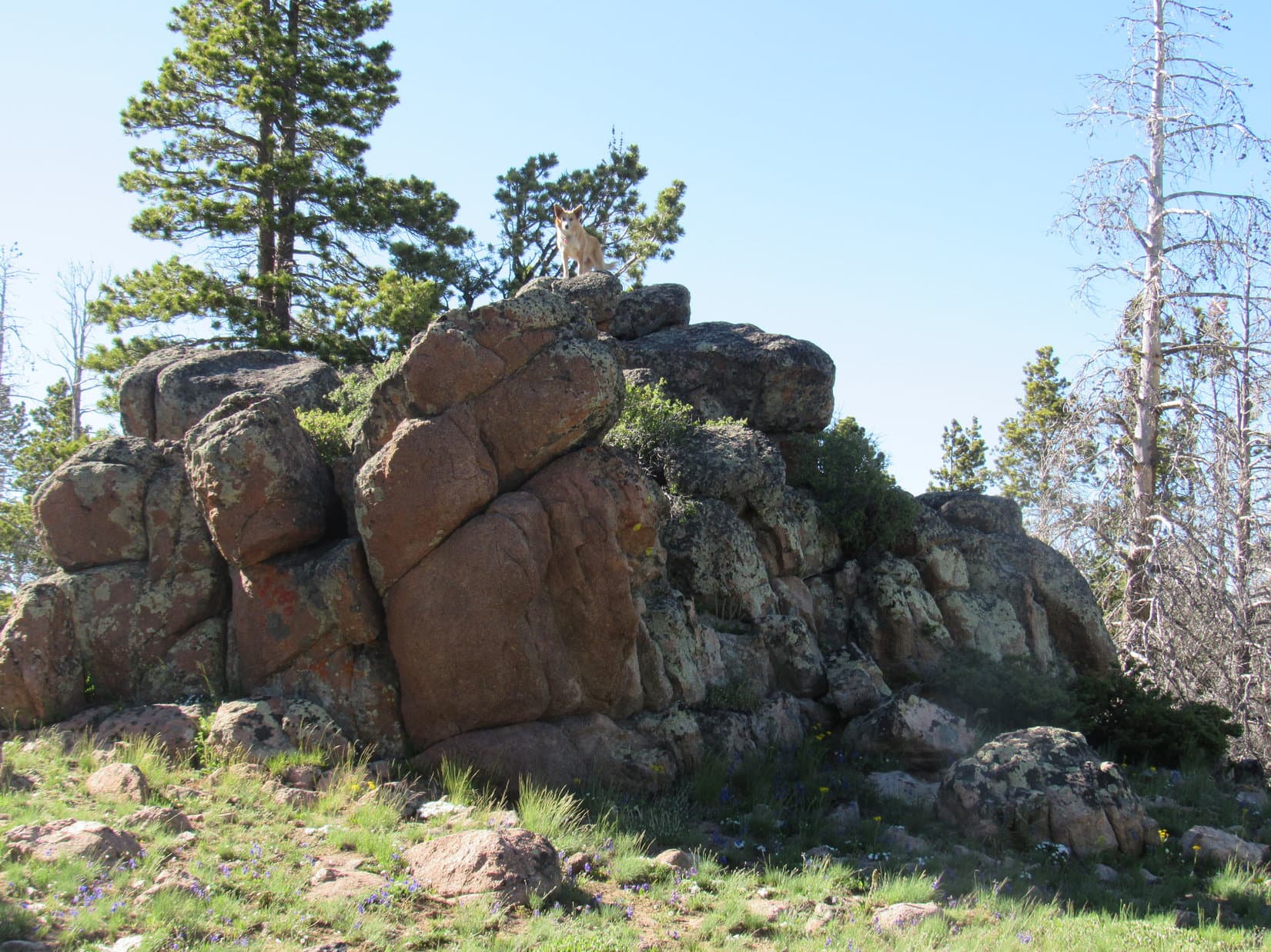
The road Lupe was on led right to the road she’d seen from a distance high up in the forest on Whiskey Ridge.  As she got near the trees, the slope began to increase dramatically.  Soon Lupe was climbing steeply.  The road up was in bad shape.  For a long way, it was deeply eroded and full of loose rocks.  As a road, it was nothing but a disaster, though it still made a good trail.

By now, it was quite warm in the sun.  The steepness of the route caused SPHP to stop many times to rest.  Lupe was eager to escape the heat.  She curled up in the shade whenever SPHP stopped, and frequently accepted water.

By and by, Lupe finally reached the top of the ridgeline.  The remnant of the road she’d been following went right on over the saddle where she came up.  Oddly enough, what appeared to be a large electrical service box was close by.

Lupe reaches the top of Whiskey Ridge at this saddle. She’s standing on the faint remnant of the road she’d been following. This road went right on over the saddle past the unexpected electrical service box seen beyond Loop. Photo looks N.

Not realizing how much of a shortcut Lupe had taken, SPHP was puzzled to find no other roads around.  The topo map showed a road following closely along the top of Whiskey Ridge for nearly 2 miles from a pass NE of Stratton Rim North.  The plan had been for Lupe to follow this road all the way to Whiskey Peak.  However, it was nowhere in sight.

SPHP failed to realize Lupe had arrived at the 8,730 foot saddle at the E end of the 2 mile stretch where the road to the summit abandons the ridgeline.  Very close to where Looper was, it jogged N going downhill a short distance before turning SE to head for Whiskey Peak.  If Lupe had just stuck with the road she’d been on a bit farther, she would soon have come to it.

Instead, Loop and SPHP turned E, and began climbing a grassy slope which led to a forested high point.  It seemed like the most reasonable thing to do, since it was clear Whiskey Peak was still well to the E from here.  As Lupe went up the grassy slope, she started getting her first look at some impressive views.

As Lupe climbed the grassy slope, she got her first look at this wild looking territory N of Whiskey Ridge. Photo looks NNW.
Looper coming up the grassy slope. Whiskey Ridge leads toward Stratton Rim in the distance on the L. The road Lupe had just missed coming to that winds along Whiskey Ridge, is seen on the R. Lupe had arrived at the saddle below coming up through the trees on the L. Photo looks WSW.

Loop entered the forest above the grassy slope, and continued on up to the high point.  The high point itself wasn’t heavily forested.  Lupe could see a tower up on Whiskey Peak from here.

SPHP was surprised by how close Lupe was already.  She was over 9,000 feet, and the summit was only a mile away.  Getting there would be a cinch!  A long grassy slope went all the way to the top.

Lupe reaches the first high point over 9,000 feet. SPHP was surprised by how close she was to the top of Whiskey Peak already. The tower (L) was only a mile away.

A small ridge led E from the first high point Lupe had reached to another slightly higher one no more than 0.25 mile away.  (High Point 9041 on the topo map)  Loopster started for the next high point following this little ridge.

Lupe following the small ridge leading to High Point 9041. Whiskey Peak is dead ahead. Photo looks E.

Lupe never got to High Point 9041.  Instead, she spotted a small pond to the N at the bottom of a short slope.  The pond looked refreshing!  Naturally, the American Dingo had to go check it out.

Before she got to High Point 9041, Lupe spotted this small pond. Photo looks N.
Oh, yeah! Lupe doesn’t like to swim, but wading in the pond was fun and refreshing.
The ridge Lupe had been following is seen on the L. Photo looks W.

After wading around to cool off and drinking her fill, Lupe left the pond.  She traveled E through an open forest where yellow wildflowers grew in sunny glades.

Among the yellow wildflowers.

Beyond the forest, Lupe reached the long grassy slope that went the rest of the way up to the top of Whisky Peak.  As she approached, a small herd of 5 horses watched with concern.  These horses seemed to be wild, and living up on Whiskey Peak permanently.  They were curious, but gave Lupe and SPHP a wide berth.

This small herd of horses watched the Carolina Dog’s approach with a mix of concern and curiosity. They gave Lupe a wide berth, but never left the broad grassy slopes W of the summit. They seemed to be wild and living on Whiskey Peak on a permanent basis.

Lupe reached the summit of Whiskey Peak (9,225 ft.).  The highest point was near the S end of a long, spacious ridge.  Pink, orange, tan and white rocks and boulders were plentiful.  The biggest, most eye-catching view was off to the ESE toward Ferris Mountain (10,037 ft.).

Lupe at the summit of Whiskey Peak. Ferris Mountain (Center) was the most eye-catching view from here. Photo looks ESE.
Ferris Mountain from Whiskey Peak. Photo looks ESE with help from the telephoto lens.

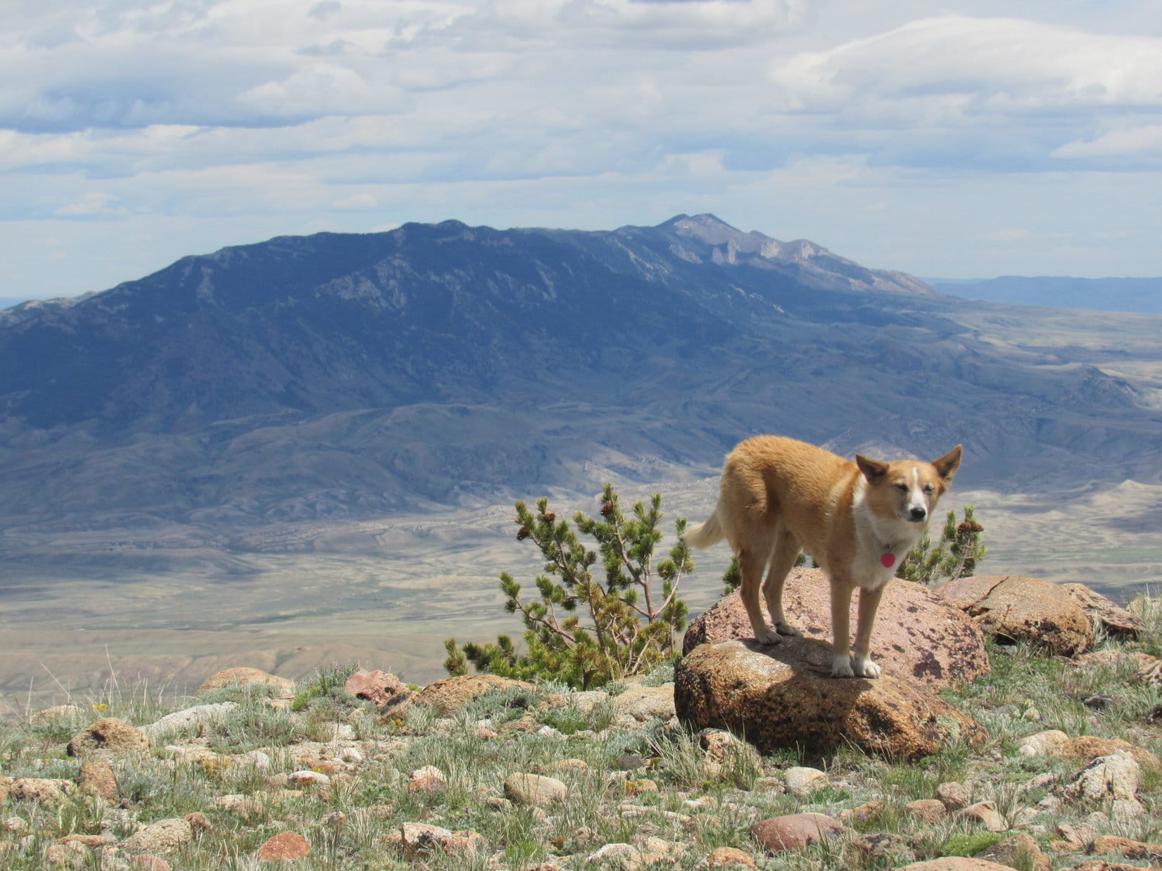
Whiskey Peak featured plenty of impressive views in other directions, too.  Lupe and SPHP hung out around the summit quite a while taking it all in.

The W wind hadn’t been bad most of the way up, but was practically a gale on top of Whiskey Peak.  Loop took little breaks now and then between photo sessions.  She usually sought out the lee side of rocks, or sat next to SPHP for shelter.

Mighty breezy up here, SPHP!  Is this it?

Sure is, Loop.  Is this what?

The top of the mountain, silly.   Is this it?

Oh, yes, of course!  Yeah, this is the top, alright.  Look at those views!

Yes, yes, quite splendid.  And windy.  So it’s time to celebrate, right?

Oh, sure!  Congratulations, Looper, you’ve climbed another magnificent mountain!  All the way to the top.  Great job, Loop!

Thanks for shaking my paw and all, SPHP.  I do appreciate your sentiments, but I was hoping for a bit more actually.  This is sort of a special place, right?

Yes, I suppose it is special.  What were you hoping for?  Water, Taste of the Wild?  I brought plenty of both.

Umm, no.  Those are fine usually, but I was hoping for something a little more appropriate for the occasion.

Huh, like what?

You’re a bit slow as usual SPHP.  Where are we after all?

Whiskey Peak.

Exactly!

Ruh, roh!  Lupe gazed expectantly up at SPHP, her eyes shining merrily with a big smile on her face.  The wind ruffled her fur, but she was momentarily unperturbed.

For a moment, not knowing what to do, SPHP did and said nothing.  Gradually, the smile began to fade from Looper’s face.  As SPHP began to pet her, Loop’s ears drooped.  Gone was the look of a 4 year old on Christmas morning.  Tears glistened in her always trusting light brown eyes.

Sorry, Loop.

So, there’s nothing else in the pack for me, for us, then?

No, sorry Loop.

No Glenfiddich?  Not even a little Jack Daniels?

Not a drop.  Guess, I didn’t think.  I didn’t realize you might be expecting anything like that.

Lupe blinked back the tears.

Oh, it’s OK.  I suppose I should have known.  We’ve been to Elk Mountains and there haven’t been any elk.  Deer Mountain and there weren’t any deer.  Bear Mountain and there weren’t any bears.  I never will understand you humans.  I just thought that this time, after all the mountains we’ve been to, maybe this one was a really special place.  Maybe this time you really were planning a special celebration for me.  I got my hopes up.

Sorry to have disappointed you, dearest Dingo.  I’ll make it up to you somehow, before too long.  Whiskey Peak is a really special place.  Just like all the other mountains we’ve been on.  There are countless mountains in the world, and we will only ever see the world from a tiny fraction of them.  Seeing these fabulous views, even if for only a little while, and even if we never ever come back to see them again, makes this place special.  And what makes it really special is that we are both here to share it together, sweet Dingo of mine!

Lupe sighed, then smiled weakly.

I know you’re right, SPHP.  But promise me one thing.  If we ever do come back to Whiskey Peak, you won’t disappoint me again.  Deal?

Deal!  Shake?

Lupe lifted her freckled paw and let SPHP shake it.

OK, SPHP.  Let’s go see what else there is to see from here before I get blown off clear to the next county.

Looking S toward the little community of Bairoil. The views were terrific, but Loopster was not enjoying the gale out of the W.
Hiding out from the wind. Photo looks SE.
Much of Whiskey Peak’s summit ridge is in view here. Loop is on some of the very highest rocks. Lupe found no cairns, but Whiskey Peak did sport the fairly sizeable stone fort seen beyond her. Photo looks NNW.
View to the WNW.
Looper in the stone fortress. Photo looks WNW.
Looking NE toward Muddy Gap.

After taking a break and spending a while near Whiskey Peak’s true summit, Lupe went N along the summit ridge toward the tower close to the N end.  The ground near the tower was definitely lower than where she’d already been, but this area provided a different vantage point for another look around.

Nearing the tower at the N end of Whiskey Peak’s long summit ridge. Photo looks N.
Ferris Mountain from the N end of the summit ridge. Photo looks ESE.
Lupe found the Rapid survey benchmark on a rock N of the tower.
View to the NNW.
Looking W from near the tower.
Looking S along Whiskey Peak’s summit ridge. The stone fort near the true summit is in view on the L.
Another look at the interesting dome-like hills to the NNW.
Looking NW.

Lupe still had a long way to go, so she couldn’t stay up on Whiskey Peak too long.  The wind being what it was, she was glad of that.  From the tower, she started down the huge grassy slope to the W.  The wild horses saw her coming again, and circled back around the S side of the slope up towards the true summit to stay out of the Carolina Dog’s way.

The wild horses circled away from Lupe back up toward the true summit.

On the way down, Loop stuck to the road that came up the center of the grassy area for a considerable distance.

Lupe stuck to the road coming down the center of the grassy area for a while, but eventually headed back to the pond she’d passed in the forest on the way up. Photo looks E.
Purple wildflowers on Whiskey Peak.

Lupe eventually left the road to go back to the pond she’d gone wading in on the way up.  From the pond she went NW through the forest, hoping to avoid having to climb the high point W of the pond again by staying N of it.

This turned out to be the worst possible route back to the saddle where she’d first reached Whiskey Ridge.  Either staying on the road from the tower, or climbing from the pond back up to the high point would have been better.  The forest NW of the pond was full of deadfall timber, plus a steep drainage that was a bother to cross.

Nevertheless, Loop made it back to the grassy slope leading down to the saddle where she’d first reached Whiskey Ridge.  The shortest route back to the G6 would have been to leave the saddle going S right back down the steep rocky road she’d come up earlier in the day.  However, by now, SPHP had seen the road following Whiskey Ridge farther WSW, and understood where Lupe was on the topo map.

Instead of going straight back to the G6, following the road along the ridge would eventually get Lupe to where she could peakbag Stratton Rim North (8,740 ft.) today, too.  This was a long detour, but Loop still had time enough to do it.  It seemed like a fun idea, and she wasn’t likely to ever have another chance like this one.

So from the saddle, Lupe followed the ridge road.

Following the road winding WSW along Whiskey Ridge. Lupe’s next peakbagging goal, Stratton Rim North, is the little high point at Center. Photo looks SW.
Orange wildflowers growing near the road on Whiskey Ridge.

After 2 miles on the winding road traversing Whiskey Ridge, Lupe reached Low Pass.  Several roads intersected here.  Stratton Rim North was still another 0.75 mile away.  Only an ATV trail went the remaining distance to it, but that was plenty good for Loop.

After following the road along Whiskey Ridge for 2 miles, Lupe arrives at Low Pass.
Several roads intersected near Low Pass. The one seen here heads down into a valley to the N. Loop wasn’t going this way.
Only this ATV route continued the remaining 0.75 mile to Stratton Rim North from Low Pass, but it was a great trail for Lupe to follow. Photo looks W.
Almost there! Approaching Stratton Rim North. Photo looks SW.

The ATV trail didn’t go quite all the way to the top of Stratton Rim North, passing N of the high point only a short distance below it.  The wind was howling here, even worse than it had been up on Whiskey Peak.  Lupe wasn’t thrilled with the idea, but she did manage to climb to the top of Stratton Rim North (8,740 ft.).

SPHP was glad she did.  The views were really terrific!

Loop arrives at the summit of Stratton Rim North. Whiskey Peak (L), where she’d just come from, and more distant Ferris Mountain (R) are in view. Photo looks E.
Ferris Mountain from Stratton Rim North. Lupe wasn’t enjoying the wind at all. It was much gustier here than it had been earlier in the day. Periods of relative calm existed between sudden blasts. Photo looks E with help from the telephoto lens.
The rest of Stratton Rim from Stratton Rim North. Photo looks SW.
High Point 8729 is the small bare hill L of Center ringed by a few trees near the top. A long snow bank is seen below the E lip of Stratton Rim’s long N ridge. Photo looks NW.
Looking N.
Ferris Mountain (R) with help from the telephoto lens. Photo looks ESE.
Whiskey Peak (R of Center) with help from the telephoto lens. Photo looks ENE.

Lupe’s journey to Whiskey Peak and Stratton Rim North had been a success!  However, the American Dingo was anxious to escape the powerful blasts of the gusty W wind.  SPHP briefly considered the possibility of going straight on down Stratton Rim North’s E slope, but decided it was too steep to be worth the trouble.  May as well take the ATV trail back to Low Pass.

Before she got all the way back to Low Pass, though, Loopster did take a shortcut.  She left the ATV trail descending E down a minor ridgeline into a valley.  She intercepted a road going S down the valley from Low Pass.  The road gradually curved SE.

Lupe was still high enough to have panoramic views to the S and E, but far enough down so Stratton Rim sheltered her from the wind.  The evening trek back to the G6 was easy, beautiful, and fun.  Lupe saw a larger herd of wild horses, and several pronghorn antelope on the way.

Happy times out of the wind on the way back to the G6. Ferris Mountain (L) is in the distance. Photo looks ESE.
View to the S on the way back from Stratton Rim North.
Red wildflowers.
On the way back, Lupe passed this sign. It understated the distance to Whiskey Peak (at least following the road) by a good mile. Photo looks NW.
Lupe passed by this larger herd of wild horses, too.
Pronghorn antelope

It was still light out when Lupe got back to the G6 (7:42 PM, 65°F).  After having her evening Alpo, she wanted out again.  She wandered around sniffing for a bit, then found a place to curl up.  This far from Stratton Rim, the W wind swept over her, though not nearly so strongly as up on the ridge.

And there Lupe stayed, listening and watching, as clouds swept past overhead and light of day faded away.  Whiskey Peak disappeared from view as the world turned black.  And if SPHP had had any Glenfiddich or Jack Daniels, Lupe surely would have gotten a shot or two before bed, but alas, the poor doggie had none!

Links:

Next Adventure                        Prior Adventure

Want more Lupe adventures?  Choose from Lupe’s 2017 Laramie Range, Wyoming & Beyond Adventure IndexDingo Vacations Adventure Index or Master Adventure Index.  Or subscribe free to new Lupe adventures.

Pine Mountain, the Sweetwater County, Wyoming High Point (6-15-17)

Day 8 of Lupe’s 2017 Dingo Vacation to the Laramie Range & Beyond!

Colorado!  For pity sake!  Edward Earl’s trip report had warned that the sign for the turnoff to Pine Mountain was difficult to see from the highway.  Supposedly, SPHP had been watching carefully for it.  Not carefully enough, apparently!  SPHP turned the G6 around.  Lupe headed N back into Wyoming.

After leaving Prior Flat and the Shirley Mountains this morning, most of the day had been spent traveling.  The afternoon drive S from Rock Springs on Hwy 430 had been gorgeous.  High, remote ridges and hills stretched to the horizon, separated by dusty oceans of undulating sagebrush prairies.  Classic Wyoming!

On the way S, Lupe had finally seen a mountain SPHP figured might well be Pine Mountain (9,550 ft.).  Even with this advance warning that Lupe must have been getting close, the turnoff had been missed.

30 or 40 miles S of Rock Springs on Hwy 430, this mountain came into view to the SSW. Maybe it was Pine Mountain? Photo looks SSW.
Getting closer. SPHP never really figured out if this was actually Pine Mountain, or another one close by. Photo looks SW.
This road leading into a scenic valley W of Hwy 430 looked intriguing, but Lupe didn’t get to explore it. It turned out this road wasn’t far from the Colorado border. Lupe had already missed the turn to Pine Mountain by the time she reached this point. Photo looks W.

The turnoff to Pine Mountain was supposed to be about 5 miles N of the Colorado border.  Of course, Edward Earl had been here way back in July, 2002.  Maybe the sign at the turn he referred to in his trip report was damaged, no longer existed, or had fallen over?  SPHP drove slowly N staring down each dirt road leading W from Hwy 430.

Maybe SPHP was just driving super slow, but it seemed like Lupe had gone well over 5 miles from the Colorado border.  Still nothing.  SPHP was considering turning around again for another pass at it going S, when at the top of a rise, there it was!  A BLM sign in perfectly good condition said “Pine Mountain 12”.  How had SPHP missed that?  Didn’t matter, Lupe was on her way!

The BLM sign at the turnoff was small, but in perfectly good condition. The turn is at the top of a rise on the W side of Hwy 430 between mile markers 49 & 50. Photo looks WSW.

It remained to be seen how far Lupe would get, however.  Edward Earl mentioned several sharply eroded ruts across the road within the first couple of miles.  Maybe the G6 wouldn’t be able to get past them?  That would be bad news.  A hot, dry 10 mile one-way march just to get to Pine Mountain wasn’t going to happen.

Fortunately, the sharply eroded ruts no longer seemed to exist.  Most encouraging!  The road was supposed to be good the rest of the way.  The next landmark Mr. Earl said to watch for was a fork in the road 4 miles from the highway.  A BLM sign on the L would say 8 miles to Pine Mountain.

At 3 miles, and again at 4 miles, Lupe came to unsigned 4-way intersections at minor crossroads.  Hmm.  Edward Earl hadn’t mentioned these.  SPHP drove straight at each one.  5 miles from the highway, Lupe did come to a fork in the road.  A BLM sign near the L fork said “Red Creek Basin, County Road #71, Titsworth Gap”.  No mention of Pine Mountain, or any clue as to where the road to the R went.

Pine Mountain was nowhere in sight.  The sign looked fairly new, but even if it had been replaced since Edward Earl was here, why didn’t it mention Pine Mountain?  None of the places listed meant anything to SPHP.  Still, the road to the L was going the right general direction.  It was probably the way.  Maybe best, though, to go a little farther on the road to the R, just to make certain another fork wasn’t coming up soon?

A 0.5 mile jaunt down the R fork revealed nothing other than that the road deteriorated rather quickly.  No other turns to the L could be seen for at least another 0.5 mile.  That settled it.  Lupe returned to the “Y” and took the road to the L.

A stuffed monkey hangs for no obvious reason from the new BLM sign at the “Y” about 5 miles from Hwy 430. Pine Mountain is nowhere in sight, but the road to the L, seen here winding off to the SW, is the right way to go!

Six miles later, SPHP parked the G6 at the base of Pine Mountain’s long NE ridge in a saddle just S of High Point 8510, a small butte mentioned by Mr. Earl.  It was getting late in the afternoon (5:17 PM), and the 9,550 ft. summit was still more than 4 miles away.

After being cooped up in the G6 most of the day, Lupe was ready for action!  A road goes all the way to the top of Pine Mountain, so getting to the summit would be a cinch.  The sun stays up late in June, so even on paw and foot Lupe and SPHP would have plenty of time.  Maybe Loop would even get to enjoy a nice sunset up there?

The trek had barely started, when SPHP nearly stepped on a baby pronghorn antelope hiding on the ground.  It was very much alive.  Lupe was already off racing around the fields, so she hadn’t seen it.  Best that she didn’t.  SPHP hurried over to the road leading up the mountain.  Lupe never did see the baby pronghorn.  No doubt she would have loved to, but it wouldn’t have been a good thing.

Lupe never did see this baby pronghorn antelope hiding on the ground.
The G6 is parked in the saddle S of High Point 8510 (L), the small butte mentioned by Edward Earl. The road on the R goes all the way to the top of Pine Mountain. It was fairly steep in places, and had one rough section at the end of a big switchback, but overall it was quite good. Even the G6 might have made it to the top. Where’s the fun in that, though? Photo looks NNW.

Despite its woodsy name, only the N side of Pine Mountain turned out to be forested.  Most of the mountain was bare or sported only scattered trees.  The road to the top never entered the forest.  Consequently, Lupe had big sweeping views all the way up the mountain.  They only got better as she gained elevation.

Only the N slopes of Pine Mountain were forested. Lupe never entered the forest. She enjoyed huge panoramic views all the way up the mountain. The road to Hwy 430 is seen below. Photo looks NE.

The first 1.5 miles were by far the steepest.  Near the end of it, the road made a single giant switchback followed by a short rocky section.  After that the slope of the mountain decreased steadily.

Looking up the steepest part of the climb. Not bad at all, really! Beyond the high point seen above, the slope of the mountain decreased steadily. Photo looks SSW.
Yellow wildflowers like these dotted the slopes of Pine Mountain.
Still early in the climb. The tan tank in the distance may be the water tank Edward Earl referred to in his trip report. The main road to the top of Pine Mountain used to go by it, but has been rerouted. The mountain in the distance is Diamond Peak (9,640 ft.) in Colorado. Photo looks SSE.
View to the NE in early evening light.
Four J Basin from Pine Mountain’s NE ridge. Photo looks ESE.

Once past the steep part, the road headed SW up a wide, grassy, but otherwise barren slope.  The view from the road would remain boringly the same for more than 2 miles.  Far to the R was the edge of the forest.  Far to the L was the SE edge of the mountain.

Yes, that’s right! The view along the road was like this for more than 2 miles. Boring! That’s why I went L over to follow the edge of the mountain. Great views over there! Photo looks SW.

After trudging nearly half of this dull distance on the road, even SPHP began to realize this trek would be a lot more fun over by the edge where Lupe could see the big views to the SE.

The edge of the mountain provided splendid views the entire way.  The only disadvantage was that the higher Lupe went, the windier and colder the edge became.  Loop didn’t care for the wind, but it wasn’t unbearable.

The wind makes Lupe squint, but she had a fantastic view of Middle Mountain (9,559 ft.) (R) and Diamond Peak (9,640 ft.) (Center in the distance) to the SE.
Loopster along the SE edge of Pine Mountain. Photo looks SW.

The highest part of Pine Mountain forms a huge crescent pointing SW.  The terrain features mostly small rocks, small plants, and is otherwise barren and flat.  The topo map shows two high points near the S edge.  At the far SE end, the former site of an old radio tower is shown as having an elevation of 9,546 ft.  Nearly half a mile to the WNW is the official summit with an elevation of 9,550 ft.

Lupe arrived at the SE high point first.  A small concrete platform only 3′ x 3′ was all that seemed to remain of the radio tower.  The platform was located next to the start of a long fence which swept around to the W from here near the S edge of the mountain.

At the SE end of Pine Mountain, Lupe reached this concrete platform, apparently all that remains of an old radio tower installation. As near as SPHP could tell, this was High Point 9,546 on the topo map. Photo looks W.
Near the old radio tower site looking SSE. The mountains in the distance are all in Colorado. Lupe is less than 2 miles from the border here.
The snow-capped peaks barely visible on the far horizon on the L are likely part of the Uinta Range in Utah. Photo looks WSW.

A two track dirt road ran along the N side of the fence close to the edge of the mountain.  Since she still hadn’t made it to Pine Mountain’s official summit, Lupe followed this road W, continuing on it as it curved gradually to the WNW, then NW.

Following the road N of the fence, Lupe came to several piles of old fence posts along the way. Photo looks N.

Edward Earl had mentioned that each of the two spot elevations on the topo map appeared higher when viewed from the other.  In Mr. Earl’s opinion, HP 9546 near the old radio tower site was likely the true summit, not HP 9550 which was the true summit according to the map.

Like Mr. Earl, Lupe visited both of these points.  In the end, SPHP had no firm opinion where the true summit actually was, only that Lupe must have reached it somewhere along the way.  No matter where Lupe was along the rim of the mountain, the terrain in the distance always looked definitely somewhat higher!

Perhaps the American Dingo knew exactly when she reached the true summit, but she maintained silence on the point.  Dingoes don’t fret about such things.  As far as Lupe was concerned, she’d done her peakbagging job and reached the top of Pine Mountain (9,550 ft.).

Near the SW end of the mountain, not too far from the official 9,550 ft. summit on the topo map, Lupe came to a green gate in the fence.  She went through the gate, and started a little down the slope before stopping near the edge of the steepest part.  A fairly strong wind still blew out of the SW, making things rather chilly on the totally exposed edge.

As far as the Carolina Dog could see, unspoiled open territory stretched past grand valleys and hills to distant mountains, some snow-capped, on the far horizon.

Lupe enjoying tremendous views along the SW edge of Pine Mountain. Photo looks W.
Barely visible snow-capped peaks are on the horizon. Perhaps part of the Uinta Range in NE Utah? Photo looks SW.
The same snowy peaks with lots of help from the telephoto lens. Photo looks SW.
The forested hill in the foreground is Kleins Hill (9,048 ft.) in Colorado. Photo looks S.

Nearly an hour remained before sunset.  Other than the wind, which seemed to be gradually weakening as the sun sank, there wasn’t a reason in the world why Lupe shouldn’t stay to enjoy the show.  Seldom has she had such a tremendous vantage point near the end of a day, plus a great route back to the G6 that would be easy to follow even after dark.

Lupe had water and Taste of the Wild, then curled up in the breeze to see how the evening would turn out.

Loop waits for sunset from her great vantage point on Pine Mountain. Photo looks NW.

For a while, the already splendid scene didn’t change much.  The sun was still too far above the horizon.  Lupe and SPHP sat huddled together against the breeze, gazing off toward Colorado and Utah, enjoying the solitude.

For a while, the views didn’t change much. The sun was still too far above the horizon. Enough clouds were around, though, to encourage the notion that the sunset might be a good one. Photo looks SW.

Slowly, the sun’s rays slanted more sharply.  A golden glow crept over the land.  Contrasts deepened between light and shadow, highlighting features of the terrain.  In the distance, outlines stood out, sky now easily differentiated from mountains and ridges.

Slowly a golden glow spread over the land highlighting features of the terrain. Photo looks W.

Lupe bathed in the golden glow, too.

Looking SSW.

The light intensified rapidly in the final brief moments before sunset.  Lupe was transformed to a brilliantly illuminated Dingo goddess!

Lupe stands brilliantly illuminated during the final brief moments before sunset. Photo looks S.
The Dingo goddess.

The golden glow faded.  Shadow spread over the earth.  Sunlight retreated to the realm of sky and clouds.

Sunlight retreated to the realm of clouds and sky. Photo looks SW.
Looking NNW.

The show wasn’t over yet, though.  Not until the sun disappeared completely did the evening sky rise to its colorful peak of glory.

Not until the sun disappeared completely did the evening sky rise to its most colorful peak of glory. Photo looks WNW.

And then it was over.  Colors collapsed.  The sky turned gray, the earth black.  Lupe had remained to the end.  Now the former Dingo goddess started the long trek back, traveling in deepening shadow the barren, breezy surface of this lofty dark underworld.

The sky grew black.  So black, the ancient dim light of stars and galaxies blazed above, a shining echo from the edge of infinity of what once was eons ago.  Miles to the E, a single small grouping of bright electric lights.  On the far N horizon, a faint glow that must have been Rock Springs.  Elsewhere, the pitch black unbroken reign of night.

On the move, heading down, the beautiful, quiet evening slipped by.  The dying breeze brought the only news, subtle hints from the wild, to a still curious, quivering nose on Pine Mountain.  (10:52 PM)

Lupe on Pine Mountain, 6-15-17

Links:

Next Adventure                          Prior Adventure

Want more Lupe adventures?  Choose from Lupe’s 2017 Laramie Range, Wyoming & Beyond Adventure IndexDingo Vacations Adventure Index or Master Adventure Index.  Or subscribe free to new Lupe adventures.

The Shirley Mountains High Point & Quealey Benchmark, Wyoming (6-14-17)

Day 7 of Lupe’s 2017 Dingo Vacation to the Laramie Range, Wyoming & Beyond!

S of Casper, roughly a mile W of Hwy 77, the wide, dusty gravel road (County Road No. 105) came to a “Y”.  Off to the SW, beyond an expanse of prairie, rose an isolated mountain range.  Although reaching more than 9,000 feet in elevation, these mountains didn’t appear particularly high, rugged or striking.  The Shirley Mountains looked more like a collection of big forested ridges.

The isolated Shirley Mountains weren’t particularly rugged, appearing more like a collection of big forested ridges. Photo looks SW.

Lupe was coming to visit the Shirley Mountains High Point (9,151 ft.), but SPHP knew next to nothing about this place.  Copies of an old topo map showed a long dotted road winding 7 miles or so in from the N that passed near the high point.  A 4WD road?  Probably.  In that case, the G6 wouldn’t be able to do it.

That wasn’t the real issue.  The Carolina Dog could travel the 7 miles on her own easily enough.  Two other questions loomed larger.  First, was there even access?  This might be all private land.  In that case, some landowner would have to be sought out, and permission obtained to even enter the area.

Second, even if access was available or could be obtained, did the road shown on the map exist in good enough condition so Lupe could follow it?  If not, the American Dingo might end up lost in the forest, as SPHP tried to make sense of a multi-mile bushwhack based solely on the old topo map.  These mountains didn’t appear to have many prominent features to orient by.  Wandering around up there might prove confusing.

A sign at the “Y” was somewhat encouraging.  Left was BLM Road No. 3115 (E end).  Right was the way to BLM Road No. 3115 (W end) in 6 miles, County Road No. 291 in 19 miles, and Miracle Mile in 25 miles.  A BLM road going up into the Shirley Mountains at least meant there was public access!

SPHP took a L driving S toward (on?) BLM Road No. 3115 (E end).  Lupe rode with her head out the window.  She was loving this!  Herds of pronghorn antelope were out on the prairie.  Unlike cows and horses, the antelope paid attention to the yippy-yappy Dingo.  Racing across the prairie, they inspired even more vigorous, frantic Dingo antics.  No doubt about it, as far as Loop was concerned, the day was off to an exciting, exhilarating start!

SPHP wasn’t nearly as thrilled.  The whole trip S on BLM Road No. 3115 (E end) was a fiasco.  After exploring 3 more “Y’s”, including a useless trip W partway into the impressive Creek Land & Livestock Company ranch, a road could be seen going W up into the Shirley Mountains.  The stony, rutted remnant of a road the G6 was on appeared to link up to it a few miles farther on.

No way!  The G6 was getting beat to death on this miserable excuse for a road.  Continuing without high clearance and a rugged suspension system was a disaster waiting to happen.  Disaster wasn’t likely to hold off much longer, either.  SPHP did the prudent thing and turned around.

Another jarring, nerve-wracking, exciting ride back past the antelope ensued.  To SPHP’s great relief, Lupe reached the first “Y” again.  This time, SPHP drove W on County Road No. 105.  This road did not deteriorate, and some 6 miles farther on Lupe reached another intersection.  A sign indicated that a side road going S was Shirley Mountains Loop Road No. 3115.  Prior Flat Campground was 0.4 mile away.

Hmm.  It was a bit odd that BLM Road No. 3115 (West End) apparently entered the Shirley Mountains from the N instead of W, but whatever.  No point in quibbling.  SPHP was actually rather pleased.  This might be the same road shown on the topo map, in which case Lupe would have public access all the way to the Shirley Mountains High Point.

SPHP made the turn S.  0.4 mile up a grassy slope, Lupe arrived at Prior Flat Campground.

Lupe arrives at Prior Flat Campground. The campground is tucked up against the trees at the N end of the Shirley Mountains, and features an expansive view of Prior Flat, a huge open prairie to the N.

Prior Flat Campground was awesome!  Two loops with campsites were tucked up in or near the trees at the base of the N end of the Shirley Mountains.  To the N was an expansive view of Prior Flat, a broad prairie.  Beyond were thirsty-looking low mountains, ridges and hills.

The whole place felt remote, abandoned.  Not a soul seemed to be around, and apparently the campground was free!  No mention of fees or registrations required anywhere.  A most excellent situation!  Lupe and SPHP grabbed a spot along the W loop, backing the G6 into the shade of aspen trees near a picnic table.

Lupe on open ground within the rail fence serving as the N boundary of Prior Flat CG. On the R, Country Road No. 105 winds away off to the W. In the foreground, Shirley Mountain Loop Road No. 3115 goes right through the CG. Photo looks W.

After a quick bite to eat, Lupe and SPHP left the G6 at the campground, and started up Shirley Mountain Loop Road No. 3115 (11:04 AM, 52°F).  For nearly a mile, the road went steadily SW up a forested valley.  SPHP was quickly convinced this was Prior Draw.  Lupe was on the exact same road on the old topo map that would lead her close to the Shirley Mountains High Point.

At the upper end of Prior Draw, the road turned E near a saddle on a ridge to the S.  Lupe left the road and climbed up to the saddle.  She had a view to the SW, but was more interested in a lone snow bank back in among the trees.  After frolicking and cooling off on the snow, Loop returned to the road.

At the upper end of Prior Draw, Lupe was more interested in this nice, cold snow bank than the view. Photo looks SSW.

No. 3115 now went 0.5 mile SE, then 1.0 mile S.  Lupe gained elevation the whole time.  The forest sometimes gave way to large, open meadows.  A high, distant mountain could be seen off to the W, but SPHP was uncertain what mountain that might be.  After passing by driveways to a couple of cabins in a more wooded area, Lupe reached flatter, open ground.

The Carolina Dog was getting fairly high up now.  Ahead she could see a tower at the top of a ridge.  This tower was at High Point 8712 on the topo map.

Approaching the tower at High Point 8712. Photo looks SE.

Lupe followed No. 3115 to the top of the ridge.  Two side roads, not far from one another, led off in different directions.  The first road went NE to the tower, which was now close at hand.  The second road disappeared into a forest to the WSW.  Instead of going to the tower, Loop took the road into the forest.  This had to be the way to Peak 8720.

Peak 8720 was a Brian Kalet peak, meaning simply that Brian Kalet, a prolific peakbagger, had entered the mountain into the Peakbagger.com database that Lupe also uses to track her ascents.  Early in 2017, Lupe had visited quite a number of Brian Kalet peaks in the southern Black Hills.

Since the Peak 8720 summit was only a 0.5 mile side trip, Lupe might as well visit this Brian Kalet peak, too!  She’d already basically climbed it.  The top of the mountain was no more than 40 to 60 feet higher than where she was now.

The side road going through the forest brought Lupe to a humongous snow drift.  The road disappeared beneath it.

The side road going WSW through the forest brought Lupe to this humongous snow drift!

The giant snow bank was just inside the W edge of the forest.  The snow must have drifted in last winter driven by winds sweeping over a huge flat meadow that was directly ahead beyond the trees.  Since the road disappeared beneath the snow, Lupe had no choice but to go right over the drift, a task she thoroughly enjoyed.

On the other side of the snow bank, the road reappeared.  Lupe followed it as it emerged from the forest and continued through the meadow.  The terrain was flat as a pancake.  The meadow extended all the way to the edge of a canyon, but the road turned N halfway there.  Lupe left the road to go find out what could be seen from the meadow’s edge.

A strong W wind swept across the meadow.  Lupe was traveling right into the teeth of it.  The wind grew stronger and stronger as she neared the edge of the meadow.  By the time she got there, Loop was standing in a gale.  She had a good view of the Cave Creek valley below, and mostly forested mountains and ridges beyond.

Looking W across Cave Creek valley from Peak 8720. The W wind coming from behind Lupe was a gale here near the edge.

The view was nice, but Lupe didn’t want to linger in this gale any longer than she had to.  According to the topo map, the true summit of Peak 8720 was somewhere in the nearby forest to the N.  Among the trees and away from the edge, it wouldn’t be nearly so windy over there.  Lupe was more than happy to go looking for the summit.

As the map indicated, the terrain was somewhat higher in the forest than in the meadow, but not by an awful lot.  This whole area varied very little in elevation.  Lupe and SPHP marched around for a while looking for a clear high point, but found nothing obvious.  Close enough for Dingo work!  Lupe posed for a photo at a point that seemed to be about as high as anywhere else, and called it good.

At the official Dingo summit of Peak 8720! Calling it good, right here!

No more time to waste on this!  Lupe still had miles to go to get to the Shirley Mountains High Point.  She left Peak 8720’s official Dingo summit heading back out of the woods and across the big, windy meadow.

After visiting Peak 8720’s Dingo summit, Lupe heads back across the windy meadow. The humongous snow drift is still ahead out of sight on the L at the edge of the line of trees in the distance. Photo looks SE.

Lupe returned to BLM Road No. 3115 again near the tower at High Point 8712.  No. 3115 had been quite a good road all this way.  SPHP might easily have driven the G6 this far.  This would have been about it, though.  As Lupe continued SE on No. 3115, the road lost elevation steadily and became rougher than the G6 would have liked.

More than a mile S of the tower, No. 3115 bottomed out where it crossed a small, clear stream only a few feet wide.  This was Cave Creek.  Lupe took a little break here for water and Taste of the Wild.  She had lost more than 450 feet of elevation since leaving Peak 8720, and was about to have to regain all of it and more.

Break time done, Lupe crossed Cave Creek.  A long, dull, dusty road trek ensued.  No. 3115 went SW for 0.80 mile, ultimately climbing a good way up a steepish hill.  It then turned and went S more than a mile before bending to the SE.  Most of the terrain was forested, but Lupe came to scattered meadows, too.  A few brief downhill sections broke an otherwise steady grind higher.

Lupe passed a few minor side roads, which went who knows where?  None of these roads, including No. 3115, had any traffic at all.  Signage was missing or meaningless.  No. 3115 eventually topped out at a large, tree-rimmed meadow.  The road turned E here, then began losing elevation.  Lupe quickly came to what appeared to be a more significant intersection.

A sign at the intersection meant nothing to SPHP, but less than a mile off to the SE Lupe could see a forested hill a couple hundred feet higher than where she was now.  The Shirley Mountains High Point?  Although certainly ready to get there by now, SPHP hoped that wasn’t it.  It didn’t look like Loop would see anything but trees from there.

This sign at the intersection meant nothing to SPHP, but Lupe could see a higher forested hill from here less than a mile to the SE. SPHP suspected that hill might be the Shirley Mountains High Point. Photo looks N.

Lupe stayed on No. 3115 going E from the intersection.  The road dipped a little more, then angled SE climbing the forested hill she had seen.  When No. 3115 looked like it was about to start losing elevation again, Lupe left it.  If this hill was really the Shirley Mountains High Point, the summit ought to be only a couple hundred yards to the SW from here.

A small meadow sloped up toward open forest.  In the forest, Loop found several rock outcroppings higher than anything else around.  The two highest were separated by 200 feet.  A big snow bank was melting quietly away on part of the ground between them.

The rock formation to the S, a short ridge of white rocks 15 feet taller than the surrounding terrain, was clearly the highest point on this hill.  Lupe scrambled up.  Ten feet S of the highest rocks at the N end of the little ridge, Lupe found what she was looking for – a survey benchmark stamped “Shirley”.

This was it, the Shirley Mountains High Point (9,151 ft.)!

Lupe discovered this survey benchmark 10 feet S of the highest rocks in the Shirley Mountains. Either the benchmark was placed in 1951, or a dyslexic surveyor stamped the wrong elevation on it. According to the topo map, the high point is 9,151 feet, not 1,951.

Old pieces of wood and long strands of smooth wire no longer serving any discernable purpose were scattered around the summit ridge near the benchmark.  Odd.  Lupe went and stood on the highest rocks at the N end of the little ridge to claim her peakbagging success.

Sadly, after coming all this long way, Lupe had no views of anything other than the forest from the Shirley Mountains High Point.  Unsurprising after seeing this forested hill from the NW, but still disappointing to SPHP.  Lupe seemed happy enough, though.

Lupe on the highest rocks of the Shirley Mountains. This view was about what SPHP expected after seeing this forested summit from the NW. Lupe seemed happy enough to be here, though! Photo looks NW.
On top of the Shirley Mountains! Photo looks SW.
Some of the smooth wire is seen draped around the rocks below Loop. What purpose it ever served was unclear. Photo looks SW.
Still on top. Photo looks NNW.

Lupe’s last rest break back at Cave Creek had been a while ago.  Now that she’d made it to the Shirley Mountains High Point, it was time for another one.  Loop went NNW from the summit over to the snow bank closer to the 2nd highest rock formation.  Here she had some Taste of the Wild and relaxed in the shade.

Lupe rests in the shade (lower L) near the melting snow bank. The N rock formation, which was the 2nd highest point on the mountain, is seen on the R beyond the snowbank. Photo looks NW.

Lupe had followed No. 3115 a good 7 miles to get here.  Yes, it was great that Loopster had reached the Shirley Mountains High Point, but SPHP remained dissatisfied with the lack of any significant views.  From the top of an entire mountain range, you’d think you would see something.  Not here.  Even on the long trek, Lupe hadn’t seen too much of interest.

Hours had gone by and it was a long way back, but maybe Lupe wasn’t done yet?  The map showed another benchmark on another mountain 1.25+ miles to the SE as the crow flies.  Quealey Benchmark (9,150 ft.) was only 1 foot lower than the Shirley Mountains High Point.  Maybe Lupe could see something from over there?

Going to Quealey Benchmark actually meant another mile E on BLM Road No. 3115, plus a 0.67 mile bushwhack S of the road.  By the time Lupe reached Quealey Benchmark, she would be nearly 9 miles from Prior Flat Campground.  Worth it?  Unknown.  Now or never, though.  When her break was done, Lupe returned to BLM Road No. 3115 and headed E.

A long forested ridge came into view.  Not too promising.  Somewhere near the S end of it was Quealey Benchmark.  The road lost 250 feet of elevation before starting to climb the ridge.  Instead of following the road all the way to its next high point, Lupe cut SE through the forest to save a little distance.

Once the American Dingo reached the ridgeline, she turned S.  The broad ridge sloped gradually upward.  This was easy terrain.  At first, Loop was in open forest.  She eventually came to meadows, but even at the meadows, forest always prevailed along the edges of the ridge.  No views.

Exploring a snow bank (of course!) on the Quealey Benchmark ridge. Photo looks S.

At the first big meadow Lupe came to, a rocky high point was in view not too far away.  She went to it and scrambled to the top.  No sign of the actual benchmark.

On top of the first high point in the first big meadow. Lupe found no sign of the actual Quealey Benchmark here. Photo looks SSE.

Onward!  Continuing S, suddenly there was movement!  Close by, a coyote emerged from the forest heading E across the meadow.  When Lupe saw it, she trotted toward the coyote wagging her tail.  She recognized it as another canine and was hoping to make a new friend.

The coyote didn’t want to be friends with Lupe, and most certainly didn’t want to be friends with SPHP.  As Lupe approached, the coyote fled.  Instantly, the emboldened American Dingo gave chase!

Loop (R) dashes after the fleeing coyote (L). Photo looks SE.

It was an exhilarating moment, but the coyote was gone in a flash.  Lupe returned to SPHP.  She continued S finding more rock formations, each one higher than the last.  Lupe investigated them all, but turned up nothing.

Lupe investigates another big rock formation on the Quealey Benchmark ridge. Still nothing. Photo looks WNW.

The big meadow ended.  Forest was ahead.  Lupe plunged right into it.  She was still gaining elevation, so it was no wonder she hadn’t found the Quealey Benchmark yet.  She emerged from the forest at a second big meadow.  Another rock formation, largest of any she’d come to so far wasn’t far off.

As Lupe drew near it, SPHP could see some wood and smooth wire up there.  Oh, that was promising!  Lupe led the way up.

Lupe at the top of the first large rock formation of the second big meadow. This was the highest rock formation so far. The wood and smooth wire seen here gave SPHP hope the Quealey Benchmark might be up here. Photo looks SW.

When SPHP joined Lupe at the top, it was clear in an instant that this was the highest point on the ridge.  Another substantial high point off to the SW wasn’t quite as high as this one.  Everywhere else, the terrain was sloping down.  Best of all, Lupe had a sweet view of a big snow-capped mountain far to the S from here.

Lupe was at the true summit of this whole long ridge!  The Quealey Benchmark had to be around here somewhere, didn’t it?

A shiny metal hubcap was hidden under a juniper bush.  Moving the hubcap aside revealed – yes, a survey benchmark!

Hidden beneath a low juniper bush almost at the top of the rock formation was this shiny metal hubcap. When moved aside, the survey benchmark was revealed.

To SPHP’s surprise, the benchmark was not stamped “Quealey” as shown on the old topo map.  Instead it was stamped “Que Ley”, Spanish for “What Law?”.

To SPHP’s surprise, the survey benchmark was not stamped “Quealey” as shown on the topo map. Instead it was stamped “Que Ley”, Spanish for “What Law?” Now that was cool!

Quealey or Que Ley, which was right, the map or the survey benchmark?  No telling.  Lupe and SPHP preferred Que Ley!  What Law? was a cool name for a mountain.  It conjured up images of outlaws hanging around in this territory back in the days of the Old West.  Maybe a really Old West, if the Spanish had named this place.

At any rate, Que Ley Benchmark (9,150 ft.), though officially one silly foot lower than the Shirley Mountains High Point, was everything the Shirley Mountains High Point was not.  Coyotes roamed this place.  The Que Ley name was cool.  The view of the distant snow-capped peak was awesome.  The summit was farther from the road, and felt even more remote.  SPHP was glad Lupe had come here!

Yes, Que Ley Benchmark was worth the extra effort!

At the top of Que Ley Benchmark. Photo looks SSW.
On the summit of Que Ley. Coming here was worth it, and felt like it had really made the day, even though Lupe had already made it to Peak 8720 and the Shirley Mountains High Point as well.
The big view to the S from Que Ley Benchmark. Elk Mountain (11,156 ft.) (Center) is the snow-capped peak on the far horizon. The even more distant ridge on the L is the Snowy Range in the Medicine Bow National Forest. Binoculars would have been nice to have up here.
Elk Mountain as seen from Que Ley Benchmark with help from the telephoto lens. Photo looks S.
Lupe remained at the top of Que Ley Benchmark while SPHP climbed down and circled around to the S to get this shot. Photo looks N.
Lupe’s success at Que Ley Benchmark felt like the high point of the day.

After enjoying the views up on Que Ley Benchmark, Lupe went to visit the other high point to the SW.  Just to make absolutely certain it wasn’t higher, you know.  It wasn’t, but also offered some decent views.

Looking S toward Elk Mountain (Center) on the far horizon again, this time from the SW high point.
Looking SE.
At the top of the SW high point. Photo looks WSW.

And that was that.  Except for the long trek back, nearly all of it retracing her route here, Lupe’s big adventure in the Shirley Mountains was over.

Of course, the Carolina Dog made the most of the return trip!  She ran, explored, and sniffed.

She rolled in snow banks.

Enjoying a snow bank on the Que Ley Benchmark ridge on the return trip.

She sniffed and examined beautiful flowers.

One of hundreds of natural floral arrangements growing right along BLM Road No. 3115.

She returned again to the Shirley Mountains High Point (9,151 ft.).

Back at the Shirley Mountains High Point for a second ascent after her journey to Que Ley Benchmark. Photo looks S.

Loop even made the 0.5 mile side trip back to look for Peak 8720’s Dingo summit again. The sun was down by the time she got to the big, flat meadow.  The wind, which hadn’t been much of an issue up on the Shirley Mountains High Point or Que Ley Benchmark, was still blowing here, though not nearly as powerfully as earlier in the day.

Back on the big, flat meadow on Peak 8720. The wind was still blowing, but not nearly as strongly as it had been earlier in the day. Photo looks E.

Lupe and SPHP searched around for the same Dingo summit as before, but couldn’t find it.  Light was fading and the forest was getting gloomy, so a new Dingo summit had to be selected.  Naturally, this still counted as an official ascent as far Lupe and SPHP were concerned!

At the 2nd Dingo summit of Peak 8720. This wasn’t the exact same spot Lupe was at earlier in the day, but that high point couldn’t be found. The whole area was so flat, this place had to be about the same elevation anyway.

Once Looper was back at BLM Road No. 3115 following her 2nd visit to Peak 8720, it was all downhill the remaining 2.5 miles to Prior Flat campground.  The Carolina Dog was still on high ground, but twilight was fading fast, when she saw the distant high peak to the W again.

What peak was that?  No telling.  The sky grew black, then lit up with stars.  SPHP still pondered the question as Lupe arrived back at Prior Flat campground (10:12 PM).  To this mystery remains an unresolved mental souvenir of Lupe’s long, happy day spent high in the remote Shirley Mountains of Wyoming.

Links:

Next Adventure                      Prior Adventure

Want more Lupe adventures?  Choose from Lupe’s 2017 Laramie Range, Wyoming & Beyond Adventure IndexDingo Vacations Adventure Index or Master Adventure Index.  Or subscribe free to new Lupe adventures.