Day 28 of Lupe’s 2017 Dingo Vacation to the Yukon & Alaska!
7:00 AM – Still foggy, but it was light out now. The fog didn’t seem as thick as it had been a few hours ago. Loopster was still snoozing after her big adventure going to Ermine Hill(2,700 ft.) and beyond yesterday up on K’esugi Ridge in Denali State Park. SPHP worked on catching up the trip journal.
Loopster catches a few more winks on a foggy morning after yesterday’s adventure to Ermine Hill and beyond on K’esugi Ridge in Denali State Park.
When Lupe woke up, SPHP suggested going back to the Ermine Hill trail registration station, which was only a short stroll away through the drippy forest. Lupe welcomed the opportunity to get out and sniff around.
Yesterday, from higher up on Ermine Hill, Lupe had seen two people and a big brown dog down on the trail. They had been watching a black bear across a small lake, before ultimately turning and retreating back down the trail. Lupe had pressed on closer to where the bear was on her way to Peak3700, but hadn’t ever seen it again. SPHP was curious whether the people had written any comments about the bear in the registry.
The people had written some comments, surprising ones! Their dog’s name was Ollie. That wasn’t so surprising, but what they had written about the bear was. Ollie and his humans hadn’t seen a black bear, they’d seen 5 of them! A sow with 2 cubs, plus 2 more mature bears. No wonder they had retreated back down the trail! K’esugi Ridge had been crawling with bears! Despite roaming around up on K’esugi Ridge practically all day yesterday, Lupe and SPHP had only seen that one.
Even though the fog was slowly thinning, by mid-morning it was fairly certain that Lupe wasn’t going to get to see Denali(20,310 ft.) today. At the pace things were improving, the Alaska Range would never come into view. May as well move on. Lupe and SPHP left Denali State Park taking George Parks Highway No. 3 to Wasilla.
By mid-afternoon, after a couple of stops and going through Wasilla, Lupe was nearing Palmer on Glenn Highway No. 1. It was a beautiful day here, 65°F and fairly sunny. Traffic was backed up for miles. People were thronging in to the Alaska State Fair. The fair wasn’t anything Lupe could go see, but another option existed. There was time enough left in the day to climb Hatch Benchmark(4,811 ft.) from Hatcher Pass.
In 2016, Lupe had climbed nearby Skyscraper(4,825 ft.) from Hatcher Pass under less favorable conditions. She had succeeded then, and Hatch Benchmark should be even easier. The April Bowl trail goes all the way from Hatcher Pass up to Hatch Benchmark passing April Bowl on the way. The trail is only 1.1 miles long, and elevation gain required is only 925 feet, comparable to what Skyscraper had been.
2.25 miles N of Arctic Avenue in Palmer, SPHP turned L (W) on N Palmer Fishhook Road (Willow Fishhook Road on some maps). 19 miles later, Lupe arrived at Hatcher Pass. Not everyone had gone to the Alaska State Fair. The pass was packed with people and vehicles. SPHP was lucky enough to grab a parking spot for the G6 at the same little pullout where Lupe had started for Skyscraper last year. (4:37 PM, 58°F)
A short, dusty walk W along the busy gravel road brought Looper to the official top of Hatcher Pass. The April Bowl trail started right across the road from the Hatcher Pass monument. The trail began by immediately switchbacking up a hillside of light green vegetation.
Lupe arrives at the start of the April Bowl trail at Hatcher Pass. Photo looks S.The trail to April Bowl and Hatch Benchmark starts out switchbacking up this hillside near the road. Photo looks SE.
The switchbacks soon brought Lupe close to a small stream tumbling down a ravine. Loop helped herself to a drink. The trail began climbing more steeply up the E side of the ravine.
Lupe got a drink from this stream coming down from April Bowl.
As Lupe drew near April Bowl, the trail leveled out to some degree. The summit of Hatch Benchmark came into view.
As Lupe nears April Bowl, the summit of Hatch Benchmark (R) comes into view. The trail eventually leads to the summit climbing the upper ridge seen here from L to R. Photo looks S.The stream from April Bowl. The high ridge leading to Hatch Benchmark is in the background. Photo looks SSE.
April Bowl contains 4 separate ponds. Lupe soon reached the first pond where the stream originated. A second pond was in view close to the first one. The trail curved around the E side of the closest pond heading for the long ridge leading to the summit of Hatch Benchmark.
Lupe reaches the first pond in April Bowl where the stream originates. The trail to Hatch Benchmark continues around the E (L) side of this pond to the ridge beyond it. Photo looks SE.Lupe at April Bowl with a view of the Hatch Benchmark summit (Center). Photo looks SW.
At April Bowl, Lupe had gained over 300 feet of elevation from the start of the trail. She had another 600 feet of elevation gain to go following the high ridge above April Bowl leading to Hatch Benchmark.
Lupe above April Bowl continuing on her way to Hatch Benchmark. Photo looks SW.Looking down on April Bowl from the same spot. Hatcher Pass is at far R. The SW end of Bullion Mountain(5,100 ft.) (R) is across the valley. The Willow Creek valley is on the L. Photo looks WNW.
Lupe had been meeting many people and dogs on the way up, but by the time she was getting close to Hatch Benchmark, fewer hikers had come this far. Only a small group of people could be seen ahead up at the summit.
Almost there! Photo looks WSW.All 4 ponds down in April Bowl are in view from here. In 2016, Lupe had climbed the near ridge at Center and followed it around to it to its far end on the R, which is the summit of Skyscraper(4,825 ft.). Photo looks N.
5 or 6 people were at the top of Hatch Benchmark when Lupe and SPHP arrived. They remained only a short while before heading back down. Lupe had Hatch Benchmark all to herself.
The summit area was triangular in shape. It wasn’t particularly large, but was level and roomy enough to walk around on easily. The two highest points were a couple of large rock outcroppings toward the N and SW separated by about 40 feet. SPHP thought the N high point was the true summit, but they really weren’t much different in elevation.
Views of the surrounding Talkeetna Range were magnificent!
Loop reaches Hatch Benchmark. She’s on the SW high point here. Photo looks SW.Looking W down the Willow Creek valley from the SW high point.Looking WSW at the area N of Bald Mountain Ridge(4,902 ft.) and S of the Willow Creek valley.Oh, this was so easy, SPHP! We didn’t even get rained on, and look at all these tremendous peaks around us! Photo looks NW from the N high point.Lupe at the true summit of Hatch Benchmark. Bullion Mountain is the high ridge at Center. Skyscraper is the near ridge on the R. Photo looks N.Looking NE. The lower ridge on the R is the one Lupe came up.Lynx Peak(6,536 ft.) is the dark high peak at Center. Lupe would be climbing Lynx Peak tomorrow. It is accessible from the end of the Reed Lakes trail. Photo looks NE.Looking down on April Bowl again. The parking lot at Hatcher Pass is in view on the L. Photo looks N.
No one else came up the mountain after Lupe, perhaps because it was getting on toward evening. However, the weather was holding up just fine. Temperatures were in the mid 50’s °F. No wind or precipitation. Lupe and SPHP lingered enjoying the views. SPHP searched around for the actual Hatch survey benchmark, but found nothing.
Off to the S, beyond Palmer and the Matanuska River valley, Lupe could see a couple of peaks in the Chugach Mountains she had climbed back in 2016, Lazy Mountain(3,740 ft.) and Pepper Peak(5,381 ft.). SPHP recognized some other peaks the Carolina Dog had never been to, as well.
The Matanuska River valley (L) and Knik River valley (R) meet near Palmer. Photo looks SE.Lazy Mountain is the low one in front on the L. The high, sharp, dark peak on the L is Matanuska Peak(6,093 ft.). Photo looks SE with a little help from the telephoto lens.Zoomed in on the Knik River valley and the Western Chugach Mountains. Photo looks SE.Loop back at the SW high point. Government Peak(4,781 ft.) is in sunshine on the L. Bald Mountain Ridge East Peak(4,820 ft.) is in shadow on the R. Photo looks S.Loopster atop Hatch Benchmark’s SW high point. Photo looks S.Same spot with Bald Mountain Ridge East Peak on the R. Photo looks S.
Lupe was happy to cooperate, and it was so beautiful out that SPHP took lots of photos.
Lupe at the true summit. Photo looks N.You are looking great, Looper!Still at the true summit, but after the light changed. Photo looks N.American Dingoes are rarely seen on Hatch Benchmark, but today was an exception.
Lupe did great, but she eventually got bored with the photo shoot. She decided to take a break while SPHP made do without her.
Loopster takes a break on Hatch Benchmark. The ridge leading back down to April Bowl is in view. Photo looks NE.Another look at the ridge leading down to April Bowl. The Little Susitna River valley is on the R. Photo looks NE.Looking WSW.The Willow Creek valley. Photo looks W.
Some of the most spectacular peaks that could be seen from Hatch Benchmark were toward the NE. With the telephoto lens it was possible to get a fairly good look at them. SPHP didn’t know the names of those peaks, but maybe they could be figured out later by comparing photos with maps?
The Pinnacle(5,500 ft.) at L in shadow, Didilicama(6,100 ft.) slightly L of Center in sunlight, Lower Spire(6,129 ft.) slightly R of Center in shadow, Higher Spire(6,135 ft.) beyond it, Microdot(4,900 ft.) closer by at far R. Photo looks NNE.Less certain about these peaks, but Lynx Peak(6,536 ft.) is the high one on the L in shadow. Photo looks NE with lots of help from the telephoto lens.
The time came to leave Hatch Benchmark. No one else had come up the mountain. Lupe was ready for a few more photos before departing.
At the SW high point. Bald Mountain Ridge is in the background. Photo looks SW.Looking SE toward Palmer.At Hatch Benchmark’s true summit. Photo looks NW.Nice, Looper! That should do it!Looking down on April Bowl again with Skyscraper(4,825 ft.) in sunlight beyond it. Photo looks NNE.
Loopster and SPHP enjoyed the easy trek back to Hatcher Pass. Lupe met far fewer people than on the way up. Everyone was heading down.
Wow, that was fun and easy, SPHP! Not a single bad thing happened. Maybe we could make this a new tradition? …. Oh, I dunno, Loop. Adversity is often part of the best adventures, though it’s important not to overdue it. Back down near the stream below April Bowl.Looking down on Summit Lake. The Willow Creek valley is beyond the lake. Photo looks W.
Not many vehicles were around when Lupe reached Hatcher Pass again. (7:35 PM) The crowds were gone. The few people who still remained were all busy getting ready to depart. Looper visited the Hatcher Pass monument.
The only thing I didn’t like about this adventure, SPHP, was this whole leash thing. Why don’t you take a turn wearing it for once?
The whole trek from Hatcher Pass to April Bowl and Hatch Benchmark had only taken 3 hours, even with all the loitering Lupe and SPHP had done up at the summit. Loopster was right, it was nice to have an easy time where everything went smoothly for once.
Before long, Lupe and SPHP were alone at Hatcher Pass. Loopster was staying for the show that everyone else was going to miss.
The show was a good one, with beautiful colors. Later there was a half moon, and even a few stars. With all the clouds and fog in Alaska, Lupe hadn’t seen stars in, well, it couldn’t really be forever, but it seemed like a long time. Maybe the stars were a good omen for tomorrow?
Loop watches the evening show from Hatcher Pass.
Oh, I think you’re right, SPHP! Those are our lucky stars! Tomorrow will be another great day. Just leave all the wildcats to me! I get along fine with cats.
Wildcats? What wildcats, Loop?
The wildcats on the mountain we’re going to, silly! Passels of ’em! Don’t worry, though. I’m always good with cats. They can’t help it that they’re handicapped. It’s no fault of theirs. They were born that way. These lynx wildcats are big, though, so it will be trouble if you rile them up. Just leave ’em alone, and let me deal with them.
I’m not expecting to see any wildcats Loop, handicapped or not. What makes you think we will, or that they will be handicapped if we do?
Oh, for pity sake! Have our plans changed again? Haven’t you been saying we are going to Lynx Peak tomorrow? Didn’t we see a lynx shortly before we left the Dalton Highway a few days back? Wasn’t it a big wildcat? Won’t lynxes be swarming all over Lynx Peak? Of course, they will!
This is starting to sound a lot like Jack Squirrel Peak, Loop. Remember how you got all worked up about the enormous jack squirrels, and then it turned out there weren’t any?
That was terrible, SPHP! A completely awful, sickening tragedy! Don’t you remember why the jack squirrels weren’t there, though? They all burned up! Lynx Peak won’t be burned up. How could it be? It rains on us multiple times practically every day here in Alaska.
That’s true enough. Couldn’t light Lynx Peak on fire, if we tried. Well, I suppose we might see a lynx. Must have been one on Lynx Peak one time or another. Why would it be handicapped, though?
Don’t you humans know anything about animals, SPHP? It would be handicapped because it’s a cat! That’s what cats are! They aren’t good at being members of the pack. They don’t understand how to hunt together and help the pack. They just want to be fed and adored for doing nothing, then left alone. They’re perfectly fine by themselves, and have no social skills other than the ability to train humans to be their servants. Why do you fall for that anyway?
I suppose it’s all the purring, Looper. A purring kitty is hard to resist.
Oh, yeah. Their one magic trick. That noise isn’t natural, though, SPHP. Nothing else does that. Suspicious, don’t you think? Something’s not right about it. Makes me wonder if they aren’t really handicapped? Maybe they made some deal with someone they shouldn’t have ever been dealing with in the first place. Maybe if their purrers were exorcised, they would be normal dogs again?
Normal dogs again? Cats aren’t dogs!
Sure they are! Why, we had them in my family when I was born. We were all there, cats and dogs together! One big happy family. We got along fine. That’s why I understand cats so much better than you do. Cats are just a different sort of dog. Handicapped, like I said before.
Alright, whatever Looper. You win. I’m just going to hope for a nice day tomorrow like the lucky stars are predicting. You can deal with the passels of lynxes for us.
Good! Remember this – when we get to the lynxes, don’t do anything that makes them wag their tails. When us Dingoes and normal dogs wag our tails, it means we like you. When cats wag their tails, it means they are thinking about eating you. The faster and twitchier they wag them, the hungrier they are, too! So watch their tails.
Wonderful advice, I’m sure, Loopster. But I don’t think lynxes even have tails, or at least not much of one.
No tails? Even stranger than most cats then. They might be more dangerous than I thought. Just stay close, and try not to look like a big mouse.
Fine, fine, whatever you say. I ought to be able to manage that!
Sunset from Hatcher Pass, Talkeetna Mountains, Alaska 8-27-17
Day 27 of Lupe’s 2017 Dingo Vacation to the Yukon & Alaska!
7:00 AM – Lupe prowled among the bushes sniffing excitedly. She liked this place! Getting to be late August. The bushes were starting to show some fall colors. SPHP stretched and walked around a bit looking at the views to the N or NE where mountains and glaciers of the Alaska Range could be seen 15 miles away beyond Monahan Flat.
Lupe’s day started off well with some excited prowling about among these bushes. Part of the Alaska Range is seen in the distance beyond Monahan Flat. Photo looks N.Zoomed in on the Alaska Range beyond Monahan Flat.A glacier in the Alaska Range.
The views were awesome, but the sky was more darkly overcast than SPHP would have liked. Lupe had an adventure planned for today over in Denali State Park. She intended to take the to Ermine Hill trail to a point where she could scramble up Ermine Hill(2,700 ft.), then press on taking the K’esugi Ridge trail to Golog Benchmark(2,970 ft.). A long day, but a fun one, if the weather didn’t interfere.
With so much in the works, Lupe had to get going. 47 miles of gravel road on Denali Highway No. 8 brought her to the pavement on George Parks Highway No. 3 at Cantwell. SPHP turned L heading SW for Denali State Park. Disappointingly, though no surprise, only the lower peaks of the Alaska Range were in view as Lupe neared Denali State Park. All the high stuff, including Denali(20,310 ft.) itself, was shrouded in clouds.
No other vehicles were at the Ermine Hill trailhead at milepost 156.5 when Lupe and SPHP arrived. Despite the general cloud cover, a few patches of blue sky offered encouragement. Looper was at least going to try for Ermine Hill. Whether she would continue all the way to Golog Benchmark might depend on how the weather developed.
A short stroll into the forest led to a registration station. SPHP registered, and the Carolina Dog was on her way. (9:59 AM, 51°F)
Lupe arrives at the Ermine Hill trailhead at MP 156.5 along George Parks Highway No. 3 in Denali State Park.
The Ermine Hill trail started off in a forest full of ferns. Lupe quickly reached a section of trail overgrown with tall grass, ferns, and bushes. It must have rained recently. All the vegetation was sopping wet. Within 5 minutes, Lupe and SPHP were, too.
Lupe starting out on the Ermine Hill trail. Within 5 minutes she would be one soggy doggie from all the wet vegetation overhanging the trail.
The trail gained a little elevation going up a small hill, leveled out for a short distance, then turned SW and dropped close to 200 feet down into the Byers Creek valley. A footbridge across Byers Creek tilted somewhat precariously. The creek had undermined the foundation on the near bank. Fortunately the bridge was still stable enough to cross.
Byers Creek had eroded away the foundation on the near bank for the footbridge going over it. The bridge leaned precariously, but was still stable enough to cross.
Beyond the bridge, the Ermine Hill trail paralleled Byers Creek through another area of thick, wet vegetation. The trail became quite muddy and went over a couple of similar, but much shorter and better supported footbridges. Lupe passed a scenic pond. The trail then started to climb. A final bridge crossed over a different rushing stream.
Loopster on the last bridge.
Once Lupe was over the last bridge, the trail began to climb in earnest. It wound up the W side of a steep slope in a series of long switchbacks. By the time the switchbacks ended, Loop was getting close to tree line. Here the trail straightened out, and proceeded SE up a long slope. Lupe left the forest behind, entering a zone of tall bushes. Soon she was above the bushes, too. She could now see lower peaks of the Alaska range to the N beyond the broad Chulitna River valley.
Above the forest and the zone of tall bushes, Lupe has a view across the Chulitna River valley of lower peaks of the Alaska Range. Photo looks NW.
Lupe kept going up the slope, which eventually became more gradual. The trail was heading into a sheltered valley where a few scattered trees grew among another profusion of tall bushes.
Looks like we’re coming to more bushes again, SPHP. Photo looks SE.
The trail map showed the Ermine Hill trail would continue SE past a narrow lake tucked near the upper end of the valley. A little beyond the lake would be an intersection with the K’esugi Ridge trail. Lupe would eventually need to go there in order to continue on to Golog Benchmark. However, since the Ermine Hill trail only skirts the NE side of Ermine Hill and doesn’t go to the top, the Carolina Dog would first need to leave the trail to finish her ascent.
Lupe drew even with a small pond to the NE. She could already see the start of the narrow lake ahead. A steep, bush-free slope appeared next to the trail offering an unobstructed lane of tundra extending up to more open ground above. This looked like a fairly easy route, so Loop and SPHP left the Ermine Hill trail and started climbing.
The route was even easier than anticipated. The slope was plenty steep enough, but there wasn’t much huffing and puffing going on. Blueberry bushes only 4 or 5 inches high were everywhere! They were loaded with sweet, ripe blueberries. So addictively delicious! SPHP spent less and less time climbing, and more and more time consuming. Progress slowed to a few steps at a time.
The open tundra was beautifully colored. Lupe had lovely views to look at. Yet she became so bored waiting for SPHP, that she took to resting on the soft tundra. Each time SPHP finally managed to go a little farther, she would test the comfort of another slightly higher spot.
Almost there, SPHP! Come on, before I sign you up for Blueberries Anonymous!The Ermine Hill trail passes the near side of the narrow lake seen in the valley below. It meets up with the K’esugi Ridge trail in the open area beyond the far end of the lake. Photo looks E.Here, Lupe has almost succeeded in leading SPHP above the deadly, delicious, time-consuming blueberry zone. The tundra was full of vivid colors. Photo looks SE.Lupe sitting patiently waiting partway up Ermine Hill. Photo looks E with help from the telephoto lens.
As SPHP consumed blueberries, blueberries consumed time. An hour went by before SPHP managed to gain 300 or 400 feet of elevation. Here, Lupe was on gentler, interesting terrain. Close by was a striking ridge of white sand and gray rock. It couldn’t be much more than another 100 feet higher, and looked like a cinch to climb.
Above the steep blueberry slope, Lupe found gentler terrain. The summit of Ermine Hill is up on the ridge beyond her. Photo looks W.
No longer distracted by blueberries, SPHP accompanied Lupe heading W for the near end of the ridge. An easy climb brought Lupe to the top of the ridgeline for a look around.
The American Dingo saw several colorful rounded hills to the SE. Those rounded hills were all part of Ermine Hill, which encompasses a large area. In fact, the topo map shows 4 different areas contained within 2700 foot contours on Ermine Hill. SPHP anticipated Lupe might have to visit several, perhaps even all of them, to figure out which was the true summit. As it turned out, Lupe wasn’t going to have to work that hard.
Lupe reaches the top of the striking white sand and gray rock ridge. Several colorful rounded hills, all part of the Ermine Hill group are seen beyond her. Lupe is already about as high as they are. Photo looks SE.
The colorful rounded hills Lupe saw to the SE included 3 of the 4 areas contained within 2,700 foot contours on the topo map. Lupe was clearly about as high as any of them. The 4th area was farther W on the ridge she was already on. The ground was noticeably higher over there. So it was easy to see that the true summit of Ermine Hill(2,700+ ft.) had to be closer to the W end of this ridge.
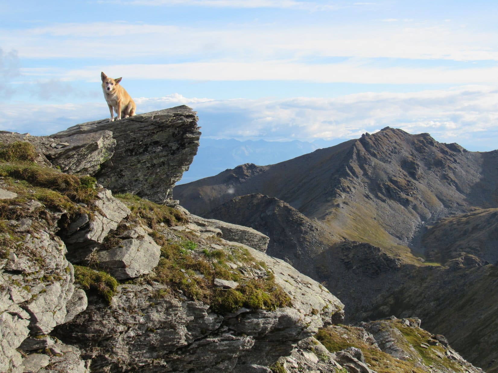
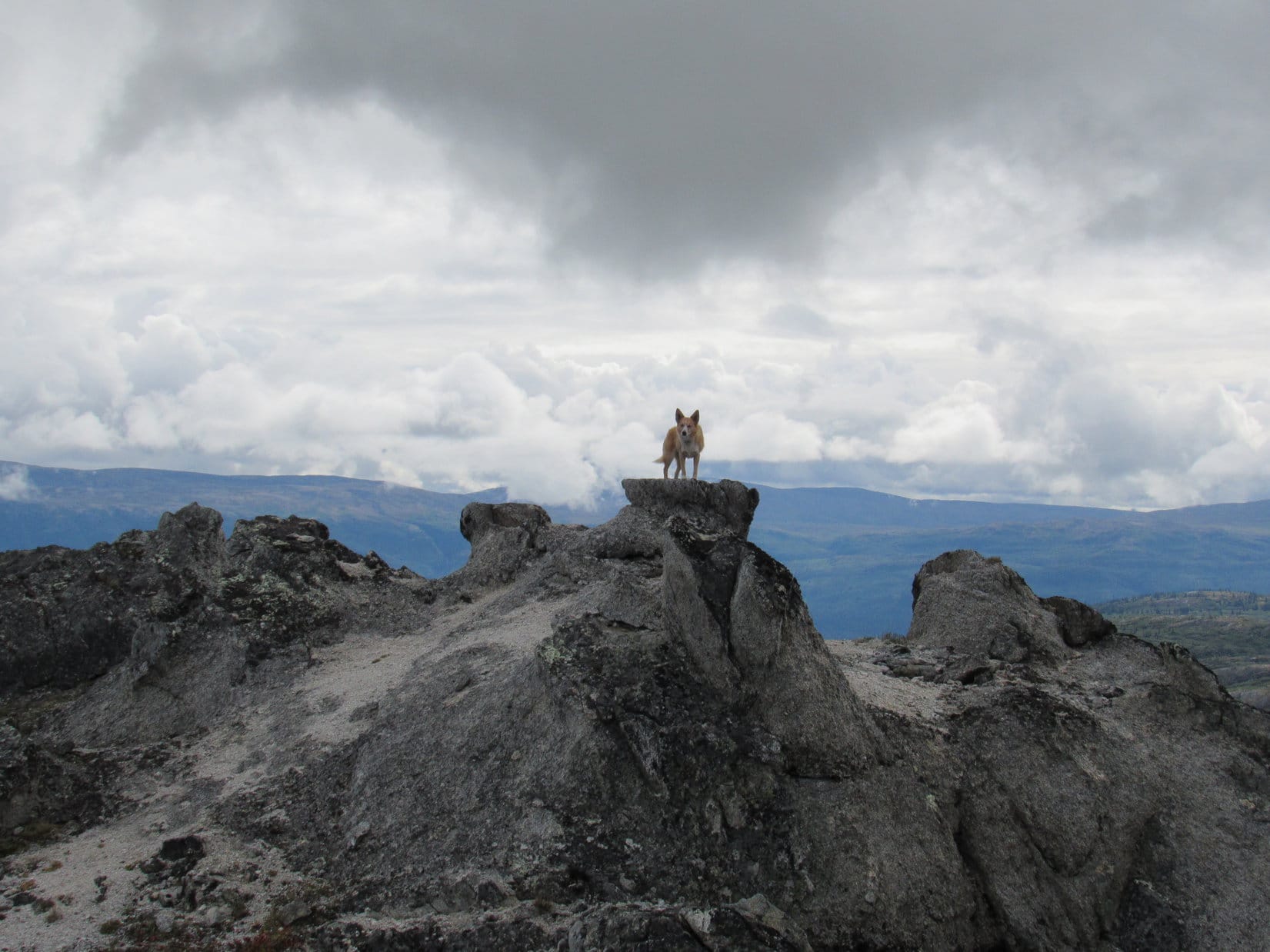
Looper didn’t have far to go to get there. She enjoyed a gorgeous, fun, easy ridge walk among flat sandy or gravelly areas and interesting rock formations. The very top of Ermine Hill featured an unusual summit offering a variety of convenient rocky Dingo perches. Despite the clouds, the views were tremendous in all directions.
Ermine Hill’s summit offered a variety of perfect Dingo perches with tremendous views. Photo looks NW.Lupe gained 1,625 feet of elevation from the Ermine Hill trailhead to reach the summit, making Ermine Hill a relatively easy peakbagging objective in the K’esugi Ridge area.The huge Chulitna River valley is seen beyond Lupe. On the far side of the river only the lowest peaks of the Alaska Range are in view below the cloud cover. On a clear day, Lupe would have had a fantastic view of Denali, the highest mountain in North America from here! Photo looks W.Another look at the Chulitna River from a slightly different angle. For hours, clouds drifted NE (R) up the river valley. Unfortunately, the great white peaks of the Alaska Range remained hidden all day long. Photo looks NW.Lupe had plenty of dramatic perches to choose from. Photo looks NNE.Looking ENE. The true summit was a little E (R) of here.Looper on a different perch. The top of Ermine Hill has sort of a badlands type of feel to it, though the views certainly did not. Looking SE from close to the true summit.Same view with help from the telephoto lens.This perch is very nearly as high as the true summit.
Lupe could see Golog Benchmark(2,970 ft.) off to the SW. She had been there a year ago, having first reached K’esugi Ridge and Whimbrel Hill(2,645 ft.) from the Byers Lake trailhead. Today’s original plan called for Loop to continue on to Golog Benchmark from Ermine Hill. If she did so, she would complete the entire portion of the K’esugi Ridge trail system between the Byers Lake and Ermine Hill trailheads.
However, Lupe hadn’t gotten off to a very early start, the blueberry trap was another hour lost, and the weather didn’t look all that favorable. Rain showers were drifting up the Chulitna River valley only a few miles to the NW. Furthermore, Loopster would have to first lose 1,200 feet of elevation, then gain 1,500 feet to get over to Golog Benchmark, only to repeat a portion of that process just to get back to the Ermine Hill trail. Golog looked far away.
Lupe could see Golog Benchmark (Center). She had been there a year ago. Back then she had come up to K’esugi Ridge from Byers Lake to get to Golog from the other side. Photo looks SW.
Loopster was perfectly content lingering up on Ermine Hill, while SPHP pondered whether it made any sense to head for Golog Benchmark.
Lupe was perfectly content to linger on Ermine Hill enjoying the fabulous views while SPHP pondered whether it made any sense to go on to Golog Benchmark. Sadly, the sky over the Alaska Range beyond the Chulitna River showed no sign of clearing up. Photo looks SW with help from the telephoto lens.In 2016, Lupe had reached Golog Benchmark from Byers Lake, seen in the distance on the L. Photo looks SW.
In the meantime, a few photos from the cluster of rocks at Ermine Hill’s true summit were in order.
Loop on one of the rocks close to Ermine Hill’s true summit. The Chulitna River valley is in the background. Photo looks N.Lupe near the true summit. She had been up on the rock near Center a little while ago. Photo looks SE.The true summit of Ermine Hill. Photo looks WNW.
Lupe had spent 50 minutes up on Ermine Hill. Decision time. On to Golog Benchmark, or not?
So, what’s it gonna be, SPHP? Are we going to try for Golog Benchmark (L) again this year, or not? Photo looks SW.
Sadly, the answer was no. Under the circumstances, Golog Benchmark just looked too far away.
However, the no go on Golog didn’t mean Ermine Hill was the end of Lupe’s explorations today. Another option existed. A little more than 3 miles away to the ENE, a big hill was in view. Peak3700 wasn’t really much closer than Golog Benchmark as the crow flies, but Lupe’s route to it would be more direct and less time consuming.
Although Lupe wasn’t going to get to go to Golog Benchmark again, she could still try for Peak 3700, the distant highest hill on the R. Photo looks NE.
After nearly an hour up on gorgeous Ermine Hill, Lupe started for Peak 3700. She began by traveling Ermine Hill’s summit ridge to its far E end. She saw Ermine Hill’s other colorful hills within 2,700 foot contours again, plus a tarn nearby that she hadn’t seen on her way up.
Lupe at the far E end of Ermine Hill’s big summit ridge. Below is a small lake she hadn’t seen on her way up. Photo looks SE.
The Carolina Dog was now SE of where SPHP had dallied on the steep blueberry slope on the way up. She could see more of the narrow lake the Ermine Hill trail passes by in the valley to the E.
Oh, no! You’re not going down that blueberry slope again, SPHP, or we’ll never get to Peak 3700! The SE end of the narrow lake that the Ermine Hill trail goes by is in view below. Peak 3700 is somewhere out of sight beyond the hills on the L. Photo looks ESE.
There wasn’t a clear, bush-free route down from here like the blueberry slope had been. Most of the way was fine, but Loopster would have to go through a stand of tall jungley bushes to reach the Ermine Hill trail.
Lupe passed by colorful plants like this one on her descent.
The Carolina Dog was making good progress on her descent when she spotted someone 200 feet lower down on the Ermine Hill trail not far from the lake. That someone quickly proved to be two someones and a large dark brown dog. They were all staring intently at the hillside on the far (E) side of the lake.
Nothing appeared unusual about that hillside. Upon closer inspection, however, a black speck was visible way over there in a clearing between the bushes that covered most of the hill. That black speck didn’t seem to be moving, but suspicions were immediately aroused. A quick check with the camera’s telephoto lens confirmed those suspicions.
A black bear was on the hillside across the lake. Probably stuck in a blueberry trap like SPHP had been.
The people and dog watching the bear remained where they were for a few minutes, before turning around and heading back down the Ermine Hill trail. The bear was far away on the other side of the lake, but was something to stay alert for, since it was sort of on the way to Peak 3700. Lupe was going to be on that same hillside, but would pass well above the bear’s current location without having to go right by it.
The bear is visible in this photo, if expanded, but only as a dark speck. The bear is in a large clearing a little R of Center well above the lake and somewhat below the exposed rocks. Photo looks NE.
For a while, Lupe and SPHP monitored the bear’s position as Loopster continued her descent. The bear never moved before Lupe lost sight of the hillside. No doubt it was anxiously devouring as many blueberries as possible before SPHP could get over there to scarf them all down.
The Ermine Hill trail junction with the K’esugi Ridge trail is at the base of the whitish area on the R. From there, Lupe would take the K’esugi Ridge trail up the big gully seen below the peak on the L, and around the back side of the hill at far L. Photo looks ESE.
Loop had lost nearly all the elevation she needed to in order to get back to the Ermine Hill trail again when she was confronted with a jungle of tall bushes. They were much taller than even SPHP was. The American Dingo had no issues with the bushes, but SPHP struggled to get through, especially at the start where they were on a steep slope. Nevertheless, Looper and SPHP did make it down to the trail.
Lupe by a nice grouping of colorful plants having reached the Ermine Hill trail again.
Once back on the Ermine Hill trail, Lupe made rapid progress. She got past all the bushes, and soon arrived at the junction with the K’esugi Ridge trail.
Loop at the junction of the Ermine Hill and K’esugi Ridge trails. She would go NE (L) on the K’esugi Ridge trail from here. Going SW (R) would have taken her past Skinny Lake to Golog Benchmark. Photo looks ESE.
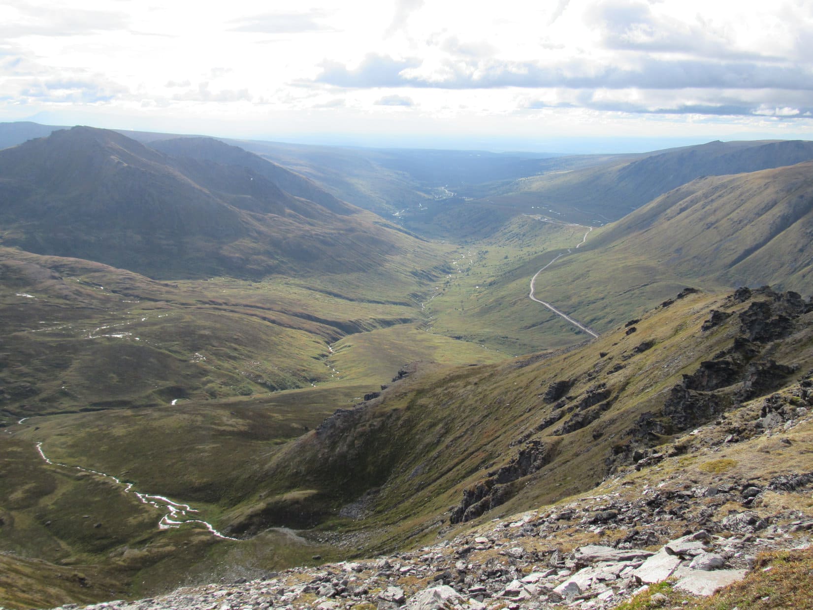
From the intersection, Lupe went NE (L) crossing the valley the narrow lake was in. The lower part of this valley was swampy. On the far side of the swamp, the K’esugi Ridge trail led Lupe up a steep creek drainage. She eventually wound up behind a wall of rock bordered by another, larger swamp.
Looking down the length of the narrow lake as Lupe went by it. The Ermine Hill trail comes up the SW (L) side of this lake. The Chulitna River valley is seen in the distance. Photo looks NW.The whole ridge in the distance is part of Ermine Hill. The summit is out of sight toward the far R. The K’esugi Ridge trail is in view below, and meets the Ermine Hill trail over at the base of Ermine Hill. Photo looks W.
Lupe got muddy legs going across this second swamp. She seemed quite pleased with the experience. SPHP managed to gingerly use stepping stones near the rock wall to avoid the worst of the swamp. Beyond the second swamp, a very short climb led to a side trail that headed W to a nearby rocky viewpoint. Lupe and SPHP went there for a look around.
Lupe emerged from her explorations of the second swamp with muddy legs looking quite satisfied with the experience. After all, what’s more fun than wandering through a mucky swamp practically up to your chest in mud?
From the viewpoint, Lupe had a wonderful view of Ermine Hill, where she had just come from. She was now somewhere up above the slope where the bear had been. Looking down, the bear was nowhere in sight. Even though Lupe had come out on top in her encounter with a grizzly bear at the Maclaren River yesterday, it was a bit worrisome not knowing where the black bear had disappeared to. Was it close by?
From a rocky viewpoint at the end of a short spur off the main K’esugi Ridge trail, Lupe has a wonderful view of Ermine Hill. She appears more worried about where that black bear is now. She isn’t too far from where the bear had been earlier. Photo looks W.
Keeping an eye and keen nose out for the bear, Lupe returned to the main K’esugi Ridge trail. The trail now climbed steadily as it wound its way N up tundra covered hillsides. Lupe loves this kind of high open territory! The Carolina Dog was soon dashing away across the tundra to explore whatever she could find of interest. Meanwhile, SPHP stuck with the trail.
The trail crossed a couple of small streams. After a mile or so, it leveled out on high ground while rounding a big ridge coming down from the E. This was the same ridge that ought to take Loop to Peak3700. SPHP now joined Lupe in her off trail explorations to begin the climb up the long ridge. Unseen, Peak 3700 was now a little more than 2 miles due E.
Lupe leads the way, charging off for Peak 3700! Photo looks E.
Exploring the huge ridge was a grand time! The ridge was big and broad and hilly. Lots of rocks, some quite large, were scattered across it, but most places there was plenty of nice soft-on-the-paws tundra vegetation, too. Lupe climbed up a series of hilly high points, but each proved to be only another false summit.
Looking for Peak 3700. Photo looks E.
Lupe finally reached the top of a larger hill where big rocks covered with black lichens were common. She could now see several considerably higher hills ahead, still perhaps a mile or more away.
One of the two most distant hills was almost certainly the summit of Peak3700. Loopster would have to lose some elevation to continue on toward them, but all the intervening terrain from here to the top of Peak 3700 looked easy no matter which distant hill was the true summit.
The summit of Peak 3700 appears ahead! It had to be either the distant hill seen straight up from Lupe, or the somewhat closer one to the L. Photo looks E.
Lupe worked her way down the E side of the rocky hill she was on and reached the tundra. Though still a mile away, Peak 3700 seemed to be in the bag already! Lupe was doing great, the terrain was a cinch, and she was making great progress.
It wasn’t that simple. The sky had been growing darker for some time. Loop hadn’t seen the sun for several hours, and it was starting to feel late. Clouds were everywhere. A huge dark one now appeared passing directly overhead. This cloud didn’t seem to be dropping much rain, none on Lupe yet, but certainly seemed like it might at any moment.
Rain showers could be seen in several directions. They weren’t terribly far away. If Lupe kept going, SPHP was convinced she was destined to get drenched. Even if this dark cloud didn’t rain on her, it certainly seemed like only a matter of time before another one would.
Reluctantly, SPHP concluded the only prudent thing for Lupe to do was turn around. The clouds had held off most of the day, but a rainy evening appeared to be in store. No sense in getting wet and chilled. Another 30 minutes and Loop would have made it to the top of Peak 3700. Now she wasn’t going to get there. So close and yet, so far!
Loopster at the turn around point. Sadly her ascent of Peak 3700 had to be called off due to deteriorating weather. Photo looks E.
Ever since reaching Ermine Hill, Lupe had enjoyed a fantastic day up in the alpine tundra. The return trip was no different. The Carolina Dog ran like the wind, streaking across vast distances, pausing briefly here and there to sniff and investigate more thoroughly. It was so much fun to watch her go – feeling vibrant and wonderful, so full of life, all joyful and excited to be here. Lupe returned to check on SPHP often, looking like the happiest Dingo in the world, strong and beautiful.
The dark cloud passed by without raining on Lupe or SPHP. Dodged a bullet there. The sky brightened, but remained overcast. Rain showers could still be seen, but none appeared headed this way yet.
On the way back. Ermine Hill is the lower gray hill on the L. The Chulitna River is seen in the distance. Overhead, the end of the dark cloud is approaching. Fortunately, this cloud never did rain on Lupe. Photo looks W.Golog Benchmark is the distant high point at Center. The much closer lower gray ridge on the R is part of Ermine Hill. Photo looks SW.A rain shower drifts up the Chulitna River valley. Photo looks NW with help from the telephoto lens.
SPHP reached the K’esugi Ridge trail again. Lupe still spent most of her time running and playing on the tundra. She never did see that black bear again.
Ermine Hill from the K’esugi Ridge trail. Photo looks WSW.
It wasn’t until SPHP made it all the way back to the forest well on the way down the Ermine Hill trail, that Lupe finally decided she better stick to the trail, or at least very close by.
Loop was near the tippy footbridge over Byers Creek, when suddenly the sky darkened again. SPHP had already been gloating that Loopster was actually going to make it all the way back to the G6 without getting rained on. Clearly rain was now on the way, but the G6 wasn’t much more than 0.5 mile away. Surely, the American Dingo could still get there before the rain hit!
Uh, uh. Halfway there, the raindrops started. Slowly at first, but soon building to a steady downpour. If SPHP had aborted the attempt on Peak 3700 only 10 minutes earlier, Lupe would have arrived back at the the G6 completely dry. As it was, both the American Dingo and SPHP returned cold, absolutely drenched and miserable. (8:32 PM)
Ermine Hill had been a fabulous day, but it rarely pays to gloat.
On the way back from the aborted attempt on Peak 3700, K’esugi Ridge, Denali State Park, Alaska 8-26-17
Days 25 & 26 of Lupe’s 2017 Dingo Vacation to the Yukon & Alaska!
8-24-17, 3:46 PM, 58°F – About 10 miles from where the Steese Highway left its junction with the Elliot Highway NE of Fairbanks, Lupe and SPHP reached Cleary Summit. A large pullout at the start of a long gravel side road just E of the highway provided a convenient spot to stash the G6. From here, the side road continued E toward what must be a residential area judging from a long line of mailboxes nearby.
Lupe hopped out, still looking woozy. She hadn’t been feeling well. Up until now, she’d spent the day resting in the G6 while SPHP ran errands in Fairbanks without accomplishing much of anything except washing a ton of Dalton Highway mud off the now sparkling G6. A short while ago, the Carolina Dog had urped up on her blankets – nothing major, and she did seem to feel somewhat better after that.
Maybe fresh air and a little light peakbagging would help speed Looper’s recovery from whatever was ailing her? Lupe and SPHP crossed over the Steese Highway and headed W on Pedro Dome Road.
Pedro Dome Road was a wide gravel road. At first there were mailboxes, driveways, and other signs of habitation in the area. Lupe was quickly beyond most of that, but vehicles still occasionally drove by. Both sides of the road were lined with thick jungley stands of tall alder bushes.
The sickly Dingo’s peakbagging destination was an easy one. Pedro Dome(2,592 ft.) was only 3 miles from the Steese Highway. Pedro Dome Road or some offshoot should take her right on up to the summit. Total elevation gain required was less than 400 feet. SPHP could probably have simply driven the G6 right on up to the top of the mountain, but where’s the fun in that? Besides, Loop needed to spend some time out of the G6, anyway.
On the way here, Looper had stopped at a rest area along the Steese Highway. There SPHP had learned that Pedro Dome was named after Felix Pedro, an Italian immigrant who sparked a local gold rush in 1902 when he discovered gold in the Tanana River valley. During his prospecting days, Felix Pedro had actually climbed Pedro Dome. Lupe wasn’t expecting to find any gold, but was looking forward to seeing whatever Felix had seen from up on Pedro Dome over a century ago.
She might not see much of anything. Nearly a mile from Steese Highway, Looper reached an intersection where Pedro Dome was in view ahead. A thick spruce and alder forest covered the whole mountain. Several large towers stood up on a large, flat summit.
Almost a mile from the Steese Highway, Lupe has her first view of Pedro Dome ahead. Photo looks SW with help from the telephoto lens.
Now that the mountain was in view, Pedro Dome Road made a big curve to the NW. The road followed a ridgeline before turning SW again. Lupe came to a couple more intersections, but it was always easy to see which way to go. Along the way, she had occasional views of big forested ridges and distant low peaks. On the final approach, the road headed S along Pedro Dome’s upper E slope. A subsequent curve to the W brought Lupe to the summit.
The summit area was round and a good 10 to 15 acres in size. Only a fraction of the entire area could be seen from any one spot, since most of the summit was covered with the forest Looper had seen from afar. The highest part of the mountain was toward the NW, but the terrain was so flat no particular point stood out as being the true summit.
Four large towers and a number of smaller ones dominated the top of Pedro Dome. A maze of gravel or grassy roads radiated out from a large patch of bare ground where Lupe had come up providing access to these towers. Loop and SPHP visited each of the four largest towers, a couple of which were fenced off and bore “No Trespassing” signs.
Tower No. 1.Tower No. 2.Tower No. 3.Tower No. 4.
Due to all the vegetation, there were few places to get much of a view from Pedro Mountain. A couple of minor side roads leading into the dense alder bush jungle went all the way to the S and W edges of the summit to provide what views there were.
The view to the W was pretty, but would have been better on a clearer day. Fewer wires wouldn’t have hurt a thing either.Steese Highway is in view down in the Pedro Creek valley. Fairbanks (R) is in this direction in the distance, but hidden by low hills and ridges. Photo looks SSW.
Due in part to the haziness of the atmosphere, the views from Pedro Dome were pretty, but no more than that. All the towers and man made stuff didn’t do a thing for SPHP either. Lupe had the best time on Pedro Dome. She loved the shady grassy roads away from the towers, and had a grand time sniffing and exploring her way through the alder jungles where SPHP couldn’t go.
Apparently coming to Pedro Dome had done the American Dingo some good. Lupe was noticeably happier, more lively, and active up on the summit. She continued to enjoy exploring the alders now and then on the pleasant trek back to the G6. (6:16 PM, 61°F) Though the trip to Pedro Dome was the only active thing Loop and SPHP did all day, that probably wasn’t a bad thing. A day of rest was overdue.
Feeling better after her alder jungle journeys up on Pedro Dome, Lupe starts on the road back to the G6. Photo looks NE.A final look back at Pedro Dome from where Lupe had first seen it. Photo looks SW.
8-25-17 – After spending the night in Fairbanks, Lupe and SPHP left town heading SE on Highway No. 2. At Delta Junction SPHP took Richardson Highway No. 4 going S. In 2016, Lupe had been on this road going the opposite direction. It had been a rainy, misty day. Loop had barely seen the rugged mountains of the Alaska Range that the road passed through. Much of what she did see looked daunting and inaccessible.
However, once the Richardson Highway was over the Alaska Range, the highway had dropped down to much lower, flatter territory on the way to Delta Junction. Here, Lupe had seen a high solitary hill. The hill was close to the highway, and looked like such an attractive peakbagging objective SPHP had stopped briefly to consider making an ascent right then and there. In the end, even though the rain had stopped, the weather still looked too iffy. Lupe and SPHP had driven on.
Since then, SPHP had learned the name of that solitary hill was Donnelly Dome. Today, more than a year since she’d first seen it, Lupe was on her way back to find and climb it. Donnelly Dome is situated 18 miles S of Delta Junction on the W side of Richardson Highway No. 4. SPHP didn’t have to drive far out of Delta Junction before Lupe once again spotted Donnelly Dome (3,910 ft.) up ahead.
Donnelly Dome from Richardson Highway No. 4. Photo looks SW.
Looking for a place offering both possible access to the mountain and a good place to stash the G6, SPHP found a gravel side road on the W side of the highway about 50 feet S of milepost 247. A flat area large enough to accommodate 2 or 3 vehicles was close to the start of this road. SPHP parked the G6 and Loopster hopped out. (12:09 PM)
More than a year after she’d first seen Donnelly Dome, Lupe is back to see if she can get to the top. Photo looks NW.
The day was brightly sunny and pleasantly breezy as Loop started for Donnelly Dome. Bushes waist high on SPHP crowded both sides of the road, so Lupe did the obvious, easy thing and simply followed the road. SPHP could have driven the G6 somewhat closer to the mountain, but it wasn’t long before the road deteriorated to a point where high clearance would have been required.
The road was soon winding around on a series of little hilltops. Spirits were high as Lupe and SPHP drew nearer to the mountain. This was looking like a great day to climb Donnelly Dome. Lupe had seen some huge white peaks of the Alaska Range to the SW from the Richardson Highway on the way here. The views of those mighty peaks from up on Donnelly Dome ought to be stunning. The prospect was exciting!
Oh, this is going to be a great day to climb Donnelly Dome, SPHP! I can already see some white monsters up ahead!
At one point, the road overlooked a small pond where Lupe saw 4 ducks. Beyond this pond, the road started fading away. It eventually turned S away from Donnelly Dome, but Loopster found a good single track trail in this area that headed W through the bushes toward the mountain. Lupe couldn’t see much of anything due to the bushes, but she was going the right way.
3 of the 4 ducks Lupe saw.
The single track trail became a maze of interconnecting alternate paths as it wound through the bushes, but Lupe eventually arrived on higher open ground free of bushes at the base of the mountain. A cairn sat up on this bare ground. Lupe was at the far SE end of Donnelly Dome.
Donnelly Dome must be a popular destination. A heavily worn trail left the open ground near the cairn, plunging right back into the bushes. This trail began climbing so aggressively up the steep side of Donnelly Dome that SPHP was often clinging to bushes for support. A bunch of loose rock on the trail didn’t help matters any.
After gaining a fair amount of elevation, the trail became somewhat less steep as it went NNW along Donnelly Dome’s E slope. Lupe was making good progress. She was above most of the bushes, which thinned out a great deal up here. Views to the E were already impressive. By now, however, what had been merely a pleasant breeze down below was an annoyingly strong S wind.
By the time Lupe was above most of the bushes, the views were already impressive! Panoramic Peak(5,150 ft.) is in the distance at far L. The G6, too small to be seen, is parked by the Richardson Hwy not far from the largest lake at Center. The duck pond is closer by. Photo looks E.Looking S toward part of the Alaska Range. Richardson Highway No. 4 is in clear view below. Looper is already feeling rather windswept.Looking up the mountain from the same spot. The high point ahead isn’t anywhere close to the summit yet. Lupe came to quite a few false summits along the way. Photo looks NW.
Lupe climbed and climbed. The trail was braided. She often had her choice of routes. They all headed the same general direction, NNW along the E slope of the mountain. SPHP kept hoping the mountain would provide some protection from the wind if Loop went far enough N, but the wind only got stronger the higher she went.
After a while, it kept looking like Lupe was about to reach Donnelly Dome’s summit ridge. Each time she reached a high point, it all proved to be an illusion. Hardly any bushes remained by the time the Carolina Dog found herself on the most barren, windswept, steepest slope yet.
Loopster on a steep slope with her nose into the wind and her eyes closed due to the bright sunshine. Although she’s already gained a lot of elevation, there’s still more to go! Photo looks WNW.Wow! How’s this for a view, SPHP? Get a picture with these bright red tundra plants! Photo looks SSE.Can’t be much farther, can it?
It seemed like Lupe had made it quite a long way N along the E slope of the mountain. She had gained what looked like an incredible amount of elevation, yet there was only supposed to be 1,660 feet of elevation gain from the highway to the top of Donnelly Dome.
SPHP resolved to leave the trail. Looper would climb straight on up this steep slope. The top didn’t look that much farther. The summit had to be close by now, didn’t it? Grabbing whatever was handy, which wasn’t much of consequence, SPHP started up. With her 4 on the floor, Looper powered her way up the slope with ease.
Top of the mountain? Hah! When Lupe reached the upper end of the slope, she wasn’t at the top of anything. This was just the E lip of a more gentle slope going up. Another trail here led still higher, continuing NNW. At least this was far easier terrain than that super steep slope. Lupe ought to be able to make a lot faster progress. The way the wind was roaring up here, it might blow her clear to the top of the mountain, or off it completely.
At least this is easier than where we were, SPHP! Provided we don’t blow away, that is. Photo looks NW.
Lupe wasn’t as far N along the mountain as SPHP had thought. She was still coming up from the SSE. She didn’t have to go far on this upper trail, though, before it was clear the Carolina Dog actually had made it to the broad, sparsely vegetated summit ridge. The upper trail faded. The top of Donnelly Dome(3,910 ft.) was directly ahead 200 yards away.
Lupe reaches Donnelly Dome’s long, broad summit ridge. The top of the mountain is straight ahead only 200 yards away. Photo looks NNW.
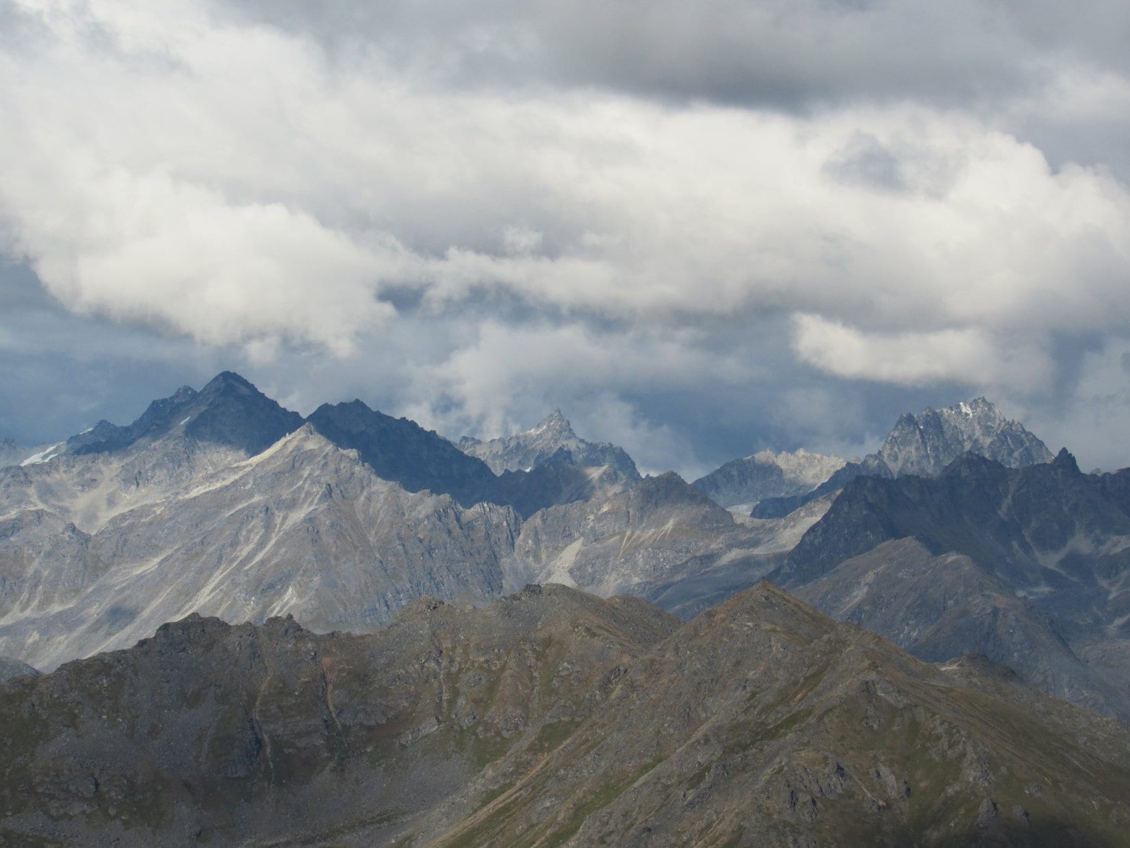
Although it was now certain Lupe was going to reach the top of Donnelly Dome, there was bad news, too. During the American Dingo’s ascent, the mountain had blocked her view of the huge white peaks of the Alaska Range off to the SW. Upon attaining the summit ridge, she immediately had a panoramic view in that direction.
The monstrous white peaks Looper had seen before she began her climb in earnest were gone! The fierce S wind had blown in a giant cloud bank that somehow clung stubbornly to the Alaska Range. Despite the wind, those clouds didn’t seem to be going anywhere. Only a tiny fraction of the formerly glorious views remained, glimpses of parts of individual peaks that didn’t convey the same overall impression at all.
So disappointing! And aggravating to think that if Loop had only arrived a couple of hours earlier, she would have seen the entire grand display. Well, it was what it was. Lupe could still see a lot from up here. The clouds weren’t everywhere, just unfortunately concentrated where the best views should have been. In any case, Lupe didn’t waste any time getting to the summit. The wind was going to make staying up here for very long far less enjoyable than it should have been.
The summit area was a nearly flat 0.5 acre strewn with mostly smallish rocks. A variety of cairns were present. Two were considerably larger than the rest. They were positioned near the SW and NE edges of the summit. The SW cairn was at Donnelly Dome’s true summit. Everything else was clearly a little lower.
A steady 30-35 mph wind scoured the mountaintop. Not a hurricane, by any means, but Lupe didn’t care for it one bit. The big SW cairn was built up like a wall. The Carolina Dog eagerly took refuge behind it whenever she didn’t have photo duties to fulfill.
Lupe reaches the biggest cairn at the true summit of Donnelly Dome. It was actually more like a wall than a cairn, for which Looper was thankful since it gave her at least some protection from the wind. The Delta River valley and part of the Alaska Range are in view in the distance. Photo looks SSW.Up on the cairn or rock wall – whatever you want to call it. Note the 2 stone tablets with writing on them. Photo looks SW.Lupe still up on the biggest cairn, but looking NW now. The Alaska oil pipeline can be seen, as well as the Delta River.
Right away, SPHP noticed two flat rocks with writing on them propped up against the rock wall cairn. A large group of military personnel, no doubt from Eielson AFB, had been here on 7-23-17, only a month and a day ago. The “Peacocks” and “Night Train”, presumably two separate units, had recorded their names on these stone tablets. Names were scrawled on many smaller rocks, too.
The “Night Train” tablet.The “Peacocks” tablet.
SPHP was unable to find any registry other than these rocks, so after poking around the true summit at the largest cairn, Loop next paid a visit to the NE cairn. It was a poorly organized pile of rocks, but Lupe had a fabulous view to the E from here. She saw Panoramic Peak(5,150 ft.) and other peaks in the Granite Mountains area.
Loopster in the wind on the poorly organized NE cairn. Panoramic Peak (far L) is in view. Photo looks E.Looking back toward the true summit at the big SW rock wall cairn (R). This is a good view of a large portion of the summit area. Photo looks SW.
Having been to both of the big cairns, some relief from the gale was in order. Loop retreated far enough down the N slope of the mountain to feel fairly well sheltered. Here, Lupe and SPHP took a pleasant break. Lupe could see the N spine of Donnelly Dome. The Delta River and Alaska oil pipeline headed N across many miles of level terrain toward small mountains in the distance.
Lupe where she took refuge from the wind on the N side of Donnelly Dome. Loop and SPHP enjoyed a nice break here. Photo looks NW.
After the break, it was time for a few more photos. Loopster thought it best to continue hiding out from the wind as best she could behind the big rock wall cairn. SPHP wandered around looking at this and that.
Zoomed in on an unknown peak of the Alaska Range. Photo looks SW.Oh, yeah! Zoomed in on a big white mountain of the Alaska Range. If the clouds would have dissipated, Lupe would have seen many more white mountains like this one from Donnelly Dome.Panoramic Peak (far L) in shadow. Photo looks E.Lupe relaxes at least somewhat protected from the wind while waiting for SPHP to finish up here. Photo looks SW.The Delta River flows N out of the Alaska Range. Photo looks SSW.Looper the Trooper comes out into the wind for another photo shortly before leaving the Donnelly Dome summit. Photo looks W.
The temperature had to be in the mid 50’s °F, which ordinarily would have been quite comfortable. However, it felt chilly in the wind. SPHP made only a half-hearted effort to search for the Pillsbury survey benchmark shown on the topo map, and didn’t find it. Oh, well. Hardly mattered. 35 minutes after reaching the summit of Donnelly Dome, Lupe was ready to begin her descent.
35 minutes after reaching the summit of Donnelly Dome, Loop is ready to start the descent. Photo looks SE.
Lupe retraced her route up on the way down. SPHP was plenty slow as usual on the steep slopes. Some sort of military plane practicing takeoffs from a dusty landing strip 4 miles off to the NNE provided the only real excitement. The plane buzzed Donnelly Dome several times, which set the American Dingo off into ferocious barking fits.
Looking ESE before leaving the summit ridge.This military plane practicing take offs and landings provided Lupe with some excitement on her way down Donnelly Dome.The plane beats a hurried retreat after threatened by a ferocious Dingo on Donnelly Dome. Photo looks NE.
Many hours of daylight remained when Lupe made it back to the G6. (4:33 PM) With Loop’s breezy Donnelly Dome adventure successfully concluded, the plan was to continue S on Richardson Highway No. 4 up into the Alaska Range to see some of the sights she had missed due to poor weather in 2016. Clouds still hampered the views in most places, but Lupe did see a big glacier E of the highway.
Loop saw this impressive glacier E of the Richardson Highway up in the Alaska Range.
By the time Lupe reached Summit Lake, patches of blue sky existed among the cloud cover.
Lupe arrives at Summit Lake. By now patches of blue sky were scattered among the cloud cover. Photo looks SW.Sunlight shimmers on Summit Lake. Richardson Highway No. 4 passes right along the E shore of this scenic 6 mile long mountain lake. Photo looks WSW.Sunlight brightens a hillside E of Summit Lake. Photo looks NE.
3 or 4 miles S of Summit Lake, just S of Paxson, SPHP turned W on Denali Highway No. 8. The first 14 miles of this 136 mile long road connecting Paxson and Cantwell are paved. Lupe had only seen the W 10 or 12 miles of Denali Highway No. 8 back in 2016. This time, she was going to travel the entire route. The evening drive was beautiful. Loop and SPHP stopped now and then for photos along the way.
The first 14 miles of Denali Highway No. 8 going W from Paxson are paved. The evening drive was beautiful the whole way. Loop stopped a number of times for photos and a bit of sniffing around. Photo looks NW.
As Lupe got farther W, Denali Highway No. 8 turned to dirt and gravel. The highway was fairly rough in places with potholes and such, so SPHP had to drive quite slowly. That was fine! The scenery was spectacular. This area felt strangely as remote as the Dalton Highway had been.
To the N, Lupe saw snow-capped peaks of the Amphitheater Mountains. Sometimes glaciers were in view right from the road. To the SW were a number of high rounded hills. They looked like easy climbs, but were a long way from the highway.
A view of the Amphitheater Mountains from Denali Highway No. 8. Photo looks NNE.Several large hills SW of the highway looked like easy climbs for Lupe, but they were a long way off. Photo looks SW with help from the telephoto lens.
Denali Highway No. 8 eventually turned NNW and went down a long slope taking Lupe into the Maclaren River valley. Looper could see the toe of the Maclaren Glacier far upriver. Near the Maclaren River, the American Dingo had a close encounter with a grizzly bear!
One might think that an encounter with a grizzly bear would be the most memorable event of almost any day. The feisty American Dingo came out on top, but didn’t seem to think it was such a big deal. In fact, she appeared rather bored with the whole affair.
Denali Highway No. 8 heads down into the Maclaren River valley. A little piece of the Maclaren Glacier (upper R) is already visible from here. Photo looks N.Looking up the Maclaren River toward the toe of the Maclaren Glacier. Photo looks N with help from the telephoto lens.Near the Maclaren River, Loopster encounters a grizzly bear. SPHP gave her a boost so she could come out on top. Photo looks ENE.Oh, you’re just a riot, SPHP! Can I get off this thing yet?This is better. Can we just stick to the scenery from now on? That was embarrassing!
W of the Maclaren River, the light began to fade. Evening was drawing to a close. Lupe saw many pullouts along the highway, but for a long way they were all full of vehicles and people camping out. The Carolina Dog finally arrived at an unoccupied pullout 47 miles from Cantwell. The light was almost gone now. This would have to do.
By now Lupe was happy to get out of the G6. The incredibly dangerous predator Dingo, who had recently come out on top in her encounter with a grizzly bear, spent the rest of the evening prowling around in the bushes as dusk turned to night.
Evening along Denali Highway No. 8, Alaska 8-25-17