Sublette Mountain, Sublette Range, Wyoming (6-19-22)

Days 3 & 4 of Lupe’s 2022 Dingo Vacation to Wyoming!

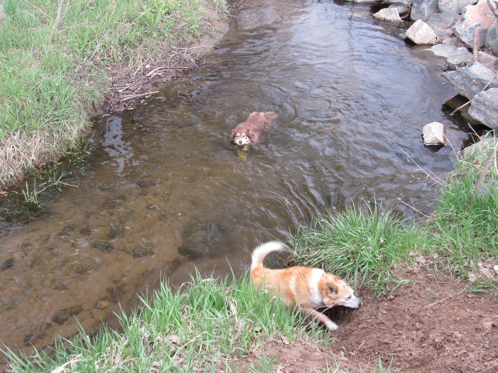
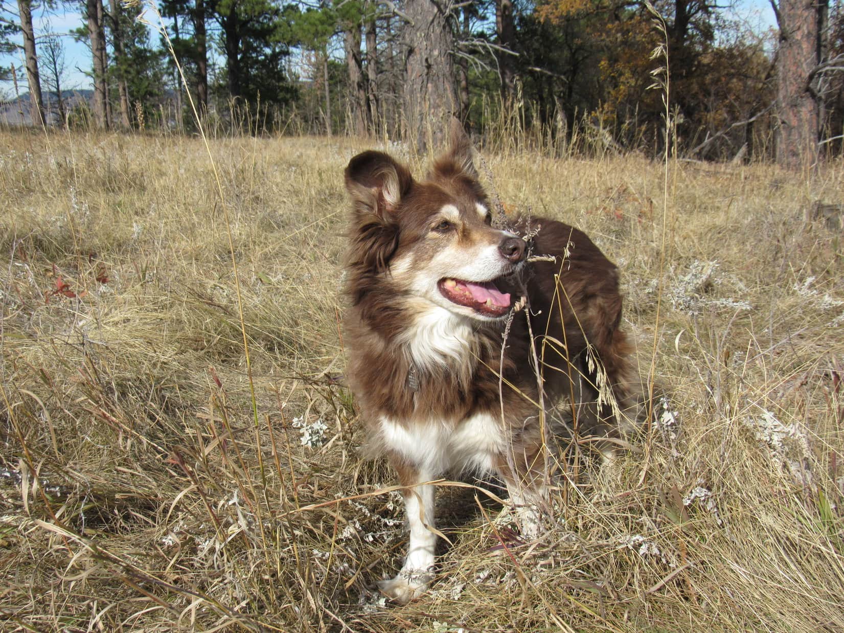
6-18-22, nearly noon – Lander City Park!  Recognizing it instantly, Lupe was enthused!  A favorite stop, Lander City Park meant soft green grass beneath the shade of big old cottonwood trees, complete with 2 little streams where the Carolina Dog could get a drink, or simply cool her paws off.  Free squirrel watching and camping, too!  Even at mid-day, quite a few tents were set up.

Lander City Park.

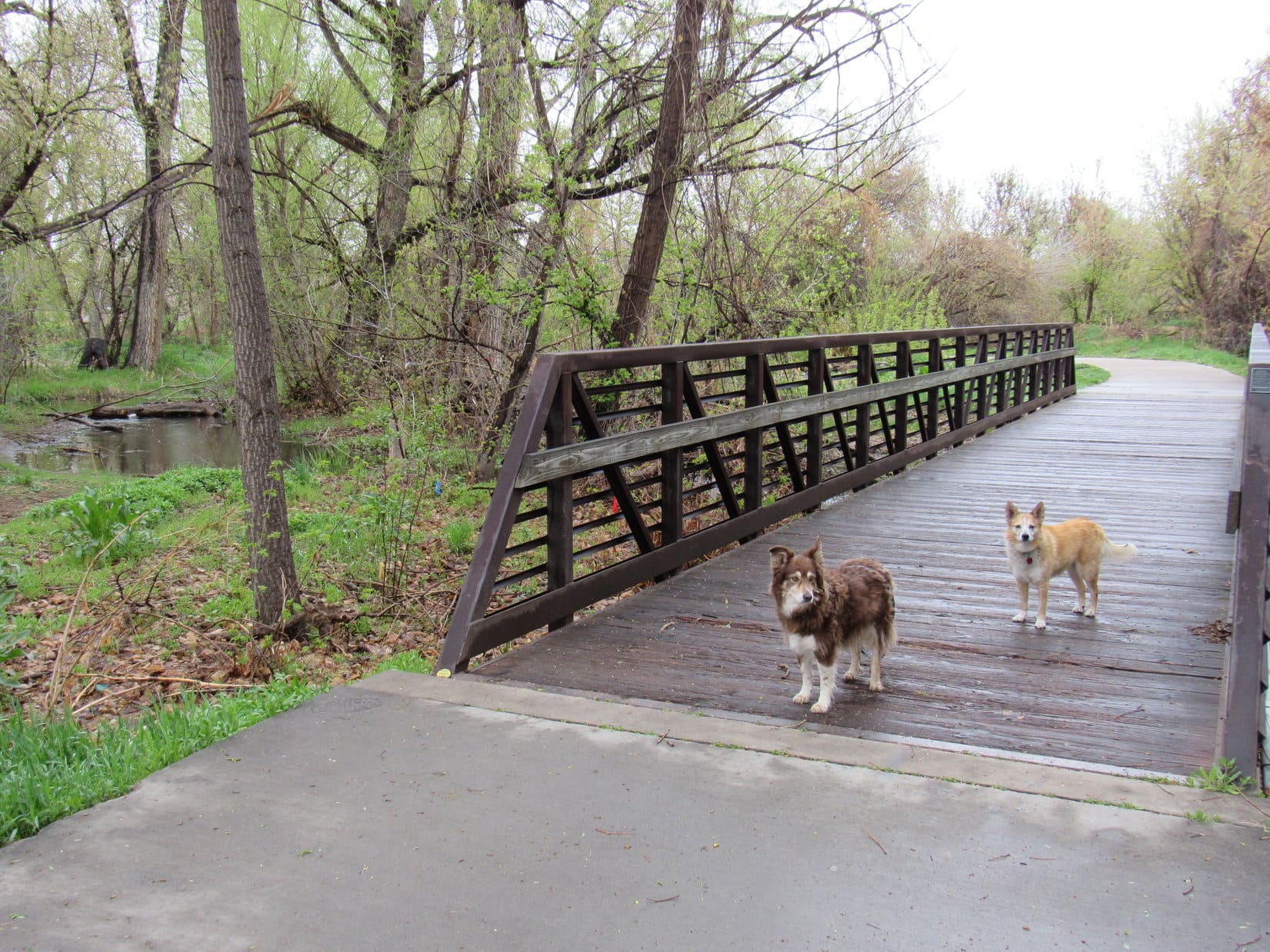
First thing Loop wanted to do was cross the gently arching bridge over the Middle Popo Agie River to explore McManus Park, a smaller, wilder area.  Weeds bearing little yellow flowers were blooming profusely.

McManus Park across the Middle Popo Agie River from Lander City Park.

Was that ragweed?  SPHP already felt a little allergic, no doubt due to all the exposure to sage over the past couple of days.  Loopster didn’t have allergies.  Sniffing happily along dirt paths, she soon came to the river.  Plenty of flow in early summer.  Loop helped herself to a drink.

Getting a drink from the Middle Popo Agie River.

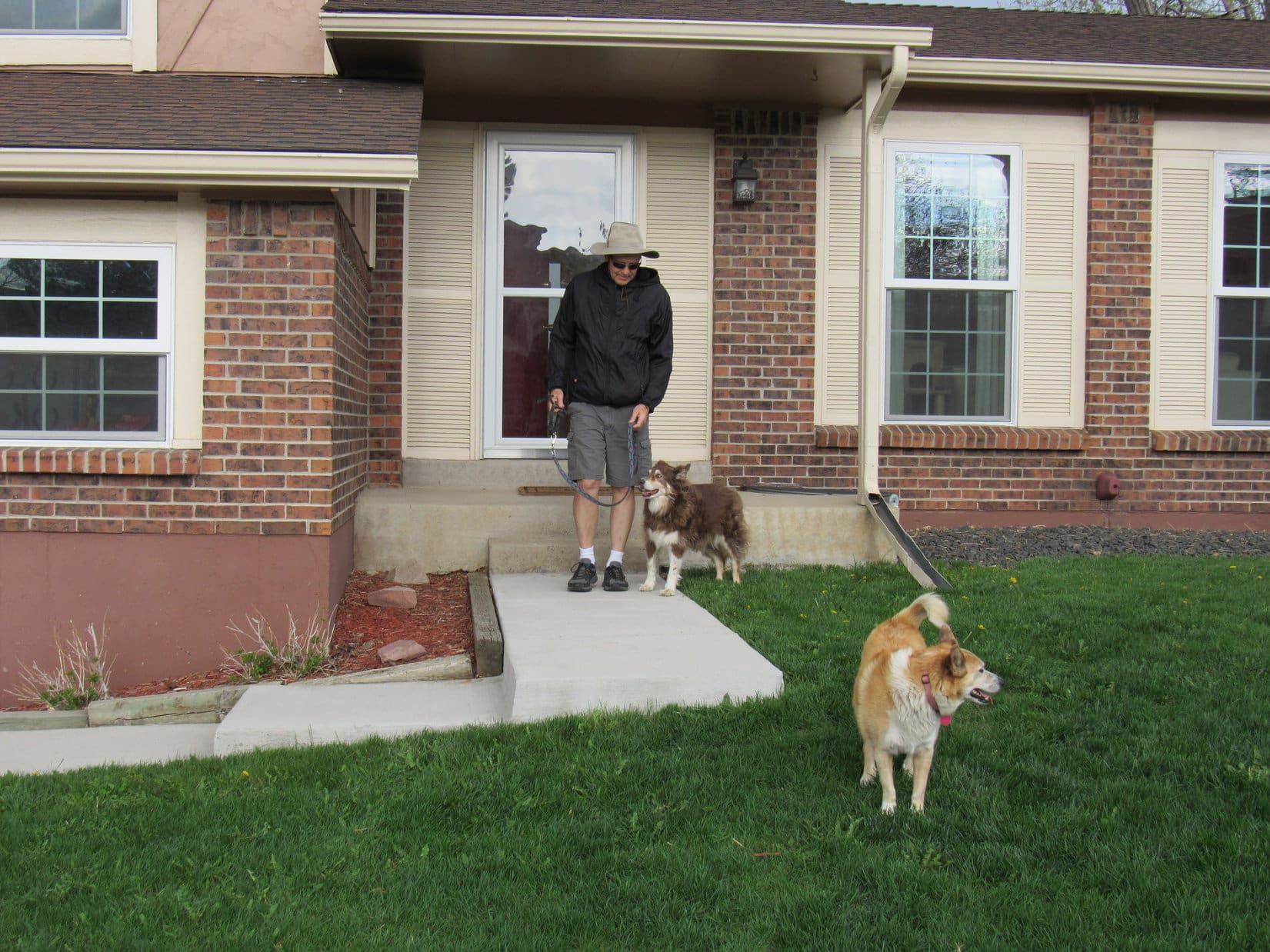
After her tour of McManus Park, Lupe relaxed while SPHP worked on the trip journal.  The squirrel watching was a little slow.  Still recovering from yesterday’s big adventure up Giant Deer Mountain (11,321 ft.) in the Bighorns, the American Dingo soon fell asleep.

A lazy afternoon snooze.

Saturday!  By early evening, there was live music.  A band was playing Johnny Cash hits.  Loopster revisited McManus Park and took a couple of strolls through the city park, enjoying sniffs with other dogs.  As the sun sank toward the Wind River Range, Country & Western was replaced by wedding music.  A happy couple was getting married.  How romantic!

6-19-22, 11:33 AM –  Only 0.25 mile E of the Idaho border, SPHP turned R off Hwy 89 a little over 4 miles N of Border Junction.  A green and white street sign said Raymond, and there was a Lincoln County Road No. 200 sign, too.  A gap in the mountains was visible only a mile E.  Must be the lower W end of Raymond Canyon.  Supposed to be a trailhead there, or at least a place to park.

Just off Hwy 89 near the Idaho border. W end of Raymond Canyon (L). Photo looks E.

County Road No. 200 went due E for half a mile, then angled NE a little way.  Sure enough, there was a big turnaround spot at the foot of the mountains.  Plenty of parking for half a dozen vehicles if need be, but the RAV4 was alone when Lupe leapt out.

Instead of a trail, a narrow gravel road left this “trailhead” heading up a gradual incline leading into Raymond Canyon.  A sign insisted there was no parking beyond this point, which seemed a bit odd.

Raymond Canyon from the trailhead. Photo looks E.

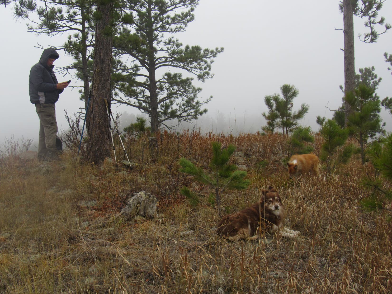
6-19-22, 11:57 AM – It had rained earlier this morning while driving through the sagebrush prairie SW of Farson.  No rain now, but the sky was cloudy as Lupe left for Sublette Mountain (9,313 ft.).

Trotting E up the incline, the road soon leveled out.  Lupe quickly came to a clearing partially shaded by big trees between towering rock walls.  There was a stone campfire ring, and Raymond Creek ran along the S side of the clearing down among the bushes.

What a cool campsite, Looper!  Feels amazingly secluded despite being so close to the trailhead, although I don’t see any reason why we couldn’t have parked here just as easily.

We aren’t camping, are we, SPHP?

Nope.  Sublette’s a day hike.  I like this spot, though.

Me, too, SPHP!  Now, if you don’t mind, think I’ll check out the creek.

Entering Raymond Canyon as the road levels out. Photo looks E.
Approaching the clearing. Photo looks E.
At the clearing. Photo looks E.
Wading in Raymond Creek.

The road ended here, but a nice, flat single track trail continued farther into the canyon.  After 0.25 mile, it curved SE, dipping down to a ford of Raymond Creek.  Not a big stream, but much too wide to leap over, and not enough rocks to rock-hop it.  Loathe to get wet boots and socks so early on, SPHP decided to wade it barepaw.

On the excellent single track trail beyond the clearing. Photo looks E.
Fording Raymond Creek.

Immediately beyond the ford, the trail curved E again.  For 300 feet, a tiny stream trickling along it made the going a bit mucky, but beyond that one short stretch, the trail was dry again.  Modest elevation gain made progress fast and easy.  Raymond Creek was seldom seen, but could always be heard among the willows and bushes N of the trail.

The day turned sunny.  Birds chirped.  Butterflies, among them a large yellow Swallowtail, danced in the sunshine.  Lupe enjoyed views of long lines of craggy rock formations running up the mountainsides.

After about a mile, the trail passed between a line of 4 metal posts.  10 or 15 minutes beyond them, the American Dingo came to a couple of large gray-green ponds.  She paused for a look.

Following Raymond Creek upstream. Photo looks E.
At the 4 metal posts. Photo looks NE.
By the beaver ponds. Photo looks E.

Awesome!  Not very often that we get to see beaver ponds, is it, Loop?

How do you know they’re beaver ponds, SPHP?  See any beavers?  I don’t.

Me either, Looper, or even any beaver lodges, but the stick dams are a dead give-away.

Beyond the best beaver pond viewpoint, the trail curved SE for 30 feet, then promptly vanished at the edge of another, smaller beaver pond.

What on earth?  Where does the trail go, Loop?  Can you sniff it out?

This seems to be the end, SPHP.

No way!  Can’t be!

By the smallest beaver pond where the trail appeared to dead-end. Photo looks SE.

Searching for a way around the pond, SPHP soon realized that it would be next to impossible to push through the willow thickets bordering it.  No sign of any trail anywhere, until looking E across the pond along the dam, yes!  A narrow lane continued between the bushes on the far side.

Aha!  There it is, Looper!

You sure, SPHP?  Even if that’s the trail, how are we supposed to get over there?

Obviously, we’re going to have to ford the beaver pond!

What?  Are you crazy?  Might not be that deep to you, SPHP, but I’ll have to swim.  And while Carolina Dogs don’t mind wading, we hate swimming!

Be that as it may, you know you can swim, Loop.  I’ve seen you do it.

Well, that was then, and this is now.  Not doing it, SPHP!  You’ll have to carry me.

Not sure that’s a good idea, Loop.  Lost my balance and dropped you once before while trying to ford a stream, and I’d rather not fall into this pond full of ooze.  Tell you what.  Stay here.  I’ll go first.  Show ya how it’s done!

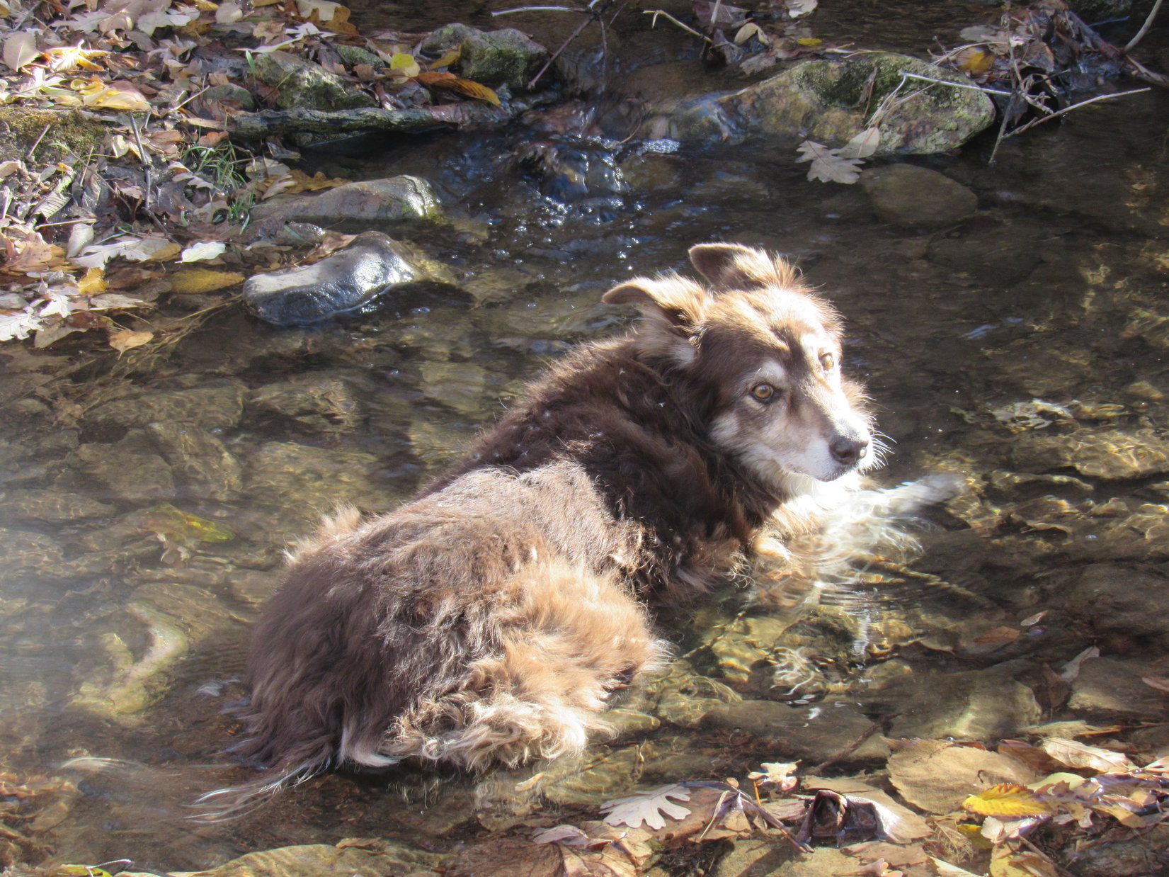
Shedding boots and socks again, SPHP waded in, staying right along the edge of the beaver dam.  The pond was 40 or 50 feet across, and away from the dam looked to be mid-thigh deep, maybe more, with a mucky bottom.  Who knew how far one might sink into the mire?

Eh, not that bad.  A little over SPHP’s knees was about as deep as it got.  Meanwhile, Lupe was in a panic at being left behind, running back and forth along the edge of the pond, afraid to cross such a large expanse of water.  She tried wading in, but stopped when it quickly got chest deep.

Chest deep in the beaver pond. Photo looks W.

Don’t go across the middle, Loopster, that’s the deepest part!  Stay close to the beaver dam, like I did.  C’mon!  You can do it!

Following SPHP’s example, Lupe did stay near the dam.  A lot deeper on her than it had been on SPHP, of course, but if she had to swim at all, she didn’t have to Dingo paddle far.  Soon she was across, spraying SPHP as she shook herself off.  Once SPHP managed to get reassembled with boots, socks, and the pack, it was Onward!  Puppy ho!

The journey E up Raymond Canyon continued.

Success! Already past the deepest part. Photo looks W.

2 miles from the trailhead, the trail forked as the canyon divided.

Which way, SPHP?  L branch, or R?

At the fork in the trail. Peak 7620 dead ahead. Photo looks ENE.

Neither, Loop.  Think this is where we need to turn S, but let’s check out both branches of the trail to make sure.

The trail that angled ENE quickly led to a view of another gray, murky little beaver pond down in a ditch.  Returning to the R branch, it seemed destined to continue nearly due E.

Overlooking the beaver pond in a ditch. Photo looks NNE.

So, does this look like where you think we are, SPHP?

Yup!  Almost certain we’re at Raymond Basin on the topo map, Looper.  Time to abandon these trails, and go up the side canyon to the S.

We don’t have to cross this beaver pond?

No, not this one, Loop.

Best news so far today, SPHP!

Only 400 feet of elevation had been gained during the entire 2 mile trek to Raymond Basin.  As Lupe headed S up the sagebrush-covered alluvial plain leading to the side canyon, the rate of climb was noticeably steeper, but still wasn’t bad.

Starting up into the side canyon. Photo looks S.

The side canyon quickly narrowed to an almost V-shaped bottom.  By the time Lupe got that far, she’d found a trail going this way, too.  The map showed a tributary of Raymond Creek here, but the valley was dry.

In the V-shaped valley. Photo looks SSW.

Before long, the trail began climbing the E side of the canyon above the valley floor.  On a steep slope, Loop came to a short switchback to the E (L) then back to the W (R), which got her up to a flatter region.  The trail turned S again, but was now beginning to fade away.

On the E side of the valley as the trail begins to fade. Photo looks S.

A steady climb along increasingly intermittent trails resumed, as Lupe traversed the lower W slopes of HP7762.  This region was fairly open, dotted with trees and wildflowers.  Sublette Mountain’s NNE ridge was just across the valley.

Traversing the lower W slopes of HP7762. Photo looks S.
A few Indian Paintbrush.
Sublette Mountain’s NNE ridge (R). Saddle leading to HP7762 (L). Photo looks SSW.

According to this GPS track by Sam Grant, that’s the way he went up, Loop.

Over there?  Really, SPHP?  That slope looks mighty steep, and for a long way, too!  Looks to me like we’re better off on this side of the canyon.

Yeah, Sam’s a beast!  Think we’ll skip Mr. Grant’s route, and stay over here, even if it is a bit longer.  Appears there may be an easier route up from PASS7540, the saddle W of HP7762 at the upper end of this canyon.

Approaching PASS7540, the lower canyon became heavily forested.  Meadows full of yellow wildflowers visible farther up the slope Lupe was on appeared much easier than plunging into the trees.  Turning SE, the Carolina Dog climbed more aggressively.  SPHP huffed and puffed, stopping frequently to gasp for air, but this slope really wasn’t that bad.  Not compared to what Sam Grant had suffered through over on the W side of the canyon!

Among the yellow wildflowers.

As she closed in on PASS7540, Lupe still had to explore short sections of forest, but way up here, other than minor deadfall, they were relatively open.  Loop finally emerged on the E side of the saddle, a bit higher than the low point.  PASS7540 proved to be an easy trek W over open ground.  Once across it, Lupe began an 1,100+ foot ascent of Sublette Mountain’s NNE ridge.

At Pass 7540. Photo looks W.

The terrain quickly steepened.  It wasn’t as steep here as where Sam Grant had gone up a little farther N, but it was still plenty steep.  Lupe had time to wander and sniff as SPHP trudged slowly higher.  Other than the steepness, which was tiring, but not scary, there were no significant obstacles.  Plenty of open ground covered with small, loose scree.

After gaining several hundred feet of elevation, a minor, almost vertical escarpment of finely layered crumbling rock was ahead.  Looked like a short, but potentially tricky, scramble might be required to get above it.  However, as Lupe reached the base of this little cliff, a clear path went around the N side, easily getting her up top.  No scrambling required!

Approaching the crumbling escarpment. A good path easily switchbacked above it from the N (R). Photo looks W.
Above the escarpment. Huff Lake Peak (9,080 ft.) (L). Peak 9023 (far L). Photo looks N.

Once above the escarpment, Lupe entered a region featuring exposed bedrock that wasn’t as steep, resulting in a spurt of progress.  However, the terrain soon steepened again.  Meanwhile, sunny skies vanished.  Rain showers swept over the mountain.  Twice the Carolina Dog sought shelter beneath big pine trees while waiting for the rain to quit.

Fortunately, no real downpours.  Delays were only 10 or 15 minutes each before the slow grind higher resumed.

In the easier region above the escarpment. Photo looks WSW.

Near the end, Looper came to a very steep slope.  The N side was heavily forested, but most of it was open.  The deceptive slope kept looking like easier terrain was only 50 feet higher.  However, Lupe had to climb 200 feet before the grade actually diminished.  A much gentler open slope now led toward a line of trees along the ridgeline.

Approaching the ridgeline. Photo looks SW.

Lupe reached Sublette Mountain’s NNE ridgeline at about 8,700 feet.  Upon entering the trees, she made an unexpected discovery.  A bright red cooler with a white top sat next to a partially collapsed light green tent near a stone fire ring.

On Sublette Mountain’s NNE ridge. Huff Lake Peak (Center). Photo looks N.
The abandoned campsite.

Sam Grant’s tent, SPHP!  Why would he just leave it up here?

Silly Dingo!  That’s not Sam Grant’s tent.

Are you sure, SPHP?  How do you know it isn’t?

100% certain.  Sam did Sublette Mountain as a day hike, just like we are, Loop.  He didn’t camp out.  Must be someone else’s tent.  Why they would leave it up here, I have no idea.  Maybe whoever it was got turned around and couldn’t find it again, or had an emergency?  In any case, it makes a great landmark showing us where to leave this ridge on the way back.

More mountain to climb!  Abandoning the newly discovered campsite, Lupe turned S, gaining another 50 or 60 feet among the trees before emerging on a broad, relatively flat meadow leading to a forested hill a good 300+ feet high.  Should have been some great views both E and W from this open region, but even though the rain showers had dissipated, the sky was still overcast, the air murky.

By now, even Lupe was getting tired.  Discouragingly, the topo map showed that this next hill still wasn’t the top of Sublette Mountain, but there was no choice but to carry on.  Somewhere beyond that hill, the summit was now less than 0.75 mile away.

In the meadow, approaching the next hill along the ridge. Photo looks S.
Looking back along Sublette Mountain’s NNE ridge. Peak 9023 (L), double-topped Huff Lake Peak (L of Center). Photo looks N.

At the upper end of the meadow, a faint trail entered the forest toward the E side of the ridge.  Lupe followed it a little way before it seemed to vanish amid some deadfall.  There was a ravine toward the W separating this part of the ridge Loop was on from the highest part of the hill, which was now SW.  Climbing gradually the whole time, the American Dingo continued S, paralleling the ravine until she got to its upper end.

It was now possible to turn W or SW without losing elevation.  SPHP led the way as Lupe began to play her stalking game.  The American Dingo hung back, only following once SPHP was completely out of sight.  Tall aspen trees, bright green leaves just beginning to emerge high in the canopy overhead, stood in hidden openings in the conifer forest.

Entering the forest. Photo looks S.
In a clearing discovered after turning W. Photo looks NW.
An open lane beneath the towering aspens. Photo looks SW.

A steeper slope was beyond the first clearing.  Upon reaching the top of the 300+ foot hill, SPHP was surprised to find most of it was a meadow rimmed by trees.  A second forested hill could now be seen to the S.  This one wasn’t quite as big as the one just climbed.

Not that much farther to go now!  SPHP was anxious to get the ascent over and done with, but where was that Carolina Dog?  Loop hadn’t made it to the meadow yet.  SPHP went back to the edge of the forest, and peering down the slope, called her repeatedly.  Slinking silently through the woods, Loopster finally appeared, climbing slowly.

About time you got here, sweet puppy!  What’s been keeping you?

Giant Deer Mountain (11,321 ft.) back in the Bighorns was only a couple of days ago, SPHP, and this is another big peak!  I’m tired.  Can’t we take a break?  You must be tired, too, aren’t you?

Of course I am, but we’re almost there, Loop!  Let’s rest at the summit.

The American Dingo knew who was boss.  Lupe plopped herself down in the meadow and refused to budge.

Like it or not, taking a break on the first 300+ foot hill. Photo looks N.
The 2nd and final forested hill (R of Center) leading to the true summit. Photo looks S.

SPHP sat down next to Loop.  Beef jerky, a chocolate coconut bar, and water were administered.  15 minutes of blissful inactivity did the trick.

Barely.  Lupe followed reluctantly, as SPHP led the way, but at least she was on the move again.  A stretch of sagebrush led to the next forest.  Couldn’t be much farther to go now, but upon entering the forest, it was choked with deadfall.  Took considerable thrashing around before SPHP realized that there was a semi-decent use trail a little more toward the E.  Once on it, life was better.

The trail ended as Lupe reached the narrow N end of a long grassy slope that widened out as it rose toward the S.  A lone pine tree stood at the far upper end, and beyond it, a series of very small rises scarcely differing in elevation, all strung out along a completely open ridge.

Emerging once again from the forest where the trail ended. Photo looks ENE.
The grassy slope leading to the lone pine (Center). Photo looks S.
Sublette Mountain’s summit region. Photo looks S.
The summit ridge from beneath the lone pine. Photo looks S.

At the first rise beyond the lone pine, a directional survey marker was surrounded by stones.  This marker bore an arrow pointing toward the next rise to to SSE.

6-19-22, 6:15 PM – Lupe was there in no time.  Although scarcely any higher than the other rises, this second rise did appear to be the true summit of Sublette Mountain (9,313 ft.).  A loose collection of smooth, rounded stones capped the mountain.  The “Sublette” survey benchmark was attached to a fairly large stone sunk down in the middle of this pile beneath a wooden stake and a tangle of rusty wire.

There was something else, too!  A coffee can painted red contained a jar with a green top.  SPHP had no doubt that there was a registry inside, or who had placed it.

At the true summit of Sublette Mountain! Photo looks SSE.
Success! Photo looks S.
The loosely assembled summit “cairn”. Survey benchmark visible at (Center).
“Sublette” survey benchmark.

My, my!  What would Richard Carey say, Loop?

He’d say that the coffee can is supposed to be upside down over the green jar to protect it, and the registry within, from the weather, SPHP.

Exactly right, Looper!  Remind me leave it that way when we go.

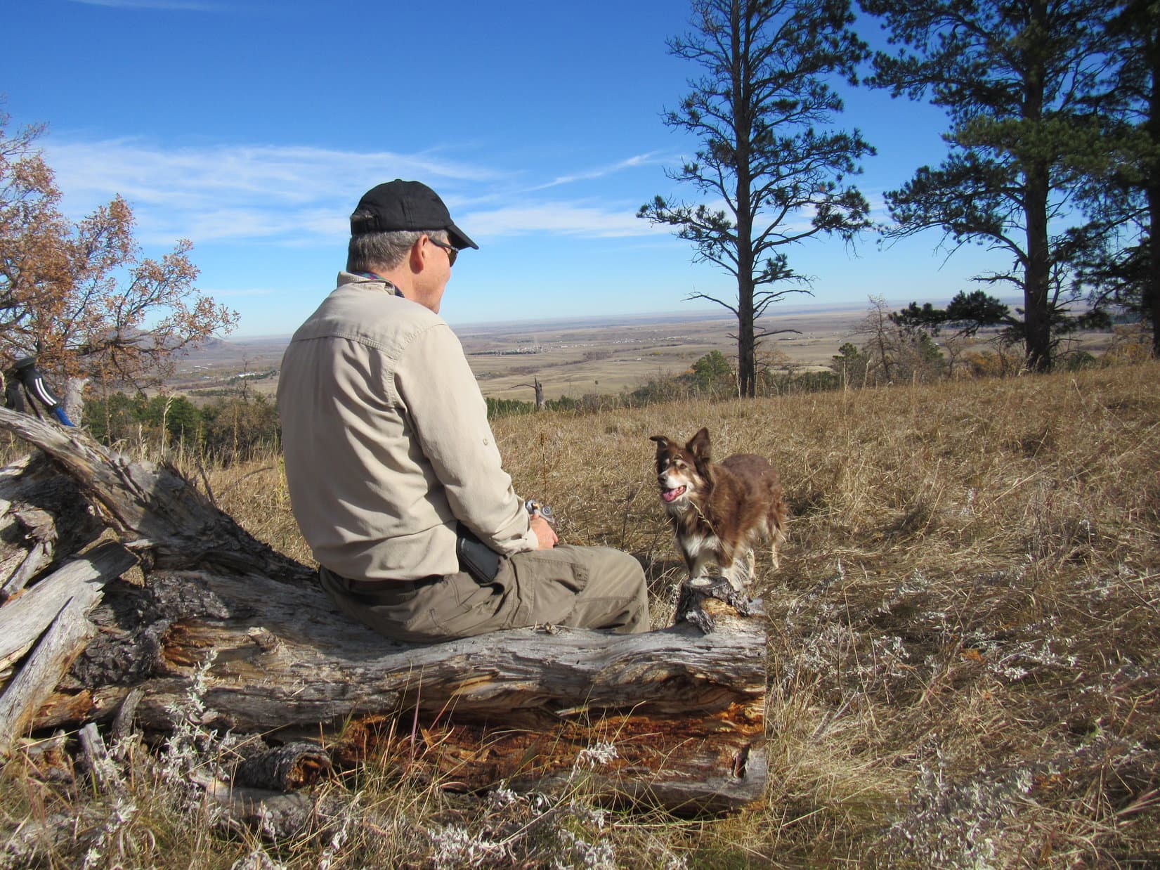
Shaking Looper’s paw, SPHP congratulated on her successful ascent of Sublette Mountain.  The Carolina Dog was then happy to lay down and rest in a chilly 10 mph SW breeze.  Big views in all directions except N, where trees blocked the line of sight.  Unfortunately, the sky was still overcast, and the air disappointingly hazy.

Long ridges, all lower than Sublette Mountain, were seen both E and W.  Very little detail was evident.  Several mountains at least as high were far to the NNE.  The most interesting view was to the SW, where the Bear River and it’s Thompson Fork tributary meandered through the broad valley down by Border Junction where Highways No. 30 & 89 met.

Huff Lake Peak (far L), and dimly seen higher peaks (R of Center). Photo looks NNE.
Distant ridges to the NW.
Border Junction (L) and the Bear River. Photo looks SW.

After sharing more beef jerky, water, and the last chocolate coconut bar, SPHP had a look at the registry, adding Lupe’s name, of course!

Sure enough, the first entry was by Richard Carey and Shelley Rogers.

Inside cover of the registry.
Richard Carey and Shelley Roger’s first entries. The Rigbys showed up 2 days later, the only other entries in 2020.
Sam Grant entry 6-13-21. First of 2021.
Josh Super‘s entry on 9-4-21 was the last one prior to Lupe’s.

The sun eventually made several brief attempts to break through the cloud cover, but those few moments of cheeriness quickly faded.  The sky grew darker again, and the SW breeze felt colder and stronger.  A couple more small rises in close competition for the title of true summit of Sublette Mountain were a little farther SSE.  It was clear from Sam Grant’s GPS track, that he’d visited both of them.

Lupe did, too.  The last rise was only 300 feet from the true summit, 600 feet from the lone pine.  Would have been easy to go even farther along the open ridge, but it was clear that this was the last real high point.

At the last high point. Photo looks SSE.
Looking back along the summit ridge. True summit (L). Photo looks NNW.

6-19-22, 7:15 PM – Exactly an hour after arriving, Lupe bid farewell to the open summit of Sublette Mountain (9,313 ft.), and the chill breeze sweeping over it.  Passing the lone pine for the last time, she began her descent.

Leaving Sublette Mountain. Photo looks S.

An hour’s rest had certainly helped!  Loopster clearly enjoyed the much easier downhill trek, displaying renewed energy.  SPHP had an easier time seeing where the various game and use trails went through the forested sections, too.

A short break was taken at the 8,700 foot abandoned camp on the NNE ridge so SPHP could pluck all the trash out of the stone fire ring, and clear the spoiled food out of the red cooler for proper disposal later.  However, the tent and cooler had to be left behind.

Look at this mess, Loop!  I blame a Norwegian!

A Norwegian is at fault, SPHP?  What makes you think that?

Who else would bring lefse and hot sauce?  A telltale combination, if you ask me!

Certainly weird enough, but I don’t know, SPHP.  Might have been a Latin American with a taste for Scandinavian food!

Maybe, but I doubt it.  Wouldn’t think most Latin Americans would have ever even heard of lefse, but everyone knows about hot sauce.

Hardly mattered either way.  What did matter was the need for speed.  SPHP wasn’t looking forward to fording the beaver pond in the dark, and suspected Lupe wouldn’t be all that thrilled about it, either.

The sun was down, light already fading fast, by the time the American Dingo reached Raymond Basin.  Turning W on the main trail going down Raymond Canyon, Lupe led the way.

Suddenly, there was movement up on the slope to the S!  150 feet away, something big was crashing and thrashing among the bushes, trying to head W.  Barking and whining, Lupe raced ahead, staying on the trail.  In the gloom, SPHP caught only a glimpse, but it was enough.

A few seconds, and the noise stopped as quickly as it had begun.  Panting hard, Lupe returned all excited, still whining.

A bear, SPHP!

Yeah, I saw it!  Stay on the trail, and let’s get past it as fast as we can.  Onward!  Puppy, ho!

A few minutes, and there was more thrashing around in the bushes S of the trail.

Cripes!  It’s a whole flock of bears, Loop!  Don’t bark, just keep going!

Two isn’t really a flock, SPHP.

Whatever!  Close enough for me!  Onward!

Lupe made it to the beaver ponds.  As soon as she got there, a loud crash came from over by the big pond just N of the trail.  Sounded almost like a gunshot, or as if someone had thrown a huge rock into the pond.

Happened again, twice, in the next minute or two.  Getting the willies, SPHP was about ready to ford the small beaver pond when it happened a fourth time.  The Carolina Dog wasn’t hanging back now!  Without the slightest hesitation, staying near the dam again, Lupe plunged into the dimly lit pond.

6-19-20, 10:18 PM, back at the RAV4 –

Bears and beavers!  Guess we’ll always remember Sublette Mountain for that exciting twilight zone return through Raymond Canyon, won’t we Loop?

Bears and beavers, SPHP?  Are you saying that beavers were making those loud crashes by the ponds?

Yup, think so.  Probably a beaver slapping the water with its tail.  You know, as a warning of our approach.  Never realized before that a beaver tail could possibly be that loud, though.  About jumped out of my skin the first time, with bears already on the brain.

So, about that lefse and hot sauce!  Are they still any good, SPHP?

Uh, no.  I’ll get you some Alpo, though.  A little past dinner time, isn’t it?

On Sublette Mountain, Sublette Range, Wyoming 6-19-22

Links:

Next Adventure                          Prior Adventure

Sam Grant’s GPS Track 6-13-21

Want more Lupe adventures?  Choose from Lupe’s Summer of 2022 Dingo Vacations to Wyoming, Canada & Alaska Adventure Index, Dingo Vacations Adventure Index or Master Adventure Index.  Or subscribe free to new Lupe adventures.


Black Hills, SD Expedition No. 305 – Cousin Laddie Pays a Visit (9-22-22 thru 9-25-22)

9-21-22, 8:00 PM – Shrill barking told the tale.  They were here!  Lupe was ecstatic, racing out the door to greet Uncle Joe, Aunt Andrea, and Cousin Laddie as soon as SPHP opened it.  Sadly, no Cousin Dusty ever again, but the Carolina Dog put on as enthusiastic a display as possible for those who had arrived.  Good times were sure to follow!

But what had happened to Cousin Laddie?  He looked strikingly different from the last time Lupe had seen him back in April.  Laddie’s luxurious long coat was gone!  Joe and Andrea explained that they’d had most of it shaved off to help Laddie stay cool this summer.  His coat was returning, but still had a considerable amount of growing out to do.  As Uncle Joe maintained, in the meantime, Laddie was part fuzzy caterpillar.

9-22-22 – It was already early afternoon by the time Uncle Joe parked the RAV4 at the high point of Boulder Hill Road on this unseasonably cool, gray day with low clouds spitting a few raindrops now and then.  Despite the weather, everyone was in good spirits on the way up the access road to the base of the mountain.

Boulder Hill (5,331 ft.) was a short, easy trek, offering plenty of scenic bang for relatively little effort.  At least, that was the general consensus among Lupe, Joe and SPHP.  Laddie had no expectations, having never been to Boulder Hill before.  All went well until the access road ended at the base of the rocky ridge atop the mountain.  Partway up the single track trail that wound up to the summit, there was a spot requiring a pretty good jump for Laddie’s short legs.

Seeing that Laddie might have a problem with the jump, SPHP offered encouragement.  Laddie gave it one half-hearted effort, failed miserably, and promptly started back down the mountain.  SPHP would have given Laddie the boost required to get past the trouble spot, but having once been latched onto and shaken like a rag doll by another dog, Laddie was extraordinarily fearful and opposed to ever being picked up.

Farther up the trail, Lupe watched and waited as Uncle Joe called Laddie and shouted encouragement.  SPHP demonstrated how easy it actually was to get up past the trouble spot, leaving Laddie alone below.  Laddie responded to Joe a couple of times, but turned around and went back down again each time he reached the trouble spot.

Well, this would never do!  If Cousin Laddie hoped to be a peakbagging Sheltie in the Black Hills, he’d have to develop a little more spirit and gumption.  Joe finally went down to Laddie, attached a leash, and with a gentle tug got him past the trouble spot.  Only took a second or two.  With Joe by his side, Laddie demonstrated more confidence.

Uncle Joe proclaimed Laddie “a weird and needy little dog”, but Laddie did manage to make it the rest of the way up under his own power.

Laddie practicing some light scrambling on the way up Boulder Hill with Joe by his side.
Loopster reaches the familiar summit. This was her 8th Boulder Hill ascent.
Joe and Laddie on Boulder Hill.

Ordinarily, a nice, long break would have been taken up on Boulder Hill to enjoy the magnificent views so easily obtained.  However, the summit was much windier than it had been on the way up, and the cold breeze seemed to be gaining strength with every passing moment.

Furthermore, although Silver Mountain (5,405 ft.) was in sight less than 1.25 mile SSW, most higher peaks were in the clouds.

Joe and Lupe together on Boulder Hill while Cousin Fuzzy Caterpillar has a sniff around. Silver Mountain (R). Photo looks SSW.

10 minutes up top were about it before a general retreat was decided upon.  The descent went fine.  Laddie was somewhat bolder, having so recently gone this way before.

Approaching the RAV4, a change was evident.  A pickup truck with a trailer was now parked nearby.  Of even more interest, a horse was tied to the trailer.  Despite how much bigger the horse was, Laddie felt plenty bold now.  Unafraid, he rushed at the enormous equine, barking.

Unable to run away, the horse did nothing, but seemed nervous.  Not a good situation!  Uncle Joe sprang into action, running over to re-attach Laddie’s leash, then dragging Cousin Watch-Me-Get-Kicked-in-the-Head away from the confrontation.

Uncle Joe staves off disaster.

No harm done!  The Boulder Hill jaunt having taken minimal time, there was still opportunity to do a little more this afternoon.  Driving down to the official Boulder Hill trailhead less than a mile farther N, the plan was to explore part of Loop B of Flume Trail No. 50.

Going clockwise around the loop, everyone made it to a slimy gray-green pond on a tiny tributary of Bitter Creek.

By the slimy pond.

A few cows were standing in the muck, so Joe restrained Laddie again.  Going only a little farther before turning back, the cows moved away as Lupe and Laddie approached a second time.  Halfway back to the RAV4, a whole herd appeared moving through the forest from out of the SW.

Turned out a cowboy was rounding the cows up.  He was riding a horse that looked strangely familiar.  On his best behavior, Laddie watched the cows cross the trail, maintaining both a respectful silence and distance until they were gone.

Not a particularly long or strenuous outing, but it had nevertheless been a successful day.  Laddie was learning the ropes!  He was both surprised, and evidently quite pleased, when he was ultimately rewarded with a big bowl of the spaghetti SPHP made for dinner.

9-23-22 – A much nicer day!  Only partly cloudy, and considerably warmer.  Still a rather leisurely start as everyone piled out of the RAV4 at Legion Lake shortly before 11:00 AM.  A jaunt along Centennial Trail No. 89 was the intended order of the day.

Since the Centennial Trail’s Badger Hole trailhead was a 0.25 mile SE of Legion Lake down the Galena Creek valley, Lupe and Laddie started out following another trail circling the lake’s W and S shores to get to where the creek leaves the E end of the lake.  This was the long way around, but in the process, they got to cross the dam along the W shore, and had an opportunity to do a short quick scramble up to a viewpoint provided by a large rock formation overlooking the lake’s S shore.

After yesterday’s Boulder Hill experience, Laddie had no problem with this scramble, although he wasn’t cooperative as far as posing for SPHP up at the viewpoint.  Loopster filled in for him, since she loves posing!

Crossing the Legion Lake dam. Photo looks SE.
Joe and Lupe up on the rocky viewpoint that was just N of the trail. Newly confident scrambler Laddie’s already somewhere up there, too. Photo looks NE.
Looking WNW back toward the dam.
A wider view of Legion Lake. Photo looks NW.

The trek down the Galena Creek valley was a mere road hike.  Upon reaching the Badger Hole trailhead, a single track spur went SW up a shallow, forested valley to the main Centennial Trail No. 89 N/S route.

About to leave the Badger Hole trailhead. Photo looks SSW.

At the intersection, Lupe and Laddie turned L, taking the route S.  The trail steepened somewhat as it continued SW up the valley.  Still forested at first, a more open region of tall grass was soon reached.  The lower NE slopes of Mount Coolidge (6,023 ft.) were now in sight directly ahead.

Centennial Trail No. 89. Lower NE slopes of Mount Coolidge ahead. Photo looks SW.

Continuing toward Mount Coolidge, the trail began curving S, becoming rocky and quite a bit steeper before leveling out at Pass 5180.  Heading ESE from here, the trail was flat for a little way.  This elevated stretch was more scenic, offering views of nearby rock formations, plus a great look at Peak 5440 off to the NE.

At Pass 5180. Peak 5440 (Center). Photo looks NE.

After passing some smaller rock formations offering viewpoints, the trail turned S, heading steeply down into the next valley.  This descent was eroded and quite rocky.  When reached, the broad valley floor was a mix of meadow and open forest.  The trail turned E here, paralleling a tiny tributary of Galena Creek that was completely dry.

In the next valley to the S. Photo looks W.

The valley was flat, a nearly effortless trek on a pleasantly warm, sunny day.  After going E for a while, Centennial Trail No. 89 curved SW prior to looping most of the way around a small hill.  Uncle Joe was starting to think this was about far enough.

Before turning back, a break was taken on the little hill.  Joe shared some beef jerky, a treat eagerly accepted by one and all.  Apples, water, and a chocolate coconut bar SPHP offered to Lupe and Laddie were also a hit.

Break time up on the little hill before turning back.

During the return, a few minutes were spent exploring some of the smaller rock formations in the Pass 5180 region.  Several towers on Mount Coolidge were visible from here.

Mount Coolidge (Center) from Pass 5180. Photo looks WSW.

In all the times Joe and Dusty had been to the Black Hills, they’d never been to Mount Coolidge (6,023 ft.).  A newcomer in just the past year, Cousin Laddie had never been there, either.  Once back at Legion Lake, SPHP suggested making the drive to the fire lookout tower.  Joe agreed.

The winding gravel road to the summit was much busier than SPHP ever dreamed it would be.  Arriving at the parking lot on top, a small crowd was streaming to and from the lookout’s viewing deck.  Although it had been a nice, sunny day down at Legion Lake and along Centennial Trail No. 89, a 40 mph wind was roaring out of NW up here.

By Black Hills standards, Mount Coolidge offers some pretty impressive panoramic views.  With the unexpected gale creating such an ominous, eerie moan among the various towers, Mount Coolidge seemed like a much more formidable and higher peak than it really was.  Joe decided Cousin Laddie ought to stay in the RAV4 rather than risk being blown right off the mountain.

Lupe wasn’t worried by the wind.  She didn’t want to miss out!  Crazy Horse, Sylvan Peak (7,000 ft.), Black Elk Peak (7,231 ft.), and many other notable high points were in sight, along with a vast expanse of western South Dakota plains beyond the Black Hills.

Mount Coolidge lookout tower. Photo looks SSW.
Joe up on the viewing deck. Black Elk Peak (L) on the horizon. Photo looks N.
Sylvan Peak (Center) and Little Devils Tower (far R) in the distance. Photo looks NW.

Up in the roaring wind, Mount Coolidge made quite an impression on Joe.  He’d never really experienced the Black Hills quite like this.  Even SPHP was surprised.  Cousin Laddie had completely missed out on the highlight of the day!

Laddie begged to differ, though, after SPHP later offered him a big bowl of sloppy joe meat for dinner.  Unsure of it at first, after just a couple of bites, Laddie was a believer, requesting and receiving a second helping!

9-24-22, 10:42 AM – Joe parked the RAV4 at the Lakota Lake picnic ground, then sauntered over to the little lake for a look.  A light breeze rippled the surface of this glorified pond beneath a thinly overcast sky.  Big rock formations were visible over on the far shore near the dam.

The Lakota Lake picnic ground off Iron Mountain Road. Photo looks NW.
Lakota Lake. Photo looks E.

Like Legion Lake yesterday, Lakota Lake was merely a starting point, not the focus of today’s outing.  The main event was going to be a trek up Iron Creek Trail No. 15.  To get to the trailhead, everyone set off heading SW along the picnic ground access road, which overlooked a skinny arm of Lakota Lake that extended nearly all the way back to Iron Mountain Road.  Crossing the highway, the trailhead was found on the other side.

Loop at the start of Iron Creek Trail No. 15. Photo looks SW.

Although Iron Creek Trail No. 15 was only going to wind gradually up the Iron Creek valley, a bit of Black Hills adventure dog training was in store for Cousin Laddie.  The trail would cross Iron Creek 11 times over just a couple of miles.

Reaching the first crossing immediately beyond the trailhead, Laddie was uncertain what to do.  Iron Creek had some flow, but was running low this time of year.  With encouragement from Joe, Laddie managed to ford the stream, while Joe rock-hopped it with ease.  Having been here before, Lupe and SPHP crossed on a narrow plank bridge.

Past the equinox, it was officially early autumn now.  The leaves on the trees were just beginning to turn.  As the trail wound its way W up the Iron Creek valley, there were some pretty spots.  Laddie forded a couple more creek crossings before attempting to use the plank bridges.  Soon he was crossing them with confidence.

Early autumn along Iron Creek Trail No. 15.
Taking advantage of one of the plank bridges over Iron Creek.

Towering rock formations were soon visible way up on the S side of the valley.  They were part of the E end of Woodpecker Ridge (5,680 ft.).  Lupe had been up there once upon a time.  Horrid deadfall was what SPHP remembered, but there had been some worthwhile views, too.

Part of Woodpecker Ridge (Center). Photo looks SE.

All seemed to be going perfectly well, when Joe suddenly announced deep concern over the amount of poison ivy along the trail.  He was soon pronouncing the poison ivy collection along Iron Creek Trail No. 15 the most extensive he’d ever seen.  Knowing he was quite susceptible to it, having suffered through poison ivy infections before, Joe seemed on the verge of wanting to beat a hasty retreat.

Fortunately, Joe stuck with it.  Continuing on, the worst of the poison ivy was left behind.

On a late September weekend, Iron Creek Trail No. 15 was surprisingly busy.  Quite a few other canines were out exploring with their humans.  Two in particular had some rather Old West names.  Lupe and Laddie got to meet an Australian Shepherd named One-Eyed Jack, and a Husky named Outlaw.  Jack actually had 2 eyes.

Farther upstream, the bridges got better.  Instead of mere planks, several were regular footbridges with railings.  The upper end of the Iron Creek trail wasn’t much farther.  Rather than a complete dead end, the trail led to a gravel road.  Continuing a little farther, this road went past the Iron Creek Summer Home Group, a collection of classic, rustic cabins.

One with a sign saying “Minnelusa” looked particularly sweet.

The Minnelusa cabin. Iron Creek flows right behind it.

0.75 mile from Iron Creek Trail No. 15, Iron Mountain Trail No. 16 would leave this same road, eventually intersecting a spur of Centennial Trail No. 89 leading to the Iron Mountain picnic ground.  A bushwhack clear to the top of Iron Mountain (5,445 ft.) itself is possible from there.

Eh.  More than Uncle Joe wanted to take on.  Shortly before reaching Trail No. 16, it was time to turn back to rerun the poison ivy gauntlet.

Heading back to Lakota Lake. Part of Woodpecker Ridge (R). Photo looks SE.

Cousin Laddie got to visit Iron Mountain, anyway.  On the way back to Hotel Lupe, Iron Mountain Road went practically right over the top of it.  A quick stop to enjoy a terrific view of both Black Elk Peak (7,231 ft.) and Mount Rushmore (5,725 ft.) was the highlight of the day.

Black Elk Peak (L) and Mount Rushmore (R) from Iron Mountain. Photo looks WNW.

Well, except for Cousin Laddie, who was anxiously looking forward to a heaping helping of SPHP’s spaghetti or sloppy joes this evening.  SPHP didn’t disappoint.  Laddie got 2 big bowls of spaghetti.

9-25-22 – Cousin Laddie had one more day in the Black Hills, but Uncle Joe wasn’t going to be available.  He and Andrea were taking Grandma down to Mush and David’s 40 acre ranch in the southern hills for a visit.  Mush and David’s dog, Chewy, was easily bigger than both Lupe and Laddie put together, much stronger, younger, and very territorial.

To prevent any possible tragic outcomes, SPHP stayed home with Laddie and Lupe.  After 3 days running of adventures in the hills, that was fine with both of them.  So, a leisurely day was spent at Hotel Lupe.  Sloppy joes were once again served for dinner, much to Laddie’s delight.

9-26-22 – Sadly, it was time.  Bright and early, Uncle Joe, Aunt Andrea, and Cousin Laddie hit the road home to Colorado.  Laddie’s Black Hills adventure training had gone just fine, and the cuisine at Hotel Lupe had apparently been among the best he’d ever experienced.  His Black Hills visit had been a big success.

Sure was fun, SPHP!  Hope they’ll be back again sometime soon!

Indeed it was, Looper!  Realistically, though, I doubt they’ll be back until sometime next spring.

Oh, that’s too bad!  Makes me wonder, though.

Wonder about what, Loop?

Any spaghetti or sloppy joes left?

Hah!  Fat chance!  Not when Cousin Fuzzy Caterpillar has been around.  About time you got back on your Taste of the Wild diet, anyway.

Well, shucks!  Now I really am sad that they’ve left.

I thought you liked Taste of the Wild, Loop?

Oh, I do!  But it isn’t spaghetti or sloppy joes!

On Iron Mountain with Black Hills adventure Sheltie Laddie, and Uncle Joe, 9-24-22

Links:

Next Black Hills Expedition               Prior Black Hills Expedition

Want more Lupe adventures?  Check out Lupe’s Black Hills, SD & WY Expeditions Adventure Index, Master Adventure Index, or subscribe free to new Lupe adventures!

Remembering Cousin Dusty

9-16-22 – Mournful eyes stared reproachfully at SPHP.  Laying listlessly on the hallway carpet, the Carolina Dog wore an expression of complete and utter boredom.  Back only yesterday from weeks of adventures, and already a clear-cut case of post Dingo Vacation depression!

Great to be home again, aye, Loopster?

I wish we were still in Alaska, SPHP!

Yeah, me too, Looper.  Getting kind of chilly up there by now, though!  Every single day can’t be another grand adventure, you know.  Most of the time, life just isn’t that scintillating.  But you really can’t complain.  We had an awesome summer!

I can complain if I want to, SPHP, because it’s all over and done with now.  You could make things better, though!

Better?  Like how?

We could go on a Black Hills expedition!

Oh, we will, Loop, but not yet.  Got a lot of unpacking, cleaning, yard work, bills to pay, and other catching up to do here first.  Gonna be a while!

Whoooeee!  Don’t all those chores sound delightful?  Have fun, SPHP!  And feel free to start without me.

Sheesh!  Spoiled Dingo!  Actually, we are going to be having fun before too much longer.  I’m checking email.  Listen to this!  Your Aunt Andrea says that she and Uncle Joe will be coming up from Colorado with Cousins Dusty and Laddie on the 21st.  That’s only 5 days from now!

Really, truly?  Finally!  Some good news!  Uncle Joe, Dusty, and Laddie will bring us some action.  They’ll want to go up in the hills!  I can hardly wait!

Finally?  We’ve scarcely been back 24 hours!  My sincere apologies for any dreariness you’ve had to put up with during this extended period of the Dingo entertainment committee’s failure to live up to your exacting standards.

Oh, I’m sorry, SPHP.  We did have a wonderful summer, didn’t we?  It’s just hard to readjust to the same old routine of waiting days, sometimes weeks, for the next adventure.  Know what I mean?  ….  Why, SPHP, whatever’s wrong?  Are you OK?

No.  There’s a second email, Loop.  I just saw it.

Bad news?  They aren’t coming?

Much worse than that, Loop.  They’re still coming, but your Cousin Dusty won’t be with them.  Dusty passed away yesterday morning while we were driving home across Montana.

The terrible, sad news was a shock, but not an entirely unexpected one.  On June 10th, Cousin Dusty had turned sweet 16, admittedly an event that isn’t nearly as sweet for canines as it is for humans.  Dusty had been slowing down the last couple of years, starting to suffer from hearing loss, dogaracts, weakness in her hind legs, and decreasing energy.  Early in 2020, several months before Dusty turned 15, she’d had a large tumor removed.  Happily, the incision had healed completely with no apparent recurrence of the tumor.

The last time Lupe and SPHP had seen Dusty was back in April.  She’d been doing pretty well for her age then.  Dusty had clearly enjoyed being in the Black Hills again, and had even led the pack most of the way to Gimlet Pond and back.

Cousin Dusty is dead, SPHP?  That’s horrible!  Say it isn’t so!

Afraid it is, Lupe.  We won’t ever see Dusty again.  All we have now are the memories of how wonderful and what a great friend she always was.

Memories aren’t the same as seeing her, SPHP!  What happened?

You mean how did she die?  I don’t know, Loop.  The email doesn’t say.  I’ll have to call your Uncle Joe or Aunt Andrea to find out.

SPHP eventually reached Andrea on the phone.  The heart-wrenching story of Dusty’s demise was short and simple.  Dusty had been fine only 2 days ago on September 14th, but then something had transpired that night.  The next morning when Joe and Andrea got up, Dusty was still alive, but in critical condition.  They rushed her to the vet, but there was nothing to be done.  Dusty had suffered a severely crippling stroke or seizure of some sort.  It was the end.

Knowing what happened doesn’t really help, does it, SPHP?  It’s still awful to lose Cousin Dusty!

Yes, it’s dreadful, Loop.  But don’t you think there’s at least some comfort in knowing that Dusty didn’t have to suffer long?  The suddenness is a shock, but a mercy, too.

I guess so, SPHP, but I wish Cousin Dusty was still alive and coming to see us like always.

Me too, Looper!  Dusty was the best ever, wasn’t she?

No denying that, SPHP!  We always had such good times together.  I know Dusty has appeared on my blog fairly often since she made so many trips up to the Black Hills, but would you be willing to gather up some of the best photos and tell about Dusty again?  That way we’ll always have something beautiful to remember her by.

Great idea, Lupe!  I’ll do it.

COUSIN DUSTY

An Australian Shepherd/Border Collie mix, Dusty was born on or about June 10, 2006 on an elk ranch in Colorado.  Literally so dirty when Uncle Joe and Aunt Andrea first saw her that they requested she be cleaned up before taking her home, they named their newly acquired adorable puppy Dusty.  She was 3 months old.

The rest of her life, Dusty lived in Arvada, Colorado.  Although Arvada is part of the Denver metropolitan area, Joe and Andrea’s house backs onto 100 acres of undeveloped land along Ralston Creek.  Dusty enjoyed daily walks around the 100 acres, or on the bike path that follows the creek.

Arriving at Hotel Dusty, Arvada, Colorado 11-5-15
Dusty & Lupe in the part of the 100 acre field right behind Dusty’s house, 11-5-15.
Dusty, Andrea & Lupe in the 100 acre field, Arvada, Colorado on 12-28-17.
Cousin Dusty, 100 acre field 12-28-17
Dusty swimming in Ralston Creek, while Lupe decides maybe not, 5-8-21.
With Dusty at the Jungle Bridge over Ralston Creek, Arvada, Colorado 5-11-21.

Dusty’s favorite activities included fetching ridiculously large sticks, catching Frisbees mid-air, and especially chasing tennis balls.  Exhibiting tremendous speed and agility, and eager for the fun to continue beyond most anyone else’s endurance, she tirelessly plunked tennis balls and Frisbees at one’s feet as many times as you were willing to launch them for her.  During walks around the 100 acres, Dusty almost always sought out a stick, the bigger, the better, then repeatedly trotted ahead to drop it where the stick could be tossed again as soon as you came to it.

Dusty awaits the tossing of an unusually small stick.  Lupe never cared about the stick.  Instead, she insisted on trying to herd Dusty as soon as it launched.  Always focused on the stick, Dusty never objected to this rude treatment.  100 acre field 12-28-17

Unlike Lupe, Cousin Dusty did not like traveling.  Perhaps she always felt a little car sick?  She rarely displayed the slightest interest in looking out the window, preferring to curl up on the floor behind the front seats for however long it took to get to a destination.  Most of Dusty’s travels were local, of course.  Uncle Joe often took her to various parks, or up into the Rockies.  Spacious White Ranch Park was a frequently visited favorite due to its numerous trails, scenic vistas, and proximity to home.

Dusty, Joe & Lupe on the Rawhide trail, White Ranch Park, 11-8-15.
Lupe and Dusty at a trail junction in upper White Ranch Park, 11-8-15.
Entering lower White Ranch Park 12-30-17
Joe and Dusty heading up the Belcher Hill trail, White Ranch Park 12-30-17
Exploring White Ranch Park 12-30-17
Dusty on the Shorthorn trail, White Ranch Park 12-30-17
Taking a break on a boulder, White Ranch Park 12-30-17
North Table Mountain from White Ranch Park on a day of crazy temperature swings.  12-30-17

Dusty’s longer trips were frequently to Grandma and Grandpa’s house on the edge of Spring Creek canyon in the Black Hills.  Dusty had been coming to the Black Hills over long weekends 2 or 3 times a year before Lupe was even born.

Lupe’s arrival was an immediate boon for Dusty.  Before Lupe came along, Dusty was generally confined in the basement when staying at Grandma and Grandpa’s house.  Lupe never met Grandpa.  He was gone when Lupe first started coming to see Grandma on a regular basis in early 2011.  Only 2 months old, little Lupe charmed Grandma with her floppy-tipped ears, freckled paws, curly tail, and friendly disposition.

And that spelled the instant demise of Dusty’s basement confinements!  Since Lupe was always granted the run of the house, the next time Dusty appeared, she was, too, which made her Black Hills visits a lot more fun!

From the very start, Dusty and Lupe always got along together.  Their only arguments, which were rare, were over food.  Food was sometimes a problem for Dusty and SPHP, too, but not due to any mutual dispute.  Used to spoiling Lupe, SPHP often shared human food with Dusty.

Not a problem, as far as Dusty was concerned!  She was all for it, and came to expect great things from SPHP.  Pleading, hopeful eyes under the dinner table generally achieved the desired delicious results.  However, this smuggling of tasty tidbits sometimes got SPHP in trouble.  Human food for dogs was a no-no in Joe and Andrea’s household.  Though guilty, SPHP was never really remorseful, other than over simply being caught.  SPHP was Dusty’s trusted partner in crime.

Cousin Dusty sometimes committed food crimes of her own.  Like Lupe, Dusty loved chocolate.  Andrea and Joe eventually learned to stash wrapped boxes of chocolates intended as Christmas presents in places Dusty couldn’t get to.  More than once they had returned home to find that Dusty had sniffed out chocolates under the tree.  The result was not pretty.  You wouldn’t feel all that great, either, if you consumed 5% of your body weight in chocolates, wrappers and all, in one sitting.

Yes, it’s SPHP’s considered opinion that chocolate in sufficient quantities is poisonous to humans and canines alike!  Ahh, but what a way to go!

As the years went by, Lupe occasionally visited Dusty at her home in Arvada, but far more often, it was Dusty who came to the Black Hills.  Either way, there were always long walks, and mountain adventures.  Dusty and Uncle Joe enthusiastically joined Lupe and SPHP on numerous Black Hills expeditions.  At Grandma’s house, there were balls and flying discs to chase, countless journeys to the cul-de-sac and back, and every once in a while, a trek down into Spring Creek canyon.

In Arvada, Lupe always got to stay in Hotel Dusty’s luxurious Cowboy room, participate in jaunts around the 100 acre field, and up Ralston Creek.  A White Ranch Park visit was almost a requirement.  Sometimes there were other destinations, too.  One hike up North Table Mountain (6,570 ft.) was particularly memorable when ordinarily mild-mannered Dusty swam in a muddy pond up on the plateau, and emerged looking ready to go completely feral and join the coyotes.

On rare occasions, when Cousin Mark was around to play the piano, Dusty and Lupe would howl a most charming duet.

Uncle Joe & Dusty welcome Lupe to 5+ star Hotel Dusty, Arvada, Colorado 5-8-21.
An earlier visit to the luxurious Cowboy Room at Hotel Dusty. 12-29-17
Back in the lap of luxury on 5-9-21.

COUSIN DUSTY in the Black Hills

Most of the adventures Lupe and SPHP shared with Dusty (& Uncle Joe) occurred during Dusty’s frequent visits to the Black Hills.  Highlights from many of the Black Hills, SD Expeditions they participated in follow in chronological order:

Black Hills, SD Expedition No. 55 (4-20-13) –  Dusty on Flume Trail No. 50.
Black Hills, SD Expedition No. 93 (9-1-14) – Together on Mount Warner (5,889 ft.).
Black Hills, SD Expedition No. 94 (9-2-14) – Joe & Dusty on Harney Peak (7,231 ft.).
Black Hills, SD Expedition No. 111 (12-24-14)Centennial Trail No. 89, the Ponderosa Hike.  Bear Butte (4,422 ft.) (Center) in the background.
Black Hills, SD Expedition No. 129 (5-22-15) – Centennial Trail No. 89: Dusty with Lupe on a ridge SW of Bear Butte (4,422 ft.).
Black Hills, SD Expedition No. 130 (5-23-15) – Together at Horsethief Lake.
Black Hills, SD Expedition No. 137 (9-7-15) – Swimming in Sylvan Lake.  Dusty was a great swimmer!
Black Hills, SD Expedition No. 137 (9-7-15) – On the way to Harney Peak again.
Black Hills, SD Expedition No. 137 (9-7-15) – On the Harney Peak (7,231 ft.) lookout viewing platform.
Black Hills, SD Expedition No. 137 (9-7-15)Harney Peak.  Dusty’s 2nd ascent.
Black Hills, SD Expedition No. 137 (9-7-15) – Dusty relaxing on Harney Peak.
Black Hills, SD Expedition No. 137 (9-7-15) – Joe and Dusty on the way to the Cathedral Spires (6,840 ft.) (L) and Little Devils Tower (6,960 ft.) (R).
Black Hills, SD Expedition No. 137 (9-7-15) – 2nd swim of the day in Sylvan Lake.
Black Hills, SD Expedition No. 169 (4-22-16) – The gang on Boulder Hill (5,331 ft)Silver Mountain (5,405 ft.) in the background.  Boulder Hill was such a hit that everyone returned again the next day.
Black Hills, SD Expedition No. 169 (4-22-16) – Joe & Dusty start the descent.
Black Hills, SD Expedition No. 169 (4-23-16) – Taking a break along Flume Trail No. 50.
Black Hills, SD Expedition No. 169 (4-23-16) – Climbing Boulder Hill a 2nd time.
Black Hills, SD Expedition No. 169 (4-23-16) – Joe & Dusty return to the summit.
Black Hills, SD Expedition No. 169 (4-23-16)Silver Mountain (L) and Harney Peak (R) from Boulder Hill.

Uncle Joe is a ham radio operator (call sign AA0Q).  Starting in July, 2016, Joe transmitted from several different Black Hills peaks in connection with the Summits on the Air program.  Response was always terrific, overwhelming, in fact.

Dusty and Lupe always enjoyed hanging out on whatever mountain while Joe did his transmitting.  Sadly, the Summits on the Air website eventually changed.  For some reason, Joe lost the ability to log in, putting an end to this sensation.

Black Hills, SD Expedition No. 174(a) (7-2-16) – Dusty & Lupe on the Custer Peak (6,804 ft.) fire lookout tower balcony.  First Summits on the Air peak.
Black Hills, SD Expedition No. 174(a) (7-2-16) – Relaxing on Custer Peak.
Black Hills, SD Expedition No. 174(a) (7-2-16) – Dusty, Joe & Lupe below the Custer Peak lookout tower. Photo looks SE.
Black Hills, SD Expedition No. 174(a) (7-2-16) – Together by the flag on Custer Peak.
Black Hills, SD Expedition No. 174(b) (7-4-16) – Back on Boulder Hill (5,331 ft.) for a 3rd time in 2016 to set up for Summits on the Air!
Black Hills, SD Expedition No. 174(b) (7-4-16) – AA0Q transmitting for Summits on the Air from Boulder Hill, with Dusty looking on.
Black Hills, SD Expedition No. 174(b) (7-4-16) – AA0Q and Dusty on Boulder Hill after another grand Summits on the Air success!  Silver Mountain (L) and Harney Peak (R).
Black Hills, SD Expedition No. 201 (4-22-17) – Dusty & AA0Q during another highly successful Summits on the Air event, this time from Silver Mountain (5,404 ft.).
Black Hills, SD Expedition No. 201Summits on the Air is serious business!
Black Hills, SD Expedition No. 201 (4-22-17) – Dusty, Joe & Lupe checking out Silver Mountain’s W ridge.
Black Hills, SD Expedition No. 201 (4-22-17) – Dusty’s 4th ascent of Boulder Hill, exactly a year after her 1st!
Black Hills, SD Expedition No. 201 (4-22-17) – On Boulder Hill and loving it!
Black Hills, SD Expedition No. 231 (5-25-18) – Fetching a stick from Deerfield Reservoir.
Black Hills, SD Expedition No. 231 (5-25-18) – Emerging triumphant!
Black Hills, SD Expedition No. 231 (5-25-18) – Climbing Hat Mountain (6,779 ft).
Black Hills, SD Expedition No. 231 (5-25-18) – On the Hat Mountain summit plateau.
Black Hills, SD Expedition No. 231 (5-25-18) – View from the top.
Black Hills, SD Expedition No. 231 (5-25-18) – Dusty on Hat Mountain.  Nearly 12 now.
Black Hills, SD Expedition No. 231 (5-25-18) – Happy bunch on Hat Mountain.
Black Hills, SD Expedition No. 231 (5-25-18) – Back at Deerfield Reservoir.
Black Hills, SD Expedition No. 232 (5-26-18) – On Flag Mountain (6,937 ft.) for what turned out to be AA0Q’s final Summits on the Air transmission.
Black Hills, SD Expedition No. 232 (5-26-18) – Relaxing on Flag Mountain.
Black Hills, SD Expedition No. 232 (5-26-18) – Exploring the Dragon Caves.
Black Hills, SD Expedition No. 232 (5-26-18) – Dusty checking for dragons.
Black Hills, SD Expedition No. 232 (5-26-18) – Exploring Ditch Creek.
Black Hills, SD Expedition No. 232 (5-26-18) – Swimming in Deerfield Reservoir.
Black Hills, SD Expedition No. 232 (5-26-18) – Dusty and her prize.  Deerfield Reservoir.
Black Hills, SD Expedition No. 243 (12-22-18) – Dusty, Joe, Mark & Lupe on the way to Peak 5917.
Black Hills, SD Expedition No. 243 (12-22-18) – Mark & Dusty lead the ascent.
Black Hills, SD Expedition No. 243 (12-22-18)Peak 5917 summit.
Black Hills, SD Expedition No. 243 (12-22-18) – Dusty with Joe and Lupe with Mark at Pistol Point.
Black Hills, SD Expedition No. 243 (12-22-18) – Dusty started shivering in the wind at Pistol Point.  Time to head back!
Black Hills, SD Expedition No. 243 (12-22-18) – Dusty having a good time now that she’s low enough to be out of the worst of the wind.  Peak 5800 (L).
Cousin Dusty arrives at Hotel Lupe on 4-23-21.  Her first Black Hills trip since the onset of Covid 19.  Grandma sold her house on Spring Creek Canyon 5-1-20.
Black Hills, SD Expedition No. 277 (4-23-21)Deerfield Trail No. 40 near Silver City.
Black Hills, SD Expedition No. 277 (4-23-21) – With Cousin Dusty by Rapid Creek.
Black Hills, SD Expedition No. 277 (4-23-21) -Dusty resting on the snow.
Black Hills, SD Expedition No. 277 (4-24-21) – Setting out for Peak 5520.
Black Hills, SD Expedition No. 277 (4-24-21) – Getting close to the top.
Black Hills, SD Expedition No. 277 (4-24-21) Peak 5520 summit.
Black Hills, SD Expedition No. 277 (4-24-21) – Cousin Dusty still peakbagging in the Black Hills at 14 years, 10.5 months!
Black Hills, SD Expedition No. 277 (4-24-21) – Always together!  Peak 5520.
Black Hills, SD Expedition No. 277 (4-24-21) – Visiting the Gold Mountain Mine near Lowden Mountain (6,055 ft.).
Black Hills, SD Expedition No. 277 (4-24-21) – Dusty at the Gold Mountain Mine.
Black Hills, SD Expedition No. 277 (4-24-21) – Taking a dip in the pond near the mine.  Union Hill (6,120 ft.) (Center) in the background.
Busy Rib Hide time at Grandma’s apartment later in the day. 4-24-21
Black Hills, SD Expedition No. 281 (10-29-21)Centennial Trail No. 89 near the start of Uncle Joe’s favorite “Ponderosa Hike”.  New Cousin Laddie now part of the pack, too!
Black Hills, SD Expedition No. 281 (10-29-21) – Cousin Dusty looking good at nearly 15.5 on Peak 4027.
Black Hills, SD Expedition No. 281 (10-29-21) – Joe & Dusty confer on Peak 4027.
Black Hills, SD Expedition No. 281 (10-29-21) – Taking a break on a ridge overlooking Fort Meade before heading back.
Black Hills, SD Expedition No. 281 (10-29-21) – A beautiful fall day.
Black Hills, SD Expedition No. 281 (10-29-21) – Cooling off in Alkali Creek at day’s end.
Black Hills, SD Expedition No. 282 (10-30-21) – In the fog on Peak 5261.  Dusty’s last Black Hills summit.
Black Hills, SD Expedition No. 301 (4-16-22) – Back at Sylvan Lake.
Black Hills, SD Expedition No. 301 (4-16-22) – Heading up the steps near the dam.
Black Hills, SD Expedition No. 301 (4-16-22) – Joe trying to help Dusty up slick ice.
Black Hills, SD Expedition No. 301 (4-16-22) – At the S end of Sylvan Lake.
Black Hills, SD Expedition No. 301 (4-16-22) – Little Devils Tower Trail No. 4.
Black Hills, SD Expedition No. 301 (4-16-22) – Hunting for buffalo Custer State Park.
Black Hills, SD Expedition No. 301 (4-16-22) – Found some!
Black Hills, SD Expedition No. 301 (4-16-22)
Black Hills, SD Expedition No. 302 (4-18-22) – Cousin Dusty at 15 years, 10 months leading the way to Gimlet Pond on her last Black Hills Expedition.
Black Hills, SD Expedition No. 302 (4-18-22) – Enjoying Gimlet Creek.
Black Hills, SD Expedition No. 302 (4-18-22) – Wading in Gimlet Pond.
Black Hills, SD Expedition No. 302 (4-18-22) – Dusty, Laddie, and Joe relaxing on the hill overlooking Gimlet Pond.
Black Hills, SD Expedition No. 302 (4-18-22) – Exploring a bit farther up Gimlet Creek.
Black Hills, SD Expedition No. 302 (4-18-22) – Trail’s end for Cousin Dusty’s Black Hills adventures.  Heading back for the last time, still leading the way.

Tennis balls, enormous sticks, flying discs, smuggled tidbits, contraband chocolates, long walks, countless mountain adventures, swims in lakes and streams!  Through it all, Dusty’s disposition was always cheerful and loving.  Ever eager to join in the next big event, she was a faithful, gentle, true friend and companion.

What so recently was, is no more, a happy life completed.  Still hard to believe, and even harder to accept.  Cousin Dusty will be forever missed by Lupe, SPHP, and her family – Uncle Joe, Aunt Andrea, Cousins Matt, Ryan, and Mark.

Joyful times with Cousin Dusty at White Ranch Park, Colorado 11-8-15

Links:

Remembering Cousin Laddie

Want more Lupe adventures?  Check out Lupe’s Black Hills, SD & WY Expeditions Adventure Index, Master Adventure Index, or subscribe free to new Lupe adventures!