Doubletop Peak, Gros Ventre Range, WY – Part 2: Brewster Lake to the Summit! (7-4-21)

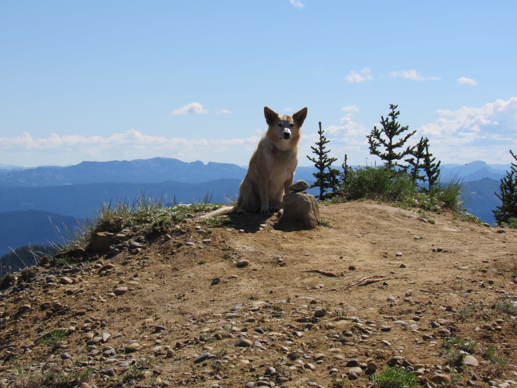
Days 13 & 14 of Lupe’s 2nd Summer of 2021 Dingo Vacation to Wyoming!

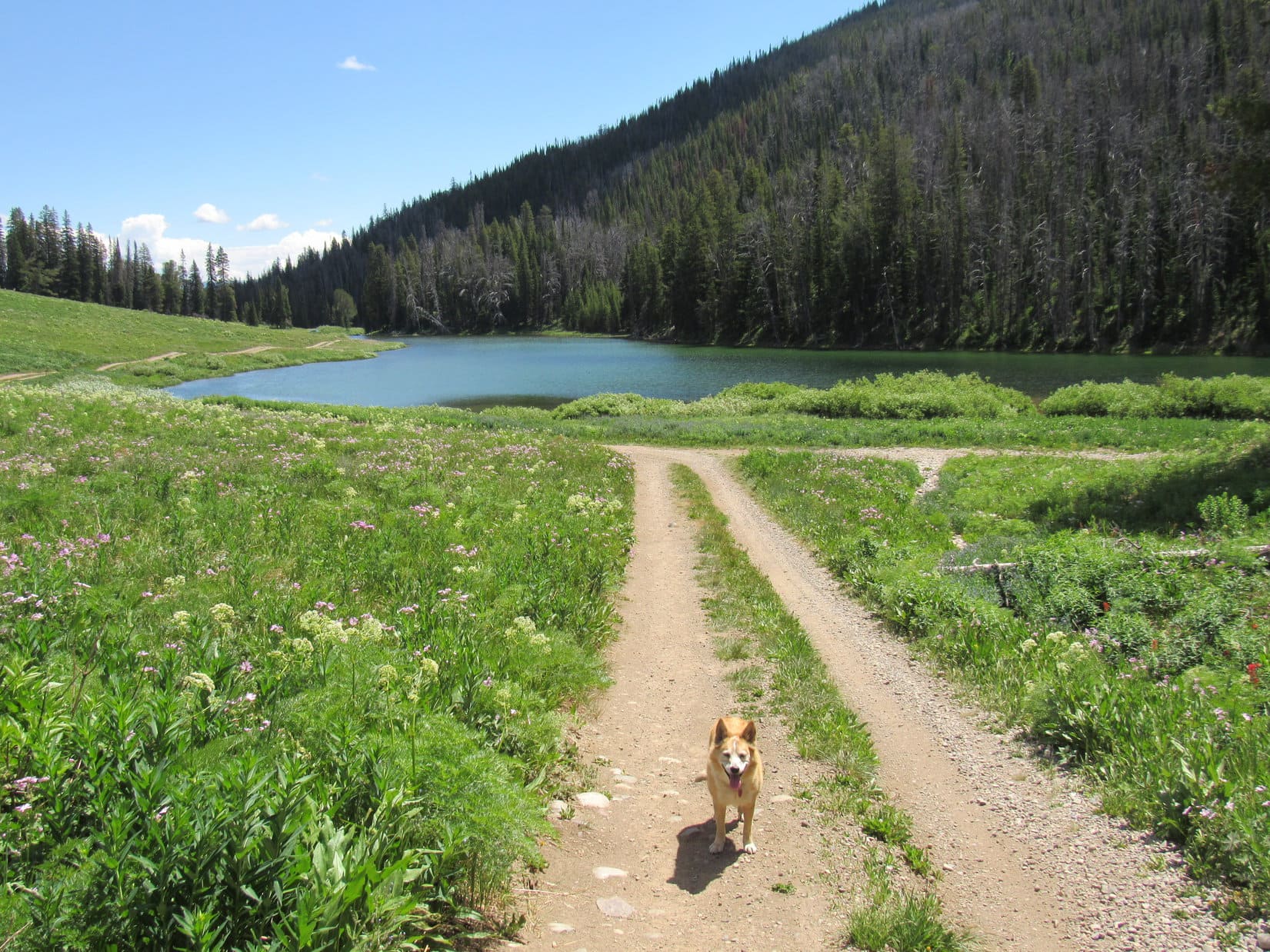
7-4-21, Brewster Lake – A glorious morning!  Lupe was up early, but so were Dale and Shannon.  They were already disassembling their tents as Loop ran over to sniff with their dogs.  SPHP paused to chat with Dale.  Their plan was to head back down Dry Fork trail No. 98 to Lunch Lake where they would camp tonight after spending the day fishing.

Lupe headed the opposite direction, continuing W on the last section of trail N of Brewster Lake.  Almost immediately, a couple accompanied by two huge German shepherds wearing goggles appeared.  Neither the dogs, nor the humans, were friendly.  They gave the American Dingo a wide berth as they passed by, apparently on their way out.

Loop would see no one else the rest of the day.

The W shore of Brewster Lake, where Lupe was heading. Photo looks SW.

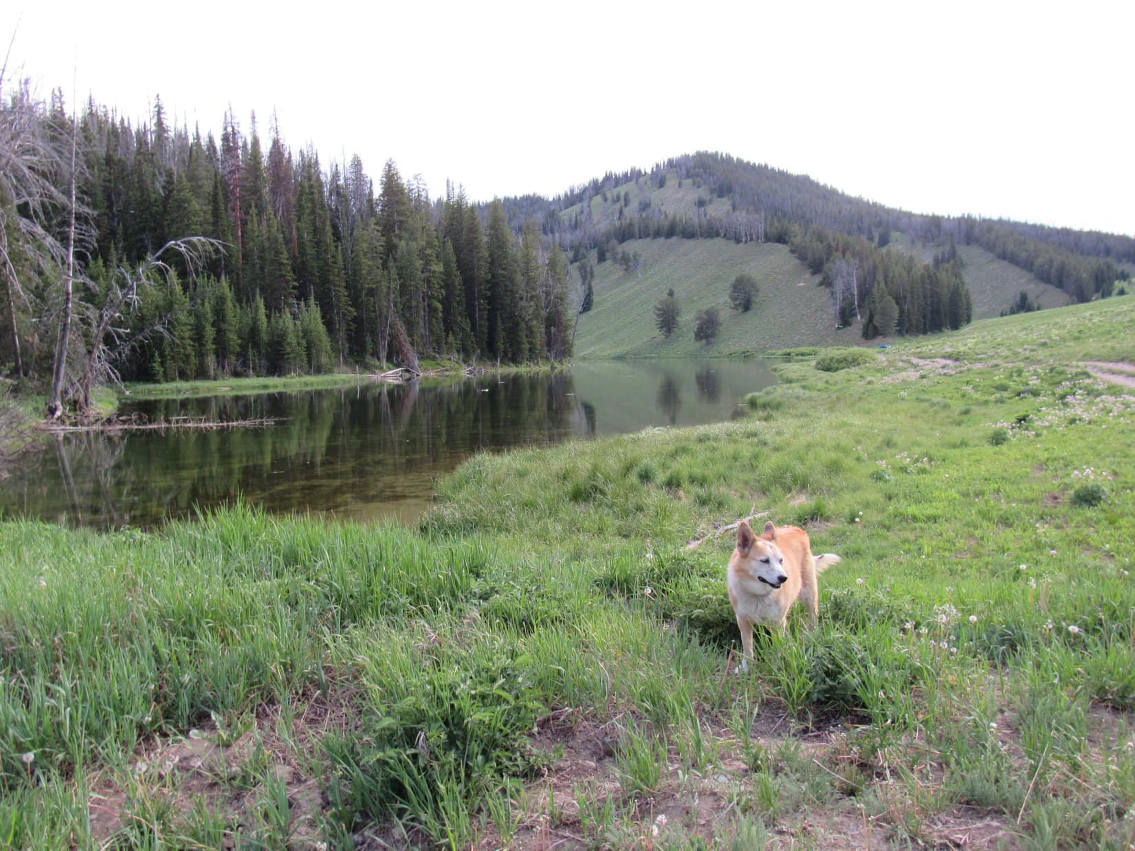
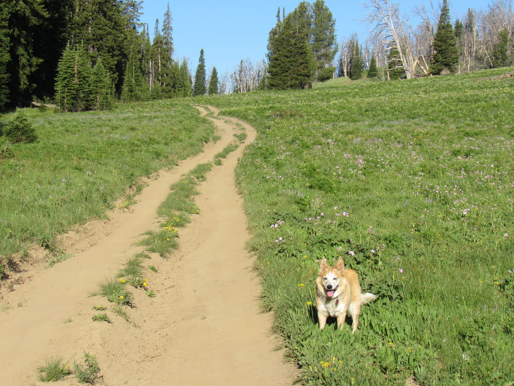
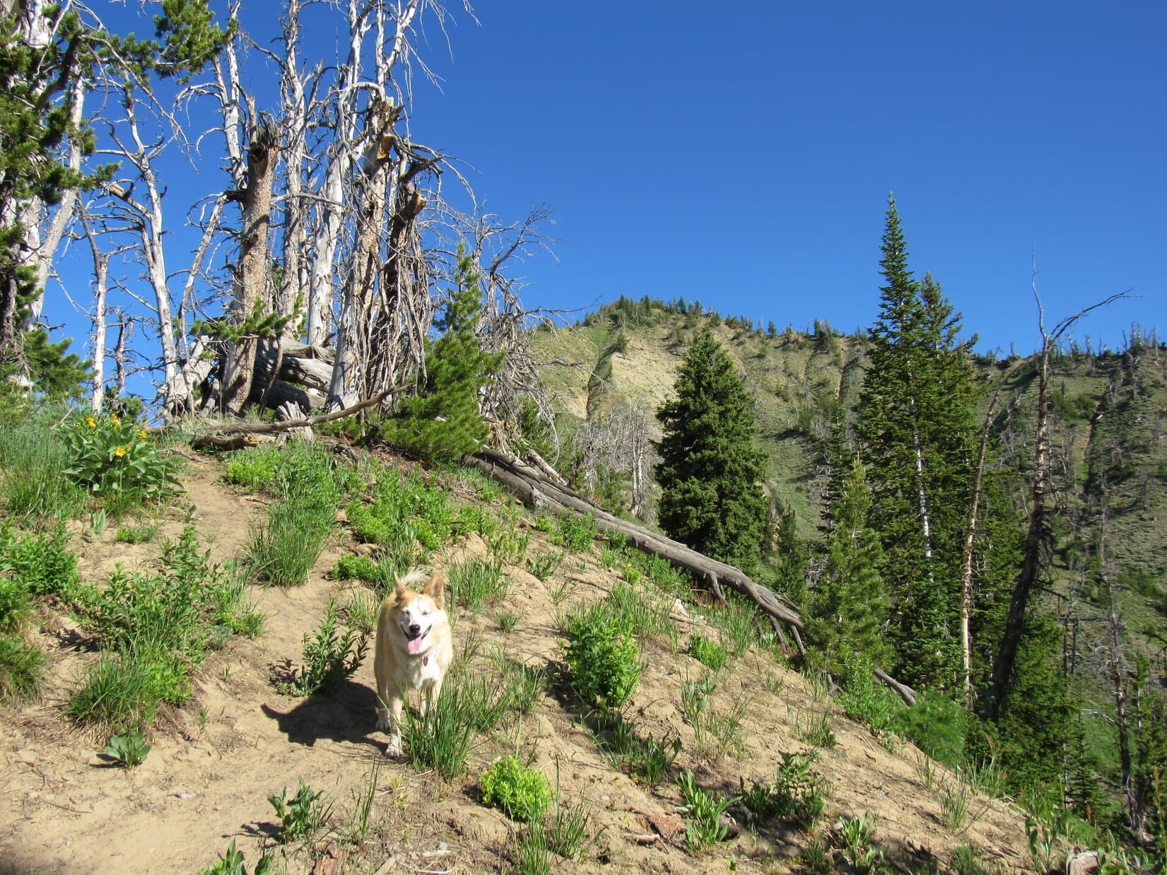
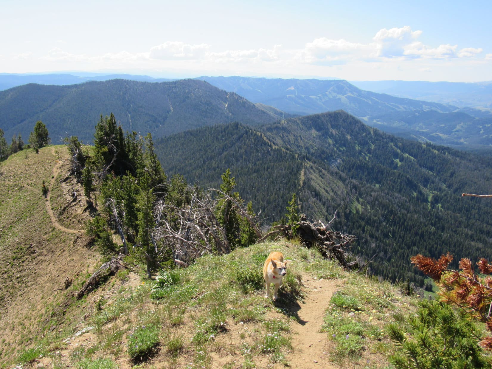
At the NW end of Brewster Lake, the trail vanished as Lupe entered a maze of bushes in a low-lying area.  A large waterfall could be heard, sometimes seen, off to the NW.  Would be fun to check it out, but the Carolina Dog was already on a mission.  Doubletop Peak (11,720 ft.), high point of the entire Gros Ventre Range, was her destination.

2 miles away, Doubletop’s NW summit was already peeking around the W end of Triangle Peak (11,525 ft.).  A lot of incredibly scenic and unique territory was between here and there.

Triangle Peak (L) and Doubletop Peak’s NW summit (Center) beyond the SW shore of Brewster Lake. Photo looks S.

Sniffing her way through the lowland bushes, Lupe crossed 3 streams.  None were problematic.  The last stream had carved a deep channel, but it was so narrow that even SPHP could easily leap over it.

Fording the biggest creek.
Brewster Lake from the lowlands. Photo looks SW.

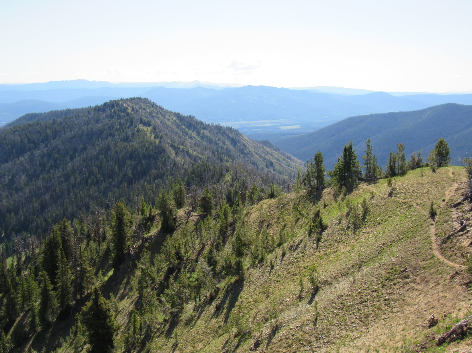
The plan had been to head up a valley visible beyond the SW shore of Brewster Lake, then strike out for Doubletop Peak’s W ridge.  However, as Lupe approached the W end of the lowlands, a wide ramp that sloped uniformly higher toward the SW was closer.  Looked like a great way to start gaining elevation.  Without bothering to consult the topo map, SPHP led Lupe toward it.

Crossing the lowlands. Doubletop Peak (L). The valley Lupe originally intended to go up starts in the region seen below it. Instead, SPHP led Loop toward the ramp on the R. Photo looks SSW.
Heading up the wide ramp. Photo looks SW.

After gaining 200 feet of elevation, Looper reached the top of the ramp.  Ahead was a small, open depression.  Turning S, the Carolina Dog trotted along the edge of the forest without descending into the depression.  She soon came to the N rim of the valley she’d originally intended to go up.

Across the valley was a terrific view of a series of long ramps separated by minor, continuous cliff bands sloping up to the SW.  In the distance,  Doubletop Peak towered above them all.

At the S end of the depression looking over the main valley SW of Brewster Lake. Doubletop Peak (L of Center). Photo looks S.

At a glance, it was clear that Lupe was already well above the valley she should have gone up.  Obviously, she was going to have to cross it pretty soon, but SPHP wasn’t eager to toss away elevation so recently gained.  Rather than bite the bullet, and simply angle down into the main valley SW of Brewster Lake, there was another possibility.

Looking SW, a broad bench, partially green with vegetation, slanted higher on a course paralleling the NW side of the valley.  Ignoring a line of cliffs above it, and although the bench could be seen narrowing near the upper end, SPHP speculated that maybe it would gradually meld into the valley somewhere up there without much elevation loss.

Figuring it would all work out, SPHP again led Lupe higher.

Staying R of Center, Lupe followed the greenery higher. Photo looks SW.

Worked great, at first.  Easy to see that it would!  Lupe climbed and climbed.  Soon she had a tremendous view back toward Brewster Lake.  The depression she’d gone by, and the valley SW of the lake were both in sight, too.  SPHP was surprised to see that the lower valley was full of wetlands.

Looking back at Brewster Lake (Center). The depression (L) is along the edge of the forest. Valley SW of Brewster Lake (R). Photo looks NE.

As Loop kept going, confidence shriveled along with the greenery.  The bench she was on was rapidly disappearing.  Ahead was a world of rock.

And so much for the bench somehow melding nicely into the valley!  The slope between what remained of the bench and the valley below was a rough jumble of huge talus that plunged steeply toward a wilderness of deep holes and fissures.  Forget that!

At the end of the greenery with trouble ahead. Photo looks SW.

To the N, 60 to 80 feet higher, the line of small cliffs still rising toward the SW capped the increasingly steep slope Lupe was traversing.  Despite rapidly dwindling prospects for this route, the Carolina Dog pressed on.  SPHP hoped she could get far enough to see what was ahead beyond a bit of a corner.

Didn’t work.  Just too steep!  Not going to make it past that corner.  Only 2 realistic choices now.  Retreat, losing a ton of elevation, or find a way to get above the cliffs!

At about the end of what was possible. Photo looks SW.

The entire slope ahead was very steep now, yet scanning the cliffs above, it appeared there might be some sort of a cleft or break in the cliff line only a little farther on.  The American Dingo scrambled toward it.

Getting close to the top! Photo looks W.

Dicey in a couple of spots, but Lupe made it!  Above the cliffs, she found herself on a sloping surface of solid rock etched by the ages.  With SPHP still hoping to come to some easy, or at least feasible, route down into the valley to the S, she again turned SW, venturing higher.  Progress was rapid on this obstacle free terrain.

Above the cliffs on unusual, but much easier, terrain. Photo looks SW.

Somewhat surprisingly, this maneuver soon worked as well!  Loop didn’t have to climb much farther before coming to a place where the cliff line disintegrated.  Avoiding significant elevation loss wasn’t possible, but an easily manageable slope free of talus, deep fissures, or sudden drops led down into the valley to the S.  Still a rocky descent, but there was even some vegetation again among it all.

On the brink of the slope leading down into the valley. Doubletop Peak (Center). Photo looks SSE.

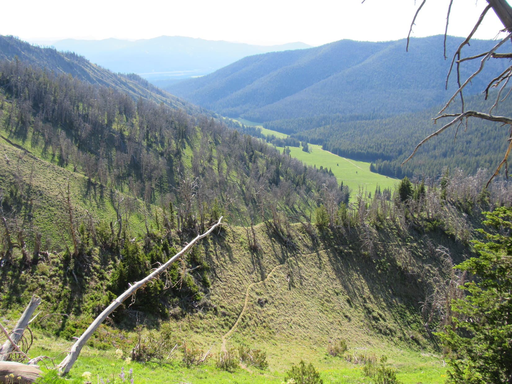
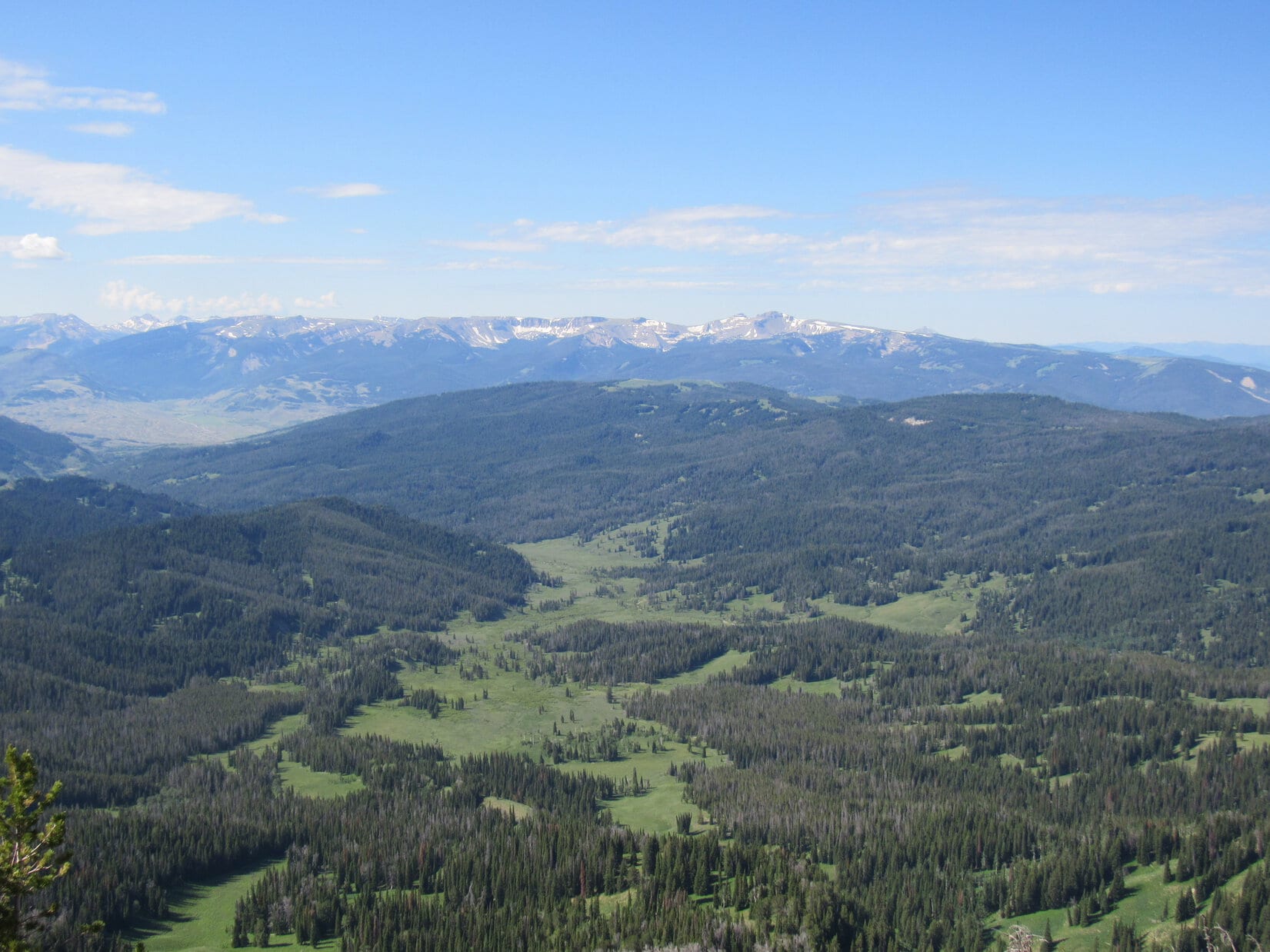
Once down in the valley, Lupe crossed several snowmelt streams as she continued working her way S.  It was easy going, and the scenery was absolutely gorgeous, but the American Dingo soon had to start regaining the elevation she’d lost.

Reaching the valley floor. If she’d climbed far enough, Loop could have come down this drainage, but she actually descended from the R. Photo looks NW.
Continuing a little farther down the valley while aiming for Doubletop Peak (L). Photo looks SSE.
Triangle Peak from the largest stream crossing. Photo looks E.
Starting up again after crossing the main valley. Photo looks S.

Lupe had reached a fascinating region!  Crumbling layers of bedrock formed a maze of minor cliffs, long ramps, and benches.  The Carolina Dog wandered through a wilderness of zones separated by walls and sudden drops.  She crossed snowfields melting in the bright sunshine that fed streams gurgling unseen deep down in narrow cracks that were easily stepped or leapt over.

To the W, a high ridge of light-colored stone.  To the E, the dark pyramid of Triangle Peak loomed over Brewster Lake shimmering far below.

Exploring the crumbling bedrock. Photo looks SW.
Brewster Lake. Photo looks NE.
Crossing a snowfield. Peak 11626 (L). Darwin Peak (11,647 ft.) (R) in the distance. Photo looks NNW.

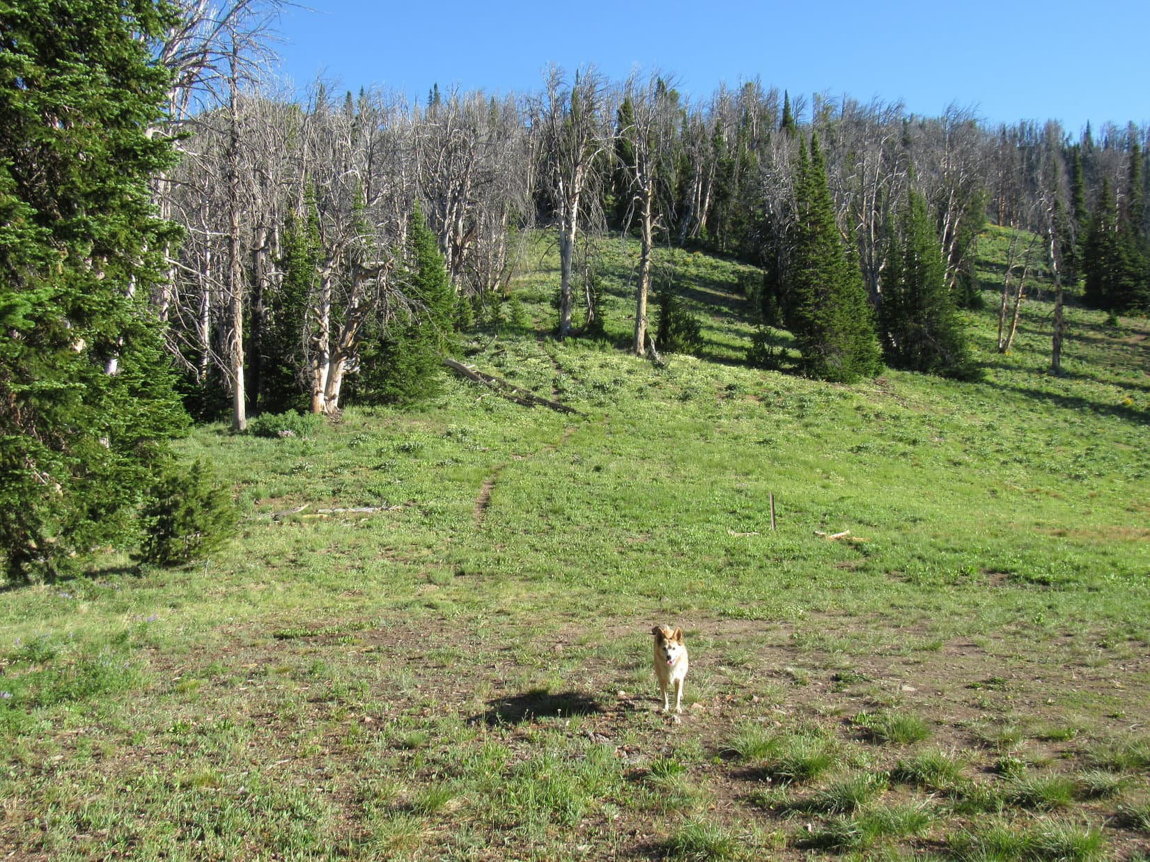
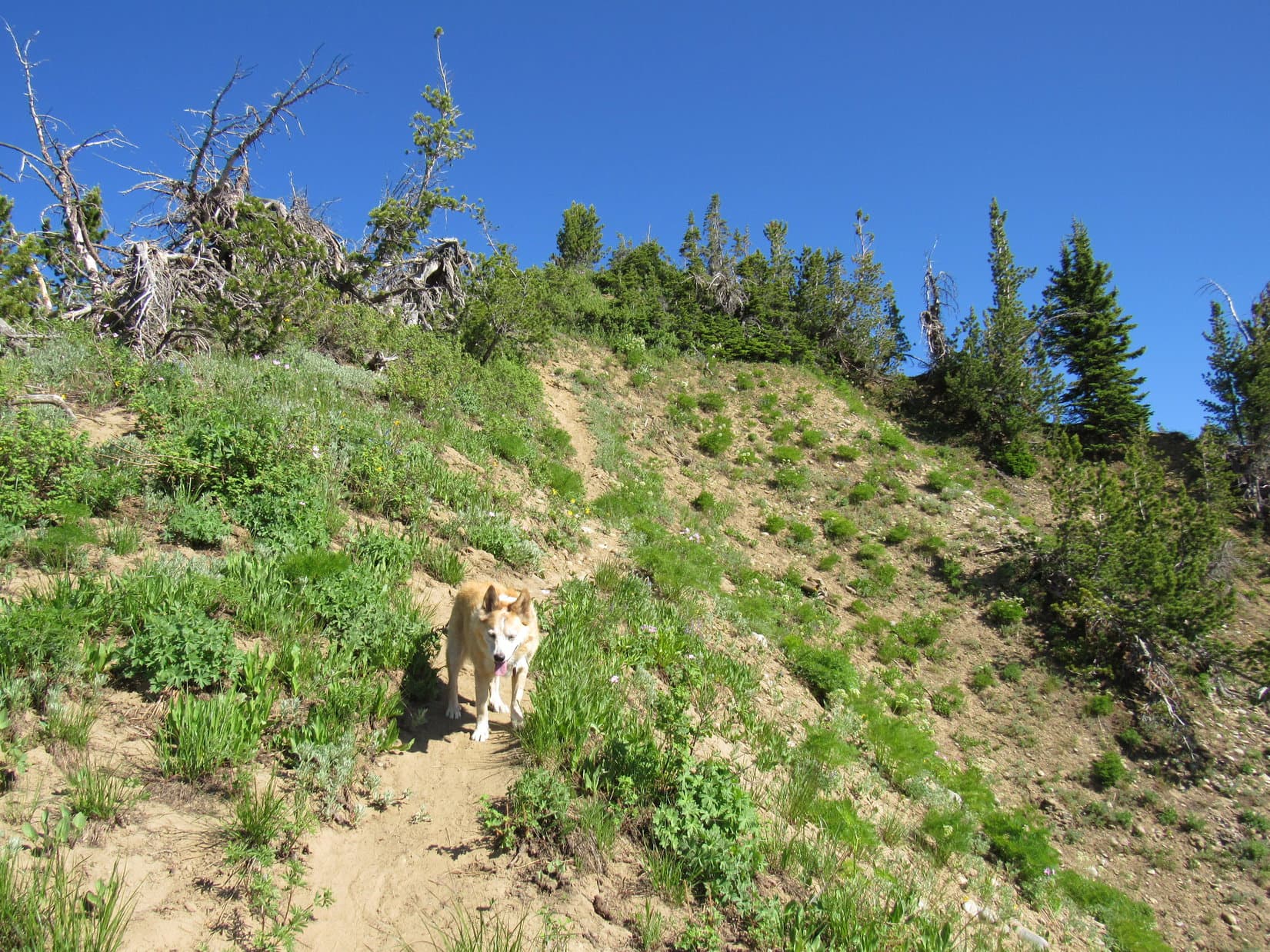
Climbing steadily, but at a deliberately slower pace this time, Loopster worked her way S.  As she started getting closer to Doubletop Peak, the rock formations began diminishing in size.  The ridge to the W was no longer as high, and appeared to have transformed itself into the edge of a precipice not all that far away.

Continuing toward Doubletop Peak. Photo looks SSE.
Another look back at Brewster Lake (L) and Triangle Peak (R). Photo looks NE.
Getting close to the top of the ridge to the W (R) as the rock formations shrink in size. Doubletop Peak (L). Photo looks S.

A bit of vegetation began to appear.  Loop had reached a high plain that wasn’t so rocky.  Doubletop Peak was directly ahead now.  Easy terrain leading toward it, but SPHP called a halt at a couple of large rocks.

Approaching Doubletop Peak (L). Photo looks S.

The plan all along had been to go up Doubletop Peak’s W ridge, which led to the lower NW summit, then proceed SE from there to the true summit.  However, a couple of cliff bands could now be seen along the W ridge.  They didn’t look all that big from way down here, but if either one proved continuous, it wouldn’t take much of a cliff to force a retreat.

As SPHP studied both the mountain and the topo map, it appeared that another, more certain approached existed.  Lupe could head for the NE side of the mountain, then climb SW up an enormous ramp directly to the true summit.  Part of the ramp was visible from here.  Although just as steep as the W ridge, it appeared to be a smoother approach.

The W ridge was much closer.  Lupe would have to lose a good 300 feet of elevation just to get to where she could start up the NE ramp.  On the other paw, climbing partway up the W ridge only to be denied, and then having to circle all the way back down around to the NE losing even more elevation seemed a dreadful prospect.

Taking a middle course for the moment, the American Dingo resumed her trek toward Doubletop Peak.  Meanwhile, SPHP dithered over which way to go as the mountain loomed closer and closer.

Onward, Puppy, ho! The question was whether to go up the NE ramp (L) or the W ridge (R). Photo looks SSE.

You can’t keep me in suspenders any longer, SPHP!  You’ve got to decide!  Which way?

W ridge, Loop!  We’re so close now, we’ve got to give it a go!

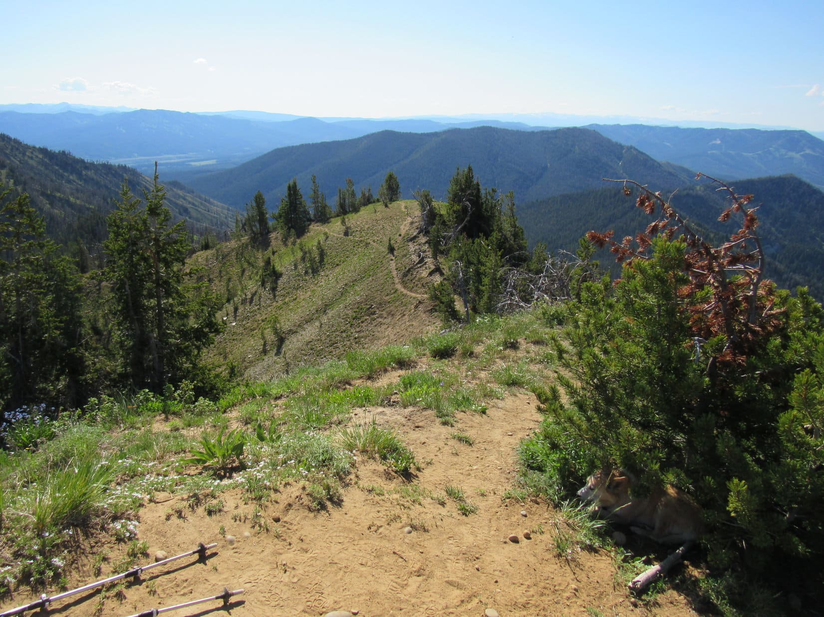
Angling higher, the Carolina Dog reached the top of the ridge to the W a little N of where Doubletop Peak’s W ridge began.  She was now along the edge of an enormous cliff with views to the W.  Following the edge S, she soon ran into a huge confidence booster.  A path headed directly for Doubletop’s W ridge.  Looked seldom used, but it was there!

Along the edge of the enormous cliff. Palmer Peak (11,404 ft.) (R). Photo looks W.
View to the SW.
On the path leading to Doubletop Peak’s W ridge. Photo looks SSE.

Even before Lupe reached the ridgeline, the views of Peak 11626 and Darwin Peak (11,647 ft.) back to the N were amazing!  Once she got to the ridgeline, she gazed upon yet another incredible sight to the SSE.  Both Hodges Peak (11,180 ft.) and Tosi Peak (11,380 ft.) were strung out along a stunning long chain of connected peaks.

Starting up! Photo looks SE.
Peak 11626 (Center), Darwin Peak (R). Photo looks NW.
Hodges Peak (Center) directly in front of Tosi Peak. Photo looks SSE.

Upon reaching the lower end of Doubletop Peak’s W ridge, Lupe’s ascent began in earnest.  One thing was immediately clear.  She would have to go around the N side of any serious obstacles.  The S side of the ridge was dangerously steep.

Impassable, SPHP!  Might as well have been a cliff!

Yeah, that’s sort of what I was implying, Loop, but some people can do just about anything.

As Lupe turned E, the first cliff band wasn’t all that far away.  From this close, it looked more like a jumble of enormous talus than a continual wall of rock, which was probably a good thing.  Loop was soon at the base of it, looking for a way higher.

At the start of the first “cliff band”. Photo looks E.

Turned out to be easy!  As expected, nothing to the S, but toward the N, Lupe discovered a lovely ramp.

A cinch! Lupe went right up the ramp (Center)! Photo looks ENE.

Past the first cliff band already!  And it was the tallest one.  However, newfound enthusiasm faded as Lupe approached the second cliff band.  Although only a few tens of feet high, it looked problematic.  No talus, only scree, but the ridge was narrower and steeper here.  No chance of success either to the R or via a direct assault.  Getting around the N side would be key.

Approaching the second (upper) cliff band. Photo looks E.

A wall of rock forced Lupe away from the ridgeline out onto the N slope.  Fortunately, the wall wasn’t very tall, and shrank steadily as Loopster followed a small ledge below it E.  The N slope was getting mighty steep by the time she could scramble higher.  Rocks clattered down, but the American Dingo managed to regain the ridgeline.

Still more to go, but no significant obstacles in sight.  Gonna make it!

Above the second cliff band, approaching the NW summit. Actually a bit of a use trail here. Photo looks E.
Closing in on the NW summit (L). True summit (R). Photo looks ESE.

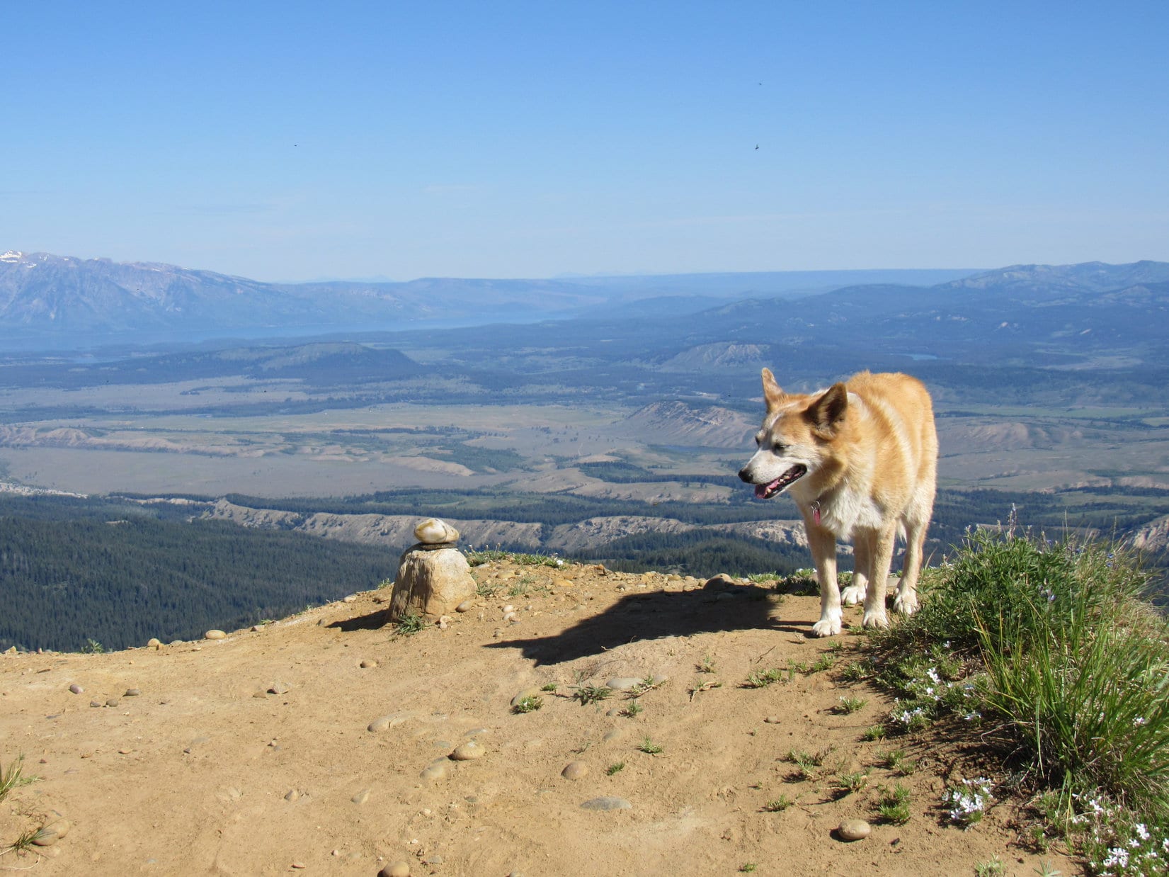
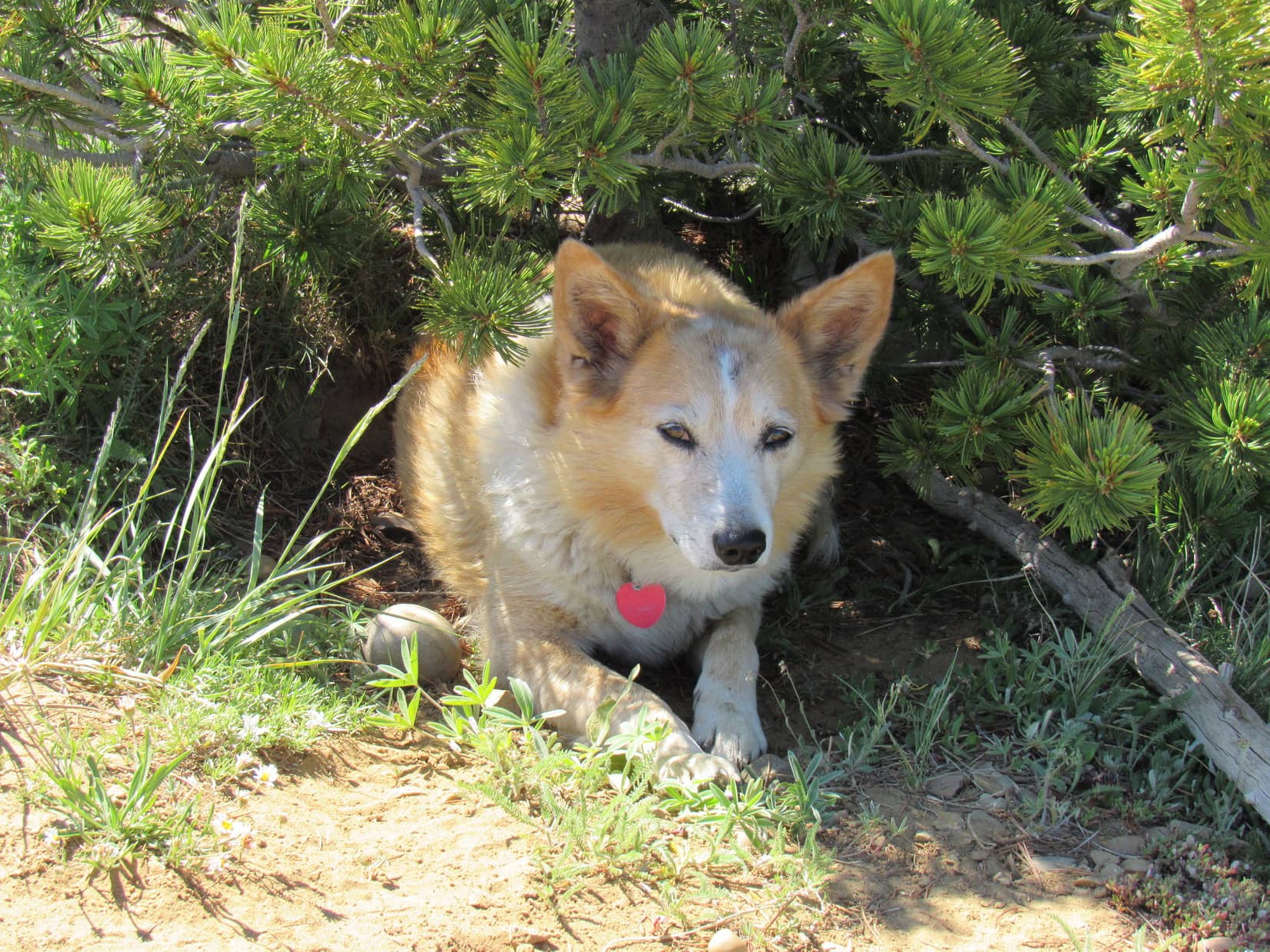
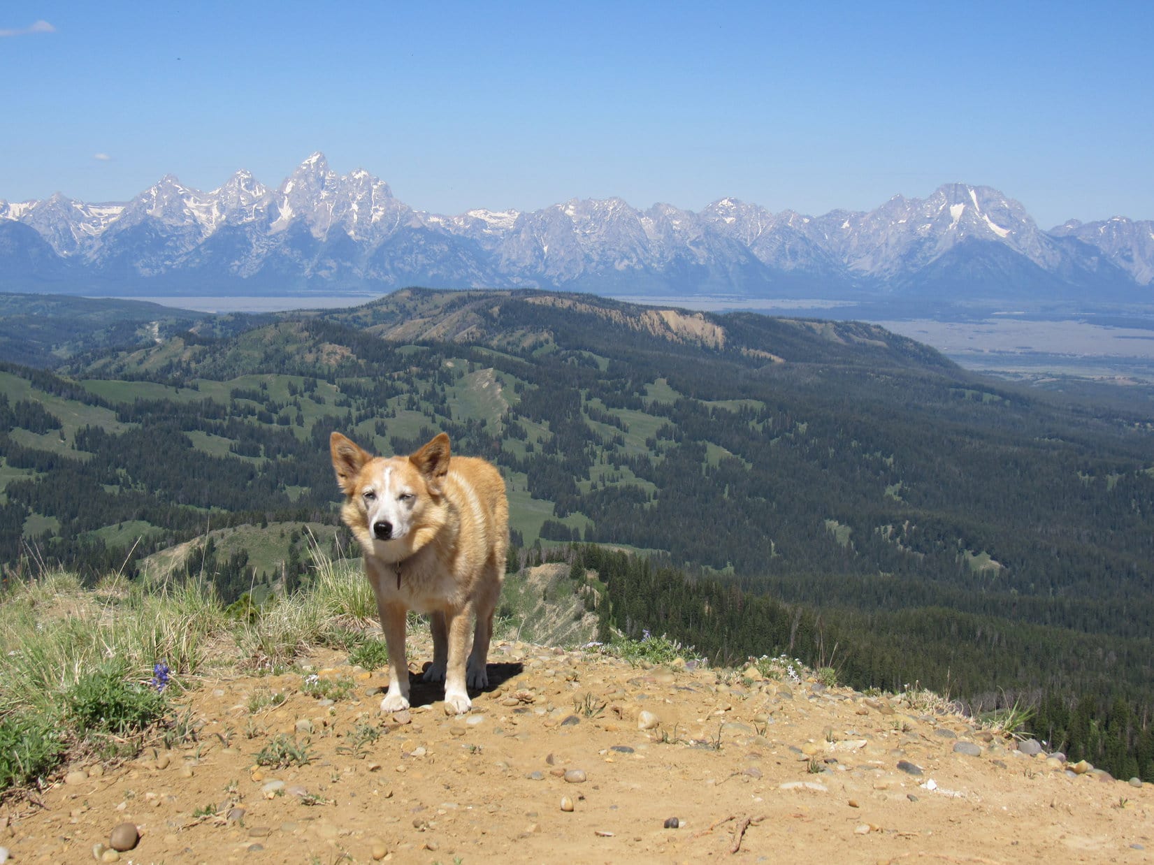
11:32 AM, 70ºF, Doubletop Peak, NW summit – The NW summit was plenty roomy.  Covered with small rocks, it was an almost level platform that sloped gradually away to the SE.  Except for the W ridge, the edge seemed cliffy in other directions.  Lupe stood at the high point near the NW end where she’d come up, looking down not only on Brewster Lake where she’d started out this morning, but even mighty Triangle Peak (11,535 ft.), as well.

Brewster Lake (Center), Triangle Peak (R). Photo looks N.

Stupendous sights were in virtually all other directions, too!  A little hazy to see the really distant stuff, but copious mountain eye candy existed between here and every horizon.

View to the NW.

Perfect conditions!  Sunny, comfortably warm, no wind.  A short break was taken to recover from the climb and enjoy the glories of the Gros Ventre Range.  Soon, however, gnawing curiosity got the better of SPHP.

Off to the SE was the most important view of all.   Lupe still hadn’t made it to the true summit of Doubletop Peak (11,720 ft.) yet.  It was in sight, though, less than 0.2 mile away.  What could be seen from the high point of the NW summit was encouraging.  Lupe could climb that no sweat!

However, success wasn’t guaranteed.  Beyond a lip, the slope that went from the NW summit down to the saddle over to the true summit wasn’t in sight.  A hidden sudden drop might effectively strand Lupe right here.

Don’t sit here fretting any longer, SPHP!  I’m dying to know the truth, too!  Let’s go check it out! 

The possibility that the Carolina Dog was stranded on the NW summit wasn’t resolved one way or another until Lupe reached the lip.

Illusion, nothing more!  The slope heading down to the saddle was cake – absolutely nothing to worry about.  The trek was a joyful one!  Lupe was soon ascending the ridge leading to the true summit.

Near the lip, with Doubletop Peak’s true summit dead ahead! Photo looks SE.

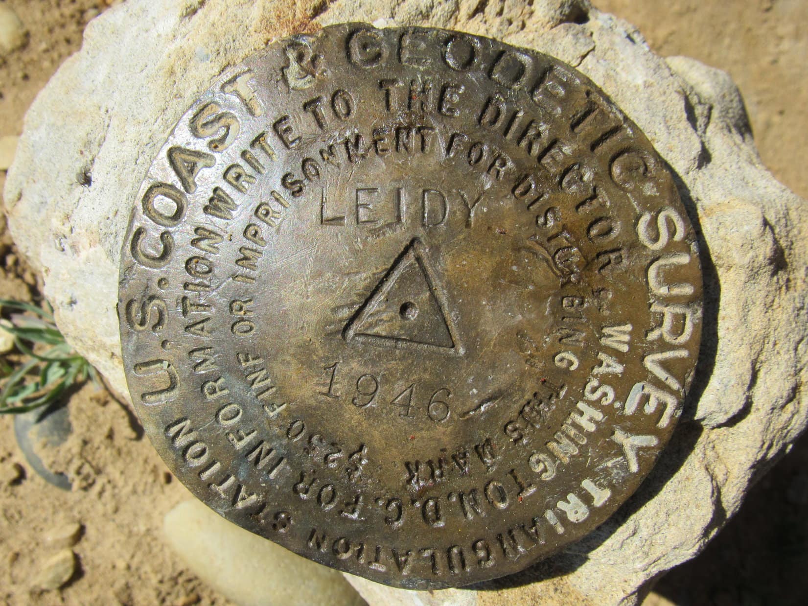
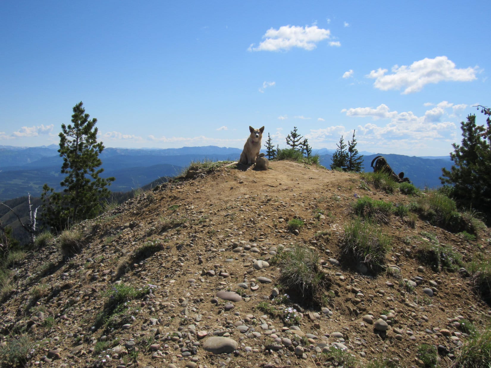
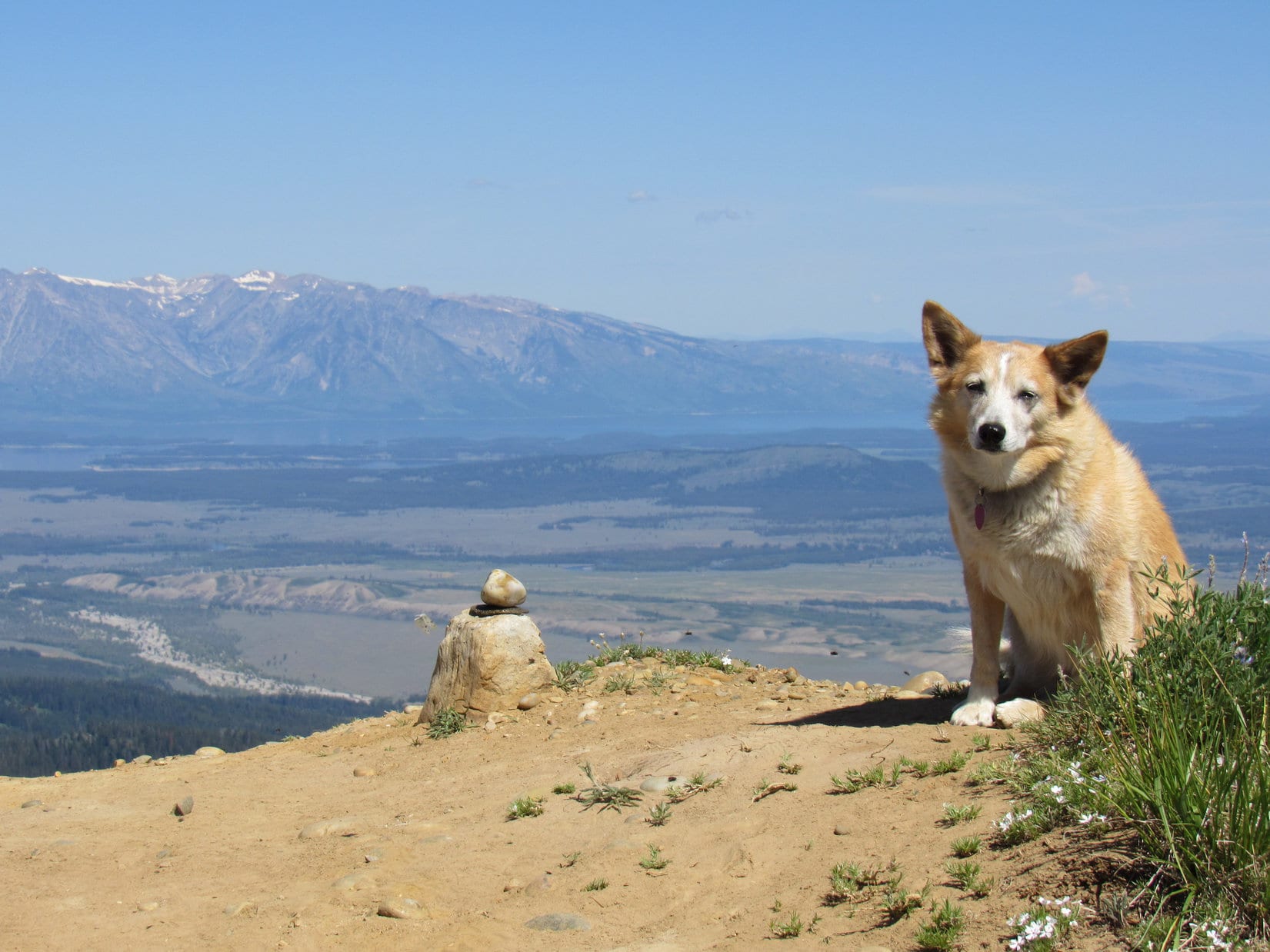
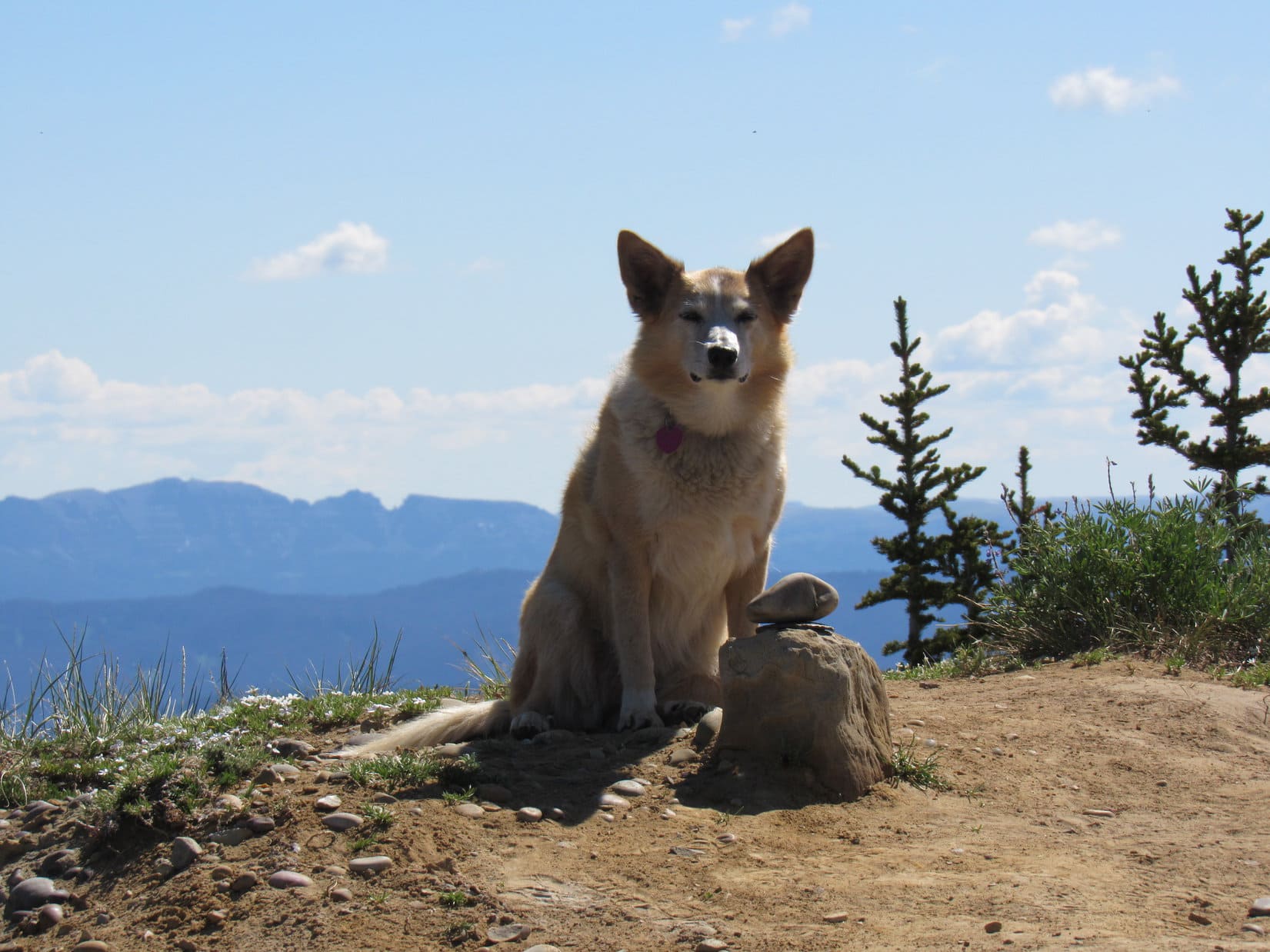
11:56 AM, 70ºF, true summit of Doubletop Peak – Two small flat chunks of crystal served as a summit cairn.  Although close to it, they weren’t even at the absolute high point, which was along the S edge.  No registry or survey benchmark in sight.  With a smile on her face, Lupe squinted in the bright sunshine surrounded by a field of broken off-white rocks.

At the true summit of Doubletop Peak! Photo looks NW.
The two crystals, only a few inches across, serving as a summit cairn.

Congratulations, Loopster!  This is it!  The true summit of Doubletop Peak!  May I shake your paw?

Absolutely, SPHP!  And good call on coming up the W ridge!

Every now and then, I guess right!  Sure glad we didn’t head for the NE ramp.  Wouldn’t get here for another hour.

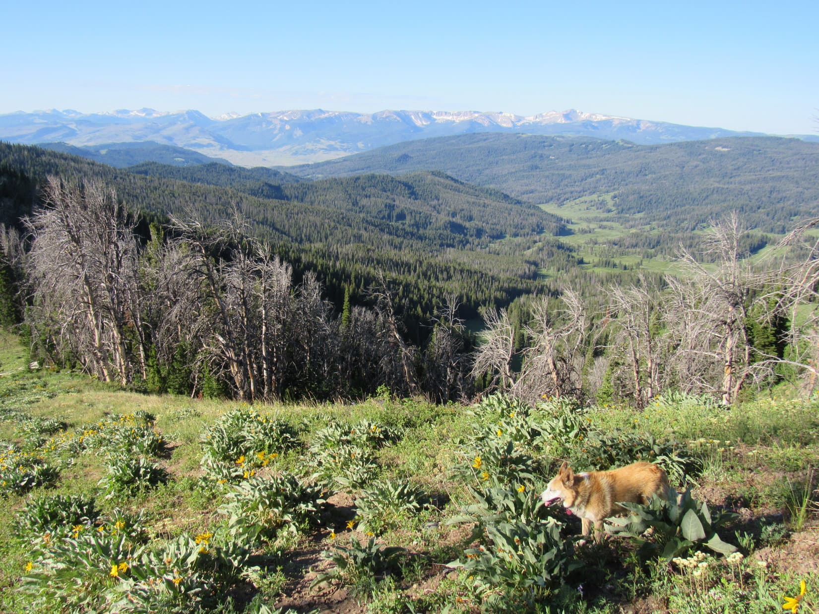
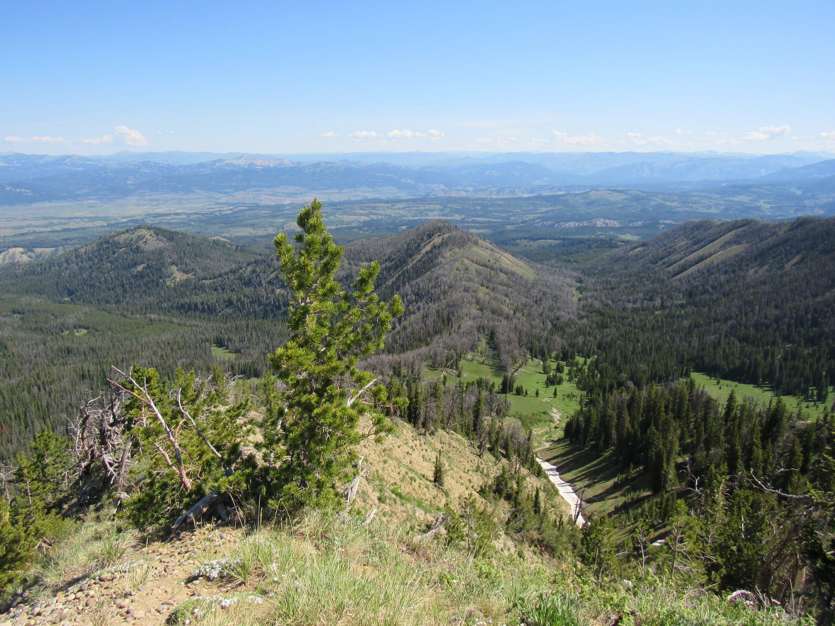
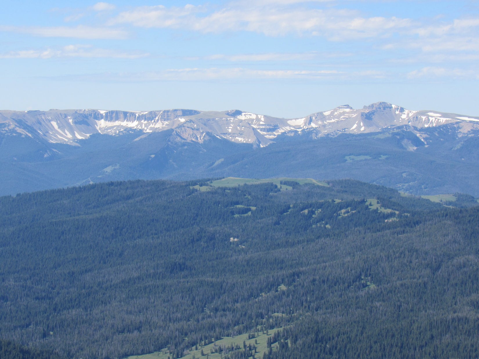
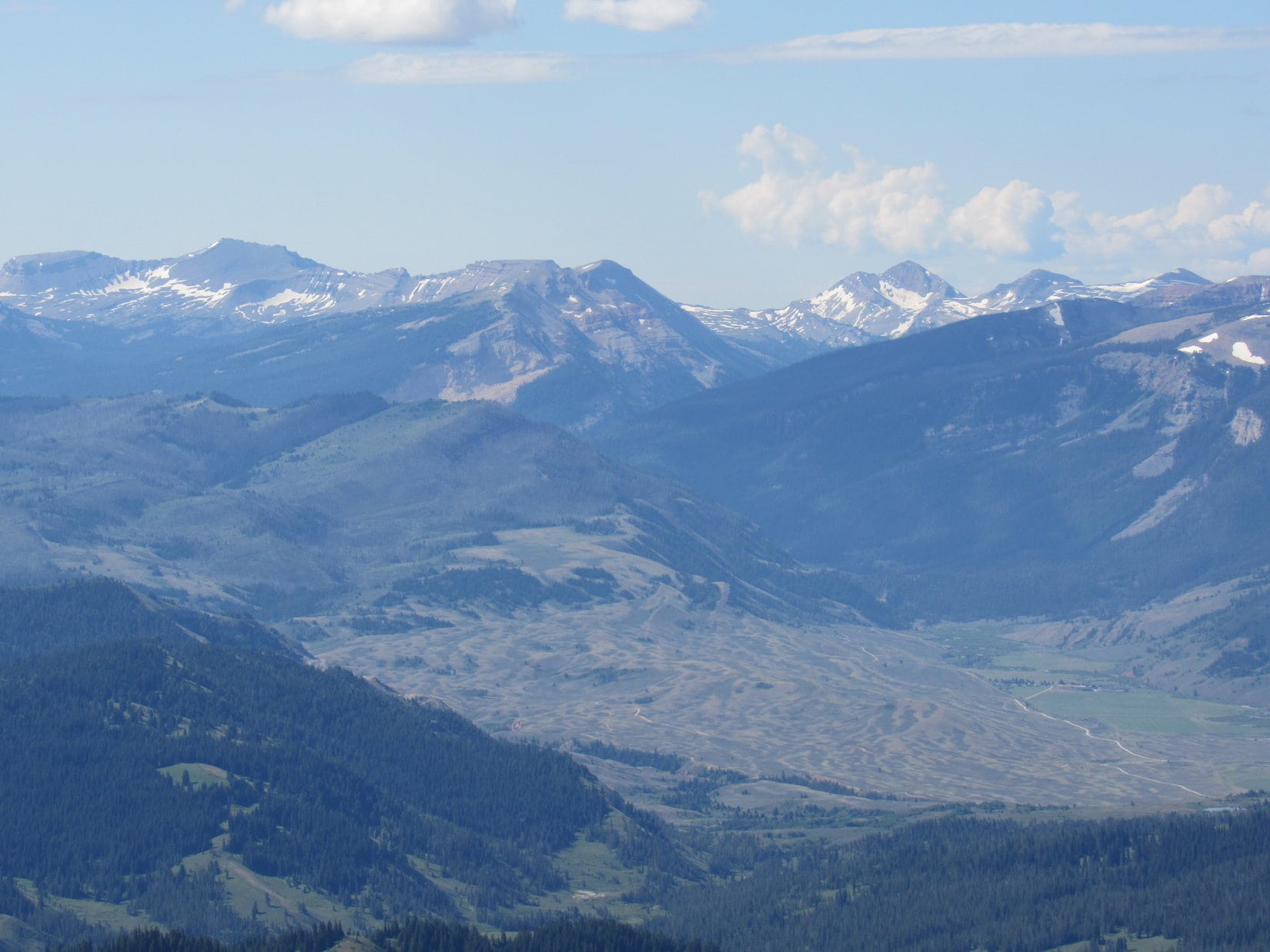
Fourth of July!  The thrill of celebrating the holiday alone with Lupe on such a magnificent peak was indescribable.  A quick tour of the sights was in order before settling down to relax.  Hodges Peak (11,180 ft.) and more distant Tosi Peak (11,380 ft.) strung out along the miles long ridge fading away to the SSE was one of the most striking and unusual scenes.

Hodges Peak (mid range on the R) with pointy Tosi Peak (R of Center) beyond it. Photo looks SSE.

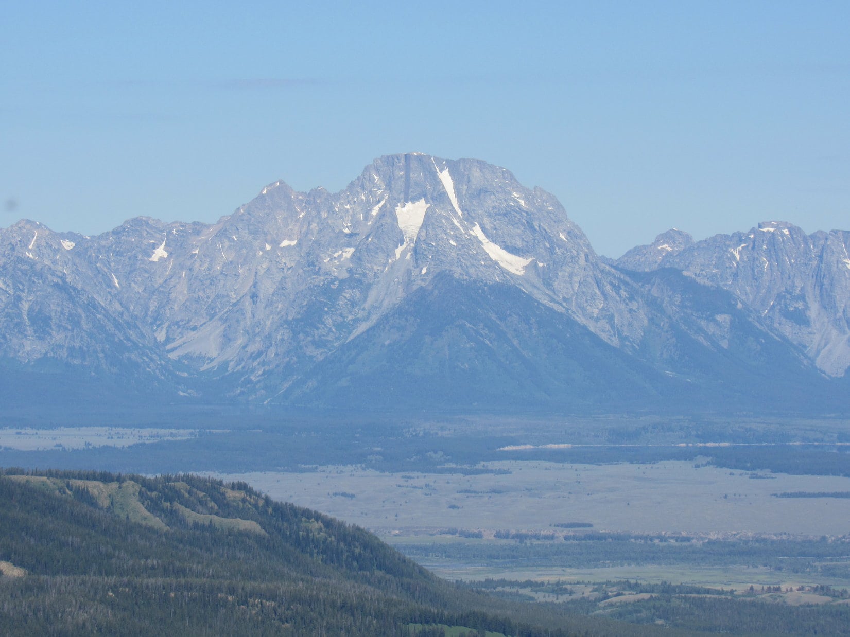
Peak 11626 and Darwin Peak (11,647 ft.) were on display toward the N.  Triangle Peak (11,525 ft.) was considerably closer, but only a tiny sliver of Brewster Lake could still be seen beyond it from here.  Looking NE down the Clear Creek valley, two smaller lakes were in sight.

Peak 11626 (far L), Darwin Peak (L of Center) and Triangle Peak (R). Photo looks NNW.
Looking NE down the Clear Creek valley. The lower lake is Lake 9022.

The Wind River Range dominated the E horizon.  Despite some haziness, it was possible to pick out Gannett Peak (13,804 ft.), Wyoming’s highest mountain.

Wind River Range on the horizon. Gannett Peak is toward the R. Photo looks ESE.
Gannett Peak (L). Photo looks SE with lots of help from the telephoto lens.

Two mountains stood out among the others toward the W or NW.  One, almost directly W, consisted of curved striated light grey rock.  Probably the SE summit of Flying Buttress (11,095 ft.).  The other, more toward the NW and farther away, had a pointy summit and was clearly higher than anything else near it.  Antoinette Peak (11,407 ft.)?  Seemed likely, but SPHP wasn’t sure.

Possibly SE summit of Flying Buttress (L), and Antoinette Peak (R of Center), Doubletop Peak’s NW summit (far R). Photo looks WNW.
Same view with help from the telephoto lens. SE end of Flying Buttress (far L) and Antoinette Peak (R)? Photo looks WNW.

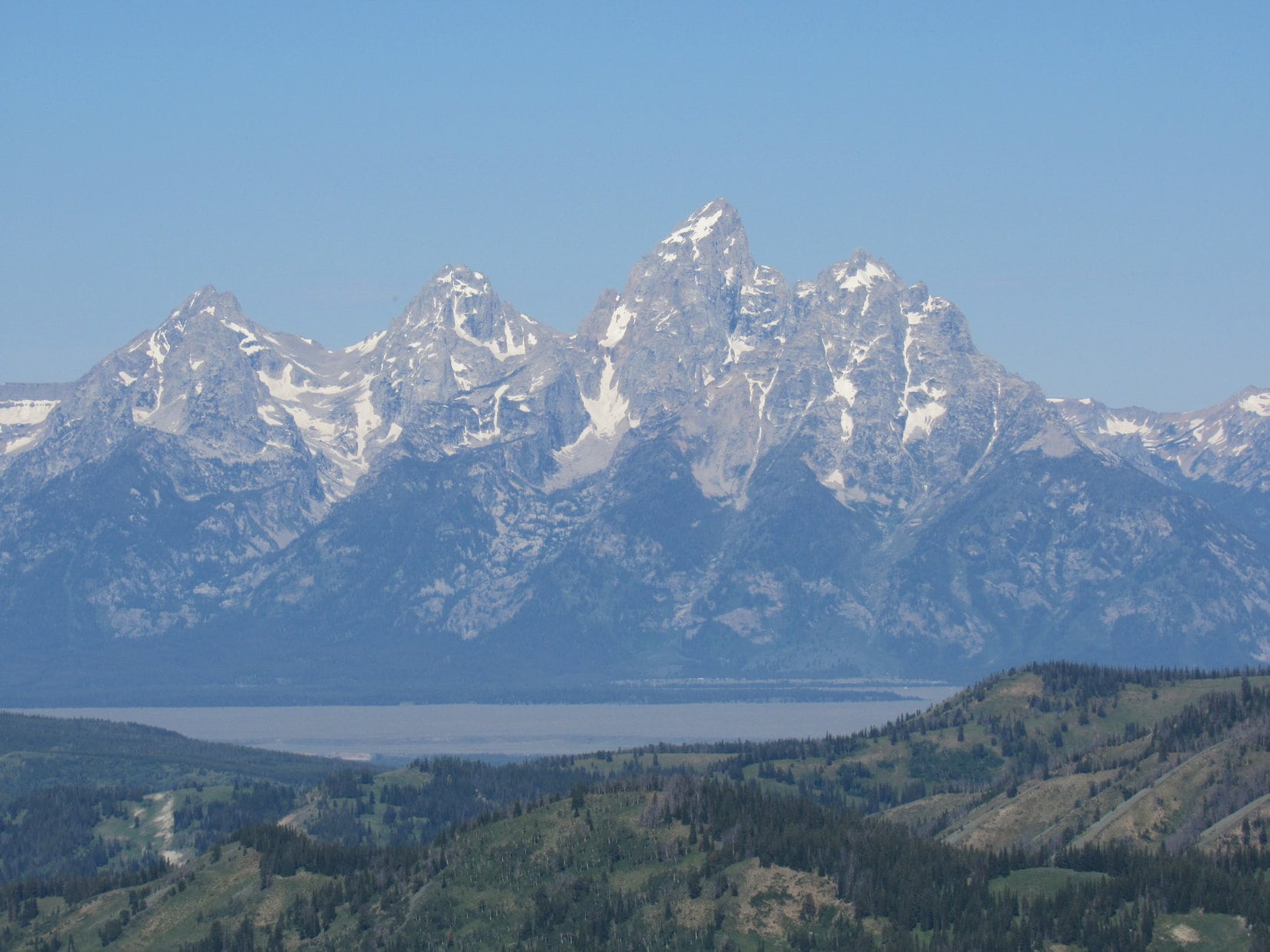
The scenic tour wouldn’t be complete without mentioning a dimly seen crag.  Far, far to the NW lurked Wyoming’s most famous mountain – Grand Teton (13,770 ft.)!

Zoomed in on Grand Teton (Center). Photo looks NW.

Doubletop Peak’s true summit was nothing but rocks.  No comfortable spot for Lupe to lay down.  For a long time, she curled up on SPHP’s lap, facing toward Triangle Peak.  A couple of chocolate coconut bars were shared to celebrate the Carolina Dog’s successful ascent.  They vanished almost instantaneously.

12:51 PM, Doubletop Peak – Lupe’s precious summit hour took longer, but slipped away, too.  With only a few minutes left, the American Dingo stood alone at the true summit.  Soon time to go.

Doubletop Peak true summit. Photo looks WNW.

SPHP briefly wandered about taking it all in again.  Over in a flash.  Hate to, but:

Onward!  Puppy, ho!

Leaving Doubletop Peak. Photo looks SE.

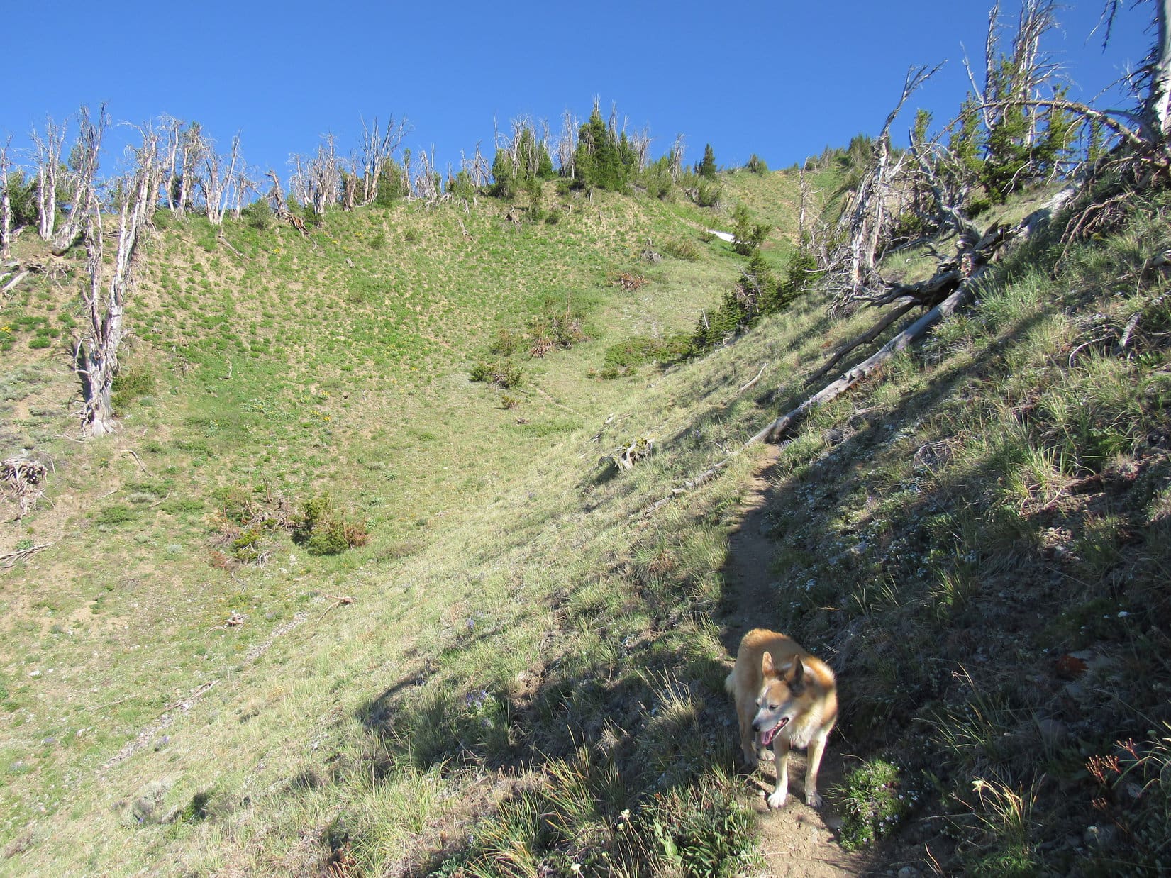
Loopster left Doubletop Peak’s true summit bound for the NW summit.  She’d have to go over it again in order to head back down the W ridge.

Starting back to the NW summit (Center). Photo looks NW.
About to cross the saddle leading to the NW summit (Center). Photo looks NW.
Peering down the W ridge. Photo looks W.

A bit of caution required near the two cliff bands, but it all went well.  Soon Lupe was down off the W ridge.  The Carolina Dog headed NNE to roam once again the beautiful intricate maze of rocky ramps and sudden drops, crossing numerous snowfields and little streams in the process.

Down off the W ridge. Triangle Peak (R). Photo looks NE.
Triangle Peak. Photo looks NE.
A glance back at Doubletop Peak’s W ridge. Photo looks SSE.
Rest break on the way back to Brewster Lake (L). Triangle Peak (R). Photo looks NE.

Trying to learn from the morning’s route mistake, once Lupe reached the big valley SW of Brewster Lake, SPHP had her go down it.  However, the lowlands near the bottom proved too wet, forcing a climb onto the ridge between it and the wide ramp Loopster had ascended in the morning.  Continuing lower, she then cliffed out, forcing a weary climb almost all the way back to the depression in order to get past a line of small cliffs preventing her from reaching the ramp again.

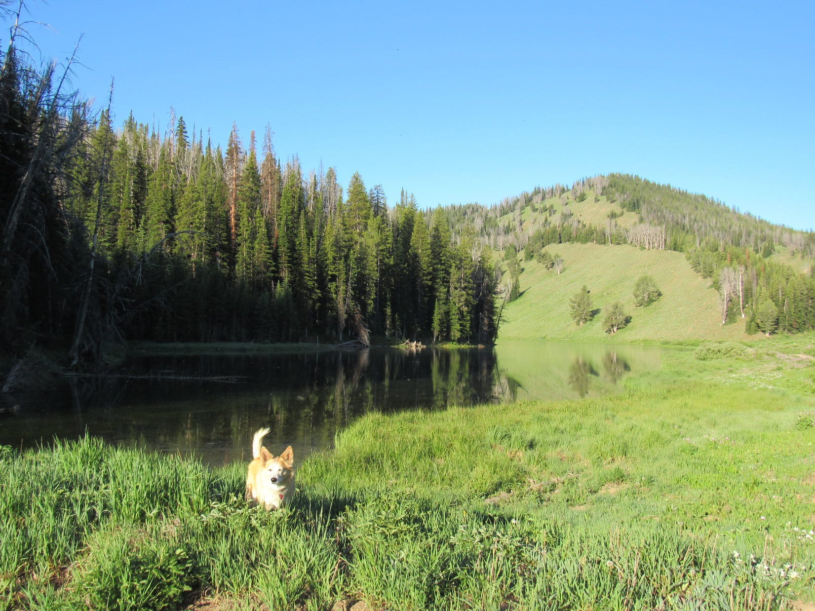
7-4-21, late afternoon, Brewster Lake –  Not a soul in sight when Lupe reached her tiny house 200 feet from the NE shore of Brewster Lake.  Tired, the Carolina Dog was anxious for a snooze.  SPHP joined her.

Later, as shadow crept up Triangle Peak, Loop journeyed down to the lakeshore near Dry Fork Creek’s outlet, then stood watching the rippled surface.  3 times, a big trout swam by all alone.  Sort of sad, but what a beautiful place!  And what an adventure Doubletop Peak had been!

It wasn’t until the last rays of sunlight vanished from Triangle Peak’s very summit that Lupe returned to the tiny house for the night.

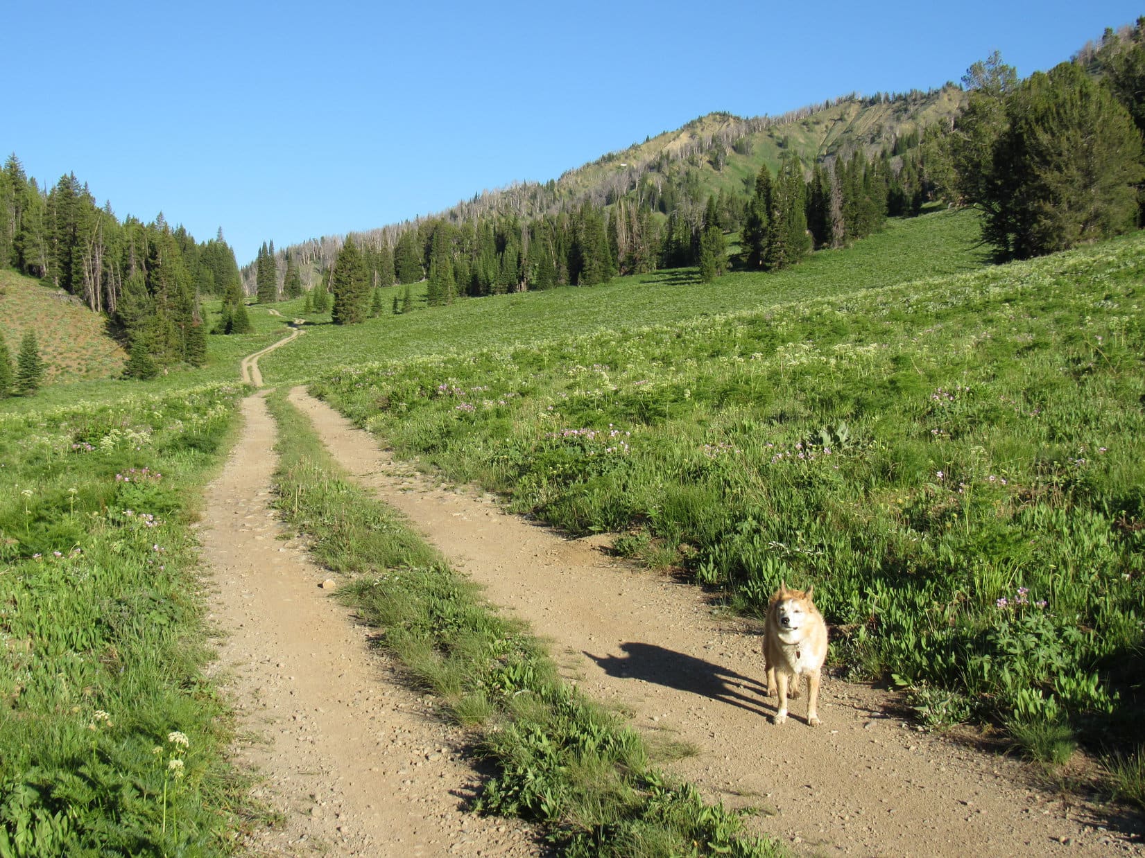
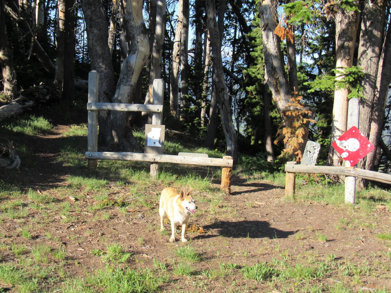
7-5-21, early – Looper left Brewster Lake under gray skies.  Light rain seemed to energize her on the way down Dry Fork trail No. 98.  By the time she reached Lunch Lake, the rain had ended and the clouds were breaking up.  No sign of Dale and Shannon or their dogs.  They must have already broken camp and left.

Past Lunch Lake, Lupe saw another grouse.  Maybe the same one?  SPHP saw something that had been missed on the way in, a sign for Ouzel Falls on the Gros Ventre River.  This must be the real junction with Trail No. 96, not the fork farther on that Lupe had noticed 2 days ago.

Half an hour from Clear Creek, two young men coming up the ridge were surprised to see an American Dingo.  Traffic was terrible today!  They’d already seen one other party heading down.  Might have been Dale and Shannon.  SPHP assured them that no one else was still up at Brewster Lake where they were headed to do some fishing.

A young woman had just crossed Clear Creek as Lupe reached it.  Her black lab was still running around on the far bank.  His name was Floyd, like “Pink Floyd”, she said.  SPHP muttered something about looking more like “Black Floyd”, and Lupe went on.

7-5-21, 11:05 AM, New Kinky Creek trailhead – Her 3 day Doubletop Peak adventure wasn’t officially over until Lupe reached the RAV4.  During the drive out, she had a blast barking at gophers that kept dashing back and forth across the road, which was pretty rough in some sections prior to reaching the Green River.

The afternoon, and most of the evening were spent in Pinedale, but as the sun sank in the W, it was in Lupe’s bright eyes as SPHP drove out of town.  Tomorrow would be a rest day, but the Carolina Dog had faith that the next big adventure was likely somewhere just around the bend.

Doubletop Peak, Gros Ventre Range, Wyoming 7-4-21

Links:

Next Adventure                          Prior Adventure

Doubletop Peak, Gros Ventre Range, Wyoming – Part 1: On the Dry Fork Trail to Brewster Lake (7-3-21)

Want more Lupe adventures?  Choose from Lupe’s Summer of 2021 Dingo Vacations to New Mexico, Wyoming & the West Coast Adventure Index, Dingo Vacations Adventure Index or Master Adventure Index.  Or subscribe free to new Lupe adventures.

Doubletop Peak, Gros Ventre Range, Wyoming – Part 1: On the Dry Fork Trail to Brewster Lake (7-3-21)

Day 12 of Lupe’s 2nd Summer of 2021 Dingo Vacation to Wyoming!

7:54 AM, 61ºF – A gorgeous July morning!  Last evening’s cloudburst had worked its magic.  Clear, calm, and pleasantly cool at the new Kinky Creek trailhead.  At least, that’s where SPHP thought Lupe was.

From what SPHP had been able to gather online, the former Kinky Creek trailhead had been moved from it’s old location on Kinky Creek.  Exactly where to had never been clear, but from the looks of the big parking area next to a gate leading into a private ranch, this was likely it, despite no sign of Kinky Creek.

At what SPHP presumed was the new Kinky Creek trailhead.

A tattered poster of the Gros Ventre Wilderness next to a trail leaving the W end of the parking lot added some degree of certainty to the “this is the new trailhead” theory, but that was it for signs of confirmation.

At the start of the trail. Photo looks NW.

Whether this was the new Kinky Creek trailhead or not didn’t concern the American Dingo in the least.  She liked the looks of what was going on.  An even bigger than normal adventure appeared to be in the works!

We’re taking the tiny house, SPHP?

Yes, indeedy, Looper!  My best guess is that this new trailhead shaves about a mile or a bit more off the old one way distance of 11 or 12 miles, but that still leaves a mighty long round trip day hike.  So, to heck with that!  We’ll just take our time and enjoy the adventure.

11 or 12 miles to where, SPHP?

Doubletop Peak (11,720 ft.), the highest mountain in the entire Gros Ventre Range, Loop!  We won’t get there today, though.  With any luck, we’ll camp at Brewster Lake this evening.  Lugging all this gear, I’m sure I’ll be ready to stop by then.

Sounded good to Lupe.  She wasn’t going to be lugging anything!  Easy day at the start of a fabulous Gros Ventre Wilderness adventure for her.  SPHP strapped the heavier-than-normal pack on, and the American Dingo was on her way.

Setting off for mighty Doubletop Peak!

All the vegetation was still sopping wet from last night’s downpour as the trail led through a lush green forest.  Fortunately, the trail itself was merely damp and not a sea of mud.  Starting out level, it soon began an easy, switchbacking descent.

Partway down into a big valley where the confluences of Clear Creek, Kinky Creek, and the Gros Ventre River were, an opening in the forest permitted initial glimpses of the surrounding territory.  The SE end of Sportman Ridge was in sight.  Far to the SW, patches of snow clung to an enormous gray ridge.  SPHP wasn’t completely sure yet, but the high point of that ridge might be Doubletop Peak.

SE end of Sportman Ridge (Center). Photo looks NW.
Initial view up the Clear Creek valley. Doubletop Peak (Center), Triangle Peak (R). Photo looks SW with lots of help from the telephoto lens.

The trail soon bottomed out in forested lowlands, where Lupe came upon several signs.  Happily, they confirmed that thus far she had been on the Kinky Creek trail, and that she was going the right way to get to the Dry Fork trail.  However, there rather oddly did not appear to be any actual trail junction at these signs.

Signs where the Kinky Creek trail leveled out.

The Kinky Creek trail headed W from here.  Lupe soon came to another sign where the trail actually did fork.  The Horse Crossing was straight ahead.  No indication of where the trail angling toward the R went, but presumably, the Human Crossing.

The Horse Crossing sign.

What makes you say that, SPHP?  Kind of presumptuous of you humans, isn’t it?  Could go to the Dingo crossing, couldn’t it?

Oh, sweet Dingo!  Not to worry!  Everyone realizes that Dingoes cross wherever they please.  No reason to limit them to this crossing or that.

A nice recovery by SPHP!  Lupe liked that explanation.

Continuing straight, the American Dingo soon came to the dry wash of an exposed river bed.  The Clear Creek Horse Crossing was just a little farther.  When Lupe got there, SPHP didn’t like the looks of it.  Clear Creek was several feet deep, and flowing swiftly over a bottom of rounded stones.  Trying to cross it here didn’t look like much fun.

Before we do anything drastic, Loopster, wha’dya say we have a look at the Human Crossing first?

Returning to the Horse Crossing sign, the trail to the Human Crossing was taken next.  The Human Crossing was somewhat downstream from the Horse Crossing.  SPHP wasn’t really expecting it to be any better, but when Lupe arrived there, it clearly was.

Despite the washed out remains of a bridge attached to the far bank, the Human Crossing was definitely the way to go!  Clear Creek was still rocky and fast-flowing, but only 1.5 feet deep here.  Neither SPHP nor Lupe had any problem fording it.

At the Human Crossing on Dry Creek. Photo looks W.

A short distance beyond the Human Crossing, Lupe came to another trail junction with a sign that was both helpful, yet also confusing.  The Clear Creek trail went L, the Gros Ventre River trail went R, and the Dry Fork trail that went to Brewster Laker was straight ahead.

Trail junction sign beyond (W of) the Clear Creek Human Ford.

Seemed simple enough, except for one thing.  A trail went L, and a trail went R, but the Dry Fork trail, which supposedly went straight, didn’t seem to exist.

SPHP knew Loop would need to climb the ridge directly beyond the sign, but was reluctant to simply take off into the forest.  After all, this was supposed to be a trail hike, not an exhausting, trackless, bushwhacking expedition.

The mystery was soon solved.  Exploring to the R along the Gross Ventre River trail, Lupe came to another fork within 30 feet.  No signage here, but the branch to the L angled straight toward the base of the ridge Lupe needed to take.

Good job, Looper!  Think you found Dry Fork trail No. 98!

For a mile or more after leaving the big valley, Dry Fork trail No. 98 climbed through the forest, a little steeply at first, but not so bad after gaining some elevation.  Nothing to see except trees, but at least the trail was in decent shape – easy to follow with no deadfall across it.

In the forest on Dry Fork trail No. 98. Photo looks, ahh, who cares? Looks the same in all directions.

The Dry Fork trail eventually made it over to the S side of the huge ridge Lupe was climbing.  Here there began to be some sagebrush clearings that provided views of the mountains.  Early on, Lupe got glimpses of the Red Hills at the far upper end of the Clear Creek valley.

Red Hills West (10,408 ft.) (R of Center) in the distance. Photo looks SSW up the Clear Creek valley.

As Looper continued higher, she began seeing more spectacular peaks beyond the Dry Fork drainage.  Doubletop Peak (11,720 ft.), Triangle Peak (11,535 ft.) and Peak 11626 were all in view.

Doubletop Peak (far L), Triangle Peak (L) and Peak 11626 (R). Photo looks SW up the Dry Fork Creek drainage.
Zoomed in on Doubletop Peak (L) and Triangle Peak (R). Photo looks SW.

The trail still veered off into the forest now and then, but never strayed far from the S edge of the ridge.  Doubletop Peak eventually disappeared from view, but Triangle Peak could still be seen from all the clearings.  SPHP began watching for Trail No. 96, which should branch off to the R on its way N to the Gros Ventre River valley.

Temporarily back in the forest again.
Triangle Peak (L of Center) from another sagebrush clearing. Photo looks SW.

Lupe finally came to a place where the trail forked.  Presumably, the R branch was Trail No. 96, but there was no signage here to confirm that notion.  Loopster took a break in the shade while SPHP consulted the topo map.

At the fork where what might have been Trail No. 96 angles off toward the R. Photo looks W.

Staying toward the L, the American Dingo carried on.  Dry Fork trail No. 98 promptly entered a very large sagebrush clearing and began heading steadily downhill.  When it made a switchback, descending even more rapidly, SPHP started to fret.

Hang on a minute, Looper!  This doesn’t seem right.

Did we go the wrong way, SPHP?

Not sure.  Let me check the map again.

The map wasn’t much help.  Wasn’t really a confidence booster that this was the right way, either.  It didn’t show Dry Fork trail No. 98 losing any significant amount of elevation in one chunk along in here.  The trail ought to be holding its own, or maybe even gaining a little elevation, yet this trail appeared destined to descend clear down to Dry Fork Creek.

If it did that, then looped back down the valley to the confluence with Clear Creek, Lupe would never get to Doubletop Peak!

However, there didn’t seem to be much choice.  Rather than set off on a bushwhack or return to the last fork, Lupe kept going.  Fortunately, the trail soon began to level out, and turned up the valley, not down.

The Carolina Dog was on a densely forested stretch again when suddenly there was a disturbance nearby.  A great fluttering was followed by an annoyed clucking as a gray bird strutted back and forth along a small log just off the trail.  Looked like some sort of grouse to SPHP.

The grouse made no attempt to fly away, instead preferring to scold both Lupe and SPHP for the rude, unexpected intrusion.  Maybe it had a nest nearby?  After watching the bird strut its stuff for a couple of minutes, Looper moved on, leaving the grouse to its boldly defended seclusion.

The fearless grouse.

The trail eventually did approach Dry Fork Creek.  However, as SPHP had already concluded it would by now, rather than following the stream down the valley, it continued upstream.  Within 5 minutes, Lunch Lake was coming into view ahead.

Near Dry Fork Creek. Photo looks SW.
Approaching Lunch Lake. Triangle Peak (Center). Photo looks SW.

11:40 AM, Lunch Lake – A small, sagebrush-dotted ridge overlooked Lunch Lake and the outlet where Dry Fork creek left it.  Sunny and warm!  Almost lunch time!  Aptly-named, Lunch Lake was easily the most scenic spot so far along the Dry Fork trail.  For 25 minutes, Lupe and SPHP relaxed and snacked while enjoying the splendid views.

At Lunch Lake. Triangle Peak (Center). Photo looks SW.
By the outlet channel where Dry Fork Creek leaves Lunch Lake. Photo looks SW.

When it was time to move on, Lupe continued W on Dry Fork trail No. 98, passing the N shore of Lunch Lake.  The Carolina Dog stopped now and then to admire the lake from this new perspective.  However, Lunch Lake was eventually lost from view as the trail steadily gained elevation and took Lupe back into the forest.

N of the trail, and way above it, was a long line of cliffs separated below by a steep grassy strip from a jumble of rough-looking talus.

Along Lunch Lake’s NE shore, about to hit Dry Fork trail No. 98 again. Triangle Peak (far R). Photo looks SSW.
Leaving Lunch Lake behind. Photo looks SE.
Below the cliffs. Photo looks NNW.

Dry Fork trail No. 98 followed the cliffs W before starting to angle SW away from them.  A marshy region containing several large ponds was just ahead.  The trail dipped almost to the ponds’ level, passing S of them as it skirted the marsh on firm, flat ground.

Approaching the first ponds. Photo looks WSW.
By-passing the marshy ponds. Photo looks NW.
Beyond the first ponds. Triangle Peak (Center) ahead. Photo looks SW.

The trail led to another pond with a mucky shoreline dotted with light gray rocks.  Near this pond, even the trail got soft.  However, Lupe was soon on firm pawing again as Dry Fork trail No. 98 curved W, and began climbing into a rockier region.

By the last big pond with the mucky shore. Triangle Peak (R). Photo looks SW.
Heading up into firmer territory. Photo looks W.

After gaining 160 feet of elevation, the trail topped out and turned SW.  A headwall could be seen ahead.  Toward the S end, Dry Fork Creek rushed out of a narrow gash.  The trail dipped as it headed that way, crossing a small stream where Loopster helped herself to a drink.

Crossing a little tributary of Dry Fork creek. Photo looks NE.
Approaching the headwall and Triangle Peak. Photo looks SW.
Dry Fork Creek as it comes foaming out of the gash. Photo looks SW with help from the telephoto lens.

As Lupe approached the headwall, Dry Fork trail No. 98 angled well N of the gash.  The headwall turned out to not be a wall so much as merely a steepish forested slope.  Nothing tricky about it, but progress was slow.  Unaccustomed to the heavy pack, SPHP was running out of gas.

Forest eventually gave way to a region of small rocks.  The top of the slope wasn’t much farther.

Approaching the top of the “headwall”. Photo looks SW.

The terrain leveled out.  A line of trees was at the far end of a meadow.  Upon reaching the trees, a short, steepish descent began.

2:50 PM, Brewster Lake – Dry Fork trail No. 98 switchbacked down to a long green meadow.  This was it!  Lupe had arrived!  Two tents sat next to a line of spruce trees along Brewster Lake.  A dog laying by one of the tents immediately raised the alarm when it saw a Carolina Dog coming down the trail.

Turned out there were 3 dogs!  While Lupe raced down to sniff with them, SPHP headed for the E end of the meadow.  Loop soon returned to watch SPHP put up her tiny house for the first time this year.  Naturally, as soon as it was set up, the American Dingo wanted to try it out.  She seemed reasonably satisfied with the result.

Oh, you know you’re on a great adventure when the tiny house gets set up!

The tiny house was roughly 200 feet from where Dry Fork Creek left the NE end of Brewster Lake.  Lupe and SPHP wandered down that way for a look around.

What a fabulous setting!  Even better than Lunch Lake!  Brewster Lake nestled at the foot of towering Triangle Peak (11,535 ft.).  To the W, the same mountains Lupe had seen from Lunch Lake were much closer.

At Brewster Lake. Triangle Peak (L). Photo looks SW.
The mountains beyond Brewster Lake. Photo looks WSW.

Even Dry Fork Creek was more impressive here.  A far cry from dry, it was a good-sized stream as it left Brewster Lake flowing NE through a channel leading to the gash where it would roar down the headwall.

Triangle Peak from the Dry Fork Creek outlet. Photo looks S.
Dry Fork Creek as it leaves Brewster Lake. Photo looks NE.

Mid-afternoon!  Nice to have arrived at Brewster Lake before the whole day was shot.  SPHP had grown thoroughly weary of the heavy pack and was glad to be rid of it.  Lupe was ready to take it easy, too!  After sharing a few chocolate coconut bars, an afternoon snooze fest ensued.

At times, a dog could be heard yapping incessantly in the distance, but neither Lupe nor SPHP paid the least bit of attention.

A tired Dingo gains admittance to the tiny house prior to an afternoon snooze fest!

6:22 PM, Brewster Lake – At least somewhat refreshed on a beautiful July evening, Lupe stood next to the N shore of Brewster Lake.  Way over at the far W end was the awesome, rocky territory she would be exploring tomorrow on her way to Doubletop Peak (11,720 ft.).

Hopes were high!  Didn’t look bad at all from here!

Along the N shore of Brewster Lake. Peak 11626 (R). Photo looks WSW.

After returning to the tiny house, SPHP decided to pay a brief visit to the neighbors.  All 3 dogs raised a ruckus as Lupe approached.

Dale and Shannon were the only people the Carolina Dog had seen all day.  They loved to fish, and had never even heard of Doubletop Peak.  The spaniel and a dachshund were theirs.  Porter, a terrier, belonged to a neighbor, but had been lucky enough to get invited along.

Dale and Shannon were so friendly that the brief visit turned into an hour.  They were from Jackson.  Dale was retired, and had once been USFS manager of this sector of the Gros Ventre wilderness.  Shannon was still working, but didn’t say at what.  Both had interesting stories to tell, the sort of stories one hears in the mountains.

Shannon had once climbed Wind River Peak (13,192 ft.) with a full pack, then had to be emergency air-lifted out after suffering a torn ACL.  Dale told stories of bear encounters, and one about a guy who had hiked into the mountains to some hot springs in winter, then nearly froze to death on the way back wearing only flip-flops and a towel when he couldn’t remember where he’d stashed his pack.

But the story Lupe liked best came after Dale asked if their dachshund had disturbed anyone?  The fishing had been good this afternoon.  Dale had caught a several nice cutthroat trout.  All had been released, except the biggest one, which had been fried up for dinner and shared with all the dogs.

The problem was that their dachshund was a fishing fanatic!  He always got so excited that he barked incessantly, and became frantic trying to bite the fish whenever Dale or Shannon tried to land one.

The only bad part of this story was that Lupe hadn’t revived early enough from her nap to participate in the delicious fish fry!

Evening at Brewster Lake, Gros Ventre Range, Wyoming 7-3-21

Links:

Next Adventure                          Prior Adventure

Doubletop Peak, Gros Ventre Range, Wyoming – Part 2: Brewster Lake to the Summit! (7-4-21)

Want more Lupe adventures?  Choose from Lupe’s Summer of 2021 Dingo Vacations to New Mexico, Wyoming & the West Coast Adventure Index, Dingo Vacations Adventure Index or Master Adventure Index.  Or subscribe free to new Lupe adventures.

Mount Leidy, Gros Ventre Range, Wyoming (7-2-21)

Days 10 & 11 of Lupe’s 2nd Summer of 2021 Dingo Vacation to Wyoming!

7-1-21, 7:00 AM, Holmes Cave trailhead 5 miles NW of Togwotee Pass (MP 20.7 of Hwy 287/26) –  About ready to head out.  Despite yesterday’s long trek to North Breccia Cliffs (11,240 ft.), Lupe had already been awake and alert when SPHP came to this morning.  SPHP, on the other paw, was still feeling the effects, but no worries.  This was going to be a rest day!  Lupe didn’t have that far to go, and the RAV4 would get her there.

Hitting Hwy 287/26, SPHP turned R.  Only 3 miles NW was a L turn onto USFS Road No. 30100, which was narrow, but in great shape.  Quickly crossing Blackrock Creek, No. 30100 then went 7 or 8 miles SW through the forest, eventually reaching a signed intersection with No. 30160.

Sticking with No. 30100, SPHP turned L.  The road wound downhill for a mile before reaching the South Fork of Spread Creek.  After following this stream S for 2 miles, No. 30100 turned sharply L to cross it.  Not the way to go!

Another road continued straight S from here.  No signage, but this was USFS Road No. 30250, and was the way to go.  During the next 4 miles, No. 30250 made a sharp turn to the R (W), climbed steeply, then leveled out and became quite stony along some stretches before reaching the E end of Leidy Lake.

SPHP parked the RAV4 at a nice flat spot near the dam, and that’s where it remained the rest of the day, most of the time with a snoozing Dingo inside.  Lupe ventured out occasionally to cool off in Leidy Creek, go for walks along Leidy Lake, or chase her squeaker ball.  In the afternoon, the sky clouded up.  Thunder rumbled for 2 hours, culminating in a brief rain shower, but that was it for excitement.  Evening came, and so did the mosquitoes.

Evening at Leidy Lake. Photo looks SW.

7-2-21, 7:09 AM, 56ºF, Leidy Lake – Not a cloud in the sky this morning!  Sunny and bright.  Loopster stood next to Leidy Lake squinting in the sunshine.  She’d be doing a lot of that today.  As soon as SPHP was ready, the Carolina Dog headed W on USFS Road No. 30250, which ran along the N shore of Leidy Lake.

Leidy Lake wasn’t very big.  Lupe was soon past it.  The road continued W, beginning a steady climb up a long valley through a meadow full of pink wildflowers.  Mount Leidy was already visible off to the WNW.

Ready to set out for Mount Leidy from Leidy Lake. Photo looks SW.
Heading up the long valley after passing Leidy Lake. Mount Leidy (R) beyond Lupe. Photo looks W.
Getting closer. Mount Leidy (R). Photo looks NW.

1.3 miles from the Leidy Lake dam, Lupe reached Pass 9176.  USFS Road No. 30250 ended here.  Could have driven the RAV4 this far easily enough.  The road hadn’t been bad, and there was plenty of room to park up at the pass.  There were also some trees providing shade.  Lupe took advantage of it, while SPHP paused to apply some sunscreen.

Two trails left Pass 9176 heading S or SW.  No signage indicating where they might go.  Didn’t matter.  Lupe didn’t need to take them.  All she had to do was start climbing the slope on the N side of the pass.  A use trail going that way led up into the trees.

Approaching Pass 9176. Photo looks WSW.
At Pass 9176 where 2 mysterious trails left it. Photo looks SSW.
Pass 9176. Photo looks N at the slope leading to Mount Leidy.

The climb was fairly steep from almost the very start.  Looper roamed a forest that was sunnier and more open than expected, passing lots of big yellow wildflowers growing in clearings.  Although many trees in this forest were dead, nearly all were still standing.

Heading up Mount Leidy’s SE ridge. Photo looks NW.

Early on, Lupe came to a view of big mountains to the S.  She continued to get glimpses of them, and Wyoming’s fabled Teton Range off to the W, as she worked her way higher.

An early view. Photo looks SW.

The SE ridge Lupe was following was broad for a long way.  The soil was noticeably odd, consisting of a powdery loose dirt with rounded rocks of modest size mixed in.  The wildflowers must have liked it.  Lupe passed many of them.

The SE ridge was quite broad for a long way. Photo looks NW.

Two thirds of the way up, the ridge narrowed to a skinny edge.  The trail dropped over to the W side, losing minor elevation before proceeding higher again at a more gradual pace as it traversed a very steep slope.  Soon the trail swept around a ravine and began angling up to a higher ridge toward the W.

The SE ridge narrows down. Mount Leidy (Center). Photo looks NW.
Approaching the next ridge (L). Photo looks NNW.

Despite a few level spots, the next ridge was both narrow and generally even steeper.  In some places, short, almost vertical chutes of packed dirt provided little traction.  SPHP clung to trees or bushes for support.  Stumps and branches in the way were additional obstacles.

On the second ridge.
Leidy Lake (Center) in the distance beyond the first ridge (foreground) where the trail can be seen below. Photo looks ESE.

Lupe kept climbing.  The summit came back into view.  Almost there!

Closing in on the summit. Photo looks NNW.

Well, not quite!  Lupe arrived at the apparent summit only to find that it was a false one.  However, the true summit was now in sight only 200 feet farther NW.  Crossing a minor saddle, a final short climb and the American Dingo was there!

Mount Leidy’s true summit (R) from the false one. Photo looks NW.
False summit (L) from the S end of the true one. East Leidy (10,145 ft.) (L of Center). Peak 9680 (R) in the foreground. Photo looks SE.

Mount Leidy’s true summit encompassed a small region no more than 15 feet across, and in most places less.  A short wing sloped away to the SE, the way Lupe had come up, and a similar one extended out to the W.  Along the N edge, near the high point at the intersection of these wings, sat a single stone with a smaller one perched on top.  Hidden beneath the smaller stone was the Leidy survey benchmark.

At the true summit. Jackson Lake (L) in the distance. Photo looks NW.
Leidy survey benchmark.
True summit from the end of the W wing. Photo looks E.

Far to the ENE was a long blue ridge of particular interest.  Took SPHP a moment or two to be sure, but it had to be, didn’t it?

Hey, Looper!  Look at that!  Isn’t that North Breccia Cliffs (11,240 ft.) where we were just 2 days ago?

North Breccia Cliffs (L). Photo looks E with help from the telephoto lens.

If you say so, SPHP!  Think I’ll go lay in the shade, if you don’t mind.

Cloudy only near the horizons, Mount Leidy (10,326 ft.) was baking in the early July sun.  Warm alright, and with scarcely a breeze.  Actually felt pretty comfortable to SPHP, but Lupe was hot.  She quickly sought out the shade of a few small trees or bushes along the summit’s edge.

Lupe (lower R). False summit (Center), East Leidy (R). Photo looks SE.

The air was humming with flies and bees of various sizes.  Loop hid out snapping away at them.  Butterflies performed wild acrobatics, chasing each other in groups of 6-8.  The whole place seemed alive and happy that it was summertime.

Hiding from the July sun.

Water and a shared chocolate coconut bar.  SPHP had a fruit cup, too.  The views were tremendous, although the air was sort of hazy.  Smoke?  Humidity?  Hard to say, but it seemed more like smoke.  Far to the SE, the Wind River Range was scarcely discernable.

The terrain to the N was all much lower.  Peak 10195 was only a mile E.  To the S was the line of high peaks that Lupe had seen on the way up.

Lowlands to the N. Photo looks NNE.
Peak 10195 (L). Mount Leidy’s false summit (R). Photo looks E.
Looking SSW.
Same view with help from the telephoto lens. Photo looks SSW.
Interesting territory! Photo looks S with help from the telephoto lens.

The real treat that Mount Leidy is famous for was off to the W, though, a tremendous view of the Tetons!  The entire range was on display with soaring Grand Teton (13,770 ft.) and the more massive, but lower Mount Moran (12,605 ft.) standing out as particularly recognizable.

Grand Teton (L) and Mount Moran (R). Photo looks W.
Grand Teton. Photo looks W with help from the telephoto lens.
Mount Moran. Photo looks WNW with help from the telephoto lens.

Completing the scene, Jackson Lake was visible to the NW, although it was a little hard to see due to the haze.

Jackson Lake from Mount Leidy. Photo looks NW with help from the telephoto lens.

A very pleasant hour shot by.  Suddenly, sadly, it was time to go.

Onward!  Puppy, ho!

One thing that had not been visible from Mount Leidy’s true summit was Leidy Lake.  However, it was easily seen from the false summit.  Lupe and SPHP paused for a moment to admire the scene.

Leidy Lake (L) from the false summit. Photo looks SE.

Then it was down the mountain the same way Lupe had come up.  A bit of caution was required in some spots, but soon there was nothing to worry about except sniffing the exotic wildflowers.  The American Dingo arrived back at Leidy Lake to find a butterfly convention underway near the RAV4.  (12:29 PM, 67ºF)

An intricate stalk of splendid little purple flowers.
Approaching Leidy Lake again. Photo looks E.
The butterfly convention.

Still early.  Mount Leidy had been a quick, easy peak with lots of scenic reward for effort expended.  The view of the Tetons alone had made it all very worthwhile!

The Tetons weren’t where Lupe was headed next, though.  The afternoon got spent on a beautiful drive over Union Pass NW of the Wind River Range.  At exactly 5:00 PM, as raindrops began sprinkling beneath a dark gray sky, Loop arrived at the Kinky Creek trailhead.  Half an hour later, a near cloudburst poured buckets for 40 minutes before easing up.

Well, that ought to clear the air for the Carolina Dog’s next adventure!  In the meantime, sweet dreams of warm breezes, dancing butterflies, and buzzing bees on magnificent Mount Leidy.

Mount Leidy, Gros Ventre Range, Wyoming 7-2-21

Links:

Next Adventure                         Prior Adventure

Want more Lupe adventures?  Choose from Lupe’s Summer of 2021 Dingo Vacations to New Mexico, Wyoming & the West Coast Adventure Index, Dingo Vacations Adventure Index or Master Adventure Index.  Or subscribe free to new Lupe adventures.