Black Hills, WY Expedition No. 179 – Warren Peaks, Black Hills, Sherrard Hill & Cook Lake (10-23-16)

Hah!  How’s this for peakbagging the easy way, Loop?  SPHP turned off the engine.  The G6 was parked at the base of the Warren Peaks fire lookout tower (8:23 AM, 38°F).  Lupe was already at the top of the mountain.  Feels like cheating, doesn’t it?  We didn’t have to do a thing.  Come on, Looper, lets take a look around!  Lupe was out of the G6 like a shot.

Lupe arrives at the base of the Warren Peaks, WY fire lookout tower.
Lupe near the Warren Peaks fire lookout tower. Photo looks WNW.

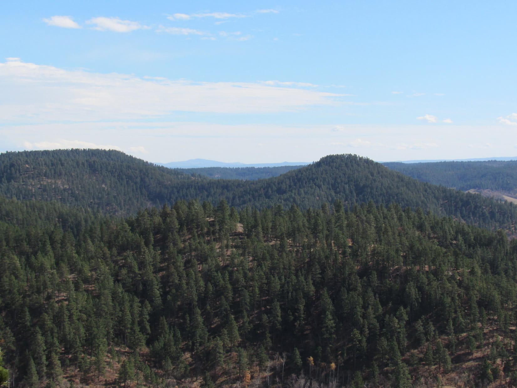
A light S breeze was blowing.  Clear skies and another unseasonably warm October day.  The panoramic views were terrific.  The Warren Peaks (6,656 ft.) fire lookout tower is atop the highest point in the Bear Lodge Mountains in NE Wyoming.  Lupe gazed out over miles and miles of high prairie far beyond the mountains.

When the light is right and the air is clear, you can see all the way to the Bighorn Mountains from here Loop!  The light wasn’t right.  A bit of haze was in the air.  Oh, well.

Looking SSW from Warren Peaks, the highest mountain in the Bear Lodge Mountains. The tower on the L is on High Point 6532.

Although Lupe was back to continue her peakbagging adventures in the Bear Lodge Mountains, Warren Peaks (6,656 ft.) wasn’t really one of her prime peakbagging goals for Expedition No. 179.  Lupe had been here twice before.  Warren Peaks was just a great viewpoint from which to start the day, conveniently located on the way to other objectives she’d never been to before.

Before leaving this terrific vantage point, SPHP stared off to the N trying to pick out Vision Peak (4,812 ft.) or Bald Mountain (4,800 ft.), where Lupe had been adventuring a week ago.  Nothing really stood out that SPHP could positively identify.  Neither did any of today’s objectives.  Most of the Bear Lodge Mountains just aren’t that rugged.

The big rounded hill seen beyond Lupe is Bull Hill. Photo looks N.
Bull Hill with a little help from the telephoto lens. Studying this photo after the fact, SPHP is 98.43% certain that Bald Mountain, where Lupe had been a week ago, is at the far L end of the most distant dark ridge seen on the R. (Not the faint ridge on the horizon.) Photo looks N.

Lupe and SPHP left Warren Peaks headed N on USFS Road No. 838.  At 9:04 AM (39°F), Lupe was leaping out of the G6 again, this time at the junction of USFS Roads No. 849 and 849.1A.  Lupe had two peakbagging objectives nearby.  They were two summits called the Black Hills.  (Not to be confused with the entire Black Hills range, which is hard not to do, since the identical names make it plenty confusing.)

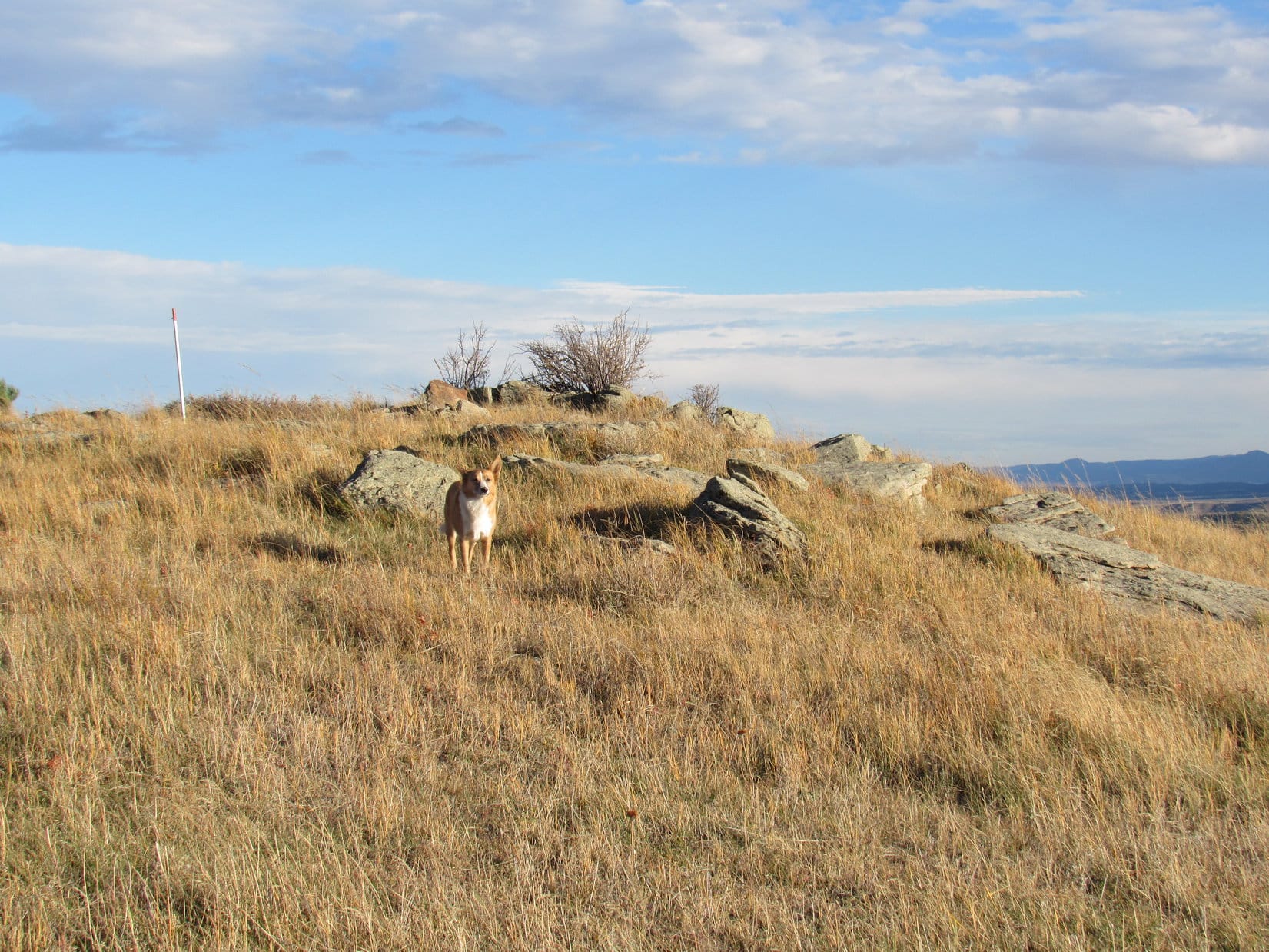
Lupe set off for the Black Hills (East) (5,229 ft.) summit first, climbing toward the S in territory W of the N ridge.  At first, she encountered thickets of brush and small trees in a forest of mixed pine and aspen.  As Lupe gained elevation, the pines prevailed and most of the smaller stuff disappeared.  The terrain was unusually lumpy.  Lupe went up a series of small rises separated by little ravines or low spots.  Deer seemed to like this area, and Lupe saw quite a few of them.

The Black Hills (East) summit ridge runs roughly NW/SE.  Lupe reached a lower part of the ridgeline a bit WNW of a protruding rock outcropping of yellowish tan limestone, or perhaps sandstone.  This rock formation proved to be quite level on top, and runs the entire length of the summit ridge, which was hundreds of feet long.  Toward the SW, the rocks form a line of small cliffs.

Lupe sits on the yellowish tan limestone or sandstone rock outcropping at the NW end of the Black Hills (East) summit ridge.

From the NW end of the Black Hills (East) summit ridge, Lupe could see Black Hills (West) (5,323 ft.).  Black Hills (West) is almost 100 feet higher than Black Hills (East).  Lupe would be going over there next, but not until she finished exploring Black Hills (East).

Looking W toward the Black Hills (West) summit from the NW end of the Black Hills (East) summit ridge.

Lupe and SPHP traveled SE along the entire length of the Black Hills (East) summit ridge, staying near the line of cliffs.  Forest effectively hid the views in every direction, other than SW from the cliffs.  Even looking SW, higher forested ridges only a mile or two away were as far as Lupe could see.

Lupe at another viewpoint along the cliffs. Black Hills (West) is in view on the R. The scene seen here is typical of the only semi-distant views available from Black Hills (East). Photo looks W.

Close to the SE end of the Black Hills E summit ridge, a small pine tree was perched near the edge of the cliffs.  Ponderosa pines can grow in some of the most amazing places.  The little tree looked like it was growing straight out of the rocks!

Lupe near the SE end of the Black Hills (East) summit ridge. A small pine tree was growing right out of the rocks at the edge of the cliffs. Photo looks S.

The Black Hills (East) summit ridge was long, on the order of 800 feet long.  Having traveled the entire length of the ridge near the cliffs, it was time for Lupe to look for the true summit.  Since the entire area was quite flat, there wasn’t going to be any one easily identifiable point.

The summit ridge of Black Hills (East) was quite level and all forested. Parts of it were quite park-like as seen here. Photo looks WSW.

Although there was only a slight elevation difference, the highest area Lupe could find on Black Hills (East) seemed to be back closer to the middle of the summit ridge.  A somewhat elevated area was 50 to 100 feet NE of the cliffs.  This high ground was covered by a dense thicket of scrub oak trees.  Lupe had no views at all from here!

Lupe in the scrub oak thicket at the true summit (as near as she could find one) of Black Hills (East).

Having achieved her first peakbagging success of the day at Black Hills (East), it was time for Lupe to head for Black Hills (West).  To get there, she first had to go back down to the G6.

Lupe roughly retraced the same route she had taken up.  The many deer held Lupe’s attention much of the time, but she also found an interesting column of rock out in the middle of the forest.  Strangely enough, someone had drawn an odd face on it.

Lupe at a big column of rock she discovered going back down Black Hills (East). Although the column of rock was in an unlikely spot for visitors out in the middle of the forest, someone had drawn an odd face on it (seen right above Lupe in white).

Lupe reached the G6 at 10:36 AM.  She was surprised and puzzled when SPHP went right on by it.  However, her next peakbagging goal, Black Hills (West) was not far away.

Lupe and SPHP crossed USFS Road No. 849 and went down to Blacktail Creek.  Lupe reached the tiny creek near a tiny waterfall.  Of course, she paused for a not-so-tiny drink from the creek as she crossed it, prior to beginning her climb up Black Hills (West).

Near the tiny waterfall on Blacktail Creek.

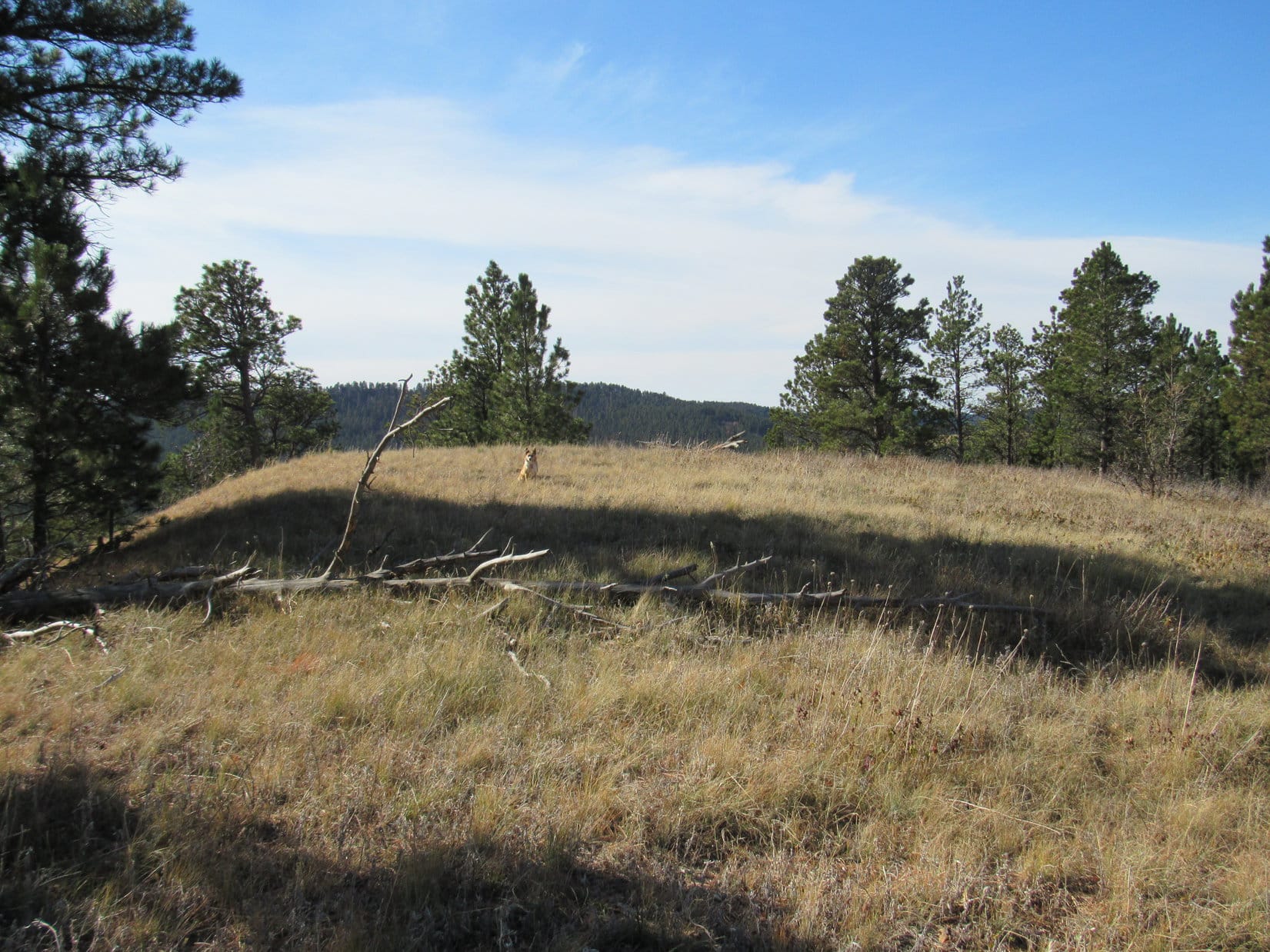
Lupe’s path up Black Hills (West) was very direct.  She simply followed the long NE ridge, staying on the ridgeline a little above the cliffs to the SE.  Lupe’s entire climb was steadily up at a moderate pace.  As Lupe neared the summit, she found a big grassy meadow at the top of the mountain.  SPHP hoped the views would be better here than from Black Hills (East).

Lupe on top of Black Hills (West). Photo looks SSW.
The summit of Black Hills (West) was a grassy meadow. Photo looks SSW.

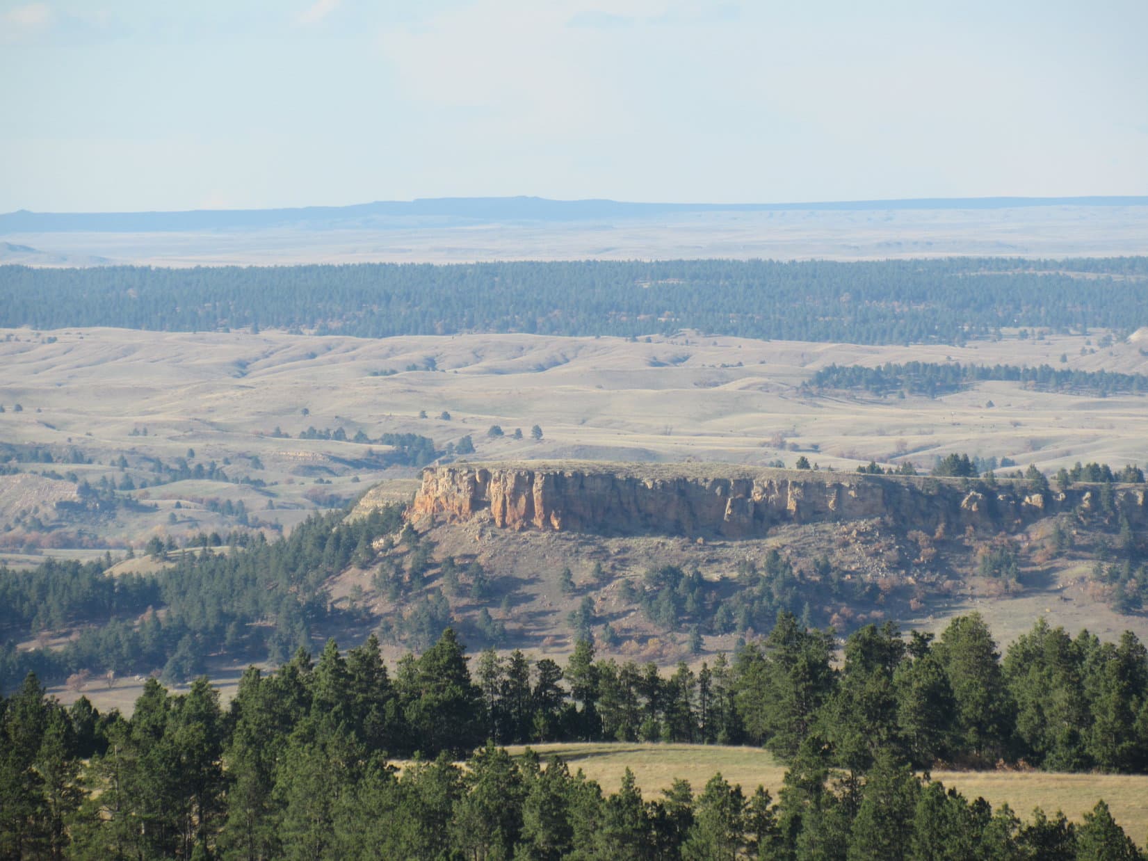
Unfortunately, the views from Black Hills (West) were rather disappointing.  The mountain wasn’t quite high enough for a good look at the most interesting sight.  Off to the WNW, Lupe had only a partial view of the Missouri Buttes (5,374 ft.) and top of Devils Tower (5,112 ft.).

Black Hills (West) wasn’t quite high enough for a good look at Missouri Buttes and Devils Tower. Photo looks WNW.
Missouri Buttes (R) and the top of Devils Tower (L) from Black Hills (West). Photo looks WNW using the telephoto lens.

Lupe and SPHP wandered around the Black Hills (West) summit area for a little while, seeing what could be seen, before taking a break.  After the break, it was photo op time for Lupe before beginning the descent.

The Black Hills (West) summit as seen from the SW.
Lupe relaxes during her break time. She looks a bit serious here.
The Black Hills (West) summit. Photo looks SW.
A happy Carolina Dog on the summit of Black Hills (West) having a good time in the Bear Lodge Mountains of NE Wyoming.

Lupe and SPHP returned to the G6 (12:01 PM) going back down the NE ridge of Black Hills (West).  Lupe had one more peakbagging goal for Expedition No. 179, Sherrard Hill.  Sherrard Hill (5,385 ft.) is a little higher than Black Hills (West).  SPHP had hopes that Lupe might find better views from Sherrard Hill than either of the two Black Hills summits had on offer.

SPHP drove a couple miles NNW on USFS Road No. 849 to its junction with USFS Road No. 860.1, before parking the G6 (12:09 PM, 57°F).  Lupe would start her trek to Sherrard Hill from here.

Much of Lupe’s journey to Sherrard Hill followed USFS Roads.  She started out going S on No. 860.1, which soon crossed Blacktail Creek.  Lupe came to many forks in the road.  At the first one, Lupe stayed to the R, avoiding side road No. 860.1A.  At the next junction, where an unmarked road to the L went down to a bridge across Hershey Creek, she stayed to the R again on a road marked as Trail No. 1042.

A week ago when Lupe had been to the Bear Lodge Mountains on Expedition No. 178, there had still been some fall colors on display. By Expedition No. 179, however, nearly all of the trees were bare. There were a few exceptions, however. Lupe saw these red berries and yellow leaves while following USFS Road No. 860.1 on the way to Sherrard Hill.

At a third junction, Lupe stayed to the R again, now following USFS Road No. 860.1F.

Lupe reaches USFS Road No. 860.1F, which was closed to motor vehicles. Photo looks S.

While on No. 860.1F, Lupe and SPHP kept hearing geese.  Finally, a flock of them flew by almost right overhead.  The geese were so high, Lupe didn’t pay much attention to them.

Geese flew by almost right overhead. Photo looks, umm, up using the telephoto lens.

As Lupe got closer to Sherrard Hill, she kept coming to more forks in the road.  She avoided taking USFS Roads No. 860.1R (to the R) or No. 860.1J (to the L).  The road she was on eventually turned W going up a valley.  When Lupe reached a saddle at the upper end of the valley, SPHP was pretty certain Sherrard Hill was the wooded hill immediately to the S.

Lupe stuck with the road she was on as it circled around to the NW side of Sherrard Hill.  She passed by USFS Road No. 860.1G on the way.  By now, the road Lupe was following had leveled out.  Lupe and SPHP turned SE and started climbing.

The climb up Sherrard Hill (5,385 ft.) was along quite a gentle slope.  The hill was heavily forested all the way up.  The summit area was large, and all heavily forested, too.  Lupe and SPHP went all the way to the SE end of the summit area.  There was little to be seen, but forest anywhere.

The top of Sherrard Hill. There was little to be seen except for the forest. Photo looks N.

Well, that was it.  None of Lupe’s 3 main peakbagging objectives of the day had provided much in the way of views, and Sherrard Hill, the highest of them all, had no views at all.  Sometimes that’s just the way it is in the mountains.

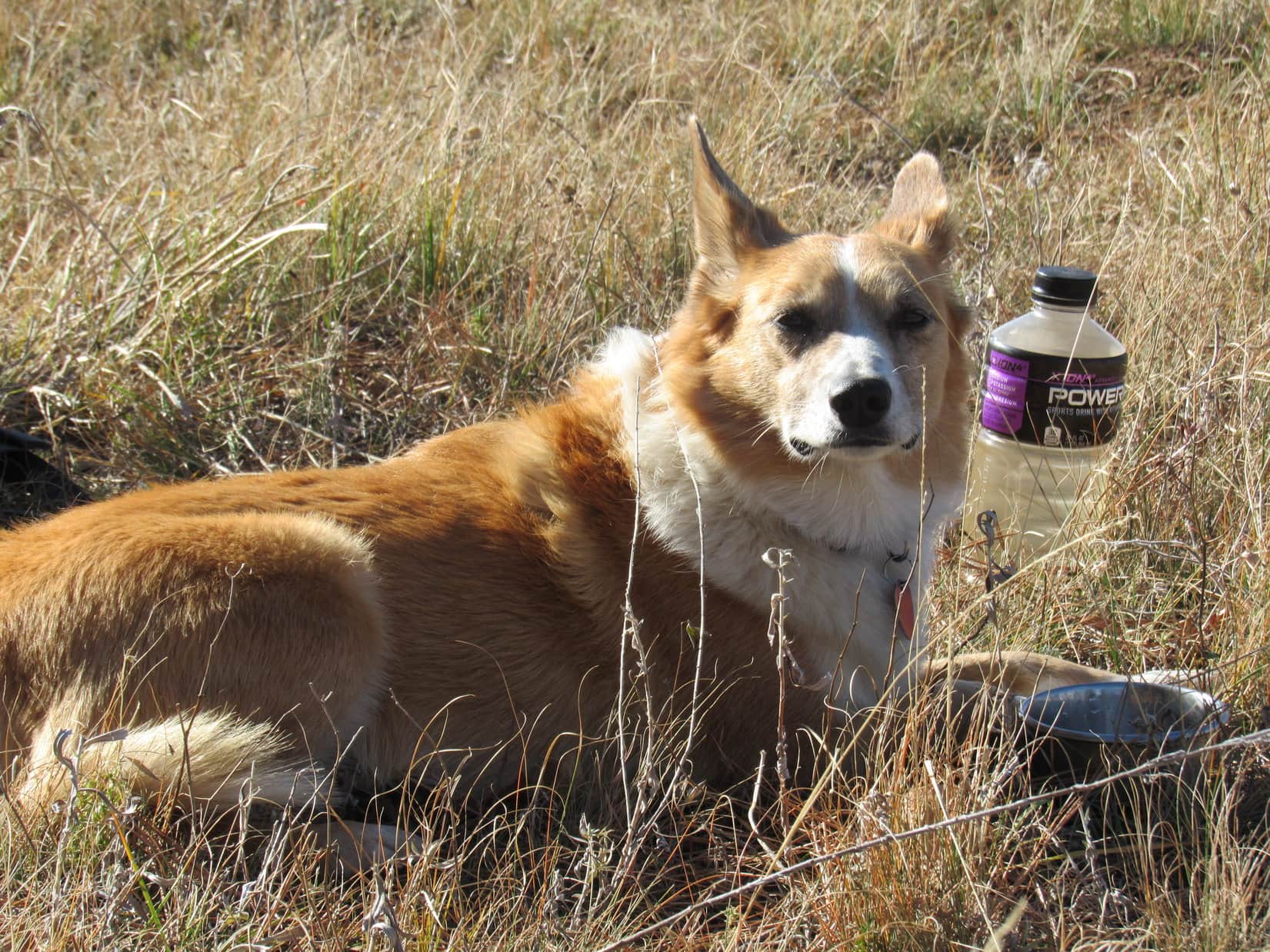
Lupe and SPHP took a short break for chocolate coconut granola bars and water at the SE end of the summit area.  Then Lupe got to explore the Sherrard Hill summit looking for the highest point.  Just like on Black Hills (East), the top of the mountain was so flat, it was hard to pin down an exact location of the true summit.  Once again, it appeared to be in a thick grove of scrub oaks.

Lupe among the scrub oaks at the true summit of Sherrard Hill. Photo looks E.
Lupe exploring the summit area on Sherrard Hill. Photo looks NNE.

Before completely abandoning Sherrard Hill to return to the G6, Lupe and SPHP wandered over to a slightly lower part of the mountain protruding to the W from the N end of the summit area.  From here, Lupe did catch a couple of glimpses of Missouri Buttes, but never had a really good look.

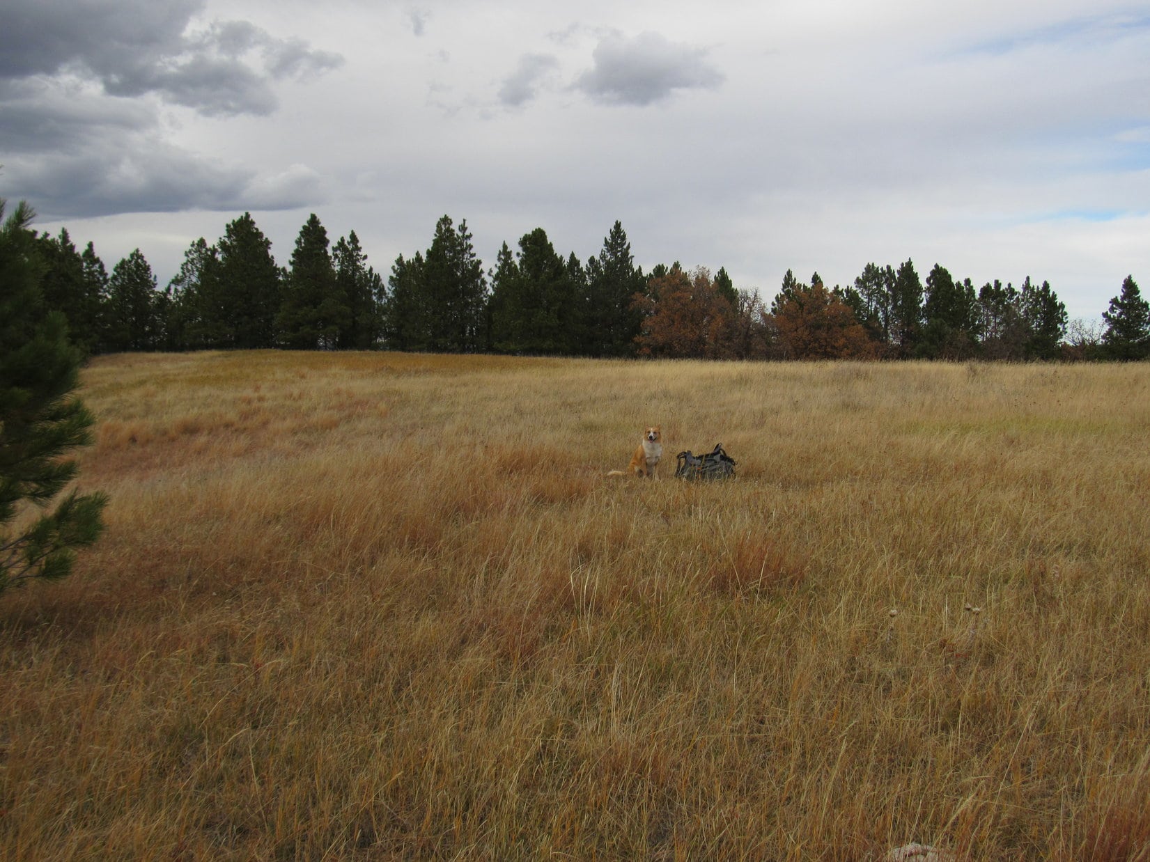
Lupe and SPHP continued NW to High Point 5255, but other than a ranch house to the W, there was nothing to see there either.  OK, that was it.  Time to give up and go back to the G6.  Lupe had a great time on the way back.  She saw many deer, and several squirrels.

On the way back to the G6 from Sherrard Hill, Lupe saw many deer in the woods. This one was out in the open near Hershey Creek.

When Lupe arrived at the G6 again (3:43 PM, 57°F), it was only a little over 2 hours until sundown.  Time enough to do something, but not go off climbing another mountain.  Since Lupe had never seen Cook Lake before, why not go see the little lake?

The Cook Lake Recreation Area features a campground, picnic area, loop trail around the lake, and another loop trail N of the lake called the Cliff Swallow trail.  Lupe arrived at Cook Lake (4:16 PM, 53°F) too late to both spend time at the lake and take the Cliff Swallow trail.  Since the main purpose was to see Cook Lake, Lupe stuck to the lakeshore trail.

Lupe arrives at Cook Lake, the only lake in the Bear Lodge Mountains. Photo looks S.
Lupe on her way around Cook Lake. Photo looks SE.
Looking NE toward the dam.
Nearing the S end of the lake. Photo looks SE.
Cook Lake from the S shore. Photo looks N.
Looking NNW.
Lupe on the lakeshore trail. Photo looks NW.
On the dock.
On the dock.

Although there had been a few people around when Lupe first arrived at Cook Lake, by the time Lupe completed her investigations along the shore (5:09 PM, 51°F), things were pretty quiet.  The lakeshore trail had been a relaxing way to end the day.

Lupe’s Black Hills, WY Expedition No. 179 wasn’t quite over yet, though.  On the way back home, while still in the Bear Lodge Mountains, Lupe made two more quick stops.  First, Lupe and SPHP took a short stroll from USFS Road No. 838 to a high point NW of Warren Peaks.  SPHP wanted to find out if Lupe could see Devil’s Tower and Warren Peaks from here.

She could!  The sun was low in the sky, and the light was weak, but there they were!  What’s more, Lupe could also see the outline of the Bighorn Mountains far to the W!

From a high point NW of Warren Peaks, not far from USFS Road No. 838, Lupe could see the Missouri Buttes and Devils Tower in the fading light. Photo looks NW.
Lupe could also see the faint outline of the Bighorn Mountains on the far W horizon.

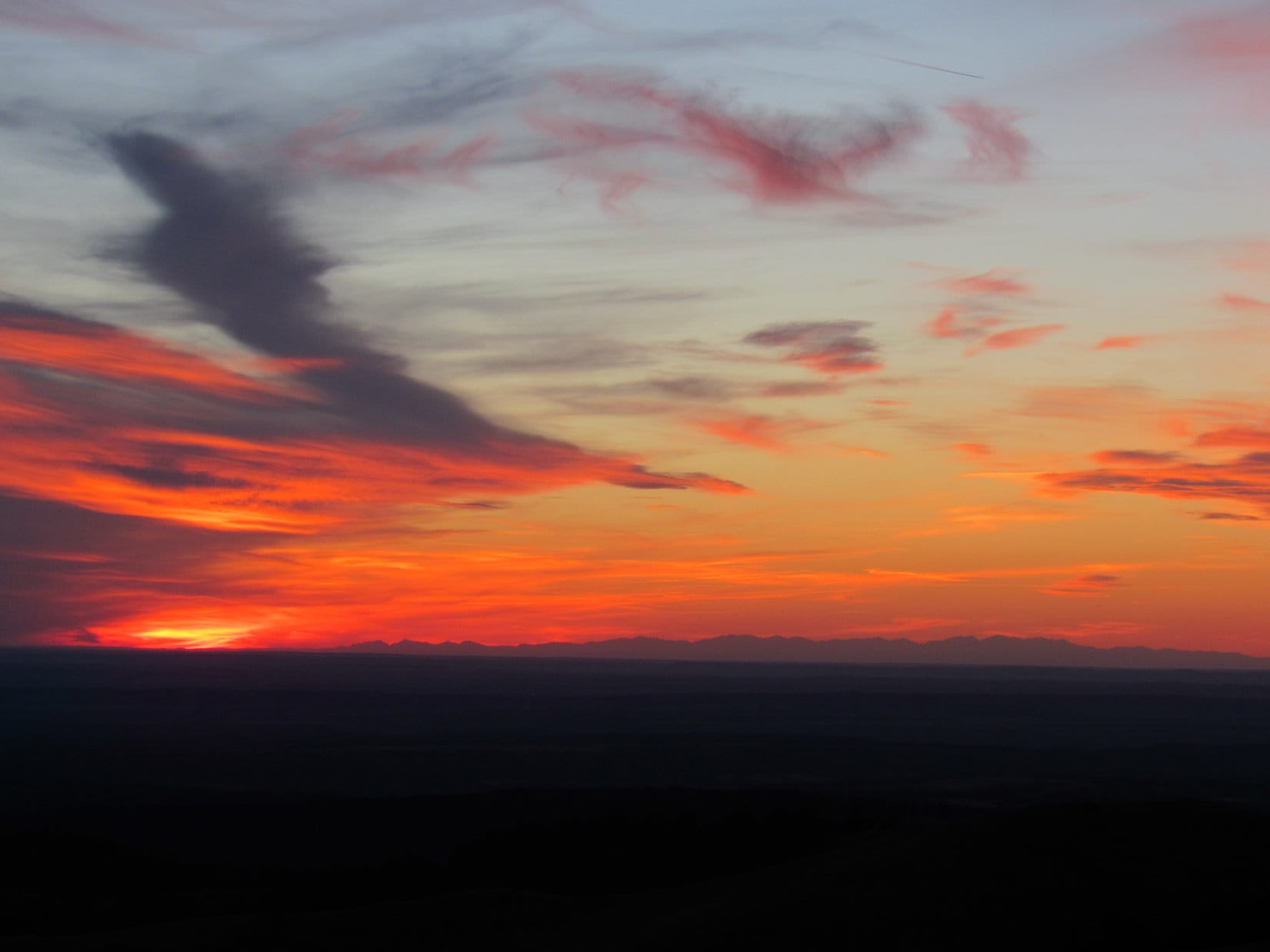
Lupe’s final stop was back up on Warren Peaks (6,650 ft.).  The sun had either just set, or was hidden by clouds near the horizon.  Lupe went over to the highest rocks on the mountain a few feet W of the fire lookout tower.

And so, Black Hills, WY Expedition No. 179 ended with Lupe standing atop the highest point in the Bear Lodge Mountains for the second time today, admiring the colorful sunset and distant outline of the lofty peaks of the glorious Bighorn Mountains.

Lupe at the highest point on Warren Peaks at sunset, her 2nd time here during Expedition No. 179. Photo looks WSW.
Bighorn Mountains from Warren Peaks.

Links:

Next Black Hills Adventure                    Prior Black Hills Adventure

Want more Lupe adventures?  Choose from Lupe’s Black Hills Expeditions Adventure Index or Master Adventure Index.  Or subscribe free to new Lupe adventures.

Black Hills, WY Expedition No. 178 – Vision Peak, Bald Mountain & Stoney Point (10-16-16)

Lupe and SPHP hit the road before dawn.  Lupe was on her way to explore the Bear Lodge Mountains, a remote part of the Black Hills in NE Wyoming separate from the main body of the Black Hills in South Dakota.  The sun was up by the time the eager American Dingo reached the Wyoming border.

Lupe reaches the Wyoming border on her way to the Bear Lodge Mountains.

Lupe had 3 peakbagging goals for the day.  SPHP had high hopes for the first one, due to it’s intriguing name – Vision Peak (4,812 ft.).  Those hopes seemed likely to be justified when SPHP parked the G6 off USFS Road No. 830 about 1.5 miles N of Hwy 24 (8:18 AM, 67°F).  Lupe was already high up on a ridge with a view to the S.

The day was unseasonably warm, but with a fairly stiff WSW breeze.  Lupe headed W on USFS Road No. 887.1, a little used side road closed to motor vehicles.  The road climbed a bit, then crossed over to the N side of the ridge, where Lupe was out of the wind.  No. 887.1 then wound around a little below the long ridgeline heading generally W, while slowly losing elevation.

Lupe on the seldom used USFS Road No. 871.1 that leads W toward Vision Peak from USFS Road No. 830. Photo looks SW.

No. 887.1 wound around for more than a mile.  Lupe didn’t find any squirrels, but whitetail deer were abundant.  The road never returned to the ridgeline, although Lupe and SPHP made one foray up onto the ridge before returning to the road again.  To the N, Lupe had views of another high ridge beyond Lucky Gulch.

Looking N toward a high ridge on the other side of Lucky Gulch.

Lupe was making great progress, when suddenly USFS Road No. 887.1 simply ended W of High Point 4805.  Fortunately, Lupe was already almost to the saddle over to Vision Peak.  A short bushwhack through the forest brought Lupe to the E end of the saddle.

Lupe reaches the narrow saddle over to Vision Peak. Here she is at the saddle’s E end, which was surprisingly bare. Most of the saddle was forested. Photo looks WSW.

Lupe crossed the saddle and began climbing.  She encountered a couple of minor rock outcroppings along the way, but the climb was neither long nor difficult.  Soon she reached the top of Vision Peak (4,812 ft.).

Lupe at the summit of Vision Peak. This was the best view. Photo looks S.

Since Vision Peak is positioned way out at the far W end of a long, fairly narrow ridge, SPHP had been hoping for great wide open views, especially toward the W.  Lupe did find quite a nice view to the S right at the true summit, but most of the summit ridge was too heavily forested to see much.  Somewhat disappointingly, Vision Peak seemed to be a BYOV (Bring Your Own Vision) mountain.

Lupe stands on a big rock at the far W end of the Vision Peak summit ridge. She has a narrow view between the trees to the W.
This photo shows much of the summit ridge of Vision Peak. Here Lupe is near the W end. Photo looks E.

Lupe and SPHP lingered on Vision Peak for a little while, taking a break and enjoying the best view, which was to the S.  The wind was out of the SSW about 20 mph, but wasn’t bad at ground level.  The forest provided quite effective protection, although the wind was certainly heard in the treetops.

On the way back to the G6, instead of taking the road, Lupe and SPHP climbed up onto the long ridge after crossing the saddle E of Vision Peak.  There were more impressive rock outcroppings along this climb up onto the ridge, than there had been climbing Vision Peak.

Although it was a bit out of the way, Lupe visited High Point 4805.  On the way there, she caught a glimpse of a high, partly barren hill off to the NW.  That was probably her next peakbagging goal, Bald Mountain (4,800 ft.)!

Near High Point 4805 (ENE of Vision Peak), Lupe caught this glimpse of Bald Mountain (R) off to the NW.

The trek along USFS Road No. 887.1 to get close to Vision Peak had been pleasant and easy, but the return trip along the top of the ridge was more fun.  Distant views to both the N and S occasionally presented themselves, and deer were plentiful.  Lupe even found a couple of squirrels along the way, which she greeted with her usual enormous enthusiasm.

Even though Vision Peak itself had turned out to be somewhat of an anti-climax, the whole excursion had been a pleasant success (10:55 AM, 70°F).

Lupe’s next peakbagging goal was Bald Mountain (4,800 ft.).  Getting to Bald Mountain was supposed to be another relatively easy tromp through the woods over some high ground with little net elevation change.  SPHP drove farther N on USFS Road No. 830 for a couple of miles looking for a closer starting point, ultimately parking at the start of USFS Road No. 830.4C (11:08 AM, 70°F).

Like No. 887.1, No. 830.4C was gated off and closed to motor vehicles, so it hadn’t seen much recent use either.  Lupe and SPHP set off following it WSW through the forest.  At first, everything seemed fine.  Lupe was having a great romp in the woods, and there were deer everywhere.  Gradually, however, the road turned more to the SW, then SSW, as it became fainter and fainter.  Lupe did not come to any of the side roads SPHP was expecting to find.

Eventually No. 830.4C faded away completely.  Lupe was in the middle of the forest.  It looked like there was blue sky between the trees off to the W, so maybe there was a viewpoint over there.  Lupe and SPHP headed W.  Yes, there was a view.  What SPHP presumed was Bald Mountain was in sight off to the W.  However, there was a big canyon between Lupe and Bald Mountain.  Something was wrong.  Time to consult the maps.

The exciting conclusion was that No. 830.4C must not have been the best place to start for Bald Mountain.  The big intervening canyon between Lupe and Bald Mountain was almost certainly Reservoir Gulch.  Lupe was too far S.  She would have to backtrack and go around the upper end of Reservoir Gulch.

It was farther than SPHP expected.  Lupe went up and down, crossing many ravines feeding into Reservoir Gulch as she now headed back to the NE.  Finally, a road appeared dead ahead.  When Lupe reached it, SPHP saw that less than 100 feet off to the SE, this road intersected a bigger road.  Oh, brother!  Lupe was all the way back to USFS Road No. 830.

The G6 was nowhere in sight.  Lupe was farther N along No. 830 than where it had been left.  A sign at the side road showed that Lupe had reached USFS Road No. 881.1.  Another sign showed that it led to Planting Spring.  Time for another map check.

Lupe at the start of USFS Road No. 881.1 to Planting Spring where it leaves USFS Road No. 830. Photo looks NW.

OK, this was it!  No. 881.1 was definitely the right road to take.  Lupe didn’t need to go all the way to Planting Spring, but in less than a mile Lupe should reach another road going SW toward Bald Mountain.  After a short rest break, Lupe and SPHP set off again.

No. 881.1 was a much better road than No. 830.4C had been.  Even so, Lupe soon came to a gate across the road closing No. 881.1 to motor vehicle traffic, too.  Apparently all these minor roads were closed to motor vehicles.

No. 881.1 went up and down little hills on its way W.  After about a mile or so, Lupe did come to a side road that turned S (L) in a sunny meadow.  This side road was marked No. 881.1A.  Lupe followed it, and soon it did turn SW.

Lupe on USFS Road No. 881.1A on her way to Bald Mountain. There were still some fall colors around.

After 0.25 mile or so, Lupe came to a marker for USFS Road No. 881.1C.  A faint track went off to the WNW (R).  Lupe stayed to the L on the better road.  In another 0.25 mile, No. 881.1A reached some cliffs.  Lupe was now on the N side of Reservoir Gulch.  From the cliffs, Lupe could see Vision Peak off to the SE.

Lupe reaches the cliffs along the N edge of Reservoir Gulch. Vision Peak (Center), where Lupe had been a little while ago, is in view. Photo looks SE.

Lupe had only another 0.5 mile to go to reach Bald Mountain.  She came to a variety of scenic points along the way.  She passed by some groves of scrub oaks sporting orangey brown leaves.

Lupe passed by several big groves of scrub oaks with orange or brown leaves. This grove with orange leaves glowing in the sunlight was particularly nice. Photo looks SW.

USFS Road No. 881.1A did not go quite all the way to Bald Mountain.  It played out about 0.25 mile from the summit.  A few hundred feet farther W was a small ridge topped with scattered large boulders.  It was possible to get a distant view to the W from one of the boulders.

Lupe up on a boulder with a view to the WNW. Her fur is being blown by a strong wind from the SW.

Lupe went S following the boulders.  When the small ridge ended, Lupe continued on through the forest.  She eventually wound up back along the N edge of Reservoir Gulch again.  Here she had an even better view of Vision Peak to the SE.  She was getting quite close to her Bald Mountain objective, too.

Lupe reached cliffs along the N edge of Reservoir Gulch again as she was getting close to Bald Mountain. The views of Vision Peak (L of Center) were even better here. Photo looks SE.
Vision Peak (R of Center) looked heavily forested. Small wonder Lupe hadn't been able to see much from there! Photo looks SE.
Vision Peak (R of Center) looked heavily forested. Small wonder Lupe hadn’t been able to see much from there! Photo looks SE.
Lupe along the dramatic line of cliffs leading to Bald Mountain. Lupe's almost there! Photo looks SW.
Lupe along the dramatic line of cliffs leading to Bald Mountain. Lupe’s almost there! Photo looks SW.

Lupe reached the top of Bald Mountain (4,800 ft.).  The summit area was a huge triangular field of tall grass, several hundred feet long on each side.  Forest ringed much of the N and NW edges of the field, and around the S tip, but elsewhere there were great unobstructed views.  This was more like it!  Bald Mountain should have been named Vision Peak!

The most dramatic view was to the SW.  Off in the distance, Lupe could see Devils Tower (5,112 ft.) and Missouri Buttes (5,374 ft.).

On top of Bald Mountain in the Bear Lodge Mountains of NE Wyoming. The views here were fabulous! Off in the distance are Devils Tower (L) and Missouri Buttes (R). Photo looks SW.
Devils Tower from Bald Mountain. Photo looks SW using the telephoto lens.
Vision Peak (Center) from Bald Mountain. Photo looks SE.
In the huge grassy field at the top of Bald Mountain. Photo looks NNW.
Looking pretty happy on Bald Mountain.

Lupe and SPHP took a stroll around the summit field before settling down for a break.  Lupe had water and Taste of the Wild.  SPHP had an apple.  The big view toward Devils Tower and Missouri Buttes was simply marvelous.  It might have been even a little more marvelous if the weather wasn’t deteriorating.

What had been a 20 mph SSW breeze earlier in the day, had built up to a 35 mph gusty SW wind.  Big clouds were moving in from the SW.  The clouds sprinkled light rain for a few minutes, but the rain shower didn’t amount to much.  Lupe didn’t care for that wind, though!  She preferred curling up behind SPHP to facing directly into the wind to see the view.

The big view toward Devils Tower (L) and Missouri Buttes (Center) on the horizon. A 35 mph wind was gusting up Bald Mountain from this direction. View or no view, Lupe preferred hiding behind SPHP to staring into the wind. Photo looks SW.

With Lupe’s second peakbagging success of the day secured, it was time to return to the G6.  Away from the SW edge of Bald Mountain, the wind was hardly noticeable.  As big clouds sailed across the sky overhead, Lupe roamed the forest.  She saw lots of deer.  The occasional squirrel kept her entertained.

Near Bald Mountain, she passed by the orange and brown groves of scrub oak again.  Farther along, were the yellow aspens.

Returning from Bald Mountain, Lupe passed by the orange and brown groves of scrub oak again. Photo looks N.
Yellow aspens near USFS Road No. 881.1A on the return trip from Bald Mountain.
A particularly brilliant stand of aspens that was more orange than golden.

The return trip was simply a retracement of Lupe’s route to Bald Mountain all the way back to USFS Road No. 830.  From there, Lupe had to follow No. 830 going S until she found the G6 again, still parked at the start of USFS Road No. 830.4C (2:47 PM, 66°F).

Most of the big clouds were gone now.  The sun was out again.   A little over three hours remained before sunset.  Lupe had one more peakbagging goal left for the day.  About 6 or 7 miles farther N on No. 830, the old USFS map showed a side road leading close to Stoney Point (4,480 ft.).  SPHP drove N looking for it.

A wooden rail fence curved away from USFS Road No. 830 where SPHP found the side road Lupe needed to follow toward Stoney Point.  A pickup truck and travel trailer were parked near the start of the side road, which was unmarked by any road number or name.  A big black horse with a large white spot on his forehead stood right in the middle of the side road.  “Spot” seemed to be the campsite’s only occupant at the moment.

SPHP parked the G6 on the W side of No. 830, away from the camp (3:22 PM, 64°F).  Lupe and SPHP then cut through a field on the S side of the rail fence away from “Spot”.  SPHP hoped to keep Lupe from playing a game of “See Spot run!  Run, Spot, run!”  Spot was quite curious about what was going on, and watched Lupe nervously.  Although Lupe loves barking at horses from the G6, she paid Spot no mind.  She reached the side road well beyond where Spot had effectively blocked it.

On the side road, Lupe soon arrived at a fence and gate.  Ahh, yes!  This minor dirt road, like all the others, was also closed to motor vehicles from here on.  A pickup truck with Ohio license plates was parked nearby.  Lupe and SPHP continued following the side road.  Stoney Point was still 2.5 miles to the NE.

Before long, Lupe came to a place where there was a grassy hill on the N side of the road.  Up on the hill were a couple of interesting large boulders.  Lupe and SPHP headed for the boulders.  Lupe leaped up on the biggest one for a photo and a look around.

Up on a boulder on the way to Stoney Point. Photo looks ENE.

With nothing else of note in the area, Lupe and SPHP continued on, taking a shortcut over the small grassy hill.  More boulders came into view as Lupe reached the crest of the hill.  As Lupe passed by the first big one, she discovered someone sitting with his back to the boulder only a couple of feet away.  A hunter!

Lupe’s sudden appearance right next to him seemed to startle the hunter for a moment.  When he saw SPHP, he waved, and SPHP waved back.  Lupe and SPHP went on.  From up on the hill, the hunter had a great view of the large field to the E.  Lupe and SPHP crossed the field, reached the road again, and eventually disappeared from his range of view as the road returned to the forest.

Hearing gunfire on Lupe’s expeditions, isn’t that uncommon.  Usually any gunfire is distant and from people doing target practice, but occasionally there are hunters about, especially this time of year.  However, Lupe has seldom actually seen hunters in the field.  Lupe and SPHP rarely see anyone on her Black Hills expeditions, except near major roads.  Lupe had never come right up on a hunter in the field like this before!

The road went close to the edge of a canyon.  There was a big view to the SE.  On the far horizon, Lupe could see the Black Hills back in South Dakota.

Lupe up on the edge of a wide canyon on her way to Stoney Point. The Black Hills of South Dakota are in view on the horizon. Photo looks SE.

The road left the edge of the canyon curving first N, then NW, as it continued through the forest.  However, the road soon left the forest as it turned N again.  Up ahead was a another grassy hill with some big boulders near the top.  Wearing bright orange, another hunter was stationed up there!

Lupe stuck to the road.  The hunter and SPHP waved as the American Dingo passed on by.  When Lupe reached the top of the hill, the road turned NE crossing a huge level field.  This treeless plain was exposed and windy.  Not as windy as Bald Mountain had been, but a 20 mph SW wind swept across the field.  At the far end of the field were some low rocks near a few pine trees.  When she got there, Lupe sought out a place sheltered from the wind.

Lupe escapes the wind at the low rocks near the NE end of the huge field. Photo looks ESE.

SPHP checked the maps.  Stoney Point had to be close by.  It was just a small hill to the ENE beyond this elevated windswept plain.  Lupe could be there in 15 minutes.  Lupe was disappointed to learn she had to leave her cozy windbreak to press on.

Back in the wind, not far from her windbreak, Lupe stands on low rocks strewn across the NE edge of the huge field. Beyond is a mixed forest of scrub oak and pine. Photo looks NW.
From the edge of the huge field, Lupe could see a very long way to the N and E. This photo looks NNW. Somewhere out there is Montana!
Looking NNW from the huge field using the telephoto lens.

A short distance E of Lupe’s rocky windbreak, Stoney Point (4,480 ft.) came into view.  Stoney Point was just a barren hill with a few boulders, bushes and trees scattered over it.  The views would be good from there, though.

Stoney Point is the small barren hill seen beyond Lupe. Photo looks E.

Lupe headed for the biggest rocks on the NW slope of Stoney Point as she approached.  The wind was blowing hard when she jumped up on them.

Getting closer to Stoney Point! Lupe headed for the biggest collection of rocks seen on the L.
Want a weather report, SPHP? Try WINDY! Hurry up and snap the shot so I can get down off of this rock!
Looking NW from Stoney Point. It may have been windy, but at least it wasn’t cold. The wind was out of the SW, not the N.

From the big rocks, it was only a short stroll up to the summit of Stoney Point.  There were huge distant views from the NW to the ESE.  Lupe could see a very long way out across low pine-covered ridges and high prairie.  Despite the wind, Lupe and SPHP hung around a while checking out the views.

Lupe stands on the highest rocks of Stoney Point, successfully completing her 3rd peakbagging goal of the day! Photo looks SSE.
Looking W back toward the high ridge where the huge field is that Lupe traveled across to get to Stoney Point.
Looking ESE from Stoney Point. Bear Butte (4,422 ft.) is seen on the R as a faint, but noticeable bump on the far horizon.

SPHP had noticed a post with a red top up on Stoney Point when Lupe first arrived, but hadn’t though much of it.  SPHP was surprised when Lupe found a survey benchmark a few feet away.  The old USFS map hadn’t shown a benchmark, but here it was!  A closer look at the topo map from Peakbagger.com did show the benchmark.

The “Stoney” survey benchmark.
Lupe sitting right next to the Stoney Point survey benchmark. It is hard to see, but is about 6" to the L of her tail. Photo looks NW.
Lupe sitting right next to the Stoney Point survey benchmark. It is hard to see, but is about 6″ to the L of her tail. Photo looks NW.

When the time came to leave Stoney Point, SPHP started heading W down the hill on the way back to the huge field.  A minute later, SPHP realized Lupe wasn’t coming.  She was still back up near the summit of Stoney Point.  SPHP called her, but she still didn’t come.  She was standing stiffly in place.

When SPHP left Stoney Point, Lupe didn't come along. Instead she stood stiffly in place. She refused to move, even when SPHP called her. Photo looks ESE.
When SPHP left Stoney Point, Lupe didn’t come along. Instead she stood stiffly in place. She refused to move, even when SPHP called her. Photo looks ESE.

Lupe looked like she did earlier in the year when she had encounters with cactus.  SPHP hadn’t noticed any cactus, but maybe she had stepped on one somewhere up on Stoney Point?

SPHP returned to Lupe.  She let SPHP inspect all her paws.  No cactus spines anywhere – nothing was wrong that SPHP could see.  Still, something must have happened.  Maybe she stepped on something sharp, and thought it was a cactus?

In any case, Lupe wouldn’t budge.  SPHP carried her as far as the big rocks on the NW slope of Stoney Point.  She was willing to pose for a couple more photos from the rocks.

SPHP carried Lupe back to the big rocks on the NW slope of Stoney Point. Photo looks NW.
Lupe on the rocks. Photo looks S.

For some reason, being up on the rocks helped Lupe’s confidence.  Presumably she discovered her paws didn’t really hurt as she moved around.  All on her own, off she went, now leading SPHP on the way back to the G6.  When she reached the E end of the huge field, she paused for one more look back at Stoney Point.

Looking back at Stoney Point beyond Lupe. Photo looks NE.

The second hunter was still in position when Lupe went by again.  Once again, the hunter and SPHP waved.  Returning to the forest, Lupe found a squirrel to bark at.  She had a great time, but a little later, as she was approaching the area where she had startled the first hunter, he came down the hill toward SPHP.  Oh, boy.  Maybe he had heard Lupe barking, and was unhappy thinking she had driven away whatever he might be hunting?

Nope.  The hunter was just friendly.  He was really a very nice guy, and simply wanted to meet Lupe and chat with SPHP.  His name was Joe Eberz.  He was from Ohio, and was way out here in NE Wyoming hunting elk.  Had Lupe seen the rest of his party?  Yes, but only half of it.  Turned out there was a third hunter Lupe and SPHP hadn’t noticed somewhere out there.

Joe hadn’t seen any elk in Wyoming yet, and neither had Lupe or SPHP today.  Plenty of deer around, but none of Lupe’s “giant deers”.  Joe and his party still had several more days to hunt.  Maybe they would find elk before they had to return to Ohio.

Joe and SPHP had a pleasant conversation.  Joe said Lupe really had startled him when she made her first sudden appearance.  SPHP had been amazed to see Joe sitting behind the big rock, too!  Joe petted Lupe, and had his picture taken with her.

Lupe in the remote Bear Lodge Mountains of NE Wyoming with her new friend, elk hunter Joe Eberz from Ohio.

So Lupe returned to the G6 (6:11 PM, 55°F) having made a new friend from Ohio – a great finish to a splendid day of peakbagging way out here in the remote Bear Lodge Mountains of NE Wyoming!

img_3138

Links:

Next Black Hills Expedition                    Prior Black Hills Expedition

Want more Lupe adventures?  Choose from Lupe’s Black Hills Expeditions Adventure Index or Master Adventure Index.  Or subscribe free to new Lupe adventures.

Black Hills, WY Expedition No. 145 – Sundance Mountain, Warren Peak, Sheep Nose Mountain & Devils Tower (11-15-15)

SPHP had been thinking about taking Lupe on an expedition to the Bear Lodge Mountains in Wyoming for a couple of months.  Checking the weather forecast early on 11-15-15, SPHP saw that it was going to be an extraordinarily warm day for mid-November in the Black Hills.  It was probably now or never, if Lupe was going to go to the Bear Lodge Mountains in 2015.

Lupe was soon on her way, barking enthusiastically at cows and horses along I-90 who were too far away to even notice her passing by.  Shortly after reaching Wyoming, Lupe and SPHP made a quick stop at a very nice information center just N of I-90.  Lupe got out of the G6 for a few pictures to commemorate the occasion.

Although it hadn’t been windy at all back home, it was plenty windy here in Wyoming.  A pretty stiff breeze was blowing out of the W across the high prairie.  Lupe took shelter behind the Wyoming welcome sign.

Gotta love that buffalo on the Wyoming state flag!
The Bear Lodge Mountains are already in view off to the W.

The Bear Lodge Mountains are a small mountain range in NE Wyoming separated from the main body of the Black Hills of South Dakota by no more than 15-20 miles of grasslands.  The Bear Lodge Mountains are part of the Black Hills National Forest.  Lupe was going to get to climb a couple of mountains in the range, and visit a couple more as part of Expedition No. 145.

Lupe’s first goal was to climb Sundance Mountain (5,824 ft.) located just S of I-90 and the town of Sundance, WY.  It was 10:04 AM, 54°F and windy out of the W, as Lupe set off to climb Sundance Mountain from the SE.  She soon reached a 4WD jeep trail that took her all the way up to the top of the mountain.  There were plenty of towers and various small buildings up at the summit.

Sundance Mountain as seen from the ENE near I-90.
Lupe sets out from SE of Sundance Mountain.
Partway up Sundance Mountain along the jeep trail is this view of Inyan Kara Mountain on the S horizon.
The biggest, most impressive tower at the top of Sundance Mountain.
Looking N at I-90 and the town of Sundance, WY from Sundance Mountain.
Looking NE at Green Mountain. Crow Peak W of Spearfish, SD is seen on the horizon just R of center.

Although there were some pretty nice views of Sundance, WY and Green Mountain (5,283 ft.) from the summit, the view SPHP liked best was hidden by the forest.  Somewhat below the summit, a short dead-end side road covered with weeds provided an expansive view to the S toward Inyan Kara Mountain (6,360 ft.).

Inyan Kara Mountain from Sundance Mountain. Photo looks S.
Inyan Kara Mountain (L) from Sundance Mountain. Photo looks S.

Lupe faced two dangers on Sundance Mountain.  The first one was a patch of cactus growing on a grassy ridge just below where Lupe first reached the jeep trail.  The second danger was a cliff on the N side of the mountain.  The cliff was situated just below a tree Lupe ran down a very steep bank to, in order to bark at a squirrel.  Fortunately, Lupe returned to the G6 unscathed by either cacti or cliffs.

Lupe on "Cactus Ridge" on the SE slopes of Sundance Mountain. Green Mountain is seen behind her to the NE. SPHP helped guide Lupe so she didn't step on any cacti.
Lupe on “Cactus Ridge” on the SE slopes of Sundance Mountain. Green Mountain is seen behind her to the NE. SPHP helped guide Lupe so she didn’t step on any cacti.
The most rugged parts of Sundance Mountain are to the N and W. This photo was taken from the W.
The most rugged parts of Sundance Mountain are to the N and W.  The towers at the summit are seen to the L in this photo taken from the W.

After climbing Sundance Mountain, Lupe’s next stop was Warren Peak (6,650 ft.), the highest mountain in the Bear Lodge range at 6,656 feet.  Lupe had been up on Warren Peak (6,650 ft.) once before on the first day of her 2014 Dingo Vacation to the Canadian Rockies and the Beartooths.

Getting to the top of Warren Peak 7 miles NNW of Sundance, WY is super easy.  A short gravel road off USFS Road No. 838 (Warren Peak Road accessed off Hwy 14 a mile from I-90) winds its way up to a lookout tower at the top.  It was 12:16 PM and 50°F with a gale blowing out of the W, when Lupe reached the top of Warren Peak.  The views were great, but the wind was really annoying.  Lupe stayed on Warren Peaks only long enough for a few quick photos.

Lupe not enjoying the wind too much on Warren Peak. Photo looks SE toward the Black Hills of South Dakota. Terry Peak is the highest point in the center on the far horizon. Crow Peak is the rounded mountain on the horizon on the L.
Lupe not enjoying the wind too much on Warren Peak. Photo looks SE toward the Black Hills of South Dakota. Terry Peak (7,064 ft.) is the highest point in the center on the far horizon. Crow Peak (5,787 ft.) is the rounded mountain on the horizon on the L.
Lupe at the base of the lookout tower.
Looking NW from Warren Peak. There is a series of high barren hills near Warren Peak. Collectively they are sometimes called Warren Peaks. This photo looks NW from the summit of Warren Peak at other hills in this group. Lupe went over there to investigate, but found the area was fenced off as US Government property with No Trespassing signs.
Lupe at the turn off USFS Road No. 838 (Warren Peak Road) to the lookout tower.

Just N of the turn to the US Government property, USFS Road No. 838, which had been paved, turned to gravel.  Shortly after turning to gravel, there was a bend in the road where there was a glimpse of an intriguing view to the NW.  There was a large pullout along the side of the road at this point, so Lupe and SPHP stopped to get a photo.

Devils Tower and Missouri Buttes from USFS Road No. 838 a short distance N of Warren Peak.
Devils Tower (5,112 ft.) and Missouri Buttes (5,374 ft.) from USFS Road No. 838 a short distance N of Warren Peak.  Photo looks NW.
A look back to the S at Warren Peak from USFS Road No. 838.

After checking out the awesome, but distant view of Devils Tower and Missouri Buttes, Lupe and SPHP continued onward.  Lupe’s next peakbagging goal was a peak neither she nor SPHP had ever been even close to before.  It wasn’t even in the Peakbagger.com data base.  Peakbagger.com’s topo maps showed it simply as Sheep Mountain.  SPHP’s old USFS maps showed it as Sheep Nose Mountain (5,829 ft.).  It lies about 4 miles ENE of Warren Peak on the E edge of the Bear Lodge Mountains.

Winding USFS roads led Lupe and SPHP to a trailhead that SPHP almost missed.  Driving by, SPHP just caught a glimpse of a small sign saying “Sheepnose Trail”.  There was a roomy parking area, and a map posted at this remote trailhead.  The map showed two Sheepnose Trails.  One was trail “M” (2.3 miles long), which led to the mountain.  The other was trail “L”, which was longer (5.8 miles), branched off from trail “M”, and did not actually quite reach the mountain.

There was no obvious “trail”, just an old unmarked USFS road that headed E from near the posted map at the trailhead.  Lupe and SPHP set out on this road, which appeared to be seldom used.  A mile from the trailhead, it turned SE where Lupe found it was still marked as USFS Road No. 831.1C.  There was an odd-shaped metal gate blocking the way to motorized vehicles.  Markers from here onward showed that this was indeed Sheepnose Trail “M”.

Lupe's first look at Sheep Nose Mountain from the NW. This view was 50 feet S of old USFS Road No. 831.1C before it reached the metal gate barring motorized traffic.
Lupe’s first look at Sheep Nose Mountain from the NW. This view was 50 feet S of old USFS Road No. 831.1C well before it reached the metal gate barring motorized traffic.

The trailhead and Sheep Nose Mountain are at about the same elevation.  Most of the way to Sheep Nose Mountain, the terrain was quite level.  Old USFS Road No. 831.1C did dip down almost 250 feet, though, partway to the mountain.  At a saddle there was a small clearing, and an intersection with the longer Sheepnose Trail “L”.  Sheepnose Trail “L” was another old USFS Road, which branched off from Trail “M” heading W.

Lupe stayed on trail "M" heading for Sheep Nose Mountain. Sheepnose trail "L" headed R from here to parts still unknown to Lupe and SPHP.
The trail intersection.  Lupe stayed on trail “M” heading for Sheep Nose Mountain. Sheepnose trail “L” headed R (W) from here to parts still unknown to Lupe and SPHP.

Of course, Lupe had to regain all of the elevation lost going down to the trail intersection.  Sheep Nose Mountain trail “M” wound around on the N side of the mountain regaining elevation.  It turned back to the W side of the mountain, and then headed S.  There was a big canyon to the W, but it couldn’t be seen through the forest from the trail.

The rocky little ridge at the summit of Sheep Nose Mountain came into view up a sparsely treed slope to the E.  Lupe and SPHP left the road to climb straight up to it.  It later turned out that the road doesn’t go all the way to the summit (although it gets close).  The road and Sheepnose Trail “M” end at cliffs SE of the summit.

Lupe just below the rocky ridge at the summit of Sheep Nose Mountain, WY.

The summit of Sheep Nose Mountain felt lonely and remote, just the way Lupe and SPHP like it.  It looked like an area very few people (or American Dingoes) ever see.  Warren Peak could be seen to the WSW.  Other than forest, not much could be seen to the N, but there were wonderful views to the S and E.

Lupe posed for some pictures.  Then Lupe and SPHP took an apple and Taste of the Wild break on top of the mountain.  Fortunately, the strong W wind Lupe had experienced up on Warren Peak was greatly diminished by now.  Only a gentle breeze remained.

Lupe on the highest rock on Sheep Nose Mountain. Photo looks N.

Lupe on Sheep Nose Mountain, WY 11-15-15

Lupe on Sheep Nose Mountain, WY 11-15-15

Lupe on the very top of Sheep Nose Mountain, WY. Lupe had very recently seen, but not climbed another Sheep Nose in Colorado on her excursion to Thunder Butte, the high point of Douglas County.
Lupe on the very top of Sheep Nose Mountain, WY. Lupe had very recently seen, but not climbed, another Sheep Nose (8,894 ft.) in Colorado on her excursion to Thunder Butte, the high point of Douglas County, CO.
Lupe and SPHP took their break on Sheep Nose Mountain here. Lupe didn't like the location much. It was too rocky to get comfortable laying down. What a view to the S though!
Lupe and SPHP took a break on Sheep Nose Mountain here. Lupe thought it was a poor choice for a break location. It was too rocky for a Carolina Dog to get comfortable laying down. What a view to the S though!

After the break, Lupe and SPHP left the summit of Sheep Nose Mountain going SE down a gradual slope to where old USFS Road No. 831.1C (Sheepnose trail “M”) had headed.  Shortly after reaching the road again, Lupe found it ended at scenic cliffs.

The gentle slope to the SE from the Sheep Nose Mountain summit.
Looking S from the cliffs. Green Mountain is the low forested hill surrounded by prairie in the distance on the L. Sundance Mountain, pokes above other ridges on the R. Far in the distance is the faint outline of Inyan Kara.
Looking S from the cliffs. Green Mountain is the low forested hill surrounded by prairie in the distance on the L. Sundance Mountain pokes above other ridges on the R. Far in the distance is the very faint outline of Inyan Kara.
Looking E along the S cliffs. Crow Peak is seen in the distance on the R.

Looking E along S cliffs on Sheep Nose Mountain, WY 11-15-15

After seeing the views from the S cliffs, SPHP was almost certain the following photo taken earlier in the day from just N of I-90 is a view of Sheep Nose Mountain from the S.

Looking N from near I-90 at Sheep Nose Mountain.

Lupe and SPHP both enjoyed the return trip along the same route from Sheep Nose Mountain back to the G6.  There were squirrels and deer in the woods.  There was silence and solitude.  The whole trip to Sheep Nose Mountain and back took only 2 hours and 14 minutes.  It was the best part of the day.

It was 3:18 PM and still 52°F when Lupe got back to the G6.  There was still a little time left before sunset for more fun in the Bear Lodge Mountains.  Lupe and SPHP took a drive through the mountains, exploring down toward Hulett, WY on USFS Road No. 849.

No. 849 followed Blacktail Creek out of the Bear Lodge Mountains.  Once the road was out of the Black Hills National Forest, it passed through private ranch lands where the creek valley was wide and grassy.  The slanting rays of the sun lit up the rocky edges of the low forested hills on the NE side of the valley.  In the shadow of the hills to the SW, down in big fields near Blacktail Creek, deer were grazing.

Blacktail Creek valley.

Lupe could hardly believe her eyes.  There wasn’t just a deer or two or three over there by the creek.  There were herds of them.  There were more deer than Lupe, or even SPHP, had ever seen before in one place.  Every field had at least 50 deer grazing in it.

As SPHP drove along, Lupe must have barked at 1,000 deer or more.  Some of the deer heard her, and dashed off across the fields into the trees.  Others just continued grazing.  By the time Lupe reached Hwy 24 S of Hulett, she was desperately thirsty and worn to a frazzle.

One of the deer Lupe and SPHP saw along the way had come to a bad end, though it wasn’t because of Lupe.  A hunter was busy trying to pull a dead deer he had just shot up into the back of a pickup truck, as SPHP drove by.  No doubt the hunter was happy and within his rights, but seeing the beautiful deer which had lost its life only minutes ago just felt terribly sad.

The last rays of the sun were about to fail by the time Lupe reached her last stop of the day.  Devils Tower loomed in stony silence as the gloom of night approached.  The big convenience store and KOA campground just E of the entrance to Devils Tower National Monument were both closed and deserted.

SPHP parked the G6 at the store.  Lupe and SPHP wandered out onto the lawn for a quick photo of Lupe and Devils Tower.  Before SPHP could take it, a loud shot rang out from somewhere not very far to the N.  Lupe raced for safety back toward the G6.  It took SPHP a few minutes to convince her she wasn’t going to wind up like the poor dead deer.

A few last faint rays of sunlight cling to Devils Tower, WY.
Lupe regains her courage long enough to pose for this photo of Devils Tower, WY.

P1070613Links:

Next Black Hills Expedition                    Prior Black Hills Expedition

Want more Lupe adventures?  Choose from Lupe’s Black Hills Expeditions Adventure Index or Master Adventure Index.  Or subscribe free to new Lupe adventures.