Black Hills, SD Expedition No. 108 – Calumet Ridge & Silver Mountain (12-11-14)

Record setting warmth in December in the Black Hills region meant it was expedition time for Lupe!  When it hit an unbelievable 70°F+, SPHP planned to take Lupe to Cicero Peak (6,166 ft.) the very next day.  Unfortunately, when morning came, SPHP got off to a late start – too late to justify the travel time.  It might be extraordinarily warm out, but that didn’t do a thing to boost the limited number of daylight hours.

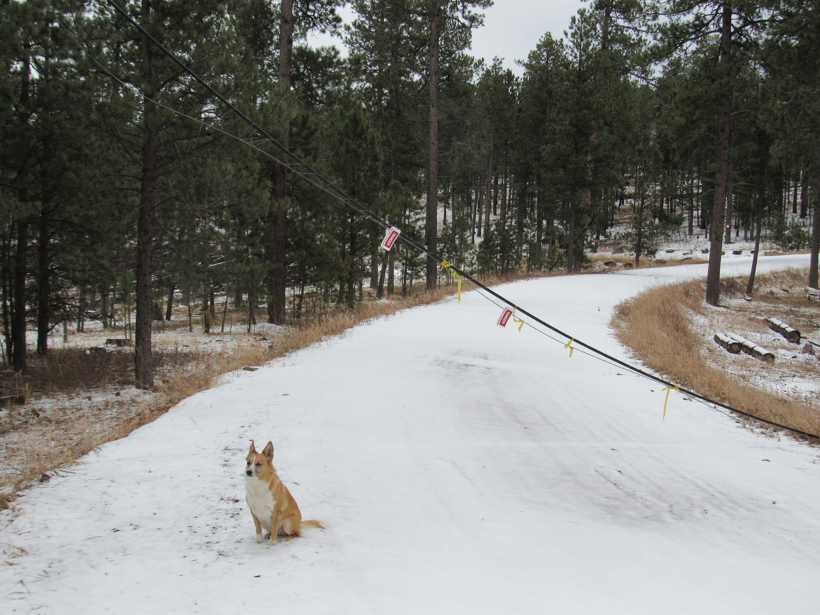
Since Calumet Ridge (5,601 ft.) was closer, and Lupe had never been there before either, Calumet Ridge became Lupe’s primary peakbagging goal for the day.  Expedition No. 108 started at a little side road just off USFS Road No. 358 (Boulder Hill Road).  Lupe was less than 0.5 mile S of Boulder Hill (5,331 ft.) and a mile N of Hwy 16, as she left the G6 at 9:43 AM (57°F) following the little side road W.

There was still ice on the road, and snow in the shadier parts of the forest.  The road skirted to the N of Silver Mountain (5,405 ft.), which Lupe had climbed for the first time only a few weeks earlier on Expedition No. 105.  Years ago, the Ponderosa pine forest on Silver Mountain burned almost completely in a devastating wildfire.  In less than a mile, the road Lupe was following turned WSW and entered the burn area.

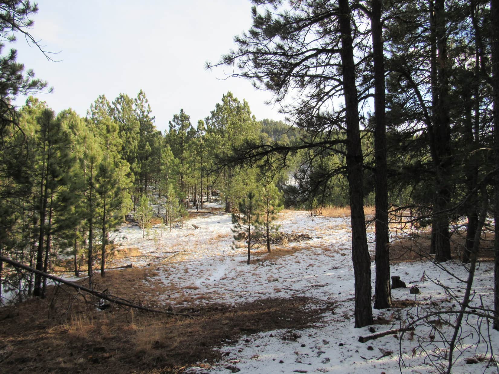
The road disappeared completely in the grass as Lupe headed up onto a barren ridge sweeping down to the NW from Silver Mountain.  Lupe followed the ridge a little way, and then turned W heading back into the forest.  She soon crossed USFS Road No. 366 at the saddle marking the high point on the road.  Lupe and SPHP continued W of No. 366, climbing two forested ridges separated by a snowy little valley that drained to the N.

From the second ridge, Lupe saw another larger valley to the W.  There was some open ground down there and a road.  Lupe and SPHP headed down into the valley, but as Lupe neared the road, a Jeep came along and parked in the open part of the valley a bit to the S.  A man with a rifle got out of the Jeep.  SPHP realized he intended to do some target practice.

Lupe has never liked gunfire, and she wasn’t going to like this.  SPHP hurried NW to reach the road and start heading N.  When the man opened fire, Lupe was greatly alarmed.  She instantly started begging SPHP to stop and hide.  It was all SPHP could do to persuade her to keep going.  Fortunately, it wasn’t far to a jeep trail that left the main road to climb NW up a little side valley.  Lupe relaxed a little, as the sound of gunfire became less distinct and more intermittent.

The jeep trail split after about 0.25 mile.  Lupe and SPHP took the branch that curved W.  It started climbing more quickly as it bent around to the S.  Lupe arrived up on a little ridge, where SPHP thought there might be some views, but all that could be seen were nearby low forested hills.  Lupe was now up on the E slopes of Calumet Ridge, still about 400 feet below and 0.5 mile SE of the summit.

Very conveniently, Lupe found another jeep trail nearby that went NW.  This jeep trail was icy, and gained elevation at a steady moderately steep pace.  Lupe and SPHP soon reached the top of the ridge at a broad, flat saddle area S of the summit.  The jeep trail continued on down the other side of Calumet Ridge.

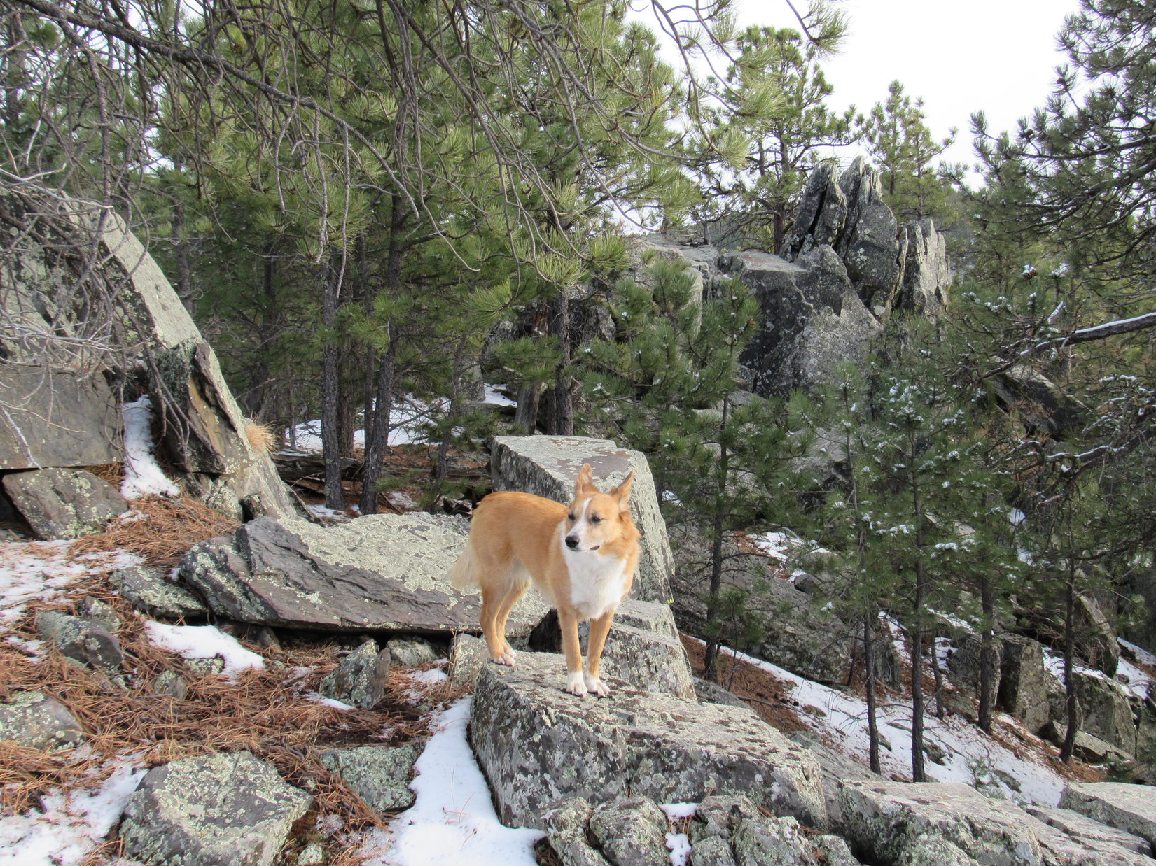
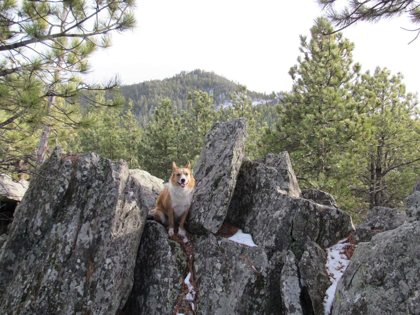
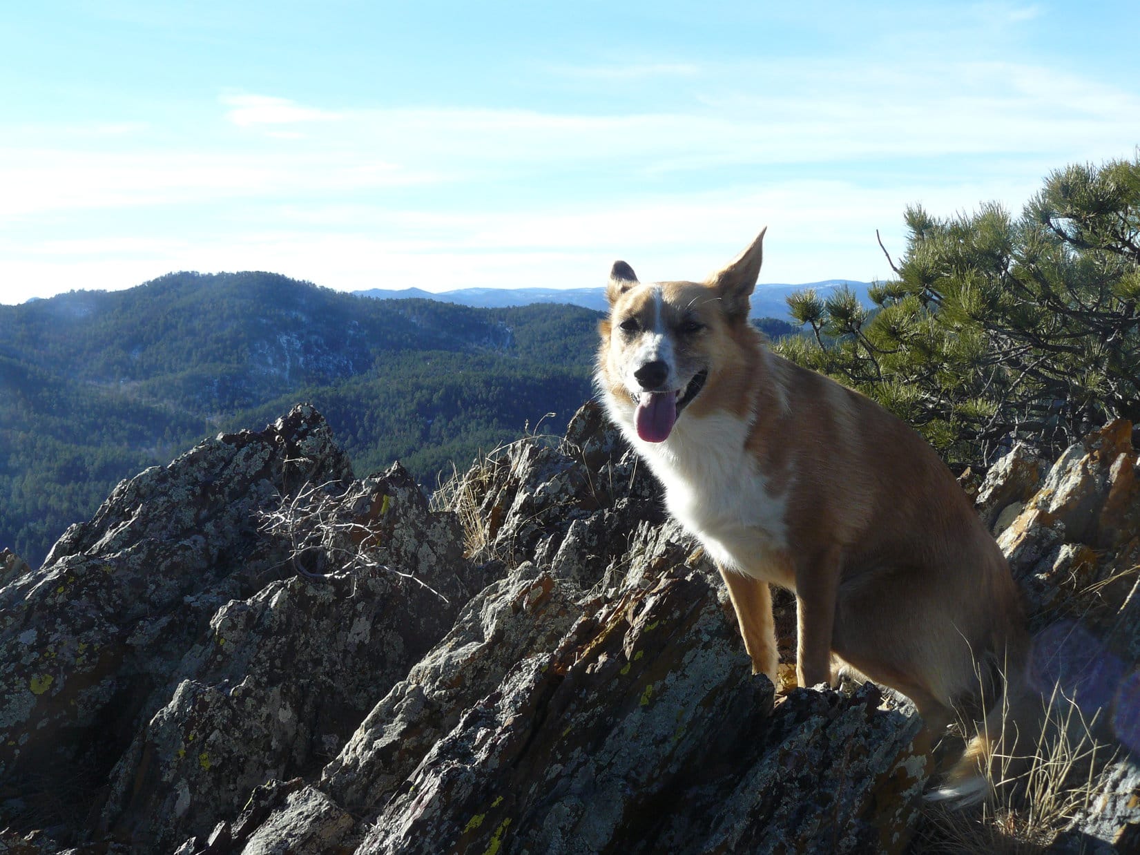
Lupe and SPHP turned N.  Lupe found the summit of Calumet Ridge at a rock outcropping in a shady forested area.  She perched up on the highest boulder to claim her Calumet Ridge peakbagging success!

Lupe claims her peakbagging success on the summit boulder near the N end of Calumet Ridge!

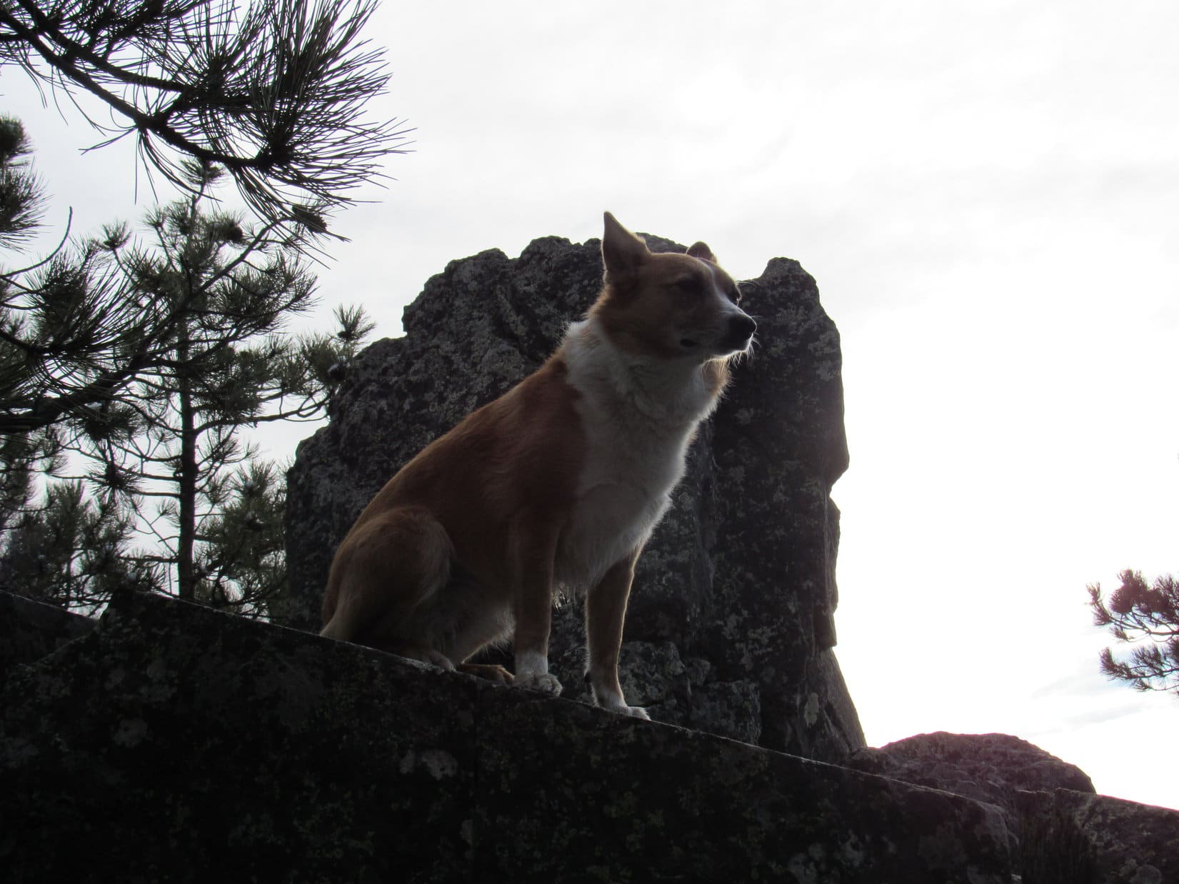
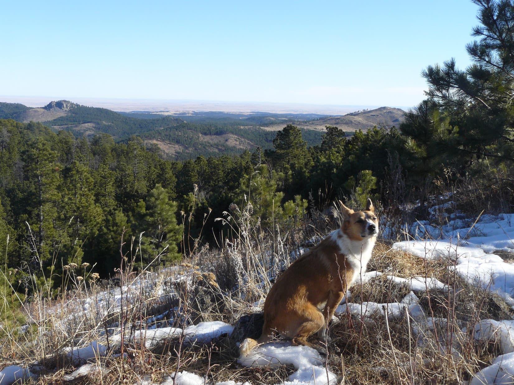
There really weren’t any views from the forested summit, but a little exploring around revealed that there was a good viewpoint not too far to the E.  From there, Lupe enjoyed a wide open view off to the N and E.  She could see Boulder Hill and Silver Mountain, and far beyond them out onto the plains of western South Dakota.

Boulder Hill (L) and Silver Mountain (R) from Calumet Ridge. They are both about 2.5 miles away. Photo looks ESE.

There was another viewpoint, too.  This one was at some big rocks a very short distance NW of the summit.  From here, there was a narrow view to the NW toward Sheridan Lake and the central Black Hills.

A glimpse of Sheridan Lake to the NW from Calumet Ridge.
Sheridan Lake
Sheridan Lake

Lupe and SPHP took a little break at the summit.  That meant Taste of the Wild for Lupe, and an apple for SPHP.  Now what?  SPHP checked the maps.  The highest parts of Calumet Ridge extend for about 0.5 mile running NNW/SSE.  Lupe was near the N end where the 5,601 ft. summit was shown.  However, the topo map also showed a very small area enclosed by a 5,600 ft. contour toward the middle of the S end of the ridge.

Well, Lupe had better check that S summit out, too!  It was so close in elevation to the N summit, that it was even possible it might actually be a bit higher.  In any case, to be certain Lupe had really visited the true summit, she needed to visit the S one, too.  Lupe and SPHP headed S, and started following a dirt road that winds partway along the ridge.

S of the saddle where Lupe had first reached the ridgeline, the dirt road brought Lupe to a big open pit toward the E side of the ridge.  Lupe sniffed around exploring the pit.  Although the Black Hills are full of old dig sites from the gold rush days in the late 1800’s, this pit was too large and too new to date back anywhere close to that long ago.  SPHP could discern no particular reason why the pit was here, but there it was.

Lupe investigates the open pit on Calumet Ridge.

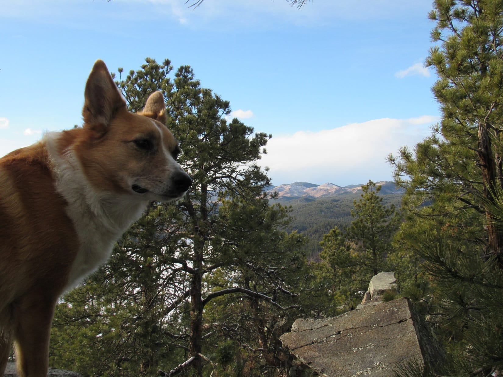
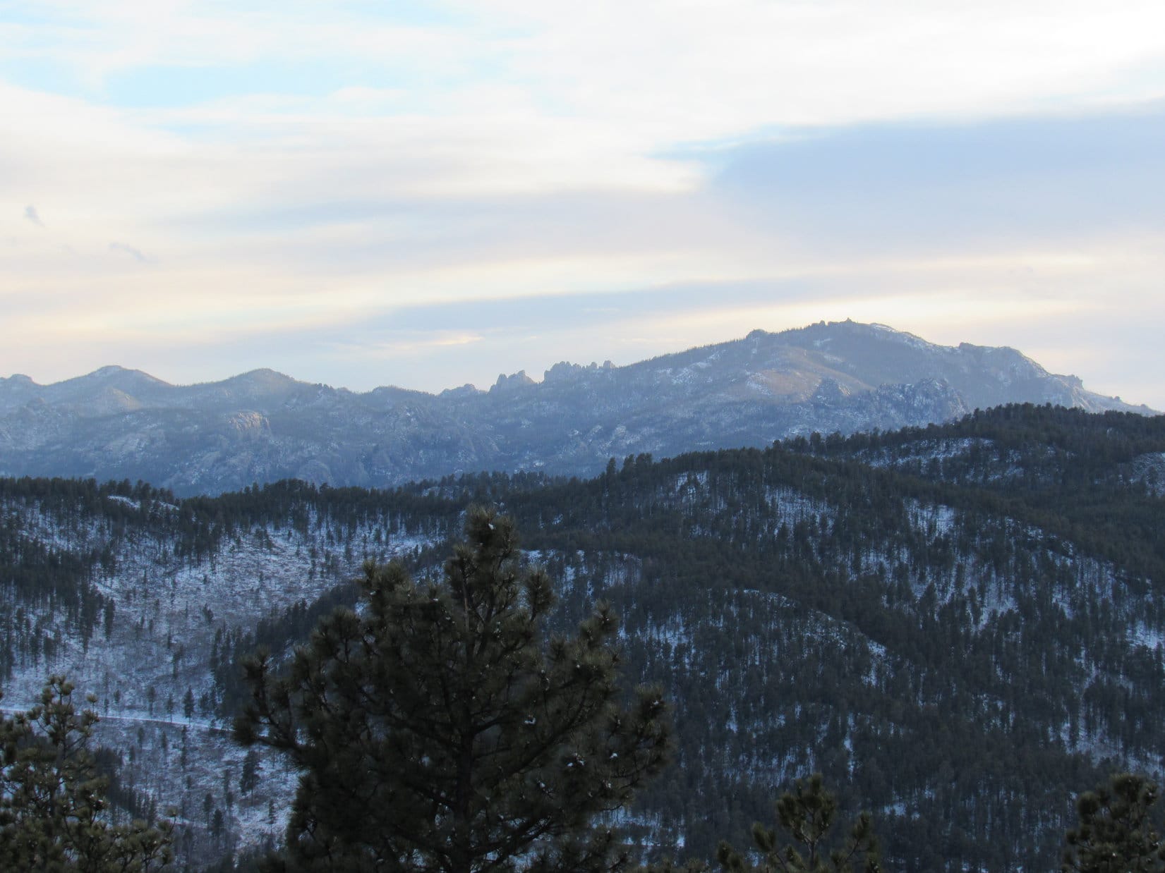
The dirt road eventually disappeared as Lupe and SPHP continued SSE along the ridge.  Lupe arrived at a high spot on the W side of the ridge where there was a rock outcropping with a clear view toward Mount Warner (5,889 ft.) to the SW.  Lupe could see Harney Peak (7,242 ft.), too.

Someone had left a white metal chair up here, positioned to take advantage of the view.  Sadly, Lupe also noticed an old dilapidated couch fallen down below the viewpoint.  It must have served the same purpose once upon a time.  People and their trash!  Although they like to claim everything is sacred – in practice, nothing really is.

Lupe at the viewpoint on the way to the S summit of Calumet Ridge. Photo looks SW toward Mt. Warner (R) in the foreground, and more distant Harney Peak (L) on the far horizon.

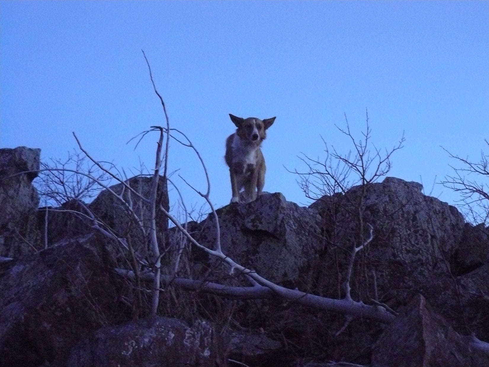
It wasn’t much farther to the S summit.  The S summit was comprised of a large rock formation, surrounded by cliffs on most sides.  However, at the N end from which Lupe approached, it was only 12-15 feet up to the top, and it wasn’t quite a cliff.  It looked possible to scramble up, without too much difficulty, using rocks and trees for support.

The S summit of Calumet Ridge. Photo looks S at the N end of the summit block where Lupe would scramble up to the top.

The short scramble up to the top of the S summit was scarier than the photo shows.  You sure wouldn’t want to have small children attempt it.  However, between the rocks and trees, there were plenty of good handholds and footholds.  There must have been adequate pawholds, too.  Lupe and SPHP were soon up on the S summit of Calumet Ridge.

The summit area was the size of a modest room in a house.  There were trees and grass growing up there, and enough room to walk around a bit.  The best views were off to the SE toward Silver Mountain, and the SW toward Mount Warner.

Lupe up on the S summit of Calumet Ridge. Silver Mountain is seen 2.5 miles to the SE.
Silver Mountain using the telephoto lens from the S summit of Calumet Ridge.
Looking SW toward Mount Warner (L).

Since the N and S summits of Calumet Ridge weren’t in view from one another due to the forest, it wasn’t possible to form any firm opinion on which might actually be higher.  In any case, Lupe had visited both.

Lupe and SPHP returned NNW to the broad saddle area where Lupe had first reached the ridgeline.  Instead of going SE back down the way she had come up, Lupe took the jeep trail down the W side of the mountain.  The road started off heading W, but soon made a sharp turn back to the SE.  Someone was using a chainsaw in the forest a little way below the road.  He didn’t see Lupe go by when she passed his truck parked in the middle of the road, but she saw him.

The road dropped rather steeply along much of its length.  Lupe and SPHP soon arrived down in a valley just W of a saddle area S of Calumet Ridge.  SPHP briefly considered having Lupe go on to make an attempt at climbing Samelius (5,856 ft.) and Hardesty (5,562 ft.) Peaks, located close to each other more than 2 miles to the SW.  Lupe could probably climb both of them before sunset, but then there would be a long trek back to the G6 in the dark.  Samelius and Hardesty would have to wait for another day.

Lupe turned E and went over the saddle.  Almost immediately, she started hearing gunfire again.  It was distant, but still made her nervous.  She made persistent efforts to persuade SPHP to stop and hide.  SPHP stopped to pet and console her.  SPHP assured Lupe she wasn’t going to get shot, if she stayed close.  Lupe wasn’t entirely convinced.  She stuck to SPHP like glue, but still campaigned for taking shelter.  SPHP had to stop several times to boost her spirits.

The area E of the saddle was a maze of little roads among low, mostly forested hills.  To stay as far as possible from the gunfire, Lupe and SPHP wandered in a generally SE direction, sometimes on the roads, and sometimes just in the forest.  Lupe came to a field where traffic noise from Hwy 16 could be heard not that far off to the S.  Part of the field extended up into a little valley to the NE.  Lupe and SPHP went that way, re-entering the forest at the end of the field.

Lupe passed a number of interesting plants like these while wandering the forests SE of Calumet Ridge.

Lupe reached USFS Road No. 366 again, a little S of the saddle where she had crossed it going W earlier in the day.  This time she crossed it heading E.  Although she hadn’t gone on to climb Samelius and Hardesty Peaks, she now headed for Silver Mountain.  This would be Lupe’s 2nd ascent of Silver Mountain in just a few weeks.  Lupe and SPHP hoped to see a dramatic sunset up there.

Lupe arrived at the top of Silver Mountain about half an hour before sunset.  With the forest completely burned off the top of Silver Mountain, Lupe and SPHP enjoyed 360° views.  Lupe wasn’t actually too interested in the views.  Target practice was still going on off to the NW toward Calumet Ridge.  She huddled under SPHP’s jacket, which made her feel safer.

Nervous Lupe up on Silver Mountain. Photo looks SW toward Harney Peak.

Together Lupe and SPHP watched the sunset, but it never really developed much color.  Once it became clear that the show was over, Lupe and SPHP started down the steep N slope of Silver Mountain.

Lupe ready to follow SPHP down off Silver Mountain.

There was a lot of dead timber on the N slope, and despite two days of very warm weather, there was still some snow, too.  It was slow going coming down the mountain.  Target practice continued off to the W until it was so dark stars were starting to come out.

By the time Lupe reached a road down below, twilight had faded to darkness.  The road was icy and slick.  SPHP didn’t recognize the place and turned the wrong direction.  After about 10 minutes, SPHP realized the error and turned around.  The road led Lupe all the way back to the G6.  Lupe arrived at 5:31 PM.  It was still a crazy 57°F out!

Lupe had a mostly fun day going to Calumet Ridge.  There was too much target practice going on in the area to the E of Calumet Ridge, though.  It had basically gone on all day long.  Lupe and SPHP both agree that more remote locations are more to their liking.

Lupe on Calumet Ridge, 12-11-14.

As for Cicero, Samelius and Hardesty Peaks, which Lupe never made it to this day – Lupe did go on to climb all three and more before the end of 2014.  But those Lupe adventures are the subjects of other posts.

Links:

Next Black Hills Expedition               Prior Black Hills Expedition

Want more Lupe adventures?  Choose from Lupe’s Black Hills Expeditions Adventure Index or Master Adventure Index.  Or subscribe free to new Lupe adventures.

Black Hills, SD Expedition No. 159 – Bluelead Mountain & Calumet Ridge (2-29-16)

While Lupe had been on Expedition No. 158 to Echo Peak, Tepee Peak and Eagle Mountain, SPHP had been thinking about it.  Tomorrow was Leap Day, February 29th, the rarest date on the calendar.

Sadly, American Dingoes don’t live long enough to see more than a handful of Leap Days, 4 or 5 at the very most.  One of Lupe’s few Leap Days (2012) was already behind her.  Lupe should go on another expedition tomorrow, just to celebrate this rare date!  She wouldn’t get many more chances.  So, it was settled.  Lupe was going on Expedition No. 159 in the morning.

Alas, she did not!  Leap Day morning brought gray skies and a cool breeze.  It started snowing.  A Leap Day expedition had been a good idea, but there was no sense going out in this.

Early in the afternoon, though, the snow stopped.  The skies cleared for a little while.  There was still time, not for a long expedition, but Lupe could still go!  It had to be someplace not too far away, though.  There were still a few named peaks nearby that Lupe had never visited.  Climbing one of them would make the day memorable.

SPHP quickly settled on Bluelead Mountain (5,170 ft.) near Sheridan Lake.  It really wasn’t a terribly exciting choice.  Bluelead Mountain is only a sub peak of nearby Calumet Ridge (5,601 ft.), but Lupe had been to Calumet Ridge once before back on Black Hills, SD Expedition No. 108 on 12-11-14.  At least Bluelead Mountain was something new, and the hike up Spring Creek from the trailhead to the lake would be scenic.

No time to lose!  SPHP threw everything together.  Lupe seemed quite surprised that anything was going to happen this late in the day just one day after a prior expedition, but she was all for it.  It was 2:00 PM (37°F) exactly when SPHP parked the G6 at the Spring Creek trailhead for Centennial Trail No. 89.  The sky was overcast again, but it wasn’t snowing.  Lupe and SPHP took off following the trail up Spring Creek.

Lupe on Centennial Trail No. 89 heading up Spring Creek toward Sheridan Lake.

Everything was going well, until Lupe reached the first bridge over Spring Creek.  It wasn’t there!  Well, it was, but it no longer went across Spring Creek.  Instead it was sitting uselessly up along the near shore.  Whether the other end had been loosened and swept back by the creek during high water, or officials had decided to effectively close the trail was unclear.

Lupe sits on the now useless bridge that used to go across Spring Creek.

There were other bridges (or used to be) upstream.  Maybe Lupe could go along the near shore far enough to reach one of them.  A short reconnaissance revealed that the terrain upstream was just too rough to waste time even trying.  The creek was too big and cold to cross.  Lupe had to go back to the trailhead.

Along the way, SPHP seemed to remember another bridge a bit farther downstream that went to a seldom used shortcut to the Flume Trail.  Maybe that would work.  Lupe and SPHP followed Spring Creek downstream well beyond the trailhead.  No bridge anywhere.

Well, piddle!  Now what?  Lupe and SPHP returned to the G6.  On to the Dakota Point trailhead of Centennial Trail No. 89!  It was only a few miles away.  Dakota Point was well above the level of Sheridan Lake.  There was a direct route to Sheridan Lake dam that didn’t involve multiple creek crossings.  The only crossing was on a really good bridge over the spillway.

Oh, please!  Really?  100 yards from the Dakota Point trailhead, a power line was drooping down onto part of the road.  How long had it been like that?  This little snow earlier in the day couldn’t have done that.  SPHP turned the G6 around and parked it (2:37 PM, 37°F).  The G6 wasn’t on the highway.  It would be fine.  Onward!  Lupe and SPHP went under the droopy power line, and hit the Centennial Trail.

Ever get the feeling something wasn't meant to be? Lupe by the droopy power line. The Dakota Point trailhead of Centennial Trail No. 89 is just another 100 yards ahead.
Ever get the feeling something wasn’t meant to be? Lupe by the droopy power line. The Dakota Point trailhead of Centennial Trail No. 89 is just another 100 yards ahead.

Lupe was off to a mighty late start.  It was a good thing Bluelead Mountain is right next to Sheridan Lake.  It wasn’t that high, and wasn’t that far away.  Lupe was still going to climb it!

Things started going better.  Lupe was enjoying exploring the snowy woods.  There was none of the target practice gunfire she had to endure on yesterday’s Expedition No. 158.  SPHP made good time on the trail.

The first part of the trail actually coincided with a dirt road buried beneath the new fallen snow.   When Lupe reached the place where Centennial Trail No. 89 left the road, she stayed on the road instead.  The official trail would have led her winding back down a very scenic route to Spring Creek, but there was no reason to go clear down there, especially not knowing if the rest of the bridges across the creek were still intact.

The road swung around to the S, went over a little rise and then started to lose elevation steadily.  It took Lupe all the way down to the spillway next to the dam.

Lupe reaches the bridge over the Sheridan Lake spillway. Good thing THIS bridge was still intact!
A first look at Sheridan Lake from the spillway bridge. Photo looks SW.

Lupe went over the spillway bridge, hopped over a dead tree fallen across the trail, and followed the trail up a small forested hill.  On the S side of the hill, Lupe got her first view of her Leap Day objective, Bluelead Mountain.

High Point 5516 (L), Calumet Ridge (Center), and Bluelead Mountain (R). Photo looks S across the Sheridan Lake dam.
High Point 5516 was higher and more interesting looking than Bluelead Mountain, but isn't a named peak.
High Point 5516 was higher and more interesting looking than Bluelead Mountain, but isn’t a named peak.

Lupe went down a stone stairway to reach the N end of Sheridan Lake dam.  From the dam she had a better view of the lake than back at the spillway.  Below the dam, Lupe could see Spring Creek.  The level line of Flume Trail No. 50 could be seen on the side of the hill to the E.  Flume Trail No. 50 goes from Sheridan Lake to Coon Hollow near Rockerville.

Sheridan Lake as seen from the N end of the dam. Less than half of the lake is in view here. Photo looks SW.
Spring Creek is barely visible down below the dam, but the line made on the hillside to the E by Flume Trail No. 50 is quite noticeable. Photo looks E.
The spillway is just around the other side of the closest rocky point. Photo looks NW.

Lupe and SPHP crossed Sheridan Lake dam heading SSW.  Beyond the S end of the dam, Lupe followed short segments of Centennial Trail No. 89 and then Flume Trail No. 50.  The base of Bluelead Mountain forms the SE shore of Sheridan Lake.  The summit was only another 0.5 mile or so to the SSW.  After gaining a little elevation on Flume Trail No. 50, Lupe left the trail to continue climbing directly up toward the summit.

Bluelead Mountain is very thickly forested with Ponderosa pines.  Even though Bluelead Mountain is right next to Sheridan Lake, the lake could hardly be seen.  After a short steep stretch, Lupe came to parts of the dense forest that were nearly level.  She had a great time prowling around being a ferocious Carolina Dog.

A ferocious Carolina Dog prowls the dense forest on the N slope of Bluelead Mountain.

Eventually the terrain began to steepen again.  Lupe gained a fair amount of elevation and arrived at the first high point, which was still a little way N of the true summit.  There was a bit of a view between the trees looking NW across Sheridan Lake.

Lupe reaches the first high point a short distance N of the true summit of Bluelead Mountain. Photo looks N.
Looking NW across Sheridan Lake.

Lupe continued S.  It wasn’t very much farther to the true summit of Bluelead Mountain now at all.  She lost a little elevation at first, but then the terrain rose steeply.  The top of Bluelead Mountain turned out to be quite rocky, but was pretty much buried in the trees.  There were only glimpses of views in a few select directions.

Lupe nears the summit of Bluelead Mountain. Those straight up pointy rocks on the right are the very top! Photo looks S.
Lupe sits high up near the very tallest rocks on Bluelead Mountain. Photo looks W.
Those rocks at the top of Bluelead Mountain were big! Photo looks S.
A glimpse to the N from the top.

Lupe on Bluelead Mountain, 2-29-16

Looking S at Calumet Ridge from Bluelead Mountain.

The rock formations at the summit of Bluelead Mountain were rather imposing coming from the N.  It didn’t look at all possible to get near the top from the W.  Lupe and SPHP went around to the E where SPHP was able to lift Lupe up onto a relatively level rock platform next to the very highest rocks.  After a few photos, Lupe jumped down again.

SPHP peered over the ridge expecting to see a straight drop down to the SW, but was surprised to see a very easy route to the top.  Lupe and SPHP scrambled over a few rocks to get over there, and then just strolled up to the summit.  Lupe’s rare Leap Day peakbagging expedition was a success!

Lupe's Leap Day expedition to Bluelead Mountain was a success! She had no way of knowing that her Leap Day expedition was about to get a whole lot more interesting!
Lupe’s Leap Day expedition to Bluelead Mountain was a success! She had no way of knowing that her Leap Day expedition was about to get a whole lot more interesting!

Lupe and SPHP had a chocolate coconut granola bar to celebrate.  The skies had cleared quite a bit and it was sunny out.  It no longer seemed so late.  Of course, Lupe could just call it good and go back to the G6.  However, it seemed like she ought to take advantage of the rest of the day and do something more.  The only other obvious possibility was to continue on S to climb Calumet Ridge again.  Well, why not?

Lupe lost a little elevation continuing S from the summit of Bluelead Mountain.  As the ground leveled out, she reached the edge of a small clearing in the forest.  Lupe stopped.  There was something right out in the open on the other side of the clearing, something Lupe had never ever seen before in 158 prior Black Hills expeditions, or on any of her Dingo Vacations either.

A full grown mountain lion stood staring at Lupe and SPHP.  It was frozen in mid-step, looking like it had just entered the clearing, too.  The lion seemed hesitant.  A ferocious Carolina Dog here in its territory?  The Bluelead Mountain mountain lion was shocked and confused.  It paused, uncertain for a moment what to do about this unexpected intrusion.

Lupe stood quiet and motionless.  She likes cats, but this was one mighty big kitty!  In fact, it looked like kittysaurus!  For a moment, Lupe just stared.  Who knew a kitty could get this big?

The moment wouldn’t last.  Instantly, SPHP knew what to do.  Off with the bulky gloves, grab the camera, off with the lens cap, hit the power button, wait a second or two for the lens to adjust … Lupe took a few steps toward the mountain lion.  It turned and fled into the forest.  Click!  Too late or not?  SPHP hit the review button.

Gah!  Too late.  A nice boring photo of an empty clearing where a moment before the only mountain lion Lupe had ever encountered in the wild had stood.

The clearing where Lupe saw the Bluelead Mountain mountain lion only a moment before.

Almost!  So close!  But, no.  Missed it by what, a second or two?  If that.  Lupe looked up at SPHP.  “Did you see that humongous kitty?”  “Yup, sure did!”  “I was just thinking, maybe you should put the cats at home on a diet?”

The moment wouldn’t return.  The big cat was gone.  Even so, suddenly Lupe’s afternoon expedition on February 29th really did seem special.  Just seeing the lion was a big treat.  Expedition No. 159 was a very memorable success no matter what happened from here.  Funny, if it hadn’t been Leap Day, if hadn’t snowed in the morning, if the bridge hadn’t been missing, Lupe would never have seen the Bluelead Mountain mountain lion.

A rough road left the clearing continuing S from near where the lion had been.  Lupe and SPHP followed it.  SPHP couldn’t help but glance now and then off into the forest to the E where the mountain lion had disappeared, just in case, but the shy cat made no reappearance.

Quite a few rough roads were carved into the side of Calumet Ridge.  At times Lupe and SPHP followed them.  Other times Lupe just climbed along a rocky spine of the mountain up through the forest.  She came to one place with a great open view back toward Sheridan Lake.

Sheridan Lake from the NW slopes of Calumet Ridge. Photo looks NW.
Mount Warner (5,889 ft.) (L of center) from the NW slopes of Calumet Ridge.
Mount Warner (5,889 ft.) (L of center) from the NW slopes of Calumet Ridge.  Photo looks SW.
Five Points (6,221 ft.) (just R of Center) from the NW slopes of Calumet Ridge.

A steep, rough snowy road led Lupe the last part of the way up to the top of Calumet Ridge.  A level spot near the summit featured wide open views to the E.  Silver Mountain (5,405 ft.), which Lupe had seen just yesterday on Expedition No. 158, was once again in sight – this time off to the SE.

Silver Mountain. Photo looks SE.

From the E viewpoint, the road turned SW to reveal a beautiful look at Harney Peak (7,242 ft.).

Harney Peak (R) from near the N summit of Calumet Ridge. Photo looks SW.

Lupe reached the N summit of Calumet Ridge (5,601 ft.), and posed on the highest boulder to claim her 2nd peakbagging success of the day.  The N summit is in the trees, so there weren’t any views.  Just a little to the NW there was a partial look at Sheridan Lake, but it wasn’t as good as the view Lupe had already seen from lower down on the mountain.

Lupe on the N summit of Calumet Ridge. Photo looks NE.

The sun was starting to get pretty low, but Lupe still had a little unfinished business on Calumet Ridge.

Although the true summit appears officially on the Peakbagger.com topo map as 5,601 ft. at the N summit which Lupe had just visited, there is another possible true summit about 0.33 mile farther S along the ridge.  The topo map shows a small area there enclosed by the 5,600 ft. contour.  Lupe was going to go to this S summit, too, just to make certain she really had reached the highest point on the mountain.

The S summit block is considerably trickier to get up onto than the easy boulder at the N summit.  Lupe and SPHP had no problems scrambling up, though.  Now Lupe could claim her Calumet Ridge peakbagging success with absolute certainty.  There was room to move around up on top of the S summit block, but not a great deal.  The best views were to the SW toward Harney Peak.

Lupe approaches the S summit block on Calumet Ridge. Photo looks S.
Success! Lupe up on top of the S summit block. Photo looks N.
Harney Peak (Center) and Mount Warner (R) from the S summit of Calumet Ridge.

Harney Peak using the telephoto lens.

Now it really was getting late in the day.  While Lupe had been up on Calumet Ridge, the sun was sinking ever lower in the W.  It was getting increasingly cloudy again, too.  As Lupe left the S summit heading N back along the ridge, the sun disappeared behind the clouds.

Not far from the N summit, Lupe reached a saddle where roads met.  It was too late to think about going back to the G6 by way of Bluelead Mountain.   Lupe had to stick to the roads now.  Lupe and SPHP took a road leading WNW down the mountain.  It soon curved sharply and went SSE, losing elevation all along the way.

As Lupe headed down the road, an ominously dark cloud bank appeared off to the NW.  It looked like snow was coming, or maybe fog.  Gradually the low, thick cloud drew nearer obscuring the mountaintops and bringing a chilly gloom with it.  Twilight faded.  Just as Lupe reached a junction with another road clear down at the S end of Calumet Ridge, the snow came.  Lupe and SPHP turned white.  Lupe was as far from the G6 as she had been all day.

Lupe still had a lot of elevation to lose.  She followed roads that went NW down toward the Blue Wing subdivision on a S inlet of Sheridan Lake.  It was night, and still snowing when Lupe got to Blue Wing.  No one was around.  Nothing stirred.  There were no tracks on the paved subdivision roads slick with snow-covered ice.

There were security lights on, though.  And a few of the homes sported Christmas lights.  In a year that had almost no winter, suddenly, late on the last day of February, on Leap Night, for a couple of hours, winter reigned briefly again.

Lupe and SPHP found Centennial Trail No. 89.  Leaving the silent lights of Blue Wing behind, the flashlight had to come out as Lupe followed the narrow trail in the darkness.  It wound through the forest high up on a steep bank along the SE side of Sheridan Lake.  The steep bank was part of the base of Bluelead Mountain.  Somewhere up above in the inky black forest was the Bluelead Mountain mountain lion.

Lupe reached Sheridan Lake dam, and crossed it heading N.  By the time she reached the G6 (7:40 PM, 29°F), winter was over.  The snow squall had moved on by.  Amazingly brilliant stars were overhead.

Bluelead Mountain hadn’t seemed like much of a peakbagging destination, but SPHP was glad Lupe had come here.  It would be a long time before she forgot Leap Day 2016, Expedition No. 159, and the Bluelead Mountain mountain lion.

The clearing where Lupe saw the Bluelead Mountain mountain lion.

Links:

Next Black Hills Expedition              Prior Black Hills Expedition

Want more Lupe adventures?  Choose from Lupe’s Black Hills Expeditions Adventure Index or Master Adventure Index.  Or subscribe free to new Lupe adventures.