Lazy Mountain, Chugach Range, Alaska (9-1-16)

Day 34 of Lupe’s Summer of 2016 Dingo Vacation to the Canadian Rockies, Yukon & Alaska

Pepper Peak (5,381 ft.) had been a stupendous day and a glorious summit, but Lupe and SPHP hadn’t really recovered yet from yesterday’s huge 4,500 feet of elevation gain.  No matter.  Feeling it or not, Lupe was climbing one more mountain today.  The calendar now said September.  After 3 fabulous, unforgettable weeks in Alaska, this was the American Dingo’s last full day in the Land of the Midnight Sun.

Lazy Mountain (3,740 ft.) was destined to be the last peak Lupe and SPHP would climb together in Alaska in 2016, or maybe forever.  Tired or not, it was time to begin (9:55 AM, 48°F).  At least Lupe had another clear, bright day.  She was guaranteed some great views of Palmer, the Matanuska River valley all the way to the Knik Arm off Cook Inlet, and mountains in all directions.

Right away, Lupe had a choice to make.  Two trails diverge near the trailhead parking lot.  They both go about halfway up Lazy Mountain to where they meet again near a picnic table situated on a point with a view.  A single combined trail goes the rest of the way to the summit.  The old Lazy Mountain approach was supposed to be the steepest.  The newer Lazy Moose trail is an easier climb, but winds around a bunch on switchbacks that add considerable distance.

Even though energy levels were low, Lupe and SPHP started straight up the Lazy Mountain trail.  The reports were no joke.  The trail started out steep.  It didn’t stay that way long.  It soon got steeper, and then stayed that way.  Whoever named Lazy Mountain must have realized what they were in for, and decided they were too lazy to even attempt it.  Otherwise, the name makes no sense at all.

As usual in most of Lupe’s Alaskan trail experiences, the Lazy Mountain trail started in a forest.  Gradually the forest thinned, and tall bushes started to dominate.  The forest had thinned out considerably, by the time Lupe reached the picnic table near the intersection with the Lazy Moose trail.  It had been a long, hard climb with frequent rest breaks, but Lupe was halfway up the 3,000 feet of elevation gain needed to reach the summit.

At the picnic table, SPHP chatted for a little while with a guy who came running (yes, running!) up the same Lazy Mountain trail Lupe and SPHP had just staggered up.  He said he lives in Palmer, and runs this far up Lazy Mountain 3 times a week.  He plays in a Christian music band, and was very surprised to hear that Lupe lives in South Dakota.

Why he was flying to Sioux Falls, SD tomorrow to play in a big concert there!  He had been with his band to South Dakota many times, including Pine Ridge and Lupe’s Black Hills.  South Dakota was a hot spot for his kind of music.  He wished Lupe and SPHP well, before running off down the longer Lazy Moose trail.

Small world.  Sort of.  Lupe still had another 1,500 feet of mountain climbing left to do in Alaska.  Somehow it still loomed large, not small.  Lupe’s trek resumed.  Still steep, but perhaps not quite as steep as before.  Tall bushes dominated, but most of the trees were gone.  On and on.  Up and up, for a while longer.

Finally, Lupe was past the bushes.  She was up in the tundra zone.  Some places were devoid even of the tough, beautiful, little tundra plants.  Bare dirt and small rocks were exposed.  Lupe had made a lot of progress up the mountain by now.  For a while, the trail leveled out.  There was even a completely flat section!  A high point that might be the summit was in view ahead.

Getting there! Lupe climbing Lazy Mountain. She’s already up above tree line here. Only scattered clumps of bushes and tundra remain. Photo looks NE.
For a while, SPHP wasn’t sure which high point might be the true summit of Lazy Mountain. It turned out to be the one on the L that the trail is heading for. Photo looks NE.

The trail soon started climbing again, but never as steeply as earlier on.  Below a ridge, Lupe passed a second picnic table.  The built-in benches were in good shape, but nearly all the boards forming the table part were missing.  Lupe did not stop.  She kept on going.  Her final climb in Alaska was dead ahead.

Lupe on her final climb in Alaska. The top of Lazy Mountain is in view only a short way ahead. Photo looks NE.

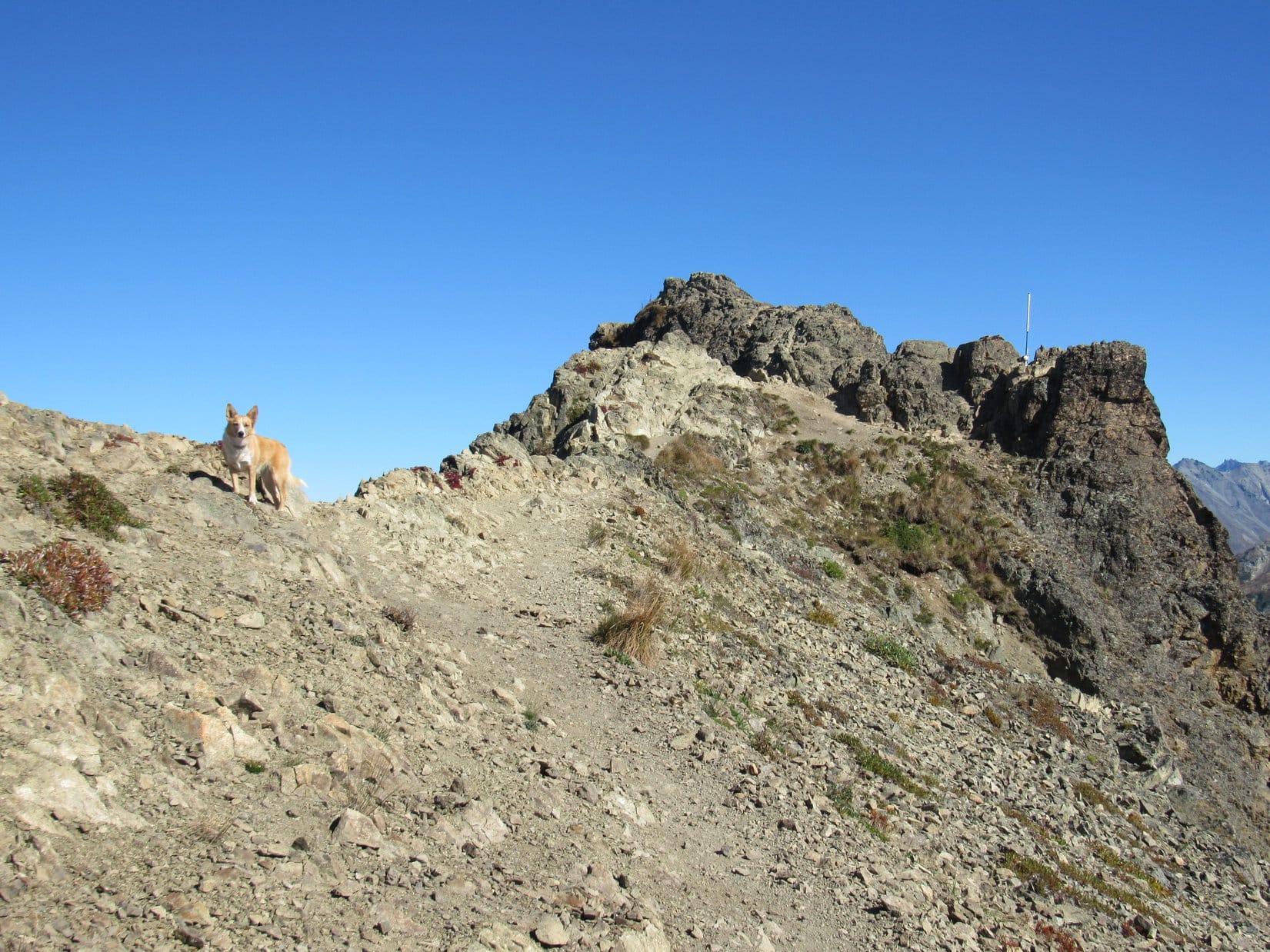
Lupe gained the summit ridge.  It wasn’t terribly long, maybe 100 feet.  At the far NE end, was a smaller ridge of solid lumpy-looking rock.  The true summit of Lazy Mountain was perched at the far end of the little ridge, perhaps an extra 20 feet above the main ridge.

Lupe rests in the shade at the base of the lumpy rock ridge at the far NE end of Lazy Mountain’s main summit ridge. Matanuska Peak is the high point in the background. Photo looks SE.

Lupe scrambled up to the highest point at the far end of the lumpy rock ridge.  She was done mountain climbing in Alaska!  This was it, the true summit of Lazy Mountain (3,740 ft.)!

Lupe perched at the true summit of Lazy Mountain, having just completed all of her mountain climbing in Alaska in 2016. Photo looks NNE.

Lupe could not be persuaded to stay up at the highest point on Lazy Mountain when SPHP tried to back down off the lumpy ridge for a more distant shot of her at the summit.  There was quite a bit of exposure up there, and not a lot of room to maneuver.

It was OK, she had made it to the top for a good close up.  Not to mention all the many other dramatic peaks she had climbed on her Summer of 2016 Dingo Vacation!  If the Carolina Dog felt better a little lower down, she had certainly earned a reprieve from posing at the top of precipices.

Lupe on the lumpy rock ridge. The true summit of Lazy Mountain is on the L. Lupe couldn’t be persuaded to remain at the high point long enough for SPHP to scramble back down for a more distant photo of her up there. The high point had a lot of exposure and not a lot of room. Photo looks ENE.
Matanuska Peak from Lazy Mountain. Photo looks SE.

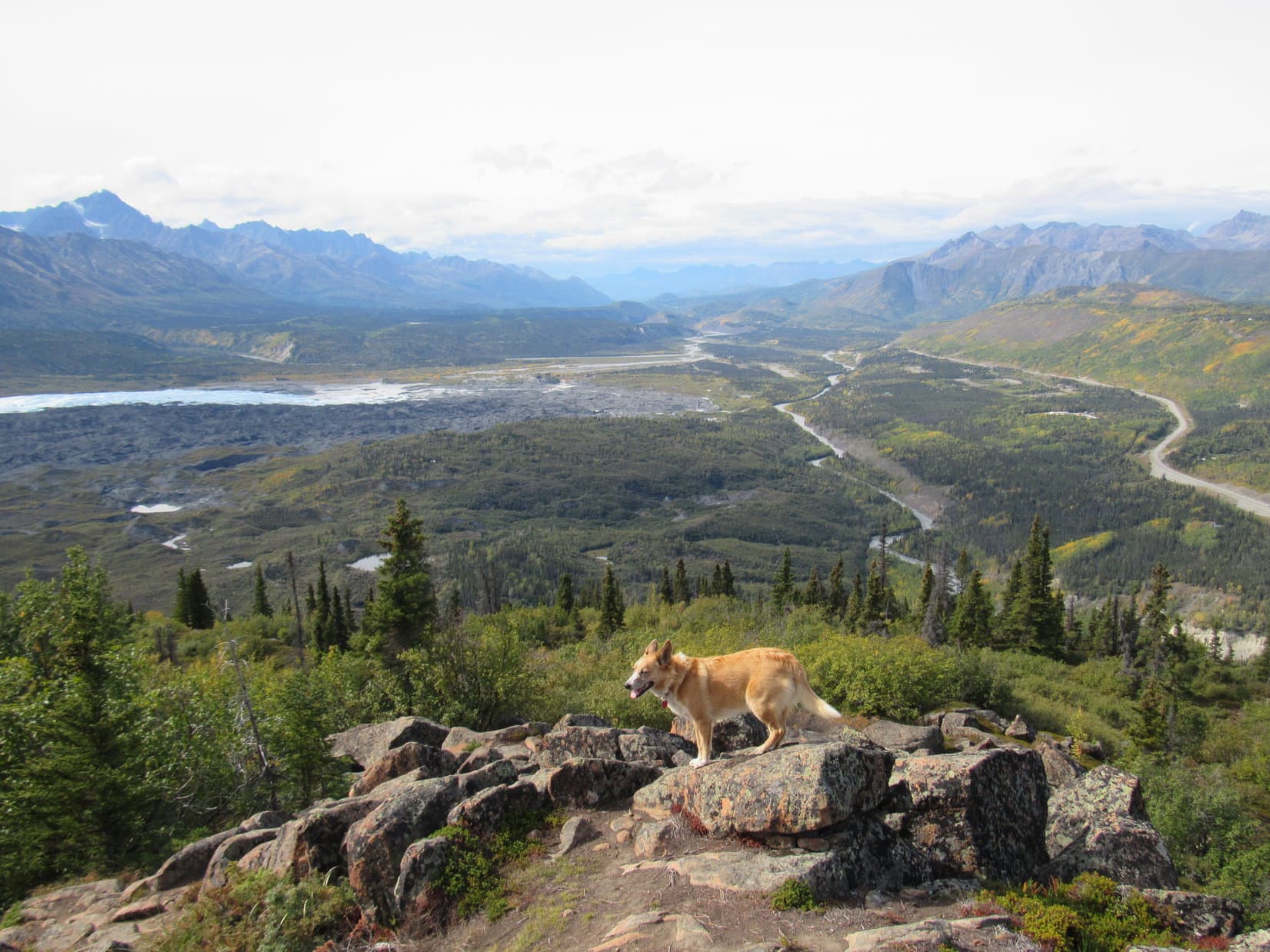
Mountain climbing in Alaska was over.  Time to take a look around at what Lupe could see from her last Alaskan mountain.  Unlike most of the mountains Loop had climbed, where the most impressive views were of other mountains, Lazy Mountain’s most dramatic views were down toward the Matanuska River valley.

More than 3,000 feet below Lazy Mountain, the braided confluence of the Matanuska River and Knik River could be seen to the SW near the start of the Knik Arm of the North Pacific Ocean off Cook Inlet.  Bodenburg Butte (886 ft.) rising more than 600 feet above immediately surrounding terrain, looked like a little hill.

The Matanuska River (Center) flows toward the Knik River (L). They have a braided confluence near the Knik Arm seen on the upper R. Bodenburg Butte(L) looks like a little hill from Lazy Mountain. Photo looks SW.

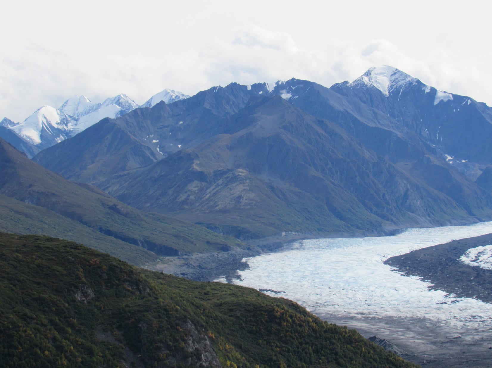
The most dramatic mountains Lupe could see from Lazy Mountain were very far away to WSW, in the direction of Mount Susitna (4,396 ft.), also known as Sleeping Lady.  (The Legend of Sleeping Lady)  Well beyond Mount Susitna were impressive white mountains on the edge of vision.

Mount Susitna (Sleeping Lady) is the long blue ridge, subject of a local legend. Photo looks WSW from Lazy Mountain using the telephoto lens.
High, white mountains could be seen faintly very far away beyond Mount Susitna. Photo looks W using the telephoto lens.

Considerably closer, it was possible to see several smaller peaks with snow and ice on them in other directions.

Unknown peak with snow in view from Lazy Mountain. Taken using the telephoto lens.

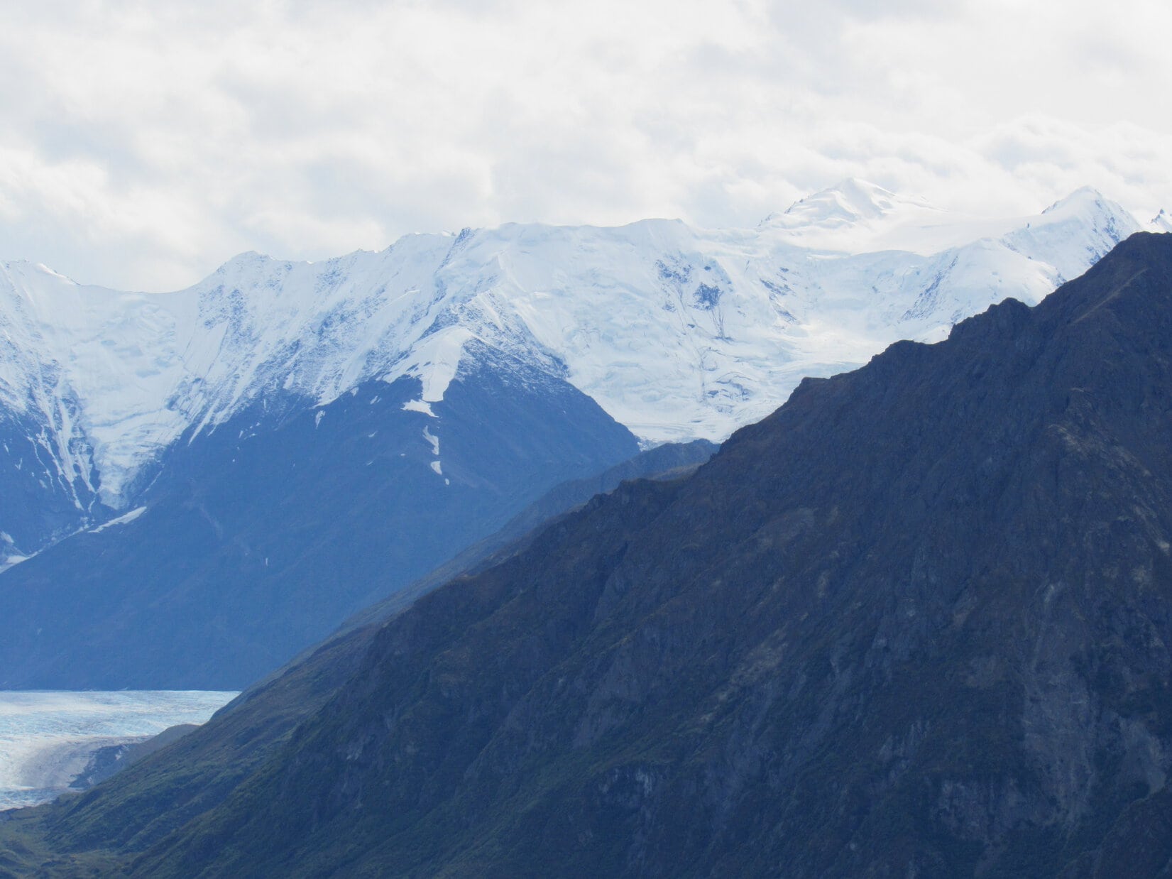
Matanuska Peak (6,093 ft.) to the SE was easily the most impressive of the nearby mountains.

Matanuska Peak (L) was easily the most impressive of the mountains nearby. Photo looks SE.
Matanuska Peak through the telephoto lens.

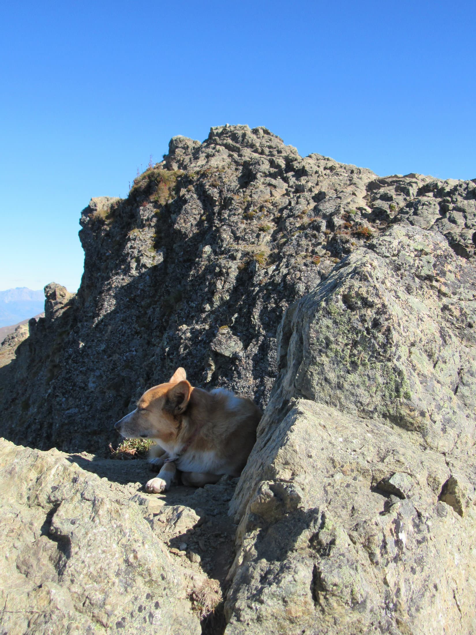
Even including the larger summit ridge, and not just the small, final lumpy rock part leading to the true summit, there wasn’t much exploring to be done up on Lazy Mountain.  Lupe could see virtually the entire summit area at a glance.  However, there was plenty of room to move around some from one end to the other, gaining slightly different vantage points.

Except for the highest lumpy rock part where the true summit is, most of Lazy Mountain’s summit area is in view here. The town of Palmer is below, mostly on the far side of the Matanuska River. Mount Susitna can be made out on the far horizon. Part of the Talkeetna Range is seen on the R. Photo looks W.

Lupe found a shady spot close to the lumpy rock ridge where she could doze a bit.  SPHP relaxed gazing off first in one direction, then another, seeing dazzlingly beautiful Alaska, possibly for the last time, from the top of a mountain Lupe had climbed.

Lupe dozes a little below the true summit. Photo looks NE.
Looking NNE toward the Talkeetna Range.

Lupe stayed up on Lazy Mountain for 45 minutes.  The time came to start thinking about moving on.  Despite the rigors of the steep trail up, the perfect day and wonderful views at the top had made Lupe’s final climb in Alaska a lovely, memorable experience.  Now only the return trip down the mountain remained.

Lupe ready to leave the mountaintops of Alaska. The lumpy rock ridge and true summit of Lazy Mountain are on the R. Photo looks NE.
Looking down on the town of Palmer, situated mostly on the far side of the Matanuska River. Photo looks WSW.
The Matanuska flows away toward the Knik Arm. Photo looks SW.
Starting down the trail. Several peaks of interest are seen along the far ridge. Straight up from Bodenburg Butte, the little hill in the valley at (Center), are 3 dark wavy peaks. The two on the L are East Twin Peak (5,840 ft.)(L) and West Twin Peak (5,472 ft.)(R). To their L across a gentle saddle is a seemingly unimpressive hill in sunlight. That hill is actually Pepper Peak (5,381 ft.) where Lupe had such a tremendous adventure only a day earlier. The high point of the dark peaks to the L of Pepper Peak is Pioneer Peak (6,398 ft.). Photo looks SW.

When Lupe got down close to the first picnic table, she took the Lazy Moose trail instead of the Lazy Mountain trail.  The Lazy Moose trail was considerably longer, but not nearly so steep.  The trail had markers along it, which seemed to represent feet traveled along the trail, starting from the lower end.

The first marker Lupe came to said 15,800, implying that Lupe was about 3 miles from the trailhead.  The markers were about 1,000 feet apart on the higher part of the trail.  Lower down, they were consistently 200 feet apart.  The Lazy Moose trail had lots of switchbacks and general winding around.  The markers told the story of Lupe’s progress down her last Alaskan mountain.

Lupe enjoyed trotting and sniffing along the easier trail.  Late afternoon on the first day of September was comfortably sunny and warm.  Lupe led SPHP down Lazy Mountain, exploring for only a little longer the fabled Land of the Midnight Sun (4:23 PM, 72°F).

Loop on the Lazy Moose trail, Lazy Mountain, Chugach Range, Alaska.

Directions to the Lazy Mountain Recreation Area trailhead:  From the Glenn Hwy in Palmer, go E on Arctic Road (Old Glenn Highway) for 2.5 miles.  Take a L on Clark-Wolverine Road, 0.5 mile after crossing the Matanuska River.  Proceed 0.5 mile to a T intersection.  Take a R on Huntley Road, following it to the end.  Stay to the R going down to the trailhead parking lot.

Links:

Next Adventure                        Prior Adventure

Matanuska Peak, Chugach Range, Alaska (9-5-19)

Want more Lupe adventures?  Choose from Lupe’s 2016 Canadian Rockies, Yukon & Alaska Adventure Index, Dingo Vacations Adventure Index or Master Adventure Index.  Or subscribe free to New Lupe Adventures.

Lion Head & the Matanuska Glacier, Chugach Range, Alaska (8-24-16)

Day 26 of Lupe’s Summer of 2016 Dingo Vacation to the Canadian Rockies, Yukon & Alaska

For once it wasn’t raining when Lupe woke up.  However, evidence some moisture had been received overnight was present S of the Glenn Highway (Alaska Route 1).  The highest peaks of the Chugach Range had a light dusting of new snow.

Finally, a day without rain! Some moisture had been received overnight, though. The highest peaks of the Chugach Range S of the Glenn Highway had a dusting of new snow. Photo looks SW from the Gunsight Mountain TH.
New snow on the Chugach Range.

No rain was good news!  Lupe could climb Lion Head today, famous for its fabulous views of the Matanuska Glacier.  The trail up Lion Head is short, but steep, gaining over 1,000 feet of elevation in less than a mile.  The climb wouldn’t take Lupe very long.  She had plenty of time for a leisurely breakfast.  Beef stew was on the menu.  Carolina Dogs love beef stew!

Lupe had a pleasant surprise when Luke Hall, the Australian whom she had met at the top of Gunsight Mountain (6,441 ft.) yesterday, dropped by for a visit.  Luke showed Lupe and SPHP his gray Chevy van that has served as both transportation and base camp on his extended adventures in Canada and Alaska over the past 3 years.

Luke and SPHP chatted about past adventures and plans for the day.  SPHP told Luke about Lupe’s intention to visit Lion Head to see the Matanuska Glacier.  Luke said he was heading for Long Lake.  After a good visit, Luke bid Lupe and SPHP farewell, and was off.

With the American Dingo contentedly full of beef stew, SPHP drove over to the S side of the Glen Highway, taking the Alascom Access Road leading to the Knob Lakes.  The intention wasn’t to go all the way to the lakes, only far enough to get a good view from a distance of Gunsight Mountain.

Gunsight Mountain, a really fun climb Lupe had made the day before. Lupe’s route up had been along the easy NE ridge seen on the R. Photo looks W from the Alascom Access Road leading to the Knob Lakes.

After a good look at Gunsight Mountain from the E, Lupe and SPHP returned to the Glenn Highway and headed W.  The turn onto the short Lion Head access road at milepost 106 was only 12 miles away.  On the approach, Lupe had a fantastic view of Lion Head (3,185 ft.) from the highway.

Lion Head is the distinctive rocky prominence seen at Center. Nearby peaks of the Chugach Range tower above it. Photo looks SW along the Glenn Highway (Alaska Route 1).

SPHP parked the G6 along the Lion Head access road.  Half a dozen other vehicles were around, all parked before the gate across the road.  Yesterday the gate had been closed, but today it was standing wide open.

Within a few minutes of Lupe’s arrival, Luke Hall appeared again!  He was already on his way back from climbing Lion Head.  He pronounced the climb a lot of bang for one’s hiking buck.  The views of the Matanuska Glacier were fantastic!  After a brief conversation, Luke was on his way to Long Lake.

Lupe and SPHP left the G6 (1:19 PM, 63°F) taking the access road through the open gate.  The road started out going SW, but almost immediately started curving around to the E, where a trail left it going S.  There was no sign, but the trail had to be the one going up Lion Head.

A woman from Girdwood, Alaska came along, and confirmed this was the trail.  She had two dogs with her, one larger than Lupe and one much smaller.  The little dog was 9 years old, a purebred, and totally deaf.  Lupe liked the little doggie, but was snarly toward the larger one.  She’s often that way.  She feels threatened by bigger dogs, and wants them to understand from the start not to mess with a Carolina Dog.

For a little while, the woman from Girdwood, her two dogs, Lupe and SPHP all took the trail climbing Lion Head together.  Since she was from Alaska, SPHP asked what she knew about the “No Trespassing” sign AT&T had on the access road gate.  Evidently no one pays any attention to that sign.  What was the real deal?

The Girdwood woman said the AT&T guys were really nice.  AT&T has a big tower on the N side of Lion Head.  AT&T doesn’t want people wandering over by the tower, but doesn’t care if people climb Lion Head, if they act responsibly.  Of course, without official permission from AT&T, it’s all at your own risk.  If you get hurt, AT&T doesn’t want you and your lawyer to come crying to them.

Lupe on the trail up Lion Head. She’s getting close to the top here. Photo looks SE.

The trail was steep most of the way.  Trees and large bushes blocked the views most of the time.  In places, the trail was braided, with two or more possible routes up.  It wasn’t until Lupe started getting close to the top of the mountain, that the trail began to level out.  Fewer trees and bushes were here.  Tremendous views started opening up!

As Lupe drew near the summit of Lion Head, tremendous views began to open up. The Matanuska River below the Glenn Highway is visible on the R. The Matanuska Glacier, much of it covered with dark-colored debris, is seen on the L. Photo looks W.
Only a little below the summit, Lupe had this fabulous view of the Matanuska Glacier. Photo looks SSE.

The last part of the climb was easy.  Lupe reached her peakbagging goal for the day up on the highest rocks on Lion Head.  What a gorgeous place!  The stunning view of the Matanuska Glacier winding for miles down a broad valley between snow-capped peaks was the main attraction, but glorious sights were in every direction.

Matanuska Glacier from the summit of Lion Head. Photo looks SSE.
Lupe at the summit. The Glenn Highway is seen below. Beyond it is Fortress Ridge. Photo looks NNW.
Sheep Mountain (6,223 ft.) (L) and the Matanuska River(Center). Photo looks NE.

When Lupe reached the top of Lion Head, she found 3 more people with 2 more dogs already there.  Both dogs were much bigger than Lupe, and she stayed away from them.  Fortunately, the summit area was roomy enough for everyone to enjoy it from their own space.

Lupe found more people and dogs on top of Lion Head, but the summit area was easily large enough to accommodate everyone with room to spread out a bit. About the W half of the summit area is shown here. Photo looks W.

The views were so wonderful, Lupe was in no hurry to leave.  Eventually everyone else did.  Lupe and SPHP stayed to enjoy this special place.  The Matanuska Glacier was simply awesome!

What a sight! The Matanuska Glacier from Lion Head. Photo looks SSE with some help from the telephoto lens.
E edge of the Matanuska Glacier(R) with possibly Fog Peak (8,555 ft.)(R) seen beyond it. Other mysterious snow and ice-capped peaks of the Chugach Range are on the L. Photo looks SE.
The W edge of the Matanuska Glacier is on the L. The highest, dramatic snow-covered peak on the R may be Icing Peak (10,955 ft.). Photo looks S.

Before long, someone else appeared at the top of Lion Head.  Incredibly, it was someone Lupe knew!  Laura from Montana, who had hailed Lupe and SPHP on her way down Gunsight Mountain yesterday, had arrived.  She was equally astonished to find Lupe here.

Once again, Laura was very friendly.  She was so, so kind to Lupe, and spent a long time talking with SPHP.  After climbing Gunsight Mountain yesterday, she’d had a dinner date that went well.  Today was her last day in Alaska.  Tomorrow she would fly home to Montana.  She was thinking about her college options, whether to complete a degree she had been working on, or switch majors.  She talked about going to school in Vermont.

Laura from Montana, who had hailed Lupe and SPHP yesterday on her way down Gunsight Mountain, made a surprise appearance on Lion Head, too! She was equally astonished to find Lupe and SPHP here.
Laura was so, so kind to Lupe on Lion Head. Lupe was enjoying every moment!

Laura happened to come up Lion Head on the recommendation of friends she was visiting in Alaska.  They worked nearby for a private company offering guided ice-climbing tours on the Matanuska Glacier.  They also told Laura that AT&T had no problem with people climbing Lion Head.

Laura and SPHP conversed for a long time.  Lupe enjoyed all the loving attention Laura gave her.  For an hour and a half, Laura, Lupe and SPHP shared the top of Lion Head and all the amazing sights.

The fabulous Matanuska Glacier is 26 miles long. It is the largest glacier accessible by road in Alaska. Photo looks SSE.
Looking as far up the Matanuska Glacier valley as it was possible to see. Photo looks SSE using the telephoto lens.
The Matanuska Glacier is larger than it appears. In the vicinity of Lion Head, the glacier spreads out to almost 4 miles wide. Much of the snow and ice is hidden beneath rocks and dirt being transported by the glacier. Photo looks SW.
Part of the Matanuska Glacier viewed through the telephoto lens. Photo looks SW.
Another look at the Matanuska Glacier through the telephoto lens. The glacier is more than 1.5 miles wide here. Photo looks SSE.

The time spent with Laura was fun, but eventually the moment arrived to leave Laura alone with her thoughts.  She retreated to the E end of the summit area, and sat on the brink of a precipice contemplating the Matanuska River valley, and the decisions she would face upon flying home to Montana tomorrow.  Lupe and SPHP spent a short while taking a final look around at the magnificent scenes from Lion Head, then bid Laura good luck and good-bye.

Lupe never saw Laura again, but she did hear her once.  Laura hadn’t stayed much longer up on lonely Lion Head after Lupe and SPHP departed.  She wound up on a different part of the braided trail on the way down, but saw Lupe from above.  Laura shouted a final farewell to Lupe.  SPHP answered for Lupe in return.

Back at the G6 (5:29 PM), Luke and Laura were gone.  Lupe’s Lion Head adventure was over.  Of course, Lupe and SPHP still had each other.  The question was, which way from here?  Easy answer.  Since the weather was good, back to Palmer!  Maybe Lupe could climb nearby Pepper Peak (5,381 ft.), tomorrow?

The road stayed dry all the way back to Palmer, but in town dark clouds could be seen hanging low in a valley to the SE.  Before the evening’s light was gone, rain started in again.  As usual, nothing could be done about it, except wait to see what tomorrow would bring.

Lupe and Laura a few moments before parting.

Links:

Next Adventure                    Prior Adventure

Matanuska Glacier State Recreation Site

Matanuska Glacier Adventures

Want more Lupe adventures?  Choose from Lupe’s 2016 Canadian Rockies, Yukon & Alaska Adventure Index, Dingo Vacations Adventure Index or Master Adventure Index.  Or subscribe free to New Lupe Adventures.