Lupe’s 13th Birthday & Black Hills, SD Expedition No. 321 – Crooks Tower (12-14-23)

12-13-23, 2:00 PMC’mon, Loop!  We’ve got to get this party underway.  Hop up onto this chair next to your birthday cake!

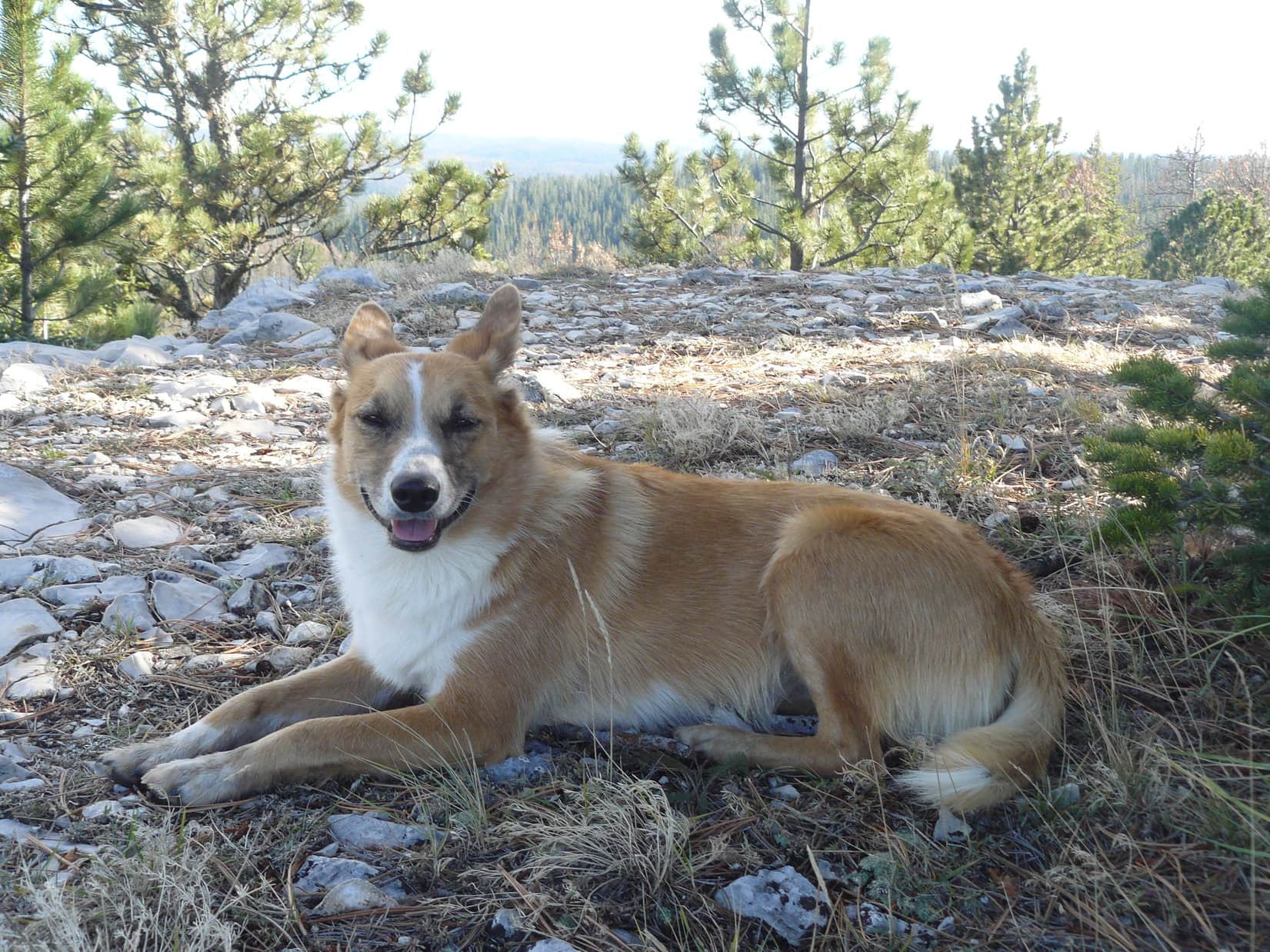
Lupe didn’t feel like it.  SPHP had to lift her onto the chair more than once to get her to stay put.  The Carolina Dog looked back questioningly at SPHP.  So soon after this morning’s terrible sadness?  It wasn’t even her real birthday yet!  That wasn’t until tomorrow.  Lupe was still 12.

The Dingo of Honor and her13th birthday cake.

No matter.  Everyone was here!  The champagne was flowing!  This was Lupe’s best attended birthday party ever by far!  People she hadn’t seen in years were here, but not for long.  Erik needed to leave for the airport in just a little while.  With time of the essence, SPHP lit the candles.  The resulting conflagration was more fearsome than ever, making Loopster nervous while the gathered throng sang “Happy Birthday” to her.

Loopster enduring the Trial by Fire! Owen & Emery at R.

Lupe didn’t even have time to make a wish.  The instant Happy Birthday concluded, Owen and Felix blew all the candles out in one mighty joint blast!  Cake and ice cream were served, subject to SPHP’s rule.  No one qualified for cake or ice cream until they appeared in at least one photo with the birthday girl.  Children were granted the opportunity to meet this draconian requirement first.

L to R: Asher, Emery, Lupe, Owen & Felix.

Women were next, followed by the men.  SPHP made certain everyone had to squint into the low December sun.

L to R: Cake & ice cream qualifiers Cassie, Yvonne, Xochitl, Andrea & Mush
L to R: Last, and no doubt least – Lanis, Joe, Steve, David, Erik & Matt

SPHP stayed busy scooping ice cream and serving champagne.  Someone else must have served cake.  Yvonne brought out presents from her and Lanis.  The party was so busy that they, and Lupe, got more or less lost in the shuffle.  The time flew!  Erik needed to go.  A final group photo was in order before he got away!

The whole gang! L to R standing: Steve, Lanis, Erik, Xochitl, Matt, Joe, Andrea, David, Mush. Kneeling and sitting: Yvonne, Felix, Asher, Cassie. Emery & Owen next to Lupe.

Leaving her own 13th birthday party, which was still going strong, Lupe went with SPHP and Erik to the airport.  By the time the American Dingo got back, her party was over.  Uncle Joe, Aunt Andrea, and new Cousin Dixie were still here, but by early tomorrow morning they’d be gone, too.

12-14-23, 8:00 AMBack down to just you and me, Loopster.  By the way, Happy Birthday!  You really are 13 now!  So, what did you think of that birthday party yesterday?  Sort of fast and furious, wasn’t it?  More like a blowout celebration of your last day of being 12.

It was fine, SPHP, except for one thing.  I wish Grandma could have been there.  She’s been at every one of my birthdays until this one.

I know, Loop.  Grandma would have loved to be here for you.  Almost made it, too, but we tried practically ever since we got back from Canada & Alaska and couldn’t save her.  Thought she was going to be fine when we had Thanksgiving dinner together.  She was the best she’d been in weeks, and in good spirits. 

Maybe I shouldn’t have eaten so much of her turkey, SPHP?

And all of mine to boot, Looper!  But no, that wasn’t the problem.  She was glad you enjoyed the turkey, and came to see her.

We won’t be seeing Grandma ever again, SPHP?

No, not in this world, Loop.

It’s hard to have your birthday party right after you bury your Grandma, SPHP!

I know, but you’re a source of joy to all of us, Lupe, and everyone was here.  If we’d had your party today, I would have been your only guest.

Promise me you’ll always be at all of my birthdays, SPHP!  And that you’ll stick with me every other day, too!

Silly Dingo!  You couldn’t get rid of me if you tried!

So now what, SPHP?  It’s my real birthday!  Is anything going to happen, or is the fun already all over and done with?

Well, I haven’t written a new post for your blog in months, and I’m way, way behind on countless other tasks, given all the adverse events we’ve run into this fall.

So you’re just going to work, while I stare out the window all day, SPHP?  Sounds like being 13 is going to get off to a crummy start.

Oh, no!  We’re not going to let that happen!  We’ve got the whole day.  How about a Black Hills expedition?

Now you’re talking, SPHP!  Where to?

It’s been super warm.  No snow at all around here.  Bet we can still get up into the high country.  How about Crooks Tower (7,137 ft.)?

Seems like forever since we’ve been to Crooks Tower, SPHP.  Let’s do it!

12-14-23, 10:17 AM, 38°F, Besant Park Road (USFS Road No. 206) – Well, there was a little snow here, but not an awful lot, an inch or two at best.  Lupe was thrilled to see it, and rolled in the frosty snow as soon as she leapt out of the RAV4 despite a chilly SW breeze.  The sullen gray clouds and cold air created a subdued wintry atmosphere, partially relieved by a large patch of blue to the S.

Parked just off Besant Park Road ready to set out for Crooks Tower. Photo looks SW.

You ready yet, SPHP?  Which way we going?

In a moment, Looper.  Crooks Tower is a few miles SW of here.  Rapid Creek Road (USFS Road No. 231) is just ahead.  We’ll take a L there.

Minutes later, SPHP was ready.  Onward!  Puppy, ho! time.  Reaching the junction with Rapid Creek Road, Lupe followed it SSW through a big field, trotting merrily along.  At the far end of the field, the road began losing elevation at a little faster clip as it curved SW into the forest.

At the intersection. Lupe followed Rapid Creek Road to the far end of the field. Photo looks S.
On Rapid Creek Road as it winds into the forest. Photo looks SW.

The gradual downhill road trek was super easy.  Didn’t take long for Lupe to reach an intersection with USFS Road No. 631.

Hang a R here Loop, and just keep going until we get to No. 631.1C.

At the start of USFS Road No. 631. Photo looks W.

No. 631 led WNW up the upper South Fork of Rapid Creek valley, but there wasn’t any surface water to be seen here.  Regaining lost elevation, Lupe passed both No. 631.1A and No. 631.1B on the R before reaching the spot where No. 631.1C split off about a mile from where she’d left Rapid Creek Road.

Heading up USFS Road No. 631. Photo looks WNW.
Approaching the junction with USFS Road No. 631.1B (R). Photo looks NW.
At the start of No. 631.1C (R). Photo looks NW.

Go R on No. 631.1C, SPHP?

Yup!  This is the start of the big loop we’re going to make, Loopster.  Later on we’ll be coming back to this point from the L.

No. 631.1C was a much more primitive route than Rapid Creek Road had been.  The clouds overhead were starting to break up.  Lupe was often in sunshine.  There seemed to be more potential for excitement here, but other than a soft breeze, the forest was quiet.  Nothing stirred.

Exploring USFS Road No. 631.1C. Photo looks NW.

After roughly 0.33 mile, a long, 20-30 foot high limestone escarpment was visible ahead on the R.  USFS Road No. 631.1C angled toward it, but by the time Lupe got to the escarpment, it and the road had pretty much vanished.  A tiny climb led up to a flat region.

Approaching the limestone escarpment (R). Photo looks NW.
Entering the flat region up on top. Photo looks W.

The roads gone, SPHP.  Now we’re in for some real exploring!

Been a very long time since we’ve been here, Loop, but if I remember right, there’s an old road somewhere nearby that’s not shown on the maps.  Let’s angle W.

Sure enough, Lupe ran into another road almost immediately.  Following it W, SPHP called a halt upon reaching a clearing.

At the edge of the clearing. Photo looks W.

OK, Loop.  I believe there’s a viewpoint we’ve been to at least a couple of times before off to the NW from here.  Nothing too magnificent, but we can head over to it for a look around, if you like, and take a little break.  Not too far away.  What do you think?  Want to do that?

Sure, SPHP!  Might as well, if we’re already close.  Leave the road here?

Yes.  Angle off to the R, Looper.

Heading off in search of the viewpoint. Photo looks NW.

Exploring happily, Lupe sniffed her way through a maze of trees, bushes, and open lanes.  Roughly 600 feet from the road, she came to the edge of a limestone escarpment.  Miles N, the top of Terry Peak (7,064 ft.) was in sight.  On the NW horizon, a forested ridge rose above others nearby.

Is that Cement Ridge (6,674 ft.) in Wyoming, SPHP?

I’ve sometimes thought so, Loop.  You can see that ridge from Crooks Tower, too.  Seems too far away to be Laird Peak (6,906 ft.), and too close to be Warren Peaks (6,650 ft.), but I just don’t know.  I’ve never been able to figure it out.

At the viewpoint 1.33 miles N of Crooks Tower. Mystery Ridge (Center) on the horizon. Photo looks NW.

Well, it didn’t really matter.  For 15 minutes, SPHP sat there enjoying the view while munching an apple.  Meanwhile, Lupe gobbled down some Taste of the Wild.  Checking the Carolina Dog’s GPS track on the iPhone, it said she’d gone 3.3 miles already.

Wandering farther W along the edge of the escarpment, Lupe discovered a stone fire ring.  Piles of gray branches nearby would have provided plenty of fuel for another fire.

By the stone fire ring. Photo looks WSW.

SPHP fished several Lupe treasures out of the fire ring.

Nice spot.  Wish people would pack out what they bring in.

Many do, SPHP!

Many don’t, too.  Well, we better keep going.  Back to the road, Loopster!

Returning to the road, Lupe followed it S.  When it turned W and started losing elevation, she left it to wander through clearings full of tall, brown grass.  Soon a forested ridge was visible ahead.

Back at the unmarked road. Photo looks SSE.
In one of the grassy clearings. Photo looks SE.
Approaching the ridge. Photo looks S.

That’s the N end of Crooks Tower, Loop.  We’re getting close!

The forested ridge was the steepest climb of the entire journey, but other than a fair amount of deadfall scattered across the slope, the ridge really wasn’t that much of an obstacle.  Before long, Lupe was standing below the N face of a 25 foot high rock formation.

Crossing USFS Road No. 189.4F on the way to the ridge. Photo looks SSW.
Steepest part of the ridge. Not bad at all! Photo looks SSW.
Below the 25 foot tall knob of rock. Photo looks SSE.

Is this Crooks Tower, SPHP?  It’s not the way I remember it.

Oh, we’ve been here at least once before, Loop.  Looks like we’re at Crooks Tower’s NNE summit.  The generally accepted true summit is a bit farther.

Scooting around the W side of the big rock formation, the American Dingo found a relatively easy way to scramble up to the top, where a loose pile of rocks apparently served as a cairn.

So this is the NNE summit, SPHP?  Can’t really see anything except trees.

Yes, this is it.  Get up on those rocks, Looper, so I can get a picture.  I sort of remember this cairn, and that we couldn’t see much last time we were here, either.  Might even be worse now that the trees have grown.

On Crooks Tower’s NNE summit. Photo looks NNE.

Five minutes was about as long as Lupe lingered.  Tree-broken glimpses of distant views were all the cramped NNE summit had to offer.  Not even a hint of the true summit, even though it really wasn’t far off at all.

Continuing on, Lupe made her way first S, then SW, through thick forest and deadfall.  Breaking out into the open, she reached the big field SE of the Crooks Tower summit block.  A quick stroll around to the SW, and a short, familiar path led to a 40 foot diameter top covered with scattered big pines, pine needles, and exposed rock.

Part of the field SE of the summit. Photo looks S.
On Crooks Tower. Photo looks S.

12-14-23, 1:18 PM, 41°F, Crooks Tower (7,137 ft.) Clear skies now!  The clouds were gone, but it hadn’t warmed up much at all.  A 10 mph SSW breeze still made it feel rather chilly.  After polishing off most of the rest of her Taste of the Wild, Lupe curled up on SPHP’s lap.

I do remember this place, SPHP.  We used to come here almost every year.

That’s right, Loop!  Even though the views are limited, Crooks Tower is one of the highest peaks in the Black Hills and long been a favorite.  This is your 11th ascent, and on your 13th birthday, too!  Makes it even more special.

I’m glad to be back, SPHP!  Seems like an awfully long time since the last time we were here.

SPHP smiled.

I looked it up before we came, sweet puppy.  Last time we were here was more than 4 years ago – on my birthday.  And now we’re here on yours.

Although still early afternoon, shadows cast by the sunlight filtering through the pines were already lengthening.  Not even mid-afternoon yet, and it already felt late.  As SPHP sat there stroking Lupe’s soft ears while gazing at the old familiar views, a certain sadness crept in.  Did Lupe feel it, too?  She was mighty quiet.

Dusty, Laddie, and now Grandma, all in less than 15 months.  Our world’s grown colder lately, hasn’t it, Loop?

It’s filling up with ghosts, SPHP.  I wish it weren’t!

Me, too, Looper.  Me, too.

The Crooks Tower region had another summit candidate more than a mile SW, plus a 7130 High Point nearly a mile S of that.  Now that Lupe was here for the first time in over 4 years, though, it seemed better to simply stay put and enjoy it rather than dash off.  The Carolina Dog had already traveled 4.7 miles, and going much farther would mean getting back to the RAV4 well after dark.

In any case, congratulations were in order!  Without getting up, SPHP shook Lupe’s paw, praising her for her 13th birthday ascent of Crooks Tower, then split an eagerly received chocolate coconut bar with her.

After that, no one moved.  SPHP wrapped the red rain jacket around Lupe to help hold in some warmth.  Minutes lost in thought ticked away.  Ghosts and days gone by!  Mere memories now, yet still so vivid, and seemingly perfectly real, it felt as if they could return anew even after long absence as easily as Lupe had returned to lay here on SPHP’s lap on Crooks Tower again today.

Gosh, look at the sun!  Can’t sit here too long, Loop!  Your summit hour is getting close to an end.  Let’s get some pictures before it’s time to go.

Upper end of the summit region. Photo looks ESE.
Near the N edge. Photo looks NNE.
Black Elk Peak (Center) from Crooks Tower. Photo looks SE.
A little below the summit. Photo looks NNE.
View to the ESE.
At the summit. Photo looks N.
Looking NNW.
New teenager Lupe on Crooks Tower. Photo looks NNW.
Looking SSW from the summit.

The best views were of Black Elk Peak (7,231 ft.) far to the SE.  Swinging toward the S, Green Mountain (7,164 ft.) stood out.  The only other real views were N in the general direction of the Mystery Ridge.

Black Elk Peak (L), Green Mountain (R). Photo looks SSE.
Mystery Ridge (L) on the horizon. Photo looks N.

So how was that, SPHP?  Get enough pictures?

Oh, I think so.  Well done, Loopster!

After a more than 4 year absence, an hour on Crooks Tower didn’t seem like nearly enough.  Nevertheless, at 2:18 PM, precisely an hour after she arrived, Lupe headed back down the short path to the SW.

Leaving Crooks Tower. Photo looks SW.

Instead of going back the way she’d come, though, just for fun, it was time to make the big loop SPHP had mentioned earlier.  Less than 0.5 mile WSW on USFS Road No. 189.4A got the American Dingo over to a big intersection with No. 189, the closest really good road to Crooks Tower, and No. 631.2C.

About to set out along USFS Road No. 631.2C. Photo looks SE.

A longer route than Lupe’s ascent, the return was otherwise even easier.  In brilliant sunshine, at first, Loopster enjoyed the long gradual descent along No. 631.2C.

Part of the easy trek along USFS Road No. 631.2C. Photo looks SE.
Loopster enjoying the romp. Photo looks NW.

By the time Lupe got back to No. 631, the sun was behind the mountains.  A bit farther on, Lupe passed the turn she had once taken into Trebor Draw where she’d been injured years ago.  Continuing N beyond this point, another ancient memory stirred in SPHP’s mind.

You know, Loop, I seem to remember a fairly well-formed arch up on one of these hillsides to the L somewhere along this road.  Help me keep an eye out for it, would you?

Sure thing, SPHP!  Arches are rare in the Black Hills.  I’ll let you know if I see one.

It wasn’t until Lupe was well past a junction with USFS Road No. 631.1E that there it was, an arch up on the hillside to the L!  The Carolina Dog went up to it for a closer look.

It’s an arch alright, SPHP! Photo looks NNW.

Well, I’ll be!  The arch really is here, Looper.  My memory of it was so faint that I wasn’t even sure this was the right road.

You were right, SPHP!

Imagine that!  Does happen now and then.

The sun was down, but it was still light out when Lupe reached Rapid Creek Road again.  No traffic at all.  In fact, Lupe hadn’t seen anyone, not even any animals, other than a few small birds, all day long.

On the final stretch near day’s end. Photo looks N.

12-14-23, 4:50 PM, 30ºF – The light was fading fast when Lupe’s 11.4 mile 13th birthday round trip journey to Crooks Tower came to an end.  She’d had a great day up in the high country of the western Black Hills, and as it turned out, more excitement and festivities were still ahead.

During the dark drive home, a herd of nearly 20 giant deers suddenly ran across the road right in front of the RAV4, provoking a hysterical barking attack.  Once home, SPHP suggested another photo session with Lupe’s presents, the two that Lanis and Yvonne had given her yesterday during all the commotion of the big birthday bash, plus one that SPHP had been holding out on.

Loopster with her presents from Yvonne & Lanis.
Biscuit Bistro all-natural gingerbread dog treats. One turned out to be a snowman, the other was Santa.
A big roll of Red Barn grain-free, beef recipe rolled dog food.
Loop with her T-bone steak from SPHP.
1.41 pounds of delicious!

Oh, you did remember, SPHP!  My birthday T-bone steak!  Can I have it now?

Yes, ma’am!  Right after I broil it for you.

Then hop to it, SPHP!  I’m starving after spending all day roaming around up at Crooks Tower.

You’re wish is my command, Teeny-Bopper, Dingo!

Lupe on her 13th birthday at Crooks Tower, Black Hills of South Dakota 12-14-23
With Grandma on Lupe’s 1st birthday. 12-14-11.

Links:

Lupe’s 12th Birthday

Next Black Hills Expedition               Prior Black Hills Expedition

Want more Lupe adventures?  Check out Lupe’s Dingo Tales Adventure Index, Black Hills, SD & WY Expeditions Adventure Index, Master Adventure Index, or subscribe free to new Lupe adventures!

Black Hills, SD Expedition No. 254 – Black Fox to Crooks Tower (11-24-19)

9:02 AM, 43ºF, USFS Road No. 231 just past the turn to Buck Spring – Not gonna make it!  Getting high-centered in this crusty, rutted snow wouldn’t be good.  The G6 had been scraping bottom at intervals for the last 0.25 mile.  Didn’t look like the situation was getting any better up ahead.  SPHP gladly pulled off No. 231 at a snowy opening on the R.

Close enough!  Black Fox couldn’t be too much farther.  Lupe could start from here!  Encouraged by conditions on Expedition No. 253, SPHP had been convinced the American Dingo could still get up into the western Black Hills high country, despite the late November date.  Might be the last chance Loop would have in 2019.  The G6 just wasn’t built to handle much in the way of ice and snow.

What an incredible morning!  Bounding out of the G6, Looper thrashed about on the snow in ecstasy, biting off mouthfuls of the crunchy upper crust.  Oh, it was going to be a great day for a romp in the hills!  As soon as SPHP was ready, she set off heading SW on USFS Road No. 231.

Waiting for SPHP to get with the program! Photo looks SW.

No. 231 was snow-packed and slippery, but level and an easy trek.  The cool fresh air and pine scent were exhilarating!  Morning sunlight cast long blue shadows on the glittering white snow.  Looked and felt like winter up here already, a winter still young and mild.

Oh, what a fabulous morning! We’re on our way to Black Fox.

0.5 mile brought Lupe to an intersection.  Here she turned L (S) on USFS Road No. 233, almost immediately thereafter crossing a bridge over the S Fork of Rapid Creek.  Somewhat surprisingly, she passed several vehicles S of the bridge.  Hunters?  Probably.  No one was around at the moment.  Black Fox campground was just around the next bend.

At Black Fox campground, a quiet spot in late November!

Black Fox was closed this time of year.  Snow was everywhere.  Lupe stopped for a look at the Rhoads Fork of Rapid Creek.  The frigid, dark water plunged over a tiny waterfall before flowing deeper into the shady, green forest.

By the Rhoads Fork of Rapid Creek.

No. 233 went SW up the Rhoads Fork valley, if up is the correct word.  For 0.5 mile, the road was flat, or nearly so, all the way to a junction with side road No. 233.2D.  A nice, rustic cabin with a sign saying “Minnelusa Tepee” was tucked off in the pines to the L.  A deer on the road ahead caught Lupe’s attention, but as soon as it disappeared into the forest, she headed NW (R) on No. 233.2D.

At the intersection of No. 233 (L) and No. 233.2D (R). Photo looks SW.

Going up Beaver Draw, No. 233.2D climbed steadily.  The road was even snowier here.  Thankfully, several vehicles had compressed a couple of tracks.  Loopster kept a careful watch for squirrels and deer, but had no luck.  The trudge up the secluded valley was pleasant and quiet.

The road eventually curved W.  A mile from the junction with No. 233, Beaver Draw began to widen out.  Lupe came to a snowy clearing.  This wasn’t the top, but it felt like she was starting to get close.

Checking for squirrels in Beaver Draw. Photo looks SE.
On No. 233.2D in Beaver Draw. Photo looks NW.
At the snowy clearing a mile from No. 233. Photo looks WNW.

The road kept climbing longer than expected, although at a diminishing pace.  Beaver Draw widened out into a broad amphitheater.  To the N, low limestone cliffs came into view.  No. 233.2D turned SW, becoming muddy and icy.  To facilitate logging operations, the road had recently been graded here.  Lupe passed piles of dead trees.

No. 233.2D became icy as Beaver Draw opened up. Photo looks SW.
Passing a pile of dead trees in upper Beaver Draw. Photo looks NE.

No. 233.2D skirted the S side of the amphitheater, climbing faster again.  Lupe finally reached some high ground where the terrain leveled out.  From here she had her first glimpse of a distant view.

Finally starting to get high enough to see something! The distant hills are part of the N end of White Tail Peak (6,962 ft.).  Photo looks E.

As near as SPHP could tell, Lupe was now on a plateau about a mile S of Trebor Draw.  There was an unmarked intersection near the viewpoint.  One road went N along the W rim of the Beaver Draw amphitheater.  However, Lupe took the road going SW.  For a while she gained a little more elevation, but after that the terrain was pretty flat, undulating only slightly up or down.

This territory was all above 6,700 feet, quite high for the Black Hills.  Even so, Lupe came to no more viewpoints.  The snow was generally deep enough to make exploring the forest too laborious to be worth the effort.  For the most part, the American Dingo stuck to the road, trotting along happily in the fresh air and sunshine.  As the day warmed up, the road became increasingly soft and muddy.  SPHP marched along the snowy edges whenever possible.

By one of several snowy clearings on the plateau. Photo looks SW.

The road system didn’t match up with SPHP’s old maps.  An expected mile long detour to the S and back again, never happened.  Thinking Loop was still on No. 233.2D, SPHP was surprised when she came to a sign saying this was actually USFS Road No. 419.

Hey, SPHP! Look! We’re already on No. 419! Where that had happened was a mystery. Photo looks SW.

No. 419 continued SW.  After a while, Lupe began to lose elevation.  A ridge came into view beyond a snowy side road.  Along in here, No. 419 curved W.  The Carolina Dog quickly came to two intersections very close to each other at a low pass.

The largest clearing along No. 419. The snow was deep here! Photo looks S.
Still on the high ground along No. 419. Photo looks SSW.
The ridge seen ahead came into view as No. 419 began to curve W. Photo looks SW.

These intersections were a mess with lots of ground recently torn up by bulldozers.  The only marker still evident was for the road coming up from the S, which said No. 189.2.  Made sense.  SPHP knew where Lupe was now.  This minor pass was 0.75 mile N of Bombard Draw.

Crooks Tower (7,137 ft.), Lupe’s peakbagging objective for the day, was now 1.5 miles NW as the crow flies.  The road going N from this pass had to be USFS Road No. 631.  Ordinarily No. 631 would be both the quickest and most direct route, however, it was a minor road.  Not too likely any traffic would have gone very far that way with so much snow around!  SPHP suspected the valley immediately S of Crooks Tower would be full of deep, pristine snow.

So Lupe took the road leading W, a continuation of No. 189.  Leaving the pass, the road curved SW and began climbing along the side of a fairly steep slope.  Soon Lupe was getting close to the ridge she had seen from No. 419.  However, the road didn’t cross the little valley leading to the ridge.  Instead it turned NW proceeding up the near side of the valley.

A closer look at the ridge Lupe had seen from No. 419. Photo looks SW.
Another view of the same ridge from farther up the valley next to it. Photo looks S.

Lupe stuck with No. 189 as it wound higher.  Way up here, conditions were even snowier.  Small rock outcroppings began to appear.  For a while, Loop climbed steadily, but the pace eventually slackened.  The road finally turned N and leveled out.

Following No. 189 higher. There was even more snow up here. Photo looks NNW.
Approaching small limestone formations on the R. Photo looks NW.
No. 189 leveled out at 7,100+ feet. Photo looks N.

The Carolina Dog was already at 7,100+ feet, nearly as high as Crooks Tower itself, but still a mile from it.  Continuing N, she now lost a bit of elevation.  0.33 mile WSW of Crooks Tower, Lupe reached a junction with USFS Roads No. 631.2C and No. 189.4A.  As SPHP had suspected, No. 631.2C was buried beneath a thick blanket of pristine snow.  Good thing Loopster hadn’t tried to come up that way!

Continuing N on No. 189. Photo looks NNE.
At the upper end of USFS Road No. 631.2C. Never would have made it coming up this way! Photo looks S.

No. 189.4A goes almost to the top of Crooks Tower (7,137 ft.).  Clearly no one had been this way since the last big snow.  Lupe began the trudge E.

At the start of No. 189.4A. Photo looks E.
So what is this, training for the Iditarod? Don’t get any big ideas, SPHP! I’m not pulling you on any Dingo sled! Photo looks E.

At last, the final 15 foot climb to Crooks Tower’s summit appeared.  As hoped, winds had swept part of the summit free of snow.  Sweet!  Lupe could relax in relative comfort.

Approaching Crooks Tower’s summit (L). Photo looks NE.
Luckily, part of the summit was snow-free. Photo looks E.

Only mid-afternoon, but November days are so short that it still seemed late.  The cheerful sunshine had vanished.  Most of the sky was overcast, not darkly, but gray enough to produce a subdued mood.  Lupe hadn’t seen a soul all day.  Despite the relatively easy road hike, Crooks Tower felt isolated and remote.

Crooks Tower is one of the highest peaks in the Black Hills, yet this area wasn’t rugged.  Consequently the views weren’t all that impressive.  The best was a distant look at Black Elk Peak (7,231 ft.) far to the SE.  Miles to the NW was a high ridge that might have been Laird Peak (6,906 ft.).  Forest blocked the views in other directions.

Lupe went to the highest spot, a flat area toward the N.  After claiming her peakbagging success, she took a quick look at the best views before curling up on SPHP’s lap facing Black Elk Peak.

At the true summit of Crooks Tower. Photo looks NNE.
SPHP thought the high ridge in the distance (L) might be Laird Peak. Photo looks NW.
Hmm. Didn’t really look like Laird Peak with help from the telephoto lens. Might actually be Cement Ridge (6,674 ft.).
At the slightly lower S end of the summit area. Black Elk Peak (L of Center) is in view on the horizon. Photo looks SE.
Black Elk Peak (L) with help from the telephoto lens. Photo looks S.

Pines sighed in a 10 mph NW breeze.  Far to the E, a big patch of blue sky lingered out over the unseen plains beyond the hills.  Everywhere else the mood was subdued beneath the gray smudge of wintery clouds.  Cool out, but not cold.  40ºF?

The view was familiar.  Crooks Tower is a favorite place.  In fact, Lupe had been to Crooks Tower more times than to any other mountain.  This was her 10th ascent.  Yet Loop hadn’t been here in more than 2.5 years.

Snow, silence, solitude.  It felt good to be back, if only for a little while.

Lupe near the spot where she took a break on SPHP’s lap. Photo looks SE.
The N end of the summit region. Photo looks N.
The S end. Photo looks S.
Looking E toward a ridge nearly as high as the top of Crooks Tower.

For nearly 40 minutes, Lupe remained up on Crooks Tower.  It would be dark before the American Dingo reached the G6 again.  Before departing she returned briefly to the true summit.  A final glance at the familiar views to the NW and SE, and that was it.

Back at the true summit. Photo looks E.
Last moments at the S end. Photo looks SSE.

Leaving the summit, Lupe had scarcely reached USFS Road No. 189.4A, when gunfire erupted somewhere to the N.  Hunters!  The courageous Carolina Dog begged SPHP for protection.  Not to worry.  She was fine.  A few shots, and that was it.  Silence returned, and the snowy trek back to the main road began.  It didn’t seem as far going downhill.

Starting back on USFS Road No. 189.4A. Photo looks SW.

The return trip was otherwise uneventful.  Lupe went back the same way she had come.  Such a beautiful, quiet time following these remote USFS roads!  Up here it already felt and looked like Christmas.  Of course, the light eventually began to fail.  Going down Beaver Draw, twilight faded.  In darkness, Lupe passed Black Fox.  Expedition No. 254 was over.  (5:31 PM, 41ºF)

A visit to Crooks Tower had been long overdue!  SPHP was glad Lupe had done it.  Six days later, on the last day of November, a blizzard struck the Black Hills dumping 2 additional feet of snow.  Expedition No. 254 really had been her last chance to visit the western high country of the Black Hills in 2019.  Fortunately, Lupe had made the most of it!

Returning from her 10th ascent of Crooks Tower, Black Hills of South Dakota, 11-24-19

Links:

Next Black Hills Adventure             Prior Black Hills Expedition

Black Hills, SD  Expedition No. 204 – Clayton Pond, Crooks Tower & Peak 6820 (5-13-17)

Black Hills, SD Expedition No. 135 – Peak 6820 & Crooks Tower (6-27-15)

Black Hills, SD Expedition No. 99 – Peak 6820 & Crooks Tower (10-8-14)

Want more Lupe adventures?  Check out Lupe’s Black Hills, SD & WY Expeditions Adventure Index, Master Adventure Index, or subscribe free to new Lupe adventures!

Black Hills, SD Expedition No. 99 – Peak 6820 & Crook’s Tower (10-8-14)

11:00 AM (60°F).  Rather a late start for Lupe’s expedition, but she would still have fun.  She was about to spend the rest of this glorious early fall day roaming the high country of the western Black Hills.  The sky was a clear blue with a few wispy clouds.  The air was calm, stirred only by an occasional light breeze.  The American Dingo was raring to go!

The G6 was parked just S of the W end of Besant Park at the junction of USFS Road No. 206 (Besant Park Road) and No. 206.2D.  As soon as SPHP let Lupe out of the G6, she streaked off across No.  206 racing N into a huge field that was part of Besant Park.  Oh, no!  She had T-bone steak on her mind!  Two black cows fled at the sudden noisy appearance of the bold Carolina Dog.  SPHP hadn’t noticed them, but Lupe sure had.

Lupe barked a couple of times just for good measure as she gave up the chase.  From far away, a brown and white streak came racing back across the field to SPHP.  The cows, also now very far away, mooed unhappily at having been disturbed.  A couple minutes later, Lupe arrived back at SPHP out of breath and panting hard.  She had a huge grin on her face.  Yes, this was already a glorious day!

It was time to move on before Lupe really got into trouble.  While she had been running around in Besant Park, SPHP saw something Lupe hadn’t noticed.  Quite close by, off in a much smaller unfenced field to the SW, a huge black bull was grazing.  SPHP hurried Lupe S on No. 206.2D.  Let’s go find Peak 6820 and leave the cows alone!

Peak 6820 was Lupe’s primary peakbagging goal for the day.  SPHP wasn’t entirely certain Lupe hadn’t been there once before.  Back on Black Hills, SD Expedition No. 58 on 5-11-13, Lupe had climbed a high ridge somewhere not too far to the E.  Maybe it was possible that ridge was part of Peak 6820?  It would be fun to find out.

Lupe didn’t stay on No. 206.2D very long.  After she had gone several hundred yards, SPHP noticed a trail heading E.  Peak 6820 was only about a mile to the E, so Lupe and SPHP followed the trail.  It climbed through the forest and arrived up on a high ridge.  SPHP recognized the ridge as the same one Lupe had been to on Expedition No. 58.  It wasn’t part of Peak 6820, though.  About 0.75 mile away, SPHP could see a modestly higher forested hill to the E.  That hill had to be Peak 6820!

Even though it wasn’t going to take Lupe any closer to Peak 6820, Lupe and SPHP explored the ridge Lupe was on around to the NNE.  At first the ridge was fairly broad, open and grassy.  The N end, though, was all in the forest.  SPHP had been hoping for a view of Besant Park to the N, but any view was hidden by the trees.  Lupe and SPHP returned S to where Lupe had come up.

Lupe could have gone down into the valley heading straight toward Peak 6820. However, it looked like she might not have to lose so much elevation, if she followed the ridge she was already on to the S.  It looked like this ridge would eventually swing around to the E toward Peak 6820.

Lupe and SPHP headed S following the ridgeline.  The ridge stayed about the same elevation, but gradually grew narrower.  Lupe came to several rock outcroppings, but the rock formations ended as Lupe approached a shallow saddle.  The saddle led over to the next ridge to the S.  Down in the saddle, Lupe found a dirt road, possibly another part of No. 206.2D.  She followed the road only a short distance before leaving it to angle SE up onto the next ridge.

The next ridge did go E.  As Lupe followed this second ridge, she could sometimes see White Tail Peak (6,962 ft.) to the S.  The second ridge started out as a broad, level mix of forest and meadows, but became narrower and rockier as Lupe went E.  The level part of the ridge ended at a small limestone cliff.  Lupe and SPHP had to double back to the W, and then turn SE to get past the cliff.

Lupe came to another saddle.  Everything to the NE was down in a thickly forested valley in the direction of Peak 6820.  To the SW, the land sloped down more gently into a sunnier, thinly forested area.  Ahead, another ridge rose to the SE.  Lupe and SPHP went up to the high point.  Lupe could see Peak 6820, but she wasn’t much closer to it.  Peak 6820 was still 0.5 mile away, but now to the NNE.

By now, it was clear that Lupe was going to have to lose some elevation to get to Peak 6820.  Lupe and SPHP went NW back down to the saddle, turned NE and plunged down into the forest.  There was quite a bit of deadfall timber, which slowed SPHP down considerably.  It wasn’t too far to the bottom of the valley, however, and once down there, Lupe came to a faint road.

Lupe followed the road NNW, slowly regaining elevation.  She soon arrived at an odd place.  Hidden down here in a small glade, was a huge metal water tank.  Nearby stood a an old tower with a rickety ladder leading up to a small warped platform at the top.

Lupe reaches the hidden water tank and tower down in the forest SW of Peak 6820. Photo looks N.

The water tank was nearly full to the top with a rusty brown water so murky SPHP could see only an inch or two into it.  Perhaps the tower had featured a windmill at some point in time?  A horizontal pipe stuck out over the water tank from near the base of the tower.

This photo shows the horizontal pipe hanging out over the water tank, and the sagging platform at the top of the tower. Photo looks NE.

Not too far to the NNE, Lupe came to another odd place.  A square area about 25 feet long on each side was fenced off by a barbed wire fence.  Inside the fence was a wooden framed structure only 6 inches high.  The wooden framework was completely covered with sheets of metal nailed to it.

Lupe sniffs around near the possible mine shaft cover SW of Peak 6820.

SPHP didn’t like the looks of it.  The only reason SPHP could think of for such an odd structure was that it served as a cover for a large, deep mine shaft.  If so, it was there to protect people or animals from a potentially fatal fall.  The cover looked like it had been here for years.  Who knew how structurally sound it still was, or how deep the hole hidden beneath it?

One thing about SPHP’s theory didn’t make sense.  There didn’t seem to be a tailings pile anywhere around.  There should have been a pretty big one nearby, if this was really the site of an old mine shaft.  Very strange!  Whatever the explanation, SPHP didn’t think anything good could come from lingering around here.  Lupe continued NNE toward Peak 6820.  She soon found another old road, or maybe it was the same one that had led to the water tank and tower.

The old road went NNE up the side of Peak 6820.  Parts of the road were clear, but much of it was choked with deadfall timber.  Lupe and SPHP spent more time off the road than on it trying to get past all the deadfall.  Shortly before reaching the top, the road veered E.  It emerged up from the forest at a fairly large clearing on Peak 6820.

The first thing Lupe noticed was a mud puddle large enough to bathe in.  She ran over to it, plunked herself down to cool off, and lapped up lots of very murky-looking water.  She emerged refreshed and well supplied with both essential and non-essential minerals, evidently quite satisfied with the experience.

The summit area on Peak 6820 is large and flat.  Much of it is open meadow, but the meadow is entirely fringed by forest.  There was hardly even a glimpse of a view in any direction.  Lupe and SPHP set off to explore the area.  The highest ground seemed to be a little way E of where Lupe had come up.

Lupe on Peak 6820. This point toward the S central part of the summit area seemed to be as much the true summit as anywhere else.

After exploring to the S and E, Lupe and SPHP returned to the mud puddle on the way to explore the N and W parts of the mountaintop.  Naturally, Lupe couldn’t resist taking another dip.

Double-dipper Lupe emerges from her Dingo-sized mud hole on Peak 6820 for a 2nd time.

Explorations to the N and W revealed only that the jeep trail Lupe had followed up the mountain continued over the top and on down the other side to the NNE.  There were some cliffs lower down toward the NW, but they weren’t terribly tall and were buried so deeply in the trees that even the cliffs didn’t provide any views.

With the summit area now fully explored, Lupe and SPHP left Peak 6820 heading WNW.  This time Lupe went down into the valley between Peak 6820 and the ridge to the W.  The terrain forced SPHP to the WSW for a little while, but eventually Lupe and SPHP were able to turn WNW again.  There was no trail and a considerable amount of deadfall timber to contend with, but this was a more direct route back to the G6.

The climb back up onto the ridge to the W was rather slow due to the deadfall, but once there, Lupe and SPHP made rapid progress again.  Lupe followed the ridge N to the trail she had been on early in the day.  She followed the trail W back to No. 206.2D, and then N to the G6 (2:46 PM, 66°F).

Approaching the G6, SPHP saw that there was now a big herd of black cows across USFS Road No. 206 in Besant Park.  This time, Lupe didn’t get to run after them.

Lupe would have loved to have more fun with these cows in Besant Park, but party pooper SPHP wouldn't permit it.
Lupe would have loved to have more fun with these cows in Besant Park, but party pooper SPHP wouldn’t permit it.

There was still plenty of time left in the day for Lupe to do some more exploring.  Crooks Tower (7,137 ft.) was only 3 miles away to the WSW as the crow flies.  Lupe had been there before, but it would still be fun to see it again.  It was still quite a long winding way to Crooks Tower from here, though.  To save some time, Lupe and SPHP hopped in the G6 and drove around to a closer point.

SPHP parked the G6 again at 3:09 PM (61°F).  Lupe was now only 0.33 mile W of Crooks Tower at the intersection of USFS Roads No. 189 and No. 189.4A.  Lupe and SPHP headed E on No. 189.4A.  Before long, Lupe had completed her 5th ascent of Crooks Tower!

Lupe relaxes on Crooks Tower. This was her 5th ascent.

The summit of Crooks Tower is a relatively small (large room-sized), level limestone platform.  Although Crooks Tower is one of the very highest mountains in the Black Hills, there are plenty of ridges almost as high in the area.  The ridges and forest block the views in most directions, but Harney Peak (7,242 ft.) can be seen far to the SE.  There is a less dramatic distant view off to the N, too.

SPHP had never realized it before, but by standing at just the right spot and peering between tree branches, it was possible to get a look at Inyan Kara (6,360 ft.) off to the WNW in Wyoming.

Harney Peak (L) can be seen on the far horizon from Crooks Tower. Photo looks SE.
Looking N from Crooks Tower.

After enjoying the views from Crooks Tower, Lupe and SPHP returned to the G6.  There were still at least a couple of hours of daylight left.  SPHP pondered what Lupe should do next?  The top alternatives were a visit to Clayton Pond, or exploring USFS Road No. 189.4B.  Since Lupe was practically at No. 189.4B already, it won out.

Lupe and SPHP left the G6 where it was, and went right on by to USFS Road No. 189.4B.  The only marker at the start of the road wasn’t entirely legible, but seemed to indicate this was No. 189.4C or 189.6C, but that didn’t agree with SPHP’s USFS map.

No. 189.4B led Lupe WNW down a shallow valley.  The ridge to the N was sunny and thinly forested.  The S side of the valley was shady and densely forested.  Tall grass, taller than Lupe, lined both sides of the road.  Lupe virtually disappeared on her little side excursions.  She soon tired of having to leap up to see where she was, and stayed mostly on the road.  The road gradually and steadily lost elevation.

After more than a mile, there was a fence with a gate.  Ten minutes after going through the gate, Lupe reached an intersection.  USFS Road No. 189.4C went S.  No. 117.6B went N.  Off to the NNW, a curve in No. 117 could be seen up ahead across a big open field in a larger, wider valley.  Lupe and SPHP followed No. 117.6B all the way to No. 117.

USFS Road No. 117 as seen from No. 117.6B. This corner of No. 117 was as far as Lupe managed to get on her explorations WNW of Crooks Tower. Photo looks WNW.

By the time Lupe reached No. 117, she was 2 miles from the G6.  The sun was getting low.  It was time to turn back.  SPHP checked the maps for an alternate route, hoping Lupe could make a loop.  No, she really couldn’t.  Other roads in the area were too long, and it was too late in the day to cut directly through the forest.  Lupe and SPHP returned on No. 189.4B, this time going up the valley, instead of down.

On the way back, SPHP started thinking it might be fun to watch the sunset from Crooks Tower.  Even though forest hid the views to the W at the very summit, there was a ridge almost as high just S of USFS Road No. 189.4C a short distance SSW of the true summit.  Maybe Lupe could see the sunset from there?

Lupe arrived up on the ridge with a little time to spare.  The W end of the ridge ended at a small limestone cliff.  It wasn’t high enough to really get a good view to the W, but the view in that direction was better than it would have been at the true summit of Crooks Tower.  SPHP sat down next to a tree to wait.  A chipmunk darting around on the rocks nearby entertained Lupe.

Lupe watching the chipmunk (not pictured).

The chipmunk eventually ran off.  Lupe rested on the ground near SPHP.  The edges of her big, soft attentive ears glowed in the last rays of sunlight.Lupe near Crooks Tower, 10-8-14

Waiting for sunset.
Waiting for sunset.

Sunset from SSW high point on Crooks Tower, 10-8-14When the show was over, Lupe and SPHP continued on to the true summit of Crooks Tower.  Lupe made her 2nd ascent of the day, and 6th all time.  The full hunter’s moon was due to come up soon.  Darkness fell and stars began to appear.  Lupe and SPHP waited.  As the pale moon rose, a lone coyote began to howl.  Lupe was entranced.

For several minutes, the lone coyote howled, pausing now and then to listen.  At last, very faintly from far to the W came a few answering howls.  That was good.  The coyote had a friend.  So did SPHP.  It was time to take her home.  (7:06 PM, 41°F)Lupe at sunset SSW of Crooks Tower, 10-8-14

Links:

Next Black Hills Expedition                    Prior Black Hills Expedition

Want more Lupe adventures?  Choose from Lupe’s Black Hills Expeditions Adventure Index or Master Adventure Index.  Or subscribe free to new Lupe adventures.