Who was that on the phone, SPHP? The fanatic again?
Yup! He’s run into 3 feet of snow on the road to Crooks Tower(7,137 ft.), so he’s got a much longer hike ahead of him than expected. Going to be running late. Won’t arrive here until sometime this evening now.
The “fanatic” was Dennis Stewart, aka “Stewy”. Neither Lupe nor SPHP knew Dennis, but that was about to change. He was a man on a mission, many missions, actually. Dennis’ purpose on this particular trip was to climb the 10 highest named peaks, plus the 10 highest named county high points, of both South Dakota and Nebraska.
Fanatic wasn’t an unfair label. Dennis owned the tallest indoor climbing wall in the Midwest – 32 feet high, more than 500 square feet of surface area, with an 11 foot overhang – a feature incorporated into his private home! At the tender age of 73, Dennis was still working on so many peakbagging lists that he knew there was no way he would ever come close to completing many of them.
No doubt about it, Loop. Dennis is our kind of fanatic!
After reaching the Black Hills region earlier today, Dennis had already been to both Terry Peak(7,064 ft.) and White Tail Peak(6,962 ft.). Tomorrow, Lupe and SPHP were going to join him on his quest.
At least, that was the plan. Dennis was not only a prolific peakbagger, but a runner, too. At one point in his life, Dennis had helped set a world record in the 2 mile relay as a member of the University of Kansas track team. In 2019, Dennis had won the 800 meter in the Huntsman World Championship in his age category.
Worrisome, actually.
If Dennis takes off running up all the mountains tomorrow, feel free to run right along with him, Loopster. You know me. Not even going to try to keep up.
5-4-22, 9:24 AM, Flag Mountain – Dennis had reassuringly promised not to run up any mountains, although it would have been fine if he did. SPHP had no intention of slowing him down. Flag Mountain(6,937 ft.) wasn’t going to be a problem in any case. A simple drive up. After SPHP parked the RAV4 at the end of USFS Road No. 416, a set of stone steps was all that had to be managed to reach what was left of the old fire lookout tower up top.
The only real issue was the weather. Although Flag Mountain normally offered sweeping views of a huge swath of territory E of the edge of the limestone plateau country, Lupe wasn’t going to get to show off her Black Hills to Dennis here today. Foggy and snowing!
Loop and Dennis arriving at the end of USFS Road No. 416.Heading up the stone steps.On the summit ridge near the remnant of the fire lookout station. Photo looks E.
While Dennis searched for the survey benchmark shown on the map out along the W end of the summit ridge, Lupe got up on what was left of the lookout tower foundation wall. Unfortunately, no hint of the usual grand view was to be seen.
Dennis searching for the survey benchmark. Photo looks W.Looper up on the wall.
Dennis found no sign of the survey benchmark. Loopster had been to Flag Mountain on half a dozen prior occasions. SPHP kind of thought that she actually had seen the benchmark somewhere up here before, but couldn’t find it, either.
Stewy had a routine he went through at each mountain he visited. It was interesting to see how he operated. Verbal notes, some of which were based on his phone’s GPS, were taken by speaking into a portable recorder. Date, time, distance traveled, elevation gain, exact location and elevation, weather and route conditions, what views were present, and anything else Dennis felt might be of interest were all mentioned. This data would eventually serve as the basis of written records and a trip report which he would post online.
Since he usually traveled alone, Dennis also had a separate camera and tripod he could use to take a decent selfie at each summit.
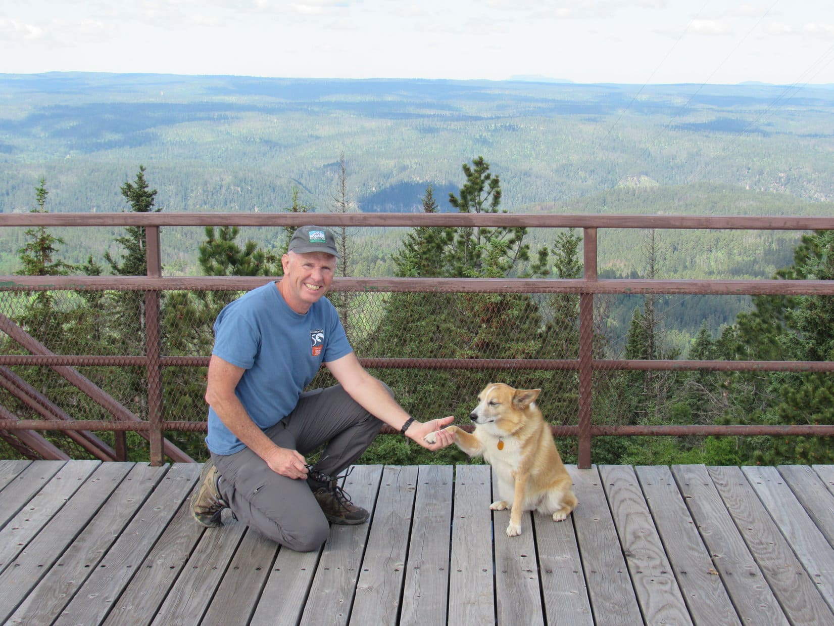
Lupe and Stewy on Flag Mountain, their first Black Hills summit together.
Given the weather, there wasn’t much reason to linger. As snowflakes continued to fall, everyone headed back down to the RAV4.
Down by the RAV4 again. Photo looks SW.
Since tomorrow’s forecast was much better, and Dennis had already spent the last 4 days since leaving home peakbagging, he was inclined to call it a day. After all, why climb mountains in this soup, and not get to see much of anything? In the meantime, he could relax in comfort while catching up on some of his record-keeping.
Made perfect sense, except for two things. The next peak on Dennis’ list was Crows Nest Peak(7,048 ft.). Although not all that far from Flag Mountain, Crows Nest wasn’t anywhere near the other Black Hills peaks Dennis still needed to tag. A quick visit to Crows Nest while in the area made sense from the standpoint of efficiency alone.
Furthermore, Dennis wouldn’t miss out on a thing by making the jaunt up Crows Nest today. At over 7,000 feet, Crows Nest Peak was certainly among the highest points of the entire Black Hills range, but incredibly misleadingly named. The surrounding territory was gently rolling and mostly forested. No distant views of, or from, the summit even on the best of days.
Lupe’s local expert advice was to climb Crows Nest today. Stewy was willing to give it a shot.
5-4-22, 10:23 AM, Boles Canyon Road and USFS Road No. 117.5K – Lupe was happy! She sniffed around while Dennis finished getting ready. Although remote Crows Nest Peak was a favorite place, the Carolina Dog hadn’t been here since the day of her Mighty Dingo Missile Launch nearly 4 years ago. This time, Loop was looking forward to an easy, and less painful, mile long romp up to the red dirt pond near the summit.
USFS Road 117.5K from Boles Canyon Road. Photo looks N.
A faint road took off to the SE through open territory from here. Within just a few minutes, Dennis was ready to go. Lupe, Stewy, and SPHP set off along the faint road, heading for the trees.
The faint road (Center beyond Lupe) serving as the start of the route to Crows Nest Peak. Photo looks SE.Stewy and Lupe about to set out. Photo looks SE.
Upon reaching the forest, the faint road merged into USFS Road No. 266. After passing through a gate in a barbed wire fence, the steepest part of the trek was ahead. Nothing too difficult, culminating in a snowy stretch near the top.
On USFS Road No. 266, looking back toward Boles Canyon Road. Photo looks NW.On the snowy stretch. Photo looks SE.Getting near the top. Photo looks SE.
The snowy stretch ended and the road flattened out, becoming a sloppy mess as Lupe entered a clearing that had been logged off years ago. No. 266 began angling E across the clearing. Before long, it would lead to a side spur that went N up to the red dirt pond near the Crows Nest Peak summit, but there was little benefit to traipsing through the mud.
Abandoning the road, everyone headed NE, cutting across the clearing. Lupe was soon in an aspen forest, hopping over deadfall and winding around bushes, as she worked her way up a slope.
In the clearing where No. 266 leveled out. Photo looks E.Among the aspens.
As the terrain flattened out again, Lupe reached the spur that came up from No. 266. The red dirt pond was just around the next bend.
Dennis and Loop across the red dirt pond. Photo looks SW.
The Crows Nest Peak survey benchmark was only 300 feet E of the pond, tucked away deeper into the forest. Looper led Dennis right to it. The surrounding terrain was so flat that, as far as could be determined, this really was the mighty true summit of Crows Nest Peak(7,048 ft.).
Dennis and Lupe on the death-defying summit of Crows Nest Peak! Survey benchmark in front of Lupe. Photo looks ESE.The “Crow 1912” survey benchmark.
While Dennis set about documenting the ascent, SPHP noticed a wooden post roughly 50 feet E of the survey marker. Going over to check it out, Lupe discovered directional survey marker No. 2 only a few feet away.
Stewy setting up for a selfie.Photographing the survey benchmark.The “Crow No. 2 1912” directional marker.
Having found the No. 2 directional marker, before departing an effort was made to locate the No. 1 marker. Lupe, Stewy, and SPHP fanned out through the forest. However, a 5 or 10 minute search yielded no results.
Well, Dennis was satisfied. He’d done what he needed to do here. Soon everyone was traipsing back past the red dirt pond again.
This was it for the day. Not much effort had been required, but it had been a pleasant introductory outing with Stewy. Lupe and SPHP had very much enjoyed being back in the limestone plateau country again.
About to head down USFS Road No. 266. Photo looks NW.Near the end, with the RAV4 in sight. Photo looks NNW.
And the good news, of course, was that Expedition No. 303 was merely a warm-up for more ambitious adventures with Stewy tomorrow!
With Dennis “Stewy” Stewart on Crows Nest Peak, Black Hills of South Dakota 5-4-22
Lupe’s June, 2018 Dingo Vacation to the Bighorn & Pryor Mountains in Wyoming & Montana had been cut short due to the fiasco at Big Pryor Mountain. Perhaps the fiasco was actually fortuitous? Shortly after the American Dingo arrived back home on the evening of 6-18-18, SPHP made a discovery.
Loopster, you’ve got mail!
I do?! Who from? What does it say?
It’s from Dave Covill. He’s coming to the Black Hills! Wants to know if you are around and have time available to spend with him?
Yes, that’s the one! Remember he sent you those Zuke’s Shiny Coat treats after Christmas and New Year’s? And yes, he says he’s going to be here next week!
Oh, those Zuke’s Shiny Coat treats were scrumptious! Do you think he’ll bring more? A Dingo’s coat can never be too shiny, you know.
Lupe in January 2018 with all the loot Dave Covill sent her back then: a Highpointers Foundation magnet & sticker, plus those scrumptious Zuke’s Shiny Coat treats.
It’s not Christmas now, silly Dingo! So probably not, but it says here Dave would like to visit a couple of 7,000 foot Black Hills peaks he hasn’t been to before. You can go with him!
Oh, an expedition with Dave Covill, that will be fun! Tell him I want to go!
But, of course, sweet Dingo! Right away …. oh my gosh, Dave sent this email on the 15th. It says he will be here on Tuesday. That’s tomorrow!
With trepidation due to the late hour, fearing to awaken Mr. Covill from his pre-trip slumber, SPHP tried the phone number provided in Dave’s email. No answer. SPHP left a message, then also emailed a response.
Lupe didn’t even really know Mr. Covill. She had never met him before. Neither had SPHP. But Dave had very kindly sent Lupe those Zuke’s Shiny Coat treats in January. For the past 2 years he had been saying he thought he might get up to the Black Hills on Highpointers Foundation business in the spring. It hadn’t happened in 2017, and it was already the 2nd half of June, 2018. Lupe hadn’t heard a thing from Mr. Covill since receiving those Zuke’s Shiny Coat treats in January. Weeks ago SPHP had just assumed Covill’s trip hadn’t worked out again this year. Not true! Suddenly, unexpectedly, there was Dave’s email in Lupe’s in-box spelling it all out in black and white.
The Highpointers Foundation, is devoted to supporting both public and private efforts to maintain the integrity and safe access to all 50 US state high points. As lead director, Mr. Covill is a busy guy. The trip he was making up to the Dakotas from his home in Colorado was going to be a 3 day whirlwind tour.
Not only was Mr. Covill going to drive up and back in those 3 days, but he needed to meet with a stonemason who had been tasked with creating a bench funded by donations to the Highpointers Foundation. The bench will eventually be installed along Little Devils Tower trail No. 4 in the Black Elk Wilderness on the way to Black Elk Peak(7,242 ft.), the highest mountain in South Dakota.
Taking a break on 9-26-17 on a lovely bench provided by the Highpointers Foundation. This bench is along Trail No. 9 at the first good viewpoint toward Black Elk Peak on the way up from Sylvan Lake. Dave Covill was coming to the Black Hills in June, 2018 in part to meet with the stonemason tasked with creating a 2nd bench funded by donations to the Highpointers Foundation to be installed along Little Devils Tower trail No. 4, another popular route to Black Elk Peak (formerly Harney Peak).
Furthermore, Dave was actually going to go way beyond the Black Hills all the way up to White Butte, the highest point in North Dakota, to meet with the rancher owning the land. With the rancher’s permission, Mr. Covill was going to install an Iron Ranger fee collection device provided by the Highpointers Foundation, plus several signs to communicate with visitors. The North Dakota excursion alone would take one whole day.
Would Mr. Covill get the messages SPHP left in time to reserve part of his journey for an outing with Lupe? One thing for certain, if it hadn’t been for that fiasco at Big Pryor Mountain, Dave would have come and gone before Lupe would ever have known about it.
Bright and early the next morning, Lupe had another email from Mr. Covill. He had gotten her messages and was just getting in his car. He was going to be staying in Custer, SD, and expected to arrive around 3:00 PM. Mr. Covill would call later. Perfect!
No call. At nearly 11:00 PM, another email. After arriving in the Black Hills, Dave had gotten tied up meeting with park rangers at the proposed Highpointers Foundation bench site. He had just returned to his motel in Custer after a long dinner meeting with a former superintendent of Theodore Roosevelt National Park in Hill City. Tomorrow was the big excursion to North Dakota to meet with the rancher at White Butte. The former park superintendent was going with him.
That wasn’t all. Thursday morning Dave was having breakfast with the bench stonemason. Early that evening he needed to be back in Colorado for another event. In short, he had only a few hours on Thursday between breakfast and when he would have to depart for Colorado around noon. That might be enough for quick visits to Terry Peak(7,064 ft.) and Crows Nest Peak(7,048 ft.), the only 7,000+ foot Black Hills peaks he had never been to before. Did Lupe want to come?
Yes, yes! Of course!
Messages back and forth on Wednesday settled it. Thursday morning, Lupe arrived at the designated rendezvous spot near Deadwood, SD at 9:32 AM. Dave was already there. Time was of the essence. Introductions were friendly, quick, and to the point. And what a guy that Dave was! He instantly produced a new bag of treats – Zuke’s Pure NZ Jerky Steaks, a wonderful gift for the lucky Carolina Dog. It was Christmas in June, after all!
Imagine poor Dave’s chagrin when after opening the bag and generously offering Loopster a treat then and there, she turned her nose up at it! Ungrateful, spoiled rotten American Dingo! What came next was even more unexpected.
Though Lupe wasn’t immediately interested in the superb treats Dave had brought her, she did have her eye on something else Mr. Covill had with him. Something even bigger and better than Zuke’s Pure NZ Jerky Steaks. To Dave’s astonishment and SPHP’s embarrassment, Lupe suddenly leapt uninvited up into Dave’s beautiful Toyota 4Runner!
Oh, yeah! Without the least hesitation, the presumptuous Carolina Dog was ready to ditch SPHP and the lowly G6 to go exploring the Black Hills in style hobnobbing with Dave Covill in the magnificent Toyota 4Runner. Carolina Dogs like luxury and prestige, and this was it! This was going to be a Black Hills expedition like no other!
That was a bit much for Dave. The 4Runner was brand new! He had just bought it! Covill certainly wasn’t ready to let it go to the Dingoes quite yet. Lupe had to be chased out of there. It was a bit of a comedown for Looper, but she got over it quickly. Soon she was back in her usual spot in the G6 next to SPHP leading the way to Terry Peak. Covill followed in that shiny, coveted 4Runner.
By Lupe’s standards, this wasn’t even a true Black Hills expedition. No long day of sniffing, roaming, and exploring the hills. Only a few hours at most, nearly all of it spent riding in the G6. Dave just needed to quickly tag the high points. He could spare a few brief minutes to look around, but then it would be time to move on again.
Terry Peak(7,064 ft.) was essentially a drive up. A short stroll from the parking area, and Dave and Lupe were poising for photos next to the old lookout tower.
Dave Covill, lead director of the Highpointers Foundation, and Lupe arrive at the lookout “tower” on Terry Peak.New peakbagging buddies Dave Covill & Lupe on Terry Peak, their first joint summit on the first day of summer in 2018.
Dave and Lupe did make it up onto the observation deck for a photo op with a view.
Lupe congratulates Dave on reaching the top of Terry Peak.
After visiting Terry Peak, only one mountain remained on the list of 7,000+ foot Black Hills peaks Dave hadn’t been to yet. Crows Nest Peak(7,048 ft.) is in the remote west central part of the Black Hills a mere 5 miles from the Wyoming border. Once again, Dave followed in his 4Runner as Lupe & SPHP led the way along scenic back roads in the G6.
The roads were sloppy with mud in some places, but all was going well when Lupe spotted cattle in a field ahead. The cows provoked the usual excited Dingo barkfest as Looper bounded frantically around inside the G6. Nothing new there, but suddenly it was quiet. Outside on the left, SPHP barely glimpsed a flash of brown tumbling uncontrollably in the field next to the road. Lupe!
Fear and horror seized SPHP. During Lupe’s frenzied leaping about she had accidentally stepped on the control for the rear window, opening it completely. A spare tire on the back seat not yet returned to the trunk following the Big Pryor Mountain fiasco had served as a platform for Lupe to hurtle herself out the window in a mighty Dingo missile launch with no thought other than to chase after those cows.
The G6 was going something like 25 or 30 mph at the time. Of course, Loop lost all control and got rolled the moment she hit the ground. She might be seriously injured or even dead! Stopping the G6, SPHP was immensely relieved to see Lupe trot over like nothing had happened. She looked a bit dazed and surprised by the results of her tremendous flying leap maybe, but otherwise appeared fine.
Of course, following along behind Dave had seen the whole spectacular mighty Dingo missile launch. He was alarmed, too. Had Lupe ever done this before? No, not really. Looper had leapt out the window of the G6 a couple of other times years ago, but never while the G6 was moving. SPHP had never really fully trusted her not to, though. Ordinarily SPHP didn’t allow the windows open far enough so she could leap out. However, SPHP hadn’t noticed the rear window opening while the crazed Carolina Dog was creating such a ruckus.
Was she really fine? Lupe didn’t look injured, yet it seemed impossible she had escaped such a stunt completely unscathed. There she was, though, standing and smiling as if totally unfazed by it all – one apparently mighty lucky Dingo! After a couple of minutes, it was decided to continue on to Crows Nest Peak, which wasn’t much farther.
Crows Nest Peak was more of a hike from the main road than the quick stroll Terry Peak had been. Not too far, though – not even half an hour to the dramatically, but poorly named summit. Dave and SPHP chatted amiably, while Lupe amazingly sniffed and explored as always.
Dave and the recently launched Dingo Missile setting off for Crows Nest Peak.
Reaching the top of Crows Nest Peak was a cinch. Minor elevation gain along a gentle rise was all that was involved. The summit was simply a big forested flat area offering no views of anything except surrounding trees. Some “crows nest”! No truth in advertising here.
As part of the high remote limestone plateau country of the western Black Hills, Lupe and SPHP love Crows Nest Peak(7048 ft.) despite the misleading name. SPHP did feel sort of bad that Crows Nest Peak wasn’t a more memorable spot for Dave, since it was the last one he’d needed to complete the entire list of 7,000+ foot Black Hills peaks. Oh, well. There wasn’t anything in the Black Hills capable of impressing a mountaineer from Colorado anyway.
Dave and Lupe by the murky little pond, a glorified mud puddle really, a short distance from the barely detectable “true” summit of Crows Nest Peak.
Crows Nest Peak is so flat that if it weren’t for a survey stake and a benchmark present in a small clearing, it wouldn’t have been possible to identify any particular spot as the “true summit”. If the surveyor thought this was it, that was good enough for all present.
Lupe reaches the summit of Crows Nest Peak, a favorite high point in the Black Hills despite its misleading name. This was Lupe’s 5th ascent.Yes, Dave! This is it! The top of lovely Crows Nest Peak complete with survey stake and benchmark.
If Mr. Covill was disappointed by his last 7,000+ ft. Black Hills “peak”, he was kind enough not to show it. Dave seemed satisfied as he accepted congratulations from Lupe and SPHP. At least the pleasant easy hike fit into what his schedule allowed. If Crows Nest Peak had been any sort of long or difficult climb, no way would he have had time to complete it with Lupe on this fine first day of summer 2018.
Dave Covill and Lupe share a happy moment together at the top of Crows Nest Peak. Lupe felt privileged to be here to see Dave complete the Black Hills 7,000+ footer list.
On the way back to the G6, SPHP made a rather bold request. Would Mr. Covill feel comfortable relating the story of another prolific peakbagger and mountaineer whose detailed trip reports Lupe has often followed to success? Dave was a friend of Edward Earl, who had perished in 2015 while attempting to cross the Jago River after two unsuccessful attempts to climb Mount Isto(8,976 ft.), the highest point of the Brooks Range in northern Alaska.
No doubt it was hard for Dave to do so. Not only was Mr. Covill a friend of Edward Earl, but he had been there in the party with Edward on that tragic day. Despite heroic efforts to rescue and revive Edward to save his life, all had been futile. Dave’s was a terribly sad, but fascinating firsthand account.
By the time it was over, everyone was back at the vehicles. Dave needed to get on the road to Colorado. SPHP knew a quicker route than the one he intended to take back to the highway. Upon reaching the highway near Four Corners, WY, it was time for Lupe and SPHP to bid farewell to Mr. Covill. Thank yous and well wishes were exchanged, and the Toyota 4Runner disappeared down the road taking Dave S on his separate way.
So, Lupe had finally gotten to meet Dave Covill! The day was a success! Or was it? Almost immediately after Dave departed, the licking began. As SPHP drove homeward, Lupe licked and licked her front paws and legs. There was no doubt what that meant. Now that the adrenaline of fun times in the hills with Dave was receding, Lupe was in pain. SPHP began to worry again.
Upon reaching home, the American Dingo was so stiff she could barely move. Her left front elbow and shoulder seemed the worst. A couple of small abrasions could be seen near her elbow, but no other outward sign of injury.
That didn’t mean anything, though. Car accident victims can seem fine at first, too, only to end up crippled for life by whiplash injuries. Was Lupe going to wind up like that? Unable to ever do anything active ever again? Were her mountain exploits so suddenly and finally over, ruined forever by one fateful Dingo Missile Launch on this beautiful first day of summer? Did a life of never ending pain await her? It was a terrible, terrifying thought, but a real possibility.
Lupe looked profoundly sad. She didn’t move at all except for the endless, useless licking. SPHP felt powerless to help her. The only thing that visibly cheered Lupe that evening was when SPHP gave her some of the Zuke’s Pure NZ Jerky Steaks that Dave Covill had brought for her. She accepted them eagerly now.
The next day was no better. Lupe could barely walk. She didn’t even want to try. Lick, lick, lick. On and on, yet it couldn’t go on and on like this. It was too awful. Early the following morning, SPHP took Lupe to the puppy doctor.
During a careful, gentle examination, Lupe winced a couple of times. Even so, the news was good. No broken bones or significant internal injuries. The puppy doctor prescribed two different pain killers and a muscle relaxant. Just keep that Carolina Dog quiet and don’t let her run around aggravating whatever injuries she does have. The puppy doctor expected Lupe to be fine in a week or so. That was a huge relief!
Lupe hates all medicines. At first SPHP hid pills in chunks of cheese. When Looper caught on to that trick, SPHP resorted to ice cream. Zuke’s Pure NZ Jerky Steaks became Lupe’s favorite part of the treatment regime. She got them as rewards for taking her medicine whether she wanted to or not.
For a couple more days, little improvement was seen. Lupe licked her front left leg so much she licked a wound into it. SPHP applied antibiotic ointment and wrapped the wound daily. Efforts to dissuade the Carolina Dog from licking that leg were unsuccessful. She knew she wasn’t supposed to, but she couldn’t help herself. Lupe licked whenever SPHP wasn’t looking.
Then suddenly Lupe was better! The happy day arrived when she not only walked, but wanted to run. Keeping her quiet and resting became the problem, a delightful problem to have! Near the end of the week, when Dave inquired again on how Loop was faring, SPHP could report that his newest peakbagging buddy was practically her old self, apparently on the way to a full recovery.
All’s well that ends well, as they say. Who knows, maybe Lupe will have a chance at another adventure with Dave Covill someday? Maybe she will get to climb a more challenging mountain with him somewhere? Fortunately, despite the memorable, but ill-advised mighty Dingo Missile launch she can still do it.
Lupe with her mighty Dingo Missile launch treatment regime.Lupe recommends Zuke’s Pure NZ Jerky Steaks for what ails you. Thank you Mr. Covill! They were delicious!New peakbagging buddies Dave Covill & Lupe on the Terry Peak observation deck, their first summit together, 6-21-18.
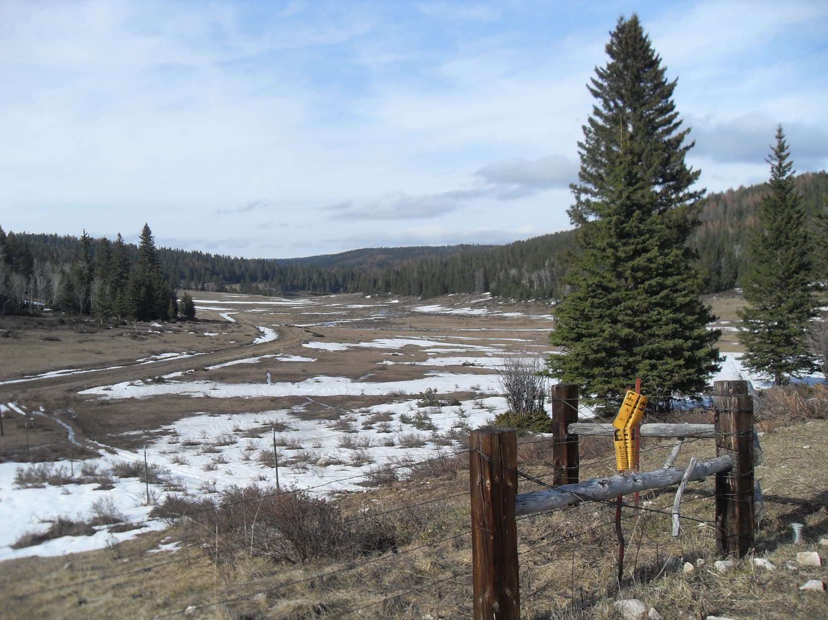
Snow! In May! So much of it the G6 would never get through. Carefully, SPHP backed the G6 up to a place where it could be turned around. Half a mile SE of the junction of County Road No. 303 and USFS Roads No. 110 & 117 in Manganese Draw, SPHP parked the G6 at a wide spot along No. 303 near a cattle guard where private property began. Lupe would have to start for Crow’s Nest Peak from here. (10:52 AM, 52°F).
So much snow on the road this late in the spring was unexpected, but Lupe was already at 6,500 ft. elevation, which is pretty high territory for the Black Hills of South Dakota. Her destination, Crow’s Nest Peak(7,048 ft.), is one of only a handful of mountains in the Black Hills topping out at over 7,000 ft.
Despite it’s lofty elevation, Crow’s Nest Peak doesn’t have the appearance of even a notable small hill, much less a peak. All of the nearby ground is gently rolling territory that’s nearly as high. Lupe and SPHP certainly weren’t expecting any dramatic views today.
In fact, the big question wasn’t whether Lupe could climb the mountain, but whether she would be able to find it? Lupe’s 2 prior attempts to reach Crow’s Nest Peak from the S and SE on Black Hills, SD Expeditions No. 72 and No. 84 respectively had both ended in failure. Snow on the ground had played a role both of those times, too. Although Lupe must have gotten close on Expedition No. 72, Crow’s Nest Peak had been so difficult to recognize SPHP hadn’t been certain if she had even seen the mountain.
This was a new day, though. This time, Lupe was starting for Crow’s Nest Peak from a closer point and a new direction. As the crow flies to it’s nest, the summit was only 2.5 miles to the SSW. Lupe began her latest attempt on Crow’s Nest Peak by finding a place to leap over to the S side of Castle Creek. She then turned NW up Manganese Draw.
Blue skies, pleasant temperatures – it was going to be a glorious spring day for a romp in the hills! Lupe had an easy time trotting along sniffing through the meadows near the clear running stream.
Looking WNW up Castle Creek in Manganese Draw.Lupe in Manganese Draw as she starts out for Crow’s Nest Peak. Today’s adventure would be her 3rd attempt to reach the summit. The meadows along Castle Creek were easy territory to travel through, and an encouraging way to begin.
Lupe had to cross the creek several more times as it meandered through the valley, but there was always a way across. Before long, Lupe was approaching the intersection of County Road No. 303 with USFS Roads No. 110 & No. 117. Even if the G6 had been able to get this far, this would have been the end. Lupe saw that No. 117 heading S from the intersection in the general direction of Crow’s Nest Peak was completely covered by a huge snowbank.
Lupe nears the intersection of County Road No. 303 and USFS Roads No. 110 & 117 in Manganese Draw. The big snow bank seen beyond her completely covered No. 117. Photo looks NW.
The plan was to follow No. 117 a couple miles S to get close to Crow’s Nest Peak. From the intersection, Lupe avoided the big snow bank by returning to the meadow close to Castle Creek. She crossed the creek one more time, and didn’t go back to the road until she was beyond the snow bank. No. 117 climbed steadily as it wound around toward the SW.
Between the brilliant sunshine and fast warming temperatures, the steady upward trek along the road soon started feeling rather warm. After going 0.5 mile SW on No. 117, an unmarked dirt side road headed SE up an even steeper slope toward the forest. This was probably USFS Road No. 117.5D. Getting out of the hot sun and up into the shady forest sounded good to both Lupe and SPHP. Lupe would have a better time exploring the forest than following the main road anyway.
A short steep climb along No. 117.5D brought Lupe to the edge of the forest. Much more snow was hidden here, still melting in the shade of the trees. The snow wasn’t everywhere, but Lupe frequently encountered drifts 2 feet deep. No. 117.5D continued climbing for a while, but eventually leveled out. The road disappeared completely not long after reaching the high ground.
Crow’s Nest Peak was still 1.5 to 2.0 miles S. According to SPHP’s old USFS map, Lupe should reach USFS Road No. 377 before she went half that far. Dodging snow drifts as much as possible while staying on the highest ground, Lupe and SPHP wandered S through the forest.
Picking a way through the snowy forest was slow going. Lupe went on and on, but came to no roads. After what seemed like quite a while, Lupe came to a high spot in the forest. SPHP wondered if this might even be Crow’s Nest Peak, but soon decided it couldn’t be. (Note: Lupe was likely at the end of the ridge extending SE from High Point 7036 on the Peakbagger topo map. Expedition No. 86 occurred shortly before Lupe discovered Peakbagger.com. SPHP did not have a topo map along on this or any of Lupe’s earlier Black Hills expeditions.)
Little could be seen from the high spot. The only distant view was toward the S or SE, but it wasn’t much of a view and there weren’t any apparent landmarks. However, Lupe did have a glimpse between the tees of slightly higher ground off to the SW.
Lupe near the first high spot she came to in the forest.
The next small ridge to the SW wasn’t that far away, but progress toward it was slow due the snow drifts. Lupe finally arrived up on this ridge, but it didn’t appear to be Crow’s Nest Peak, either. Lupe could see even less from here (likely High Point 7034), but it looked like there might possibly be higher ground to the SE.
Lupe tried following the ridgeline SE, but didn’t seem to be losing or gaining any significant elevation. However, she eventually came to a rocky ledge from which she had somewhat more of a view. From here there appeared to be slightly higher ground off to the WSW. Noticeably higher ground was off to the SSW, but farther away than SPHP thought Crow’s Nest Peak ought to be. Still, nothing else around here could be any higher.
Lupe continued SE on the ridge, but soon had to give up on finding any better viewpoint. She now left the ridge going toward the closer high ground to the WSW. Another slow trek through the snow drifts brought Lupe to this new high ground. She wasn’t really any higher than before back on the last ridge. Not a thing could be seen except the forest. The terrain in all directions was virtually flat. Lupe turned S.
Only a few minutes after turning S, Lupe came to a road. No. 377 at last! Lupe followed the road WSW, and quickly arrived at a small clearing in the forest where she found a water trough surrounded by a pole fence. Nearby was an unexpected intersection. The new road was unmarked, but the road Lupe had been following was clearly marked as USFS Road No. 377.1C.
Lupe near the unexpected road junction. The marker for USFS Road No. 377.1C, which Lupe had already been following for a little way is seen on the right. The water trough surrounded by the pole fence is also in view. The intersecting road is out of sight behind the camera. Photo looks ENE.
Time to stop and check the USFS map again. SPHP figured this new road must be USFS Road No. 377. The map had surprising news. The map confirmed the new road was No. 377, but Lupe was nearly 2 miles E of where she was supposed to be, a little N of Knutsen Spring!
It hardly seemed possible Lupe had gone this far E, but that was what the map showed. How had SPHP gotten so badly turned around with the sun out in a cloudless sky? Lupe was still far from Crow’s Nest Peak. The map showed she had two options from here. After a short jog S to Knutsen Spring on No. 377, the road would turn W, then NW for 2 miles. At another junction, she would then have to turn SE following a different road for nearly another mile just to reach USFS Road No. 266.1A at a point 0.5 mile E of the mountain.
A shorter, more direct route was possible, too. After reaching Knutsen Spring, if Lupe simply left No. 377 continuing S through the forest, she should find No. 266.1A less than 0.25 mile away. No. 266.1A would then take Lupe 2 miles WSW straight to Crow’s Nest Peak. That seemed like the thing to do. Yet it was shocking to think that Lupe was still nearly as far away from Crow’s Nest Peak as when she’d left the G6. Was Crow’s Nest Peak going to elude Lupe for a 3rd time?!
Lupe and SPHP left the junction with No. 377.1C heading W on No. 377. This also seemed odd, since No. 377 was supposed to be going S to Knutsen Spring from here. The only other choice, though, was to head E on what SPHP assumed was No. 377.1D, and for certain Lupe didn’t need to be going any farther E. SPHP figured No. 377 would turn S soon, but it didn’t. It kept going W.
With Lupe so far E of where she should have been, going W was probably OK, even though the road wasn’t going where it was supposed to according to the USFS map. The next new development, however, was more disturbing. Lupe started losing elevation, and losing it fast. The road was going downhill! Snow was plentiful, both on the road and in the surrounding forest. Downhill or not, Lupe had best stick to the road and continue W.
Down, down, Lupe and SPHP went. Before long, the forest ended. The road entered a snowy meadow. Another surprise! A much better gravel road was in view ahead. The gravel road was unmarked where Lupe reached it, but a marker confirmed Lupe had been traveling No. 377. Nothing made any sense. Why was this good gravel road even here? It hadn’t been that long since Lupe had left No. 377.1C. Lupe turned S on the gravel road, while SPHP pondered these mysteries.
Gradually, it began to dawn on SPHP that this good gravel road had to be No. 117 again. Lupe was now somewhere farther S than where she’d originally left it. Back at the marker for No. 377.1C, Lupe hadn’t actually been anywhere near Knutsen Spring, but much farther W, about where SPHP had originally thought she was before seeing the marker and consulting the map. Within another 0.5 mile, Lupe should come to another road that would take her SE to Crow’s Nest Peak.
Before she’d gone another whole 0.5 mile, Lupe did come to another road. This new road went ESE up a small draw, and was marked as No. 377.1A. This seemed like it might be the right road. At least it was going the right direction. Lupe took it.
No. 377.1A steadily regained Lupe’s lost elevation, which was a good thing. The road gradually turned SE, which seemed good, too. The road was so soft and muddy from melting snow, Lupe and SPHP traveled much of the time off in snowy meadows nearby.
SPHP was watching for an expected junction with No. 377 again 0.5 mile from No. 117, but it never materialized. Strange. The map showed it, but no junction appeared. Lupe continued on. About 1.0 mile from No. 117, Lupe was approaching the top of a rise. Off to the W in a meadow sat a large white plastic tank, presumably for water. It was enclosed by another pole fence. There wasn’t much snow up here. Was Lupe coming to the top of Crow’s Nest Peak?
Coming up USFS Road No. 377.1A, Lupe saw a white plastic tank to the W of the road as she was approaching the top of a rise about 1 mile SE of USFS Road No. 117. Photo looks S.
A short distance beyond the white water tank at the top of the rise, Lupe found an unexpected road intersection. If she stayed on No. 377.1A continuing SE, Lupe would start losing elevation at a good clip. Turning SSW, she would lose less elevation following No. 377.1B. Both roads were clearly marked. Which way? SPHP had no clue.
Lupe pricked up her ears listening to a wild turkey gobbling somewhere in the forest as SPHP sat on a log studying the USFS map. It didn’t even show a road No. 377.1B. Crow’s Nest Peak couldn’t be that far away, but where was it? Lupe and SPHP went over to the white plastic water tank. It bore no markings that shed any light on the situation. Back to the log. The question remained, which way to go?
SPHP remembered another map in the pack. It was an old Black Hills National Forest “Travel Information Map”. Maybe it would provide a clue? SPHP took it out of the pack for a look. The BHNF travel information map showed the USFS Roads in much greater detail than the old USFS map, although it contained absolutely no other details except section lines and numbers.
No wonder everything had been so confusing! The BHNF travel information map was an enormous help! It showed road patterns that matched up with what Lupe had been seeing on the ground. The road numbers agreed with the markers Lupe had seen, too. SPHP’s old USFS map, normally reasonably accurate, was riddled with inaccuracies. It was a work of fiction in the area Lupe had been traveling through.
The BHNF travel information map showed the intersection of USFS Roads No. 377.1A and No. 377.1B where Lupe was right now. She clearly needed to take No. 377.1B. Although the BHNF travel information map didn’t show Crow’s Nest Peak, by comparing section lines on the two maps it was easy to see Lupe was only 0.5 mile NE of the summit. Lupe and SPHP took off heading SSW on No. 337.1B.
As the roads went, Lupe would have more than 0.5 mile to go to reach Crows Nest Peak. In fact, the BHNF travel information map led SPHP to believe she would have to go 0.5 mile just to reach the next intersection with USFS Road No. 266. Well before Lupe had gone 0.5 mile, however, she came to a small clearing. A road buried in snow disappeared going S into a dense forest. There was no marker for it, but it was probably No. 266.
A less snowy road made a sharp turn to the W into another dense forest. A marker showed this was still part of No. 377.1B. Lupe did need to go W to get to Crow’s Nest Peak, so she left the small clearing staying on No. 377.1B.
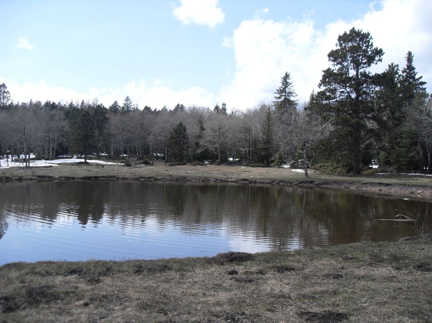
Lupe didn’t go much farther before she reached a larger clearing. This clearing wasn’t completely treeless. Spruce trees were scattered around. On the N side of the road was a good-sized pond. Three ducks were paddling around on this pond, but they flew off as Lupe approached.
Three ducks paddling around on this pond on the N side of USFS Road No. 377.1B flew away as Lupe approached. Photo looks NW.
Although the pond contained rather murky, brown water, it still seemed like a relatively nice place to take a short break. Lupe had Taste of the Wild, while SPHP munched an apple.
After finishing her Taste of the Wild, Lupe went down to the edge of the pond. She saw a salamander trying to avoid detection by burying itself in the mud at the bottom of the pond. Salamanders are a fairly unusual sight in the Black Hills. Lupe wondered what that strange thing was? Fortunately, as far as SPHP was concerned, she didn’t want to find out badly enough to enter the cold, dirty-looking water.
Lupe near Salamander Pond. Photo looks ENE.
The time came to press on from Salamander Pond, but SPHP had a hard time discerning where No. 377.1B went from here. A foray to the S revealed nothing. As it turned out, No. 377.1B continued W hidden under snow. It seemed like Lupe was gaining a little elevation as she followed the road W. Soon she was definitely gaining elevation. The faint road climbed a small hill from the SE.
Lupe arrived on top of the little hill to find a small, flat, opening in the forest. Part of the opening was buried beneath a large snow bank. A big pool of snow melt water covered a portion of the road ahead to the W. The whole area was so level, most of the ground was soggy. Water trickled NE into a marshy area among the trees.
Was this Crow’s Nest Peak? Lupe seemed to be at the top of the small hill, but saw no signs or markers anywhere. To the E, lots of snow could be seen between the trees. A spur of the road headed in that direction. However, before going E, Lupe went W to check out the big pool of water. Beyond it, SPHP thought it looked like there might be a view.
Going over to the big pool, the ground was sopping wet. Beyond the pool, however, the ground was drier and Lupe did have a bit of a view off to the W. The forest had been thinned enough in this direction so that she could see a few high hills that had to be well into Wyoming. Closer by were blue ridges nearly as high as where Lupe was now. SPHP thought Lupe must be on Crow’s Nest Peak, but found no proof.
Looking E at the pool of snow melt water that partially covered the road on top of the little hill.
Lupe traipsed back E past the snow melt water pool, crossing the soggy ground again to reach the trees at the E side of the clearing. She explored the spur of the road that went E into the forest. Only a few trees into the forest, Lupe found herself at the edge of another even smaller clearing. This tiny clearing was full of snow. The snow made it hard to tell, but it looked like the spur road ended already at a small turnaround circle in the clearing.
Out in the middle of the tiny clearing, a red and yellow metal post stuck up out of the snow. Lupe and SPHP ran over to the post. It said “Survey Marker”! This had to be it!
The post in the middle of the tiny snow-filled clearing said “Survey Marker”! This had to be it!
Excitedly, Lupe and SPHP started digging in the snow around the post. At first Lupe didn’t find anything. SPHP found a few rocks close to the W side of the post. Almost immediately, Lupe uncovered something metal about half a foot N of the post. The survey marker! SPHP brushed the rest of the snow away. The marker said “1912”. At the center of a circle rimmed with the usual propaganda a single joyful word was stamped: “Crow”.
After failing on two prior expeditions, Lupe had arrived! She was now undeniably on Crow’s Nest Peak(7,048 ft.). She had found the survey marker someone had set here 102 years ago! SPHP took a picture of it, not realizing until later on how blurry it had turned out. Oh, well.
The survey marker on Crow’s Nest Peak. SPHP didn’t realize until later on how blurry this photo had turned out. “Crow” can sort of be made out above the triangle.
There were no views from the tiny snow-filled clearing. The clearing bore no resemblance to what one thinks of as a mountain top. Lupe hadn’t had much in the way of a distant view anywhere along the way here, either. Yet finding the survey marker felt like finding a treasure. Lupe was actually at one of the highest points in the Black Hills. Looking for the marker in this remote part of the western Black Hills had been fun!
Lupe at the remote, undramatic, summit of Crow’s Nest Peak for the very first time.
Lupe and SPHP left the summit feeling inexplicably happy. Nothing wrong with being happy is there? The American Dingo seemed to take it for granted. SPHP decided happiness needs no weighty justification. Take it when you can get it, and be glad! If being too happy is a problem, it’s among the best problems you can have. Enduring it is easy. Lupe and SPHP were willing to tough it out!
The Carolina Dog’s peakbagging goal for the day had been achieved. SPHP knew there was beautiful open land flanked by forests not too far off to the W. Lupe could wander over that way, find USFS Road No. 117 again, and have fun exploring on her way back to the G6. Lupe passed by the pool of snow melt water on the W side of Crow’s Nest Peak one more time.
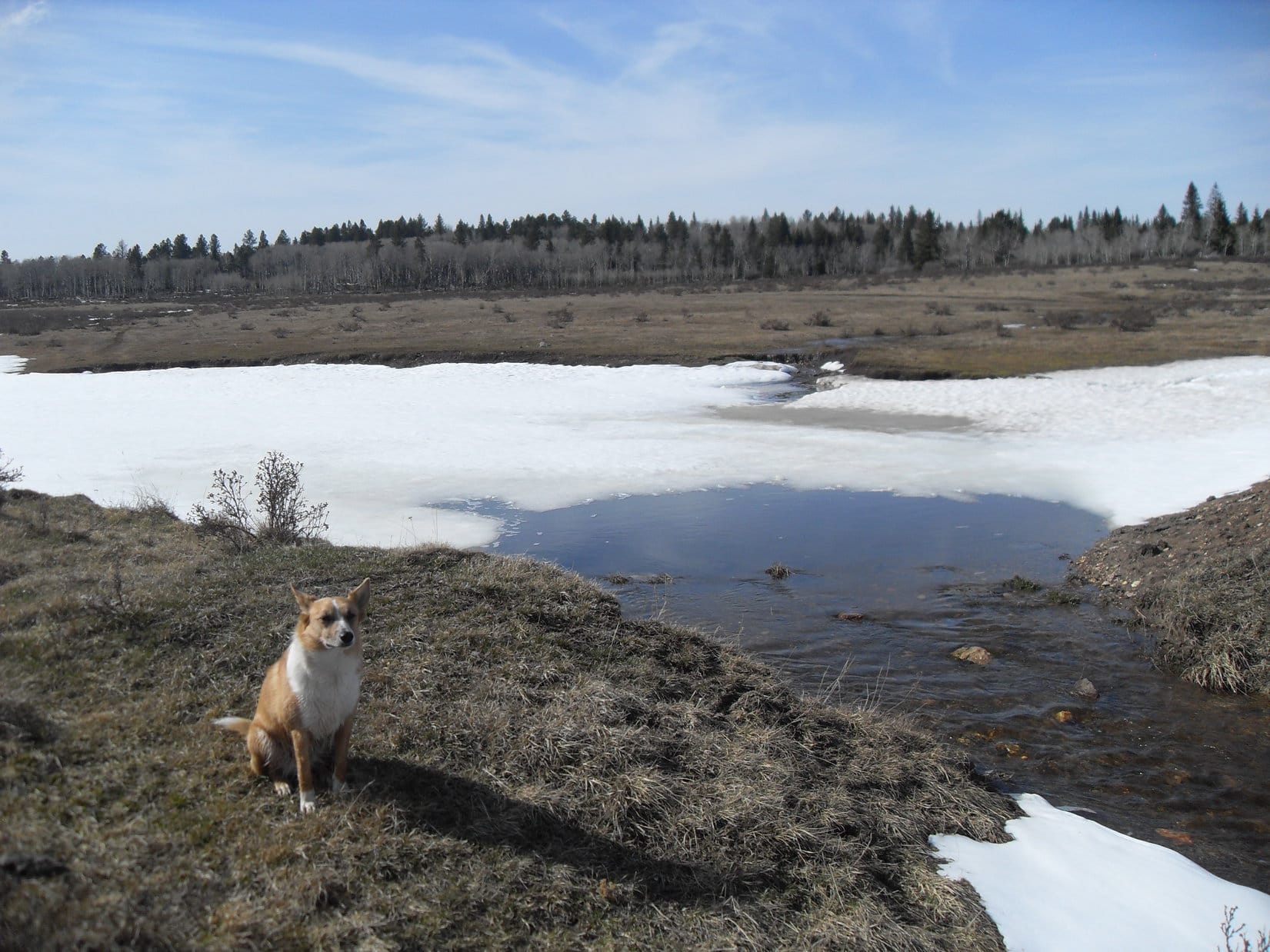
Lupe near the pool of snow melt water for the final time on her first successful trip to Crow’s Nest Peak. Photo looks WSW.
After enjoying the view W of the pool for a few minutes, Lupe followed the road down the SW slope of the little hill. The road was in poor condition here. It led to an intersection where Lupe turned WNW. After passing through a level clearing, Lupe resumed losing elevation as the road went downhill through a forest. Emerging at the far end, Lupe could see the good gravel road, USFS Road No. 117, again.
USFS Road No. 117 came into view again from the snowy road WSW of Crow’s Nest Peak as Lupe emerged from the forest. Photo looks NNW.
When Lupe reached No. 117 again, SPHP was surprised there was no sign at all for Crow’s Nest Peak at the turn onto the minor road she had been following. A short distance off to the W was a junction with another good gravel road. Lupe went over to check out that junction. She found a sign saying this other good gravel road heading N was No. 117.5K.
A stream with a strong current was flowing S on the W side of No. 117 from this junction. Ordinarily, no stream exists here. It was all snow melt. Maybe Lupe could have some fun following the temporary stream S along the road? SPHP kind of wanted to see if there were any more roads heading toward Crow’s Nest Peak from No. 117, and if any signs for Crow’s Nest Peak existed anywhere along the way.
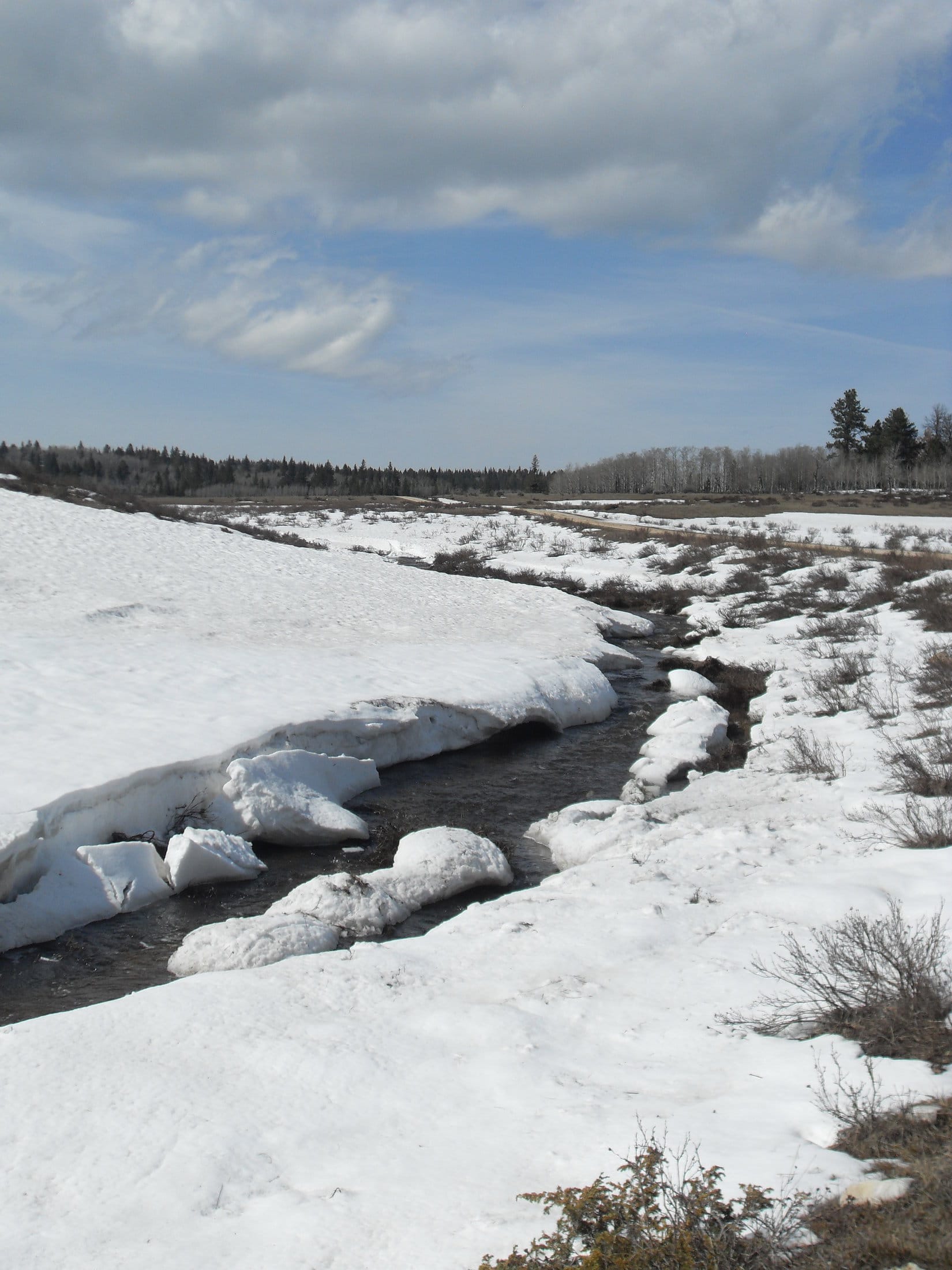
The snow melt stream flowing S along the W side of USFS Road No. 117.5K. Ordinarily there is no stream at all here. It was all snow melt that would eventually flow into Beaver Creek a few miles SW of here. Photo looks NNE.
Lupe had a good romp exploring the meadows near the snow melt stream as she followed No. 117. The road wound around to the SW. Lupe paralleled it for at least 0.5 mile before coming to a bend where two big truck tires had been turned into water troughs. One was full to the brim, while the other was nearly empty.
Lupe sits near the truck tire water trough. This one was almost overflowing. Photo looks NE in the direction Lupe had come from.Lupe enjoyed the shade next to the almost empty truck tire water trough while SPHP checked the maps again. Photo looks SSW.
SPHP checked the maps again. Lupe hadn’t come to any more roads. It wasn’t likely any roads would leave No. 117 for Crow’s Nest Peak from any farther S than where Lupe was here. SPHP’s curiosity was satisfied. May as well head back N.
The two truck tire watering troughs were as far SW as Lupe went along USFS Road No. 117. The snow melt creek was pretty impressive down here. Lupe started following it back upstream.
Near the two truck tires, the snow melt stream was impressive for the Black Hills. This was as far SW as Lupe went along No. 117 before turning around to go back N. Photo looks NE.
Lupe went all the way back to the junction with No. 117.5K. The meadows W of No. 117.5K looked so beautiful and inviting, Lupe and SPHP left No. 117 to continue N in those meadows. Lupe came to a pond along the snow melt stream that was mostly full of snow. A small waterfall tumbled into the little pond.
Lupe came to this cool little snow filled pond with a small waterfall tumbling into it in the meadows W of No. 117.5K. Photo looks NW.
No. 117.5K went almost straight N gaining elevation gradually. Eventually the road went over a little pass. Beyond the pass was another long beautiful valley off to the NNE. SPHP continued marching along soggy, wet side roads in the fields W of No. 117.5K, while Lupe roamed to her heart’s content. SPHP stayed toward the W side of the valley near the forest, since Lupe enjoys having a mix of open ground and forest to run around on and explore.
As No. 117.5K went over this pass, the next long beautiful valley to the NNE came into view. Lupe and SPHP followed it staying toward the W (L) near the trees. Photo looks NNE.Lupe enjoyed being able to make forays into the nearby aspen forest from the meadows along No. 117.5K. Photo looks NW.
No. 117.5K ended as a good gravel road a little N of the pass. Near a barbed wire fence, it veered off to the NW as a muddy minor road. Lupe was hungry again by the time she reached this point. She took another Taste of the Wild break near the fence where the good part of No. 117.5K ended.
By the time she reached the N end of the good part of No. 117.5K near the barbed wire fence, Lupe was ready for more Taste of the Wild. A long day roaming the Black Hills gives a Carolina Dog a healthy appetite!Ahh, better!Looking back to the S from the N end of the good part of No. 117.5K toward the little pass Lupe went over. The mucky part of No. 117.5K continued off to the NW (R) into the forest, but Lupe didn’t follow it that way.
From the fence at the N end of the good part of No. 117.5K, Lupe left the road to continue NNE down the long gentle valley ahead. She roamed the W side of the valley, crossing many little snow melt streams. SPHP found another dirt road, and followed it where it wasn’t too muddy. The easy, gradual, downhill trek was beautiful. The air grew chilly as the sun began to sink. It was still early spring up at this elevation.
The easy, gradual trek down the long valley beyond USFS Road No. 117.5K was a beautiful time. Lupe crossed many little snow melt streams and roamed happily as the sun began to sink and the air grew chilly. Photo looks NNE.
Eventually, SPHP saw No. 117 reappear on the E side of the valley. Soon No. 117.5D came into view, too, on the far side of No. 117. This was the road where Lupe had originally left No. 117 to escape the heat and explore the forest on her way to Crow’s Nest Peak. Lupe could have gone over to No. 117 again, but instead she stayed on the W side of the long valley.
SPHP led her along the dirt road even after it re-entered the forest, turned NW, and started gaining elevation. This proved to be a mistake. Soon Lupe and SPHP had to leave the road to plunge down the N side of a densely forested steep slope. The snow was feet deep here. Suddenly, Lupe was leaping and bounding through snow up to her neck.
After what seemed like a long struggle, Lupe escaped the snow when she reached the floor of a valley. She came to another road, No. 117.5I. The intrepid Carolina Dog was now a little farther W in upper Manganese Draw than she had been early in the day. Her adventure to Crow’s Nest Peak and back was almost over. Before long she was E of No. 117 again, following Castle Creek downstream. At 6:38 PM, (44°F) Lupe reached the G6.
Lupe had enjoyed sunshine all day near Crow’s Nest Peak. Surprisingly, on the way home it turned out the rest of the Black Hills only a few miles to the E was under dense cloud cover. Lupe was tired. She curled up on the G6’s passenger side front seat. SPHP thought she might go to sleep as the light faded.
The Carolina Dog couldn’t relax, though. She was too worried she was missing out! She wound up standing and watching for cows, horses and deer to bark at all along the long road home. For Lupe, the adventure never ends!