Day 25 of Lupe’s 2nd Summer of 2022 Dingo Vacation to Canada & Alaska!
1:53 PM, 55ºF, Dalton Highway MP 195.3, side road N of Nugget Creek – Rained all morning, which was OK since it was supposed to be a rest day, anyway, after Lupe’s grand adventures on her first ever backpacking trip in Alaska the past 3 days, but it wasn’t raining now. SPHP closed the trip journal.
All caught up, SPHP?
No, not quite, but getting sick of writing, Loopster. We ought to do something.
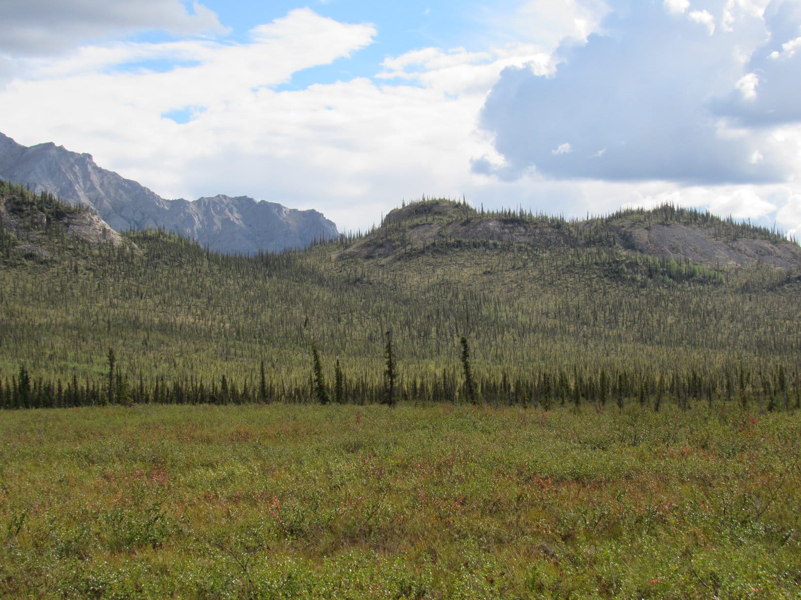
Outside the RAV4, the day was glum, darker again than it had been an hour ago. Apparently in need of physical support, heavy gray clouds draped themselves over all the mountaintops.
Sounds good to me, SPHP, but what can we do on a dreary day like this?
Just so happens, I’ve got just the thing in mind, Looper!
2:26 PM, Dalton Highway pullout near MP 207 –
Recognize this place, Loopster?
No, I don’t. Where are we, SPHP?
Ahh, well. That’s because these mountains are hidden to such an extent. You’ll recognize where we are soon enough. This is a favorite spot from some years back, one that used to have a special significance.
I’ll need more of a clue than that, SPHP. We’ve been to so many fabulous places!
Need a few clues, aye? Follow me, Looper!
The RAV4 parked near Dalton Highway MP 207. Photo looks S.
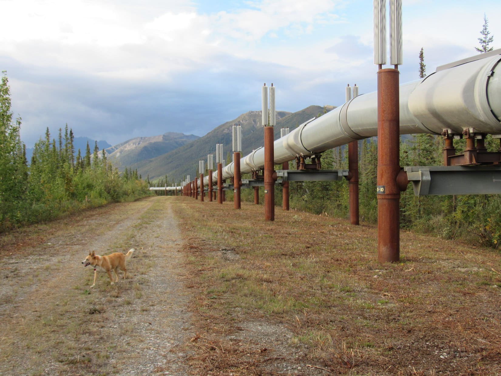
Crossing the Dalton Highway, SPHP led Lupe along a short access road, then turned NE.
The Alaska oil pipeline, SPHP!
By the Alaska oil pipeline. Photo looks E.
That’s right, Loop. Now think – we’re in the Brooks Range, and what mountains did we see off to the N from Peak3780 a few days back?
Sukakpak Mountain(4,459 ft.) and Dillon Mountain(4,820 ft.). Oh, I get it! This is my old last mile N trek from 2016, isn’t it, SPHP?
Sure is, sweet puppy! A perfect, easy stroll even on a gloomy day like this, too. Shall we?
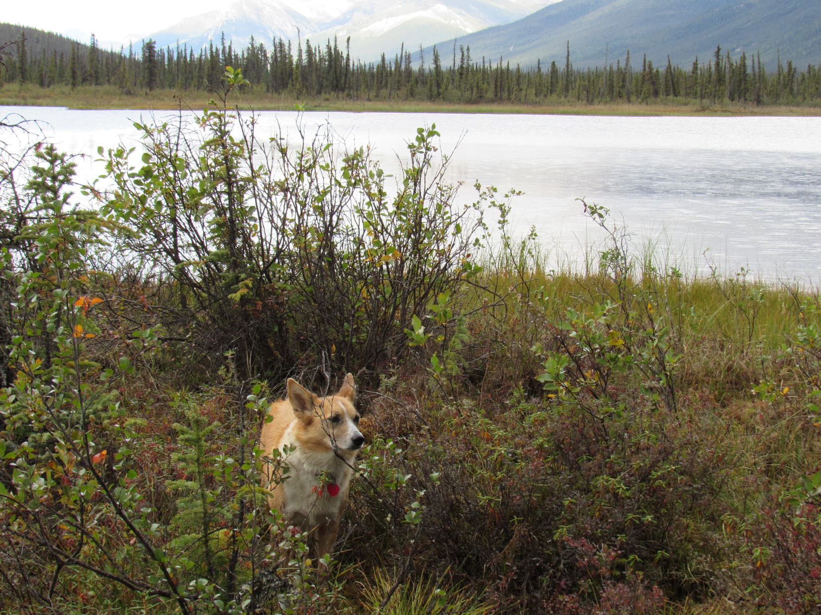
Oh, I can’t wait, SPHP! I love this place! Been ever so long since we’ve been here.
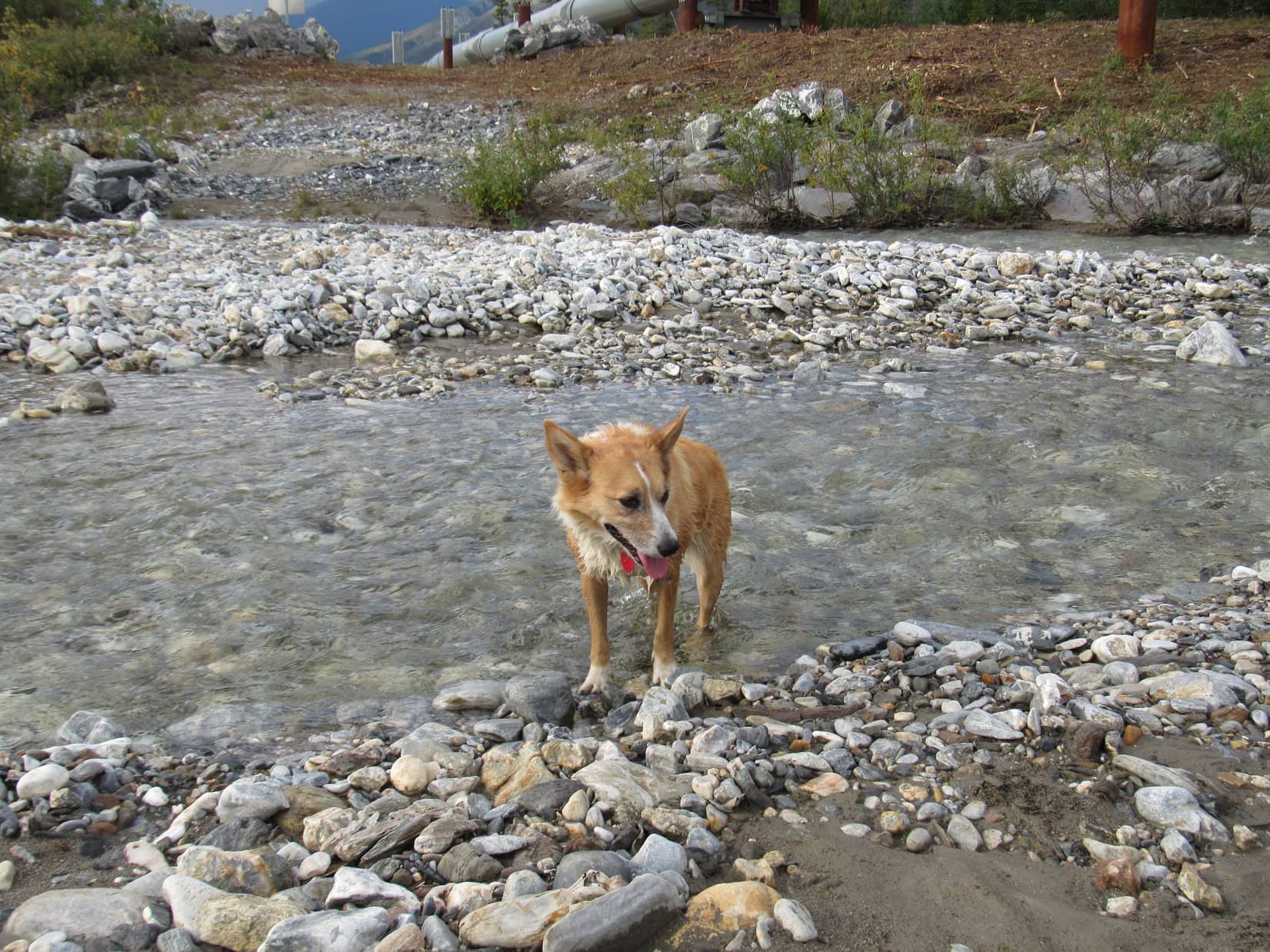
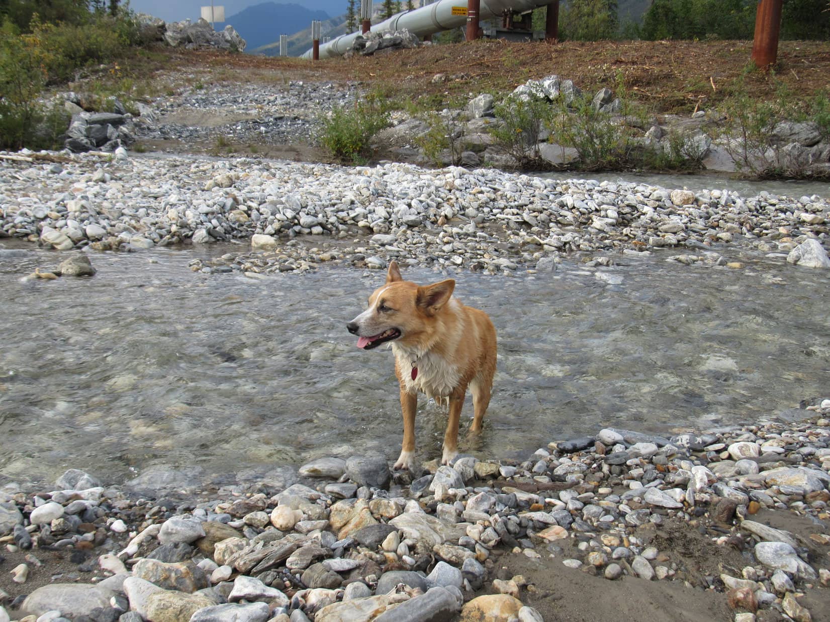
Following the pipeline N for the first time in years, Lupe didn’t see any of the bunnies that used to live in the brush near the manicured service road, or the curious ravens that used to follow her hopping along up on the pipeline itself.
Nevertheless, it was awesome just being here again in the cool, moist air beneath the sullen sky. The Carolina Dog did get to see the shallow pond W of the pipeline again. It hadn’t gone anywhere.
The familiar shallow pond W of the Alaska oil pipeline. Photo looks WNW.
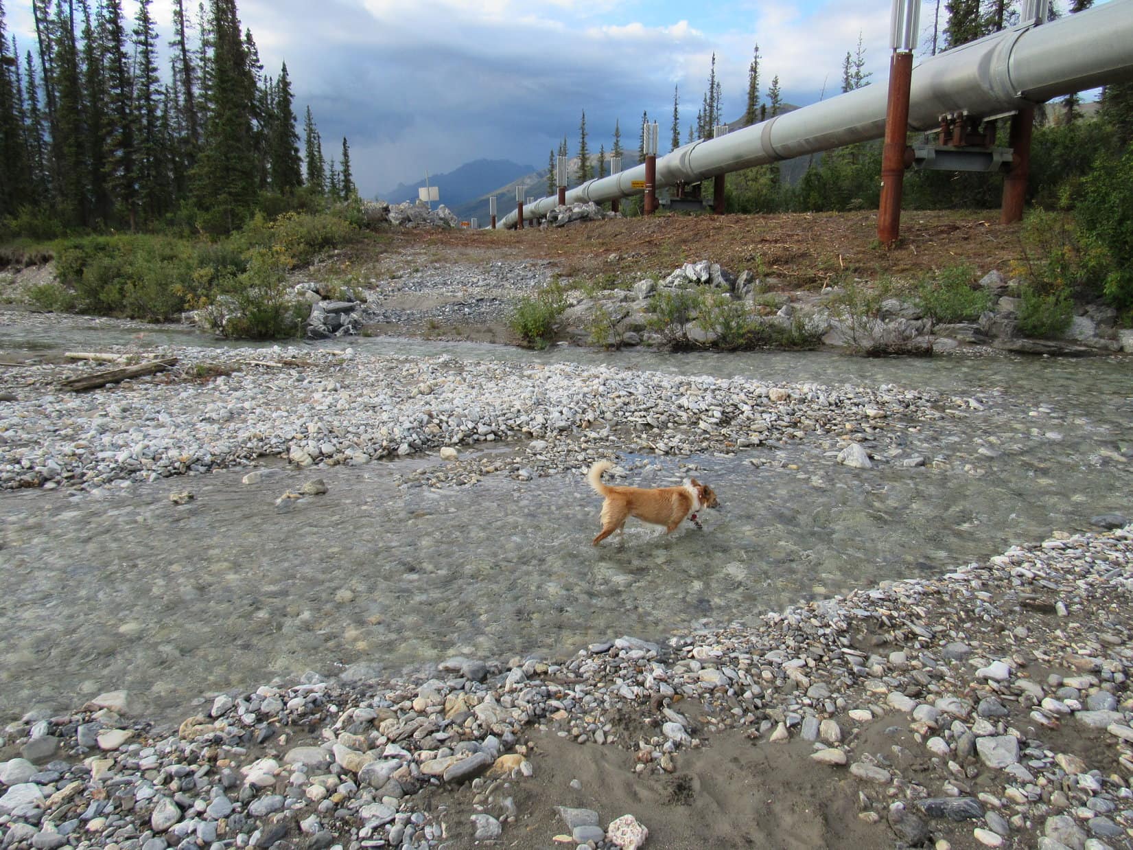
Somewhat more than a mile along the pipeline led to the stream that flows W from the valley N of Dillon Mountain. When Lupe got there, it was running fairly high for this time of year, spread out over a broad, stony floodplain.
Dillon Creek at the N end of the traditional Last Mile N pipeline trek. Photo looks NE.
We used to call this stream Dillon Creek, remember, SPHP?
Yeah. Still seems reasonable. Don’t think it has any other name, Loop.
We go W from here to the confluence of Dillon Creek and the Dietrich River, right, SPHP?
Yup, that’s where your last mile N ended in 2016, Looper.
Looking in the direction of the confluence with the Dietrich River. Photo looks WNW.
Lupe wanted to go to the official end of her 2016 Last Mile N trek down at the confluence. SPHP wanted to, too, but had foolishly forgotten to bring the new red rain jacket, and all the bushes in the forest were still sopping wet.
Are you kidding me? How could you forget your rain jacket, SPHP, after all the rain we’ve seen over the past few days? Look at the sky! Looks like RAIN at any moment, doesn’t it?
Oh, I know. Silly me. Guess I just wasn’t thinking. Sort of thought that we could just wander down that way along the floodplain, but Dillon Creek is right up against the near bank now, and I don’t want to get my boots wet.
Well, it’s kind of a big deal, SPHP. How often are we here, anyway? Hardly ever. Last time was clear back in 2017. This was our big chance!
Sorry, Loop. We’ll do this again soon, and go all the way to the confluence to make it official. How does that sound? We’ll get to do this twice!
Only once good and proper, SPHP. And how “soon” is soon?
Maybe tomorrow, before we continue N, Loop. Or on our way back S a week or two from now.
Oh, well, I suppose that wouldn’t be so bad. Promise, SPHP?
I promise, sweet puppy, provided the weather isn’t dreadful.
OK then, SPHP. Just don’t forget. Remember, you promised!
Since SPHP didn’t want to get wet, it was already time to head back. The return was every bit as pleasant with iconic Sukakpak Mountain, most famous peak along the Dalton Highway, ahead in the distance. Too bad the summit was still in the clouds, but, of course, it was going to be on a day like this.
Heading back along the Alaska oil pipeline. Sukakpak Mountain (R). Photo looks S.Continuing S. Sukakpak Mountain (L). Photo looks SSE.
Near the very end, the American Dingo went right on by the access road back to the Dalton Highway all the way to where the Alaska oil pipeline crossed the Dietrich River. The Dalton Highway bridge was in sight from here with Sukakpak Mountain beyond it. Sukakpak’s great N fin was now cloud-free.
Dalton Highway bridge over the Dietrich River.N fin of Sukakpak Mountain (R). Photo looks SSE.
3:39 PM, Dalton Highway pullout near MP 207 –
Wow, I’m glad we did that, SPHP! Great idea, although it would have been even better if you’d remembered to bring your rain jacket so we could have gone all the way to the confluence. Why are you humans such a bunch of sissies, anyway? Getting a little wet wouldn’t have killed you.
Maybe so, but look at it this way, Looper. You’ve still got my promise to come back again real soon, and do it up right next time.
That will be wonderful, if it actually happens, SPHP. By the way, speaking of what happens, what’s next now?
As rainy as it’s been, Loop, I’m thinking maybe it wouldn’t hurt to drive back to Coldfoot. Bet I can get an updated weather forecast at the Arctic Interagency Visitor Center. Might actually help us decide what we ought to do next.
Not a bad idea, SPHP! You could also go to the restaurant at Coldfoot Camp, and get me another big, juicy, barbecued beef rib from the buffet!
Heh. Maybe, Loop. They don’t serve the buffet until 5:00 PM, though. We ought to be there in plenty of time to order a hamburger instead, which might cost quite a bit less.
Not if you’re buying one for me, too, SPHP! And you better!
Sorry, you can’t order from the menu now. Restaurant closes at 4:15 PM to get ready for the buffet. $27.95 tax included, all you can eat. Buffet opens at 5:00 PM, runs until 9:00 PM.
What time is it?
4:16 PM.
Figures.
That was fast, SPHP! Did you bring me a hamburger?
No. They said we’re having the buffet, Loop, but not for a little while yet. Let’s go get that weather forecast.
The Arctic Interagency Visitor Center did have a 5 day forecast. Not a very good one. Temperatures were fine. High’s in the 50’s, and lows in the 40’s ºF. No wind to speak of, either. Every day overcast, foggy, or at least mostly cloudy, though, with a significant chance of rain. A mere 40% tomorrow, but 60% or more after that.
About time, SPHP! Anything left at the buffet? More importantly, did you bring me another luscious, barbecued beef rib?
Nope. Buffet was different tonight, Loopster. No ribs. Chicken or pulled pork. Since we’ve had plenty of chicken earlier on this Dingo Vacation, I brought you pulled pork. Think you’ll like it. Here you go. Have at it!
7:09 PM, 60ºF, Dalton Highway MP 195.3, side road N of Nugget Creek –
We’re staying here again tonight, SPHP?
Yeah, why not? Nice and quiet and secluded. I like it! So, how was that pulled pork?
Scrumptious, SPHP! Thank you! Too bad we can’t get the big buffet every night on this Dingo Vacation. Have to admit that the pulled pork lacked the bone crunching satisfaction of the barbecued ribs, though.
Glad to hear you enjoyed the pork, Loop. Figured you would. Want to take a stroll? Hardly any traffic out on the Dalton Highway at this hour.
Walking only a little way N along the quiet highway, a magnificent sight soon came into view off in the distance.
SPHP, look! There’s sunshine on Sukakpak! It’s out of the clouds!
It was true. Even some blue sky over that way. Time to keep a promise!
Back to the RAV4, Loopster! We’ll get a few pictures, then do up your 2016 Last Mile North the way it ought to be done this time.
Blue skies over Sukakpak Mountain! Photo looks NE.Sukakpak Mountain from the Dalton Highway. Photo looks NE.Dillon Mountain beyond the Bettles River. Photo looks ENE.
7:55 PM, Dalton Highway pullout near MP 207 – This time as Lupe set out along the Alaska oil pipeline, she turned S first, going the short distance to where the pipeline crossed the Dietrich River. Best to get another look at Sukakpak Mountain(4,459 ft.) from this angle before the clouds had a chance to regroup.
Dalton Highway bridge over the Dietrich River with Sukakpak Mountain beyond. Photo looks SSE.Sukakpak Mountain. Photo looks SSE.
It was a perfect evening as Lupe followed the Alaska oil pipeline N once again. Thrilling to see so much blue sky around! Maybe the weather forecast was wrong? If so, the Carolina Dog might get a chance to climb Sukakpak Mountain tomorrow! That would be so incredibly fantastic!
Following the Alaska oil pipeline N for the 2nd time today. Photo looks NE.
Full of such happy, stimulating thoughts, Lupe reached Dillon Creek in what seemed like no time at all. SPHP was prepared, already wearing the new, red rain jacket. Pushing past an initial line of alders and other tall bushes, Lupe headed W into the forest.
A luxurious Christmas carpet of thick, green moss, and short red bushes greeted the American Dingo. Although there were many tall bushes, too, the forest was fairly open, and easy to navigate. Displaying great energy and enthusiasm, Loopster sniffed and explored her way W through this hidden, special place, where it instantly felt like she was being magically transported back to a day long ago.
On the Christmas carpet. Photo looks W.
After 0.6 mile, Lupe reached the E bank of the Dietrich River. Down on the rounded stones and sand of the floodplain, Lupe followed the river upstream to the confluence with Dillon Creek.
8:47 PM, confluence of the Dietrich River and Dillon Creek – This was the place! Where does the time go? It had been more than 6 years now since Lupe had first been here on a beautiful August day. The dark blue mountain Lupe had seen the day before back then from the summit of Sukakpak Mountain, the one that SPHP had dubbed the Mountain of the Midnight Sun, was in sight again off to the N, it’s summit lost in cloud.
Confluence of the Dietrich River (L) and Dillon Creek (R). Mountain of the Midnight Sun (L of Center) in the distance. Photo looks NNE.
Remember how we thought this was as far N as we would ever be back in 2016, SPHP?
I’ll never forget that, Loop. It was as far N as we went then. For a whole year, I was always sorry we turned around without finding out what was beyond this point.
We returned, though, in 2017, SPHP, right back here before going all the way to Deadhorse!
Yeah, that was awesome, such fun times, Loopster! Really only thought we’d get as far as the N Slope in 2017. Everyone we’d talked to said that Deadhorse was just an ugly industrial place, and that going any farther wasn’t worth it. Once we got to the N slope, though, we couldn’t stop and turn around again. Would have regretted it forever!
Turned out to be marvelous, SPHP! Like going to the end of the world!
Indeed it was, Looper. Only bad thing was that no Dingoes were allowed on the Arctic Ocean tour. Had to go as your personal representative.
We’re going to Deadhorse this year, too, right, SPHP?
Absolutely, sweet puppy! Not turning around after coming this far again until we’re at the very end.
Many adventures to look forward to, to be sure! Right now, though, on this wonderful evening, Lupe lingered at this marvelous, magical place, remembering.
To the SE, Dillon Mountain was a mountain of gold! To the S, the spires of Sukakpak soared skyward in the late evening sun. Miles N loomed the dark blue mysteries of the Mountain of the Midnight Sun. Turned out it had a real name, Snowden Mountain(6,420 ft.), but Lupe had never climbed it. Too steep for SPHP.
Dillon Creek (L) and Dillon Mountain (R). Photo looks SE.Sukakpak Mountain (Center). Photo looks S.Sukakpak Mountain. Photo looks S.Mountain of the Midnight Sun (L of Center) from the confluence of the Dietrich River (L) and Dillon Creek (R). Photo looks NNE.
You can go back to a place you love after a long absence, but it’s never quite the same. Even if the place hasn’t changed, you have. What once was, is no more. Happily, despite a 5 year absence, Lupe’s 2016 last mile N hadn’t changed much at all, and the spirited Carolina Dog was once again looking forward to fabulous adventures ahead.
Doesn’t get any better than that!
Before we go, SPHP, we should get a souvenir! Something to remember this place and time. How about a snazzy rock for my rock collection?
Great idea, Loopster! I’ll have a look around, see what I can find.
A smooth white pebble with a gold swirl plucked from Dillon Creek only a few feet from the Dietrich River seemed a good choice. Lupe gave it a sniff of approval, and it was time to go.
The souvenir pebble.
Then it was back through the magical forest to the Alaska oil pipeline, and the easy stroll S in the cool evening air with Sukakpak Mountain ahead, the sky blue with promise for what tomorrow might bring. (8:52 PM)
Heading back along the Alaska oil pipeline. Photo looks S.Evening at Sukakpak Mountain (L of Center). Photo looks S.Lupe’s 2016 Last Mile North Revisited, Brooks Range, Alaska 8-23-22
Day 17 of Lupe’s Summer of 2016 Dingo Vacation to the Canadian Rockies, Yukon & Alaska.
Was it foggy? No, only condensation inside the G6. Stepping outside, the sky was overcast. No sunshine at all, but the clouds were pretty high. Most of the mountaintops were in view. Hopefully, the clouds would burn off as the day went on.
Yesterday’s feeble attempt to climb Dillon Mountain had ended before Lupe even gained any elevation. It was SPHP’s fault. SPHP had fallen into a blueberry trap. All ambition had drained away as SPHP consumed blueberries, and Lupe dozed on the soft, spongy tundra. The whole attempt had been doomed from the start, anyway. The previous day’s climb of Sukakpak had sapped both Lupe’s and SPHP’s energy.
Today, though, this was it. Now or never. Lupe and SPHP left the G6 (9:41 AM, 57°F) parked N of milepost 207 along the Dalton Highway, and headed S. Lupe followed a faint road through the forest, and then animal trails to the edge of the swamp. Instead of trying to go SE through all those terrible tussocks again, this time Lupe went SW to the river.
Following the Bettles River S, Lupe made much faster progress than yesterday. Part of the time it was possible to travel over exposed parts of the riverbed. Other times, the river forced Lupe and SPHP up onto the E bank, where there were usually trails to follow. Lupe was gaining on her first objective, a low saddle between Dillon Mountain and High Point 2003.
Looking SE along the Bettles River toward High Point 2003, the low hill at center. The S edge of Dillon Mountain is seen on the L. Lupe’s first objective was the saddle between them.
Lupe turned SE, leaving the Bettles River when she got close to High Point 2003. Lupe and SPHP crossed a lot of spongy ground on the way up to the saddle between High Point 2003 and Dillon Mountain. Despite occasional wet areas with annoying tussocks, Lupe had avoided nearly all of the difficult tussock-infested swamp NE of the river.
Lupe on the N slope of High Point 2003(R). Much of the saddle area toward Dillon Mountain(L) is in view ahead. Photo looks E toward the end of Dillon Mountain’s S ridge.
As a guide, Lupe and SPHP were using a copy of a Peakbagger.com trip report on Dillon Mountain(4,820 ft.) written by Richard Carey. Carey, a highly experienced mountaineer, was the only Peakbagger.com account holder ever to have reported climbing Dillon Mountain. Carey had climbed the mountain more than 21 years ago on August 4, 1995.
Carey’s trip report mentioned an old road in the saddle, but Lupe did not come to it. Lupe and SPHP were staying on the S side of the saddle close to High Point 2003. Maybe it was more toward the other side of the saddle, closer to Dillon Mountain? Or maybe 21 harsh Arctic winters had obliterated the old road?
The ground was spongy with tundra moss, but otherwise travel wasn’t difficult through the saddle area. Lupe and SPHP gave up on finding the old road, instead following animal trails that Lupe kept coming across. According to Carey, the next objective was to reach Dillon Mountain’s S ridge, which was still a mile to the E.
As Lupe continued SE beyond High Point 2003, she came to a wide grassy area free of the tall dense bushes that grew nearby. During wetter periods, the entire grassy area might well be a fairly large pond, but only a remnant pond was here today. The grassy area was easy traveling. Lupe and SPHP went along its NE edge.
Lupe beyond High Point 2003(L) near the E end of the grassy area. Photo looks WNW.
Lupe left the grassy area and High Point 2003 behind, re-entering the forest. She angled E, toward Dillon Mountain, crossing the saddle to avoid losing elevation. Soon she started a moderate, steady ascent traversing Dillon’s lower slopes.
Carey advised getting up onto Dillon Mountain’s S ridge, but not until beyond the steep eroded cliffs on the upper portion of the ridge. A glance at the mountain made it easy to see why.
High, steep eroded cliffs along the upper S ridge(R) of Dillon Mountain. Even without Richard Carey’s sound advice, Lupe and SPHP would have avoided any attempt from this direction. Photo looks N.
It wasn’t clear exactly how far Lupe needed to go before attempting to climb up onto the huge S ridge. Lupe and SPHP simply pressed on toward the lower end of the ridge looking for any promising way up.
In the forest, Lupe crossed three boulder fields left by landslides. The first one was small. The next two, considerably larger. When Lupe reached the third boulder field, a forested ramp was visible on the far side.
Lupe reaches the third boulder field she crossed. The forested ramp she would climb to reach the S ridge starts almost directly above her, joining the main ridge toward the upper left. Photo looks ENE.
Lupe crossed the boulder field, continuing on to the base of the forested ramp. The ramp was quite steep and fairly narrow, but Lupe began the ascent. Trees and bushes made some parts of the climb annoyingly slow for SPHP, but there was nothing new about that.
About halfway up, water was dripping from the rock wall next to the ramp. By now, it was sunny and warm, the clouds having dissipated somewhat. Lupe seemed to like sitting in the cold dripping water. SPHP immediately dubbed this place the “Dingo Shower”.
Lupe at the lightly dripping “Dingo Shower” on her way up the steep ramp to the S ridge. The water dripped so slowly, it didn’t show up well in this photo.
Lupe and SPHP made it to the top of the ramp. There wasn’t really any clear spot where Lupe gained the S ridgeline. Instead, she kept coming to and climbing up a series of benches. All these benches were forested, relatively steep, and separated by stretches of even steeper ground.
The climb went on and on. Lupe gained lots of elevation. SPHP kept trying to lead Lupe toward the NE to see what was on the other side of the ridge, but the ridge was very broad. For a long time there was no open view. Eventually, though, the trees began to thin out.
Finally, Lupe made it above tree line. A steep, open slope continued relentlessly higher. Looking E toward Wiehl Mountain, SPHP could see Lupe must still have a big climb ahead. Wiehl Mountain still looked much higher than where Lupe was.
Lupe above tree line, somewhere on Dillon Mountain’s S ridge. Photo looks NNE.Wiehl Mountain from the S ridge of Dillon. Lupe still had a considerable climb ahead of her, since the highest part of Wiehl Mountain shown here is only about 300 feet higher than Dillon. The true summit of Wiehl Mountain is higher yet, but off the R edge of this photo. Photo looks E.
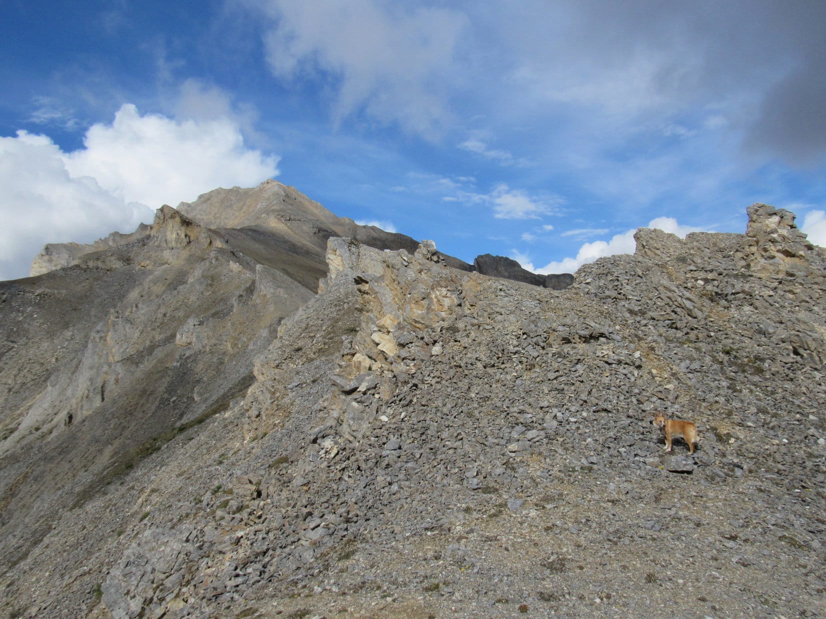
Lupe climbed and climbed. SPHP started to become concerned. Carey had warned in his trip report that the S ridge was complex. About 4 uplifted bands of rock run E/W across the main S ridge. Carey said they were more easily crossed lower down on the E side.
Lupe was getting mighty high up. Although SPHP had been trying to head NE, the S ridge was very broad. As far as SPHP could tell, Lupe hadn’t gotten around any uplifted rock bands yet. Fear grew that Lupe was going to arrive up on some kind of dangerous pinnacle with no way forward.
Lupe still on her way up the steep S ridge. The Bettles River(L) is seen far below. Photo looks SSE.
At last, a little tor appeared high above Lupe, perched up at the end of the long slope. As Lupe worked her way up to it, SPHP wondered if it was the “Tor of Glad Tidings” or the “Tor of Doom”? The answer would be clear soon.
The little pinnacle of rock (R of Center) perched at the top of the long slope. Was it the Tor of Glad Tidings or the Tor of Doom? Photo looks N.
Lupe reached a shallow saddle at the top of the slope. SPHP’s heart sank. It was the Tor of Doom! Some sort of cliff was almost certainly just out of view beyond it.
The summit of Dillon Mountain could be seen ahead, still many hundreds of feet higher, at the end of the long, jagged S ridge. SPHP had made the fatal mistake, warned against by Carey, and led Lupe straight on up the S ridge to the uplifted rock bands.
Gah! How sickening! Was this defeat? How was Lupe ever going to get to the summit? Going all that way back down to try again farther E was unthinkable. Just getting this far had sucked up so much energy and time!
Lupe near the Tor of Doom(R). The summit of Dillon Mountain was in view, still many hundreds of feet higher, beyond the jagged uplifted rock bands of the S ridge. Photo looks N.
There was a rounded flat area to the NE, a little higher than the Tor of Doom. Glumly, SPHP climbed up there to take a look around. If nothing else, it was time to take a few photos of how far Lupe had made it. Lupe followed along as happy as a clam.
Sure enough, there was a cliff directly ahead. It wasn’t all that high, maybe 20 feet? Didn’t matter. No way was SPHP going to attempt to navigate it, or let Lupe get hurt trying it either. Even if Lupe could get past this cliff, it looked like a series of cliffs continued along the ridge. SPHP tried to figure out where Lupe was on the topo map. Around 700 feet below the summit seemed likely.
Dang, Carey! Why did he have to be so right?
Well, because he’s an extraordinarily experienced mountaineer! Over 2,600 ascents logged on Peakbagger.com on 6 continents around the world! His top 10 ascents are all over 15,000 feet, the top 2 over 20,000 feet. You did notice that, didn’t you, SPHP?
Oh, thank you so very much Looper! And I’m just a foolish day hiker way out of my league. I get it, and it’s plainly hard to deny given where we are right this very minute!
No need to get sore about it, SPHP, you asked. I still love you, and this is a fabulous spot. Look at the views! Aren’t you all about the views? What’s wrong with this? What a glorious place!
You’re right, of course. And I still love you, too Loop, so very much. The views are fabulous, and we are extraordinarily lucky to be here. The only thing wrong about this place is it’s not the summit, and there doesn’t appear to be a way to it without going way, way back down the mountain. There’s not enough time to do that, even if I had the energy. I thought we were going to make it. Look over there, the summit’s not all that much higher than where we are now, not compared to how far you’ve already come! Anyway, you’re right, picture time. We’ll take a break and think about what to do next. Maybe we’ll come up with something.
Why hadn’t SPHP thought this all through better when clearly warned? Nothing to be done about it now. Take those pictures. Lupe had certainly made it to a dramatic and beautiful spot.
Lupe on the rounded high spot even higher than the Tor of Doom. Ahead lies the summit of Dillon Mountain, but a few feet beyond Lupe is an unseen cliff. Photo looks N.Looking SW toward Sukakpak Mountain(4,459 ft.) in the background. In the foreground on the L is one of the jagged cliffs of Dillon’s S ridge.Lupe was tantalizingly close, but Carey’s uplifted rock bands along the S ridge posed a seemingly unsurmountable challenge to Lupe and SPHP without going way back down the mountain to try again farther E, as Carey recommended all along. Photo looks N.At first, SPHP thought the peak on the R was a separate mountain, but soon realized it was almost certainly High Point 4228 along Dillon’s E ridge. Lupe seemed to be 100 feet lower, which would have placed her still 700 feet below Dillon’s summit. Photo looks NE.Looking SE toward the true summit of 5,765 ft. Wiehl Mountain.The Bettles River is seen below on the L flowing toward its confluence with the Dietrich River (unseen) to form the Middle Fork of the Koyukuk River seen at upper L. Photo looks WSW.
Hey, wait a minute! While taking the last photo, SPHP noticed a wide ledge of relatively level grassy ground in an unexpected direction. It was close by to the SW, only a little below the cliff where Lupe and SPHP were standing. Was there a way down to it? Did it lead anywhere?
Lupe went back down to the small saddle below the Tor of Doom. SPHP had thought there was nothing but a fearsome cliff beyond the saddle. Getting closer to the other side, there was a huge cliff, but there was also a rocky chute leading directly down to the grassy ledge. The ledge appeared to go up and around the 20 foot cliff Lupe and SPHP hadn’t been able to get beyond!
Looper! It’s your Luck of the Dingo again! Looks like we can at least make it to the next uplifted band of rock. Come, on!
Lupe was already leading the way. SPHP picked a way down the steep, rocky slope. Soon Lupe stood on top of the next band of rock. Once again, there appeared to be no way forward along the ridge, but at least Lupe was past the first cliff now!
Looking S from the top of the 2nd band of rocks back toward the low cliff(L) that had stymied Lupe and SPHP at the 1st band for a while. That 1st cliff wasn’t all 20 feet high, after all. Parts of it were only 10 or 12 feet high. The low cliff still would have forced Lupe and SPHP a long way back down the mountain, if it hadn’t been for the short, steep, rocky chute which led down to the grassy area below. The chute is a little hard to pick out, but is near the center of this photo.Well, SPHP, the good news is we are a little higher and closer than before. The bad news is there are more rock bands and cliffs ahead. By the way, suddenly the weather’s not looking so hot, either. Now what?
On top of the second rock band, Lupe was a little higher than before, and a little closer to the summit. The view ahead was still disconcerting. More rock bands and more cliffs. They looked impassable. Now what, indeed?
Looking around, it appeared that Lupe might be able to get by this 2nd cliff by following the rock band she was on down to the SE. About 150 feet lower, the rock band looked like it broke up enough to destroy the cliff’s continuity. Lupe should be able to get around it down there. Only 150 feet of elevation loss was tolerable, but once she was beyond the 2nd rock band, then what?
The valley between the main S and E ridges was in view. Off to the NNE, SPHP could see sort of a gap in one of the biggest bands of rock sloping down the mountain. The gap was at a point not too far below Lupe’s current elevation. If she could get around this 2nd cliff, and make the traverse over to and through that gap, she would be well on her way to the middle of the SE valley. The SE valley was very steep, but maybe Lupe could climb straight up it?
Well, Loopster, that valley doesn’t look any worse than Decoeli(7,650 ft.), and you made it up that. Let’s see if we can get over there.
150 feet of elevation loss to get around the 2nd cliff turned out to be more like 300 feet. Lupe was 1,000 feet below the summit again, but at least she could resume climbing slowly once more, while angling toward the gap. More importantly, by staying well below the S ridgeline as Carey had advised, Lupe could hopefully bypass any more difficulties with cliffs and rock bands.
The summit of Dillon Mountain disappeared from view. A cloud passed over, sprinkling rain. SPHP called a halt to put on an old blue plastic rain poncho. It wasn’t very good, but helped some.
That’s your emergency rain gear, SPHP? You look like the Cookie Monster!
Yeah, yeah, let’s go, Dingo!
The plan worked! Lupe and the Cookie Monster made it to the gap and beyond. Blue sky reappeared. The blue rain poncho went back in the pack. Lupe reached the middle of the SE valley. SPHP began plodding slowly straight up the steep slope. The climb was easiest where there was a little heather, and not just loose rocks. Fortunately, for a while, there were plenty of heather routes to follow.
Way down below, something was moving! A small herd of mountain goats was running single file across the valley. They disappeared over one of the rock bands of the S ridge.
Lupe heads for the SE valley. Photo looks NNW.Lupe reaches the middle of the SE valley. The summit is still way, way up there! Photo looks NW.Mountain goats ran single file across the SE valley far below. They soon disappeared over one of the rock bands of the S ridge. Photo taken using the telephoto lens.
The steep climb seemed endless. Lupe became bored with SPHP’s dreadfully slow pace. She began roaming at will all over the vast SE valley, as if she was a mountain goat herself. She often went out of SPHP’s line of sight, reappearing suddenly hundreds of feet above or below. She returned frequently to check on SPHP’s snail-paced progress.
The energy Lupe displayed was astounding! Once, SPHP became worried. Lupe couldn’t be spotted anywhere. SPHP called and called her. In a couple of minutes, a tiny American Dingo appeared at least 500 feet down the mountain, racing practically straight up. It only took her two minutes to reach SPHP, arriving breathless and panting like a steam engine.
Loopster! That was incredible! You could be at the summit in 3 minutes, couldn’t you? Take it a little easy, though, and stay closer. You’re going to bust a lung doing that!
Bit by bit, the summit was getting closer. SPHP was almost certain Lupe was going to reach the top of Dillon Mountain. Unfortunately, the weather had been deteriorating again for some time. Blue sky was losing the battle against the spreading gray clouds.
Gray clouds spread across the sky as Lupe and SPHP progressed up the very steep SE valley. Wiehl Mountain(L) is disappearing from view, but the Bettles River can still be seen. Photo looks SE.Lupe was having a grand time roaming the SE valley while climbing Dillon Mountain. Although SPHP was gradually getting closer to the summit, clouds kept obscuring it. Photo looks NW.
300 or 400 feet below the summit, it started raining again. Lupe was so close to success, there was no way she was turning back, even if there wouldn’t be anything to see except fog. Sometimes there were still breaks in the clouds. SPHP continued to hope Lupe would have some kind of a view.
Since it wasn’t raining hard, and the showers were intermittent, SPHP was slow to put the Cookie Monster costume back on again. Another mistake. SPHP wound up getting fairly wet. Should have done it earlier. The Cookie Monster costume didn’t come off again the rest of the day. Lupe’s fur was all soaking wet and cold to the touch, but she wasn’t shivering at all. She still seemed to be in great spirits.
The climb got tougher. Heather was virtually non-existent. Lupe and SPHP climbed among loose, wet, gray rocks. There were bigger, more stable rock formations over toward the E ridge. SPHP worked over that way. The climb remained very steep. Rocks were sliding and tumbling with every step.
Carey had suggested finishing the climb up on the upper E ridge, which leads directly to the summit. However, it looked like pretty rough going on top of the ragged ridgeline. SPHP stayed just below the firm rock formations, using those rocks for assistance.
Not too much farther to go! Photo looks W from a little below the top of the ragged E ridge.
Perhaps 200 feet below the summit, Lupe reached a sizable, nearly level area with a thin covering of heather right up on top of the E ridge. As expected, the ridge proved too rough to stay up on it. The climb got even steeper, as Lupe and SPHP continued up a little S and below the ridgeline during frequent rain showers.
Lupe returned to the top of the E ridge again above a large rock formation. She was on another fairly roomy level spot. There was a patch of heather, but this level area was mostly covered with sand. A steep slope of sand and small rocks led up to a small saddle between two rock outcroppings about 30 feet higher up. The summit! Was it true?! If so, Lupe was almost there!
Lupe on the final, short sandy slope to the summit. Photo looks W.
A minute or two later, Lupe was there, perched high on Dillon Mountain right next to the summit cairn! Lupe received exultant congratulations and praise from SPHP, who shook her expert mountain-climbing front paws enthusiastically. The luck and persistence of the Dingo had prevailed!
Lupe perched next to the summit cairn on Dillon Mountain, Brooks Range, Alaska (8-15-16). Photo looks WNW.As far as SPHP knows, Dillon Mountain is the northernmost peak any Carolina Dog has ever been seen on.
It wasn’t raining when Lupe reached the top of Dillon Mountain. The clouds had lifted somewhat, too. The views, although not nearly as clear as they had been 2 days earlier on nearby Sukakpak Mountain, were still incredible and much better than SPHP had expected.
The Dietrich River, Dalton Highway and even the Alaskan oil pipeline are seen far below. Photo looks NNW.The 50 foot long summit area on Dillon Mountain featured two rocky high points separated by a saddle that wasn’t much lower than either one. The N high point where the summit cairn sat was only moderately higher than the S high point pictured here. Photo looks S.Looking down the sandy slope at the last nearly level spot Lupe had reached along the E ridge on the way up. Wiehl Mountain(R) is seen across the valley. Photo looks ESE.The small prominence seen R of Center is part of the start of the S ridge. Wiehl Mountain(L) again in the background. Photo looks SE.
Tremendous cliffs were in every direction, except toward the steep valley to the SE where Lupe and SPHP had come up. While SPHP took photos, Lupe nestled down in a relatively sheltered spot among the rocks and sand in the saddle between the N and S high points. A gigantic cliff was only a couple feet away.
Our soggy Carolina Dog heroine tries to nestle on rocks and sand in the only slightly lower saddle between the N and S high points. A gigantic cliff is only a couple feet beyond her. Photo looks W.Comfy! Hmm, maybe not so much, but it will have to do. Photo looks W.Sukakpak Mountain, which Lupe had climbed only 2 days ago. Photo looks SSW.Looking down the infamous jagged S ridge. Bettles River below. Photo looks SSE.
SPHP realized Lupe wouldn’t be able to spend much time up on Dillon Mountain. Fog and rain showers were visible in many directions. Nearly all distant mountains were obscured by clouds. Rain could start in again any time.
It was also getting late in the day. Although Lupe had demonstrated that she could have made the entire round trip to Dillon Mountain and back in only an hour or two, dawdling around waiting for SPHP to drag up the mountain had taken nearly forever!
A patch of blue sky appears above the Dietrich River. It sill looked like there could be more rain coming at almost any time. Photo looks NNW.
Roughly 20 minutes after Lupe arrived at the summit, the rain hit again. Most definitely time to go! Lupe and SPHP were already underway, when suddenly there came a single loud peal of thunder. Lupe never heard another one, nor did she see any lightning, but the thunder lit whatever fire could be lit under SPHP. From then on, it was down the mountain, as fast as possible.
As fast as possible wasn’t fast at all. Going down the super steep slope was harder and slower than climbing it had been. Rocks slid out from underfoot, tumbling hundreds of feet. It rained often, sometimes rather hard. Poor Lupe was absolutely drenched. When she was finally far enough down the mountain so there was some vegetation, she tried desperately to dry herself off on the heather. It didn’t work. Everything was soaking wet.
There was no point in trying to go back to the S ridge where Lupe had left it. The sun would be down soon. SPHP didn’t think it would be possible in fading light to find the steep forested ramp where the Dingo Shower was in order to get down off the ridge. The plan was to just head straight on down the SE valley, then follow whatever river was at the bottom around the S end of the mountain.
Down, down, down! Lupe reached a waterfall in the SE valley. Below it, the valley was narrow and steep on both sides. The terrain forced Lupe and SPHP down onto the valley floor, which continued to lose elevation rapidly. Fortunately, the stream was underground nearly all the time.
Lupe below the waterfall in the SE valley. She had already lost a tremendous amount of elevation.
Below the waterfall, Lupe continued to lose lots of elevation. Finally, SPHP grew worried. Hours had gone by since leaving the summit. The sun must be down by now. The end of the SE valley looked like it was still a long way off. There was almost certainly a river of some sort at the bottom. What if it went through a narrow chasm boxed in by cliffs? Lupe and SPHP would be stuck out here all night.
That didn’t sound good at all. SPHP had come prepared only for a day hike. No tent or supplies. SPHP had matches, but there was no way to start a fire with everything totally drenched, and more rain coming. Other than cold hands, SPHP was fine. Lupe, however, had been cold and wet for a long time now. She still wasn’t shivering, but what would happen when it got too dark to be moving around generating heat?
Maybe it was better to get out of this SE valley, and try going around the mountain now, while there was still some light? SPHP decided it was the best option. Lupe and SPHP left the SE valley, entering the forest.
The forest floor was covered with thick, spongy, wet moss. It was a lot easier to move here than down in that interminable SE valley. SPHP charged through the woods. Lupe seemed to realize there was a need for speed. She sniffed frantically everywhere, searching out the best routes ahead. Clouds obscured much of the precious twilight. Rain continued sprinkling now and then.
After a while, there were cliffs to the SSE. A river was in view farther down the mountain. Lupe and SPHP stayed above the cliffs, turning more to the SW. The dark outline of Sukakpak came into view ahead. That was great news. Lupe was making progress!
Lupe started coming to landslides full of rocks and boulders. At one of the first landslides she came to, there was a particularly big rock. SPHP laughingly asked Lupe if she remembered that rock. Lupe whined. How odd! Then it struck SPHP. That rock did look faintly familiar.
SPHP looked around, back the way Lupe had just come. Even in the growing darkness, SPHP was almost certain of it. This was the landslide near the Dingo Shower ramp up to the S ridge. In fact, there was the Dingo Shower ramp, barely visible in the gloom. Lupe was already past it on the way back.
Haha, Loop! We’ve got it made now! Since we aren’t going to die of hypothermia tonight after all, maybe we should try to avoid being eaten by grizzlies, too?
SPHP started to sing. SPHP is a terrible singer, but if you are trying to drive away grizzly bears, how good do you have to be? What the singing lacked in quality, SPHP made up with volume. The song of the hour was, of course, She’ll Be Comin’ Around the Mountain!
Lupe crossed the next 2 landslides, she passed through the saddle between Dillon Mountain and High Point 2003, this time staying much closer to Dillon Mountain. She even seemed to find a stretch of Carey’s old road here, though it was hard to tell for certain in the darkness.
Nearing the Bettles River, there were troubles crossing a couple of ravines with water and mud in them. SPHP finally just plunged right through, getting soaking wet feet. Along the river, SPHP got stuck in dense stands of tall bushes, while Lupe continued racing around sniffing as if they didn’t exist.
Lupe drove those 6 white horses around the mountain a zillion times, but at long last she reached the Dalton Highway and the G6.
It must have been after midnight when Lupe jumped in. Up on her stack of pillows and blankets, she started licking herself frantically. SPHP toweled her off, fed her an entire can of Alpo, and put her special blankie on her. She soon felt much warmer, and fell asleep almost immediately.
The Cookie Monster costume was in tatters. SPHP was soaking wet and cold, too. SPHP tore off the old blue rain poncho, stripped down, toweled off, and put on dry clothes. Better! Now to turn on the heater in the G6, and enjoy the luxury of warmth. Click… Click?! Nothing but click? Nope. Click was it. The battery was dead.
Spiffy. Nothing to do about it now. SPHP piled on every available blanket and snuggled down under. The battery was just going to have to wait until morning.
Day 16 of Lupe’s Summer of 2016 Dingo Vacation to the Canadian Rockies, Yukon & Alaska.
Lupe barely stirred. SPHP woke briefly several times. Eventually, it was light out, a beautiful bright Arctic day, but weariness still overcame. SPHP could hardly move. The sandman prevailed.
After yesterday’s amazing, and ultimately triumphant, climb of Sukakpak Mountain(4,459 ft.), Lupe and SPHP had returned to the G6 a little after midnight, the N sky still aglow with twilight. Lupe had been exceptionally lively on the return trip, but once back at the G6, she devoured an entire can of Alpo and promptly passed out, exhausted.
Twilight at 11:55 PM nearing the G6 on the return from Sukakpak Mountain the previous evening.
12:18 PM! Good grief, it was afternoon already! Both Lupe and SPHP felt better. Time to get going. SPHP drove N a mile or two from the pullout W of Sukakpak Mountain near milepost 203 to a rest stop on the E side of the Dalton Highway.
Lupe explored the bushes and forest nearby, while SPHP straightened up the G6 and picked up trash scattered around the rest stop. Lupe was surprisingly energetic. She acted like she could climb Sukakpak Mountain again, today! SPHP didn’t feel ready for that, but it was a gorgeous day in the Arctic – pale blue skies, puffy white clouds and temperatures in the 60’s °F – something ought to be done with it!
Content with her investigations of the nearby forest, Lupe returned to rest in the shade of the G6. Now it was SPHP’s turn to feel energetic. Maybe another mountain ascent was possible? Only 3 or 4 miles NNE of Sukakpak Mountain, was Dillon Mountain. SPHP had brought along a Peakbagger.com trip report by Richard Carey, who had climbed not only Sukakpak, but Dillon Mountain, too.
That was it! Lupe was going to climb Dillon Mountain(4,820 ft.)! Lupe and SPHP piled back into the G6. SPHP drove N another 2 or 3 miles, crossing the bridge over the Dietrich River before parking the G6 again at a little pullout a short distance beyond milepost 207. At 1:42 PM (70°F), Lupe and SPHP set off to the SE for Dillon Mountain.
According to Carey’s trip report, Lupe’s first objective was to cross a swampy low plain for more than a mile while aiming for a low saddle N of High Point 2003, where Lupe might be able to find an old road. High Point 2003 was in view from the Dalton Highway, so it was easy to see which way to go.
The first part of the low plain was open forest, and an easy march over dry land. Lupe followed an old road a little way. When the road faded away, there were animal trails to follow. The forest was soon left behind. Lupe had reached the swampy part of the plain.
In the middle of August, the swampy plain really wasn’t all that swampy, but it was surprisingly difficult to traverse. The entire area was full of tussocks, each one surrounded by partially hidden narrow channels, normally full of water. The channels were up to 2 feet deep, and some of them still did contain water, or were at least muddy.
Walking on top of the tussocks was hard. Most of them leaned, or collapsed, in unpredictable directions as soon as stepped on. Walking in the narrow, partially hidden channels between them wasn’t any good either, due to frequent wet or muddy surprises. Although the plain looked flat as a pancake, progress across it was ridiculously slow and tiring.
A stunted forest could be seen ahead, on the opposite side of the plain where the terrain started rising toward High Point 2003. The plain became wetter and muddier as Lupe got closer to the forest. Small ponds appeared. Finding a dry route became tricky.
Approaching the stunted forest on the SE side of the swampy plain. High Point 2003 (Center) is in view, as well as part of Dillon Mountain (L). Tussocks made crossing this plain far more difficult and tiring than anticipated. Photo looks SE.
Lupe and SPHP found a way around the ponds and wet areas. Lupe reached the forest. She was about to start the gradual climb toward the saddle N of High Point 2003. She never got there. A little way into the forest, SPHP decided to take a breather, and sat down for a short rest. Lupe laid down to rest, too.
The forest floor was thickly covered with beautiful plants of the tundra. The ground was spongy, soft and inviting. Wild blueberries grew everywhere. SPHP tried a few. They were much smaller than blueberries sold in stores, but were an exquisite combination of sweetness and tartness.
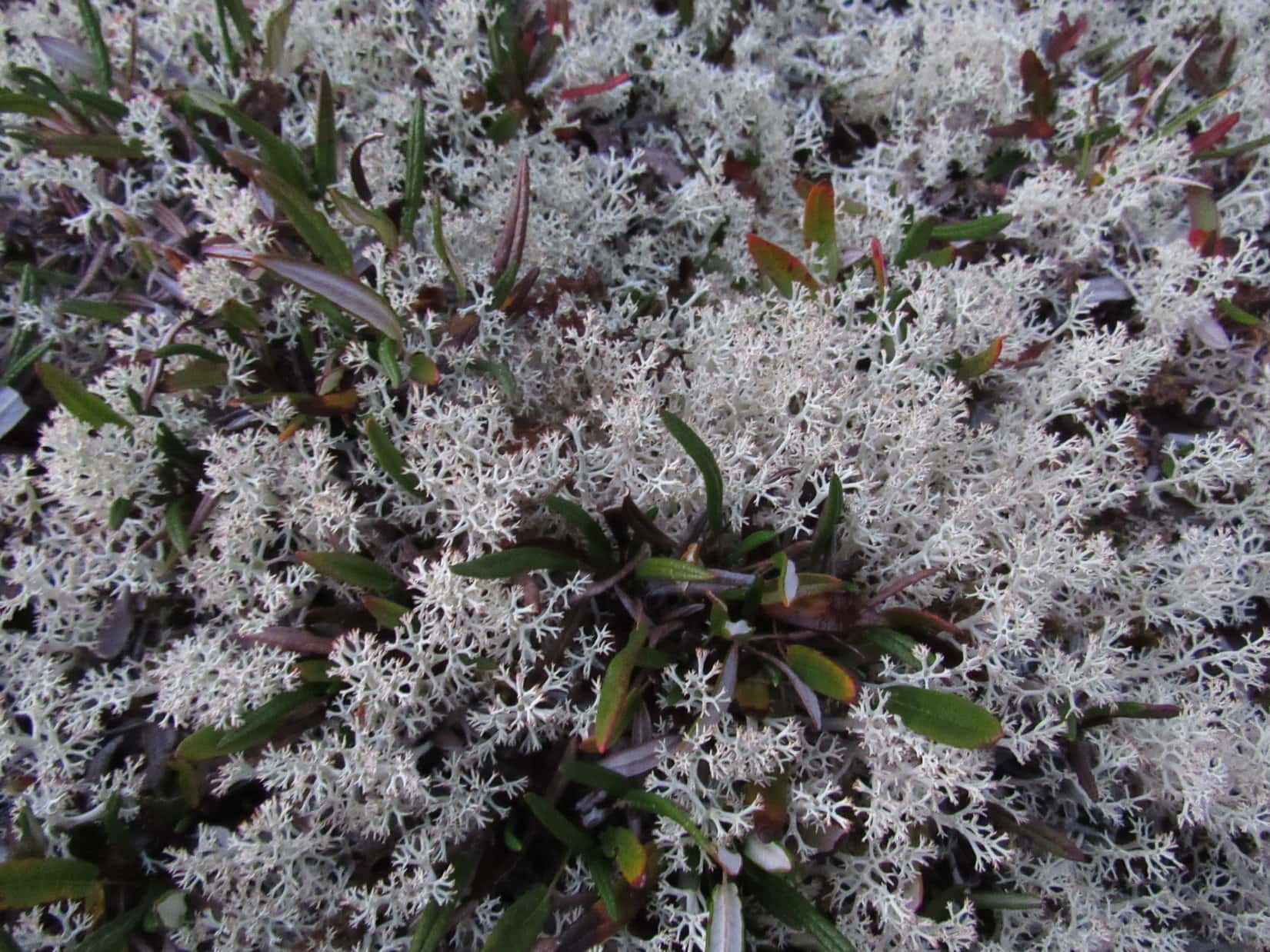
The tundra was thickly covered with beautiful small plants. They made the forest floor incredibly spongy and soft. The white moss or lichens seen prominently in this photo, tended to grow where the ground was a little drier.Lupe dozing on the soft tundra among the wild blueberries.
SPHP fell into the blueberry trap. The wild blueberries were small, but oh, so delicious! They hung on delicate low bushes so closely together that sometimes it was possible to pick 4 or 5 of them at a time. They grew everywhere. SPHP sat picking and consuming wild blueberries. Lupe dozed nearby on the soft, comfy tundra.
Crossing the low plain was supposed to have been the very easy start to the difficult climb up Dillon Mountain. Instead, it had been much more of a struggle than anticipated. Neither Lupe nor SPHP had really recovered from Sukakpak Mountain yesterday.
As SPHP consumed blueberries, all ambition drained away. Time slipped by. Lupe was happy snoozing. Soon it was apparent that Dillon Mountain wasn’t happening. It was too late in the day to try it anyway. Forget about it! Maybe tomorrow.
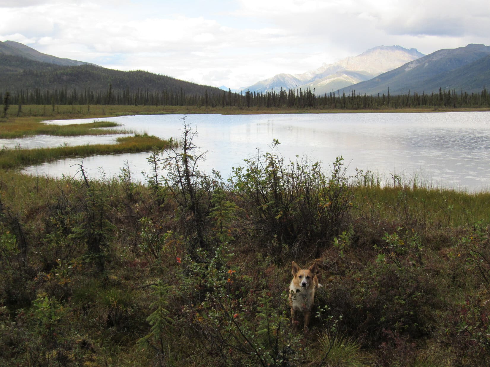
The sky started clouding up. Soon, raindrops sprinkled over the tundra. It didn’t look serious, but maybe it was time to head back. SPHP had noticed a small lake to the N on the way here. Lupe might as well check it out on her way back to the G6.
Staying farther N helped avoid the worst of the tussocks. Lupe did find the small lake, which proved to be quite close to the Dalton Highway. The shore of the lake was swampy. Lupe and SPHP passed SW of the lake, eventually reaching the dry ground and animal trails leading to the faint old road to the highway.
Lupe reaches the small lake near the swampy S shore. This lake (elevation 1,415 ft. on the Peakbagger.com topo map) is a mile W of Dillon Mountain. Photo looks NNW.Lupe S of the lake. Photo looks NNW.Dillon Mountain from the small lake. Photo looks E.On the way back to the G6 after SPHP gave up on Dillon Mountain.
The rain showers hadn’t amounted to much, but about the time Lupe arrived back at the G6 (4:08 PM), she heard thunder. The rain started in again. This time it rained harder. Lupe and SPHP took shelter in the G6, having a meal and then another nap, while the rain fell outside.
Two or three hours later, SPHP woke up to the sound of Lupe panting. She was warm in the G6. Outside it was a cool, comfortable 57°F. The rain showers had passed on by. Lupe and SPHP got out of the G6 for an evening stroll. At first there was no plan. Lupe and SPHP went N in the ditch on the E side of the Dalton Highway. Machinery had recently churned the ground up, so it was a little rough.
Soon the small lake was visible again. It was much closer to the Dalton Highway here, and bigger than SPHP had realized before. The W shore was also swampy, but Lupe didn’t care. She ran down into the lake for a drink, and to lay down and cool off. In a couple of minutes, she came running back.
Lupe and SPHP wandered N in a band of trees W of the lake. SPHP picked a few more blueberries. The American Dingo sniffed the exotic unfamiliar smells of the Alaskan tundra. It was still hard to believe Lupe was really here, 90 miles N of the Arctic Circle along the Dalton Highway in the Brooks Range of the Alaskan Arctic. Slowly, a simple plan came to mind.
Before ever coming on this Dingo Vacation, SPHP had read online about the Dalton Highway. It goes 414 miles N to Prudhoe Bay on the Arctic Ocean. Right now, Lupe was almost exactly halfway there. The G6 was parked just N of milepost 207.
If it had been possible to simply drive on to the Arctic Ocean, Lupe and SPHP would have done it. However, access to the ocean is fenced off 8 miles short of the ocean. Oil companies control the land near the shore. Since arriving in Alaska, SPHP had heard there were tours reaching the Arctic Ocean from Deadhorse, but had no clue what they might cost, or whether a Carolina Dog would be allowed on them.
No, Lupe wasn’t going on to the Arctic Ocean. In fact, on this gorgeous evening in the beautiful, remote Brooks Range of Alaska, maybe it was time for Lupe’s last mile N. It seemed fitting to do it on paw and foot. Lupe and SPHP returned to the ditch E of the Dalton Highway, and started N. The torn up ground was rough and unappealing. Lupe went up on the highway.
Traffic was light, so it would have been easy enough to just walk N along the Dalton Highway. After 5 minutes, though, SPHP realized there was a dirt road following the Alaska pipeline about 200 or 300 yards off to the W. Wouldn’t that be more fun? Of course, it would! Lupe and SPHP left the highway and headed for the Alaska pipeline.
It was the right decision. A broad swath of vegetation had been cleared beneath the pipeline, and along the dirt road just W of it. Lupe had a ton of fun racing into and out of the forest on both sides of the pipeline. There was no traffic at all. The pipeline itself was no nuisance, just kind of a dramatic reminder of where Lupe was, as close to the top of the world as she had ever been, or likely ever will be.
Lupe having a blast running around near the Alaska pipeline W of the Dalton Highway and Dillon Mountain. Photo looks N.
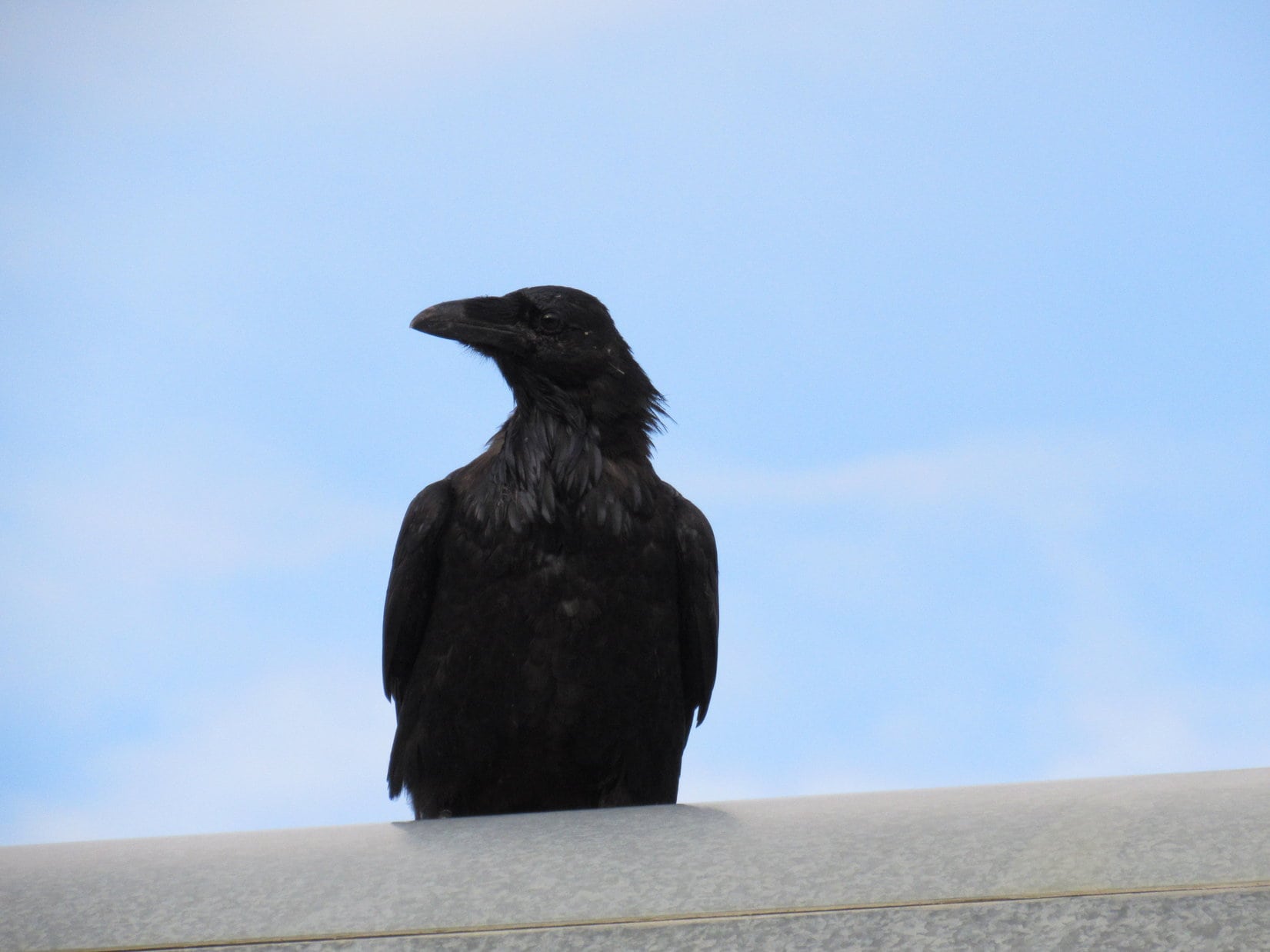
A raven appeared, and landed on the Alaska pipeline. It was curious about what a Carolina Dog was doing way up here in Alaska? The raven was joined by a few friends. They seemed to like watching Lupe, and hopping along on top of the pipeline. Sometimes they flew for short stretches, but they always landed on the pipeline again. Four ravens flew and hopped, following Lupe on her way N.
One of four ravens that seemed to enjoy using the Alaska oil pipeline as a perch from which to monitor Lupe’s activities on her last mile N.
The easy stroll N along the pipeline was a wonderful way to spend the evening. When Lupe had gone about a mile, she came to a clear, rushing stream. It was flowing W from the valley N of Dillon Mountain toward the Dietrich River. The water was incredibly clear, and must have been cold, but Lupe waded right in for a taste of the pure water.
Lupe waded right into the incredibly clear, cold stream flowing W from the valley N of Dillon Mountain. Photo looks N.Whoooeeee! These clear waters are Carolina Dog tested and certified pure and cold!Now that’s refreshing! Photo looks N.
For Lupe to go any significant distance farther N, SPHP would have had to ford the stream, or gone E back to the Dalton Highway. SPHP decided against it.
Lupe had already gone a mile N. The stream was low this time of year. Lupe could follow the mostly exposed streambed, which angled NW before reaching the stream’s confluence with the Dietrich River. That confluence could be her point of farthest advance N. For some reason, the idea appealed to SPHP. Lupe had no objections.
Lupe on her way along the stream bed to this stream’s confluence with the Dietrich River. Photo looks NW.Carolina Dogs range much farther than their name implies. This one is way up N of the Arctic Circle in Alaska! Carolina Dogs simply consider this extreme northern North Carolina. Of course, it also happens to be part of extreme western West Carolina.
It only took 10 or 12 minutes for Lupe to reach the clear stream’s confluence with the Dietrich River. Lupe’s last mile N was complete. She was as far N as she had ever been in her life. So was SPHP. Lupe and SPHP sat together for a while on the bank above the river, close to 90 miles N of the Arctic Circle in the Brooks Range of Alaska.
Lupe at the end of her last mile N at the confluence of the clear running stream and the Dietrich River. Photo looks N.
There’s a last time for everything. Usually though, one doesn’t think about it at the time. There’s a last day you will ever be in school, a last time you will ever leave the place where you work, or go out the front door of a house you’ve lived in for many years.
There is a last time you will see favorite places you’ve been to hundreds of time, or visit special friends. There’s a last time you will say good-bye to your parents, your children, your spouse, your pets, and to everyone and everything you have known and loved, and perhaps too often taken for granted. And there are some points beyond which you will never go.
SPHP stroked Lupe’s fur and praised her. Lupe listened carefully. Still farther N, were more beautiful mountains seen through the mist of more rain showers. Lupe and SPHP had a conversation. This was an important moment.
Still farther N beyond the Dietrich River were wild boreal mountains seen through the haze of rain showers. Photo looks N.
Well, Loopster, this is it. This is as far N as we are ever likely to be in our entire lives. We are only a little more than 200 miles S of the Arctic Ocean. Perhaps less, as those ravens on the pipeline fly. Once we leave this place, we will probably never, ever be this far N again. Kind of sad to think about, but this is a gorgeous spot, isn’t it?
Yes, this place is fantastic, but why aren’t we going adventuring all the way to the Arctic Ocean? Is there something wrong with it?
Well, I don’t know if they will let you on a tour to the Arctic Ocean. Access is restricted. It’s still a long way to go just to find out if they will take you. Probably not worth it. Remember the Lu-Lu Belle in Valdez? You couldn’t go on the Lu-Lu Belle, and I doubt you can go to the Arctic Ocean. Don’t worry, though, you have lots of other adventures lined up ahead of you in Alaska, but they are all farther S than this place. Besides, I kind of like the idea of stopping here.
Unfair! Sounds like discrimination against Carolina Dogs to me! I’d like to see the Arctic Ocean! Itch my belly would you? Ahh, better. Why do you want to stop here, anyway? We are having such a great time going N!
Yeah, we are having a great time, the best ever maybe. Perhaps it’s silly, but I guess I’m thinking of calling it good here for several reasons. First, I don’t know if you can go all the way to the Arctic Ocean. It doesn’t make any sense to me to drive way up to within 8 miles of it, only to get turned back. It would be too frustrating, not to mention an unnecessary expense.
Second, even though I doubt we will ever be here again, I kind of want to leave a reason to come back. See that cool mountain a few miles off to the N?
The dark blue one on the right where it’s raining now?
Yeah, that’s the one. I like that mountain. It looks mysterious. We saw it from the top of Sukakpak yesterday, remember? Something about me doesn’t want to see the end of the mountains. Let’s not go all the way to the end of the Brooks Range, or any farther than we are right now. That way we can still imagine that the mountains continue on forever, that there’s no end to them.
Oh, yeah, that sounds like human logic to me! Can I interest you in some sweet swampland in Carolina? The tooth fairy invested down there, you know!
Loop, I’ve been thinking about giving that mysterious mountain a private name. We can always remember how beautiful it is, and still dream that someday we will return to climb it. What do you think?
Geez, SPHP! I think you have whole flights of bats in your belfry. We are almost to it! If you want to go climb that mountain, we can do it tomorrow! Why leave and dream about it till the day you die, when you don’t think we will ever be back?
Well, because it leaves us a goal, a reason to return. That way we can always tell ourselves we are coming back. Who knows? The future isn’t set in stone. Maybe someday we actually will return. Besides, we are in the Arctic. I haven’t done any research on that mountain. Maybe there’s no way we could climb it. We might get ourselves in trouble wandering off into unknown territory without so much as a topo map.
Oh, I suppose that makes a little tiny amount of sense, SPHP. If it makes you happy, whatever. I still think we could go there tomorrow, and see if we could climb it without any harm done. So what’s the real name of that mountain, and what name were you thinking of giving it? By the way, keep petting me, don’t stop! Dingoes love getting love. We give lots of love, and expect a little in return, you know.
Of course, sweet puppy! Let me kiss you on your furry nose. All better?
Yes, that’s the idea! Don’t stop!
OK, about that mysterious mountain. I have no clue what its real name is. At first I was thinking we could call it Northern Lights Mountain, but I’ve kind of settled on Mountain of the Midnight Sun. We haven’t actually seen the northern lights by it, but we did see it in twilight last night at midnight on the way back from Sukakpak.
Twilight isn’t the same as seeing the midnight sun.
Well, we would have seen the midnight sun if we’d been here in June instead of August.
Yeah, but who knows how many nights of the year we might be able to see the Northern Lights, here? Maybe most of them?
Perhaps. Do you want it to be Northern Lights Mountain, then?
Doesn’t matter to me. Mountain of the Midnight Sun is fine. Just saying there wouldn’t have been anything wrong with Northern Lights Mountain. If you leave it up to me, we’re calling it Squirrel Mountain – now that’s a mountain worth coming back to! Speaking of the Midnight Sun, do you intend to wait for it right here? I’d kind of like to go see if there are any squirrels in that forest S of here along the river.
OK, fine. You can go look for squirrels, but it’s Mountain of the Midnight Sun, not Squirrel Mountain. You can name the next mountain. On this one, I’m calling the shots.
Squirrel Mountain – no, wait – Mountain of the Midnight Sun, as seen with help from the telephoto lens at the end of Lupe’s last mile N. Brooks Range, Alaska. Photo looks N.
Lupe and SPHP left the end of Lupe’s last mile N forever, heading S along the Dietrich River. At first Lupe stuck with SPHP out on the rocks and sand exposed on the riverbed. She wasn’t the least bit disappointed, though, when the river swung over the E bank, forcing SPHP up into the forest.
The forest was so exciting, Lupe took off running. SPHP saw her dashing here and there, but soon she was out of sight. When she didn’t return for a few minutes, SPHP started calling her before she got so far away she became disoriented and lost. Lupe didn’t return.
Suddenly, there was shrill American Dingo yelping going on a long way off to the SE, followed by a chattering. That crazy Carolina Dog actually had found a squirrel in the Arctic! SPHP pressed on through the forest toward all the commotion.
The forest was dense and jungley. As is often the case, SPHP made slow progress. Before SPHP reached the squirrel tree, Lupe had given up on the alarmed and annoyed squirrel. Most inconsiderately, the squirrel had refused to come down out of the tree to be devoured. That’s squirrels, for you! They’re a stubborn lot! Lupe returned searching for SPHP. She tracked that slowpoke down in nothing flat.
If the Dietrich River had stayed over by its W bank, it would have been fun to follow the river all the way S to its confluence with the Bettles River near the Dalton Highway, but SPHP had already seen that wasn’t going to work. Best to just head E back to the Alaska oil pipeline.
Going E, Lupe and SPHP quickly arrived at an open area normally flooded when the Dietrich River ran high. Ahead was a wide channel of nearly stagnant water. This sluggish stream looked deep and mucky. It must have surfaced from underground somewhere back upstream. Clearly, there wouldn’t be any way to cross it to the S. Lupe and SPHP turned N again.
45 minutes after Lupe and SPHP headed S forever from the confluence of the clear-running stream and the Dietrich River, Lupe was back! Funny how things go. Once again, Lupe and SPHP paused to enjoy this fateful spot. Finally, it was time to start up the dry streambed of the clear-running stream, heading SE toward the Alaska pipeline. Like a giant gold nugget, Dillon Mountain glowed in the late evening sunlight.
Golden Dillon Mountain glowing in the late evening sunlight. Photo looks SE.
Lupe reached the Alaska oil pipeline again. The ravens had flown away. Lupe and SPHP turned S, following the pipeline. The evening was gorgeous. Straight ahead was spectacular Sukakpak Mountain. Only yesterday, Lupe and SPHP had been at the very top, looking down from a great height.
Lupe romped around in the forests near the pipeline. As far as she was concerned, this hike was as fabulous as climbing any mountain. With Sukakpak to admire, it was hard to disagree.
Lupe had a great time again romping around in the forests near the Alaska oil pipeline on the way back S. Spectacular Sukakpak Mountain was dead ahead on the return trip. Photo looks S.Sukakpak Mountain, Brooks Range, Alaska. Lupe is still racing around at the lower L. Only yesterday, Lupe and SPHP had been at the summit of Sukakpak. Photo looks S.Fun times in the Arctic!
Lupe and SPHP followed the Alaska oil pipeline all the way S to where it crossed the Dietrich River. The Dalton Highway and the G6 weren’t far away now. Lupe postponed going back to the G6. The evening was simply too wonderful. For a little while, Lupe and SPHP wandered NW along rocks and sandbars exposed along the river.
Lupe reaches the Dietrich River again near the Dalton Highway. Photo looks S.
Lupe and SPHP went as far along the exposed riverbed as the river permitted, before it flowed right up against the forested bank. Well, this was it. It really was time to go back to the G6. Sadly, the evening of Lupe’s last mile N was almost over. On the bright side, at least tomorrow was another adventure!
Lupe heads back to the G6, which is parked as far N as it would ever go beyond milepost 207 along the Dalton Highway. Photo looks NE.
In fact, Lupe wasn’t going any farther S tomorrow than where she was right now. She was staying here, spending another full day in the far N. Her ascent of Dillon Mountain was still to come!
Happy Lupe at the end of her last mile N, Brooks Range, Alaska 8-14-16.