Elk Mountain, Bighorn Mountains, Wyoming 6-17-22

Day 2 of Lupe’s 1st Summer of 2022 Dingo Vacation to Wyoming!

Wee hours – The Carolina Dog was awake.  Earlier, the night had been very dark despite a zillion stars overhead.  That was then.  Bellyache Flats was now drenched in the ghostly light of a dying moon.  A faint breeze murmured something inaudible, then faded.  Nothing stirred.

Try to get some sleep, Loopster, or you’ll be exhausted before we ever get to Giant Deer Mountain (11,321 ft.)!

I can’t sleep, SPHP!  Not on the first night of a Dingo Vacation!

Yeah, I know.  Honestly, I don’t understand how you can peer endlessly into the night like you do, but suit yourself.  Nothing’s happening is it?

Not so far, but you never know when something will, SPHP.  Watching comes naturally for us American Dingoes.

If Lupe did see anything in the night, she never mentioned it to SPHP.  The next time SPHP pried an eyelid open, she actually was getting a few winks in.  Already light out by then, though!  As SPHP fired up the RAV4, Loop instantly sprang back to life.

The early drive N on USFS Road No. 24 to Battle Park to register prior to entering the Cloud Peak Wilderness was exciting!  Deer, and even a few giant deer, to bark at along the way!  The last time time Lupe had been to Battle Park in 2018, the big clearing had been a horse camp city full of trucks, trailers, and people.  However, this morning she arrived to find it deserted, except for a large herd of giant deers.  They raced off as soon as the trembling Carolina Dog started her high-pitched whining.

6:42 AM, 46°F, USFS Road No. 24, Middle Fork Trailhead –  Lupe stood smiling in the sunlight at the start of Trail No. 066 as SPHP hoisted the pack.

Ready to set out from the Middle Fork trailhead. Photo looks NE.

No tiny house, SPHP?  We’re taking on Giant Deer Mountain as a day hike?

Yup!  Most likely our best bet after what we saw from Buck Mountain yesterday evening, Loop.

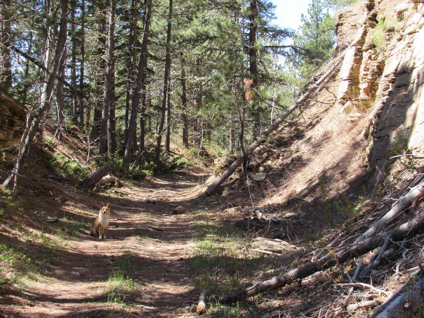
Trail No. 066 started out as an ATV route.  Winding NE, mostly through forest, it steadily gained elevation on its way to Lily Lake roughly 1.5 miles from the trailhead.  Fairly early on, as the trail skirted the N side of a large meadow, it passed near a tributary of the Middle Fork of Paint Rock Creek.  Beyond the meadow, Lupe came to a tiny snowmelt stream that trickled right down the middle of a long, muddy section of the trail.

Near the tributary of the Middle Fork of Paint Rock Creek. Photo looks ENE.
Trail No. 066 along the N edge of the first big meadow. Photo looks E.
Following the snow melt stream flowing down the middle of Trail No. 066.

From almost the very beginning, patches of snow had been melting away in the forest.  There was more snow by the time Lupe reached a wooden bridge over a small creek.  After crossing the bridge, the trail steepened for 0.25 mile before beginning to top out.

Crossing the bridge.

A second big meadow was ahead.  The road angled N here, but Looper abandoned it, continuing NE while cutting across the open terrain.

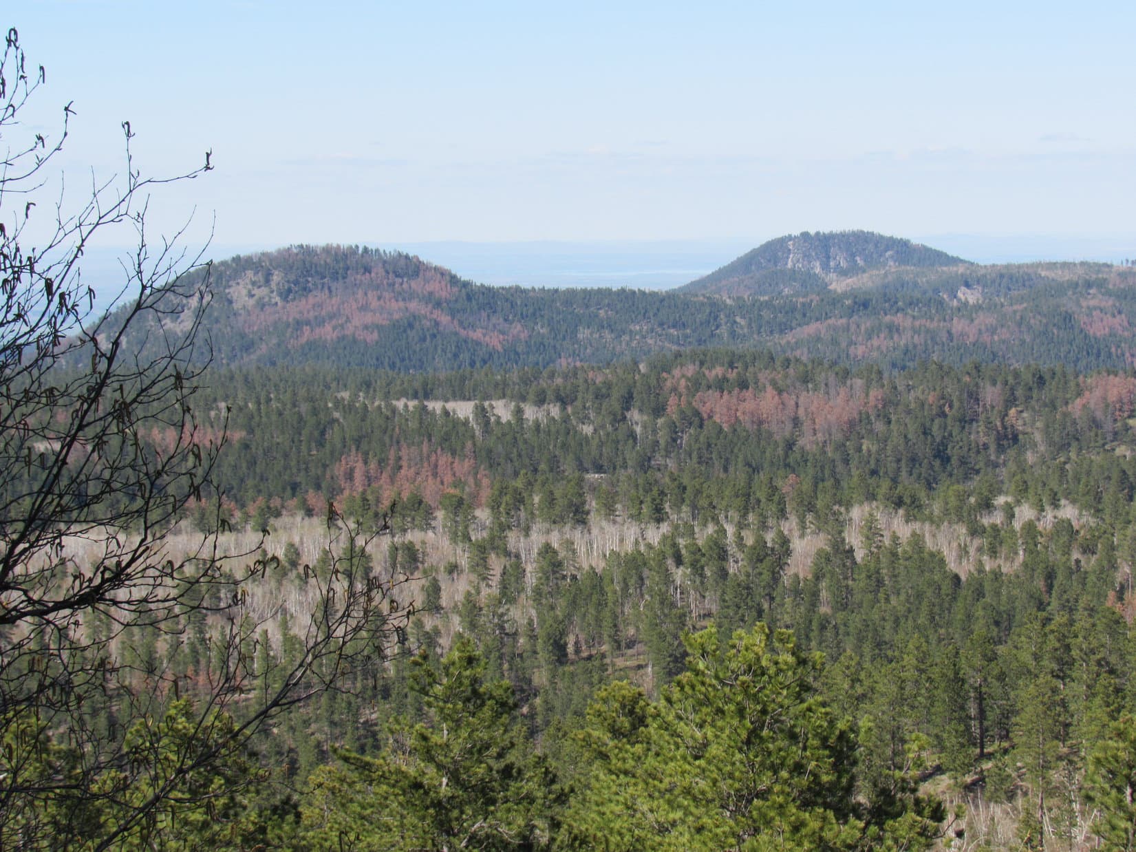
That’s Giant Deer Mountain (11,321 ft.) straight ahead, isn’t it, SPHP?

No doubt about it, Loop!  Our SW approach is looking very doable, too!  Think we’ve made the right decision.

The second meadow. Photo looks E.
Giant Deer Mountain dead ahead! Photo looks NE.

Glimpses of Lily Lake were soon visible beyond a line of trees along the N edge of the meadow.  Trotting over to the shoreline to get a view of Giant Deer Mountain from the lake, the American Dingo crossed Trail No. 066 again, which had now turned E.

Elk Mountain from Lily Lake. Photo looks NE.

Conifers surrounded Lily Lake on 3 sides, but the second meadow was vast.  Extending along the E shore, it also encompassed a spacious, gently rolling region E of the lake.  Clearly, the meadow was the easiest way to get closer to Giant Deer Mountain.  As Lupe circled around the SE end of Lily Lake, the only question in SPHP’s mind was whether she would be able to get across the outlet stream that left the lake’s NE corner.

Re-entering the meadow near Lily Lake’s SE shore. Photo looks NNE.
Lily Lake’s E shore. Photo looks WSW.

SPHP needn’t have worried about that.  Happily, a broad outlet channel quickly narrowed down to a little stream easily rock-hopped even in mid-June.  After enjoying a cold drink, Lupe roamed the open territory NE of the creek.

The outlet channel at the NE corner of Lily Lake. Photo looks NE.

Exploring the open ground was fun!  Progress was rapid.  Lupe soon came to a rocky embankment.  Since the region above it all appeared to be densely forested, she remained below, traveling along the base of the embankment in order to take full advantage of the meadow for as far as it went, which didn’t appear to be much farther at all.

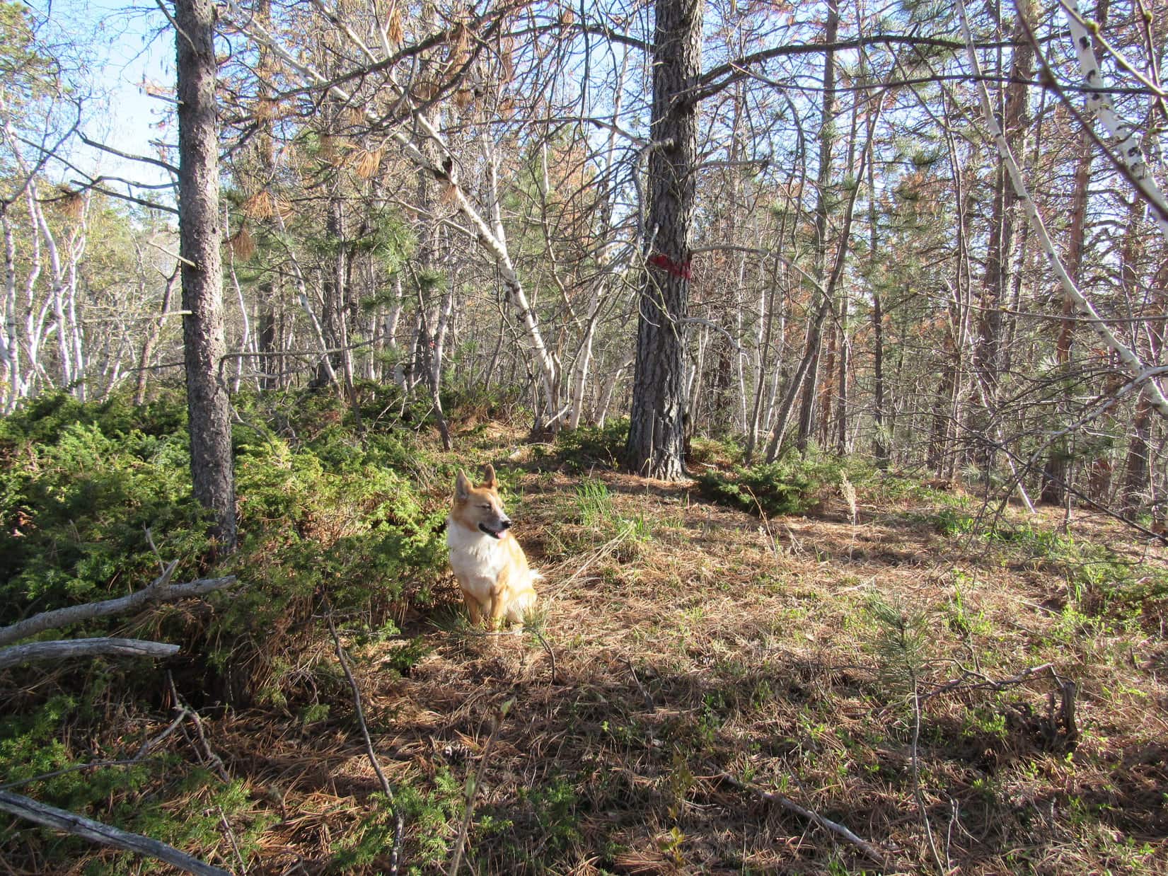
Even after plunging into the trees once the vast meadow came to an end, the forest proved surprisingly open, too.  A small hidden clearing led to a much larger one.

Everything was going great!  Looked like Looper wasn’t going to have to endure as much of a struggle getting to tree line as SPHP originally anticipated.

Below the embankment (L), approaching the end of the vast meadow. Photo looks NE.
Traveling a nice open lane through the forest.
Entering another sizable clearing. Photo looks NE.

However, the going got tougher once this larger clearing ended.  Turning N, Lupe followed game trails up onto a ridge where the forest was much denser.  A 25 foot descent on the other side of the ridge led to a small stream flowing among boulders.

Wading in the bouldery creek.

After another drink, Loop explored ENE up the stream a little way.  It soon divided into a multitude of rivulets and disappeared.  The forest was so thick that SPHP had difficulty pushing through.

Wandering N or NW, opportunistically following narrow open lanes whenever possible, another stream was reached.  A rocky ridge was now visible to the NNE.

By another stream, after breaking out of the forest again. Photo looks NE.

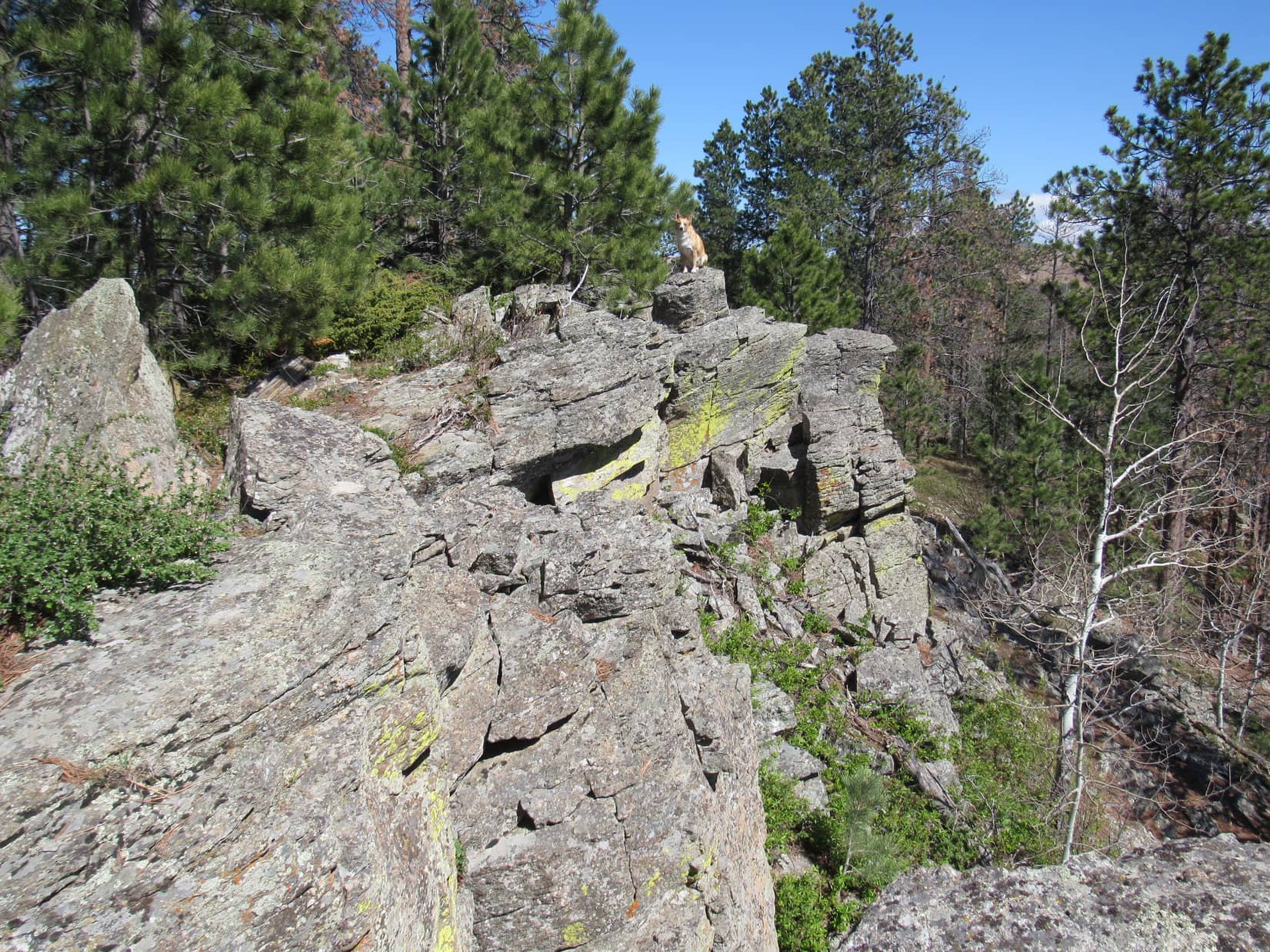
Heading over to the base of the ridge, the first section looked to be only 30 feet high, or so.  It appeared likely Lupe might reach an open region up there where SPHP anticipated she would be able to follow a broad, grassy bench ENE.

The scrambling wasn’t hard, but Lupe had to climb twice as high and go 3 times as far as SPHP expected before reaching the bench.  When the American Dingo got there, the news was terrible!  Instead of a smooth, grassy plain, a jumble of talus stretched away to the ENE.  Scattered stands of conifers only amounted to additional obstacles.

A bit of grass barely visible up on a rise at the far end of the boulder field held out the only glimmer of hope for better terrain ahead.

On the talus-infested bench. Photo looks ENE.

Not much choice!  A tedious boulder hop began.  A couple of spots were scary, as Lupe barely managed to make the required leaps between giant chunks of talus.  SPHP’s progress was dreadfully slow.  More than an hour and a half slipped by just getting up to a first little grassy spot where a rest break could be taken.

Beef jerky, Loop?

Don’t mind if I do, SPHP!  Bring it on!

The Carolina Dog practically inhaled each piece of jerky offered, while SPHP munched calmly away.  Looking SW back toward Lily Lake, it seemed Lupe hadn’t made it very far, or gained all that much elevation, considering the amount of effort expended coming up the talus bench.  Lily Lake appeared to be only 500 feet lower than the rest spot.

Climbing toward the first rest spot. Photo looks NE.
Lily Lake (Center) from the first rest spot. The talus bench (R) just crossed, and Buck Mountain (L) in the distance. Photo looks SW.

Criminy!  Going to be a mighty long day at this rate, Loopster!  Still have another 1,300 feet to go!

Guess we better get at it then, SPHP!

More talus was above the rest spot, but Lupe didn’t have to scramble much higher before reaching the patch of greenery that had been visible from a distance.  A most encouraging sight was ahead!  A lovely little stream gurgled down a wide swath of grass stretching up a long slope.

A series of high points was visible considerably farther up the mountain, each rising above the one before.  Lupe headed for them.

Oh, yeah! Much better! Continuing higher on much easier terrain. Photo looks NE.
Pasques.

This long trek higher started out easy enough, but eventually the grassy region withered away as the terrain became increasingly rocky again.  At first, the rocks were much smaller than the talus field encountered earlier, and lanes of vegetation could still be found.  Pressing on, though, the rocks grew in size.  Grass became scarce.  Another endless rock hop!

Upon reaching two large flat rocks at a small grass oasis, Lupe and SPHP were both ready for a break.  HP10882 was now in sight, about 60 feet higher, off to the W.  To the NNE, the most distant of the high points Lupe had been climbing toward appeared to be the true summit of Giant Deer Mountain.  Still a ways off, but Lupe had made considerable progress.

Closing in on the line of high points. Photo looks NE.
Not far from HP10882 (L). Photo looks WNW.
The apparent summit (Center) from the smaller of the two flat rocks. Photo looks NNE.

Continuing NNE from the two flat rocks, there was almost no vegetation.  The rock-hopping slog higher got steadily tougher as long snow banks and big talus appeared.  The snow was so soft and slushy that it wouldn’t hold even Lupe’s weight.  Completely avoiding it seemed advisable due to the many holes hidden in the rough terrain beneath it.

Winding between the long snow banks lengthened the route, and the higher the American Dingo went, the more snow there was to contend with.  Near the end, Loop finally reached the base of a much deeper and steeper snow field that covered so much territory that avoiding it wasn’t going to be easy.  SPHP tested the surface.  A couple feet beyond the soft edge, this snow had a much harder crust.

We’re in luck, Looper!  Onward!  Puppy, ho!

Approaching the summit region. Photo looks NNE.
Heading up the last snowfield. Photo looks NNE.

Traveling over the hardened snow was so much easier than scrambling among the rocks!  Lupe quickly got up to where the snow field leveled out up top.  To the NE, a big wall of talus several hundred feet long was directly ahead.

The high point Lupe had been heading for all this time was now only a little off to the NW, and clearly higher.  At the very top, a lone boulder in the shape of a massive, fallen column leaned against some other huge rocks, projecting skyward like the barrel of a cannon.

On the upper snow field, with a wall of talus ahead. Photo looks NNE.
Near the NW high point topped by Cannon Barrel Rock. Photo looks NW.

Cannon Barrel Rock looked like a mighty airy perch, but a quick glance around revealed that it wasn’t really the true summit.  Toward the SE, another outcropping of big talus appeared to be even higher.  The true summit of Giant Deer Mountain had to be somewhere over that way.

The true summit turned out to be this way. Photo looks SE.

Heading over to explore this outcropping, Lupe discovered a patch of grass next to a snow melt puddle.  The Carolina Dog promptly plunked herself down.

On the soft grass next to the snow melt puddle. Photo looks SE.

Can we take a break, SPHP?  It’s been a long climb, with so many rocks to leap over!  I’m soooo tired and sleepy!

Sure thing, Looper!  Knew you’d get sleepy after staying up half the night.  Relax a bit.  We can’t be far from the top now, anyway.

SPHP shared some more beef jerky.  Lupe devoured a bowl of Taste of the Wild, too.  Then, while the weary American Dingo dozed on the soft grass, SPHP sat munching an apple.  Turned out Loop wasn’t the only would-be peakbagger on Giant Deer Mountain.  A fuzzy caterpillar had made it way up here, too.

Relaxing on Giant Deer Mountain.
The intrepid caterpillar.

20 minutes hardly seemed like enough of a break, but the time had come to find out if Lupe could actually get to the top of Giant Deer Mountain.  Returning to the snow field, she climbed a bit higher, circling around to the N side of the SE talus outcropping.  From up here, the outcropping was seen to be a ridge extending farther SE.

The summit ridge. Photo looks S.

Ascending near the NW end of the ridge, the rocks were so huge that SPHP had to give Lupe a boost at a couple of points to get her to the ridgeline.  Once on top, cautiously working SE among the enormous rocks, Lupe headed for a big rock shaped like a gumdrop.

On the summit ridge, heading for Gumdrop Rock (Center). Photo looks SE.

As Lupe got close to Gumdrop Rock, higher rocks were visible beyond it.  Something else was visible, too – a tall, thin pole standing erect.  That had to be it!  The true summit of Giant Deer Mountain (11,321 ft.) was over by that skinny pole!

The skinny pole (Center) from Gumdrop Rock (R). Photo looks SE.

The ridge narrowed as Lupe headed for the pole.  15 feet NW of it, she came to a tiny patch of dirt and moss tucked down among the talus.  Loop could sit on this mossy spot comfortably enough, but it was so small that she couldn’t really lay down.  A brief rest here, and the final scramble to the summit was on.

2:37 PM, 65ºF, 10 mph SW breeze – Two big rocks next to the tall pole, each large enough to provide a decent, but solitary perch, proved to be the true summit of Giant Deer Mountain.  The American Dingo needed another boost from SPHP, rather awkwardly rendered, to get to either one.  After photos by the skinny pole, Lupe stood on the SE rock, while SPHP sat on the NW one.

By the skinny pole on top of Giant Deer Mountain. Photo looks SE.
Made it!
At the true summit. The summit ridge (R) extended farther SE.

We made it, SPHP!

Yes, we did, Loop!  Congratulations on your successful ascent of Giant Deer Mountain!

Chocolate coconut bar, SPHP?

Uh, yeah, but not here.  A bit airy for that.  Look at that E ridge, Loop!  Would have taken us a month of Sundays to get here from that direction.  Glad we came up from the SW.

Me too, SPHP!  Look at these views, though, simply spectacular!

Indeed, they were!  Giant Deer Mountain’s E ridge, a jumble of talus with sections nearly as high as where Lupe stood now, snaked away for more than a mile.  Beyond it, still significantly snow-clad, the mightiest peaks of the entire Bighorn range were on display.

Black Tooth Mountain (13,005 ft.), Mount Woolsey (12,978 ft.), Cloud Peak (13,167 ft.), Bomber Mountain (12,840 ft.), Peak 12,328, Mather Peaks (12,400 ft.), Darton Peak (12,275 ft.), Bighorn Peak (12,324 ft.), and others were all in sight.

Giant Deer Mountain’s E ridge (foreground). Cloud Peak (far L), Bomber Mountain (L), Florence Pass (Center) Peak 12328 (R of Center), Mather Peaks (R), and Peak 12080 (far R) beyond. Photo looks ENE.
Peak 12473 (L), Black Tooth Mountain & Mount Woolsey (L of Center), Cloud Peak (Center), Bomber Mountain (R), Florence Pass (far R). Photo looks NE.
Florence Pass (far L), Peak 12328 (L), Mather Peaks (L of Center), Peak 12080, Darton Peak & Bighorn Peak (R). Photo looks SE.

You know, Loop, Giant Deer Mountain (11,321 ft.) has got to be the best vantage point we’ve ever been to, as far as having a clear view of so many of the highest peaks in the Bighorns!  Incredible what we can see from here!

Part of the route up. Buck Mountain (Center), Lily Lake (R). Photo looks SSW.

Despite the fabulous panorama, SPHP was nervous about letting Lupe remain up on such a cramped, airy perch for long.  Essentially the same views had been available from all along the summit ridge, and even from the much safer terrain where Lupe had first started up it.

No registry or survey benchmark.  5 minutes of glory spent basking in the splendor of the Bighorn Mountains from Giant Deer Mountain’s true summit, then SPHP helped Lupe down off her lofty boulder.  A careful retreat to the security of the little spot of dirt and moss, and not 1, but 2 celebratory chocolate coconut bars bit the dust in short order.

The scramble NW back along the summit ridge to where Lupe had come up was roughly 300 feet long.  The American Dingo paused frequently to enjoy the views as SPHP poked along amidst the big talus.

Starting back along the summit ridge. Photo looks NW.
Peak 11806 (L of Center), Peak 12473 (R), Black Tooth Mountain & Mount Woolsey (far R). Photo looks NNE.
Peak 11806 (far R). Photo looks N.
Close to where Lupe would leave the N (R) side of the summit ridge. Cannon Barrel Rock (L) atop Giant Deer Mountain’s NW high point. Photo looks NW.

Once down off the summit ridge, Looper took a final look at the grand vista available from several boulders nearby.  She then returned to the grassy spot by the snow melt puddle for another rest before beginning the long descent of Giant Deer Mountain’s SW slope.

Peak 12473 (L of Center), Black Tooth Mountain & Mount Woolsey (R of Center), Cloud Peak (R), Bomber Mountain (far R). Photo looks NE.
Final rest break by the snow melt puddle. Cannon Barrel Rock (L). Photo looks NW.
Starting down. Lily Lake (Center) with HP10882 in front of it. Photo looks SW.
Leaving Giant Deer Mountain’s summit region. Photo looks E.

The return was an adventure in itself!  Venturing farther W along the big snowfield near the summit, Lupe lost plenty of elevation with relative ease before coming to such a soft patch that even the Carolina Dog was post-holing and floundering.  SPHP lost a boot deep in the snow, and had a dandy time extracting it.

Descending the talus field while avoiding the long snow banks seemed just as hard as on the way up.  SPHP was surprised when Lupe managed to find the 2 flat rocks again E of HP10882.  After that, life got easier once the grassy lanes among the rocks reappeared.

An attempt to avoid the lower talus field failed miserably.  By the time Lupe reached the forest, a big wind had come up out of the SE, bringing rain.  SPHP donned a brand new red rain jacket for the first time ever, the ancient blue plastic Cookie Monster poncho having finally given up the ghost on Bruce Mountain nearly a year ago.  The squall promptly ended.

Venturing farther S this time, Lupe got close to the Middle Fork of Paint Rock Creek.  At one point her route was blocked by a pond not shown on the map.  Passing S of HP9746, it was nearly dark by the time Loop made it back to the E shore of Lily Lake.

During the trek back down Trail No. 066, SPHP was profoundly weary.  Lupe, on the other paw, seemed energized by the black forest, sniffing along in and out of the weak beam of the little flashlight.  SPHP finally begged for mercy, laying down next to the trail to doze in the dirt.  The ordeal didn’t end until the RAV4 was reached at 11:05 PM.

What a day!  Long, sort of grueling, but that was OK.  Lupe had made it to Giant Deer Mountain!  Her 1st Summer of 2022 Dingo Vacation was off to an auspicious start.

On Giant Deer (Elk) Mountain, Bighorn Mountains, Wyoming 6-17-22

Links:

Next Adventure                             Prior Adventure

Want more Lupe adventures?  Choose from Lupe’s Summer of 2022 Dingo Vacations to Wyoming, Canada & Alaska Adventure Index, Dingo Vacations Adventure Index or Master Adventure Index.  Or subscribe free to new Lupe adventures.

Black Hills, SD Expedition No. 214 – The Search for Elk Mountain with Rizzo, Buddy & Josh Hilpert (11-4-17)

October 21st dawned bright and breezy, the air exceptionally crisp and clear.  Puffy white clouds sailed the blue sky.  SPHP knew instantly that cancelling had been a mistake, but nothing could be done about it.  Yes, this was a breezy day, but nothing approaching the forecast 40+ mph wind gusts would ever materialize.

Lupe’s opportunity to meet new friends had been rescheduled.  November 4th arrived, and she was finally on her way!   What a day this was, though!  Heavily overcast, dark and cold.  Only a couple of days ago, the forecast had looked fine.  Now this!  Again too late to do anything about it.  Expedition No. 214 was on, come what may!

At 7:59 AM, with exactly one minute to spare, Lupe arrived at the Latchstring Inn at Savoy in Spearfish Canyon.  No sign of Rizzo, Buddy & Josh, yet.  No worries, they’d be here soon enough.  In the meantime, Lupe went over to take a look at the Spearfish Canyon Lodge.

The Spearfish Canyon Lodge at Savoy normally has wonderful views of some of Spearfish Canyon’s most impressive limestone cliffs. Today it was socked in with fog.

Looper also had time to check out Little Spearfish Creek.

At Little Spearfish Creek. Two of the best waterfalls in the Black Hills are on Little Spearfish Creek. Spearfish Falls is only 20 or 30 feet downstream of where Lupe stands here. Roughlock Falls is less than a mile upstream. Lupe wouldn’t get to see them today.

Rizzo, Buddy & Josh soon arrived.  Rizzo and Buddy were so excited about going on an expedition, they weren’t about to hold still for a group photo.  Lupe and her new friend, Josh, posed together, though.

Lupe and new friend Josh Hilpert at Savoy in Spearfish Canyon.

The date wasn’t the only thing that had changed for this first outing together.  Only a couple of days ago, Plan A’s chosen destination had fallen through.  A major disappointment at the time, but now clearly a good thing given the weather.

Josh had expressed interest in any routes Lupe knew of up into the country E of Spearfish Canyon.  On prior expeditions Lupe had explored two such routes.  Plan B was that Loop would take Rizzo, Buddy and Josh on one of them.  Two specific destinations became Expedition No. 214’s objectives – Elk Mountain (6,422 ft.) and the cliffs overlooking Savoy.

Lupe’s route to Elk Mountain started at Annie Creek Road near Elmore, 4 miles up Spearfish Canyon from Savoy.  The weather remained cold and heavily overcast, even a bit foggy, but everyone was in good spirits as the trek began.  (8:36 AM, 32°F)

Lupe and her new friend Buddy near the start of Annie Creek Road. Photo looks N.

Annie Creek Road went N for 0.75 mile.  Upon reaching the side canyon Annie Creek flows down, it turned NE for another 0.75 mile.  The snowy road was an easy romp, being nearly level this whole way.  It was a good place for everyone to become acquainted.

Lupe wasn’t used to having so much company, but the dogs all got along just fine.  Buddy and Rizzo were adventure dogs, too!  In fact, Rizzo and Josh have been enjoying their own weekly adventures in the Black Hills even longer than Lupe and SPHP.  Buddy wasn’t as experienced in the adventuring business, having only recently joined the Hilpert family.  However, it was clear he was relishing his good fortune.

The first big decision came at an intersection 1.5 miles from the start.  The only time Lupe had been to Elk Mountain before was nearly 1.5 years ago.  Back then, she had taken the road to the L, which went W back to Spearfish Canyon before turning NW.  The road stayed level, but ultimately came to two places where old bridges had collapsed.  Lupe had made it past the first resulting gap, but not the second.  In the end, she’d had to climb a very steep slope, though once on top, this had ultimately proven to be a good direct route to Elk Mountain.

The other option was take the road to the R, which went NE up the Annie Creek valley.  Last time, looking for a shortcut back to the G6 late in the day, Lupe had gone down a different steep slope that had brought her into this valley.  SPHP remembered it had looked like Lupe could have followed roads all the way down, if she had been willing to take a somewhat longer route.

Nearing the first intersection. A decision would have to be made soon – go L or R? Josh crouches to stay in the photo (which he didn’t have to do). Buddy on the L while Rizzo circles around behind Josh. A familiar furry face out front and center. Photo looks N.
Same spot, but showing better how foggy it was. Josh pats Buddy while Rizzo helps himself to some snow.

It was cold and damp.  Ice and snow might make hillsides treacherous.  It seemed best to avoid the steep climb up from the road to the L.  The decision was made to turn R, following the road up Annie Creek valley.

Another intersection was reached only 0.25 mile farther on.  Rizzo and Buddy crossed Annie Creek for a brief exploratory foray on a side road going SE up Lost Camp Gulch.  That wasn’t the way to Elk Mountain, though, so they quickly returned.

Buddy (L) & Rizzo (R) return from a brief foray up Lost Camp Gulch. The small stream is Annie Creek. Photo looks SE.

Lupe and SPHP had never been this far up Annie Creek before, but it seemed reasonable to continue on the road following the creek a little farther before looking for a way up onto higher ground to the N.  Rizzo, Buddy and Josh had never been here before either, so they simply tagged along.

The road following Annie Creek headed NE, beginning to gain significant elevation above the stream on the way.  Eventually a minor side road appeared on the L.  It went N up a steep, forested slope.  N was the right direction, so the side road seemed like a good way to reach higher ground quickly.

After a steep climb, the side road leveled out as expected.  The forest was pretty foggy up here.

Buddy and Lupe on the minor side road once it leveled out. The forest was cold and quite foggy up here. Photo looks NNW?

Elk Mountain couldn’t have been much more than 1.5 miles to the NW as the crow flies from here.  Due to the fog, though, the mountain wasn’t in sight.  No other landmarks more than a couple hundred feet away could be seen, either.  As long as Lupe kept heading N or NW, though, SPHP was confident she would eventually find the mountain.

The minor road eventually faded and curved off in the wrong direction.  Lupe and SPHP led everyone N or NW, traversing snowy slopes.  The terrain was more convoluted here than where Lupe had been on her first visit to Elk Mountain.  Lupe tried to keep gaining elevation, but often she had to lose some.  She finally came to a big fence.

Reaching the fence was encouraging!  Beyond it were extensive gold mining operations.  Lupe had seen them before.  She had followed this fence N on her first trip to Elk Mountain.  She hadn’t had to follow it more than 0.25 mile before she’d seen a big pond inside the fence.  If the American Dingo could find that pond again today, SPHP was certain of the rest of the route to Elk Mountain.

Everyone trudged NW along the fence.  The terrain went up and down, but eventually seemed to be going more down than up.  On and on, much farther than Lupe had followed the fence the first time.  SPHP had expected it to be farther coming this way, but quite a bit of time went by.  The pond didn’t materialize.  By now it was so foggy Lupe might not even be able to see it.

Why hadn’t the pond appeared?  Had the Carolina Dog passed it in the fog?  Could it really be this far?  Josh and SPHP stopped to consult the topo map and discuss things.  The problem was, the topo map SPHP had was old.  The mining operations, which had altered a great deal of terrain, were newer and not shown on the map.  SPHP knew the mine was SE of Elk Mountain, but only had a general idea of how far SE.

Consulting the map without being able to see some landmark shown on it, was no help.  Even more disturbing, it turned out that Josh and SPHP had completely different ideas on what direction Lupe had been going!  Knowing the truth about that was sort of important.  Critical, one might say.

15 or 20 feet beyond the fence, a mine worker was standing on a knoll.  He was busy watching or directing someone else operating a truck or other equipment that could be heard, but wasn’t in sight from outside the fence.  Josh suggested asking him where this spot was on the map.  Sure, why not?

The miner was friendly, and glad to be of service.  He said this was the Wharf Mine.  No doubt that was true.  Other than that, he was a wealth of misinformation.  Before even looking at the topo map, he volunteered that Lupe and company were somewhere between Foley Mountain (6,640 ft.) and Terry Peak (7,064 ft.).

What!?  Impossible!  If true, Lupe had been going in completely the wrong direction for a long time.  Another glance at the map convinced SPHP that couldn’t possibly be right.  Lupe would have had to take the road up Lost Camp Gulch to be anywhere close to the area between Foley Mountain and Terry Peak.  Rizzo and Buddy had started up that road, but that hadn’t been where everyone had ultimately headed.

Josh and SPHP showed the miner the topo map.  He ultimately pointed out a different area ESE of Elk Mountain, and said that was where this place was.  That didn’t seem right either, but it wasn’t outlandish.  Lupe might not be too far S of there.  If so, that was good news.

Nearby, a road headed away from the fence.  The miner said to follow it to get to Elk Mountain.  Worth a shot, maybe.  After thanking the miner for his assistance, everyone took the unmarked road.

The snowy road was fairly level.  The forest was foggier than ever.  Away from the fence, all sense of direction, accurate or not, was lost.  Rizzo, Buddy, Lupe, Josh & SPHP arrived at a fork in the road.  Which way?  The road to the L led to a hill.  The road to the R was level or losing elevation gradually as it disappeared into the fog.

Rizzo in the fog that was threatening to confound Expedition No. 214.
After leaving the fence at the edge of the gold mine behind, Rizzo, Buddy, Lupe and Josh arrive at a fork in the road suggested by the miner. Which way now?
Buddy on the L, Rizzo again behind Josh. In the fog, Lupe was having a hard time even finding Elk Mountain. Photo looks ?

On the vast majority of mountains, the summit is kept at the top.  SPHP suggested taking the L fork going up the hill.  If Lupe was anywhere on the slopes of Elk Mountain, going up would eventually get everyone to the summit.

The hill proved to be a small one.  The road soon leveled out.  It began curving to the L, then disappeared beneath a pile of deadfall.  In every direction, the terrain sloped down.  Gah!  SPHP thought higher ground was visible in a small opening between trees off to the R, then became convinced it might only have been fog.

Josh had a compass!  He’d mentioned it before.  SPHP was completely turned around, so when Josh mentioned the compass again, suddenly it seemed to be the crucial missing link.  Was the compass accurate?  Josh was convinced it was.  According to the compass, this road up the hill had been going W before turning SW.

No one was going to get to Elk Mountain going SW!  SPHP still believed the mountain was NW from here, but NW was down a slope.  Lupe and SPHP led everyone N off the road, into the forest.  The terrain to the N lost elevation, too, but more slowly than going NW would have.  It wasn’t long before Lupe was gaining elevation again.  SPHP found a road!  Yes!

No!  Josh had the temerity to point out this was the very same road that had just been left behind.  Really?  Yeah, really.  There were the fresh foot and paw prints.  Proof positive.  Good grief!  Better go back to the fork and try the road to the R.  Josh headed off in the wrong direction.  Everyone arrived again at the place where the road turned SW and disappeared under the deadfall.  Company halt!  About face, and march!

Back once again at the fork, the road to the R was the next subject of exploration.  After 5 or 10 minutes, a long straight section was reached that stretched ahead as far as could be seen into the foggy forest.  What direction was that?  Josh checked the compass.  The road went W.

This wasn’t going to work either.  SPHP was convinced Lupe was still too far S.  Going a long way W would only bring everyone to cliffs at Spearfish Canyon.  A lot of time was being chewed up wandering all these roads.  Best to go back to the fence at the mine, and keep following it as before.  If that didn’t work, Expedition No. 214 was doomed to failure.  Sad, but true.

The terrain went down at first, as Lupe followed the fence.  This didn’t seem right, but she hadn’t gone far when suddenly, there was the pond!  It was faintly visible in the fog beyond the fence.  Confusion vanished.  Lupe was going to get Rizzo, Buddy and Josh to the top of Elk Mountain after all!  Puppies, ho!  Onward!

After crossing shallow McKinley Gulch, a rough road was reached.  This road went NE to an intersection near the upper end of the gulch.  A much better road ran E/W here.  W was now the way to go!  Still unseen, Elk Mountain was only 0.5 mile away.

On the road to success! Looking W on the road near the upper end of McKinley Gulch. Rizzo at Josh’s feet.

The road W soon arrived at another fork.  Lupe took the L branch going SW.  She followed it looking for one more turn, a driveway on the R.  Found it!  Gaining elevation all the way, the driveway headed W to the S side of Elk Mountain, then curled all the way around to the mountain’s E and then N slopes.

Rizzo and Buddy charge on ahead. The summit of Elk Mountain wasn’t much farther now! Photo looks NW.

It was only early November, but the top of Elk Mountain was a winter wonderland!  Snow, frost, cold and fog.  It could have been January, the way things looked and felt.

Lupe, Buddy & Rizzo on the final stretch to the summit. It was only early November, but Elk Mountain was a winter wonderland! Photo looks S.
A better look at Rizzo at lower L.
Buddy’s turn up front.

Due to the fog, the success of the whole expedition had been in doubt for hours, but everyone made it to the top of Elk Mountain (6,422 ft.).

Buddy and Josh Hilpert with Looper up on Elk Mountain. Rizzo’s here too, a little way off in the background.
Rizzo next to the playhouse at the summit of Elk Mountain. Rizzo once fell out of a truck at 60 mph, and is lucky to still be able to go exploring the Black Hills. Rizzo is a very experienced Black Hills explorer, and has been many places Lupe’s gone to, plus more besides!
Buddy at the summit. Buddy is a recent addition to the Hilpert clan. Lucky guy! He loves his weekly outings in the Black Hills with Josh and Rizzo. Buddy had one oddity about him. When he stood, one of his back legs would often start quivering and shaking as though he was very cold. Josh says this is normal for Buddy. It happens even when it’s warm out.

Of course, all views from Elk Mountain on this glorious day were hidden in the fog.  Right on the summit, though, was a sight that brought cheer to the whole group.  Lupe and SPHP had known it was here, but it was a complete and welcome surprise to Rizzo, Buddy & Josh.

At the top of the mountain is a small octagonal structure with 7 windows and a little door.  It appears to be a child’s playhouse.  Nothing of significance was inside.  Hundreds, maybe thousands of dead flies covered the carpeted floor.  On this cold, snowy day, that didn’t matter.

The playhouse was unlocked, a little warmer, and much drier than being outdoors.  It was just large enough so Rizzo, Buddy, Lupe, Josh & SPHP could all get inside.  Everyone got in to rest and warm up a bit.  Lupe had water and her usual Taste of the Wild.  Rizzo and Buddy tried some Taste of the Wild, too, and found it to their liking.

Josh and Buddy near the octagonal child’s playhouse on Elk Mountain. This structure came as a complete surprise to Rizzo, Buddy & Josh, but they were glad to see it on this cold day.
Of course, Lupe and SPHP had seen the playhouse before. In good weather, it has a fantastic view of the Wharf gold mine. Today, it was just large enough to serve as a shelter for the entire expedition.

Josh and SPHP discussed options for the rest of the day.  Unfortunately, it had taken so long to find Elk Mountain, there wasn’t going to be much time for extras.  The other original objective for the day, going to the cliffs overlooking Savoy, was out.  It would take too long to get there, and nothing would be gained from going to a fabulous viewpoint in the fog, anyway.

Ragged Top Mountain (6,200 ft.) was only 1.25 miles NW, but other than peakbagging for peakbagging’s sake, again there didn’t seem to be any point in the fog.  The old townsite of Preston was closer, but consists mainly of a single decaying old building.  Not too scintillating.  It wasn’t enough of an enticement on such a wintery day.

In the end, no other easily attainable objectives nearby came to mind.  Days are short in November, and it was already early afternoon.  In this weather it would get dark even earlier than normal.  Just getting back to the vehicles was going to take hours.

So once everyone had taken a break and warmed up a little in the charming, dead-fly decorated playhouse, it was time for another look around Elk Mountain’s summit before beginning the journey back.

Josh and Rizzo on Elk Mountain. The weather hadn’t improved any during break time in the playhouse. Photo looks SW.
Rizzo awaits departure time.
Josh grasps a post to which a small metal crucifix (not pictured) is attached while Buddy looks on. A certain Black Hills dingo is still in the vicinity, too. Photo looks NNE from near the playhouse.
Rizzo near the crucifix post. Photo looks NNW.
Looking W.
A self-flocking frosty tree.
Despite the weather, Lupe’s Elk Mountain guide service had ultimately been fruitful.

With no views to linger for, final inspection of Elk Mountain’s relatively small summit ridge didn’t take much time.  Soon the descent through the mountain’s winter wonderland began.

Rizzo & Buddy start the descent.
Josh and either Rizzo or Buddy on the upper N slope of Elk Mountain. Photo looks N.
Loopster blends in with the winter wonderland, not too far below the summit yet. Photo looks SSW.

The first part of the journey back was a simple retracement of the ascent.  By the time everyone was S of McKinley Gulch, back at the fence on the W side of the Wharf gold mine again, the fog had lifted to a degree.  The pond Lupe had been looking for on the way to Elk Mountain was now in clear sight.

On the journey back, the fog lifted to a degree. The pond at the Wharf gold mine was now in view from the fence around the mine. This pond is less than a mile SE of Elk Mountain. Photo looks N.

While heading S from the pond not far from the fence, SPHP saw terrain to the SW that looked familiar.  Hadn’t Lupe been over there the first time she went to Elk Mountain?  Yes!  A quick foray in that direction brought the expedition to a road Lupe had been on before.

From here, it was possible to follow a series of unmarked roads S or SE that ultimately led back down to Annie Creek.  The clouds had lifted enough to reveal partial views from a few points along the way.

Looking SW toward Spearfish Canyon.
Josh, Buddy & Lupe on the way down to Annie Creek. The W end of Foley Mountain (6,640 ft.) is in view. Photo looks SE.
Fellow Black Hills explorer and adventurer Josh Hilpert with Lupe.

Light was beginning to fade by the time the last intersection 1.5 miles from the vehicles was reached.  The rest of the way back was a snap from here.  Maybe enough time remained for a little more exploring?  SPHP talked Josh into checking out the road Lupe had taken to Elk Mountain the first time.

It was farther along this road to where the first bridge had collapsed than SPHP remembered.  After 0.5 mile or more, it was time to forget it and turn around.

In increasing darkness, the march back along Annie Creek Road seemed longer than it had early in the day.  The adventure dogs all had a fine time, though, while Josh and SPHP chatted.

There had been plenty of opportunities to visit during the day.  It had been fun to compare notes and have wide ranging discussions on peaks, places, and a variety of other topics.  Rizzo, Buddy and Lupe had gotten along well together.  The weather hadn’t been conducive to enjoying scenery, but had made Expedition No. 214 seem far more mysterious and challenging than it otherwise would have been.

It had been a good day, a fun time for all.  Rizzo, Buddy & Josh Hilpert live in Sturgis, SD, so perhaps more adventures are in store with Lupe’s new friends from time to time.  It’s something to look forward to!

With new adventuring friends Buddy & Josh on Elk Mountain. Camera-shy Rizzo was around here somewhere, too!

Links:

Next Black Hills Expeditions                     Prior Black Hills Expeditions

Black Hills SD Expedition No. 230 – Ward Draw & 2K Peak with Rizzo, Buddy & Josh Hilpert (5-19-18)

Black Hills, SD Expedition No. 172 – Elk Mountain, Ragged Top Mountain & Twin Peaks (5-14-16)

Want more Lupe adventures?  Check out her Black Hills, SD & WY Expeditions Adventure Index, Master Adventure Index, or subscribe free to new Lupe adventures!

Black Hills, SD Expedition No. 172 – Elk Mountain, Ragged Top Mountain & Twin Peaks (5-14-16)

A little downstream (N) of the sign for the cabin community of Elmore in Spearfish Canyon, SPHP stopped the G6 on a small pullout next to Hwy 14A.  USFS Road No. 215.1 was supposed to be around here somewhere.  Finding it was critical to Lupe being able to complete her peakbagging goals for the day.

SPHP checked the maps again.  Either No. 215.1 wasn’t much farther ahead, or SPHP had already missed it.  Let’s go a little farther Loop, if we don’t see it, we will have to turn around and make another pass.

The G6 had hardly gotten going back on Hwy 14A again, when a street sign saying Annie Creek Road appeared on the R next to a very rocky side road.  That was it!  Very carefully, SPHP crawled the G6 up the first little hill.  This wasn’t G6 territory!  As soon as the terrain flattened out, the G6 got parked along a wide spot in the dirt road (10:33 AM, 41°F).

Lupe and SPHP started off heading N on Annie Creek Road.  It was narrow, kind of rocky, but almost level.  An easy hike to start the day!  Last weekend, Lupe had found a similar road leading out of Spearfish Canyon farther N on her way to Little Crow Peak (5,885 ft.).  That road had been steep for over a mile, though.  This was a piece of cake!

The thick haze that had persisted all day on Expedition No. 171 was gone.  The air was a crisp, crystalline blue.  Not a cloud was in the sky.  Lupe and SPHP were both in high spirits, making good progress along the road.  The first point of interest came as the road angled NE.  A cold, clear rivulet poured down the steep hillside SE of the road between mossy banks.

The mossy-banked rivulet next to Annie Creek Road. Lupe wasn’t thirsty yet.

Lupe wasn’t thirsty yet, so she just went on.  She was surprised when a big mud puddle covering most of the road turned out to have a thin coat of ice.  Lupe passed several big iced-over puddles.  Near one of them, SPHP spotted a Lupe Treasure.  The aluminum beer can turned out to be heavy.  It was full of ice, too.  SPHP decided to move it from the ditch into a sunnier spot where the ice would melt.  Lupe could claim her treasure on the way back to the G6 at the end of the day.

Annie Creek could now be heard down in the deep forested valley to the NW.  Lupe was more than 1.5 miles from the G6 by the time the road curved N, and went over a high embankment above Annie Creek.  Lupe saw Annie Creek, which had surprisingly good flow, but did not leave the road to run down to it.

The road divided on the NW side of the creek.  The main road went NE following Annie Creek upstream.  A lesser, but still good road went W.  The topo map showed that this road would gain elevation slowly while working around the W end of a big hill to the N.  Eventually, it would turn E, arriving after 2 miles at a point less than 0.5 mile S of Lupe’s first peakbagging goal, Elk Mountain (6,422 ft.).  Lupe and SPHP left the main road heading W on the lesser road.

Lupe on the lesser road after leaving Annie Creek Road. Photo looks W.

Everything was going great!  It was all so easy.  The lesser road started curving around to the NW.  Suddenly it ended.

Lupe reaches the sudden end of the lesser road. Photo looks NW.

Looking down into the steep ravine ahead, it was possible to see a couple of big old cement foundations and some collapsed timbers.  The road didn’t use to end here, there must have been some kind of trestle bridging the gap.  Trees kind of hid the other side, but it did look like the road still continued NW on the other side of the gap.

Going down the S end of the gap seemed easy enough, but climbing up the N end looked pretty steep.  It didn’t appear too bad, though.  Lupe and SPHP went down into the gap to get a closer look.

Lupe on one of the cement foundations down in the gap. Photo looks N up the steep slope Lupe would have to climb to get to where the road would continue NW.
Looking WNW from the bottom of the gap.

Lupe and SPHP climbed up the steep N side of the gap.  It wasn’t too bad going up, and less than a 50 foot climb, but SPHP hoped there weren’t any more gaps in the road ahead.  SPHP didn’t relish the prospect of going back down this way, if Lupe had to turn around.

The road did continue NW from the N side of the gap, but the view wasn’t entirely encouraging.  This part of the road was full of rocks and boulders that had fallen down the steep slope to the NE.  Trees were growing on the old roadbed.  It didn’t look like this part of the road got used at all any more.

The road continued on N of the gap, but didn't look very encouraging. Photo looks NW.
The road continued on N of the gap, but didn’t look very encouraging. Photo looks NW.

Lupe didn’t have to go very far N before SPHP’s fears were confirmed.  Another gap was dead ahead.  This one was even bigger, steeper, deeper and wider.  One look at it, and SPHP knew Lupe couldn’t continue on this way.

The 2nd, even bigger gap wasn’t far N of the 1st one. No way Lupe and SPHP could get across this one!

SPHP didn’t want to back down that N slope of the 1st gap, but crossing the 2nd gap wasn’t an option at all.  Lupe and SPHP had to turn around.  SPHP searched the steep slope to the NE.  Was there a way up there?  It was the only other possibility.

The NE slope was steepest down right next to the road where part of the hillside had been carved out during road construction.  About 50 feet up, the slope wasn’t quite as steep.  Only one spot offered a possible reasonable route up.  From the very top of the steepest part of the bank, a fallen tree slanted down at an angle for about 30 feet.  The upper end of the trunk was wedged against a big living pine.  The lower end was firmly wedged between big rocks.  This tree trunk looked very stable, and getting to the lower end of it appeared relatively easy.

So, Lupe and SPHP tried going up the steep NE slope using the fallen tree for support.  No problems!  It worked just fine.  SPHP still had to crawl up the higher slope for quite some distance.  Very gradually, it became less steep.  Near the top, SPHP was able to walk again.  After gaining 200-300 feet of elevation, the ground finally leveled out.  Whew!  Lupe and SPHP took a breather at a rock outcropping at the edge of the slope.

Lupe at the rest point after climbing up the long steep slope unseen just beyond the edge of the rocks behind her. SPHP was quite glad to reach this point. Photo looks WSW.

Lupe had some Taste of the Wild and water.  SPHP checked the topo map.  From here Lupe needed to keep climbing while following the sweep of the ridge.  However, it wouldn’t be nearly as steep from here on.

SPHP had not planned for Lupe to ever be on this ridge, but now she was.  Everything went fine, though.  At first Lupe went SE climbing the now gently sloping ridge.  Before long, the ridge turned NE.  Lupe continued gaining a little elevation.  Somewhere far below to the SE was Annie Creek.  Lupe was so high above it, SPHP couldn’t even hear the creek.

Close to a mile from where Lupe and SPHP had reached the top of the steep slope, Lupe could see a huge pile of mine tailings up ahead.  It looked like a completely barren mountain.

Lupe draws near a mountain of mine tailings up ahead. Photo looks NE.

Lupe reached a dirt road as she got closer to the mine tailings.  Lupe followed the dirt road N.  The top of Elk Mountain was now in view up ahead.

The top of Elk Mountain came into view. Photo looks N.

The dirt road quickly dead-ended.  Lupe continued NNE through the forest.  Elk Mountain looked like it would be easiest to climb from the E.  Lupe reached a fence at the edge of the mining property.  She stayed W of it, still trying to head NNE.  A constant sound of machinery in operation was getting louder and louder.

A big area covered with a black liner came into view.  A small pond of water was at the lower end.  Trucks could now be heard.  The mine was definitely in operation.  Lupe and SPHP stayed away from it in the forest.  Lupe had to cross a little valley to get to where she could start climbing Elk Mountain.  There were a few unmarked roads along in here, but Lupe didn’t follow any of them very far.  She climbed Elk Mountain (6,422 ft.) from the S and then E.

Lupe at the summit of Elk Mountain. Photo looks SE toward the mine and Terry Peak (7,064 ft.) in the distance.

Although SPHP’s old USFS map showed Elk Mountain to be in the Black Hills National Forest with private property nearby, there were plenty of signs of human habitation near the top.  At the summit, a tall post stuck up out of a small pile of rocks.  Nearby was a short building with windows.  The building was shaped like it might house a hot tub.  SPHP peered inside.

Lupe near the strange little building on Elk Mountain. SPHP thought it might contain a hot tub, but it didn’t. It appeared to be a child’s playhouse. Photo looks SSW.

There was no hot tub.  The strange little building appeared to be a child’s playhouse.  In a way, it was sort of a glorified tree fort with the lofty summit of Elk Mountain substituting in lieu of a treetop.  Sadly, it looked like no child had played here in a long time.

Lupe and SPHP took another rest break up on Elk Mountain.  SPHP had an apple.  Lupe had Taste of the Wild.  Water for all, of course.  Lupe shared a peanut butter granola bar with SPHP.  American Dingoes love granola bars!

There were clear views toward the S.  The most impressive view was SE toward the nearby mine.  Terry Peak (7,064 ft.) and Deer Mountain (6,652 ft.) were both in view farther off in the same direction.  Trees blocked most of the views to the N and W, although it was possible to get a glimpse of Cement Ridge (6,674 ft.) in Wyoming to the W.

The mine was kind of pretty in a devastated human way from the top of Elk Mountain. Terry Peak (L) and Deer Mountain (6,652 ft.)(Center) were in clear view beyond it. Photo looks SE.
The mine was kind of pretty in a devastated by humans way from the top of Elk Mountain. Terry Peak (L) and Deer Mountain (6,652 ft.) (Center) were in clear view beyond it. Photo looks SE.

Lupe’s next peakbagging goal, Ragged Top Mountain, was about a mile away to the NW as the crow flies.  Lupe and SPHP had to go farther than that to get there.  Lupe went down the NE slope of Elk Mountain.  On the way she spotted the greatest hoard ever of Lupe Treasures!  It was a veritable aluminum mine!  SPHP left the vast glittering riches where they were.

Ragged Top Mountain (6,200 ft.) has two high points of nearly equal elevation. The E high point is seen here from Elk Mountain. Photo looks NW.
Ragged Top Mountain (6,200 ft.) (L) has two high points of nearly equal elevation. The E high point is seen here from Elk Mountain. Photo looks NW.

Farther down the mountain, Lupe came to a road.  She followed it NW down to Preston, where there were a couple of decaying buildings.  From Preston, Lupe and SPHP headed back into the forest, and up the SE ridge to the top of Ragged Top Mountain (6,200 ft.).

A forlorn old building at Preston, SE of Ragged Top Mountain. Photo looks N.

Ragged Top Mountain has two highpoints, both areas enclosed by the 6,200 foot contour.  The topo map showed the E high point had a much larger area enclosed by the contour.  SPHP consequently expected the true summit would probably be found here.  Lupe reached the E high point first.  She found a ridge of rock that dropped steeply off to the S.

Lupe on top of the E high point of Ragged Top Mountain. This might have been the true summit. Photo looks ESE.

Lupe on the E high point of Ragged Top Mountain, 5-14-16

Lupe on another high rock, though not the highest one, in the area of the E high point on Ragged Top Mountain. Photo looks WNW.

SPHP had caught a glimpse of the W high point from Elk Mountain.  It looked far more rugged, or perhaps “ragged” than the E part of Ragged Top Mountain.  After visiting the E high point, Lupe and SPHP enjoyed an easy stroll most of the way over to the W high point.

Actually getting to the top of the W high point involved a steeper, more peak-like climb.  It was still an easy scramble, but left both Lupe and SPHP more impressed with the W high point than the E one.  The W summit also featured a rock ledge dropping steeply off to the S.  However, the W high point had superior open views from the SE around to the W.  Right away, Lupe found a survey benchmark on a rock next to the very highest one.

This survey benchmark saying "Ragged" was located up on the W high point of Ragged Top Mountain. The W high point was certainly more impressive and a better viewpoint than the E one. However, even after Lupe visited both, SPHP remained uncertain which high point is actually the true summit.
This survey benchmark saying “Ragged” was located up on the W high point of Ragged Top Mountain. The W high point was certainly more impressive, and a better viewpoint than the E one. However, even after Lupe visited both, SPHP remained uncertain which high point is actually the true summit.
Lupe on the W high point of Ragged Top Mountain. The survey benchmark is underneath her just in front of her rear paws. Cement Ridge in Wyoming is seen in the distance on the L. Photo looks W.
Lupe on the W high point of Ragged Top Mountain. The survey benchmark is underneath her just in front of her rear paws. Cement Ridge (6,674 ft.)  in Wyoming is seen on the horizon on the L. Photo looks W.
Elk Mountain (Center) and more distant Terry Peak (L of Center) from the W high point of Ragged Top. Photo looks SE.
Forest generally hid the views to the N, but SPHP caught this glimpse between the trees of Crow Peak (5,787 ft.) (L) W of Spearfish, SD. Photo looks N.
Forest generally hid the views to the N, but SPHP caught this glimpse between the trees of Crow Peak (5,787 ft.) (L) W of Spearfish, SD. Photo looks N.  Taken with the telephoto lens.
Lupe tried to get comfortable here while taking a rest break up on the W high point. It was rather rocky, though, and not entirely suited to Lupe's purpose. Photo looks W.
Lupe tried to get comfortable here while taking a rest break up on the W high point. It was rather rocky, though, and not entirely suited to Lupe’s purpose. Photo looks W.

The views were so nice, the sky so clear, and the temperature so pleasant, that Lupe and SPHP spent quite a while relaxing up on the W high point.  Lupe had her Taste of the Wild, and part of another peanut butter granola bar.  SPHP polished off the orange.  Lupe tried to doze in the sun, but didn’t look too comfortable on the rocks.

Eventually, it was time to press on toward Twin Peaks (6,000 ft.), Lupe’s final peakbagging goal of the day.  On the way down the W high point of Ragged Top, there was a spot where SPHP could see the two peaks Lupe had climbed a week ago on Black Hills, SD Expedition No. 171 – Little Crow Peak (5,885 ft.) and Spearfish Peak (5,800 ft.).

Lupe lingers up on the W high point of Ragged Top Mountain. Photo looks WSW.
Little Crow Peak (5,885 ft.) (L) and Spearfish Peak (5,800 ft.) (R) from Ragged Top. Photo looks N using the telephoto lens.

Lupe and SPHP returned briefly to the E high point of Ragged Top Mountain.  From there, Lupe continued E to the edge of the high ground.  Twin Peaks is about 1.5 miles NE of Ragged Top as the crow flies.  SPHP wanted to get an idea what it looked like before leaving Ragged Top, but forest partially blocked the view.

Located at the N end of a ridge almost as high, Twin Peaks didn’t really stand out.  SPHP checked the topo map pretty carefully, comparing it to what could be seen of the view.  SPHP still wasn’t entirely certain which forested bump out there was Twin Peaks.  Well, Lupe, it isn’t that far away, and the intervening ground isn’t all that rugged.  We may as well just head NE.  We will find it!

After a little trek N along the E edge of Ragged Top, Lupe headed E down into the forest.  Reaching the valley floor, she crossed the road in the grassy field N of Preston.  Lupe went ENE up the next forested ridge and crossed it, too.  Down into another small valley, which had to have been Long Valley, and up the next ridge.  A road led E to a better dirt road where Lupe turned N.  Twin Peaks could now be seen up ahead.  Even this close, it wasn’t very impressive, just a comparatively small hill on the ridge.

Lupe came to the S peak first.  The top was covered with low bushes.

Lupe reaches the top of the S peak of Twin Peaks. Photo looks N.

There wasn’t much to see on the S peak.  Lupe paused there only long enough for her summit photo before continuing on to the N peak, which was only a few minutes hike away.  The N peak was more interesting, and definitely a little higher than the S peak.  This was the true summit of Twin Peaks (6,000 ft.).

The views would have been better from the N peak, but it was buried in a dense forest.  Once again, Lupe remained only long enough for her summit photo and a few minutes of sniffing around.  SPHP had seen a rather nice view back to the S toward Elk Mountain while walking up the S peak.  Lupe and SPHP went back there for another look.

Lupe on top of the N peak and true summit of Twin Peaks (6,000 ft.). Photo looks S.
Elk Mountain (R) from the upper slopes of the S peak of Twin Peaks. Photo looks S.

Lupe had now achieved all of her peakbagging goals for the day.  It was already early evening, but the sun would still be up for a while longer.  It was time for Lupe to start back toward the G6.  Lupe and SPHP went S from Twin Peaks, and got on the dirt road heading that direction.  Lupe started regaining elevation slowly, but steadily.

Off to the NE, there was a view of a big hill that SPHP had earlier thought might be Twin Peaks.  Now SPHP knew it wasn’t.  Lupe and SPHP stopped briefly to take a photo of it.  A check of the maps later revealed it had to be Richmond Hill (6,040 ft.).  Lupe had never been there.  Maybe she will some day!

Richmond Hill (6,040 ft.) from near the road S of Twin Peaks. Photo looks NE.

The sun was getting sort of low, but it looked like Lupe should have time to return to the top of Elk Mountain one more time.  SPHP hoped the road Lupe was on would eventually turn SW toward Elk Mountain, but it didn’t.  Instead the road came to a high point where it turned sharply E.

Well, E was no help at all.  Lupe and SPHP left the road going WSW toward Elk Mountain.  Lupe lost quite a bit of elevation again crossing a valley.  On the other side of the valley, she started regaining it.  Lupe and SPHP climbed up the ENE side of Elk Mountain, making it to the top for the 2nd time.  The views were even prettier in the evening light.

Lupe returns to the summit of Elk Mountain. The views were even prettier in the evening light. Photo looks SSW.
Lupe near day's end on Elk Mountain. Photo looks SSE at some of the nearby mine tailings, which resembled ancient pyramids.
Lupe near day’s end on Elk Mountain. Photo looks SSE at some of the nearby mine tailings, which resembled ancient pyramids.

Lupe and SPHP couldn’t stay very long.  The sun was getting low, and Lupe had to find a new route back to the G6!  There was no way she was going back by way of the steep terrain she had to climb on her way to Elk Mountain the first time.  There was one more thing to do, though, first.

On the way down Elk Mountain, Lupe and SPHP stopped by the big hoard of Lupe Treasures!  SPHP stuffed three plastic grocery bags full of them.  Five times the amount SPHP could carry had to be left behind, but there wasn’t any choice.  One of the bags got stuffed in the backpack.  SPHP found a stick to use as a handle for carrying the other two.

By the time Lupe was down in forest W of the big mining operation again, a fiery orange sun was glowing on the horizon.  Lupe reached the road N of the Annie Creek valley as twilight was already starting to fade.  SPHP hoped the road would take Lupe down into Annie Creek valley, but didn’t bother to check the maps when the road forked.

One branch of the road went E.  The other went S.  SPHP took the road S, since it was the most direct route to Annie Creek.  Wrong move!  After losing modest elevation, the road dead-ended at the edge of a steep slope.  Annie Creek could be heard, but not seen far below.

SPHP scouted around.  There was a glimpse of Annie Creek Road down below!  It wasn’t far away, but a lot of elevation had to be lost to get to it.  The forested slope was steep, but looked reasonable.  Lupe and SPHP started down, hoping cliffs weren’t hidden below.

The slope got steeper, but Lupe didn’t come to any cliffs.  SPHP did have to go ever more slowly and carefully.  Lupe wandered this way and that.  She had no problems traversing this kind of stuff.  She was having a good time sniffing around.  Meanwhile, twilight was fading fast.  With each step, SPHP sent little showers of rocks cascading down the mountain.  The terrain forced SPHP toward a steep ravine.

Suddenly, one of the sacks full of Lupe Treasures caught on something, ripping loose from the stick.  Lupe Treasures spilled out as the sack tumbled 20 feet down before coming to rest.  Just lovely!  SPHP went carefully down to the damaged sack, gathering the Lupe Treasures back up again.  The loose sack was too badly damaged to be used now.

SPHP pulled the sack in the backpack out, and attached it to the stick.  All the Lupe Treasures from the damaged sack went directly in the backpack.  By the time SPHP had gathered up all the scattered Lupe Treasures, it was dark enough to have to use a flashlight.  Lupe and SPHP resumed the steep trek down.  SPHP had to stay in the ravine navigating through loose rocks, juniper bushes, trees and occasional deadfall.

In the darkness, Lupe trotted easily back and forth across the ravine, her tail waving happily, as if to show SPHP how to do it.  SPHP couldn’t.  Advantage, Carolina Dog!  Finally, however, the ravine got a little less steep.  Looking down, SPHP saw Lupe standing on Annie Creek Road.  Sweet!  SPHP joined her in just a couple of minutes.

The rest of the way back was easy, or should have been.  All Lupe and SPHP had to do was follow nearly level Annie Creek Road the entire way.  However, carting all of the Lupe Treasures, while holding the flashlight, plus trying to keep the camera from swaying wildly on its strap with each step, took both of SPHP’s hands.

Thoughtlessly, SPHP rubbed an itchy right eye with a finger, cleverly placing three molecules of sunscreen in the eye.  The result was a stinging sensation, and subsequent release of a cascade of tears from the offended right eye which insisted on closing tight.  One-eyed SPHP lost all depth perception of the faintly lit road.  It didn’t help that the left eye wanted to close in sympathy with the right one, too.

Lupe trotted happily on ahead in the darkness.  SPHP trudged slowly along Annie Creek Road, weeping from the right eye and trying to avoid the big mud puddles, while still managing to hang on to everything.  When Lupe found the aluminum can that had been full of ice where SPHP had left it to melt in the morning, SPHP stopped to add it to Lupe’s Treasure collection.

Unfortunately, draining the water out of the can released a ghastly, putrid odor.  As Uncle Peanut used to say, it was “enough to gag a maggot”.  SPHP almost abandoned the can right then and there, but thought better of it and managed to stuff it in one of the sacks on the stick.  Yuck!  SPHP didn’t like the idea of putting it in the G6, even in the trunk.

Lupe and SPHP continued on in the darkness – Lupe sniffing along as happy as ever; SPHP carting a clanking collection of dreadfully stinking Lupe Treasures, weeping from one eye, and trying not to stumble on rocks on the road due to a lack of depth perception.

When Lupe raced ahead, SPHP knew it was finally over.  She had seen the G6 (10:02 PM, 32°F).  SPHP was busy loading all the gear into the G6, and Lupe’s stinking treasure hoard into the trunk, when suddenly an owl hooted close by.  Lupe reacted like she had seen (or heard) a ghost, immediately leaping into the safety of the G6.  To SPHP, though, the owl just seemed to be laughing.

Lupe on the W high point of Ragged Top Mountain.

Lupe Treasures collected: 2 glass bottles, 2 plastic bottles & 204 aluminum cans.

Links:

Next Black Hills Expedition                       Prior Black Hills Expedition

Want more Lupe adventures?  Choose from Lupe’s Black Hills Expeditions Adventure Index or Master Adventure Index.  Or subscribe free to new Lupe adventures.