Black Hills, SD Expedition No. 304 – Getting High in the Black Hills with Peakbagger Dennis Stewart (5-5-22)

8:40 AM, USFS Road No. 297 –  Oh, it was on, and Lupe was excited!  After a quick weather-shortened introductory jaunt with new friend Dennis Stewart out to a couple of peaks of the limestone plateau country yesterday, the weather was much improved.  “Stewy” was ready to hit it hard today.  Time permitting, 7 of the 14 highest named peaks in South Dakota were on his agenda, and the American Dingo had every intention of getting high with him at each one.

Starting the day in the Negro Creek valley along USFS Road No. 297. Photo looks NNE.

With that many peaks to visit, even though none of them were all that hard to get to, there wasn’t going to be a lot of time for dilly-dallying.  Within minutes of when SPHP parked the RAV4 at a wide spot along USFS Road No. 297, everyone was ready.

Medicine Mountain (6,878 ft.) was first.  Although actually the lowest peak Dennis would be climbing today, it was the steepest and involved the most elevation gain from the starting point, a little over 900 feet.

Dennis and Loop about to set out for Medicine Mountain (L of Center). Photo looks W.

An old jeep trail going W from No. 297 got things off to an easy start.  Less than 100 feet of elevation gain led to USFS Road No. 297.3F, which wasn’t much help, since 3F ran almost horizontally N/S along the E slope instead of toward the summit.  Crossing the road to head straight up the mountain, No. 297.3F was encountered a second time 200 feet higher, but the situation was no different here.

Coming up the jeep trail. Photo looks ENE.
Dennis checks his GPS after reaching USFS Road No. 297.3F. Photo looks SSW.
And checks it again after reaching No. 297.3F a second time. Photo looks N.

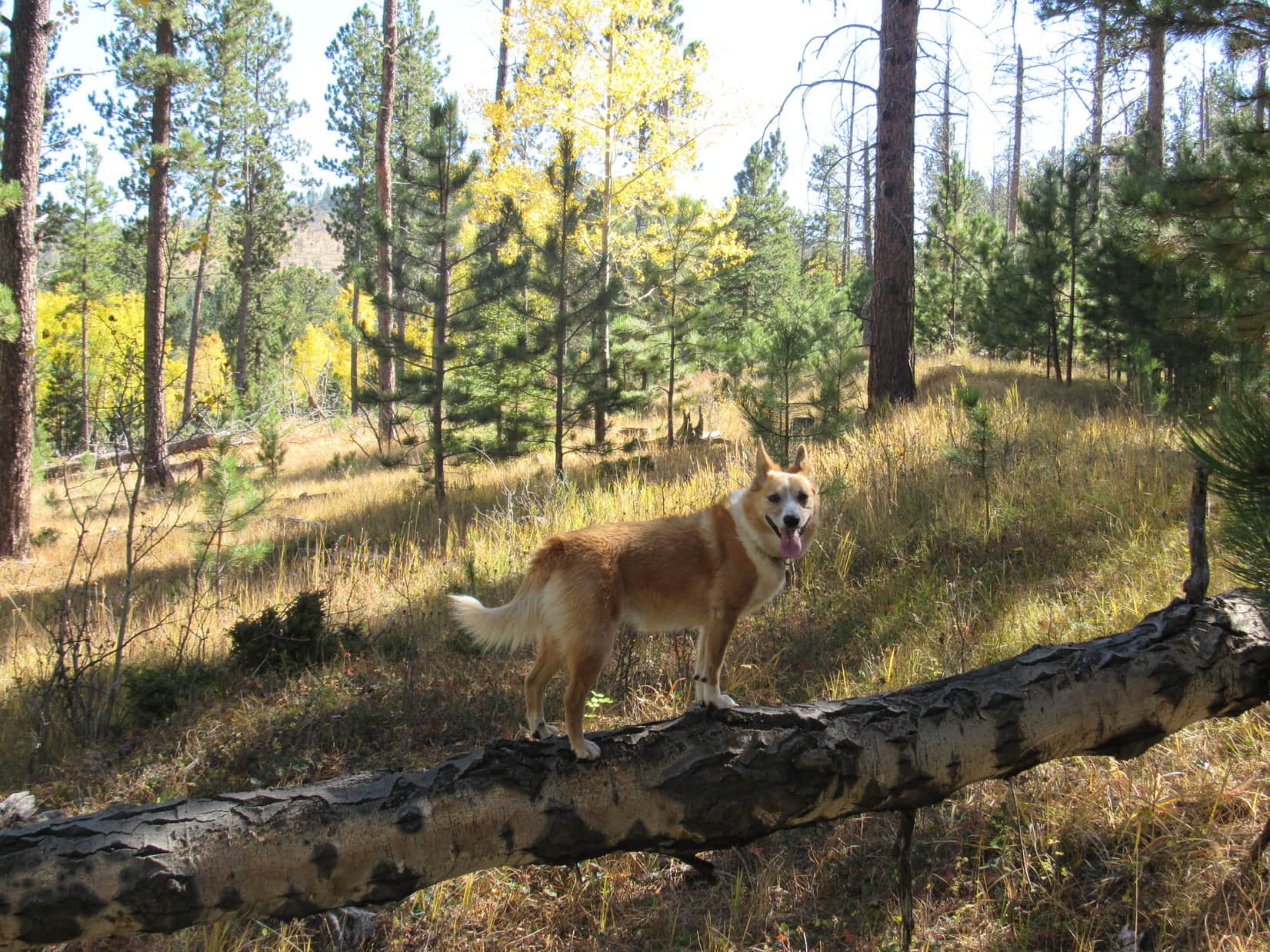
After crossing No. 297.3F the second time, that was it for roads.  The rest of the way up was merely a fairly steep trudge higher.  A little deadfall and a few scattered boulders to contend with, but otherwise a romp through open pine forest.

Loop squinting in weak sunshine for the first time in the last couple of days as she heads up Medicine Mountain’s E slope. Photo looks W.
Stewy coming up the E slope. Photo looks E.
Loop posing for Dennis on a rock. Photo looks NW.
Starting to get close to the top. Photo looks WNW.

The last 100+ feet of elevation gain was steepest.  Dennis preferred to go directly up the E face.  However, Medicine Mountain (6,878 ft.) has two summits, the S one being the true summit.  Looper hadn’t been here in nearly 5 years, but SPHP was pretty certain that by angling NW toward the saddle between the two summits, the Carolina Dog could pick up a use trail that would get her to the top.

A little longer, but the Lazy Dingo route worked out perfectly.  While Dennis proved his mettle against the mountain, Lupe came to a nicely rounded clearing up at the saddle, easily sniffed out the use trail, and was there in time to greet Dennis as he reached the summit.

On the grassy saddle between the N and S summits. Photo looks SSW.
Up on Medicine Mountain’s S summit. Photo looks S.

9:34 AM, Medicine Mountain (6,878 ft.) – The true summit was a rock tucked in at the base of a small birch tree that was slightly higher than others nearby.  After the required summit shot, a short rest break was in order.  Lupe shared a chocolate coconut bar with SPHP, and drank some water.  Dennis opened a can of cashews, and enjoyed a few while sitting on a big rock, offering some cashews to SPHP, too.

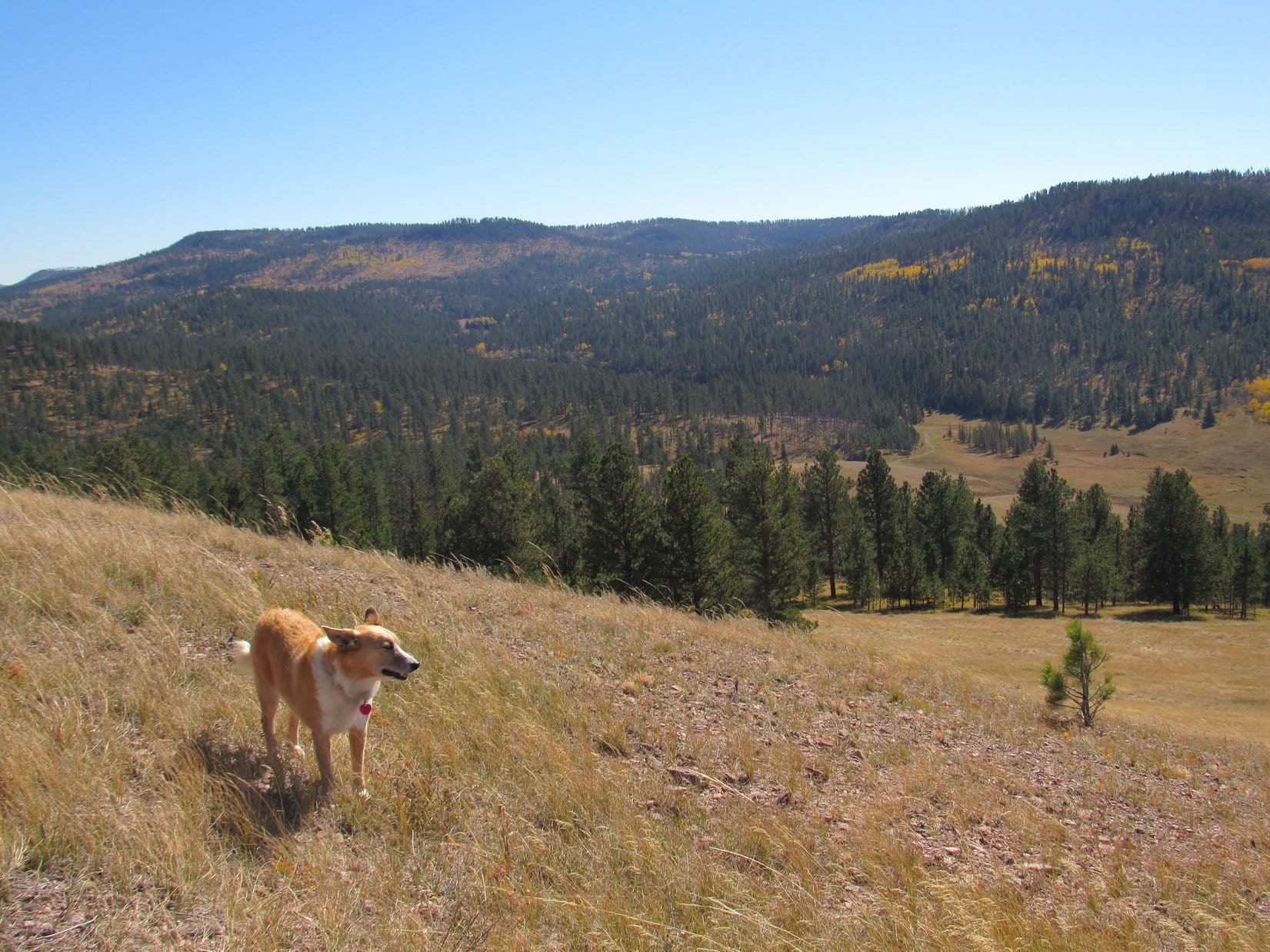
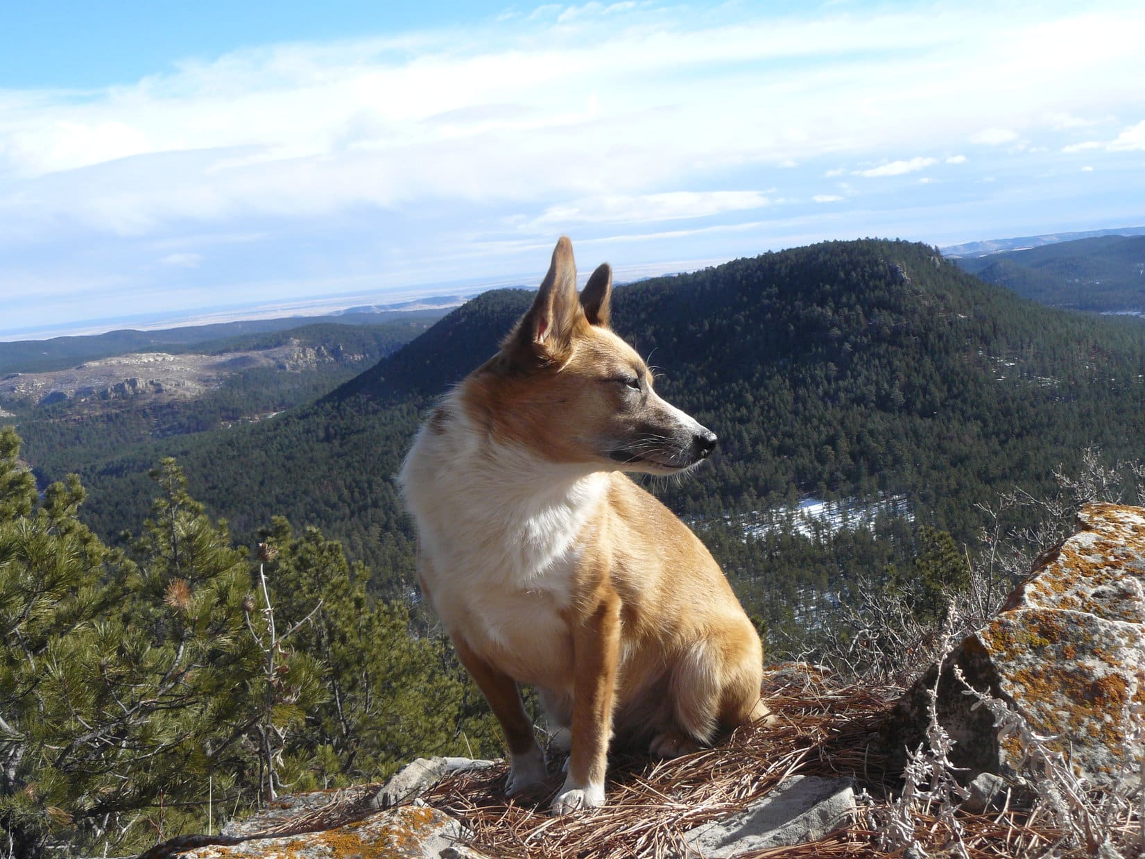
Getting to be a beautiful day!  Partly cloudy with blue sky and sunshine.  As everyone relaxed, the big view was toward the SE, where several of the highest peaks in South Dakota were visible on the horizon.

Dennis had already been to Black Elk Peak (7,231 ft.), South Dakota’s high point, many years ago back when it was still officially Harney Peak, and wouldn’t be returning on this trip.  SPHP pointed out two others, Little Devils Tower (6,960 ft.) and Sylvan Hill (7,000 ft.), that were on his current itinerary.

Looper near Medicine Mountain’s true summit, the rock (R of Center) beneath the birch tree. Photo looks NW.
Black Elk Peak (far L), Little Devils Tower (L), and Sylvan Hill (L of Center) all on the horizon. Photo looks SE.
Two peakbagging nuts, plus a can of nuts, on Medicine Mountain.

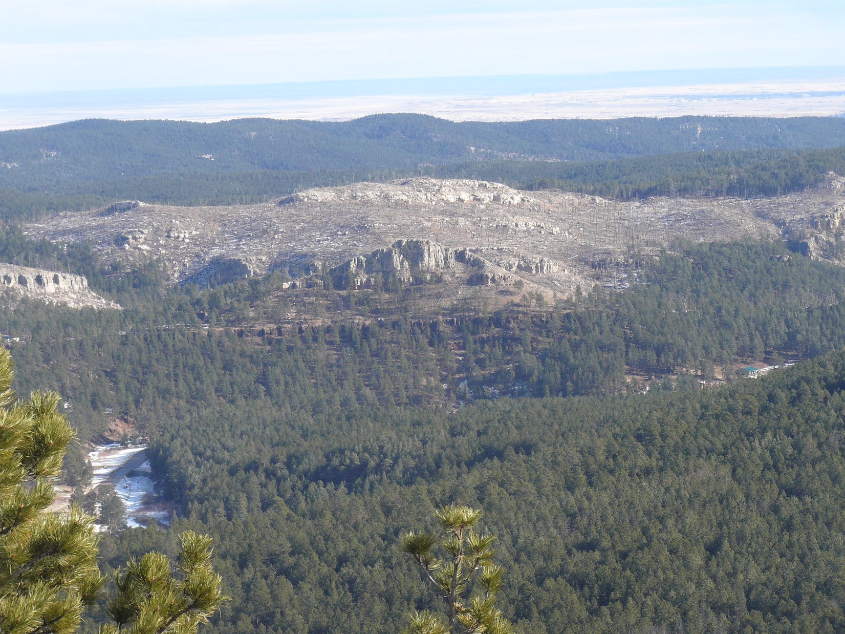
The view NW was of more immediate interest.  Dennis’ next 3 objectives, Odakota Mountain (7,200 ft.), Green Mountain (7,164 ft.) and Copper Mountain (6,920 ft.) were in sight.  In fact, all of the other peaks Dennis intended to climb today were visible from Medicine Mountain, since Bear Mountain (7,166 ft.) was also in view off to the SSW.

Green Mountain (L of Center) and Copper Mountain (R of Center). Photo looks NW.

The views were sweet, and Medicine Mountain had been a decent climb, but with so much left to do today, less than half an hour went by before it was already Onward, puppy ho! time.  One mountain down, six to go!

10:49 AM, junction of Sixmile Road and USFS Road No. 297.3O – Next up, Copper Mountain (6,920 ft.)!  Crossing Sixmile Road, Lupe looked for a spot where an old road once headed N.  A little deadfall to contend with, but this open lane made what would otherwise have been an annoying, and needlessly difficult task contending with a thick forest of young pines, a simple one.

Before long, the lane opened onto a big clearing.  At the far end, another lane was visible.  Following these lanes was the secret to getting to the summit of Copper Mountain without undue aggravation.

At the clearing with the next open lane (R) in sight on the ridge ahead. Photo looks N.

According to the topo map, Copper Mountain’s summit was 0.33 mile due N of where the RAV4 was parked.  However, as everyone was getting close to that region, where it was impossible to see much of anything due to all the young pines, SPHP surprised Dennis by insisting that the true summit was actually well off to the E near a line of cliffs.

Trusting the map, Stewy was skeptical to say the least.  However, since there was nothing to be seen here, and SPHP assured him that not only was the true summit E, but that the best views by far were available from the cliffs over that way, Dennis went along with the detour.

By now, the wide open lanes were gone, but it was still possible to follow narrower ones through the trees until the terrain began to rise.  Soon the forest began opening up as the ground became rockier.

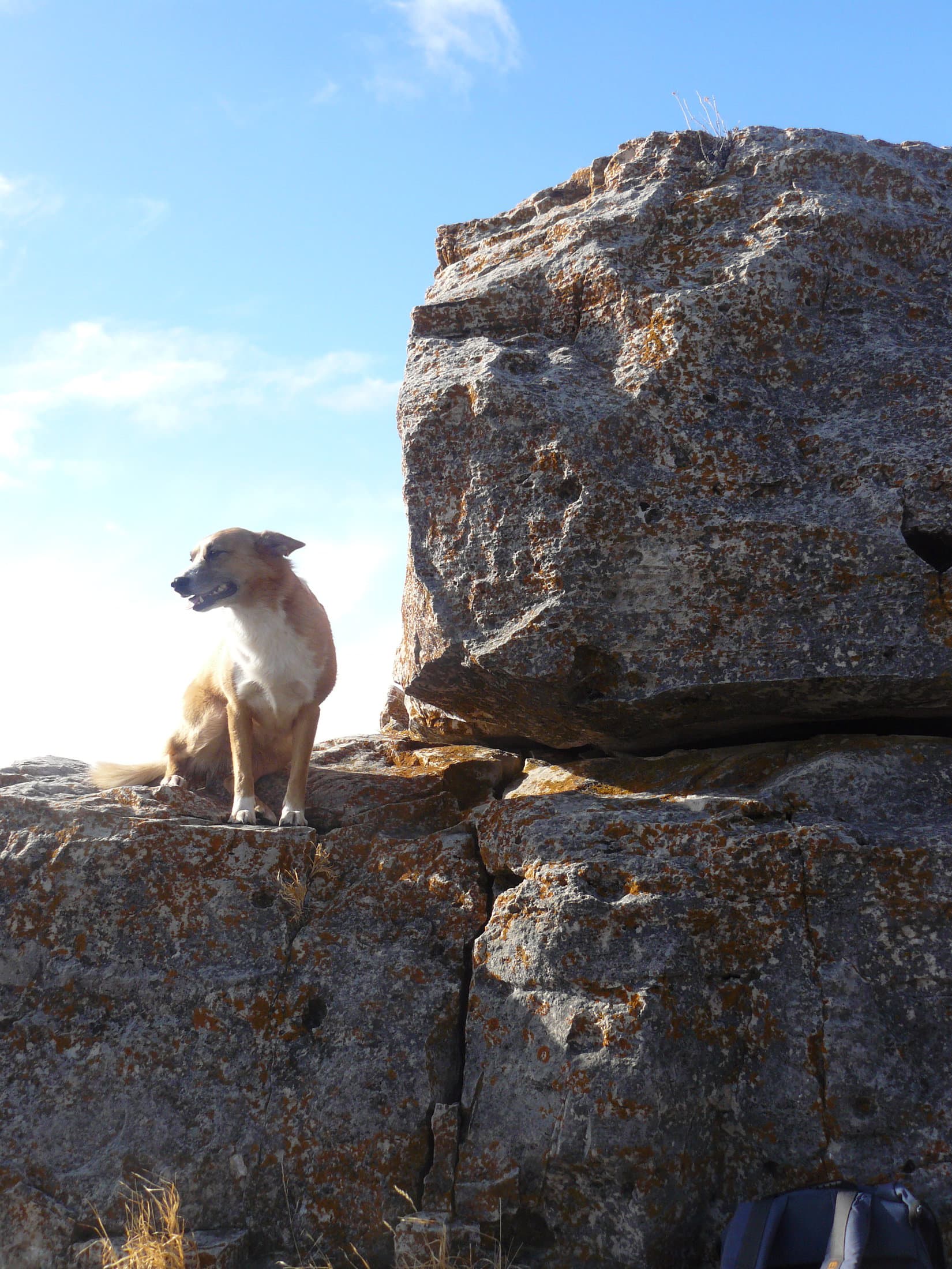
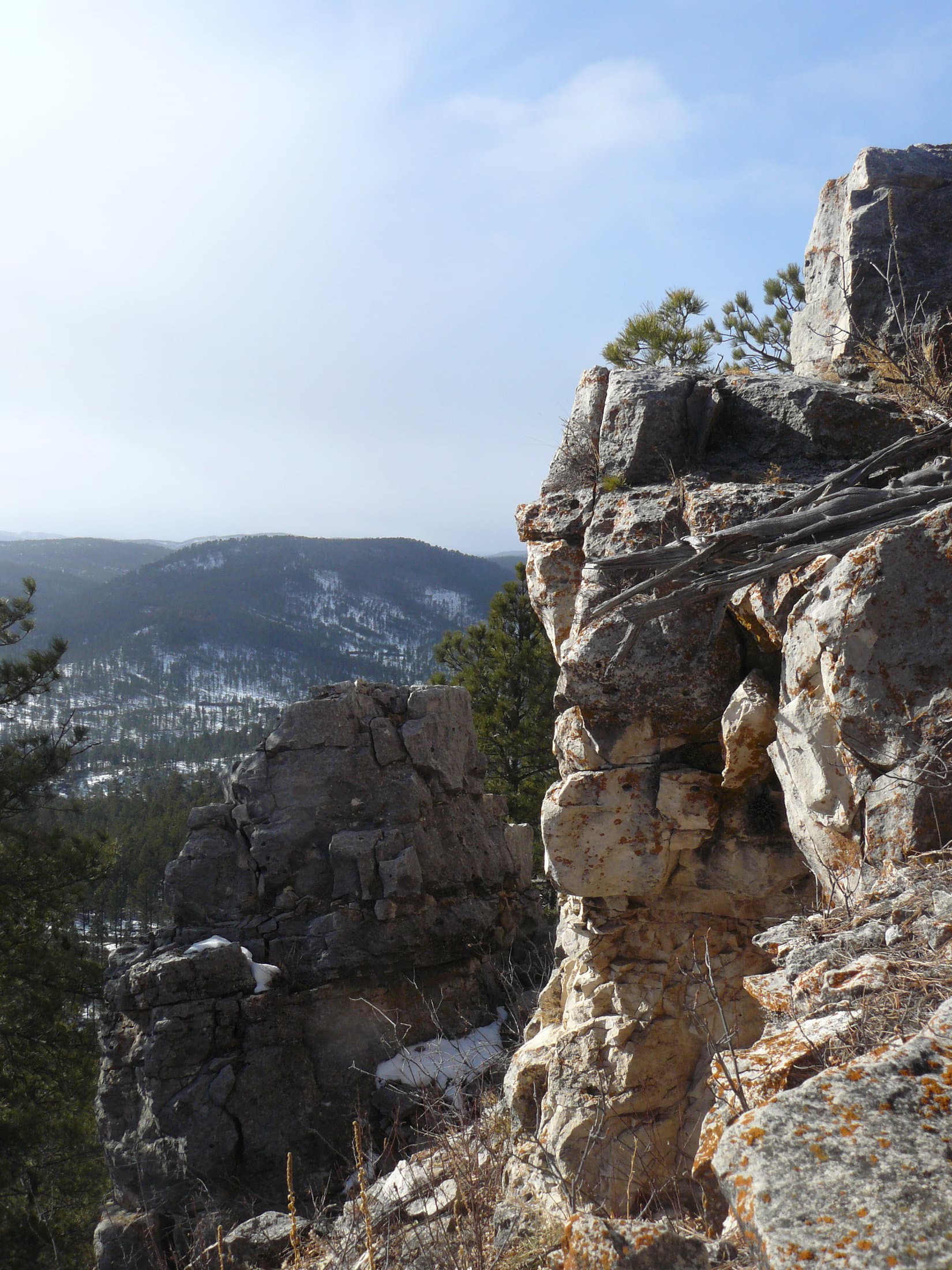
Upon reaching the limestone platform along the E edge of the mountain, Dennis set his GPS unit on what appeared to be the highest rock, and took a reading.  After wavering around, it settled in at about 6,946 feet.

Lupe on the rock where Dennis took his GPS elevation reading. Photo looks SE.

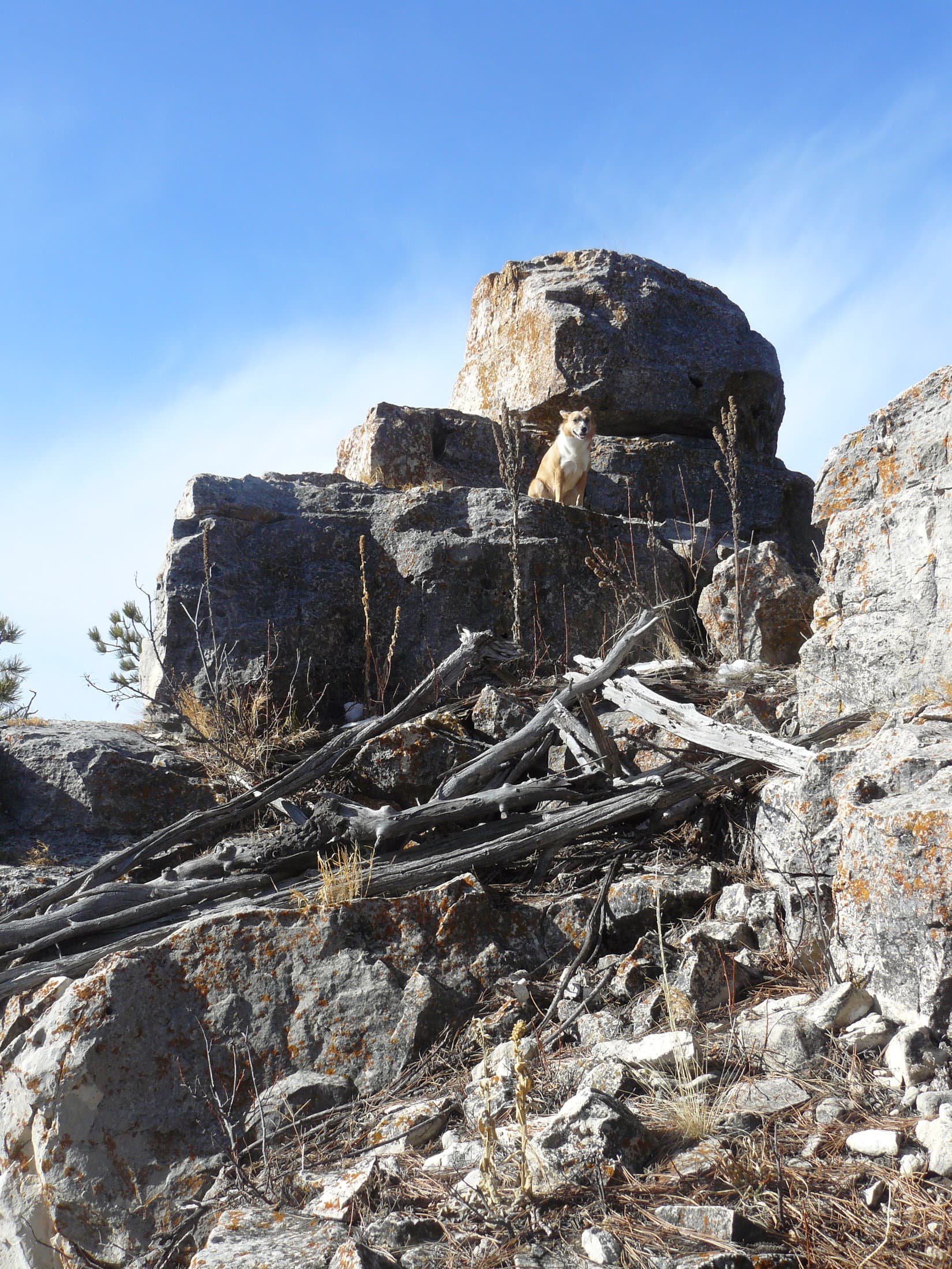
After gathering this data point, everyone headed SE to the cliffs at end of the platform where the big views were.  A cairn Looper hadn’t seen here before, now sat on the highest rocks along the S edge.

Dennis didn’t bother with another GPS reading, since it seemed unlikely to yield a significantly different result.  Instead, several minutes were spent exploring the rocks along the cliff edge while taking in the views.  Medicine Mountain stood out 2.25 miles SE, with some of Dennis’ higher objectives well beyond it in the distance.

Sylvan Hill (far L) on the horizon, Medicine Mountain (L of Center). Photo looks SE.
Loop and Dennis at the far SE end of Copper Mountain. Photo looks SE.
L to R beyond Dennis: Black Elk Peak, Peak 6920, Little Devils Tower. Sylvan Hill (R). Photo looks SE with help from the telephoto lens.
Loopster and Dennis over by the cairn. Photo looks WNW.
On Copper Mountain.

Time to head back!  Not to the RAV4, but to the region shown on the topo map as Copper Mountain’s summit.  Returning to the rock where Dennis had taken the elevation reading, everyone then went WNW, first down a slope, then gradually higher through deadfall and dense young pines tall enough to hide what was ahead.

The terrain flattened out.  Dennis reported that, according to the map, this was Copper Mountain’s summit.  Laying the GPS unit on a log about a foot above the ground, another elevation reading was taken.  In just a moment it would be clear whether SPHP or the topo map was correct about the location of Copper Mountain’s true summit.  After bouncing around a bit, the reading settled out at 6,947 ft.

One foot higher than the rock back E!  Except that here the GPS unit was a foot above the ground, resting on the log instead of a rock.  Within the limits of the GPS unit’s accuracy, it was a tie.

Hmm.  Well, so be it.  There were no views here at the W summit except of the thick stand of pines in all directions.  SPHP didn’t even bother to take a photo, although Stewy did.

12:11 PM – Less than a mile W of where the RAV4 had been parked near Copper Mountain, SPHP turned S off Sixmile Road onto USFS Road No. 693.  0.125 mile, and No. 693 turned SW.  After yesterday’s precipitation, the road was pretty soft here, with a couple of ruts in it.

SPHP parked the RAV4.  The top of Odakota Mountain (7,200 ft.) was only 0.4 mile SE.  Somewhat more than that following the road, but still within easy reach.

Striking out for Odakota Mountain along USFS Road No. 693. Photo looks SW.

After a jog to the W, the road turned SE, climbing gradually all the time.  Halfway to the summit, No. 693 topped out and curved SW toward Long Draw.  Abandoning the road, Lupe traveled ESE through a gently sloping field toward a small pillar of limestone near the trees.  Coming to a fence a little beyond the pillar, she ducked under it, then followed it S.

Heading for Odakota Mountain’s summit after leaving No. 693. Photo looks ESE.

SPHP’s intention had originally been to go farther E in order to approach Odakota’s summit ridge near the NE end, which past experience had shown to be the easiest route up.  The problem coming up from the SW had always been that the barbed wire fence, which ran right by the SW end of the ridge, was broken down and dangerous due to a huge jumble of deadfall that had collapsed upon it.

However, Dennis had left USFS Road No. 693 before SPHP, getting a head start following a jeep trail trail toward the SW end of the summit ridge.  Hoping to intercept him, Lupe continued S along the fence all the way to the end of the ridge.  Amazingly, since the last time the American Dingo was here more than 4.5 years ago, someone had removed the deadfall and repaired the fence.

Stewy had already made his way up to the summit.  A 20 foot climb got Lupe up onto the flat ridge, which was still full of deadfall.  Going 200 feet NE, Loop found Dennis where a tall, skinny white rock cairn had once stood.  The white rocks were still here, but now all tumbled over.  Dennis was busily setting up his tripod and resurrecting the cairn in preparation for his traditional summit selfie.

On the lovely summit of South Dakota’s 2nd highest mountain. Photo looks SW.
Dennis rebuilding the cairn.

12:35 PM, Odakota Mountain (7,200 ft.) – Poor Odakota Mountain!  South Dakota’s second highest peak was a mess.  Surviving pines and a crop of new ones grew among what remained of a forest devastated by pine bark beetles 10 years ago.  No views from the cairn, although both Bear Mountain (7,166 ft.) and a pond down by the old Boy Scout camp could be seen to the S from a little farther SW along the summit ridge.

Certainly not much up here to make Dennis want to hang around.  After getting a group selfie shot, he packed up his camera and tripod, and took the easy way down off the NE end of the ridge.  Meanwhile, Lupe and SPHP went to take a quick look at the view of Bear Mountain and the Boy Scout pond.  It was actually a little better than the last time Loop had been here, since more trees had fallen over.

Bear Mountain (R) and the Boy Scout pond (L of Center). Photo looks SSE.

Turning around to leave and catch up with Dennis, SPHP saw something Lupe had never noticed on Odakota Mountain before.  Back in the trees, only 25 feet from where Stewy had rebuilt the cairn, there was a sign.

Going over to check it out, the sign said “Odakota Mountain High Point 7,198 feet”.  Below it, a round marker set in concrete was stamped “Odakota High Point”.  There was also another white rock cairn.

Lupe at the now apparently official Odakota Mountain high point. Photo looks N.

The sign must have been here a while.  Some of the paint was peeling.  Odd that Lupe had never seen it before, but maybe a few years out in the weather was sufficient to get the peeling process underway?  This spot really wasn’t discernably higher than where the first cairn was, or most of Odakota’s summit ridge, but the sign and marker were exactly the sort of thing Dennis would be interested in.

SPHP started yelling.  Fortunately, Dennis hadn’t gotten too far away yet.

All official now!
Glancing back at Odakota Mountain’s summit ridge from the barbed wire fence after starting back to the RAV4. Photo looks SE.

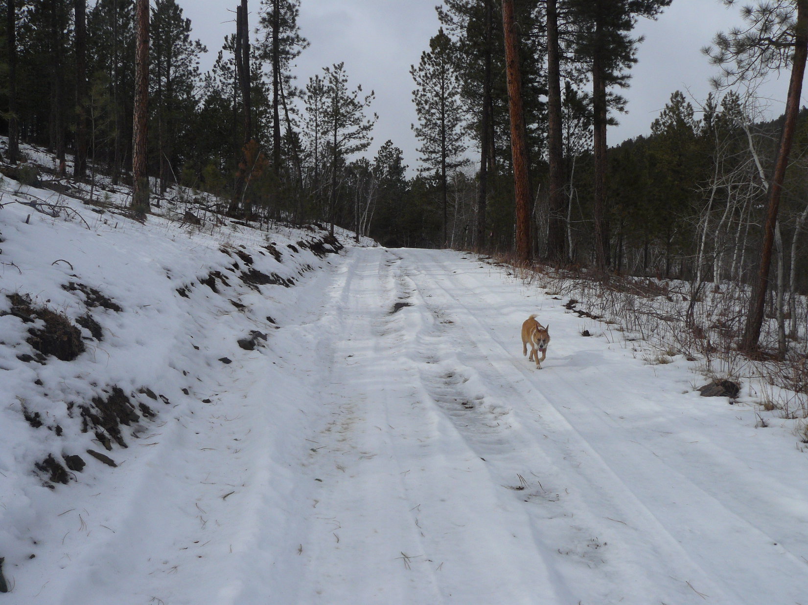
1:35 PM, junction of Sixmile Road and a faint road – Started out looking like the right spot, but the farther up the faint road Lupe went, the less familiar it all seemed.  SPHP must not have driven far enough W to get to Windmill Draw.  This was the wrong place.  Instead of going a long way up a gentle grassy valley, the faint road merged into an unmarked USFS road near the trees.

It didn’t help when the USFS road played out shortly thereafter.  SPHP hadn’t even brought a topo map.

Well, no matter.  Green Mountain (7,164 ft.) had to be less than a couple of miles away.  Lupe would find it!  To SPHP’s recollection, all she had to do was find the E edge of the limestone plateau and follow it N.

On the faint road, setting out for Green Mountain. Photo looks N.

Going through open forest, the terrain kept rising.  Eventually there was a lot of deadfall.  The E edge of the limestone plateau didn’t materialize.  Lupe had never come this way before.  Consulting his GPS, Dennis led the way in a direction that seemed 90 degrees off kilter to SPHP.

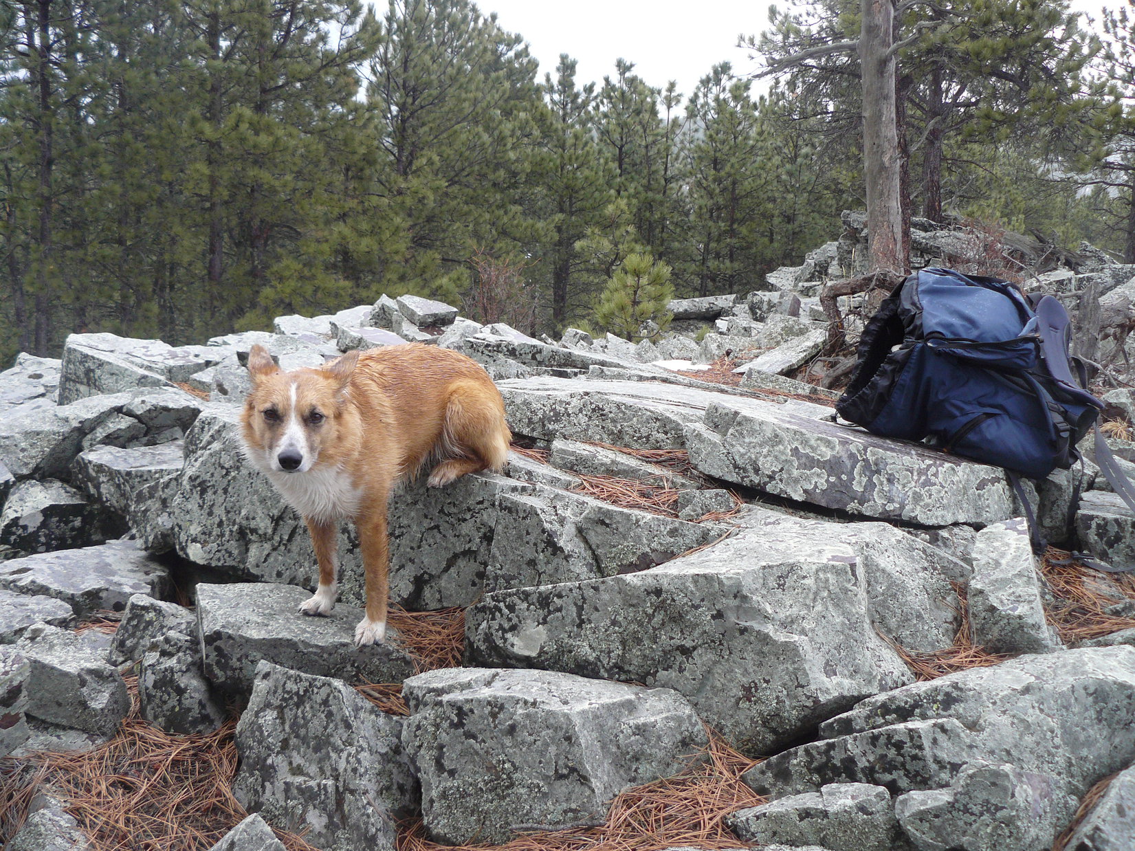
Lupe finally reached a flat region up on a broad ridge.  There was a ton of deadfall up here.  A higher hill to the N didn’t look right.  None of the terrain looked right.  Was this the edge of the limestone plateau?  SPHP was expecting a much sharper drop-off, something more cliff-like.  No sign of the limestone pillar Lupe used to get up on over by the hill.

Frequently consulting his GPS, Dennis led the way along what appeared to be the only plausible route.  Circling along the upper W slope of a big bowl, Lupe leapt over one fallen log after another.  An unfamiliar road finally provided relief, leading to a gate near a large, flat clearing.

Still following his GPS, Dennis crossed the clearing.  Continuing a little way into the forest, he arrived at a cairn.

Stewy setting up for another group summit selfie.

2:26 PM – Lupe had never seen a cairn on Green Mountain (7,164 ft.) before, but again, it had been more than 4.5 years since she’d been here.  Furthermore, this boring spot in the forest did resemble the featureless region SPHP recalled as being all that could be found in the way of a high point where the summit was supposed to be.

As soon as Stewy had his summit selfies, it would be easy to figure out if this was the same place Lupe had been to several times before.  If it was, the limestone pillar she used to get up on had to be along the edge of the mountain somewhere near the clearing.

Summit shots taken, everyone headed back there.

Oh, yeah!  This was the right place, alright.  Going over to the edge of the clearing, slightly down the slope beyond it, there was Lupe’s pillar.

In the clearing 200 feet SE of the cairn. Top of the pillar (Center) is visible next to Dennis, who is partly behind a tree. Photo looks SE.
Lupe’s Green Mountain limestone pillar (L). Photo looks SE.

After the long, tedious bushwhack through the trackless deadfall-laden forest, and disappointing cairn in the middle of nowhere buried in trees summit, Dennis brightened immediately at the sight of the big sweeping view to the E and SE, and that taunting limestone pillar.  If a Carolina Dog could do it, Stewy could, too!  The peakbagger in him took over.

Dennis stakes his claim to Green Mountain’s limestone pillar. Black Elk Peak (L), Copper Mountain (Center), Sylvan Hill (R of Center), Medicine Mountain (R), in front of Stewy. Photo looks SE.

SPHP wasn’t getting up there, but sent a personal representative.  Since Lupe hadn’t brought her Dingo wings, SPHP had to give her a boost.

Carefully, carefully! Dennis getting off the pillar.
Lupe’s turn. Gillette Prairie (L). Photo looks E.
Oh, it’s good to be back on the Green Mountain pillar again!
Another angle. Photo looks SE.
Part of Copper Mountain (far L), Sylvan Hill (L), Medicine Mountain (Center) with help from the telephoto lens.

A short break was taken before starting back to the RAV4.  Dennis was in the habit of texting a photo to family and friends from each summit, and sent out the one of him standing on the pillar.  He often got quick, but brief responses.  In this case, the most common response was “jump”!

SPHP had to laugh.  Always nice to know you’re loved.

A final look at Green Mountain’s limestone pillar (L). Photo looks NNE.

4:26 PM –  Four down, three to go!  Unfortunately, Green Mountain had taken up more time than expected, in part due to SPHP’s error in not parking far enough W at the start of Windmill Draw.  Would have been much more of a road hike from there, instead of a bushwhack through deadfall-laden forest.

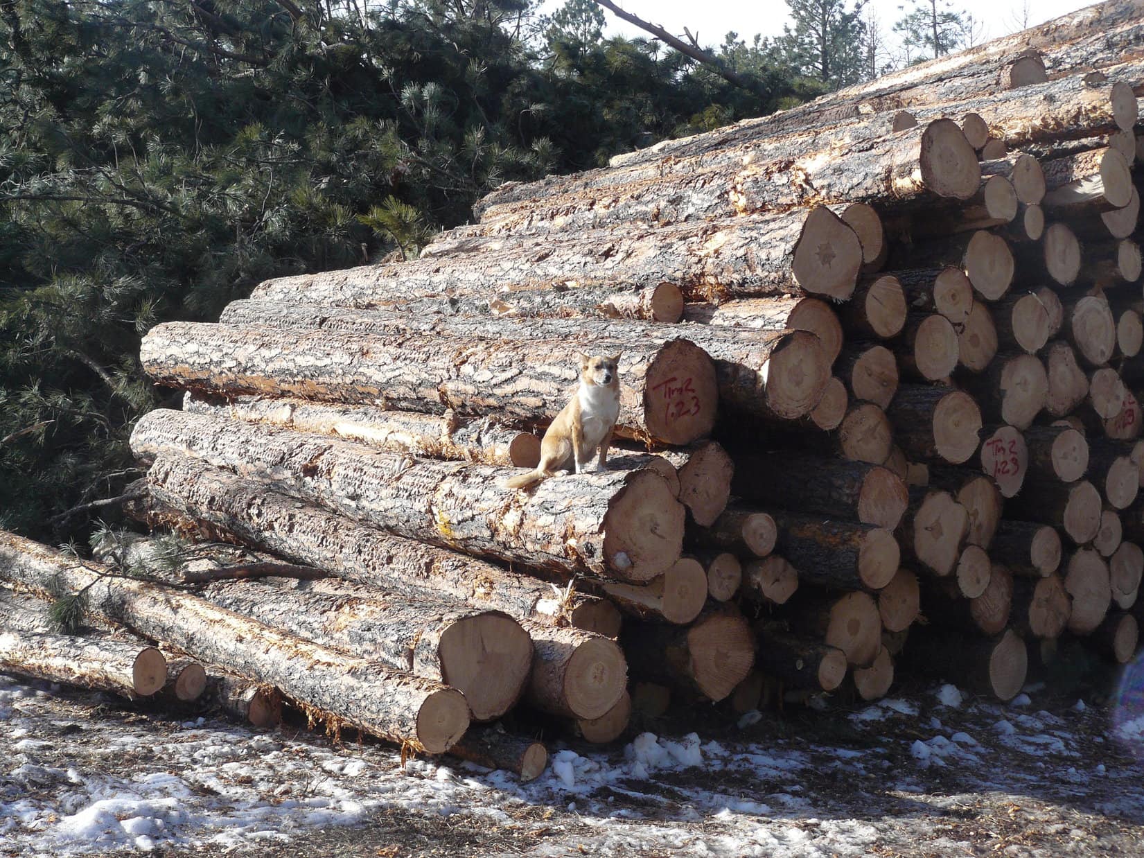
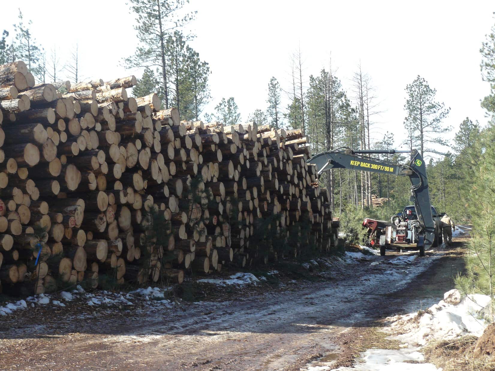
Couldn’t be helped.  Done is done.  Happily, Bear Mountain (7,166 ft.), the next objective, was a mere drive-up to a lookout tower.  Shortly after turning onto USFS Road No. 293, SPHP was astonished by the amount of logging that had gone on since Lupe had last been here.

In fact, it was still ongoing.  0.5 mile from the summit, a log truck being actively loaded completely blocked the road.  Apparently, this was going to take a while.  Pulling off the road, SPHP parked the RAV4.  Everyone leapt out.  After circling past the log truck, the road hike began.

The RAV4 parked a little way off USFS Road No. 293. Photo looks W.
Past the log truck on USFS Road No. 293. Photo looks W.
Approaching the Bear Mountain fire lookout tower. Photo looks E.
By the tower. Photo looks SSW.

Lupe had once paid a visit to the ranger at the top of the tower.  On a clear day, it was possible to see Laramie Peak (10,272 ft.) in Wyoming.  Unfortunately, the tower wasn’t open for the season yet.  A sign said it was closed to the public.

A survey benchmark and another sign showing the elevation were at the base of the tower, but there wasn’t a view from here without actually climbing the tower.  However, Lupe knew there was a nice view from a small limestone outcropping a short distance SE.

At the base of the tower. Photo looks SW.
The Bear Mountain survey benchmark.
Loop and Dennis on the limestone outcropping SE of the tower. Photo looks ENE.
Elkhorn Mountain (6,381 ft.) (far L), Black Elk Peak (L), Little Devils Tower (Center), and Sylvan Hill (R) from the viewpoint.

5:58 PM, Needles Highway No. 87, Little Devils Tower trailhead –  Upon reaching the RAV4 after Bear Mountain, Dennis faced a choice.  5 of 7 complete, but delays had chewed up enough time so that climbing both remaining peaks wasn’t going to be possible unless Dennis wanted to be out after dark, which he didn’t.

Sylvan Hill (7,000 ft.) or Little Devils Tower (6,920 ft.)?  SPHP spoke of the differences in what would be involved, since the nature of the routes was so different.  Either one had fabulous views.

Really wasn’t a monumental decision.  Dennis could climb whichever peak he didn’t get to today tomorrow.  In the end, Stewy chose Little Devils Tower as his last summit with Lupe.

Sweet!  A great choice!  (Both would have been.)  700 feet of elevation gain along a maintained trail that went past scenic granite formations, followed by a fun scramble to the top.

Map posted at the trailhead.

Little Devils Tower Trail No. 4 was nearly level as it started up a valley.  Lupe was soon passing the first granite formations.  The views improved steadily as the trail gradually steepened.

Little Devils Tower Trail No. 4. Photo looks NE.
Big granite formations in a side valley.
Approaching some spires. Photo looks NNE.

After more than a mile, Little Devils Tower Trail No. 4 topped out on a ridge near the Cathedral Spires (6,840 ft.).  From here, a spur trail split off to the L, heading N.  Taking this spur, Little Devils Tower’s massive granite summit quickly came into view.

On the spur trail. Little Devils Tower (R). Photo looks N.

At first, the spur trail was level, or nearly so, but as Lupe got close to the granite, it turned NE and began to climb.

The spur trail starts getting interesting. Photo looks NE.
Dennis on the way up. Photo looks SW.

The spur trail soon topped out at a high spot tucked between huge rock walls.  However, this wasn’t the end.  Blue arrows painted on the rocks marked the route from here, which now turned NW through a narrow slot in the granite.  The first part of the slot was so steep that Loopster needed a boost from SPHP to get up to where she could continue under her own power.

Climbing the slot after an initial boost. Photo looks NW.
Dennis emerging from the slot. Photo looks SE.

Above the slot, minor variations in the route were possible.  All involved scrambling up the granite.  A little exposure in spots, but not much.  The route wound along the granite to a final brief push higher.

Dennis leading the way during the scramble up the granite. Photo looks N.

6:55 PM, Little Devils Tower (6,960 ft.)  Suddenly, Lupe was there!  The summit region was a roomy collection of large granite outcroppings and boulders that didn’t vary an awful lot in elevation.  There was even a flat area of packed dirt with a bit of vegetation.

The views were incredible!  Little Devils Tower is right in the heart of the most rugged part of the Black Hills.  While Dennis climbed up onto the highest boulder to tag the true summit, Loopster had a look around.  Highlights included Black Elk Peak (7,231 ft.) a little more than a mile NNE, and the magnificent Cathedral Spires (6,840 ft.) only 0.25 mile SE.

Black Elk Peak (R) from Little Devils Tower. Photo looks N.
The Cathedral Spires, also known locally as the Needles. Photo looks SE.

Dennis made it up onto the true summit boulder.  Lupe needed another boost from SPHP to join him.

Stewy over at the high point. Photo looks S.
Loop and Dennis together at the true summit. Photo looks S.

6 of 7 complete, but Little Devils Tower was definitely going to be it.  The sun was already low.  Sylvan Hill wasn’t happening today.

That was alright.  Kind of took the pressure off.  Lupe, Dennis, and SPHP could all linger for a while in the beautiful evening light.

Black Elk Peak from Little Devils Tower. Photo looks NNE.
Cathedral Spires (L and Center) in the evening light. Photo looks SE.
Dennis relaxing at the true summit. Photo looks SSW.
Texting a photo before departure.

Over all too soon!  Before long, Stewy was at the end of the scramble lower, about to descend from the slot to the spur trail.

Descending the slot. Blue arrow (R).

So, Little Devils Tower was a happy ending to a fabulous day!  Dennis pronounced it easily his favorite peak in the Black Hills.  Sometime he was going to have to bring his wife, Geri, up here.

Lupe hopes to welcome her to the beautiful Black Hills on that great day.

With Stewy on Little Devils Tower, Black Hills of South Dakota 5-5-22

Note: Dennis did climb Sylvan Hill the next day before heading to Nebraska to continue his peakbagging adventures.  Among his greatest goals are (1) climb the 10 highest named peaks in all of the 48 contiguous US states, (2) climb the 10 highest named county high points in each state, (3) visit every state park with his wife, Geri, (4) float the length of rivers in all states that have a river of the same name.  At 73, he realizes these are tall orders.

Before departing, Dennis gave Lupe and SPHP an autographed copy of his book 23 Nights Working for the US Treasury Department, which tells of his experiences working for the US government’s most feared agency, the IRS.

Links:

Next Black Hills Expedition                  Prior Black Hills Expedition

Want more Lupe adventures?  Check out Lupe’s Black Hills, SD & WY Expeditions Adventure Index, Master Adventure Index, or subscribe free to new Lupe adventures!

Black Hills, SD Expedition No. 210 – Hat Mountain & Green Mountain (10-7-17)

Start – 10:44 AM, 57°F at the Gold Run trailhead near Deerfield Reservoir

Sunny skies, a light S breeze, and pleasant early October temperatures – a great day for a romp in the Black Hills!  Lupe would likely get to see some fall colors, too.  First things first, though.  Loop hadn’t been to Deerfield Reservoir in a while.  She may as well take a quick look at the lake before dashing off on her peakbagging adventures.

Only a small portion of the lake was visible from here, but the deep blue waters were a pretty sight surrounded by low pine-covered hills.

Lupe started the day with a look at Deerfield Reservoir. The blue lake was a pretty sight. Photo looks N.

After admiring the lake, Lupe set off for her first peakbagging destination of the day.  She left Deerfield Reservoir heading SW up a forested embankment.  It wasn’t far to Deerfield Road, which she followed W to USFS Road No. 691 (Williams Draw Road).  Traveling S along No. 691, Loop came to a small field where she could see Hat Mountain (6,779 ft.) up ahead.

From this small field near USFS Road No. 691, Lupe gets a fairly good view of Hat Mountain up ahead. Photo looks SSW.

Hat Mountain was only a mile away, so it wouldn’t take Lupe long to get there.  That is, if cows blocking the road could be convinced to get out of the way.  Not to worry!  The cattle were mightily and speedily impressed by the Carolina Dog’s enthusiastic persuasive abilities.  They complied immediately with her wishes.

These cattle on USFS Road No. 691 were quickly convinced to move and let Lupe and SPHP pass. Photo looks SW.

A little farther on, Lupe left the road herself.  She started her trek up the lower NE slope of Hat Mountain passing through a beautiful stand of yellow aspens.

Starting up among the yellow aspens. Photo looks SSW.

Above the aspens, Lupe climbed through a pine forest.  Above the pines, the upper N slope of Hat Mountain was grassy and treeless.

Looper on the upper N slope of Hat Mountain. Photo looks S.

When Lupe reached the summit, the first thing she did was to go over to the survey benchmark.  It was easy to find toward the E side of the flat, barren summit area.

Lupe stands next to the survey benchmark. Part of Deerfield Reservoir, where she had started from, is in view.  Custer Peak (6,804) (Center) can be seen on the horizon. The huge grassy area in between is Reynolds Prairie. Photo looks NNE.
The survey benchmark is so scratched up it’s getting a little hard to read “Hat”.

Next Lupe went to see the sights.  She had unobstructed views in every direction.  Simply fabulous!

Looking NNW. The grassy area seen straight up from Lupe is part of the Castle Creek valley. The most distant peak seen on the R is Terry Peak (7,064 ft.).
Black Elk Peak (7,231 ft.) is the distant high point on the L. Green Mountain (7,164 ft.) is the high ridge on the R. Photo looks SE.
Green Mountain, the long high ridge on the R, would be Lupe’s next peakbagging goal. The summit is near the edge seen almost straight up from Lupe. Photo looks SE.
Most of Hat Mountain’s flat, oval-shaped summit area is in view here. Photo looks S from near the N edge.
Near the S end of Hat Mountain’s otherwise flat summit is this small depression. Photo looks SW.
Loopster stands next to the small depression. The grassy ground seen in the distance straight up from her back is the upper S slope of South Castle Rock (6,840 ft.). Photo looks N.
Loop stands on a ledge at the S edge of the summit area. A little of the Heely Creek valley is seen below. Photo looks SW.
Kind of windy up here, SPHP! Think I’m going to go hide in the depression as soon as you’ve taken this shot. Photo looks NE.

Carolina Dogs aren’t fans of wind, and it was rather breezy up on Hat Mountain.  The steady 15 mph SW breeze was enough to make Lupe want to look for a sheltered spot.  She found that the small depression near the S end of the summit area worked fine.  She curled up there and took a little break.

Lupe retreats to the small depression to relax out of the wind. Photo looks SW.
Take as much time looking at the views as you like, SPHP. Think I’ll take a nap. Wake me when it’s time to go to the next mountain.

SPHP joined Lupe in the depression for a short break, then left to stroll around the summit again for another look at the views.  Meanwhile, Loop dozed off for a few minutes in her sunny, sheltered spot before SPHP announced it was time to move on.

Lupe left Hat Mountain heading S.  Green Mountain (7,164 ft.), her next peakbagging goal was still close to 4 miles away even as the crow flies.

Looper stands at the S end of Hat Mountain’s summit ready to head down to the grassy slope below. Photo looks S.
On the way down Hat Mountain. Photo looks SW.
Looking back at the Hat Mountain summit from the upper S slope. Photo looks N.
Lupe leaves Hat Mountain heading for Green Mountain, the high ridge on the L. On the way, she would cross the Heely Creek valley, seen below on the R. Photo looks SSE.

The first part of the way to Green Mountain was easy.  Lupe descended mostly open ground into the Heely Creek valley where fall colors were on display.

On the way down Hat Mountain to cross Heely Creek. Photo looks SW.
Fall colors on display in the Heely Creek valley. Photo looks SW.

Heely Creek was very small this time of year, only a foot wide and a few inches deep.  As soon as Lupe crossed it, her long gradual climb to the top of Green Mountain began.

Once she entered the forest S of Heely Creek, Lupe followed old logging trails and minor USFS roads.  Sometimes she was on faint roads abandoned so long ago that pine trees were growing on them.  Other times she simply went through the forest not on any road or trail at all.

On the way to Green Mountain, still W of USFS Road No. 691. Photo looks SSE.

About 2 miles from Hat Mountain, Lupe reached USFS Road No. 691 again.  She followed it S for a mile.  When it began angling SW, she left No. 691 going SE up a forested slope with enough deadfall on it to slow progress down for a while.  Eventually she came to a minor USFS road, which she was able to follow E the rest of the way to Green Mountain.

Green Mountain (7,164 ft.) is one of the highest points in the entire Black Hills.  However, the only distant views available are obtained along the E rim of the mountain.  The best views are toward the SE from limestone outcroppings right along the edge.

Lupe reaches the E edge of Green Mountain. On the horizon are Five Points (6,221 ft.) (L) and Black Elk Peak (7,231 ft.) (R). The large grassy area is the S end of Gillette Prairie.  Photo looks E.
Looking N along the E edge of Green Mountain.
A cairn can be seen on the limestone pillar beyond and behind Lupe. The pillar has a commanding view to the E, but is not the actual summit of Green Mountain. Photo looks NE.
Looking SW along the rim.
Black Elk Peak (Center) is in view on the horizon. Copper Mountain (6,290 ft.) is the much closer forested hill toward the R. Photo looks SE.

While Lupe was enjoying the big views, SPHP noticed a chipmunk.  Lupe hadn’t spotted it yet.  The chipmunk was scrambling around the limestone, appearing and disappearing right along the brink of the cliffs.

Lupe didn’t notice this chipmunk scrambling around the limestone right along the brink of the cliffs. Sometimes it disappeared over the edge before reappearing again a few feet away.

SPHP kept a watchful eye on the Carolina Dog.  These limestone cliffs were no place to go chasing around after chipmunks or anything else!  The chipmunk was sure-footed and could cling to the vertical face of the limestone.  Lupe could not.  Fortunately, she never saw the crafty, quiet “tiny squirrel”.

Lupe perches near the edge of the cliffs where the chipmunk had been scrambling around a few minutes earlier. She never did see it. The big ridge on the R is High Point 7159, an unnamed mountain only 5 feet lower than Green Mountain. Photo looks SE.

After taking in the views, and enjoying a Taste of the Wild and water break, Lupe agreed to let SPHP give her a boost up onto the limestone pillar where the cairn was.  The pillar was an excellent American Dingo display platform with a tremendous view.

On the limestone pillar. Five Points is in view on the horizon on the L. Part of Gillette Prairie is seen below. Photo looks E.
The cairn can be seen better here.
Peakbagging Carolina Dog (L) in the foreground, Black Elk Peak (R) in the distance, and Copper Mountain (R) between them. Photo looks ESE.

Ordinarily, Green Mountain offers complete solitude.  That wasn’t the case today, however.  Upon arrival at the E edge of the mountain, Lupe and SPHP had both seen a hunter perched on the limestone.  He had a tremendous view, and was using binoculars to scan a wide swath of territory below.  The hunter and SPHP had waved at one another, but did not speak.

Surprisingly, Lupe and SPHP weren’t alone on Green Mountain. From his limestone perch, this hunter quietly scanned a broad swath of territory below. Gillette Prairie is seen in the distance. Photo looks NE.

Lupe hates gunfire.  If that hunter took a shot at anything from so close by, poor Loopster would have been terrified.  Having seen the views and had a little break, it was probably best not to tarry here any longer.  It was a long way back to Deerfield Reservoir, anyway.

Of course, before leaving Green Mountain, Lupe still needed to visit the true summit to claim her peakbagging success.  Lupe and SPHP headed N from the limestone pillar.  The highest ground on Green Mountain was somewhere back in the forest only a little W of the E rim.

A fairly large area was nearly level.  It wasn’t really possible to identify an exact high point.  A variety of potential highest spots existed, none convincingly higher than the others.  Most of them featured small mounds of broken limestone.  After searching around for a few minutes, it was time to pick one.  Close enough for Dingo work!

At Green Mountain’s true summit, or as close to it as Lupe and SPHP could find. Photo looks N.
This was Lupe’s 4th visit to Green Mountain.

Although Lupe had been to Green Mountain 3 times before, it was a big place. She’d never explored some of the territory toward the N end.  Enough daylight remained today so she could go sniff about over there on her way back to Deerfield Reservoir.  Looper headed NW through the forest looking for a couple of sub-peaks shown on the topo map.  Both were still over 7,000 feet elevation.

The first hill she would come to was High Point 7062.  Plentiful deadfall timber slowed SPHP’s progress, but High Point 7062 eventually did come into view.

High Point 7062 (L), located 0.625 mile NW of Green Mountain’s summit, comes into view. Photo looks NNW.

As it turned out, High Point 7062 was worth visiting.  The small summit was capped with a limestone outcropping from which there were 180° views to the N.  Lupe climbed up for a look around.  She could see the top of Hat Mountain (6,779 ft.) from here.

Up on High Point 7062. Photo looks N.
High Point 7062 was worth visiting! Lupe could see a long way N from here. Photo looks N.
Hat Mountain, where Lupe had been earlier in the day, is the grassy, flat-topped hill on the L. Photo looks NW from High Point 7062 with help from the telephoto lens.

From High Point 7062, Loop could also see her next objective, High Point 7025, more than 0.5 mile to the W.  High Point 7025 had a much larger summit area in the form of a 400 to 500 foot long ridge.  The fairly narrow ridge was all about the same elevation, but heavily forested.  Lupe wouldn’t have much in the way of views over there.

High Point 7025, Lupe’s next objective, is the heavily forested ridge seen on the L. Photo looks W.

Even so, when Lupe left High Point 7062, she headed W for High Point 7025.  She enjoyed a beautiful early evening trek, while exploring new territory.

Lupe enjoys the evening on her way to High Point 7025. Photo looks WNW.

Lupe made it to High Point 7025.  She traversed the entire summit ridge from N to S, then back again.  As anticipated, there wasn’t much to be seen in the way of views due to the forest.

On the High Point 7025 ridge. Photo looks SE back toward Green Mountain.

The sun was getting low.  Deerfield Reservoir was still 4 miles N as the crow flies.  Better keep going!  Lupe left High Point 7025 heading N.  She explored more beautiful territory, saw lots of deer, and eventually found minor roads that led her back to USFS Road No. 691.

Darkness fell on the long road hike back to the G6.  Stars glittered above in a moonless sky.  The wind had died down hours ago.  SPHP tramped along, Lupe trotting nearby.  No lights, no traffic, no noise.  Everything as it should be when adventure’s done.  Quiet time together, then the long drive home.  (End – 8:09 PM, 44°F)

Heading down the N slope of High Point 7025 on the way back to Deerfield Reservoir. Hat Mountain on the L.

Links:

Next Black Hills Expedition                Prior Black Hills Expedition

Black Hills, SD Expedition No. 134 – Copper, Odakota, Green & Hat Mountains Plus the Dragon Caves (6-20-15)

Want more Lupe adventures?  Check out her Black Hills, SD & WY Expeditions Adventure Index, Master Adventure Index, or subscribe free to new Lupe adventures!

Black Hills, SD Expedition No. 116 – Green Mountain, Northern Rainbows & High Point 5219 (1-24-15)

SPHP almost chickened out.  Even though the forecast was for an unseasonably warm 52°F, it was supposed to be windy with possible rain showers.  Rain showers are almost unheard of in the Black Hills of South Dakota in late January, but that was what the forecast said.  The rain showers were supposed to end by noon, but a little rain was not the problem.  The 35 mph NW wind in the forecast was.  Up on a mountaintop, 52°F, if it even reached that, might be less than wonderful when combined with a 35 mph gale.

Lupe was bored and restless, though.  She stared expectantly at SPHP with eager, pleading puppy eyes.  She knew SPHP had been considering taking her into the mountains, due to preparations that had been underway before checking the forecast.  Lupe was ready for action.  She was expecting to go, eager to go, and doing her Carolina Dog best to demand to go!

Well, it would probably be alright.  Lupe won out!  At 9:46 AM, Lupe and SPHP left the G6 parked along Duran Road (USFS Road No. 679.1) just across Box Elder Creek from Nemo Road.  It was already a very balmy 46°F.  There wasn’t any rain yet.  It was only partly cloudy, but those clouds were making good time across the sky.  The wind was roaring in the trees.  Fortunately, the breeze wasn’t too bad down at ground level.

Lupe had two peakbagging goals for the day.  The first one was Green Mountain.  No!  Not the Green Mountain (7,164 ft.) along the E edge of the limestone plateau country of the western Black Hills, but the Green Mountain (5,240 ft.) located a little under 2 miles S of better known Steamboat Rock.  Lupe’s second goal was Hat Mountain.  No!  Not the Hat Mountain (6,779 ft.) S of Deerfield Reservoir, but a much more diminutive Hat Mountain (4,883 ft.) located about 3 miles SE of Lupe’s Green Mountain goal.

USFS Road No. 679.1 was covered with snow and ice.  It wound around a lot, but steadily gained elevation while working its erratic way W.  After Lupe had gone nearly 2 miles along the road (just 1 mile as the crow flies), she came to a huge pile of logs.  A couple of loggers were there getting ready to go to work.  The loggers had the interesting news that they had seen a mountain lion right there the previous day.

Lupe on the pile of logs along USFS Road No. 679.1 on her way to Green Mountain.
Approaching the loggers.

Lupe had scarcely passed the loggers when the ridge to Green Mountain came into sight to the SW.  Lupe and SPHP left the road to head up through an area where the forest had been greatly thinned to reach the top of the ridge.  The top of the ridge was still forested.  Lupe followed a faint path SE along the ridge.

Lupe on the forested ridge leading to Green Mountain. Photo looks SE the direction would take to the summit.

As Lupe got close to the summit of Green Mountain, she started to encounter rock outcroppings.  At the summit, there was a small area of limestone jutting sharply up above the surrounding terrain.  The limestone formation was about 20 – 25 feet high.  It was pretty easy to climb almost all the way to the top.  In order for Lupe to reach the very top, though, SPHP had to lift her up onto the highest rock.

Lupe didn’t like it up on the highest rock on Green Mountain.  It was high enough to be a little scary.  Mostly, though, she didn’t like the wind.  The wind hadn’t been much of a problem, so far, but up on top of Green Mountain, Lupe felt its full force.  SPHP wanted Lupe to stay up on the highest rock long enough for SPHP to climb down and get a good picture of her sitting up there.

The only picture SPHP got of Lupe on the very top of Green Mountain was one taken while still right beside her.  As soon as SPHP moved away, despite SPHP’s protestations, Lupe leaped down.  She wasn’t staying up there in that gale!  No way!  American Dingoes have lots better sense than that!

Lupe started to encounter limestone rock outcroppings as she got close to the summit of Green Mountain.
Lupe sitting up next to the highest rock on Green Mountain. SPHP had to climb up there, too, in order to lift a reluctant Lupe up to the very top.
Lupe was fine sitting next to the highest rock on Green Mountain. It was to her N and shielding her from the strong wind.
This is the only photo SPHP would get of Lupe on the highest rock on Green Mountain. She did not like it up there in the wind! She jumped down at her first opportunity.

SPHP knew it was pointless to lift Lupe back up onto the top rock again.  She would just jump down again.  The 30+ mph N wind was just too annoying.  Instead, Lupe and SPHP retreated maybe 20 feet down to the SE of the summit, where it wasn’t so breezy.  There were some nice views to the S and E from here.

Lupe likes it better here. She's just SE of the summit of Green Mountain, but much better protected from the wind. Photo looks SE toward forested High Point 5136.
Lupe likes it better here. She’s just SE of the summit of Green Mountain, but much better protected from the wind. Photo looks SE toward forested High Point 5136.
Looking E toward a burned area E of Nemo Road from Green Mountain.

The views were great from Green Mountain from the E around to the S, and all the way over to the WSW.  SPHP tried to spot Hat Mountain, Lupe’s next objective, which was about 3 miles off to the SE.  There was a clear view of a lot of territory in that direction, but SPHP had no success identifying Hat Mountain.

SPHP persuaded Lupe to go back up toward the summit of Green Mountain again.  Lupe agreed to cooperate, but only if she didn’t have to sit way up on top getting blasted by the wind.  She was fine with being just a little below the summit, sheltered from the wind by the rocks.

Lupe just below the summit of Green Mountain. There was a considerably larger drop off on the other side of the rocks. Photo looks NW.

Lupe on Green Mountain, 1-24-15

Looking W from Green Mountain.

To get to Hat Mountain, Lupe’s next peakbagging goal, she needed to go SE.  However, Green Mountain dropped off very steeply in that direction.  The easiest way down was to go back to the NW along the ridge far enough to where the sides of the mountain weren’t so steep.

Lupe and SPHP were about to leave Green Mountain heading NW, when a series of squall lines started moving in from the N.  Blown by the strong N wind, they came fast and left just as fast, spitting rain as they passed over.

Lupe caught a glimpse of the first of several rare Northern Rainbows that she would see during the day as she left Green Mountain.  All the rainbows that SPHP could remember had always been in the E or the W, when slanting rays of the sun shone through raindrops in the air.  These rare Northern Rainbows were due to the date, time, and unusually warm weather.

The January sun just isn’t all that high above the S horizon, even during the middle of the day.  Ordinarily any precipitation this time of year would have been in the form of snow, not rain.  The combination of the sun’s rays coming slanting in from the S, and shining through the rain squalls blowing in from the N, caused the Northern Rainbows.

Some of the rainbows were quite brilliant for a few moments, but they didn’t last long as the wind pushed the squall lines through quickly.  Unfortunately, Lupe and SPHP were never where there was a clear view to the N when the rainbows formed.  It was still fun to catch glimpses of them now and then.

Lupe caught a glimpse of this Northern Rainbow as she left Green Mountain. She saw several others during the day, too, but never had a good clear view of them.

As soon as the sides of Green Mountain’s NW ridge were less steep, Lupe and SPHP started heading S down off the ridge.  When the ground eventually leveled out, Lupe turned more SE in the direction of Hat Mountain, still 3 miles away.

Soon Lupe and SPHP found themselves at the edge of a long limestone cliff above the Bogus Jim Creek valley.  Even if there had been a way down, the land below was nearly all privately owned.  Homes on acreages were scattered sparsely in the valley below.

Lupe and SPHP searched for a way down and around the private land.  Finally, Lupe found a way, but it involved a long detour to the W.  Lupe reached USFS Road No. 201.2J, and eventually made it to the main gravel road near Bogus Jim Creek.  Now down in the valley, Lupe headed E on the main road.  SPHP kept an eye out for USFS Road No. 201.1B.

Lupe trots along USFS Road No. 201.2J. This detour to the W took a lot of time, but did ultimately lead Lupe on down to County Road No. 270 (Bogus Jim Road), the main gravel road near Bogus Jim Creek.

When Lupe finally made it to USFS Road No. 201.1B, SPHP was still optimistic that Lupe would find and climb Hat Mountain.  A lot of time had been lost on the detour way around to the W, but all Lupe had to do was follow No. 201.1B up over a big ridge on the S side of the Bogus Jim Creek valley, and then turn ESE until she came to Hat Mountain.

Lupe takes a break 100 yards from USFS Road No. 201.1B on the S side of the Bogus Jim Creek valley. Green Mountain, where Lupe had been just a couple hours ago, looms to the N. Only a few minutes earlier, there had been a bright Northern Rainbow, but by the time Lupe and SPHP got to this opening in the forest for a photo, the sky clouded over and the rainbow disappeared.

It sounded easy, but it wasn’t.  No. 201.1B turned E before it got up over the ridge.  Lupe and SPHP tried a side road, which may have been No. 201.1H, but it soon turned W.  Lupe and SPHP abandoned the roads to climb directly up the slope, and ultimately succeeded in reaching flatter ground above.  There Lupe and SPHP encountered a maze of little roads in the forest.  Some of the roads were marked with ATV Trail Numbers, but they meant nothing on SPHP’s old USFS map.

Lupe and SPHP had by now crossed over the S ridge, and out of the Bogus Jim Creek drainage area.  Hat Mountain was likely no more than 1.5 miles away, and probably less, but the weather was deteriorating.  The sky was clouded over nearly all the time now.  Although the rain showers were supposed to have ended by noon, the rain was really just getting going.  The wind continued to roar in the trees.  Occasionally the sun still made a brief appearance, but increasingly the low clouds and rain were closing in.

Without being able to see the sun, orientation became difficult.  The relatively level forest provided no views.  SPHP led Lupe on a series of little roads heading SE, but Hat Mountain did not appear.  Finally, through the forest, SPHP saw a small rocky high point that looked like it would offer a view.  Lupe and SPHP were soon there.

Lupe arrives at High Point 5219.

The little rock outcropping yielded a view alright, but not the view SPHP was expecting.  SPHP expected to see Hat Mountain, or perhaps Norris Peak (4,982 ft.) or even Thrall Mountain (5,091 ft.).  Hat Mountain was nowhere to be seen.  Neither was Norris Peak.  Much farther off to the E than it should have been, was a mountain that looked like it might be Thrall Mountain.  It was hard to tell in the rain and clouds.

Just a glance was enough.  SPHP knew instantly that Lupe was nowhere near Hat Mountain.  Lupe and SPHP had been heading SW instead of SE.  Far below, SPHP could see a short stretch of Hwy 44W that looked familiar.  Lupe was well W of Johnson Siding, or even Pine Cliff.  Miles off to the SW was a mountain that SPHP recognized.  The Seth Bullock Lookout Tower was barely visible on Scruton Mountain (5,922 ft.).

Looking SW from High Point 5219. This view, which disappeared in the clouds minutes later, enabled SPHP to quickly figure out where Lupe was.

Time to look at the maps.  Lupe sat uncomfortably on the rocks while SPHP tried to pinpoint where Lupe might really be.  The wind continued blowing.  It was raining, not hard, but enough so Lupe was gradually becoming a pretty soggy doggie.  SPHP glanced up for another look at the view to the SW.  It was gone.  Now there was just fog.

Lupe sat uncomfortably on the rocks getting wetter and more miserable looking as SPHP checked the maps.
A rather soggy doggie Lupe at High Point 5219. Why she chose to sit perched so strangely is a mystery.
"Come on, SPHP, figure it out! You told me we were going to Hat Mountain. If this isn't it, where in the world are we?"
“Come on, SPHP, figure it out! You told me we were going to Hat Mountain. If this isn’t it, where in the world are we?”

It was OK.  SPHP had seen enough.  From the maps, the only thing that made sense was that Lupe and SPHP had inadvertently arrived at High Point 5219.  Hat Mountain was now nearly 2 miles to the ENE.  No way Lupe and SPHP were going to find it today.  There wasn’t time, even if the weather had been better.

It was late, the weather wasn’t so hot, Hat Mountain had eluded Lupe, and it was a long way back to the G6.  Time to start making tracks!  Actually, time to start following tracks back the way Lupe and SPHP had come.  It was a good thing there was some snow on the ground.  SPHP set off from High Point 5219 at a lively pace retracing Lupe’s path in the snow.  SPHP was making great progress until…..

Until SPHP turned around.  Lupe wasn’t there!  She wasn’t following, and SPHP hadn’t seen her up ahead for a few minutes either.  SPHP was alone in the windy, rainy, almost foggy forest.  Raindrops on SPHP’s glasses made it difficult to see clearly.  Where had Lupe gone?  She always stays close.  She never runs off for more than a few minutes, without coming back to check on SPHP.

SPHP went back.  Soon SPHP spotted Lupe.  She was at the end of a dead tree trunk, digging furiously.  Clouds of reddish brown dirt and rotten wood went up around her.  SPHP was amazed to see her start ripping the old tree trunk apart with her teeth.  Clearly, Lupe was convinced something mighty interesting was in that old log.

Lupe had forgotten all about SPHP and was digging furiously at the end of a hollow log.

Clouds of rotten wood flew; Lupe ripped big chunks of the old log off with her teeth.  Lupe kept hard at it.  When Lupe loosened a particularly big piece of wood, SPHP helped her break it off.  She continued digging like a Dingo possessed.

Suddenly a bunny streaked out of the other end of the log, and made a mad dash through the forest.  Lupe yipped and was after it.  They were both out of view in a flash.  SPHP ran after them.  Lupe’s frustrated yipping led SPHP to her.  The bunny knew this forest, and every hollow log in it.  It was now hiding in Hollow Log No. 2.  No telling how many hollow logs that rabbit was familiar with!

Lupe hadn’t lost an ounce of enthusiasm.  She was digging furiously again, now at the end of Hollow Log No. 2.  Well, this couldn’t go on.  Time to leave the bunny alone.  Lupe was plenty disappointed when SPHP made her leave.  No doubt the American Dingo thought SPHP had absolutely no idea how to fend for oneself in the wild.  Here was a perfectly good fresh rabbit dinner being passed up for a long trek in the wind and rain on an empty stomach.  Humans have no instincts worthy of the name!

It was a long way, hours, back to the G6.  Lupe and SPHP made it back to the main gravel road in the Bogus Jim Creek valley while there was still some light.  The rain had stopped.  The wind even died down somewhat.  The sky partially cleared.  Lupe and SPHP trudged onward.

Along USFS Road No. 679.1, the darkness came.  It should have been easy to follow the road back, but SPHP got lost.  More than once.  Several times SPHP took wrong side roads, not realizing they were side roads.  Lupe waited patiently while SPHP stopped to study maps with a flashlight each time it became clear something wasn’t right.

Orion was blazing brightly in the night sky by the time Lupe and SPHP reached the G6 again.  It was 7:54 PM, and still 36°F when Lupe hopped into the G6 for the ride home.  Back home, Lupe and SPHP feasted on spaghetti and chocolate cake.  It was good, but SPHP suspected Lupe would have much preferred rabbit.

Near High Point 5219, Lupe rips apart Hollow Log No. 1 with her teeth in her anxiety to get at the bunny hiding inside!

Links:

Next Black Hills Expedition                    Prior Black Hills Expedition

Want more Lupe adventures?  Choose from Lupe’s Black Hills Expeditions Adventure Index or Master Adventure Index.  Or subscribe free to new Lupe adventures.

Black Hills, SD Expedition No. 161 – Mount Theodore Roosevelt, Polo Peak, Green Mountain & Elkhorn Peak (3-12-16)

Well, it happened again, and at the exact same spot.  Lupe was on her way to Mount Theodore Roosevelt, but the G6 wasn’t going to make it to the parking lot near the summit.  Even though temperatures have been way above normal in the Black Hills for weeks, snow and ice covered the road ahead.  The G6 would probably make it through OK, but probably wasn’t good enough.  Fortunately, there was a spot next to the road where SPHP could park (8:11 AM, 55°F).

Nearly a year ago, Lupe had come to Mount Theodore Roosevelt (5,680 ft.) on Black Hills, SD Expedition No. 123.  Back then, the snow was considerably deeper.  A red car had been abandoned on the road, high centered and incapable of moving.  Even though conditions were better now, they weren’t good enough.  SPHP didn’t want to chance it.  No harm in using paws and feet to go the extra 0.33 mile to the parking lot.

Lupe, freshly damp from rolling in the snow. Photo looks S from the ridge close to where the G6 was parked.
High clearance vehicles would have no problem, but the G6 wasn’t really made for this.

Along the way, Lupe came to a rare Mountain Dew colored snowfield.  There was even a plastic Mountain Dew bottle laying right there, left by the original artist.  The green snow looked kind of strange.  They say “Don’t you eat that yellow snow!”  What about green snow?  Green snow isn’t natural.  Lupe and SPHP just let it be.

Lupe at the greenish Mountain Dew snowfield. The Mountain Dew bottle is to her left, abandoned there by the original artist.

Lupe made it to the parking lot 0.25 mile from the summit of Mount Theodore Roosevelt.  A trail goes to the Friendship Tower at the top of the mountain.  Two plaques telling about the Friendship Tower were at the start of the trail.  The Friendship Tower was built in 1919 through the efforts of Seth Bullock to commemorate the life and death of his personal friend Theodore Roosevelt.Plaque on Mt. Roosevelt, 3-12-16Plaque on Mt. RooseveltNot far from the parking lot, the trail divides and makes a loop.  Lupe and SPHP took the SW part of the loop, which features a nice view of Deer Mountain (6,652 ft.) and Terry Peak (7,064 ft.) to the SW.

Lupe along the trail.
Deer Mountain (snowy peak at far L) and Terry Peak (far R) from the trail to the Friendship Tower on Mount Theodore Roosevelt.

A couple was just leaving the Friendship Tower as Lupe and SPHP approached.  They stopped to chat briefly with SPHP.  They commented on what a nice day it was, and then pointed at a discarded plastic water bottle on the snow.  What a shame it is that people have the energy to bring stuff up here, but don’t bother to take it with them when they leave!  SPHP agreed.

The couple then left empty-handed on their way back to their truck, leaving the water bottle behind.  Hmmm!  It wasn’t their fault the water bottle was there, of course.  They weren’t the problem, but then again, they weren’t the solution, either.  SPHP resolved to pick the water bottle up, if it was still there later in the day when Lupe returned.  No sense carting it all over the mountains.

Lupe and SPHP climbed up the steep, narrow circular staircase to the top of the Friendship Tower.

About to enter the Friendship Tower.
Lupe at the top of the Friendship Tower. She is sitting on the grate over the stairway, where she can see without risking a fall. In the distance, Bear Butte is seen beyond Crook Mountain. Lupe had been to Crook Mountain just a week earlier on Black Hills, SD Expedition No. 160.
Lupe at the top. She is sitting on the grate over the stairway, where she can see without risking a fall. In the distance, Bear Butte is seen beyond Crook Mountain. Lupe had been to Crook Mountain just a week earlier on Black Hills, SD Expedition No. 160.
Lupe looks back down the steep, narrow circular stairwell.
Custer Peak (6,804 ft.) (L of Center) from the Friendship Tower. Photo looks S.
Bear Butte (4,422 ft.) (in distance on L) and Crook Mountain (4,930 ft.) (long forested ridge at Center) from the Friendship Tower. Taken with the telephoto lens. Photo looks ENE.
Spearfish Peak (5,800 ft.) (L) using the telephoto lens. Photo looks NW.

Even from the top of the Friendship Tower, the forest blocked the views in some directions, but there were great views in many others.  At first, SPHP didn’t see Lupe’s next peakbagging objectives, Polo Peak (5,410 ft.) and Green Mountain (5,325 ft.).  They were supposed to be practically due N and just a couple miles away, but where were they?  SPHP saw nothing that looked right.

SPHP brought out the USFS map to try to figure it out, lining up known peaks with Mount Theodore Roosevelt.  There they were!  SPHP had been looking for Polo Peak and Green Mountain twisted around on directions by nearly 45°.  SPHP had been looking NW instead of N.  It still didn’t seem quite right, but the map insisted it was, and the map knew best.

Now that SPHP knew where Polo Peak and Green Mountain were, Lupe headed back down.

Leaving the Friendship Tower.

Lupe and SPHP followed a short path NW to the edge of Mount Theodore Roosevelt.  The path led to a wooden viewing platform with a grand view to the NW and N.  A field of boulders covered the NW side of the mountain just below the platform.  Lupe needed to go N, so she circled over in that direction, but the boulder field extended over that way, too.

Lupe near the top of Mt. Roosevelt. Polo Peak is the thinly forested hill at center. Green Mountain is the heavily forested hill just beyond Polo Peak and slightly to the R. Photo looks N.

Lupe had to go down the boulder field to get to Polo Peak.  The rocks were only of modest size.  Even some of the larger ones were loose and tippy.  It wasn’t hard going down, just a little slow.  Below the boulders, Lupe came to a fairly large snow field.  The snow was up to 2 feet deep in a few places, but only 1 foot deep on average.

Aspens were growing thickly at the lower end of the snow field.  Below the aspens, Lupe entered a Ponderosa Pine forest.  The N slopes of Mount Theodore Roosevelt are quite steep, but Lupe was able to follow a spine of the mountain that remained walkable for SPHP.  Lupe was losing elevation as fast as SPHP could go.  The going was steepest as Lupe neared the bottom of Polo Gulch.

Lupe on her way down the N slopes of Mount Theodore Roosevelt. She is getting closer to Polo Peak, seen in the background. Photo looks N.

Lupe found a dirt road at the base of the steep slopes down in Polo Gulch.  On the other side of the road was a 15 foot embankment leading down to a level area full of aspens, a few pines, and a great many leafless bushes and brambles.  Lupe and SPHP could hear running water.  A brief struggle through the nearly 2 foot deep snow and thick underbrush brought Lupe to Polo Creek.

Lupe reaches Polo Creek. Melting snow had Polo Creek flowing right along at a good clip on this very warm early March day. This part of Polo Creek may well be just a seasonal stream.

Polo Creek was in the sunlight where the snow had already melted.  SPHP thought Lupe might be thirsty by now, but she wasn’t.  She had been busy eating snow.  Lupe and SPHP crossed the stream.  Lupe climbed a 40 foot embankment on the other side.  It wasn’t too steep, but there was a lot of underbrush in the forest.  Even after Lupe reached flatter ground above Polo Creek, SPHP had to wind around through the dense vegetation.

Before Lupe could begin her climb up Polo Peak, it looked like she might have to lose some elevation again traversing a small valley up ahead.  It turned out she didn’t have to.  Instead, Lupe came to another dirt road.  Lupe and SPHP followed it, since the road was so much easier than going through the forest.  The road headed NE gaining elevation slowly, but steadily.

Before long, Lupe came to a very steep side road that went N.  A sign said this road was closed to motor vehicles to encourage re-vegetation.  Lupe and SPHP followed it.  The road started down in the forest, but as Lupe gained elevation, the forest thinned and finally gave way to scattered stands of pines.  Lupe entered sunny meadows with big views.

Lupe reaches the meadows on the S end of Polo Peak. Terry Peak (Center) is seen in the distance. Photo looks SW.

The top of Polo Peak is rounded and grassy.  As Lupe neared the end of her climb, the terrain became progressively less steep and more level.  The road gradually faded away.  Here and there, small rock outcroppings rose above the open ground.

Shortly before reaching the summit of Polo Peak, Lupe came to this rock outcropping. In the background are Mount Theodore Roosevelt (L), Deer Mountain (snowy peak on the far horizon R of Center), and Terry Peak (R). Photo looks SSW.
Lupe reaches the summit of Polo Peak! Photo looks SSW.
Looking W from the summit.

Polo Peak was sunny and warm.  The brilliant sunshine made Lupe squint whenever she looked S.  From the summit, Lupe and SPHP continued N.  It was a very easy stroll on gently sloping terrain.  Lupe was heading toward Green Mountain, her next peakbagging goal.

Spearfish Peak (5,800 ft.) (L) and Crow Peak (5,787 ft.) (R) from near the N end of Polo Peak. Photo looks NW using the telephoto lens.
Lupe reaches the N end of Polo Peak. Green Mountain is seen beyond her. Photo looks N.

Green Mountain is only 0.5 mile from the N end of Polo Peak.  The entire territory between the mountains is forested.  Lupe went down the N slope of Polo Peak staying a bit toward the W.  She crossed the saddle over to Green Mountain and started climbing again.

SPHP wasn’t certain Lupe would find any views up on Green Mountain.  From the S, it looked much more heavily forested than Polo Peak had been.  There was only one little opening visible among the trees near the top that had given SPHP at least a little hope that Lupe might find a view in some direction.

As Lupe neared the summit, it became clear that the top of Green Mountain was not completely hidden in a shady forest as SPHP expected.  Beyond the band of trees around the S end, the summit was flat and almost completely bare.  Lupe had sweeping, unobstructed 180° views to the N.

Part of the flat, bare top of Green Mountain. Although fringed with trees toward the S, most of the summit area was like this.
Lookout Peak (4,478 ft.) near Spearfish, SD from Green Mountain. Photo looks NW using the telephoto lens.
Elkhorn Peak (4,724 ft.) from Green Mountain. Photo looks NE using the telephoto lens.
Elkhorn Peak (4,524 ft.) is the big barren hill at Center.  Photo looks NE from Green Mountain using the telephoto lens.
Bear Butte (4,422 ft.) using the telephoto lens. Photo looks ENE.
Crow Peak (5,787 ft.) using the telephoto lens. Photo looks WNW.

The glorious views from the flat, barren expanse on top of Green Mountain were surprising.  Green Mountain had another surprise, too.  Someone had used rocks to spell out names and other words.  Not all of them were still legible, but SPHP could make out the following: Dannette, Trussell, Mexico, Seiler.

Green Mountain, with its sweeping views, was a great place to take a break.  Lupe wasn’t terribly hungry yet, but she was thirsty.  After a big drink, she rested on the ground near SPHP, panting in the warm sun.  Meanwhile, SPHP ate an apple while enjoying the incredible views extending far out onto the prairie beyond the Black Hills.

After a while, the time came for Lupe to leave.  She paused for a photo at the summit before heading out.

Lupe at the very summit of Green Mountain before starting her trek back to Polo Peak and Mount Theodore Roosevelt (both seen on the L). Terry Peak is seen on the horizon on the R. Photo looks SSW.

Lupe and SPHP took essentially the same route back to Polo Peak and Mount Theodore Roosevelt.  There was plenty of time, so Lupe stopped for a few photos along the way.

Although most of Green Mountain is rounded, there was a rather large craggy rock formation Lupe had to go by part way down the S slope. Lupe is seen here standing on a small portion of it. (It was easy to just go around these rocks.) Photo looks SE.
After summiting Polo Peak for a 2nd time, Lupe continued S to this jagged rock formation with a view toward Mount Theodore Roosevelt. Photo looks S.
Even though it was still early March, Lupe found one of the first signs of spring in the Black Hills on the sunny S side of Polo Peak. Bees were busy gathering nectar from these Pasque flowers (also called crocus). The Pasque is the state flower of South Dakota.

When Lupe got back to Mount Theodore Roosevelt, people were coming and going between the Friendship Tower and the viewing platform to the NW.  At least a dozen people came and went.  Lupe cooled off on the snow, while waiting for the crowds to leave.

SPHP hadn’t forgotten the discarded water bottle.  It was still there, plus a rusty beer can and some other trash near a picnic table.  SPHP picked it all up and put it in the backpack.  SPHP ate the last apple seated at the picnic table.  When everyone else had left, Lupe and SPHP returned to the top of the tower.

Lupe cools her jets on the snow near the Friendship Tower on Mount Theodore Roosevelt.
Lupe in the Friendship Tower.

On the way back to the G6, Lupe and SPHP reached the greenish Mountain Dew snowfield again.  SPHP had been picking up trash alongside the road and added the plastic Mountain Dew bottle to the collection.

Even though it was still early, Lupe must have figured Expedition No. 161 was over when she arrived back at the G6 (3:07 PM, 66°F), but SPHP had a surprise in store for her.  She was going to climb one more mountain today, one she had seen from Green Mountain.

SPHP drove Lupe to Elkhorn Mountain.  Lupe did seem surprised when SPHP parked the G6 again (3:30 PM, 76°F).  At first, she wasn’t sure if she was supposed to get out, or not.  When SPHP encouraged her, she jumped out ready for action.

Elkhorn Mountain looks like just a big rounded hill.  SPHP hadn’t appreciated how BIG it really was.  It took considerably longer to get to the top than anticipated.  Between the heat and the elevation gain, Lupe and SPHP went through the rest of the water supply.

Up above the forest, Elkhorn Mountain really was beautiful in the slanting rays of the late afternoon sun.  Some of the taller grass glowed an amazing orange.  The 360° views were wonderful.  A bit of a breeze helped counter the heat.  Lupe found what appeared to be a grave shortly before reaching the summit.

Lupe came to this gravesite very close to the summit of Elkhorn Mountain. There was no sign, marker or plaque telling who might be buried here. Photo looks WSW.

Lupe and SPHP spent a bit of time at the summit of Elkhorn Mountain.  It was a beautiful way to end the day, with a pleasant stroll back down to the G6 ahead.  When Lupe got back to the G6 (5:10 PM, 76°F), her peakbagging exploits on Expedition No. 161 were over, but SPHP still had a task in mind.

There was still time to return to the junction of Crook Mountain Road (USFS Road No. 176) and USFS Road No. 176.1A.  This was where the G6 had been parked a week ago at the start of Lupe’s Black Hills, SD Expedition No. 160 to Crook Mountain (4,930 ft.)  and Whitewood Peak (5,140 ft.).  The intersection had been strewn with all kinds of trash.  SPHP didn’t have anything to put it all in back then, but now had 2 garbage bags in the trunk of the G6.

Lupe barked enthusiastically at many deer, cows and horses on the way to USFS Road No. 176.1A.  Once there, though, she had to stay in the G6 while SPHP gathered up the trash.  There was broken glass around, and SPHP couldn’t be certain it had all been found.  It only took a little more than 1 overflowing garbage bag to hold all the trash SPHP could find.  It was almost dark out by the time Expedition No. 161 was really, truly over, and the American Dingo was on her way home.

Lupe at the summit of Elkhorn Peak. Photo looks W.

For those possibly interested in the surprising tale of Theodore Roosevelt’s last great adventure exploring Brazil after losing the 1912 U.S. Presidential election, Lupe recommends The River of Doubt – Theodore Roosevelt’s Darkest Journey by Candice Millard.

Note: Lupe Treasures gathered for disposal or recycling on Black Hills, SD Expedition No. 161 included: 57 aluminum cans, 15 glass bottles, 3 large plastic cups, 27 plastic bottles, 17 cigarette butts, a tin of Copenhagen snuff, part of a tailpipe, beer cartons, plastic bags, broken glass and assorted miscellaneous trash.

Links:

Next Black Hills Expedition                     Prior Black Hills Expedition

Want more Lupe adventures?  Choose from Lupe’s Black Hills Expeditions Adventure Index or Master Adventure Index.  Or subscribe free to new Lupe adventures.

Black Hills, SD Expedition No. 134 – Copper, Odakota, Green & Hat Mountains Plus the Dragon Caves (6-20-15)

It’s getting to that time of year when Lupe’s expeditions into the Black Hills usually stop for the summer.  The weather just gets too warm for a long day’s march in the hills to be much fun.  Usually the mud puddles have dried up by now, and the little seasonal creeks and streams are starting to dry up too.  SPHP has a hard time carrying enough water to satisfy a hot, thirsty American dingo.

So far this June though, temperatures have been pretty mild.  Rainfall has been way above normal, so there are still lots of mud puddles.  All the creeks and streams are looking good.  With a still reasonably tolerable high temperature forecast in the lower hills just in the low 80’s, this day was still going to be pretty nice in the higher hills.  Lupe could continue her peakbagging along the E edge of the limestone plateau country of the western hills.

SPHP parked the G6 at 7:49 AM along USFS Road No. 301.1A just off No. 301 at the exact same spot as on Expedition No. 132 two weeks earlier.  It was a beautiful 59°F, with completely clear blue skies and a light N breeze.  Since they were so close, Expedition No. 134 was going to start the same way as Expedition No. 132, with ascents of Copper and then Odakota Mountains.

Lupe on the SE cliffs of Copper Mountain. Harney Peak is the highest point in the distance. Medicine Mountain is at the right edge. Photo looks ESE.
Lupe on the flat top of Copper Mountain.
The first of many water holes, mud puddles and streams made use of by Lupe. This one is on the W side of Copper Mountain.
Green Mountain is the high point on the right. Photo looks NNW from USFS Road No. 301.

The views were great from the SE end of Copper Mountain (6,920 ft.).  Lupe and SPHP stopped here for a little while for SPHP to goop up with sunscreen (the first of 3 goopings on this sunny day) while appreciating the bright morning views.  The stop at the summit of Odakota Mountain (7,200 ft.) was shorter, just long enough for a photo of Lupe at the summit cairn.  Lupe and SPHP weren’t going to trek all the way to the SE edge of the mountain through all that deadfall timber again like Lupe did on Expedition No. 132.  Instead, Lupe left Odakota Mountain to head for Green Mountain (7,164 ft.).

Odakota Mountain summit cairn.

Lupe headed W from Odakota Mountain crossing USFS Road No. 693 at its high point and continuing on following the ridge line, which had a series of small rock escarpments along it.  There was a fair amount of deadfall timber around, but not so much as to seriously impede progress.  More annoying was the barbed wire fence which followed along fairly close to the ridge line, too.  No matter which side of the fence Lupe and SPHP got on, it seemed like the terrain soon changed to make the other side of the fence more desirable again.

Lupe and SPHP reached USFS Road No. 301 again just E of No. 301.1R, which goes N up Windmill Draw.  Windmill Draw is a pretty shallow broad valley with open meadows in the middle.  Pines and a few aspens line the sides of the draw.  No. 301.1R stuck to the W side of the draw near the pines.  Beetle-killed deadfall blocked the way fairly frequently, but it was easy to just drop down a bit into the valley to get around it where it was bad.  Pines still standing provided some shade, which was welcome with the sun so high in the sky.

At the upper end of Windmill Draw, No. 301.1R meets up with No. 691.1B (both unmarked here).   Lupe and SPHP took No. 691.1B NE to Green Mountain.  The best views here were from the cliffs at the SE end of the mountain.  There were splendid views of everything from the NE around to the SE and S.  Lupe and SPHP took a break on the cliffs.  Lupe was ready for some Taste of the Wild.  SPHP had the usual apple and split a little granola bar with Lupe.

Looking SE towards Copper Mountain (near center) from Green Mountain.
Looking SE towards Copper Mountain (lower rounded hill near center) from Green Mountain.

Lupe on Green Mountain 6-20-15

Gillette Prairie from Green Mountain. Photo looks E.
Lupe on Green Mountain 6-20-15. Photo looks E.

Lupe’s next peakbagging goal of the day was Hat Mountain (6,779 ft.) over 3 miles to the NW.  Although Hat Mountain is near the limestone plateau country, it is a little different from Copper, Odakota and Green Mountains in that it sits out a little distance from the limestone plateau instead of being along the E edge of the long escarpment.  Lupe and SPHP left Green Mountain exploring to the N of No. 691.1B until the terrain forced a turn to the W to stay on the high ground.  Although SPHP was hoping for views of Hat Mountain, there were none from here that were any good.  There were too many trees.

There was also a substantial amount of deadfall timber to contend with.  Somewhere not too far W of the junction of USFS Roads No. 301.1R and No. 691.1B at the upper N end of Windmill Draw, Lupe and SPHP retreated S to get back on No. 691.1B heading W.  The road was open and the deadfall timber in the forest was just too much to deal with.  Lupe had a long way to go yet on this expedition, and it just took too much time.  When No. 691.1B reached No. 691, Lupe turned N on No. 691.

No. 691 isn’t a major gravel road, but it was in good condition and wide enough so that it didn’t get much shade.  Even though No. 691 lost elevation as Lupe headed N on it, the trek was so sunny and warm that SPHP was soon sweating.  Lupe and SPHP took occasional shade breaks (and a goop break) along the way in the forest just off the road.  SPHP was glad to leave No. 691 to turn W on No. 691.1E (marked as ATV trail No. 6004) just before reaching Heely Creek S of Hat Mountain.  No. 691.1E was a lesser road and much shadier.

Lupe takes a rest break on her way to Hat Mountain.
Pretty girl Lupe takes a rest break on her way to Hat Mountain.  What a lovely dingo!

From No. 691.1E, Hat Mountain, now just a mile to the N, was soon visible through the trees.  SPHP hoped for an easy way down the short, but steep bank through the trees into the meadow near Heely Creek, but finally gave up and just plunged N into the forest full of deadfall to get down to the valley.  Shortly after getting there, it was apparent that no more than a couple hundred yards farther W on No. 691.1E would have brought Lupe and SPHP to an easy side road right on down to a little ford across Heely Creek.  Exploring is like that.

Hat Mountain dead ahead! Lupe in the Heely Creek valley. Photo looks N.

There was a lot of marshy ground along Heely Creek and the easiest crossing point was at the little ford on the side road, so Lupe and SPHP crossed the creek there.  Once across the creek, it was an easy matter to make the trek up Hat Mountain from the S.  Unlike the other mountains Lupe had already climbed earlier in the day, Hat Mountain is not thickly forested and there was no deadfall timber to contend with.

Looking W at the Heely Creek valley S of Hat Mountain.

The top of Hat Mountain is a flat limestone escarpment.  Without any trees up there, the views were excellent in every direction.  Consequently, Lupe and SPHP dallied up on Hat Mountain quite a while.  Lupe took a generous helping of Taste of the Wild.  The last little granola bar was shared and the last apple disappeared.  There were some beautiful clouds around and some big birds came swooping by for a little while.  The only thing Lupe didn’t like was that the top was so rocky.  It wasn’t terribly comfortable laying down to rest while viewing the scenic display.

Getting there! Lupe nears the summit of Hat Mountain from the S.
The view N from Hat Mountain towards South Castle Rock, Nipple Butte and Flag Mountain where Lupe had been on Expedition No. 133.
The view N from Hat Mountain towards South Castle Rock, Nipple Butte and Flag Mountain (all near the center on the horizon) where Lupe had been on Expedition No. 133.
Deerfield Lake from Hat Mountain. Photo looks N.
The flat summit of Hat Mountain.
A big bird soars over Hat Mountain.
Looking S from Hat Mountain towards Green Mountain (large ridge at right) and Copper Mountain (lower ridge just left of Green Mountain).
Looking S from Hat Mountain towards Green Mountain (large ridge at right) and Copper Mountain (lower shaded ridge just left of and beyond Green Mountain).
Another look S from Hat Mountain. Green Mountain at very right edge. Copper Mountain beyond it and now in sunlight. Harney Peak toward left side of photo.
Looking SW from Hat Mountain towards the limestone plateau country where the Dragon Caves are hidden.
Deerfield Lake from Hat Mountain. Photo looks N.
Deerfield Lake from Hat Mountain. Photo looks N.  Custer Peak (6,804 ft.) is the highest point toward the left on the horizon.  Reynolds Prairie is the open ground beyond and to the left of Deerfield Lake.  Only a small portion of the lake is visible from Hat Mountain.

A 50% chance of scattered thunderstorms had been in the forecast for between 1-4 PM.  There were enough clouds around by now so that rain did look like it might develop.  SPHP thought maybe it was time for Lupe to head for the Dragon Caves.  There was probably time to get there before any serious rain developed.  So Lupe left Hat Mountain heading SW.  She rounded the S end of a low ridge down near Heely Creek and then followed the creek to USFS Road No. 291 (Ditch Creek Road).

A look back at Hat Mountain from the SW before Lupe rounded the low ridge near Heely Creek.

Lupe turned S on No. 291, which is a pretty major gravel road.  It is a beautiful drive, but was way busier than SPHP likes for hiking.  Groups of ATV’s roared up and down the road, along with cars and pickup trucks.  Nothing really all that major, but Lupe and SPHP usually go many hours and often the entire day without seeing anyone on Lupe’s expeditions.  Now it was minutes, and not all that many, between traffic events.  Fortunately, it was only 2/3 mile from Heely Creek to the bridge across Ditch Creek that leads to the Dragon Caves.

Lupe refreshed after a dip in Heely Creek.

Lupe crossed the bridge over Ditch Creek and instead of following USFS Road No. 385 to the right, continued straight ahead on an ATV trail up a small hill.  A right turn at an open area leads directly to the Dragon Caves.  The Dragon Caves have three large openings (they have to be large to accommodate dragons) facing S.  Farther back into the caves all three entrances connect.  Imagine a capital letter “E” with the long connecting side running E/W and the three shorter lines pointing S, and you have a good idea of the floor plan and orientation of the Dragon Caves entrances.

Lupe reaches the Dragon Caves. Two of the entrances are seen here. The third is around a little corner to the right.
Lupe reaches the Dragon Caves. Two of the entrances are seen here. The third is around a corner to the right.
Uh, SPHP, you did bring the flashlight didn’t you? Ever consider using it? Maybe you should now.

It was cool inside the Dragon Caves.  And dark.  SPHP got the flashlight with weak batteries out.  The dim light showed the dusty floor well enough to continue in to the area where the entrances are connected.  There is more to the Dragon Caves than just the “E”.  Big side passages and some smaller ones go back into the dark recesses.  Lupe went dragon hunting.  Fortunately for Smaug and any other dragons, they must have had some warning that a Carolina Dog was coming for them.  They had already departed.

I’ve got this exit covered SPHP, see if you can find any dragons over there.
Lupe dragon hunting in the Dragon Caves.
Possessed dingo prepares to face dragons in the Dragon Caves.
American Dingo heroine Lupe arrives at the Dragon Caves too late! The dragons have already fled with all their treasure hoards and damsels in distress.

Unfortunately for Lupe and SPHP, the dragons had evidently had time to pack up their treasure hoards and damsels in distress and depart with the entire bounty.  The only thing left other than dust was a beer can, dropped no doubt by some poor tourist during a dragon encounter with an unhappy ending.  Tourists just don’t know enough to bring a Carolina Dog with them for protection.  It’s not their fault really, they are from somewhere else and unfamiliar with the situation.  SPHP picked up the beer can as the only souvenir of Lupe’s dragon hunting this time around.

Lupe emerged from the Dragon Caves to find that it was sprinkling outside.  Now and then weak pathetic thunder could be heard.  If this was the scattered thunderstorm in the forecast, there was nothing to worry about.  Lupe went back to USFS Road No. 291 and turned S again.  About 1.5 miles farther on Lupe passed Ditch Creek campground, which seemed to be a source of the traffic in the area.  Despite its dreadful name, Ditch Creek campground is one of the nicest and most scenic campgrounds in the Black Hills.  Many of the campsites are right on Ditch Creek, a small clear cold stream that always has decent flow.  Plenty of people were around, but the campground wasn’t yet full.

Approaching Ditch Creek campground from the N.

Lupe wasn’t going to camp.  She pressed on to the S on No. 291.  An ATV trail map back at Ditch Creek campground had shown SPHP that Lupe should watch for ATV trail No. 6008 less than 0.75 mile S of the campground.  It supposedly wound its way E back to USFS Road No. 691.

Pretty soon Lupe reached No. 6008 and made the turn to the E.  No. 6008 was a lovely little road that climbed steadily, but not too steeply.  By the time Lupe turned on to No. 6008, the sun was low on the horizon.  As she climbed on No. 6008, though, the sun just didn’t set.  It always seemed like it was going to, but Lupe kept getting high enough up to keep it in view.

A look back N along USFS Road No. 291 (Ditch Creek Road) shortly before Lupe left it to head E on ATV trail No. 6008.

No. 6008 went on and on, climbing higher and higher.  Lupe saw a nice herd of 10 elk (the “giant deers”, as Lupe knows them!) disappear into the forest.  There started to be various intersecting ATV trails, all with different numbers.  Where No. 6008 went to, SPHP couldn’t say.  After a while Lupe seemed to be on No. 6010 and still later on No. 6011.  Lupe was on No. 6011 when the road finally reached the high point of the ridge between No. 291 to the W and No. 691 to the E.  Unfortunately, No. 6011 turned S and didn’t look like it was going to complete the trip to No. 691, which couldn’t have been much farther E at this point.

By now the sun was down, but it was still plenty light out to leave No. 6011 in search of No. 691.  Lupe and SPHP headed E and then SE through the forest.  Sure enough, before long Lupe reached No. 691.  SPHP recognized the spot, too.  Lupe was just 100 yards N of where No. 691.1B leaves No. 691 to head for Green Mountain.  SPHP decided it would be fun for Lupe to go tag the summit of Green Mountain again.  It would be nearly dark by the time Lupe got there, but so what?  It was a beautiful evening.

The 2nd ascent of Green Mountain was Lupe’s final peakbagging accomplishment of the day.  The light was fading fast, but Lupe and SPHP were both ready for a rest.  Copper Mountain was visible a couple miles to the SE.  The G6 was a short distance beyond Copper Mountain.  However, with darkness coming on, Lupe and SPHP would have to stick to the roads.  That meant the G6 was still 6 miles away.  After a 10 or 15 minute rest break at the cliffs on Green Mountain, it was time to move on ready or not.

Lupe ascended Green Mountain for a 2nd time this date, reaching it as dusk was coming on.
Lupe on Green Mountain at nightfall. Still 6 miles by road back to the G6!

The flashlight had to come out as the crescent moon wasn’t going to provide much light.  It was going to set within 2 or 3 hours and was obscured by clouds part of the time anyway.  Lupe and SPHP retraced No. 691.1B going SW to No. 301.1R at the N end of Windmill Draw.  SPHP started S through Windmill Draw on No. 301.1R and somehow got on a dirt track heading down through the meadow in the middle of Windmill Draw.  This was actually better than being on No. 301.1R, since there wasn’t any deadfall timber to contend with.

By the time Lupe reached the main gravel road, No. 301, there was lightning.  There was a little cloud-to-cloud lightning in the thin clouds nearby, but in the distance there was intense lightning in several different directions.  Lupe and SPHP took a rest break, but it didn’t last long.  SPHP heard thunder, still faint, but coming from off to the NW, the likely source of approaching weather.  It was time for Lupe to hurry on.

Lupe and SPHP took several more short rest breaks.  It had been a very long day.  The lightning display grew brighter and more dazzling, though it was still far enough away so only distant thunder could be heard and even that only now and then.  The situation changed after Lupe passed the turnoff for No. 693 to Odakota Mountain and Long Draw, which Lupe did not take.  There started to be clear bolts of cloud-to-ground lightning.  Thunder rumbled ominously.

Lupe wanted SPHP to stop and hide.  She was scared of the lightning.  SPHP wouldn’t let her stop and urged her to find the G6.  Lupe was almost to Copper Mountain and the G6 wasn’t far beyond it.  On the final stretch of road beyond Copper Mountain, the lightning bolts directly to the ground started striking alarmingly close.  The lightning was nearly continuous.  Thunder exploded, echoing in the forest.  When Lupe finally saw the G6, the terrified dingo bolted away from SPHP and ran for it.  When SPHP caught up, she leaped into the G6 as soon as the door was open.

Through all of this, not a drop of rain had fallen.  Within a minute of reaching the G6 though, it began.  First one large drop, then another, then a few more, then a hailstone.  Oddly enough, the terrified dingo regained enormous courage, bolstered by the comforting familiarity and armor of the G6.  Lupe now wanted to stick her head out the window to sniff the air and see what was going on as SPHP drove the gravel roads towards the pavement at Deerfield Road.

The whole head out the window and sniffing bit didn’t last more than a few minutes.  Rain and hail grew stronger.  The wind blew.  Lightning and thunder raged.  The dingo decided to take full advantage of the G6 armor, brought her head back inside the vehicle and curled up on the seat.  On the way home there were two significant weather events.

The first was something Lupe and SPHP had never been in before.  About 5 miles NW of Hill City, SD was a “hailburst” – like a cloudburst, except with hail instead of just rain.  In seconds the road went from having a few hailstones on it to being completely white.  In fact, everything was white.

SPHP had to completely stop the G6 several times right on the highway.  Even with high beams on and windshield wipers on the fastest setting, nothing but a wall of white hailstones streaking down could be seen beyond the hood of the G6.  SPHP could not see any portion of the road or anything else around the G6.  Fortunately, there was no traffic and the hail was not large enough to cause major damage.

The 2nd event occurred later on after a lull in the storm, a cloudburst with just rain and no hail.  Although intense, it seemed like a piece of cake next to the hailburst.

Lupe had reached the G6 at 11:40 PM (53°F), 15 hours and 51 minutes after setting out on Expedition No. 134.  At nearly 16 hours, Black Hills, SD Expedition No. 134 had been the 2nd longest expedition Lupe has ever been on.  It was certainly a memorable one.  Lupe didn’t reach home until after 1 AM.  A very tired and dirty dingo gobbled up some Alpo and then went straight to bed.  Outside the open window, the rain, wind, lightning and thunder continued in the night.

Links:

Next Black Hills Adventure                    Prior Black Hills Adventure

Want more Lupe adventures?  Choose from Lupe’s Black Hills Expeditions Adventure Index, Dingo Vacations Master Index, or Master Adventure Index.  Or subscribe free to new Lupe adventures.