Peak 9300 & High Park Lookout, Bighorn Mountains, Wyoming (6-30-19)

Part 1 of Day 5 of Lupe’s 1st 2019 Dingo Vacation to the Bighorn Mountains of Wyoming!

3:30 AMHey, Loop, wake up!  Are you OK?  What’s wrong?  Stretched out on her pink blanket, Lupe was breathing fast, as if she was having an exciting dream.  Alarmingly, though, she’d been going on and on like that, and hadn’t been responding even when jostled or spoken to.  Nothing roused her!  Was she having altitude or lung problems, or maybe some kind of an attack?

Motionless, still breathing shallow and fast, Lupe finally opened a dull eye.  The zombie eye slowly shifted to stare at SPHP, but the Carolina Dog didn’t even raise her head.

At last, SPHP offered Lupe a couple of Zuke’s treats that Dave Covill had sent her.  That did the trick!  Suddenly, Loopster came to.  Lifting her head, she proceeded to gobble the Zukes up.  She then polished off the rest of a can of Alpo she had started last night, inhaled some Taste of the Wild, and lapped up multiple bowls of water.  Satisfied, the American Dingo zonked out again, returning to a deep, almost comatose sleep.

Guess 4 days of peakbagging in a row can do that to ya!

6:03 AM – When Lupe had gone out to sniff the air a little after midnight, a jillion stars of the Milky Way had been blazing overhead.  Not now.  Clouds and rain!  Maybe nothing much was going to happen today?  Having taken a Benadryl during the night, SPHP was in sort of an anti-histamine haze, anyway.  After breakfast and catching up the journal, SPHP conked out again.  Lupe seemed content with snoozing, too.

11:30 AM – Conscious again.  Patches of blue sky.  The rain was over!  Plenty of time left in the day for Lupe to go check out a couple of easy peaks.  First up was Peak 9300.  1.5 miles SE of Meadowlark Lake, SPHP turned S off Hwy 16 onto USFS Road No. 429.   0.33 mile up the hill was a turn W (R) onto USFS Road No. 433, which went nearly 2 miles clear to the top of the mountain.

Peak 9300 from near the start of USFS Road No. 433. Photo looks WNW.

Except for a stretch of forest where the G6 scraped bottom a couple of times in a deeply rutted section, most of No. 433 was fine.  However, at the base of the short switchbacks to the summit, the road deteriorated to practically a 4WD route.  The first sharp turn was so bad that SPHP nearly decided to back down.

That was the worst of it, though.  The G6 persevered, the road improved, and up on top SPHP parked near a small tower next to a pale green shed.  (11:56 AM, 61ºF)

Getting closer. Photo looks WNW.
Peakbagging the easy way! Parked practically at the summit. Photo looks NNE.

Peak 9300’s summit region was acres in size.  No. 433 actually continued on a little beyond this point.  Following the road a bit farther, Lupe came to another small tower at a slightly higher spot.

At the second tower. Photo looks SE.

From the second tower, the road sloped gradually N down to a green gate which bore a sign reading “Meadowlark Ski Lodge Boundary”.  No one was around, and nothing said Lupe couldn’t go take a quick look at the ski facilities and views, so she ducked under the fence to go check things out.

The Meadowlark Lake Lodge operates ski facilities on Peak 9300.

Straight ahead, a little beyond the gate, was a sign for the “Hole In The Wall” double diamond ski run.  Peering down this gap in the limestone N edge of the mountain, Lupe could see part of Meadowlark Lake more than 800 feet below.

At the start of the Hole In The Wall ski run.
Peering down the Hole In The Wall. Photo looks NE.

Immediately off to the NW (L), a couple rows of log benches sat perched on a big limestone platform.  Cliffs along the N edge provided terrific views of the high peaks of the Bighorn Mountains, plus a commanding view of Meadowlark Lake.

Darton Peak (12,275 ft.) (L of Center near the butterfly) & Bighorn Peak (12,324 ft.) (R) from the log benches. Photo looks NE.
Meadowlark Lake. Photo looks N.
Meadowlark Lake.

The views were wonderful, but it wasn’t clear yet if the American Dingo had been to the true summit of Peak 9300, or not.  Exploring farther E, Lupe came to a chair lift on a little rise that might have been it.  The true summit was either here, or back at the second small tower.

By the chair lift. Photo looks NE.
The chair lift looked quite new, or at least recently upgraded.
Possibly the true summit of Peak 9300, if not, the 2nd small tower had been it.
The 2nd small tower from close to the chair lift. Photo looks WSW.
Meadowlark Lake from the chair lift. Photo looks NE.

Another ski run was a little E of the chair lift.  This was a less demanding route than Hole In The Wall.  A broad open area sloped SE toward USFS Road No. 433.  Presumably the run then curved N back down to the ski lodge by Meadowlark Lake.  From the top of this run High Park Lookout (9,477 ft.) was in view.

High Park Lookout (Center) from the ski run E of the chair lift. Photo looks SE.

High Park Lookout was where the Carolina Dog was going next.  She had been there only yesterday, but on a rushed ascent trying to get to the top before sunset.  No reason she couldn’t take the short trail to the summit again today when she could relax and mosey along exploring.

Before leaving Peak 9300, Loop returned to the limestone platform with the log benches for a last look at Meadowlark Lake.  (12:26 PM)

Must be beautiful in the winter, too, when everything is white and all the skiers are up here!

On the way to High Park Lookout, SPHP parked briefly near the junction of USFS Roads No. 433 & 429, so Lupe could get out and see the old fire lookout tower from down here.

High Park Lookout from close to the junction of USFS Roads No. 433 & No. 429. Photo looks WSW.
The fire lookout tower with help from the telephoto lens.

The High Park trailhead was up at the end of No. 429 at the base of the forest crowning the mountain.  The parking area was tiny; 4 vehicles was about all it could accommodate.  Fortunately, there was space for the G6.  (1:47 PM, 61ºF)

Plaque at the High Park Lookout trailhead.
Sign at the start of the trail.

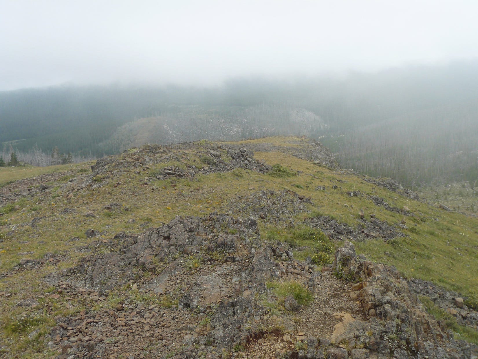
The trail started out as a level path through a beautiful forest of tall pines.  Soon, however, Lupe was gaining elevation in spurts of varying steepness interspersed with only short level stretches.  The trail wound among boulders adorned with green moss and orange lichens.

Start of the High Park Lookout trail.
By one of the first big boulders.
Moss grew on many boulders.

The terrain became rockier as Lupe went higher.

Among more boulders.
Among the pines.
The terrain gets rockier.

Near the end, 64 concrete steps were quickly followed by 21 dirt steps held back by wooden supports.

64 concrete steps appeared.
Followed by 21 dirt steps held back by wooden edges.
Rocks formations by the dirt steps.

The dirt steps ended close to a platform of rock just S of the lookout tower.  The stairway leading to the tower’s balcony was open.  Looper went up for a look around.  The balcony’s wooden planks were soft and badly weathered.  Many of the nails holding them in place were loose or missing.  Despite this questionable state of affairs, a cautious tour didn’t seem too risky.

The views were great!  The rugged spine of the Bighorn Range was off to the N.  Most of Meadowlark Lake could be seen to the NW.  8 to 10 miles E was a line of half a dozen peaks Lupe had climbed, all but one in just the past few days.

On the rocky platform S of the fire lookout tower. Photo looks N.
Up on the balcony. The intersection of USFS Roads No. 429 (L) & No. 434 (Center) is on the L. Photo looks SSE.
Meadowlark Lake. Photo looks NW.
Looking E. USFS Road No. 429 is in sight along with intersections with No. 433 (L) & No. 434 (R). In the distance are Peak 10493 (Long ridge at L, but not at the edge), Peak 10215 (L of Center), Hesse Mountain (10,385 ft.) (Center), Peak 10372 (R), and Hazelton Pyramid (10,534 ft.) (far R).
Loaf Mountain (10,722 ft.). Lupe hadn’t climbed this one yet, but it sure looked tempting!  Photo looks NE with help from the telephoto lens.

A couple of people appeared.  Lupe and SPHP left the lookout tower, moving down to the rocks to the N.

On the rocks N of the fire lookout tower. Photo looks SSE.
Part of the spine of the Bighorn Range. Photo looks NNE.
Peak 9300 (L) and part of Meadowlark Lake (R). Photo looks NW.
Meadowlark Lake (L) and Cloud Peak (R edge). Photo looks N.
Cloud Peak (13,167 ft.) (L) and Bomber Mountain (12,840 ft.) (Center). Photo looks N with help from the telephoto lens.
Peak 10215 (L), Hesse Mountain (Center L), Peak 10372 (Center R above Lupe’s tail) and Hazelton Pyramid (R above her shoulders). Photo looks E.

And that was about it.  Everything was so beautiful, but it was time to move on.  Lupe had completed the peaks she had come to climb in the S Bighorn Mountains on this Dingo Vacation.  Bidding High Park Lookout farewell, she returned to the G6.  (2:29 PM, 61ºF)

The American Dingo wasn’t done yet, though!   Down at Hwy 16, SPHP turned W.  Before long Lupe was in Tensleep Canyon on the way to her next adventure.

Tensleep Canyon, Bighorn Mountains, Wyoming 6-30-19

Links:

Next Adventure                   Prior Adventure

High Park Lookout & Sheep Mountain, Bighorn Mountains, Wyoming (8-5-14)

Meadowlark Ski Lodge

Want more Lupe adventures?  Choose from Lupe’s 2019 Dingo Vacations to the Bighorn Mountains of Wyoming Adventure IndexDingo Vacations Adventure Index or Master Adventure Index.  Or subscribe free to new Lupe adventures.

High Park Lookout & Sheep Mountain, Bighorn Mountains, Wyoming (8-5-14)

SPHP woke up in the G6 about 7:30 AM on the morning of 8-4-14.  Lupe and SPHP were parked near their favorite camping spot on the Clark’s Fork of the Yellowstone River in the Beartooth Mountains.  The previous day Lupe and SPHP had spent a wonderful long day climbing Lonesome Mountain, the highest mountain Lupe has ever climbed so far.  The sky was overcast, but not too dark.  SPHP had hopes of pitching the tent next to the Clark’s Fork of the Yellowstone, and spending a lazy recovery day there with Lupe while plotting new adventures in the Beartooths.

It was not to be.  Although by 11:30 AM SPHP was able to claim Lupe’s favorite camping site, it started to rain.  The rain lasted for several hours and then quit.  The skies remained heavily overcast.  The tent didn’t get set up.  The mosquitoes were bad.  The skies never cleared.  Everything outside was sopping wet.  No ray of sun appeared.  Lupe and SPHP spent most of the day in the G6 resting up and waiting for the weather to break.  It looked like it could start raining again at any moment.  Another night was spent in the G6.

On 8-5-14, SPHP woke up at 6:45 AM.  52°F and still heavily overcast, almost foggy.  Lupe was well rested again by now.  There wasn’t going to be any keeping the lively dingo satisfied with another day in the G6.  SPHP’s plans for more Lupe adventures in the Beartooths had to be scrapped.  It was time to move on.  Lupe and SPHP headed for Cody, WY via the Chief Joseph Scenic Byway, Hwy 296 and then Hwy 120.  Lupe’s 2014 Dingo Vacation to the Canadian Rockies & Beartooth Mountains was rapidly drawing to a close.

It wasn’t over yet, though.  The fog and clouds were hanging over the mountains to the W, but Lupe and SPHP drove out into the sunshine even before reaching the pass on Hwy 296.  SPHP still had a few adventures in mind for Lupe.  After  fueling up in Cody, just to see something new Lupe and SPHP continued SE on Hwy 120 through Meeteetse all the way to Thermopolis.  Lupe was happy just to be moving again with the opportunity to bark at cows and horses along the way.  Neither SPHP nor Lupe had ever taken this route before, so it was all new and interesting.

Most of the way from Cody to Thermopolis was like much of Wyoming – sagebrush, dry high plains with ridges and buttes all around and higher mountains in the distance.  Very Old West looking and largely unspoiled.  Meeteetse is in the Greybull River valley where there were some green trees, green irrigated fields, and a little more going on.  Meeteetse itself is less than 400 population.  Thermopolis was considerably larger, around 3,000 population.  It is named after natural hot springs in the area.  After days spent outdoors, SPHP was pretty grimy.  SPHP was looking forward to the hot springs as a great relaxing way to get cleaned up.

Lupe at the Stegosaurus roaming the grounds at the Thermopolis hot springs.
Lupe roaming the grounds at the Thermopolis hot springs with a Stegosaurus.  American Dingoes are natural born leaders.

Fortunately the day hadn’t heated up much yet, with temperatures still around a comfortable 70°F.  SPHP left Lupe in the G6 parked in the shade with the windows partially down.  She set about entertaining herself by watching squirrels in the trees.  SPHP spent a pleasant hour and a half in the pools or on the waterslide at the State Bath House, and returned much revived to the by-now bored dingo in the G6.  Nothing promotes an appreciation of cleanliness like long days spent outdoors.

It was time to head for the Bighorn Mountains!  The drive on Hwy 16/20 from Thermopolis to Worland was flat and dull with little to commend it, but heading E from Worland to Ten Sleep on Hwy 16 was another matter.  The scenery was wild, remote and dramatic.  At Ten Sleep, SPHP noticed that Dirty Sally’s was still open, but didn’t stop.  E of Ten Sleep, Hwy 16 started up beautiful Ten Sleep canyon into the Bighorns.

A little over a mile past the lodge on Meadowlark Lake, SPHP turned S on FS road No. 429.  SPHP parked the G6 just off No. 429 close to the highway.  Lupe was certainly ready to get out and stretch her legs again.  No. 429 is a gravel road that leads about a mile up through mostly open meadows to a forest near High Park Lookout (9,477 ft.).  There is a small parking lot at the edge of the forest.  A 15 minute hiking trail winds up through the forest to the old lookout tower.  The now unmanned lookout tower is closed to the public due to a broken support beam.

Lupe along road No. 429 on her way to High Park Lookout in the Bighorn Mountains. No. 429 is accessed via Hwy 16 a little over a mile SE of Meadowlark Lake.

Lupe and SPHP followed No. 429 and then the hiking trail to the High Park Lookout summit.  From some rocks near the lookout tower the best views were toward Meadowlark Lake to the NW and the higher mountains to the NNE.  On the way back down to the G6, Lupe followed the trail to the little parking lot, but did not follow No. 429 again.

Instead, Lupe and SPHP took a shortcut through the beautiful high country meadows and a small forest.  That got Lupe more into the spirit of things than just following the road.  She started sniffing and exploring around more enthusiastically.

Lupe at the High Park Lookout in the Bighorn Mountains. Photo looks N.
At look back up at High Park Lookout. Lupe was already on her way back to the G6. Photo looks S.

From High Park Lookout, Lupe and SPHP had seen lots of clouds around.  To the N where the Cloud Peak Wilderness is, all the high country was lost in dark clouds and fog.  Any thoughts SPHP had of taking Lupe to Cloud Peak were dashed.

There were fewer clouds to the S though, and SPHP started thinking about climbing Hazelton Pyramid as a substitute.  Consulting the maps, SPHP found it might be possible to hike three 10,000+ foot peaks easily enough in a day – Hesse Mountain (10,382 ft.), Hazelton Pyramid (10,534 ft.), and Hazelton Peak (10,264 ft.).  SPHP decided Lupe would try it the next day.

Lupe and SPHP headed E on Hwy 16 over Powder River Pass.  About a mile E of Powder River Pass, SPHP turned S on gravel road No. 29 and about 1/8 mile later onto USFS Road No. 448.  Half a mile later Lupe arrived at Munkres Pass.  Hesse Mountain and Hazelton Pyramid had been visible from No. 29 and looked like easy climbs.  SPHP was satisfied that Munkres Pass was a good starting point for Hesse Mountain the next day.

Lupe and SPHP left Munkres Pass to find water and a place to park for the night.  Water was found at Lost Cabin campground, and SPHP was fortunate to find a dispersed camping spot along gravel road No. 28 just after it crossed Merle Creek.

The G6 at the dispersed camping site on Merle Creek.

Lupe was quite happy with Merle Creek, a rushing little stream where she was able to drink and lay down to get cooled off.  She soon found squirrels to bark at in the surrounding forest, always a major dingo benefit.  SPHP checked the map and saw that only another 1.5 miles from Merle Creek, road No. 28 ended at the Sheep Mountain (9,610 ft.) lookout tower.  Leaving the G6 at Merle Creek to claim the spot, Lupe and SPHP set out along No. 28 to go see the views from Sheep Mountain.

The lookout tower at the top of Sheep Mountain.

There wasn’t much to see.  By the time Lupe and SPHP reached the top of Sheep Mountain, there was fog in every direction.  Dark clouds and thunder were to the E, but were moving farther away out onto the prairie beyond the Bighorns.   No one else was around.  Lupe and SPHP got up on the platform around the top of the lookout tower.  SPHP took a few photos.

The area immediately around the tower was not yet in the fog, but it was close by on all sides.  Less than 10 minutes after Lupe left, the Sheep Mountain Lookout Tower itself disappeared in the fog.  On the way back, instead of following the road, Lupe and SPHP headed down the SW slope of Sheep Mountain going almost directly back to the G6 through a big opening in the forest.

A happy American Dingo arrives at the Sheep Mountain lookout tower to see what there is to see.
Normally the views would be great from Sheep Mountain. When Lupe was there, not so much.
Lupe on the Sheep Mountain lookout tower.
Look, SPHP!  The view is almost as good with my eyes closed!

Despite the fog, the trek up Sheep Mountain had still been a pleasant excursion.  Once back at the G6, Lupe had some Alpo and entertained herself barking at squirrels.  Dusk came on.  The squirrels called it a day and disappeared.  Without the squirrels around, Lupe realized she was kind of tired too.  She wanted to get in the G6.  There she curled up for the night on her throne of blankets and pillows.  SPHP stayed up sitting on a big stone next to Merle Creek until it was too dark to write.

Lupe in Merle Creek, Bighorn Mountains of Wyoming, 8-5-14

Links:

Next Adventure                       Prior Adventure

Peak 9300 & High Park Lookout, Bighorn Mountains, Wyoming (6-30-19)

Want more Lupe adventures?  Choose from Lupe’s 2014 Canadian Rockies & Beartooths Adventure IndexDingo Vacations Adventure Index or Master Adventure Index.  Or subscribe free to new Lupe adventures.