
Lupe was on a mission! Another account holder at Peakbagger.com had contacted her on 3-20-16 asking for beta on road conditions in the western Black Hills. How much snow was there? Were the roads open? Lupe and SPHP hadn’t been to the highest parts of the hills for several months, and didn’t know for certain – but Lupe was going to find out.
The other Peakbagger.com account holder wasn’t coming to the region until early April. Since snow was in the forecast, it hadn’t made sense to run out to the western hills right away. The last shot of new snow was over by the morning of 3-26-16. Lupe and SPHP waited for 3-28-16, to give the snow a bit of time to melt.
It was supposed to get to 60°F by afternoon, but it was still quite cool in the morning. That was alright. Lupe and SPHP planned to visit a couple of lower peaks along the way. The high country could wait until afternoon. Let the snow keep melting until then! Lupe’s first peakbagging goal was Clark Mountain (5,267 ft.), just W of Sheridan Lake.
Lupe and SPHP set off heading W up Clog Gulch on Be Still Road (USFS Road No. 738) from Hwy 385 (8:35 AM, 35°F). Be Still Road took Lupe around the N end of Clark Mountain, gaining a bit of elevation while slowly turning SW. After 0.5 mile, a house came into view up ahead. Lupe was approaching private property. To stay on USFS land, Lupe and SPHP turned SE leaving the road behind. Lupe started climbing.
The first part of the climb was steep and rocky. The rocks weren’t all that large, however, or difficult to navigate. There was snow on the ground most places, but less than an inch on average. After a pretty good climb, the ground became less steep as Lupe approached a broad swath of open ground where the pines had been cut down beneath a power line.
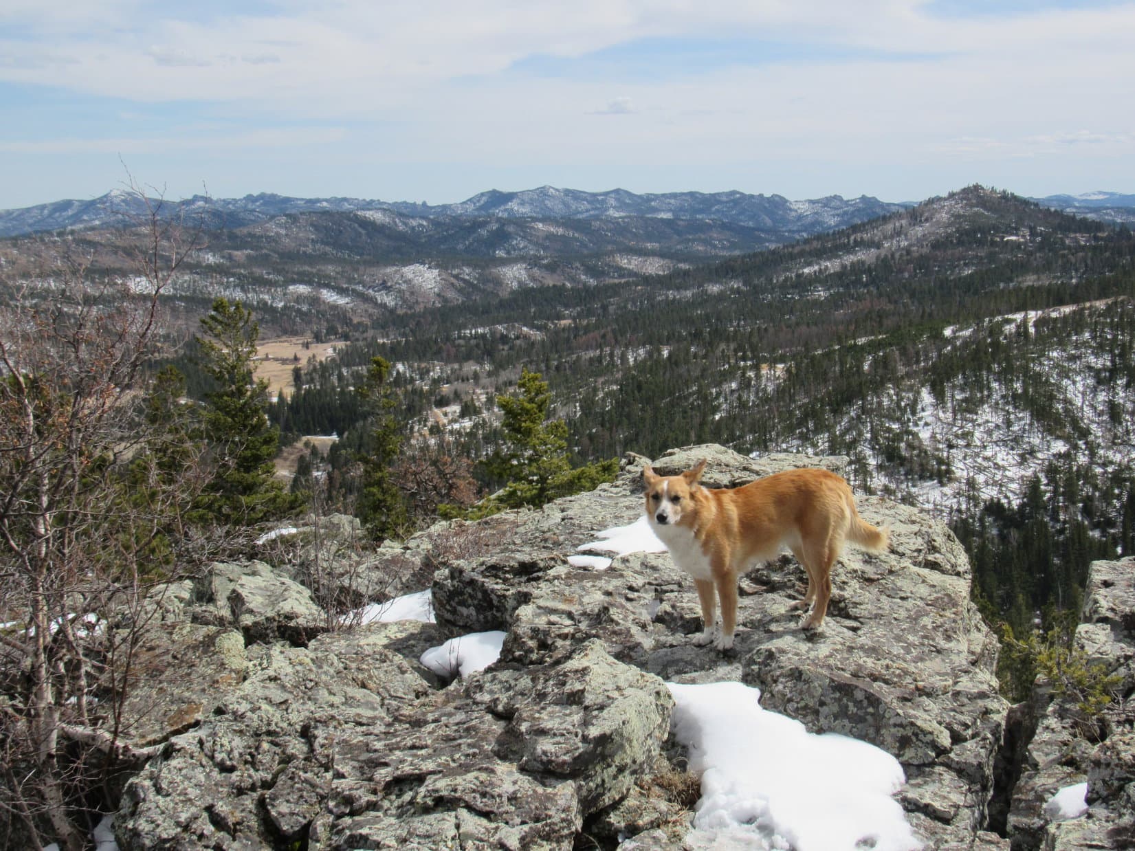
It wasn’t too much farther to the top of Clark Mountain. Lupe passed under the power line, and turned S. On the last part of the trek, Lupe was on a gently rising ridge about 100 feet wide. A rock outcropping came into view ahead. It was the summit of Clark Mountain! Lupe climbed up on top of the highest rocks to claim her first peakbagging success of the day.


There were a couple of other rock outcroppings that looked almost as high a bit farther to the S. Lupe and SPHP went to check them out. They proved to be a little lower. Lupe had already been to the true summit. Lupe hopped up on one of these also-ran rock outcroppings, anyway.


To make absolutely certain Lupe hadn’t been to a false summit, Lupe and SPHP continued exploring to the S. SPHP was also hoping to find a vantage point with a view to the E toward Sheridan Lake, less than a mile away.
The forest at the top of Clark Mountain consists mostly of large pines, without too many young ones in between. By all appearances, the forest had been thinned quite a few years ago. Even so, it was only possible to get glimpses of distant views in most directions. Only an insignificant little piece of Sheridan Lake could be seen.
Lupe and SPHP didn’t have to go much farther S to be completely convinced Lupe had been to the top of the mountain. Lupe returned to the true summit for a final look around before departing.


After bidding the Clark Mountain summit a final farewell, Lupe went N starting her descent. She could have gone NW back down to Be Still Road, but instead Lupe explored the NE ridge. This route wasn’t as steep and rocky. Lupe passed through a stretch of very densely packed young pines. Before long, she came to an open area which looked like it had been heavily logged recently.
Lupe went down into the open area following a logging trail E. The logging trail entered a valley just S of the NE ridge, and followed the valley as it curved NE again. After an easy downhill stroll, the logging trail ended right back at the G6, just S of Be Still Road (9:59 AM, 53°F). Before heading on to Humbolt Mountain (5,722 ft.), SPHP gathered up a small collection of Lupe Treasures for recycling.
Humbolt Mountain is 3.5 miles SW of Clark Mountain near Hill City. SPHP drove up Penalua Gulch Road looking for an access point. The short road went through private property, and dead-ended at private driveways. Lupe and SPHP had better luck on China Gulch Road (USFS Road No. 249), a bit farther W. It provided an access point on USFS land less than a mile N of Hwy 16/385 (10:24 AM, 53°F). Humbolt Mountain was just 0.25 mile to the SE.
Lupe and SPHP headed ENE up a faint road until Lupe wasn’t far from the N end of the mountain. The intrepid Carolina Dog then turned SSE and began her climb in earnest. The terrain got steeper and rockier as she went. SPHP switchbacked a little bit looking for the easiest way up. Lupe arrived up on the summit ridge somewhat S of its N end. She then turned S to follow the ridge to the true summit near the S end of the mountain.
Humbolt Mountain’s summit ridge was much narrower and rockier than Clark Mountain’s had been. Lupe went up and down, frequently having to skirt around the W side of a series of large rock outcroppings. She had to lose a bit of elevation at a shallow saddle before the final climb up to the true summit. Humbolt Mountain was forested, but Lupe and SPHP were pleased to find a few decent viewpoints.


The rocky ridge was quite narrow, and there were several pine trees with annoyingly low branches up at the very summit. After taking a look around, Lupe and SPHP continued S just a short distance where the ridge was a bit lower, but also wider and more open. It was time for a little break. Lupe had some Taste of the Wild. SPHP consumed an orange.


After a leisurely, but not overlong rest break, Lupe returned to the summit of Humbolt Mountain. Although the view toward Harney Peak was the most impressive, Storm Hill could also be seen close by to the SE. A little to the N of the summit was a look at Five Points (6,221 ft.) to the N.


Lupe returned to the G6 via the same route she had taken up the mountain (12:18 PM, 57°F). The day had warmed up considerably. Even out in the high country of the western Black Hills, whatever snow there was had to be melting fast.

It was time for Lupe to go conduct her western hills reconnaissance! Lupe and SPHP drove to Hill City, and turned NW on Deerfield Road. At East Slate Road, SPHP turned S. For the first few miles, there was hardly any snow at all. Lupe enjoyed the drive. There were lots of cows and a few horses to bark at along the way.
After a few miles, patches of snow appeared on the road. The snow was only a few inches deep most places, and pretty slushy. The G6 made it all the way to Six Mile Road (USFS Road No. 301) without any problem. Six Mile Road was in good enough condition so SPHP could easily have driven further, but SPHP parked the G6 at the start of USFS Road No. 301.1A (1:09 PM, 54°F). Lupe and SPHP would continue on paw and foot from here.

Although there was some snow on Six Mile Road, it was melting fast. Lupe and SPHP followed the road as it wound its way up closer to Copper Mountain. The cliffs at the SE end of Copper Mountain (6,920 ft.) have some great views. Before pressing on to her ultimate objective, Lupe was going to climb Copper Mountain first.
Lupe didn’t leave Six Mile Road until she was SW of Copper Mountain. She then climbed N to the top of the W ridge before proceeding E. There was some deadfall timber and thick stands of young pines along the way, but the climb wasn’t long or difficult. Lupe reached the flat, rocky summit. Most of the summit is forested, but there are cliffs very close by with magnificent views to the S and E. Lupe and SPHP had a look around.


Lupe could see Odakota Mountain (7,200 ft.) about 1.5 miles away to the SW. Odakota Mountain is the 2nd highest in the Black Hills and all of South Dakota. It is not nearly as well known as Harney Peak. However, Odakota Mountain was Lupe’s ultimate objective for Expedition No. 164. It was the mountain that the other Peakbagger.com account holder had contacted Lupe about!

Lupe and SPHP went back to Six Mile Road, and resumed following it W. There wasn’t any significant snow on the road until the final turn up to a saddle 0.5 mile NNW of Odakota Mountain. This point was about 2 miles closer along the road to Odakota Mountain than where the G6 was parked. The G6 could have made it this far, but no farther.
USFS Road No. 693 left Six Mile Road going S from the snowy saddle. No. 693 is a minor gravel road that ultimately gets to within about 0.30 mile of Odakota’s summit. It was snow-covered, narrow, and had some partially cleared deadfall timber. A 4WD high-clearance vehicle might have been fine on No. 693, but not the G6. Lupe and SPHP now knew the truth about the road conditions in the vicinity of Odakota Mountain.

Surprisingly, there was only 1-2″ of snow on the ground on average. Lots of places had no snow, and some areas had 4-6 inches. What snow there was, looked new. Apparently there hadn’t been any snow pack at all until the last couple of small storms. It was possible to drive as far as No. 693 or very close to it. That left a hike of about 0.5 mile one way to the summit of Odakota Mountain.
Happily, if conditions didn’t change, the other Peakbagger.com account holder wouldn’t have any problem getting to the top of Odakota Mountain!
Of course, being this close to the top of the 2nd highest mountain in South Dakota meant Lupe and SPHP were going to go see it. Lupe and SPHP went S on USFS Road No. 693.

The last 0.30 mile was just a bushwhack toward the summit of Odakota Mountain. The smallish summit ridge is oriented E/W. The top is level, but a complete tangle of deadfall timber. SPHP wondered if the limestone cairn Lupe had seen on prior visits near the E end of the ridge would still be there? It was!


Even though a lot of dead trees have fallen over on Odakota Mountain, there are still enough trees standing to mar the views. Currently, the only good viewpoint is at the far SE end of the mountain. Lupe and SPHP had been there once before, but it was quite a trek through the dead forest. Lupe wasn’t going back there today. Her reconnaissance mission was already successfully accomplished!
SPHP had other things in mind for Lupe. First among them was another rest break. Lupe ate the rest of her Taste of the Wild. SPHP finished the last orange. There were still a few hours of daylight left. Lupe could go exploring a couple of places she hadn’t been to before!
The first place Lupe went exploring after leaving Odakota Mountain was the gravel quarry N of Six Mile Road. The gravel quarry wasn’t the real goal, though. SPHP wanted to see what the views were like from the high cliffs a short distance NE of the quarry.


The second place Lupe went exploring was along a ridge going S from Six Mile Road and Copper Mountain toward Medicine Mountain. Lupe went clear to the very S end of the high ground along the ridgeline, but the views never really opened up completely.


Lupe and SPHP arrived back at the G6 at 6:12 PM (47°F). Well, that was it. Lupe’s peakbagging reconnaissance mission was over! She gave SPHP orders to submit her report to the interested party when she got home, but not until she was first served a proper Alpo dinner.
Cows, horses and deer provided entertainment on the way home. The fun never ends on the rambunctious Carolina Dog’s Black Hills Expeditions!


Links:
Next Black Hills Expedition Prior Black Hills Expedition
Want more Lupe adventures? Choose from Lupe’s Black Hills Expeditions Adventure Index or Master Adventure Index. Or subscribe free to new Lupe adventures.