Black Hills, WY Expedition No. 257 – Inyan Kara (11-7-20)

8:57 AM, 61ºF, Hunter Ranch at the end of Crook County Road No. 198

Wish you hadn’t brought the dog!

Doug Hunter, owner of the ranch that Lupe needed permission to cross to get to Inyan Kara Mountain (6,360 ft.), was soft-spoken.  A tall, older man, he didn’t look entirely well.  His face had a reddish-purple cast to it.  SPHP felt a little bad about showing up unannounced to ask this favor of him.  The softly smiling reply was a bit sheepish.

Well, I did.

Doug sighed.

I’ll tie up my dog then.  If I don’t, he’ll follow you.

Thank you, so much!  By the way, we brought you a present.

You didn’t have to do that.

It is your land.  Realize that we’re asking you a favor, so thought we better come prepared to do a little something for you, too.  It’s nothing much.  Hang on a moment.

Opening the trunk of the G6, SPHP produced a 6 pack carton of Corona Extra.  Doug seemed surprised, maybe even faintly pleased, but said nothing.  He didn’t turn it down, though, when SPHP handed it to him.  A truck pulled up, as Doug accepted the gift.

They’re here for Inyan Kara, too.

Hunters?

No, hikers like you.

Doug went to tie up his black and white salt and pepper-coated dog, which was about the same size as Lupe and showing a lot of interest in her.  SPHP parked the G6 near the fence close to the house, let Lupe out, and grabbed the backpack.  As the Carolina Dog passed by, Mr. Hunter was chatting with the new arrivals.

We’ve established a no pet policy.  One dog got bit by a rattler, and another was attacked by a badger.  The owners wanted to blame us.

Yikes!  Awkward!  Maybe that young couple had a dog, too, had called ahead, and been told not to bring it?  Clearly, Doug had been expecting them.  Waving cheerily, but briefly, SPHP stepped up the pace.

Thanks again!  We’ll be out of your hair in just a few minutes.

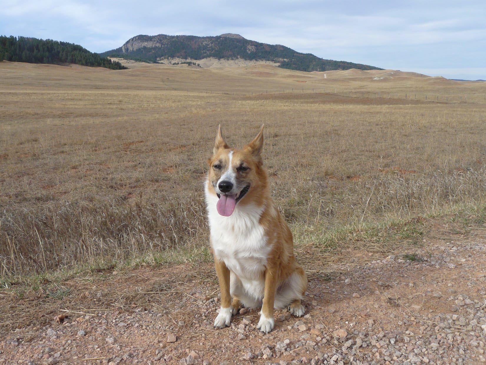
Making it to the end of the fence around the ranch house yard, Lupe turned W following a dirt road down into a little dry creek bottom, then up the other side.  In bright sunshine, Inyan Kara loomed ahead.  Not all that far to the fence line marking the boundary of the Hunter ranch, and start of the isolated 2 square miles of Black Hills National Forest on which the mountain sat.

Even after ducking under the fence, Lupe and SPHP hurried on, angling NW now toward the trees.  Out of sight, out of mind!

Inyan Kara on the way to the Hunter ranch. Photo looks WNW.
Glancing back at the Hunter Ranch headquarters after ducking under the fence onto Black Hills National Forest land. Photo looks E.
On the lower E slope heading for the trees. Photo looks NW.
Edge of the forest. Photo looks S.

Reaching the forest, Lupe continued NW for a little way, still climbing gradually.  When SPHP figured she’d gone far enough, it was time to turn W straight up the steep slope leading to the top of the E ridge.  Loop was soon there, popping up onto the ridgeline near a minor rock formation.  Inyan Kara’s summit was already in sight only 0.5 mile away.

Getting close to the top of the E ridge. Photo looks WSW.
Inyan Kara summit (Center) from the E ridge. Photo looks WNW.

Looper was going to have to go a lot farther than 0.5 mile, though, to get to the top of Inyan Kara.  The igneous mountain, an ancient wanna-be volcano that never erupted, is shaped like an elongated horseshoe, or an enormous, partially coiled serpent.  A V-shaped valley hundreds of feet deep was between the American Dingo and the summit.

This E ridge was part of the serpent’s tail.  Loop would have to travel the length of the serpent’s coiled spine clear around to the S and SW before heading NE to the summit.  Before doing all that, Lupe wandered a little farther N to where the serpent’s tail began to drop more steeply.  Her clockwise journey around to the summit would start from here.

Lupe as far N along the E ridge as she went. Photo looks SSE.

As Lupe started the journey S, the forested ridge was narrow, but nicely rounded.  Minor rock outcroppings protruded at various points like petrified serpent vertebrae.  Slowly, but steadily, Loop gained elevation as she went, occasionally coming to minor dips and high points along the way.  An even higher spot was always reached a little farther on.

Tree effectively blocked the views, but every now and then, Loop came to small openings where she could see off into the distance.  At first, all of these openings looked E or SE out over the plains surrounding Inyan Kara.  From the first of these openings, the main body of the Black Hills looked like little more than a long blue ridge.  Farther on, the piney tablelands of the Sweetwater Mountains High Point (6,440 ft.) were discernable on the SE horizon.

Starting the clockwise journey around the long outer ridge. Photo looks S.
The Black Hills of South Dakota from Inyan Kara. Photo looks E.
Sweetwater Mountains High Point (Center – the most distant ridge). Photo looks SE.
Continuing higher. Photo looks SSW.
Another look at the Sweetwater Mountains High Point (Center – most distant ridge). Photo looks SE.

Lupe was SE of the summit by the time she got her next look at it.  From this angle she had the best view of the columnar jointing on the S face of the summit region she would have all day.  Although not as spectacular, Inyan Kara bore a certain resemblance to Devils Tower (5,112 ft.), NE Wyoming’s most famous and dramatic mountain.

S face of the summit region. Photo looks NW.
Columnar jointing is a relatively rare geologic feature. Photo looks NW with help from the telephoto lens.

Inyan Kara had not escaped a pine beetle infestation that hit the Black Hills region more than 10 years ago.  Considerable quantities of deadfall timber were strewn along the ridge.  As Lupe turned W along the S part of the ridgeline, she had to dodge more and more deadfall.  Many broken tree trunks amidst this shattered mess were laying perpendicular to her direction of travel, greatly slowing SPHP’s progress.

The weather was deteriorating, too.  What had started out as a sunny morning had clouded over to a considerable degree, especially toward the S.  An early gentle breeze was now a 15 to 20 mph wind sweeping in out of the SW.  SPHP kept an eye on some of the more threatening trees still standing in the swaying, creaking forest.

At the S end, Lupe came to broader grassy region.  For the first time, she could now see the plains SW of Inyan Kara.  Turning NW to explore the SW part of the ridge, the deadfall was really icky, and the Carolina Dog had to put up with the full force of the SW breeze roaring up the slope.

The wide grassy region at the S end of the ridgeline. Photo looks SW.
Traveling the SW ridge. What a mess! Photo looks WNW.
Summit (L) view from the SW part of the ridge. Photo looks NE.
View to the SSW with help from the telephoto lens.
A last look back to the SE.

Beyond the worst of the deadfall, Lupe came to a dip in the ridgeline and another, smaller grassy spot.  This led to a short climb, culminating at forested HP6262, the highest point along the Inyan Kara serpent’s body.

In the second grassy region, on the way to HP6262. Photo looks NW.
At HP6262. Summit (Center) in the background. Photo looks NE.

The serpent’s neck had been crushed.  To get to the head (summit!), which was now off to the NE, but not easily seen due to all the trees, Lupe had to descend 130 feet into a wide saddle leading to Inyan Kara’s N ridge.  She was happy to do so.  This descent immediately got her into the leeward protection of the ridge and out of the wind.

The downslope was full of deadfall, slowing progress again, but even so, Lupe was soon approaching the bottom.  The highest part of the saddle was also littered with deadfall.  However, by staying toward the SE, Loop was able to cross the saddle in nearly obstacle-free open forest.  A few minute’s tramp, and the American Dingo stood confronted by the first rock formations of the N ridge.

Near the highest part of the saddle leading to the N ridge. Photo looks N.
A bit farther SE in an almost deadfall-free zone. Photo looks E.
Approaching the SW end of the N ridge. Photo looks E.

Inyan Kara’s N ridge was much rockier than the long outer spine of the serpent Lupe had just come from.  Exactly where to start up wasn’t clear, and maybe didn’t make much difference, although it seemed to SPHP it might be best not to start too close to the S end.  Picking a spot just N of some thin-layered rock formations, Lupe began her ascent.

Open lanes strewn with pine needles existed among the rocks, making for a fairly easy, though somewhat steep, trek higher.  Upon regaining the elevation she’d lost on the way down to the saddle from HP6262, Looper reached an initial top at HP6285.  To the S, she already had a good view of the ridge she’d traveled to get here.  Off to the NNE, she could once again see Inyan Kara’s summit.

Among the first rock formations encountered along the N ridge. Photo looks NNE.
At HP6285. The long ridge Loop had traveled to get here (from L all the way to the R), is the closest one beyond her. Sweetwater Mountains High Point (R of Center) on the far horizon. Photo looks SE.
Summit (L) from HP6285. Photo looks NNE with help from the telephoto lens.

As Lupe and SPHP were taking a look around from HP6285, the young couple that had arrived shortly before Loop left the Hunter ranch caught up.  A quick exchange of greetings, and they pressed on ahead.

Lupe was soon hot on their trail.  The summit was only 0.25 mile away now, and not even 100 feet higher.  However, the route N following breaks among knobby rock formations was up and down with several steep or narrow spots along the way.  The top of the ridge was rough enough so it was often best to stay somewhat below it, usually toward the E overlooking the deep central valley.

Among the rock formations. Photo looks N.
Making progress. Up on top of the ridge at the moment. Photo looks NNE.
Getting there! Summit (Center). Photo looks NNE.

At one point, a large rock formation provided a break in the trees.  Both Devils Tower (5,112 ft.) and the Missouri Buttes (5,374 ft.) were faintly visible on the far NW horizon.

Missouri Buttes and Devils Tower (visible if expanded) both L of Center. Photo looks NW.

Just before the final rocky spurt to the summit, Lupe came to a big dip requiring a bit of a down climb.  The young couple were already beyond the dip, paused not far below the top, as Loopster approached.

Closing in on the summit. Photo looks NE.
In a rocky gully just shy of the top. Photo looks NNE.

The young man pushed on as Lupe passed the woman, who remained where she was.  Up a little rocky ramp, and the Carolina Dog was there!  On top of Inyan Kara (6,360 ft.), Lupe and SPHP met Marcus Neiman.  He’d already removed the rocks of a cairn located a little W of the true summit.

Roughly carved into the bedrock where the cairn had been was an item of historical significance.  “74 Custer”.  The inscription had been here for more than 146 years, since July 23, 1874, when an expedition led by Lt. Col. George Armstrong Custer had been in the Black Hills searching for gold.

Looper by the “74 Custer” inscription. Photo looks NW.
“74 Custer”. A closer look.

SPHP asked Marcus about the young woman with him.

She’s just nervous about this last part?  She’s practically here already!  A shame to come so far, get so close, and not make it to the summit.  Really nothing to it now.  Mind if Lupe and I talk to her?  We’d just like to give her a little encouragement.  No question she can do this!

Marcus had no objection.

What’s her name?

Martina.

Lupe and SPHP returned to where Martina sat in a partially sheltered spot below a juniper bush.  She couldn’t have been any more than 15 or 20 feet lower than the true summit, or 100 feet from it, but the top wasn’t visible from where she waited.

What could be seen of the rocky ramp higher might seem a bit exposed to someone not used to the mountains.  In fairness, Inyan Kara’s N ridge, which Martina had already come across, was more intimidating than the vast majority of mostly gentle peaks in the Black Hills region.  The gusty SW wind was blowing up here, too, which couldn’t have been helping matters.

Despite Lupe’s calming presence, and SPHP’s attempts to reassure her, Martina repeatedly said she was fine with staying right where she was.  Her choice, of course.  SPHP was about to give up when an idea struck.  The problem was that short, but psychologically intimidating, rocky ramp higher into the wind and the unknown.  Was there another route?

Climbing only a few steps N past the juniper bush, there was!  Piece of cake!  Martina could even see the critical part from right where she was.  Not expecting any miracles, SPHP pointed out that, if she could get to where SPHP stood only a dozen feet from her, Martina had Inyan Kara made.  The rest was even easier.

A moment’s hesitation, then without saying a word, Martina stood up.  Something inside had clicked!  Literally 2 minutes later, though perhaps still a bit nervous, Martina was standing, smiling and hugging with her husband, at the true summit of Inyan Kara.

Congratulations, were in order, of course!  Then a few photos.  SPHP had the temerity to ask Martina if she liked coconut?

Yes …

How about chocolate?

Martina shot SPHP an incredulous look.

Yeeessss …

3 small chocolate coconut bars were in the backpack.  SPHP offered one each to Martina and Marcus, then split the remaining one with an eager Dingo.

At the true summit with Martina and Marcus. Photo looks ESE.

A registry was in a round plastic bin tucked under a juniper bush along the N edge 10 feet from the true summit.  Somehow, the upper edge of the registry notebook had been gnawed away.  Marcus and SPHP both created new entries.

A couple of survey markers were up here, too.  One was 10 feet W of the true summit.  The other, stamped with an arrow, was 15 feet NE.

By the W survey benchmark.
W marker.
NE marker.

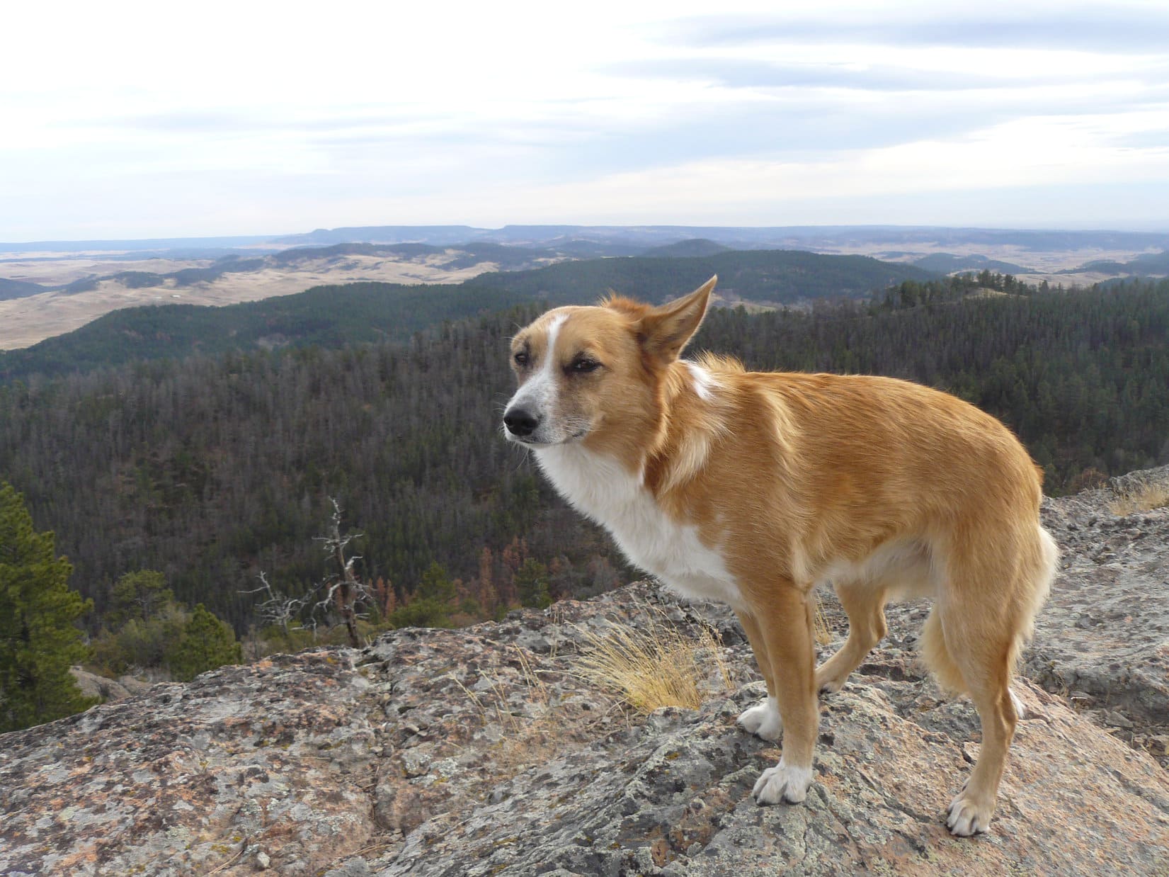
Half a dozen miles W of the main body of the Black Hills, Inyan Kara stood in grand isolation out in the high prairies of E Wyoming, part of a line of mostly smaller hills.  Sweeping views in all directions, although a bit murky on this unsettled day.

Marcus said he had climbed Missouri Buttes (5,374 ft.).  Surprising!  The buttes were on private property, so SPHP was under the impression that only a limited number of people had ever been there.

Zoomed in on Missouri Buttes (L) and Devils Tower (R). Photo looks NW.

Marcus and Martina were soon ready to go.  After Marcus rebuilt the cairn over “74 Custer”, they bid Lupe farewell and were on their way.

The rebuilt cairn hiding “74 Custer” is in front of Lupe. Photo looks NE.

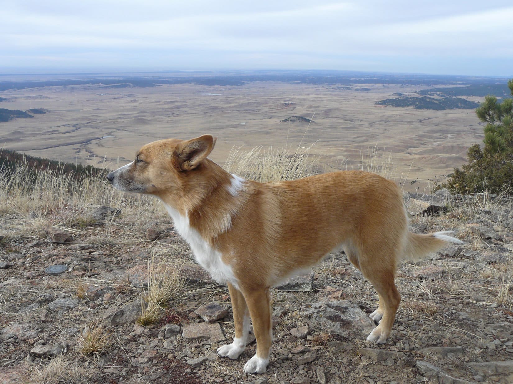
Alone again.  Lupe had been here once before on a November day, nearly 6 years ago.  SPHP had seen her old entry in the registry, still there and legible on a page now smudged and dirty.  That had also been a gray, windy day, but colder, darker, and even windier than this one.  SPHP encouraged Looper to pose as she had stood back then, buffeted by the breeze with clouds approaching out of the SW.

In the November breeze again on Inyan Kara. Photo looks SW.
Looking SE.

6 years gone, a sobering thought.  Who knew if the Carolina Dog would ever return to Inyan Kara again?  What once was, is no more.

146 years ago when someone inscribed “74 Custer” up here, this had still been Sioux territory.  Lupe might have seen bison on the prairies below.  Despite the coming huge Native American victory at Little Bighorn in June, 1876, that had all been about to change forever.  By the end of 1877, with the surrender of Chief Joseph of the Nez Perce, no numerous native tribe still roamed freely in the United States.

As the afternoon wore on, the winds died down.  Clouds sailed away.  The day became sunnier and warmer.  On a remote sacred mountain, Lupe lingered.

At the true summit. Photo looks E.
Upper NE end of the summit region. Hooker Peak (5,862 ft.) (L). Photo looks NE.
View to the W.

On a clear day, it might be possible to see the Bighorn Mountains far to the W, but Loop saw no sign of them today.  A second somewhat lower region of the summit area was hidden in forest off to the E.  Together, Lupe and SPHP went over to explore it.  Cactus!  Had seen only a little of it back near the true summit, and none on the way up, but there was a fair amount of it way out at the E end.

Loopster got a couple of small, but painful cactus spines in one of her paws.  SPHP pulled them out, but she had had it!  The American Dingo demanded SCOP (Standard Cactus Operating Procedure) from then on as long as she was in this region.  She wouldn’t budge unless SPHP either carried her, or explored ahead before giving her the signal indicating that the route was cacti-free!

Lower E end of the Inyan Kara summit region. Hooker Peak (far L). Photo looks NE.
Let’s head back to the true summit. Less painful up there! Photo looks NW.

1.5 hours after arriving, and, well, you know the drill.  A final look around, and Lupe stood perched in a light breeze at the true summit of Inyan Kara (6,360 ft.) for the last time.  Solitude, beauty, isolation, joy!

Back near the true summit. Photo looks NE.
Last look NNW. Missouri Buttes (L) and Warren Peaks (6,650 ft.) (R) on the horizon.
Inyan Kara

Onward!  Puppy, ho!

Actually, SPHP led the way for the first little bit.  Lupe hung out up on Inyan Kara’s summit, waiting until SPHP had already gotten a good start.  She then came bounding along the rocks, catching up in a jiffy.

Go on ahead, SPHP! I’ll be with you shortly. HP6262 (R). Photo looks SW.
At the SW end of the summit region. Photo looks SSW.
About to begin the descent. Photo looks NE.

The first part of the return was a retracement of the same route Looper had taken up Inyan Kara’s N ridge.

On the way down. HP6262 (Center) on the far ridge. Photo looks SW.
Last look back. Photo looks NE.

Still time!  Looper’s explorations of Inyan Kara weren’t over.  Once the American Dingo made her way back to the saddle leading to HP6262, Lupe instead turned N, venturing into a valley she’d never seen before.

Usual sort of thing.  The remote valley steepened, becoming V-shaped with plenty of deadfall to contend with.  0.75 mile later and 850 feet lower, Loop emerged from the pines as the valley widened and flattened out.  She was way over on the NW side of the mountain now.

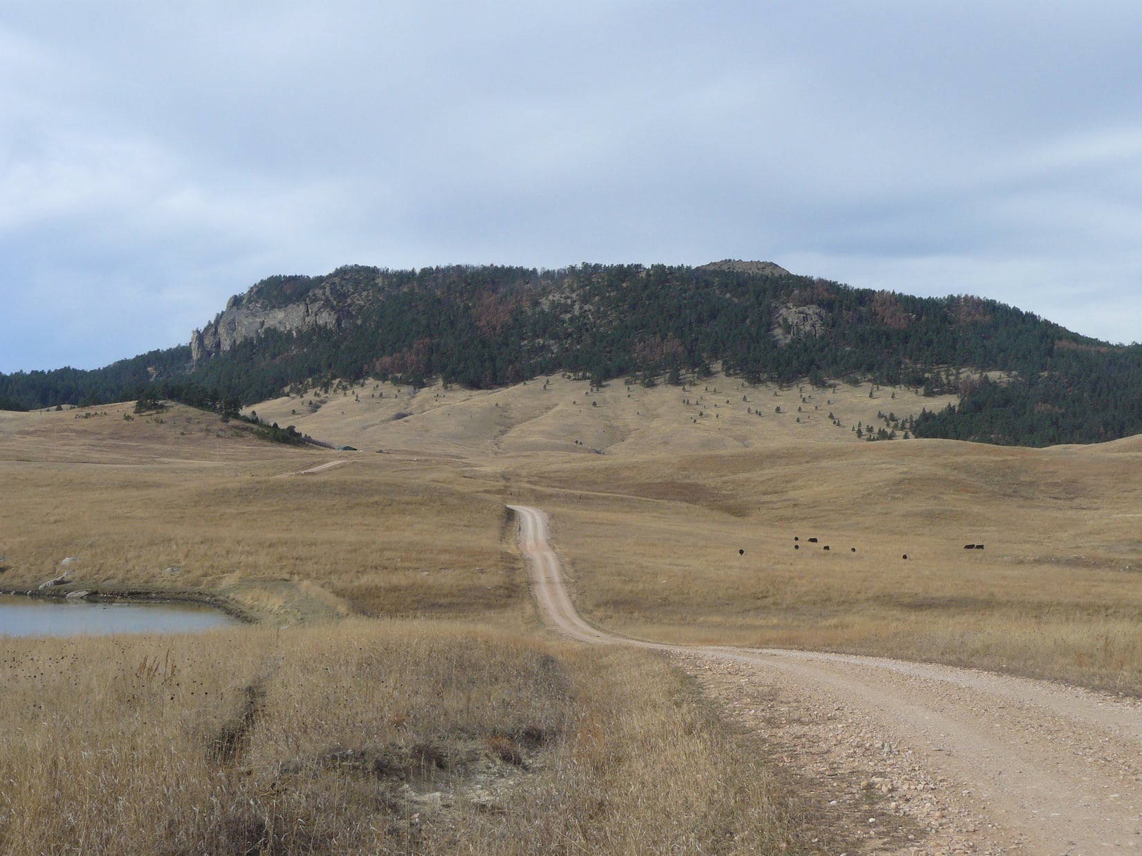
Traveling a grassy road that soon turned to dirt, the Carolina Dog circled the base of Inyan Kara clockwise, usually out on open prairie, but at times in darkening forest.  Not all that late, but evening comes stealing out of the E early while stalking the weary November sun.

Down off the mountain. Photo looks N.

To the N, Peak 5475 and O’Haver Peak (5,530 ft.) across the rumpled prairie, both looking much more significant now than they had from above.  To the NE, Hooker Peak (5,862 ft.), Iron Mountain (5,887 ft.) and Duling Hill (6,005 ft.), old friends Lupe had once visited before.

Peak 5475 (L) and O’Haver Peak (R). Photo looks NNW.
Hooker Peak (L), Iron Mountain (L of Center), and Duling Hill (R of Center). Photo looks NE.

Near the end, shortly before the dying day passed away, the sun cast a brief gleaming glance back as it fled into the W.  The American Dingo paused.  A moment of tranquil beauty.

Day’s end. Photo looks N.

Then it was gone.  Lupe was too, trotting S in the shadow of Inyan Kara.  (End, Hunter ranch HQ, 4:47 PM, 59ºF)

With Marcus and Martina, Inyan Kara, Wyoming 11-7-20

Links:

Next Black Hills Expedition                 Prior Black Hills Expedition

Black Hills, WY Expedition No. 104 – Inyan Kara Mountain (11-9-14)

The American Surveyor: Sacred Mountain – Climbing Inyan Kara

Many thanks to Douglas Hunter for granting Lupe permission to cross his ranch!

Want more Lupe adventures?  Check out Lupe’s Black Hills, SD & WY Expeditions Adventure Index, Master Adventure Index, or subscribe free to new Lupe adventures!

Black Hills, WY Expedition No. 104 – Inyan Kara Mountain (11-9-14)

Snow was in the forecast.  An approaching winter storm was supposed to hit tomorrow and dump half a foot of snow on the Black Hills.  The next 10 days weren’t expected to get above freezing.  Today was supposed to be nice, though, with highs in the 50’s.  Last chance, for a while at least, for Lupe to go on a Black Hills Expedition!

Lupe’s peakbagging goal for Expedition No. 104 was a rather unusual Black Hills mountain – Inyan Kara (6,360 ft.).  Inyan Kara is part of a line of forested ridges and hills in eastern Wyoming separated from the main body of the Black Hills in South Dakota by 5-10 miles of grasslands used mostly for ranching.  Like Devil’s Tower (5,112 ft.) in NE Wyoming and Bear Butte (4,433 ft.) near Sturgis, South Dakota, Inyan Kara was considered sacred by the Lakota Sioux.  General George Armstrong Custer is purported to have visited Inyan Kara on July 23, 1874.

Inyan Kara sits on roughly 2 square miles of the Black Hills National Forest completely surrounded by privately held ranch lands.  To even reach the national forest land, Lupe would need permission from the ranchers.  Lupe and SPHP had tried once before to get permission, way back on Black Hills Expedition No. 91 on 6-1-14, but had arrived at the ranch headquarters to find no one at home except the dog.

Lupe SE of Inyan Kara Mountain. Would she get permission from the local ranchers to cross their property to reach it?
Inyan Kara from the SE. Although Inyan Kara is on roughly 2 square miles of Black Hills National Forest, the mountain is surrounded by privately held ranchlands.
The road to the headquarters of Douglas and Sheila Hunter's ranch E of the mountain.
The road to the headquarters of Douglas and Sheila Hunter’s ranch E of the mountain.

This time Lupe and SPHP were in luck!  Lupe arrived at the headquarters of Douglas and Sheila Hunter’s ranch just E of Inyan Kara to find Mr. Hunter and a couple of helpers in his front yard busy loading a vehicle on a trailer.  Mr. Hunter’s dog, Bear, was very interested in meeting Lupe, but Lupe just growled.

Despite Lupe’s less than cordial reaction to Bear, Mr. Hunter kindly and readily granted Lupe and SPHP permission to cross his ranch to access Inyan Kara.  Mr. Hunter directed SPHP where to park the G6.  By 10:15 AM (50°F), Lupe and SPHP were on their way.

Lupe started out going W on a continuation of the dirt road that led to, and also went on by, the Hunter Ranch headquarters.  She passed some old outbuildings near a tiny, mucky creek, and soon afterward came to a junction with another road.  Lupe and SPHP turned N on this other road, but left it before long to start climbing through the fields directly toward SE-facing cliffs on Inyan Kara.  On the way up, Lupe and SPHP ducked under a fence, thereby leaving the Hunter ranch and entering the Black Hills National Forest.

Lupe and SPHP turned N to avoid the cliffs.  Lupe still angled slightly up the slope to gain elevation slowly, but steadily.  She was approaching the forest on the E side of Inyan Kara.  Once in the forest, Lupe and SPHP continued N working gradually up the ridge to the W.  When the top of the ridge became visible between the pines, Lupe and SPHP turned W and climbed directly up the steep slope to the crest of the ridge.  Lupe could now see the igneous summit of Inyan Kara to the WNW.

Lupe reaches the crest of the ridge. The summit of Inyan Kara is seen beyond her to the WNW.
The summit of Inyan Kara is basalt, an igneous rock. The basalt was forced up into overlaying sedimentary rocks as magma, which cooled and solidified. The sedimentary rocks at the top have since eroded away. Vertical columns can be seen in the basalt. A more famous and clearer example of similar geology can be found at Devil's Tower about 27 miles NW of Sundance, WY.
The summit of Inyan Kara is comprised of igneous rock.  Magma was forced up into overlaying sedimentary rock layers, but never erupted.  Instead, it cooled and solidified. The sedimentary rocks at the top have since eroded away. Vertical columns can be seen on the mountainside. A more famous and clearer example of similar geology can be found at Devil’s Tower, about 27 miles NW of Sundance, WY.

Lupe on the ESE ridge of Inyan Kara, 11-9-14Inyan Kara is an interesting mountain.  It is shaped rather like a distorted horseshoe, with the opening of the horseshoe NE of the summit and facing N.  A long ridge starts rising from the NE end of the horseshoe, and makes a big sweeping curve clear around to the E and then S of the summit, ultimately going clear over to the SW.  This long ridge gains elevation rapidly at first, but much more slowly as it progresses SW.

The S and SW portions of the sweeping ridge are quite high.  Close to the SW end, there is a significant saddle where some elevation must be lost going NE to approach a shorter, but higher ridge leading to the actual summit.  This N ridge is characterized by large igneous rock formations, but is easily climbed.  Several smaller saddles must be navigated while heading N along the summit ridge.

The N ridge angles NE shortly before reaching the top of Inyan Kara.  The summit and nearby areas form the NW end of the horseshoe.  Between the N and S ridges, a deep forested valley comprises the center of the horseshoe.

Lupe had reached the top of the lower sweeping ridge ESE of the summit.  The easiest way to reach the top of the mountain was to just follow the ridge as it swept around to the S and then SW.  From there, Lupe could traverse the saddle over to the higher N ridge and continue on to Inyan Kara’s summit.

The ridge was all forested and fairly narrow most of the way to the saddle, but it was never narrow enough to be a problem.  Deadfall timber sometimes partially blocked the way for SPHP.  It was only bad in one small area toward the SSW.  As Lupe progressed around the ridge, there were a few places with great views to the SE, S or SW.

Lupe on the S ridge of Inyan Kara. Photo looks SSE. The high ridge on the horizon seen above her head in this photo is the Sweetwater Mountain (6,440 ft.) high point.
Looking NNE at the Inyan Kara summit ridge from the lower S ridge.
Looking SSW from the S ridge.

Lupe and SPHP followed the S ridge around to the SW.  Lupe continued W far enough to make certain she had reached the highest part of the S ridge.  She then headed NE down into the saddle on her way to the N ridge leading up to the summit.  Lupe could have started NE down into the saddle a bit sooner, and she wouldn’t have lost quite as much elevation.  It still didn’t take her long to cross the broad forested saddle to reach the N ridge.

The most interesting part of Lupe’s climb up Inyan Kara started upon reaching the N ridge.  There were big rock formations.  The rocks were tan or pinkish orange, and had little steps or contours in them.  Lupe quickly climbed up to a high point at least as high as any spot along the S ridge.  From here, she could see the Inyan Kara summit off to the NNE.

The rest of the way to the summit was a bit tricky.  It involved some exploration and occasional back-tracking to find the easiest route.  In general, it proved best to stay to the NW side of the N ridge until getting quite close to the summit, since there were places that ended in cliffs to the SE.

The top of Inyan Kara is an open rocky ridge from which there are grand views in most directions.  Although it hadn’t been windy on the way up, there was a steady, cold wind out of the SW when Lupe reached the summit.  With the darkly overcast sky and stiff breeze, it was beginning to look like the forecast snow storm might well be on its way.  Lupe wasn’t going to get to enjoy the views for very long.

Lupe reaches the top of Inyan Kara! She didn't like the strong, cold breeze coming from behind her. The dark sky did look like the expected snow storm might be on its way. Photo looks SW.
Lupe reaches the top of Inyan Kara! She didn’t like the strong, cold breeze coming from behind her. The dark sky did look like the expected snow storm might be on its way. Photo looks SW.
Looking SSE from the Inyan Kara summit toward Sweetwater Mountain, the high ridge on the far horizon.
Looking NW from Inyan Kara. The circular USGS benchmark is on the ground in front of Lupe.

Right away, SPHP noticed a USGS benchmark out in the open just 10 or 12 feet E of the summit. SPHP was disappointed that it didn’t even say Inyan Kara on it.  While SPHP was looking at the USGS benchmark, Lupe was sniffing curiously around a big juniper bush just 8 feet N of the summit. Upon investigation, stuffed inside the bush SPHP found a broken Tupperware container inside a couple of Ziploc bags.  It was all held in place inside the bush by several rocks placed on top.

USGS benchmark on Inyan Kara.
Lupe not enjoying the wind by the juniper bush. The registry log was hidden inside this bush 8 feet N of the summit.

Inside the broken Tupperware container was a pen and notebook that serves as a registry log.  There were also other papers relating to a wedding, a funeral service and other events that had been held on top of Inyan Kara.  The registry went back to 2008 and contained quite a few names.  Some of the individuals had climbed Inyan Kara multiple times, with one claiming to have made 6 ascents.

SPHP would have liked to spend more time reading the registry, but the wind made reading for very long unpleasant.  It was difficult to hold the pages open and still without tearing them.  SPHP entered Lupe’s name in the registry log, before putting it all back together and stuffing everything securely in the bush.

Despite the wind, Lupe and SPHP lingered up on Inyan Kara for a while to enjoy the views.  Lupe had water and Taste of the Wild, and then huddled inside SPHP’s jacket to stay warm.  SPHP ate an apple and a big carrot.  For the Black Hills, the views were tremendous.  Far below and all around Inyan Kara was open ranch land, dotted here and there with forested hills and ridges.

On the N horizon, Lupe could see Missouri Buttes (5,374 ft.), Devil’s Tower, and Warren Peaks (6,650 ft.)Cement Ridge (6,674 ft.) was off to the NE.  Terry Peak (7,064 ft.) and the main body of the Black Hills were in view to the E.  Sweetwater Mountain was SSE.  Very far to the W are the Bighorn Mountains, which are easily seen from Inyan Kara on a clear day when the light is right.  However, SPHP could only barely make out one small portion of the southern Bighorns on this overcast day.

When it was time to go, Lupe and SPHP took the same route back along the N ridge going SSW and then down into the saddle area between the N and S ridges.  Instead of going on to retrace Lupe’s route along the S ridge, Lupe and SPHP ventured E down into the steep, deep forested valley between the ridges – the middle of the Inyan Kara horseshoe.

Lupe on her way down Inyan Kara. Photo looks N.

Lupe followed the valley all the way down to its exit onto the prairie NE of the Inyan Kara summit (the open end of the horseshoe).  There was no trail at all in the upper portion of the valley, and only a faint one in the lower part, until Lupe reached a jeep trail near a couple of old rusting water tanks near the valley’s N end.

The trek down through the central valley proved to take much more time than the S ridge route.  Except at the upper and lower ends, the valley is V-shaped nearly all the way.  Even the very bottom was steep, rough ground.  In places it was choked with deadfall timber killed by pine bark beetles, making the going very slow.

The valley did provide Lupe complete protection from the cold wind.  About the only other advantage was a tiny intermittent trickle of a stream where Lupe could get a drink.  Not much of an advantage when SPHP was porting water anyway.  While the valley was fun to explore once, Lupe and SPHP definitely recommend the S ridge route instead for the splendid views, shorter hike, and easier terrain!

Once Lupe emerged from Inyan Kara’s horseshoe, she followed the jeep trail around the E side of the mountain.  There were forests near the E ridge, but most of the time Lupe was out on the open range.  The jeep trail led right back to the Hunter ranch headquarters.

Lupe arrived at the G6 at 4:24 PM (51°F).  No one was around except Bear, who was standing on the front porch.  Bear whined when he saw Lupe.  Bear still wanted to play, but the tired Carolina Dog showed no interest, dashing the lonely ranch dog’s hopes.

Sunset leaving the Hunter ranch.

Inyan Kara Mountain is about 4 miles W of Hwy 585 in NE Wyoming between Sundance and Four Corners.  Turn W on County Road No. 198 about 15 miles S of Sundance.  Follow it about 1.5 miles W.  A sharp turn N on a dirt road eventually leads 2.5 miles NW to a fork in the road.  The Douglas and Sheila Hunter ranch headquarters is a short distance down the right fork.  Courtesy and respect for the landowner’s rights will go a long way toward securing permission to access Inyan Kara.

For more information on the interesting history of Inyan Kara, click here.

Links:

Next Black Hills Expedition                    Prior Black Hills Expedition

Black Hills, WY Expedition No. 257 – Inyan Kara (11-7-20)

Want more Lupe adventures?  Choose from Lupe’s Black Hills Expeditions Adventure Index or Master Adventure Index.  Or subscribe free to new Lupe adventures.