10-28-21 – Lupe could hardly believe her big soft Dingo ears! Uncle Joe, Aunt Andrea, and Cousin Dusty were coming from Colorado. Not only would they be here tonight, but Lupe had a brand new cousin that was coming with them, too!
When Cousin Laddie gets here, Loop, you’re going to have to be extra nice to him. Laddie’s had a tough life and might be scared. He’s a nice dog, a little Sheltie not even as big as you. So, no growling or rough-housing! Got that?
Why? What happened to Cousin Laddie, SPHP?
Oh, I don’t know the whole story, but Laddie’s been at the shelter. He got adopted, but a few months ago Laddie was grabbed by the neck and torn into by another dog in the same family that adopted him, and was just about done in. To survive, Laddie needed thousands of dollars worth of surgery. The fur on his chest is still growing back. Laddie’s also missing almost all his front teeth, which were rotten and had to be pulled back when he first got to the shelter.
No teeth? My poor cousin! His bark must be worse than his bite!
Probably right about that, Loop, but he still has his back teeth.
How come you’ve never mentioned Cousin Laddie before, SPHP?
Because he’s a brand new cousin. He just joined the family when Aunt Andrea and Uncle Joe agreed to adopt him, since he couldn’t stay with the same family any longer after being attacked. In fact, Laddie is his new name. He used to be called Danny Boy.
It was all true! Later that evening Uncle Joe, Aunt Andrea, and Cousins Dusty and Laddie did arrive. Loopster raced around barking for joy, wild with delight! Extremely curious about Cousin Laddie, she sniffed and sniffed. SPHP hadn’t said anything about sniffing. Lupe sniffed so much that Laddie maybe did get a little scared, but nothing bad happened.
The amazing thing about Cousin Laddie was that he was almost the same color as Lupe. Laddie’s fur was a lot longer, though, except on his chest where it had been cut. Laddie did have one front tooth, an upper canine on the L side. That lone tooth gave Laddie sort of a crooked smile. SPHP later said that Uncle Joe and Aunt Andrea should have named him Snaggle Fang.
10-29-21, Centennial Trail No. 89, Alkali Creek trailhead – Everyone was excited! Cousin Laddie was about to get his first introduction to the Black Hills. Cousin Dusty was 15 now, so the hike had to be a relatively easy one. The stretch of Centennial Trail No. 89 N of the Alkali Creek trailhead to a ridge overlooking the old 7th cavalry post at Fort Meade was one of Uncle Joe’s favorites, and would do nicely. He always called it the Ponderosa hike.
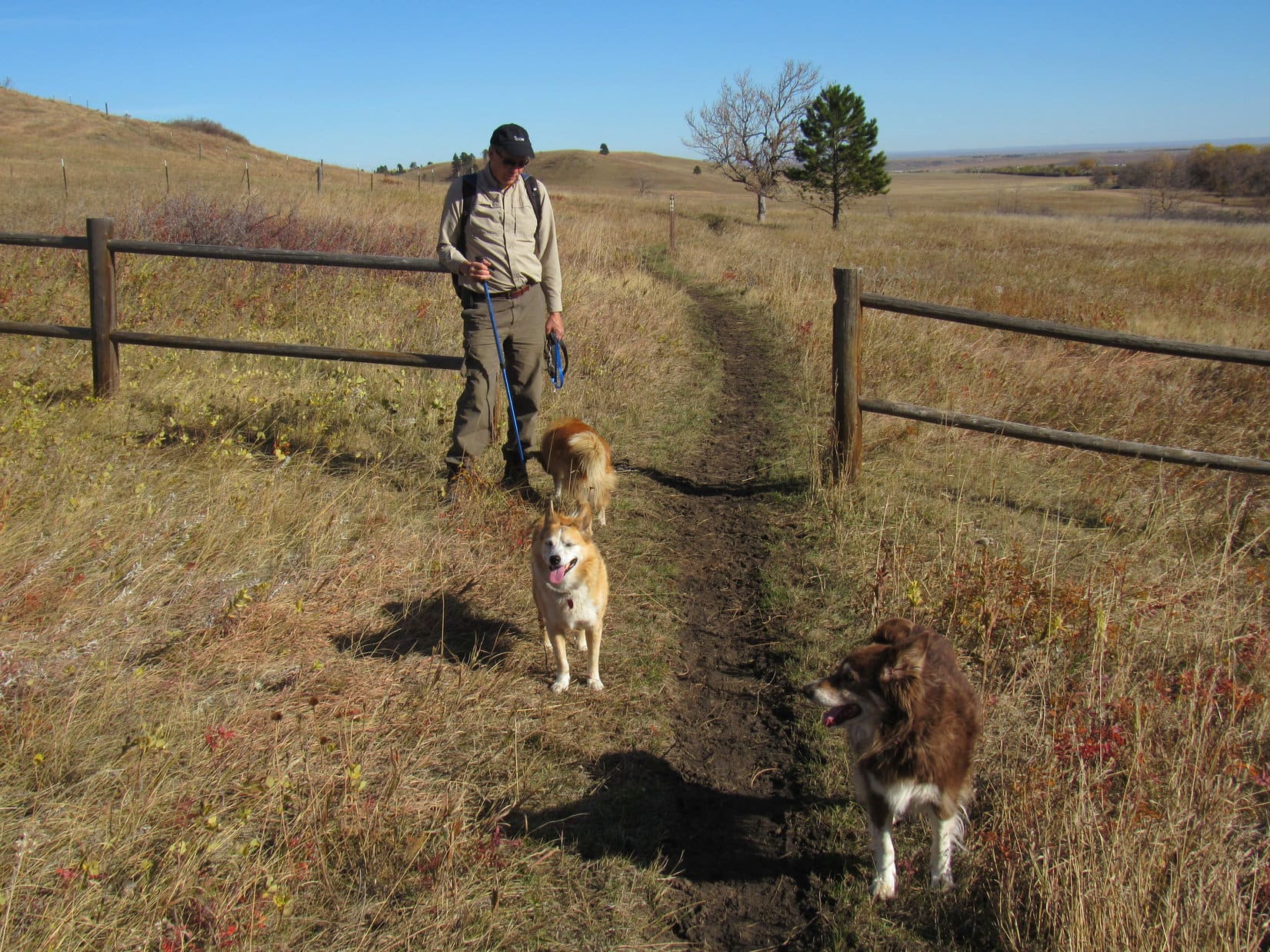
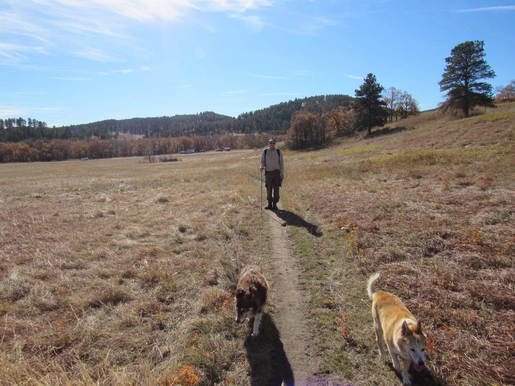
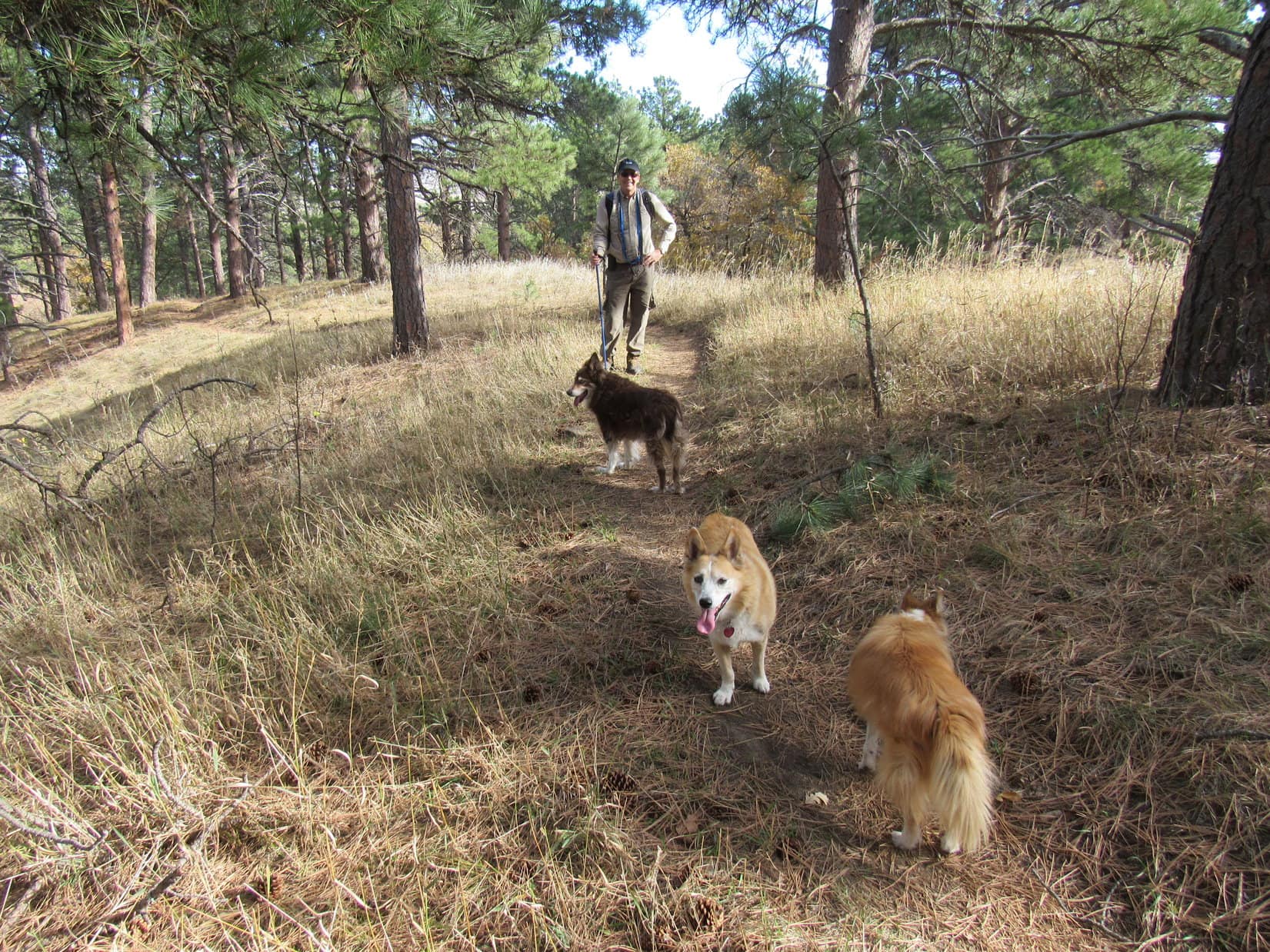
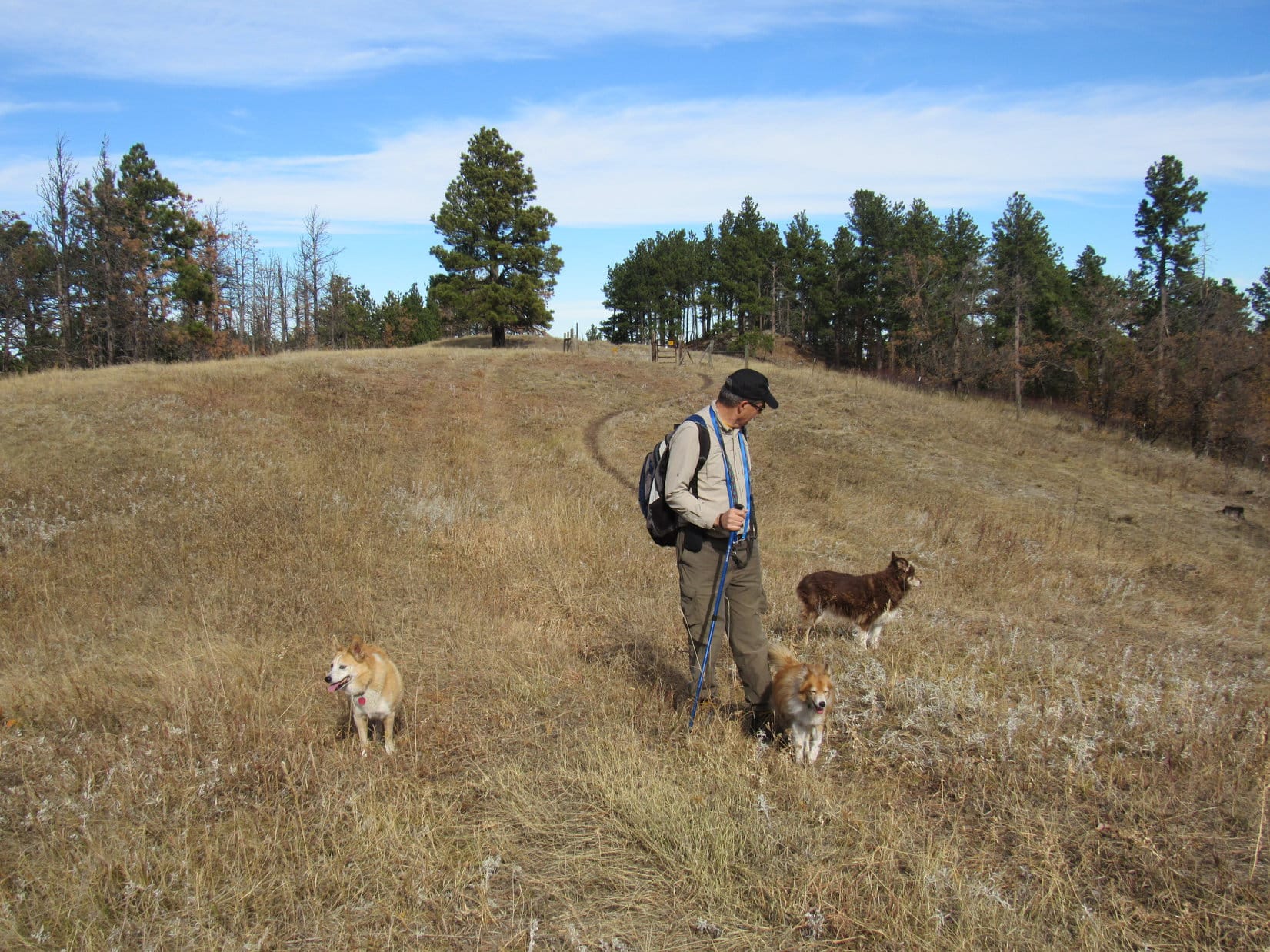
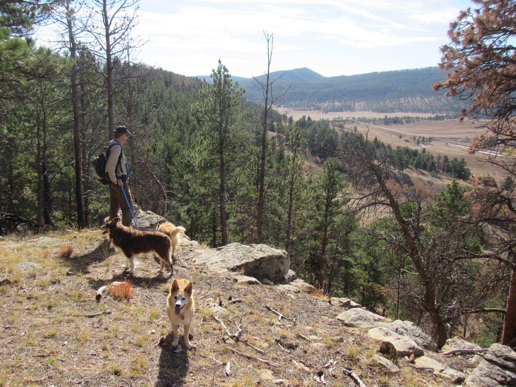
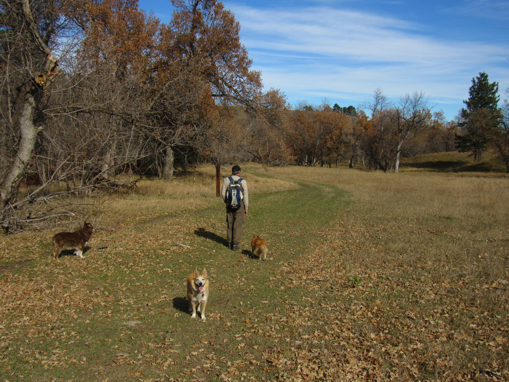
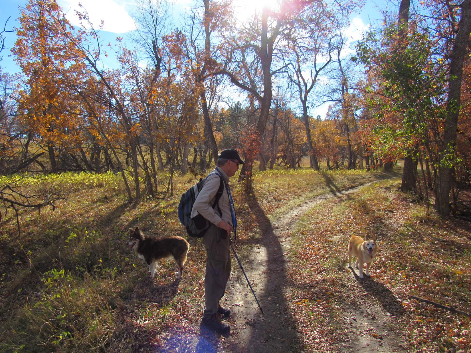
The whole pack at the start of Uncle Joe’s “Ponderosa Hike” along Centennial Trail No. 89. Photo looks NE.Off to a good start, looking back toward the Alkali Creek trailhead. Photo looks SSW.
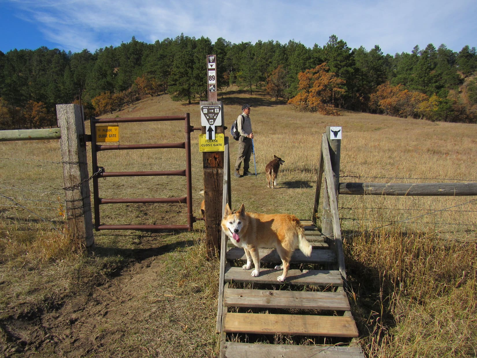
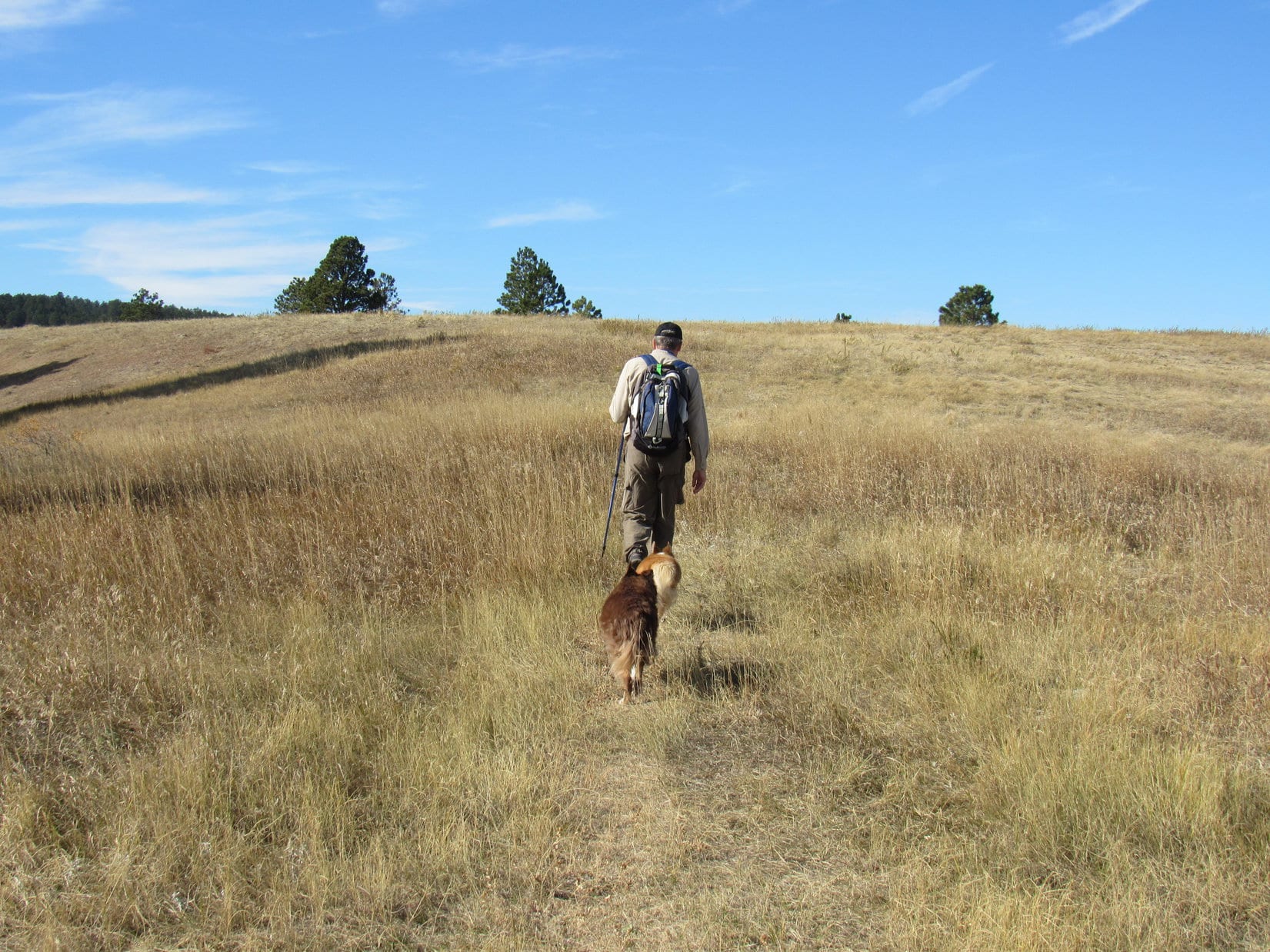
The first part of the trail was an easy stroll through the grasslands. Soon Bear Butte(4,422 ft.) was coming into view. At the top of a rise, the trail diverged by a gate in a barbed wire fence. Centennial Trail No. 89 went L here, heading W for a forested ridge.
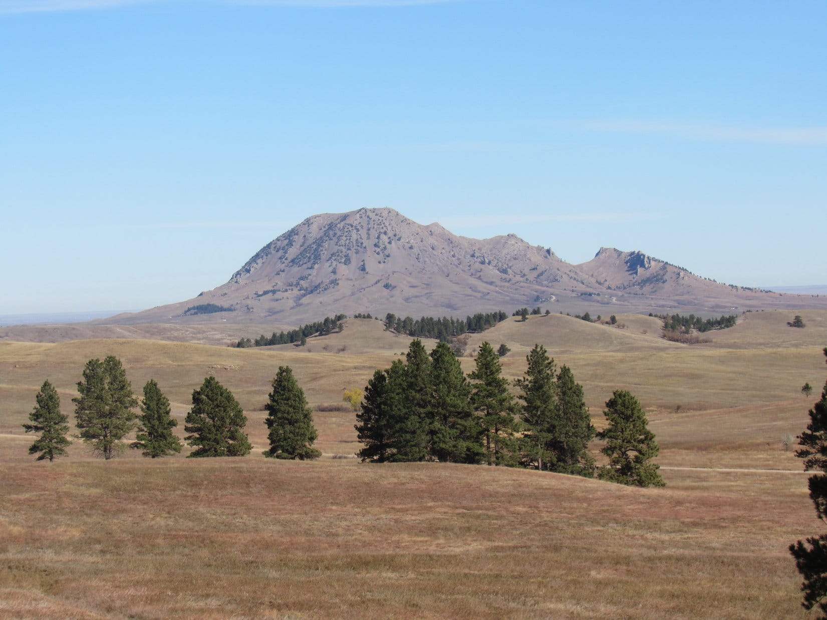
At the gate where Centennial Trail No. 89 turns W (L) to go up onto the forested ridge. Bear Butte (R) in the distance. Photo looks NNE.Bear Butte. Photo looks NNE with help from the telephoto lens.About to head up the ridge. Photo looks W.
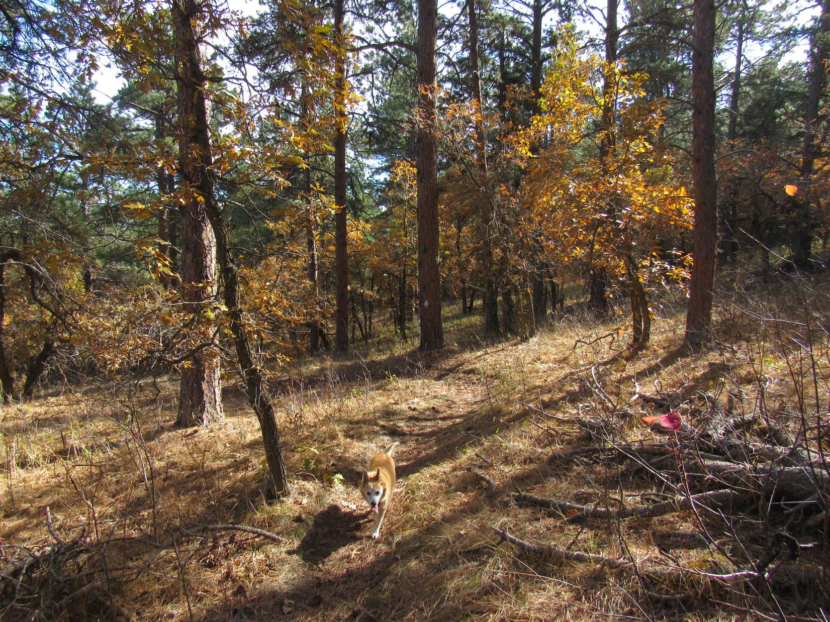
Upon entering the forest at the base of the ridge, Centennial Trail No. 89 continued W, working steadily higher on a winding course. At nearly the end of October, autumn leaves still clinging to the scrub oaks were well past their scenic best, but did add splashes of color. Cousin Dusty, a veteran of many prior adventures in the Black Hills, was doing great! She often took turns leading the way with Lupe.
Still unaccustomed to the Black Hills and his new life, Cousin Laddie was happiest sticking close to Uncle Joe.
Loop and Dusty, together again in the Black Hills!Loopster in the lead.Getting close to the top of the ridge. Photo looks ESE.
Centennial Trail No. 89 reached the top of the ridge at its far S end. Here the trail leveled out. Peak4027, true summit of the entire mile long ridge, was only a little farther N. The trail went practically right to it, but never did go quite all the way to the top, sweeping around the hillside E of the summit instead.
Naturally, being this close, Lupe had to tag the high point! The Carolina Dog left Centennial Trail No. 89, venturing up to the summit. Everyone else followed as a matter of course.
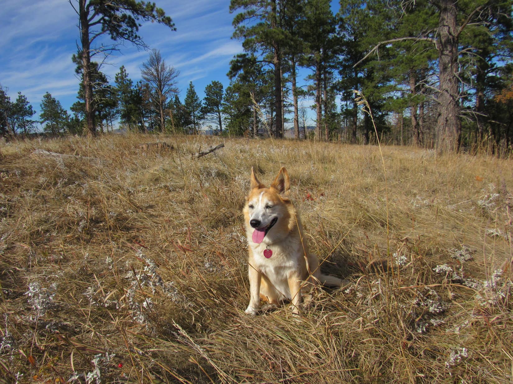
It took only a couple of minutes to reach the top, a big, flat, grassy field ringed by Ponderosa pines in most directions. Lupe, SPHP, Cousin Dusty, and Uncle Joe had all been here before, but this was Cousin Laddie’s first Black Hills peakbagging success. Peak 4027 was super easy, but Laddie seemed happy enough with it.
The whole pack up on Peak 4027. Photo looks NNW.Lupe and Uncle Joe.
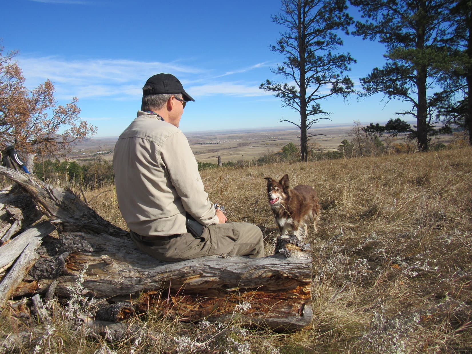
A short break was taken up on Peak 4027. Although trees blocked the views in most directions, Bear Butte and the prairies E of the Black Hills were on display. SPHP had brought apples and chocolate coconut bars. Uncle Joe shared Kirkland bars. All of the dogs enjoyed some chocolate coconut bar, and Cousin Dusty even wanted the apple cores. Water was available, too.
Cousin Dusty looking good at 15 on Peak 4027.Dusty asking Uncle Joe if it’s alright to have some chocolate coconut bar?In the sunshine back on good ole Peak 4027.Bear Butte (Center) from Peak 4027. Photo looks NNE.
When all the goodies were gone, it was time to continue on. From Peak 4027, Centennial Trail No. 89 ran another 0.75 mile all the way to the far N end of the ridge. Most of this route was forested, but there was a big clearing approaching HP3983, and a little past HP3983 was a viewpoint off to the L (W) overlooking I-90.
Laddie N of Peak 4027 hitting Centennial Trail No. 89 again.Uncle Joe and the pack in the meadow approaching HP3983. Photo looks N.At the viewpoint N of HP3893 overlooking I-90 (R). Photo looks SSW.
At the N end of the ridge was another viewpoint overlooking the town of Sturgis. Oyster Mountain(4,040 ft.), Sly Hill(3,920 ft.), and Peak 3950 were all in sight, too.
At the N end of the ridge. Oyster Mountain (Center), Sly Hill (R) and Peak 39050 (far R). Photo looks NW.
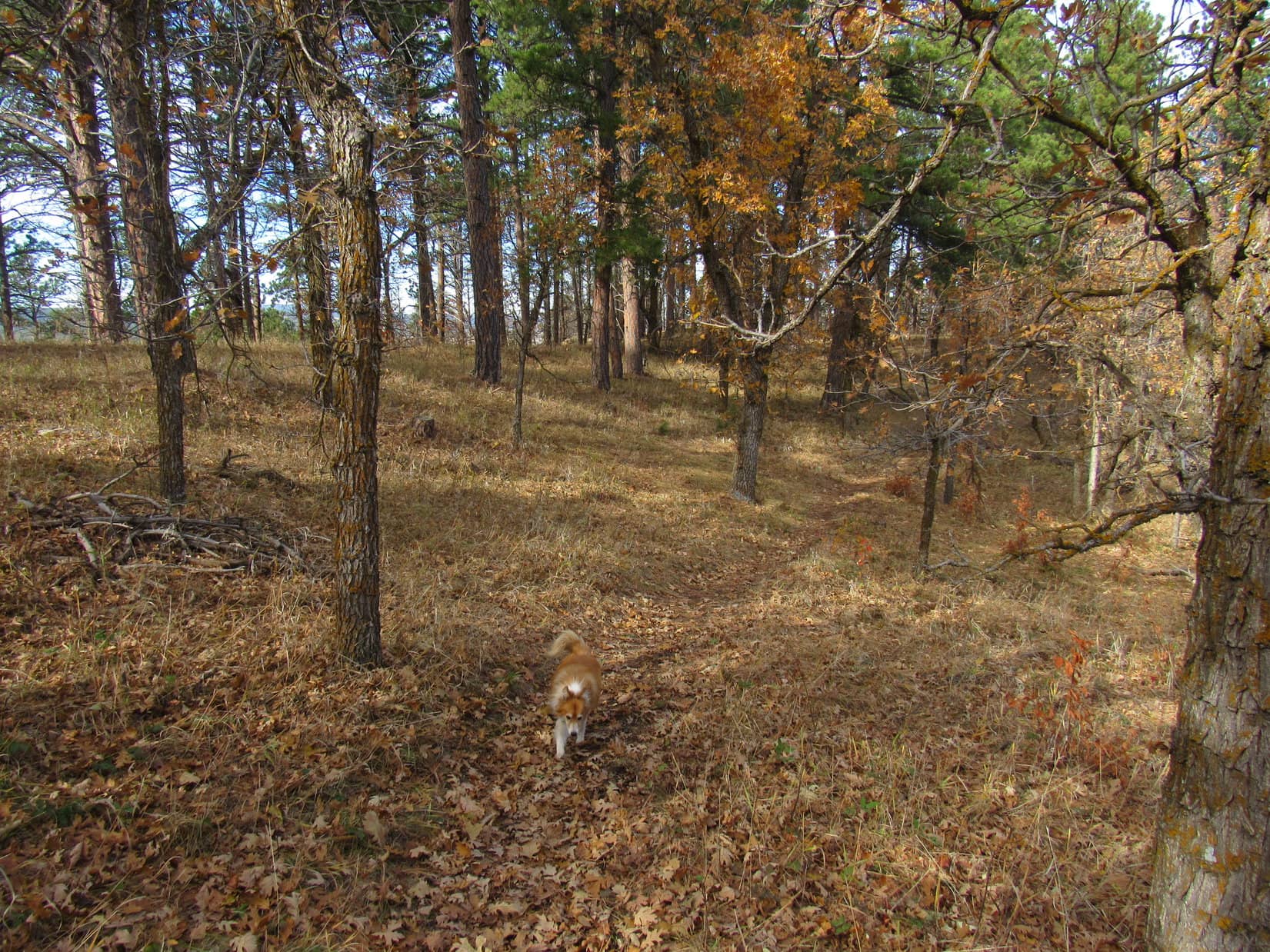
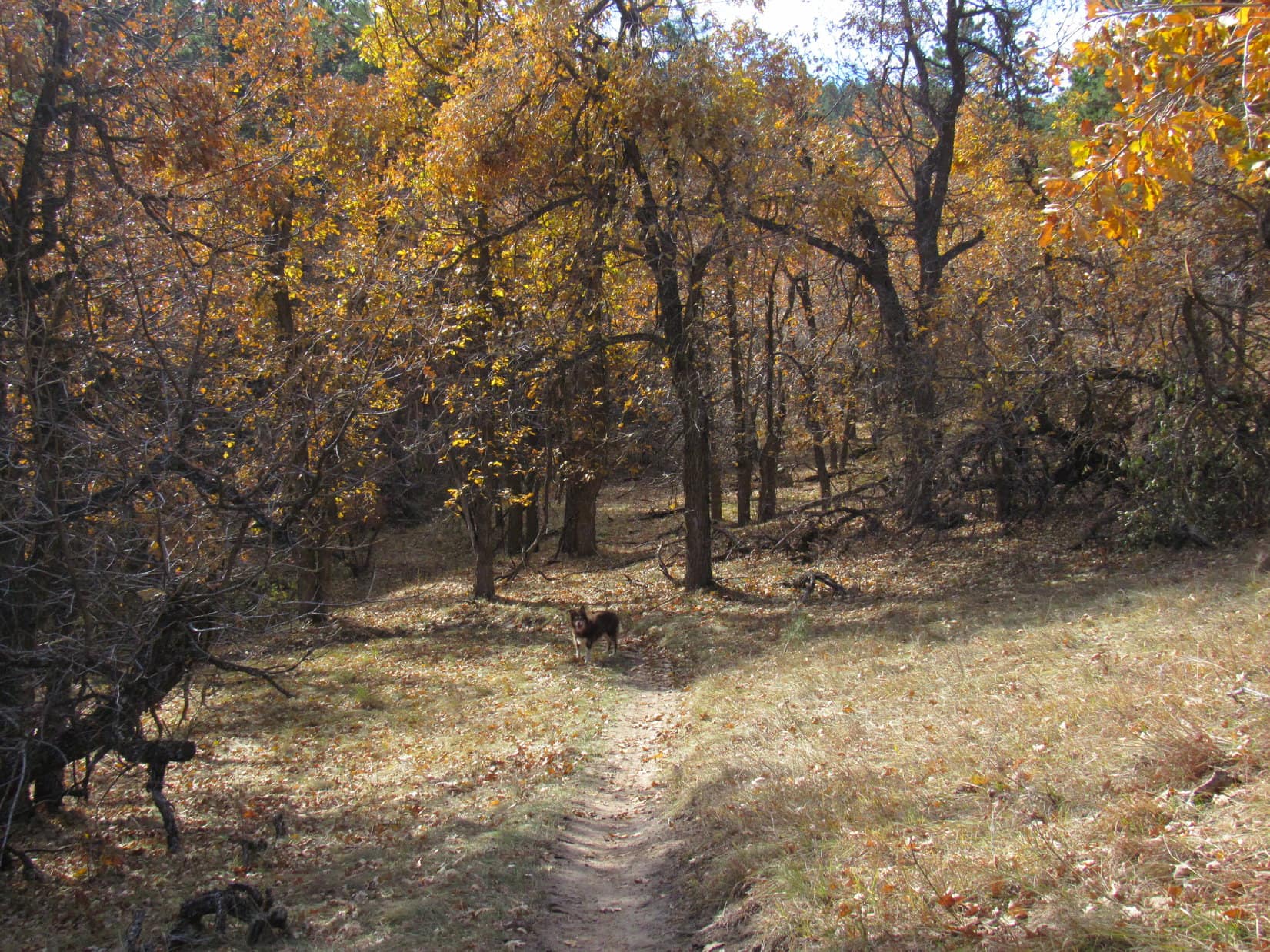
From the Sturgis viewpoint, the trail began descending NE. Halfway down the mountain it curved back into a valley to the S, then turned NE again upon reaching the valley floor. Scrub oaks were the most scenic feature of this trek, especially lower down where, protected from the wind, they still had quite a few leaves.
Heading down the N end of the ridge.Cousin Dusty amid the scrub oaks as she enters the valley.
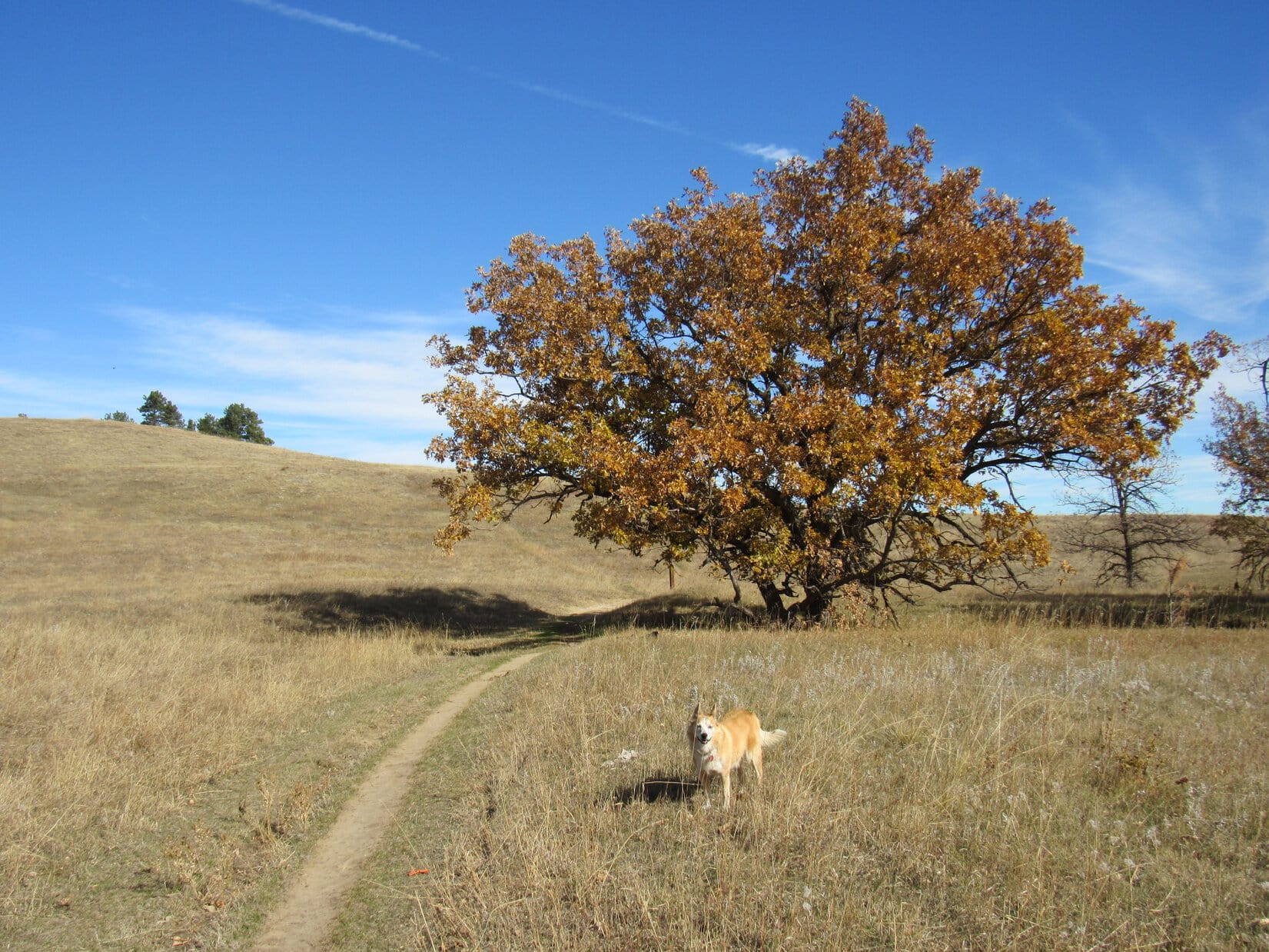
The valley of the scrub oaks eventually led clear down to Old Stone Road. Centennial Trail No. 89 crossed the road, entering a larger, flatter drainage which continued NE out toward the prairie. The trail soon curved E, but everyone abandoned it to take a shortcut up a grassy slope onto the ridge to the N.
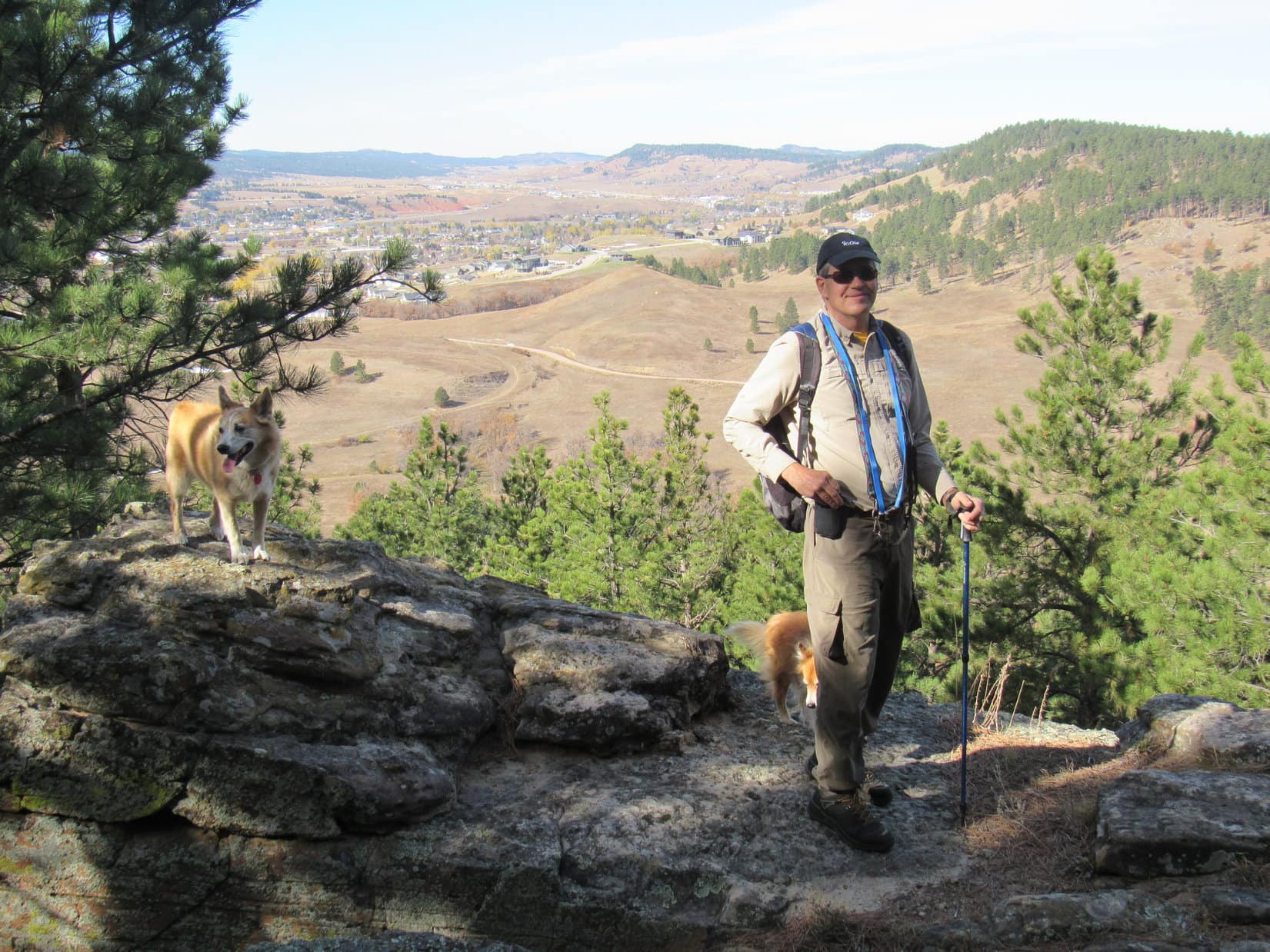
Near the start of the wider drainage after crossing Old Stone Road. Photo looks NE.Approaching the prairie. Centennial Trail No. 89 curves E (R) beyond the magnificent tree, but everyone left the trail here to go N (L) up onto the ridge. Photo looks NE.Joe, Laddie and Dusty getting close to the top. Photo looks NW.
Overlooking both Fort Meade and Bear Butte(4,422 ft.), the top of this ridge was the traditional end of the “Ponderosa Hike”.
Fort Meade (L) and Bear Butte (R) from the end of Uncle Joe’s traditional “Ponderosa Hike”. Photo looks NNE.
Hardly a cloud in the sky, and incredibly warm for practically the end of October! A little farther W along the ridge, everyone hid out from the sun in the shade of a few large pine trees enjoying a second rest break. More bars, more apples, more water!
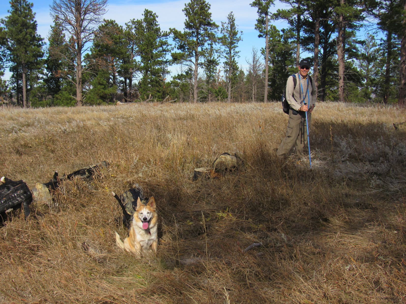
Relaxing in the shade at the end of the Ponderosa hike. Photo looks SW.New cousin Laddie taking it easy on his first ever Black Hills expedition.
When the time came to start back, there was some discussion of possibly exploring farther W first. In the end, though, the whole pack headed right back down the grassy ridge’s S slope.
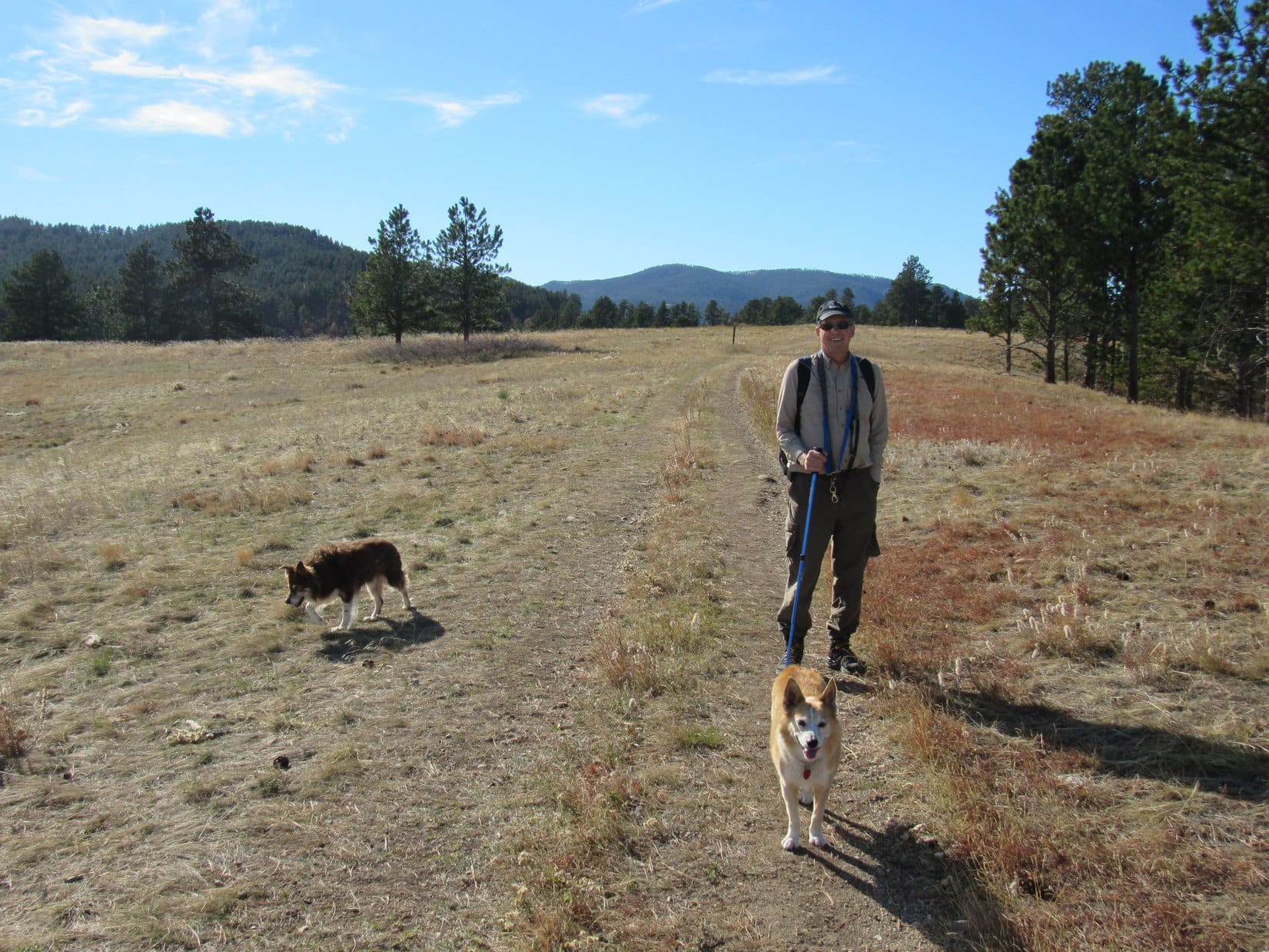
Ready to start back to the trailhead. Photo looks WSW.Final moments on the grassy ridge. Photo looks S.
Rejoining Centennial Trail No. 89 down in the wide drainage, the pack followed it SW only a short distance. Before reaching Old Stone Road, it was decided not to return via the ridge leading to Peak 4027. Instead, a different trail was taken that went S down on the rolling prairie.
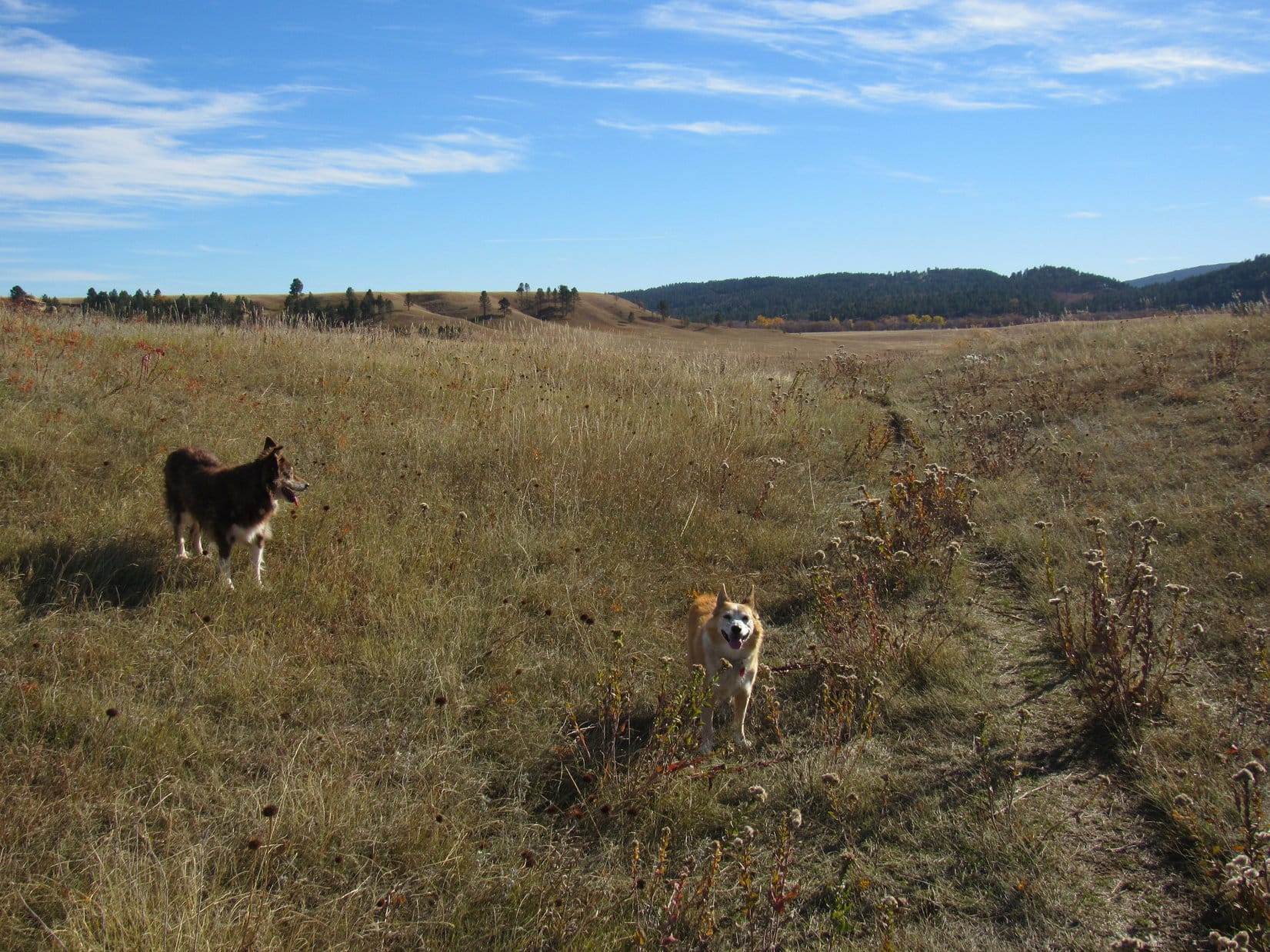
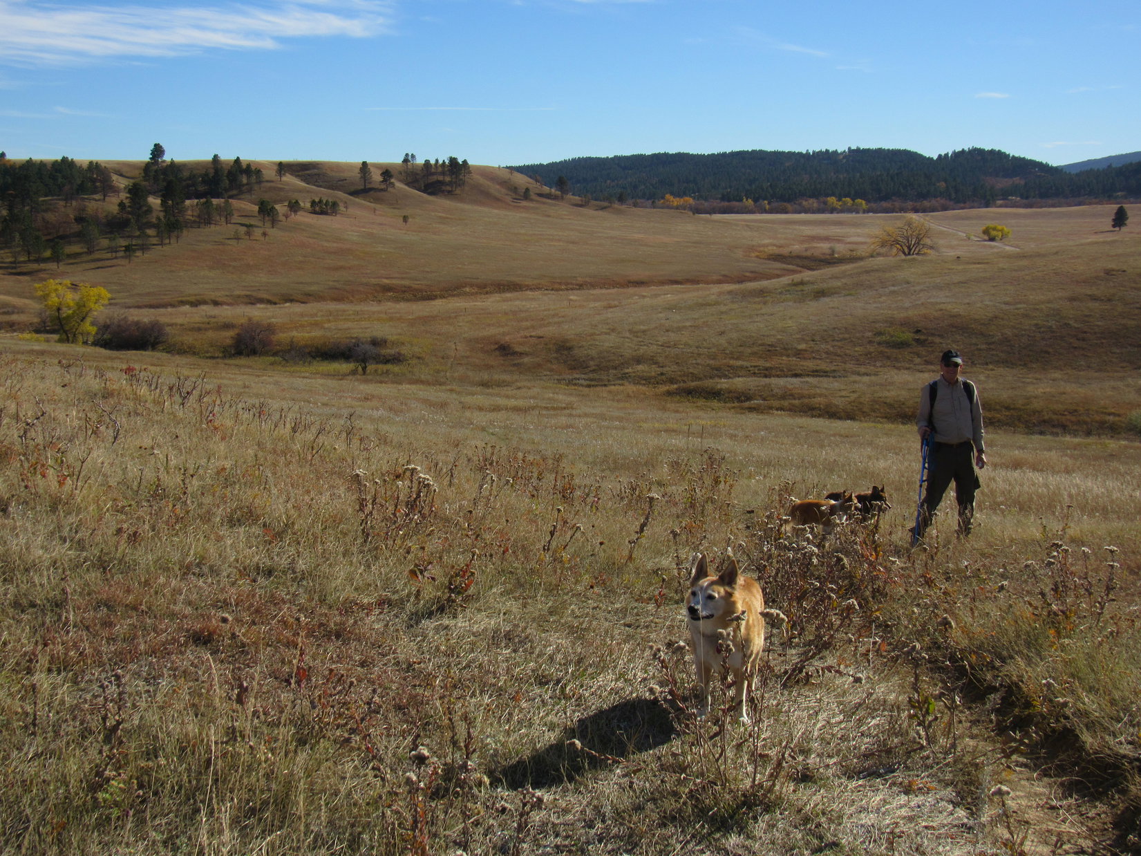
Briefly back on Centennial Trail No. 89 again S of the grassy ridge. Photo looks SW.Lupe and Cousin Dusty out on the prairie. Photo looks SSW.Still more than a mile from the Alkali Creek trailhead. Photo looks SSW.
Near the end, Centennial Trail No. 89 was eventually rejoined at the gate where it turned W going up to the forested ridge and Peak 4027. Getting just plain hot out! The sun was a beast with the temperature soaring into the mid 70’s ºF. In their fur coats, Lupe, Dusty and Laddie were all panting, tongues hanging out on the final stretch.
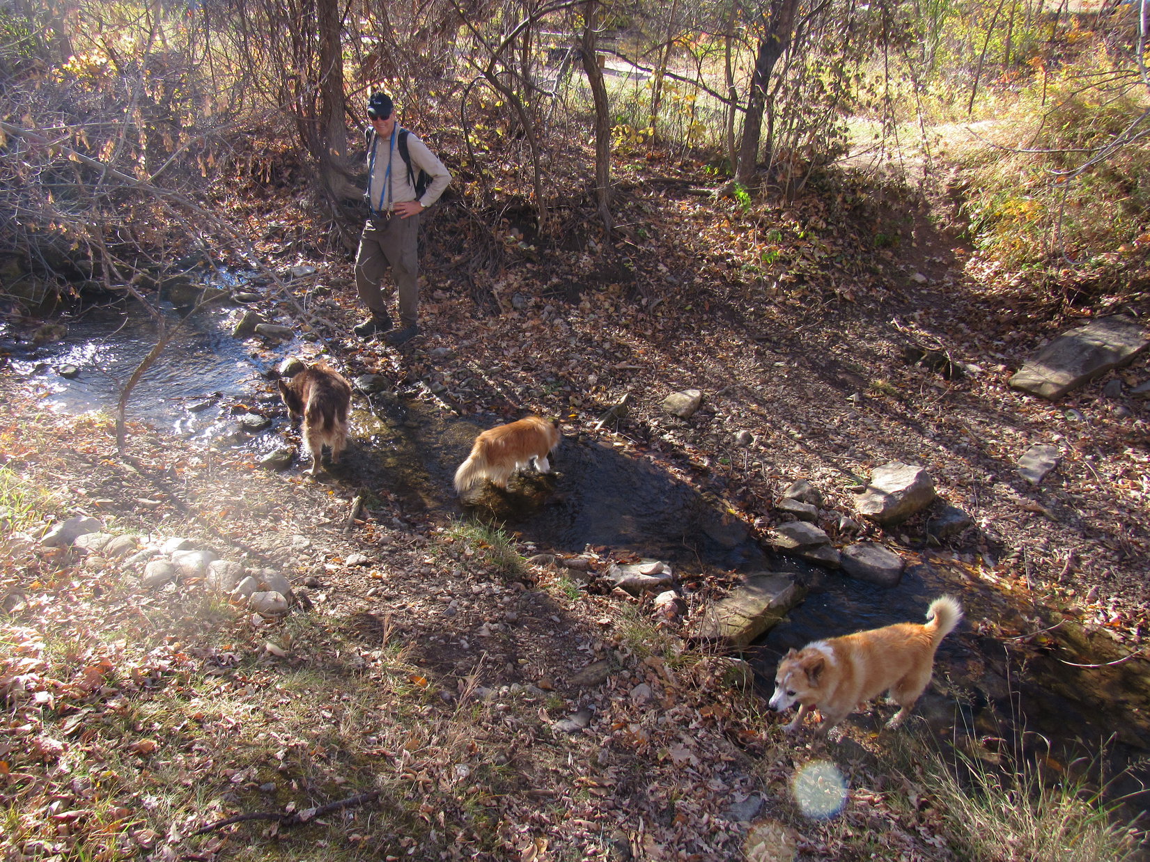
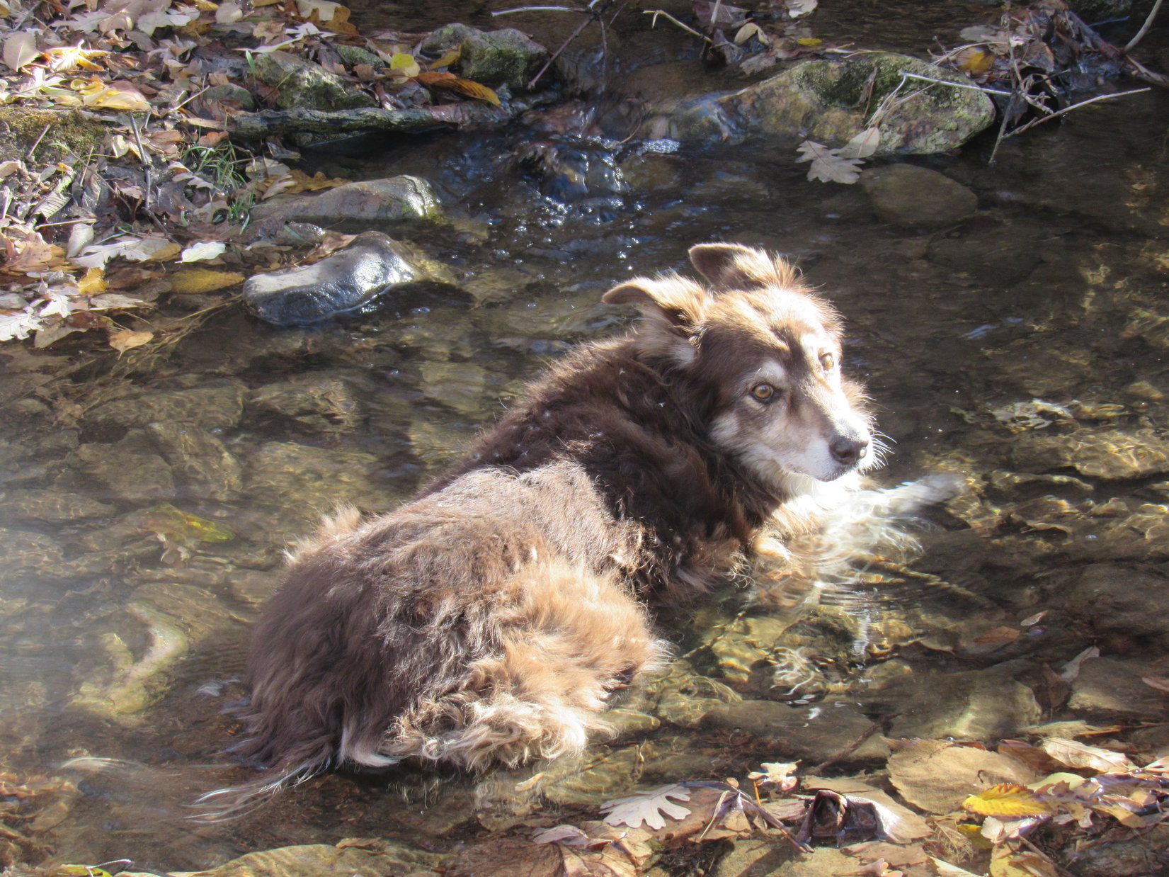
Arrival back at the Alkali Creek trailhead was promptly celebrated with a much anticipated cold drink out of Alkali Creek. Lupe and Laddie both eagerly waded in and drank their fill, but Dusty wasn’t satisfied with just getting her paws and insides wet. Instead, she plunked herself right down in the stream and stayed there.
Relief from the heat at Alkali Creek.Cousin Dusty cooling off in Alkali Creek.
No one was going anywhere, and Black Hills Expedition No. 281 wasn’t finished, until Cousin Dusty was ready to declare it over and done with. Taking her sweet time about it, Dusty finally got sufficiently cooled down to come dripping out of Alkali Creek.
A little under 4 hours round trip on a summery October afternoon, the Ponderosa hike had been a great choice! Easy enough for Dusty, and a gentle introduction to Black Hills peakbagging for Laddie, the day had been a success.
Days 6-9 of Lupe’s 3rd Summer of 2020 Dingo Vacation to Wyoming & Montana!
8-10-20, 8:40 AM, Donelson Lake, Beartooth Mountains – For the last time, Lupe stood on Camel Hump Rock by the N shore of exquisite Donelson Lake. SPHP was feeling lethargic after her gloriously successful jaunt up Sky Pilot Mountain(12,047 ft.) yesterday, but had at least managed to get the tiny house and all the gear packed. This was it. Ready to go!
A moment’s delay to appreciate this incredible place, and the Carolina Dog was on her way. No rush. Loop had all day to get back to the Island Lake trailhead. After working around to the SE shore, Lupe paused once more for a final look at Donelson Lake. Then it was over the low pass to the SSE, as the return began in earnest.
On Camel Hump Rock at Donelson Lake. Photo looks S.Final farewell to Donelson Lake. Photo looks W.
The return was so beautiful, with so many great places to explore! Marmots whistled in the distance, as Lupe ran here and sniffed there, roaming as freely and happily as any Dingo in history. Two Bits Lake, Jasper Lake, Albino Lake, and Lonesome Mountain(11,399 ft.)! She passed all these familiar friends and more.
Near Two Bits Lake. Photo looks E.Approaching Jasper Lake (L) and Lonesome Mountain (R). Photo looks SSE.Closing in on Albino Lake. Photo looks SE.
8-11-20, 2:15 PM, Livingston, Montana – After getting back to Island Lake yesterday at 6:00 PM, Lupe had had the rest of the evening off. Today was a rest and travel day, and tomorrow would be, too. The American Dingo had already been over Beartooth Pass on Hwy 212 this morning, and visited the Yellowstone River at Columbus. Now she stood in a gravel parking lot N of I-90.
Beyond parched fields of tall tan grass, that dome-shaped peak to the S had to be Livingston Peak(9,314 ft.).
Thar she blows, SPHP! Livingston Peak (Center)! Photo looks S.
Loop was soon heading S out of Livingston on Hwy 89. SPHP watched for the Carter bridge over the Yellowstone River, which wasn’t long in appearing. A L turn on East River Road (Hwy 540) led directly to the bridge. After crossing the river, SPHP drove several more miles, looking for another L turn leading to the Suce Creek trailhead. The search was successful, and Lupe found herself staring up at Livingston Peak from the trailhead.
Livingston Peak (L) on the way to the Suce Creek trailhead. Photo looks NE.Found it!Livingston Peak from the Suce Creek trailhead. Photo looks NE.
That was it, though. Livingston Peak was on Loopster’s list of potential climbs, but wasn’t happening today. Not after marching around in the Beartooths for 4 straight days! Instead, SPHP drove back to the Carter bridge where Lupe got to spend time exploring an access area along the Yellowstone River.
Yellowstone River S of Livingston. Photo looks N.
For several hours SPHP worked on catching up the trip journal while Lupe rested under a picnic table, occasionally running off to sniff with other dogs. Small rain showers passed through. SPHP was eventually surprised to look up and see the sky full of smoke. Huh. Evening, time to move on, anyway.
Carter bridge from the river access area. Smoky now. Photo looks SSW.
By sunset, Lupe was in Bozeman. Skies to the N were still pristine, while smoke obscured everything W and S. Bad.
8-12-20, 8:47 AM, Bozeman, Montana – Fortunately, the news was good. Blue skies everywhere this morning. That wasn’t all, either!
That was Jobe Wymore on the phone, wasn’t it, SPHP?
Yes, Sweet Dingo!
So what did he say?
It’s on! Koch Peak (11,293 ft.) tomorrow! All we have to do is get to the trailhead today. Jobe climbed Torrey Mountain(11,147 ft.) yesterday. He’s currently in Idaho, but on the way over. He’ll meet us at the Upper Taylor Fork trailhead sometime this afternoon or evening.
So we get to see him again, and climb a mountain? Oh, that’s fabulous!
Yup! Yup! Jobe also knew all about the smoke we saw. Said it was coming from a forest fire that just exploded near Dillon. Still burning totally out of control, so we’re going to have to hope the wind keeps blowing the smoke some other direction.
After re-supplying in Bozeman, SPHP drove S on Hwy 191. The highway was extremely busy, but traffic was moving along OK. A stop was made for water at the Moose Creek recreation area along the Gallatin River. 14 miles S of the Big Sky intersection with Hwy 64, SPHP spotted the R turn on Taylor Fork Road (USFS Road No. 134). That was easy!
Still 11 miles to the trailhead, but Taylor Fork Road was nice and wide and smooth. Soon some beautiful mountains could be seen off to the W. One of them might well be Koch Peak.
Smooth sailing on Taylor Fork Road (No. 134). Photo looks W.
4 miles led to a junction with Wapiti Creek Road No. 2522. That was the wrong way.
Stick with Taylor Fork Road to Cache Creek here! Photo looks SW.
A mile beyond this junction, Taylor Fork Road passed the Nine Quarter Circle guest ranch. 7.5 miles from Hwy 191 came a bridge over Taylor Creek. A short distance dead ahead the road divided. Cache Creek was straight, and Lightning Creek, a tributary of Taylor Creek, was a L turn.
8 miles from Hwy 191. Turn L here for Lightning Creek! Photo looks NW.
Still 3 miles to go when SPHP made the L for Lightning Creek. Smooth as silk up to this point, but suddenly the road deteriorated. Littered with small, pointy stones with the occasional significant pothole thrown in, it was a rough ride. Creeping 5 to 10 mph up the Taylor Creek valley, the G6 passed a series of designated dispersed camping sites.
Minor miracle! 3 miles gone, and the G6 hadn’t popped a tire. The road forked here. Going straight up a little hill led only to another dispersed camping site, but a curve L went to another bridge over Taylor Creek. A parking lot was visible on the far bank.
8-12-20, 1:21 PM, Upper Taylor Fork trailhead –
Hah! Made it, Loopster!
Luck of the Dingo, SPHP! By the way, do you ever intend to purchase us a vehicle suitable for adventures in the mountains?
Don’t hold your breath on that one, Sweet Puppy! Enough diss’in the G6! C’mon, let’s check this joint out.
Upper Taylor Fork trailhead from close to the bridge. Photo looks S.Upstream view of scenic Taylor Creek. Photo looks SW.Yup! This is it, alright!The route to Koch Peak starts out with Trail No. 17, but heads up Tumbledown Creek before getting all the way to Taylor Falls.
No doubt about it. This was the right place. Nothing to do now, but relax and wait for Jobe. Those new boots were getting better, but SPHP’s paws were still sore from Lupe’s multi-day jaunt in the Beartooths. Soaking them in lovely Taylor Creek sounded like a great idea.
Paws comfortably numb, SPHP was just putting those infernal boots back on when the Rubicon rumbled across the bridge. Jobe was here! Fun times! Jobe was full of stories. By evening, a series of rain showers swept through. Easy to see it coming in sheets. Hopping in and out of the vehicles with each onslaught. Jobe passed out sarsaparillas, but Lupe didn’t get one.
8-13-20, first light, Upper Taylor Fork trailhead – A tap on the window. The American Dingo exploded in fury! Oh, yeah. Sorry ’bout that! Just Jobe rousting SPHP. Time for action! 10 minutes of final preparations, and Lupe was on her way.
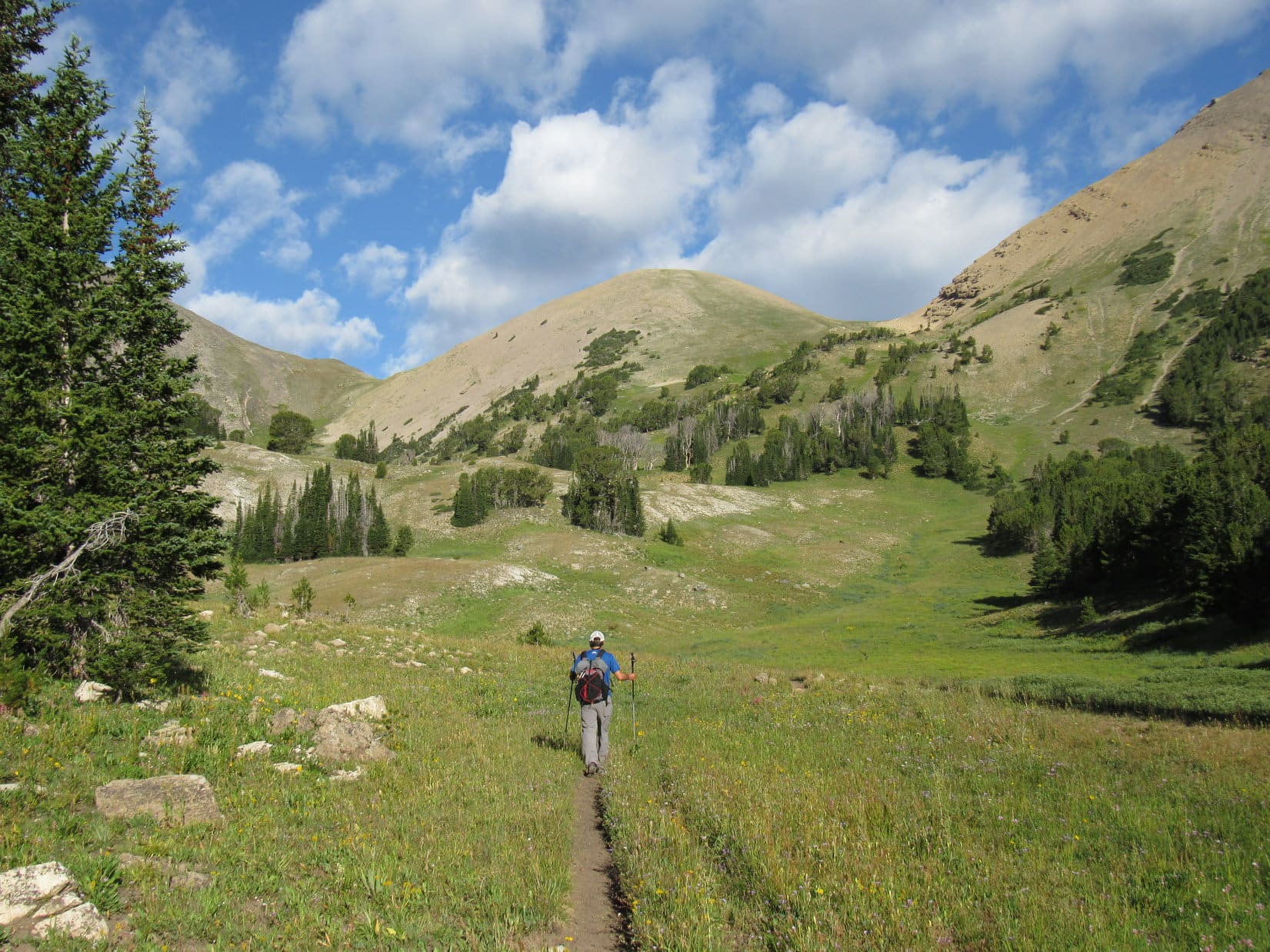
First light meant mostly dark, a situation Loop and Jobe both approved of. Once the cobwebs cleared a bit, SPHP did, too. An exciting start to the day! Lupe trotted alertly along Trail No. 17, which passed through a level tall grass meadow before entering the forest.
Progress was rapid as Trail No. 17 headed up the valley. A big dry wash full of rocks appeared, but was easily crossed. A mile from the trailhead, not terribly far beyond this wash, the trail turned and disappeared into Taylor Creek. No bridge. Oh, joy!
The stream was divided into 2 channels by a small island equipped with a cairn in case there was any doubt. The first channel was only inches deep and easily negotiated, but the second one was 15 feet wide and 1.5 to 2 feet deep. No rock hopping, or quick shallow splish-splash here.
Jobe bit the frigid bullet first. No sense getting boots and socks soaking wet so close to the start. Removing them, Jobe waded across the stony channel. No choice. SPHP followed, doing the same. Deep enough so Lupe actually floated for a moment, but she made it no problem, shaking herself off on the far bank.
Onward! Humans, ho!
Contemplating crossing the first channel of the Taylor Creek ford. Jobe’s already over by the second one.
SPHP fretted. How often was this trail going to ford Taylor Creek? Hadn’t the topo map shown several crossings? A quick check revealed that wasn’t true. More streams to cross, but just tributaries. This ford was the only one of Taylor Creek itself.
Cold standing around here all wet! How about Onward! Humans, ho! now?
The journey resumed. For a little while, the path remained in the forest, but Lupe eventually reached a big meadow with a clear view of Taylor Creek and the valley ahead. Sunlight was working its way down the mountainsides, but hadn’t reached the valley floor yet.
Taylor Creek valley. Photo looks W.
At the far end of the meadow, Trail No. 17 crossed Tumbledown Creek, a much smaller stream than Taylor Creek. Another 0.2 mile brought Lupe to a junction with Tumbledown Trail No. 4, the next part of the route to Koch Peak.
Approaching Tumbledown Creek (Center), the minor tributary seen beyond Lupe. Taylor Creek (L). Photo looks WNW.At the junction with Tumbledown Trail No. 4.
Trail No. 4 started up a series of tight steep switchbacks progressing up the lower shoulder of the mountain Trail No. 17 had led to. As the rate of climb slowed, the trail eventually straightened out. Still steadily gaining elevation, Lupe traveled NW through a forest permitting no views. 40 minutes on No. 4, and a sign appeared for the Lee Metcalf Wilderness.
Entering the Lee Metcalf Wilderness.
Trail No. 4 crossed Tumbledown Creek several times. Half an hour after entering the Lee Metcalf Wilderness, a rocky slope led down to another creek crossing. Beyond this crossing Trail No. 4 climbed more steeply again. Within 10 minutes, Lupe came to a small opening with a bit of a view. Making progress, but still a long way to go.
Crossing Tumbledown Creek shortly before the first viewpoint.Somewhat encouraging! At least we’re starting to get somewhere. Photo looks ESE.
It wasn’t much farther to another encouraging sign. In a meadow, Lupe came to a junction with Tumble Basin trail No. 237.
At the junction with Tumble Basin trail No. 237, next leg of the journey to Koch Peak. Peak 10829 (R). Photo looks WNW.
The trek SW into Tumble Basin was easy. Trail No. 237 was nearly level, and became increasingly scenic as forests gave way to meadows and views of the surrounding mountains. Koch Peak(11,293 ft.) was less than 2 miles away, and could sometimes be seen ahead.
Koch Peak (Center) from Tumble Basin trail No. 237. Photo looks SW.Jobe leading the way. Koch Peak (far R). Photo looks SSW.Entering Tumble Basin. Peak 10764 (L) and Peak 10668 (R of Center). Photo looks S.
Trail No. 237 ultimately headed W toward the ridge N of Koch Peak, but Koch Peak’s S ridge was the way to go. Leaving No. 237 before it ended, Lupe and SPHP wandered SW up a minor forested rise and came to a shallow pond. A steep wall of rock could be seen to the SSW connected to Peak 10668. No going up that!
Jobe on Trail No. 237 as it heads for the hilly ridge N of Koch Peak. The N ridge is not the way to go! Soon time to leave the trail and veer off to the L (SW), but not quite yet. Photo looks WNW.Peak 10668 from the pond. The steep sunny slope on the R was a no go. Photo looks S.
SPHP had left the trail too soon. Should have gone a little farther W and crossed Tumbledown Creek one more time before turning S. Leaving the pond and the last of the forest, Lupe headed W down into a wide bushy marsh, the headwaters of Tumbledown Creek. Jobe had already made the course correction, and was waiting on the far side at the base of a steep slope decorated with wildflowers.
This was actually part of the same slope Loop had seen from the pond, but farther NW where it wasn’t just a wall of rock. Jobe powered up with SPHP lagging behind. A 250 foot climb gained a rounded grassy ridgeline a little S of HP9571 on the topo map. Drier up here with less vegetation.
Following this ridge SE was initially still a steady climb, but it gradually got easier. Lupe came to 3 or 4 grassy hills separated by minor drops, each hill a bit higher than the one before.
Jobe and Lupe head up the steep slope W of the headwaters of Tumbledown Creek. Photo looks W.Almost to the rounded ridgeline. Jobe powers ahead while Lupe lingers to urge SPHP onward. Koch Peak (R). Photo looks SW.Heading for the next little hill along the grassy ridge. Peak 10668 (L). The darker ridge (R) connects to Koch Peak’s S ridge. Photo looks SSE.
As the American Dingo got close to Peak 10668, the time came to turn SW. Leaving the grassy ridge, Jobe led the way across the upper reaches of a minor drainage where springs seeped out of a hill. On the far side, Jobe and SPHP paused by some rocks to shed weight for the upcoming ascent. Both stashed water bottles that weren’t going to be needed.
About to leave the grassy ridge to follow Jobe across the next drainage. Photo looks SW.Taking a breather where the water bottles got stashed while Jobe checks his phone. Photo looks SW.
Not far ahead was another steep slope. This one featured a few patches of melting snow, and a series of rock outcroppings separated by benches partially obstructed with stunted pines. A 200+ foot climb brought Lupe to a flat grassy plain sprinkled with rocks. Crossing this small plain led to a view of a hidden tarn. Beyond it was Koch Peak’s S ridge.
Cake! Didn’t look bad at all.
On the rock-strewn plain with the tarn coming into view. Koch Peak’s S ridge looming over it. Photo looks SW.Contemplating Koch Peak’s S ridge while proceeding around the S end of the tarn. Koch Peak is off the R edge. Photo looks SW.
Pretty straightforward from here! After going around the S end of the tarn, everyone headed NW up the easiest part of the slope leading to Koch Peak’s S ridge. The loyal Carolina Dog hung back with SPHP while Jobe blazed the way.
Once up on the S ridge, all that remained was to follow it NNW all the way to the summit. And breathe! No way SPHP was ever going to come close to keeping up with Jobe. Didn’t matter now, anyway. Another 600 or 700 feet higher would do the trick, and Jobe would be waiting up top.
Lupe absorbed fabulous views while SPHP absorbed oxygen at frequent intervals. Imp Peak(11,202 ft.), which could now be seen due S across the upper Taylor Creek drainage was the big eye-catcher. More distant Echo Peak(11,220 ft.) well beyond Imp and a bit to the W (R) was also impressive.
On the S ridge. Whenever you’re ready, SPHP! Koch Peak dead ahead! Photo looks NW.Imp Peak (Center) with Echo Peak slightly to the R beyond it. Photo looks S.The route up as seen from the S ridge. Peak 10764 (L), Peak 10668 (L of Center), and Peak 10760 (R of Center). Photo looks E.
The last part of the ascent was nearly all rock, but various use trails ran among it all, and the rocks were only of moderate size. The climb was longer than it first appeared, but at last the use trail Lupe was on curled around to the W side of the summit, and grass reappeared as the terrain began to level out.
Going to get rocky for a while now, but we’re not that far from the top! Photo looks NW.Lupe surveys the view while SPHP sucks air.Bit of a scramble. Nothing major.
When Lupe reached the top of Koch Peak (11,293 ft.) Jobe was chatting with a couple of guys who had passed SPHP on the way up. They were waiting for a 3rd member of their party who had yet to arrive. Skies were now mostly cloudy, and a SW breeze Loop had been exposed to ever since reaching the S ridge made it rather cool up here. Even Jobe was bundled up to some degree.
The grassy summit region wasn’t enormous, but there was plenty of room to move around. The highest rocks, all relatively small, were along the SE edge. A survey benchmark was in this vicinity as well.
The “Taylor” survey benchmark on Koch Peak.An American Dingo at the true summit of Koch Peak. Photo looks E.
360º panoramic views, of course! The best were to the N and S. Sphinx Mountain(10,876 ft.) and Pioneer Mountain(9,857 ft.) were most prominent to the N, with more distant Cedar Mountain(10,768 ft.) also in sight.
Sphinx Mountain (L) with more distant Pioneer Mountain (Center), and Cedar Mountain (far L). Photo looks N.
Only 3 miles due S, Imp Peak(11,202 ft.) looked grand, and Lupe was now high enough to see another mountain of special interest. Between Imp Peak and Echo Peak(11,220 ft.) the rugged spires of Hilgard Peak (11,316 ft.) soared skyward.
Imp Peak (Center) with Hilgard and Echo just to the R beyond it. Photo looks S.
Jobe intended to climb Hilgard Peak sometime in the near future. Before Lupe had even set out on this Dingo Vacation, Hilgard had been on a short list of summits Jobe had invited SPHP to consider for possible joint ascents. A quick review of maps and photos online had caused SPHP to take a pass on Hilgard in favor of Koch.
Although Hilgard was quite a long way off from here, that decision was looking like a real good one!
Zoomed in on Imp (L), Hilgard (R of Center), and Echo (R). Photo looks S.
Peering down on Koch Peak’s S ridge, Lupe saw it sweeping SE, then clear around to the E and NE to link up with Peaks 10668 and 10754. To the NE was a beautiful view of Tumble Basin. Only a mile W was the light-colored summit of Sawtooth Ridge(11,049 ft.). To the SW, a small lake could be seen way down in the upper reaches of the Taylor Creek basin.
By the time Loopster had taken a good look around, the guys Jobe had been talking to were on their way down again, their 3rd member having already shown up and spent only a few minutes up here with them.
Jobe was pleased with how well Koch Peak had gone! Roughly 6 miles and over 4,000 feet of elevation gain, most of it on good trails without any real difficulties whatsoever – just that chilly ford of Taylor Creek early on. Jobe half-jokingly pronounced Koch Peak the best mountain Lupe had ever climbed! It was certainly her biggest joint success with Jobe. Way better result than the beautiful, but ultimately disappointing Castle Mountain(12,612 ft.) fiasco back in the Beartooths.
Jobe and Lupe at the true summit. Photo looks E.
11:41 AM – Jobe started down first. Lupe and SPHP soon followed. The first steep rocky part on the way down the S slope was slow going, but it was nearly all easy after that.
Jobe starting down. Peak 10712 (Center) and the Sawtooth Ridge summit (R). Photo looks WSW.Final moments atop Koch Peak. Photo looks ENE.Following Jobe down the S ridge. Photo looks SSE.
Descending from the S ridge on the way back to the tarn, 6 to 8 people were coming up with 3 dogs. They were all members of a single family. The first young woman said she had been up Koch Peak “a million times”. Before Lupe made it back to the springs where the water bottles were stashed, one of those dogs could be heard yelping and whining piteously. This went on for some time, but whether the poor dog was suffering due to actual pain or simply terrified was never clear.
Back at the tarn. Peak 10829 (L). Photo looks NNE.Jobe grabbing a photo of Koch Peak. Photo looks NW.Koch Peak from the tarn. Photo looks NW.Continuing down to the springs where the water bottles are stashed. Peak 10764 (L) and Peak 10668 (Center). Photo looks E.
During the return, Jobe regaled SPHP with many a tale – some serious, some informative, and some simply hilarious. Lupe trotted along, often right on the trails listening in, but taking off now and then to roam as she saw fit, clearly enjoying the day. Time passed quickly. Suddenly Jobe was taking a last photo of the Taylor Creek valley. Hardly seemed possible the Koch Peak adventure was already almost over.
Back in the Taylor Creek valley. Photo looks W.
4:00 PM, Taylor Fork trailhead – The intrepid Carolina Dog had braved that Taylor Creek ford once again, and made it back to the trailhead. No one was going anywhere else tonight, so Loop had another evening off. After a hearty meal, she wanted to spend it relaxing on her pink blankie in the G6. Boots off, SPHP soaked sore paws in Taylor Creek, then spent the rest of a pleasant evening chatting with Jobe.
Jobe produced another sarsaparilla for SPHP. Tried to rain a few times again, but never amounted to much. The Grateful Dead were playing on the Rubicon’s stereo. Classic Jobe! All too soon, Jobe was pitching his tent next to the Rubicon and crawling inside as the darkness grew.
Such fun times! Koch Peak had been a marvelous day!
With mountaineer Jobe Wymore on Koch Peak, Madison Range, Montana 8-13-20
Note: Nine days later, Jobe did scale fearsome Hilgard Peak, but Lupe wasn’t there to see it.
Day 4 of Lupe’s 3rd Summer of 2020 Dingo Vacation to Wyoming & Montana!
6:00 AM, near a tarn S of Two Bits Lake – An early start is a good thing, but thankfully Jobe had waited until after dawn to roust Lupe and SPHP. Took SPHP a while to pack the tiny house and everything else up, but it wasn’t too long before that was accomplished. It all had to come with. Proposed base camp on the NE shore of Varve Lake (aka Forsaken Lake) for the attempt on Castle Mountain(12,612 ft.) tomorrow was more than 3 miles away.
Yesterday evening, Jobe had still had the energy to do a little scouting along the ridge W of the stream running down from Two Bits Lake to Triskel Lake. He recommended crossing the ridge at the lower of two possible routes, which was toward the S. However, after rock-hopping the stream at a point where it was practically underground, instead of making the trek S everyone simply started straight up the short, rather steep slope immediately to the W.
The terrain up top leveled out to a considerable degree. Turning SW, Jobe led the way through some rough looking territory. Really wasn’t bad at all due to lanes of vegetation running through this region.
Jobe leads the way through the area above the first steep slope while Loop takes an early snow break. Photo looks SW.
This shortcut soon linked up with the S route Jobe originally proposed. Traveling NW up a valley of mixed meadows and rock, it wasn’t far to a pass where Donelson Lake was in sight directly ahead.
Donelson Lake was a gem! Lupe had never been this close to it before, having seen Donelson Lake only once 7 years ago from higher up when she’d been on her way to Sky Pilot Lake. SPHP recommended going around the N shore, which worked out fine.
Lupe on her way back to see what’s keeping SPHP as Jobe heads for the pass leading to Donelson Lake. Photo looks WNW.Loop and Jobe near Donelson Lake. HP10817 (Center). Photo looks NNW.Along the N shore of Donelson Lake. Photo looks SW.
What lay ahead was now unexplored territory. Lupe had never been W of Donelson Lake. Responsible for enticing Jobe to take this “Lupe route” to Castle Mountain, SPHP sincerely hoped it was going to pan out, and believed it would.
The topo map didn’t look at all dicey until past Maryott Lake. What could be seen from here appeared fine. A couple of large boulders stood out up on top of a ridge not too far to the W. Maryott Lake was supposed to be on the other side of that ridge. The route up there was a little slow due to all the rock, but not difficult.
Sure enough, when Lupe reached the ridgeline, Maryott Lake was right there where it should be. Surprisingly, both Pilot Peak(11,699 ft.) and Index Peak(11,240 ft.) were in view way off in the distance, as well.
Maryott Lake from the ridge W of Donelson Lake. Pilot Peak (L) and Index Peak (R) far beyond Lupe. Photo looks SW.Donelson Lake from the ridge overlooking Maryott Lake. Two Bits Lake is hidden on the far side of the ridge in the foreground on the L. Drop Off Mountain(12,115 ft.) (far L) in the distance. Photo looks ESE.
A notably higher ridge was now in view 0.25 mile off to the NW. Three small pine trees growing near the top became the next objective. Some elevation had to be lost leaving the ridge overlooking Maryott Lake, but the terrain N of the lake was relatively easy to cross. However, much rougher ground was ahead. Plenty of talus to deal with on the way up to those little pines.
Upon reaching three pine ridge, Looper not only had a terrific view of a small unnamed lake NW of Maryott Lake, but an even better view of Pilot Peak and Index Peak than before, plus a whole lot more.
The unnamed lake NW of Maryott Lake. Pilot Peak (L) and Index Peak (R) both at (Center) in the distance. Photo looks SW.By one of the 3 little pines. Maryott Lake (R). The ridge Lupe had just come from is at far L in front of the sliver of Donelson Lake in view. Lonesome Mountain(11,399 ft.) (Center) in the distance. Photo looks SSE.
Three pine ridge was connected to yet another even higher ridge due N. The Carolina Dog would have had to go over that one, too, except for the presence of a wide, flat shelf along its cliffy SW face. That shelf was a real blessing, saving close to 150 feet of steep elevation gain. Beyond it, a long snowbank could be seen draped along another ridge that wasn’t too much higher than where Lupe was now.
Scouting ahead, Jobe proved it was quite possible to get over to the wide shelf with little difficulty. Lupe and SPHP brought up the rear, as Jobe crossed the shelf to explore the region beyond it.
Jobe (Center) on the broad shelf that saved having to scale the high ridge on the R. The route eventually goes over to the R end of the long snowbank seen on the L. Photo looks NW.Another look at the unnamed lake NW of Maryott Lake from close to the SE end of the shelf. Pilot Peak (far R). Photo looks SSW.Looking back after crossing the broad shelf. 3 pine ridge (Center) in the foreground. Lonesome Mountain (Center) in the distance. Photo looks SSE.
After crossing the shelf, Lupe followed Jobe through a rocky region where a little tarn could be seen to the S. This tarn was fed by the melting snows of the long snowbank only a bit higher and farther W. Upon reaching the snowbank, Loop crossed it angling toward the N (R) end.
This snowbank rested along the SE side of Pass 10660 less than 0.5 mile NW of Maryott Lake. The American Dingo was now coming to a critical point. If the “Lupe route” to Castle Mountain was going to cliff out, it might easily happen as soon as she reached the NW side of the pass, or somewhere in the next 0.75 mile beyond it.
Looking back after crossing the long snowbank. Lonesome Mountain (L of Center) in the distance. Photo looks SSE.
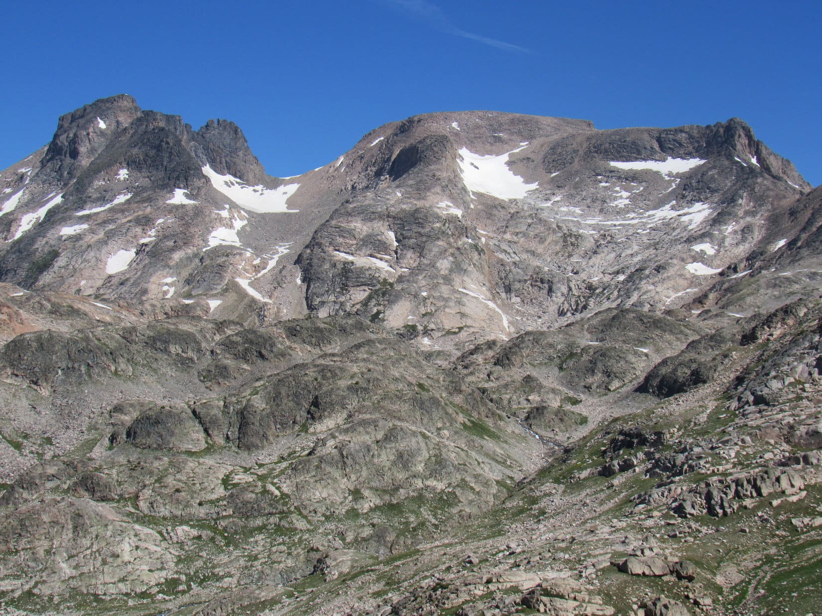
A little beyond the N end of the long snowbank, Jobe was waiting for Lupe and SPHP along the NW edge of Pass 10660. Ahead was a steep drop. The territory just S of Pass 10380, only a little more than 0.25 mile SE of Flat Rock Lake, was now in view. However, Jobe wasn’t fixated on the terrain between here and there. Instead, he stood staring curiously at Castle Mountain(12,612 ft.).
Little more than the large, gently rounded top of Castle Mountain and its steep SW flank could be seen from here. Hidden by the end of a massive ridge jutting SW from Sky Pilot Mountain(12,047 ft.), the critical S face of Castle Mountain wasn’t quite in view yet. That was where the route Jobe and Loopster would take from Varve Lake up to the summit was supposed to be.
Continuing N, Jobe led the way down a long steep slope littered with rock toward a tarn visible on a big shelf. Not too bad a descent. Patches of vegetation lower down provided some relief. Lupe didn’t get all the way to the tarn. Jobe paused upon reaching slabs of bedrock not far from it.
To the SW was an enormous canyon drained by Sierra Creek. Several of the little Pleiades Lakes were in view along with a slice of much larger Summerville Lake well beyond them.
Heading down toward the tarn (Center) on the way to Pass 10380, which lies above the L end of the shadow of the big knob ahead. Photo looks N.Summerville Lake (R) with Pilot Peak (L) and Index Peak (R) beyond it. Pleiades Lakes in the foreground. Photo looks SW.
From the slabs, another steep, rocky slope to the W finally got everyone down to a meadow. Lupe was now a good 100 feet below Pass 10380, which was still to come, having lost roughly 400 feet of elevation since leaving Pass 10660.
So far, the “Lupe route” to Castle Mountain had been viable, but not without its trials. Loop had already contended with a lot of rock, and while Jobe didn’t say anything directly against this route, he did describe this latest 400 foot descent as a future “soul-crushing” experience when the time came to ascend it during the return.
Unencouragingly, the topo map showed a similar situation lying in wait beyond Pass10380, where another 400 foot descent would be required to get down to Flat Rock Lake. Didn’t look like it would be quite as steep as this first big drop, but it sure wouldn’t be anything to look forward to during the return, either.
No point in dwelling on that now. Turning N, Jobe, Loopster and SPHP all headed up toward Pass 10380. Near the upper end of the meadow, a giant boulder sat alone out among the wildflowers and grass. Beyond it, the terrain quickly became increasingly rocky. No doubt anxious for that first really good look at Castle Mountain, Jobe powered on ahead, disappearing over the pass.
Jobe heading for Pass 10380. Photo looks NE.Loop about to cross the pass. Photo looks NNE.
11:00 AM, a little N of Pass 10380 – Jobe was again standing on a rock scrutinizing Castle Mountain when Lupe and SPHP caught up with him. The summit was still nearly 2.5 miles due N, but he finally had a good unobstructed view of the whole S face.
0.25 mile NW, part of Flat Rock Lake was visible 400 feet below Looper’s current position. No sign yet of Varve Lake, today’s ultimate objective. It was still hidden somewhere more than a mile away at the base of Castle Mountain.
Happily, the “Lupe route” to Castle Mountain had proven itself! No cliffs! Getting down to Flat Rock Lake looked no worse than the descent from Pass 10660 had been. At Flat Rock Lake the Carolina Dog’s route merged with the known successful approach others had taken from the S up Sierra Creek canyon. Whether Lupe’s route was any better or worse, who knew? At least it had worked.
Even so, Jobe was dismayed.
Jobe returns to his pack just N of Pass 10380 after coming back to check on SPHP. Castle Mountain (Center). Photo looks N.Flat Rock Lake from the Pass 10380 region. Castle Mountain (R). Photo looks NNW.Rainbow Peak (L of Center) and Castle Mountain (R). Photo looks N.Castle Mountain. Photo looks N.
The view was disturbing. Above the region where Varve Lake had to be were 2 tremendously steep sections of slabs. Above them was a gentler region of slabs partially covered with snow. Unhappily, cliffs towered above the gentler slabs, and a humongous snowbank to the W (L) filled the entire less forbidding slope to the top.
Shortly after SPHP reached Jobe, he sighed and spoke.
Rookie mistake!
Why, what’s wrong, Jobe?
Admittedly, Castle Mountain looked intimidating. Certainly beyond SPHP’s capabilities. Sadly, that meant Lupe was never going to stand at the summit, but Jobe could make it with his vast experience. SPHP was sure of it.
Left my crampons and ice axe in the Rubicon. See that big snowfield on the L? That’s the way up. Steep enough that every step has to be perfect. 100 or more. No room for error.
Jobe didn’t have a problem with any of the rest of it, just that one darn snowfield. He hadn’t expected so much snow on a S facing slope in August. For half an hour, Jobe and SPHP stood mesmerized, pondering the situation and discussing options. Hard to tell from so far away how challenging it all really was, but from here it didn’t look like any route other than that one upper snowfield was likely to prove safely viable.
Castle Mountain (Center) with help from the telephoto lens. Photo looks N.
It all ended with 2 little lightning bolt words from Jobe.
I’m out!
The voice of experience. Three days short of a year ago, Jobe had been injured during a solo attempt on Castle Mountain. On the way up the West Fork of Rock Creek route intending to come over Omega Pass, Jobe hadn’t even gotten all that close when he’d been caught in a rock slide. One of his hands had gotten mangled with compound fractures.
Perhaps even more relevant, also last year, for the first time ever in his climbing career, Jobe had been “on the clock” as he put it. At a different mountain, although fully equipped, he had lost control on a snowfield, hurtling toward doom. “The clock” was a short one. Trying with all his might with precious seconds ticking away, Jobe couldn’t regain control. Not until his ice axe finally bit in at the last possible moment.
Just like that, this attempt on Castle Mountain was over. Rookie mistake! Talk about soul-crushing! After all this way. Jobe took it stoically, but had to be chagrined. Nevertheless, the mountain would still be here, he declared, and someday he would return fully prepared.
Jobe and SPHP picked up the heavy packs again.
Puppy, ho! Onward!
Only in this case, onward meant retreat.
Jobe took the lead, as always, and was soon out of sight S of Pass 10380, lost in whatever dark thoughts one experiences in such disappointment. Not far from the lone, giant boulder, Lupe and SPHP caught up with him again, where he had paused to wait. SPHP wanted to talk to him.
Castle Mountain was one of the few of 414 peaks on the list of Western Contiguous USA County High Points that Jobe hadn’t climbed yet. Nothing else around here was on any list Jobe was working. He could head on out. Lupe and SPHP would be fine. Arrangements were made for a possible Jobe/Dingo encounter at another peak in the near future.
Not even noon yet. The sun blazed overhead in a cloudless sky. Lupe and SPHP hid out in the shade of the boulder, relaxing and watching while Jobe climbed the steep rocky slope back up to Pass 10660. After losing sight of him for a little while, Jobe reappeared way up on the ridge. Half a minute later he disappeared again, this time for good. Jobe was gone.
The whole experience had been a complete waste of time for Jobe, but not necessarily for a certain Carolina Dog. Castle Mountain had always been a long shot for Looper and SPHP. Seeing Jobe again and getting to explore this route had been fun, although it was shocking and terribly sad how it had all ended in such sudden and unexpected denial.
So now what, SPHP? Are we going to go back and check out Varve Lake? See how tough that S route up Castle Mountain is up close?
Hah, no! Faintly tempting, but if Jobe isn’t up for it, neither are we. Let’s do something where we might actually stand some chance of success.
And that would be?
Where we’ve been wanting to go for 7 years now, sweet puppy!
Oh! We’re finally going to do it? Which way then?
Back the way we came. We’ve got to get back over Pass 10660, too.
SPHP had been studying the slope leading back up to Pass 10660 as Jobe climbed it. By heading farther S from the giant boulder before turning E to start up, most of the talus could be avoided. Quite a bit easier, though still a wearying steep climb. Upon reaching the ridgeline, Lupe and SPHP paused to rest and gaze back at the gorgeous territory being left behind.
Sierra Creek canyon from Pass 10660. Castle Lake (straight up from Lupe’s ears), and SummervilleLake beyond it. Photo looks SW.Salo Mountain (L of Center) and Castle Mountain (far R). Photo looks NNW.
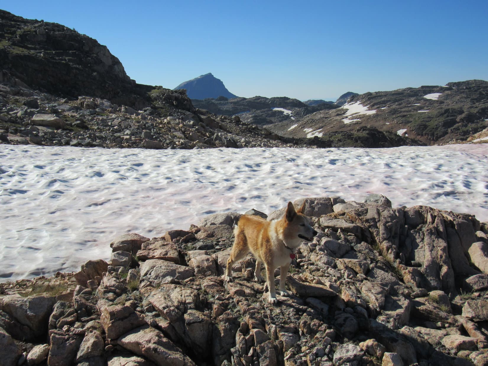
More or less retracing the same route she’d taken this morning, Looper enjoyed a mid-afternoon frolic on the long snowbank SE of Pass 10660. She then crossed the broad bench N of the unnamed lake NW of Maryott Lake to reach 3 pine ridge where she could see Maryott Lake itself again.
On the long snowbank SE of Pass 10660. Lonesome Mountain (L of Center) in the distance. Photo looks SSE.Keeping cool in the Beartooths! Photo looks SW.The tarn below the long snowbank. Photo looks SW.The unnamed lake NW of Maryott Lake. Lonesome Mountain (L). Photo looks S.Maryott Lake from 3 pine ridge. Photo looks S.
This time Lupe went clear down close to the N shore of Maryott Lake.
4:07 PM, Donelson Lake – Upon reaching Donelson Lake, SPHP called a halt. This was it! Donelson Lake was going to be a lucky American Dingo’s home for the night. SPHP set up her tiny house E of a stream a little way back from the N shore. The sky had clouded up some after Jobe had left, and a 10-20 mph SW wind had kicked up, but it wasn’t blowing that hard here.
Time to rest! The long evening got spent relaxing both in and out of the tiny house. Dinner, with a view, of course! Lupe and SPHP didn’t know it, but Jobe was busy climbing Lonesome Mountain(11,399 ft.), visible 3 miles SSE of Donelson Lake.
We love Donelson Lake! It’s so beautiful here! Photo looks SSE.Relaxing by the tiny house. Photo looks S.Donelson Lake. Photo looks SW.
If everything had gone as planned, Lupe would have been resting up NE of Varve Lake, getting ready to take on Castle Mountain tomorrow along with SPHP and her friend Jobe. Sadly, that dream had been dashed. Yet here along the N shore of gorgeous Donelson Lake, the American Dingo was perfectly positioned to take a shot at fulfilling another dream, a dream now 7 years old.
High adventure in the morning, Loopster! Guess we better hit the hay!
Better rest up! Tomorrow’s adventure is going to be a doozy! You will be joining us, won’t you?Evening at Donelson Lake, Beartooth Mountains, Montana 8-8-20At Pass 10660 with Jobe Wymore on the way to Castle Mountain, Beartooth Mountains, Montana 8-8-20