Cook Inlet, the Homer Spit & Lupe’s Return to the Rock of the West at Anchor Point, Kenai Peninsula, Alaska (8-31-17 & 9-1-17)

Day 32 & Part 1 of Day 33 of Lupe’s 2017 Dingo Vacation to the Yukon & Alaska!

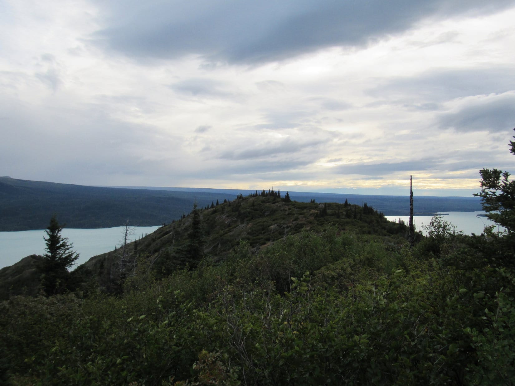
8-31-17, 10:00 AM at Bottenintnin Lake on the Kenai Peninsula, Alaska – Of course, it had rained overnight.  It rained every day here in Alaska, usually every few hours.  It wasn’t raining at 6:00 AM, though, or when SPHP woke up again now, either, but the sky was completely overcast both times.  The day really wasn’t looking too promising.  Meanwhile, Lupe was off barking in the forest.  She must have found a squirrel as soon as she’d escaped the G6.  Better go check on her.

Loopster was close by.  Yes, she had found a squirrel, almost instantly!  If SPHP didn’t think the day was shaping up the way it ought to, she had a different opinion.  She was having a good time at Bottenintnin Lake.  A forest full of moss, ferns, squirrels and exotic aromas was a Dingo playground.  The Most High Exalted Dingo of the Arctic Sisterhood was a busy girl, and in no hurry to leave.

Lupe at Bottenintnin Lake where she had spent the night after visiting Skilak Lookout yesterday afternoon.
Well, hello there sleepyhead! Up so soon? Not even noon yet. Don’t get any big ideas now. It’s a cloudy day, so we may as well stay here at Bottenintnin Lake where there is plenty of fun stuff for a Dingo to do!
The squirrel watching is excellent!
And there’s lots of important sniffing to do, too, if you will excuse me a moment.
And of course, there’s this lovely lake. Bottenintnin Lake is shallow and full of water lilies. Seems like a great place for waterfowl, SPHP, but I haven’t seen any yet. Maybe if we hang around, though, we’ll see some?

Loopster was right.  No need to rush off given the weather.  If she wanted to bark at squirrels and play in the forest for a while, why not?

11:23 AM – The trip journal was caught up.  Loop was back in the G6, her good times squirrel watching cut short by a steady rain.  The day was looking gloomier and gloomier.  What to do?  Two choices.  The first was to cut and run.  The current weather on the Kenai Peninsula wasn’t conducive to outdoor adventures.  No sign it was going to clear up, either.  Maybe it was best to go back to Palmer, and then just keep going until Lupe found sunshine somewhere far from the rainy S Alaska coast?

The other option was to carry on as originally planned.  Head W all the way to Homer, and hope that the weather would improve by tomorrow.  If it did, Loopster could take a water taxi across Kachemak Bay like she did last year when she got to spend a fabulous day on Grace Ridge in Kachemak Bay State Park.  This year, the Grewingk Glacier might be a fun adventure.

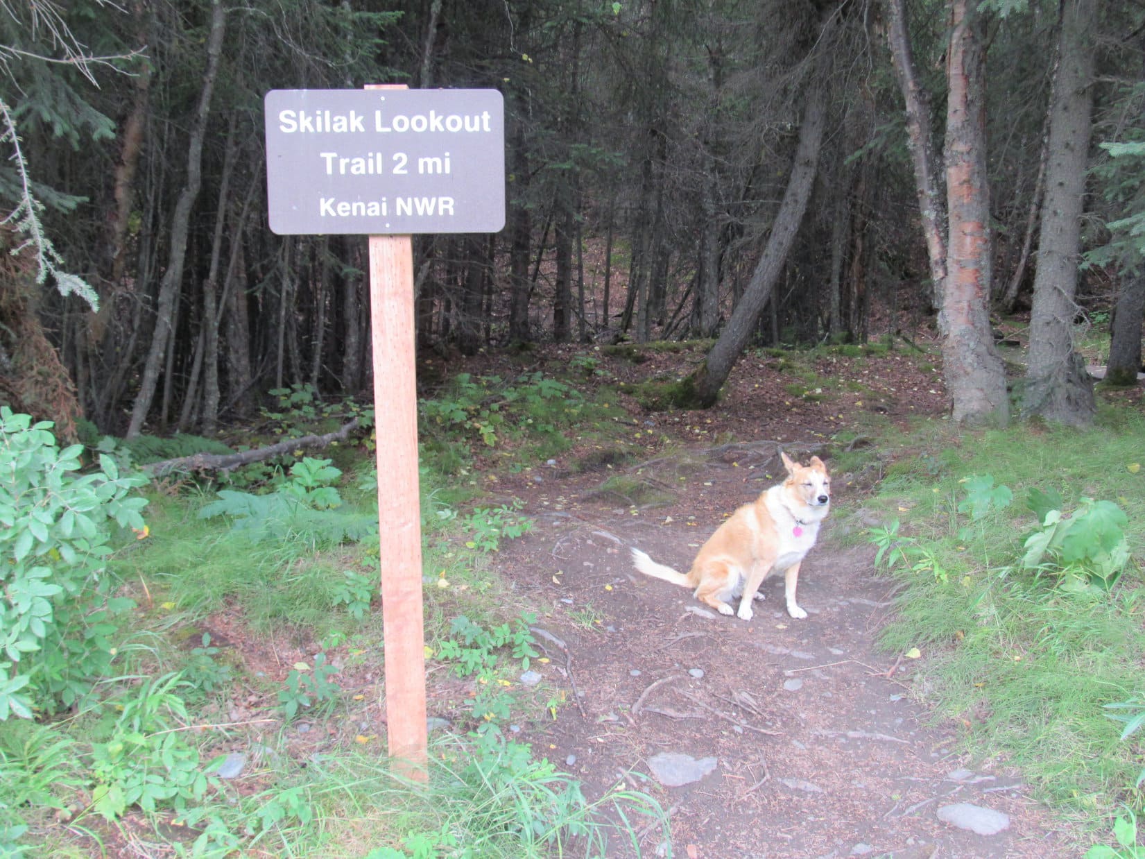
12:20 PM at the trailhead for the Skyline Trail to the Mystery Hills along Sterling Highway No. 1

What’s happening, SPHP?

We’re turning around, Loop.

Yes, I kind of gathered that.  Did you change your mind?  Are we going to Homer after all?

Yeah, I can’t stand the thought that we’re leaving after getting so close.  Might be a complete waste of time, but let’s give it one more day.  You never know, the weather might clear up and be beautiful like it did last year.  We have an awful lot of great stuff we can do on the Kenai Peninsula, if we can catch a break.  If it doesn’t work out, at least we tried.

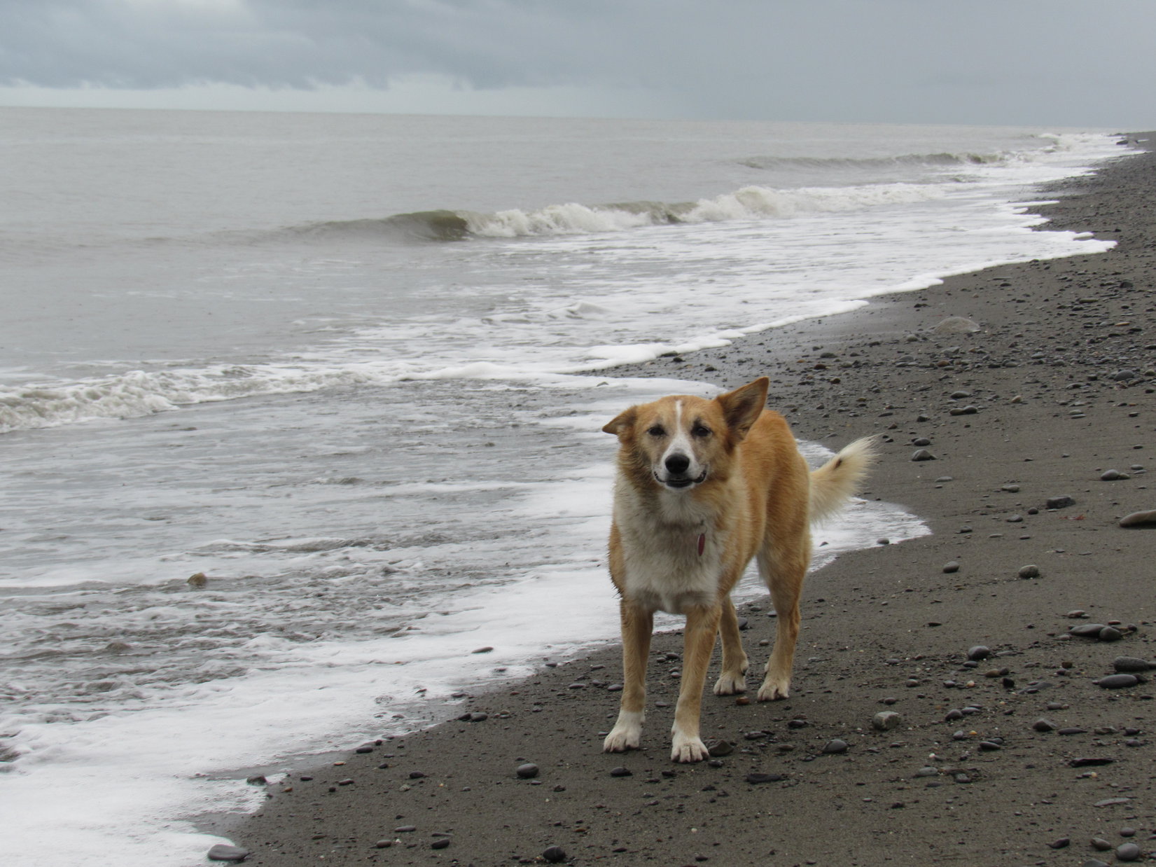
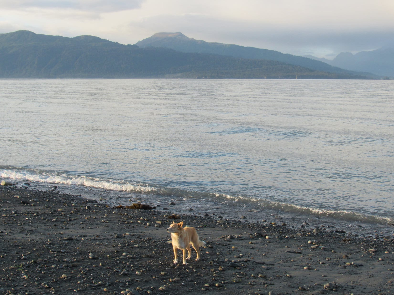
3:20 PM, 52°F at the Cook Inlet beach at Ninilchik – So far, still not too promising.  Lupe had just had a bit of luck, though.  When she arrived at Ninilchik, the rain had quit for a little while.  She’d just had a good romp along Cook Inlet before the rain started in again.

A year ago, Lupe had spent a wonderful evening here in Ninilchik.  She’d had gorgeous views of both Iliamna Volcano (10,016 ft.) and Redoubt Volcano (10,197 ft.) far across Cook Inlet as the sun went down behind the mountains.  Nothing like that today.  Dull, gray clouds hid everything except the ocean and the nearby beach, but watching seagulls and listening to the roar of the waves as they collapsed exhausting their energy on the beach had been fun.

When Lupe arrived at Ninilchik, the rain had abated for a little while. As a result, she got to enjoy a romp along Cook Inlet.
Not standing here long, SPHP. The tide is coming in. Let me know if you see one of those sneaker waves coming up behind me!
Even though we can’t see the volcanoes across Cook Inlet today, it’s always fun to take a stroll along the beach, isn’t it, SPHP?
Looper along Cook Inlet near Ninilchik on the Kenai Peninsula.

By 5:00 PM, Lupe was in Homer near the end of Sterling Highway No. 1.  Sadly, the weather showed no signs of improving.  Only the base of the mountains across Kachemak Bay could be seen beneath low clouds.  A heavy mist was falling as SPHP drove out to the Homer Spit.

Despite the gloomy atmosphere, Homer Spit was alive with activity.  Vehicles and people in rain gear were everywhere.  SPHP dropped by a restaurant, and got an order of fish and chips to go.  Lupe didn’t care for them, preferring salami and English muffins.  Oatmeal cookies for dessert.  Together Loop and SPHP sat in the G6 having dinner, while watching rain and fog over Kachemak Bay.

6:32 PM, 52°F, rain and fog at the Homer Spit – After dinner, Lupe went with SPHP to Mako’s Water Taxi to inquire about prospects for a trip across Kachemak Bay to see the Grewingk Glacier tomorrow.  Unfortunately, it didn’t take a rocket scientist to realize what a long shot this was likely to be.

Despite long odds, Lupe went with SPHP to inquire at Mako’s Water Taxi about the prospects for a trip across Kachemak Bay to see the Grewingk Glacier tomorrow.
In 2016, Lupe had sailed across Kachemak Bay aboard Mako’s water taxi “Xtra Tuff” to enjoy a fabulous day on Grace Ridge.
As a former customer, Loop hoped the good people at Mako’s could do something about this weather for her, but they weren’t making any promises.

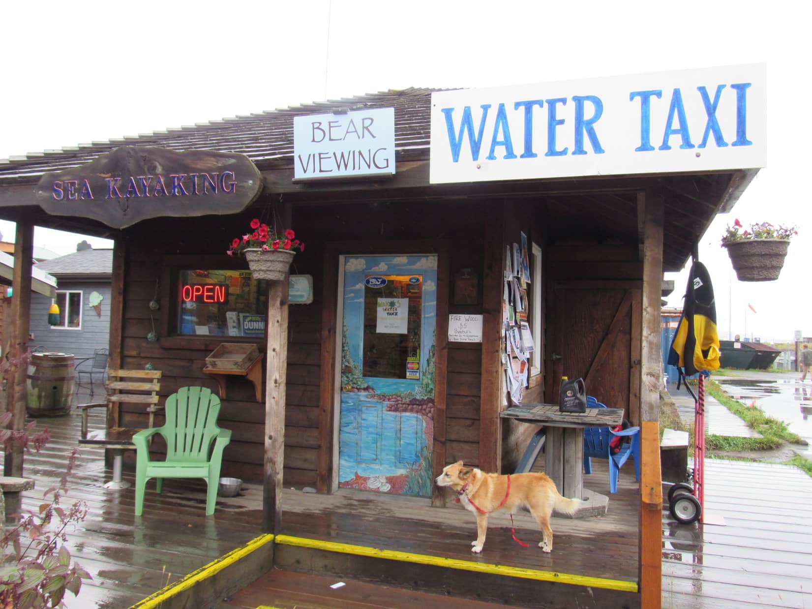
Lupe could go to see the Grewingk Glacier tomorrow, if she wanted to.  The price of the round trip water taxi ride across Kachemak Bay was $80.33 including all taxes and fees.  That was the good news.  No problem, if that was the only consideration.  However, there was the all important weather issue, too.  The people at Mako’s weren’t expecting much change in the weather anytime soon.

Well, if that turned out to be true, no Grewingk Glacier trip for Loopster.  No sense in spending $80.33 to spend a whole day soaking wet, cold and miserable.  Disappointing, but not unexpected.  Nothing to be done about it, except wait to see what things looked like in the morning.

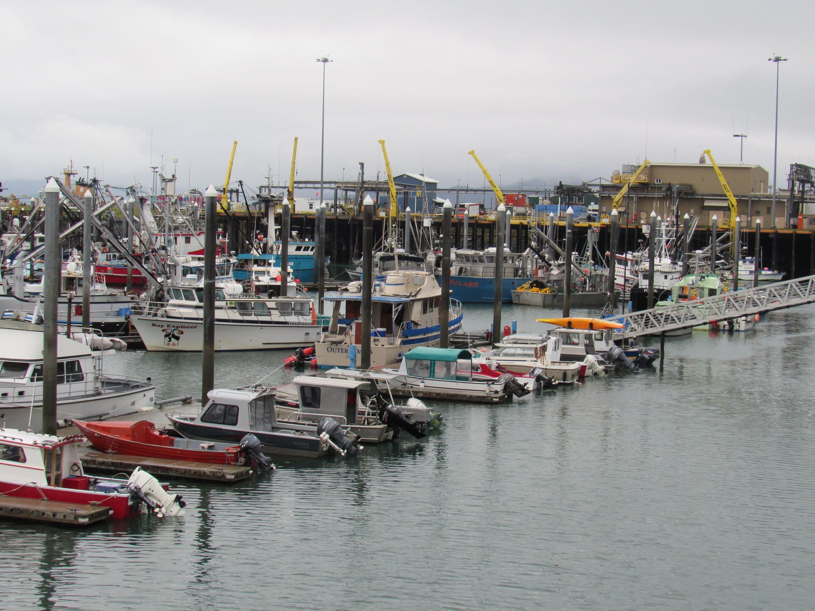
Despite fog and light rain, after leaving Mako’s, Loop and SPHP took a walking tour of the Homer Spit.  Lupe saw many boats on the protected NE side of the spit.

Lupe saw many boats moored on the protected NE side of Homer Spit.

Loop also visited Kachemak Bay on the unprotected SW side of the spit.  The ocean was still beautiful despite the dismal sky.

On the unprotected SW side of Homer Spit next to Kachemak Bay. Photo looks SSE.
Looking NNW along Homer Spit.
Not looking too good for another boat ride tomorrow, is it, SPHP? …. No, afraid not, Looper.

After a damp stroll along Kachemak Bay, Loopster went to take a look at some of the shops along Homer Spit’s main drag.  All sorts of adventures were being advertised!  It all sounded like fun, but Lupe and SPHP were set on going to see the Grewingk Glacier tomorrow.

Bears were a top draw at places advertising wildlife adventures.
Fishing adventures, especially for halibut, were apparently the most popular here.
Sea kayaking was popular, too.

As the evening wore on, already faint hopes for the Grewingk Glacier dream were fading fast.  Sometimes it rained, sometimes it didn’t, but the sky looked like it could rain forever.

9-1-17, 7:29 AM, 45°F – Seemed like a long night.  Rained off and on for hours.  But what was this?

Loopster, look, blue sky!

Oh, maybe we’re in luck!

Can you believe it?  Maybe not, though.  Still some clouds around.

Well, let’s go see what we can find out!  Drive us back to Mako’s, SPHP!

When Lupe and SPHP returned to Homer Spit, there was a lot of blue sky around.  So encouraging, but would it last?  Before going to Mako’s, Lupe ran down to Kachemak Bay.  There was a rainbow over the ocean!

Upon returning to Homer Spit in the morning, Lupe saw a rainbow over Kachemak Bay. Photo looks SW.

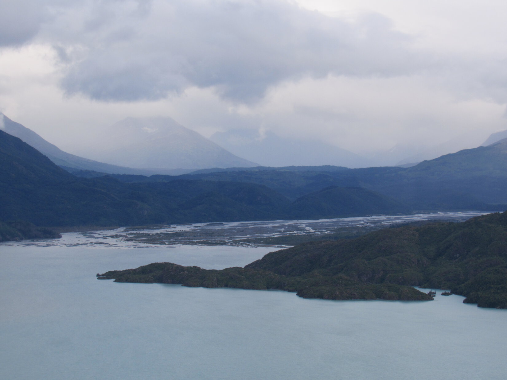
The rainbow wasn’t all the American Dingo could see.  High snow and ice clad peaks of Kachemak Bay State Park were in sight across the bay!  Looper could even see Grace Ridge, where she had such a good time last year.  Suddenly, prospects for a Grewingk Glacier adventure were looking bright!

Most of the sky was clear! Lupe could see high snow and ice clad peaks of Kachemak Bay State Park across the bay. Photo looks SSE.
Oh, this looks promising, SPHP! Maybe we can go see the Grewingk Glacier today, after all!
Grace Ridge (3,136 ft.) (Center) where Lupe had such a great adventure in 2016 was in view, too. It was all so encouraging! Photo looks S.

Lupe and SPHP inquired again at Mako’s.  Lupe could sail at 9:00 AM, with a 9:30 AM arrival at Glacier Spit.  4:00 PM pickup at Saddle Point.  Total price was still $80.33.  Yes, yes, yes!  Want to book it?

Hold on.  And the weather forecast?

Supposed to close in again, and get nasty around noon.

Oh.

Loop and SPHP went back to the G6 to think about it.  Not much time to decide.  15 minutes.  The sun was still shining on Kachemak Bay.  The rainbow was bigger and brighter than before.

Sadly, there really wasn’t much to think over.

Sorry, Looper.

I’m not going to get to see the Grewingk Glacier, am I, SPHP?

Nope.  ‘Fraid not.

The rainbow and all the blue sky had my hopes up.

Mine too.  That’s the way the cookie crumbles, though.

So, now what?

Well, I don’t suppose there’s any sense hanging around here now.  Weather is supposed to be OK for a little while yet.  Maybe we can go to Anchor Point, and you can visit the Rock of the West again?  Anchor Point isn’t far from here.

Oh, wasn’t that where all the seagulls were last year?  That was fun!

OK then, let’s do it!

SPHP had bought a postcard of the Homer Spit yesterday evening for Lupe to send to her Grandma.  Looper told SPHP what to write on it, making sure to send lots of love.  The rainbow was still shining brightly over the ocean as Lupe and SPHP drove away from Homer Spit.  SPHP stopped to mail the postcard before leaving Homer.  When SPHP came out of the post office, it was raining hard.  (9:03 AM, 47°F)

Sheesh, Loopster, glad we didn’t spend $80.33!  We would have enjoyed blue skies only until the moment of departure.

Sigh.  Don’t suppose we will even get to go to the Rock of the West now.

Not true!  Astonishingly, when Lupe arrived at Anchor Point (9:59 AM, 52°F), skies were sunny here.  Distant mountains N of Cook Inlet were cloaked in clouds, but the sky over the ocean was clear and bright.

Lupe returns to Anchor Point for a repeat of her 2016 Last Mile West journey along Cook Inlet.

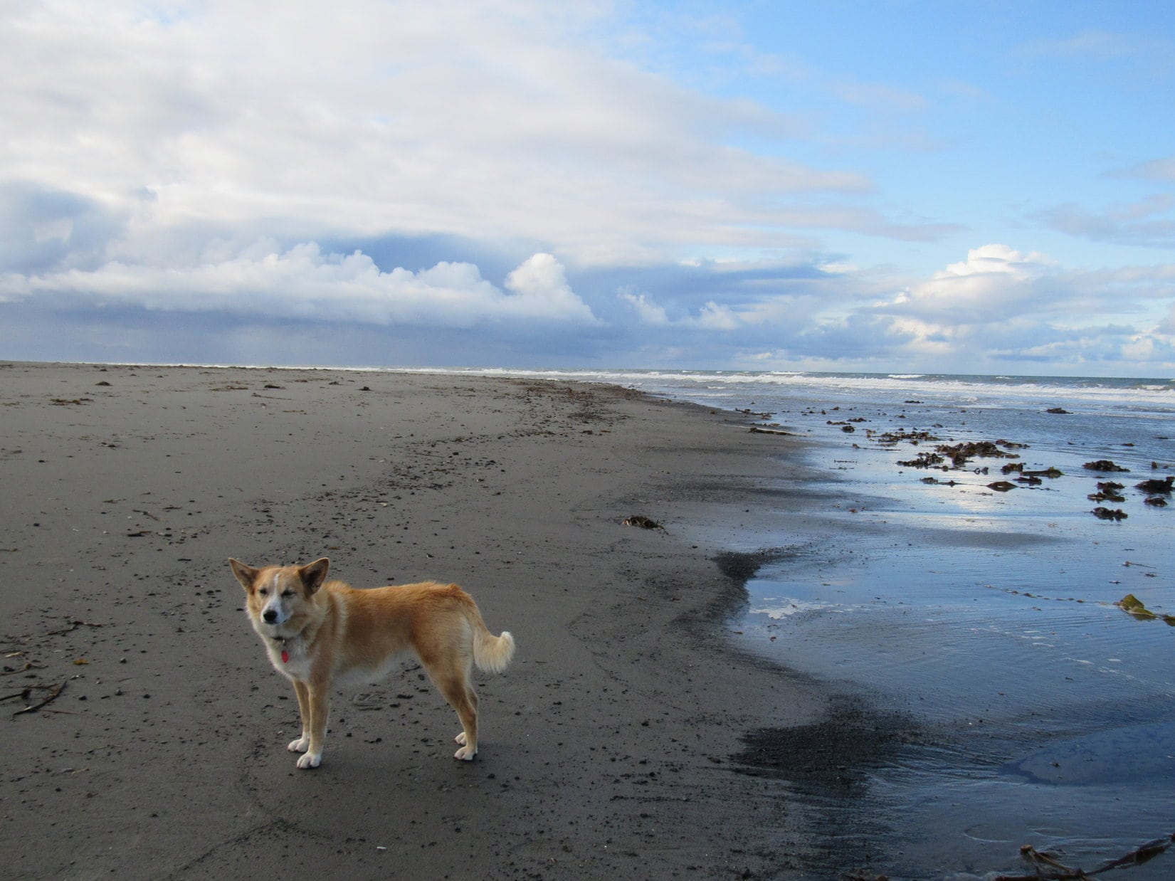
After leaving the G6, Lupe and SPHP traveled S along the beach.  SPHP ambled along watching the sky, listening to the restless sea, and enjoying the breeze.  Lupe barked at seagulls flying by, and sniffed seaweed and odd bits and pieces of things from the ocean, all while dodging incoming waves.

Lupe by Cook Inlet, an arm of the North Pacific Ocean at Anchor Point. Photo looks W.

Loopster had been to Anchor Point in 2016, too.  She had explored this same stretch of beach.  Since no road connected to the North American highway system goes any farther W than Anchor Point, Lupe was as far W here on this beach as she was ever likely to be in her entire life.

Lupe had taken this same stroll along the beach S from Anchor Point in 2016. At the time, SPHP believed the Carolina Dog was as far W as she would ever be in her life. Yet only a little more than a year later, here she was again. Photo looks SW.

Earlier on this Dingo Vacation, Lupe had returned to the Brooks Range and broken her 2016 Last Mile North record for how far N she had ever been by continuing N on the Dalton Highway all the way to Deadhorse near the Arctic Ocean.

Lupe couldn’t break her 2016 Last Mile West record today.  All she could do was tie it.  The ocean prevented her from going any farther W than this beach.  Even so, it was remarkable to think the American Dingo had actually returned to this remote place.

Lupe stands among strands of seaweed on her 2017 Last Mile West trek along the beach at Anchor Point. Photo looks W.

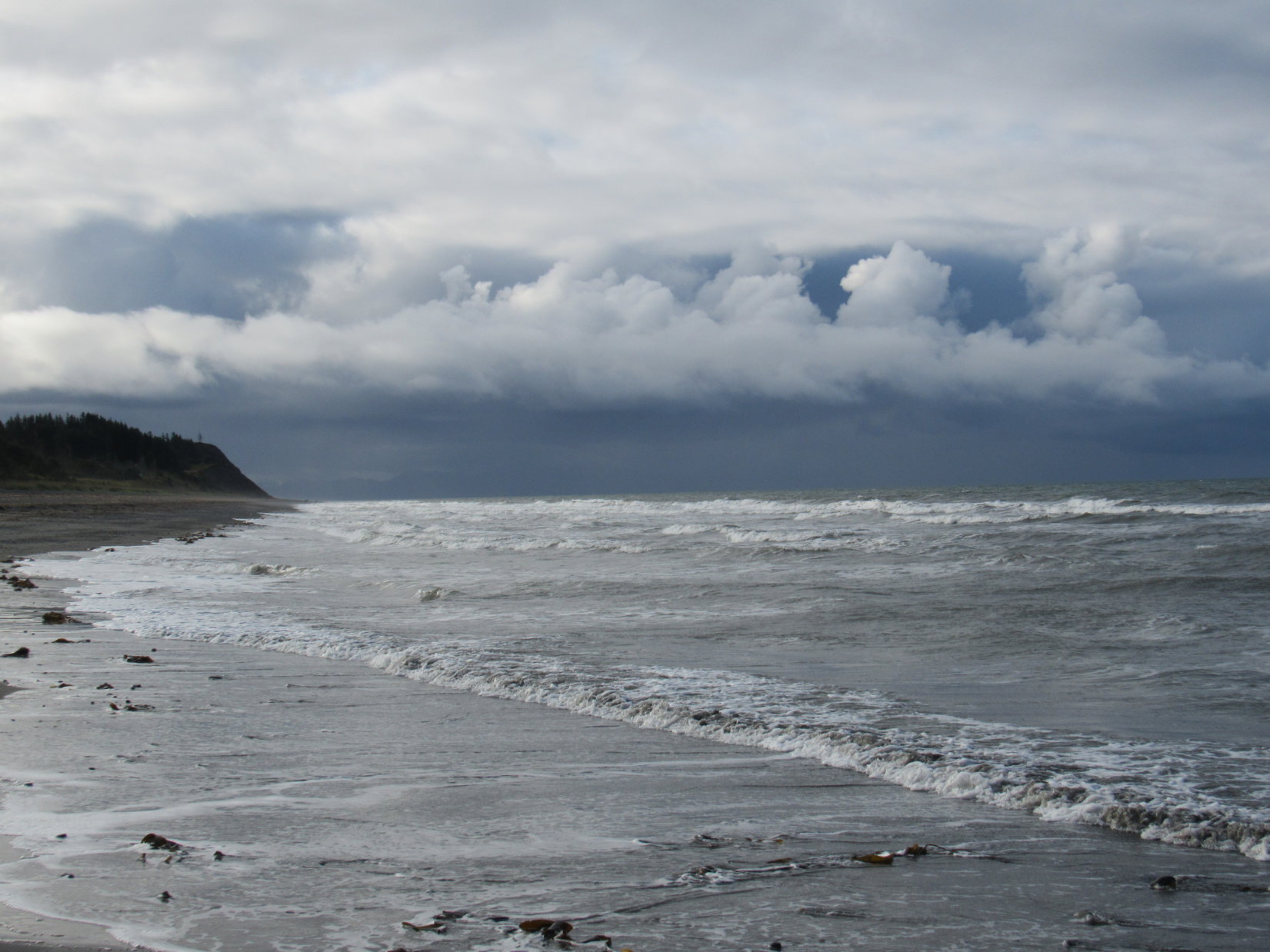
As Lupe continued S along the beach, it was evident that not taking the water taxi to the Grewingk Glacier across Kachemak Bay from Homer Spit had been a good decision.  The sky to the S toward Kachemak Bay looked dark and stormy.  Heavy rain was falling over that way.

The sky to the S was dark and stormy. Not taking the water taxi to see the Grewingk Glacier had been a good decision. Photo looks S.

Lupe was having a good time on the beach here, so things were working out about as well as they could have today.

Lupe was staying busy and having fun on the beach S of Anchor Point. Photo looks SSW.
Loopster races by a big patch of seaweed. Fun times! Way better than getting drenched would have been.

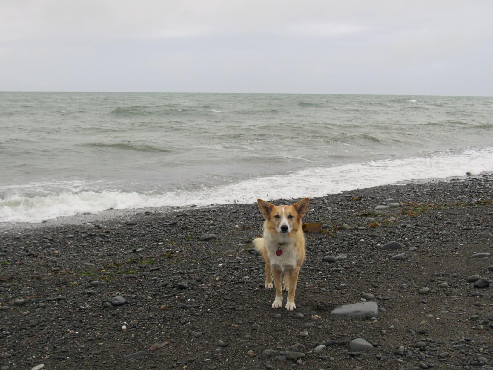
For about an hour, Loop and SPHP continued S along the beach.  SPHP thought Lupe made it at least as far S as she had gone in 2016.  Back then, Lupe had stood on a dark rock next to the ocean before turning around to return to Anchor Point.  That dark rock had been officially dubbed the Rock of the West, representing the farthest point W Lupe had ever been.

SPHP had expected to be able to recognize the Rock of the West again, but hadn’t seen it.  Maybe the tide was higher or lower now than a year ago?  Entirely possible.  If the Rock of the West was underwater, SPHP wouldn’t have seen it for sure.  Since 2016’s Rock of the West couldn’t be found, Lupe climbed up on a different boulder.  This greenish boulder could serve as 2017’s official Rock of the West.

Lupe astride the all new, 2017 official Rock of the West. Photo looks W.
Lupe never seemed very comfortable up on the 2017 Rock of the West. Photo looks S.
Is that rock slippery or what, Loop? You are perched so strangely on it! Photo looks SW.
I did come back to my westernmost point ever, didn’t I, SPHP? …. You certainly did, Looper! Congratulations! Photo looks NW.

The stroll back to Anchor Point was beautiful and relaxing.  Loop and SPHP were in no rush.  Lupe’s home in the Black Hills of South Dakota is a long way from any ocean.  Being next to the ocean all the way up here in Alaska was such a treat!  Lupe and SPHP savored every moment.

Looking N across Cook Inlet.
White sub-peaks of Iliamna Volcano (10,016 ft.) stick up out of the clouds on the L. The true summit is hidden from view. In 2016, Lupe had seen it. Photo looks NW.
Seagulls afloat on Cook Inlet.
Looking S one more time. The weather didn’t seem to have improved much. At least the rain stayed down there while Lupe enjoyed her 2017 Last Mile West.

Lupe caught glimpses of the Iliamna Volcano (10,016 ft.), but she never did see Iliamna’s true summit or any of Redoubt Volcano (10,197 ft.) like she had in 2016.  Both volcanoes remained hidden by the clouds on the far side of Cook Inlet.  However, Loopster could clearly make out the Augustine Volcano (4,025 ft.), which is on an island of its own making, even though it was far across the water on the SW horizon.

This is a far more comfortable rock than that slick green one you chose to be the 2017 Rock of the West, SPHP. You should have picked this one instead!
Nearing Anchor Point again at the end of Lupe’s 2017 Last Mile West trek. She’d had a great time! Living as far from the sea as she does, even short adventures along the ocean are a rare treat for Loop. Photo looks NE.

Seagulls flew by, then either landed to rest on Cook Inlet, or joined flocks strutting about farther along the beach.  A fresh breeze blew out of the SW.  Waves rolled into shore, retreated, reformed, and resumed their ceaseless attacks on the coast.  Puffy white clouds plied a blue, blue sky above the sea.

It was all wonderful!  When Lupe reached Anchor Point again, she stood with SPHP near the shore, watching and listening to the waves roll in a while longer.

Lupe’s last moments near the North Pacific Ocean in 2017. Photo looks NW.
By the sea, by the sea, by the beautiful sea.

After returning to the G6 (12:22 PM), Loop and SPHP still sat watching the ocean while sharing English muffins and salami again for lunch.  A peaceful, leisurely hour went by.  When lunch was over, it was time to move on.  (1:40 PM, 54°F)

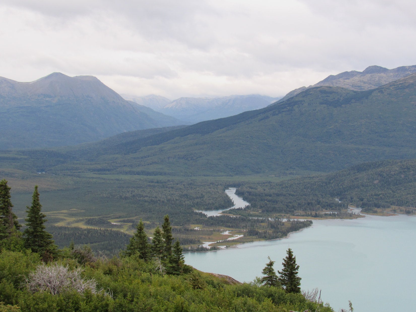
Sadly, after only a single brief day, Lupe was leaving the Kenai Peninsula.  If the weather had been better and more reliable, she had a week’s worth of adventures planned here.  As SPHP drove toward Soldotna, there were signs that maybe the weather was going to improve.  Sunny skies prevailed over Cook Inlet.  Even to the S, where rain showers were in progress, patches of blue sky could now be seen over the mountains.

But SPHP had no faith that the weather was really going to clear up and stay that way.  It was September now.  Maybe it was time to leave rainy Alaska?  Lupe did have an alternate backup plan in case the Kenai Peninsula didn’t work out.  Perhaps it was time to put it into action?

Months ago, Lupe’s friend, Australian adventurer Luke Hall, whom she had met at the top of Gunsight Mountain in 2016, had recommended that the Carolina Dog visit Tombstone Territorial Park in the Yukon.  SPHP had been thinking Lupe wouldn’t have time to get over there on this Dingo Vacation, but she still could, if she started that way now.

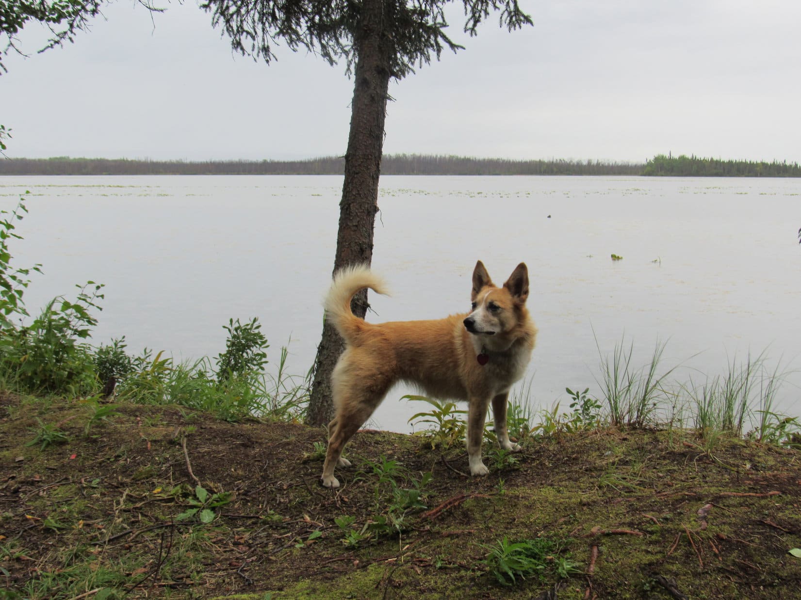
Several hours after leaving Anchor Point, Lupe was restless.  She was ready to get out of the G6 and do something.  Since Bottenintnin Lake wasn’t that far away now, SPHP asked if she like to make the short side trip off Sterling Highway No. 1 to visit the lake again for a little while?

Bottenintnin Lake where there were lots of squirrels in the forest?  The American Dingo’s response was most enthusiastic!

Oh, yes, all you Dingoes out there. I highly recommend the blue ribbon squirrel watching here at Bottenintnin Lake next time you’re in the area! Photo looks S.
Oh, I won’t go far, SPHP! There’s plenty of squirrels in this forest close by. Call if you need me! I’ll be back in a bit.

Want more Lupe adventures?  Choose from Lupe’s 2017 Dingo Vacation to the Yukon & Alaska Adventure IndexDingo Vacations Adventure Index or Master Adventure Index.  Or subscribe free to new Lupe adventures.

Skilak Lookout, Kenai Mountains, Alaska (8-30-17)

Days 30 & 31 of Lupe’s 2017 Dingo Vacation to the Yukon & Alaska!

8-29-17, 12:33 PM, at a pullout along N Palmer Fishhook Road – Awake again, surprisingly soon.  Lupe was awake, too.  Only 3.5 hours gone by since she had returned from her 25 hour “day” hike on the Reed Lakes trail to Lynx Peak (6,536 ft.) and back again.

The relatively short snooze had definitely done some good.  Both Lupe and SPHP were feeling better.  Better, but still tired.  Back to sleep!  Not for long, though.  The next time Looper woke up, SPHP drove down to Palmer.  Having fallen in the mud 4 times yesterday, SPHP searched for a laundromat.  The rest of the day was taken up by a shower and adventures in laundry.  Loopster snoozed, recuperating in the G6.

The day’s biggest events didn’t come until late evening.  SPHP bought a whole roasted chicken at Fred Meyers.  Lupe hadn’t eaten much during the day.  Now she was famished.  The Carolina Dog made short work of the chicken SPHP shared with her.  Nothing left, but bones.  Then it was a late evening walk in Palmer before hitting the hay again.

8-30-17 – The morning shot by.  The weather in Palmer was decent.  Overcast, but not raining or threatening to, with temps in the mid 50’s.  Lupe and SPHP were sufficiently recovered from the Lynx Peak ordeal to consider something active again.  Nothing too strenuous.  Anything involving enough effort to get the blood flowing again would do.  Crow Pass or Skilak Lookout might work.  By noon, Lupe was on her way to Anchorage on Glen Highway No. 1.

S of Anchorage, Lupe and SPHP stopped at Beluga Point along Seward Highway No. 1.  A gale was blowing out of the SW, roiling the muddy Turnagain Arm which appeared to be near high tide.  The view to the SE in the direction of Girdwood was not at all encouraging.  Clouds and mist hung over the mountains.

After going through Anchorage, Lupe stopped briefly at Beluga Point. A gale out of the SW was roiling the muddy Turnagain Arm. Photo looks WSW.
The view looking SE along the Turnagain Arm toward the Girdwood area was not encouraging. Clouds and mist were hanging around the mountains in that direction.

When Lupe arrived in Girdwood a little after 2:00 PM, a light rain was falling.  The wind wasn’t a gale here, but a lively breeze was blowing.  The air was damp and raw.  Crow Pass was out.  Too bad.  SPHP wondered about the wisdom of even continuing on to the Kenai Peninsula and Skilak Lookout?

Lupe wanted to go.  May as well.  No better options came to mind.  By 4:00 PM, the Carolina Dog was well into the Kenai Peninsula.  Once beyond Cooper Landing, SPHP started watching for a L turn off Sterling Highway No. 1 onto Skilak Road.  Shortly after making the turn, Lupe got her first look at Skilak Lake.

From Skilak Road W of Cooper Landing, Lupe got her first view of Skilak Lake.

The weather certainly hadn’t improved much.  The sky was more darkly overcast than back at Girdwood.  At least it wasn’t raining, although it looked like it might at a moment’s notice.  5.5 miles from the Sterling Highway, SPHP found the Skilak Lookout trailhead.  The parking lot was vacant.  Not a soul around.

A small sign on the other side of the road marked the start of the Skilak Lookout trail.  The trail immediately disappeared into a gloomy forest.

Lupe at the start of the Skilak Lookout Trail. The weather was questionable to say the least, but it wasn’t raining yet. Loop was going to see how far she could get. With a little luck she might make it to Skilak Lookout, which was only 2.2 miles away.

The trail started off going down a short slope.  Near the bottom, Lupe found an information station.

Within a few minutes of starting out, Lupe came to a trail information station.
This handy rundown on what to expect along the Skilak Lookout Trail was on display.
The information station also provided this lovely map.

The first part of the Skilak Lookout trail wound generally S through a dense forest.  Even though she had no views, Lupe was having plenty of fun sniffing around the forest floor close to the trail.

Loop in the forest on the first part of the Skilak Lookout Trail. She liked this area.

The Skilak Lookout trail was just the ticket for a first outing after the huge trek a couple of days ago on the Reed Lakes trail to Lynx Peak.  Nice and easy.  Less than 800 feet of elevation gain over more than 2 miles, most of it near the end.

Lupe trotted happily along gaining elevation slowly.  There were no views until she got out of the forest upon reaching the Hidden Creek burn area mentioned back at the information station.  SPHP then started to get occasional views, but Lupe still had none.  The Hidden Creek burn had occurred way back in May, 1996.  An awful lot of vegetation had grown up since then.

Upon reaching the 21+ year old Hidden Creek burn area, SPHP started getting views of the E end of Skilak Lake. Photo looks SE.
Even after reaching the burn area, Lupe couldn’t see much. An awful lot of vegetation had grown up over 21 years.
Looking E from farther along the trail. The Kenai River enters Skilak Lake at the base of the low hill R of Center. In the distance are Russian Mountain (4,318 ft.) (L), Bear Mountain (3,707 ft.) (Center), and Surprise Mountain (4,094 ft.) (R).

The Skilak Lookout trail appeared seldom traveled.  Long stretches were overgrown with vegetation.  Other sections were quite muddy.  Hardly surprising, since it seemed to rain almost every day in Alaska.  Lupe was getting sprinkled on every so often here, too.  Fortunately, the showers were light and didn’t last long.

Views? What views? Seems more like a tunnel to me!

Lupe was at least a third of the way along the trail before she caught a glimpse of hills ahead.  Skilak Lookout had to be somewhere up among those hills!

When Lupe was more than 1/3 of the way along the Skilak Lookout Trail, she started getting glimpses of hills ahead. Photo looks SSW.

Nearing the hills, Lupe came across fresh evidence American Dingoes weren’t the only ferocious predators in the area.

Fresh bear scat on the Skilak Lookout Trail.

5 minutes before coming to the bear scat, Lupe had found a squirrel to bark at.  Perhaps that had been a good thing?  Maybe the bear was so frightened by the sound of an approaching  American Dingo it had fled?  At any rate, SPHP was glad Loopster had given that squirrel a proper barking.  No bear was seen, though the lush vegetation could have been hiding one almost anywhere.

The last part of the Skilak Lookout trail was steep and slick.  SPHP had a hard time maintaining traction on the mud.  Dense stands of bushes and small trees crowded the trail, so staying right on the path was about the only option.  SPHP used branches for assistance, and began to wonder if anything at all could be seen from the top of Skilak Lookout?

The steep section was short.  Lupe was soon up above it.  The Carolina Dog quickly came to a small, exposed rocky ridge.  SPHP needn’t have feared.  Lupe had a great view of the E part of Skilak Lake!  Now that she could finally see, Looper wasn’t all that thrilled about it.  A cold 25 mph wind swept up the ridge from across the lake.

Nearing the top of Skilak Lookout, Lupe reaches a small, exposed ridge. An annoying, cold 25 mph wind was sweeping up from across Skilak Lake. Photo looks ESE.
Lupe didn’t like the strong wind, but at least it wasn’t raining when she reached Skilak Lookout. Patches of blue sky raced by overhead. Photo looks SE.
Lupe could see the Skilak River delta at the far E end of Skilak Lake. The Skilak River is short, originating from the Skilak Glacier not too many miles away. Photo looks ESE with help from the telephoto lens.
The Kenai River enters Skilak Lake along its N shore near the NE end of the lake. Photo looks NE.

The top of Skilak Lookout was only a few hundred feet away from the first good viewpoint.  A small stand of old evergreens stood slightly W of the true summit.  Their windswept appearance provided proof positive that the current strong wind sweeping up from across Skilak Lake was nothing out of the ordinary.

Lupe reaches the summit of Skilak Lookout. A windswept stand of ancient evergreens provided proof that today’s strong wind from across Skilak Lake was nothing unusual. Photo looks W.
Loopster faces into the same prevailing wind the battered evergreens behind her had endured all their lives. Photo looks NNW.
The evergreens had put up with this stiff breeze a lot longer than Lupe intended to.
Hideout Hill (2,858 ft.) (R above Lupe) is seen in this view looking N.

At Skilak Lookout’s true summit, Lupe found a small rock outcropping and an unimpressive cairn.  Loop didn’t spend much time here.  Several rock outcroppings closer to the lake provided better viewpoints.

From the rock outcroppings, Lupe had excellent views of Skilak Lake to the E and S, however the views to the W were disappointing.  Skilak Lake is big.  Most of the lake was off to the W or SW, yet very little of the western part of the lake could be seen.  Other hills were in the way.

A slightly lower hill to the SW was positioned where it might provide a more panoramic view of Skilak Lake.  Several different paths started off in that direction.  Lupe tried them all, but none of them went anywhere.  They all dead ended or circled back into each other.

If a decent trail had actually gone to the lower hill, Lupe would have taken it.  However, it was getting late and charging off trail into dense vegetation seemed foolhardy.  The weather was questionable, and no telling where that bear had run off to.  Lupe and SPHP gave up on the idea.  After all, this was supposed to be an easy day!

Little could be seen of the larger western portions of Skilak Lake from Skilak Lookout. Henton Benchmark (1,568 ft.) (R) was one of a couple of large hills blocking the view. Photo looks WNW.
Several trails headed off toward this slightly lower hill to the SW, but they all dead ended. If any of them had actually gone over there, Lupe would have, too. Photo looks SW with help from the telephoto lens.
Lupe on the rock outcropping providing the best view. Her ear points up at Russian Mountain (4,318 ft.). Photo looks E.
A good look at the E end of Skilak Lake.
Looking SW.
Looking SE toward the Skilak River delta and rocky islands in Skilak Lake with help from the telephoto lens.

The wind soon drove Lupe away from the best viewpoints.  They were too exposed.  Loop and SPHP retreated back to the true summit, at least somewhat out of the wind.  In 2016, on a much nicer day, Lupe had taken the Skyline Trail to the Mystery Hills.  The views from there had been even better.  Could Lupe see the Mystery Hills from here?  SPHP spotted a long high ridge off to the NNE.

In 2016, Lupe had taken the Skyline Trail to both North Mystery Hills (3,284 ft.) (L) and Mystery Hills Central (3,291 ft.) (R). It was fun to see them again from Skilak Lookout. Photo looks NNE with help from the telephoto lens.

Yes, Lupe could see the Mystery Hills from Skilak Lookout!  It was fun to think about that day over a year ago now.  Loop and SPHP sat on the ground at the summit of Skilak Lookout huddled together for warmth.

Clouds and several large patches of blue sky sailed swiftly by.  A small flock of crows came flying on the wind.  For a few minutes, the crows circled above Skilak Lookout playing games with each other.  Together they plunged earthward before soaring and swirling back into the wild blue heavens.  The breeze soon carried them out of sight.

15 minutes at the summit, then the sky suddenly looked ominous over by the Skilak River delta off to the SE.  Mountains were disappearing in an approaching dark cloud.  Time for action!  Rain was clearly on the way.  Better get with it.  Maybe Lupe could beat the rain back to the G6?

SPHP slipped and fell in the mud on the steep part of the trail shortly after leaving Skilak Lookout.  No damage done.  Puppy, ho!  Onward!

Hurry, hurry, all the way.  Lupe didn’t beat the rain, but it wasn’t as bad as it had appeared.  Showers came and went.  Loopster arrived damp, but not soaked, back at the G6.  English muffins and summer sausage for dinner, then SPHP drove to the W end of Skilak Road.  Due to highway construction, flagmen were preventing traffic from entering the Sterling Highway.

Information posted near the junction showed a map of the area.  A fairly good-sized lake was close by.  A short side road led to it.  It was getting dark.  Maybe Lupe could hang out there tonight?

This sign showing the Skilak Lake area was posted at the W end of Skilak Road near the junction with the Sterling Highway.

No one here.  No facilities, only a large turnaround next to the lake.  SPHP parked the G6.  Bottenintnin Lake was big, but shallow.  Water lilies extended far out from shore.  Another side road left the turnaround.  The American Dingo and SPHP explored it.  Loop sniffed out a few dispersed camping sites.  None were occupied.  The side road soon ended.  Perfect!

Skilak Lookout had been fun!  It had been an easy half day, which was all Lupe and SPHP had really been up for.  The weather could have been better, but Lupe did get to Skilak Lookout, and she did get to see Skilak Lake.  Nature doesn’t give guarantees.  You take what you can get.

Tomorrow was another roll of the dice.  Maybe Lupe would get lucky?  Dark now.  Time to rest up.  Better be ready, in case she did.

Skilak Lookout, Kenai Peninsula, Alaska 8-30-17

Related Links:

On the Skyline Trail to the Mystery Hills, Kenai Peninsula, Alaska (8-27-16)

Want more Lupe adventures?  Choose from Lupe’s 2017 Dingo Vacation to the Yukon & Alaska Adventure IndexDingo Vacations Adventure Index or Master Adventure Index.  Or subscribe free to new Lupe adventures.

On the Skyline Trail to the Mystery Hills, Kenai Peninsula, Alaska (8-27-16)

Day 29, Part 2, of Lupe’s Summer of 2016 Dingo Vacation to the Canadian Rockies, Yukon & Alaska

Plans for a return visit to the beach at Ninilchik on Cook Inlet were quickly dashed when Lupe and SPHP stopped to help a woman hitchhiker along the Sterling Highway (Alaska Route 1).  Turned out she needed a ride to her landscaping job, well beyond Ninilchik, clear over in Soldotna.  She was already late and needed to get there quickly.  Her car (nowhere in sight) had broken down, and no one else had stopped to give her a lift.

Jane was a friendly, plucky gal.  She introduced herself to Lupe and SPHP, and immediately launched into her life’s story.  Some of it made not a lick of sense, but it was an entertaining tale nevertheless.  Lupe and SPHP listened in silence as the miles flew by, and Jane related her only-in-Alaska monologue.

Jane had moved to Homer, Alaska from California years ago.  Naturally, she loved Alaska.  She had made some money back in California in real estate.  Jane used part of the money she’d saved to make a great purchase of 40 acres near the edge of a development somewhere around here, the particular parcel having been carefully selected by closing her eyes and putting her finger to a map.

The land wasn’t even for sale at the time, but when Jane approached the owners, they thought she was so wonderful, they promptly agreed to sell it to her for a song.  She lives off-grid in a cabin on this beautiful property, where she and her dog manage to avoid being eaten by grizzlies by sticking close to either the cabin, or her ATV, on which they zoom away to safety at a moment’s notice.

When you live off grid, you have to create your own entertainment.  Jane kept chickens to produce eggs.  A pure white rooster served as head of the flock.  For fun, Jane used a water pistol to paint the rooster with bright colors so he was more of a fancy rainbow rooster instead of a boring pure white one.  The rooster didn’t object in the least.  Instead, his reaction was to put on a Mick Jagger style strutting performance to impress his harem, which Jane found endlessly amusing.

Sadly, tragedy struck.  All but two of her chickens and the beloved rainbow rooster passed away very recently when her pet wolf broke its new chain after only 2 days, and did what wolves like to do to chickens.

With the wonderful, balmy climate Alaska now has due to global warming, it’s getting harder and harder to keep the riff raff out.  The Kenai peninsula is filling up with people.  Living off the grid here is no longer the hardy pioneering existence it once was a few years back.  Fortunately, Jane’s 24 year old son took pictures of a mind-bogglingly beautiful little town, with a name that SPHP has since forgotten, but it started with a “U”.

U-ville is located on Spruce Island, near much larger Kodiak Island, and can only be accessed by boat or the air.  The few pictures Jane’s son took were enough to convince Jane that U-ville is the place to be, so she is in the process of getting ready to sell her 40 acres and move.  People in U-ville, who have never met Jane, but have advanced word of her interest in living on Spruce Island, are falling over themselves offering her good jobs, and encouraging her to join their community ASAP.

Jane related all this, and a good deal more which now escapes SPHP, in the time it took to reach Soldotna, where she promptly exited the G6, cheerfully bidding Lupe and SPHP a fond farewell.  Clearly there had been much more to come, time permitting, so it was with a mixed sense of reluctance and relief that Lupe resumed her own adventures, though they may pale in comparison to Jane’s.

Lupe’s next adventure started E of Soldotna near milepost 61 of the Sterling Highway at the trailhead for the Skyline Trail to the Mystery Hills (12:03 PM, 68°F).  The trailhead parking lot was on the SW side of the highway, but the actual trail started over on the NE side, a bit farther to the NW.

Looking up at the Mystery Hills from the Skyline Trail parking lot near milepost 61 of the Sterling Highway. Photo looks NE.

A sign near the start of the Skyline Trail provided general information.  Lupe could expect a steep 1,800 feet of elevation gain over 1.25 miles.

The Skyline Trail is somewhat oddly named, since it officially ends at a saddle between mountains, before ever getting up to any of the peaks of the Mystery Hills, or even following any portion of the ridgeline.  Skyline Access Trail would have been a better name for it.

The sign did show a trail continuing on up from the saddle.  On the topo map SPHP had along, a pack trail goes on for miles all the way from the saddle up to and over a series of peaks in the Mystery Hills.

Sign near the start of the Skyline Trail.

Just as the sign had promised, the Skyline Trail was steep.  There were no significant switchbacks.  Up and up.  SPHP was soon pausing frequently to let heart, lungs and legs catch up with the demands of the trail.  Lupe, of course, wasn’t fazed in the least.

For a long way, the trail was in forest.  Little could be seen.  After quite a climb, the forest finally started gradually giving way to tall bushes.  Lupe started to get glimpses of the progress she was making.

Once the forest thinned out, Lupe could see the progress she was making. Part of her first peakbagging goal, Mystery Hills North is seen on the R. Photo looks E.

The trail’s rate of climb didn’t diminish until Lupe was getting fairly close to the saddle.  Then things started to level out rapidly.  Where Lupe first reached the saddle, she came upon a final big stand of gnarled old pine trees.  The day was warm and bright.  The shade provided by this last clump of odd old pines was welcome.  Lupe and SPHP took a break.

As near as SPHP could tell, Lupe had reached the official end of the Skyline Trail.

Lupe takes a break beneath an isolated stand of gnarled old pines she came upon as she reached the saddle. She was at, or very near, the official end of the Skyline Trail.

The Skyline Trail may have officially ended, but the sign and maps were right.  A good trail continued on across the saddle toward the mountain to the E.  (Note: As far as Lupe was concerned, this continuation of the trail going on up to the Mystery Hills was all part of the same Skyline Trail, and will be referred to as such for the remainder of this post.)  When Lupe’s break under the gnarled pines was over, Lupe and SPHP pressed onward.

Not far from the pines, Lupe passed by another trail branching off to the N on its way through the saddle.  The American Dingo ignored the side trail and started climbing the mountain to the E.

A good trail continued beyond the gnarled pines across the S end of the saddle area. Lupe ignored a side trail that branched off to the N (L), and continued up the hill seen directly ahead. This extension of the Skyline Trail eventually climbed around to the S (R) side of the hill. Photo looks E.

Lupe still had nearly 1,000 feet of elevation gain to go in order to reach her first peakbagging goal, North Mystery Hills (3,284 ft.).  She encountered a short stretch of rock climbing near the base of the mountain, but was soon easily past it.  Lupe came to no further complications along the trail, which now worked around to the S side of the slope, as it continued E.  Another higher saddle could be seen ahead.

Lupe on her way up to a higher saddle(Center). Lupe was heading for North Mystery Hills, seen on the R. Photo looks SE.

On the way to the next saddle, Lupe already had some splendid unobstructed views.

Lupe already had splendid views on her way up the Skyline Trail to the next saddle. Jean Lake is in the foreground. A portion of much larger Skilak Lake is in the distance. Photo looks S.
Far away across Cook Inlet, Lupe could see impressive snow-capped peaks. Photo looks NW using the telephoto lens.

The path up to the higher saddle was a long, steady grind, but the pace of elevation gain wasn’t bad, certainly nothing like Lupe had faced on the way to the first saddle.  Upon reaching the higher saddle, the trail turned S, climbing more aggressively up the mountain.

When the Skyline Trail finally started leveling out, a rock outcropping larger and higher than any other nearby point was a short distance ahead.  Lupe went over to it.  She had reached the N end of the North Mystery Hills summit ridge.  The views were fabulous!

Here, at the end of the climb up from the 2nd saddle, Lupe reached the N end of the North Mystery Hills summit ridge. A metal box containing a register was tucked among the rocks on the E (R) side of this high point. (Close to the backpack.) The unnamed peak in the background is nearly as high as North Mystery Hills and is located on the other (N) side of the 2nd saddle Lupe had just come from. Photo looks N.
Looking down on Peak 2851 (L) from North Mystery Hills. Peak 2851 is on the NW side of the first big saddle Lupe reached where she took a break among the gnarled old pines. Flatlands of northern Kenai Peninsula are seen in the distance. Photo looks NW.
Hideout Hill (2,869 ft.) from North Mystery Hills. Part of Skilak Lake is seen in the distance. Photo looks SW.

Right away, Lupe discovered a metal box tucked among the rocks on the E side of the rock outcropping.  The box contained a register.  SPHP entered Lupe’s name on it to secure the Carolina Dog’s place in North Mystery Hills history.

Although it had been a warm, calm, sunny day lower down, a fairly strong, cool E wind was blowing up here.  While SPHP was entering her name in the register, Lupe found a big rock to hide behind.  She curled up on the W side of it to escape the wind.

While SPHP entered her name in the register, Lupe curled up behind a big rock to escape the E wind. Lupe hadn’t quite reached the true summit of North Mystery Hills yet. The true summit is the high point beyond Lupe on the L. The similarly colored more distant hill is her next peakbagging goal, Mystery Hills Central. Photo looks SE.

Lupe had seen a number of people along the Skyline Trail, but hadn’t come across anyone since leaving the first saddle.  However, while she was still curled up out of the wind, and SPHP was busy gazing off into the distance, a young man showed up.  His name was Patrick Metzger.

Patrick was quite friendly to Lupe and SPHP.  Soon, Patrick and SPHP were engaged in conversation.  Patrick wasn’t an Alaskan native.  He moved to Soldotna a few years ago, where he works for Univar, a global chemical distribution business.  Like Lupe, he enjoys the outdoors and climbing mountains in his spare time, so there was a lot to talk about.

Patrick shared his love of Alaska with Lupe and SPHP.  He recommended several places Lupe might want to consider visiting while she was here.  By the time Patrick needed to move on, nearly an hour had gone by.  The visit with Patrick had been fun, but Lupe needed to get going, too.

Technically, Lupe still hadn’t reached the true summit of North Mystery Hills, but it wasn’t far away.  A short, windy stroll to the SE brought Lupe to the NW end of a small hill on the broader ridgeline.  The small hill proved to have two high points on it, one at each end of a little ridgeline, sort of a minor summit ridge up on the greater summit area.  Lupe visited both high points.  It was a close contest, but the true summit seemed to be at the SE end where Lupe found a small cairn.

Lupe reaches the NW high point on the minor summit ridge. This point was in contention with another spot nearby to the SE for true summit of North Mystery Hills. Mystery Hills Central is on the L. The SE end of Skilak Lake is on the R. Photo looks S.
Lupe stands in the wind at the NW high point of the minor summit ridge. This might possibly have been the true summit of North Mystery Hills, but the high point in view to the SE (Center) appeared to be marginally higher. Photo looks SE.

The trail didn’t even go to the likely true summit at the SE end of the minor summit ridge.  Instead, the trail skirted below it to the SW.  Lupe left the trail to make the short side trip to the true summit.  A pitifully small cairn was the only indication Lupe had finally reached her North Mystery Hills (3,284 ft.) peakbagging goal.

Success! Lupe sits in the E breeze at the true summit of North Mystery Hills. Her next peakbagging goal, Mystery Hills Central, is in view along the ridgeline. Photo looks SSE.
Looking back to the NW from the North Mystery Hills true summit. The other candidate for true summit at the NW end of the minor summit ridge Lupe is on is seen straight up from her rump. The high point where she first reached the broader summit ridge is at the far end straight up from her head. That’s over where Lupe found the metal box containing the register.
Mystery Hills East (3,478 ft.)(Center) from North Mystery Hills. Mystery Hills East is the highest of the Mystery Hills. The trail Lupe was following (an extension of the Skyline Trail) goes all the way to Mystery Hills East, but Lupe didn’t make it that far. Peeking over the R shoulder of Mystery Hills East is Round Mountain (3,901 ft.). Photo looks ESE.

Having finally reached the summit of North Mystery Hills, Lupe’s next objective was Mystery Hills Central (3,291 ft.), still 1.25 miles away to the SSE.  Getting there was simply a matter of following the Skyline Trail on a beautiful, fun ridge hike.  Lupe had splendid sweeping views along the entire route.  She passed over a series of rocky highpoints, as well as lower, gentler terrain, on the way.

Looking back at the summit of North Mystery Hills on the way to Mystery Hills Central. Photo looks NNW.
Lupe takes a break on a rocky high point on her way to Mystery Hills Central. Her ears point up toward Mystery Hills East. Photo looks E.
Approaching Mystery Hills Central. Photo looks SSE.

When Lupe arrived at the top of Mystery Hills Central, she found a roomy, nearly flat, summit area.  It also had two candidates for true summit, separated by only a short distance.  Lupe found a survey benchmark at the E high point, and a modest cairn at the W one.

Despite the still rather annoyingly strong E wind, Lupe and SPHP paused on Mystery Hills Central for a while to appreciate the grand 360° views.

The survey benchmark on Mystery Hills Central.
Kenai River valley from Mystery Hills Central summit. Photo looks SE.
Lupe enduring the stiff E wind up on Mystery Hills Central. What a tremendous view of Skilak Lake to the SW!
Looking S toward distant glories of the Kenai Peninsula.
S using the telephoto lens.

The topo map showed the Skyline Trail continuing on from Mystery Hills Central, looping around for miles, still following the ridgeline.  Eventually the trail goes all the way to Mystery Hills East (3,478 ft.).  Lupe could see part of the trail from above.

One look was enough to convince SPHP that Lupe didn’t have the time, and SPHP didn’t have the energy, to press on to Mystery Hills East.  That part of the trail had some serious elevation gains and losses along the way, in addition to being nearly another 3 miles long.

The trail to Mystery Hills East can be seen below on the hill on the R. It follows the ridgeline, eventually going over the next hill toward the L. Round Mountain is in view in the distance on the L. Photo looks ESE.

So this was it, Lupe had come as far along the Skyline Trail as she was going to.  Mystery Hills Central was the end of the line.  The sun said Lupe would soon have to start back.  Lupe and SPHP lingered a little while longer together on Mystery Hills Central.

Lupe at the Mystery Hills Central cairn. The ridge route back to North Mystery Hills (Center) is beyond her. Photo looks NW.
View to the NE.
The Kenai River on its way to Skilak Lake. Photo looks SW.

The time came to say good-bye to Mystery Hills Central.  Lupe started back the way she had come.

Starting back toward North Mystery Hills (Center). Photo looks NNW.
The Mystery Dingo of the Mystery Hills up on the ridgeline. Photo looks E.

As the sun sank lower toward the horizon, the E wind finally began to relent, losing some of its strength.  Lupe had a wonderful time exploring the ridge along the Skyline Trail.  It was a relaxing evening trek, surrounded by beauty on all sides, high in the Mystery Hills.

Lupe returned to the true summit of North Mystery Hills.  From there, she went on to the NW end of the broad summit ridge, back to the high rocky point where she had first discovered the metal box containing the register, and met Patrick Metzger only 4 hours ago.

Lupe returns to the true summit of North Mystery Hills. Photo looks NW.
Back at the far NW end of the North Mystery Hills summit area. Lupe is at the high point where she found the metal box containing the register, and met Patrick Metzger a few hours ago. Photo looks NNW.
Looper in the evening sunlight, prior to starting back down the Skyline Trail from North Mystery Hills. Photo looks N.
Lower Peak 2851 is partially hidden by the slope on the R. The Skyline Trail can be seen leading back down this slope on its way from the high saddle to the first saddle where the stand of old gnarled pines was. The Sterling Highway is on the L. Photo looks NW.

Although Lupe hadn’t seen anyone on the Skyline Trail after Patrick left, once Lupe began her descent from the Mystery Hills, she met a few hikers on their way up.  They were hoping to catch the sunset from North Mystery Hills.  To SPHP, it looked like the sun was going to sink into a cloud bank.  The sunset was likely to be more silver and gray than colorful.

Looking WSW on the way down to the first saddle. Skilak Lake can be seen beyond Hideout Hill on the L. A silvery Cook Inlet shimmers on the far horizon.
Jean Lake and more distant Skilak Lake. Photo looks SW.

What those hikers actually saw at sunset, Lupe never knew.  By then she was far down steep Skyline Trail in the encroaching gloom of the dark forest at the base of the Mystery Hills.  (8:49 PM)

On the Skyline Trail to the Mystery Hills.

Links:

Next Adventure                              Prior Adventure

Want more Lupe adventures?  Choose from Lupe’s 2016 Canadian Rockies, Yukon & Alaska Adventure Index, Dingo Vacations Adventure Index or Master Adventure Index.  Or subscribe free to new Lupe adventures.