Albany Peak, Laramie Range, Wyoming (6-8-23)

Days 1 & 2 of Lupe’s 1st Summer of 2023 Dingo Vacation to Colorado & New Mexico!

6-7-23, 4:16 PM, Horseshoe Creek Road, SW of Glendo – Pulling over to the side of the road, SPHP parked the RAV4 near the edge of a small ridge and leapt out.

C’mon, Loopster!  Let’s have a look!

Lupe started to follow, but stopped almost as soon as she hit the ground.

Umm, there’s cactus, SPHP!

Only a little, Loop.  Just stay right behind me.  We aren’t going far at all.

From the edge of the ridge, Horseshoe Creek Road snaked away across a wide, rolling green valley toward rocky ridges and mountains only a few miles away.  The closest ones weren’t all that high, but off in the distance beneath an unsettled sky loomed a much more prominent peak.

Laramie Peak!  Seems like forever since we’ve been there!  Are we going to climb it again, SPHP?

Laramie Peak (10,272 ft.) (Center) on the horizon. Photo looks SW.

That would be fun, Loop, but no.  However, we are going to try a peak not too far from it tomorrow that’s been on your list of possibilities for many years.  We’ll stop again for another look when we get close it.

SPHP had been acting weird lately.  Lupe hadn’t realized until this very morning what was going on.  Tremendously excited, the Carolina Dog had then followed SPHP in and out of the house countless times as the RAV4 got loaded with gear and supplies, before finally giving up and simply laying down in the shade on the lawn’s thick grass to watch and wait for the inevitable invitation.

That invitation came at 11:09 AM, 79ºF.  Beneath clear blue skies, Lupe leapt into the RAV4, and took up her usual position on her pink blanket.  Moments later, as SPHP backed out of the driveway, the American Dingo grinned broadly.  She could hardly believe it!  The long-awaited Summer of 2023 was finally here!  Dingo Vacation days of glory ahead!

It began with a scenic drive through the Black Hills, Lupe barking with enormous enthusiasm at cows and horses.  By early afternoon, she was in the great state of Wyoming, where skies suddenly looked stormy.  S of Mule Creek Junction, SPHP drove through a cloudburst.  Fortunately, no hail.  Near Lance Creek, skies were blue again, but more rain showers had appeared as the RAV4 sped S.

Another small cloudburst along Horseshoe Creek Road had drifted off to the E.  Returning to the RAV4, and resuming the drive SW up the green valley, SPHP reached a junction that looked familiar.  Sure enough, after turning S on USFS Road No. 633, SPHP was soon recognizing places Lupe had been to long ago.

No. 633 ultimately climbed higher, and became quite a bit rougher, than SPHP remembered.  Once the road topped out, SPHP subsequently failed to notice the turn into the Boy Scout camp at Harris Park where Lupe had once set out for Black Mountain (7,960 ft.).  Eh, no matter.  Shortly after passing the region where the turn had to have been, SPHP parked the RAV4 again.

Thar she blows, Looper!  Our first destination, Albany Peak (7,720 ft.)!

Albany Peak (Center) from USFS Road No. 633. Photo looks S.

Sweet, but looks mighty rocky on top, SPHP!

Yeah, I know.  Pretty typical for the Laramie Mountains, though.  The topo map actually shows two summits of roughly equal elevation.  That’s our ace in the hole!  If we can get to the top of either one, we’re calling it close enough for Dingo work and claiming a peakbagging success.

Taking a R on County Road No. 71 at the next junction, it continued S past Albany Peak down to Cottonwood Park, a very broad, scenic valley just a few miles SE of Laramie Peak.  A couple of roaming pronghorns vanished over a ridge before SPHP could get a photo.  When a L turn onto Fletcher Park Road appeared, SPHP took it.

6-7-23, 5:30 PM, USFS Road No. 643 at Elk Park – Lightning flashed now and then, and the distant rumble of thunder was often heard from dark clouds to the S.  This region wasn’t at all the dense forest SPHP expected, due to a fire long ago.  White tree skeletons decorated a hilly landscape dotted with rounded rock formations.  Scattered live trees remained in tall, spindly stands.

Raining to the S, but doesn’t look too threatening here, Loop.  Air’s nice and cool now.  Want to scout around a bit, just for fun?

I’d love to, SPHP, but how about dinner first?

An entirely reasonable request.  SPHP had been munching on honey roasted peanuts and wasn’t that hungry, but Lupe was famished.

Once the Carolina Dog had her fill, the evening’s leisurely explorations began.  Following USFS Road No. 643 N for roughly 0.4 mile, Lupe sniffed gorgeous wildflowers along the way before reaching a minor pass.  From a small, deadfall-laden rise on the W side of the pass, she had a terrific view of Laramie Peak.

Among the wildflowers.
In pristine condition!
Laramie Peak (Center) from the rise W of the pass. Photo looks NW.

Double-pronged Albany Peak was already in sight, 3 or 4 miles NNE.  Beyond the pass, SPHP was surprised to see the road continuing a long way toward it.

Hmm, that’s odd.

What’s odd, SPHP?

The map shows No. 643 turning NW not too far from here, then heading down to Cottonwood Creek.  Doesn’t show this road winding toward Albany Peak at all, Loop.

Nothing wrong with that, is there, SPHP?  Looks like an way to get there.

Yup.  I’d been thinking we’d take USFS Road No. 650, which lies 0.5 mile farther E, but I like the looks of this.  Maybe we’ll just go this way?

Wandering back S off-road, Lupe came to an enormous boulder cracked in two.  SPHP joined her in climbing up onto it.  While relaxing up there, suddenly the wild dogs began singing.  Her ears straight up, listening, Lupe’s eyes grew big.  For 2 minutes the coyotes sang.  They were many, not too far away from the sound of it, although none were in sight.

Getting dark.  The coyotes’ wild chorus ended as suddenly as it began.  To the W, black silhouettes of the spindly trees stood against a pale sky.

Guess we should amble on back to the RAV4, Looper.

6-8-23, sunrise, USFS Road No. 643 at Elk Park – The tiger attacked, biting SPHP’s hand.  Blood spurted out.  Another moment, and it would all be over, but somehow SPHP got free.  Incredibly, the tiger transformed into a big dog, and began attacking other people.  Lupe appeared, heroically standing over SPHP, her fur shining in the morning sun now peeping over the horizon.

About time you woke up!  Mind letting me out, SPHP?

Huh?  Morning already?  Yeah, I’ll let you out.  In fact, I’ll join you, Loop.  Need to clear my mind.  I’ve been dreaming like a nut case.

6-8-23, 6:36 AM, USFS Road No. 643 at Elk Park – Lupe stood impatiently next to the RAV4.  The sky had clouded up a bit, but the pack was ready.

About to set out for Albany Peak. Photo looks N.

Onward!  Puppy, ho!

Music to my ears, SPHP!

Heading N on USFS Road No. 643 again, by the time Lupe made it to the minor pass, she was in brilliant sunshine.  An absolutely gorgeous day!

Looking back along USFS Road No. 643. Photo looks S.
Laramie Peak (L of Center) in the morning light. Photo looks NW.
Albany Peak (Center) from just N of the 1st minor pass. Photo looks NNE.

Continuing N over the pass, No. 643 began a steady descent.  Lupe soon came to a cattle guard where there were signs about a hunting walk-in area, plus a great view of Black Mountain (7,960 ft.) 5.5 miles N.

Albany Peak (L & Center) from the start of the hunting walk-in area. Photo looks NNE.
Black Mountain (R of Center) from the 1st cattle guard. Photo looks N.

A bit beyond this first cattle guard, the road curved NE, leaving the route No. 643 was supposed to take.  It steepened somewhat on the way down to a valley full of young aspens where Lupe drank from a small stream.  Beyond this valley, the road climbed again to a junction with another road coming in from the SE.

Heading down into the valley full of young aspens. Photo looks ENE.

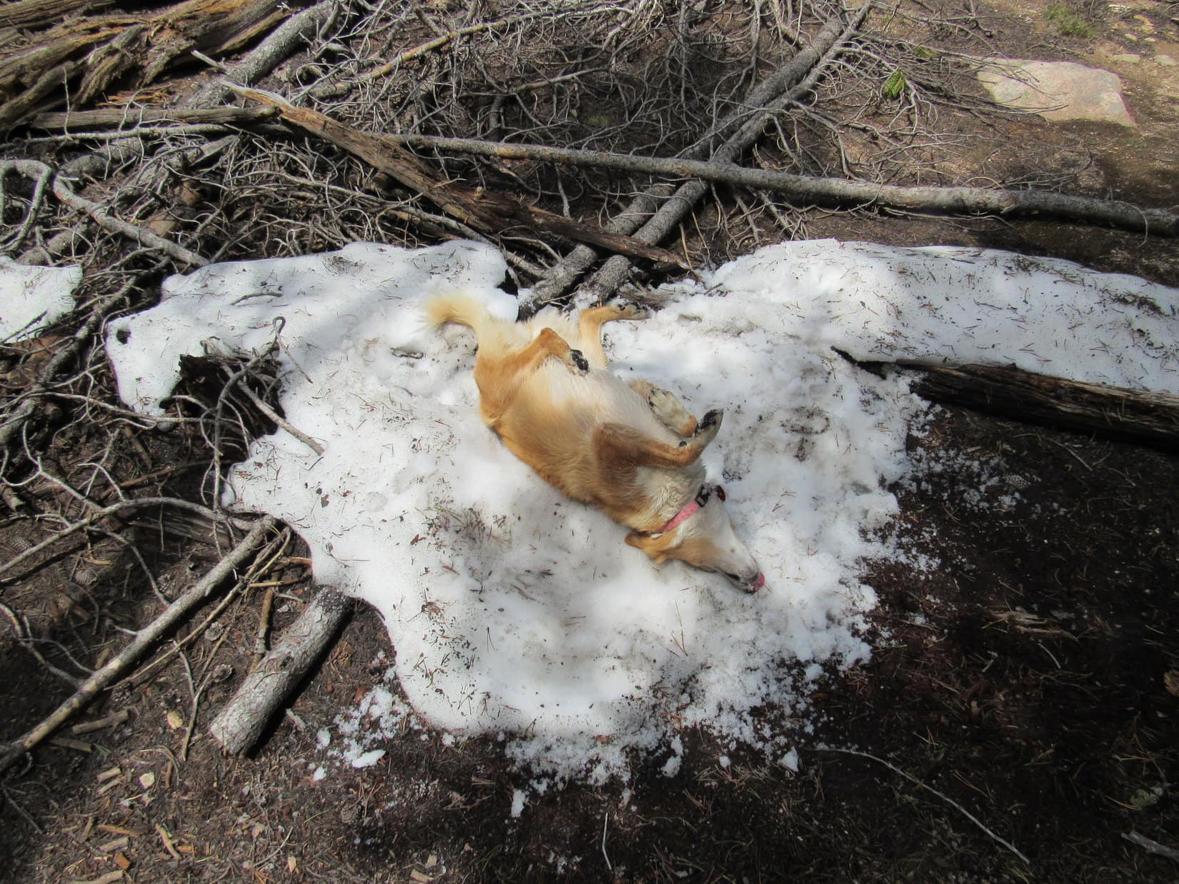
Continuing N, then NE, from this intersection, Lupe had opportunities to get more drinks from big mud puddles left over from yesterday’s rains.  Most were a muddy brown, but a few were clear.  Made no difference to the American Dingo.  Lupe tromped through every puddle, getting a few licks from each one.  Gradually gaining elevation, she was about a mile past the first creek when the road topped out at a second cattle guard.

Albany Peak (L) from the 2nd cattle guard. Photo looks NE.

Sunny and bright, the day was warming up fast.  Thus far, Lupe had been out in the open exposed to direct sun, but a pine forest was now in sight ahead.  Shade was starting to sound good as she trotted toward it.

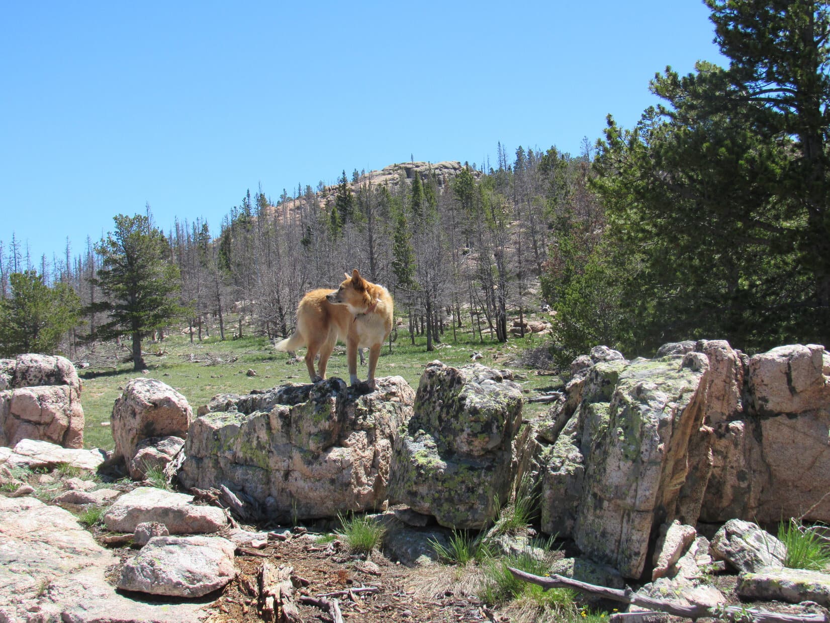
Upon reaching the forest, the pines provided welcome relief from the sun.  When a rock formation appeared slightly off-road in a clearing on the L, Lupe scrambled up onto it for another look at Albany Peak, which was noticeably closer now.  Then it was back to the road, which wound gently down to a second junction with another unmarked road.

Albany Peak (R) from up on the rocks. Photo looks N.
Enjoying the shade of the pines. Photo looks NNE.

Going L at this intersection, Lupe quickly came to a shallow valley S of a very rocky ridge.  From the W, a tiny stream flowed through a big puddle on the road.  A clump of lovely purple wild irises grew just upstream.

At the 2nd stream. Photo looks N.
Wild irises.

It wasn’t much farther to a third unmarked junction.  Staying L again, Lupe headed up to a third minor pass.  Towering rock formations were now visible off to the R (NE).

Heading up to the 3rd minor pass. Photo looks NW.
At the 3rd pass. Photo looks N.

Alrighty!  Starting to get somewhere now, Loopster!

Good news, SPHP!  So, where are we?

Believe we’re on USFS Road No. 650 crossing Albany Peak’s SW ridge.

Follow the ridge from here, SPHP?

Nope.  Way too rocky.  Much easier to stick with this road going N for nearly another mile before turning E somewhere to start our climb.

Which summit are we going for first, SPHP?

The N one, I guess, although Peakbagger.com shows the S summit as the true one.

Either one counts as a success, SPHP?

Yes!  Good enough for Dingo work, Looper!  Unless we see much more of a difference than I expect.

Continuing N past the 3rd minor pass, the road gradually lost elevation.  Once beyond the first big rock formations on the R, it leveled out for a stretch, then resumed a slow climb.  Lupe was out in the open again W of Albany Peak.  Several enormous steep-sided rock ridges were visible way up near the top.

Approaching Albany Peak. Photo looks NNE.

Yikes!  Still looks a little dicey up there, SPHP!

Yeah, I know it.  Was kind of afraid of that.

Nothing to do about it, but keep going.  When an even more primitive spur road appeared that went E right up the slope, Lupe took it.  Closer now, the views above weren’t any more encouraging than they had been from a distance.  The spur road soon curved N, and leveled out.  When it turned NW and started downhill, that was it.

On the rough spur road. N summit (L), S summit (R). Photo looks NE.

Leave the road here, SPHP?

Yup!  This first hillside doesn’t look bad at all.  With a little luck, we can simply walk right on up to the top of the N summit.

About to leave the spur road where it turns NW (L). Photo looks NE.

Abandoning the road, Lupe pushed through a band of young aspens in a ravine, crossing a tiny stream in the process.  A slope partially strewn with rocks and deadfall was ahead.  Aiming L of a towering knob of rock partway up, the American Dingo started her ascent.

Starting up! Albany Peak N summit (R). Photo looks NE.

Pretty easy at first, but the slope steepened considerably as Lupe drew near the towering knob.  Before Lupe even got to it, SPHP was doing a big bad wolf impression, huffing and puffing.

Hold on, Looper!  Let’s take a little break!

What?  Already, SPHP?

Yes.  Been a long time since your last Dingo Vacation.  I’m out of shape!

No worries!  You’ve got all summer now to get back into shape, SPHP.

Yeesh.  Hope it doesn’t take that long!

After a break spent mostly gasping for air while admiring the already lovely views, SPHP was ready to carry on.  The towering knob turned out to be just the lower end of a long wall of rock.  Happy in its shade, Lupe climbed along the NW side of the wall, which steadily shrank in height as she got higher.

The towering knob and wall beyond it. Photo looks NE.

Wasn’t that far, but SPHP was ready for another breather once Lupe got past the upper end of the wall, which simply melted into the rest of the terrain.  Another higher, and much more formidable wall of rock was now in sight.

The next spine of the mountain. Photo looks SSE.

So the upper end of this next wall is the N summit of Albany Peak, SPHP?

Uh-huh.  Sure doesn’t look like we’ll be able to get to the top from this side, though.

Might as well see how high we can go, SPHP.  Maybe there’s a way?

Fat chance from the looks of it, but we’ll see what we can do.  Should have brought your Dingo wings.

N summit of Albany Peak (Center). Photo looks ESE.

Climbing toward the N summit, Lupe was soon scrambling amid a jungle of young aspens springing up from a field of huge talus slabs below the highest part of the rock wall.  The Carolina Dog got quite high, but was eventually stymied at the base of a near vertical chute.

Heading for the N summit. Photo looks ESE.
At the base of the chute. Photo looks up!

Face it, our goose is cooked here, Loop.  If we were decent rock climbers we could do it.

How much higher to the top, SPHP?

Can’t tell for sure, Loopster.  About 50 feet, I think.

Well shucks, SPHP!  So close, and yet so far!  Too bad you’re an indecent rock climber, or I’d send you as my personal representative.

Hah!  Not happening.  Not going to break my fool neck attempting this.  Let’s see if we can work our way around to the other side.

A glance over at what appeared to be the highest rock (R of Center) of the N summit from the NW side. Photo looks S.

Descending NE along the base of the wall of rock, Lupe reached a point where SPHP was able to boost her up onto the ridgeline, then scramble up after her.  The narrow spine of the wall continued a long way NE as it sank toward the Wyoming prairies.  Albany Peak’s S summit was now in view, too.  Another massive, vertical wall of rock, the S summit towered beyond a lower central wall.

Wow!  The S summit is impressive, isn’t it, SPHP?

I’ll say, Looper.  So much so, that it’s depressive.  We’ll never get to the top!

On the NE spine of the N summit. Photo looks NE.
S summit (Center) from the NE spine of the N summit. Photo looks SSE.

Due to a 6 foot drop, SPHP had to scramble down off the SE side of the ridgeline first, then help lower Lupe.  Traipsing S through a region of boulders, bushes, and young aspens, the Carolina Dog managed to get around to a clear view of the N summit from the SE.

Albany Peak’s N summit. Photo looks NNW.

Sheesh!  N summit’s not happening from this side, either, Loopster.  Let’s take another break.

Some cool, gnarly rock formations, aren’t they, SPHP?  A rock climber’s dream!  But yes, let’s take a break.  Bring any water?  It’s hot in the sun!  I’m missing those mud puddles.

After a short water break, Lupe ventured up to the base of the N summit wall, but probably didn’t get any closer to the top than she had from the other side.  Seeing no reasonable route up, SPHP abandoned all hope of a successful N summit ascent.

Hmm, well, I suppose we might as well take a closer look at the S summit, Loop, even though it appears completely impossible for us.

Follow me, SPHP!  We’ll check it out!

Leaping over rocks and deadfall, the American Dingo headed for the central ridge.

Approaching the central ridge between the two summits. Photo looks SE.

Even getting over the central ridge didn’t look feasible.  A gap toward the S end looked like the best way around it.  After passing through the gap, the S summit still appeared every bit as daunting as it had before.

Despite appearances, Lupe continued S.  Eventually turning E, she climbed through another region of young aspens, deadfall, and boulders.

Glancing back at the N summit from the gap. Photo looks N.
Albany Peak’s S summit (R) from beyond the gap. Photo looks ESE.

As the Carolina Dog kept going, the terrain kept steepening.  Climbing above most of the trees and deadfall, suddenly there was hope!  A long, steep slope of bedrock led skyward.

We can do this, SPHP!

My gosh!  It is possible?  Looks like we can go all the way to the top, Loop!

The unexpected, promising route (Center) to the S summit. Photo looks NE.

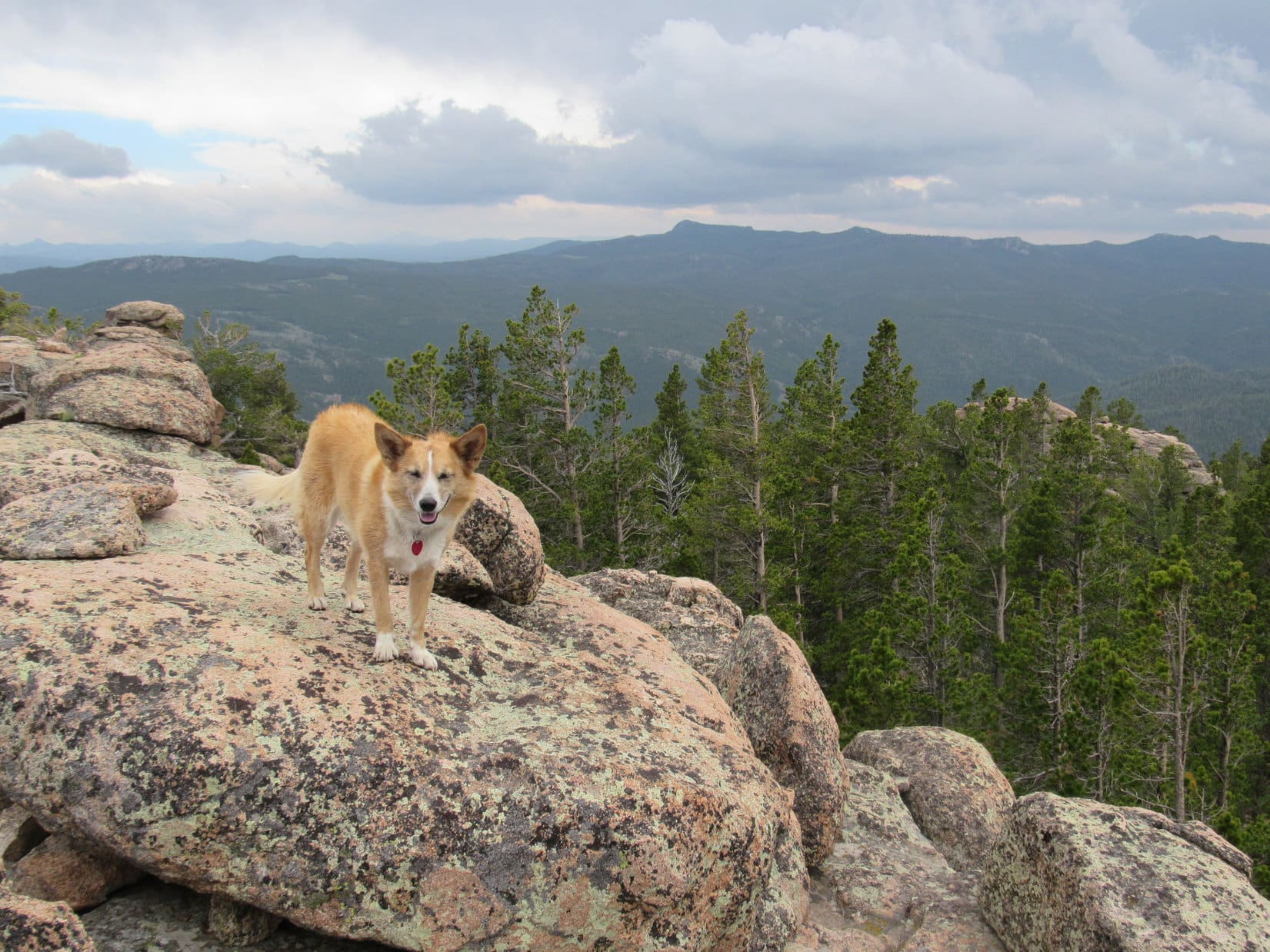
The bedrock got plenty steep.   Paw holds weren’t great in spots.  The rock was just too smooth.  Nevertheless, Lupe had no difficulties at all.  Never even got that scary for SPHP.  Within a few minutes, SPHP was joining the American Dingo up on a nice level area next to a knob of rock that was easy to scramble onto.

6-8-23, 10:53 AM, 74ºF, Albany Peak (7,720 ft.), S summit region –

Unfortunately, there was more to Albany Peak than that knob.  Opposite it, immediately N of the flat area Lupe had reached, a wall of rock rose another 40 or 50 feet that hadn’t been visible from below.  Full of little overhangs, there was clearly no way Lupe could get up there.

Albany Peak’s S summit from the knob. Photo looks NNW.

Dingo feathers!  We’re skunked, Looper!  Tried both sides of both summits, and nothing’s worked.

Don’t worry about it, SPHP!  Can’t win ’em all.  We’ve done our best.  We’ll get to the tops of plenty of mountains on this Dingo Vacation.  At least we had hope for Albany Peak until nearly the very end.  Besides, we can’t have been that far from the true summit, and the views are awesome right here!

True.  Although the wall of rock comprising the S summit blocked views to the N, the Carolina Dog enjoyed sweeping views in other directions.  Laramie Peak (10,272 ft.) 5.5 miles due W was the big standout, with Albany Peak’s long, gnarly SW ridge sloping away in runner-up position.

Laramie Peak (Center) from Albany Peak’s S summit region. Photo looks W.
Laramie Peak (R of Center) beyond Cottonwood Park. Photo looks W.
The S summit’s SW ridge (R). Photo looks S.
Albany Peak’s S summit ridge (L) from up on the knob. Photo looks NNE.

After an initial look around, Lupe went over to the knob searching for a spot to settle in.  Roasting in the sun, she lapped up a bowl of water, then curled up in a cubby hole among the rocks where at least her head was shaded.  By sitting with legs over this grotto, SPHP was able to provide the American Dingo almost complete shade.

Loopster hiding out in her grotto. Photo looks ESE.

Don’t suppose there’s any chance of getting a chocolate coconut bar since we didn’t make it to the top of Albany Peak, is there, SPHP?

None at all, Looper.  As a matter of fact, I forgot to bring them.  They’re still at home!

At home!  That is tragic news, SPHP!  How could on earth could you forget the chocolate coconut bars?

Heh.  No excuse.  Just plain and simple forgot them, but I did remember something else you’ll like.  How about some beef jerky?

Beef jerky proved to be an exceptionally popular substitute for chocolate coconut bars.  Lupe also gobbled down an entire bowl of Taste of the Wild before dozing off.  Meanwhile SPHP drank a Sparkling Ice.

Birds were singing.  At one point there was a strange cry like that of a crane or heron.  SPHP didn’t see any, but did get a glimpse of two giant deers to the SE.  Sunny and warm when Lupe first arrived, cumulus clouds were building, sometimes casting pleasantly cool shade.  Time slipped away.

“Summit” hour is about up, Loopster!  A few more pictures before we go?

Lupe was all for it.  Before departing, she got up on the highest big rock she could easily reach next to the S summit wall, then returned to the top of the knob.

On the big rock next to the S summit wall (R). Photo looks S.
Final moments up on the knob. Photo looks SE.

Satisfied, SPHP?

Yup.  Let’s scoot!  Onward!  Puppy, ho!

The way back. Laramie Peak (R). Photo looks WSW.
Looking down the steep bedrock descent. Photo looks SW.

Although Lupe got down the steep scramble quickly and easily enough, SPHP had to exercise considerable caution.  Once down, the American Dingo took a shortcut heading W back to the spur off USFS Road No. 650.  Part of this region was meadow, but most of it involved pushing through a combination of young aspens, deadfall, and talus of varying degrees of steepness.  All went well.  Once down to the road, Lupe retraced her original route.

By the time she made it back to where the wild irises were growing in the little stream, the sky had almost completely clouded over.  Raindrops began falling as SPHP donned the red rain jacket.  Lupe enjoyed trotting along the winding roads in a cool light rain.  Noticing a wigwam W of USFS Road No. 643, she went to investigate.  By then, the RAV4 wasn’t much farther.

Checking out the wooden wigwam. Photo looks SW.
Nearly back to the RAV4 (Center). Photo looks S.

6-8-23, 2:05 PM, USFS Road No. 643 at Elk Park – 

Albany Peak was fun, SPHP!  Great to be back in the Laramie Mountains!  Still fairly early, what’s next on the agenda?

A bite to eat, then we’re hitting the road, Loop.  We’re on our way to Colorado.  Going to stay at Hotel Mika tonight!

We’re leaving the Laramie Range already, SPHP?  That’s sad!  And what’s this about Hotel Mika?

Yup, afraid we have to leave the Laramie Range, Looper.  At least we got a taste of it again.  Your Uncle Joe and Aunt Andrea are expecting us tonight in Arvada.  Hotel Mika is Hotel Dusty under new management now that both Cousin Dusty and Cousin Laddie are gone.

A cat is running Hotel Dusty now, SPHP?

Yup.  Any objections, Loop?  You’ll still get to stay in the luxurious Cowboy Room tonight!

The Cowboy Room?  Well, what are we waiting for?  Onward!  SPHP, ho!

Driving SE on Fletcher Park Road on the way to I-25, SPHP kept an eye on Albany Peak in the rearview mirror until a cloudburst swept over it, hiding it from view.  Despite never quite getting to the summit, Lupe was right.  Her brief return to the Laramie Range had really been fun!

On the knob near Albany Peak’s S summit, Laramie Mountains, Wyoming 6-8-23
Lupe’s Albany Peak GPS track (return)
In the lap of luxury! Relaxing in the Cowboy Room at Hotel Mika.

Links:

Prior Dingo Vacation                   Next Adventure

Lupe’s Scrollable Albany Peak GPS Track

Laramie Peak, Wyoming (8-9-15)

Black Mountain, Laramie Range, WY (6-8-17)

Jack Squirrel Peak, Laramie Range, WY (6-19-17)

Want more Lupe adventures?  Choose from Lupe’s Summer of 2023 Dingo Vacations to Colorado, New Mexico, Canada & Alaska Adventure Index, Dingo Vacations Adventure Index or Master Adventure Index.  Or subscribe free to new Lupe adventures.

Buffalo Peak & Twin Peaks in the Laramie Mountains of Wyoming (6-12-17 & 6-13-17)

Part 2 of Day 5, plus Day 6 of Lupe’s 2017 Dingo Vacation to the Laramie Range, Wyoming & Beyond!

Reluctantly, Lupe left the huge old squirrel tree at the edge of the beautiful green glade.  She quickly forgot about squirrels, sniffing her way NNE.  The Carolina Dog came to a burned forest, passed through it, and entered another section of live forest where she crossed a dirt road. By the time she reached the W side of the Meadow Creek valley, Loop was back in burned out forest again.

Lupe reaches the burned out forest in the Meadow Creek valley on her way to Buffalo Peak. Photo looks N.

After having a great time climbing nearby Squaw Mountain (9,313 ft.) earlier in the day, Loop was on her way to Buffalo Peak (9,387 ft.).  The summit was now less than a mile to the NE.  Unfortunately, the weather was deteriorating.  Clouds were moving in.  A sudden wind arose, and distant thunder could be heard.  Better take cover, but where?

Glancing around, SPHP spotted a square recess in a big rock formation.  The opening appeared to have a bit of an overhang.  The recess was 70 feet higher up a moderately steep slope to the SW.  Lupe could hide out there until this squall passed.

No other option was readily available.  Loop and SPHP climbed the slope up to the square recess.  The opening was large enough to accommodate both Lupe and SPHP, with sufficient overhanging rock to provide decent protection from rain or hail.  Sweet!

Lupe at the square recess in the rock where she would take shelter from the storm. Photo looks W.

While the American Dingo watched from the safety of the square recess in the rock, storm clouds swept across the sky from the SE.  Only a small patch of blue sky remained to the N.  Lupe saw a single bolt of lightning miles to the E.  An eerie, angry buzzing or humming sound filled the whole valley.  The peculiar noise went on and on.

The wind blowing among the dead trees must be making that strange sound!  From here, Lupe could see nothing but burnt forest in Meadow Creek valley.  On the other side of the valley, the entire SW face of Buffalo Peak had burned, too.

Thunder rumbled constantly.  While Lupe waited for the storm to hit, SPHP had plenty of time to check maps and study the SW face of Buffalo Peak.  The plan had been to go N up the Meadow Creek valley, gradually turning NE.  When Lupe got high enough she would turn SE, approaching the mountain from the NW.  The topo map seemed to suggest this would be the easiest way up.

However, the SW face of Buffalo Peak didn’t look all that bad.  It appeared Lupe might be able to go right on up a long, wide slope between two large rock ridges.  Above this wide chute, she would need to turn E to reach the top of the mountain, but that looked feasible from down here, too.

From her square recess in the rocks, Lupe could see the whole SW face of Buffalo Peak. SPHP thought she could probably climb the mountain from this direction, instead of circling around to the NW as originally planned. Photo looks NE.

After a huge, suspenseful buildup, nothing happened.  No hail, no rain – not even a drop.  The distant thunder and the odd buzzing sound both faded away as storm clouds sailed off to the NW.  Blue skies returned.  Buffalo Peak was in sunshine.  More than 40 minutes had gone by.  This was her chance!  Lupe had better get going!

The American Dingo headed NE down into the valley.  She crossed Meadow Creek, which was only a small stream.  Soon she reached the base of the long slope up the SW face of Buffalo Peak.  Even from here, it didn’t look bad.

Lupe began climbing.  The long chute was very wide, bordered by large rock formations on both sides.  At first, Looper encountered quite a lot of deadfall timber.  Higher up, less deadfall existed.  The slope was steep, but not at all scary.  Lupe traversed a mix of bare ground, scattered yellow flowers, and numerous small to medium-sized loose rocks.

The American Dingo made great progress, especially after SPHP got above the worst of the deadfall.  Lupe made it up to the top of the long chute.  She now needed to angle more to the E.  What appeared to be Buffalo Peak’s summit was still a good 300 feet higher.  Getting up there looked somewhat more complicated from here than it had appeared from below.  However, Lupe was able to gain elevation traveling ENE below a high ridge of rock.

Lupe near the upper end of the long steep slope she climbed from the SW. From here, she gained elevation traveling ENE (R) through more complicated rocky terrain than expected. Photo looks N.

Shortly after reaching the upper end of the SW chute, it became clear another squall was on the way.  More clouds were approaching rapidly, blown in on a strong SE breeze.  No lightning was seen, but initially faint thunder grew steadily louder.  Time to seek refuge again!

A great many large rocks were in the area, but places to hide beneath an overhang were scarce.  Lupe and SPHP scouted out possibilities with increasing urgency.  A couple of tight spots were all that could be found.  SPHP stuffed the backpack beneath a small overhang.  Loop and SPHP jammed together into a different barely large enough space under a big rock nearby.

As another squall approached, Lupe and SPHP searched for a place to take shelter. Lupe and SPHP wound up jammed together in the small space under the rock seen to the L of Lupe. Photo looks SSE.

Wind blew.  Thunder rumbled, but no lighting was seen.  A series of threatening clouds raced by.  From the cramped space, SPHP had a glimpse of wild-looking clouds and blue sky far to the S.

Ho hum.  Dullsville.  Lupe had gotten used to this routine.  She dozed on SPHP’s lap, waiting for the squall to pass.

In cramped quarters under a large rock, Lupe dozes on SPHP’s lap, while waiting for the storm to pass.

Eventually, the distant blue sky to the S appeared to be heading this way.  Once again, not a drop of rain, despite all the sound and fury!  When thunder could no longer be heard, and sunshine reached Squaw Mountain 1.5 miles away, Lupe and SPHP clambered out from under the boulder.

With skies starting to clear again, Lupe emerged from beneath the boulder she’s standing on to resume her ascent of Buffalo Peak. Photo looks NE.

Another 30 minutes had been lost.  The summit of Buffalo Peak was still 200 feet higher.  Lupe resumed her ascent.

Within 10 minutes, the American Dingo had scrambled up enough boulders to reach a large amphitheater where the ground sloped toward the NW.  The amphitheater contained burnt trees, quite a few large low rocks, and a fair amount of bare earth with little vegetation.  Around the perimeter were 3 large ridges of rock, with openings to the SW and NW.

Lupe reaches the amphitheater near the top of Buffalo Peak. The true summit is unseen a short distance beyond the high rocks on the L. Photo looks N.

Of the 3 high points on the rocky ridges around the amphitheater, the lowest was clearly the one to the SW.  From below, the one to the SE had appeared to be the mountain’s summit.  However, from the amphitheater it looked fairly certain the large ridge to the N was actually highest.

Lupe went to check out the SE ridge first, in case part of it was hidden from view.  The possibility that the true summit was over here hadn’t been completely ruled out yet.  As soon as Loop got up on top, though, it was clear this was not the true summit.  Nevertheless, the views were awesome!

Loop reaches the top of Buffalo Peak’s SE high point. This turned out not to be the true summit. Photo looks NE.
Retreating clouds make for a dramatic scene from Buffalo Peak’s SE high point. Photo looks NNE.
Squaw Mountain (9,313 ft.) (Center) is the high burnt ridge to the R of Lupe. The much more distant high point seen above her rump is Warbonnet Peak (9,414 ft.). Photo looks SE.
The lower SW ridge is in view on the R. The territory Lupe had come up through to reach the amphitheater from the SW is seen on the R. Photo looks SW.
The summit of Buffalo Peak as seen from the SE high point. Photo looks NNW.

From the high point on the SE ridge, the true summit of Buffalo Peak was clearly seen off to the NNW.  Lupe had to get over there to claim her peakbagging success.  Off Lupe went.  A scramble up from the SE was easily accomplished.  The mighty Carolina Dog stood at the very top of Buffalo Peak (9,387 ft.)!

Loop stands on the true summit of Buffalo Peak. Photo looks NW.
Lupe’s odd summit stance makes the situation look much more precarious than it actually was.
Looking N from the true summit.
Buffalo Peak’s SE high point is seen beyond Lupe. Squaw Mountain is the long, high burnt ridge even farther away. The plastic jar by the summit rock on the R contained a registry. Photo looks SSE.

A plastic jar tucked next to the two highest rocks on the mountain contained a registry.  Six people ranging from 10 to 64 years old had made the trek up Buffalo Peak and started the registry on Memorial Day, 2013.  Since then, only one other person had signed in on 7-12-16.  Naturally, Lupe’s name got added.

The Buffalo Peak registry had gotten off to a good start on Memorial Day, 2013, but had seen little use since then.

It was a good thing Lupe made it to the top of Buffalo Peak when she did.  Before long, the weather was deteriorating again.  The entire sky grew dark.  Distant peaks disappeared in a soft, gray haze.  Nearby peaks could still be seen clearly, except when wisps of fog streamed by on the relentless SE breeze.  Thunder roared threats from afar.

SPHP started down first.  At the top of Buffalo Peak, Lupe stood alone in the wind waiting for the signal to come.

Alone on Buffalo Peak waiting for the signal to follow SPHP down. Photo looks NW.

The signal was given.  Lupe bounded down.  Now it was a race against the storm!  She scrambled down to the amphitheater of dead trees, crossed it heading S, and started descending the mountain’s SW slope.  Loop hadn’t lost much elevation before it was necessary to hide again.

Another overhanging rock was found to squeeze in beneath.  This time there was room for the backpack, too.  Lupe and SPHP waited.  No blue sky could be seen, only a light band of weird yellow sky on the SW horizon.  The wind picked up. Sprinkles of rain dashed against the rocks.

Under the rock, waiting out the latest storm threat on the descent.

Thunder echoed closer than before, but Lupe remained calm.  She dozed while SPHP stroked her warm fur and soft ears.  It rained harder.  Water began dripping into Lupe’s refuge, ultimately becoming a steady stream.  The Carolina Dog curled up on SPHP’s lap, comfortable and dry, while SPHP sat on increasingly muddy ground.

Half an hour passed with no changes.  How long was this going to go on?  The Carolina Dog might be fine here, but SPHP was not looking forward to a long night crammed under a rock.  That was what it would come down to if the storm didn’t let up.  Getting drenched didn’t seem like a good plan either.  Better stay as dry as possible.  No reasonable choice other than to wait it out.

An hour went by.  It began to hail.  Nothing major.  Pea-sized hailstones ricocheted off nearby rocks.  A few struck stinging glancing blows, but did no real damage.  Fun, fun!

After 10 minutes, the hail let up.  It had been the storm’s last hurrah.  A SE breeze remained, but now the sky was clearing again.  Not a moment too soon, either.  The sun was getting low.  Better make tracks.  Lupe and SPHP set off down Buffalo Peak, retracing the Carolina Dog’s earlier route up.

A profusion of yellow wildflowers like these grew on the slopes of Buffalo Peak.

The sun was still up when Lupe reached the top of the long, wide SW chute leading down to the Meadow Creek valley.  By the time she reached the worst of the deadfall timber at the lower end of the slope, sunlight remained only high up on Squaw Mountain.

The sun was still up as Lupe began her descent of the wide, SW chute leading to the Meadow Creek valley. Photo looks SW.

Puppy, ho!  Onward!  No time to lose.  Lupe crossed Meadow Creek again, and turned S.  As twilight weakened, she passed through the burnt forest and reached the live forest.  A dark, shady gloom prevailed.  Lupe kept going.  Across the dirt road, out of the gloom, and into another burnt forest.

Little light remained by the time Lupe made it back to the gnarled old squirrel tree.  The tent and sleeping bags hung in it were only slightly damp.  At least that had worked.  In almost total darkness, SPHP pitched Lupe’s “tiny house” beneath a starry sky.  What a day it had been!  Sweet success!  Lupe had managed to climb both Squaw Mountain (9,313 ft.) and Buffalo Peak (9,387 ft.).

Once safely inside her “tiny house”, Lupe was ravenous.  She gobbled down her Alpo, before curling up on her red sleeping bag.  In no time, she was out like a light.  (End of Day 5)

It was a cold night.  The wind blew for hours, yet the American Dingo hardly stirred.  When she did, SPHP kept wrapping the red sleeping bag over her for warmth.  She must have snoozed well, much better than SPHP.  When dawn arrived, Loopster was ready for action.  She demanded to be let out!

No problem.  Loop wouldn’t run off, not with a giant squirrel tree right outside.  SPHP unzipped the tent door.  Out she went.  An excited yipping and yapping commenced immediately.  The squirrel tree hadn’t failed her.  An annoyed squirrel scolded the Carolina Dog for rudely breaking the early peace and tranquility of the new day.  The scolding only egged her on.

The excitement finally died down and became an occasional thing.  SPHP dozed fitfully for another 2 hours, checking on Looper every so often.  She was always there, waiting and watching beneath the huge squirrel tree.

The sun was well up by the time SPHP managed to spring back to life.  A stroll out in the sunny green glade to take off the morning chill was in order.  The warm sunlight felt good.

Lupe next to her “tiny house” at the edge of the green glade. The huge squirrel tree is beyond her. Photo looks N.
In the warm sunshine of the green glade. Photo looks S.

The original plan had been for Lupe to climb Buffalo Peak today, but she’d already done it.  Fortunately, there was something else fun to do on the way back to the G6.  Looper could climb Twin Peaks (9,280 ft.) again.  Twin Peaks was the mountain Lupe had climbed a year ago where she’d first spotted Squaw Mountain and Buffalo Peak.

Lupe stood guard at the base of the squirrel tree while SPHP packed everything up.  When all was ready, Loop had to leave the squirrels in peace.  She didn’t mind.  By now she was ready for more exploring.  She crossed the green glade heading S and entered the forest.

Back in the forest.

It was 2 miles back to the minor pass S of the big rock formation close to where Lupe had left Twin Peaks Trail No. 618 yesterday.  On the way, Loop stayed W of the route she had taken to Squaw Mountain.  Much of the time she was in forest, but a brighter, more open forest than she’d been in before.

Loop made it back to the minor pass.  SPHP ditched the tent and sleeping bags near some rocks.  The Twin Peaks summit was only 0.5 mile S from here.  Lupe crossed Twin Peaks Trail No. 618 and took off into the forest again, starting her ascent. At first, she had only the forest and deadfall timber to contend with.  Higher up, she reached rock formations, much steeper ground, and even some snow.

On the way up Twin Peaks, Lupe reaches rockier territory and even some snow. Photo looks SSW.

The Carolina Dog came to a rocky high point SPHP recognized from last year.  As she continued higher, the mountain seemed more and more familiar.  For the most part, Lupe took a more direct route straight up from the N this time.  She didn’t scramble up onto the same NW ridge she had approached from last year until very near the summit.

On the way up the N slope, the NW ridge protected Loopster from the weather.  Upon attaining the summit, however, she was exposed to the full force of a gale blowing out of the SW.  Puffy white clouds floated swiftly by.  The sky was mostly blue, and the day sunny, but it wasn’t warm or relaxing up here.

Lupe detested the wind.  She stood on the summit long enough for a short photo session.  After that, SPHP could gaze at the views without her.  Loop hid down in a grassy slot between some of the highest rocks where she was at least partly sheltered from the relentless, stiff breeze.  The American Dingo had some sense, even if SPHP did not.

Lupe stands on the tip top rock on Twin Peaks (9,280 ft.) again for the first time in a year and 12 days. It was windy! Squaw Mountain (9,313 ft.), which Lupe had climbed yesterday is seen on the L. Photo looks NE.
Part of Squaw Mountain (Center) is seen near Lupe’s forehead. Buffalo Peak (9,387 ft.) is the barren rounded peak a little to the L. Photo looks NE.
Laramie Peak (10,272 ft.) (Center) is the most distant high point. Warbonnet Peak (9,414 ft.) is the highest point closer by on the R. Photo looks SE.
A Carolina Dog leans into the stiff SW gale up on the summit of Twin Peaks. Photo looks E.
Loopster takes shelter from the roaring SW wind in the slot between Twin Peak’s summit rocks. The open end of the slot faces W, so the protection wasn’t perfect, but it was a lot better than standing up on top of these same rocks. Photo looks E.

The views from Twin Peaks were fabulous!  Seeing them again was great fun, especially looking over at Squaw Mountain and Buffalo Peak now that Lupe had been to both.  While Lupe hid out, SPHP endured the gale a little longer.

Looking W. The very last part of Lupe’s ascent was from this direction.
It was especially fun seeing Buffalo Peak (L) and Squaw Mountain (R) from Twin Peaks again now that Lupe had climbed both! Photo looks NE.
The valley Lupe would travel through on her way back to the Twin Peaks trailhead is seen below. Squaw Mountain is on the L. Photo looks ENE.
Buck Peak (9,061 ft.) is the conical mountain at Center. Photo looks NNW.

It was a shame it was so windy up on Twin Peaks, but SPHP was glad Lupe had returned.  Still, 20 minutes of this gale, and even SPHP was ready to retreat.  Lupe was more than happy to start the descent.  She definitely preferred roaming the forest to the conditions at the top.

Heading down the N slope of Twin Peaks. Lupe much preferred the forest where she was sheltered from the wind. Finding hidden snowbanks like this one was an added bonus!

Looper returned to the minor pass N of Twin Peaks.  SPHP retrieved the tent and sleeping bags.  Together, Lupe and SPHP started E back down Twin Peaks Trail No. 618.

At 2:19 PM, Loop arrived back at the trailhead.  After a bite to eat, both Lupe and SPHP were overcome with weariness.  Adventuring can take it out of you!  Nothing wrong with taking a nap, is there?

Naptime lasted nearly 3 hours.  When she awoke, Lupe’s adventures in the Laramie Mountains were about over for now.  During the last 6 days, she’d had peakbagging successes and failures, spent countless hours sniffing and exploring, seen many beautiful things, and even faced some dangers.  As wonderful as it had all been, the moment had come to move on.

On the way back to Douglas, Lupe rode with her head out the window of the G6, barking vigorously and happily at everything she saw along the way.  SPHP stopped at several scenic spots. The SW wind still blew hard, but that didn’t detract from the beautiful western scenery.

Near Bear Rock along Cold Springs Road, Lupe faces into the sun and SW wind. Photo looks NE.
Lupe on her way back to Douglas, WY. She’s leaving behind adventures in some truly beautiful territory. Bear Rock (L), Squaw Mountain (Center) and Buffalo Peak (R). Photo looks SW.
Bear Rock seen through the telephoto lens. Photo looks SW.
A pronghorn antelope dashes away across the rolling high plains. Lupe loves watching antelope run!
Lupe stopped by the fancy entrance to the gorgeous Powderhorn Ranch. Buffalo Peak (Center) is in the distance. Photo looks SW.
The Powderhorn Ranch SW of Douglas, WY. Buffalo Peak (L) in the distance. Photo looks SW with help from the telephoto lens.

Upon reaching Douglas, WY, Lupe and SPHP headed W on I-25.  A side trip S to Ayer’s Natural Bridge ended in disappointment.  A sign said the park closes at 5 PM, and it was more than an hour later than that.  Didn’t matter.  The sign also said no pets allowed.  Oh, well.

Lupe was happy anyway, barking at the buffalo she saw from the G6 in a big field along the gravel road.

Buffalo near the road to Ayer’s Natural Bridge.

Back at I-25, SPHP drove W.  Bright-eyed Lupe rode up even with the dash, comfy on her pile of pillows and blankets.  With the Laramie Mountains to the S, and high plains to the N, the sinking sun shone upon her eager face.  Loop was on the road to adventure once more!  Tomorrow she’d be in unexplored territory beyond the Laramie Range.

Links:

Next Adventure                      Prior Adventure

Part 1: Squaw Mountain, Laramie Range, Wyoming (6-12-17)

Twin Peaks, Laramie Mountains, Wyoming (6-1-16)

Want more Lupe adventures?  Choose from Lupe’s 2017 Laramie Range, Wyoming & Beyond Adventure IndexDingo Vacations Adventure Index or Master Adventure Index.  Or subscribe free to new Lupe adventures.

Squaw Mountain, Laramie Range, Wyoming (6-12-17)

Day 5, Part 1, of Lupe’s 2017 Dingo Vacation to the Laramie Range in Wyoming & Beyond!

What a glorious day!  Spirits were soaring as Lupe and SPHP left the Twin Peaks trailhead on Trail No. 618 (7:14 AM, 59°F).  The lucky American Dingo was setting off on a 2-day trek to a couple of fabulous peaks she’d seen for the first time a year ago when she’d taken this same trail and climbed Twin Peaks (9,280 ft.).

A lucky American Dingo about to set off on Twin Peaks Trail No. 618 for a couple of beautiful peaks in the Laramie Range.

Trail No. 618 started off as an old jeep trail that headed W up a rise.  The E end of Lupe’s first peakbagging goal, Squaw Mountain (9,313 ft.), was soon in sight ahead.

Squaw Mountain (Center) came into view shortly after Lupe left the trailhead. Photo looks NW.

Even though the summit of Squaw Mountain was less than 2 miles WNW of the trailhead, Lupe was going to have to travel a lot farther than that to get there.  According to the topo map, the easiest way up was from the NW.  The plan was to circle more than halfway around the mountain to approach it from those NW slopes.

Loop wasn’t the least bit worried about how far it was to Squaw Mountain.  She was just looking forward to a fun time exploring.  On this long day in early June, the Carolina Dog would have plenty of time to get to the top of the mountain.

The jeep trail passed over the small rise, then dipped down close to Roaring Fork Creek.  Lupe couldn’t resist going in for a cool drink.

Looper cools her paws off in Roaring Fork Creek.

Although there were a few muddy areas along Trail No. 618, it never did cross Roaring Fork Creek.  Instead, the trail went W up a deep, forested valley staying a little S of the creek.  After a mile or so, the jeep trail turned SW heading up a steep slope.  At the base of the slope, Trail No. 618 veered off to the R, becoming a single track going down a much smaller slope almost to the edge of Roaring Fork Creek again.

Lupe stayed on Trail No. 618, continuing W up the valley.  Now that the wider jeep trail had been left behind, it really did seem like Lupe was in a wilderness.

On Trail No. 618 after it left the much wider jeep trail behind. Now it really did seem like Lupe was in the wilderness!

Lupe knew what to expect, though.  She had been this far before.  Lupe continued along No. 618, which stayed relatively close to Roaring Fork Creek.

Before long, Lupe arrived at a fence with a sign saying “Please! Close the Gate”.  A year ago, SPHP hadn’t seen a gate to close, just the fence, which ended right over the trail next to some rocks.  Puzzled, Lupe and SPHP had climbed up onto the rocks to get around the end of the fence.

Not a thing had changed, but this time SPHP had a hunch.  Doh!  Yes, the entire fence across the trail was a gate.  It swung open without much effort.

How about that, Loop?  Learn something new every day!

Having a year to think about it helped, aye?  Glad you passed the intelligence test this time around, SPHP!

Just call me Einstein and keep going, smart-alecky Dingo.

Lupe on the rocks at the site of SPHP’s intelligence test success.

Eventually, Trail No. 618 moved farther away from Roaring Fork Creek and began to fade.  A few cairns helped show the way.  Sometimes sticks had been placed across what otherwise might have looked like the route.  The surest way of being certain Lupe was still on the trail was to watch for blazes on the trees.  Generally there were two blazes, a small upper one with a larger blaze below.

Trail No. 618 eventually began to fade. A few cairns like this one helped show the way.
Blazes on the trees, like the ones on the tree on the R, became the most reliable way of following seldom-used Trail No. 618.

About a mile after it became single track, Trail No. 618 angled SW leaving Roaring Fork Creek behind.  SPHP expected it to continue SW to a minor pass about 0.6 mile farther on.  A year ago, Lupe had followed this same trail to that pass.

However, after going SW for 0.25 mile, this time the trail turned SE and kept going that way.  Something was wrong.  SPHP kept expecting the trail to bend back around to the W, but it didn’t.  Hmmm.  SE was definitely the wrong way.

SPHP had been watching for, and caught a glimpse of, a tall rock formation that SPHP remembered was immediately N of the minor pass.  May as well head straight for it.  Lupe left whatever trail she was on, going W through the forest.  She soon came across another trail, which must have been No. 618, because it went the right way.

Lupe made it to the minor pass.

Lupe arrives at the minor pass. The tall rock formation just N of Trail No. 618 is in view. A year ago, Lupe had gone 0.5 mile S from here to climb Twin Peaks (9,280 ft.). This time she needed to go N around the W end of Squaw Mountain. Photo looks N.

A year ago, Lupe had gone S from here to climb Twin Peaks, the summit of which was only 0.5 mile away.  After a successful ascent, Lupe had come back down to this pass, crossed over No. 618, and proceeded N around the E side of the tall rock formation.  She’d gone quite a distance bushwhacking through forests and bogs, but had never made it to the W end of Squaw Mountain before she ran out of time and had to turn back.

Last year’s march through the forests and bogs had been intriguing, but maybe there was an easier way?  From up on Twin Peaks, Lupe and SPHP had seen large meadows in the valley W of this pass.  SPHP didn’t remember how far N they went, but looking for the meadows seemed like a good idea.

Lupe followed No. 618 going W over the minor pass.  The topo map showed the trail continuing W, but Lupe needed to start turning N.  Once she’d lost a little elevation, the Carolina Dog left No. 618 heading NW through the forest.  From here on, she wouldn’t have any roads or trails to follow the rest of the way up Squaw Mountain.

That suited Looper just fine.  American Dingoes love exploring off trail!  Lupe raced through the forest sniffing like a Dingo possessed.  She soon sniffed her way far enough NW to arrive at one of the big meadows she had seen a year ago from the top of Twin Peaks.

Lupe arrives at one of the big meadows she had seen a year ago from the summit of Twin Peaks. Photo looks SW.

The big meadow meant easy traveling, much easier than going through the forest.  SPHP had hoped the meadow would extend a long way N, but was disappointed to see it didn’t go much farther that way.  A short stroll brought Loop to the NE corner of the meadow.

Squaw Mountain wasn’t even in sight, but there was no other choice.  Without the slightest hesitation, Lupe plunged headlong back into the forest.  She traveled N or NNE through rolling terrain slowly gaining elevation along the way.

For close to a mile, there was no sign of Squaw Mountain.  Looper had never been here before, and it seemed like she had been wandering the forest for a long time.  Presently, though, she saw a creek to the E at the base of an embankment.  She scrambled down, leapt over the little creek, and found herself on the W side of another meadow of bright green grass.

To the ENE was another tall rock formation.  That had to be the W end of Squaw Mountain!  Lupe had just crossed Roaring Fork Creek, which was much smaller up here.  Hah!  Progress!

After a mile long trek through the forest, Lupe crossed Roaring Fork Creek and arrived at this meadow of bright green grass. The rock formation seen ahead is the W end of Squaw Mountain. Photo looks NE.

The meadow of bright green grass was only a few hundred feet wide, but extended NNE for a long way.  Perfect!  Just the direction Lupe needed to go from here.

Actually, it wasn’t so perfect.  The bright green meadow quickly proved to be mostly bog.  The ground was soft, wet and mucky.  Standing water was here, there and everywhere.  Not good!

SPHP led Lupe across the bog the shortest and driest way possible.  Back into the forest!  The forest on the E side of the bog was dense, but without much deadfall, so it wasn’t too bad to go through.  Lupe had a blast!  She thought this place was great.  She explored this way and that.  Whenever she felt like it, she wandered over into the bog for a drink.

Sniffing around in the dense forest somewhere between the W end of Squaw Mountain and the bog E of Roaring Fork Creek. Photo looks N, but the view was the essentially the same in all directions.
A very busy Carolina Dog passes by again. Loopster loved this place!

The dense forest was nearly level near the bog, but Lupe eventually got far enough N to where she needed to start angling NE.  Once she left the bog behind, the terrain started rising and became rougher.  Lupe continued on until she was NW of Squaw Mountain.

This was supposed to be the easiest side of the mountain to go up.  Lupe turned SE to begin her ascent, but soon faced a jumble of large boulders on a still densely forested and now much steeper slope.  Deadfall timber was more abundant here, too, creating more obstacles.  How tough was this going to get?  For a while, progress was slow.

After gaining a couple hundred feet, Lupe found the terrain wasn’t as steep as before.  Fewer large boulders were in the way.  The forest wasn’t as dense, either.  SPHP found it much easier to maneuver around.

The topo map showed there was no rush to reach Squaw Mountain’s main E/W ridgeline.  Reaching the top of it too far W meant Lupe would have to go over a couple of potentially rough high points.  The Carolina Dog would likely have an easier time angling gradually up the N side of the mountain traveling ESE.  If she could reach the ridgeline about halfway to the E, that should be perfect.  From there, it shouldn’t be too hard to get to the summit at the far E end.

Lupe went E for a little while climbing more slowly, and unexpectedly arrived at the edge of the living forest.  Ahead the entire forest had burned.  The vast majority of the dead trees were still standing.  The burnt forest wasn’t pretty, but it was certainly easier to see the terrain.  Loop didn’t care for the dead forest nearly as much as the living one, but it made the trek easier for SPHP.

Coming up from the NW, Lupe discovered that most of the forest on the N slopes of Squaw Mountain had burned. The American Dingo didn’t like the burnt forest as much as the living one, but it was easier for SPHP to traverse and see what was ahead. Photo looks ESE.

Lupe arrived at what seemed to be the ridgeline a little E of a tall rock formation.  There were a few live trees here.  The forest hadn’t burned at all on a nearby slope to the SE which rose steeply toward an unseen high point still far above where Lupe was.

Lupe near the base of the tall rock formation. This point seemed to be somewhere up on the main E/W ridge, but still too far W. A forested slope to the SE rose steeply to much higher terrain. Photo looks WNW.

A patch of ground E of the tall rock formation was level and not rocky.  Lupe was going to have to camp somewhere tonight.  Maybe this wasn’t such a bad place?  After pondering for a couple minutes, SPHP decided against leaving the tent and sleeping bags here.  It might be hard to find this place again, and it was still quite early in the day.

Lupe pushed on, continuing E or ESE through the burned forest.  She did not climb through the living forest leading to the much higher point to the SE.  Instead she stayed to the N until she was past it, trying to avoid gaining too much elevation too soon.

The American Dingo was still steadily gaining some elevation, though.  After a while, Looper was clearly getting quite high on the mountain.  Shortly before reaching the main summit ridge, Lupe found something that delighted her – snow!

Nearing Squaw Mountain’s summit ridge, Lupe was delighted to find these snow banks on the N side of more large rock formations.

Lupe did a little slipping, sliding and sledding on the soft, deliciously cold snowbanks.  No doubt it was refreshing.  Loop was clearly pleased with the experience and somewhat re-energized.

Squaw Mountain’s main E/W ridge wasn’t far off now.  Beyond the snowbanks, Lupe turned SE climbing more aggressively.  Reaching the ridge was easy, and she was soon there.

Lupe had reached the main ridge at a great point.  She was well past the high point she had skirted to the N.  It’s rocky summit was now in view a little off to the W.  Lupe had saved some unnecessary elevation gain by going around it.  Squaw Mountain’s true summit was still unseen somewhere off to the E, but the path to it looked open and easy.

The main ridge was level and several hundred feet wide here.  Toward the N, the trees had burned.  However, the S half of the ridge was all living forest.  This was a good place to take a break.  Lupe found a spot in the shade to lay down.  She had her usual fare of Taste of the Wild and water.  SPHP dropped the tent and sleeping bags.  This place would be easy enough to find again.  Maybe Lupe should camp here?

Loop takes a break in the shade up on Squaw Mountain’s main E/W ridge. Photo looks E in the direction of the still unseen summit.

When her break was over, Lupe traveled E along the broad ridge staying near, but not in, the living forest.  She soon came to a N/S running line of boulders.  Up ahead a much larger rock formation was in sight.  Was that the summit?  Lupe pressed on toward it.

Heading E along the main ridge, Lupe reaches a line of boulders. Beyond it, a much larger rock formation was in sight. Was that the summit? Photo looks ENE.

The Carolina Dog climbed a broad, thinly forested slope between the big rock formation and a smaller one to the S.  The high point she had seen from the line of boulders wasn’t the summit, but part of a ridge of solid rock that went even higher.  Lupe got up on the smaller rock formation for a better look.

A path led toward a wall of rock roughly 40 feet high.  The wall appeared to extend NW/SE across the entire main ridge.  The high point on the wall might well be Squaw Mountain’s summit, but was there even a way up onto it?  Who knew?

No one yet, but Lupe was about to find out!  She took the path leading to the wall of rock.

After coming up the slope on the L, Lupe got on this smaller rock formation for a better look at the 40 foot high rock wall ahead. A path led toward it. Lupe took the path to go see if she could find a way up. Photo looks NE.

The path ended at the base of the rock wall.  There was certainly no way up that Loop or SPHP could manage from here.  Lupe headed SE along the wall, looking for some sort of a break providing a route to the top.  She came to a place where a big knob of rock sat up on top of the wall.  It looked like there was a place right next to it where Lupe could scramble up with a little help from SPHP.

After following the rock wall SE, Lupe arrived here. If SPHP would give her a boost, it looked like she could get up on top of the wall right next to the large knob of rock seen on the R. Photo looks ENE.

Lupe climbed as high as she possibly could.  SPHP then gave her a boost up the last few feet.  She’d made it!  Lupe was up on the rock wall.  SPHP scrambled up after her.  A quick look around revealed a couple of surprises.

Lupe stands near the big knob on top of the rock wall. A couple of surprises were immediately evident up here. Photo looks SE.

First of all, SPHP had expected Lupe might be able to simply walk NW back along the top of the rock wall to the highest rocks to claim a peakbagging success.  She could go that way, alright, but Squaw Mountain’s summit wasn’t over there.  Lupe could now see the summit, but it was some distance away off to the ENE.  She still had farther to go.

You mean we still have to go way over there? …. Afraid so, Looper, looks like that’s the true summit of Squaw Mountain. Come on, it’s not that far. You’ll be there in a jiffy! Photo looks ENE.

The second surprise was that if Loop had only gone a little farther SE along the base of this rock wall, there was an opening where she could have easily gotten past it without having to climb up on top.  Oh, well!  At least that was news she could use on the way back.

There didn’t seem to be any reason to dilly dally around on the rock wall.  It was easy to get down off the NE side of it.  Once down, Lupe trotted through the forest heading ENE toward the summit.  She discovered a couple of fun things to do along the way.

Lupe dug furiously at the base of a tree for several minutes.  She didn’t turn up anything, but the American Dingo left the freshly undermined tree looking quite cheerful.  Apparently, digging like that had been a good time.  Loop also found a few more small patches of snow.  They were melting fast, even in the shade.  Lupe availed herself of these opportunities to cool off again.

It really wasn’t that far from the rock wall to the true summit, only a few hundred yards.  A short, easy scramble up white rocks brought Lupe to the summit of Squaw Mountain (9,313 ft.).  At the very top, a white rock about 3 feet high leaned at a steep angle.  Loop bounded up in a single leap.  Sweet success!

Lupe on the highest rock on Squaw Mountain. Another peakbagging success! Photo looks NE.

The trek up Squaw Mountain had been really fun!  The views at the top were rewarding, too.  A few trees existed around the summit area, but not enough to block the views.  By moving around a bit, it was possible to get a clear view in any desired direction.

Climbing Squaw Mountain had been fun! Lots of off-trail exploration and a few challenging spots, but nothing too difficult. Great views from the top, too! Photo looks NE.
Looking back along Squaw Mountain’s main ridge. The rock wall Lupe had climbed over from the other side is in view above her head. The big knob she had gotten up next to is seen on the L. Other lower high points along the main ridge are seen farther off to the R. Photo looks WSW.
Another look at Squaw Mountain’s main E/W ridge. Photo looks WSW with a bit of help from the telephoto lens.

A small wooden structure a couple feet NW of the summit rock had collapsed long ago by the looks of it.  There was some smooth wire around, too.  However, the one man-made thing SPHP hoped to find up here was nowhere to be seen.  A search for the Squaw Mountain survey benchmark yielded nothing.  Where was it?  The entire summit area was only 15′ x 10′.  It should have been easy to find.

Nope, nada.  SPHP eventually gave up the search.

The small collapsed wooden structure a couple feet NW of the summit rock is seen on the R. Photo looks W.
A short distance E of the true summit, Lupe stands on a rock shaped like an elongated chair. SPHP promptly dubbed it “the Dingo Throne“. The views from the Dingo Throne were fantastic! Photo looks ENE.
Still on the Dingo Throne, this time looking NW at Buffalo Peak (9,387 ft.) (R).
Buffalo Peak was Lupe’s next peakbagging goal after Squaw Mountain. Looks like fun, doesn’t it? Photo looks NW.
Buffalo Peak (Center) is 1.5 miles NNW of Squaw Mountain.

After spending a little time gazing at the tremendous views, Lupe was ready for another break.  Even up here, the day was getting kind of hot for wearing a fur coat.  Loopster took shelter in the shade of a couple of small trees SE of the summit rock.  SPHP gave her water and Taste of the Wild again.  She would have preferred steak and ice cream, but at the top of a remote mountain in the Laramie Range, even an American Dingo has to take what she can get.

After dining, Lupe looked ready to doze off.  However, some pesky flies arrived and wouldn’t leave her alone.  She spent her time snapping instead of napping.  Meanwhile, SPHP went back to looking around.

A large bird swooped by.  No doubt some loyal reader of this blog will once again suggest the bird was both a vulture and an evil omen.  Fortunately, with all the snapping at flies going on, and SPHP apparently still conscious, the evil omen did not yet feel confident enough about the situation to drop in for a meal.

Lupe takes it easy in her fly-snapping spot.
A large bird swooped by. Fortunately for Lupe and SPHP, even if it was a vulture, it was premature in it’s thinking. Photo looks up.
A year ago, Lupe had also climbed Warbonnet Peak (9,414 ft.), the highest point seen L of Center. That had been a great adventure, too! Photo looks SSE.
Warbonnet Peak is the Converse County, Wyoming high point. Photo looks SSE with help from the telephoto lens.

A rare moment arrived.  SPHP had an idea!  Peering down among cracks between the rocks under the collapsed wooden structure, there it was!  The Squaw Mountain survey benchmark.  Hah!  SPHP had to wait until the angle of the sun illuminated it better before taking a photo.

The Squaw Mountain survey benchmark is hidden down in cracks between rocks beneath the collapsed wooden structure next to the summit rock. Photo looks down.

Lupe had been up at the summit of Squaw Mountain for half an hour now.  Unfortunately, the weather to the SW seemed to be deteriorating.  It looked like rain showers might move in from that direction.  Maybe it was time to think about moving on?

Loop was fine with that.  Snapping at flies had grown old.  Before leaving, though, she returned briefly to both her Dingo Throne and the true summit for a last look around.

Lupe back on her Dingo Throne for a final look around. Buffalo Peak is seen on the L. She would be headed there next! Photo looks NNW.
Looking N from the Dingo Throne.
Final moments on the summit rock. Photo looks ENE.

SPHP started down first.  Lupe waited for the signal to follow.

Waiting for the signal to come down. Photo looks N.

Still waiting at the same spot. Photo looks WNW.

From the summit, the rock wall Lupe had climbed up earlier had looked equally high.  A quick check of the topo map revealed that the highest part of the wall was also enclosed by the 9,280 foot contour.  So the rock wall was conceivably just as high or higher.  SPHP didn’t really believe the rock wall was higher, but she may as well tag this “W summit” on her way back, too.

Even including time spent frolicking in the snow again, it only took Looper 10 or 12 minutes to get back to the rock wall.

Ahh, so nice and cool!
Dingo ecstasy!

Coming from the E, it wasn’t hard to get up on the highest rocks of the rock wall.  In the short time it had taken to get here, though, clouds had spread across a large portion of the sky.  A cool breeze blew out of the SW.  Lupe better not stay up here long.

Lupe reaches the highest rocks of the rock wall. It had only taken 10 or 12 minutes to get here from the summit, but clouds had already spread over a large part of the sky. Warbonnet Peak is the high point at Center. Photo looks SSE.
Looking NE from the rock wall back toward the true summit. The sky was still mostly blue in this direction.
Looking W.
Looking E.

After a good look around from the top of the rock wall, Lupe circled down around to the SE, passing through the break in the wall she had discovered earlier.  With the weather clearly deteriorating, she made a beeline W back to the place where SPHP had left the tent and sleeping bags on Squaw Mountain’s main ridge.

Too bad the weather was threatening.  It would have been fun for Lupe to spend the night up here and get some sunset photos.  However, considering the situation, it seemed better to get down off the mountain.  SPHP grabbed all the gear.  Lupe left the main E/W ridge going NW down Squaw Mountain’s N slope.

Looper lost elevation faster than she’d gained it coming up.  She was somewhere N of where she’d been before, but she was still angling W, too.  It seemed to take a long time to get through the burned forest.  The sky became so threatening, it became prudent to look for a place to take shelter.  Widely scattered big raindrops started falling.  Lupe finally found a place to hide under a small overhanging rock formation.

The rain shower didn’t amount to anything.  It was over only a couple of minutes after Lupe took cover.  Figures.  When nothing further happened for another 10 minutes, the Carolina Dog went on.  Down, down, down, trying to go WNW now.  Lupe was aiming for relatively level ground SW of Buffalo Peak and the Meadow Creek valley.

Lupe finally reached the living, unburned forest.  She liked this better, but now it wasn’t possible to see much at all.  SPHP was surprised when Lupe came across a logging trail or some kind of road not long after reaching the living forest.  First she followed it SW, the direction where she ought to run into the bright green bog and Roaring Fork Creek again.  Before long, though, the road simply dead-ended.

Oh, well.  Other than to get re-oriented, there wasn’t much reason to return to the bog anyway.  May as well turn around and see where this road came from.  At first, it took Lupe NE, but soon began curving N, then NW, and finally clear around to the W.  N was fine.  NW was fine.  W into unexplored territory was not.  Lupe didn’t need to go any farther that way.

On the logging road somewhere NW of Squaw Mountain. Photo looks W.

Even so, the road was a nice luxury.  After all the bushwhacking, SPHP was reluctant to leave it.  Maybe it would curve back N again?  It did, but only for a short stretch, then it curved W again.  Gah!  Who knew where it went?  SPHP was about to abandon the road to head N when it briefly curved SW.  Ahead beyond a huge gnarled tree with 3 trunks was a sunlit meadow.  A squirrel chattered.  Lupe streaked over to bark at it.

An omen!  A good one, too!  To heck with buzzards and vultures!  Lupe needed a place to camp tonight, and a beautiful green meadow next to a giant squirrel tree would be perfect!

Lupe arrives at the beautiful green meadow. She needed a place to camp tonight. This secluded meadow fully equipped with a giant squirrel tree nearby was perfect! Photo looks SW.

The rain shower had passed on by.  Clouds remained in the sky, but the meadow was sunny and bright.  The sun was still high, looking like it would be up for another 5 or 6 hours.  Twilight would linger for another hour after that.  Buffalo Peak (9,387 ft.) couldn’t be much more than a mile away to the NE.

Why wait until tomorrow?  Lupe had time.  The tent and sleeping bags could be left here.  In case it rained again, SPHP hung them up in the ancient squirrel tree.  Less surface area would be exposed to the sky that way.

Lupe wanted to linger at the old tree and watch squirrels.  For a few minutes, SPHP indulged her.  Then it was time for the next big thing.  Lupe and SPHP left the grand old squirrel tree heading N for Buffalo Peak.

(End of Part 1 of Day 5)Links:

Next Adventure                    Prior Adventure

Part 2: Buffalo Peak & Twin Peaks in the Laramie Mountains of Wyoming (6-12-17 & 6-13-17)

Twin Peaks, Laramie Mountains, Wyoming (6-1-16)

Want more Lupe adventures?  Choose from Lupe’s 2017 Laramie Range, Wyoming & Beyond Adventure IndexDingo Vacations Adventure Index or Master Adventure Index.  Or subscribe free to new Lupe adventures.