Black Hills, SD Expedition No. 235 – Centennial Trail No. 89: Deer Creek to Pilot Knob (9-29-18)

Start – 10:40 AM, 46 °F, Deer Creek trailhead of Centennial Trail No. 89

A week had shot by since Expedition No. 234 when Lupe had arrived at the Deer Creek trailhead of Centennial Trail No. 89 on a warm, sunny afternoon.  Now she was back.  A cool, light S breeze rustled the newly yellow leaves of the aspen trees.  The Carolina Dog was in high spirits!  She was eager to continue her explorations along the Centennial Trail.

Lupe returns to the Deer Creek trailhead. The aspen trees were much yellower than they had been only a week ago. Even so, the fall colors didn’t appear to be quite at the season’s height yet.

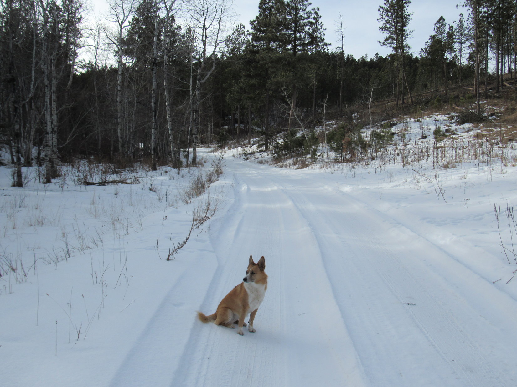
Lupe lost no time setting off from the trailhead on the spur trail that winds W up a slope to the main trail.

Heading up the spur trail to the main trail. Photo looks W.

Five minutes on the spur trail brought Looper up to the junction with the main trail.  She took the branch to the R (N) having already explored to this point from the S a week ago.  Centennial Trail No. 89 started out crossing a relatively open area.  Loop was still gaining elevation, though more gradually than on the spur trail.

Lupe reaches Centennial Trail No. 89 at the upper end of the spur trail. Here the main trail gains elevation more gradually as it crosses this open area. Photo looks WNW.

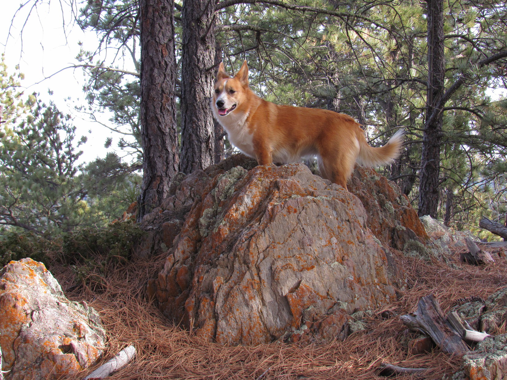
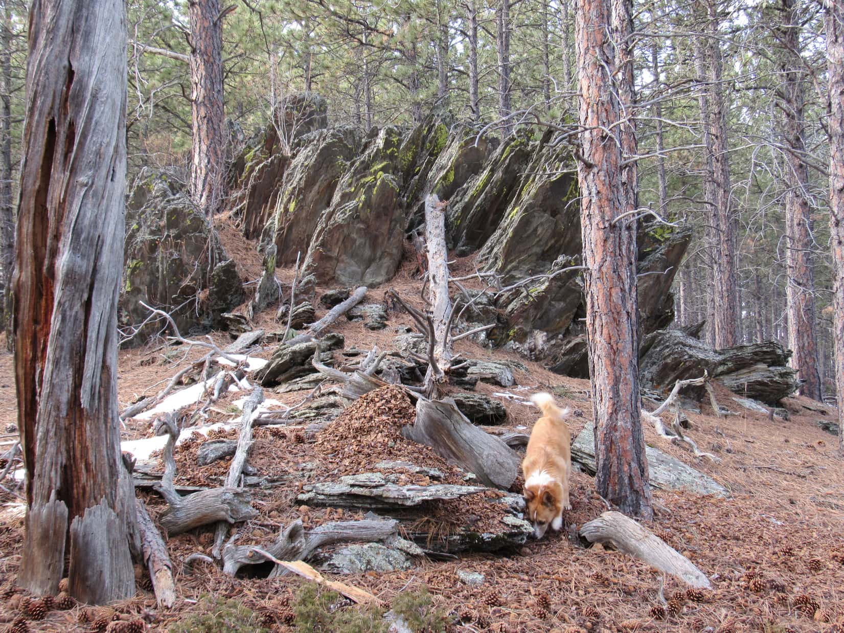
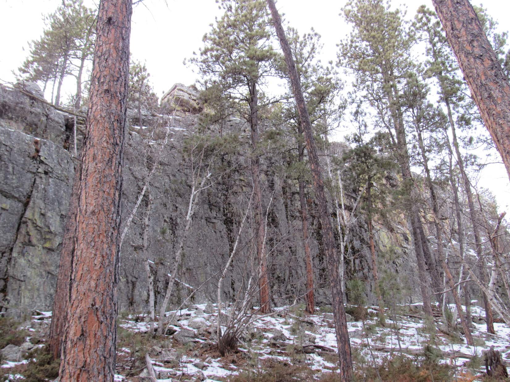
As Centennial Trail No. 89 entered the forest beyond the open area, Lupe passed by a small rock outcropping on the R.  The trail leveled out here and turned NW roughly paralleling Highway 385.  The highway was a good 0.25 mile away down in a broad valley to the E.  Lupe could easily hear the traffic, and could sometimes see the busy highway.

After Looper passed by a small rock outcropping on the R (E), Centennial Trail No. 89 leveled out and headed NW.

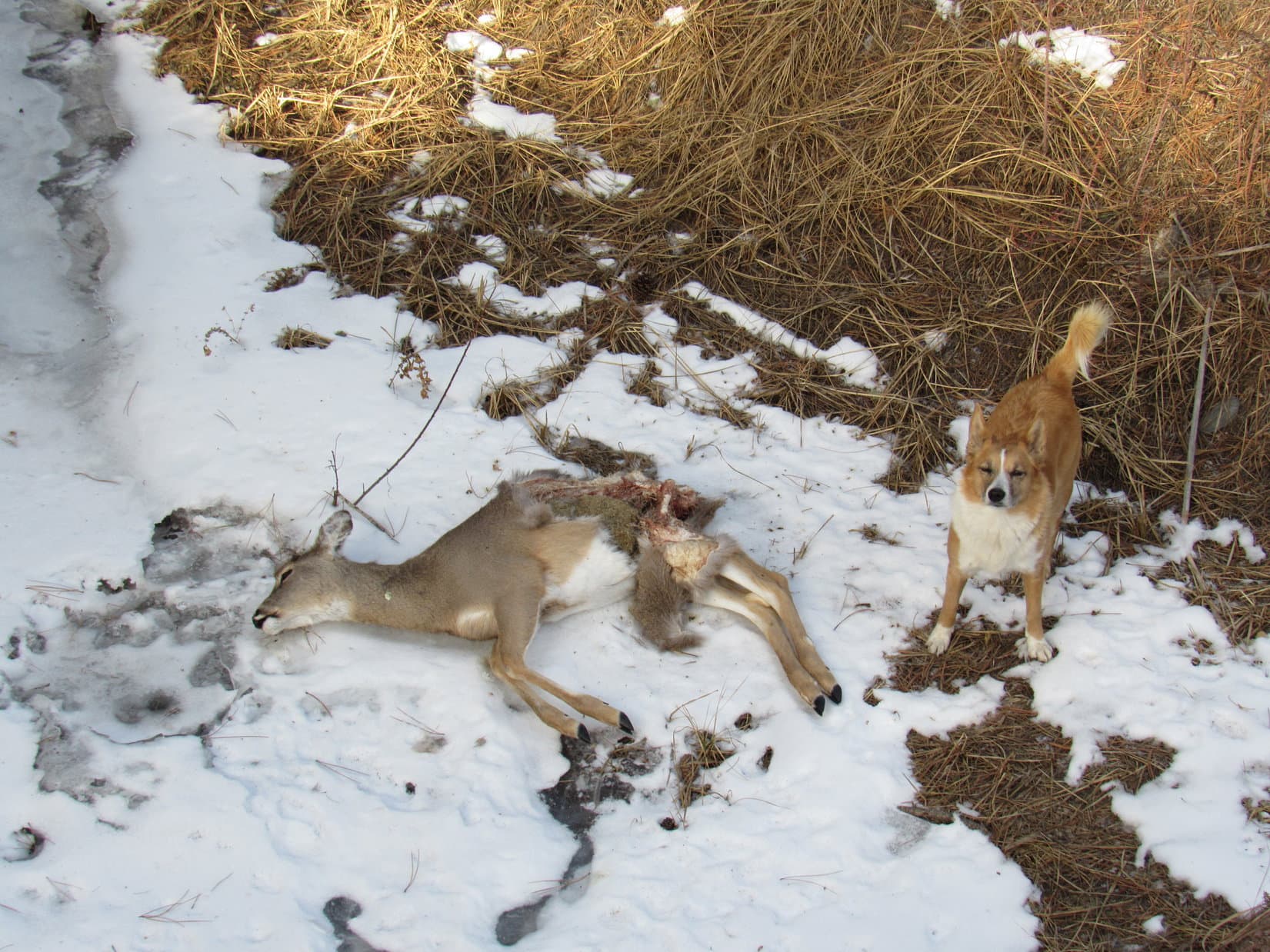
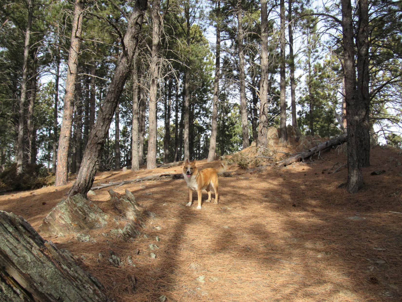
Not much of a sense of solitude here!  Even so, Lupe had a great time.  She was having good luck finding squirrels!  The American Dingo raced happily through the open forest, stopping frequently to check out trees hoping to spot more squirrels.  Running was fun, too!  Lupe encountered very little of the usual annoying slash or deadfall timber so common in much of the Black Hills.

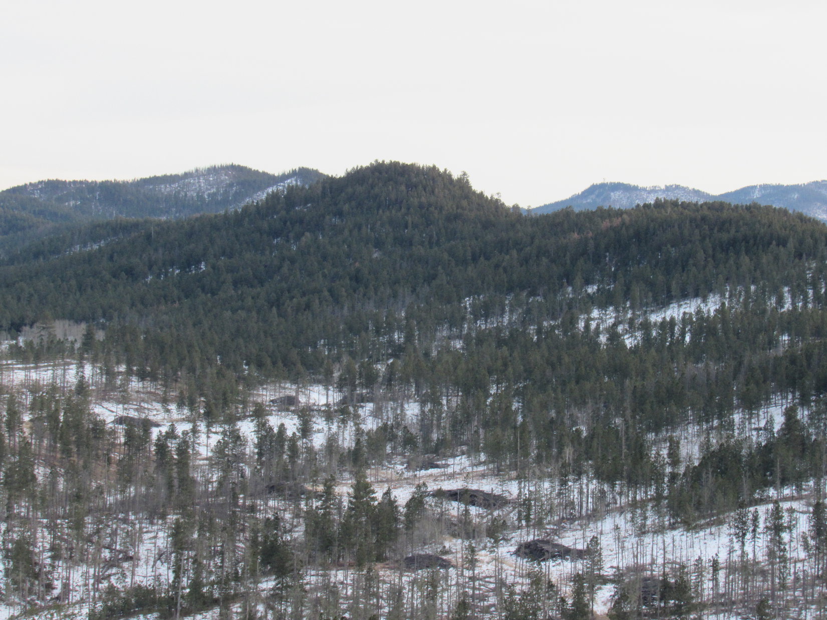
Centennial Trail No. 89 bounced along a slope with little net elevation change as Lupe followed it NW.   Often the trail was almost perfectly level.  Even where it wasn’t, the route was never steep.  To the SW, the terrain rose toward an unseen ridge 200 or 300 feet higher than where the trail ran.  The forest always kept the ridgeline hidden from view.

Open forest and gently undulating terrain make this one of the easiest areas to explore along the entire Centennial Trail system. Loopster had a fabulous time charging around looking for squirrels.

The 3.8 miles between the Deer Creek and Pilot Knob trailheads is one of the shortest and easiest sections of the 111 mile long Centennial Trail.  Lupe made rapid progress.  The gently undulating terrain provided little in the way of distant views.  Most of the way Lupe was traveling through pine forest.  Occasional stands of yellow aspens provided at least some scenic variation.

Although this part of Centennial Trail No. 89 provided little in the way of views, Lupe didn’t care. She was having lots of fun racing around in the forest. Photo looks NW.
Stands of yellow aspens provided at least some scenic variety.
Happy Lupe at one of the prettiest spots.
Loggers had thinned the forest at some point years ago. They had done an unusually nice job of cleaning up any slash and deadfall.

The trail seemed to be slowly drifting farther away from Highway 385, which was sort of nice.  After Loopster had gone more than 1.5 miles, though, it curved E.  The noisy highway was soon in view again.  Nearing the highway, Centennial Trail No. 89 turned N shortly before crossing it.

Approaching Highway 385. The trail crosses the highway here, then heads N near the power line. Photo looks N.

After crossing Highway 385, Centennial Trail No. 89 continued N in a strip of forested land 50 to 150 feet wide between a power line to the E and USFS Road No. 202 to the W.  Here, Lupe came to a splendid thistle.  It was big and prickly and extraordinarily healthy.  The splendid thistle sported a huge, beautiful, purplish pink blossom.

Lupe discovers a splendid thistle after crossing Highway 385.
Ordinarily Lupe and SPHP aren’t all that terribly keen on thistles, but this one was truly a splendid specimen!

Lupe was slowly gaining elevation.  Before long the trail and power line both crossed USFS Road No. 202.  The road subsequently turned E and disappeared into the forest.  The trail took Lupe up an open strip of ground beneath the power line toward a minor pass.

Following the power line to a minor pass. Photo looks N.

Cresting the pass revealed steeper terrain ahead.  Centennial Trail No. 89 went down an otherwise abandoned dirt road for much of the descent into the Jim Creek valley.  Lupe was fast closing in on the Pilot Knob trailhead, now only 0.25 mile away.

Continuing N after cresting a minor pass, Centennial Trail No. 89 follows this dirt road as it begins losing elevation heading down into the Jim Creek valley. Photo looks N.

In the valley, Centennial Trail No. 89 skirted the E edge of a cattle ranch.  Pilot Knob (5,440 ft.) was in view off to the WNW.  Loopster was more interested in a big black bull standing out in the field beyond the fence.

Down in the Jim Creek valley, Centennial Trail No. 89 skirts the E side of this cattle ranch. Pilot Knob (Center) is in view off to the WNW. Lupe was more interested in the big black bull beyond the fence. Photo looks WNW.

For the most part, the trail stayed in the pines a little up the slope E of the fence line as Lupe passed by the ranch.  It then led down to a bridge over Jim Creek.  USFS Road No. 208 (Merritt Road) could be seen only a short distance beyond the creek.

Crossing Jim Creek. USFS Road No. 208 (Merritt Road) is in sight. Photo looks SW.

After crossing Jim Creek, it took only a few minutes to reach the Pilot Knob trailhead on the other (N) side of Merritt Road.

Loop arrives at the Pilot Knob trailhead along USFS Road No. 208 (Merritt Road). Photo looks NNE.

That was about it.  Success!  Lupe had completed the entire 3.8 mile long trek from the Deer Creek trailhead to the Pilot Knob trailhead.  This easy segment of Centennial Trail No. 89 really hadn’t taken her very long.  It was still early afternoon.  Instead of simply heading back by the same route, the American Dingo was up for more of a challenge.

Time to get a little peakbagging in while making a loop back to the G6!  Pilot Knob (5,440 ft.), was 0.75 mile due W.  It would serve nicely as a first objective.  Rather than start back S on Centennial Trail No. 89, Lupe continued N, as if she intended to head for the South Boxelder Creek trailhead.

Right away, Centennial Trail No. 89 swung sharply W heading up a slope.  It soon curved N again, and Lupe found herself E of another cattle ranch.  Pilot Knob was in view beyond a grassy field.  At the far end of the field a small cabin nestled at the edge of the pines.

Pilot Knob (L) from Centennial Trail No. 89 N of the Pilot Knob trailhead. Photo looks W with help from the telephoto lens.

Lupe continued N.  Centennial Trail No. 89 turned E before too long at Boodleman Spring.  Just E of the spring, Lupe left the trail turning N yet again.  She followed a dirt road up a small valley until she was N of the cattle ranch fence line.  The Carolina Dog then scrambled up out of the valley heading W.

Once out of the valley, Lupe was confronted with open forest on rolling terrain.  Trying to stay on high ground instead of crossing ravines meant heading more NW than due W.  For a while Pilot Knob wasn’t even in view due to all the trees, but Loop eventually caught sight of it again.

In the forest N of the cattle ranch. Photo looks WNW.
At a small clearing, Lupe catches sight of Pilot Knob again. Photo looks SW.
The Pilot Knob summit with help from the telephoto lens. Photo looks SW.

SPHP eventually lost patience with trying to stay on the high ground.  Lupe was having to go too far NW to get to Pilot Knob’s N ridge.  Simply crossing the last intervening valley was easier and faster.  Looper was soon closing in on Pilot Knob’s rocky summit from the N.

Loop reaches the N end of Pilot Knob’s rocky summit ridge. Photo looks SE.

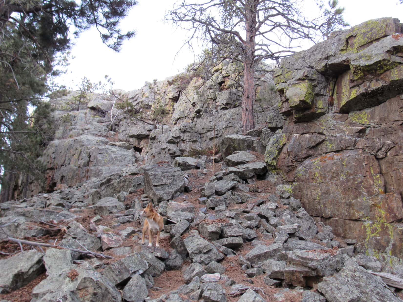
The summit ridge was a good 40 feet high or more.  The N end was very steep and not a good place to attempt an ascent.  Way back in January, 2016, Lupe had climbed Pilot Knob once before.  SPHP remembered that about the only relatively easy way up started at the SW end of the ridge.  Lupe headed that way.

Loop on her way S beside Pilot Knob’s vertical W face. Photo looks N.

The Pilot Knob summit ridge is several hundred feet long.  On the W side of the ridge near the far S end, Lupe found the way up.

Come on, SPHP! This is the way up! About the only easy way to the top of Pilot Knob starts here at the SW corner of the very rocky summit ridge. Photo looks S.

Once up on the lower S end of the ridgeline, a bit of scrambling was required almost immediately to begin heading N toward the still unseen true summit.  SPHP thought Lupe might need help at a couple of points, but she always managed to get up all by herself.

The W edge of the ridgeline became a sheer vertical drop.  To keep going N, Lupe had to stay toward the E.  This route was fine, except for small pines that made it unnecessarily difficult for SPHP to pass.

Lupe up on the summit ridge after the first bit of scrambling. She is just E of the highest rocks where it was possible to continue N. Loop had no trouble at all getting by these small pines, but they slowed SPHP down. Photo looks N.

Once beyond the pines, thorny bushes among lots of jumbled rock kept progress slow.  A vertical drop existed to the E, too, but at least there was some room up here to maneuver a little W of the edge.

Getting close to the summit, still E of the highest rocks. Photo looks N.

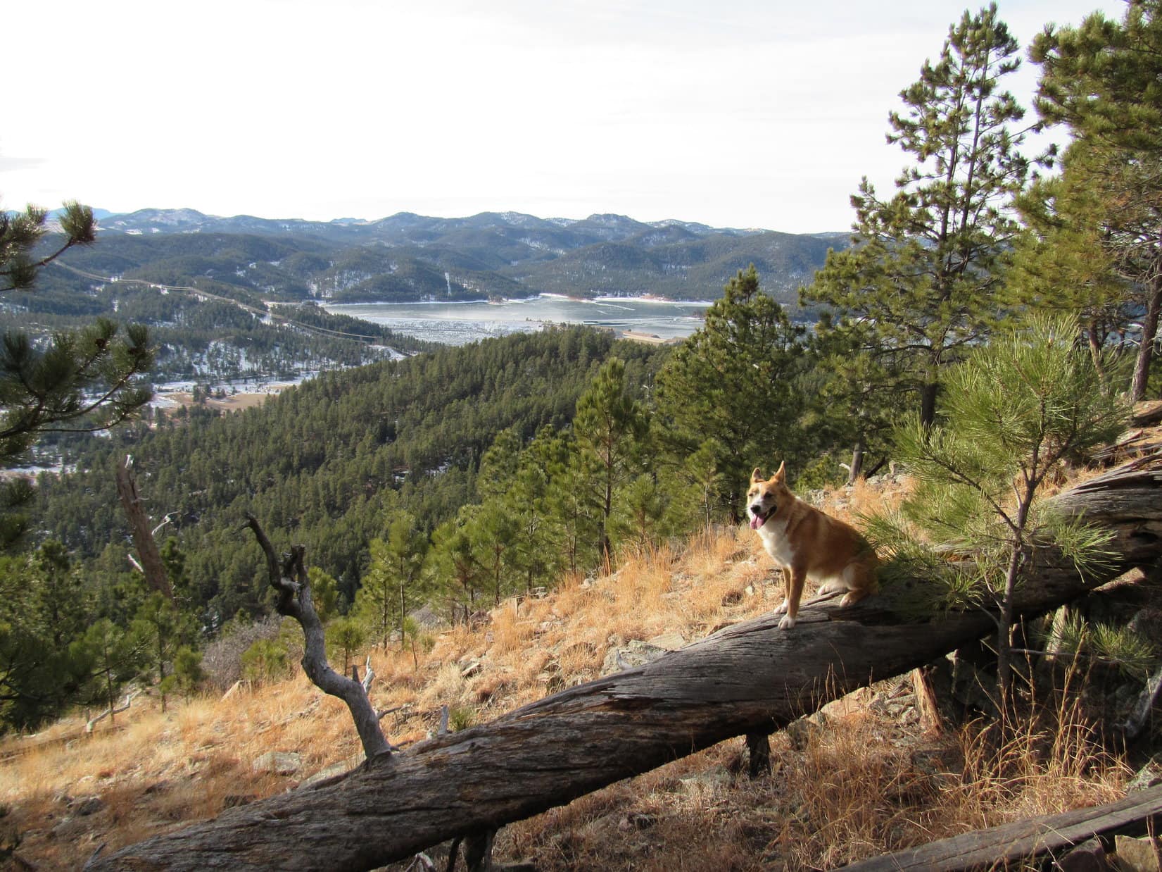
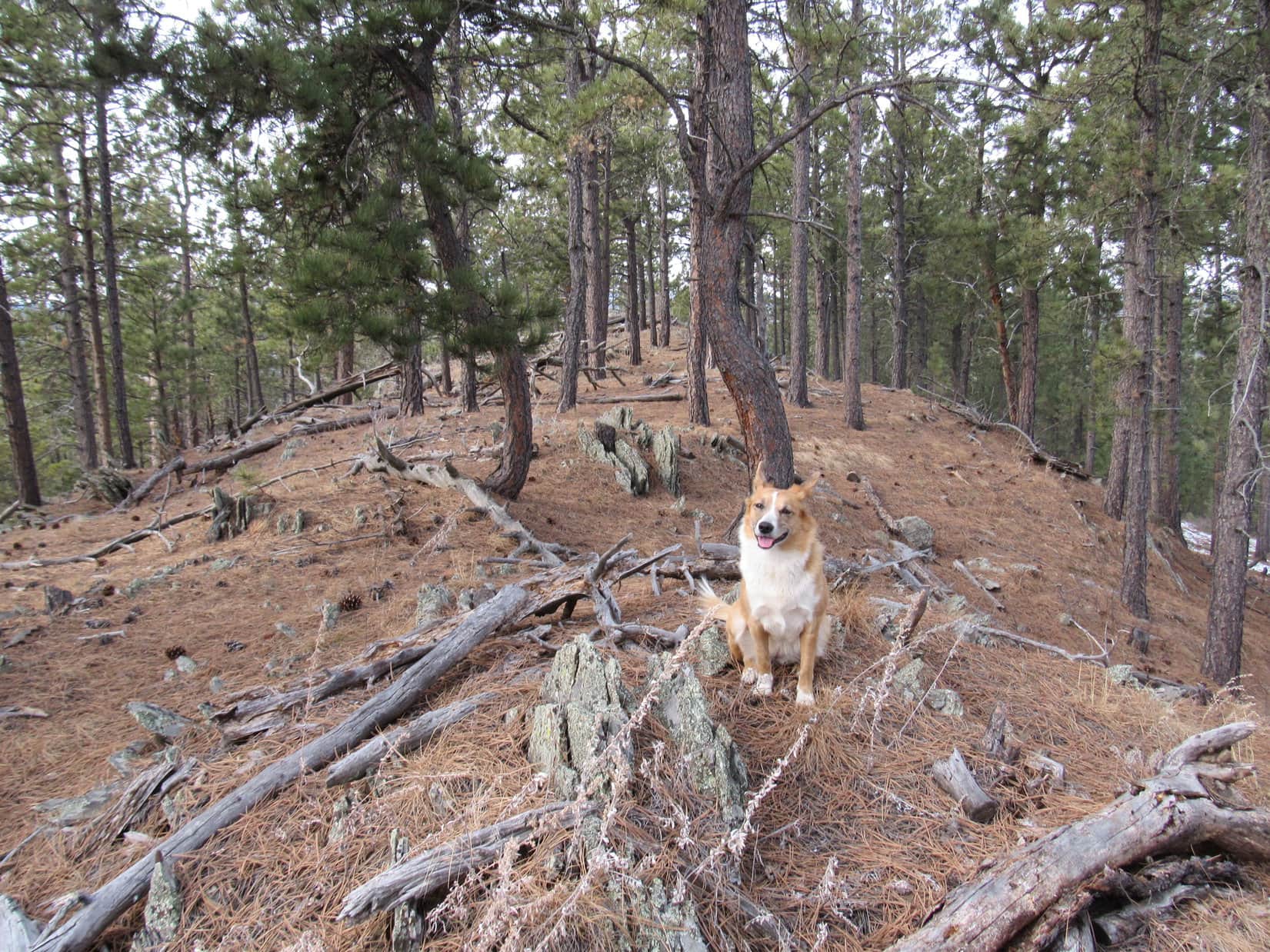
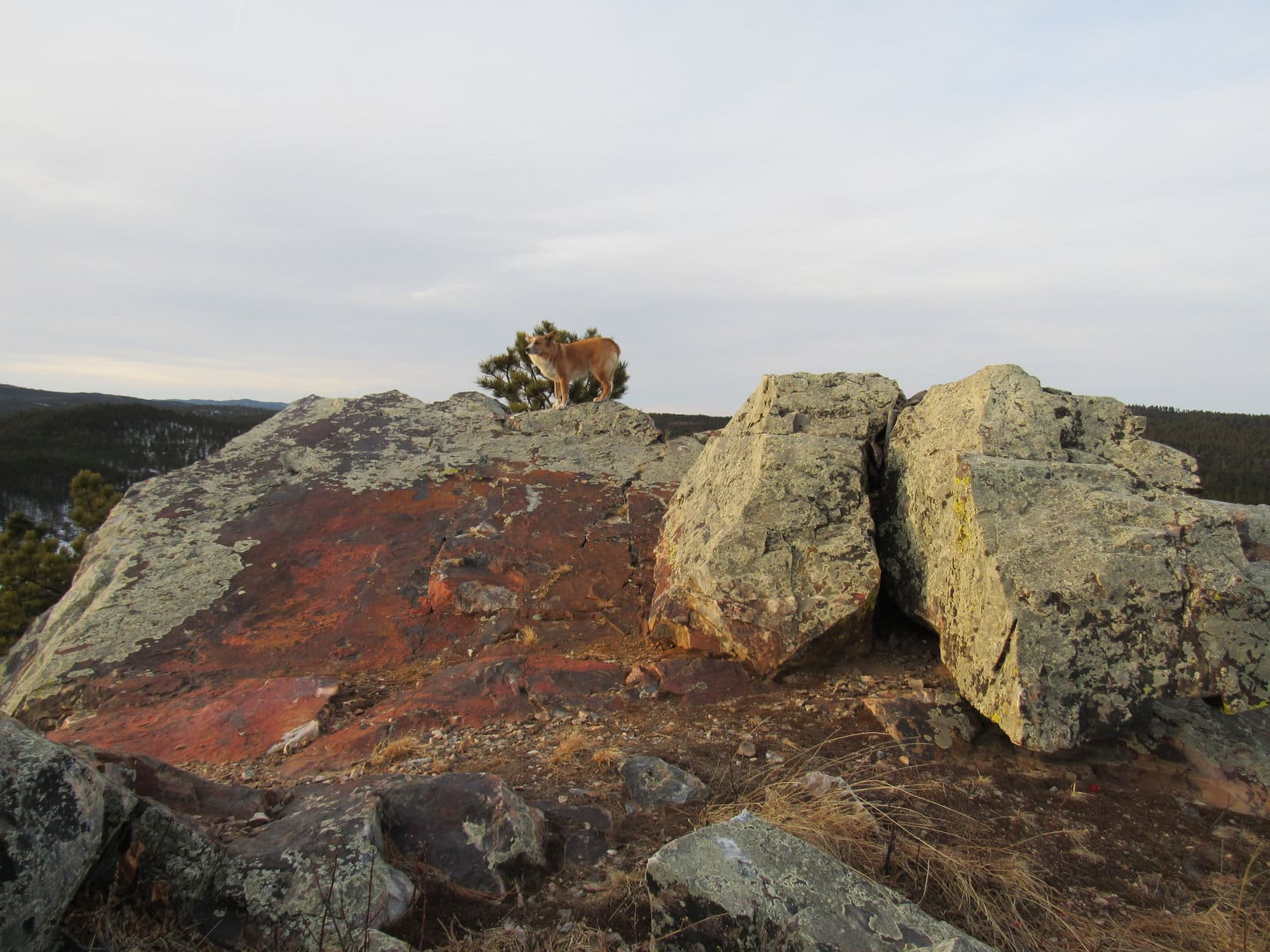
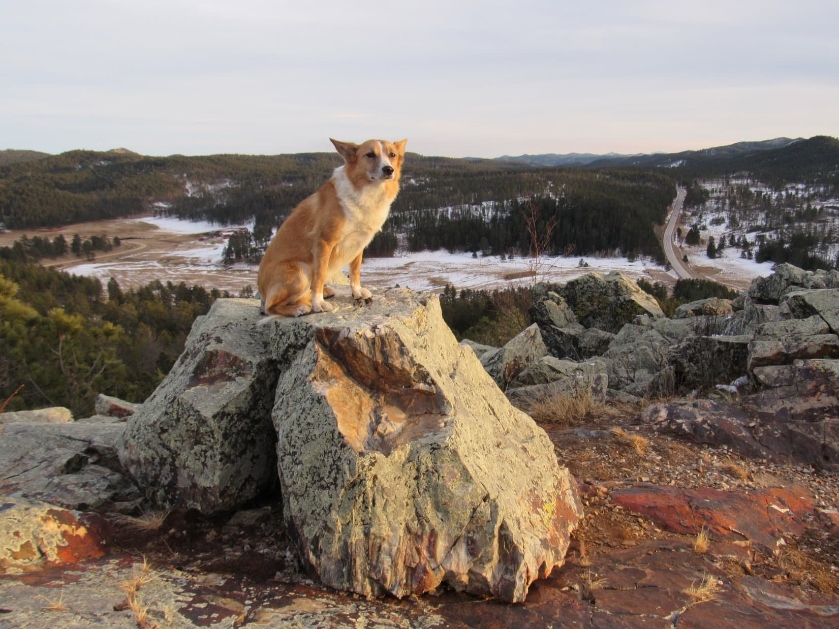
After fighting through the bushes, another short scramble and Lupe was up!  For the first time in more than 2.5 years, the American Dingo stood at the top of Pilot Knob (5,440 ft.).

For the first time in more than 2.5 years, Lupe stands once again on the highest rocks up on Pilot Knob. Photo looks N.
Oh, I made it up here again, SPHP. And without any help from you, I might add!
Say, these views are surprisingly impressive aren’t they?

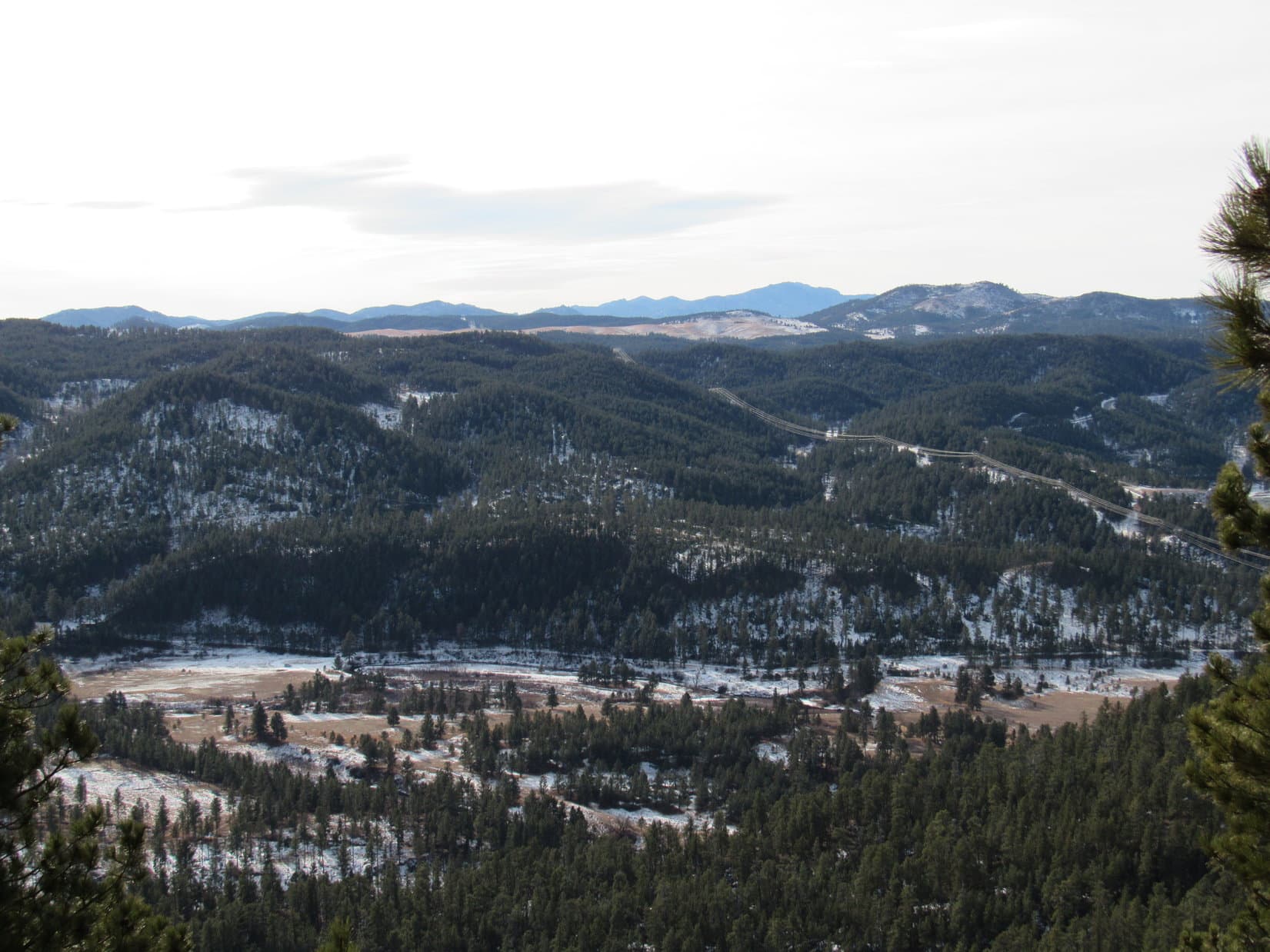
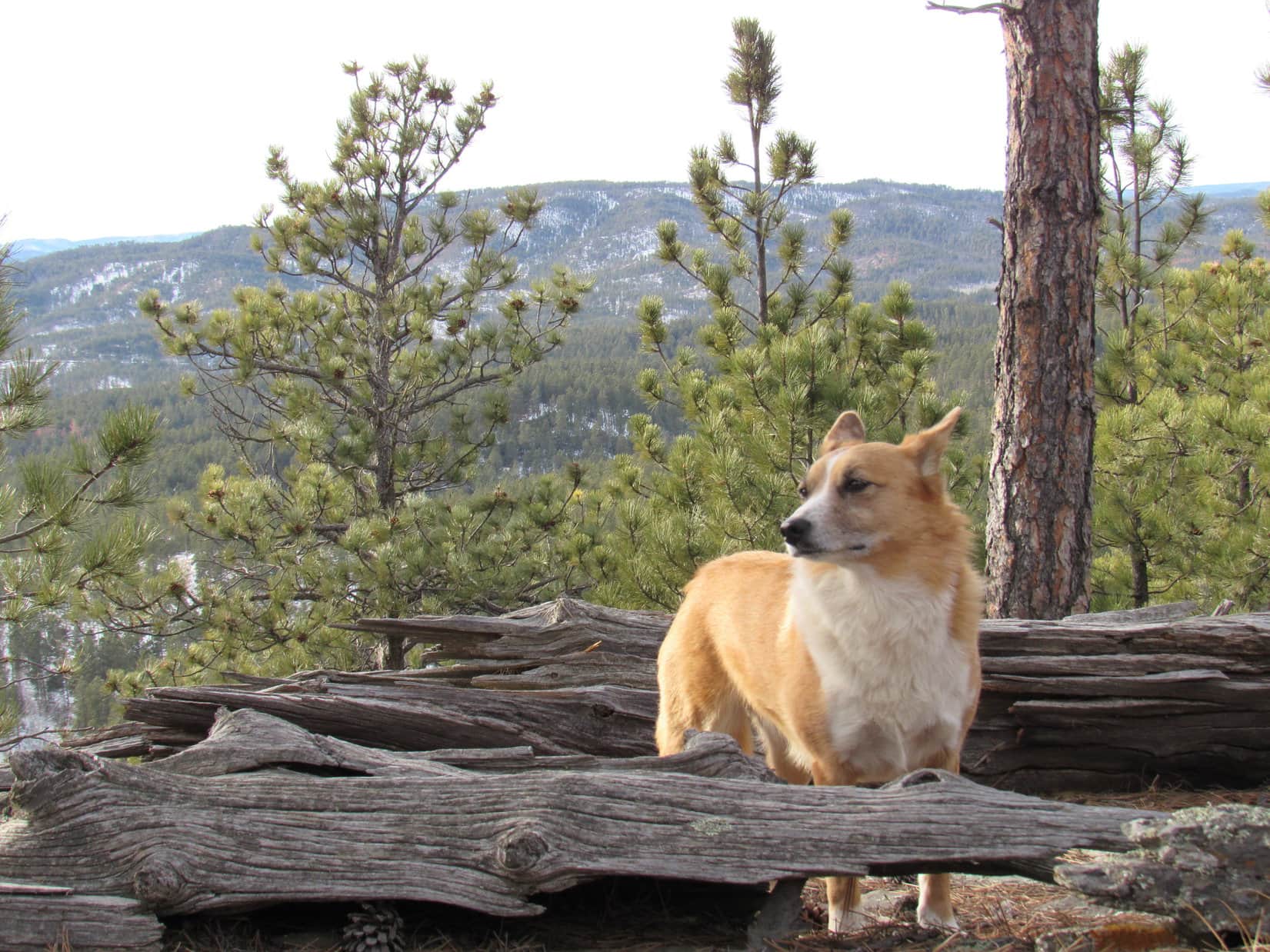
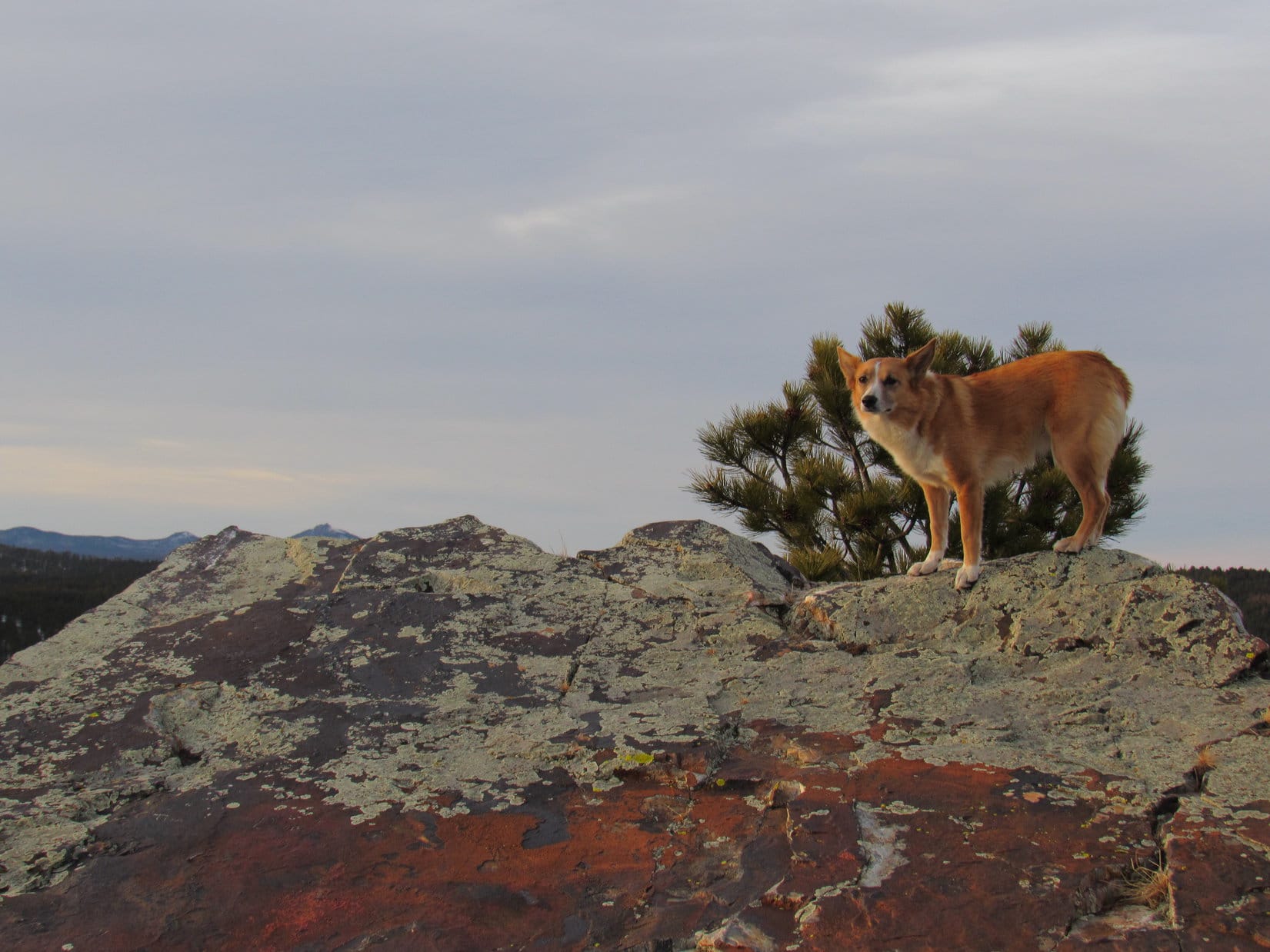
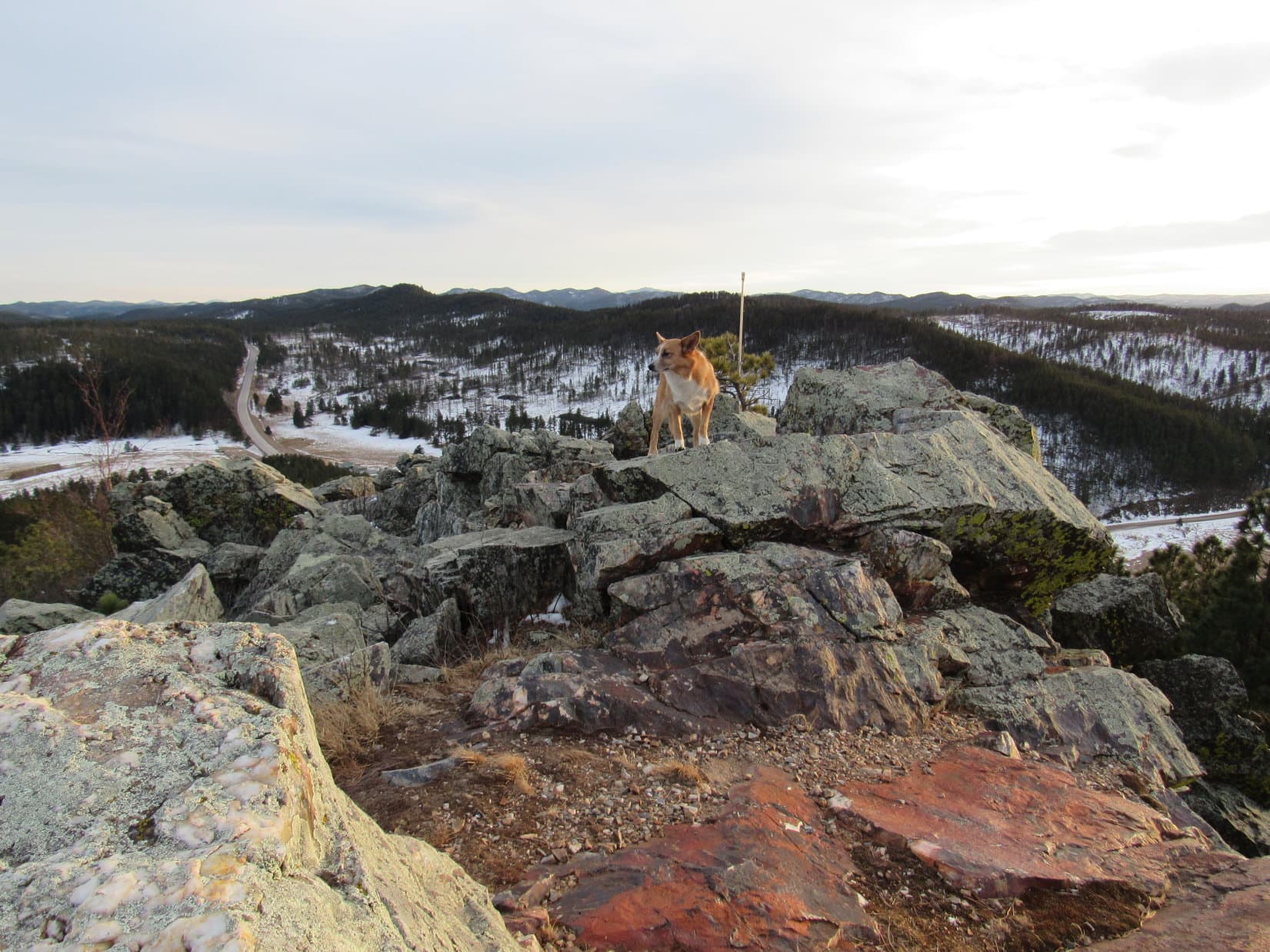
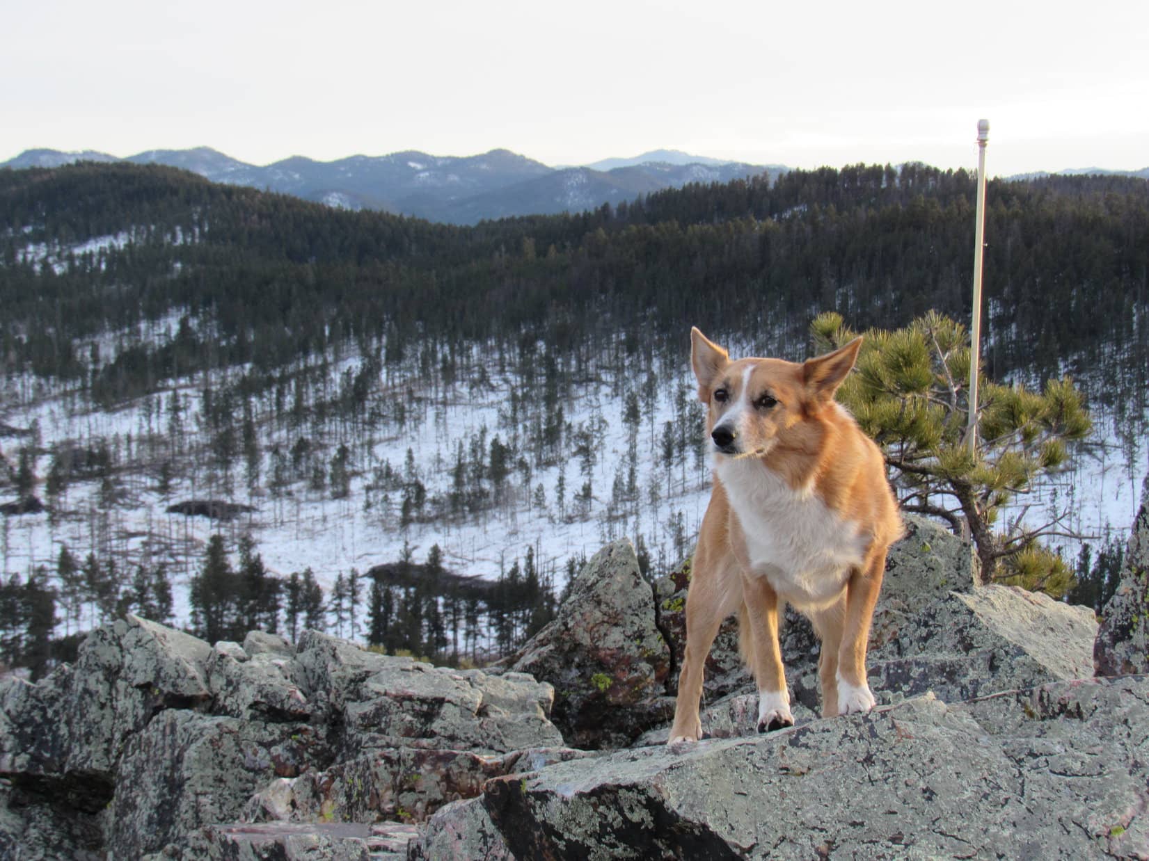
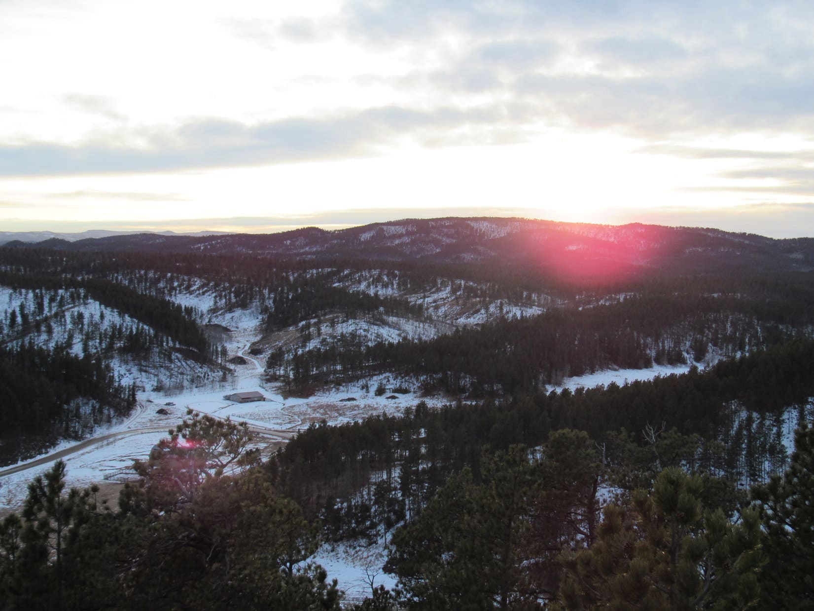
Pilot Knob’s summit was so rocky there were hardly any trees around.  Even though Pilot Knob (5,440 ft.) hadn’t seemed like much of a climb, the views were rather impressive.

Time for a break.  A snack while enjoying the scenery was in order.  Lupe had water and Taste of the Wild.  SPHP munched an apple.  Lupe could see and hear the traffic on nearby Highway 385, but it was all far enough below so the mood was still largely one of tranquility up here on Pilot Knob.

On the highest rock. The cattle ranch Lupe had gone past on Centennial Trail No. 89 down in the Jim Creek valley is seen on the L. Hwy 385 is on the R. Photo looks SE.
The rounded forested high point toward the L at the far end of the near ridge (close to Hwy 385) is Merritt Peak (5,556 ft.). Lupe would be heading there next. Rochford Road is on the R. Photo looks S.
This big patch of orange and purple rock gives the summit of Pilot Knob a distinctive look. Photo looks NNW.
Looking down the ragged rocky N end of the summit ridge. Photo looks N.
View to the NW with help from the telephoto lens and a peakbagging Carolina Dog.
Rochford Road from Pilot Knob. Photo looks SW with help from the telephoto lens.

Loopster wasn’t going to get better views than this from anywhere else today, so the American Dingo wasn’t in any hurry to leave Pilot Knob.  She lingered with SPHP up at the summit for more than 40 minutes.  By then it seemed like time move on if Lupe still wanted to get to Merritt Peak (5,556 ft.), her second and final peakbagging objective.

Hate to leave Pilot Knob, SPHP, but maybe we better get going, if we still want to have time to reach Merritt Peak (Center). Photo looks S.

After a slow, careful descent off of Pilot Knob’s summit ridge, Loopster headed S through the forest.  Down, down!  The SW side was the steepest part of the main mountain, but Lupe wanted to get down to Highway 385 as fast as possible.  It wasn’t far, only about an eighth of a mile.  Near the bottom, a ravine to the W that wasn’t too steep got her there.

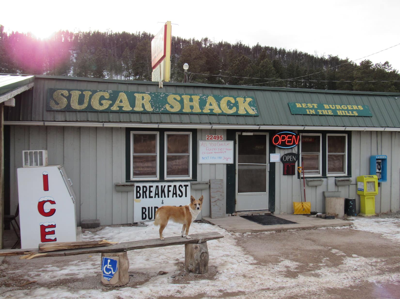
The busy highway wasn’t a fun place to be.  Lupe and SPHP headed S in the ditch as cars and trucks roared by.  Near Merritt Road, Lupe crossed over to the W side of Highway 385.  She passed through the parking lots of the Sugar Shack and other businesses.  If they would have welcomed Dingoes, Looper would surely have begged SPHP to take her into the Sugar Shack for a burger.  Sadly, that wasn’t in the cards.

Loop and SPHP hurried along.  After 0.50 mile, it was a relief to reach USFS Road No. 672 and escape all the highway traffic.  Peaceful No. 672 wound its way SW steadily gaining elevation.

Lupe was glad to get to USFS Road No. 672, safely away from all the Highway 385 traffic. Photo looks SW.

After 0.5 mile on USFS Road No. 672, Lupe reached an intersection at the top of a pass.  From here No. 672 continued S down into Broad Gulch.  Loop didn’t need to go that way.  Instead, she turned E on Trail No. 6237.

Loop left USFS Road No. 672 here at the top of a minor pass. Trail No. 6237 would take her SE along the ridge leading to Merritt Peak.

Trail No. 6237 quickly brought Lupe up onto a ridgeline leading SE to Merritt Peak.  The forest had been thinned in recent years, but the pines were still dense enough to mar any distant views.  Even so, traveling along the ridge was fun.  Lupe enjoyed looking down the forested slopes on both sides for deer or squirrels.

On the ridge leading to Merritt Peak. Photo looks SE.

After following the ridge for 0.25 mile, SPHP figured Lupe had to be getting close to Merritt Peak.  However, Trail No. 6237 suddenly made a big curve down to the W leaving the ridgeline.  That didn’t seem right at all!  Back in January, 2016 when Lupe had climbed Pilot Knob for the first time, she had also come this way and climbed Merritt Peak, too.  SPHP didn’t remember the trail leaving the ridge back then.  Loop certainly hadn’t.

Instead of following Trail No. 6237 down off the ridge, Lupe continued SE looking for another trail.  Almost right away, she found the trail SPHP remembered.

In 2016, the trail had not gone clear up to the top of Merritt Peak, but had passed only 30 or 40 feet below the summit ridge on the E side of the mountain.  Sure enough, this trail gained elevation before leveling out E of higher ground.  SPHP was certain this had to be it.  The Carolina Dog left the trail and climbed the slope to the top.  Yes, this was Merritt Peak (5,556 ft.) alright!

Lupe reaches the S end of Merritt Peak’s 200 foot long summit ridge. Photo looks NNW.

Lupe had come up near the S end of Merritt Peak’s 200 foot long summit ridge.  The whole ridge was pretty close to level.  A small rock outcropping seemed to be the high point at this end.  The N end of the summit ridge was rockier and had seemed perhaps slightly higher back in 2016.  May as well go check it out again.

Eh.  Maybe the N end was a little higher.  Still seemed that way, but not super convincingly so.  Really not much difference one way or another.  Lupe and SPHP sat down together just below the highest rocks to take another break.

The N end of Merritt Peak’s summit ridge might have been a bit higher than the S end. Still seemed that way, but not by much. It was certainly rockier. Photo looks N.
If not the true summit, this is mighty close to it. Photo looks NNE.
So this is it, isn’t it, SPHP? I’ve bagged myself a 2nd ascent of Merritt Peak, haven’t I? …. Yeah, congratulations Looper, we’re calling this good.

Lupe had also taken a break at this very same spot in 2016.  Even though the forest had been thinned since then, there still weren’t any decent views from Merritt Peak (5,556 ft.).  Seemed like there had been at least a fairly good look at Minnesota Ridge (6,240 ft.) off to the NW from here before.  Even that view was now marred by a couple of trees that had grown up in the meantime.

Still, SPHP was glad Lupe had returned.  More than 2.5 years gone by.  Made you think.  SPHP hugged Lupe close.  For a while Lupe huddled there with SPHP content just sitting and watching.

Time is relentless.  That precious commodity was slipping away even as it was being pondered.  The sky had been totally overcast all afternoon.  It wasn’t possible to tell how close the sun was to setting.  No more than an hour from now, maybe less?  Lupe still had close to 2 miles to go to get back to the Deer Creek trailhead.  SPHP stood up.

Come on, Looper, let’s finish exploring this ridge!

Lupe was on it.  She was ready.

The ridge SPHP was referring to wasn’t Merritt Peak’s summit ridge.  Lupe had already seen that.  However, she had never been any farther on the long ridge extending SE from Merritt Peak.  This was the same ridge that had been unseen and higher up to the W during much of the early part of today’s journey along Centennial Trail No. 89.

The American Dingo returned to the nearby trail.  The easiest thing to do would have been to head directly down to Centennial Trail No. 89, which couldn’t have been more than 0.5 mile away.  Instead, Lupe stuck with the high ground traveling SE along the ridgeline.

A network of seldom traveled trails crisscrossed the ridge.  None were marked.  Up and down!  From one high point to the next the Carolina Dog continued her explorations.  For more than a mile whatever trail she was on was in good shape.  After that it began to fade.  Eventually there didn’t seem to be a trail at all.

Finally, Lupe saw Silver City Road just ahead down at Pass 5307.  Time to begin her descent.  Loop headed E off the ridge.  It wasn’t dark yet, but certainly dim when she reached Centennial Trail No. 89 at the edge of the pines by the rock outcropping where the trail had first leveled out this morning.

Lupe’s big loop on and off Centennial Trail No. 89 today was complete.  Ten more minutes of sniffing would bring her back to the Deer Creek trailhead and the G6.  Another day, a fun one, gone forever.  At least her precious time had been well spent.  End – 6:21 PM, 42°F

On some of the highest rocks near the N end of Merritt Peak. 9-29-18

Links:

Next Black Hills Expedition                     Prior Black Hills Expedition

Next Trail Section South

Black Hills, SD Expedition No. 234 – Centennial Trail No. 89: Rapid Creek to Deer Creek (9-22-18)

Next Trail Section North

Black Hills, SD Expedition No. 237 – Centennial Trail No. 89: Pilot Knob to South Boxelder Creek (10-18-18)

Centennial Trail No. 89 brochure & map

Want more Lupe adventures?  Check out Lupe’s Black Hills, SD & WY Expeditions Adventure Index, Master Adventure Index, or subscribe free to new Lupe adventures!

Black Hills, SD Expedition No. 152 – Perrin Mountain, Merritt Peak & Pilot Knob (1-13-16)

A forecast high near 50°F in the Black Hills was only supposed to last one day before colder temperatures returned.  Lupe and SPHP were going to make good use of the opportunity.  Lupe realized what was up.  She followed SPHP around impatiently, urging action at the soonest possible moment.  Lupe couldn’t wait for her next Black Hills, SD Expedition to begin!

At 8:47 AM (35°F), SPHP parked the G6 just off Hwy 44W about 1/8 mile SE of USFS Road No. 167 (the road to Placerville Camp).  Lupe and SPHP marched along a fence line outside of a big open field to get to No. 167.  When Lupe reached the road, she made a sad discovery.

A small deer was laying dead and frozen on the ice over Deer Creek.  Its hind quarters were badly damaged.  Perhaps the poor deer had been hit by a car on Hwy 44, and had managed to drag itself only this far before succumbing to the traumatic injury.

Lupe ready to start Black Hills, SD Expedition No. 152. She would climb the hill in the background on the way to Perrin Mountain. This hill was the first of two high points she reached along the way. Photo looks SW.
Lupe found this poor frozen dead deer laying on iced-over Deer Creek.

Lupe’s first peakbagging goal of the day was Perrin Mountain (5,212 ft.).  Although SPHP originally had another route in mind, it looked pretty easy and enticing to just start up the N ridge.

Lupe on the N ridge on her way to Perrin Mountain. Here she is about to climb up to the first of two high points along the way. Photo looks S.

There were a couple of high points along the easiest route up to Perrin Mountain from the N.  The topo map showed a NW/SE running ridge at the first one, with the highest point at the NW end.  When Lupe got up there, it looked like just another spot in the forest.  There were a few rocks about a foot high around, but that was about it.

Peering SE through the forest, though, it looked like there might be something more interesting over there.  Lupe and SPHP followed the short ridge to its SE end, where there was a large blocky rock formation.  In fact, the rock formation at the SE end of the ridge is almost certainly a little higher than the map’s supposed highest point to the NW.  Lupe and SPHP explored around to the SE end of the rocks, by going around the N side.

Lupe reaches the interesting rock formation at the SE end of the ridge at the first high point on her way to Perrin Mountain. Photo looks E.
Lupe at the SE end of the first high point ridge. Photo looks S at Perrin Mountain, her first peakbagging goal of the day.

The second high point on the way to Perrin Mountain was about 0.25 mile SW of the first one.  There were some interesting rock formations on the way to the second high point, but nothing too spectacular at the top.

Lupe at the top of the second high point on the way to Perrin Mountain. The rocks here weren’t nearly as impressive as at the SE end of the ridge at the first high point.

Lupe went a little farther SW from the second high point, losing some elevation.  Shortly after she started climbing up to the main Perrin Mountain ridge, she came to a snowy little road.  It headed SE toward the summit, but didn’t go all the way there.  At the end of the road, Lupe and SPHP were surprised to see a Subaru.  Someone was inside it, too.  Whoever it was, had car camped overnight.

That really was pretty extraordinary.  In all of Lupe’s Black Hills, SD Expeditions, this was the first time she had come to anyone camped anywhere outside of a designated campground in the national forest.  Since the person didn’t seem to be entirely up yet, Lupe and SPHP didn’t stop to chat, even though it would have been interesting to know more about the hardy soul who chose to car camp in January.

SPHP was surprised when Lupe found a trail leading from the end of the road to the top of Perrin Mountain.  The faint trail looked like it didn’t get much use these days, but wasn’t hard to follow.  The trail went all the way up to the summit.  Actually, it went to a sign nailed to a tree just SE of the summit.  The sign had the cryptic message “Hurt Locker”.  If Lupe knew what the sign meant, she wasn’t saying.  SPHP could divine no relevant meaning, since there was no locker of any sort in sight.

Hurt Locker? Would have made more sense if a locker had been evident somewhere, but Lupe and SPHP found none.

The summit of Perrin Mountain was maybe 25 feet NW of the odd Hurt Locker sign.  There were a few rocks a couple of feet high there, but nothing more dramatic than that.  The forest blocked the view in every direction.

Lupe on the summit of Perrin Mountain.

Perrin Mountain is less than a mile NE of Pactola Reservoir, the largest lake in the Black Hills.  It was rather disappointing that there weren’t any clear views of the reservoir from the summit, or on the way to it.  However, the trail continued SE on past the Hurt Locker sign.  Although it was losing elevation along the way, maybe there would be a viewpoint from somewhere in that direction?

Lupe and SPHP followed the trail all the way down to where it ended, which wasn’t far from the summit.  There were a couple of viewpoints along the trail, not wide open views, but better than anywhere else Lupe had found on Perrin Mountain.  To the S, it was possible to see the large flat meadow Rapid Creek flows through E of the dam.  To the SW, there was one spot with a pretty good look at part of Pactola Reservoir and the dam.

Looking S from the SE end of Perrin Mountain. The large flat meadow where Rapid Creek flows below the dam is seen below.
Pactola Reservoir and dam from the SE end of Perrin Mountain. Photo looks SW.

Lupe and SPHP climbed back up the trail heading NW to return to the summit.  Lupe posed for another photo there, before starting on the way back to the G6.

On Perrin Mountain. The rocks on the R are the true summit. Photo looks NW.

There were other routes Lupe could have taken back to the G6, but the way Lupe had come up Perrin Mountain had been pretty cool.  It was a nice, easy bit of wandering in the forest on ridges and saddles between high points.  SPHP thought it might be fun to chat with the Subaru person on the way back, but by the time Lupe and SPHP got back to the little road, the Subaru was gone.

Lupe returned to both of the high points N of Perrin Mountain on her return to the G6.  The only memorable event of the return trip was when she spotted a squirrel on her way from the second high point back to the first.  The squirrel eluded her near an interesting rock outcropping, but Lupe didn’t give up easily.  She sniffed around there for a while trying to figure out where that squirrel had disappeared to.  SPHP finally made her move on before she had time to resolve the mystery.

Lupe returned to both of the high points N of Perrin Mountain. Here she is back at the 2nd one (actually the closest to Perrin Mountain).
Lupe searches for the tricksy squirrel.

By 12:01 PM (50°F), Lupe was back at the G6.  There were a number of Lupe treasures scattered around, so SPHP picked most of them up for disposal later.  With this much time left in the day, Lupe had at least one more peakbagging goal ahead of her.  First though, Lupe and SPHP went to see if it would be possible to get a photo of Perrin Mountain from Pactola Reservoir.

SPHP parked the G6 at the viewpoint at the N end of the dam near the spillway.  The view of Perrin Mountain from near the spillway was none too impressive.  It was a good thing Lupe went there, though.  The place was kind of a mess.  There were Lupe treasures all over the place.  SPHP filled 5 plastic grocery bags full of them.

Lupe near Pactola Reservoir. Photo looks W.
Mighty Perrin Mountain towers over the surrounding country NE of the Pactola Reservoir spillway. Well, maybe "towers" isn't the word. At least this photo shows why it wasn't very easy to get a clear shot of Pactola from Perrin Mountain.
Mighty Perrin Mountain towers over the surrounding country NE of the Pactola Reservoir spillway. Well, maybe “towers” isn’t the word. At least this photo shows why it wasn’t very easy to get a clear shot of Pactola from Perrin Mountain.

When SPHP was done collecting Lupe treasures at Pactola, Lupe and SPHP drove N on Hwy 385.  SPHP turned W on Broad Gulch Road (USFS Road No. 676) about 0.5 mile S of the Sugar Shack.  There was a place to park the G6 on the left, right after crossing a cattle guard close to Hwy 385.

At 12:53 PM (50°F), Lupe set out on her second peakbagging quest of the day.  Her new goal was Merritt Peak (5,556 ft.).  The first part of the journey was just a walk up snowy Broad Gulch Road.  Lupe followed the road until it reached its highest point at a saddle.

On Broad Gulch Road.

Lupe and SPHP left Broad Gulch Road at the saddle, heading E into the forest.  Surprisingly, there was a trail going this way, too.  The trail went to the N end of the long ridge of which Merritt Peak is a part.  It then turned and followed the ridge line S.  Lupe and SPHP stayed on the trail all the way to Merritt Peak.  The trail didn’t go quite all the way up to the top, instead passing just to the E of the summit.

The trail appeared to continue on to the S, but Lupe and SPHP left it to climb the remaining short distance up to the top of Merritt Peak.  The summit proved to be a ridge a few hundred feet long, and quite flat.  There were small rock outcroppings scattered along the ridge.  It was hard to tell which rock might be the highest point on the mountain.  There were lots of possible candidates, none much higher than any of the others.

Merritt Peak was pretty heavily forested, but here and there it was possible to get a little bit of a view off into the distance in one direction or another.  Enough could be seen between the trees so that it did seem like Lupe was up on a mountain, and not just in a thick forest.  Lupe and SPHP came up near the S end of the ridge, so Lupe explored that end of the mountain first.

A glimpse to the SW from the S end of Merritt Peak.
Lupe at one of the highest points near the S end of Merritt Peak. Photo looks NNW along the ridge.
Buck Mountain (5,553 ft.), where Lupe had gone on Expedition No. 151 on 1-5-16, from Merritt Peak. Buck Mountain is about 4 miles E of Merritt Peak. (With help from the telephoto lens.)
Buck Mountain (5,553 ft.), where Lupe had gone on Expedition No. 151 on 1-5-16, from Merritt Peak. Buck Mountain is about 4 miles E of Merritt Peak. (Taken with help from the telephoto lens.)

The N end of Merritt Peak was a bit rockier than the S end.  Custer Peak (6,804 ft.) could be seen in the distance to the NNW.  Minnesota Ridge was off to the NW.  It was time to take a short break.  Lupe was hearing gunfire off to the N, and was getting a little scared.  She was hungry, too.  She ate some Taste of the Wild.  Whenever she heard the guns, though, she wanted to be right next to SPHP.

SPHP shared a jacket with Lupe.  She was trembling a little bit, probably due to the gunfire, but the light N breeze was a bit cool, too.

Lupe at the N end of Merritt Peak. This might have been the highest point on the mountain. It was hard to tell for sure.
Lupe had some Taste of the Wild at the N end of the Merritt Peak summit ridge.
Looking NW toward Minnesota Ridge.

Lupe had now achieved two peakbagging goals so far on Expedition No. 152.  Both Perrin Mountain and Merritt Peak had turned out to be pretty fun, easy peaks.  Originally, SPHP had a third possible peakbagging goal in mind for Lupe, but it was probably too late in the day to attempt that one.

However, there was another mountain pretty close by that Lupe might still have time to climb.  Pilot Knob (5,440 ft.) was less than 3 miles N of Merritt Peak.  SPHP knew the top of Pilot Knob was pretty rocky looking, maybe Lupe wouldn’t be able to climb it at all?  In any case, there was enough daylight left to find out.  Lupe would make an attempt on Pilot Knob.

After the break up on Merritt Peak, Lupe and SPHP went back down to the trail and headed N.  Lupe didn’t turn W to go back to Broad Gulch Road when the trail did.  Instead she continued N through the forest.  Eventually she wound up down on Broad Gulch Road again, anyway.  When she reached the G6, it was 2:43 PM (50°F).

On her way to the Pilot Knob trailhead of Centennial Trail No. 89, Lupe stopped by for a photo op at the Sugar Shack.

Lupe dropped by the Sugar Shack along Hwy 385. The Sugar Shack is a popular spot known for great hamburgers. Lupe would have loved to go in for a burger, but no doubt the health department wouldn't have approved. Health departments just don't understand that American Dingoes are way healthier than most people. The Sugar Shack business is currently for sale, so the future is a bit uncertain.
Lupe dropped by the Sugar Shack along Hwy 385. The Sugar Shack is a popular spot known for great hamburgers. Lupe would have loved to go in for a burger, but no doubt the health department wouldn’t have approved. Health departments just don’t understand that American Dingoes are way healthier than most people. The Sugar Shack business is currently for sale, so the future is a bit uncertain.

Despite having a Pilot Knob trailhead, Centennial Trail No. 89 does not actually go to Pilot Knob.  The trail stays about a mile E of it.  Lupe and SPHP started for Pilot Knob on Centennial Trail No. 89, but eventually had to leave it to turn W near Boodleman Spring.

Lupe and SPHP wandered through the forest in the general direction of Pilot Knob.  There was a maze of little roads going this way and that.  Lupe and SPHP took them when they seemed to be going the right direction.  Often they weren’t.  As Lupe got closer to Pilot Knob, the ground got steeper.

What Lupe found approaching the summit from the E was surprising.  SPHP had expected the top of Pilot Knob to be rocky, but the E face was a vertical cliff.  It looked like the rock had been sliced with a knife.  There was no way Lupe and SPHP could go up the E face of the mountain!  Would there be another way?

The E face of Pilot Knob was just a wall of rock. No way Lupe and SPHP could climb that!

Since Lupe reached Pilot Knob near the SE end of the mountain, Lupe and SPHP went around the S end over to the W side.  The wall of rock really wasn’t terribly thick, so it wasn’t very far to get over there.  Most of the W face of Pilot Knob was every bit as high and vertical as the E face had been, but at the SW corner there was an area of broken rock that didn’t look too bad.

Broken rock at the SW end of Pilot Knob.

Lupe and SPHP started climbing.  There was some snow and ice in the shady spots, so it was slick in some places.  Lupe and SPHP succeeded in getting up on the very S end of the ridge.  SPHP abandoned the backpack at a cleft in the rock.  The ridge was only 10 or 12 feet wide at the S end, with sheer drops to the E and W, but there were good hand and foot holds.  Lupe seemed to have no trouble at all.  SPHP climbed slowly and deliberately.

The solid rock ridge got wider and higher as Lupe climbed toward the N.  The E & W cliffs got taller, too, but there was more space to stay away from them.  The easiest way up proved to be along the E side of a rock wall up on the ridge.  If the climb had been much more challenging, SPHP would have just given up on it.  As it was, it was a pretty fun little Class 3 scramble.  Lupe and SPHP made it to the summit to claim Lupe’s third peakbagging success of the day!

Lupe on the summit of Pilot Knob. Photo looks N.
Unlike Perrin Mountain and Merritt Peak, Pilot Knob was enough of a rocky crag to provide unobstructed 360° views!

Since Pilot Knob was so rocky, there were unobstructed 360° views from the top.  The views were the best of the day!  SPHP was loving it, but Lupe wasn’t.  Somewhere there was construction going on not too far away, with a lot of banging going on.  There was also a considerable amount of gunfire off to the W.  Someone must have been doing some target practice, since it went on and on.

SPHP persuaded Lupe to get up on some of the rocks for photos, but the gunfire made her quite nervous.  Mostly she just wanted to lay right on SPHP’s lap being petted.  That was OK!  Pilot Knob was a great place to sit and take in the views.  Lupe and SPHP stayed up there at least half an hour gazing at the pretty world.  Pilot Knob turned out to be a great way to end a successful day of peakbagging!

Merritt Peak is the rounded forested high point at the center. Photo looks S from Pilot Knob.
Lupe on one of the highest rocks on Pilot Knob. Hwy 385 is seen toward the right. Photo looks SSE.
Looking S.
Looking S.
Looking S.
Looking S.

The sun was very low on the horizon.  SPHP considered staying for the sunset, but there were quite a few clouds off to the W.  Maybe the sun was just going to sink into the clouds without putting on a show.  Since it was a bit tricky getting up here, perhaps it was best for Lupe to get down off the rocky summit while the light was still good.  Still, Lupe and SPHP would have stayed up there, if the sunset had been more promising.

Getting down was slow, but really no problem.  SPHP retrieved the backpack.  Lupe and SPHP circled around the mountaintop to the W and N, just to see what it all looked like.  The W face was even more impressive than the E face.  There might be an easy way up at the N end of the mountain, but SPHP had doubts it was any easier than Lupe’s route had been.

The N face of Pilot Knob.

As Lupe and SPHP left Pilot Knob behind, heading E again through the forest, the clouds to the W developed a rosy glow.  What little Lupe could see of the sunset looked pretty.  It was better than most, but wasn’t particularly brilliant.  In 10 or 15 minutes, it was all over.  The rosy glow faded from the sky.

Expedition No. 152 ended like so many others, with another march through darkening forests and fields back to the G6.  It had been a fun day.  Three peaks climbed.  All different, but each one a good time in its own way.

Lupe was already back on Centennial Trail No. 89 not far from the G6, when she heard them.  The wild dogs, the coyotes, were howling out there somewhere to the S.  Several times, Lupe stopped and stood still with her ears straight up listening.  She made no sound.  SPHP wondered what she was thinking.

At 5:38 PM (38°F), Lupe was back at the G6.  After eating snow all day, she wanted water.  When she’d had enough, she hesitated just a moment before getting in the G6.  SPHP asked if she wanted to stay out and live with the coyotes?  In January?  At the very thought, the Carolina Dog jumped up into the G6.  Maybe another time.  Tonight – Alpo, a soft bed and warm blankie!

Minnesota Ridge from Pilot Knob.

Links:

Next Black Hills Expedition                    Prior Black Hills Expedition

Want more Lupe adventures?  Choose from Lupe’s Black Hills Expeditions Adventure Index or Master Adventure Index.  Or subscribe free to new Lupe adventures.