Start: 9:20 AM, 36°F at the Boulder Hill trailhead of Flume Trail No. 50 on USFS Road No. 358 (Boulder Hill Road)
Going to Boulder Hill with Mark and Hillary on Expedition No. 219 had reminded SPHP that while Lupe had been to Boulder Hill half a dozen times, she had never been to nearby Storm Hill. Wasn’t it about time she went?
Of course, Lupe was in favor of any idea that would get her out of the house for another Black Hills adventure! Soon she was setting out for Storm Hill(5,192 ft.) from the same Boulder Hill trailhead of Flume Trail No. 50 where she had so recently been with Mark and Hillary.
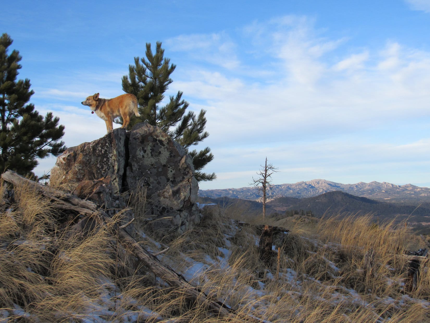
Lupe sets out for Storm Hill on Flume Trail No. 50. A spur of the trail goes up to Boulder Hill, but that wasn’t Lupe’s destination today. Photo looks SE.
For the first 0.33 mile, Lupe followed Flume Trail No. 50. The trail went SE up to a saddle between Boulder Hill and Storm Hill. With only an inch of snow on the ground, Lupe could have run around exploring easily enough. Instead, she nervously stuck close to SPHP. Distant gunfire could be heard coming from somewhere off to the W. Someone was doing target practice.
On the way up to the saddle between Boulder Hill and Storm Hill. Photo looks SE.
At the saddle, Lupe was between Boulder Hill to the SW, and Storm Hill to the NE. A spur of Flume Trail No. 50 goes all the way up to the top of Boulder Hill, but there isn’t any trail going up Storm Hill. Lupe would have to bushwhack through the forest.
Carolina Dogs love bushwhacking! Despite the distant gunfire, Lupe grew bolder after leaving the Flume Trail. She followed the saddle NE over to Storm Hill. She was going away from the gunfire, which helped her confidence.
On the saddle leading to Storm Hill. Photo looks NE.
Upon reaching the SW slope of Storm Hill, Lupe traveled right on up a rocky spine of the mountain. The climb would have been easier if she had simply avoided the rocks. However, she did get glimpses of Boulder Hill from the rocks she wouldn’t have otherwise had.
Partway up the rocky SW spine of Storm Hill. Photo looks E.Although climbing the rocky SW spine of Storm Hill was harder and slower than avoiding the rocks would have been, Lupe did get some views of nearby Boulder Hill (L) she wouldn’t have otherwise had. Photo looks WSW.The top of Boulder Hill(5,331 ft.) with help from the telephoto lens. Photo looks SW.Boulder Hill (Center) is only 0.5 mile SW of Storm Hill. Lupe had been there half a dozen times, but she’d never been to Storm Hill before. Photo looks SW.
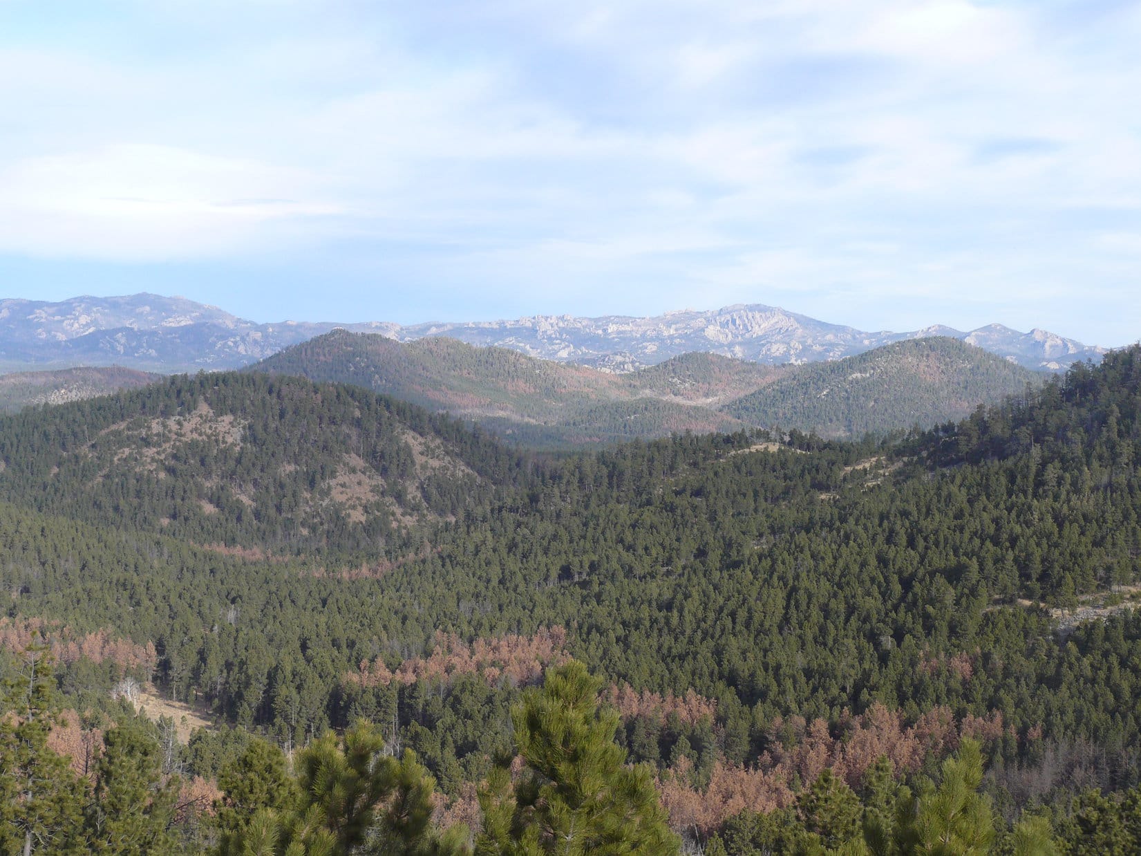
The SW spine of the mountain topped out near the S end of a broader ridge. This broader ridge was also quite rocky, but wasn’t as steep. Lupe gained elevation more slowly as she followed it N. To the E, Loop could see little but forest. However, she did come across places where she had views off to the SW or W.
The SW spine of the mountain led to this broader ridge, which was still quite rocky. Lupe gained elevation more slowly than before as she followed this ridge N. Photo looks N.Another look at Boulder Hill (R) from the broader ridge. The top of Silver Mountain(5,405 ft.) (L) can be seen sticking up between the trees. Photo looks SW.Getting closer to the summit! Loop along the W edge of the broad ridge. Photo looks N.
The summit of Storm Hill was close to the N end of the broad ridge. A fairly large summit area, perhaps 30 or 40 feet in circumference, was the highest part of the mountain. Pine trees obscured the views in some directions. However, Lupe enjoyed a panoramic view to the N and NE from the top of small cliffs.
At the summit of Storm Hill. Photo looks NNE.From the top of small cliffs along the edge of the summit area, Lupe had a panoramic view to the N and NE. Photo looks NE.
By moving around the summit area, Lupe found at least partial views in other directions.
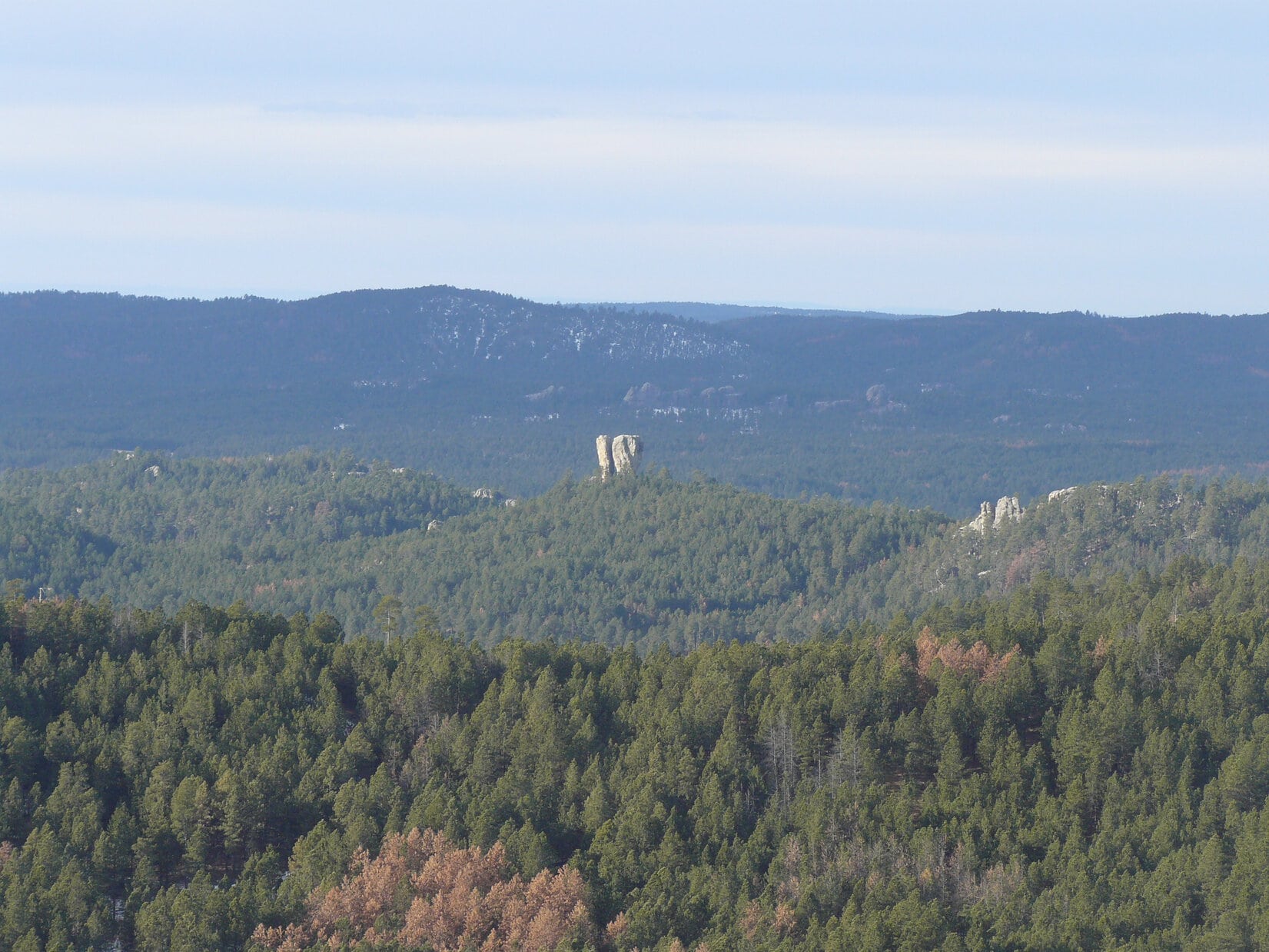
Looking SE.Custer Peak(6,804 ft) (R of Center) with a lot of help from the telephoto lens. Photo looks NW.
Storm Hill has a double summit. Two widely separated areas contained within 5,160 foot contours are on the topo map. Lupe was at the W high point where a site elevation of 5,192 feet was shown. SPHP presumed this was the true summit of Storm Hill. It was hard to get much of a look at the E high point, but there was a spot from which it could be seen.
The E high point was a long, skinny ridge. It was steeper and more rugged-looking territory. The highest parts of the E ridge appeared to be about as high as where Lupe was, but SPHP was pretty certain they weren’t any higher. Satisfied that Lupe had actually reached the true summit of Storm Hill, SPHP didn’t make her spend the extra hour it might have taken to visit the E ridge, too.
This rough skinny ridge E of Storm Hill’s true summit looked almost as high. Much of it was also within a 5,160 foot contour on the topo map. Photo looks E.
Lupe returned to the true summit of Storm Hill, before taking a little break. Meanwhile, SPHP took a few more photos of the views.
After an initial look around, Lupe returns to the true summit of Storm Hill. Photo looks N.Looking NE with help from the telephoto lens. The opening in the far ridgeline seen on the R is the area known as “The Gap” in Rapid City.Baker Park (Center & L) is the grassy open area down below. Photo looks NW.Boulder Hill (L), Mount Warner(5,889 ft.) (R), and Saint Elmo Peak(6,458 ft.) (Center in the distance) from Storm Hill. Photo looks SW.
Lupe spent 20 minutes enjoying the summit of Storm Hill before moving on. The Carolina Dog started back retracing her route S along the broad ridge. She soon left the ridge, however, veering SW to explore easier terrain in the forest below. She reached Flume Trail No. 50 again well N of the saddle where she’d originally left it.
By 11:06 AM (42°F), Loop was back at the G6. Storm Hill had been fun, but had taken her less than 2 hours. Plenty of time left in the day for more adventures! SPHP drove S. Lupe had fun barking at cows, horses, and eventually even some buffalo.At 1:52 PM (41°F), SPHP parked the G6 at the mouth of a grassy valley N of USFS Road No. 336 (Flynn Creek Road) less than a mile S of Northeast Cicero Peak(6,240 ft.). Lupe had been to Northeast Cicero Peak twice before, but her most recent ascent was now more than 2.75 years ago. For fun, she would try a new route up.
Lupe started out climbing NW up a thickly forested ridge on the W side of the grassy valley. She eventually emerged from the trees. An open hilltop was only a short distance away. Loop went to the top for a look around. She was a little S of High Point 5821. Cicero Peak(6,166 ft.) was in view not quite a mile to the SW.
Lupe reaches the hilltop S of HP 5821. Cicero Peak (Center) is in view. Photo looks SW.On her journey up NE Cicero Peak, Lupe would head for the high grassy area seen on the L before turning toward the summit on the R. Photo looks NNE.
Continuing onward, Lupe skirted High Point 5821 to the NE. The partially forested slope was so steep, she might just as easily have gone to the top of High Point 5821, but she didn’t. Upon reaching the saddle N of High Point 5821, the American Dingo turned N. She climbed a mostly open slope up to a high grassy area with a commanding view.
Lupe reaches a high grassy area SW of NE Cicero Peak’s summit. From here she had a commanding view of Cicero Peak (Center). Photo looks SW.
From the high grassy area, Lupe headed NE gaining elevation at a slower pace. Most of this part of her climb was in a forest containing scattered lumpy rock outcroppings. In the shade of the pines, snow was several inches deep.
The final approach to the summit from the WSW was a gentle climb up a grassy slope. A N/S running rock ledge only 2 or 3 feet high was at the top of the mountain. A lone boulder sat a short distance beyond the ledge. That boulder, which appeared to be slightly higher than the ledge, was the true summit of Northeast Cicero Peak(6,240 ft.).
Lupe reaches a rock ledge only a couple of feet high at the top of NE Cicero Peak. The true summit appeared to be the lone boulder seen on the L. Photo looks E.Lupe on NE Cicero Peak. Photo looks E towards the plains of western South Dakota with help from the telephoto lens.Up on the lone boulder, the true summit of NE Cicero Peak. Photo looks N.
The summit area was large and grassy. A few pines along the N edge blocked views to the NW, while a dense forest hid views to the S and SE. In other directions, Lupe could see big swaths of the Black Hills. The most interesting views were of higher country to the N.
Black Elk Peak(7,231 ft.) is the highest peak on the L. Closer, but also on the L, is heavily forested Custer Mountain(6,089 ft.). Peak6735 is the middle of the 3 high points seen just R of Center. Photo looks NNE.Same scene, but with more help from the telephoto lens. Custer Mountain is in the foreground. Black Elk Peak on the L in the distance. Peak 6735 is the middle high point on the R. Photo looks NNE.Looking NE now. Mount Coolidge(6,023 ft.) is in the distance on the R.Mt. Coolidge (L) with help from the telephoto lens. Lupe had recently visited Mt. Coolidge for the first time in over 5.5 years on Expedition No. 218.
A cool W breeze blew. A low, weary sun, partially obscured by a bank of clouds, dangled listlessly above the horizon. Northeast Cicero Peak felt forlorn, sad. Mid-afternoon, but it felt late. Late in the day. Late in the year. Winter solstice was only 3 days away. Christmas soon after that. A week later, 2017 would be over. Another year gone forever. A depressing thought.
Neither Lupe nor SPHP knew it yet, but Northeast Cicero Peak was the last mountain Lupe would climb in 2017.
At the summit of Northeast Cicero Peak, the last mountain Lupe would climb in 2017. Photo looks E.Back on the small ledge. Cicero Peak is visible on the L. Photo looks WSW.Cicero Peak (Center) from the higher summit of NE Cicero Peak. Photo looks SW.
Northeast Cicero Peak was the highest mountain this far S in the Black Hills. The views were impressive. Yet the somber mood of the mountain made SPHP restless after only 10 minutes on top. Maybe action would add some cheer? Lupe set off into the forest, intent on exploring the mountain’s S ridge on the way down.
The S ridge wasn’t a very good route. It was full of obstacles. Dense stands of young pines, slick snowy spots, rough rock outcroppings, deadfall timber, all the usual rigamarole except fences to deal with. Not much in the way of views as compensation, either. For what seemed like a long way, the Carolina Dog didn’t lose much elevation.
The summit of Cicero Peak with help from the telephoto lens on the way down NE Cicero Peak’s S ridge. Photo looks SW.
Lupe finally came to a rare open spot in the forest where the going was easier. Beyond it, the descent began in earnest.
After a slow trek along NE Cicero Peak’s upper S ridge, Lupe reached this rare open spot in the forest. Her descent became much steeper beyond this point. Photo looks S.
Once the descent really got going, it was one steep slope after another. Lupe avoided rocky areas as much as possible, which became progressively easier the lower she went. She eventually turned SW, ultimately reaching the floor of the valley W of the S ridge. Here, the American Dingo found a faint road leading back to the G6 (4:08 PM, 36°F).
The last of 33 Black Hills, SD Expeditions in 2017 was over.
Loop on Northeast Cicero Peak at the end of her Black Hills, SD adventures in 2017.
Lupe was up before dawn. SPHP hadn’t gotten up early enough for Expedition No. 108 to take Lupe to Cicero Peak(6,166 ft.), and wasn’t going to make the same mistake again. The sun had yet to make an appearance, but sunrise was coming as Lupe and SPHP headed out in the G6.
Sunrise on 12-13-14.Lupe hoping the early Carolina Dog gets the squirrel!
By the time Lupe and SPHP turned onto USFS Road No. 338, the sun was well up above the horizon. SPHP soon regretted turning onto No. 338. A high clearance vehicle wouldn’t have had any problem, but the G6 just wasn’t built to take this kind of abuse.
The narrow road wasn’t steep, but it was littered with rocks large enough to worry about getting a hole torn in the bottom of the G6’s oil pan. Some of the rocks were loose, but many were firmly attached to the mountain. No. 338 wound an excruciatingly long 1.5 miles up to a little parking lot near the top of Cicero Peak.
The G6’s oil pan survived, but the bumpy ride couldn’t have done the alignment, suspension system or tires any good. SPHP was by now firmly resolved that this was the G6’s one and only trip up Cicero Peak. Never again! At least there hadn’t been any traffic on the narrow road. There had been only one possible place to turn around other than the little parking lot near the top.
Lupe, of course, was unconcerned. She was eager to get out, and get going. It was 8:43 AM (45°F), when she hopped out of the G6. The first order of business, of course, was to go the very short remaining distance (30 feet of elevation) up to the summit. In just a few minutes, Lupe was there sniffing around a little building near the base of a tower at the top.
The tower and small building at the top of Cicero Peak.
It turned out there were a few rocks W of the tower that were a little bit higher than where the tower sat. Lupe went over and stood on them to claim her first peakbagging success of the day. Not much of an accomplishment, really. The G6 had done all the real work. Still, Lupe was here, up at the top of Cicero Peak!
Lupe on the highest rocks on Cicero Peak.
Although the top of Cicero Peak was pretty heavily forested, there were places not far below the summit where there were some pretty nice views. From the little parking lot, Lupe could see off to the E. S of the summit was a great open view to the S. Except for a few peaks far to the W, Cicero Peak is the last peak this high this far S in the Black Hills. Lupe could see a long way, clear into Nebraska.
Lupe could see a long way S from Cicero Peak.
USFS Road No. 338 was a lousy road to the top for the G6, but it made a great hiking trail. After taking a shortcut down through the forest W of the summit, Lupe and SPHP followed No. 338 most of the way back down the mountain.
Near the only possible vehicle turnaround point along No. 338, Lupe and SPHP left the road to climb a grassy slope. There were good views from here both back S toward Cicero Peak, and NE toward Lupe’s next peakbagging objective, Northeast Cicero Peak(6,240 ft.).
Lupe N of Cicero Peak. Photo looks S.Lupe’s next objective, Northeast Cicero Peak, is actually higher than Cicero Peak. Flynn Creek Road can be seen at the base of the mountain, especially toward the R. Photo looks NE.
From the grassy slope, Lupe headed directly toward Northeast Cicero Peak. She went down the grassy slope, crossed USFS Road No. 338, and cut through a field dotted here and there with pines. She entered the forest again shortly before reaching USFS Road No. 336 (Flynn Creek Road).
After crossing Flynn Creek Road at the bottom of the valley, Lupe started climbing NNW along a ridgeline. After a while, it was became apparent that this ridge was not going to be a very direct route up Northeast Cicero Peak. Lupe left the ridge, going down into the upper end of a draw. The draw was forested lower down, but mostly open territory at the upper end where Lupe entered it. Lupe found a trail to follow NNE up the other side of the draw. She ultimately arrived up on a saddle ridge running ESE/WNW.
Lupe was now WNW of Northeast Cicero Peak. From the saddle ridge, another higher ridge was visible to the ENE. Most of that ridge was barren. It looked like it had been ravaged by a forest fire at some point in the past. Was that barren ridge Daisy Peak(5,948 ft.), Lupe’s 3rd peakbagging objective of the day? It seemed to be too close, but the ridge led N to a forested hill, which might well be Kruger Peak(5,838 ft.), Lupe’s 4th peakbagging goal of the day.
Lupe reaches the saddle ridge WNW of Northeast Cicero Peak. Photo looks ENE at another higher ridge that SPHP initially mistook for Daisy Peak.This photo shows High Point 5999 (on the Peakbagger.com topo maps), which SPHP initially mistook for Kruger Peak. Photo looks N from the saddle ridge WNW of Northeast Cicero Peak.
The saddle ridge WNW of Northeast Cicero Peak also provided a great view toward higher mountains to the N and NW.
Looking NNW from the saddle ridge WNW of Northeast Cicero Peak. Some of the highest peaks of the Black Hills are in view.
After taking in the views from the saddle area, it was time for Lupe to continue on up Northeast Cicero Peak. From Cicero Peak, SPHP had noticed a large grassy area that extended high up onto the SW part of the mountain. It couldn’t be too far away from where Lupe was now. Lupe and SPHP set off heading SE to look for it.
After crossing a level open area, Lupe had to climb steeply up through a thick forest of young trees where there was snow on the ground. Lupe emerged above the forest not far from the open area SPHP had seen from a distance. A short trek to the SW brought Lupe to it. There was a great view to the S of Cicero Peak.
Lupe SW of the summit of Northeast Cicero Peak. Photo looks S toward Cicero Peak.
Back at Cicero Peak, SPHP had also caught a glimpse through the trees of an interesting little hill to the W capped by a rock that looked very much like a broken tooth. SPHP had dubbed it “Cracked Molar”. From where Lupe was now, SW of the summit of Northeast Cicero Peak, there was a clear view of Cracked Molar.
“Cracked Molar” from the SW slopes of Northeast Cicero Peak.
From the SW viewpoint, a 10 minute trek took Lupe up to the summit of Northeast Cicero Peak. The summit area was pretty broad and flat. Most of it was grassy, open ground. There was a little ridge of rocks just a few feet high, and several large boulders sitting around. There were great views in every direction, except to the S and SE where trees were in the way.
Lupe on the little rock ridge on top of Northeast Cicero Peak. The boulder that is the true summit, can be seen beyond Lupe near the trees. Photo looks ENE.Looking W from Northeast Cicero Peak. SPHP still hasn’t figured out what mountains those high peaks seen above Lupe’s back on the far horizon are.Lupe perches comfortably up on the boulder that is the true summit of Northeast Cicero Peak. Beyond Lupe on the L side of the photo is a half forested (L side), half barren (R side) hill, which was Lupe’s next peakbagging goal, Daisy Peak. Mt. Coolidge is seen just L of the dead tree on the R side of this photo. Photo looks NE.Daisy Peak (L) and Mt. Coolidge (R) from NE Cicero Peak. Photo looks NE.Harney Peak(7,242 ft.) (L) is the highest point on the horizon. Custer Mountain is the forested hill seen just below and slightly to the R of Harney Peak. Daisy Peak is on the R side of the photo. Photo looks N.
Looking N from Northeast Cicero Peak, SPHP really began to doubt that the high barren ridge and forested high point Lupe had seen from the saddle ridge down WNW of Northeast Cicero Peak were really Daisy and Kruger Peaks. They were just too close and easy to reach. On the other hand, if they weren’t Daisy and Kruger Peaks, where were they? Nothing else really stood out.
SPHP pondered the point as Lupe headed NE following a ridge down off Northeast Cicero Peak. The going was kind of slow. Rocks, dead timber, and scattered patches of snow were hidden in the grass. About halfway down to the next ridge (the one mistaken for Daisy Peak), SPHP stopped to check the maps. Lupe curled up near some rocks to enjoy the sunshine and get out of the breeze sweeping W across the ridgeline.
Lupe takes a sunny break out of the wind NE of Northeast Cicero Peak while SPHP checks the maps.
A look at the maps left no doubt. There was no way the high barren ridge Lupe was approaching was Daisy Peak, nor was the forested hill beyond it Kruger Peak. They had to be farther N, but another look in that direction left SPHP uncertain exactly which hills Lupe needed to head for. For a couple of minutes, SPHP considered just having Lupe turn around and return to the G6.
Nah! Lupe wasn’t going to turn around. The area was scenic and interesting. SPHP would figure out where Daisy and Kruger Peaks were eventually. It was an adventure, in any case, and Lupe was having fun. Onward!
The open ridge was a great place to be. There were views in every direction. Even well below the summit of Northeast Cicero Peak, Lupe was still quite high compared to much of the immediately surrounding terrain. There continued to be numerous rocks in the grass, though, and lots of fallen timber, too. To avoid tripping, SPHP had to stand still to look around.
Lupe reached the SSE end of the barren ridge. Lupe and SPHP headed for a small rocky prominence toward the NE. Time for a break. SPHP ate an apple, studied maps, and looked around trying to figure out where Daisy Peak was. Lupe had some Taste of the Wild.
Lupe at the break spot near the SSE end of the barren ridge. Photo looks NW.
OK. SPHP had it figured out. Daisy Peak was in sight off to the N. It had to be that hill well N beyond the forested hill SPHP had originally mistaken for Kruger Peak (actually High Point 5999). Kruger Peak wasn’t in view, but it was lower and probably hidden behind Daisy Peak. Now that it had been properly identified, from now on Daisy Peak was going to be easy to recognize. It was a rounded hill forested on the W side, and barren on the E side.
Daisy Peak was still quite a long way off. Time to get moving. Lupe and SPHP set off following the barren ridge NNW along the E side. Lupe eventually worked her way up to the highest point on the ridge. She continued NNW along the ridgeline from there.
The highest part of the barren ridge came to an end. Lupe and SPHP went W down a rocky slope toward a saddle leading up to High Point 5999. Partway down into the saddle, where the terrain became less rocky and not as steep, Lupe and SPHP paused. There were good views back S toward Northeast Cicero Peak, and N toward Daisy Peak.
Looking SSW back at Northeast Cicero Peak from partway down into the saddle over to High Point 5999. Part of the ridge Lupe and SPHP had followed coming down to the NE from Northeast Cicero Peak is seen toward the L.Daisy Peak is easily identifiable on the L. Lupe went all the way down to the bottom of the valley seen here on her way to climb Daisy Peak. Mt. Coolidge is the highest point on the R. Photo looks NNE.
SPHP could see that if Lupe continued following the spine of the saddle area up to High Point 5999, Lupe was going to have a long trek over a lot of rough ground. She would eventually have to lose elevation anyway, to get to Daisy Peak. Instead of climbing High Point 5999, Lupe and SPHP left the saddle area going N down into a big valley.
At first the route down was steep, rocky and full of dead timber. Gradually the going got easier. As Lupe approached a small forest in the valley, she came to a road. The road had been abandoned years ago. Trees were growing on it, but it made a great trail.
At the far N end of the valley, Lupe reached an intersection with another road going E/W. A marker showed that Lupe had been on USFS Road No. 337.1B. She had just reached USFS Road No. 337.1A, although there was no marker saying so. Lupe turned W (L) following No. 337.1A past a hill (High Point 5706) just to the N.
By the time Lupe was SW of High Point 5706, she was back in the forest. Here No. 337.1A turned SW, but Daisy Peak was still off to the N beyond High Point No. 5706. Lupe and SPHP left the road, and started climbing up the SW slope of High Point 5706. The terrain grew increasingly steep, and it became easier to just travel N along the slope.
Lupe and SPHP made it around High Point 5706 to the saddle that led up to Daisy Peak. Lupe went right on up the S slope to arrive at the summit. The true summit of Daisy Peak was out in the open near the S end of the summit ridge. There were good views from this grassy area in every direction except to the W and NW. Mt. Coolidge(6,023 ft.) was notable off to the NE.
Lupe on Daisy Peak. Photo looks NE toward Mt. Coolidge.Mt. Coolidge from Daisy Peak.Northeast Cicero Peak from Daisy Peak. Photo looks SSW.
Looking N from Daisy Peak, Lupe could finally see Kruger Peak. It wasn’t far off at all now, less than 0.5 mile. After a short rest break, Lupe headed N along the Daisy Peak summit ridge. Most of the ridge was forested, but at the very N end there was a great view of the big Glen Erin Creek valley and Custer Mountain(6,089 ft.) beyond it.
From Daisy Peak, Lupe could finally see Kruger Peak. It is the next hill over, and about 110 feet lower than Daisy Peak. Harney Peak is the highest point on the horizon. Photo looks N.Kruger Peak is the next mostly barren ridge dotted with small trees seen here to the N. The summit is in the larger trees toward the L side of this photo. Lupe was going over there next! Mt. Coolidge is seen on the R. Photo looks NNE from Daisy Peak.Custer Mountain is the forested hill seen on the L beyond the big Glen Erin Creek valley. Photo looks NNW from the N end of Daisy Peak.
To get to Kruger Peak, Lupe and SPHP started directly down the N slope of Daisy Peak. The going was slow, since the slope was fairly steep, snowy, and yet again there was a considerable amount of dead timber laying around. Lupe came across an old road down in the saddle area between Daisy and Kruger Peaks, but didn’t follow it. Instead, she just continued right on up to a high rocky point at the W end of the Kruger Peak summit.
Lupe perched on the highest rocks at the W end of Kruger Peak. This may not have been the true summit. Pictured between the trees is some ground to the E that looks slightly higher.
The rocks at the W end of Kruger Peak may not have been the true summit. There was an area a short distance E through the forest that was probably a little higher. Lupe went over there, too, to make certain she had reached the very top of the mountain. There were some rocks at the E high point, but they weren’t as impressive as those to the W.
By climbing Kruger Peak, Lupe had completed her 4th and final peakbagging goal of the day. She wasn’t going to go any farther N beyond Kruger Peak. The G6 was now 4 miles to the SSW as the crow flies. The E high point (and probable true summit) of Kruger Peak seemed like a good place to stop and take a break.
There was another reason to stop, too. Coming up Kruger Peak, Lupe had started hearing gunfire from down in the Glen Erin Creek valley to the W. It made her nervous, and she had been begging SPHP to stop and hide. So SPHP stopped and covered Lupe with a jacket so she would feel better. Lupe was happy and felt safe curled up under the jacket. SPHP ate an apple, checked the maps again, and took in the panoramic views to the E.
Daisy Peak from near the true summit of Kruger Peak. Photo looks SSW.
Lupe liked hiding under the jacket on Kruger Peak, but soon it was time to go. As SPHP led her down the E spine of the mountain, Lupe kept trying to persuade SPHP to stop again. Those big soft Carolina Dog ears could still hear gunfire far off to the W. The sun was starting to get low, though, and it was a long winding way back to the G6. Lupe and SPHP had to press on.
Lupe well down the E spine of Kruger Peak. Daisy Peak is seen on the R. Lupe traveled from here down into the valley below and over the saddle seen E (L) of Daisy Peak.
After losing quite a bit of elevation, Lupe and SPHP left the E spine of Kruger Peak. Lupe headed S down into a valley where she saw lots of deer. She headed for a saddle E of Daisy Peak. On the other side of the saddle, the land was forested and lost elevation again. Lupe had found a trail leading up to the saddle on the N side, and it continued down into the forest on the S side.
Daisy Peak from the NE.
The trail eventually led to USFS Road No. 337.1A. Lupe turned WSW (R) on it. She passed the junction with No. 337.1B, which she had come down earlier before climbing Daisy Peak. Lupe and SPHP just stayed on No. 337.1A all the way until it reached the main road, USFS Road No. 337. Although the sun was down by now, there were still a few active squirrels in the trees along the way, so Lupe had some exciting times barking as twilight closed in.
Just prior to reaching No. 337, Lupe came to half a dozen bearded men standing around a pickup truck. These were the first people Lupe and SPHP had seen since leaving the G6. The men were drinking beer, and for some reason, putting little branches of spruce trees in the empty beer bottles so they stuck out as if they were Christmas trees.
The men said they were from Custer. They weren’t hunters, just out drinking and talking in the woods having a good time. They were quite friendly. They treated Lupe kindly and offered SPHP a beer, which was politely declined. SPHP chatted with them for a few minutes. They seemed truly surprised to find out where Lupe had been.
Somewhere along USFS Road No. 337, Lupe got something stuck in her right ear. She kept shaking her head and scratching. SPHP tried to help her, but even with a flashlight couldn’t see anything in her ear. SPHP scratched it for her, which she enjoyed, but it didn’t really help. Lupe kept scratching it herself whenever SPHP stopped for more than a moment. Her ear bothered her off and on the rest of the day.
No. 337 led to No. 336 (Flynn Creek Road). No. 336 led to No. 338, the rocky road up to Cicero Peak. It was pitch dark by the time Lupe and SPHP reached No. 338. A red light could be seen up on the tower on Cicero Peak. As Lupe and SPHP made the trek up the mountain, SPHP threw 100 – 200 large loose rocks off to the side of the road, hoping to make the trip back down less traumatic for the poor, abused G6.
Before leaving Cicero Peak, Lupe and SPHP went all the way back up to the very highest rocks on the mountain, so Lupe could claim a 2nd ascent. At 6:06 PM (48°F), Lupe jumped into the G6 for the ride home. Despite SPHP’s rock clearing efforts, it still took 25 minutes to carefully drive the 1.5 miles back down the mountain, but the G6 emerged unscathed.
Black Hills, SD Expedition No. 109 was over. It was the last expedition for SPHP and the 3 year old Carolina Dog. Tomorrow was Lupe’s 4th birthday. Lupe’s last day being 3 years old had been quite a day!
After nearly two weeks of weather too cold for a pleasant outdoor experience, Lupe was really, really ready for another Black Hills Expedition. She had been thoroughly bored for days on end. Saturday, March 7th arrived with a forecast high in the low 50’s after a couple of pretty nice days which helped to melt some of the snow around. SPHP was ready to get back into action, too.
Lupe’s main peakbagging goal for the day was to climb Custer Mountain(6,089 ft.), located roughly 3 miles ESE of the town of Custer in the southern Black Hills. (The Black Hills also feature a Custer Peak, which is considerably higher and better known. Custer Peak is in the north central Black Hills.) At 9:01 AM, SPHP parked the G6 near the intersection of USFS Roads No. 342 & 341, just 0.75 mile N of Custer Mountain. Conditions were sunny, calm and 41 degrees F.
Lupe started out heading W on No. 341. She hadn’t gone too far before it was time to leave the road and start climbing the mountain to the S. The climb was moderately steep heading through a Ponderosa pine forest typical of the Black Hills. Due to the northern exposure there was a small amount of snow, not even half an inch, still on the ground.
SPHP could see through the forest that there were two high points above that might be the summit of Custer Mountain. Lupe climbed up to the W high point first, but once there, it didn’t take much exploration to establish that the true summit of Custer Mountain was to the E. After a brief break, Lupe headed past some nice rock outcroppings down into a little saddle that led to the final climb up the rather steep NW slope of Custer Mountain.
Pine bark beetles had killed large numbers of trees. Although there was still a standing forest of living trees, there was a lot of deadfall timber to contend with on the ground too. The climb up to the summit of Custer Mountain was consequently quite slow. The summit itself was a bit surprising. Having seen Custer Mountain from the S back on Black Hills, SD Expedition No. 109 on 12-13-14, SPHP had expected a fairly large flat summit area, but instead there was a narrow rocky spine running N/S at the highest point.
Lupe on the highest rock on Custer Mountain.
The rocky spine was easily climbed and Lupe posed for a couple of photos up there. There weren’t any distant views from the actual summit due to the surrounding forest. After a brief time at the top, Lupe climbed down off the rocky spine and headed SE down into a small saddle which led to another close-by high spot. This second high spot was much more level and had some open ground affording some fairly decent views to the SE.
Lupe reaches a high spot SE of the summit of Custer Mountain.
Lupe had already accomplished her main peakbagging goal for the day, which was to climb Custer Mountain. It was still very early in the day, so SPHP paused to consider what the plan might be from here. Originally SPHP had supposed Lupe would next head over to Mt. Coolidge(6,023 ft.), about 2 miles to the ESE. However, the view to the S was more interesting. In that direction were three of the peaks Lupe had climbed back on Black Hills, SD Expedition No. 109. Kruger and Daisy Peaks were 1.5 to 2 miles away. Northeast Cicero Peak was 4 miles away.
Between the trees are Kruger Peak (on left) and Daisy Peak (on right), as seen from Custer Mountain.
SPHP decided Lupe would skip Mt. Coolidge in favor of Kruger, Daisy and NE Cicero Peaks. It would be a considerably longer day, but a more challenging and interesting day too. The decision made, Lupe headed SW down off Custer Mountain. After losing nearly all the elevation gained climbing Custer Mountain, she emerged into a valley, where loggers had greatly thinned the forest. She followed a logging road down the valley to USFS Road No. 343.
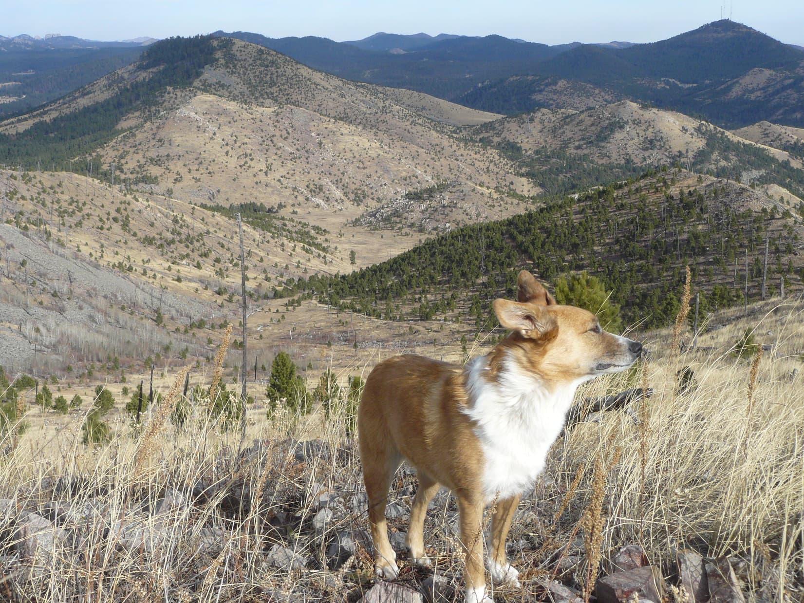
A 0.25 mile hike along No. 343 brought Lupe to an intersection with USFS Road No. 337. Lupe turned S on USFS Road No. 337. Eventually Lupe left No. 337 to hike through the forest, and then through a field to the base of Kruger Peak(5,838 ft.). She climbed Kruger Peak from the NW. (The photo featured at the start of this post is of Lupe on the upper slopes of Kruger Peak with a view back to the NW towards Custer Mountain.)
There is a fairly flat area up on the top of Kruger Peak with a couple of rocky high points at the E and W ends. Lupe visited both high points since neither was noticeably higher than the other. SPHP and Lupe paused for a little while to enjoy the Kruger Peak views, and take a water and Taste of the Wild break.
Daisy Peak from Kruger Peak.
After Kruger Peak, Lupe headed for Daisy Peak(5,948 ft.). She lost about 100 feet of elevation heading down the saddle at the SW end of Kruger Peak. From there she climbed up the N slope of Daisy Peak to arrive on top of the ridge extending NW from the summit. SPHP had Lupe go to the end of the ridge for a few photos back towards Custer Mountain. A five minute stroll SE along the narrow ridge then brought Lupe to the broader, grassy, rounded summit of Daisy Peak.
Custer Mountain (on left) and Harney Peak (center) from end of NW ridge on Daisy Peak.
At the summit of Daisy Peak there was a bit of a breeze out of the SW. The sky was also starting to cloud up a bit more, although it was still mostly clear. Lupe and SPHP spent some time enjoying the views, which were unobstructed in most directions except the NW. Lupe obliged SPHP by posing for an assortment of photos. Then it was time to move on towards NE Cicero Peak, still 2 miles to the S.
Lupe and the dead tree at the summit of Daisy Peak.Mt. Coolidge from Daisy Peak.Kruger Peak is the nearby lower ridge. From Daisy Peak it doesn’t look too impressive.Northeast Cicero Peak is the highest point towards the left center of this photo taken from Daisy Peak.
Lupe headed S down off Daisy Peak following along or just W of the ridge line. At the saddle between Daisy Peak and a smaller hill to the S, Lupe turned SW and proceeded to work her way S around the smaller hill. She reached a faint road which she followed up to the SE. The road faded into just a single track trail which reached a broad level saddle area in the forest. The trail then linked up with USFS Road No. 337.1A (unmarked) just S of the smaller hill.
Lupe followed No. 337.1A heading E and gradually losing elevation as the saddle area was left behind. Before long Lupe reached the intersection with No. 337.1B (marked). No. 337.1B headed S up a long valley towards a high ridge about 0.5 mile N of NE Cicero Peak. SPHP was impressed with the scenery in this valley back on Black Hills Expedition No. 109 when Lupe had come down the valley from the S, and enjoyed the trip up the valley from the N as well.
Looking S up USFS Road No. 337.1B from near the intersection with 337.1A.
Part way up the valley, No. 337.1B is overgrown with young pine trees. It soon dissolves into a single track trail. Lupe and SPHP headed up the trail towards the closest prominent rocky point along the high ridge to the S. Lupe left the trail to turn a bit to the E and climbed up to the top of the high ridge just E of the prominent rocky point. At the rocky point, SPHP took another photo or two looking back towards Daisy and Kruger Peaks.
Lupe on the high rocky point N of NE Cicero Peak. Photo looks N towards Daisy Peak (bare hill on the right) and Custer Mountain (forested hill near center in front of distant Harney Peak).
From the high ridge, Northeast Cicero Peak(6,240 ft.) was back in view again. This ridge sweeps around to the SE and then turns SW to head up to the summit of NE Cicero Peak. The whole ridge has only a few living trees on it, so the views are great. There are rock outcroppings scattered along the ridge, some deadfall timber, and plenty of rocks hidden in the grass. Lupe followed this ridge all the way around to gain the summit of Northeast Cicero Peak.
Looking SE along the high ridge from near the rocky point. NE Cicero Peak is on the right.Northeast Cicero Peak. Lupe climbed it via the ridge sweeping up from the NE (at the left of this photo).A look towards the SE (still along the high ridge) at territory to the E of NE Cicero Peak.
The summit of Northeast Cicero Peak is broad, flat and grassy. There is a single big rock at the NE end which is the highest point and true summit. Perhaps 30 feet to the W is a low flat row of exposed rocks running N/S which is nearly as high. At this row of rocks, Lupe was ready for a rest. She had water and ate the rest of her Taste of the Wild. It was getting cloudier. A cool breeze out of the SW was getting stronger. Perhaps 1.5 hours or a bit more remained before sunset.
Lupe sitting and squinting on the highest rock on Northeast Cicero Peak.Lupe stands on the low row of rocks on NE Cicero Peak. The prairie E of the Black Hills is in sunlight.
Lupe posed for more photos on NE Cicero Peak. She then left the summit area heading SW. At the end of the ridge to the SW was an exposed grassy area with the best views to the S of Cicero Peak. SPHP took a couple more photos here, before heading NW down into the forest. The going was a bit slippery since there was still some snow in this part of the forest. Lupe headed down towards a ridge forming a saddle between NE Cicero Peak and the next hill to the W.
Cicero Peak(6,166 ft.) (the highest point at center right) from Northeast Cicero Peak.
Lupe headed N down over the ridge and entered a big valley heading W. She lost lots of elevation as she went NW towards the valley floor. Eventually she picked up a jeep trail or USFS road which was much more level. The road headed N for a while and then turned NW starting to lose elevation again. It came to an open field where there was another road that ended in a big flat turn-around area at its E extremity.
Lupe left the road she was on to head N past the turn-around circle. A single track path disappeared into a forested valley. Lupe followed that path which continued gradually losing elevation. After 0.25 mile at most, the path reached a larger valley. USFS Road No. 337 was along the W side of this valley. Lupe followed No. 337 or paths paralleling it in the nearby fields and forests all the way back to USFS Road No. 343.
By the time Lupe reached USFS Road No.343, it was dark out. Lupe turned E on No. 343. She followed it and then USFS Road No. 342 the rest of the way back to the G6. The stars were blazing in the night sky by the time Lupe reached the G6 at 7:32 PM. It was now 35 degrees out.
After a mere 10.5 hours, Lupe still wasn’t ready to get in the G6. SPHP backed it out and turned the G6 around while Lupe sniffed the air for a few more minutes. As mysterious and exciting as the night air and sounds were, Lupe finally decided she was ready. She hopped into the G6 and curled up for a fitful snooze during the ride home.
Daisy Peak in the last weak rays of sunlight before sunset.


 At 1:52 PM (41°F), SPHP parked the G6 at the mouth of a grassy valley N of USFS Road No. 336 (Flynn Creek Road) less than a mile S of Northeast Cicero Peak (6,240 ft.). Lupe had been to Northeast Cicero Peak twice before, but her most recent ascent was now more than 2.75 years ago. For fun, she would try a new route up.