Black Hills, SD Expedition No. 300 – Peak 5266 & Peak 5360 (4-8-22)

Morning in Peedee Gulch near Deadwood

Sorry, Loopster, this just isn’t going to work.

Are you sure this is the right road, SPHP?

Yup, but I didn’t realize there was so much development going on around here, Loop.  Apparently this is all private property.  Peak 5452 is out.  So is Lexington Hill.  No access, at least from this direction.

So, what are we going to do, SPHP?

No worries!  We’ve got other Lists of John peaks to try not too far away.

Peak 5266 was next on Lupe’s list of possibilities.  Driving back down Peedee Gulch, SPHP turned W on Hwy 14A.  At the lowest point near Whitewood Creek E of Deadwood and the junction with Hwy 85, a L (S) turn led immediately to a large dirt parking area.  A “for sale” sign was advertising a lot including quite a few acres.  Exactly what was for sale wasn’t clear, but a road with a single set of tracks in the snow went through an open white gate.

Hah!  Maybe we can buy Peak 5266, Loop?  Let’s have a look!

At the big parking lot.
Setting off for Peak 5266. Photo looks S.

9:56 AM, 41ºF – Mountain shopping was an entirely new idea!  Owning a piece of the Black Hills – Lupe liked the sound of that!  Going through the white gate, she set off to inspect the property.

The snowy road immediately began curving SW, and quickly led to a junction with a muddy road.  Following it S, Peak 5266 was already in sight only 0.75 mile ahead.

Peak 5266 (R) from the muddy road. Photo looks SSE.

Avoiding the muck as much as possible, it wasn’t far to another curve SW where snow still covered the road.  A steepish, but otherwise easy march led to a flat area.  Lupe now had a clearer view of Peak 5266, and was already high enough to see Mount Theodore Roosevelt (5,680 ft.) and Peak 5360 off to the NW.

Past the mud, approaching the snowy turn to the SW.
On the steepish road march higher. Photo looks SW.
Peak 5266 from the flat region. Photo looks S.
Mount Theodore Roosevelt (Center) and Peak 5360 (R). Photo looks NW.

A couple more roads left the flat spot.  The American Dingo took the one going SE.  The initial stretch was nearly level, but the map showed that this road would eventually work its way up to a point less than 200 feet below Peak 5266’s summit.  After passing under a power line, the road bent E.

About to take the road going SE.
Passing under the power line. Photo looks SW.

Although Lupe saw no one, and didn’t come to any more for sale signs, indications of change were everywhere.  Primitive side roads had been bulldozed off in various directions.  Recently logged trees were stacked here and there.  Electric junction boxes sat awaiting use.

Looks like this whole mountain really is for sale, SPHP!

Apparently this N slope is going to be, if it isn’t already, Loop.  Destined to be turned into a housing development by the looks of things.  Going to be some beautiful building sites with views up here pretty soon.  Kind of sad, though.  Peak 5266 will never be the same.

Humans and their progress, SPHP.

I know.  What can I say?  We all have to live somewhere.

Passing signs of impending development. Photo looks ESE.

Before Lupe got far enough E to reach the point where the road would turn S beginning a winding journey back W again, heavy machinery could be heard not too far ahead.  Abandoning the road, Looper began climbing through the snowy forest directly up Peak 5266’s N slope.

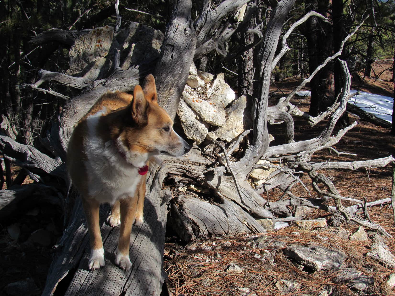
Didn’t take long to get above the pines to a rather steep region full of young aspens.  By the time Loop intercepted the road again, she was above most of the aspens, too.  The road was buried under such deep snow drifts up here that there was no advantage in trying to follow it.  Crossing the road as soon as she came to a spot where it was possible to do so, the Carolina Dog reached a barren slope.

Leaving the road to head through the forest. Photo looks SSW.
Among the young aspens. Photo looks S.
200 feet higher now, back on the road again. Photo looks W.
About to tackle Peak 5266’s upper N slope. Photo looks S.

The summit couldn’t be much farther!  Passing minor outcroppings, Lupe headed for a limestone escarpment visible along the upper end of the slope, obvious source of several huge chunks that had broken away ages ago.  Bear Butte (4,422 ft.) was already in sight far to the NE.

Bear Butte (L) from Peak 5266’s N slope. Photo looks ENE.
Approaching the limestone escarpment. Photo looks S.

Once above the escarpment, open terrain that wasn’t as steep led to the summit.  Several deer enjoying the day here weren’t anxious to strike up an acquaintance with a Carolina Dog.  As soon as they spotted Lupe, they all dashed away, much to her disappointment.

Above the escarpment, on final approach. Photo looks SW.
One of Peak 5266’s current residents before the humans move in.

11:09 AM, 45ºF, Peak 5266 – Lupe arrived at a summit region so big and flat that it was hard to say which little rock might be the absolute high point.  Short dry grass covered the entire hilltop.  No trees, only a few bushes toward the N where the terrain began gradually dropping away.

Wow!  What beautiful views from up here, SPHP!

This is a sweet viewpoint, Loop!  Sort of surprising for a minor peak like this, but the openness is key.  The snow still lingering on the hills doesn’t hurt a thing, either.

The views really were nice.   Terry Peak (7,064 ft.) off to the SW, flanked by both Deer Mountain (6,652 ft.) and Bald Mountain (6,617 ft.), was the big standout.

Deer Mountain (L), Terry Peak (R), and Bald Mountain (far R). Photo looks SW.
Terry Peak (L), Bald Mountain (Center). Looking SW with help from the telephoto lens.

In the completely opposite direction, Bear Butte (4,422 ft.), looking quite small from here, lurked beyond the main body of the Black Hills.

Crook Mountain (4,930 ft.) (L), Bear Butte (L of Center). Photo looks NE.
Bear Butte with lots of help from the telephoto lens.

Much more to see, too!  Something of interest in almost every direction.  Peak 5177, another Lists of John peak Lupe had recently visited rather late one day in January, from which she’d had a great view of the lights of Deadwood, was to the NNE overlooking the Whitewood Creek valley.

Junction of Hwy 14A & Hwy 85 E of Deadwood (L), Whitewood Creek valley (R), Peak 5177 (far R). Photo looks NNE.
Whitewood Creek valley (L of Center), Peak 5177 (R). Photo looks NNE.

White Rocks (5,250 ft.) was only 0.5 mile W.  NW, Lupe could see both the top of Mount Theodore Roosevelt (5,680 ft.) and Peak 5360, the next Lists of John peak she intended to visit.

Terry Peak and Bald Mountain (L), White Rocks (Center). Photo looks W.
White Rocks (R of Center). Photo looks W with help from the telephoto lens.
Mount Theodore Roosevelt (L), Peak 5360 (R). Photo looks NW.

Looking S, mostly barren slopes white with snow rose along both sides of Spruce Gulch toward unfamiliar hilltops capped by dark green pines.  More to the E, Lexington Hill (5,485 ft.) and Peak 5452, which had both proven inaccessible from Peedee Gulch, were in sight.

Spruce Gulch (L of Center). Photo looks S.
Peak 5452 (Center). Photo looks SE.
Lexington Hill (Center). Photo looks SSE.

Peak 5452 was even farther away now than it had been at Peedee Gulch.  Still the wrong direction to approach it from, anyway, but Lexington Hill was a different situation.

Gosh, Loop!  Lexington Hill can’t be any more than 1.5 miles from here.  All open country, so we shouldn’t have any trouble getting over there.  It isn’t a Lists of John peak with a minimum of 300 feet of prominence, but it’s a named peak we’ve never been to in the Black Hills.  Want to try it?

No time like the present, SPHP!  Let’s do it!

Peak 5452 (L) and the next hill leading to Lexington Hill (R). Photo looks SE.

Loop would have to lose 300 feet of elevation before she could start up Lexington Hill.  Heading down Peak 5266’s gentle SE slope, she made it to a sudden drop.  Peering over the edge, the Carolina Dog found herself gazing down on someone’s house.

Someone else already bought part of Peak 5266, SPHP!

So I see.  Well, we can’t go traipsing uninvited right through someone’s yard, Looper.  That’s just asking for trouble.  Would love to climb it, but maybe we better forget about Lexington Hill?

Forced to abandon the Lexington Hill idea, Lupe briefly returned to Peak 5266’s summit before heading down the N slope, this time aiming more directly for the flat spot where the road going back down to the muddy stretch left the mountain.

About as far down Peak 5266’s SE slope as Lupe got before having to head back up. Photo looks NW.

12:49 PM, 46ºF, back at the RAV4

Peak 5266 was pretty cool, SPHP!  Fabulous views!  Are we going to buy it?

Wish we could, Loopster, but I really can’t afford to buy a whole mountain.

Aww!  Please, please, please!  It’s not such a big mountain, but if it’s too much, then how about buying just the top?  That’s where we’d want to be, anyway, you know.  Imagine living way up there!  We’d leave the yard all natural, so the deers could still live up there with us!

Sounds terrific, Lupe, but I didn’t see any for sale signs up top, did you?  The only for sale sign is way down here near the bottom.  Not nearly enough acreage involved to go clear to the top of the mountain.  Don’t think it’s for sale, at least, not yet.

Maybe someday then, SPHP?

Maybe, Loop, but I think we’re dreaming.

12:56 PM, 46ºF, a pullout near the junction of Mount Roosevelt Road & Stage Run Road, 0.25 mile NW of Peak 5360

This should be an easy one, Looper!  All Black Hills National Forest, so no access issues at all, and it’s not that far away.

About to set out for Peak 5360. Photo looks SE.

Ignoring an obvious snowy lane heading directly up the hill to the SE, SPHP led Lupe past a pile of snow the plow had left at the end of the pullout.  Another lane beyond the snow pile curved along the hillside, then seemed to switchback up it.  However, this lane soon seemed less and less like a road, or even a path.

Buried in many places beneath a couple of feet of snow, it was hard to tell exactly what sort of route this was that Loop was trying to follow.  The slope was pretty steep, but the top of the ridge didn’t look all that much higher, so a decision was soon made to simply go straight up the slope.  As soon as Loopster got above the trees, which only took a few minutes, Peak 5360 was already in sight.

Peak 5360. Photo looks SE.

A little steep near the end, SPHP, but Peak 5360 is going to be cake!

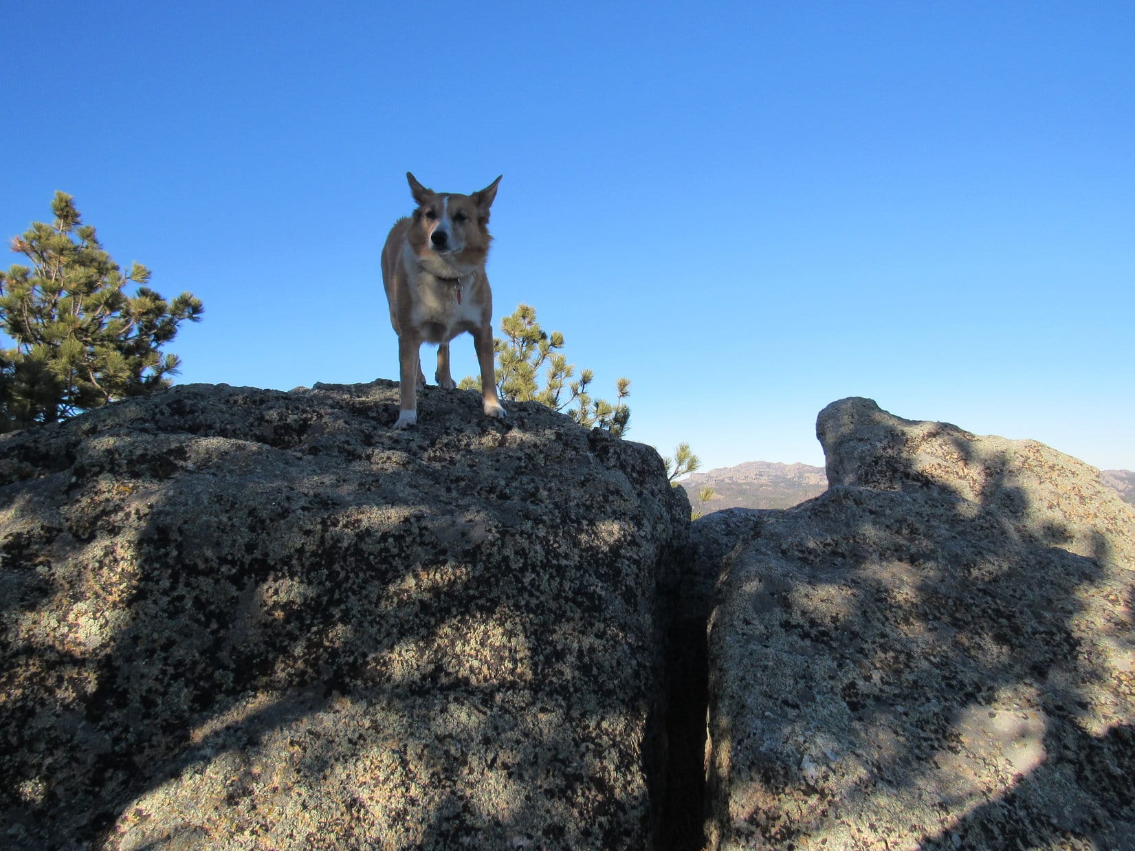
2 minutes later, Lupe made it to dry ground up on the ridgeline.  Slash piles left over from old logging operations dotted the ridge, and even Peak 5360’s upper slopes.  An easy stroll along the open ridge, and the American Dingo was at the base of the final rocky pitch higher.

Up on the ridge. Peak 5360 (R). Photo looks SE.
Nothing to it, really!
About as steep as it got closing in on the summit. Photo looks SE.

1:24 PM, 46ºF, Peak 5360 –  Tilting skyward SW, the true summit of Peak 5360 was a platform of solid rock that provided an even better view of Terry Peak, Deer Mountain, and Bald Mountain than the one Lupe had enjoyed from Peak 5266.  Foley Mountain (6,640 ft.) was in sight from this angle, too.

Peak 5360 true summit. Deer Mountain (L), Terry Peak & Bald Mountain (L of Center), Foley Mountain (Center). Photo looks SW.
Terry Peak & Bald Mountain (L), Foley Mountain (L of Center). Photo looks SW with help from the telephoto lens.

Let’s hang out right here, Loop.  This is a cool summit, too.  We’re really lucking out with these last 2 Lists of John peaks!

This isn’t as good a spot to build a house, SPHP.  Not enough room, but what a dramatic viewpoint!

No homes allowed in the National Forest, anyway, Looper.  Care for a chocolate coconut bar?

Thought you’d never ask, SPHP!  Way past lunch time, you know.

Yup.  There’s Taste of the Wild for you, too.

Looking down the SE ridge, Peak 5266 was in sight.  Peak 5360 was only 100 feet higher, but that was enough to make quite a difference.  From here, SPHP could identify some peaks Lupe hadn’t been to in a long time.  Pillar Peak (5,469 ft.), Bear Den Mountain (5,642 ft.), Dome Mountain (5,512 ft.), and Anchor Hill (5,720 ft.) were all on display.

Pillar Peak (far L), Dome Mountain (L) and Bear Den Mountain (L of Center) all on the horizon. Peak 5266 (Center) in the foreground with Anchor Hill (Center) beyond it. White Rocks (far R). Photo looks SE.
Peak 5266 (L) with Anchor Hill beyond. Spruce Gulch (R), White Rocks (far R). Photo looks SE with help from the telephoto lens.

Looking W, considerably more of Theodore Roosevelt Mountain was in sight.  Spearfish Peak (5,800 ft.) was now visible on the horizon, too.

Mount Theodore Roosevelt (R of Center), Spearfish Peak (R). Photo looks W.

The SW edge of the summit platform Lupe was relaxing on was the brink of a cliff.  Peering over it, homes along both sides of Stage Run Road were visible in the valley below.  None of the homeowners would have had any inkling of the dramatic setting their homes were part of from down there.

Stage Run Road (below). Deer Mountain (Center). Terry Peak, Bald Mountain and Foley Mountain all (R). Photo looks SW.

Two more high points only moderately lower than the true summit were visible out along Peak 5360’s NE ridge.

Didn’t take us long to get up here, SPHP.  Want to explore those other high points?  They aren’t very far away.

Sure, Loop.  Why not?  Looks easy.

Peak 5360’s NE ridge from the true summit.

It was a fun little trek!  From the rocks at the first high point, Lupe could see Polo Peak (5,410 ft.) and Green Mountain (5,325 ft.), and enjoyed a different perspective on Peak 5360’s true summit.

Mount Theodore Roosevelt (L), Polo Peak (R), and Green Mountain (far R) from the first high point. Photo looks WNW.
Peak 5360’s true summit (L), Terry Peak (Center), Bald Mountain (R of Center), and Foley Mountain (R). Photo looks SW.

The part of the ridge leading to the second high point had been clear cut, and was full of brown-needled slash piles.  The ridge continued E to a third, somewhat lower, high point where it looked like there was either a monument, or giant cairn.

However, hoping to climb yet another Lists of John peak today, Lupe didn’t go that far, content with a view of Pillar Peak beyond a stretch of Hwy 14A from the second high point, instead.

Approaching the second high point. Photo looks ESE.
Pillar Peak (R) beyond Hwy 14A. Photo looks SE with help from the telephoto lens.

Well, about time to head back.  Retracing her journey along the NE ridge, Lupe returned briefly to Peak 5360’s true summit.

Terry Peak and Peak 5360’s true summit (far L), Mount Theodore Roosevelt and the first high point (far R) from the second high point. Photo looks WSW.
Returning to the true summit (L). Terry Peak (Center), Bald Mountain (R of Center), Foley Mountain (R). Photo looks SW.
Back on Peak 5360’s true summit. Peak 5266 (R). Photo looks SE.

Loop made it to the RAV4 (2:38 PM) with plenty of time to climb another Lists of John peak, but SPHP chose poorly.  Driving to Central City and taking Maitland Road N, shortly after making a R (E) turn onto USFS Road No. 195.2A, it proved too soft and mucky with melting snow to get the Carolina Dog into position to climb Peak 5260.

Well, shucks, Loopster!  We aren’t close enough now to anything else you still need to climb to get there today.  Guess we’re going to have to call it kind of early.  Black Hills, SD Expedition No. 300!  Sort of a milestone.  Hope you had a good time.

Oh, I did, SPHP!  Both Peak 5266 and Peak 5360 were great viewpoints, and you did make Expedition No. 300 quite memorable for me today, too!

I did?  What makes you say that, Looper?

First time you’ve ever talked about buying me a whole mountain, SPHP!

Maybe someday, but probably not.  Never hurts to dream.

Peak 5266, Black Hills of South Dakota 4-8-22

Links:

Next Black Hills Expedition                    Prior Black Hills Expedition

Want more Lupe adventures?  Check out Lupe’s Black Hills, SD & WY Expeditions Adventure Index, Master Adventure Index, or subscribe free to new Lupe adventures!

Black Hills, SD Expedition No. 296 – Peak 5440, Peak 5360 & Big Rock (2-19-22)

9:22 AM, 37ºF, Custer State Park Road No. 8

Badger Hole again, SPHP?  Hey, wait!  You missed the turn!

SPHP drove only another 0.1 mile before turning R off CSP Road No. 8 at a big lot where a few small mounds of snow-covered gravel were stored.  A bit nippy in the breeze, yet a lovely morning for mid-February.  The sunny, clear blue sky held out hope for additional warmth soon enough.

At the gravel lot. Photo looks SSE.

No, we’re not returning to Centennial Trail No. 89 today, Loop, but do you remember that cool peak we saw from Pass 5180 last time out?

Yes, of course!  Looked like fun!  Are we climbing it today, SPHP?

Yup!  I looked it up.  It’s Peak 5440, another Lists of John peak with 400 feet of prominence.  We’ll climb it today along with Peak 5360, which is only another mile or so NNW.

Loopster was fine with that.  The American Dingo trotted over to CSP Road No. 8, and turned SE.  After a few hundred feet, the road curved S.  Abandoning it, Lupe headed straight into the forest.  From the top of a small rise, part of Peak 5440’s long SW ridge was already in sight.

CSP Road No. 8. Photo looks ESE.
Peak 5440’s SW ridge (Center) from the first rise. Photo looks ENE.

Might as well have stuck with the road a bit farther!  A shallow valley was directly ahead.  Angling E, Lupe passed S of a metal building, then followed the road that went to it S almost to the very end of Peak 5440’s SW ridge.  A short climb got her up to the ridgeline.

The ridge was mostly forested, plenty wide, and only moderately steep.

Descending into the shallow valley. Photo looks ENE.
In the valley. Start of Peak 5440’s SW ridge (Center & L). Photo looks SSE.
About to head up. Photo looks SE.
Start of Peak 5440’s SW ridge. Photo looks NE.

Going to be a snap, Looper!  Just follow this ridge NE.  0.5 mile and 500 feet of elevation gain ought to about do it!

Lupe started climbing.  The ridge she was on melded into another ridge farther E.  As the American Dingo gained elevation, she paused now and then, allowing SPHP to gasp for air while she admired the views that were already beginning to appear.  Mount Coolidge (6,023 ft.) was in sight a couple of miles back to the SW.

At a sunny spot while approaching the next ridge E (R). Photo looks NE.
Mount Coolidge (L of Center). Photo looks SW.
Snowy hills bordering the Galena Creek valley. Photo looks SE.
Mount Coolidge (Center) again from a little higher up. Photo looks SW.

Soon HP5200 was visible out along Peak 5440’s SE ridge.  Looked like a nice, mostly open, vantage point, but Lupe didn’t go over there.  Instead, she continued climbing along the SW ridge, which was getting rockier and starting to narrow down.

HP5200 (Center). Photo looks E.
Continuing up the SW ridge. Photo looks NE.

The ridge narrowed a great deal, developing a rocky spine.  From an open spot, a high point appeared ahead.  Perhaps the summit?

Approaching a high point (L of Center). Photo looks NNE.

Up here, the wind was gusting a brisk 20 mph out of the NW.  Loop didn’t much care for that!  Nevertheless, the Carolina Dog pressed on.  She was now high enough to catch a glimpse of Little Devils Tower (6,960 ft.), the Cathedral Spires (6,840 ft.), and Black Elk Peak (7,231 ft.).

Bracing against the wind. Photo looks NE.
Looking back along the ridge. Photo looks SSW.
Little Devils Tower (L), Cathedral Spires (L of Center) and Black Elk Peak (far R). Photo looks NW with help from the telephoto lens.

The spine of rock extended all the way up to the high point Looper had seen.  She arrived at a snowy, scenic spot, nicely sheltered by the forest from the NW wind.

Following the rocky spine higher. Photo looks SSW.
On the snowy high point. Photo looks N.
What a beautiful spot! Photo looks SSW.

Turned out, Lupe still hadn’t reached Peak 5440’s true summit.  Leaving the snowy high point, the ridge widened as Loop continued NE down to a saddle leading to the final ascent.

Leaving the snowy high point. Photo looks SW.
On the way down to the saddle that leads to the summit. Photo looks NE.

10:43 AM, 42ºF, Peak 5440 –  A broad, thinly-forested ramp made for an easy romp up to a surprisingly large summit region.  The true summit proved to be a steeply tilted rock on a small rise along the SE edge.  The big, unobstructed view was of snowy hills off to the SE.  They were all lower than Peak 5440.

Almost there! Heading up the broad ramp. Photo looks NE.
Entering the summit region. Photo looks NE.
At Peak 5440’s true summit. Photo looks SSW.
The big view. Photo looks SE.

Pines along the NW edge only partially blocked the wind.  Actually felt like winter at the true summit!  Retreating down the SE slope to escape the breeze helped a great deal.  Springtime here!

On the more hospitable SE slope. Photo looks WSW.

Springtime, and time for a chocolate coconut bar, too, SPHP!

Lupe curled up on SPHP’s lap, eagerly accepting her share of the much anticipated chocolate coconut bar.  Really quite comfortable out of the wind.  Snow on the lower hills to the SE contrasted pleasingly with the dark Ponderosa pines.

Off to the SSE was a view of some barren hills that SPHP suspected might include Peak 5120, which Lupe had been to less than 2 weeks ago during Black Hills, SD Expedition No. 295.  Couldn’t positively identify it, though.

Relaxing on Peak 5440. Photo looks SE.
Same view with help from the telephoto lens.
Peak 5120 (L)? SPHP wasn’t certain.

Inertia set in.  The day finally seemed to be warming up.  Cozy here, and the view was excellent.  45 minutes drifted by before Loopster decided she’d had enough.  Returning briefly to Peak 5440’s true summit, she then continued NE, starting for the next saddle leading to Peak 5438.

Along the way, she once again caught sight of Little Devils Tower, the Cathedral Spires, and Black Elk Peak.

Back on Peak 5440’s true summit. Photo looks S.
Little Devils Tower (far L), Cathedral Spires (L), and Black Elk Peak (far R). Photo looks NW with help from the telephoto lens.
Peak 5438 (L of Center). Photo looks NE.

Almost as soon as Lupe left Peak 5440, the ridge going to the saddle over to Peak 5438 became rocky and narrow.  Kind of rough ground!  Before Loop even got close to the saddle, SPHP was ready to ditch this route.

Heading down the rocky ridge. Photo looks NNE.

Hey, Loop!  We’re on our way to Peak 5360 now, so forget Peak 5438.  Let’s get off this goofy ridge.

The American Dingo began angling NNW.  At first, the fairly steep slope she was descending was rocky, too.  Looper lost quite a bit of elevation before getting below the rocks, but even that didn’t really help much.  The forest had recently been thinned down here, and a lot of still green slash was on the ground.

Starting down off the ridge. Photo looks S.

The rate of descent gradually diminished, but progress remained slow as SPHP kept maneuvering to avoid as much slash as possible.  After losing 300 feet of elevation, the situation changed with the discovery of a road.

The snowy road was level and ran NE at first, but soon started to curve NW and lose elevation.  Lupe eventually made it down to a sunny field, where a different road ran N/S in the valley N of Peak 5440.

On the helpful snowy road. Photo looks NE.
In the valley N of Peak 5440. Photo looks NNE.

Following this road N to the trees, it then began to climb and angle off to the NE.

Hmm.  SPHP checked the topo map.  Didn’t show any of these roads, but Lupe clearly didn’t need to go NE.  Abandoning the road, Lupe continued N, deeper into the forest.

Should be a relatively short drainage going NW somewhere along in here, Loop.  We can follow it down to Hwy 16A.

Sure enough, the Carolina Dog soon came to a ravine.  A little rougher, and more V-shaped than SPHP expected, but it all went well.  Before long, Lupe was crossing Hwy 16A.

About to enter the ravine. Photo looks NNW.
Along Hwy 16A. Photo looks NE.

A moderately steep slope N of Hwy 16A presented no real obstacles, making it a relatively easy climb.  Quickly gaining 200 feet of elevation, Lupe reached a minor saddle along a flat ridge that extended E.  From here, she had quite a nice view of Peak 5440, where she’d just been.

Climbing toward the saddle (Center). Photo looks NNW.
Peak 5438 (far L) and Peak 5440 (R). Photo looks SSE.

The view to the NW wasn’t nearly as pleasing.  Loopster was already partway up Peak 5360’s SE slope.  However, the forest had also been thinned here, although not as recently as over by Peak 5440.  Brown slash littered the entire slope.  Yuck!

Peak 5360’s SE slope. Photo looks NW.

Consisting almost entirely of small diameter stuff, the slash wasn’t all that terrible, but it wasn’t much fun, either.  Lupe patiently picked her way through it, as SPHP trudged along behind.  Slash, slash, and more slash!  Loop never got above it.  The slash extended almost 400 feet higher, all the way to the top of the mountain.

Amid the slash, getting close to the top. Photo looks NW.

1:16 PM, 44ºF, Peak 5360 – The wind was still out of the NW, but only at 15 mph now, as Lupe reached a flat, triangular summit region roughly 25 feet across.  The true summit, only a foot or two higher, if that, was a rocky area toward the W partially covered with slash.

Despite the forest having been thinned, there were still way too many trees up here to have any real views.  Glimpses of Peak 5733 to the W, and the very top of Black Elk Peak to the NW were about it.

Peak 5360 summit. Photo looks W.
Peak 5733 (beyond Lupe). Photo looks W with help from the telephoto lens.
Top of Black Elk Peak (L of Center) in the distance. Photo looks NW.

Lupe sat down in the snow next to a big tree.

This is it, SPHP?  The top of Peak 5360?

Afraid so, Loopster.

Peak 5438 would have been better than this, and a lot easier to get to, too!

Yeah, but this is a Lists of John Peak with more prominence, Loop.

Your prominence is all fine and dandy, SPHP, but what good is it, if we can’t see anything?  Especially, when the whole mountain is just a pile of slash!  Kind of takes the fun out of getting here.

Most of it, maybe, but we can still enjoy the peace, solitude, and tranquility.

And maybe another chocolate coconut bar, SPHP?

Oh, sure!  You can have some Taste of the Wild, too.

Thinking deep thoughts by the big tree. Photo looks E.

The chocolate coconut bar vanished in a flash.  Loopster then crunched away at her Taste of the Wild.  SPHP threw a sweater over her to protect against the wind.

Every mountain is unique – a unique place on the earth’s surface, and on any given day, a unique experience.  Peak 5360 wasn’t the splendid sort of mountain the American Dingo was likely to return to someday, but it had taken a while to get here.  Since Lupe wasn’t in any big rush, it seemed appropriate to linger for a while.

Slowly dying, the wind came in gusts.  The camaraderie was great, even if the views weren’t.  Nothing like being on another mountain with your best friend, ever!  Half an hour of together aloneness ebbed away.

As Lupe stood on the true summit for the last time, for the first time, SPHP noticed another view due N.

Hey, how about that, Looper!  George and Abe are here!

On Peak 5360’s true summit. Photo looks E.
Mount Rushmore. Photo looks N with lots of help from the telephoto lens.

Leaving Peak 5360, Lupe headed SW.  Definitely the way to go!  Soon she was out of the slash.  Gently sloping terrain, and reasonably open forest made for a pleasant, easy descent.

About to leave Peak 5360’s true summit. Photo looks SW.
Getting past most of the slash. Photo looks SW.
In the sunlit forest. Photo looks SW.

It wasn’t far to a power line that ran N/S.  Going S, the terrain dropped steeply.  Lupe followed the power line only a short way before veering off to the SW again, where she soon picked up a road that wound down to a saddle where the road divided.  Still descending, Loopster took the branch going S.  Eventually a field appeared off to the W that led to Hwy 87 near its junction with Hwy 16A.

At the power line. Photo looks S.
On the road discovered shortly after abandoning the power line. Photo looks WNW.
Following the field to Hwy 87. Photo looks W.

The rest was easy.  Lupe followed Hwy 16A to Legion Lake.  Below the dam, a shortcut got her back to CSP Road No. 8 and the RAV4.

By Legion Lake. Photo looks SE.

3:04 PM, 46ºF – Well, that was a nice day, SPHP!  Glad we did this!

See!  Peak 5360 wasn’t so bad!

No, it wasn’t, SPHP.  The descent was lovely, and a chocolate coconut bar had been waiting at the top, so I’m happy.  Peak 5440 was better, though, you have to admit that.

Yeah, Peak 5440 was fun, Looper!  Not that hard, yet an interesting route, plus that grand view SE from the top.  Doubt Big Rock will be any better.

Big rock?  What big rock are you talking about, SPHP?

Oh, Big Rock is where we’re going next, Loop.

What!  We aren’t done, SPHP?  Is Big Rock another Lists of John peak you’ve dredged up?

No, not a Lists of John peak, Loop.  Big Rock (5,655 ft.) is just a hill along the S edge of Custer that Arthur Caverly added to Peakbagger.com a few years ago.  Don’t really know anything about it.  Shouldn’t take us long to tag it, though.

3:21 PM, 46ºF, Custer Chamber of Commerce – SPHP parked the RAV4 at the Custer Visitor Center on Washington Street.  Out front, a snazzily painted buffalo depicted General Custer firing a pistol while wearing a freshly punctured arrow shirt.

By the painted buffalo at the Custer Visitor Center.

Harbach Centennial Park and the Mickelson Trail were right across the street.  Taking the Mickelson Trail E to South 8th Street, Lupe turned S, starting up a hill.  South 8th Street ended at a turn E onto Canal Street.

At this turn, the Big Rock trail continued S up the hill.  However, Lupe had to check out an amazing sight before taking the trail.  A whole herd of painted buffalo was grazing in a nearby vacant lot!

Part of the painted buffalo herd at the S end of S 8th Street. Photo looks E.

The painted buffalo were awesome!  Each bison bore a different colorful design.  Lupe and SPHP both favored the one with mountain goats on it.

The mountain goat buffalo.

The Carolina Dog would have been even more impressed, if the painted buffalo herd had been a little more lively.  Since she’d apparently come across the bison during a period of inactivity, Lupe started up the Big Rock trail.

About to head up the Big Rock trail.

The snowy trail climbed at an easy pace.  Lupe passed several benches.  Heading S at first, the trail eventually curved W.  Getting rather late for a February afternoon!  Low angle sunlight filtered through the trees.

On the way to Big Rock. Photo looks WSW.

The trail nearly flattened out as Lupe headed W.  Other trails took off in various directions.  After crossing a road, the Big Rock trail led to a long stairway.

Starting up the stairs. Photo looks WSW.

The long stairway led to the base of Big Rock’s massive summit block.  Solid rock, of course!  A second stairway went up to a viewing platform.

At the base of the summit block. Photo looks W.

3:57 PM, 45ºF, Big Rock (5,655 ft.) – Still windy!  Looper stood blinking in bright sunshine.  Big Rock’s true summit was tantalizingly close, right behind her.  However, no access to it without leaving the platform for a dicey scramble.

Big Rock summit. Photo looks E.

Guess we won’t be getting up there!  At least, I’m not.  Be my guest, if you want to go for it, SPHP! 

Think I’ll pass, Loop.  Apparently, Big Rock is one of those “good enough for Dingo work” peaks where we fall a bit short of the true summit, yet still claim a successful ascent.

And a chocolate coconut bar, SPHP!

Nope!  Not this time, overly-sweetened Dingo of mine!  None left, and we don’t really deserve one in this case, anyway.

No chocolate coconut bar?  That, and the chilly wind, dampened the mood, but the views were sweet!  Buckhorn Mountain (6,330 ft.) was just N of Custer.  Sylvan Hill (7,000 ft.) and Black Elk Peak (7,231 ft.) were also in sight to the NNE, but much farther away.

Northeast Cicero Peak (6,240 ft.) was the eye-catcher off to the SSE.

Buckhorn Mountain (L of Center) beyond Custer. Sylvan Hill (R). Photo looks N.
Buckhorn Mountain (L), Sylvan Hill (L of Center), and Black Elk Peak (R). Photo looks NNE.
Northeast Cicero Peak (Center). Photo looks SSE.

The Big Rock viewing platform was small.  Not much to do up here, other than the forbidden scramble.  5 or 10 minutes taking a good look around was sufficient.

On the way back, Lupe visited Sunrise Point, which offered a closer, but almost identical view of Custer.  From here, she completed a loop via the Skywalk Trail back down to Harbach Centennial Park right across the street from the RAV4.

About to head down.
Big Rock Park trail map posted at the Skywalk trailhead.

4:24 PM, 45ºF, Custer Chamber of Commerce Visitor Center –

So are we done now, SPHP?

Yup.  That’s it for Black Hills, SD Expedition No. 296, Loop!  Any thoughts?  What was your favorite part?

Well, Peak 5440 was the best mountain with that snowy high point, plus the great view to the SE, but you know what, SPHP?  The mountain goat painted buffalo is hard to beat!

By the mountain goat buffalo, Custer, South Dakota 2-19-22

Links:

Next Black Hills Expedition                     Prior Black Hills Expedition

Want more Lupe adventures?  Check out Lupe’s Black Hills, SD & WY Expeditions Adventure Index, Master Adventure Index, or subscribe free to new Lupe adventures!

Black Hills, SD Expedition No. 191 – Peak 5360, Peak 5240 & Buckhorn Mountain (2-13-17)

Even standing right next to the marker, the numbers on it were so faded SPHP could barely make them out.  313.1G.  Excellent!  No doubt about it now, this icy dirt road leading into the trees was a USFS Road.  Come on out, Loop, this is it!  Lupe was out of the G6 in a flash (8:58 AM, 39°F).  She thrashed around rolling on the ice in her excitement and desire to cool off.

Most of the land right along Carroll Creek Road (County Road No. 313) was privately owned in this area, but SPHP’s old USFS map did show national forest land coming right down to Carroll Creek Road in a few places.  Finding USFS Road No. 313.1G meant Lupe had national forest access around the private property nearby.  She could get to Peak 5360.

Much of the snow that had been in this vicinity a week ago had melted.  What was left had turned to ice on No. 313.1G, making it quite slippery.  Off road, patches of crusty, crunchy snow lingered in shady spots.

The snow that had been in this vicinity a week ago had turned to ice now on USFS Road No. 313.1G. Photo looks N.

Peak 5360 was another of the series of peaks in the southern Black Hills that Brian Kalet had added to the Peakbagger.com data base last spring.  On recent expeditions, Lupe’s adventures had been focused on climbing these Brian Kalet peaks.  She now had a good start on visiting all of them.  A successful summit of Peak 5360 would “X” another one off the list.

Peak 5360 was only 0.67 miles N as the crow flies.  Lupe would have to go more like a mile to actually reach the summit.  No. 313.1G started out curving across the lower end of a draw to the NE.  It then went around the SW end of a forested ridge before turning NE.  Here, Lupe already had a view of Peak 5360 to the N beyond a field of private property.

After following No. 313.1G around the SW end of a forested ridge, Lupe could see Peak 5360 ahead beyond a privately-owned field. Photo looks N.
Peak 5360 from the S.

Displaying limestone cliffs at the SW end, Peak 5360 looked like it was probably easiest to climb from the NE.  Lupe followed No. 313.1G up the valley.  After the road got beyond the end of the private field, Lupe came to two intersections in rapid succession.  At the second one, she left No. 313.1G to continue NE on No. 313.1H.  She hadn’t gone far at all before reaching a fence with a “No Trespassing” sign.

SPHP checked the USFS map again.  Yes, a very narrow strip of private property within the national forest extended farther up the valley from here.  Lupe ought to be able to go around it easily enough.  SPHP led Lupe NW directly toward Peak 5360.  Sure enough, the fence ended shortly after reaching the trees.  Lupe turned NE again.

As she got closer to the NE end of the mountain, Lupe started climbing.  She had already gained a fair amount of elevation by the time she was able to turn SW to tackle the steepest part of the slope leading to the summit.  The remaining snow was getting soft and starting to melt, making things slick for SPHP.  The Carolina Dog had no problem, though.  She was rapidly approaching the small limestone outcroppings near the top of the mountain.

The snow was starting to melt and make things slippery as Lupe reached the steepest part of the climb up the NE slope. The snow was no problem for her. Soon she could see the limestone rock outcroppings just below the top of the mountain ahead.
Lupe at the base of the limestone cap of Peak 5360. Fortunately, the line of rock was discontinuous here at the NE end of the mountain. Lupe had no problem finding an easy route to the top. Photo looks SSW.

The exposed limestone cap at the NE end of Peak 5360 was not thick or continuous enough to create a solid line of cliffs.  Lupe had no problem reaching the top of the mountain.  The mountaintop was heavily forested, but she had good views from an opening looking NE.

Cicero Peak (6,166 ft.) (L) from the NE end of Peak 5360. Photo looks NE.
Black Elk Peak (7,231 ft.) (L). Photo looks NNE using the telephoto lens.

Now that she had made it up here, it was time for Lupe to explore the top of Peak 5360 to find the true summit.  The summit ridge extended another 0.125 mile to the SW, so the high point might be some distance away.

From here near the NE end of the mountaintop, Lupe set out to find the true summit of Peak 5360. Photo looks WSW.

As it turned out, Lupe didn’t have far to go.  The true summit was only 100 feet from where she’d reached the top of the mountain’s limestone cap.  Brian Kalet had marked the true summit on Peakbagger.com as being close to the NE end of the mountain.  Brian was absolutely correct.

A dead tree had fallen over right at the actual summit, and made a great prop from which Lupe could claim her 1st peakbagging success of the day.

Lupe stands on the fallen dead tree at the true summit of Peak 5360. Photo looks NE.
Amid a dense forest, the gnarly roots of the fallen dead tree were the most scenic thing in view from the true summit.

Simply because she had reached the true summit of Peak 5360 so quickly didn’t mean Lupe was done here.  Loop was ready to explore the entire summit area to see what else she might discover.  Two ridges converged at the true summit.  The shorter one went W, while the longer one went SW.  Lupe went SW first.

The SW ridge varied from 50 – 200 feet wide.  Although the ridge was fairly level, Lupe lost elevation steadily as she conducted her exploration.  From cliffs along the SE edge, Lupe often had nice views in that direction, but the forest hid everything to the NW.

Explorer Lupe midway along the SW ridge. Photo looks back to the NE in the direction she was coming from.
Exploring the SW ridge. Photo looks SW.

Lupe had lost significant elevation by the time she reached the cliffs at the end of the SW ridge.  Unsurprisingly, the best views were to the SSW.  Lupe could see both Parker Peak (4,848 ft.) and Matias Peak (4,780 ft.).  Both were far away on the horizon and looked like mere bumps from here.

The best view from the end of the SW ridge was to the SSW. Lupe could see both Parker Peak (on the horizon straight up from the end of her nose) and Matias Peak (also on the horizon, but a little to the R of her tail), but they were so far away they looked like mere bumps from here.
Looking down on the Carroll Creek valley. Despite the melting snow, the creek was bone dry when Lupe came by today. Photo looks WNW.

Since the views were better here at the end of the SW ridge than back at the true summit, SPHP suggested taking a short break.  Lupe was fine with that for 10 minutes.  Then she disappeared.  SPHP had to call her.  She came running back from the NE.  Apparently she had seen enough of this end of the mountain!

At the end of the SW ridge during break time. Photo looks S.

Lupe and SPHP started back up to the NE.  When the Carolina Dog was getting close to the true summit again, she turned W to explore the shorter W ridge.  This was the only part of the mountain with decent views toward the N or NW.  Lupe saw both Sylvan Hill (7,000 ft.) and Thunderhead Mountain (6,567 ft.), but they were quite a long way off.

Lupe’s explorations of Peak 5360 were now complete.  She returned briefly to the true summit before heading back down the NE slope.  She retraced her entire route back to the G6 (11:12 AM, 46°F).

On USFS Road No. 313.1G again on her way back to the G6. Photo looks SSW.

Lupe wasn’t done with Brian Kalet peaks yet today.  Another one, Peak 5240, was her next destination.  Peak 5240 is nearly 4 miles SE of Peak 5360 on the opposite side of the little town of Pringle.  Ordinarily that would have been close enough for Lupe to consider simply exploring a route to it through the hills, but the USFS map showed a lot of private property in the Pringle area.  Lucky Lupe was going to get a ride over to Peak 5240 in the G6.

That was fine with the American Dingo!  She kept a keen eye out for cows and horses to bark at along the way.  She saw several on the way to Pringle, and hit the jackpot when she got there.  A whole herd of black cattle was grazing SE of the intersection of Hwy 385 and Hwy 89.  Peak 5240 was close by, in full view beyond the herd.

Peak 5240 is only 0.67 miles SE of the small town of Pringle. It is clearly visible from the junction of Hwy 385 & Hwy 89. Photo looks ESE at the mountain from Hwy 89 less than 0.5 mile S of Pringle.

The old USFS map made it look like there was national forest access to Peak 5240 starting less than 1 mile E of Pringle on the S side of Hwy 385.  A possible USFS road shown on the Peakbagger.com topo map was nowhere in evidence, though, when SPHP drove by.  Quite a bit of private property was in the area.

In fact, an apparently long-established commercial business, the Pringle Bed & Breakfast resort, sat on fenced land S of Hwy 385 where SPHP had expected to find the national forest.  The Pringle Bed & Breakfast looked affordable to begin with, and they were advertising winter rates.  SPHP was in a generous mood.  Did Lupe want to go in for a luxurious, comfy snooze and hearty, nutritious breakfast?

Oh, you’re a riot, SPHP! No, I’m not this tired or hungry!
I’ll get you for this! Yeah, some day my fans will be reading “SPHP went missing mysteriously on Expedition No. Blah, Blah”.

SPHP still thought the land the Pringle Bed & Breakfast sat on was national forest ground, but the expected access road didn’t seem to exist and there was nowhere to park.  Maybe there was access from the W?  SPHP drove back W to Shirttail Canyon Road and turned S.  After passing by several private properties, a USFS marker appeared near the start of a dirt side road.  Lupe was in luck!  SPHP parked the G6, and Lupe was back in business (11:41 AM, 47°F).

The USFS road led up the W slope of Peak 5240 through an open forest of Ponderosa pines.  It soon ended at the old Townsite Mine, where a couple of signs indicated someone from Oklahoma had recently staked a new mining claim.  Lupe found nothing else here other than the big scar in the hillside left by the original mining operation.  She did have quite a good view back toward Pringle to the NW.

Lupe arrives at the historic Townsite Mine on the upper W slope of Peak 5240. It is historic simply because all defunct old mines are historic, in case you hadn’t ever noticed before.
From the Townsite Mine, Lupe had an unobstructed view of Pringle, SD. Photo looks NW.
Other than this big gash in the W side of Peak 5240, Lupe found nothing else at the old Townsite Mine. Photo looks N.

It doesn’t take a Carolina Dog long to look at a hole in the ground, even if it’s a fairly big one.  Lupe left the Townsite Mine going a little S before turning E.  She had to make her way up a short, fairly steep slope, but quickly reached the top of a limestone outcropping.  Lupe stopped briefly here for a look at the already great view to the SSW.

The view from here was similar to the one Lupe had from the SW ridge on Peak 5360, but was more open and panoramic.  Loopster could see Parker Peak (4,848 ft.) and Matias Peak (4,780 ft.) again.  They were still far away, but a little closer than before.

Coming up Peak 5240 from the SW, Lupe reached the top of this limestone outcropping where she had a great panoramic view to the S. Still appearing as little bumps on the horizon, Lupe saw Matias Peak (straight up from her tail end) and Parker Peak (L of Center). Photo looks SSW.
Another look SSW. Parker Peak is now near (Center) on the horizon.
Parker Peak (R) through the telephoto lens.

The rest of the climb up Peak 5240 was only moderately steep.  At the top of the mountain, one medium-sized rock stood out as being the true summit of Peak 5240.  Lupe stood on it to claim her 2nd peakbagging success of the day, striking a somewhat dramatic pose.  There was little doubt she was merely following a tradition already established by Brian Kalet.

Lupe poses dramatically at the true summit of Peak 5240! Hwy 385/89 N of Pringle can be seen in the distance. Bear Mountain (7,166 ft.) is on the far horizon. Photo looks NNW.
At the true summit. Photo looks WNW.

Near a cairn E of the true summit, Lupe found a survey marker, but it seemed to have more to do with a section line than anything having to do with Peak 5240.  The top of the mountain formed a ridge running E/W.  The ground was close to level for about 200 feet in this direction.  Lupe had surprisingly good views in most directions except to the W and NW, where pines blocked the view toward Pringle.

Looking down the S ridge from a point E of the true summit. Photo looks S.
View to the NE.
Looking SE. A lot of forest had burned in this direction.

After looking at the views from the E end of the summit, Lupe and SPHP took a break over toward the W end.  The trees here provided welcome shade.  Lupe wasn’t really hungry yet, but she stayed close by while SPHP munched an apple.

The view down the S slope was lovely.  On the horizon was a distant blue ridge that might be part of the Seven Sisters Range (4,420 ft.), where Lupe hopes to visit some more Brian Kalet peaks in the relatively near future.  SPHP must have been daydreaming and munching away for a while.  Suddenly an American Dingo was right there, demanding an explanation.

Just how long does it take you to eat one crummy apple, anyway? Can we go yet?

Lupe was ready for action!  OK, OK!  SPHP finished the apple.  Lupe cooperated with SPHP for one last photo looking down the S slope.  She returned briefly to stand atop the summit rock one more time.  Then she headed down the S slope to continue her exploration of Peak 5240.

Looking at the lovely view down the S slope from the break area a little W of the true summit. Photo looks SSE.
The high points along the distant blue ridge at Center and to the L may be part of the Seven Sisters Range S of Hot Springs, SD. Photo looks SSE using the telephoto lens.

Lupe went all the way down to the drop-off at the bottom of the S slope.  Although she had lost a fair amount of elevation, she still had a great panoramic view.

Lupe near the drop-off at the lower end of Peak 5240’s S slope. Shirttail Canyon Road is the dirt road below on the R. Beyond it, Hwy 89 curves away to the W. Matias Peak is the highest dark hill seen L of Center near the horizon. Photo looks SW.
Looking N back up the S slope.

Lupe’s investigations on Peak 5240 were now complete.  She left the mountain, stopping by the Townsite Mine one more time along the way.  Soon she was back at the G6 (1:04 PM, 47°F).

More than 4 hours remained before sunset.  Lupe had run out of Brian Kalet peaks to explore near Pringle.  However, while Loopster had been climbing all the Brian Kalet peaks farther N in recent weeks, SPHP had noticed a mountain not in the Peakbagger.com data base that Brian had somehow missed.  Buckhorn Mountain (6,330 ft.) was just N of Custer, SD.

Lupe had seen Buckhorn Mountain from Peak 6181 only a few weeks ago.  It looked like a fairly impressive peak which might have some pretty sweet views from the top.  The Custer area, especially to the N, is rugged territory for the Black Hills featuring lots of huge granite rock formations.  SPHP wasn’t even certain if Lupe could get to the top of Buckhorn Mountain, but she was about to find out!

After driving to Custer, SPHP parked the G6 again at the intersection of Hwy 89 and USFS Road No. 362, about a mile N of Hwy Alt 16 (1:33 PM, 45°F).  Buckhorn Mountain was only 1.5 miles to the NW.

On the first half of the trek to Buckhorn Mountain, Lupe followed USFS Road No. 362.  The road wound NW through a forest which had been thinned by loggers fairly recently.  Lupe liked the open forest, and trotted along on or near the road sniffing happily.  She gained elevation steadily, but only gradually, on the way.  She passed by a private drive on the N side of the road, but No. 362 continued on beyond it.

At the high point on No. 362, Lupe found an intersection.  From here, No. 362 went W starting downhill.  USFS Road No. 362.1C went N.  By now, Lupe was very close to the end of the part of the forest the loggers had thinned.  Buckhorn Mountain’s thickly forested SE ridge came right down to No. 362.1C nearby.  Lupe took No. 362.1C going N, but arrived almost immediately at a gate barring the road.  A sign said she had reached private property.

Lupe didn’t need to go any farther N anyway.  Time for the American Dingo to begin her ascent of Buckhorn Mountain!  Lupe and SPHP plunged into the forest, starting up the SE ridge.

The climb was really fun!  It was steep, but not too steep.  At first the forest was the only obstacle to navigate, but very quickly Lupe began coming to granite rock formations along the top of the ridge.  The higher up Lupe went, the more the rock outcroppings grew in size.  At any moment Lupe might come to a wall of solid rock preventing further advance along the ridge, but she didn’t.  Each time that kind of situation seemed to be developing, Lupe found an easy way over, around, or through.

Climbing Buckhorn Mountain’s SE ridge, Lupe came to many interesting rock formations along the way. This one has a hole in it near the top. Photo looks SSE.

SPHP knew that Lupe would eventually come to an intermediate high point, sort of an ESE shoulder of the mountain.  The shoulder area had some towering granite at the top.  It was the first area of real concern.  Would Lupe be able to get past this area without having to lose a bunch of elevation going around it?

A wall of rock 40 feet high appeared ahead.   Lupe’s prospects weren’t looking too good, but she kept climbing right up to it.  The luck of the Dingo held.  Looper found an easy route around the NE side of the rock formation.  She was past the ESE shoulder.  Nothing to it!

Lupe alongside the rock formations of the ESE shoulder of Buckhorn Mountain. She has already made her way around the NE (L) side of them. Photo looks SE.
Lupe below the rocks of the ESE shoulder. Photo looks SE.

Now that she was beyond the ESE shoulder, Lupe could see the top of Buckhorn Mountain ahead.  It was still a bit of a climb, but wasn’t that far away!

Now that she was past the ESE shoulder, Lupe could see the top of Buckhorn Mountain ahead. It wasn’t that far away!

Lupe lost only a little elevation traversing the saddle from the ESE shoulder to start the remaining climb up the E slope of the mountain.  The forest in the saddle had been thinned by loggers.  SPHP staggered through all the annoying slash the loggers had left behind.  Before reaching the end of the slash, Lupe was already climbing again.

It still wasn’t clear if Lupe would be able to reach the top of Buckhorn Mountain or not.  The final climb had stretches near the top which were even steeper than before.  SPHP had to grab onto rocks and trees in some places to get up.  None of this was difficult or scary – just a little light scrambling, but with snow and some deadfall timber around, it was slow going.

Near the top, suddenly the ridge was much flatter and easier than before.  Lupe and SPHP went W making rapid progress.  High rocks appeared ahead.  SPHP’s heart sank.  There was no way Lupe could reach the top, at least not from what SPHP was seeing from this direction.  The rocks were nearly vertical and way too high.

Nothing to do, but check it out.  Lupe worked her way around the N side of the rock formation, and found herself in a saddle between it and another rock formation to the N.  It still didn’t look like Lupe would be able to climb up the first rock formation.  So disappointing!  The rocks to the N looked easier, so Lupe went that way first.

The rocks extended farther N than SPHP had seen at first.  Lupe kept climbing along a surprisingly easy route.  As she reached the N end, SPHP looked back and saw that she appeared to be every bit as high as the highest rocks to the S!  In fact, the very highest rocks at the N end looked like they might even be slightly higher.  Lupe had reached the true summit of Buckhorn Mountain (6,330 ft.)!  Easy as pie in the end!

Lupe reaches the summit of Buckhorn Mountain. Easy as pie in the end! Photo looks E.
Lupe at the top of Buckhorn Mountain. These rocks at the N end are the true summit in SPHP’s opinion, although it is a very close contest with the first high point Lupe had seen roughly 200 – 300 feet farther S. Photo looks N.

The views were fabulous!  Poor Brian Kalet had really missed out by not getting to this peak.  Lupe had a sweeping 180°+ panoramic view everywhere to the N.  The Carolina Dog could see lots of the highest, most rugged territory and peaks of the Black Hills from here.

Thunderhead Mountain (6,567 ft.) is almost always referred to locally as Crazy Horse due to the memorial being carved into the mountain. Photo looks N using the telephoto lens.
Sylvan Hill (7,000 ft.)(L) and Black Elk Peak (7,231 ft.)(R). Photo looks NNE.
Bear Mountain (7,166 ft.) (L of Center) is the highest point along the far ridge. Photo looks NW.

Lupe decided to celebrate her successful ascent of Buckhorn Mountain by taking a break.  She feasted on Taste of the Wild, then curled up for a rest at a comfy spot in the warm sunlight.

Lupe decided it was time to put a little Taste of the Wild in her tank.
Relaxing in the sun. Photo looks NNE.

While Lupe relaxed, SPHP took a couple of close-ups using the telephoto lens.

Sylvan Hill with some help from the telephoto lens. Photo looks NNE.
A closer look at Bear Mountain. Photo looks NW.

After her short rest, Lupe got back up on the true summit at the N end of Buckhorn Mountain again.

Lupe returned to the N summit after her rest break. Black Elk Peak is seen on the R. Photo looks NNE.

The time had arrived to explore the rest of the summit area.  Maybe it was possible for Lupe to reach the top of the first rock formation she had come to farther S?  If she could, there wouldn’t be any question whether she had reached the true summit of Buckhorn Mountain.  The Carolina Dog headed S to check it out.

The top of the rock formation to the S is seen on the R. Photo looks S from a point not too far from the N summit.

It turned out that the S rock formation was really the middle high point on Buckhorn Mountain.  Between the trees, another high point could be seen even farther off to the SSW.  However, it was clear that the actual S high point wasn’t as high as either the central or N ones were.

From the NW, the middle rock formation didn’t look nearly as daunting as it had from the E.  Lupe could probably climb it from the SW!

Lupe near the middle high point. Seen from the NW, it wasn’t nearly as imposing as it had seemed when Lupe originally approached from the E. In fact, it looked like Lupe might be able to get to the top from the SW. Photo looks SE.

A couple of minutes later, Lupe and SPHP were at the top of the middle summit.  Getting there was an easy little scramble.  The area at the top was all lumpy granite, but Lupe had a little room to move around.  From here, she had terrific views to the E.  She could see part of the town of Custer to the SSE, and beyond all the way to Northeast Cicero Peak (6,240 ft.).

Loop reaches the top of the central high point on Buckhorn Mountain, the rock formation that had looked too imposing to climb as Lupe first approached it from the E. Photo looks NE.
Lupe on the Central high point. Looking back toward the N summit, which was almost in view from here, SPHP really wasn’t certain which was the true summit. Either way, Lupe had now been on top of both. SPHP’s final conclusion was that the N high point is the true summit, but it’s an extremely close contest. It’s entirely possible this is actually it. The difference might be only inches, a foot or two at most.

Having climbed both the N and Central high points now, no matter which one was actually the true summit of Buckhorn Mountain, Lupe had been there.  All that was left to do was check out the views from the lower S high point.  As Lupe approached it from the N, there seemed to be little prospect of reaching the top.  The rocks were vertical.

As Lupe approached from the N, there seemed to be little chance she could get to the top of the S high point. Photo looks S.

Sadly, SPHP didn’t think Lupe could even reach the S end of this rock formation, where there ought to be a sweeping panoramic view.  Wrong!  Lupe discovered an easy way around the W side that led directly up to a fantastic viewpoint.

From the far S end of the S high point, Lupe had this beautiful view to the WNW. Huge granite formations were close by. Farther off was Atlantic Hill (6,393 ft.) (R), and beyond it were the distant high ridges of the western Black Hills.
Lupe at the far S end of the S high point. The town of Custer is seen below. In the distance is Northeast Cicero Peak (6,240 ft.) (Center). Apparently deer (or mountain goats?) like this view. There were lots of what looked like deer droppings near the edge of the precipice. Photo looks SSE.
Part of the town of Custer, SD with Northeast Cicero Peak in the distance. Photo looks SSE using the telephoto lens.

Lupe couldn’t get to the top of the highest rocks at the S high point, but reached a point that wasn’t too much lower.  It didn’t matter anyway, since the S high point was definitely not the true summit.  After enjoying the grand view, Lupe returned to the N end of the mountain.  SPHP needed to retrieve the pack, which had been left there.

Thunderhead Mountain (Crazy Horse) (R of Center) again from the N summit. Photo looks N.
Black Elk Peak with a little help from the telephoto lens.

After SPHP retrieved the pack, Lupe left Buckhorn Mountain.  What a splendid fun climb and summit it had been!  Lupe went back to the G6 following the same scenic route she had taken up.  Near the wild-looking rock with a hole in it, SPHP found the topo maps on the ground.  SPHP had dropped them on the way up.

Fortunately, when the route is obvious, a map isn’t required.  Just keep following that curly Dingo tail onward and upward!  (5:27 PM, 36°F)

Links:

Next Black Hills Expedition                      Prior Black Hills Expedition

Want more Lupe adventures?  Choose from Lupe’s Black Hills Expeditions Adventure Index or Master Adventure Index.  Or subscribe free to new Lupe Adventures.