Black Hills, SD Expedition No. 296 – Peak 5440, Peak 5360 & Big Rock (2-19-22)

9:22 AM, 37ºF, Custer State Park Road No. 8

Badger Hole again, SPHP?  Hey, wait!  You missed the turn!

SPHP drove only another 0.1 mile before turning R off CSP Road No. 8 at a big lot where a few small mounds of snow-covered gravel were stored.  A bit nippy in the breeze, yet a lovely morning for mid-February.  The sunny, clear blue sky held out hope for additional warmth soon enough.

At the gravel lot. Photo looks SSE.

No, we’re not returning to Centennial Trail No. 89 today, Loop, but do you remember that cool peak we saw from Pass 5180 last time out?

Yes, of course!  Looked like fun!  Are we climbing it today, SPHP?

Yup!  I looked it up.  It’s Peak 5440, another Lists of John peak with 400 feet of prominence.  We’ll climb it today along with Peak 5360, which is only another mile or so NNW.

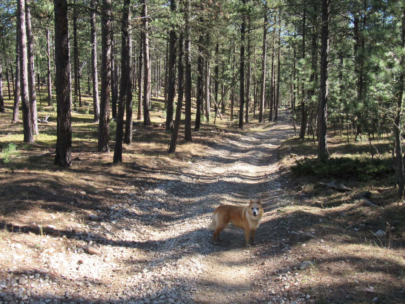
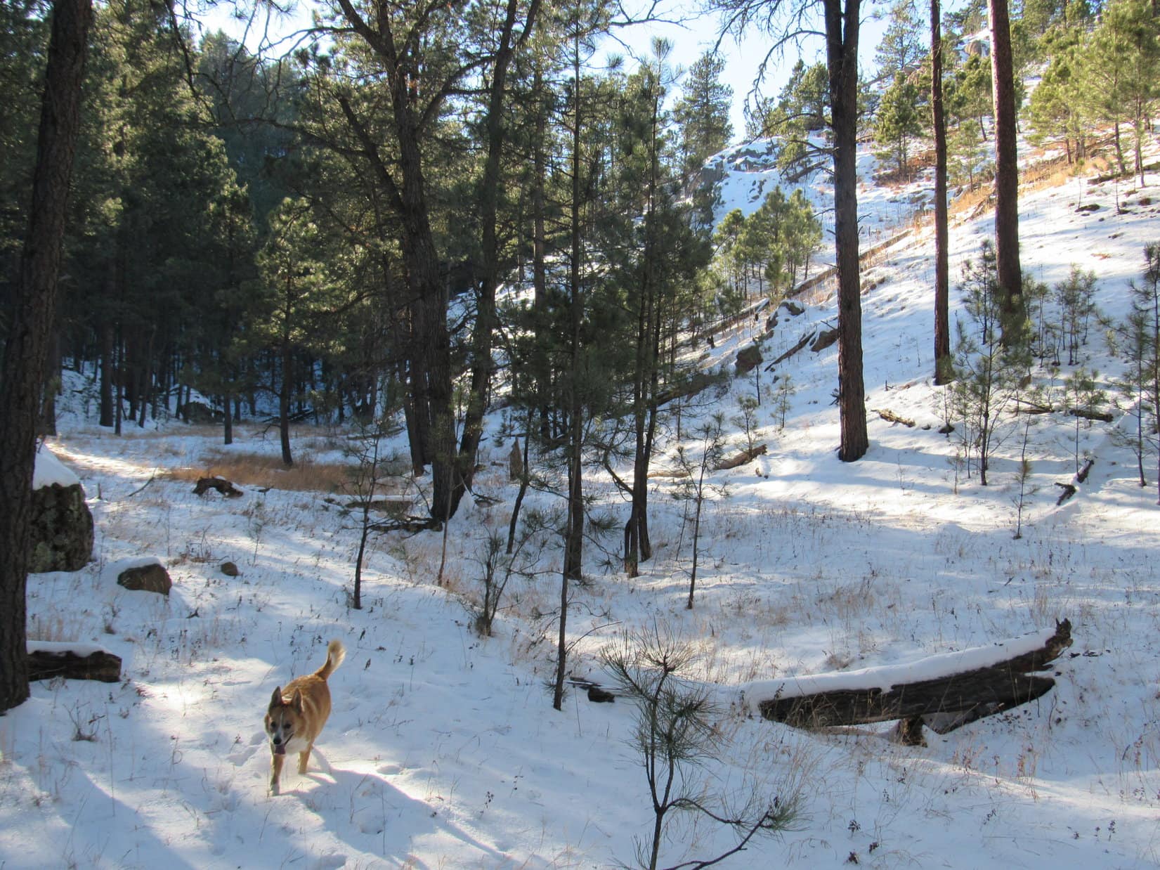
Loopster was fine with that.  The American Dingo trotted over to CSP Road No. 8, and turned SE.  After a few hundred feet, the road curved S.  Abandoning it, Lupe headed straight into the forest.  From the top of a small rise, part of Peak 5440’s long SW ridge was already in sight.

CSP Road No. 8. Photo looks ESE.
Peak 5440’s SW ridge (Center) from the first rise. Photo looks ENE.

Might as well have stuck with the road a bit farther!  A shallow valley was directly ahead.  Angling E, Lupe passed S of a metal building, then followed the road that went to it S almost to the very end of Peak 5440’s SW ridge.  A short climb got her up to the ridgeline.

The ridge was mostly forested, plenty wide, and only moderately steep.

Descending into the shallow valley. Photo looks ENE.
In the valley. Start of Peak 5440’s SW ridge (Center & L). Photo looks SSE.
About to head up. Photo looks SE.
Start of Peak 5440’s SW ridge. Photo looks NE.

Going to be a snap, Looper!  Just follow this ridge NE.  0.5 mile and 500 feet of elevation gain ought to about do it!

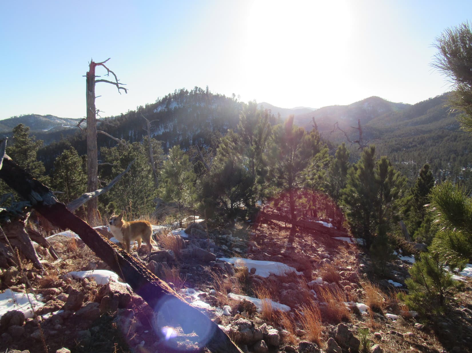
Lupe started climbing.  The ridge she was on melded into another ridge farther E.  As the American Dingo gained elevation, she paused now and then, allowing SPHP to gasp for air while she admired the views that were already beginning to appear.  Mount Coolidge (6,023 ft.) was in sight a couple of miles back to the SW.

At a sunny spot while approaching the next ridge E (R). Photo looks NE.
Mount Coolidge (L of Center). Photo looks SW.
Snowy hills bordering the Galena Creek valley. Photo looks SE.
Mount Coolidge (Center) again from a little higher up. Photo looks SW.

Soon HP5200 was visible out along Peak 5440’s SE ridge.  Looked like a nice, mostly open, vantage point, but Lupe didn’t go over there.  Instead, she continued climbing along the SW ridge, which was getting rockier and starting to narrow down.

HP5200 (Center). Photo looks E.
Continuing up the SW ridge. Photo looks NE.

The ridge narrowed a great deal, developing a rocky spine.  From an open spot, a high point appeared ahead.  Perhaps the summit?

Approaching a high point (L of Center). Photo looks NNE.

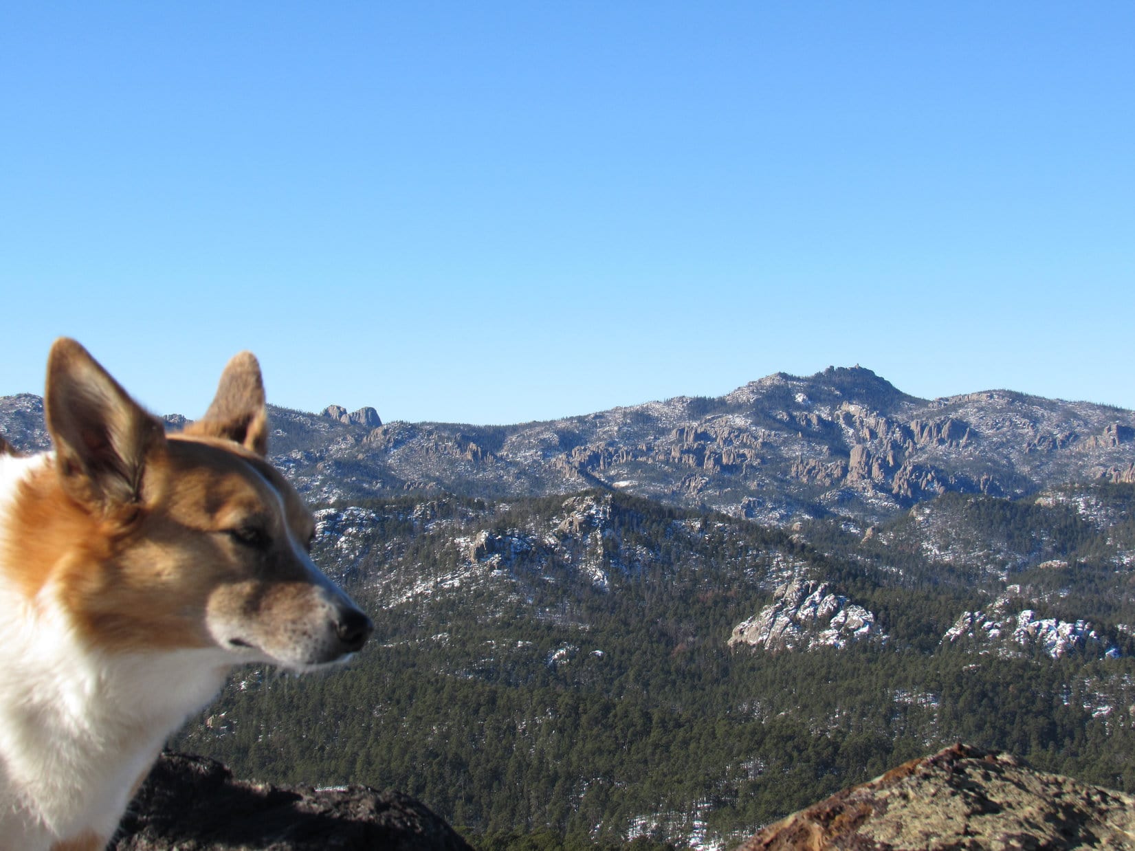
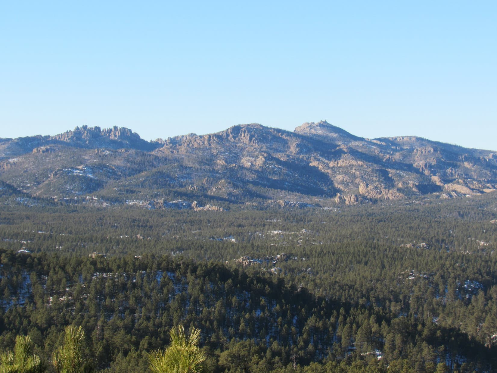
Up here, the wind was gusting a brisk 20 mph out of the NW.  Loop didn’t much care for that!  Nevertheless, the Carolina Dog pressed on.  She was now high enough to catch a glimpse of Little Devils Tower (6,960 ft.), the Cathedral Spires (6,840 ft.), and Black Elk Peak (7,231 ft.).

Bracing against the wind. Photo looks NE.
Looking back along the ridge. Photo looks SSW.
Little Devils Tower (L), Cathedral Spires (L of Center) and Black Elk Peak (far R). Photo looks NW with help from the telephoto lens.

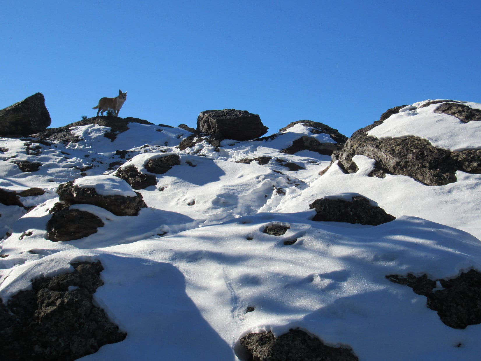
The spine of rock extended all the way up to the high point Looper had seen.  She arrived at a snowy, scenic spot, nicely sheltered by the forest from the NW wind.

Following the rocky spine higher. Photo looks SSW.
On the snowy high point. Photo looks N.
What a beautiful spot! Photo looks SSW.

Turned out, Lupe still hadn’t reached Peak 5440’s true summit.  Leaving the snowy high point, the ridge widened as Loop continued NE down to a saddle leading to the final ascent.

Leaving the snowy high point. Photo looks SW.
On the way down to the saddle that leads to the summit. Photo looks NE.

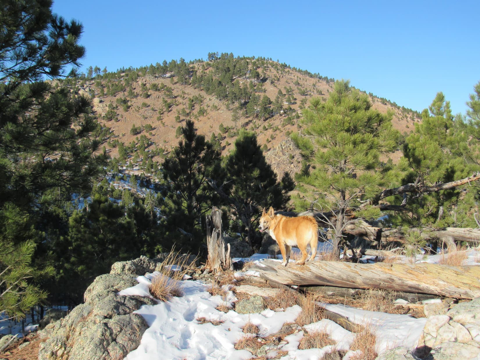
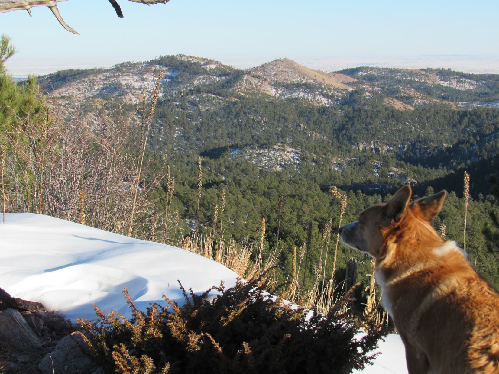
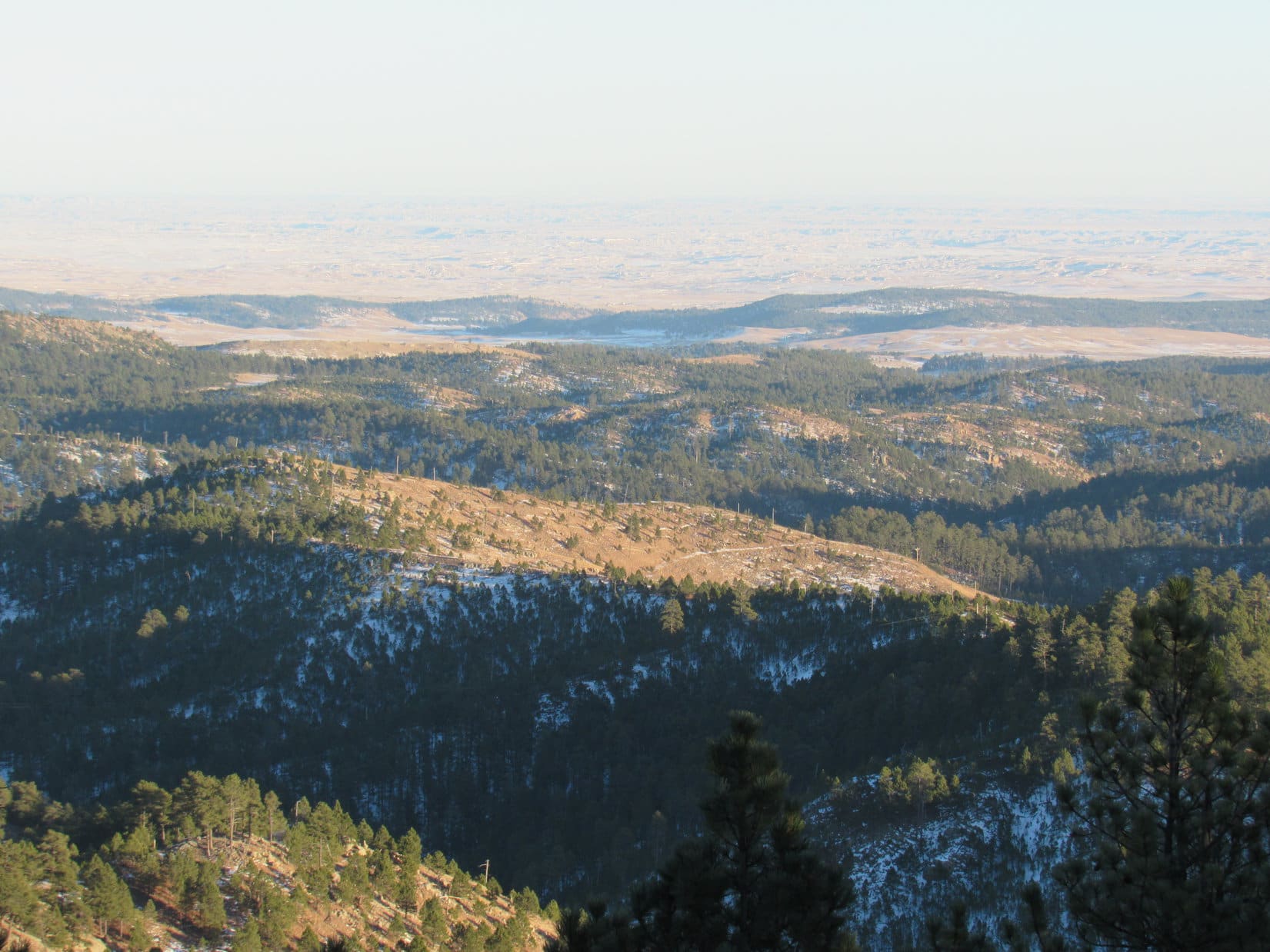
10:43 AM, 42ºF, Peak 5440 –  A broad, thinly-forested ramp made for an easy romp up to a surprisingly large summit region.  The true summit proved to be a steeply tilted rock on a small rise along the SE edge.  The big, unobstructed view was of snowy hills off to the SE.  They were all lower than Peak 5440.

Almost there! Heading up the broad ramp. Photo looks NE.
Entering the summit region. Photo looks NE.
At Peak 5440’s true summit. Photo looks SSW.
The big view. Photo looks SE.

Pines along the NW edge only partially blocked the wind.  Actually felt like winter at the true summit!  Retreating down the SE slope to escape the breeze helped a great deal.  Springtime here!

On the more hospitable SE slope. Photo looks WSW.

Springtime, and time for a chocolate coconut bar, too, SPHP!

Lupe curled up on SPHP’s lap, eagerly accepting her share of the much anticipated chocolate coconut bar.  Really quite comfortable out of the wind.  Snow on the lower hills to the SE contrasted pleasingly with the dark Ponderosa pines.

Off to the SSE was a view of some barren hills that SPHP suspected might include Peak 5120, which Lupe had been to less than 2 weeks ago during Black Hills, SD Expedition No. 295.  Couldn’t positively identify it, though.

Relaxing on Peak 5440. Photo looks SE.
Same view with help from the telephoto lens.
Peak 5120 (L)? SPHP wasn’t certain.

Inertia set in.  The day finally seemed to be warming up.  Cozy here, and the view was excellent.  45 minutes drifted by before Loopster decided she’d had enough.  Returning briefly to Peak 5440’s true summit, she then continued NE, starting for the next saddle leading to Peak 5438.

Along the way, she once again caught sight of Little Devils Tower, the Cathedral Spires, and Black Elk Peak.

Back on Peak 5440’s true summit. Photo looks S.
Little Devils Tower (far L), Cathedral Spires (L), and Black Elk Peak (far R). Photo looks NW with help from the telephoto lens.
Peak 5438 (L of Center). Photo looks NE.

Almost as soon as Lupe left Peak 5440, the ridge going to the saddle over to Peak 5438 became rocky and narrow.  Kind of rough ground!  Before Loop even got close to the saddle, SPHP was ready to ditch this route.

Heading down the rocky ridge. Photo looks NNE.

Hey, Loop!  We’re on our way to Peak 5360 now, so forget Peak 5438.  Let’s get off this goofy ridge.

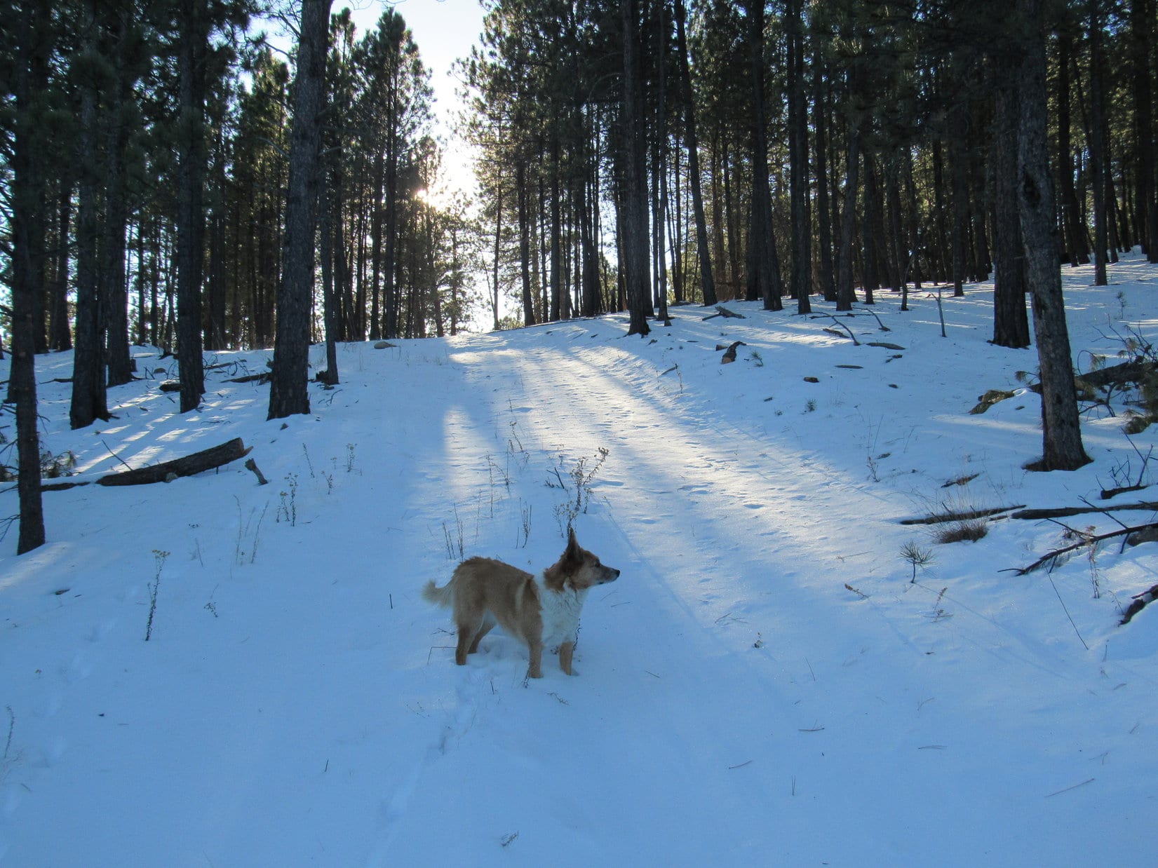
The American Dingo began angling NNW.  At first, the fairly steep slope she was descending was rocky, too.  Looper lost quite a bit of elevation before getting below the rocks, but even that didn’t really help much.  The forest had recently been thinned down here, and a lot of still green slash was on the ground.

Starting down off the ridge. Photo looks S.

The rate of descent gradually diminished, but progress remained slow as SPHP kept maneuvering to avoid as much slash as possible.  After losing 300 feet of elevation, the situation changed with the discovery of a road.

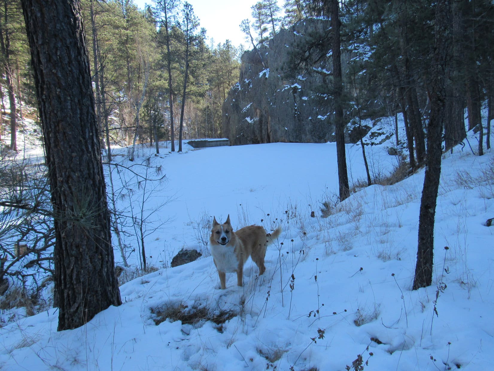
The snowy road was level and ran NE at first, but soon started to curve NW and lose elevation.  Lupe eventually made it down to a sunny field, where a different road ran N/S in the valley N of Peak 5440.

On the helpful snowy road. Photo looks NE.
In the valley N of Peak 5440. Photo looks NNE.

Following this road N to the trees, it then began to climb and angle off to the NE.

Hmm.  SPHP checked the topo map.  Didn’t show any of these roads, but Lupe clearly didn’t need to go NE.  Abandoning the road, Lupe continued N, deeper into the forest.

Should be a relatively short drainage going NW somewhere along in here, Loop.  We can follow it down to Hwy 16A.

Sure enough, the Carolina Dog soon came to a ravine.  A little rougher, and more V-shaped than SPHP expected, but it all went well.  Before long, Lupe was crossing Hwy 16A.

About to enter the ravine. Photo looks NNW.
Along Hwy 16A. Photo looks NE.

A moderately steep slope N of Hwy 16A presented no real obstacles, making it a relatively easy climb.  Quickly gaining 200 feet of elevation, Lupe reached a minor saddle along a flat ridge that extended E.  From here, she had quite a nice view of Peak 5440, where she’d just been.

Climbing toward the saddle (Center). Photo looks NNW.
Peak 5438 (far L) and Peak 5440 (R). Photo looks SSE.

The view to the NW wasn’t nearly as pleasing.  Loopster was already partway up Peak 5360’s SE slope.  However, the forest had also been thinned here, although not as recently as over by Peak 5440.  Brown slash littered the entire slope.  Yuck!

Peak 5360’s SE slope. Photo looks NW.

Consisting almost entirely of small diameter stuff, the slash wasn’t all that terrible, but it wasn’t much fun, either.  Lupe patiently picked her way through it, as SPHP trudged along behind.  Slash, slash, and more slash!  Loop never got above it.  The slash extended almost 400 feet higher, all the way to the top of the mountain.

Amid the slash, getting close to the top. Photo looks NW.

1:16 PM, 44ºF, Peak 5360 – The wind was still out of the NW, but only at 15 mph now, as Lupe reached a flat, triangular summit region roughly 25 feet across.  The true summit, only a foot or two higher, if that, was a rocky area toward the W partially covered with slash.

Despite the forest having been thinned, there were still way too many trees up here to have any real views.  Glimpses of Peak 5733 to the W, and the very top of Black Elk Peak to the NW were about it.

Peak 5360 summit. Photo looks W.
Peak 5733 (beyond Lupe). Photo looks W with help from the telephoto lens.
Top of Black Elk Peak (L of Center) in the distance. Photo looks NW.

Lupe sat down in the snow next to a big tree.

This is it, SPHP?  The top of Peak 5360?

Afraid so, Loopster.

Peak 5438 would have been better than this, and a lot easier to get to, too!

Yeah, but this is a Lists of John Peak with more prominence, Loop.

Your prominence is all fine and dandy, SPHP, but what good is it, if we can’t see anything?  Especially, when the whole mountain is just a pile of slash!  Kind of takes the fun out of getting here.

Most of it, maybe, but we can still enjoy the peace, solitude, and tranquility.

And maybe another chocolate coconut bar, SPHP?

Oh, sure!  You can have some Taste of the Wild, too.

Thinking deep thoughts by the big tree. Photo looks E.

The chocolate coconut bar vanished in a flash.  Loopster then crunched away at her Taste of the Wild.  SPHP threw a sweater over her to protect against the wind.

Every mountain is unique – a unique place on the earth’s surface, and on any given day, a unique experience.  Peak 5360 wasn’t the splendid sort of mountain the American Dingo was likely to return to someday, but it had taken a while to get here.  Since Lupe wasn’t in any big rush, it seemed appropriate to linger for a while.

Slowly dying, the wind came in gusts.  The camaraderie was great, even if the views weren’t.  Nothing like being on another mountain with your best friend, ever!  Half an hour of together aloneness ebbed away.

As Lupe stood on the true summit for the last time, for the first time, SPHP noticed another view due N.

Hey, how about that, Looper!  George and Abe are here!

On Peak 5360’s true summit. Photo looks E.
Mount Rushmore. Photo looks N with lots of help from the telephoto lens.

Leaving Peak 5360, Lupe headed SW.  Definitely the way to go!  Soon she was out of the slash.  Gently sloping terrain, and reasonably open forest made for a pleasant, easy descent.

About to leave Peak 5360’s true summit. Photo looks SW.
Getting past most of the slash. Photo looks SW.
In the sunlit forest. Photo looks SW.

It wasn’t far to a power line that ran N/S.  Going S, the terrain dropped steeply.  Lupe followed the power line only a short way before veering off to the SW again, where she soon picked up a road that wound down to a saddle where the road divided.  Still descending, Loopster took the branch going S.  Eventually a field appeared off to the W that led to Hwy 87 near its junction with Hwy 16A.

At the power line. Photo looks S.
On the road discovered shortly after abandoning the power line. Photo looks WNW.
Following the field to Hwy 87. Photo looks W.

The rest was easy.  Lupe followed Hwy 16A to Legion Lake.  Below the dam, a shortcut got her back to CSP Road No. 8 and the RAV4.

By Legion Lake. Photo looks SE.

3:04 PM, 46ºF – Well, that was a nice day, SPHP!  Glad we did this!

See!  Peak 5360 wasn’t so bad!

No, it wasn’t, SPHP.  The descent was lovely, and a chocolate coconut bar had been waiting at the top, so I’m happy.  Peak 5440 was better, though, you have to admit that.

Yeah, Peak 5440 was fun, Looper!  Not that hard, yet an interesting route, plus that grand view SE from the top.  Doubt Big Rock will be any better.

Big rock?  What big rock are you talking about, SPHP?

Oh, Big Rock is where we’re going next, Loop.

What!  We aren’t done, SPHP?  Is Big Rock another Lists of John peak you’ve dredged up?

No, not a Lists of John peak, Loop.  Big Rock (5,655 ft.) is just a hill along the S edge of Custer that Arthur Caverly added to Peakbagger.com a few years ago.  Don’t really know anything about it.  Shouldn’t take us long to tag it, though.

3:21 PM, 46ºF, Custer Chamber of Commerce – SPHP parked the RAV4 at the Custer Visitor Center on Washington Street.  Out front, a snazzily painted buffalo depicted General Custer firing a pistol while wearing a freshly punctured arrow shirt.

By the painted buffalo at the Custer Visitor Center.

Harbach Centennial Park and the Mickelson Trail were right across the street.  Taking the Mickelson Trail E to South 8th Street, Lupe turned S, starting up a hill.  South 8th Street ended at a turn E onto Canal Street.

At this turn, the Big Rock trail continued S up the hill.  However, Lupe had to check out an amazing sight before taking the trail.  A whole herd of painted buffalo was grazing in a nearby vacant lot!

Part of the painted buffalo herd at the S end of S 8th Street. Photo looks E.

The painted buffalo were awesome!  Each bison bore a different colorful design.  Lupe and SPHP both favored the one with mountain goats on it.

The mountain goat buffalo.

The Carolina Dog would have been even more impressed, if the painted buffalo herd had been a little more lively.  Since she’d apparently come across the bison during a period of inactivity, Lupe started up the Big Rock trail.

About to head up the Big Rock trail.

The snowy trail climbed at an easy pace.  Lupe passed several benches.  Heading S at first, the trail eventually curved W.  Getting rather late for a February afternoon!  Low angle sunlight filtered through the trees.

On the way to Big Rock. Photo looks WSW.

The trail nearly flattened out as Lupe headed W.  Other trails took off in various directions.  After crossing a road, the Big Rock trail led to a long stairway.

Starting up the stairs. Photo looks WSW.

The long stairway led to the base of Big Rock’s massive summit block.  Solid rock, of course!  A second stairway went up to a viewing platform.

At the base of the summit block. Photo looks W.

3:57 PM, 45ºF, Big Rock (5,655 ft.) – Still windy!  Looper stood blinking in bright sunshine.  Big Rock’s true summit was tantalizingly close, right behind her.  However, no access to it without leaving the platform for a dicey scramble.

Big Rock summit. Photo looks E.

Guess we won’t be getting up there!  At least, I’m not.  Be my guest, if you want to go for it, SPHP! 

Think I’ll pass, Loop.  Apparently, Big Rock is one of those “good enough for Dingo work” peaks where we fall a bit short of the true summit, yet still claim a successful ascent.

And a chocolate coconut bar, SPHP!

Nope!  Not this time, overly-sweetened Dingo of mine!  None left, and we don’t really deserve one in this case, anyway.

No chocolate coconut bar?  That, and the chilly wind, dampened the mood, but the views were sweet!  Buckhorn Mountain (6,330 ft.) was just N of Custer.  Sylvan Hill (7,000 ft.) and Black Elk Peak (7,231 ft.) were also in sight to the NNE, but much farther away.

Northeast Cicero Peak (6,240 ft.) was the eye-catcher off to the SSE.

Buckhorn Mountain (L of Center) beyond Custer. Sylvan Hill (R). Photo looks N.
Buckhorn Mountain (L), Sylvan Hill (L of Center), and Black Elk Peak (R). Photo looks NNE.
Northeast Cicero Peak (Center). Photo looks SSE.

The Big Rock viewing platform was small.  Not much to do up here, other than the forbidden scramble.  5 or 10 minutes taking a good look around was sufficient.

On the way back, Lupe visited Sunrise Point, which offered a closer, but almost identical view of Custer.  From here, she completed a loop via the Skywalk Trail back down to Harbach Centennial Park right across the street from the RAV4.

About to head down.
Big Rock Park trail map posted at the Skywalk trailhead.

4:24 PM, 45ºF, Custer Chamber of Commerce Visitor Center –

So are we done now, SPHP?

Yup.  That’s it for Black Hills, SD Expedition No. 296, Loop!  Any thoughts?  What was your favorite part?

Well, Peak 5440 was the best mountain with that snowy high point, plus the great view to the SE, but you know what, SPHP?  The mountain goat painted buffalo is hard to beat!

By the mountain goat buffalo, Custer, South Dakota 2-19-22

Links:

Next Black Hills Expedition                     Prior Black Hills Expedition

Want more Lupe adventures?  Check out Lupe’s Black Hills, SD & WY Expeditions Adventure Index, Master Adventure Index, or subscribe free to new Lupe adventures!

Black Hills, SD Expedition No. 237 – Centennial Trail No. 89: Pilot Knob to South Boxelder Creek (10-18-18)

Start – 8:55 AM, 50 °F, Pilot Knob trailhead of Centennial Trail No. 89

The first half of October had been cold and wet, but that was history now.  This morning was clear and bright, and it was already 50 °F when Lupe and SPHP arrived at the Pilot Knob trailhead along USFS Road No. 208 (Merritt Road).  The air was calm down here at the trailhead, but Lupe could hear a breeze up in the pines.

Lupe arrives at the Pilot Knob trailhead of Centennial Trail No. 89. It was going to be a great day with highs near 60°F expected. Photo looks NNE.

Lupe was eager to get started, which was a good thing.  Days are getting short by the second half of October, and she had a long way to go.  The South Boxelder Creek trailhead of Centennial Trail No. 89 near Nemo was 7.6 miles away, a 15.2 mile round trip.  And that was if Loop stayed on the trail, which she wouldn’t, because a little off-trail peakbagging was part of the plan for the day, too.

It’s 7.6 miles one way to the South Boxelder Creek trailhead from the Pilot Knob trailhead – 15.2 miles round trip. And that’s if you don’t climb any mountains on the side along the way!

Only a few minutes on the trail got Loopster up the first forested slope and around the bend to the N where she could see Pilot Knob (5,440 ft.) beyond a big field.  Pilot Knob didn’t look like much from here, but Loop had been there recently on Expedition No. 235.  Pilot Knob was actually a fun little climb and the views from the top had been surprisingly good.

Hey, SPHP! There’s Pilot Knob (L) again! We were just up there not too long ago, remember? Photo looks WNW.

Lupe followed Centennial Trail No. 89 NNW along the E side of the big field.  Near the end of the field, the trail curved NE and went past a sign for Boodleman Spring, which didn’t seem to have much in the way of water.  The trail got steeper after passing Boodleman Spring, and soon turned N again going up a forested valley.

After passing under a big power line, Centennial Trail No. 89 bent NW paralleling the power line.  When the power line reached a high point, the trail curved away to the E.  Lupe briefly left the trail to check out this high point, but there really wasn’t much to see.

Returning to the trail, Loop and SPHP followed it around the S end of a nearby hill to the E.

Going around the S end of the hill E of the power line’s high point. Photo looks E.

Lupe had been gaining elevation ever since leaving the Pilot Knob trailhead.  However, as Centennial Trail No. 89 curved back around to the N on the E side the hill, the trail reached a high point, too.

Ahead was a limited view of a high ridge beyond a deep valley.  Several high points could be seen along this ridge, which extended off toward the NNW.  The topo map revealed that the closest high point was Peak 5701, the highest spot along the entire ridge.

Peak 5701 (Center) is in view as Centennial Trail No. 89 descends into the valley of the West Fork of Estes Creek. Photo looks NNE.

Although Peak 5701 and the rest of the ridge it was on looked intriguing, Centennial Trail No. 89 wasn’t going up there.  The trail went toward Peak 5701, but upon reaching the floor of the deep valley it turned E at the base of the mountain.

The American Dingo had entered the valley of the West Fork of Estes Creek.  Looper soon came to a large puddle where Estes Creek crossed Centennial Trail No. 89.  The creek itself was a mere trickle only an inch or two deep.

Lupe reaches the puddle where the West Fork of Estes Creek crosses Centennial Trail No. 89. Photo looks ESE.

For 0.5 mile, Lupe continued E going down the valley on the N side of the West Fork of Estes Creek.  The creek gained some flow along the way, but remained quite a small stream.  NW of High Point 5452 the trail left the valley floor climbing up onto a small rise.  From here, the trail turned N gaining elevation gradually as it wound around the SE end of Peak 5701.

Lupe at a junction of Centennial Trail No. 89 and ATV trail No. 8251 shortly after leaving the West Fork of Estes Creek. Centennial Trail No. 89 is also an ATV trail all the way from Pilot Knob to South Boxelder Creek. In fact, it’s possible to go even farther on an ATV all the way to the Dalton Lake trailhead. Photo looks NNW.
Going around Peak 5701’s E ridge. Photo looks ENE.

Centennial Trail No. 89 eventually brought Lupe around E of Peak 5701.  For 0.75 mile, the trail now headed NNW roughly paralleling the long ridge between Peak 5701 and Peak 5628.

Now E of Peak 5701 heading NNW.

While the first part of this area was forested, farther on Lupe came to meadows, too.  The Carolina Dog reached a spot where she had a fairly clear view of Peak 5440 off to the NE.

Peak 5440 didn’t look too impressive.  It was just a flat-topped forested hill.  Yet with 360 feet of prominence, Peak 5440 was the most prominent mountain along the entire route Lupe would be traveling today.  So the plan was to take a little off-trail side trip to climb Peak 5440.  After seeing it, though, expectations were none too high.  Loop probably wouldn’t be able to see anything but trees from up there.

Despite technically being the most prominent peak along this section of Centennial Trail No. 89, Peak 5440 didn’t look too impressive. Lupe intended to climb it anyway. Photo looks NE.

Continuing on, Looper soon had views of Peak 5701 again and the long ridge going NNW from it to Peak 5628.  That big ridge looked a lot more intriguing than Peak 5440 did.  Despite not having as much prominence, it was higher and appeared to at least offer some views.  Peak 5701 even had a little snow.

Peak 5701 (L) looked more interesting than Peak 5440, and even had some snow. Photo looks SW.

The trail gradually curved toward the NE.  Stands of aspens sported a few yellow leaves, the last of 2018’s autumn colors.  Approaching Peak 5440, Lupe came to a couple of ponds surrounded by wooden fences.

A few colorful aspen leaves were about the last of this autumn’s display. Peak 5701 is on the R. Photo looks S.
Lupe comes to a fenced-in pond as Centennial Trail No. 89 approaches Peak 5440. Photo looks NE.

Beyond the ponds, Centennial Trail No. 89 curved N again.  This was as close as the trail was going to get to Peak 5440.  Looper left the trail and began to climb, heading first E, then SE as she got higher up.

Lupe soon reached a grassy area on the W face of Peak 5440 that she had seen earlier from a distance.  This was the only place she was likely to see much from Peak 5440.  She actually had a rather nice view of Peak 5701 and the long ridge to Peak 5628 from here.

Peak 5701 (L) and Peak 5628 (R) from the upper W slope of Peak 5440. Photo looks SW.
Peak 5701 from Peak 5440. SPHP sort of wished Lupe was climbing Peak 5701 instead. It looked far more interesting. Photo looks SW.

From the grassy area with a view, Lupe still faced the steepest part of the climb up Peak 5440, but even so, it wasn’t difficult and didn’t take her long.  The terrain soon began to level out.  The topo map showed two 5,440 foot contours on the mountain.  Lupe headed NE through dense forest looking for the first one, which contained by far the smallest area.  A single large boulder proved to be the clear high point of this contour.

Lupe on the big boulder which appeared to be the high point of the first and smallest 5,440 contour shown on the topo map. Photo looks NW.

The area contained by the larger 5,440 foot contour was only a couple hundred yards farther NE.  Loopster traveled through dense forest the entire way.  She seemed to gain at least some elevation.  This larger area was almost certainly higher than the big boulder, and had to be the location of the true summit.

No big boulder or other definite high point existed here, however.  The true summit might have been any of a number of smallish rocks located on nearly flat terrain that sloped only very gradually toward the SE.  The most interesting thing about this place was actually a 15 or 20 foot high escarpment along the NW edge of the area.  Forest blocked all views, but the escarpment featured some interesting rock formations.

The true summit of Peak 5440 is right around here somewhere! Photo looks N.
Hardly matters which of these rocks is the true summit of Peak 5540. Can’t see a thing except trees from any of them anyway! I’m calling this good enough for Dingo work!
This escarpment along the NW edge of the summit area is cool, though! Photo looks N.

Exploring is always fun, but Peak 5440 was the sort of place Lupe was only likely to get to once.  Might as well linger a while to enjoy whatever the experience had to offer.  It was time for a short break, anyway.  The usual fare was on offer.  Water and Taste of the Wild for Lupe.  An apple for SPHP.

When break time was over, it was back to Centennial Trail No. 89 by the same route Lupe had taken up.  Upon reaching the trail, Lupe continued N.  She soon came to a sign saying it was 4.5 miles to Nemo or 3.5 miles back to Pilot Knob.  Nemo was about a mile beyond the South Boxelder Creek trailhead, so this was about the halfway point.

Lupe reaches a sign near the halfway point between the Pilot Knob and South Boxelder Creek trailheads. Photo looks E.

It wasn’t much farther to another high point.  Centennial Trail No. 89 had been gaining elevation, albeit quite gradually, ever since leaving the West Fork of Estes Creek.  N of Peak 5440, however, the trail went over a broad, gentle pass.  On the other side Lupe was soon losing elevation faster than she had gained it.  She was entering the upper reaches of yet another valley.

Loop hadn’t gone far beyond the high point when she reached a sign for Caryl Spring.  Caryl Spring consisted of several inches of standing water full of fallen leaves.  Lupe cooled her paws off, and helped herself to a drink.

As Lupe headed toward the pass N of Peak 5440, she caught sight of this high ridge N of Peak 5628. Photo looks WSW.
Loopster at the high point of Centennial Trail No. 89 N of Peak 5440. There was a major road junction here, but not much in the way of signage. Photo looks E.
Starting down into the next valley. Caryl Spring is right around the bend.
Lupe standing paw deep in Caryl Spring, which did have a few inches of water.

From Caryl Spring the trail continued E farther down the valley, but not for long.  When the valley turned N, Centennial Trail No. 89 took off to the SE up a side draw.  Lupe gained close to 100 feet of elevation going over a minor ridge extending NNE from Peak 5440.  The Carolina Dog was soon over this ridge and starting a descent that would take her into Blue Draw.

Loop reached a sign indicating the South Boxelder Creek trailhead was only a mile ahead.

Gaining elevation again going over the minor ridge NNE of Peak 5440. Photo looks SE.
Beginning the descent into Blue Draw after crossing the ridge. Photo looks ESE.
Getting there! Only a mile to go to the South Boxelder Creek trailhead!

A junction existed where Centennial Trail No. 89 reached Blue Draw.  It wasn’t clear where the road heading SW was going other than farther up the draw.  Where it went didn’t really matter.  Loop just needed to head down the valley.  At the lower end of Blue Draw she would find the South Boxelder Creek trailhead.  The trail headed NE at first, then E the rest of the way.

Lupe in Blue Draw.
Approaching a seasonal stream in Blue Draw. It was just a puddle today.

The trek down Blue Draw was shady and pleasant, but it seemed like Lupe had gone more than a mile since seeing the sign about the trailhead.  Finally she saw a ramp for ATV’s and a gate ahead.  Just beyond the gate was the bridge over Boxelder Creek.  This was it!  Looper had reached the trailhead!

Oh, look! There’s the gate and ATV access ramp. We’re just about to the South Boxelder Creek trailhead!
Loop on the bridge over Boxelder Creek. Photo looks NE.
Boxelder Creek looking downstream (SE) from the bridge.
Looking upstream (NNW) from the bridge.
Lupe reaches her Centennial Trail No. 89 destination for the day, the South Boxelder Creek trailhead. Photo looks ESE in the direction of Nemo, which is out of sight about a mile away.

Despite Lupe’s side trip to Peak 5440, she had made fairly good time getting to the South Boxelder Creek trailhead.  Her Centennial Trail No. 89 explorations were complete for the day, although she still had to repeat the experience going all the way back to Pilot Knob again.

Not yet, though!  Time for another rest break.  Lupe and SPHP relaxed for a while on a grassy bank by the creek.

So we made it! That wasn’t so hard now, was it? And look at this beautiful stream and scenic bridge to adventure!
Guess that’s about it unless we come up with some other grand scheme on the way back to Pilot Knob!

Well, that would have been it, but on the way back to Pilot Knob the American Dingo made such excellent progress that when she reached the pass N of Peak 5440 again, SPHP realized that the sun wouldn’t set for at least another couple of hours.

So what do you say, SPHP? Still want to explore that big ridge going from Peak 5628 (R) to Peak 5701 (L)? Photo looks SW.

The big ridge with Peak 5701 at the S end and Peak 5628 at the N end was now in sight.  Seemed like Lupe had enough daylight left to explore it.  The American Dingo was willing, so why not?

Lupe and SPHP left Centennial Trail No. 89 heading SW for a saddle N of Peak 5628.

Lupe now off trail on her way to the saddle N of Peak 5628. Photo looks SW.

At first, the way was easy.  The terrain gained elevation slowly.  Lupe came to few obstacles.  For a while, SPHP even thought Loop might be on a long abandoned road, but it was hard to tell for certain.

As the Carolina Dog got closer to the saddle, though, the going got tougher.  No road here!  Lupe passed through a very dense pine forest.  Beyond that was an area of mixed pines and aspens thick with deadfall timber.  Loop didn’t have much farther to go to reach the saddle, but progress in the middle of this mess was slow, slow, slow.

The map showed a road going up to the saddle.  Lupe ought to come to it, but for a long way she didn’t.  SPHP had about decided the road didn’t exist any more, when suddenly there was Lupe, standing right on it.  Loop headed W on this road until it was clear she was due N of Peak 5628 and wasn’t going to gain any more elevation sticking with the road.

Time to start up Peak 5628!  Lupe and SPHP left the road heading S up a fairly steep slope.

Lupe reaches the road leading to the saddle N of Peak 5628. Photo looks SW.
Loop in the saddle N of Peak 5628. She left the road here. Photo looks SW.

The hardest part of the climb was the very beginning.  The slope was steepest here, and again full of deadfall timber.  Once Lupe was above the deadfall, the rest of the way was much easier.  The elevation gain from the saddle to the top of Peak 5628 was only about 300 feet, so it didn’t take long.

Close to the summit, Lupe discovered a platform of rock with a good view of Custer Peak (6,804 ft.).  A nearby rock formation proved to be the true summit of Peak 5628.  Looper had no problem getting up onto the highest rock.

This platform of rock near the true summit of Peak 5628 provided a distant view of Custer Peak (Center). Photo looks NW.
Lupe at the summit of Peak 5628. Photo looks N.
Oh, I’m glad we came here, SPHP! Quite a few trees around, but the views are most definitely better from here than they were at Peak 5440! Photo looks E.

Quite a few trees grew near the top of Peak 5628, so views were limited.  However, this was definitely better than Peak 5440 had been.  Not only could Lupe see Custer Peak, but a little way S of the summit was an open area where she had a good look at Peak 5701 at the opposite end of the ridge.

Looper could also see a broad expanse of territory to the S and W.  Even Black Elk Peak (7,231 ft.) was in view, although it was quite far away.

There’s our next peakbagging objective, Peak 5701 (Center)! Photo looks SE.
A broad expanse of Black Hills territory was visible to the S & W. Photo looks S.
Looking back toward the summit of Peak 5628 from the S.

SPHP had expected Lupe would have an easy time traveling along the ridgeline from Peak 5628 to Peak 5701.  However, the highest part of the ridge was capped by large rock formations.  Large quantities of deadfall timber existed in some places, too.

Traveling the highest part of the ridge would have taken too much time.  Lupe made far faster progress staying somewhat lower on the W side of the ridge.  She avoided the much steeper E side.

Loop heading S along the ridge from Peak 5628 to Peak 5701. The highest part of the ridgeline was too rocky for efficient travel. Photo looks SE.

The climb up Peak 5701 was short, but fairly steep and rocky.  The top of the mountain had quite a bit of rock, too.  The summit area was forested, but breaks in the trees provided some views.  The highest point was toward the SE at the edge of an uneven rocky platform.

The sun was getting low by the time Lupe reached Peak 5701. Photo looks SW.
Looking back over the ridgeline Lupe had just traversed toward Peak 5628 (Center). Photo looks NW.
Looper reaches the true summit of Peak 5701. Photo looks ESE.

Lupe and SPHP took the last rest break of the day up on Peak 5701.  The best views were toward the N and E from a rocks a little below and SE of the true summit.  Lupe could see both of the other mountains she had climbed today, and a big expanse of territory she had passed through on Centennial Trail No. 89.

Looking down on Peak 5440 (Center) from Peak 5701. Photo looks NE.
Peak 5628 (Center) from Peak 5701. Photo looks NW.

The sun was still up when Lupe headed N off Peak 5701 back down to the ridge leading to Peak 5628.  She went only far enough to reach a slope she could easily descend into the valley to the W.  This valley drained S into the valley of the West Fork of Estes Creek, but SPHP wasn’t certain which direction Lupe ought to go once she got there.

Which way to Centennial Trail No. 89?  The sun had set.  Light was now fading fast.  A decision needed to be made quickly.  When a brief foray to the E didn’t reveal anything that looked familiar, the Carolina Dog turned and went W.

W proved to be the wrong direction.  No matter.  Lupe continued up the valley of the West Fork of Estes Creek until she reached the power line she had been to much earlier in the day.  Following the power line SE got Loop back to Centennial Trail No. 89.

Since striking out for Peak 5628, Lupe’s return route had bypassed most of the trail.  Less than a mile remained to the Pilot Knob trailhead.  It had been a great day, and was now a beautiful evening.  Darkness reigned.  Stars twinkled.  A coyote howled.  Puppy, ho!  Onward!  Almost there.  (End 6:38 PM, 44°F)

Lupe on Peak 5701, Black Hills, South Dakota 10-18-18

Links:

Next Black Hills Expedition                  Prior Black Hills Expedition

Next Trail Section S

Black Hills, SD Expedition No. 235 – Centennial Trail No. 89: Deer Creek to Pilot Knob (9-29-18)

Next Trail Section N

Black Hills, SD Expedition No. 238 – Centennial Trail No. 89: South Boxelder Creek to Dalton Lake (10-28-18)

Want more Lupe adventures?  Check out Lupe’s Black Hills, SD & WY Expeditions Adventure Index, Master Adventure Index, or subscribe free to new Lupe adventures!

Black Hills, SD Expedition No. 186 – Iron Mountain & Peak 5440 (12-23-16)

The cold came first.  Single and low double digit highs.  Subzero nights.  Ten days later, the snow arrived.  Lupe was in for a white Christmas.

Yes, Christmas was coming, and what Lupe wanted most for Christmas was action!  All these days laying around waiting for the weather to improve were excruciatingly dull for the Carolina Dog.  Three weeks into December, a break in the weather came.  Three days with highs in the 40’s.  A little snow melted the first two days.  Only one day remained before things turned cold again.

Lupe’s Christmas wish was going to be granted a little early.  When she saw SPHP starting to get the pack ready, Loop was as excited as if she had caught Santa Claus himself coming down the chimney.  Leaping!  Barking!  Hurry!  Hurry!  Lupe was anxious to go.

SPHP did a poor job of hurrying.  Much of the morning got chewed up by pre-Christmas errands.  Two days after winter solstice, this wasn’t going to be a very long expedition.  Lupe didn’t care.  She was taking what she could get.

Iron Mountain (5,446 ft.) was once again on the way to Lupe’s peakbagging objective.  Since Iron Mountain Road essentially winds all the way up to the top of Iron Mountain, Lupe stopped briefly to check out the view from the summit (11:42 AM, 41°F).  Maybe the Black Hills looked more like Christmas now that there was some snow around?

Lupe arrives up on Iron Mountain on her first Black Hills expedition in 19 dreadfully long days!

Mount Rushmore (5,725 ft.) from Iron Mountain. Lupe saw some snow around, but there wasn’t any up in the trees to make the views look Christmas white.  Photo looks NW.
Harney Peak (7,242 ft.) from Iron Mountain. Photo looks W.

From Iron Mountain, Lupe saw some snow around, but the scene wasn’t exactly a winter wonderland.  There wasn’t any snow up in the trees to make things really look Christmas white.  Lupe and SPHP returned to the G6 and continued on.

Lupe’s peakbagging objective for the day was Peak 5440.  Although the mountain is only 0.25 mile E of the Needles Highway (Hwy 87), Lupe would start for it from Center Lake (12:04 PM, 45°F), 2 miles to the NE.  Her actual route would be longer than that.  After all, Lupe was here to enjoy the day, not to be done with it all as soon as possible!

Lupe started for Peak 5440 here at Center Lake. Center Lake looked plenty white enough, with a good 6″ of snow or more. Photo looks SE.

From Center Lake, Lupe climbed an embankment to reach a road W of the lake.  The map showed this road would lead to some kind of trail following Grace Coolidge Creek to the SSE.  The road climbed a little to the SW, then turned S and dropped down to creek level.

It turned out the trail along Grace Coolidge Creek was actually an abandoned dirt road.  That made it easy to follow, even with half a foot of snow on the ground.  Lupe had a great time looking for squirrels in the forest, while SPHP plodded along.  She found several to bark at that had emerged to enjoy the relatively warm, sunny afternoon.

On the abandoned road that serves as a trail near Grace Coolidge Creek.

Despite the recent long cold snap, Grace Coolidge Creek wasn’t entirely frozen.  In places there was still open flowing water.  Even where there wasn’t, the ice couldn’t be trusted.  The trail crossed the creek a number of times.  It wasn’t a problem, since a single, long sturdy plank provided a footbridge at each crossing.

Lupe pauses on the snowy trail to listen and look for squirrels. She had some success finding squirrels that had emerged to bask in the sunshine on this relatively warm afternoon.

While the mighty squirrel hunter was busily occupied, SPHP was looking for the turn where Lupe needed to leave the creek to start climbing.  The plan was to follow a side trail up a canyon to the W passing N of High Point 4924.  There was no telling what that side trail or canyon might look like.  SPHP rejected a couple of possibilities after comparing actual terrain to the topo map.

The turn couldn’t be much farther.  Lupe came to a place where the trail was about to cross to the E side of the creek again.  Ahead was a small concrete dam next to the base of a natural solid rock wall.  A narrow side canyon full of trees veered off to the NW.

The terrain seemed right, but at first there didn’t appear to be any trail going up the canyon.  That would be bad news.  Lupe and SPHP left the trail by the creek to investigate further.

Yes!  Lupe came across a faint, remnant of a road.  Clearly, it had been a long time since any vehicle had come this way.  The old road was impassable for vehicles now, but looked easy enough to follow on foot and paw.

Lupe looks for the turn to the W. A little concrete dam on Grace Coolidge Creek next to a natural wall of rock is seen beyond Lupe. This was where Lupe needed to leave the creek and start following a narrow side canyon leading NW. Photo looks S.

Lupe left Grace Coolidge Creek behind, following what remained of the ancient road going NW up the narrow side canyon.  The canyon eventually broadened out becoming a wider valley, which wound around toward the W.  SPHP wasn’t entirely certain Lupe had taken the correct route, but things seemed to be matching up pretty well with the topo map.  Lupe passed to the N of a hill which was likely High Point 4924.

This valley was a beautiful and obviously seldom visited place.  Lupe gained elevation steadily, but so did the sides of the valley.  There was lots of snow, but it wasn’t too deep for Lupe to get through.  The big disappointment was that there weren’t nearly as many squirrels here as back along the creek.

For a mile or so, everything seemed fine, but then the valley narrowed sharply, becoming a canyon again.  What was left of the old road had completely vanished.  The canyon floor became increasingly rocky and steep.  This didn’t seem right.  The topo map had shown this route climbing gradually toward Pass 5111.  SPHP halted for another look at the map.

Lupe having a good time in a seldom visited valley W of Grace Coolidge Creek. She is already more than a mile from the creek, near the start of a side valley SPHP took by mistake. Photo looks W.

The map showed Lupe was likely in a minor side canyon SPHP mistook for the main route to Pass 5111.  Lupe was probably N of High Point 5196.  If so, she wasn’t off track by much at all.  Lupe could easily backtrack a short distance back to the main route, or she could climb up the ridge to the N, then follow it W to Pass 5111.

Lupe continued up the narrow canyon.  She left it as soon as an opportunity arose to climb up onto the ridge to the N.  It wasn’t hard to reach a high point along the ridgeline.  From here, Lupe could see a big hill to the N.  SPHP tried to place it on the map.  It seemed to be a hill 0.25 mile NE of Pass 5111.

Lupe reaches the ridgeline N of High Point 5196. She could see this hill off to the N. After consulting the topo map, SPHP concluded this hill was 0.25 mile NE of Pass 5111.

Off to the SW, barely in view due to the forest, was an even higher hill that might well be Peak 5440.  At least everything seemed to make sense again.  Lupe headed W along the ridgeline, climbing steadily.  She soon came to a road that led her right to Pass 5111.  Lupe could see Harney Peak to the NW on the other side of the pass.

At Pass 5111. Harney Peak (Center) is in view. From here, Lupe only needed to follow a ridgeline S to reach Peak 5440. Photo looks NW.

From Pass 5111, Lupe only had to follow one more ridge SSW to Peak 5440.  This ridge has a couple of high spots along the way.  Although the topo map didn’t show any trail leading toward Peak 5440, Lupe found a side road that took her SW partway up onto this next ridge.

Lupe on a snowy side road that went SW from Pass 5111 partway up onto the ridge that would take Lupe to Peak 5440. Photo looks SW.

Lupe reached the ridgeline.  She followed it SSW, still climbing, until she reached the first of the two high points along the way.  This first high point was the highest, and open enough so Lupe had some great views from here.

Cathedral Spires (6,840 ft.)(L) and Harney Peak (7,242 ft.)(R of Center) from the first high point Lupe came to on the ridge leading to Peak 5440. Photo looks NW.
From here, Lupe had her first good look at her peakbagging objective, Peak 5440(L of Center). It was less than 0.5 mile away. Photo looks SSW.
Looking NNW. Cathedral Spires(L), Harney Peak(L of Center) and Peak 5688(far R). Lupe recently visited Peak 5688 for the first time on a windy day in November on Expedition No. 184.
Looking E.

Lupe continued S along the ridge.  She lost some elevation coming off the first high point, crossed over the second lower high spot, and began a fairly steep climb up the forested N face of Peak 5440.  Soon she reached the top of the mountain.  A small rock outcropping only a few feet high toward the NW was the true summit.

Success! Lupe on the true summit of Peak 5440. Harney Peak is in view beyond her. Photo looks NW.

Lupe had her peakbagging success for the day!  Time for a break.  SPHP sat on a rock near the true summit munching an apple.  Lupe wasn’t hungry or thirsty.

At least this expedition had accomplished something!  Lupe was tired enough to want to curl up and lay down next to SPHP for a little bit.  The temperature had been dropping.  It was now close to freezing, yet Lupe insisted upon laying on a patch of snow.

Break time lasted only until the apple was gone.  The sun was getting low.  Lupe and SPHP explored the summit area, which was of modest size.  Most of the summit area was SE of the true summit.  There were good views in most directions, although forest screened everything to the NE.

Looking SE from the true summit.
Cathedral Spires through the telephoto lens. Photo looks NW.
Looking up toward the top of Peak 5440 from the S.
Looking S from the top.
Mount Coolidge (6,023 ft.)(L of Center). Lupe hasn’t been to Mount Coolidge since Black Hills, SD Expedition No. 13, way back on 3-22-12. Photo looks SW.
Looking SE using the telephoto lens.

Time to be heading back, or it would get pitch black out before Lupe would reach the G6.  Lupe and SPHP left Peak 5440 heading down the N slope.  Lupe would retrace her route up back to Pass 5111.  There, a decision would have to be made on which way to go.

Lupe sniffs around in the forest on her way back down the N slope of Peak 5440.
Looking back at Peak 5440 from the N ridge. Sunlight illuminates some of the pine trees for a little while longer. Soon the sun would be down. Photo looks S.

The sun was down by the time Lupe reached Pass 5111 again.  Which way?  Taking the road going NNW would quickly bring Lupe down to the Needles Highway only 0.25 mile away.  It was the safest choice.  Lupe could then take known roads back to the G6.

The other option was the road going SE from the pass.  The topo map showed it going down to the canyon leading to Grace Coolidge Creek.  Once at the creek, Lupe could easily follow the trail back to Center Lake.  This route was more remote, and a little chancy.  Twilight would fade.  However, Lupe should reach the canyon in plenty of time to verify she was on the right track before it got dark.

Lupe took the remote route instead of going to the highway.

Soon there was a problem.  The road didn’t go SE as expected.  Instead, it went NE, staying high on a ridge.  Lupe pressed onward.  As long as the road didn’t play out, NE was actually the shortest route back.

The luck of the Dingo held.  The road didn’t play out.  It remained high on the ridge until finally descending to come out at the Black Hills Playhouse.  Lupe had taken a shortcut on a road not shown on the map.  All was well.  White Dingo magic again!  (5:06 PM, 28°F)

A last look back at Peak 5440 from the high point SW of Pass 5111.

Links:

Next Black Hills Expedition                      Prior Black Hills Expedition

Want more Lupe adventures?  Choose from Lupe’s Black Hills Expeditions Adventure Index or Master Adventure Index.  Or subscribe free to new Lupe Adventures.