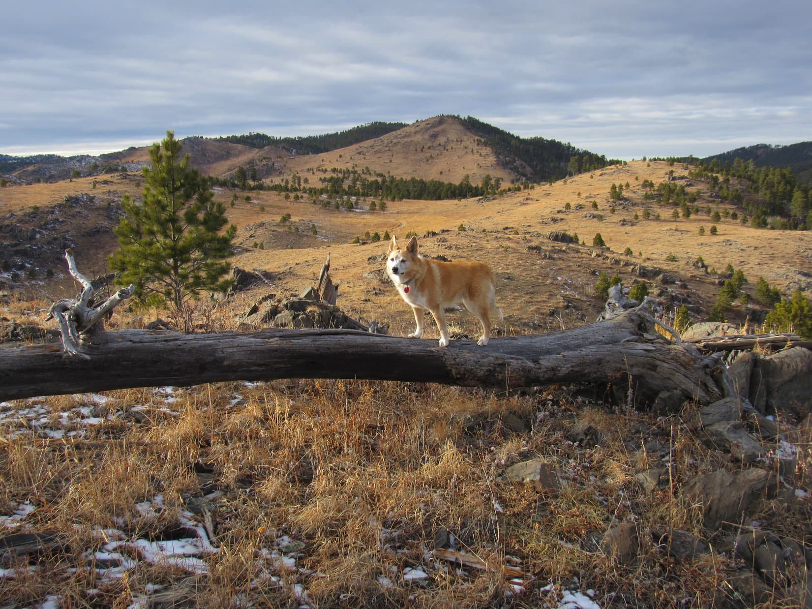
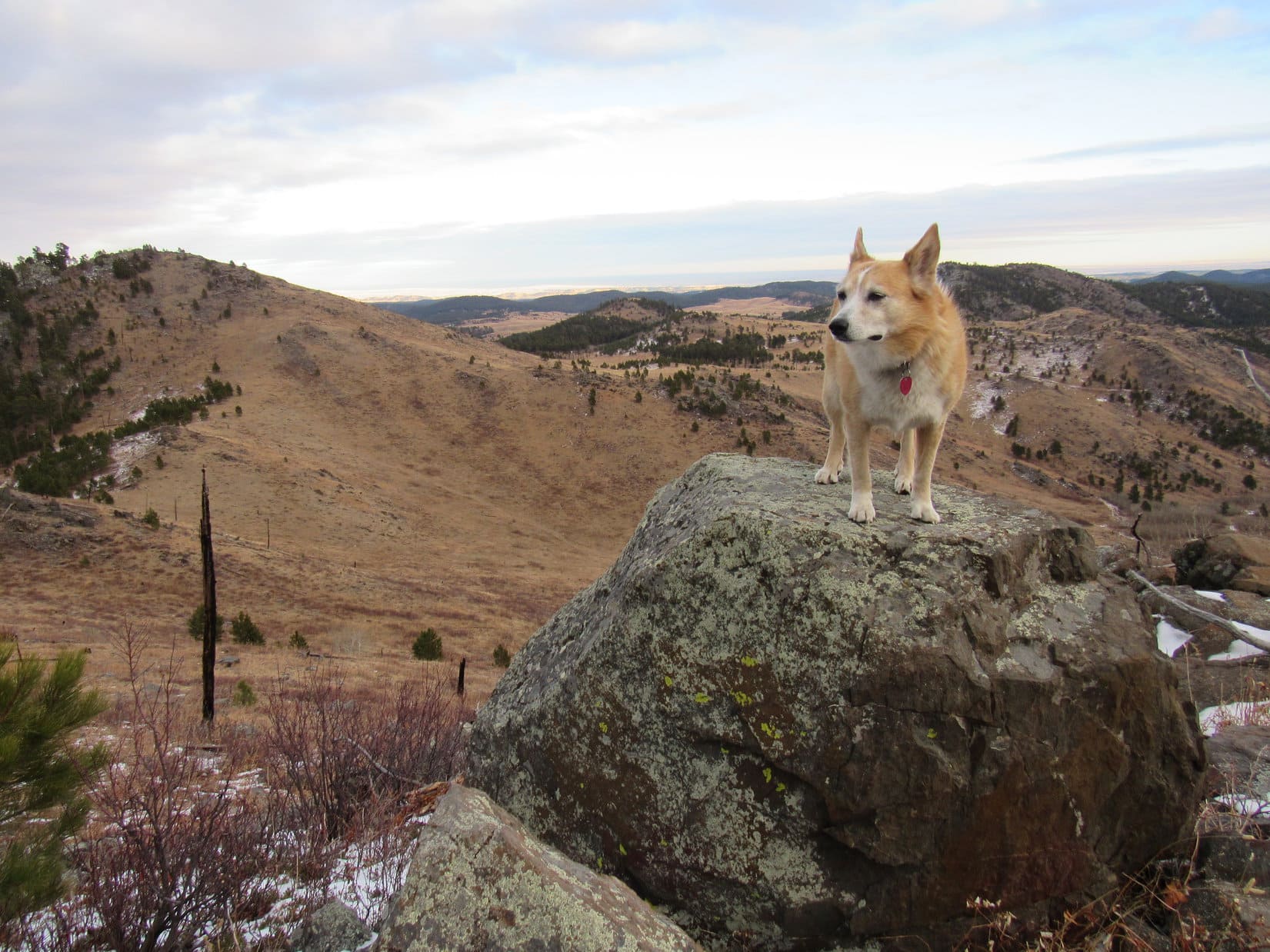
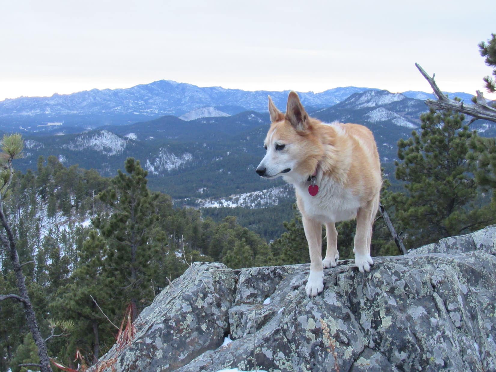
12:32 PM, 39ºF, junction of USFS Road No. 710 & Hwy 385 – Lupe stood next to the RAV4 with a big smile on her face. The American Dingo was all fired up for the last big adventure of 2022, her traditional year end visit to New Year’s Eve Peak(6,046 ft.)!
Ready to set out for New Year’s Eve Peak on the last day of 2022. Photo looks SW.
What luck, SPHP! This year we actually get to go right on December 31st! That’s not always the case.
True enough, Looper! This will be your 10th visit to New Year’s Eve Peak, but only the 4th time right on New Year’s Eve. Flexibility is required, since the weather is unreliable this time of year. I’m like you, though, always hoping December 31st will work out.
Yes, let’s do it! Should have time enough for that. Onward! Puppy, ho!
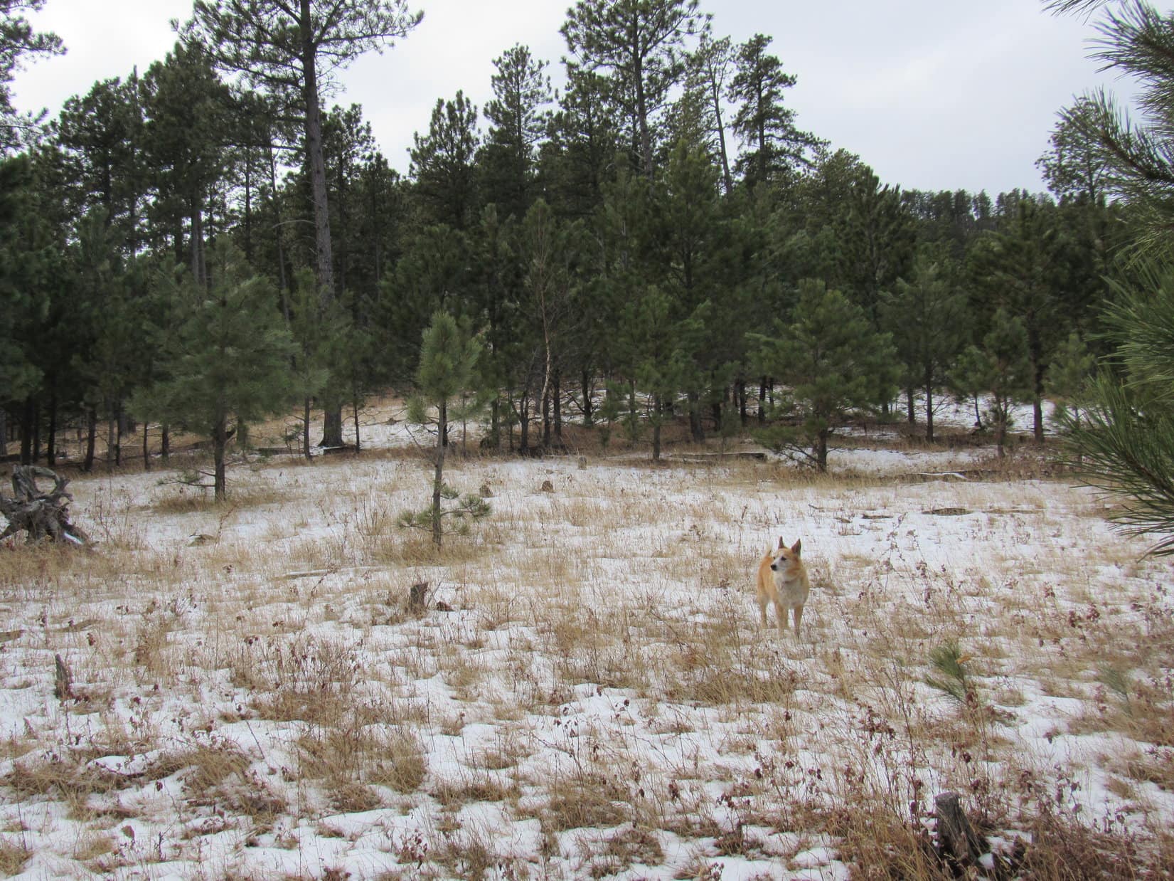
Beneath an overcast sky, Lupe headed SW into the forest. The cool air and patches of old snow on the ground did make the day feel a little on the wintry side, but conditions really weren’t bad at all.
Heading into the forest. Photo looks SW.
A gentle slope soon became a steeper climb. Nothing too difficult. After gaining 400 feet of elevation, Lupe reached a clearing where a platform of rock provided the first real view of the day. Rolling grasslands of the Bald Hills were in sight only a mile or two NE. Far beyond them, the sky was lighter on the horizon. Apparently, the gray cloud hanging over the Black Hills didn’t extend way out onto the western South Dakota prairie.
The Bald Hills from partway up Peak 5800. Photo looks NE.
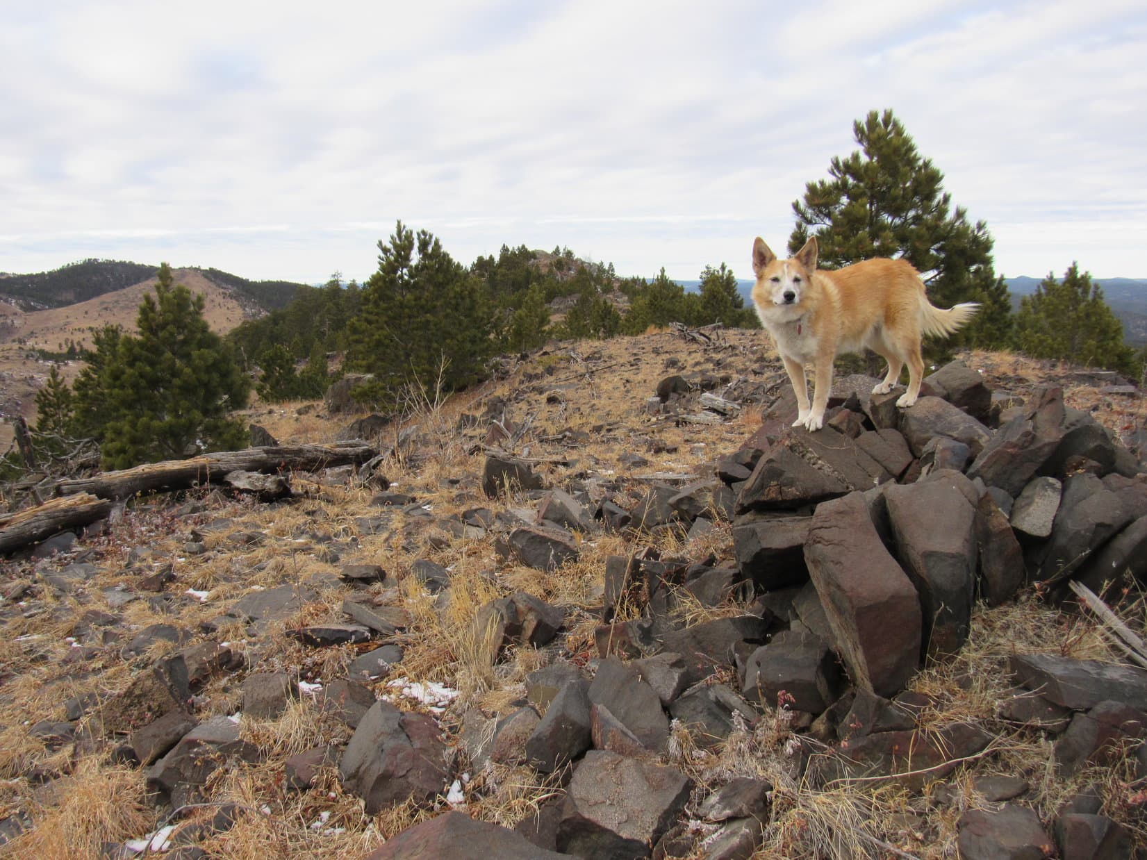
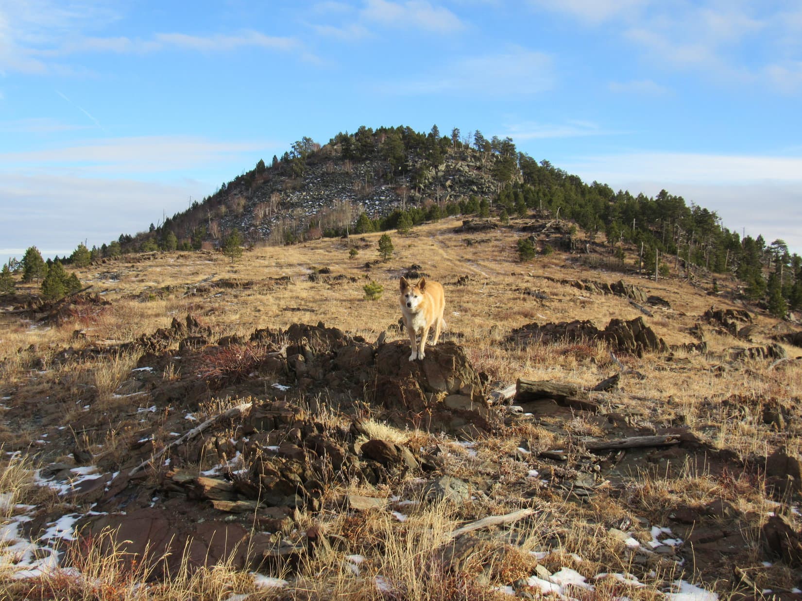
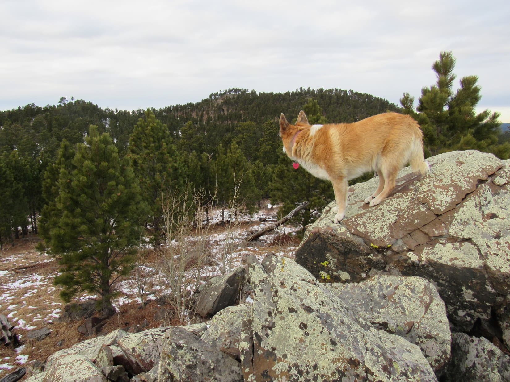
As Lupe continued higher, she came to a series of rock outcroppings in the forest that were kind of fun.
Coming to some rocks. Photo looks SW.Queen of the outcropping! Photo looks SSW.
Peak 5800’s long NW/SE oriented summit ridge wasn’t much farther. The forest ended as Lupe approached it. A little snow and deadfall on this last slope presented no difficulty.
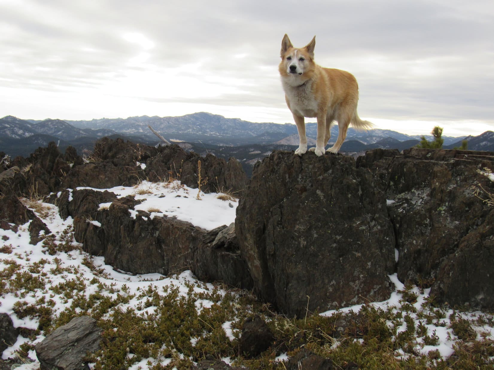
Lupe reached the summit ridge a bit NW of the SE high point. This was not the true summit, which was located at the NW end. Lupe turned SE going past the high point down to some rocks providing excellent views. Tiny snowflakes filled the air, a gloom descending on Peak 5800 as snow showers swept in.
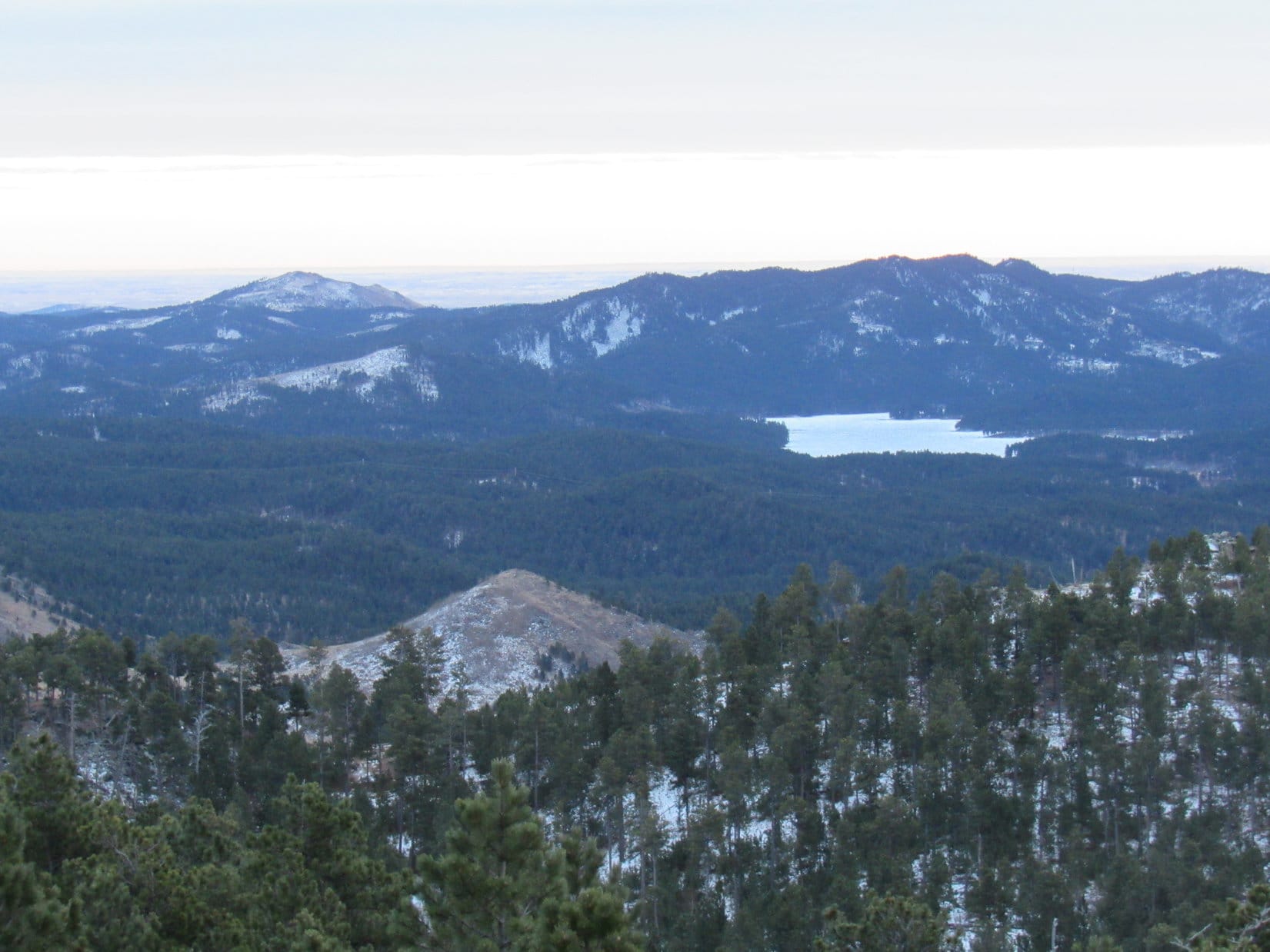
Storm Hill (far L), Boulder Hill (L), Silver Mountain (Center), and Calumet Ridge (R) in the distance. Sheridan Lake (R). Photo looks SE.Five Points (L) and False North Point (Center). Photo looks SW.
Gosh, I wasn’t expecting snow, Loopster. Maybe the situation is going to get more interesting than the forecast indicated?
Well, we better not dilly-dally then, SPHP. We don’t want to miss out on New Year’s Eve Peak!
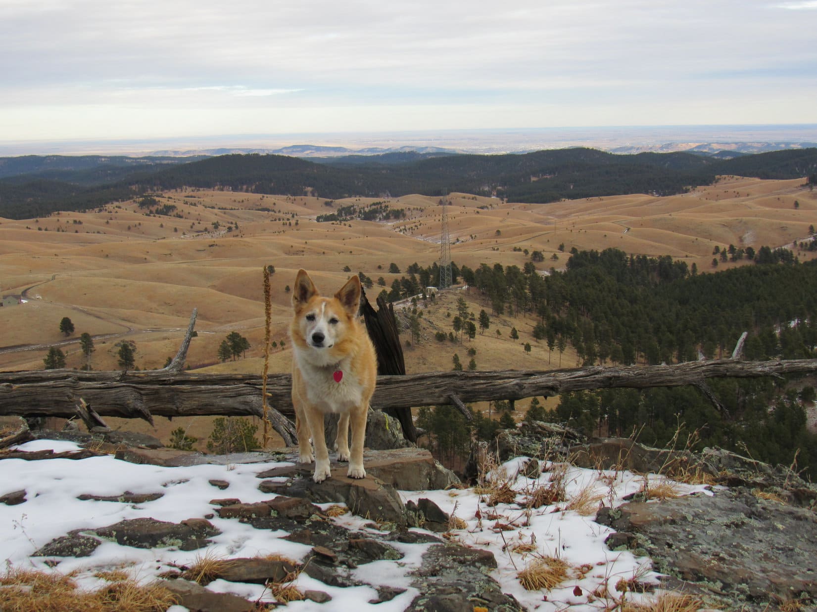
Heading NW to Peak 5800’s true summit, Lupe paused briefly on the SE high point before continuing on. New Year’s Eve Peak was already in sight 2 miles NW. Although the sky was completely overcast, it didn’t look as stormy over there.
Loop on Peak 5800’s SE high point with the true summit (R) beyond her. Forested New Year’s EvePeak (L of Center) in the distance. Photo looks NW.
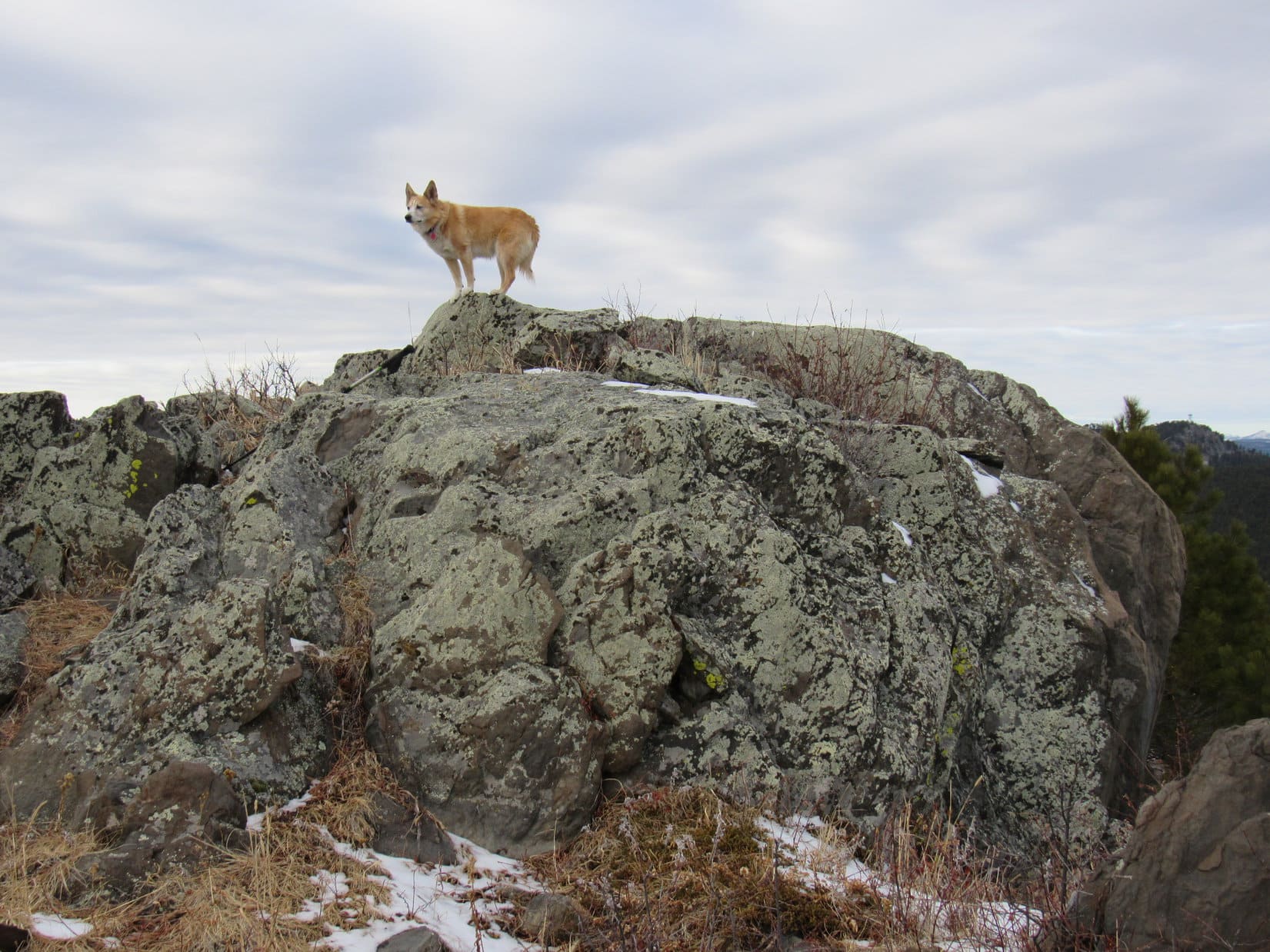
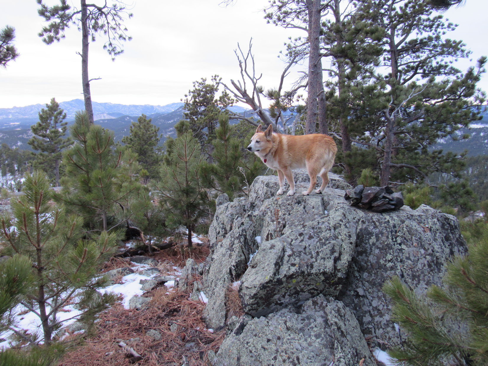
Strewn with rocks and scattered pines, Peak 5800’s broad summit ridge was a pleasant, easy trek. Soon the Carolina Dog was standing atop the 10 foot high rock formation at the true summit.
At Peak 5800’s true summit. Photo looks NW.
1:42 PM, 35ºF, Peak5800 – The view of New Year’s Eve Peak(6,046 ft.) was even better here. Lupe could see the Seth Bullock lookout tower on Scruton Mountain(5,922 ft.), too.
New Year’s Eve Peak (Center) from Peak 5800. Scruton Mountain (R). Photo looks NW.
Conditions don’t seem to be getting any worse, Loop. Think we can stay here a little while. How about a chocolate coconut bar?
Oh, SPHP! You know I’m never in such a rush that I’d be unwilling to hang around for a chocolate coconut bar!
Shortly after the chocolate coconut bar vanished, a snow shower swept over the mountain, reviving at least some sense of urgency about getting to New Year’s Eve Peak. After a brief stay on Peak 5800’s summit, Lupe was on her way again.
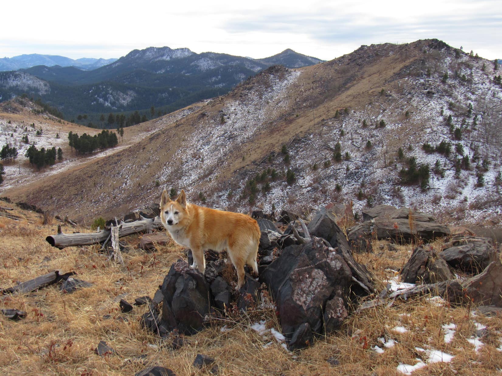
Peak 5800’s W face was by far the most rugged terrain the Carolina Dog would encounter today. Past experience had shown that by going SW, getting off the mountain wasn’t actually hard at all.
A scenic descent! Photo looks WNW.Toughest terrain of the day. Great fun! Photo looks NNW.Down safe and sound, looking SE back at Peak 5800.
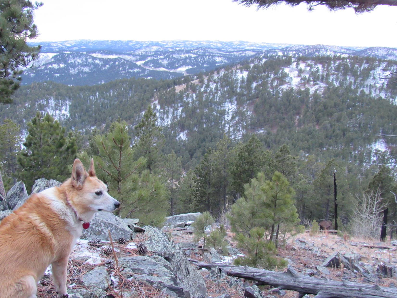
Skies were clearing to the N. Patches of blue appeared! Continuing NW, beautiful, rolling territory was ahead. This region of rock outcroppings, scattered pines, and big views was one of the features that always made Lupe’s New Year’s Eve Peak tradition such an attractive proposition.
Without much snow to deal with this year, even SPHP made great progress as the American Dingo sniffed and explored her way toward Peak5917, which now hid most of New Year’s Eve Peak.
New Year’s Eve Peak (R) behind Peak 5917 (far R). Pistol Point (Center) beyond Lupe. Photo looks WNW.Among the rolling hills and grasslands. Peak 5917 (R). Photo looks WNW.Black Elk Peak (L), Five Points (Center), False North Point (R). Photo looks SW.
An unexpected transformation had taken place by the time Lupe was closing in on Peak 5917. With only an hour or two of daylight left in 2022, suddenly the Carolina Dog was in sunshine. To the N, skies were almost completely blue, although plenty of clouds remained elsewhere.
Approaching Peak 5917. Photo looks NW.
Keep your claws crossed, Looper! Maybe we’ll get to see a glorious sunset from New Year’s Eve Peak?
Oh, I hope so, SPHP! That would be a fabulous finish for 2022!
An hour earlier, and Lupe would have had time to climb Peak5917, too, but the position of the sun indicated that she’d better not delay in getting to New Year’s Eve Peak. Traversing the S slope, Loop went over a ridge then down to the saddle leading to Pistol Point.
Turning first W, then SW, 2 steep climbs on a snowy old road next to a fence got Lupe up to the Pistol Point region. Abandoning the road, she headed S looking for the pistol handle, which was super easy to find.
At Pistol Point. The big rock R of Lupe is the pistol handle. Photo looks ENE.
Pistol Point is the high point at the end of New Year’s Eve Peak’s S ridge where it curls to the E. With Peak5917 only 0.5 mile NE, and a great look at Peak5800 to the ESE, Lupe always stopped here to enjoy the sweeping views.
Peak 5917 (L), Peak 5800 (R) from Pistol Point. Photo looks E.
Pistol Point offered grand views to the S as well, but the scene to the SW was the important one at the moment. Quite a few clouds that way, but reasonable hope still remained for a marvelous winter sunset. With the sun already low, Lupe had to press on.
Near sunset at Pistol Point. Photo looks WSW.
Hard to believe a whole year had already slipped away since Lupe’s last journey along New Year’s Eve Peak’s familiar S ridge, but it was true. 2022 had been a spectacular year! Now it was about to fade into history forever. A brooding sadness came flooding over SPHP as the American Dingo finished her ascent.
4:02 PM, 29ºF, New Year’s Eve Peak(6,046 ft.) – The sun was still up, but not for much longer when Loopster leapt onto the 4 foot high rock formation that was the mountain’s true summit. A cairn was still on it, and a second cairn sat on some lower rocks a little farther S. The small pines surrounding the true summit were growing up, getting taller every year. Soon enough, there wouldn’t be a view.
At New Year’s Eve Peak’s true summit. Photo looks SSW.
The first time Lupe had ever come here, the trees had been tall and old. Hardly any views at all back then except from along the S edge. There hadn’t been any cairns, either. And then, a year or two later, Loop had arrived to find that loggers had come through, taking out quite a few of the old trees, which opened up at least some views to the S and SE.
That first time Lupe stood on these rocks had been the last day of 2012, exactly 10 years ago. Not only 2022 was dying, a whole decade was about to be lost to the annals of time with it. 10 years gone!
Amid SPHP’s morose thoughts, ever so gently requesting recognition, dear Lupe offered her sweet paw. Brightening, SPHP shook it.
Great job, Looper! So glad we’re together again on New Year’s Eve Peak!
In time for sunset, too, SPHP! And another chocolate coconut bar, I hope!
Oh, yes, I brought another one, Loop. Let’s go sit down and enjoy it.
Suddenly, from somewhere off to the N, gunshots rang out. Panicked, Lupe sprang off the summit.
Hide, SPHP! Enemies!
The gunshots were loud and kept coming, seldom pausing for more than a minute or two.
Blam, blam, blam!
Took a lot of convincing, but Lupe curled up on SPHP’s lap on the upper W slope. Lupe and SPHP had always sat here together facing the snowy hills stretching away to the W, but this time Lupe was trembling as SPHP stroked her soft ears.
Nervous Lupe on the upper W slope. Photo looks N.The familiar snowy hills. Photo looks WSW.
Sitting there facing WSW, it was kind of cold. The chocolate coconut bar was frozen stiff as SPHP divided it up. Loopster enjoyed her share, but not the rest of the experience. That dang gunfire wouldn’t stop. More than anything else, the Carolina Dog wanted to flee.
The chocolate coconut bar was gone. SPHP chomped 2 small apples while the sun sank into a bank of clouds. Instead of a splendid show, 2022 was destined to die dull and drab. Too bad, but nothing to be done about it. SPHP tried to think of all of Lupe’s wonderful adventures in 2022, but it was impossible to celebrate the now fleeting year, brood over days gone by, or even ponder what 2023 might bring.
Blam, blam, blam!
200 rounds. For the first time ever, New Year’s Eve Peak wasn’t fun.
4:32 PM – Still light in the sky, but after sinking into the murk, the sun hadn’t been seen for a while. Clearly no point in staying in this war zone without even any hope of a colorful display. Exactly half an hour after arriving, a paranoid American Dingo stood once more on New Year’s Eve Peak’s summit.
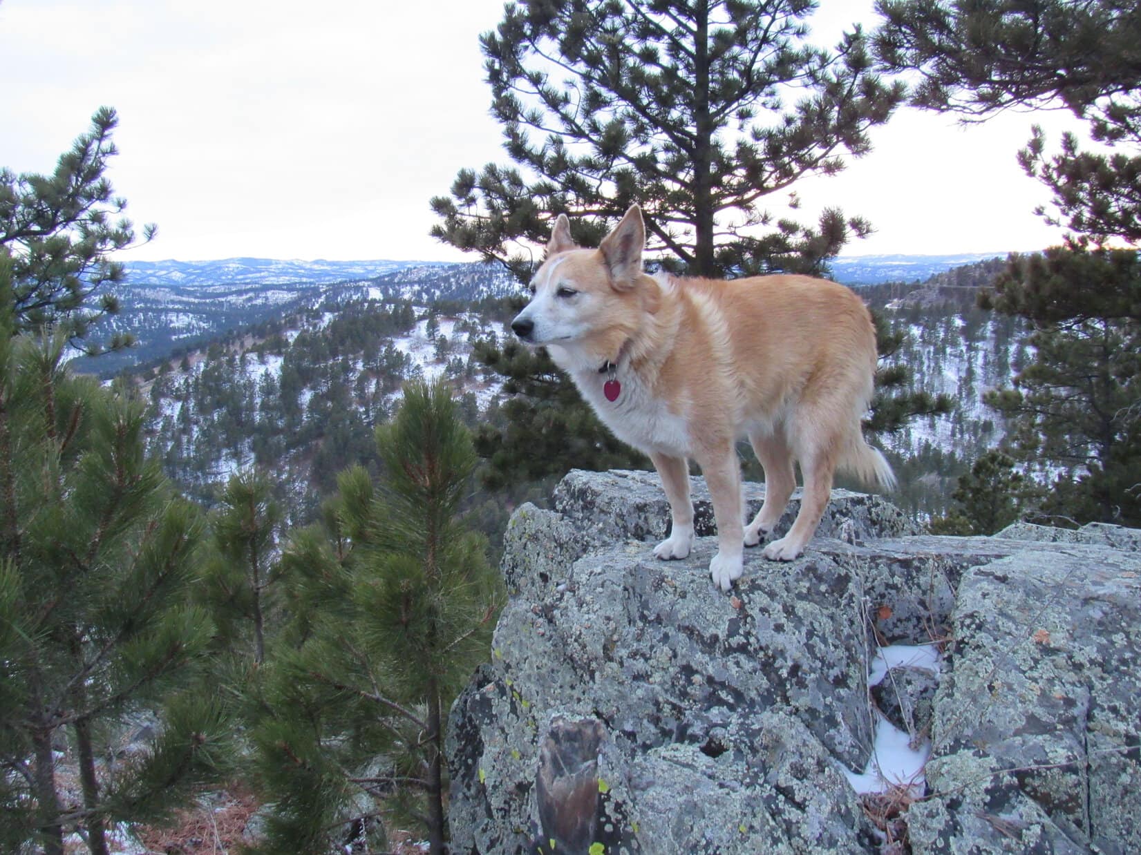
Back at the true summit. Sheridan Lake (L), Black Elk Peak (R). Photo looks SSE.
SPHP smiled, and gave Lupe an apparently unreassuring pat.
10 years, Loopster! At least we made it back here again.
Yes, wonderful, truly amazing, SPHP! Now hurry up, take the shot, and let’s get out of here before this turns out to be not only 2022’s grand finale, but ours as well!
Lupe leapt down the instant the photo was taken, but did pause briefly a short distance from the summit on the rocks with the best views along the S edge. Beyond her, Black Elk Peak(7,231 ft.) was a dark blue, Five Points(6,221 ft.) a deep green and gray. Far to the SSW, a pale orange strip of sky was visible above the distant hills.
Soon the light would fade. 2022 would sneak away in the night never to return. For a moment, Lupe stood there looking wistful.
The Carolina Dog said nothing, though, before continuing down the slope leading to the S ridge. By the time she got to Pistol Point, dusk was on the verge of turning into night. Silence reigned among the shadows. A little later on, going over Peak 5917’s S ridge, the flashlight came out. Stars twinkled above, and a half moon brightened what snow remained.
In darkness, snow crunched beneath SPHP’s boots as Lupe trotted down USFS Road No. 710. 2022’s final quiet, happy time together. Tomorrow dawn would arrive with whatever adventures New Year 2023 would bring. (End 5:54 PM, 30ºF)
New Year’s Eve Peak, Black Hills of South Dakota 12-31-22
I know it, and it was a fun time, too! Pure inspiration! Hope you’re ready for a big adventure today, Loopster.
Aren’t I always? What’cha got in mind?
Silver City to Daugherty Gulch. Roughly 11.25 miles one way, I figure. Then if we still have any moxie left, we’ll tack on another couple of miles to climb Peak5800 before circling back to Deerfield Trail No. 40 via USFS Road No. 530 and the Slate Creek Dam.
Oh, that is a big day! We better get crackin’!
Leaving the Silver City trailhead.
Five days ago it had been snowing when Lupe had been here with Cousin Dusty and Uncle Joe. What a difference those 5 days had made! Suddenly it was springtime – blue skies, tweeting birds, the whole bit! Progress was rapid on the broad, flat trail. Silver Peak(5,810 ft.) was soon coming into view.
Off to an easy start.In scenic Rapid Creek canyon. Photo looks W.Silver Peak (L of Center). Photo looks SW.
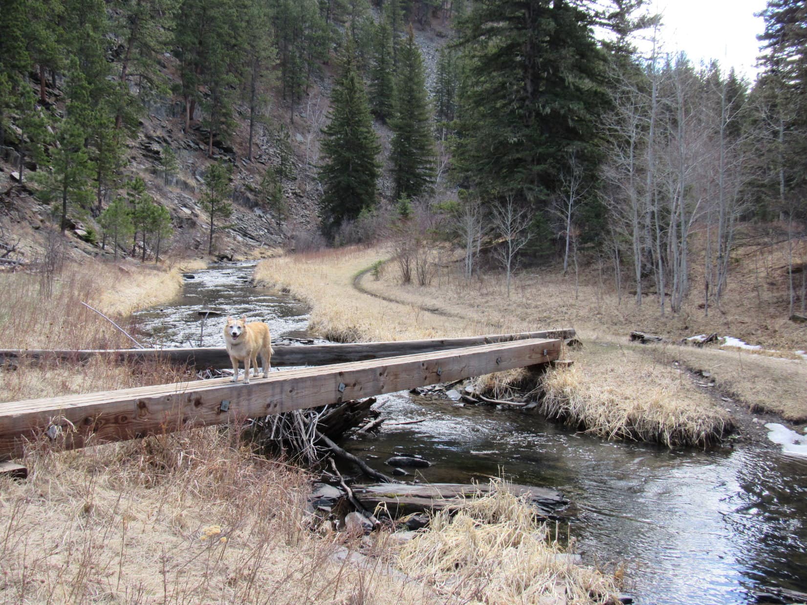
Just beyond the Silver Peak view, Lupe crossed the 4th bridge already over Rapid Creek. The first 3 had been concrete and as wide as a road, but this one was an all wooden pawbridge complete with railings. All the rest of the bridges across Rapid Creek would be like this.
Downstream view of Rapid Creek from the first wooden bridge. Photo looks N.
Deerfield Trail No. 40 narrowed after crossing the wooden pawbridge, but was still well-beaten and super easy to follow, remaining flat and rock-free. The trail passed mostly through the forest, but was never far from Rapid Creek.
Rapid Creek from Deerfield Trail No. 40. Photo looks SW.
Five minutes from the first pawbridge, Lupe came to her Dingo Cave, a great spot to hang out during a hail storm.
Loopster from the Dingo Cave.
No hail expected today, so the American Dingo went right on by, enjoying the sunshine as the day warmed up. Rapid Creek is the largest stream in the Black Hills, and this beautiful stretch of Deerfield Trail No. 40 along it certainly had to rank among the most scenic hikes in the entire region.
Every now and then, another pawbridge appeared. After the 5th one, Loop reached a big bend in the river not far from where Spurgeon Gulch comes in from the N. W of Spurgeon Gulch, the trail passed through a region of tall, slender bushes. Beyond the bushes was another super scenic trail segment along Rapid Creek.
Ordinarily quite a clear-running stream, Rapid Creek’s color resembled the muddy Mississippi today with all the spring run-off.
Getting close to the Spurgeon Gulch area after crossing the 5th wooden pawbridge. Photo looks N.At the big bend a little E of Spurgeon Gulch and Canyon City. Photo looks E.Past the bushes W of Spurgeon Gulch. Photo looks SW.
Nearly 0.4 mile W of Spurgeon Gulch and Canyon City, Lupe came to a 6th and final pawbridge over Rapid Creek. Crossing it, she followed a long straight stretch of Deerfield Tail No. 40 going WSW on the S side of the creek. In the shade of a mountain, much of this part of the trail was still icy. After 0.33 mile, Lupe came to a big bank of ice at the confluence of Slate Creek and Rapid Creek.
Looper was now 3.33 miles from the Silver City trailhead. Slate Creek, a mere tributary of Rapid Creek, was running as high as SPHP could ever remember seeing it. Something was missing, wasn’t it?
Approaching the 6th and final pawbridge over Rapid Creek. Photo looks WSW.Looking upstream from the 6th pawbridge. Photo looks WSW.On the straightaway S of the creek. Photo looks WSW.Confluence of Slate Creek (L) and Rapid Creek (Center & R). Photo looks NW.
Seems we’ve reached the Slate Creek glacier, SPHP! Watch your step! Might be pretty slippery for you!
So we have, Looper. Say, didn’t there used to be a bridge over Slate Creek here? Not a big pawbridge with railings like the ones over Rapid Creek, just 4 or 5 planks on end bolted together.
Don’t really remember, SPHP. Been a while since we’ve been here, like years! Maybe there was, or maybe we always rock-hopped Slate Creek? Never had this much water in it before!
Well, hard to say. I don’t remember, either, but I was sort of expecting a plank bridge here, since I remember lots of them across Slate Creek farther upstream.
You aren’t saying we’re done already, are you, SPHP? Slate Creek still isn’t very deep! Can’t you wade across it?
Yup! In fact, I even brought water shoes, since I do remember at least one ford farther up Slate Creek. Guess they’re about to come in handy a lot sooner than I thought.
Lupe waited while SPHP switched from boots to water shoes prior to fording Slate Creek. The water shoes were actually SPHP’s old gray and blue Merrell running shoes bought in Haines, Alaska in 2017. When brand new, they were the prettiest shoes SPHP had ever had, almost like dancing slippers, but now they were dingy and falling apart. No matter! As long as they still held together, they were light-weight and perfect for fording streams.
Waiting for SPHP prior to fording Slate Creek. Photo looks SW.
Slate Creek was frigid, but the water shoes worked perfectly. Once across, there was another delay as SPHP sat in the sun swapping back over to boots. As soon as that was accomplished, Loopster hit the trail again. Deerfield Trail No. 40 abandoned Rapid Creek. For the next 4.25 miles, it would follow Slate Creek upstream instead.
Starting up the Slate Creek valley. Photo looks SW.
Deerfield Trail No. 40 had been flat and smooth all along Rapid Creek, but going up the smaller Slate Creek valley, it soon became rockier and started gaining elevation. Still an easy trek, but not quite the total cake walk it had been before.
Within 5 minutes, Loopster came to another stream crossing. Just like SPHP remembered, a sturdy plank bridge went over Slate Creek.
1st Slate Creek crossing beyond the confluence with Rapid Creek. Photo looks SW.
As the Carolina Dog continued up the valley, Deerfield Trail No. 40 kept crossing Slate Creek at short intervals in a narrow gorge. The 2nd and 3rd crossings also had plank bridges, but approaching the 4th crossing Lupe discovered that the bridge had washed out.
3rd Slate Creek crossing beyond the confluence with Rapid Creek.The bridge at the 4th crossing was washed out.
Water shoe time! SPHP donned them again prior to fording the stream. Then it was back to putting on the boots once more before Lupe could keep going.
Fording Slate Creek at the 4th crossing.
Didn’t take long to became apparent that the whole process of constantly switching footwear was a ridiculous waste of time. The bridges were out everywhere! Sick of it, and now used to the cold water, SPHP relegated the boots to the pack, marching along in water shoes as Lupe came to one ford after another.
SPHP kept count of the number of times Deerfield Trail No. 40 crossed Slate Creek after starting up the valley. After the 9th crossing, the trail climbed 50 feet above creek level. On the way up the steep hillside, Loop found another glacier slowly melting away in the shade of a bend. This second Slate Creek glacier was centered on the trail, and treacherously sloped and slippery, but SPHP managed to get over it without mishap.
Beyond the glacier, the trail flattened and stayed well above Slate Creek for a little way, but Lupe was soon fording it again. It wasn’t until Loop got to the 12th crossing that she found another bridge intact.
Fording Slate Creek for the 8th time in a row at the 11th crossing.On the plank pawbridge at the 12th crossing.
No bridge at the 13th crossing, but after that none were washed out for a while. In fact, there were 2 bridges at both the 15th and 17th crossings. By the time Lupe got past the 16th crossing, the Slate Creek valley was widening out to a considerable degree.
At the 13th crossing, the last ford for a while.The 14th crossing, where intact bridges finally began to consistently appear again.The Slate Creek valley opened up beyond the 16th crossing.At the 17th crossing, where there were 2 bridges.
The journey up the narrow gorge had been scenic with a very secluded feel to it. As the valley opened up, that sense of seclusion diminished, and the stream crossings were more spaced out. After the 17th crossing, Lupe reached the Flannigan cabin. Not much was left of it mouldering away beneath a stand of ancient spruce trees.
At the Flannigan Cabin.
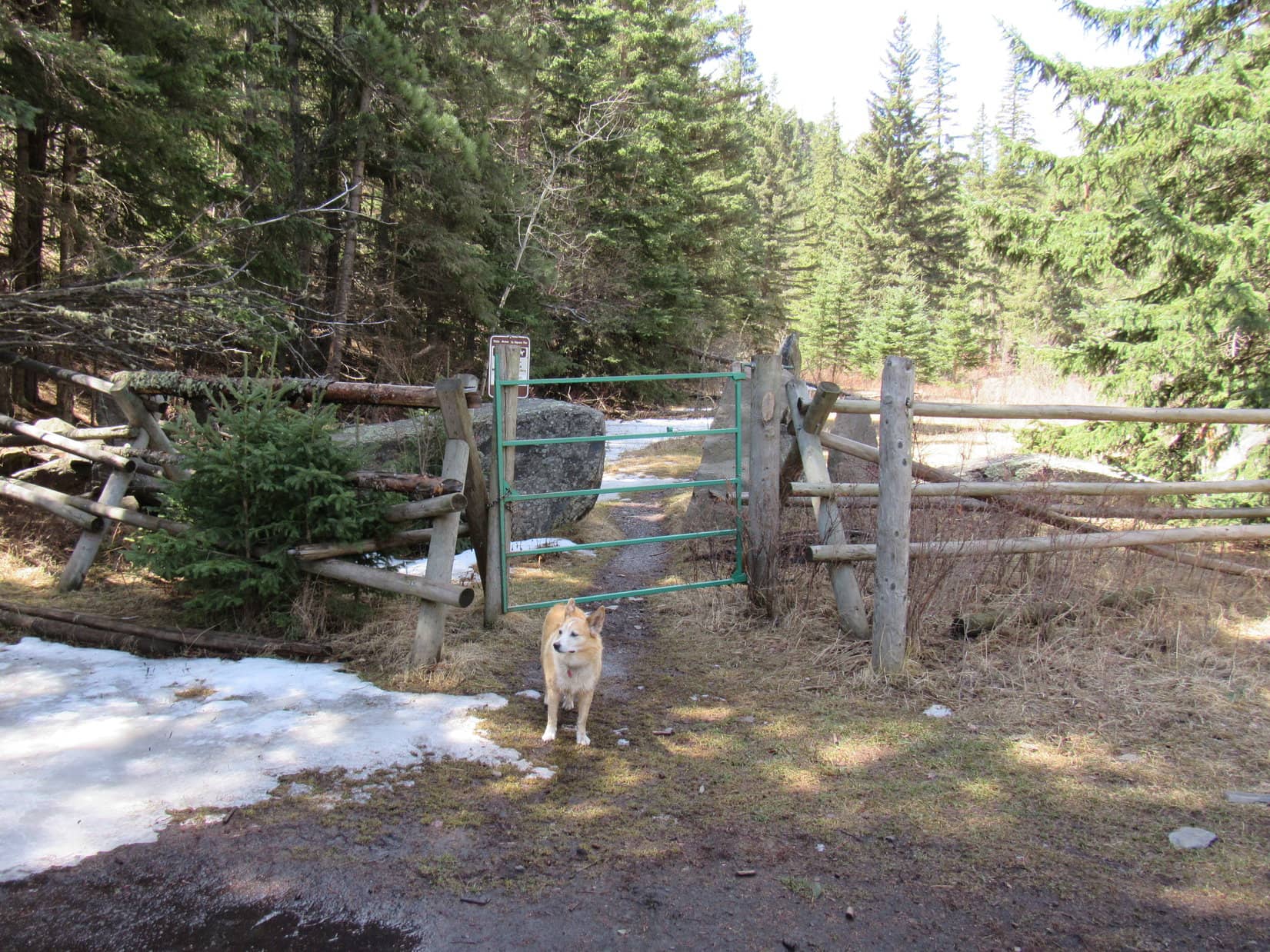
Doesn’t take an American Dingo long to inspect a wreck like that! A brief examination, and Lupe pressed on. Deerfield Trail No. 40 crossed Slate Creek for the 18th time beyond the confluence with Rapid Creek just past the cabin. A green gate in a pole fence led to a circular drive where USFS Road No. 606 dead-ended at the lower end of Spaw Gulch.
N end of USFS Road No. 606 which comes down Spaw Gulch.
Lupe went through another green gate on far side of the circle. Beyond it was a sign about an old road that used to follow Slate Creek, crossing it 25 times in 3.5 miles!
Only 25, SPHP? At the rate we’re going, we’re going to beat that record!
At the 2nd green gate.
Sure enough, Lupe continued to come to more stream crossings. Since there had been perfectly good plank bridges over all of them for some time now, a short break was taken after No. 20 while SPHP abandoned the water shoes, exchanging them for boots again. A chocolate coconut bar got shared before following the trail up over a little ridge.
On the other side of the ridge, Loop came to a place that looked sort of like a campsite. 5 sections of big logs stood arranged in an “X” pattern out in the middle of this area. Lupe got up on the center log.
On the center log at the campsite.
She was still standing there, when SPHP noticed a hole resembling an old mining dig over in the hillside to the E. Further inspection revealed a short tunnel through the ridge.
Peering into the tunnel.
Venturing in, the tunnel opened up at the far end at a spot overlooking Slate Creek. Inside the tunnel, some filthy ancient plywood shelves were arranged like bunk beds along one side. Attached to the shelves was a clear plastic sleeve containing an astonishing bright new sheet of paper.
In this rat hole out in the middle of nowhere? You have got to be kidding me!
What’s it say, SPHP?
It’s says the world has completely lost it’s mind, Looper!
Nonsense! It does not! What does it really say?
It’s a warning notice about Covid-19, Loop. Talks like this is the Holiday Inn or something.
Here? Doesn’t look like anyone has been here in ages!
Exactly my point, except, of course, for whoever thought this joint needed a Covid-19 notice. If Covid-19’s here, they must have brought it with them!
Whether the notice was totally Looney Tunes, or not, Loopster didn’t have a reservation at this 0 star establishment, and it was still a long way to Daugherty Gulch. The American Dingo pressed on.
Deerfield Trail No. 40 continued to wind SW following Slate Creek. Lupe came to several more creek crossings with plank bridges. After No. 23, a brown wand marking the route pointed off toward the R, away from the obvious trail. Evidently a re-route up a less traveled path in order to avoid another couple of creek crossings ahead.
The official route climbed 60 feet before topping out near a rocky point overlooking the next part of the Slate Creek valley. Part of USFS Road No. 245.1A was in sight. The topo map showed a short section of the road paralleling Slate Creek before leaving the valley.
At the Slate Creek valley overlook. Photo looks SSW.
Continuing back down into the valley, the trail now led to a set of stairs with rock walls. However, the stairway was virtually unusable due to an enormous spruce tree which had collapsed along the length of it. Even so, Loop was soon through this obstacle, and approaching an impressive natural rock wall towering next to Slate Creek.
The huge rock wall was quite a scenic spot! Nearby was a 24th crossing of Slate Creek. No bridge, but paving stones made for a super easy ford as SPHP employed the water shoes again.
Approaching the scenic wall of rock. Photo looks S.Magnificent! Photo looks ESE.As seen from the 24th Slate Creek crossing. Photo looks E.Fording again!
Beyond the impressive rock wall, the Slate Creek valley was even more open. A 25th stream crossing, another ford with paving stones instead of a bridge, wasn’t far from the 24th one, but that was the last ford.
Wasn’t the last stream crossing, though! The crossings were farther apart now, but the count continued to rise as the Carolina Dog crossed one bridge over Slate Creek after another. Meanwhile, she was seeing lots of deer and having a fabulous time!
Approaching crossing No. 26, another one with 2 bridges. Photo looks S.Near crossing No. 29. Photo looks NNE.A curious dilapidated structure between crossings No. 30 and 31.Crossing No. 31.Wading just for fun at crossing No. 32.
The trail went on and on. Lupe finally arrived at a fork. A brown wand along a path going SW across a big field indicated that this was the way Deerfield Trail No. 40 went. At the far end of the field, Slate Creek ran along the base of a forested hill. The last bridge over the steam, crossing No. 35, if SPHP hadn’t lost count somewhere along the way, was visible from the divide.
About to leave the Slate Creek valley via the bridge seen at the base of the hill. Photo looks SW.
Crossing the field and the last bridge, Lupe left the Slate Creek valley. Deerfield Trail No. 40 started steeply up a slope, but quickly turned L and began to switchback less aggressively higher. Near the top of a ridge, the trail ran W along the N side before crossing over to the S.
For the first time today, the cheerful sound of flowing water was absent and missed, but Lupe had gained enough elevation to get a distant view of some forested hills, the higher ones still sporting a little snow. Not a spectacular scene, but a pleasant one.
On the N side of the ridge. Photo looks SW.First distant view of the day. Photo looks SW.
How much farther to Daugherty Gulch, SPHP?
Still a ways, Loop. About 3.67 miles from where we left Slate Creek.
Trending W or SW, the trail leveled out as it began winding along the top of the ridge. Lupe visited a couple of high points separated by 0.33 mile, the second one a bit higher than the first.
At the first high point. Photo looks W.Second high point. Photo looks WSW.
The high points had only a minor drop between them, but Loop came to a larger drop after passing the second one. During the descent, the trail went by an old horizontal mining shaft. Turned out it wasn’t very big, and the Carolina Dog didn’t find anything of interest in it.
Checking out the mining shaft.
Losing 160 feet of elevation heading S into a valley, the trail bottomed out at a junction with an abandoned road. Deerfield Trail No. 40 turned W again here, but not for long. The road kept going W, but within a few hundred feet, the trail veered SW up a steeper drainage. Before long it was curving NW. Upon regaining all the elevation she’d just lost, Lupe arrived at a minor pass.
Near the low point in the valley, starting up the abandoned road. Photo looks W.At the pass. Photo looks NW.
Going over the pass, a smaller drop of 50 feet ensued. Soon USFS Road No. 245 could be seen ahead. The trail turned W, paralleling the road for a little way before merging with it just before the road came to another pass. At about 5,500 feet, this pass was the high point of Deerfield Trail No. 40 between Silver City and Daugherty Gulch.
At the high point of USFS Road No. 245 and this segment of Deerfield Trail No. 40. Photo looks NW.
From the pass, No. 245 went NW down Lind Gulch for more than a mile. A bit muddy at first, the road hike was super easy, although not terribly interesting. After losing 400 feet of elevation, Lupe finally reached a gate where the Mickelson Trail crossed the road.
Heading down Lind Gulch. Photo looks NW.More than halfway down Lind Gulch it became a little more scenic.Junction of USFS Road No. 245 and the Mickelson Trail. Photo looks NW.
Deerfield Trail No. 40 abandoned USFS Road No. 245, turning SW along the Mickelson Trail. Site of a former railroad line, the Mickelson Trail curved W on a gradual incline that led to a tunnel that trains used to run through many years ago. The tunnel was pretty cool!
After reaching the Mickelson Trail, Deerfield Trail No. 40 follows it the rest of the way to the Daugherty Gulch trailhead. Photo looks SSW.Approaching the tunnel. Photo looks W.Inside the tunnel.
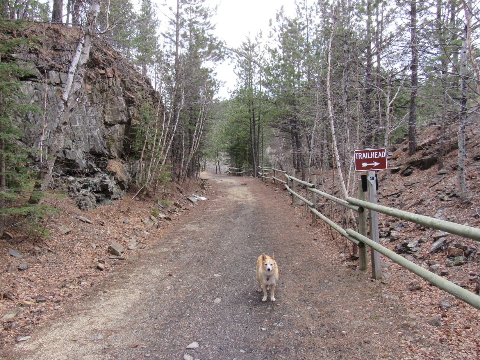
Beyond the tunnel, the trail continued W on a slight incline for nearly 0.33 mile before starting to curve S. A trailhead sign appeared ahead. Soon Lupe was going through a green gate, down a little slope to the W, over a tiny tributary of Castle Creek, and across Mystic Road.
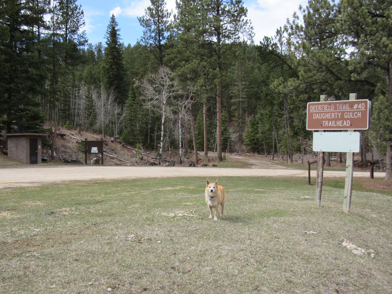
Continuing W beyond the tunnel. Photo looks W.Getting close to the end. Photo looks SW.Leaving the Mickelson Trail. Photo looks ENE.Success! At the Daugherty Gulch trailhead. Photo looks NW.
3:38 PM, 58ºF, Daugherty Gulch trailhead –
Congratulations, Loopster! We made it!
Thank you, SPHP! Such a beautiful trek, especially the parts along Rapid Creek and Slate Creek. Really wonderful!
Yes, indeed! Best part of the entire Deerfield Trail, if you ask me, although the loop around Deerfield Reservoir is mighty nice, too.
7 hours, though, SPHP! We sure took our sweet time getting here! Are we still going to climb Peak5800, too? Do you have it in you?
Sure! We’ll share another chocolate coconut bar up there. Maybe that will spur me on? Wha’dya say?
Last one there is a human!
Not much doubt about that! Some things never change. 5 minutes after arriving at the Daugherty Creek trailhead, the Carolina Dog headed back to the Mickelson Trail. Turning S, the trail slowly, relentlessly, continued uphill.
Heading S on the Michelson Trail. Photo looks S.
Keeping an eye on Mystic Road to the W, SPHP watched for side roads. USFS Road No. 241 came first. It went SW up Daugherty Gulch. For some odd reason, the Daugherty Gulch trailhead was actually located at Whitetail Gulch. No logical explanation seemed possible other than that someone was confused when they named it.
The next road was the critical one. When USFS Road No. 231.1A came into sight, that was the signal to start looking SE. Looper would start her ascent of Peak5800 following the next ridge the Michelson Trail went by in that direction.
Worked great! Climbing from the WNW, the Carolina Dog was soon on top of the mountain.
Heading up Peak 5800’s WNW ridge. Photo looks ESE.
4:48 PM, 55ºF, Peak 5800 – Peak 5800’s summit proved to be a large flat area of open forest with no obvious absolute high point. SPHP dropped the pack beneath a big Ponderosa pine with many branches that seemed to be about where the highest ground was. Nearby stood a weathered tree stump. 4 feet tall, it was almost as if it were a post deliberately set to mark the summit location.
Peak 5800 summit. Photo looks SSE.By the weathered tree stump. Photo looks NW.
Congratulations were once again in order! Praising Lupe, SPHP shook her paw, but wasn’t going to get off that easy. The chocolate coconut bar had to be delivered as promised, along with a silver bowl full of Taste of the Wild. SPHP ate the last of two apples, the first one having met its fate hours ago.
For a while Lupe and SPHP just sat there, looking WSW across a barren spot. Never know what you might see when you climb a new peak in the Black Hills. As it turned out, there were enough trees on Peak 5800 to mar the views in all directions. Sometimes that’s the way it goes. Plenty of glimpses of hills and ridges, but no clear views.
The bare spot. Photo looks WSW.
After resting for 20 minutes, it was time to get up and move around. The summit region was big, and there weren’t that many trees! Surely Lupe could find some decent viewpoints, if she looked for them.
The viewpoints were all toward the S, somewhat below the summit’s perimeter. To the SW were high ridges difficult to identify from here. Peak6167 and Old Bald Peak(6,130 ft.) were in sight to the ESE. To the SSE, Black Elk Peak(7,231 ft.) made Lowden Mountain(6,055 ft.) look like a little hill.
Looking SW.Old Bald Peak (R) and Peak 6167 (far R). Photo looks E.Lowden Mountain in front of Black Elk Peak (Center). Photo looks SSE.
Shadows were lengthening. A long way back. 40 minutes after reaching Peak 5800, Lupe headed down the S slope. Here she came upon the best view yet, a lovely panorama due S. Black Elk Peak, Lowden Mountain, Sylvan Hill(7,000 ft.), and Redfern Mountain(6,075 ft.) on display!
Black Elk Peak and Lowden Mountain (far L), Sylvan Peak (R of Center), Redfern Mountain (far R). Photo looks S.
After losing some elevation, Lupe turned E down into a valley that led to USFS Road No. 530. Loop had never been on this part of it before. In the evening light, No. 530 was a scenic journey and downhill practically all the way. A good thing, since there was now a need for speed!
With only few hours of daylight left, the race was on. SPHP wasn’t keen on doing close to 40 Slate Creek crossings via narrow plank bridges or outright fords in the dark, even if the stream wasn’t all that big.
The American Dingo showed great energy, often racing ahead. Herds of deer kept her excited. Progress was limited only by SPHP’s pace. Still took nearly an hour to get to the little lake at the Slate Creek Dam.
USFS Road No. 530 close to where Lupe first reached it. Photo looks E.A beautiful evening! Photo looks N.Approaching the Slate Creek Dam. Photo looks NE.By the little lake at the Slate Creek Dam. Photo looks S.
After a look at the lake, Lupe turned WNW on USFS Road No. 530.1C, which followed Slate Creek.
A little over 0.25 mile, and No. 530.1C ended. No problem! A single track trail continued down the valley. Over the course of a mile, Lupe crossed 4 or 5 more plank bridges, one of which didn’t extend all the way across the stream, before getting back to Deerfield Trail No. 40.
The last rays of sunlight disappeared from the hilltops about the time Lupe reached the fords back at the 25th and 24th Slate Creek crossings. Dusk arrived and deepened as she hurried on.
Still some light in the sky, but everything was turning pitch black down in Slate Creek’s narrow gorge by the time she got there. The flashlight had to come out before attempting to cross the slippery glacier between crossings No. 10 and No. 9.
It all went well! Every bridge, every ford! Better than expected. Once Lupe got across Slate Creek at its confluence with Rapid Creek, success was assured. Flat trail and bridges with railings the rest of the way.
Yet still miles to go in the night! In the black as eternity canyon, Rapid Creek rushed noisily downstream as silver stars glittered in a narrow band of sky visible above. On the deep space edge of the weak beam ahead, a curly tail waved, confidently leading the way. (10:30 PM, 34ºF)
Deerfield Trail No. 40, Black Hills of South Dakota 4-28-21
12:47 PM, 37ºF, junction of Hwy 385 & USFS Road No. 710 – A little late in the day to be starting out on a Black Hills expedition, but that was by design. Lupe was excited, though, and SPHP was too! As soon as SPHP was ready, the American Dingo headed SW into the forest. A skiff of snow was on the ground, somewhat surprising since the weather had been extremely dry and unseasonably warm for 2 months.
Loopster heads into the forest. Photo looks SW.
The slope quickly increased into a steady, relatively steep climb. Lupe was already most of the way up Peak5800 when she began coming to minor rock outcroppings and shelves. Pausing briefly at a particularly open spot, she could see the rolling grasslands of the Bald Hills.
Glancing out over the Bald Hills. Photo looks NE.
The climb got easier near the end. Lupe reached Peak 5800’s big summit ridge near the SE high point. Heading SE, she lost a bit of elevation on the way to a few big rocks for a look at the views in this direction.
Part of Sheridan Lake, which looked frozen over, was in sight. Beyond the lake was Calumet Ridge(5,601 ft.). Boulder Hill(5,331 ft.) and Silver Mountain(5,405 ft.) were easily recognizable, too.
At the SE end of Peak 5800’s summit ridge. Sheridan Lake (R) with Calumet Ridge beyond it. Boulder Hill (L) and Silver Mountain (L of Center). Photo looks SE.
Five Points (L) and False North Point (L of Center). Photo looks SW.
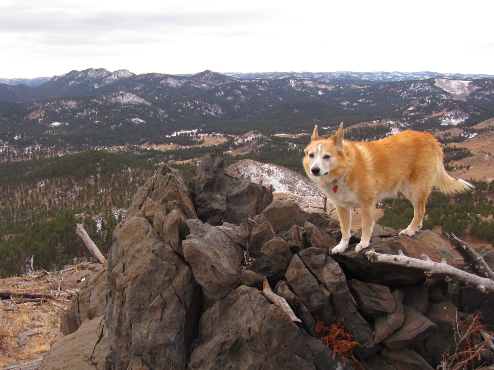
Turning back, Lupe headed NW for Peak 5800’s true summit, stopping at both the SE high point, and for a look at Black Elk Peak(7,231 ft.) along the way.
On Peak 5800’s SE high point. True summit (Center). New Year’s Eve Peak (L). Photo looks NW.Black Elk Peak (L of Center). Photo looks S.
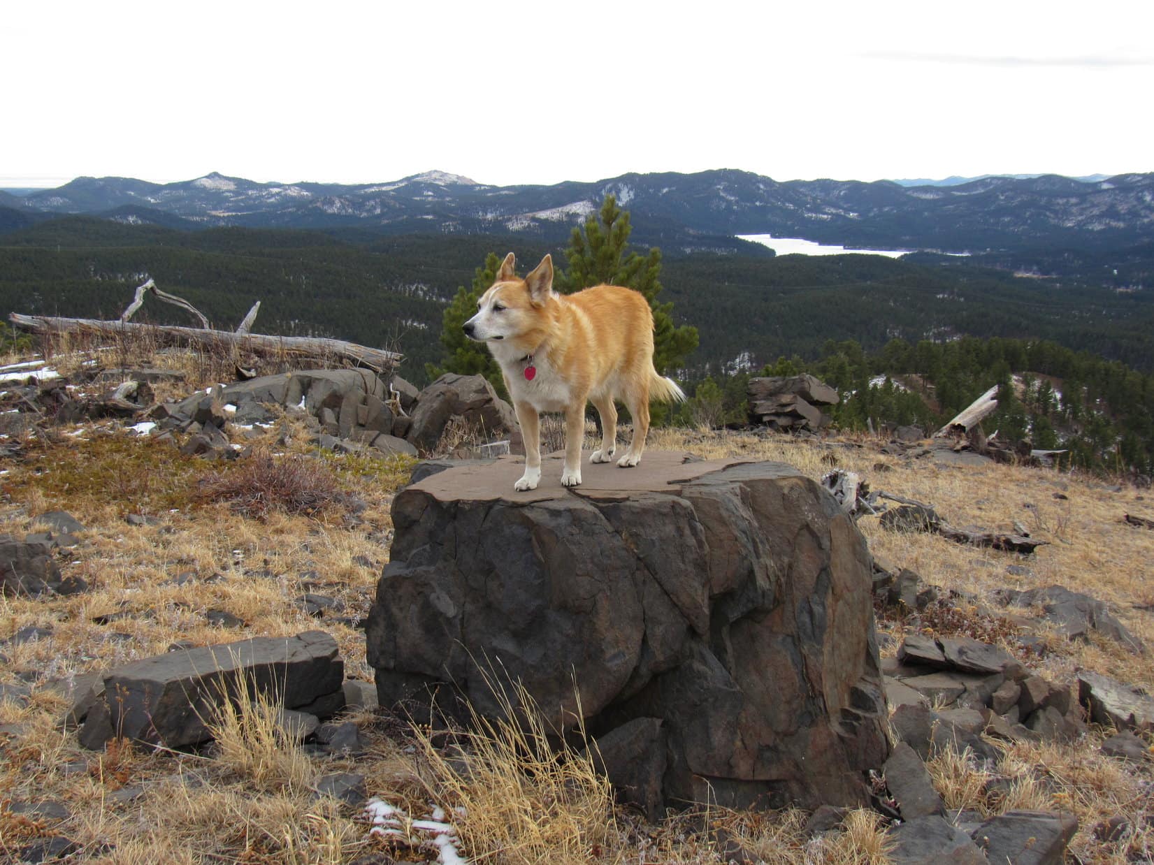
Traversing the summit ridge was easy. Lupe quickly reached the big gray rock formation near the NW end that constituted the true summit. Light green and charcoal gray lichens decorated the stone. Peak5800 wasn’t as high as New Year’s Eve Peak(6,046 ft.), Loopster’s ultimate destination today, but the views here were actually better, since they were much more open.
At the true summit of Peak 5800. Photo looks NW.Enjoying the open views from Peak 5800’s true summit. Bald Hills (L). Photo looks E.
Among other sights, New Year’s Eve Peak itself was visible nearly 2 miles NW as the crow flies. Today’s late start had been driven by the intention of letting Loopster say good-bye to the Year of Perfect Vision over there. A glorious sunset was hoped for, but the completely overcast sky was not encouraging.
New Year’s Eve Peak (Center) from Peak 5800. Photo looks NW.
However, all was not lost. The cloud cover appeared to be rather thin. Would take a while to get over to New Year’s Eve Peak, so maybe there was still a chance a decent sunset would materialize? 10 minutes at the true summit of Peak5800, and the American Dingo continued on.
The NW face of Peak 5800 was quite steep and very rocky. A little better more toward the W. This was Lupe’s 3rd time on Peak 5800. She’d come down this way each time, but the descent seemed trickier than SPHP remembered it. Might have gotten a little off course somewhere along the line this time around.
Descending the W face. Scruton Mountain(5,922ft.) (L). Photo looks NNW.
Fortunately, Lupe didn’t have to lose an awful lot of elevation here. Even so, the descent took longer than expected. By the time Looper reached much easier terrain, she had some good news! Patches of blue sky were appearing and seemed to be spreading. Weak sunlight illuminated golden fields ahead.
Looking back at Peak 5800 after getting past the steep, rocky part of the descent. Photo looks E.The golden trek ahead. Peak5917 (Center) with forested New Year’s Eve Peak behind it and slightly to the L. Photo looks NW.Blue skies over Peak 5800. Photo looks ESE.
The journey through the sunlit fields was as gorgeous and fun as it was easy. This region was a longtime favorite. Ever since Lupe first climbed New Year’s Eve Peak on the last day of 2012, she had been coming here near the end of every year. Poor weather often prevented Loop from returning right on December 31st, but she had usually been able to get here within a day or two.
The American Dingo roamed freely, having a blast as SPHP pondered this tradition and the sad imminent demise of the Year of Perfect Vision. Two years since Lupe had come this way! In 2019, SPHP had been far too sick to make the journey. Great to be back! Lupe hated fireworks, and this annual trek to New Year’s Eve Peak was her much preferred method of celebrating New Year’s Eve. Beauty, solitude, and freedom!
Along the way. Five Points (L) and False North Point (R of Center). Photo looks SW.
By the time Loop made it to Pistol Point, hopes for a glorious sunset were fading fast. Obliterating all blue sky in its path, a thicker bank of clouds was sweeping in from the NW. Still not darkly overcast, but the sun was already reduced to a mere bright spot in the clouds.
At Pistol Point. Photo looks ENE.Peak 5917 (L) and Peak 5800 (R) from Pistol Point. Photo looks E.New Year’s Eve Peak (Center) from Pistol Point. Photo looks NNW.
Only 0.5 mile to go! Leaving Pistol Point, Lupe headed W across open ground, but was soon turning N along New Year’s Eve Peak’s S ridge. The ridge was narrow, rocky, and thickly forested. Some up and down along the way, but nothing major. Before long, Loop was coming up the S slope.
3:56 PM – For the 8th time in her life, and 3rd time right on New Year’s Eve, Lupe stood atop the true summit boulder on New Year’s Eve Peak. Perfect timing!
All to no avail. Somewhere the sun was still up, but not for long. Clearly, no sunset, whether grand and glorious or otherwise, was in the cards. The sky was a uniform light gray, the mood merely a chilly, blah nothing. Not a ray of sunshine anywhere. Entirely out of character, New Year’s Eve Peak(6,046 ft.) felt neither like the end, nor the beginning, of anything.
A disappointing end to 2020, the Year of Perfect Vision.
A few years ago, loggers had come and thinned out some of the pines to the S, both creating a mess and opening up the views, which used to be very limited. Young pines were already growing all around the summit boulder. A few more years, and the views would be vanishing again.
On the true summit boulder of New Year’s Eve Peak. Photo looks SW.
Before doing anything else, Lupe and SPHP performed a ritual task in keeping with tradition. Sitting together, a short break was taken facing W. Taste of the Wild, a couple of shared chocolate coconut bars, and an apple disappeared. Quite a bit of territory was in sight, looking snowier and more wintery than seemed justified at the end of a December so warm and dry.
Taking a break. Photo looks SW.
In the past, Lupe had always arrived here earlier in the day. In fact, she’d always completed her New Year’s Eve Peak tour well before the sun went down. By sunset she was on her way back to the G6, out in open country where the final gleaming rays and dazzling colors of the dying year could be better appreciated.
Knowing that the sun was already on the horizon, but unable to glimpse it, simply felt wrong. No moment of anticipation. Nothing was going to happen. What was the point?
None really, except to maintain the tradition, to be here together as whatever remaining light of the old year faded, to remember the year that had been.
Grandma finally moved this year. Then months spent working on her house getting it ready to sell. The sale itself, which went so fast. The last of more than 1,000 trips to the cul-de-sac. Then summer. A late start to it, but Lupe had climbed some fabulous peaks, among them some of the highest she had ever been to. An early end to those happy times, as the smoke of countless wildfires blanketed and obscured the W. Through it all, the trials of Covid-19 which had prevented the Most High Exalted Dingo of the Arctic Sisterhood from returning to Canada and Alaska.
Each day is precious, unique, never to return. Lupe and SPHP stirred. A quick New Year’s Eve Peak summit tour was in order, even if other plans had been denied.
Black Elk Peak (L), Five Points (R) with Sylvan Hill(7,000 ft.) beyond it.Silver Mountain (L) and Calumet Ridge beyond Sheridan Lake (R). Photo looks SE with help from the telephoto lens.Peak6070 (Center). Photo looks NW.
Done. Mission complete. Onward! Puppy, ho!
Ironic. By the time the flashlight had to come out, stars were twinkling above. So where did all those infernal clouds go? The Dingo didn’t care. No brilliant sunset before 2020 vanished forever? So what? Peak 5800 and New Year’s Eve Peak! She’d had a great time. (End, 6:00 PM, 32ºF)
At home, dinner then early to bed, very early. For hours, Lupe laid close to SPHP for protection while sporadic fireworks boomed in the night. With each thud, the Carolina Dog glanced up in fear and wonder. Near exhaustion and final collapse, the Year of Perfect Vision was still hanging on, still fending off the dread uncertainties of 2021.
Oh, don’t worry about it, Loopster! Gonna be OK! You’ll still be climbing mountains in 2021. You might as well enjoy that Busy Rib Hide!
Stroking her soft fur, SPHP gave Lupe another kiss. Reassured yet again, the American Dingo went back to chomping away.
On New Year’s Eve Peak, Black Hills of South Dakota 12-31-20