Black Hills, SD Expedition No. 288 – New Year’s Eve Peak (1-3-22)

11:41 AM, 46ºF, Horse Creek Road across from USFS Road No. 243.2B

New starting point, SPHP?

Yup!  Going to mix things up a bit, try a little different route this year.

Which way then, SPHP?

NE, Looper!  We’ll hit Peak 5800 first!

A few days late, but ready to set out for New Year’s Eve Peak! Photo looks NNE.

Naturally, Lupe’s annual pilgrimage to New Year’s Eve Peak (6,046 ft.) was supposed to happen on December 31st, but the Carolina Dog had to be flexible.  Often the weather simply wasn’t cooperative, which had once again been the case at the end of 2021.  A high of 5ºF, and that was at home, not up in the mountains.  No thank you!

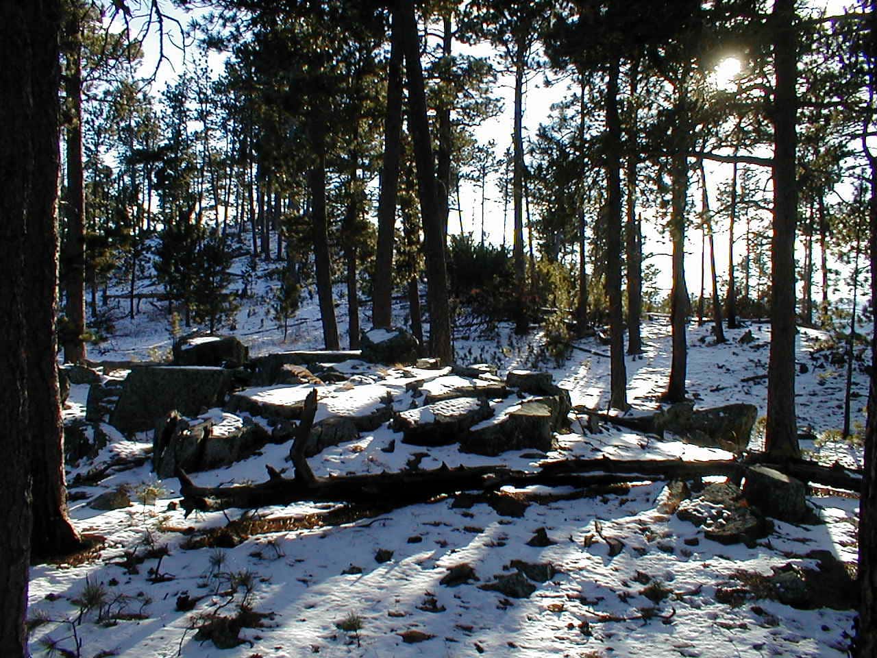
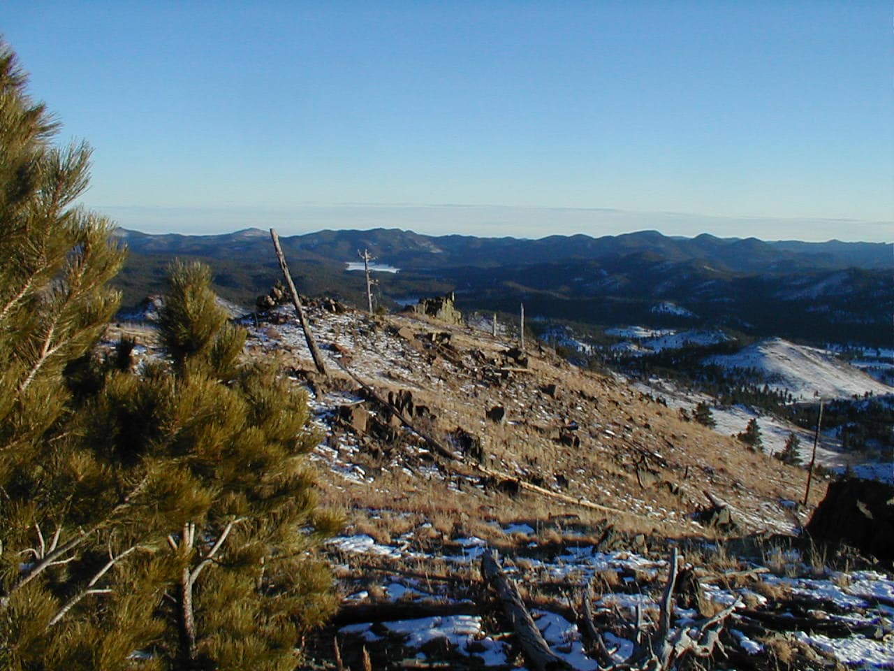
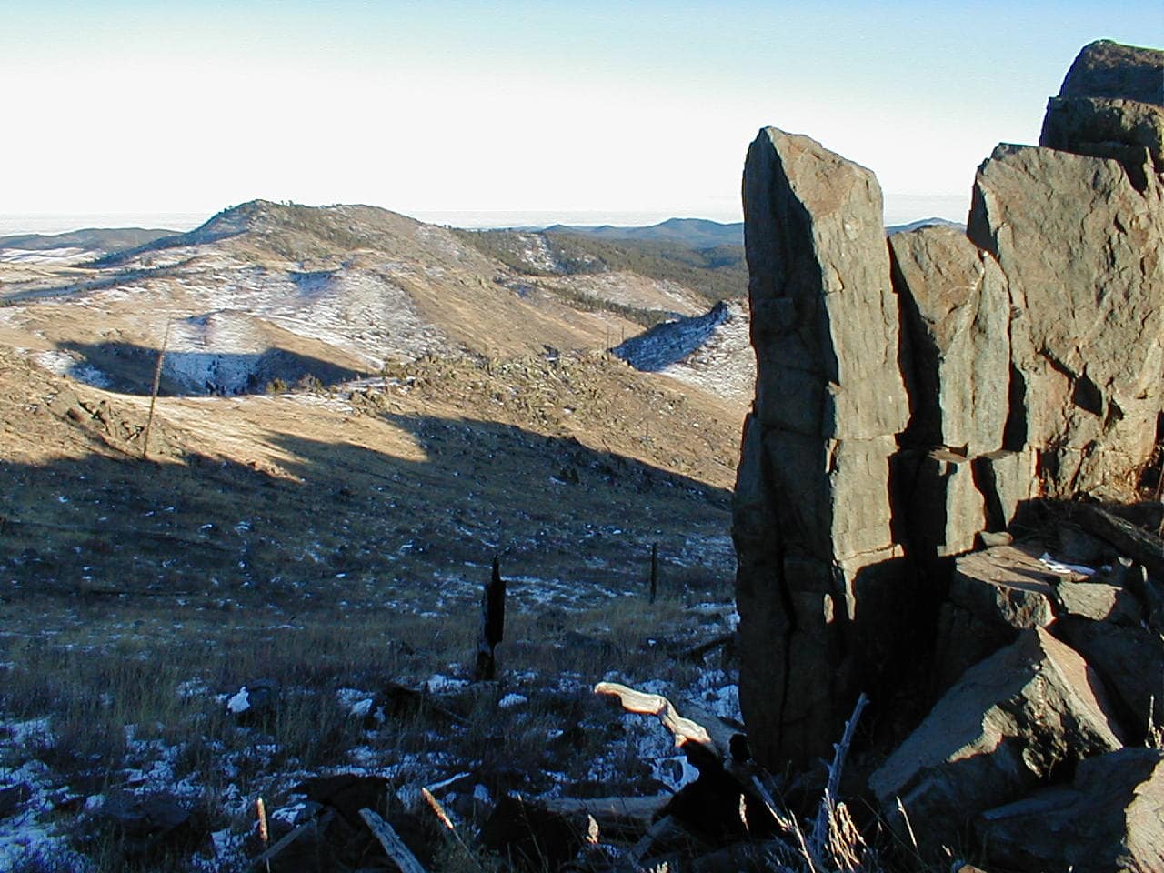
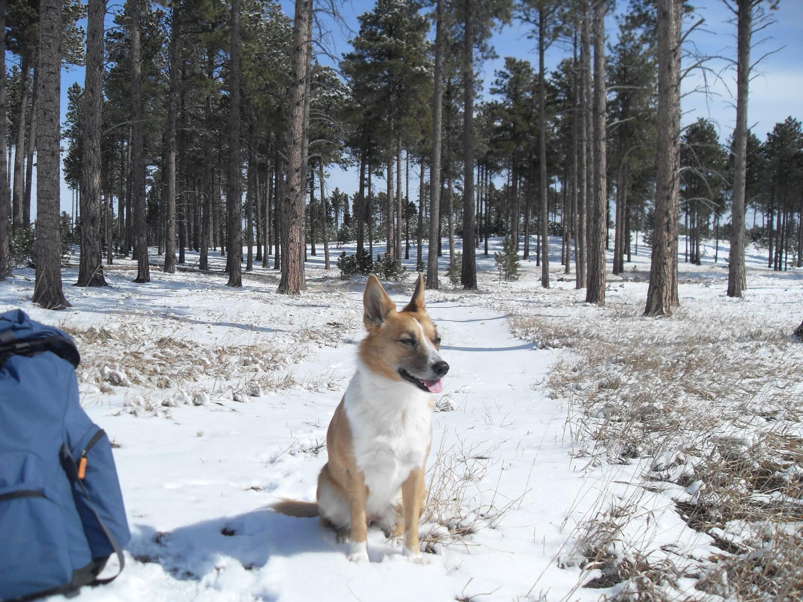
The trek always seemed cheerier once the new year arrived, anyway, sort of like the difference between attending a funeral or baby shower.  With a warm, bright day in early 2022, Lupe was in high spirits as she set out.  Passing through a short stretch of open forest, she soon reached the dry grass of a sunny field.  Already some rock formations!  Loopster checked a few out.

On the first Dingo-approved boulder of 2022! Photo looks NNE.
Objective Peak 5800 (Center) already in sight! Photo looks NE.

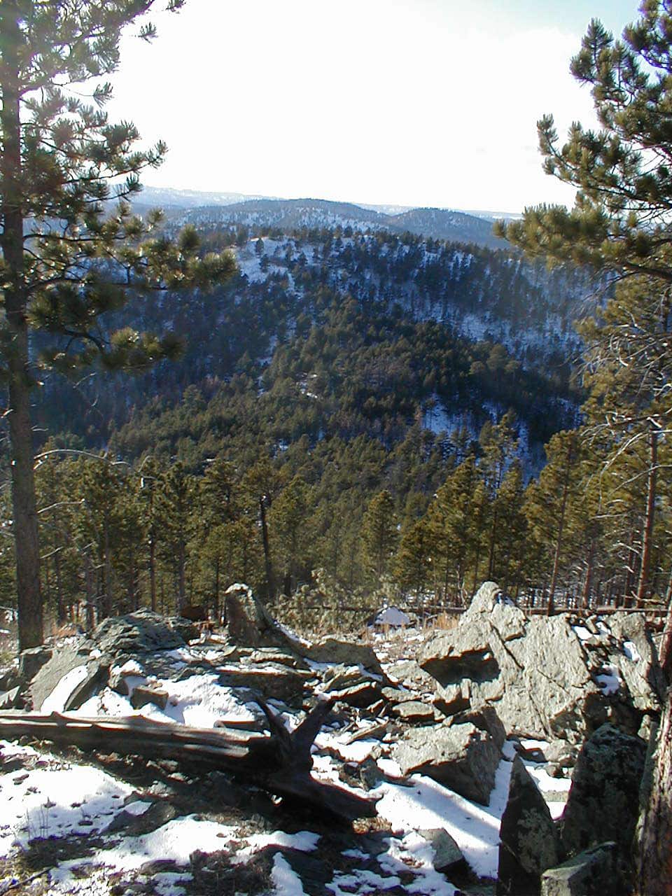
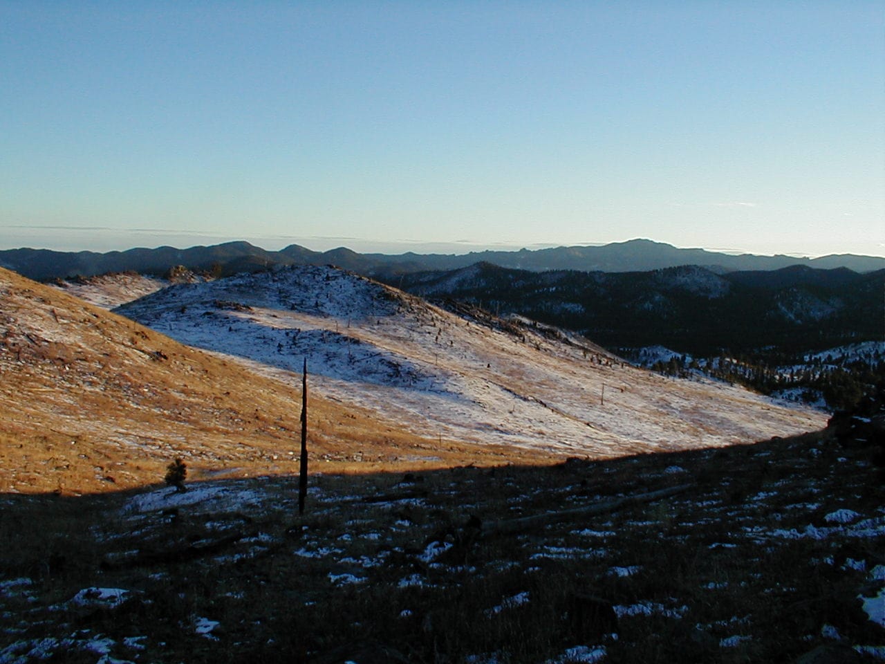
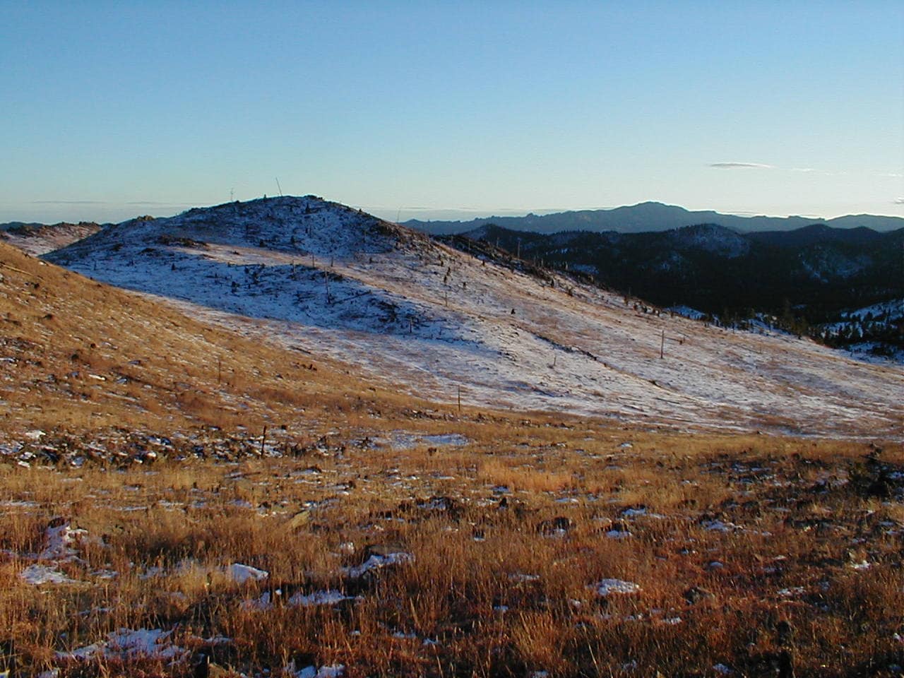
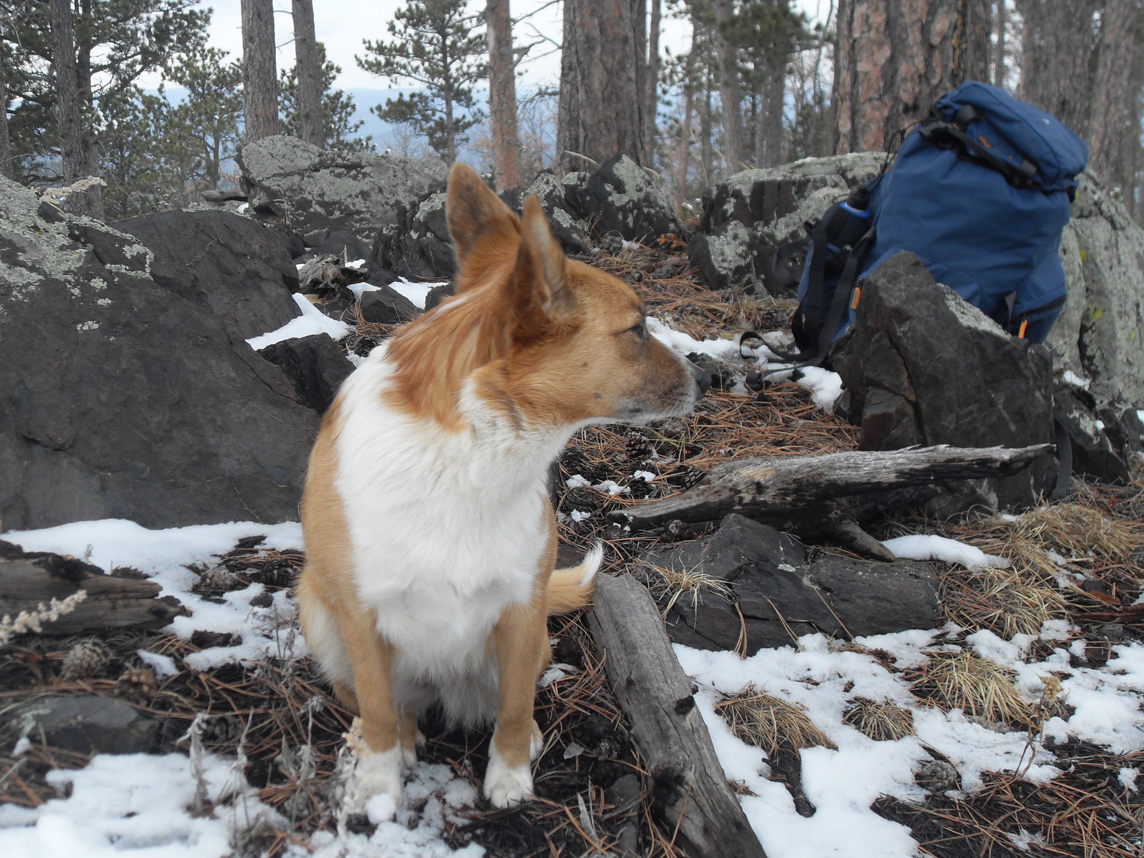
After going over an initial rise, Loop lost a little elevation as she entered a more forested region again.  After a trek through the woods, another rise provided a view of HP5360.

Approaching the next stretch of forest. Photo looks NE.
No deadfall and nearly flat – an easy stroll! Photo looks N.
HP5360 (Center) from the second rise. Photo looks NE.

Continuing NE, Lupe came to a road in a shallow valley.  Must be USFS Road No. 243.2F.  Taking the road N, it quickly curved NW into a barren upper valley.  This was the direction to New Year’s Eve Peak, but not the way to Peak 5800.

On USFS Road No. 243.2F. Photo looks N.
Heading into the barren upper valley. Photo looks NW.

Evidently, Lupe had run into No. 243.2F N of where No. 243.2I branched off.  She was still one valley too far W.  Turning NE again, the Carolina Dog headed up to a saddle on the intervening ridge.  There was a nice view of HP5360 along the way, and once Loop got to the ridgeline, Peak 5800 was back in sight, too.

Heading for the ridgeline NE of USFS Road No. 243.2F. Photo looks NE.
HP5360 (R). Photo looks SSE.
Peak 5800 (L) comes back into view. Photo looks ENE.

Down to USFS Road No. 243.2I, SPHP?

Oh, I don’t know, Loop.  You know me.  Hate losing elevation we’ve just gained, and it’s farther down there than I thought it would be.  Maybe we should just follow this ridge N?

Fine with me, SPHP.

Only problem with that was the ridge was sort of a steep climb.  Lupe led the way, while SPHP huffed and puffed after her.  Kind of a long way up to the top, too, but the American Dingo got there.

Heading up the ridge. Photo looks N.
Peak 5800 (R) from where the ridge topped out. Photo looks E.

Hmm.  Maybe should have bitten the bullet and just gone down to USFS Road No. 243.2I as the Carolina Dog had suggested?  It would have come up the valley to the E much closer to Peak 5800.

You know what, Loopster?  We climbed Peak 5800 last year.  I’ve sort of messed up our route now, and if we have to go this far out of our way, maybe we ought to visit Peak 6070 after New Year’s Peak instead?  Haven’t been there in quite a while.

So, forget about Peak 5800 this year, SPHP?

Yeah, I think so, Loop.

As long as we keep up our tradition and visit New Year’s Peak, it’s all good, SPHP!

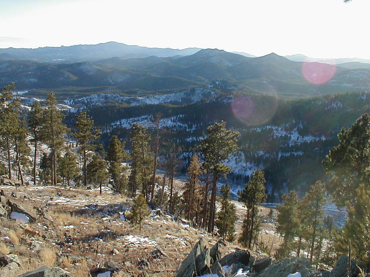
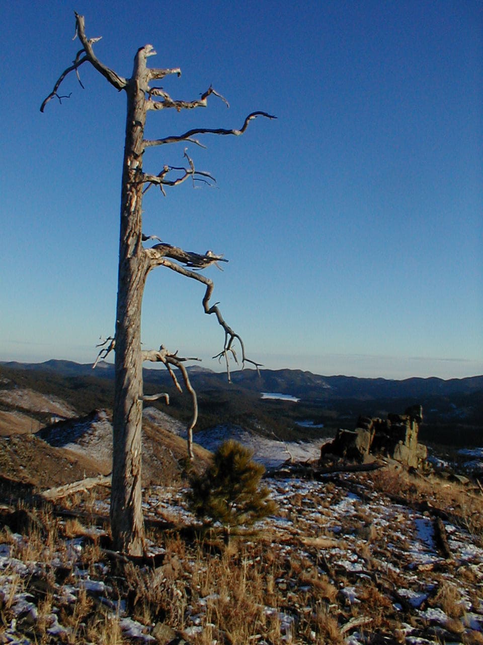
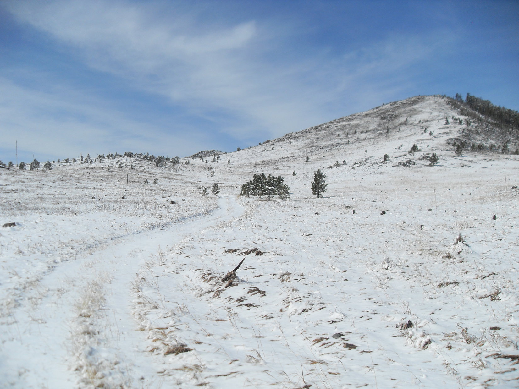
With Peak 5800 out, and Peak 6070 now Plan B, Lupe headed NW for the S slopes of Peak 5917.  Lost a bit of elevation along the way, which then had to be promptly regained, but this was a favorite region – grasslands, but with interesting rocks, scattered pines, and sweeping views to the S.  Not much snow this year, which would have made for an even prettier scene, but still a fun trek.

Heading NW from the ridge. Pistol Point (Center), New Year’s Eve Peak (R of Center), and Peak 5917 (R). Photo looks NW.
Black Elk Peak (L), Five Points (beyond Lupe), and False North Point (far R). Photo looks SSW.
Crossing a patch of snow on the way to Peak 5917 (R). Photo looks NW.
Pistol Point (R of Center). Lupe would be there soon. Photo looks W.

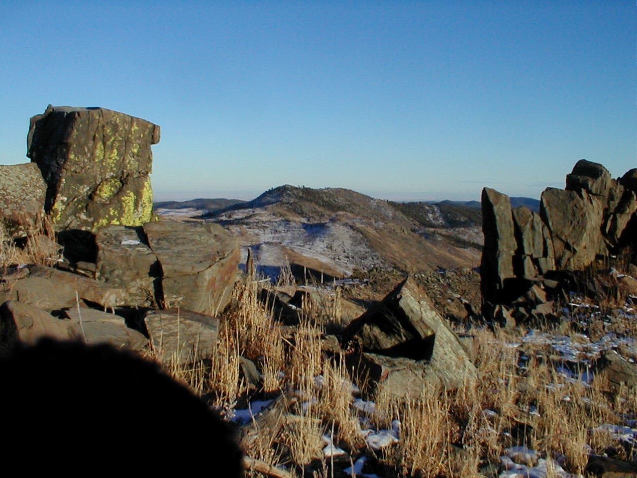
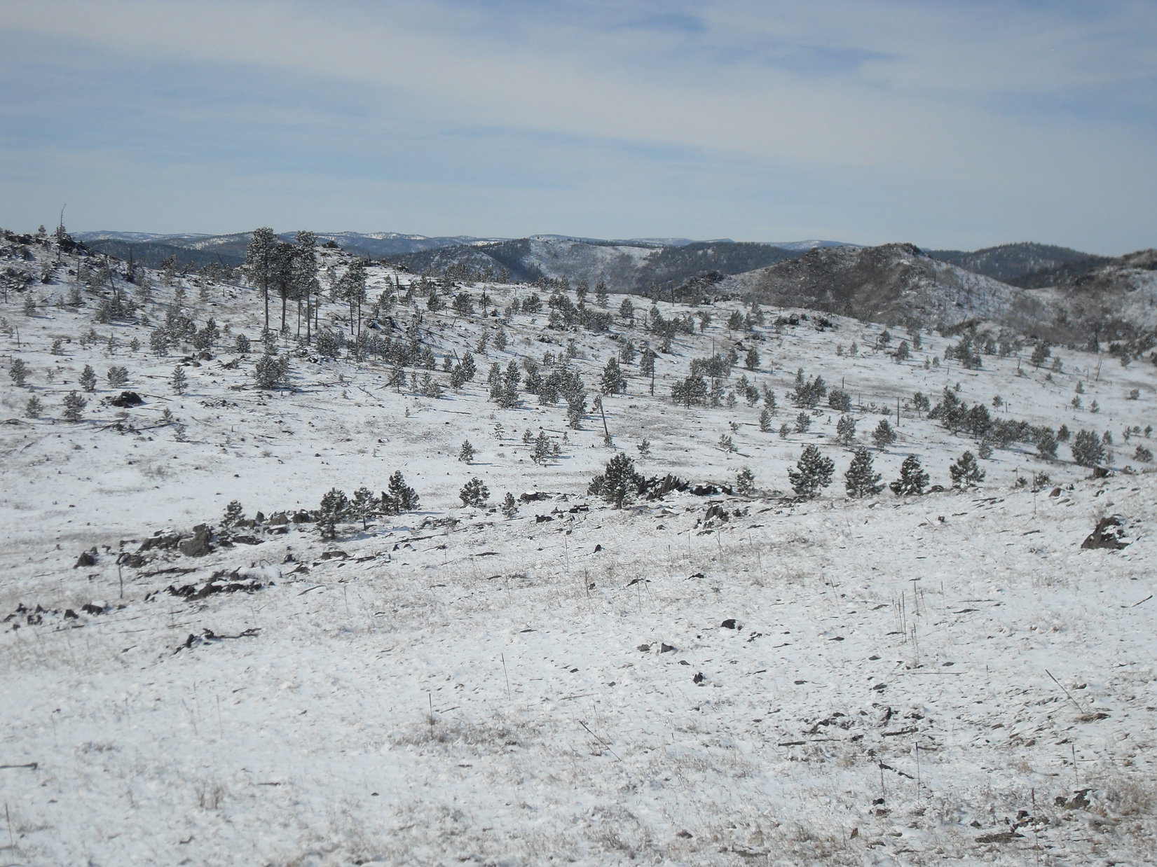
Upon reaching the short ridgeline S of Peak 5917, Loop paused for a look back at Peak 5800.  Beyond it, and farther S, both Boulder Hill (5,331 ft.) and Silver Mountain (5,405 ft.) were easily picked out.  More directly S, there was also a great view of Black Elk Peak (7,231 ft.), Sylvan Hill (7,000 ft.), Five Points (6,221 ft.), and False North Point (6,130 ft.).

Peak 5800 (L), Boulder Hill (R), and Silver Mountain (far R). Photo looks SE.
Black Elk Peak (L), Sylvan Hill (L of Center), Five Points (R of Center), and False North Point (far R). Photo looks S.

New Year’s Eve Peak (6,046 ft.) was only 0.6 mile NW now as the crow flies.  It was possible to go almost directly to it.  Lupe had been that way once or twice before.  However, although a slightly longer route, it was more fun to head up to Pistol Point at the SE end of the mountain’s S ridge, then follow the ridge to the summit.

New Year’s Eve Peak (R). Getting close now! Photo looks NW.

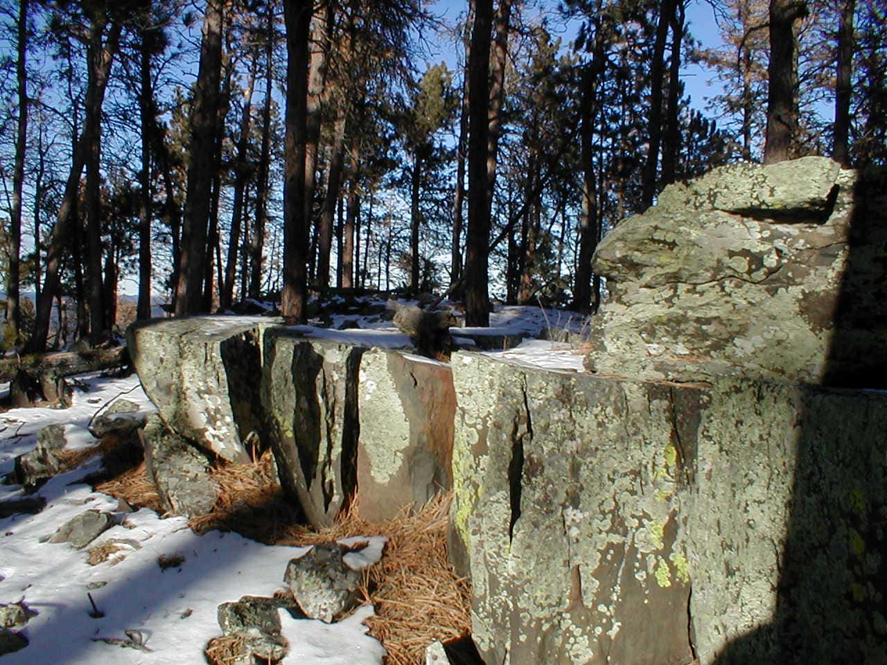
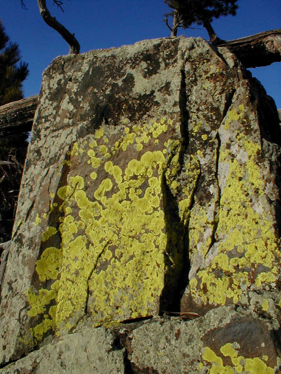
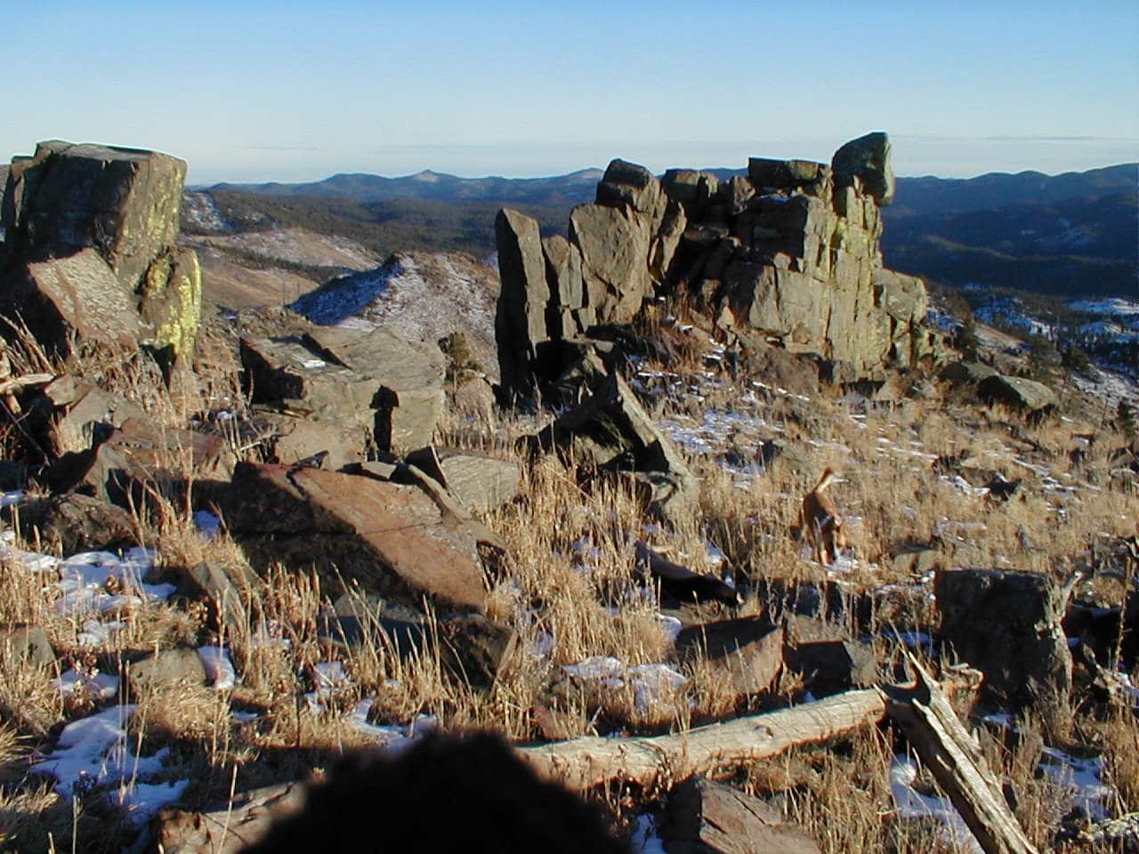
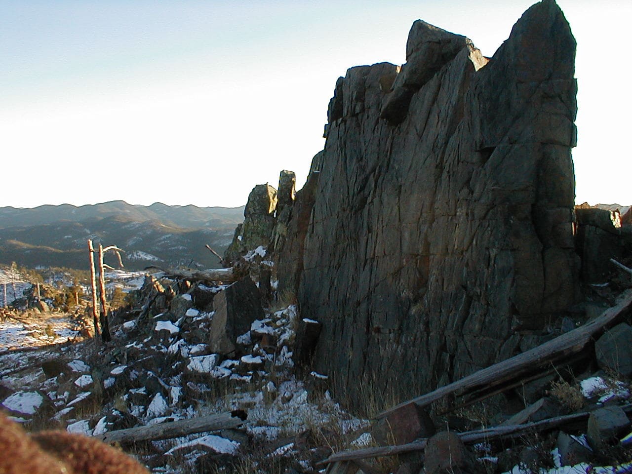
The route to Pistol Peak from the saddle SW of Peak 5917 followed a barbed wire fence and involved a couple of short, steep climbs.  No big deal.  Looper was soon there.  As always, she scrambled up on the rock formations that Pistol Handle Rock was part of.

Following the fence to Pistol Point (L). Photo looks SW.
Arriving at Pistol Point. Pistol Handle Rock (R). Photo looks SSE.
New Year’s Eve Peak (L) from Pistol Point. Photo looks NNW.
By Pistol Handle Rock (L). Photo looks W.

As Lupe left Pistol Point there was a sudden chill in the air.  The sky had been gradually clouding over, and a cool breeze had sprung up out of the W.  Gone was the warm, sunny day the Carolina Dog had enjoyed as she’d set out from the RAV4.

As Loopster worked her way N along New Year’s Eve Peak’s S ridge, the temperature dropped and the breeze strengthened.  Although it didn’t take all that long to get to the summit, by the time the American Dingo arrived, the mood was subdued.

Good to be back, though!  Despite deteriorating conditions, Lupe stood smiling on the 4 foot high rock platform that was the true summit.

Back at the true summit of New Year’s Eve Peak. Photo looks SSE.
SW end of the summit region. The true summit is only a few feet off to the R. Photo looks NW.

3:23 PM, 36°F, New Year’s Eve Peak – Facing into the wind, Lupe curled up on SPHP’s lap.  Virtually no snow here, but the familiar hills to the W looked snowy.  SPHP brought a couple of chocolate coconut bars out of the pack to celebrate the occasion.  A very short party.  The Carolina Dog saw to that.  Then there was nothing to do but contemplate the cold, silent hills.

The snowy hills. Photo looks W.

How many times have we been here, SPHP?

Nine, Loop.

Third day of brand spanking new 2022, but something about the cold wind and gray sky revived a sense of brooding over the old year gone by.  2021!  So recently the future, now come and gone, lost forever except to memory, part of the endlessly receding and expanding past.

Guess we should have gotten here earlier in the day, Looper.  Already kind of late.  Not sure we even have enough daylight to press on to Peak 6070.  To tell the truth, not too inclined to now anyway, given the conditions.

That’s OK, SPHP!  Don’t worry about it.  Our tradition is intact, since we made it this far.  We can just stay here together at New Year’s Eve Peak a little longer then.  How does that sound?

Sounded good.  A quiet half hour went by.  The wind just seemed to keep getting colder.

Well, we’ve done our duty, Looper!  Let’s wrap this up, and get out of this melancholy breeze, I’ve had enough.

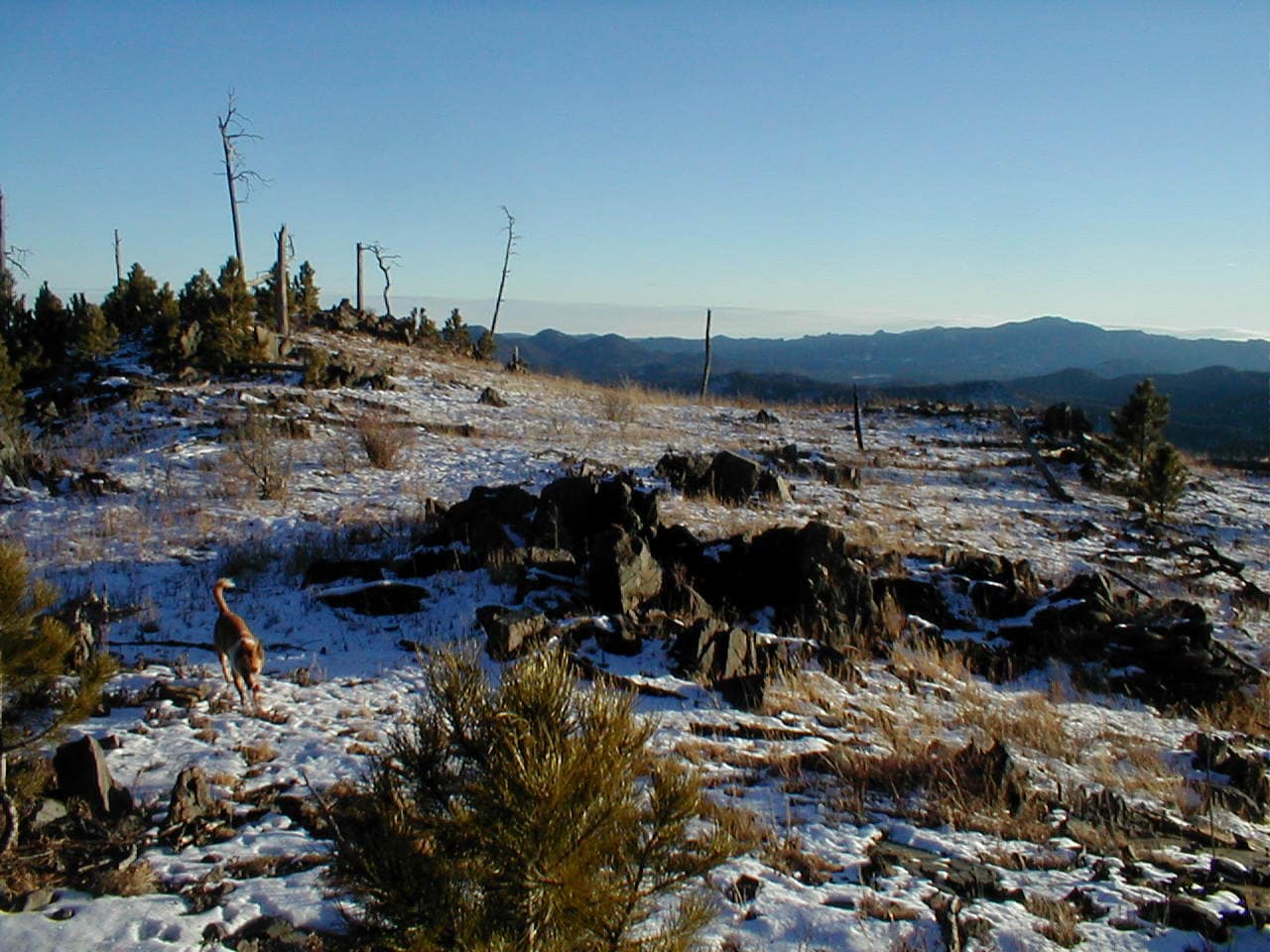
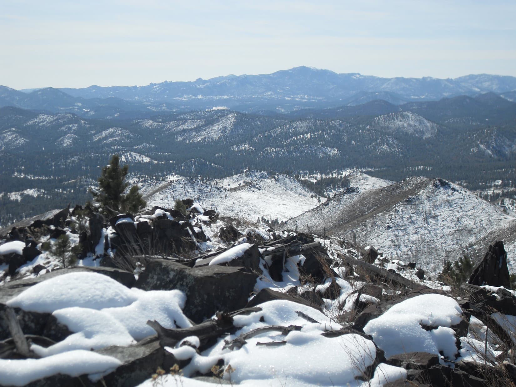
Loop was fine with that.  Before departing, though, she had a final look at the big views, which were all toward the S, followed by a brief return to the true summit.

Boulder Hill (L), Silver Mountain (L of Center), Calumet Ridge (5,601 ft.) (R of Center) beyond frozen Sheridan Lake. Photo looks SE.
Black Elk Peak (Center), Five Points (R). Photo looks S.
Back at the true summit in the cold wind. Photo looks NNE.

Then it was down New Year’s Eve Peak’s W slope to the saddle leading to Peak 6070.  Kind of steep, but not too bad.  Optimism returned as soon as the windy summit was left behind.

Heading down the W slope. Photo looks NW.

Down at the saddle, Lupe ducked under a barbed wire fence.

Are we going to head for Peak 6070 after all, SPHP?

Nope.  I’m done.  Back to the RAV4, Looper.

The American Dingo turned S, quickly reaching the edge of the forest.  The scenic valley S of New Year’s Eve Peak was just ahead.

The upper valley view. Photo looks SSE.

Taking USFS Road No. 257 down the valley, the easy, late afternoon trek back to the RAV4 was very pleasant.  Deer up on the hillsides kept Lupe animated.  Even SPHP cheered up as snow crunched underpaw.

Whitetails on the hillside. Lupe saw quite a few!
USFS Road No. 257 on the way back to the RAV4. Photo looks SE.

Sort of just did the minimum today, didn’t we, Loop?  Don’t worry, though!  2022 is going to be a great year!  Next time out, we start the blitz!

The blitz, SPHP?  What do you mean?

Oh, a mini-blitz actually, but it will be fun.  You’ll see!  I’ll explain later.

4:15 PM, 37ºF, Horse Creek Road, back at the RAV4 – Tradition honored!  New Year’s Eve Peak (6,046 ft.) visited!  Lupe’s initial launch into New Year 2022 was officially complete.  Better yet, what with the upcoming mini-blitz and all, this was destined to be one of the Carolina Dog’s best and most action-packed Januarys ever!

New Year’s Eve Peak, Black Hills of South Dakota 1-3-22

Links:

Next Black Hills Expedition                Prior Black Hills Expedition

Black Hills, SD Expedition No. 261 – Peak 5800 & New Year’s Eve Peak (12-31-20)

Want more Lupe adventures?  Check out Lupe’s Black Hills, SD & WY Expeditions Adventure Index, Master Adventure Index, or subscribe free to new Lupe adventures!

Black Hills, SD Expedition No. 41 – New Year’s Eve Peak (12-31-12)

1:00 PM, start of USFS Road No. 257 just off Horse Creek Road (No. 243) – Been a while since Lupe had been here, more than 11 months, in fact.  Way back on 1-29-12 on Expedition No. 3, the Carolina Dog had started from this same spot.  She’d gone mountain climbing for the first time ever, intending to reach the top of Old Bald Peak (6,130 ft.), but had ended up on Peak 6043, instead.

Back then, Lupe had seen a line of barren hills NE of here that looked like it might be fun to explore.  For her final Black Hills, SD Expedition of 2012, the American Dingo was going to do just that!  Exactly as she’d done on Expedition No. 3, Lupe headed N on USFS Road No. 257.

0.5 mile brought her to the junction where No. 257.1A split off to the W.  That was the way she’d gone on Expedition No. 3, but Lupe continued N this time.  The road curled around the E side of the first high point ahead, before turning W for a short distance.  No. 257 then began a steady climb NNW up a long valley.

The road was gradually taking Lupe farther W than SPHP had intended.  The Carolina Dog was skirting the W end of the barren hills region she was supposed to be exploring, but it seemed simpler to gain elevation following the road than to take off into much steeper terrain.

Nearly 2 miles from the start, No. 257 went over a forested pass between two hills.  The peak to the E was now less than 250 feet higher.  This was Lupe’s chance to get up there without much trouble.  Leaving the road, she scrambled up a steep, slippery slope with ease, while SPHP clung from tree to tree trying to maintain traction on 0.5″ of snow covering loose pine needles.

Lupe came up near a 2 foot high wall of rock basking in the brilliant, weak warmth of 2012’s last afternoon.  This line of rocks was along the W edge of a spacious summit region.  Little could be seen to the N or E due to all the trees.

Part of the wall of rock along the W edge of the summit region. Photo looks N.

The high point was visible a little way off to the S.  2012 was still alive and well up here, the sun 2 hours from the horizon.  An inch of pristine white snow hid a layer of pine needles, further brightening a mountaintop already illuminated by sunlight filtering through the pines.

Something in the slanting rays whispered of enchantment.  Quiet, alone, undisturbed, this mountain had been waiting.  Waiting countless days and starry nights, not long forgotten, but never even known, and those times having passed, were now as if they had never been.  No one comes here – ever.

Yet on this final fading afternoon, magic had conjured an unanticipated wonder.  A visitor!  Lupe!  The American Dingo had appeared as though foretold, or perhaps pre-destined, barely in time to beat some ancient deadline established in ages past for reasons beyond memory.

New Year’s Eve Peak. Photo looks S.

Turning S, Lupe prowled toward the high point.

Heading for the true summit. Photo looks N.

A big rock was the absolute high point.  Nothing happened when Lupe got up on it.  A breeze sighed amid the pines, otherwise stillness, silence.  Although summoned, perhaps even the mountain had forgotten why?

Yet the spell remained unbroken.  Gone was the desire to explore the barren hills.  Maybe Lupe was supposed to stay here, simply watching, experiencing, appreciating the light and glory of 2012 before it vanished never to be seen again?

By the true summit, pondering the demise of 2012. Photo looks NW.

So Lupe and SPHP stayed, lingering while earth’s beautiful sun settled wearily in the SW.  A whole year gone!  2012, the year Lupe had started her Black Hills expeditions, and climbed her first mountains.  For some reason this lonely mountain, by now dubbed New Year’s Eve Peak (6,046 ft.), was destined to be the last of the bunch.

As 2012 slipped away, Lupe and SPHP shuffled back and forth between viewpoints.  To the W was a narrow look at snowy hills similar to this one, to the S, a panoramic view of forested hills stretching away toward Harney Peak (7,242 ft.), South Dakota’s highest mountain.

Looking W.
Harney Peak (L), Five Points (6,221 ft.) (R of Center), and False North Point (6,130 ft.) (R). Photo looks S.

A profound brooding serenity at last gave way.  Enough!  While 2012 still lived and breathed, the barren hills were calling.  Insufficient time for a thorough exploration, but Lupe could still experience the essence of what lurked there.

The American Dingo bid farewell to the true summit of New Year’s Eve Peak heading ESE through the forest.  A steep descent into a deep valley appeared.  Lupe started down, but SPHP was soon thinking that maybe this wasn’t the best way to go?  Turning sharply back toward the WSW, Lupe climbed just enough to get up to a ridge S of the true summit.

Following this ridge S, Lupe traipsed along an intermittently rocky spine through pine forest, gradually losing elevation.  The forest thinned after 0.33 mile as the ridge turned SE and broadened out.  Lupe roamed in sunshine among rock outcroppings and clearings.

Lichens on a big rock S of New Year’s Eve Peak’s summit.
Roaming the S ridge. Harney Peak (R). Photo looks SSE.

The sky was clear as Lupe reached the barren hills.  The Carolina Dog was high on the NW edge of the region, enjoying a commanding view to the S and E similar to the one from the top of New Year’s Eve Peak.

Frozen Sheridan Lake was in sight miles to the SE.  Heading toward it, Lupe came to an open lower ridge with a series of big rock formations strung out along its crest.

Sheridan Lake (L of Center) with Calumet Ridge (5,601 ft.) beyond it. Photo looks SE.
Frozen Sheridan Lake (Center). Photo looks SE.

Late afternoon.  End of December.  The barren hills glowed serenely, as if happy that Lupe had finally come to bask with them in the final silent sunlit moments of 2012.

Not much time left for exploring!  Sunset imminent!  Joyful in the fresh mountain air, Lupe sniffed all that she could as she wandered SE amid the rock formations.

Exploring the rocks. Photo looks SE.
Peak 5800 (Center). Photo looks ESE.

Lupe soon left the rocky ridgeline, entering a valley to the E.  Here, she turned S on a grassy slope in the shadow of the ridge she’d just left.

Peak 5800 (L) from the spot where Lupe left the ridge. Photo looks ESE.
E side of the rock formation. Photo looks S.
Starting down the valley. Harney Peak (R). Photo looks S.

For a few fleeting minutes, Lupe made it back into the beautiful sunlight, but this was the end.  By the time the Carolina Dog turned SW going over a low pass, 2012 glittered only from high points still able to glimpse the gleaming orb fleeing W.

In sunshine again. Photo looks SSE.

Down, down to the black pines ahead!  This next valley would take Lupe back to No. 257.  Five Points (6,221 ft.) and False North Point (6,130 ft.) were the culprits looming to the SW, casting an early shadow over all.

Five Points (L of Center) and False North Point (R of Center). Photo looks SW.

4:48 PM, 14ºF, at the start of USFS Road No. 257 off Horse Creek Road – Twilight.  A few stars already.  Snow crunching underpaw, the dim trek back along No. 257 had been a time to reflect on all that Lupe had done in 2012.  41 Black Hills expeditions!  The Carolina Dog’s first ever Dingo Vacation with Lanis clear to the W coast!  So many adventures!

Sadly, 2012 was gone, or nearly so, about to steal away in the night.  At the start of 2012, none of these adventures had even been dreamed of, but Lupe had high hopes now.

Tomorrow the golden sun would return, bringing 2013 in all its blazing glory!  Another year of new mountains, new adventures, near and far!  And maybe at the end of it all, an American Dingo would stand again atop the silent, magical summit of New Year’s Eve Peak (6,046 ft.).

In the barren hills SE of New Year’s Eve Peak, Black Hills of South Dakota 12-31-12

Links:

Next Black Hills Expedition                      Prior Black Hills Expedition

Black Hills, SD Expedition No. 80 – New Year’s Eve Peak (3-23-14)

Want more Lupe adventures?  Check out Lupe’s Black Hills, SD & WY Expeditions Adventure Index, Master Adventure Index, or subscribe free to new Lupe adventures!

Black Hills, SD Expedition No. 80 – New Year’s Eve Peak (3-23-14)

10:39 AM, 31°F – Intersection of USFS Road No. 710 & Hwy 385, a few miles S of Pactola Reservoir

Lupe was off to a late start, but for a good reason – two good reasons, actually.  Last week’s Expedition No. 79 – The Snow Trek, had been an 11 hour in the field ordeal, and subsequent complete social fiasco.  Big Sid, the neighbor’s dog who had been joining Lupe on recent expeditions, had been returned home late – 10 PM, and totally exhausted.  Though Loop recovered quickly, Sidney had hardly been able to move for days afterward.

The neighbors were not amused.  They’d been worried sick about Sidney being gone so long.  Apparently Big Sid had a curfew.  Who knew?  Sid’s exhausted condition had earned SPHP the rather unflattering nickname “Dog Killer”.  Sidney wasn’t going to be allowed to join Lupe on her expeditions any more.  SPHP hadn’t even bothered checking this morning whether there had been a change of heart.  Back to the old ways – just SPHP and Loop from now on.

So after The Snow Trek fiasco, something less arduous had sounded good to get back into the swing of things again.  Rushing off early for another super long day wasn’t in the cards this time around.

The other reason Lupe was off to a late start was that it had been only 6°F when she’d gotten up.  No sense in following up The Snow Trek with the Frozen Solid Trek was there?  Lupe’s adventures are supposed to be fun, not dubious episodes of “Survivor”.  Although Lupe had been eager to get going, SPHP had insisted on hanging around the house for a few hours letting the day warm up.

At any rate, Lupe was here now, and happy to be out and about again.  She trotted W on USFS Road No. 710, following it gradually up a forested valley.  A dusting of new snow that had fallen overnight was unspoiled, showing no tracks.  Snow was plentiful, but not nearly as plentiful as it had been in the higher hills W of Nahant last week.

After going a mile, Lupe reached the upper end of the valley.  Here the road leveled out as it went through an open forest of large, beautiful pines.  Beyond the pines was barren ground, all clean and white beneath a blanket of snow.  Lupe saw a big white hill (High Point 5217) only 0.33 mile away to the W.

Lupe on USFS Road No. 710 after passing through the open forest of tall pines at the upper end of the valley. Photo looks NE.
After emerging from the forest at the upper end of the mile long valley, USFS Road No. 710 headed into a barren area where the forest had burned years ago. Blue skies and the white snow made everything look clean, bright and cheerful. High Point 5917 is the hill on the R. Photo looks W.

This barren area must have burned in a forest fire many years ago.  The dazzling white snow beneath the blue sky made everything look bright and cheerful.  Lupe stayed on No. 710 as it curved to the S.  The road soon circled back to the SE, passing through another stand of tall pines on the way.

By the time No. 710 emerged from this second stand of trees, Lupe was gaining elevation again.  Off to the N was a smaller, snowy hill.  The American Dingo left the road to climb it.  From here, Lupe could see much more of the burn area.  With so few trees around, she was treated to a panoramic view to the S and W, a rare sight in the mostly heavily forested central Black Hills.

Looking SW from the small hill N of the road, Lupe could see quite an extensive area that had burned years ago. Small pines were growing, indicating the forest will eventually take over again. In the meantime, the panoramic views were great!
Harney Peak (7,242 ft.), the highest mountain in South Dakota, was in view from the hill Lupe was on. Photo looks S.

To the SE, Peak 5800 was in view only 0.5 mile away.  Earlier, SPHP had been thinking maybe Lupe should climb it.  However, the day was now so nice out that greater ambitions had started to set in.  SPHP had visions of Lupe making it all the way to Old Bald Peak (6,130 ft.).

Peak 5800 was in view only 0.5 mile away from the small hill. Earlier, SPHP had been thinking maybe Lupe should climb it today. By now, though, SPHP had a grander vision that Lupe might make it all the way W to Old Bald Peak instead. Photo looks SE at Peak 5800.

The views were so wonderful from this small hill, that it seemed to make sense for Lupe to head W up to High Point 5917, the first snowy hill she had seen.  High Point 5917 was considerably higher than where Lupe was now, so the views should be even better over there.  Furthermore, High Point 5917 was on the way to Old Bald Peak, if Lupe was really going that far.

So instead of continuing SE to climb Peak 5800, Lupe went S back down to the road and started following it NW.  She passed through the second grove of trees again, then kept going NW, leaving the road and ultimately climbing all the way to the top of High Point 5917.

No doubt about it, the views were even better here!

Looking back at Peak 5800 (L) from High Point 5917. The smaller hill Lupe had been on earlier is the closest hill on the far L. Part of Sheridan Lake is seen as a patch of white in the distance on the R. Photo looks SE.
Harney Peak again. This time as seen from High Point 5917. Photo looks S.
Lupe on High Point 5917 in happy expectation of some kind of treat or attention from SPHP as a reward for having reached such a lofty height.

After enjoying the terrific views from High Point 5917, Lupe left going SW down the hill.  She lost a couple hundred feet of elevation on the way down to a saddle leading over to the next ridge.  Right away, she had to regain nearly all of the elevation she had just lost.  When she arrived up at the first real high point on the next ridge, SPHP recognized this place.

Lupe had been here before, way back on Expedition No. 41.  This ridge would go a little farther W, and then turn N on its way up to Peak 6046 about 0.5 mile away.  Lupe had come down this way on Expedition No. 41 after climbing Peak 6046 by another route.  It had been the last day of 2012, which was how Peak 6046 had become privately known as New Year’s Eve Peak (6046 ft.).

Returning to New Year’s Eve Peak was an appealing idea.  2014 wasn’t exactly new anymore, but there was still snow on the ground and the year was still young!  Lupe set off to the W, following the ridgeline as it curved N.  The final climb up the S slope was a little steep, but soon Lupe was back on New Year’s Eve Peak again.

Lupe back on top of New Year’s Eve Peak for the first time since the end of 2012. Photo looks N.

It hadn’t taken all that long to get here, but the mood of the day had changed by the time Lupe reached the top of the mountain.  The blue skies were gone.  Gray clouds hung low over the hills.  A chill light breeze blew in from the NE.

Lupe and SPHP sat together looking at the view to the W.  Lupe had some Taste of the Wild.  SPHP ate an apple.  Old Bald Peak was still 2.5 miles off to the WSW.  It was easy to see Lupe would have to lose hundreds of feet of elevation again to continue any farther W.  Then it would be up and down all the way to Old Bald Peak.

The weather had changed by the time Lupe reached the top of New Year’s Eve Peak. The sky was overcast and a chill breeze blew in from the NE. In the end, SPHP decided she shouldn’t continue on to Old Bald Peak. Photo looks W in the direction she would have taken.

In the end, SPHP decided the change in weather meant Lupe shouldn’t continue W looking for Old Bald Peak.  Instead, the original idea of climbing Peak 5800 returned.  It was much closer to where the G6 was parked.

Even that never happened.  After leaving New Year’s Eve Peak, Lupe made it all the way back E to the NW face of Peak 5800.  By then, the mountaintops were all hidden in the clouds.  Beneath the dark, foggy sky, the gloom was thicker than ever.  Tiny snowflakes fell.  The top of Peak 5800 was no more than 200 feet higher, but Lupe would have to start by climbing a slippery snow-covered boulder field.

SPHP hesitated.  Snowflakes swirled in the cold breeze.  Maybe this wasn’t the day for Peak 5800, either.

And that was it.  Lupe and SPHP left the mountain.  Lupe took a shortcut going N down a long slope through a snowy forest.  On the way, she heard gunfire.  Now she was desperate for SPHP’s protection.  SPHP urged her onward.  Lupe reached USFS Road No. 710 again.  Still, she didn’t feel safe until she was back in the G6 (3:07 PM, 32°F).

Barely 4.5 hours.  Not much of an expedition compared to The Snow Trek ordeal a week ago.  Too bad big Sid hadn’t been along today, he would have loved it!  The shorter day would have been better suited to his needs.  Who knew, though, if Big Sid would ever come along again?

As for Lupe, she hadn’t made it back to Old Bald Peak (which she had visited once before) or to the top of Peak 5800, but maybe she still would some day.  At least, she’d had a good time, and seen some beautiful sights.  And whether the calendar said it was the right day for it or not, she had enjoyed her journey back to the cold, lonely summit of New Year’s Eve Peak.

Harney Peak is seen in the distance between pine trees on the summit of New Year’s Eve Peak. Photo looks S.

Links:

Next Black Hills Expedition            Prior Black Hills Expedition

Expedition No. 41 – New Year’s Eve Peak (12-31-12)

Expedition No. 112 – New Year’s Eve Peak (12-31-14)

Expedition No. 147 – Silver Peak & Old Bald Peak (11-24-15)

Want more Lupe adventures?  Choose from Lupe’s Black Hills Expeditions Adventure Index or Master Adventure Index.  Or subscribe free to new Lupe Adventures.