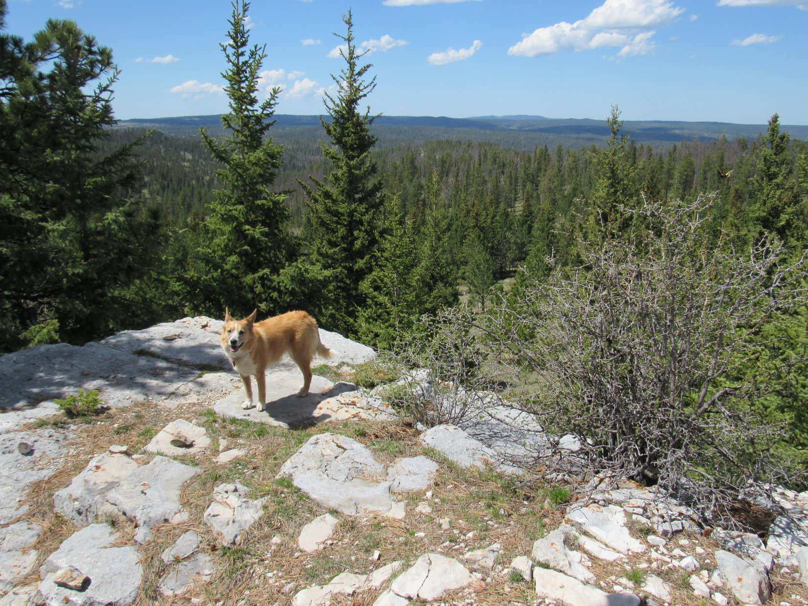
11:00 AM (60°F). Rather a late start for Lupe’s expedition, but she would still have fun. She was about to spend the rest of this glorious early fall day roaming the high country of the western Black Hills. The sky was a clear blue with a few wispy clouds. The air was calm, stirred only by an occasional light breeze. The American Dingo was raring to go!
The G6 was parked just S of the W end of Besant Park at the junction of USFS Road No. 206 (Besant Park Road) and No. 206.2D. As soon as SPHP let Lupe out of the G6, she streaked off across No. 206 racing N into a huge field that was part of Besant Park. Oh, no! She had T-bone steak on her mind! Two black cows fled at the sudden noisy appearance of the bold Carolina Dog. SPHP hadn’t noticed them, but Lupe sure had.
Lupe barked a couple of times just for good measure as she gave up the chase. From far away, a brown and white streak came racing back across the field to SPHP. The cows, also now very far away, mooed unhappily at having been disturbed. A couple minutes later, Lupe arrived back at SPHP out of breath and panting hard. She had a huge grin on her face. Yes, this was already a glorious day!
It was time to move on before Lupe really got into trouble. While she had been running around in Besant Park, SPHP saw something Lupe hadn’t noticed. Quite close by, off in a much smaller unfenced field to the SW, a huge black bull was grazing. SPHP hurried Lupe S on No. 206.2D. Let’s go find Peak 6820 and leave the cows alone!
Peak 6820 was Lupe’s primary peakbagging goal for the day. SPHP wasn’t entirely certain Lupe hadn’t been there once before. Back on Black Hills, SD Expedition No. 58 on 5-11-13, Lupe had climbed a high ridge somewhere not too far to the E. Maybe it was possible that ridge was part of Peak 6820? It would be fun to find out.
Lupe didn’t stay on No. 206.2D very long. After she had gone several hundred yards, SPHP noticed a trail heading E. Peak 6820 was only about a mile to the E, so Lupe and SPHP followed the trail. It climbed through the forest and arrived up on a high ridge. SPHP recognized the ridge as the same one Lupe had been to on Expedition No. 58. It wasn’t part of Peak 6820, though. About 0.75 mile away, SPHP could see a modestly higher forested hill to the E. That hill had to be Peak 6820!
Even though it wasn’t going to take Lupe any closer to Peak 6820, Lupe and SPHP explored the ridge Lupe was on around to the NNE. At first the ridge was fairly broad, open and grassy. The N end, though, was all in the forest. SPHP had been hoping for a view of Besant Park to the N, but any view was hidden by the trees. Lupe and SPHP returned S to where Lupe had come up.
Lupe could have gone down into the valley heading straight toward Peak 6820. However, it looked like she might not have to lose so much elevation, if she followed the ridge she was already on to the S. It looked like this ridge would eventually swing around to the E toward Peak 6820.
Lupe and SPHP headed S following the ridgeline. The ridge stayed about the same elevation, but gradually grew narrower. Lupe came to several rock outcroppings, but the rock formations ended as Lupe approached a shallow saddle. The saddle led over to the next ridge to the S. Down in the saddle, Lupe found a dirt road, possibly another part of No. 206.2D. She followed the road only a short distance before leaving it to angle SE up onto the next ridge.
The next ridge did go E. As Lupe followed this second ridge, she could sometimes see White Tail Peak(6,962 ft.) to the S. The second ridge started out as a broad, level mix of forest and meadows, but became narrower and rockier as Lupe went E. The level part of the ridge ended at a small limestone cliff. Lupe and SPHP had to double back to the W, and then turn SE to get past the cliff.
Lupe came to another saddle. Everything to the NE was down in a thickly forested valley in the direction of Peak 6820. To the SW, the land sloped down more gently into a sunnier, thinly forested area. Ahead, another ridge rose to the SE. Lupe and SPHP went up to the high point. Lupe could see Peak 6820, but she wasn’t much closer to it. Peak 6820 was still 0.5 mile away, but now to the NNE.
By now, it was clear that Lupe was going to have to lose some elevation to get to Peak 6820. Lupe and SPHP went NW back down to the saddle, turned NE and plunged down into the forest. There was quite a bit of deadfall timber, which slowed SPHP down considerably. It wasn’t too far to the bottom of the valley, however, and once down there, Lupe came to a faint road.
Lupe followed the road NNW, slowly regaining elevation. She soon arrived at an odd place. Hidden down here in a small glade, was a huge metal water tank. Nearby stood a an old tower with a rickety ladder leading up to a small warped platform at the top.
Lupe reaches the hidden water tank and tower down in the forest SW of Peak 6820. Photo looks N.
The water tank was nearly full to the top with a rusty brown water so murky SPHP could see only an inch or two into it. Perhaps the tower had featured a windmill at some point in time? A horizontal pipe stuck out over the water tank from near the base of the tower.
This photo shows the horizontal pipe hanging out over the water tank, and the sagging platform at the top of the tower. Photo looks NE.
Not too far to the NNE, Lupe came to another odd place. A square area about 25 feet long on each side was fenced off by a barbed wire fence. Inside the fence was a wooden framed structure only 6 inches high. The wooden framework was completely covered with sheets of metal nailed to it.
Lupe sniffs around near the possible mine shaft cover SW of Peak 6820.
SPHP didn’t like the looks of it. The only reason SPHP could think of for such an odd structure was that it served as a cover for a large, deep mine shaft. If so, it was there to protect people or animals from a potentially fatal fall. The cover looked like it had been here for years. Who knew how structurally sound it still was, or how deep the hole hidden beneath it?
One thing about SPHP’s theory didn’t make sense. There didn’t seem to be a tailings pile anywhere around. There should have been a pretty big one nearby, if this was really the site of an old mine shaft. Very strange! Whatever the explanation, SPHP didn’t think anything good could come from lingering around here. Lupe continued NNE toward Peak 6820. She soon found another old road, or maybe it was the same one that had led to the water tank and tower.
The old road went NNE up the side of Peak 6820. Parts of the road were clear, but much of it was choked with deadfall timber. Lupe and SPHP spent more time off the road than on it trying to get past all the deadfall. Shortly before reaching the top, the road veered E. It emerged up from the forest at a fairly large clearing on Peak 6820.
The first thing Lupe noticed was a mud puddle large enough to bathe in. She ran over to it, plunked herself down to cool off, and lapped up lots of very murky-looking water. She emerged refreshed and well supplied with both essential and non-essential minerals, evidently quite satisfied with the experience.
The summit area on Peak 6820 is large and flat. Much of it is open meadow, but the meadow is entirely fringed by forest. There was hardly even a glimpse of a view in any direction. Lupe and SPHP set off to explore the area. The highest ground seemed to be a little way E of where Lupe had come up.
Lupe on Peak 6820. This point toward the S central part of the summit area seemed to be as much the true summit as anywhere else.
After exploring to the S and E, Lupe and SPHP returned to the mud puddle on the way to explore the N and W parts of the mountaintop. Naturally, Lupe couldn’t resist taking another dip.
Double-dipper Lupe emerges from her Dingo-sized mud hole on Peak 6820 for a 2nd time.
Explorations to the N and W revealed only that the jeep trail Lupe had followed up the mountain continued over the top and on down the other side to the NNE. There were some cliffs lower down toward the NW, but they weren’t terribly tall and were buried so deeply in the trees that even the cliffs didn’t provide any views.
With the summit area now fully explored, Lupe and SPHP left Peak 6820 heading WNW. This time Lupe went down into the valley between Peak 6820 and the ridge to the W. The terrain forced SPHP to the WSW for a little while, but eventually Lupe and SPHP were able to turn WNW again. There was no trail and a considerable amount of deadfall timber to contend with, but this was a more direct route back to the G6.
The climb back up onto the ridge to the W was rather slow due to the deadfall, but once there, Lupe and SPHP made rapid progress again. Lupe followed the ridge N to the trail she had been on early in the day. She followed the trail W back to No. 206.2D, and then N to the G6 (2:46 PM, 66°F).
Approaching the G6, SPHP saw that there was now a big herd of black cows across USFS Road No. 206 in Besant Park. This time, Lupe didn’t get to run after them.
Lupe would have loved to have more fun with these cows in Besant Park, but party pooper SPHP wouldn’t permit it.
There was still plenty of time left in the day for Lupe to do some more exploring. Crooks Tower(7,137 ft.) was only 3 miles away to the WSW as the crow flies. Lupe had been there before, but it would still be fun to see it again. It was still quite a long winding way to Crooks Tower from here, though. To save some time, Lupe and SPHP hopped in the G6 and drove around to a closer point.
SPHP parked the G6 again at 3:09 PM (61°F). Lupe was now only 0.33 mile W of Crooks Tower at the intersection of USFS Roads No. 189 and No. 189.4A. Lupe and SPHP headed E on No. 189.4A. Before long, Lupe had completed her 5th ascent of Crooks Tower!
Lupe relaxes on Crooks Tower. This was her 5th ascent.
The summit of Crooks Tower is a relatively small (large room-sized), level limestone platform. Although Crooks Tower is one of the very highest mountains in the Black Hills, there are plenty of ridges almost as high in the area. The ridges and forest block the views in most directions, but Harney Peak(7,242 ft.) can be seen far to the SE. There is a less dramatic distant view off to the N, too.
SPHP had never realized it before, but by standing at just the right spot and peering between tree branches, it was possible to get a look at Inyan Kara(6,360 ft.) off to the WNW in Wyoming.
Harney Peak (L) can be seen on the far horizon from Crooks Tower. Photo looks SE.Looking N from Crooks Tower.
After enjoying the views from Crooks Tower, Lupe and SPHP returned to the G6. There were still at least a couple of hours of daylight left. SPHP pondered what Lupe should do next? The top alternatives were a visit to Clayton Pond, or exploring USFS Road No. 189.4B. Since Lupe was practically at No. 189.4B already, it won out.
Lupe and SPHP left the G6 where it was, and went right on by to USFS Road No. 189.4B. The only marker at the start of the road wasn’t entirely legible, but seemed to indicate this was No. 189.4C or 189.6C, but that didn’t agree with SPHP’s USFS map.
No. 189.4B led Lupe WNW down a shallow valley. The ridge to the N was sunny and thinly forested. The S side of the valley was shady and densely forested. Tall grass, taller than Lupe, lined both sides of the road. Lupe virtually disappeared on her little side excursions. She soon tired of having to leap up to see where she was, and stayed mostly on the road. The road gradually and steadily lost elevation.
After more than a mile, there was a fence with a gate. Ten minutes after going through the gate, Lupe reached an intersection. USFS Road No. 189.4C went S. No. 117.6B went N. Off to the NNW, a curve in No. 117 could be seen up ahead across a big open field in a larger, wider valley. Lupe and SPHP followed No. 117.6B all the way to No. 117.
USFS Road No. 117 as seen from No. 117.6B. This corner of No. 117 was as far as Lupe managed to get on her explorations WNW of Crooks Tower. Photo looks WNW.
By the time Lupe reached No. 117, she was 2 miles from the G6. The sun was getting low. It was time to turn back. SPHP checked the maps for an alternate route, hoping Lupe could make a loop. No, she really couldn’t. Other roads in the area were too long, and it was too late in the day to cut directly through the forest. Lupe and SPHP returned on No. 189.4B, this time going up the valley, instead of down.
On the way back, SPHP started thinking it might be fun to watch the sunset from Crooks Tower. Even though forest hid the views to the W at the very summit, there was a ridge almost as high just S of USFS Road No. 189.4C a short distance SSW of the true summit. Maybe Lupe could see the sunset from there?
Lupe arrived up on the ridge with a little time to spare. The W end of the ridge ended at a small limestone cliff. It wasn’t high enough to really get a good view to the W, but the view in that direction was better than it would have been at the true summit of Crooks Tower. SPHP sat down next to a tree to wait. A chipmunk darting around on the rocks nearby entertained Lupe.
Lupe watching the chipmunk (not pictured).
The chipmunk eventually ran off. Lupe rested on the ground near SPHP. The edges of her big, soft attentive ears glowed in the last rays of sunlight.
Waiting for sunset.
When the show was over, Lupe and SPHP continued on to the true summit of Crooks Tower. Lupe made her 2nd ascent of the day, and 6th all time. The full hunter’s moon was due to come up soon. Darkness fell and stars began to appear. Lupe and SPHP waited. As the pale moon rose, a lone coyote began to howl. Lupe was entranced.
For several minutes, the lone coyote howled, pausing now and then to listen. At last, very faintly from far to the W came a few answering howls. That was good. The coyote had a friend. So did SPHP. It was time to take her home. (7:06 PM, 41°F)
Start: 9:43 AM, 68°F, intersection of Long Draw Road (USFS Road No. 209) & USFS Road No. 209.2D
Loop barely got started on USFS Road No. 209.2D when it curved to the N and started going uphill. Not the way she needed to go. An unmarked grassy side road curved W continuing down the valley. Lupe took it instead.
Lupe leaves USFS Road No. 209.2D to take the grassy side road seen beyond her down the valley to Merow Spring. Photo looks WNW.
As usual, Lupe was in a great mood! She was ready for action on this gorgeous spring morning. She trotted ahead of SPHP, frequently leaving the road to sniff and explore the narrow, forested valley.
The downhill grade gradually became steeper. The road turned to dirt and rock. After 0.5 mile, Lupe came to an ancient trough brimming with water. A steady stream trickled out over one edge. Below the trough was a muddy pool, where additional water seeped out of the ground. A separate clear stream bubbled right up out of the road.
Lupe had reached Merow Spring.
Lupe reaches the ancient water trough at Merow Spring. It was completely full of water with a steady trickle overflowing the top of the edge on the L. Photo looks NE.The muddy pool below the water trough. Loop started to venture into the pool for a drink, but sank into the mud so deeply that she backed off and drank from a tiny clear stream bubbling up right out of the road instead. Photo looks NE.
The Carolina Dog helped herself to a drink from Merow Spring, but finding nothing else of interest here, she continued on down the road. For a little way, the tiny stream originating at Merow Spring wound around in the nearby forest, before sinking back underground.
The day was unseasonably warm. Lupe and SPHP enjoyed the shade of the heavily forested valley.
Lupe on USFS Road No. 232.2C down in the narrow, shady valley W of Merow Spring. The morning was unseasonably warm with nearly cloudless skies, so the shade was nice to have. Photo looks W.
Less than 0.5 mile W of Merow Spring, the narrow valley merged with a wider valley of sunny green meadows.
Lupe reaches the wider valley W of Merow Spring. Photo looks SSW.
Lupe turned S, roaming freely through the bright meadows, exploring up the larger valley. She soon discovered a stream. The stream, though quite small, was much larger than the one at Merow Spring.
This stream was actually upper Spearfish Creek, the same Spearfish Creek that carved famed scenic Spearfish Canyon in the northern Black Hills. This far upstream the valley did not exhibit the huge limestone cliffs present in Spearfish Canyon, but rock walls were exposed in a few places along the valley’s edge.
Lupe exploring the green meadows along the upper reaches of Spearfish Creek. The creek is small here, but has many tributaries farther downstream. By the time it reaches its more famous lower region in Spearfish Canyon, Spearfish Creek is one of the largest streams in the Black Hills. Photo looks S.Limestone walls exposed along the edge of the valley. Photo looks WSW.
Loop was super excited when she heard a squirrel in the forest! For some odd reason, the squirrel did not immediately climb a tree when it saw Lupe racing straight for it. Instead, the squirrel waited until the last possible moment to scramble to safety beneath a large fallen tree.
The American Dingo was frantic to get at the poor squirrel! The foolish squirrel was down on the ground, cornered beneath the fallen tree! This was the opportunity of a lifetime! Lupe bounded and danced around the tree, stopping to dig furiously in several places. The dirt flew, but she couldn’t get at the squirrel, which was by now chattering loudly, thoroughly alarmed by the situation.
Lupe was keen on digging lunch out from under the fallen tree, but the squirrel proved elusive. How to get at it?
When digging didn’t work, Lupe decided to rip the tree apart!
The Carolina Dog resorts to ripping the dead tree apart!
SPHP called Lupe away, spoiling all the fun.
Loop, come on! Leave that squirrel alone!
Don’t you humans have any survival instinct at all, SPHP? Help me, don’t scold me! Squirrels that aren’t smart enough to climb a tree are what we Dingoes call lunch!
Come! Now! I brought lunch, and you know it. Taste of the Wild, good for Dingoes!
Yeah, but not as much fun!
Now!
Oh, all right. Sheesh.
Lupe came. Puppy ho! Onward! Meanwhile a greatly relieved nervous wreck of a squirrel made a mental note to climb way, way up a tall tree immediately if it ever caught so much as a glimpse of a ferocious Carolina Dog again. Whew!
Loop trotted along happily for a few minutes before deciding to drag herself on her belly through Spearfish Creek to cool off. She dried herself off on the green grass, then continued her upstream explorations. About 0.75 mile from where she’d reached the Spearfish Creek valley, the terrain opened up where several valleys came together. The creek curved away up into a small valley to the E.
Lupe along Spearfish Creek shortly before she left it where it turned and went up a smaller, steeper valley to the E. Photo looks S.
SPHP recognized this place. Lupe had been here once before over 4 years ago on Expedition No. 57 way back on 5-4-13. Back then she had come down Clayton Draw from the S looking for Clayton Pond. She had found it, too, up in a side valley off to the NW. Visiting Clayton Pond again was Lupe’s first real objective for today’s Expedition No. 204.
Where Spearfish Creek turned E, Lupe left it to follow the main valley curving W. Soon she was going up a wide, shallow side valley to the NW. Clayton Pond wasn’t much farther now.
When Lupe reached Clayton Pond, SPHP couldn’t help feeling a bit disappointed. Clayton Pond hadn’t been very large at all when Lupe had first seen it on Expedition No. 57. Now it was even smaller. It was easy to see why. A breach in the earthen dam showed where the pond had overflowed and eroded away part of the dam. The water level was now permanently a foot lower than before. Not much, but to the shallow pond, one foot made a huge difference.
Lupe returns to Clayton Pond for the first time in more than 4 years. SPHP was disappointed to see that the pond was smaller than before due to a breach in the earthen dam. Photo looks NW.
Loop and SPHP strolled completely around the pond before taking a break at the edge of the forest to the E.
The muddy part on the R was all under water last time Lupe was at Clayton Pond. The pond was 50% larger and had a more interesting shape back then. Photo looks SE.Looking SSE.
Since squirrel wasn’t on the menu due to SPHP’s confounded interference, Lupe settled a little glumly for her usual Taste of the Wild snack. SPHP relaxed while looking at the topo maps, and enjoying the view of what remained of Clayton Pond. Who knew? Another 4 years of erosion, and Clayton Pond might pass into history. May as well appreciate what remained of it while one could.
After 15 minutes of laziness, Lupe was ready to press on. She departed Clayton Pond going SE back to the main valley, where she followed a road S. Her next objective was a mountain 4 miles S of Clayton Pond – Crooks Tower(7,137 ft.), one of the highest points in the Black Hills.
A mile S of Clayton Pond, Lupe reached a part of the valley where she’d had a strange experience back on Expedition No. 57 with a type of creature she’d never seen before or since. At Yellow Jacket Spring she had been, if not pursued, at least vigorously followed, by an odd, fearless, furry black and white creature – a skunk!
The Yellow Jacket Spring skunk had headed straight for Lupe and SPHP the moment it became aware of Lupe’s presence. Lupe began running over to greet it, but fortunately returned to SPHP when called. The skunk followed (pursued?) Lupe for 10 minutes thereafter, but failed to catch her before giving up.
SPHP had thought the skunk’s behavior peculiar. Maybe it was rabid? Whether it was or not, a Dingo/skunk encounter was not likely to end well. Much better to avoid any such event. Now, as Lupe approached Yellow Jacket Spring again, SPHP couldn’t help but wonder if the Yellow Jacket Spring skunk or its relatives were still around, but Lupe passed through the area uneventfully.
Nearing Yellow Jacket Spring where Lupe had been pursued by a skunk on Expedition No. 57. The spring wasn’t flowing today or back then, but probably originates at the water tank barely visible here in front of the largest pine tree on the R. Photo looks W.
Lupe made good progress going S up the wide valley, but the day was sunny and warm. No stream or pond was to be found. SPHP stopped several times along the shady edge of the forest to give Lupe water. Dingo explorations can be a thirsty business!
Lupe took one of her quick water breaks near this large limestone outcropping right along the road S of Yellow Jacket Spring. Photo looks SE.
Two miles S of Yellow Jacket Spring, Lupe came to an intersection with South Rapid Creek Road (USFS Road No. 231) near a couple of cabins and a big power line. She was now half way to Crooks Tower from Clayton Pond. She turned ESE on No. 231, but followed it only far enough to get E of private property associated with a cabin to the S. Here she came across a side road heading SW into the forest.
The side road looked promising, so Lupe took it. Being back in the shade of the forest again was nice.
On the shady side road S of South Rapid Creek Road. Having some shade again was nice! Photo looks WSW.
The road curved WSW for a little way, then bent back to the S. Before long, the road divided. Lupe took the L branch, which started a long climb up a moderately steep slope. A couple of water breaks later, the road finally leveled out. Ahead was a limestone platform that looked familiar. SPHP was almost certain Lupe had been up there before on several other occasions.
The limestone platform wasn’t a bad viewpoint. Lupe left the road. She found a place where she could climb up onto the ridge, then went out to the far W end of the platform. Yes, this was the same place!
Looking NW from the limestone platform. Lupe had been here before on several of her expeditions. The views aren’t bad to the N & W from here. Photo looks NW.Looking N. This viewpoint is about a mile N of Crooks Tower.A profusion of pink and white wildflowers were growing on the limestone platform.
The views were nice enough to entice Loopster and SPHP to take another 10 or 15 minute break here. Crooks Tower was only a mile away to the S, but still couldn’t be seen. All the views from the platform were toward the N or W.
Even though Crooks Tower wasn’t in view yet, Lupe knew the way when the time came to get going again. She ran through the forest sniffing everywhere, as she worked her way S. Finally, she could see part of the N ridge ahead.
This tree-broken view of the Crooks Tower N ridge is about as good as it gets on the approach from the N. Photo looks SSE.
Despite having a rather dramatic name and being one of the highest points in the Black Hills, Crooks Tower is in an area where much of the nearby terrain is heavily forested and almost as high. Consequently, the views from the top aren’t dramatic, and there aren’t many places from which it is even possible to recognize the mountain from a distance.
Several nearby high points on the topo maps are enclosed by contours of the same elevation as the contour enclosing the true summit. The N ridge led Lupe naturally SE up to the high point in the contour NE of the true summit. Lupe found a crumbling limestone cairn.
Lupe reaches the top of the NE high point. The true summit of Crooks Tower was only a couple hundred yards to the SW, but could still barely be seen, even from here. Photo looks NW.Lupe astride what appeared to be a disintegrating limestone cairn on Crooks Tower’s NE high point. Photo looks N.
Loopster didn’t dilly dally long at the NE high point. She was going to get a good half hour break up on Crooks Tower’s true summit, which was only a couple hundred yards away. She easily climbed the mountain’s 20 foot high limestone crest by circling around to the SW, where a short footpath leads right to the summit.
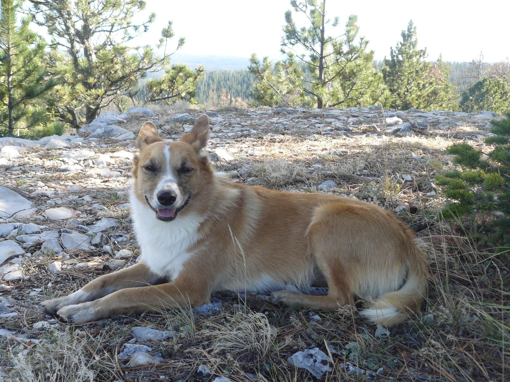
Ta da! Lupe stood on Crooks Tower(7,137 ft.) for the 8th time, making it once again the peak Lupe has visited more often than any other.
Loopster taking it easy on Crooks Tower. Photo looks N.Despite how high Crooks Tower is, this pleasant, but none too dramatic view is the best available from the true summit. Black Elk Peak(7,131 ft.) is seen on the far horizon on the L. Green Mountain(7,164 ft.) is the distant ridge on the R. Photo looks SSE.On the tippy top of Crooks Tower. Photo looks N.Crooks Tower is so easy! No wonder I like to come here. Photo looks N.Loop on a slightly lower limestone ledge only a few feet NW of the true summit. Photo looks NNW at the other decent view from Crooks Tower.
What a beautiful day! Loop and SPHP took it easy for a while. The sun was still very high in the sky. Puffy white clouds floated by. Lupe had plenty of time. SPHP ate the only apple. Lupe had more Taste of the Wild. Water for all.
Lupe chillin on Crooks Tower. Photo looks W at the lovely view, assuming you are a Ponderosa pine tree enthusiast.
This was Lupe’s 8th time on Crooks Tower. It had been nearly 2 years since the last time she’d been here on Expedition No. 135. Back then she had wound up getting injured down in Trebor Draw after leaving the summit. SPHP had rushed her (sort of – it took hours to get there) to the the Animal Clinic of Rapid City where Emergency Veterinarian Dr. Erin Brownhad patched her up late on a Saturday night.
Poor Lupe! She’d come staggering back to SPHP after her operation looking drugged with tears in her eyes. No more Trebor Draw today! That wasn’t going to happen again. Yet Lupe had so much time left in the day, a new plan was hatching in SPHP’s mind. Why not go to another peak Lupe had been to a couple of times before? Peak 6820 was less than 4 miles away to the NE as the crow flies.
Going to Peak6820 would make for a long day, and there were no views at all from that forested hill, but so what? May as well do something. Lupe returned to the true summit of Crooks Tower for a final goodbye.
Back at the summit one more time. Photo looks SE.
SPHP tried to persuade Lupe to remain up on the summit block long enough for a bold American Dingo photo taken from below, but Lupe wasn’t having any of that. If SPHP was starting for Peak 6820, she was too. She did consent to a photo of a bold American Dingo beneath the summit block, but somehow it wasn’t quite the same.
Bold American Dingo, Lupe, poses undramatically beneath the not-so-towering limestone cliffs of Crooks Tower. Photo looks NNW.
Oh, well. Onward! Even though it was nearly 4 miles to Peak 6820 as the crow flies and Lupe knew a good shortcut, so many hours of daylight remained that SPHP led her on a long way around she had only taken once before long ago. Lupe started off going SW instead of NE. She ended up taking a considerably longer-than-SPHP-remembered tour of the entire region along USFS Road No. 631.
This route was scenic and easy, but time slipped by as Lupe traveled all the way from a valley SW of Crooks Tower around to the S, then E and NE sides of the mountain. On the way, Lupe passed by the road leading NE into dangerous Trebor Draw. A little later on, she discovered Dingo Arch.
On USFS Road No. 631 S of Crooks Tower. This route SPHP chose was scenic and easy, but miles longer than it needed to be. Photo looks E.Looking NNE up the same hillside along USFS Road No. 631 S of Crooks Tower.Lupe discovered Dingo Arch E of Crooks Tower, on a slope above USFS Road No. 631 near the road’s highest point. Arches are uncommon formations in the Black Hills. Photo looks WNW.
The long march on USFS Road No. 631 eventually brought Lupe to a valley leading all the way down to South Rapid Creek Road (USFS Road No. 231). Lupe followed this major gravel road N until she was within sight of the junction with Besant Park Road (No. 206). Many deer were grazing in a lovely green field here, but they fled at Lupe’s approach.
By now, the angle of the sun was noticeably lower. The blue skies and puffy white clouds prevalent earlier in the day had given way to a more darkly overcast scene.
Many deer were grazing in this lovely green field when Lupe arrived, but they fled at Lupe and SPHP’s approach. The junction of South Rapid Creek Road & Besant Park Road is at the far end of this big field on the R. Photo looks N.
Lupe was still 1.5 miles from Peak 6820 as the crow flies. She wouldn’t have the benefit of a road the rest of the way. Was there still enough time remaining for all the bushwhacking she would have to do? Yeah, Loop could make it. She had been through parts of this region before.
Lupe and SPHP left South Rapid Creek Road, crossed the green field, and headed SE up into the forest.
The forest was a complete mess. Deadfall timber everywhere. Slow, slow, slow! After a long struggle, Lupe finally made it up to a clearing at the top of a ridge. She was already almost as high as Peak 6820, but still quite a distance from it. Exactly how far was impossible to tell. The flat terrain and dense forest at the edge of the clearing made it difficult to see a thing.
Lupe reaches the clearing at the top of the ridge after a long struggle through copious deadfall timber. Although she was quite high, Peak 6820 was nowhere in sight. Photo looks SE.
Peak 6820 was somewhere to the NE. Lupe and SPHP plunged into the forest again. More deadfall. Tons of it. Zigging and zagging like drunks looking for a way through. Nothing looked the least bit familiar. Everything was just a jumble of dead trees beneath the still standing forest.
Lupe came to a higher, short rocky ridge. High Point 6801? Who knew? No views were available even from here. The only other time Lupe had come to Peak 6820 from this direction was her first time up it on 10-8-14, more than 2.5 years ago. It hadn’t been this difficult then. Lupe had at least caught a few glimpses of Peak 6820 from a distance to orient by. Now, nothing.
N, E, SE – Lupe went which ever way seemed easiest to avoid the worst of the deadfall. None of the strange structures she had seen on her first trip to Peak 6820 appeared. She had to be getting close, but in the gloom of the forest, it was becoming confusing as to which way Lupe should even try to go. Speaking of gloom, the forest seemed prematurely dark.
Thunder in the distance. First drops. Rain! No matter. Onward! The rain was light, but even so, before long Lupe was wet. She reached another high point. Was this it? Had Lupe stumbled upon Peak 6820? It didn’t look right. SPHP remembered a clearing with a mud hole where Lupe had bathed both times she’d been to Peak 6820 before. Lupe searched all around the top of this hill for it. Nada. Wrong hill.
It must be farther N. Lupe went N on the big hill until she began to lose elevation. No sign of Peak 6820 here or anywhere else. Had Lupe gone too far SE earlier? SPHP led her NW down off the big hill. The deadfall wasn’t quite as bad here, but Peak 6820 did not appear. Lightning flickered in the clouds, thunder rumbled constantly. The rain remained light and sporadic, but might become a cloudburst at any time. The forecast hadn’t even mentioned rain today. Figured.
The Carolina Dog wanted attention.
What’s wrong with your senses? Don’t you hear or see anything, SPHP? Lightning, thunder! Let’s hide! A storm is coming! I’m already all wet.
Yeah, I know, but we’ll be OK. Besides there isn’t any place to hide, and we need to get to Peak 6820 soon, or forget about it. We can’t let it get dark while we sit around out here. We’ll never find a way out of this deadfall at night.
Well then, let’s get there fast! What’s in that water bottle of yours anyway? You’ve been stumbling around out here like you’re totally wasted.
I’m trying to find it, Looper.
What, the mountain?
Yes, of course. I’m just not totally sure which direction it is from here.
You mean it’s lost?
No, of course not, silly Dingo. Mountains don’t move. They always stay in the exact same place.
Oh, I get it. You mean we’re lost.
No, well, I mean we are imprecisely located right now. I know about where we are, just not exactly, which makes it hard to say where the mountain is from here, but I know it can’t be too far away.
Lupe wasn’t buying it. The Carolina Dog looked worried.
Sweet! We’re lost in this wretched forest with night and a storm coming on. Any more good news, SPHP? The Carolina Dog looked worried.
Oh, OK! I suppose you’re right Looper. Apparently it’s later than I thought. Maybe we better give up on Peak 6820. I shouldn’t have taken the long way. Let’s get out of here.
Lupe was in favor of that. SPHP led her NW through the forest. Even though this was the shortest way out, the Carolina Dog had at least a mile of bushwhacking ahead of her.
Ten minutes later, there it was! Peak 6820! SPHP saw it off to the NE. That hill had to be it, and wasn’t too far away. Lupe could make it. There was still time. SPHP turned on a dime.
Change of plans, Looper! Forget NW, we’re going NE. Peak 6820 is right over there. Come on!
Lupe led the charge through the forest. Apparently she wanted to get Peak 6820 over and done with fast. The rains came more often and harder. More lightning! More thunder! As the first tiny hailstones bounced on the ground, Lupe and SPHP both saw it. Up a short slope at the base of a limestone outcropping was a perfect little Dingo Cave. Lupe and SPHP scrambled up the bank to safety.
Lupe reaches the safety of the Dingo Cave somewhere on the upper W slope of Peak 6820. Photo looks NW.
It hailed briefly twice, but not hard. The hail was only pea-sized at most, so it wasn’t that bad. Rain poured down, though, for 20 minutes. Never a deluge, but by the time it was all over, everything was sopping wet outside. Lupe and SPHP watched it all happen from the bone dry shelter of the Dingo Cave. Not a drop fell inside. What were the odds?
Loopster, my friend, you are one lucky Carolina Dog! We never would have found this place, even if we’d known it was here ahead of time.
Loop at the mouth of the Dingo Cave after the storm went by.
Pushing past soaking wet bushes on the forest floor, Lupe still got drenched, but the top of Peak6820 was only 5 minutes from the Dingo Cave. She did get there. This was it! The familiar mud hole in the clearing didn’t have much water in it, but what was there was fresh. Heh. As sopping wet as Lupe was, she felt no need for a bath this time around.
Lupe by the little mud hole in the clearing on top of Peak 6820. The glare beyond her is the sun low in the W.No need for a mucky Dingo bath today!
The top of Peak 6820 is nearly level over a large area, but slightly higher ESE of the mud hole. Lupe and SPHP went over that way to visit the true summit. Someone else had been here! Lupe came across a cairn she never seen before.
Lupe at the new cairn she discovered on Peak 6820. Photo looks E.
Lupe and SPHP continued E beyond the cairn. Lupe went to the spot she has always considered the summit, even though it was scarcely any higher than where the cairn was. And that was it. Success! Peak 6820 visited for a 3rd time!
At Lupe’s traditional Peak 6820 summit point, perhaps 30 or 40 feet E of the cairn. Photo looks W.
Sunset in 30 minutes. Lupe now faced a race against time. The shortest route back to the G6 was to the NW. Lupe had been that way before, but it was too late to even try that direction. It was a total bushwhack through forest and deadfall timber for more than a mile to any road.
The second time Lupe had come to Peak 6820, SPHP remembered she’d followed a faint road up from the E, arriving at the N end of the summit area. Going E meant going away from the G6, but the faint road led to USFS Road No. 234, a better road which went around the W end of Swede Gulch. If Loop could make it to No. 234, she wouldn’t get stuck out here in the deadfall all night.
The road to the E was even fainter now. SPHP had a hard time even finding it at first, but it was there. Good thing! Hurry, hurry Dingo! Lupe and SPHP followed the faint road as quickly as possible. SPHP briefly lost track of the road a few times, but the American Dingo kept finding it again. The road was longer than SPHP remembered. The sun set, twilight was fading, but Lupe made it to No. 234.
Lupe on USFS Road No. 234 E of Peak 6820. By reaching this better road, Lupe escaped the possibility she might get stuck spending the night out here. Photo looks N.
Seven miles at least back to the G6. The long march began. It rained again, but not as hard as before. Lupe and SPHP found partial shelter beneath a big pine along No. 234. In 10 minutes it was over. Lupe left the road to take a shortcut through big fields heading W along Tillson Creek. On and on. A couple miles later she reached Besant Park Road (USFS Road No. 206) near the SE end of Besant Park.
The rest of the way back was entirely along good gravel roads. The Carolina Dog trotted along sometimes leading, sometimes at SPHP’s heels. It was an amazing evening. Lightning flashed among clouds in ever changing directions, but always some distance away. Now and then a brilliant bolt struck the earth. Thunder rolled louder, fainter, then louder again. Dark rumbling clouds threatened rain, but never did more than sprinkle.
Once Lupe begged SPHP to stop for a rest along South Rapid Creek Road. OK. For 10 minutes, Lupe curled up next to a tree stump, wearily licking tired, muddy paws. Rain threatened again. Still nearly 4 miles to go. Puppy ho! Let’s get this over with!
At exactly 11:00 PM (50°F), Lupe made it back to the G6. She was thirsty. SPHP gave her a big drink. Then she jumped in and curled up. Her 13+ hour adventures on Expedition No. 204 were finally over.
Or were they?
Ten minutes later, heading E on South Rapid Creek Road, the high beams illuminated something scurrying along as fast as it could. Big, furry, low to the ground, black and white. SPHP shouted a word Lupe had never heard shouted before – skunk!
Lupe leapt to her paws in time to see it. Dead ahead a huge skunk was racing E for the exact same spot where Lupe had taken her last rest break by the tree stump! The Carolina Dog barked furiously as the G6 sped by, and the skunk dashed into the darkness.
By golly, Looper, that Yellow Jacket Spring skunk is still on your trail after all these years!
Clayton Pond in all its glory 4 years earlier. Photo taken on Expedition No. 57, 5-4-13.At the hidden Dingo Cave on the W slopes of Peak 6820.
Lupe started Expedition No. 135 on USFS Road No. 259.2A about 0.25 mile W of Nahant Road. Nahant Road leaves the W side of paved County Road No. 17 about 5 miles N of Rochford in the west central Black Hills of South Dakota. Both Nahant Road and USFS Road No. 259.2A are marked. No. 259.2A leaves Nahant Road about 0.5 mile S of County Road No. 17. There is a small corral near the intersection and two barbed wire gates to go through to gain access to No. 259.2A.
After the traumatic finish to Expedition No. 134 a week earlier, Lupe had been reluctant to even take her nightly walks for a few days. When no more lightning, thunder and hail storms made an appearance, towards the middle of the week Lupe regained her confidence and enthusiasm for the outdoors. Although the forecast was for the mid-80’s in the lower Black Hills, Saturday was supposed to be clear weather all day long. SPHP thought Lupe might be ready for another expedition in the higher western Black Hills, where it should at least be a bit cooler out.
Early Saturday morning, Lupe expressed great enthusiasm for “hiking in the mountains”. She was eager to go. Soon Lupe and SPHP were in the G6 and underway. It was a very pleasant 60°F when SPHP parked the G6 at 8:29 AM along USFS Road No. 259.2A just 0.25 mile W of Nahant Road. Lupe and SPHP have been here before on at least a couple of prior expeditions, so it was familiar territory. SPHP’s plan was to let Lupe enjoy a romp along Tillson Creek in Swede Gulch and then do some peakbagging with Peak 6820 and Crooks Tower(7,137 ft.) as goals.
Before too long, USFS Road No. 259.2A basically comes to a dead end where the road reaches Tillson Creek in Swede Gulch. A remnant of the road continues on upstream, but is in poor to non-existent condition in a lot of places. Many pine bark beetle-killed trees have fallen across the route. The main problem this morning though, was that there was a lot of marshy, mucky wet ground. (The Black Hills have received nearly 3 times their normal rainfall for the month of June in 2015!) Getting around the soft areas meant frequent detours into the forest up on the sides of the valley and picking a way through the deadfall timber.
Lupe near Tillson Creek in lower Swede Gulch. Lupe traveled upstream on Expedition No. 135.
Lupe had fun in Tillson Creek and exploring around Swede Gulch, but Lupe and SPHP weren’t making great time. It didn’t really matter. Despite being a very busy dingo, Lupe has no deadlines to meet. SPHP was really hoping Lupe would get as far as Crooks Tower though, before it got too late in the day.
About 2 miles from the end of the good road, Lupe reached the confluence of Tillson Creek and a good-sized tributary coming in from the W. Shortly after passing the confluence, it became necessary to cross Tillson Creek. While on past occasions, SPHP had always managed to cross Tillson Creek without getting wet boots, this time there was so much flow in the creek nothing could be done except to just wade right in and ford it.
Lupe cools off in Tillson Creek just below the confluence of Tillson and a major tributary coming in from the W. Although hidden by the grass, the main flow of Tillson Creek is coming in from the right side of this photo looking W.
The creek had to be forded several more times as Lupe progressed up Swede Gulch. Lupe loved the fords, and frequently waded into Tillson Creek to cool off and drink even where it wasn’t necessary. SPHP was now resigned to marching soggily along in wet boots. SPHP splashed right on into Tillson Creek at each ford without hesitation.
Tillson Creek is smaller by the time it gets here. This photo looks NNW up Hallorans Draw. The main flow of Tillson Creek comes from a valley to the W (L side) of this photo.With all the recent rains (8.40″ so far in June), Lupe found a little temporary waterfall on the N side of Swede Gulch. It will probably be gone in a very short period of time, but was fun to see.
Eventually Lupe heard a great deal of mooing going on up ahead. Where USFS Road No. 234 crosses Tillson Creek, there was a herd of cattle out on the road. Beyond the road is some private land, but these cattle were outside of the fence in the Black Hills National Forest. This is not uncommon as grazing permits are available in the national forest. Lupe and SPHP took a little break near No. 234, while the cattle decided maybe it would be best to mosey on along, since they preferred their own company to that of dingoes.
Lupe and SPHP left Tillson Creek and headed S on No. 234, which started climbing the hillside. After a bit, the road leveled out and then curved SW. A high point became visible ahead. SPHP stopped to check the maps and give Lupe a little water and Taste of the Wild. Lupe rested in the shade of a spruce tree and snapped at flies.
The topo map SPHP had printed out from Peakbagger.com showed that Peak 6820 was about 1 mile due W of Lupe’s location. A draw heading WNW would be the least steep approach. Lupe could curve back to the SW for the last little bit of the climb. Lupe and SPHP backtracked just a little bit to go through a gate up into the draw. There was a faint remnant of a road heading up the draw. Lupe and SPHP followed it. SPHP repeatedly lost the remnant road and then found what looked like what might be it again.
Lupe started seeing these striking flowers scattered in open areas in the woods on the E slopes of Peak 6820.
The plan worked. Lupe and SPHP had been to Peak 6820 once before, back on Expedition No. 99 on 10-08-14. Arriving on flat terrain that seemed to be the top of the mountain, SPHP recognized a particular mud puddle toward the W end of the summit area. Lupe happily went over to lay down in it and have a drink of mineral water. A cool, wet, muddy dingo is a happy dingo!
Lupe enjoys her mud puddle on top of Peak 6820.
Although a high point, Peak 6820 is all forested and there aren’t really any decent views, since they are blocked by all the trees. The top of the mountain is very flat. There is a fairly large summit area rather than any discernable peak or highest point. Lupe and SPHP explored around for just a few minutes before SPHP was satisfied there really wasn’t much more to be done up here. Then it was time to continue on to Crooks Tower where the views would be better.
Lupe on the summit of Peak 6820. The summit area is pretty large and flat. There is no discernable definite highest point. The views look pretty similar in every direction due to the forest.
Lupe and SPHP went back to the mud puddle and then down an old road heading SW from the W end of the summit area of Peak 6820. The first time Lupe had climbed Peak 6820, she had come up this road. SPHP remembered it as being pretty choked with deadfall timber along most of its length near the top. Things really hadn’t changed. It still was. Lupe and SPHP were off the road more than on it.
SPHP was hoping to find again a strange little area in the saddle between Peak 6820 and a ridge to the SW. Lupe had found it on Expedition No. 99. There was a big water tank and a tall deteriorating wooden tower, plus a nearby opening in the forest completely fenced in and covered by metal sheeting just 6″ off the ground. SPHP thought the metal sheeting might serve as a safety cover for a large open mine shaft, but wasn’t sure. In any case, Lupe didn’t find it again this time. SPHP wasn’t sure it was worth spending extra time looking for it either. If the metal sheeting did cover a mine shaft, it might just be best for Lupe to stay away from it.
The strange wooden tower and water tank Lupe found on Expedition No. 99 on 10-8-14. Lupe did not find it again on Expedition No. 135.This photo from Expedition No. 99 shows the sheet metal cover on the ground Lupe found SW of Peak 6820 on 10-8-14.
Lupe and SPHP crossed the saddle area and climbed a ridge SW of Peak 6820. Lupe headed W along the ridge and came to a high spot. Lupe’s immediate goal was to get to South Rapid Creek Road (USFS Road No. 231). The terrain seemed to push Lupe and SPHP farther N than SPHP really wanted to go despite crossing a couple of ridges. SPHP didn’t want to go too far S either. The topo map showed some pretty steep terrain and even small cliffs to the S. With no views and no roads or paths to follow, it was hard to know just where Lupe would come out.
Lupe stands near a collection of the pretty orange flowers. This was the biggest group of them Lupe found all in one spot.
It took quite a while, but Lupe eventually emerged from the forest just E of the intersection of USFS Road No. 231 and Besant Park Road (No. 206). Lupe had been here quite a few times before. From the intersection, Lupe and SPHP headed S near the edge of the forest W of No. 231. The grass was so tall in the big meadow, Lupe had a hard time seeing over it. She bounded along to see where she was going. The meadow eventually narrowed. Lupe and SPHP walked on No. 231 for the last part of the distance to USFS Road No. 631.1.
The start of No. 631.1 was the low elevation point on Lupe’s journey from Peak 6280 to Crooks Tower. From here on, the rest of the way was up, although mostly at a moderate pace. Lupe went W up No. 631.1 until reaching No. 631.1B. She followed No. 631.1B NW up a side gully, but after gaining some elevation left the road to travel W through the forest. Loggers had stacked a big pile of tree trunks up near the top of the ridge. Once there, Lupe followed the logging trail heading generally WSW. The logging trail was pretty flat and easy, but gained a little elevation as it went along.
Perhaps a mile or less N of Crooks Tower is a flat ridge that extends out to the WNW. At the end of the ridge from some small cliffs is a very nice overlook with good views off to the NW. Lupe has been to this viewpoint on several occasions before. As SPHP expected, the logging trail passed just to the SE of this ridge and Lupe was able to trot on over to the WNW for another look.
Lupe at the end of the overlook located about a mile N of Crooks Tower. Photo looks NNW.
Lupe and SPHP took a break in the shade of a small tree at the end of the ridge. Lupe had a bit more Taste of the Wild. Both Lupe and SPHP enjoyed the views. Miles off to the NW was a high ridge which might be Cement Ridge. Far off to the N a sharper peak stuck up above the rest of the Black Hills. This might be Crow Peak W of Spearfish. SPHP wasn’t certain in either case.
Lupe went back to the logging road and followed it S a short distance farther. The logging road started turning to the W and losing elevation. Lupe left it before it lost any elevation and continued S through the forest. At times there were remnants of roads to follow, and at other times there weren’t. Crooks Tower could sometimes be seen ahead at openings in the forest. It was now only a couple hundred feet higher than where Lupe was. Lupe came to a road, which was probably USFS Road No. 189.4F. She crossed it continuing S.
As Lupe got closer to Crooks Tower, the terrain became steeper. Lupe and SPHP worked their way on up the forested slope. Upon gaining the top of the ridgeline, Lupe followed the ridge SE still gaining elevation. When SPHP saw some 15 foot tall limestone outcroppings ahead, SPHP thought Lupe was practically at the summit. Lupe skirted around the W side of the outcroppings and found an easy way to the top. Nothing was familiar to SPHP. This wasn’t the true summit of Crooks Tower.
The question was, since this wasn’t it, where was it? It couldn’t be too far away, but there were no views through the forest. Lupe was either too far E or too far W. SPHP decided to head SW hoping to find USFS Road No. 189.4A, which passes just S of the summit of Crooks Tower. (You can practically drive to the summit of Crooks Tower, if you want to. USFS Road No. 189.4A comes in from the W.) Within just a minute or two, SPHP knew where Lupe was. She was just NE of Crooks Tower.
A platform of limestone about 20 feet high forms the summit of Crooks Tower. A path leads to the top from the W side. Lupe headed around the S side of the summit passing a couple with two young children picnicking in the shade of a spruce tree below the summit. In just a few minutes Lupe was at the top of Crooks Tower. She had completed both her peakbagging goals of the day!
Lupe on Crooks Tower. Photo looks SE toward Harney Peak barely seen as a faint blue line in the distance above Lupe’s head.
A forested ridge nearly as high as Crooks Tower itself lies not far away to the E. (Lupe had initially climbed up to the N end of this ridge.) The ridge blocks any views farther to the E. Similarly, to the W the forest blocks any views in that direction where the land is nearly as high as Crooks Tower. There are nice views to the N, though, and even better views to the S. Harney Peak(7,242 ft.) can be seen in the distance to the SE.
Crooks Tower(7,137 ft.) is the highest point in Lawrence County, SD, and the 4th highest ranked peak in the Black Hills of South Dakota on Peakbagger.com. [GreenMountain(7,164) feet is actually the 4th highest point, but unranked since it lacks the required 280 feet of prominence. Lupe had been to Green Mountain twice just a week ago on Expedition No. 134.]
Lupe on Crooks Tower. This photo looks NW.
Lupe and SPHP stayed up on Crooks Tower for a little while. SPHP ate a peanut butter and jelly sandwich. Lupe helped out with the sandwich and had some Taste of the Wild, too. The young couple left with their children in tow heading W on USFS Road No. 189.4A. Soon SPHP heard their vehicle start up and move away. Lupe and SPHP had Crooks Tower to themselves. The sun was still high in the sky. While there were still some hours of daylight left, SPHP knew most of the day had already shot on by. It was a long way back to the G6. Lupe couldn’t stay up on Crooks Tower too long.
Lupe on the tippy top of Crooks Tower 6-27-15
SPHP thought it was unwise to try to head back to the G6 the same way Lupe had come to Crooks Tower. It was going to get dark long before Lupe could be back. SPHP did not like the idea of trying to go back down Swede Gulch through all the mud and deadfall timber in the dark. Instead, Lupe would go down Trebor Draw to South Rapid Creek Road. Lupe could follow South Rapid Creek Road SE past the turn for Black Fox Campground, and then miles more to the E until reaching USFS Road No. 259. No. 259 would take Lupe N through Telegraph Gulch a few miles to Nahant and the G6.
At first, it all went fine. Lupe left Crooks Tower following No. 189.4A around the S end of the ridge to the E. E of the ridge, it headed N for longer than SPHP had remembered, but finally did turn SE winding steeply down the mountain to No. 631.2. A short jog to the S on No. 631.2 brought Lupe to a virtually abandoned USFS road (signed as an administrative road only) at Trebor Draw. Lupe and SPHP headed NE down into Trebor Draw.
Trebor Draw was in the shade of the mountain. The grass was thick, tall and green. Lupe could not see over it, so it was like a complete jungle to her. The administrative road went on for some distance, then faded to a single track before disappearing altogether. The valley narrowed and led into a thick forest to the E. Lupe had been here once before, but that time SPHP had not taken her through the forest, instead leading her up over the high ridge to the N.
South Rapid Creek Road was to the E. This time Lupe had to continue on down Trebor Draw through the dense forest. At least it couldn’t be much more than 0.5 mile further to the road. The going was very slow. A lot of deadfall timber had fallen down into the narrow valley. It was bad, but Lupe and SPHP have dealt with worse. Lupe steadily made progress down Trebor Gulch. A very narrow cow trail appeared. (What cows would have been doing in this mess, SPHP had no clue, but the trail was there with an occasional cow pie to prove it.) Lupe was able to run along the cow trail.
SPHP saw the danger just before tragedy struck. An old barbed wire fence had fallen over the trail. Five strands of barbed wire lay in wait for Lupe who raced right into them. SPHP called out to Lupe and heard her hit the fence. A moment later SPHP saw Lupe standing on the trail. The barbed wire had cut a big bloody gash across the whole front of her left front leg. Her fur was hanging open to reveal the bare flesh beneath the skin. SPHP was horrified.
Lupe on South Rapid Creek Road (USFS No. 231) with a nasty gash from a fallen barbed wire fence in nearby Trebor Gulch. The heroic dingo partly walked and was partly carried by SPHP to Black Fox campground to find help.
Fortunately, the barbed wire had only just nicked the muscle beneath the fur. At first Lupe didn’t even seem to realize anything really bad had happened. She could still walk, even run. It wasn’t bleeding much, but it looked ghastly and had to hurt. Quickly SPHP dug through the whole backpack. Matches, plastic bags, flashlight, extra batteries, gloves, hat, sunscreen, gloves, toilet paper and a plastic raincoat were all there. But not the little first aid kit. Major mistake! It had been a long time since SPHP had even thought about checking on the first aid kit. No telling now how long it had not been in the pack. Probably removed and forgotten during a cleaning months ago. The kit wouldn’t have had much to treat such a large wound in any case.
Lupe needed to get to a veterinarian and soon. SPHP picked her up and started to carry her. It was hard on the uneven ground with obstacles. SPHP carried her part of the time and she walked part of the time. Fortunately, within 10 minutes or so, Lupe reached South Rapid Creek Road. As much as possible, SPHP carried Lupe, but she walked as much as she was carried and probably more. She occasionally seemed to realize something was wrong with her bloody leg and would pause to lick it. SPHP stopped her from doing that. She must not have felt too horrible. She still sometimes wanted to run off into the forest, or up a hillside off the road to bark at a squirrel. SPHP didn’t permit that either.
Black Fox Campground was about 2 miles from where Lupe reached South Rapid Creek Road. It really didn’t take too long to get there, but it seemed endless to SPHP. Fortunately there were people camping at Black Fox. SPHP asked for help for Lupe. Four people with two dogs (Achilles and Lily – naturally SPHP has forgotten the kind people’s names) had a first aid kit. Lupe got a generous dose of antibacterial gel. Then her leg was wrapped with a gauze bandage and taped up. Another kind man named Jim, who lives in the Wonderland Homes subdivision near Black Hawk and Piedmont, SD gave Lupe and SPHP a ride in his Ford pickup truck all the way back to the G6.
Lupe liked Jim’s Ford pickup. She didn’t want to get out. Maybe she was just afraid SPHP was going to make her walk some more. SPHP thanked Jim for the ride, gathered Lupe up and got her in the G6 as fast as possible. It was 8:30 PM. Without Jim’s help it would have been well after midnight before Lupe could have gotten back to the G6, even if she had been totally well.
Somewhere around 10:00 PM, SPHP brought Lupe into the Animal Clinic of Rapid City, also known as the Emergency Veterinarian Hospital. The Emergency Veterinarian Hospital has a veterinarian on duty 24/7. Even though it was late on a Saturday night, lead emergency veterinarian Dr. Erin Brown was on duty. Soon Lupe was being anesthetized in preparation for stitches. Dr. Brown stitched Lupe’s leg up and put a drain in to help prevent serious infection. An hour after disappearing into the operating room, Lupe walked back to SPHP. There were tears in her eyes, but she was smiling.
Lupe’s wounded front leg the morning after lead emergency veterinarian Dr. Erin Brown stitched it up. The plastic is a drain to help prevent a serious infection. 6-28-15Wounded dingo the morning after when it still really hurt. Thank you Dr. Erin Brown for your skillful and timely help late on a Saturday night!Heroic dingo Lupe struggles to survive! Somehow Dr. Brown forgot to mention treats and vanilla ice cream as a pain killer and antibiotic delivery system, but SPHP took care of it. Lupe was certain treats had to be part of any decent “treat”ment plan. 6-28-15
Many thanks to Jim and the other good people who helped Lupe at Black Fox campground, and especially to veterinarian Dr. Erin Brown. Lupe is going to be OK! She is on pain medication and antibiotics, but less than 48 hours after seeing Dr. Brown, she is back to running around and barking at the garbage truck, recycling truck and Lupe’s long-suffering mailman.
There will be no more new Black Hills, SD Expeditions until Lupe is fully healed up (and a new much beefed up first aid kit is in SPHP’s pack). While Lupe recuperates, The (Mostly) True Adventures of Lupe will continue in July with new posts on some of her previously unpublished prior adventures in the Canadian Rockies, Beartooth Mountains and Bighorn Mountains.


 When the show was over, Lupe and SPHP continued on to the true summit of Crooks Tower. Lupe made her 2nd ascent of the day, and 6th all time. The full hunter’s moon was due to come up soon. Darkness fell and stars began to appear. Lupe and SPHP waited. As the pale moon rose, a lone coyote began to howl. Lupe was entranced.