Black Hills, SD Expedition No. 311 – The Peak 5452 Fail & Pillar Peak (1-15-23)

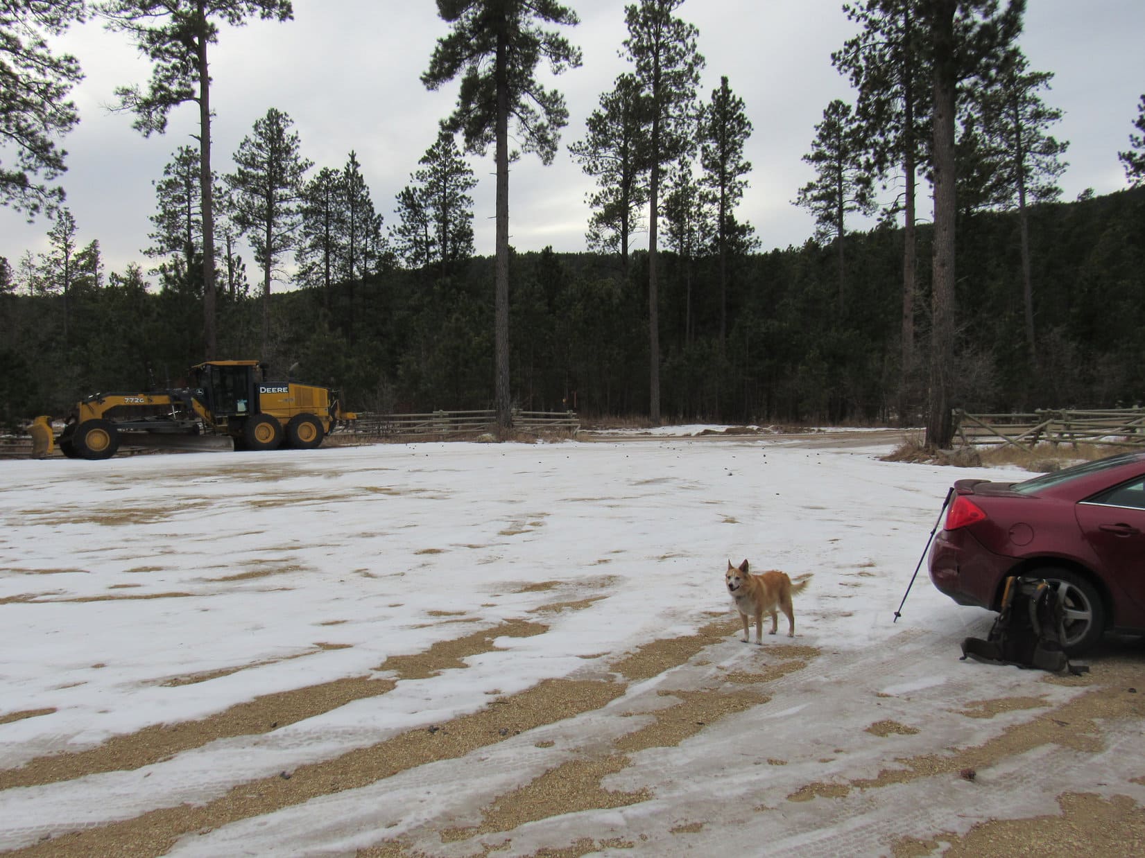
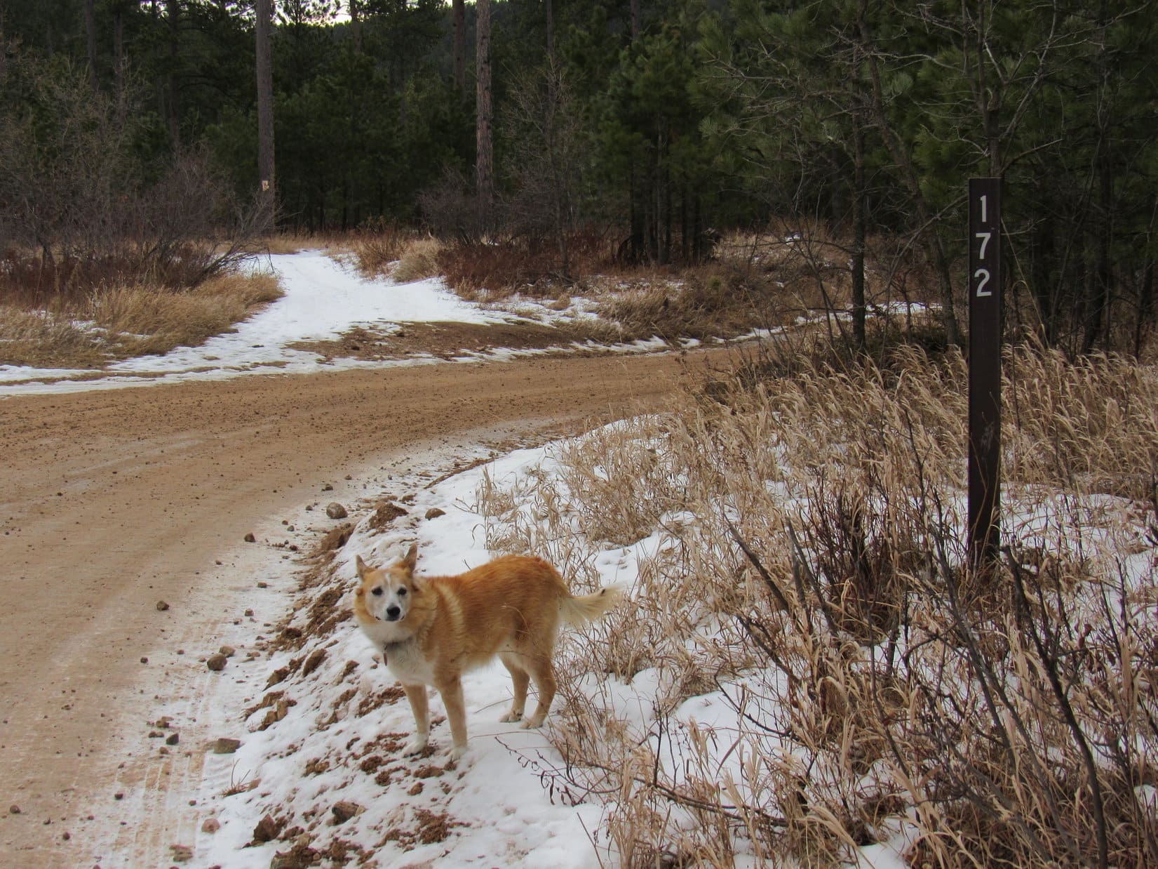
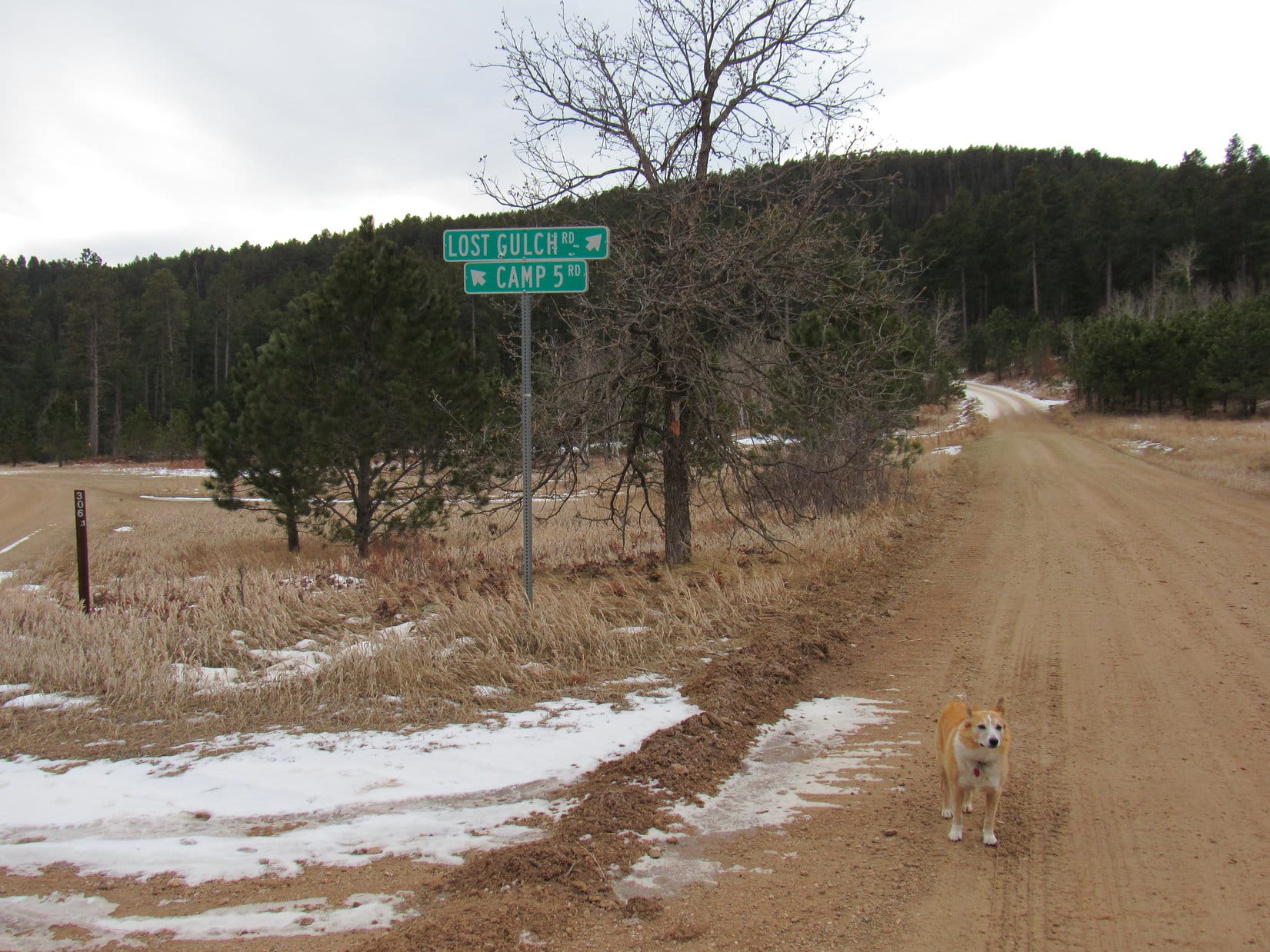
9:02 AM, 33ºF, Camp 5 Road (USFS Road No. 172) trailhead off Hwy 14A – Record high temperatures for the date yesterday, but you sure wouldn’t have known it from conditions at the Camp 5 trailhead this morning.  SPHP parked the RAV4 in more than a foot of snow.

Arriving at the snowy Camp 5 Road trailhead. Photo looks SW.

It’s still winter here, SPHP!

Going to be winter for a while yet, Loopster.  Still January, about as wintry as it gets.  Supposed to warm up some again today, though, although not as much as it did yesterday.  You still want to go, don’t you?

Oh, of course I do, SPHP.  Where are we off to?

Peak 5452, Looper!

Peak 5452?  Sounds like another Lists of John 300+ foot prominence peak.  In fact, I sort of vaguely remember that we were driving around looking for access to a Peak 5452 last fall.  Am I right, SPHP?

Indeed, you are, Loop!  We drove up Peedee Gulch one day thinking Peak 5452 would be a short easy romp from the W.  However, turned out it was all private property over that way, a big housing subdivision.  So this time we’re going to come at it from the NE, a much longer route, but hopefully we won’t have to be traipsing through anyone’s front yard.

Crossing Camp 5 Road, Lupe set out taking a shortcut down into the Boulder Creek drainage, which was full of snow, but otherwise dry.  A 40 foot climb up the opposite bank, and the Carolina Dog popped out on USFS Road No. 172.1G, which was also quite snowy.

USFS Road No. 172.1G. Photo looks NW.

Wow, a lot more snow around than I expected, Loopster!  We might be in for quite a time today.

I like the snow as long as it doesn’t get too deep, SPHP.  Which way now?

We go W from here all the way to the end of No. 172.1G, Loop.  0.5 mile should get us to Two Bit Creek.

Following tire tracks where the snow had been compressed, Lupe trotted W with relative ease as the road wound through the woods paralleling the course of the Boulder Creek drainage.  This was a beautiful trek, but not nearly as peaceful as it looked.  Traffic roared along Hwy 14A on the opposite N side of the valley.

The last tire tracks ended 0.25 mile in.  Traveling through the foot deep snow now required greater effort.  No. 172.1G eventually curved SW and ended at a sign.

Beyond the last tire tracks. Photo looks SW.
At the end of USFS Road No. 172.1G. Photo looks SW.

“Area restriction, unauthorized route, no motor vehicle use yearlong”.  We’re golden, Looper.  You aren’t motorized are you?

I’m 1 Dingo power, SPHP.

Don’t think that counts.  Onward!  Puppy, ho!

Beyond the sign, what was left of USFS Road No. 172.1G dipped into the Two Bit Creek drainage.  No surface water, but even more snow here.

Start of the trek up Two Bit Creek. Photo looks SW.

OK, Looper, now we just follow Two Bit Creek upstream.  2 miles at most, depending on how much winding around there is.  That should get us to a mile long climb up Peak 5452’s NE ridge, and we’ll be there!

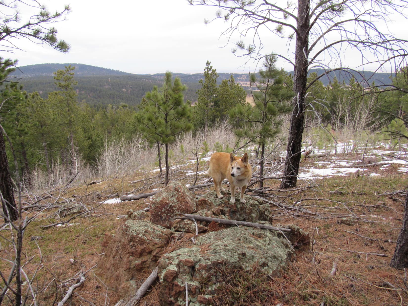
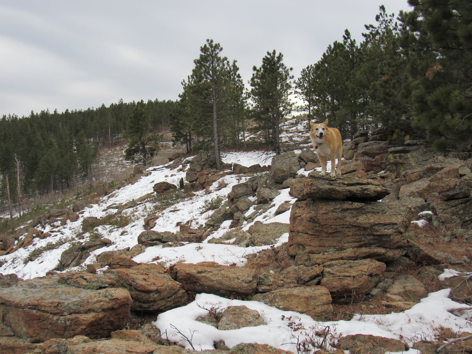
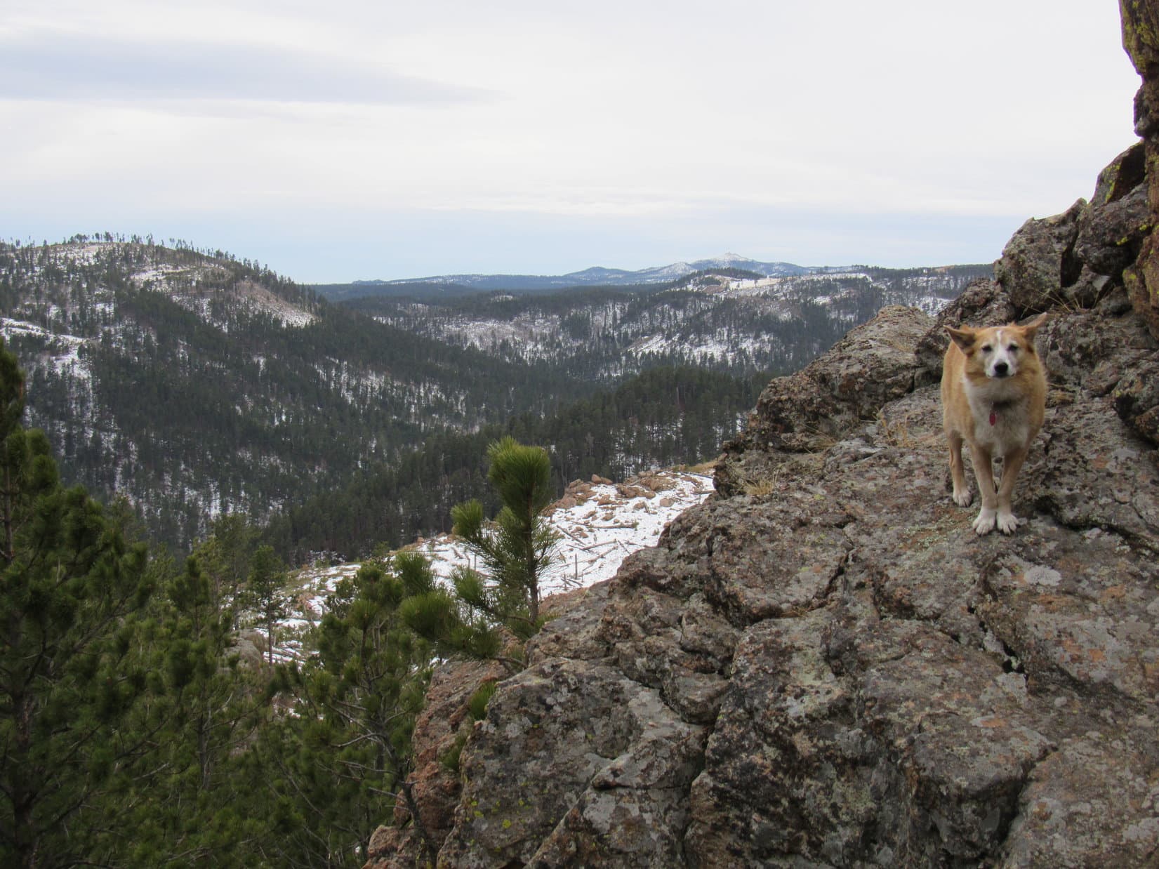
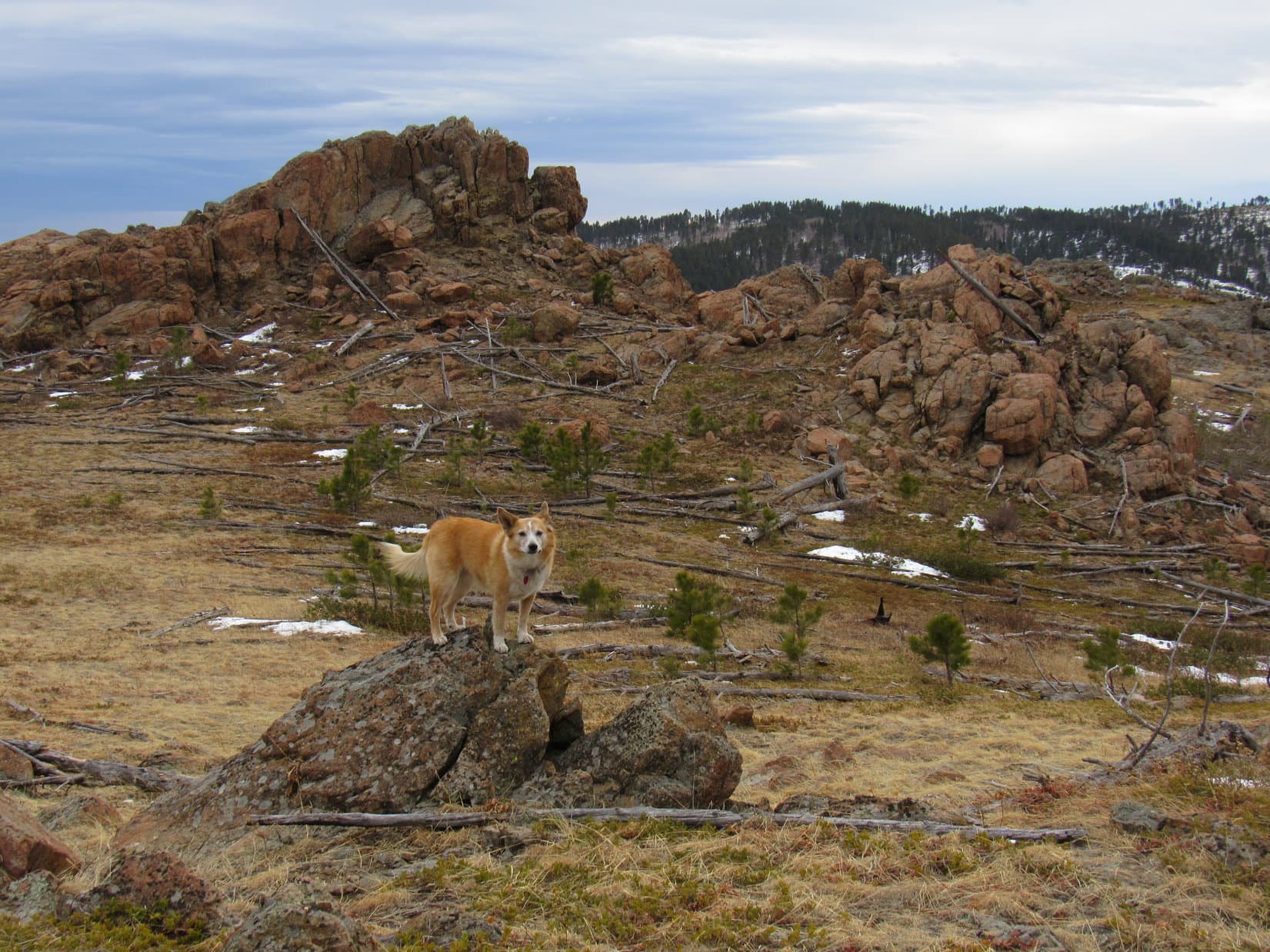
As the American Dingo explored the Two Bit Creek valley, the snow was often deep enough down along the dry streambed to make travel much slower and more difficult than expected.  Two feet deep in some places, three in a few spots!

Heading up the Two Bit Creek streambed. Photo looks W.

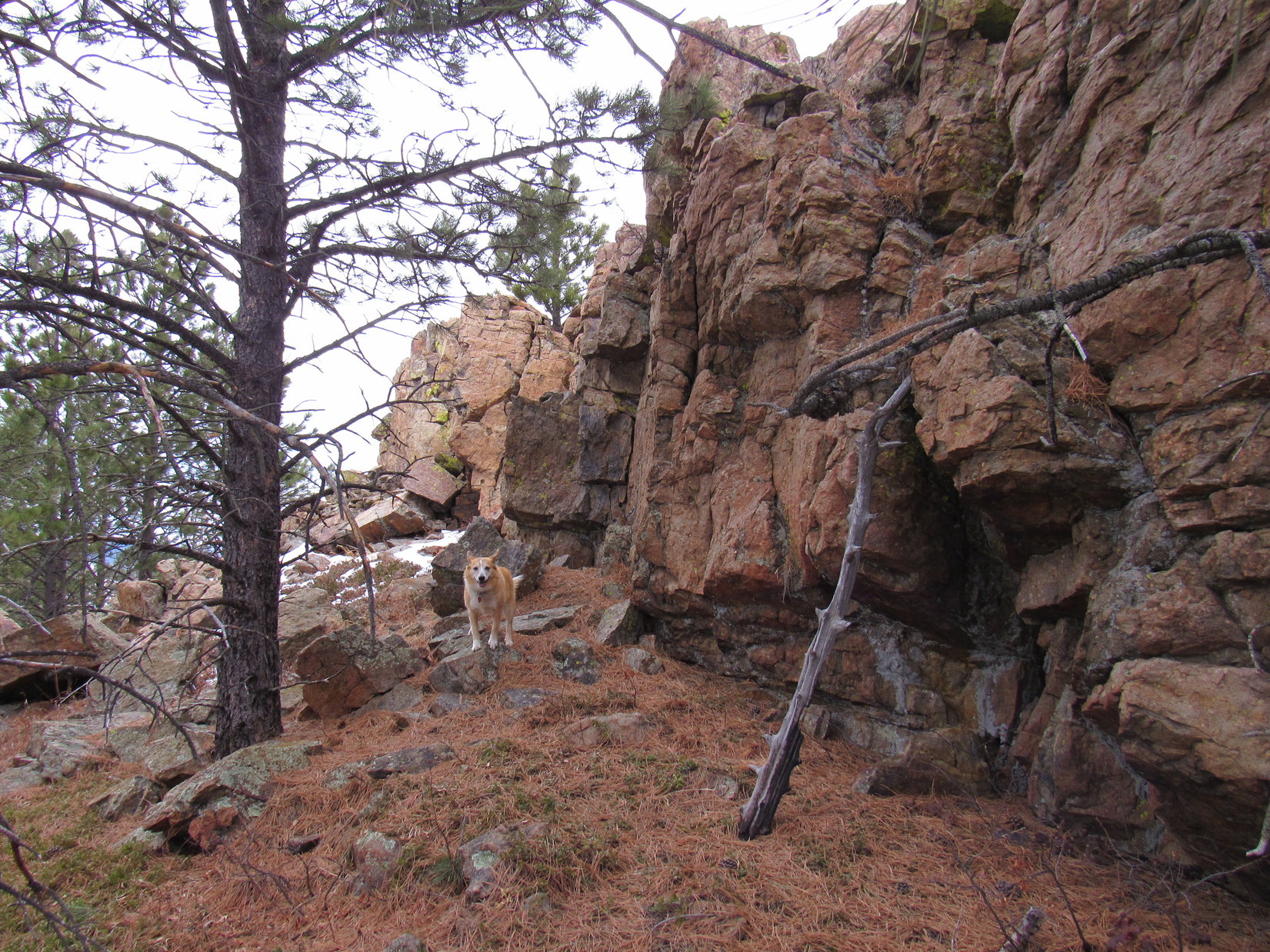
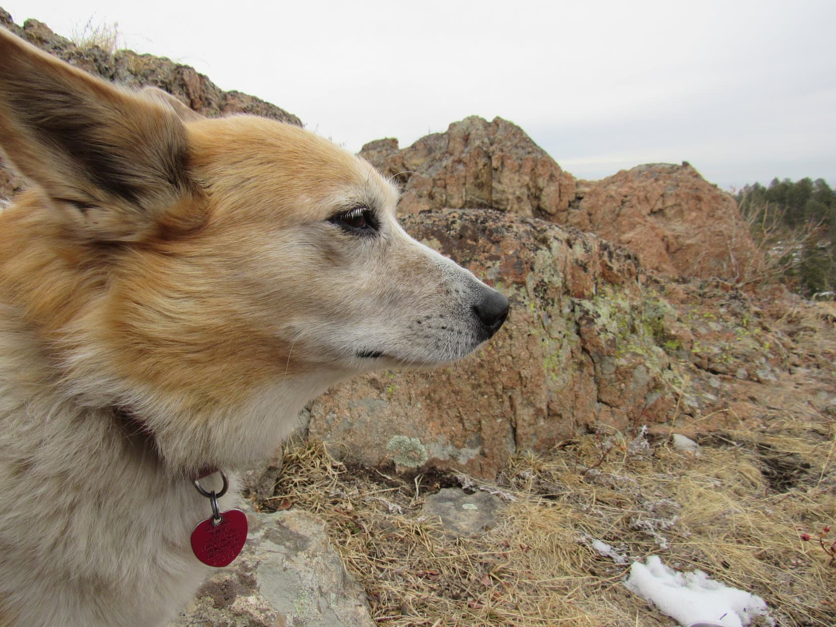
Attempting to avoid some of the deepest snow, while cutting off some distance as the stream looped around, at times Lupe roamed regions above one bank or the other.  The snow usually wasn’t as deep when that was possible, but it often wasn’t.  In some places, Two Bit Creek ran along the base of scenic limestone cliffs.

Near the end of USFS Road No. 172.1G, there’d been signs about mining claims in this area.  They warned against anyone else, presumably even Carolina Dogs, attempting to extract any minerals.  More mining claim notices appeared as Lupe’s journey continued.  She ignored them all.

Passing a mining claim notice (L). Photo looks SSW.

Don’t know why, but I’ve never really been inclined to start mining, SPHP.

Nothing to worry about, Loop.  I’d be surprised if you were.

In truth, there was little evidence the mining claim owners really had much interest in mining, either.  Not entirely true, though.  Looper did pass one upturned plastic cart next to a small exploration dig.

Heart of the Two Bit Creek mining industry.

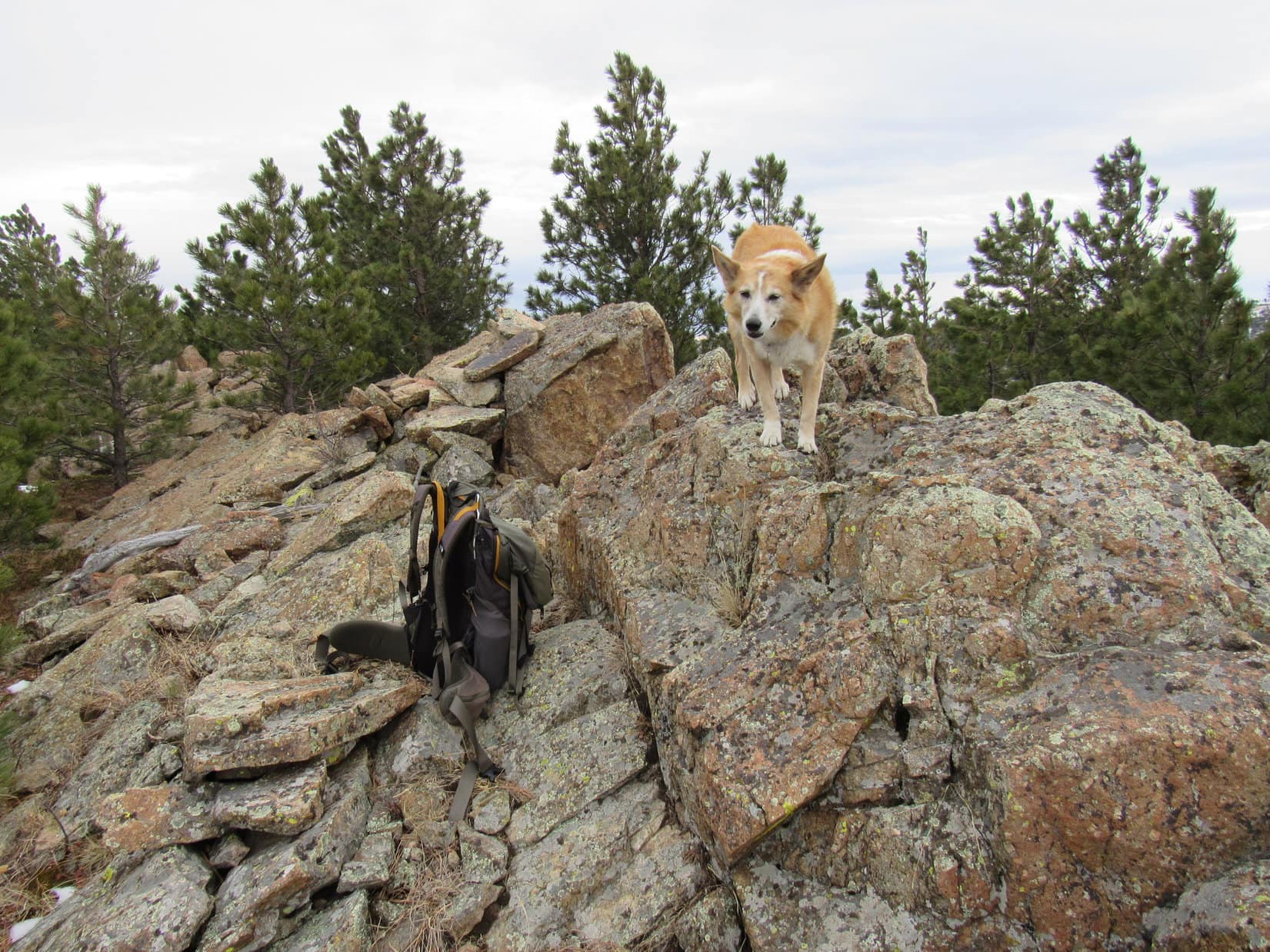
Two Bit Creek went on for what seemed like a long way.  Now far from the highway, Lupe explored a quiet, wonderfully secluded region.

Below a scenic cliff.
Down along the streambed again. Photo looks SW.
Exploring a flat region above the stream bank. Photo looks WSW.

Eventually, a snow-free spot was found well above the streambed.  This was the first opportunity to sit down and take a break.  Looper wasn’t hungry yet, but was happy to curl up on SPHP’s lap.

At the break spot.

How much farther to Peak 5452, SPHP?

According to the Peakbagger app on our new iPhone, we’re still only about halfway to the start of the NE ridge, Loop.

Beyond the break spot, the Two Bit Creek trek continued in a similar manner for quite a way.  Eventually, the valley began to broaden out.  Climbing the S bank of the streambed, Lupe reached a large flat region that wasn’t as thickly forested.  Somewhat surprisingly, vehicle tracks were visible in the snow only a little farther S.

In a flat region S of Two Bit Creek. Photo looks SSW.

Going over to the tracks, they wound E or W through the forest.

On what might have been a road again beneath the snow. Photo looks W.

Wonder where this goes, SPHP?

Not sure, Looper.  Certainly easier than following Two Bit Creek, though.  Head W.  That will get us closer to the start of Peak 5452’s NE ridge.

The Carolina Dog made excellent time along the snowy tracks.  Soon an intersection appeared.  Partially hidden by trees, a house was now in view ahead.

Uh-oh!  We’re either on, or coming to, private property, Loop.  That house is right where we want to go, too.  We need to get around it somehow.

Which way then, SPHP?  The tracks go either N or SW from here.

Peak 5452 is SW, Loop.  Go that way.  N won’t do us any good.

The terrain rose gradually as Lupe followed the tracks SW.  A snow-free stretch soon revealed that this really was some kind of a primitive road.

On the primitive road. Photo looks SW.

It wasn’t far to another junction along the edge of a ravine.  Another house was now in sight on the hillside W of the ravine.

Well, shoot!  We’re cut off from where we need to go, Loop.  Apparently this whole valley is part of a subdivision.

So what now, SPHP?  Is our goose cooked on Peak 5452?

Kind of looking that way, Loopster.

A road or track of some sort went SE up a steep slope from here.

Looking up the steep track. Photo looks SE.

Let’s go that way, Loop.  There are still a couple of these big ravines W of us that we need to get past.  Their sides are so steep that we aren’t going to be able to get over the ridges between them with so much snow around, but maybe this route will wind through it all somehow?

As Lupe climbed SE up the steep track, it seemed to be the only realistic hope of ever getting to Peak 5452 today.  After gaining a fair amount of elevation, the track leveled out and turned SW again, an encouraging sign.  Maybe this was actually going to work?

Approaching the curve SW. Photo looks S.

However, the track soon curved S again.  A small sign was ahead.

No trespassing!  We actually did stray onto private property, Looper.

Are we going to get into trouble, SPHP?

Doubt it.  No harm done, and we’re off it now.  Never meant to intrude, and we won’t be back, so this should be the end of it.

By the No Trespassing sign. Photo looks NNE.

The news still wasn’t good.  Although the track continued on from here, it went S staying on the E side of the ravine.  Any attempt to cross the ravine, and go W up and over the heavily forested steep slope beyond it looked like an unrewarding task.

We’ve struck out on Peak 5452 today, haven’t we, SPHP?

Yeah, I think this is it for Peak 5452.  Not a decent route in January.  It will get dark on us during the return if we try to force our way over these hills and ravines to get there.  Won’t be much fun without a trail to follow.

So now what?  How do we get back to the trailhead, SPHP?  Can’t go back the way we came without trespassing again.

Oh, don’t worry about that.  We aren’t going back that way.  Want to climb Pillar Peak (5,469 ft.), Loop?  It’s only about a mile S.  No access issues, and we already know a good route back to the trailhead from there.

Pillar Peak?  I’m all for it, SPHP!  At least we’d get to climb something.

According to the topo map, the best route to Pillar Peak from here was to climb SE entirely out of the ravine, then turn S along a broad ridge that would ultimately lead first to the mountain’s somewhat lower E summit.  Although no road or trail went that way, this route began as a pretty easy climb.  Not all that steep, and not much snow around, either.

Sniffing her way through the forest, Lupe hadn’t gone much farther when a Black Hills National Forest boundary sign appeared.

Officially re-entering the national forest.

Gosh, were we still on private property, SPHP?

Guess so, hard to tell without any fences, Loop.  There’s a survey marker here, so we ought to be officially back in the national forest now.

Continuing SE, the terrain nearly leveled out.  Time to turn S!  Lupe led the way, roaming easily through an area thick with dog hair pines that slowed SPHP’s progress considerably.

Waiting on you, SPHP!

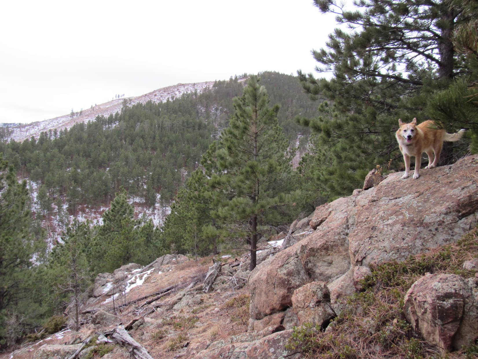
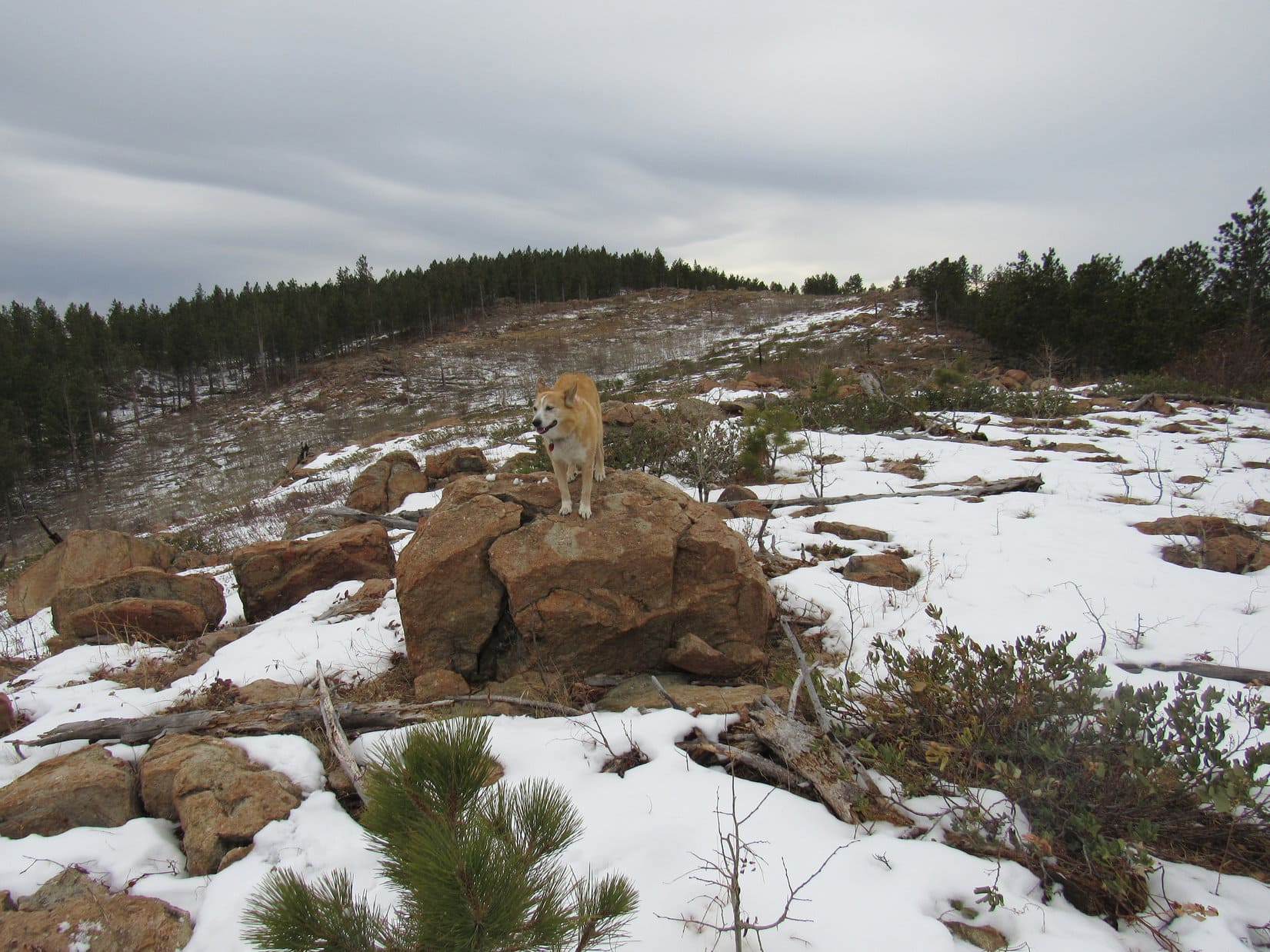
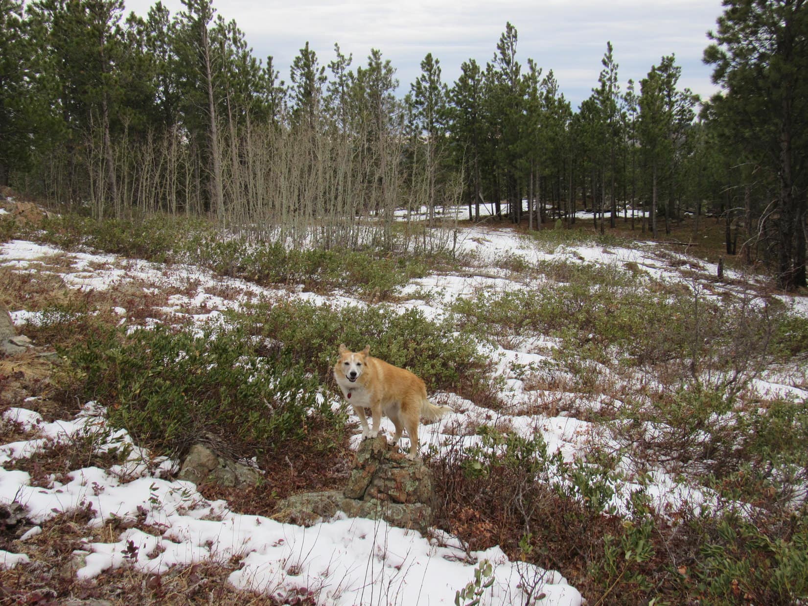
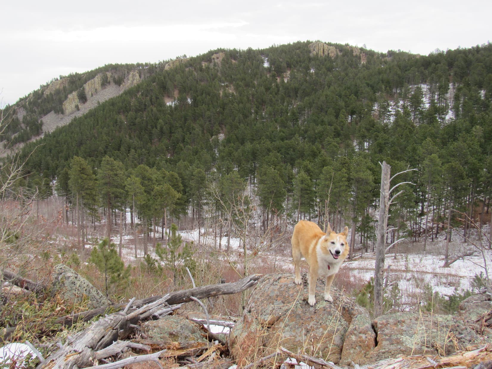
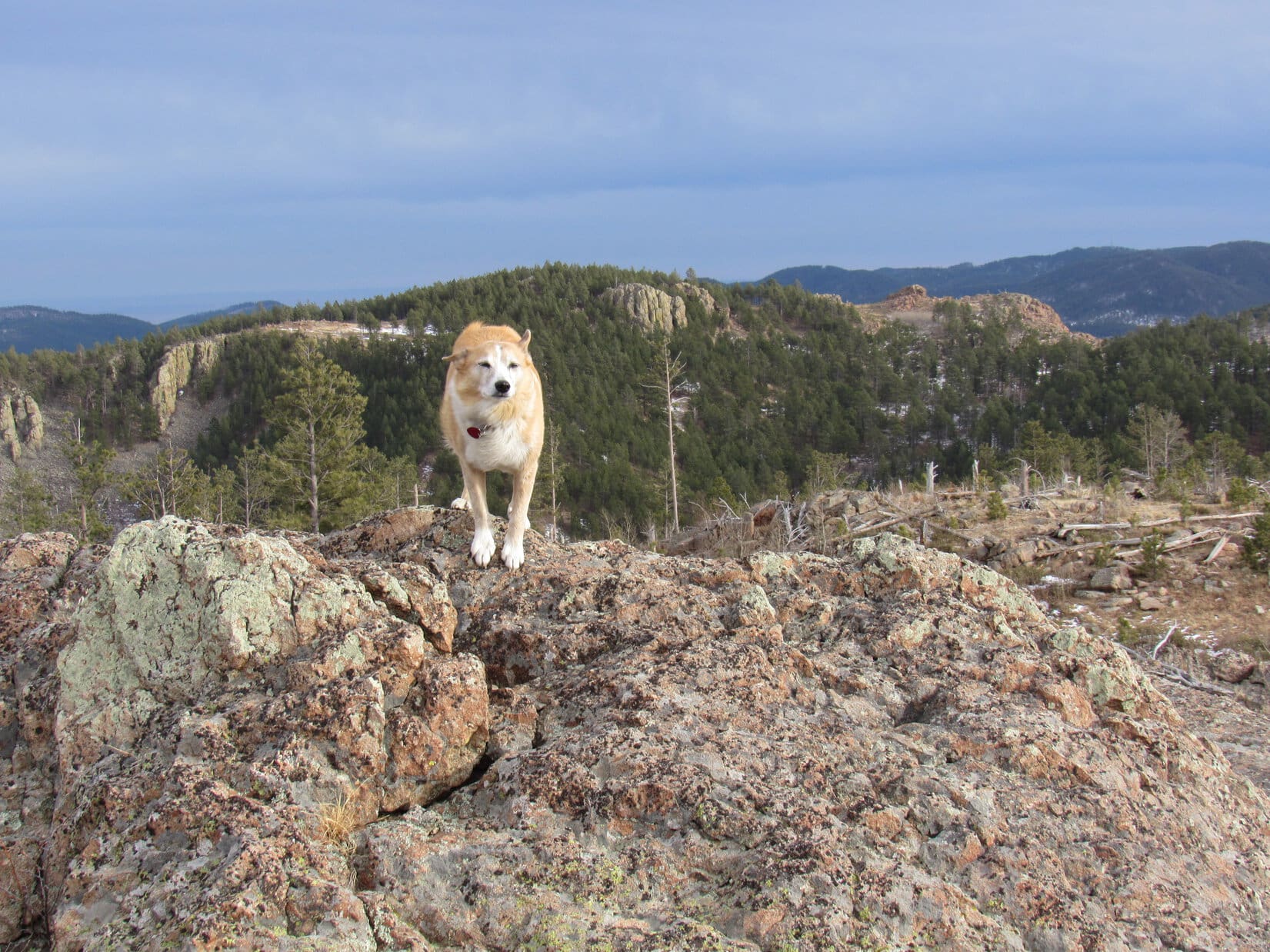
Beyond the dog hairs, SPHP was able to make much better progress.   A gradual climb resumed, which led to a big clearing full of snow.  Parts of the upper regions of Pillar Peak were now in sight ahead.  From here, Pillar Peak looked like just a couple of forested hills.

Continuing S in a somewhat more open forest. Photo looks S.
Pillar Peak (E summit L, true summit R) from the clearing. Photo looks SSW.

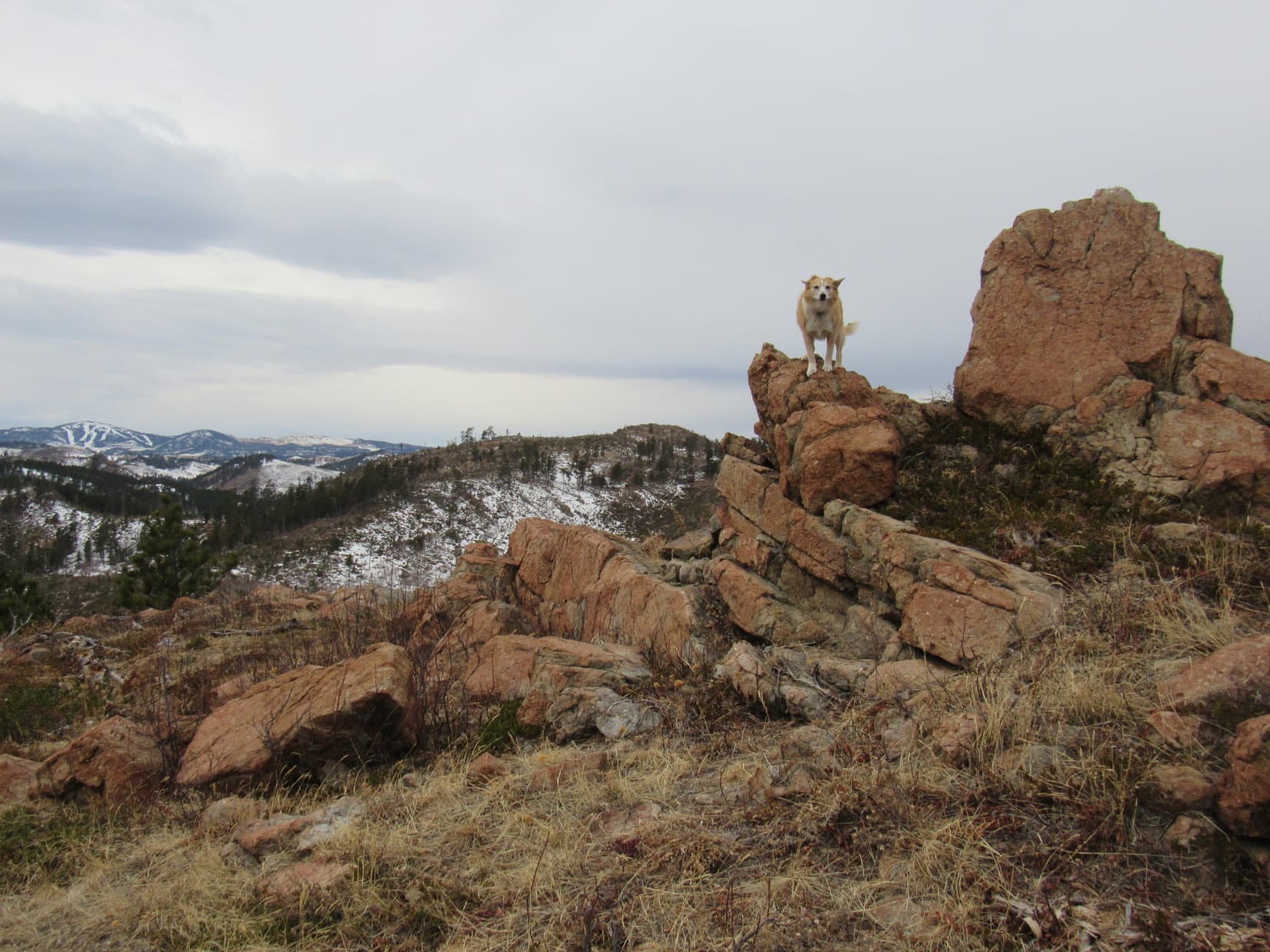
Avoiding the snow as much as possible, Lupe continued S along the edge of the clearing heading toward Pillar Peak’s E summit.  The rate of climb began increasing again.  After gaining a few hundred feet of elevation, the Carolina Dog reached a drop-off along the E side of the mountain.  From a big snowbank, she now had a much better view of the E summit than the one she’d had from the clearing.

Beyond the snowy clearing, heading for Pillar Peak’s E summit. Photo looks S.
Closing in on the E summit (Center). Photo looks SSW.

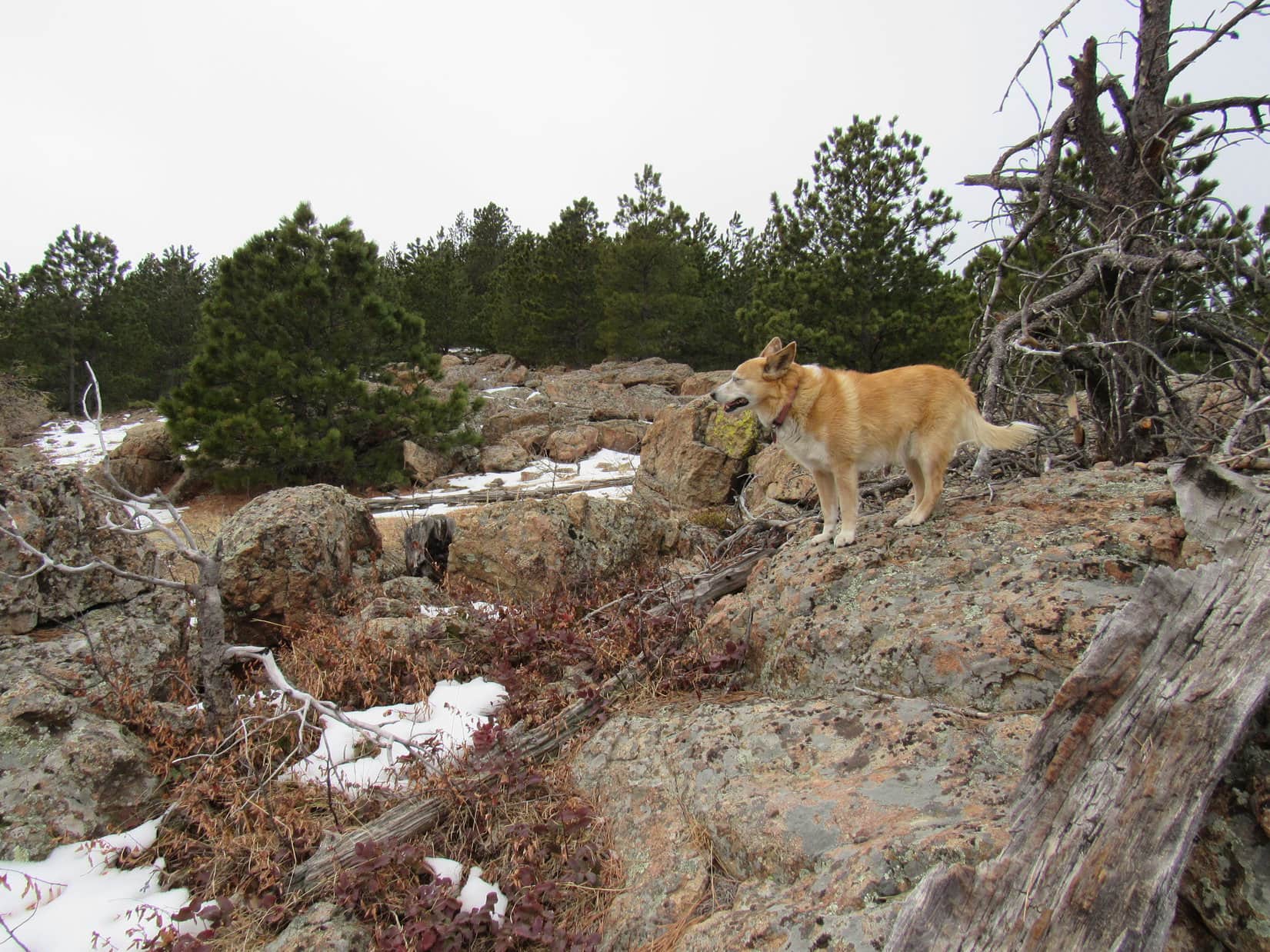
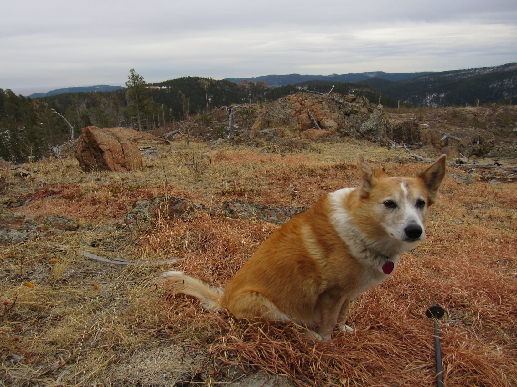
The E summit wasn’t much farther or higher now.  Swinging around to the SW to avoid most of the snow along the edge of the mountain, there was quite a bit of deadfall to contend with.  The discovery of a deer skull was of interest to the American Dingo.  SPHP preferred the view of Peak 5400 across the deep valley to the SE.

A bit closer to Pillar Peak’s E summit (Center). Photo looks SSW.
The intriguing deer skull.
Peak 5400 (R). Lupe had been there a year and 2 days ago. Photo looks SE.

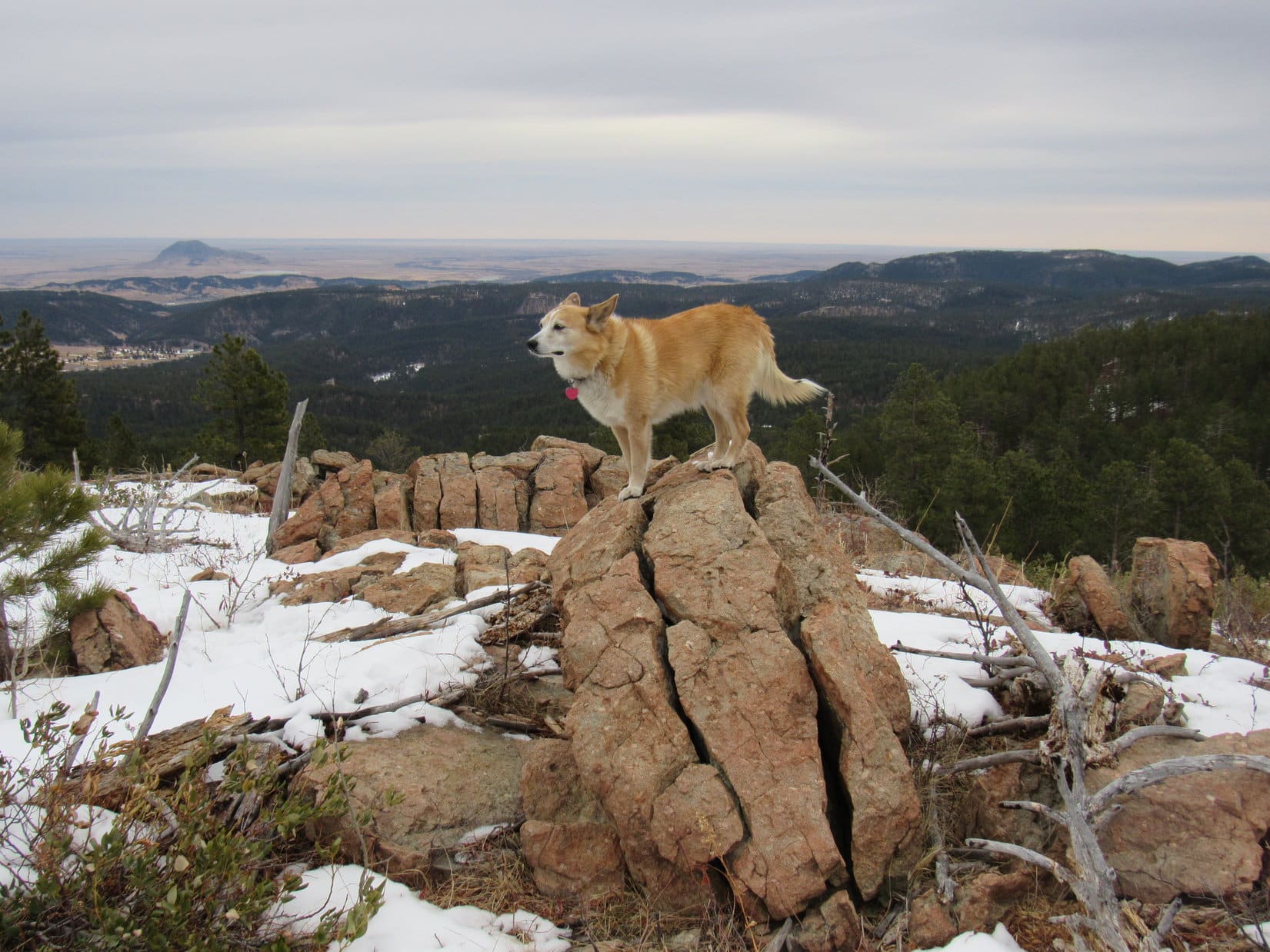
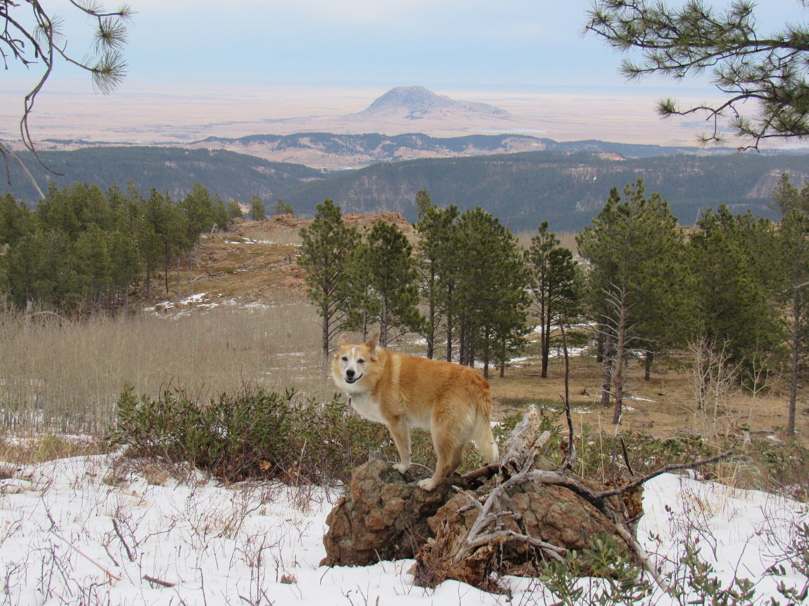
A final short, steep climb got Lupe up to the E summit region.  Where she first reached it, she enjoyed a nice, distant view of Bear Butte (4,422 ft.) off to the NE.

Bear Butte (R of Center) out on the prairie beyond the Black Hills. Photo looks NE.

The actual E summit was only a short uphill stroll from this viewpoint.  Only took a minute or two to get there.

Almost there! Pillar Peak’s E summit (Center). Photo looks SW.
On Pillar Peak’s E summit. Photo looks S.

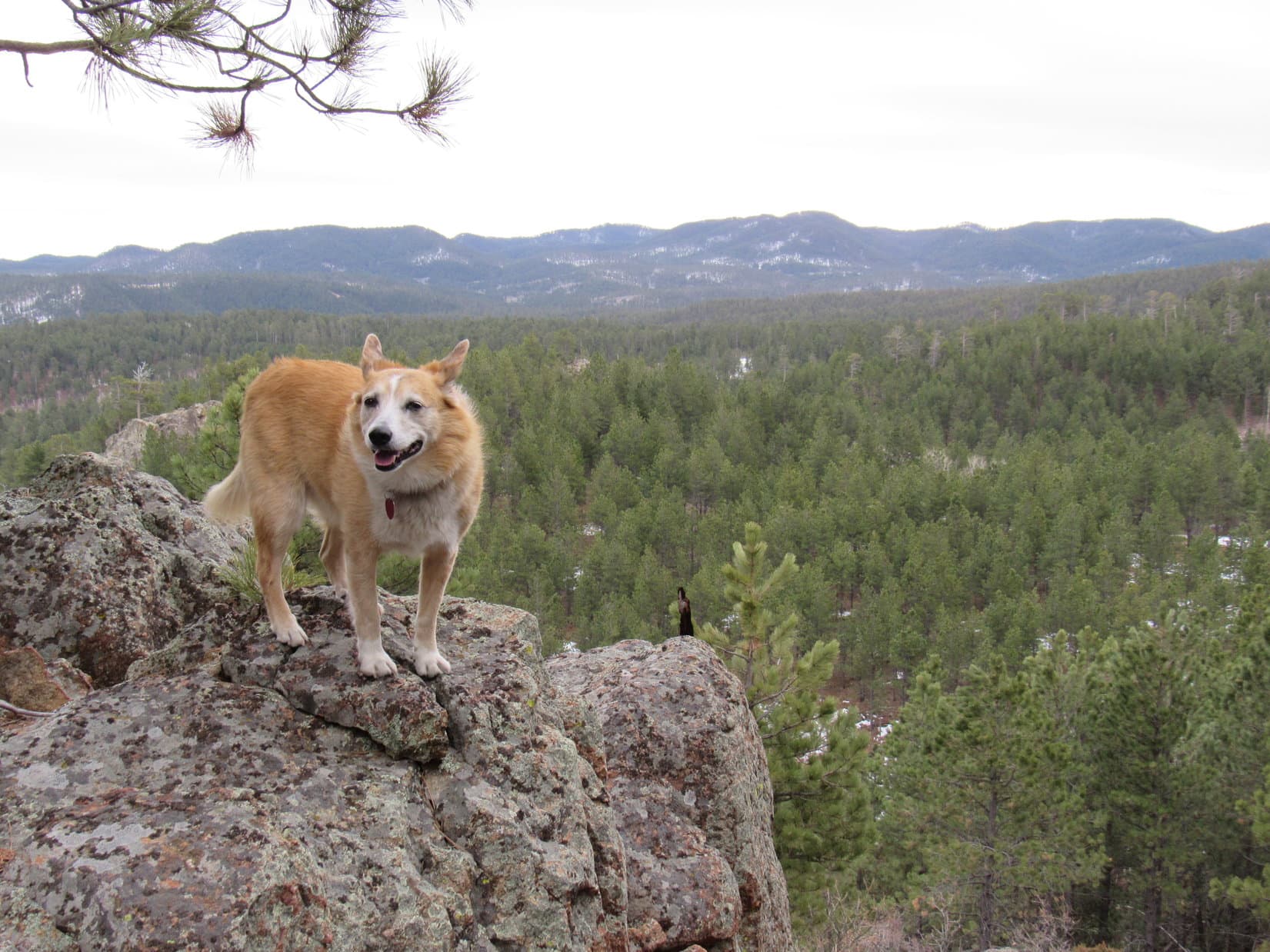
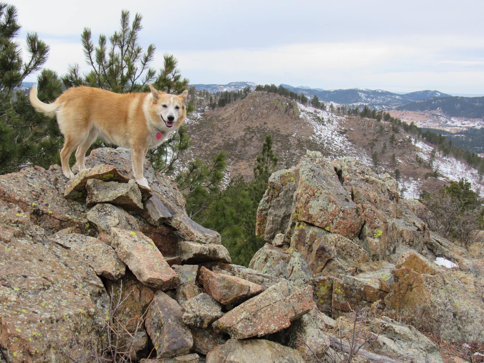
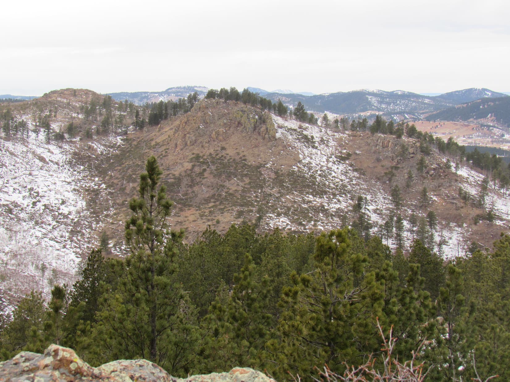
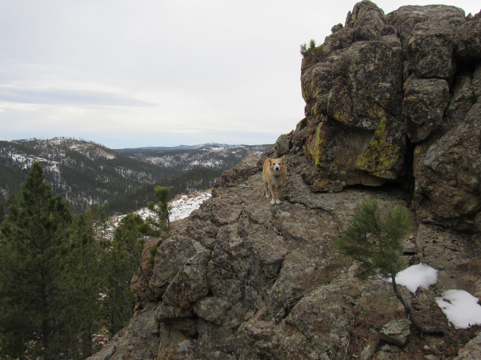
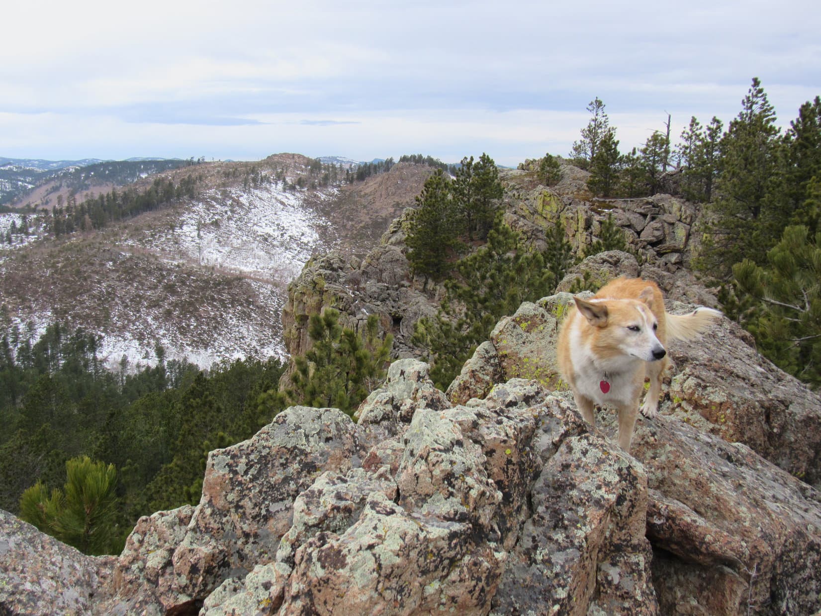
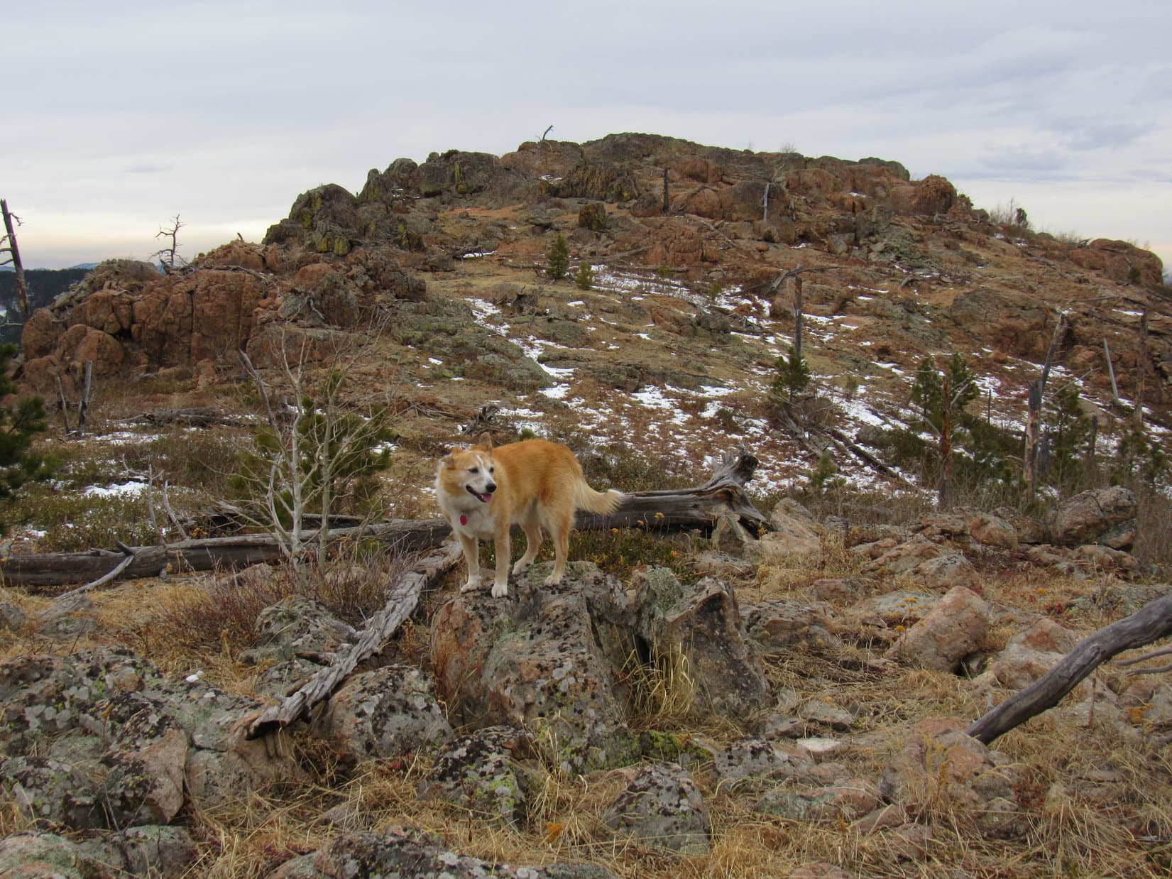
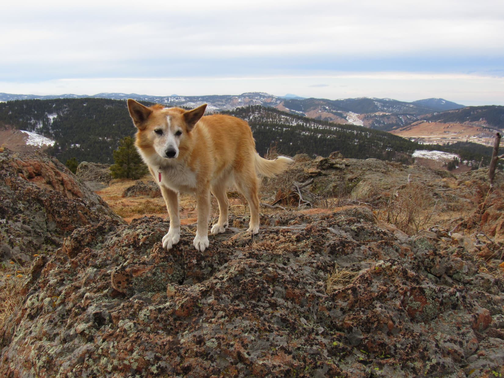
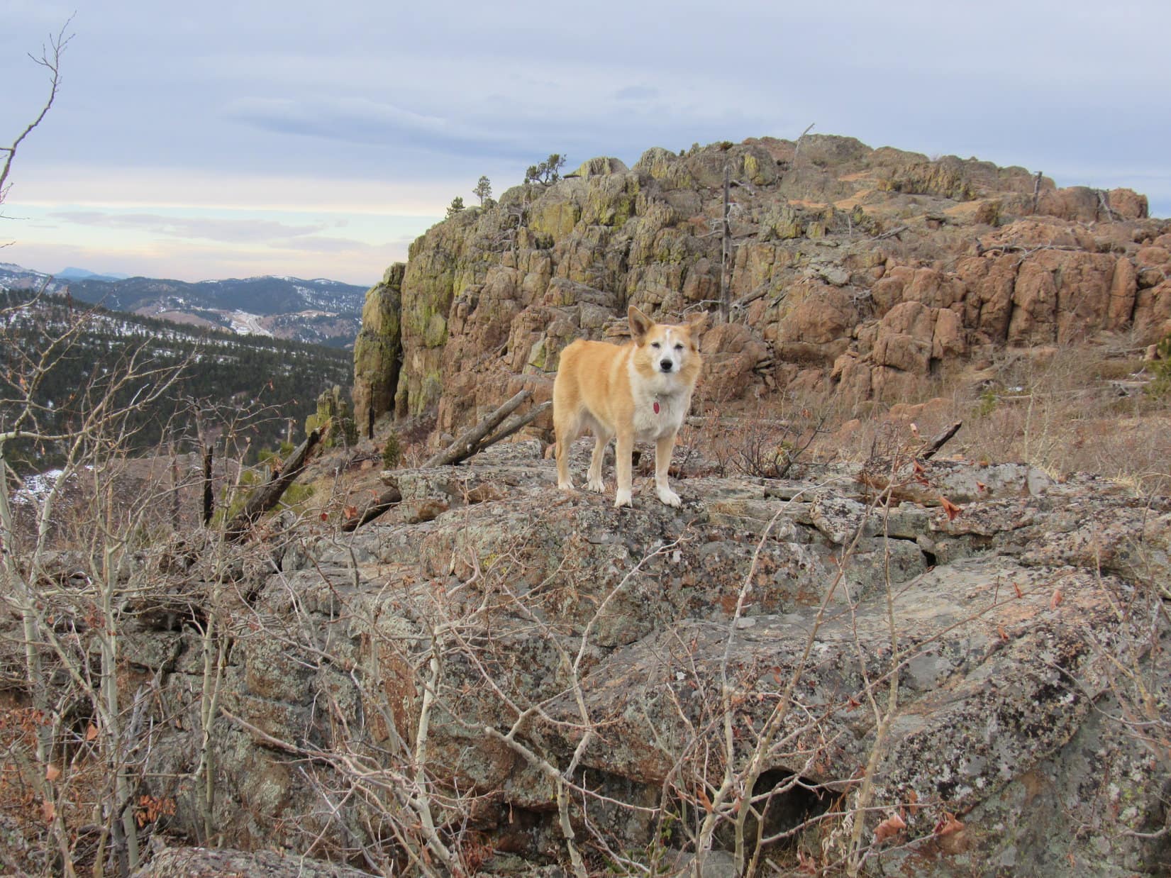
1:24 PM, Pillar Peak E summit – Although Lupe had been to Pillar Peak on 3 prior occasions, this was the first time she had ever visited the E summit, which had remained a mystery.  Now the Carolina Dog stood on the highest boulder among a collection of others along the edge beneath a sullen sky.  Hidden by pines, Pillar Peak’s true summit wasn’t in view from here, but Loop enjoyed an open panorama from the S all the way around to Bear Butte to the NE.

Bear Butte (L) from the E summit. Photo looks NE.

Wow!  This is sweet, SPHP.  What a great view of Peak 5400 across the valley!

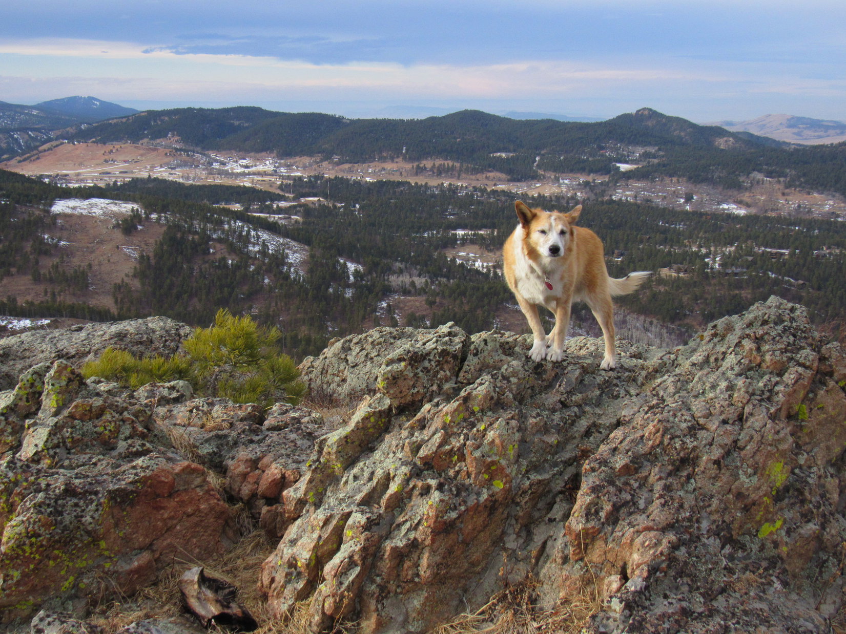
Glad we came here, Loopster!  Pillar Peak’s E summit really is pretty cool.  Always wondered what it was like.  See that road down in the valley?  We’ll be taking it on our way back to the trailhead later on.

Peak 5400 (Center). Photo looks ESE.

This is already better than a lot of hills we climb in the Black Hills, SPHP.  We ought to celebrate!

Uh-huh!  By which you mean, we ought to share chocolate coconut bar, I presume, conniving Dingo!

The thought did cross my mind, SPHP.  You wouldn’t happen to have one in the pack, would you?

SPHP did.  Sitting down together on a bed of pine needles next to the boulders, the Carolina Dog’s wish came true.  SPHP stroked her soft ears.

I like this spot, Loop.  Let’s just hang out here for 10 minutes, take a break.

It was a nice, relaxing time together, but 10 minutes shot by like nothing at all.  Eh, maybe 15?

OK, time to finish this.  To the true summit, Loop!  Onward!  Puppy, ho!

Leaving Pillar Peak’s E summit. Photo looks ENE.

The true summit wasn’t far away at all, no more than 0.2 mile.  Lupe lost maybe 60 feet of elevation going down to the broad saddle leading to it, then began an easy climb.

In the saddle leading to the true summit (R). Photo looks W.

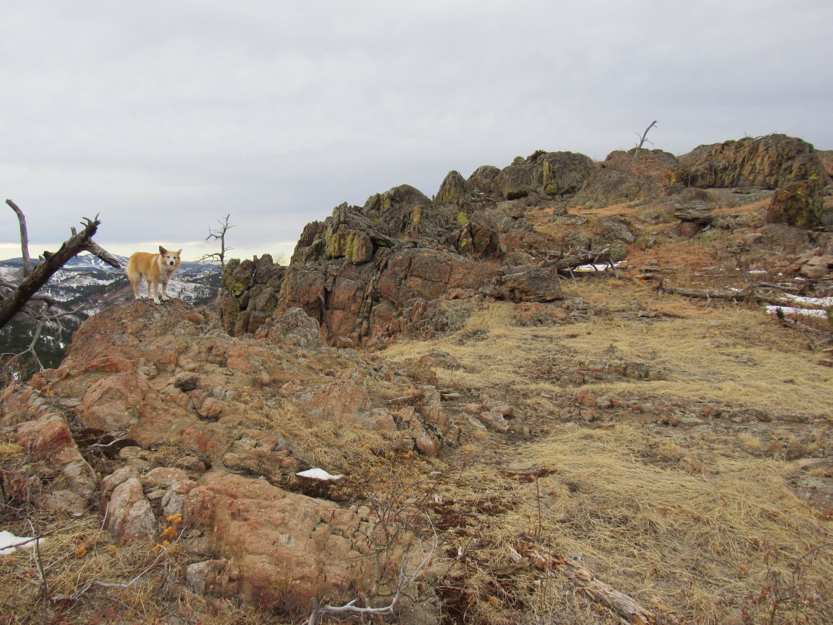
Having been here before, the American Dingo knew what to expect.  Long ago, fire must have swept over Pillar Peak’s true summit region.  Surprisingly little remained of any dead trees.  This made Pillar Peak a more striking summit and an excellent viewpoint.

Approaching Pillar Peak’s true summit. Photo looks WNW.

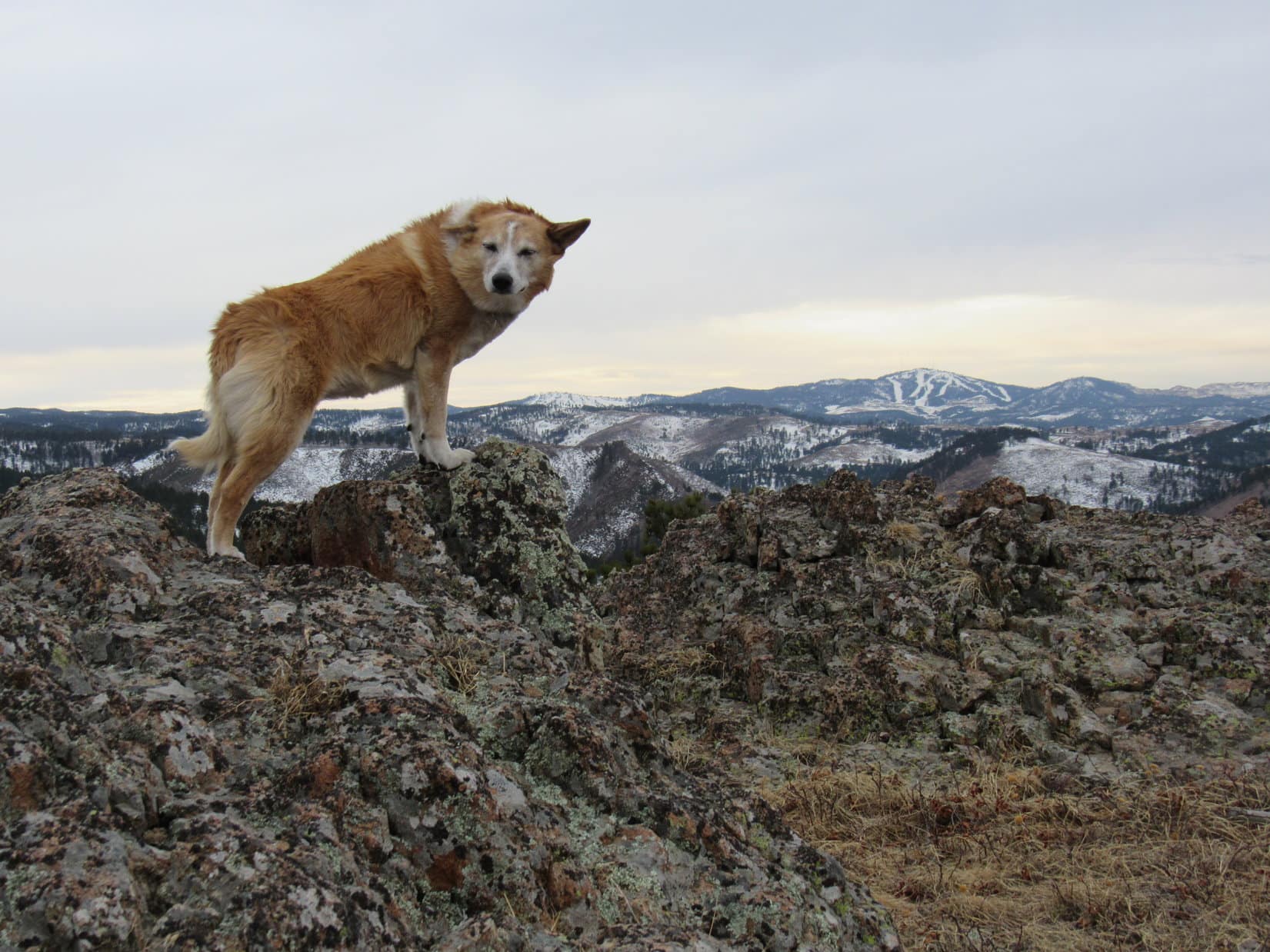
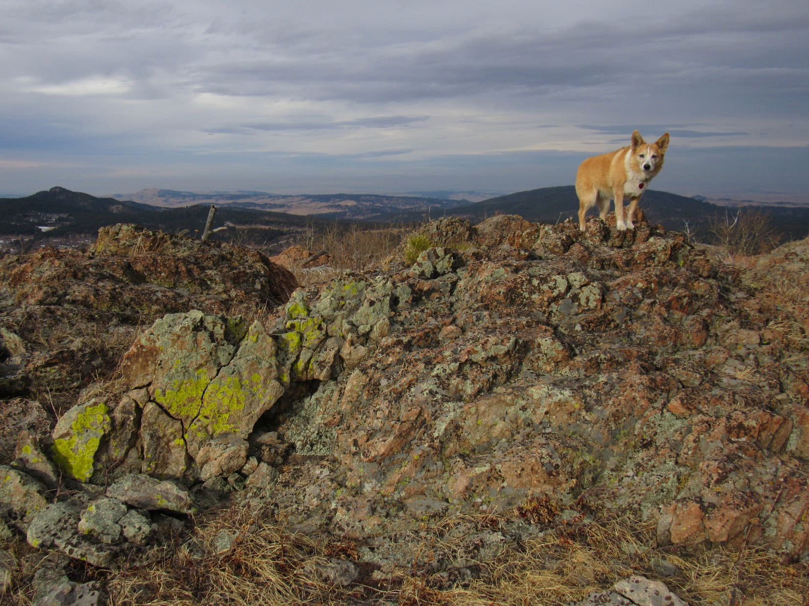
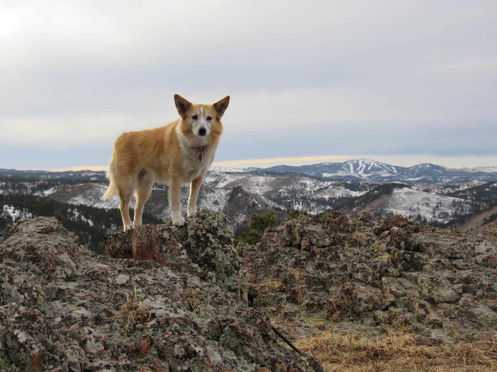
1:54 PM, 43ºF, Pillar Peak (5,469 ft.) –  Pillar Peak’s true summit was an interesting place, and a bit unusual for the Black Hills.  A maze of rock formations a few feet high were separated by lanes of grass resembling intentionally designed walkways.  Lupe easily leapt up onto the highest rock, completing her 4th ascent.

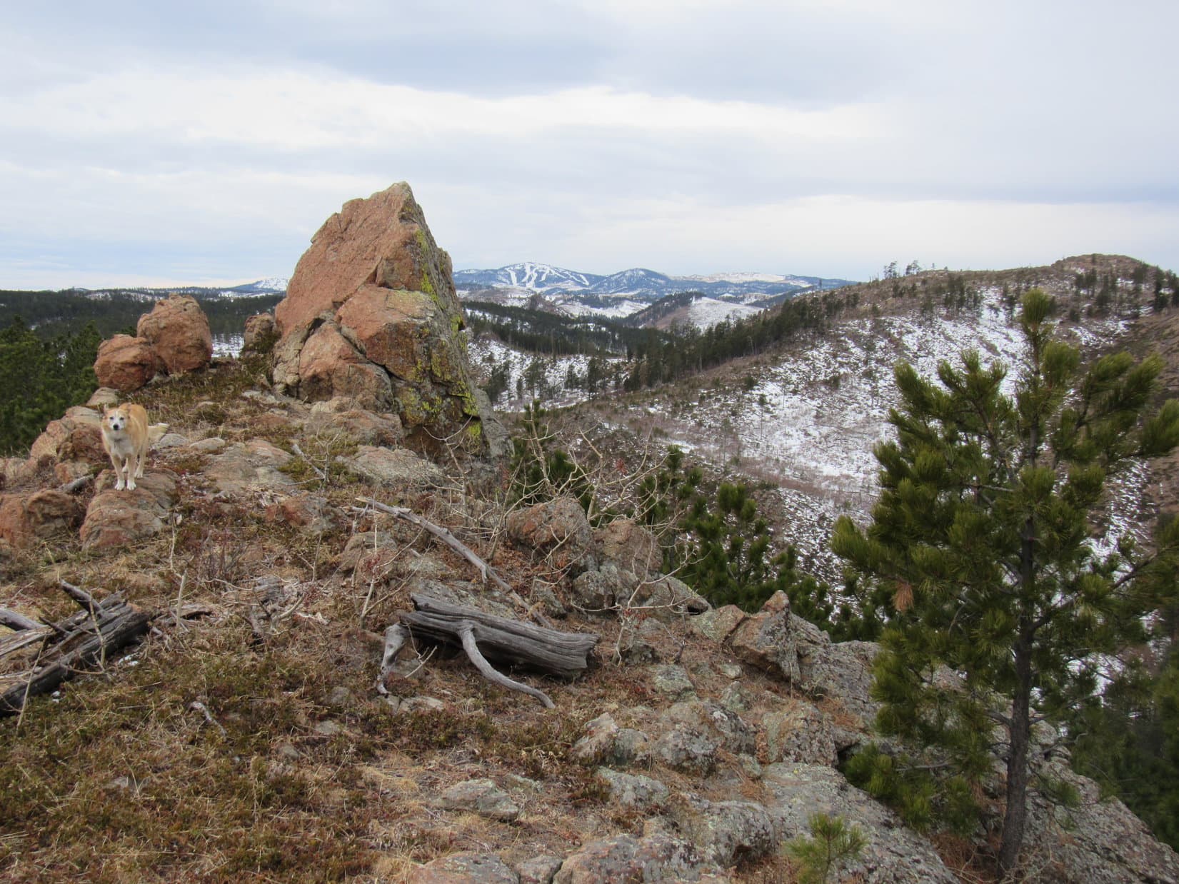
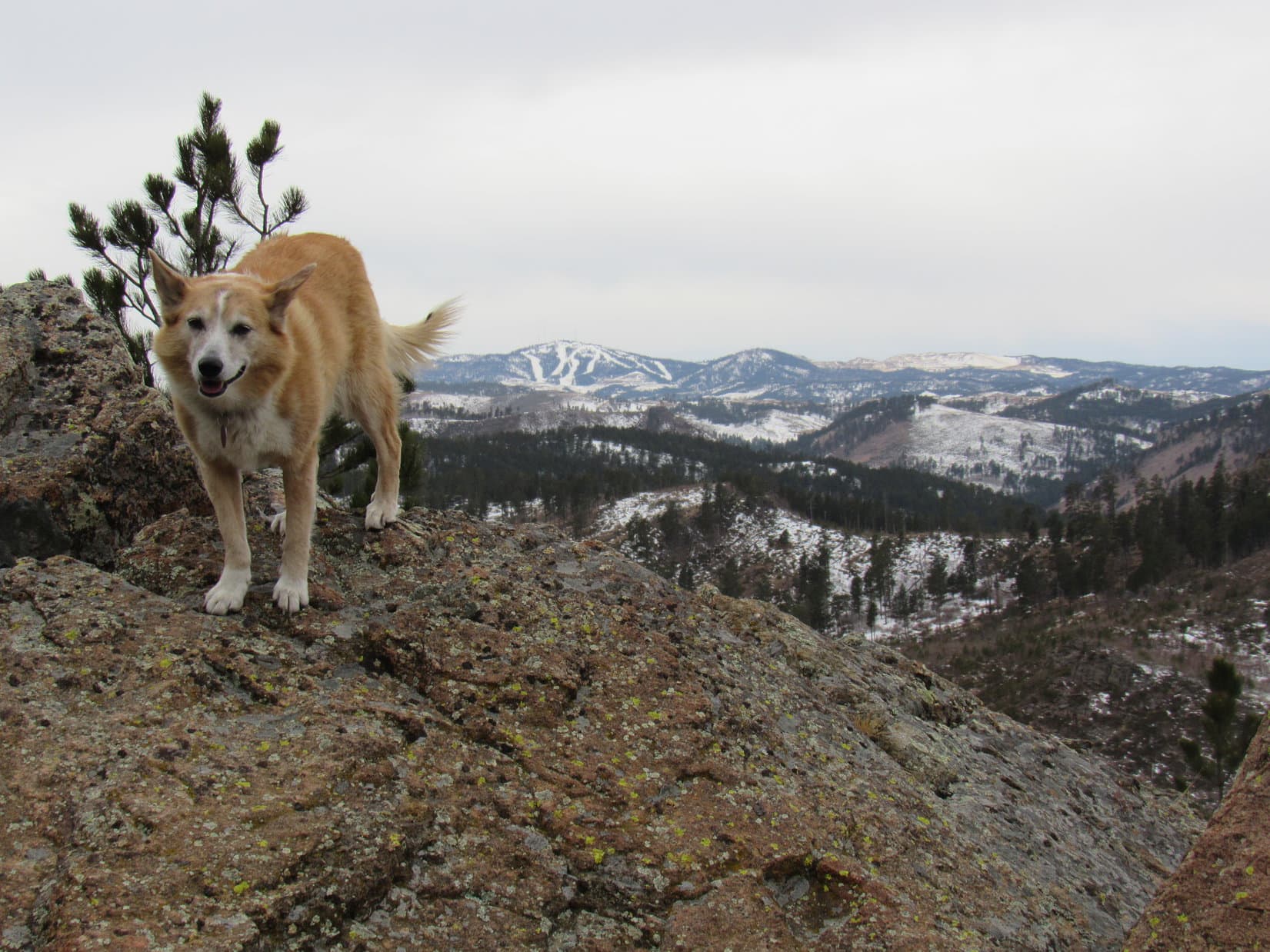
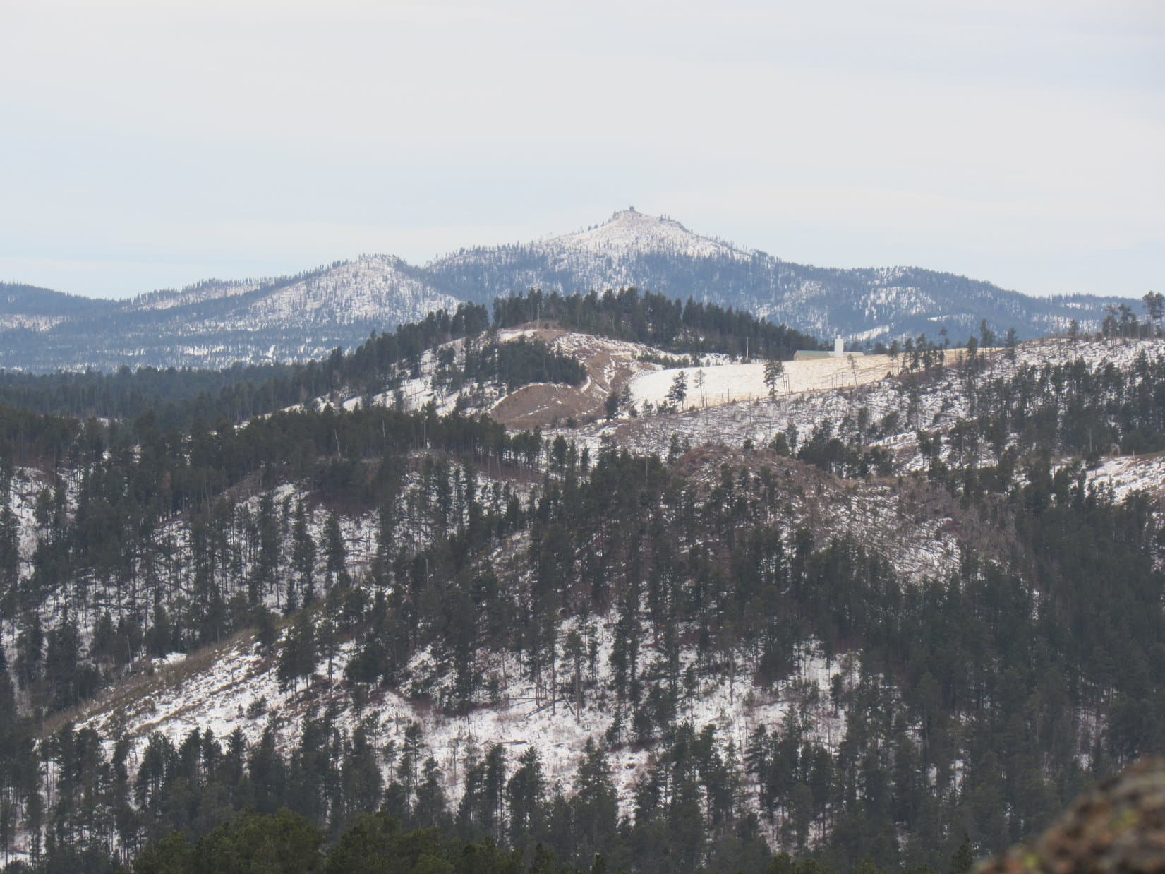
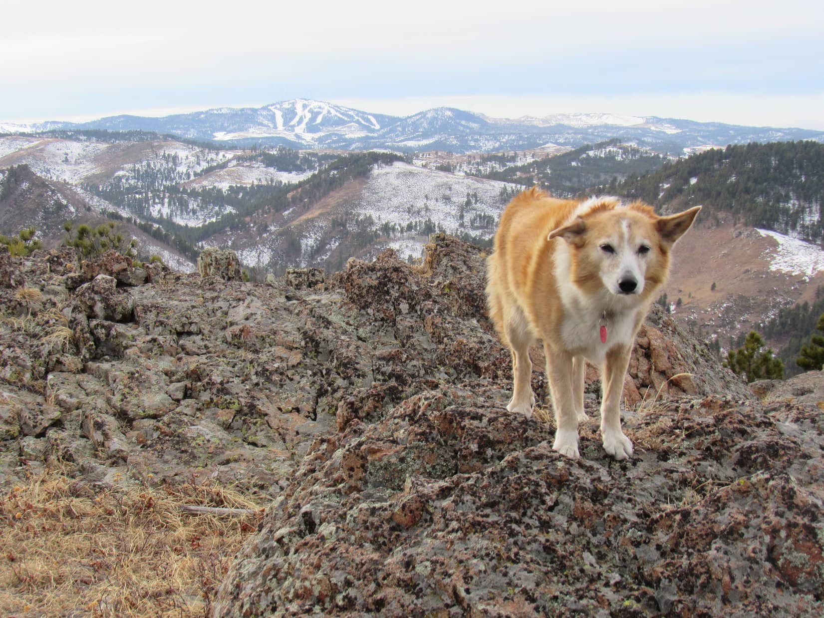
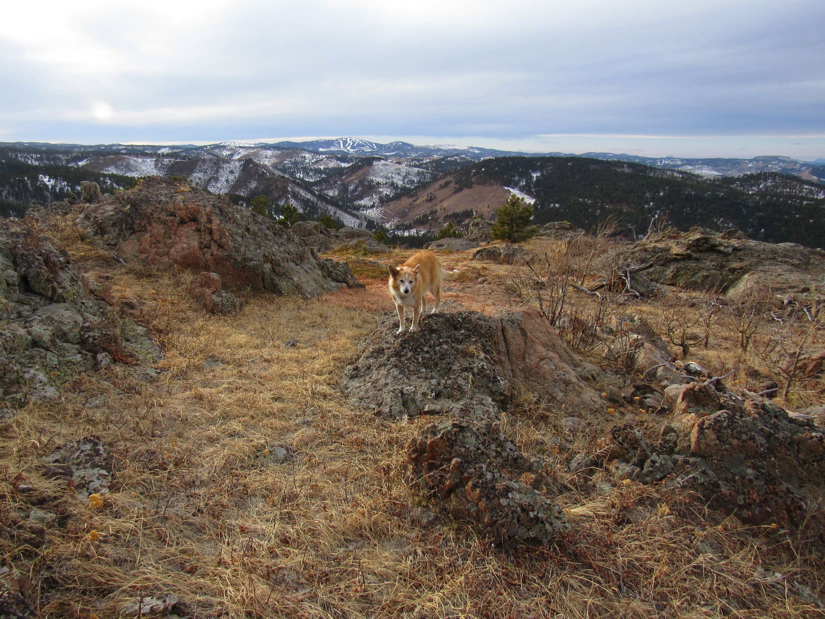
The premier view was of Terry Peak (7,064 ft.) with its ski runs off to the SW.  With snow on the hills, it stood out particularly well today.

At the true summit. Terry Peak (R) in the distance. Photo looks SW.

A lot to see in other directions, too, but all that could wait.  Loopster had her whole traditional summit hour to spend up here.  First it was time for a longer rest break.  And lunch!  Sitting down on the dry grass near the true summit, SPHP brought out another much anticipated chocolate coconut bar, Taste of the Wild, water, and an apple.

Lunch time on Pillar Peak. Dome Mountain (L), Terry Peak (R). Photo looks SW.

The second chocolate coconut bar of the day had already bit the dust, and the Taste of the Wild was still in the process of being gobbled up, when a sudden breeze arose from out of the SW.  Hadn’t been any wind at all when Lupe first got here only 5 or 10 minutes ago.

We better finish eating pretty quick, Looper.  Custer Peak (6,804 ft.) was in sight only moments ago.  Now I don’t see it at all.  Weather’s coming in!

Probably just a snow shower that wouldn’t amount to much of anything.  Hadn’t been much precipitation expected in the forecast, but SPHP kept an eye on it while munching on that apple.  Meanwhile, Lupe finished her Taste of the Wild.

Soon the breeze felt colder.  Deer Mountain (6,652 ft.) was gone now, too, and it looked like snow was starting to envelop Terry Peak, as well.

If you want any pictures, SPHP, maybe we better start getting them now?

We think alike, Looper!  Come on!  Time for your Pillar Peak summit tour!

Since the snow shower was coming from out of the SW, concentrating on Terry Peak, Bald Mountain (6,617 ft.), Dome Mountain (5,512 ft.), and Bear Den Mountain (5,642 ft.) all to the S or W first made sense.

Terry Peak (Center), Bald Mountain (R of Center). Photo looks SW with help from the telephoto lens.
Bear Den Mountain (R). Photo looks SSE.

Other directions wouldn’t be affected by the snow shower for a while yet.  Flat-topped Mount Theodore Roosevelt (5,680 ft.) was visible to the NW, with both Spearfish Peak (5,800 ft.) and Crow Peak (5,787 ft.) barely in sight a little to the R of it.

Mount Theodore Roosevelt (L), Spearfish Peak and Crow Peak (L of Center), and Green Mountain (R) all on the horizon. Photo looks NW.
Mount Theodore Roosevelt (L), Spearfish Peak (R) and Crow Peak (far R). Photo looks NW with lots of help from the telephoto lens.

More directly N, Whitewood Peak (5,120 ft.) stood out among lower hills.  A little more to the E, Crook Mountain (4930 ft.) looked like just a large, low, forested dome.  Way out on the prairie far beyond it, two little blips were on the horizon.  Probably Castle Rock Butte (3,768 ft.), but might have been Deers Ears Butte (3,438 ft.).

Whitewood Peak (L of Center). Photo looks NNW.
Crook Mountain (Center). Photo looks NNE.

And of course, Bear Butte (4,422 ft.) was easily recognizable to the NE.

Bear Butte (Center) in the distance. Photo looks NE.
Bear Butte (L of Center). Photo looks NE with help from the telephoto lens.

The W end of the summit region was 20 feet lower, and featured a big grassy area.  Loop and SPHP took turns going down there.

Lupe still up on top. Photo looks E.
Down in the big grassy area. Terry Peak (L), Mount Theodore Roosevelt (far R). Photo looks WSW.

The wind blew harder, the temperature dropped.  Wouldn’t be long now before the snow shower arrived.

When it hit, it was a nothingburger.  Middle of January, and it wasn’t even snow!  Rain fell for a few minutes, and that was it.  Incredible!  The “storm” passed, and Terry Peak came back into view.  Lupe watched it all happen from the highest rock formation on Pillar Peak.

Back at the true summit. Terry Peak (R). Photo looks SW.
Carolina Dog storm survivor. All 10 drops! Photo looks SW.

2:54 PM, 39ºF, Pillar Peak – An hour had gone by already!  Time to say good-bye to Pillar Peak once again.  SPHP started down first.  Loop was supposed to wait up top for the signal, but when SPHP looked back, the American Dingo was already on her way!

Leaving the summit. Photo looks NW.

Couldn’t wait for a final summit shot, aye, Looper?

You’ve got plenty already, SPHP!  I’m ready for more exploring!

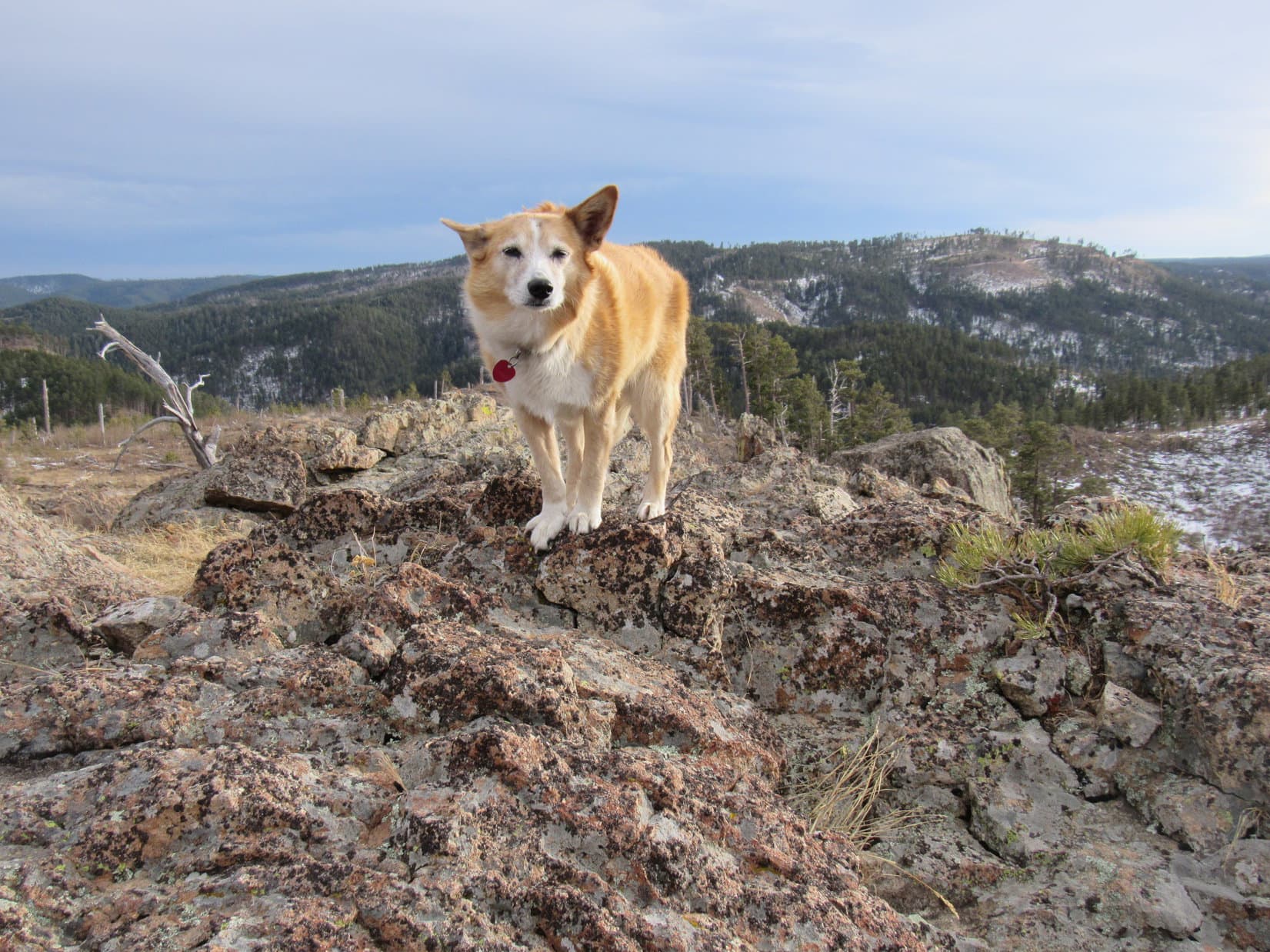
The Carolina Dog was more cooperative at a few more scenic spots as she left the summit region.

Deer Mountain (far L), Terry Peak (L), Bald Mountain (L of Center). Photo looks WSW.
Crook Mountain (R of Center). Photo looks NNE.
Leaving Pillar Peak (Center). Photo looks NNE.

Then it was down the steep, rocky S slope to a saddle where Lupe turned SE on a very snowy romp down to USFS Road No. 172.1H.  The road was flat as it went a short distance E to another saddle SE of Pillar Peak.

Lupe had been here before.  Up a little rise to get over the pass, and with only relatively minor exceptions, it was downhill all the rest of the way.

Heading down the valley between Pillar Peak and Peak 5400. Photo looks NNE.

4:50 PM, 37ºF, Camp 5 Road trailhead – Just as Lupe reached the RAV4, it started to rain again.  The Carolina Dog hopped in before she even got damp.

Pillar Peak was awesome, as always SPHP, but we never did get to Peak 5452.  Wonder if we ever will?

Oh, I suspect we will, Looper, but don’t think we’ll try it again until the snow melts.  Maybe in 2 or 3 months?  At least we saw it today.

We did?  When?  You never pointed it out!

It was there, Loop.  You saw it from Pillar Peak.  Big forested hill only 1.25 miles due W, but it didn’t really stand out.  Don’t think we’ll see much more than trees even if we do get there eventually.

We’re still going to pick it off, SPHP!  I’m going to get all these Black Hills Lists of John 300+ foot prominence peaks done, or at least all the ones we can actually climb.

That’s the spirit, Loopster!  We’ll try a different Lists of John peak next time out.  Maybe we’ll have better luck then?

On Pillar Peak, Black Hills of South Dakota 1-15-23. Peak 5452 beyond Lupe.

Links:

Next Black Hills Expedition                   Prior Black Hills Expedition

Want more Lupe adventures?  Check out Lupe’s Black Hills, SD & WY Expeditions Adventure Index, Master Adventure Index, or subscribe free to new Lupe adventures!

Black Hills, SD Expedition No. 262 – Peak 5400 & Pillar Peak (1-13-21)

9:03 AM, 37ºF, Camp 5 Road trailhead off Hwy 14A W of Boulder Park – Overcast, but warm for the middle of January.  Last warm day before a giant Canadian air mass was supposed to come howling in out of the N.  Dead calm at the moment, and about time to get New Year 2021 off to a good start!  The American Dingo was rarin’ to go!

Lupe had been here once before, years ago.  SPHP couldn’t remember exactly when, but the big, empty trailhead seemed completely familiar.  Anxious to get underway, Loop set off heading SE down Camp 5 Road.  She soon crossed a dry wash at the bottom of the Box Elder Creek drainage.  Camp 5 Road then curved SW on a short uphill stretch, before leveling out at a meadow 0.25 mile from the trailhead.  Roads branched out in various directions.

This place seemed familiar, too.

At the Camp 5 Road trailhead ready for the first Black Hills, SD expedition of 2021!
Starting out along Camp 5 Road, aka USFS Road No. 172 at this point.
Approaching the Box Elder Creek drainage. Photo looks S.

Camp 5 Road resumed its SE course here, branching off to the L.  Lost Gulch Road continued straight ahead, while a lesser road curved off to the NW a bit beyond this junction.

Which way, SPHP?  Where are we going?

Straight ahead, Loop!  Lost Gulch Road!  Thought we’d kick off 2021 with a mountain you’ve never been to before, mighty Peak 5400!

What’s so mighty about it?

Who knows?  We’ll find out when we get there.  Lists of John says it has 360 feet of prominence, which is about all I know about it, unless you remember what it looks like?

Remember what it looks like?  Have we seen it before, SPHP?

Yeah, a long time ago, from Pillar Peak (5,469 ft.).

In the meadow where Camp 5 Road forks off to the L. Lupe continued straight on Lost Gulch Road, aka USFS Road No. 172.1. Photo looks SW.

Pillar Peak (5,469 ft.)!  Pillar Peak had been ages ago!  Well, maybe just one age ago.  Lupe had first climbed Pillar Peak an overcast day way back in February, 2015.  Pillar Peak had the distinction of being the first post SPHP had ever written for The (Mostly) True Adventures of Lupe.

Of course, Lupe had already gotten up to Black Hills expedition No. 120 by then, so there had been an illustrious, still little known prior age, too.

Lost Gulch Road curved W heading up into a forested valley.  Had Loop been this way before?  SPHP was almost certain she had, but nothing along in here rang a bell.  After going 0.5 mile W, Lost Gulch Road curved S (L) at a snowy junction with USFS Road No. 804.

0.25 mile farther, and Lost Gulch Road bent E as it passed a ravine.  SPHP stopped to check the map.  Yeah, this must be it.  Time to leave the road.  Lupe headed SW up the SE side of the ravine.

About to leave Lost Gulch Road. Photo looks SSW.
Heading up the SE side of the ravine. Photo looks WSW.

The Carolina Dog didn’t get far at all before reaching a narrow, deep side ravine coming down from the S.  Since Loop was already well above the bottom of this drainage, it was blocking further advance SW.  Instead of descending into it, Lupe turned S climbing along the side of the steep hill E of this new ravine.

No point in going all the way to the top of this first hill, though.  What Lupe really needed was to get over to the W side of the ravine.  Avoiding additional elevation gain, Loop continued S on a steep slope littered with loose pine needles. The ravine soon rose to Loopster’s level, permitting her to follow the bottom of it higher.

Going up the narrow side ravine. Photo looks S.

Loopster got only a little higher before the ravine widened and started leveling out to some degree.  She could easily continue SW from here, and began a moderately steep climb.  Before long a clearing with a bit of a view appeared.  Crook Mountain (4,930 ft.) was in sight off to the N.

At the first viewpoint. Crook Mountain (L). Photo looks NNE.

Lupe was now somewhere ENE of unseen HP5082 way out near the far NE end of Peak 5400’s long N ridge.  Continuing SW, she soon came to the S edge of the ridge.  Veteran Peak (5,333 ft.) was visible among other hills to the SE.

Veteran Peak (Center) on the horizon. Photo looks SE.

Continuing W along the S or SE edge of the ridge, Lupe came to a series of rock outcroppings providing viewpoints.  She caught a glimpse of Bear Butte (4,422 ft.), and shortly after that a half-way decent look at Peak 5400 itself.

Bear Butte (Center). Photo looks NE with help from the telephoto lens.
Hey! We’re making progress! Peak 5400 dead ahead! Photo looks SW.

Although Peak 5400’s summit was still 0.67 mile away, Lupe had already gained most of the elevation she needed to in order to get there.  As a result, the remaining ridge trek was pretty easy.  Surprisingly scenic, too!  Lots of nice views to enjoy from interesting rock formations along the SE edge.  Even the middle of the ridge was often much more open than SPHP had been anticipating.

Somewhere along the way, Lupe passed or went over HP5082, but exactly when and where that occurred wasn’t entirely clear.

At a rocky clearing. Photo looks W.
Another glimpse of Bear Butte (Center). Photo looks NE.
Approaching one of the larger rock formations. Photo looks SW.

As the ridge turned S, it broadened out and the rate of climb decreased.  Soon the forested summit came into sight beyond a big open region.

Getting close now! Photo looks S.
True summit dead ahead, somewhere up in the trees. Photo looks S.

Windy up here!  That Canadian air mass must be moving in sooner than expected.  Carolina Dogs don’t care much for wind, but the terrific views from Peak 5400 were so totally unexpected that Lupe was willing to put up with it to some extent.

The panorama encompassing Bear Butte (4,422 ft.), Deadman Mountain (4,933 ft.), and the prairies E of the Black Hills was incredible, but Pillar Peak (5,469 ft.) and Terry Peak (7,064 ft.) off to the W were even more eye-catching.

Bear Butte (L) and Deadman Mountain (R). Photo looks ENE.
Hey, there’s Terry Peak (L) and our old friend, Pillar Peak (R)! Photo looks WSW.
Terry Peak (Center) and Pillar Peak (R). Photo looks WSW.
Hurry up and take the shot, SPHP! Before I get blown away would be nice! Terry Peak (L) and Pillar Peak (Center). Photo looks W.

Leaving the scenic, but annoyingly windy W edge of the mountain, Loop headed SE intent upon finding both shelter and Peak 5400’s true summit hidden somewhere not too far away in the pine forest.  SPHP figured the top would probably be just a big non-descript flat spot buried among the trees, but that turned out not to be the case at all.

The Carolina Dog didn’t have to go very far into the forest before the terrain sloped sharply up to a long, narrow ridge of rock.  Reaching it near its WNW end, Lupe immediately discovered a loose collection of rocks piled against a much bigger rock perched at a sharp slant.  On the other side was a precipitous 20 foot drop.

Although several stones along the crest of this minor ridge appeared almost as high, it was pretty clear that the American Dingo had already found the true summit of Peak 5400.

This is it! The top of Peak 5400! Photo looks WNW.

Not quite high enough to be above the treetops, the summit ridge did provide some protection from the wind, but it was still rather breezy.  Views were open to the N and W, but not to the S or E.  Nearby Pillar Peak and much more distant Terry Peak again stood out among many other hills and mountains in sight.

Finding a reasonably comfortable spot among the rocks, Lupe curled up on SPHP’s lap, enjoying a snack while taking it all in.

Pillar Peak (L) and in the foreground. Mount Theodore Roosevelt (5,680 ft.) (L of Center) in the distance. Photo looks WNW with help from the telephoto lens.
Terry Peak (Center). Photo looks WSW.
Peak 5400’s rocky summit ridge, which was roughly 200 feet long. Photo looks SE.

After nearly half an hour, Loopster was ready to move on.  There was more to Peak 5400 that she wanted to explore.  Traveling ESE along the summit ridge, she found a way down below the line of small cliffs, intent upon seeing what things looked like from down here.  Sniffing her way along the base of the cliffs, she discovered they were tallest toward the W and gradually petered out toward the E.

So this is what it’s like on the S side of the ridge! Photo looks WNW.

With the summit ridge more or less fully explored now, Lupe headed S across a snowy field full of bushes and young aspens.  Turning W, she quickly came to more rock formations.  Custer Peak (6,804 ft.) was visible on the horizon.

Fair amount of territory to explore up here on Peak 5400! Let’s check it out! Photo looks SE.
Custer Peak (Center) on the horizon. Bear Den Mountain (5,642 ft.) (L). Photo looks SW.
Zoomed in a little more.
Custer Peak (Center). Photo looks SW with lots of help from the telephoto lens.

A 15 foot scramble up onto the top of this rock formation revealed that Lupe was now perched along the upper rim of a line of much taller cliffs offering a slightly different perspective on Pillar Peak.

Pillar Peak (L of Center) from another line of cliffs. Photo looks WNW.

There was even more to see!  Exploring back to the E now, Lupe came to yet another sweet view of Bear Butte (4,422 ft.).

Mighty nice, aye? Bear Butte (Center). Photo looks NE.

Peak 5400’s SW ridge would get Lupe over to Pillar Peak, so she decided to explore it, too.  Passing more nifty rock formations along the way, the Carolina Dog eventually made it to USFS Road No. 804, which went over the saddle leading to Pillar Peak.

Cool rock formations near the start of the SW ridge. Photo looks SSE.
At USFS Road No. 804 in the saddle leading to Pillar Peak. Photo looks NW.

Crossing the road, Lupe started up Pillar Peak’s SE ridge.  After reaching an initial high point, she paused for a look back at Peak 5400.

That’s where we were! Peak 5400 right behind me! Photo looks E.

Pillar Peak’s SE ridge was a lot different than Peak 5400’s SW ridge.  Instead of easily avoided rock formations and a trek through a snowy pine forest, Lupe had to force her way through dense stands of bushes, young aspens, rotting deadfall, and a jumble of medium-sized rocks.

The slope was easy enough at first, leveled out for a bit, then steepened.  Loop even had to do a bit of scrambling before she finally reached more open territory where things got easier again.  A cake walk stroll up a gentle slope of small bushes and minor deadfall got her to the top of a rocky knoll.  Pillar Peak’s summit was now in sight again just a few hundred feet away.

Approaching Pillar Peak’s summit. Photo looks NW.

Nearly 6 years after climbing Pillar Peak (5,469 ft.) for the first time, Lupe again stood at the true summit.  Nothing to block the views in any direction up here, but the Carolina Dog wasn’t having much fun.  Braced against a 20+ mph NW wind, she just wanted SPHP to hurry up and take that blasted photo!

Terry Peak (R) from the true summit of Pillar Peak. Photo looks SW.

Time for another break anyway.  After one quick shot, Loop and SPHP abandoned the top of the mountain, retreating 15 or 20 feet down the S side of the summit.  With a wall of granite to block the wind, conditions weren’t bad at all.  For a while, Lupe curled up on SPHP’s lap again, a couple of eagerly anticipated chocolate coconut bars making life sweet.

Out of the wind, thinking deep thoughts.
Wouldn’t happen to have any more chocolate coconut bars, would you, SPHP? Peak 5400 (L of Center). Photo looks ESE.

A pleasant break, but once supplies ran out, not much use in prolonging it.  The wind was only supposed to get worse, turning into a complete gale later this evening.  Pillar Peak was awesome, though!  The roomy summit region featured a maze of grassy lanes running between minor rock formations providing a variety of excellent vantage points.

So Looper wasn’t going to just cut and run.  Conditions would have to be worse than this for that to happen!  Instead, she returned to the summit, for at least one good look around.  The wind came in powerful sudden gusts, so she often really had to brace herself.

Looking NW.
The big view. Terry Peak (L of Center). Photo looks WSW.
Terry Peak (Center). Photo looks WSW with lots of help from the telephoto lens.
W end of Pillar Peak’s summit region. Terry Peak (Center) on the horizon. Photo looks WSW.

To the N, Whitewood Peak (5,120 ft.) and Crook Mountain (4,930 ft.) were easily identifiable.  Off to the NW was a less readily recognized peak.  Green Mountain (5,325 ft.)?  Probably, but SPHP wasn’t certain.

Whitewood Peak (far L) and Crook Mountain (R) behind Lupe. Photo looks N.
Green Mountain (?) (far L), and Whitewood Peak (R). Photo looks NNW.

In the opposite direction, Bear Den Mountain (5,642 ft.) was visible to the S.  And, of course, Peak 5400 was off to the E.

Bear Den Mountain (R). Photo looks S.
Peak 5400 (Center). Photo looks ESE.

And that was about all the wind Loopster was willing to put up with.  A brief, final return to the true summit rock, and she was on her way.

Final moments atop Pillar Peak.
Leaving Pillar Peak (R). Photo looks W.
Last glance back.

Instead of going down Pillar Peak’s messy SE ridge the way she’d come up, the Carolina Dog went S down a steeper slope to the first saddle leading to Dome Mountain (5,512 ft.).  From here, Lupe headed SE down a wide, snowy valley to pick up USFS Road No. 804.

Once on the road, the rest was easy.  Lupe followed No. 804 over the saddle between Pillar Peak and Peak 5400, and started down the other side.  No. 804 would eventually take her down Pillar Peak’s long NE ridge, before linking back up with Lost Gulch Road.

USFS Road No. 804.

Well, it seemed the American Dingo’s first Black Hills expedition of 2021 had been a success!  The wind was scarcely noticeable down here, and the return was a happy, peaceful time.  No. 804 was a quiet, secluded trek, with a few whitetail deer thrown in for a bit of excitement.

4:13 PM, 52ºF, Camp 5 Road trailhead – Back to the G6 before sunset!  Unusual this time of year.  Twilight hadn’t completely faded by the time Lupe got home.  Good thing the Carolina Dog had gotten out today!  An hour after arriving home, the Canadian cold front arrived full strength.

80 mph gusts!  All night long the world moaned.  The whole house shook, as Lupe lay twitching as she dreamed.  Dreaming, perhaps, of a mighty American Dingo astride a lonely summit forever battered by the breeze.

On Pillar Peak, Black Hills of South Dakota 1-13-21

Links:

Next Black Hills Expedition                  Prior Black Hills Expedition

Black Hills, SD Expedition No. 120 – Pillar Peak (2-20-15)

Black Hills, SD Expedition No. 122 – Bear Den Mountain, Anchor Hill, Dome Mountain & Pillar Peak (3-14-15)

Want more Lupe adventures?  Check out Lupe’s Black Hills, SD & WY Expeditions Adventure Index, Master Adventure Index, or subscribe free to new Lupe adventures!

Black Hills, SD Expedition No. 122: Bear Den Mountain, Anchor Hill, Dome Mountain & Pillar Peak (3-14-15)

After a week of above average temperatures and with a near record high in the 70’s forecast for this Saturday, it was definitely time for Lupe to head out for another Black Hills expedition.  SPHP decided Lupe would go back to the Pillar Peak area (see Expedition No. 120) where there were three more mountains listed on Peakbagger.com that Lupe could climb:  Bear Den Mountain, Anchor Hill and Dome Mountain.

SPHP parked the G6 at the big Camp 5 Trailhead parking lot located just S of Hwy 14A between Sturgis and Deadwood, SD at 9:19 AM.  It was already 47 degrees F out under sunny skies.  Lupe started out heading S along USFS Road No. 306.1.  Within a few minutes she reached the dry creek bed of Boulder Creek and just beyond it came to an intersection with USFS Road No. 172.1.  Lupe took No. 172.1 which headed WSW for about half a mile before turning S.

No. 172.1 gained elevation steadily, but at an easy pace.  The road was damp from recently melted snow.  Only at a few shaded curves in the road was there any snow or ice still on it.  The road wound along the lower E slopes of a high hill for over a mile before entering Lost Gulch.  Lupe could have followed No. 172.1 up Lost Gulch, which would have brought her to the general vicinity of all three of her peakbagging goals.

However, up to this point, No. 172.1 had not been too interesting.  It was not a major gravel road, but was in good enough shape so that SPHP could have driven the G6 up it without much of a problem.  Lupe and SPHP both prefer a more remote and secluded feel than No. 172.1 was exuding.  Stopping briefly to check the maps, SPHP found that an intersection with USFS Road No. 567.1F wasn’t too far ahead.  It might be more of a challenge.

Lupe at the start of USFS Road No. 567.1. Before long this road faded away to the point where it was essentially non-existent.

Lupe passed an intersection with No. 172.1F, which did look interesting, but another look at the maps showed it ultimately curved around to the NE – the wrong direction.  Lupe stayed on No. 172.1 and about 0.25 mile later reached No. 567.1F.  No. 567.1F was covered with snow and long branches of bushes were reaching out over the road.  There were no tracks in the snow.  It looked like No. 567.1F was likely impassable to vehicles, which made it a great choice for Lupe and SPHP.

Lupe clearly enjoyed No. 567.1F.  While on No. 172.1, she had just trotted along at SPHP’s heels most of the time.  On No. 567.1F, however, she started branching out and exploring the forest in every direction, while SPHP struggled along through the increasingly numerous obstacles on the long abandoned road.  No. 567.1 headed generally SW up a fairly big side gulch off to the S of Lost Gulch.  The road gradually deteriorated as it went up the gulch.  Parts of it were completely wiped out at the bottom of the gulch due to erosion.

Deadfall timber, growing trees and bushes, rocks and snow eventually made it impractical to try to stay on the faint remains of No. 567.1F any longer.  So Lupe and SPHP started climbing up the steep slopes of the NW side of the gulch.  After a while the terrain leveled out quite a bit and became more open.  There was a high point visible off to the SE, but SPHP checked the maps and it looked like the summit of Bear Den Mountain (5,642 ft.), Lupe’s first peakbagging goal of the day, should be off to the SW.

Lupe resumed climbing and looking for the summit of Bear Den Mountain.  From Pillar Peak on Expedition No. 120 on 2-20-14, SPHP had seen that there were a number of roads on the upper slopes of Bear Den Mountain.  Lupe started running into and crossing them.  SPHP’s old USFS map showed that the summit of Bear Den Mountain was surrounded by private property, but Lupe came to no development other than the roads, not even any fences or signs.

Past the first high point, Lupe is now on the ridge leading to the summit of Bear Den Mountain. Custer Peak is visible in the distance.

Lupe did come to a high spot, also reached by a jeep trail, which at first SPHP thought might be the summit of Bear Den Mountain.  A look around soon convinced SPHP that there was likely still higher terrain some distance to the W.  Exploring in that direction, Lupe did clearly gain some elevation and arrived at the summit of Bear Den Mountain.

Lupe nearing the summit of Bear Den Mountain from the E. A forest fire burned the area some years ago.
Lupe nearing the summit of Bear Den Mountain from the E.  A forest fire burned the area some years ago.
Lupe at or near the summit of Bear Den Mountain. Photo looks SE.
On top of Bear Den Mountain. Photo looks SE.
Lupe on Bear Den Mountain. Pillar Peak at far left is less than 2 miles to the N.
Lupe on Bear Den Mountain. Pillar Peak (5,469 ft.) at far left is less than 2 miles to the N.
Lupe on Bear Den Mountain. Photo looks W at hill SPHP mistook for Anchor Hill. Terry Peak visible as distant snowy highest point (left of center).
Lupe on Bear Den Mountain. Photo looks W at hill SPHP mistook for Anchor Hill. Terry Peak visible as distant snowy highest point (left of center).  It was this photo and topo maps available on Peakbagger.com that convinced SPHP two days later that the forested hill in the background, which Lupe did climb next, was actually about 0.5 mile NNE of and higher than Anchor Hill.

Having reached the summit of Bear Den Mountain, after a short Taste of the Wild and water break, it was time for Lupe to head for her next peakbagging goal – Anchor Hill (5,720 ft.).  Lupe headed SSW down a long ridge extending out from Bear Den Mountain.  She then turned WNW and followed a mile long saddle between Lost Gulch to the N and Butcher Gulch to the S.

Lupe heading down the SSW ridge from Bear Den Mountain. Photo looks W. Custer Peak and what SPHP believes to be the old Gilt Edge Gold Mine in view.
Lupe heading down the SSW ridge from Bear Den Mountain. Photo looks SW. Custer Peak (6,804 ft.) and what SPHP believes to be the old Gilt Edge Gold Mine are in view.
Bear Den Mountain from the WSW along the ridge between Lost & Butcher Gulches. Bear Butte visible out on the prairie.
Bear Den Mountain from the WSW along the ridge between Lost & Butcher Gulches. Bear Butte (4,422 ft.) visible out on the prairie.
Lupe cools off in the snow on the way to Anchor Hill.

Lupe did climb the high forested hill that SPHP had seen from Bear Den Mountain and had assumed was Anchor Hill.  Only two days later did SPHP realize that the hill Lupe climbed was not really Anchor Hill, but a slightly higher hill about 0.5 mile to the NNE of the real Anchor Hill.  On three expeditions, No. 119, No. 120 and now No. 122, silly little Anchor Hill has eluded Lupe and SPHP.

Lupe reached this pile of loose rocks at the summit of the fake Anchor Hill.
Break time for Lupe on the fake Anchor Hill. Notice the brown pipe sticking up near a tree toward the right side of the photo.

After a rest break on the fake Anchor Hill, Lupe headed NE for Dome Mountain.  Coming down the NE slopes of the ridge connected to fake Anchor Hill, the snow was 2 to 3 feet deep.  Lupe crossed the saddle ridge between fake Anchor Hill and the ridge Dome Mountain is on.  It was a real mess for a long stretch due to deadfall timber as a result of a fire years ago.

Lupe looks NNE towards Dome Mountain. Pillar Peak pokes up above the trees in the distance.
P1060006
Oh, delightful! The last stretch of the saddle ridge leading NE towards the E end of the Dome Mountain ridge. Actually the hike across it wasn’t too bad as the dead trees were fairly small.

Once Lupe was across the saddle ridge and into the living forest, it was much easier going as she headed W towards the rocky point that is the summit of Dome Mountain.

P1060007
Looking W at Dome Mountain while still on the saddle ridge.  This ridge separates Lost Gulch to the E from the big gulch that sweeps around the S and W sides of Dome Mountain.
P1060009
Looking SW at the rocky summit of Dome Mountain. Fake Anchor Hill in the background.

Up on Dome Mountain (5,512 ft.), there was a fairly stiff breeze out of the NW.  The blue skies of the early morning had long ago clouded up with an indefinite overcast haziness.  The highest rock outcropping which is the summit of Dome Mountain was easily climbed.  Lupe finished the rest of her Taste of the Wild up on the summit, although she didn’t care much for the wind.

P1060012
Looking W towards Terry Peak (7,064 ft.) from Dome Mountain summit.
P1060014
Looking NE towards Pillar Peak from summit of Dome Mountain. Lupe is ready to get off the windy summit and hoping SPHP hurries up with the photo session.

Having climbed Dome Mountain, SPHP was under the delusion that Lupe had achieved all three of her peakbagging goals for Black Hills, SD Expedition No. 122.  (Not realizing that Lupe had climbed a false Anchor Hill.)  It was time to start heading back to the G6, but SPHP also thought Lupe might have time to climb Pillar Peak (5,469 ft.) once again, which was not too out of the way.  The key to being able to do so was to follow along the saddle ridge between Dome Mountain and Pillar Peak.

Lupe left the Dome Mountain summit area heading E through the living forest.  When she got near the edge with Lost Gulch, she turned N trying to stay on the high ground.  This was successful for a while, but the high ground she was following eventually dropped off.  She had to go a considerable distance down into a ravine and climb back up to the N again to get back up on the saddle.  SPHP was starting to get weary and almost decided against climbing up again in favor of just heading down into Lost Gulch.  This would have meant giving up on Pillar Peak.

Fortunately, SPHP managed to summon the energy to climb back up on the ridge.  Lupe continued on to Pillar Peak.  The wind out of the NW was even stronger and gustier than it had been on Dome Mountain as Lupe climbed up the final stretch.  The gusting wind and late hour made the stay up on Pillar Peak a short one.  SPHP took a few photos and Lupe was on her way again.

P1060019
Getting very close to Pillar Peak while approaching from the SW.
P1060020
Lupe reaches the summit of Pillar Peak not long before sunset.  The snowy ski runs on Terry Peak to the W visible in the distance (left).

Lupe left the summit of Pillar Peak and headed toward a slightly lower forested high point on Pillar Peak a short hike to the E.  Just before reaching it, she headed SE down a steep slope.  Like much of the day’s journey, it was slow going for SPHP picking a way down through all the deadfall timber, rocks and bushes.  After losing 500 feet of elevation, Lupe found a road.  It headed up in both directions.  Lupe followed it S.  It eventually went over a saddle.  On the other side of the saddle was another road, which may have been No. 172.1H.

Lupe followed this road for a while hoping to lose elevation, but it stayed high up on the slopes of the mountain it was going around.  It eventually just ended.  About 150 feet lower another road could be seen.  Lupe headed down to it.  This road did the same thing, heading around the mountain while maintaining elevation.  It also dead ended.  Again another road could be seen farther below, this time near the valley floor.  SPHP by now had to pick a way down the slope very carefully, for the sun had set a while ago and with the cloud cover, even twilight was fading fast.

The lowest road continued on down Lost Gulch.  Even here it was a bit tricky going in the dark.  The road was covered with snow and ice for a long way.  Finally Lupe reached the intersection with USFS Road No. 567.1 again.  SPHP recognized it and was now certain Lupe was on USFS Road No. 172.1, which she could follow essentially the rest of the way back to the G6.

It was quite dark by now.  SPHP was feeling pretty played out.  Even though it was downhill almost all the rest of the way, SPHP had to stop on one of the short uphill stretches for a rest.  Lupe was still bright and alert.  However, once back at the G6, she hopped right in as soon as SPHP was ready for her.  It was 8:59 PM and still an amazing 61 degrees out.  Lupe curled up and went to sleep almost instantly.

Black Hills, SD Expedition No. 122 was a success, but it wasn’t a complete success.  SPHP didn’t realize it yet, but Anchor Hill had once again eluded Lupe.

Links:

Next Black Hills Expedition                     Prior Black Hills Expedition

Want more Lupe adventures?  Choose from Lupe’s Black Hills Expeditions Adventure Index or Master Adventure Index.  Or subscribe free to new Lupe adventures.