
It did feel like spring! With a Leap Day in 2016, spring had officially arrived on the calendar yesterday on March 19th, as early as it ever does. Yesterday hadn’t felt like spring, though. Squall lines blew through repeatedly trying to snow on the Black Hills. The snow hadn’t amounted to much, just a skiff, but it was a cold, gray, hint of winter day.
Today, though, was different – crisp, clear, blue skies, with light breezes and perfect temperatures for a Lupe expedition in the Black Hills! SPHP parked the G6 at the intersection of USFS Road No. 170.2B and Vanocker Canyon Road a few miles SW of Sturgis (10:23 AM, 41°F). Lupe started following No. 170.2B toward her first peakbagging goal of the day, Deadman Mountain (4,943 ft.).
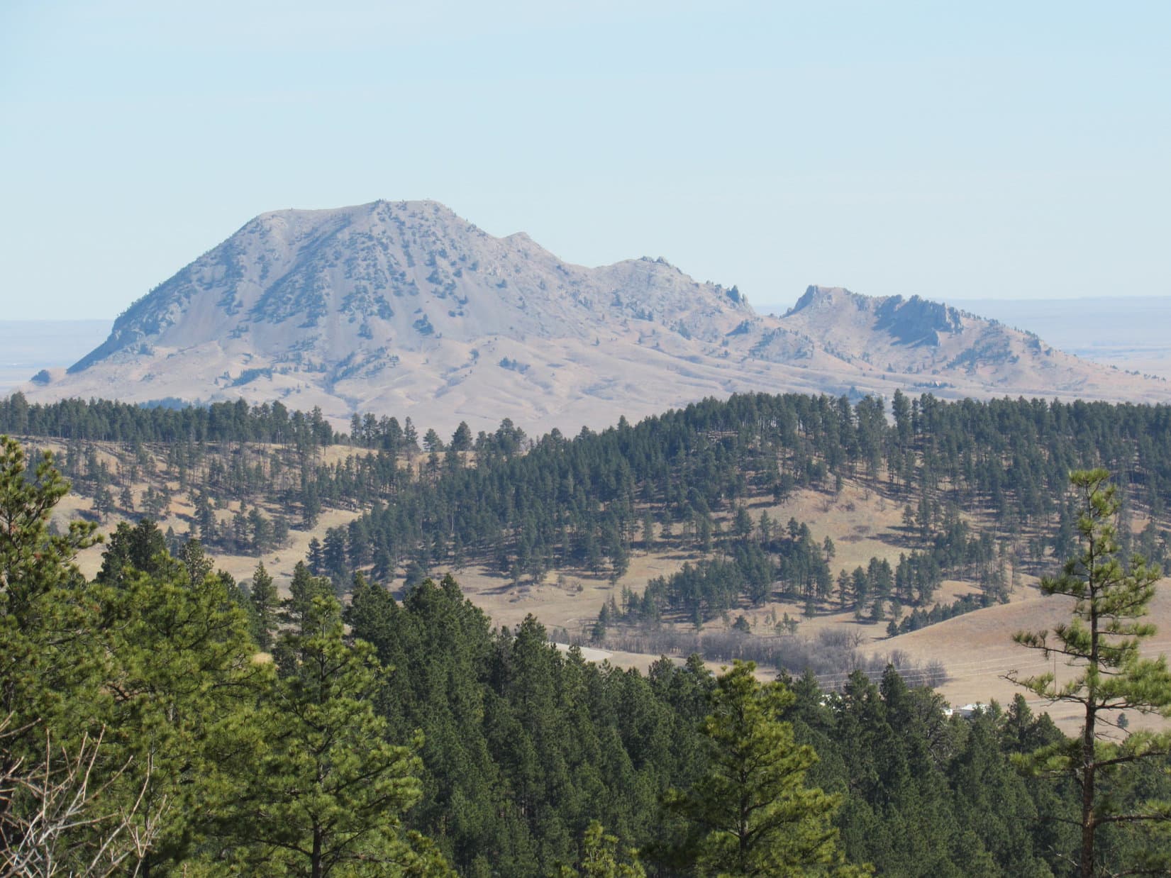
At first, No. 170.2B rose steadily at an easy to moderate pace. After a little while, though, the road reached a meadow where it leveled out, and then started to wind its way N around several fingers of the mountain coming down from the W. Almost as soon as the road leveled out, Bear Butte (4422 ft.) came into view off to the NE.
Following No. 170.2B as it wound around on the level was easy and fun, but it wasn’t going to get Lupe to the top of Deadman Mountain. When No. 170.2B showed no sign of wanting to resume its upward climb after winding around several fingers of the mountain, Lupe and SPHP abandoned the road, turned W and resumed climbing.
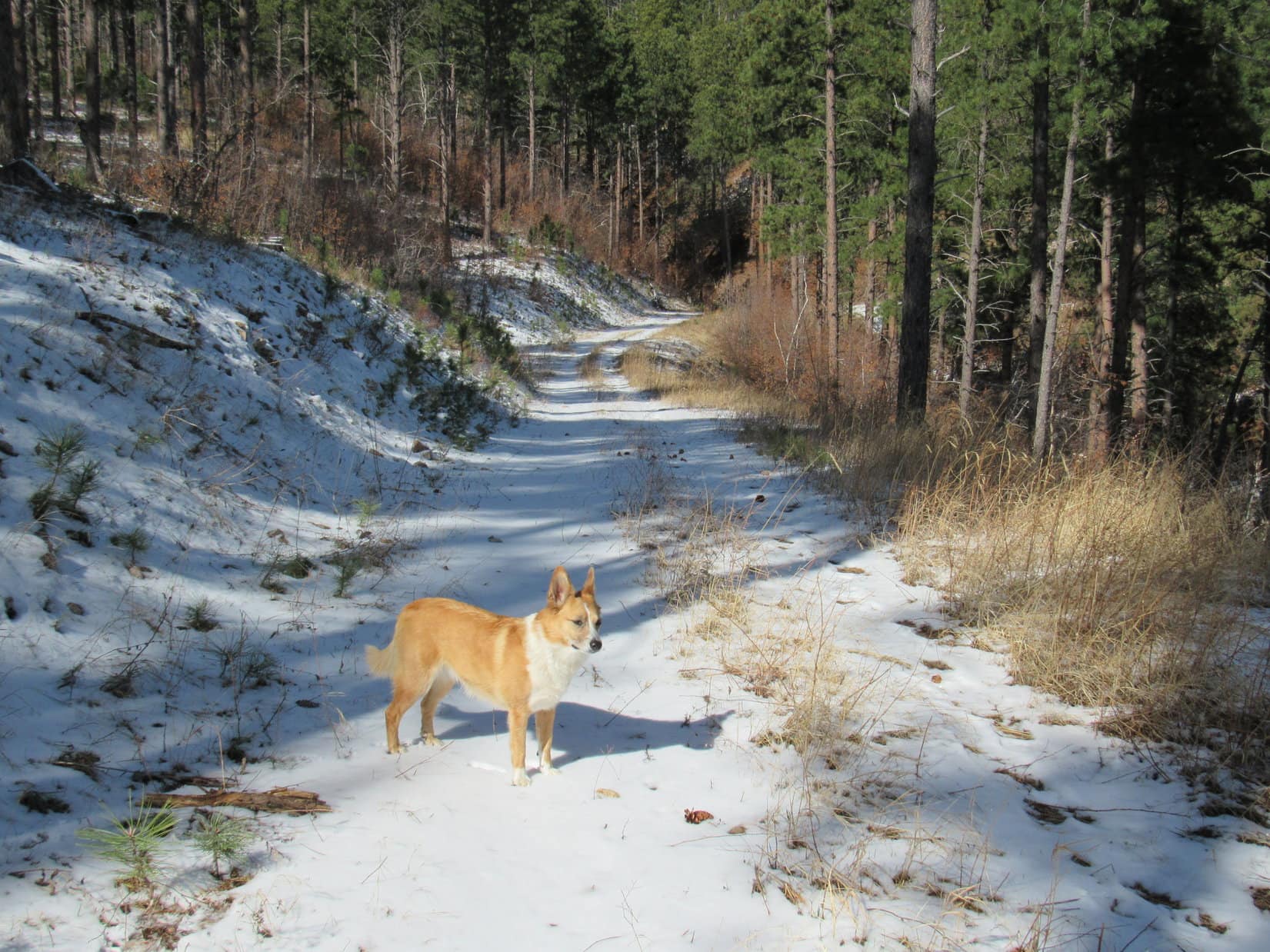
Lupe went only a few hundred feet before coming across a faint jeep trail. The jeep trail climbed aggressively right up the mountain. Lupe and SPHP followed it through the forest. For a road, the jeep trail was steep, but on paw and foot it was no problem. The road eventually reached the top of a ridgeline.
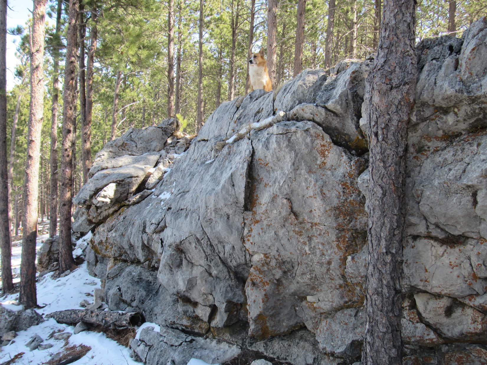
Here, the jeep trail improved and leveled out. It continued W along the N side of the mountain. The ridgeline, however, angled SW continuing to gain a little elevation. Lupe and SPHP stayed on the road after it leveled out for just a couple more minutes. A rock outcropping near the top of the ridgeline a short distance S of the road looked interesting. Lupe left the road to go check it out.

 Lupe and SPHP continued SW along the ridgeline. Along the way, Lupe came to a couple more rock formations, but the first one was the biggest. The ridge was broad and almost flat, but did gain elevation slowly as it continued SW. The entire area was forested, so there were no views in any direction. Although there had been only scattered deadfall timber all the way up Deadman Mountain, there was more of it along the ridge, but not enough to impede progress for long.
After following the ridge for 5 or 10 minutes, Lupe came to what appeared to be the highest part of the mountain. A stretch of the ridge 200 feet long was all at about the same elevation. Toward the SW end were three big trees close together. They seemed to SPHP to be standing at the true summit.


It sure seemed like Lupe was at the true summit of Deadman Mountain, but SPHP wasn’t 100% certain. After all, it had been a long trek up through the forest with no views since seeing Bear Butte way back down on USFS Road No. 170.2B. Maybe there was another higher point around up ahead? Lupe would have to do some more exploring to confirm her success.
SPHP studied the topo map. From the summit of Deadman Mountain, there was supposed to be a saddle about 100 feet lower to the NW. The saddle led to a slight rise along a wide level ridge that went N, and then NW to the edge of Deadman Gulch about 0.33 mile away. Peering down between the trees, it did look like there might be a saddle to the NW. It wasn’t very far away. Lupe and SPHP went to investigate.
Before Lupe even got all the way down to the bottom of the saddle, she came to a clearing in the woods where there were views off to the W. There was even a handy Carolina Dog display stump to facilitate the addition of extra beauty and grace to the scene.

Lupe and SPHP crossed the saddle. An unmarked road coming from the W side of Deadman Mountain farther S went up a gentle rise (shown on the topo map), and continued on to the N. A fainter road soon veered off to the NW. Lupe and SPHP followed the fainter road along the nearly level ridge. The road slowly lost elevation.
Lupe arrived at the edge of Deadman Gulch. There was no question about it now. It was clear that she really had been to the top of Deadman Mountain. The forest pretty effectively hid the views of Deadman Gulch, although there were glimpses of it here and there. Lupe and SPHP explored to the N near the edge of Deadman Gulch, but the ground kept losing elevation and the views didn’t open up.
Lupe and SPHP gave up on going any farther N, and doubled back to the S. This time, SPHP noticed a narrow rocky point protruding out to the SW from where Lupe had first come to the edge of Deadman Gulch. Lupe and SPHP went out on the point. There were some views from here!


Lupe had two more peakbagging goals for Black Hills, SD Expedition No. 162, but they were both on the other (W) side of Deadman Gulch. To get over there, SPHP thought it best to return to the G6. It would be a lot easier to drive over to a closer starting point, than try to find a long route on paw and foot around Deadman Gulch.
Lupe and SPHP returned to the summit of Deadman Mountain one more time. It was practically on the way to the G6.

Lupe and SPHP took the same route back to the G6. It was still early afternoon when Lupe arrived (1:33 PM, 50°F). Plenty of time remained for more fun and adventures! SPHP drove SW a few miles, and parked the G6 again (1:45 PM, 51°F). This time, Lupe would start out from the intersection of USFS Road No. 170 and No. 171.1 (1:45 PM, 51°F). Lupe and SPHP headed N on No. 171.1. Lupe’s new peakbagging goal was Red Hill (4,690 ft.), more than a mile to the N.
By now it had been warm long enough so yesterday’s skiff of snow had melted almost everywhere, except in very shady spots. The moisture made No. 171.1 soft and muddy. Lupe soon passed a big open area where several roads met. There was a lot of garbage strewn around here, including some broken glass. Lupe and SPHP hurried on by.
Beyond the intersection, No. 171.1 continued N gaining a little elevation before leveling out. This was actually the high point on Lupe’s journey to Red Hill. Before long, Lupe came to some heavy equipment sitting idle along the side of the road. Even though this area is all Black Hills National Forest land, a big thick underground power line is being installed along the road. Three huge spools of cable were up on a truck trailer. No one was around. The equipment was idle.
Past the equipment, the road lost elevation gradually. The equipment had recently been at work along this stretch. The roadbed was freshly churned up and very soft. So much mud clung to SPHP’s boots, that SPHP quickly gave up on the road. Lupe and SPHP went through the forest. Lupe liked going through the forest better than staying on road, anyway.
The road improved again by the time Lupe reached an intersection with USFS Road No. 171.1B. Lupe and SPHP followed No. 171.1B W to an intersection with No. 171.1U. This was the low point of Lupe’s journey to Red Hill. From the intersection, No. 171.1B turned N and started regaining elevation. Soon Lupe was getting close to one of two possible locations for the true summit of Red Hill.
Looking at the topo map, Red Hill is shaped like an upside down “U”, except that the bottom half of the SW side is “missing” – it’s not really part of the high ground. Red Hill features two areas enclosed by the 4,680 foot contour. The largest area is at the NE corner, and a smaller area is at the SW end of the high ground. Lupe would have to visit both areas to be certain of reaching the true summit.
No. 171.1B stopped gaining elevation and turned NW. Peering N through the forest, it did look like the terrain gained elevation in that direction. Lupe and SPHP left the road. Within 5 minutes, Lupe was standing on top of a small hill in the forest next to a fairly impressive cairn.


The impressive cairn seemed to indicate that Lupe was already at the true summit of Red Hill. Just to make certain, Lupe and SPHP did go looking for the SW high point. About 0.5 mile away, Lupe found it at a very flat piece of ground only marginally higher than the surrounding terrain. There was no cairn here.

The NE hill with the cairn definitely felt like the true summit of Red Hill. Whether it was or not, Lupe had visited both the NE and SW high points. Both high points were buried in the forest. Nearby trees were the only views. Lupe and SPHP went back to USFS Road No. 171.1B, and followed it back to No. 171.1.
The truth is, Red Hill is not an impressive mountain. It hardly seemed like a mountain “peak” at all. The whole area was an unremarkable part of the forest comprised of undulating terrain without any significant elevation changes. It made SPHP wonder why Red Hill even had a name. Not too far away are other higher and much more impressive hills that seem far more deserving of attention. Nevertheless, Red Hill was shown on all the maps.
Lupe and SPHP turned N again on No. 171.1. Granite Peak (4,424 ft.), more than 2 miles N of Red Hill, was Lupe’s 3rd and final peakbagging goal. Getting there was basically just a road hike along No. 171.1. Lupe came to a junction with No. 171.1C, but none of the junctions she came to after that were marked. At the turn to the NW toward Granite Peak, big pieces of white limestone had been placed across the side road to block it.
The sun was getting low by the time Lupe reached the summit of Granite Peak at the top of a small wooded hill. Leafless scrub oak mixed in with the pines made the forest less dark. It was possible to see a little more here than at Red Hill, but there still weren’t any clear views.
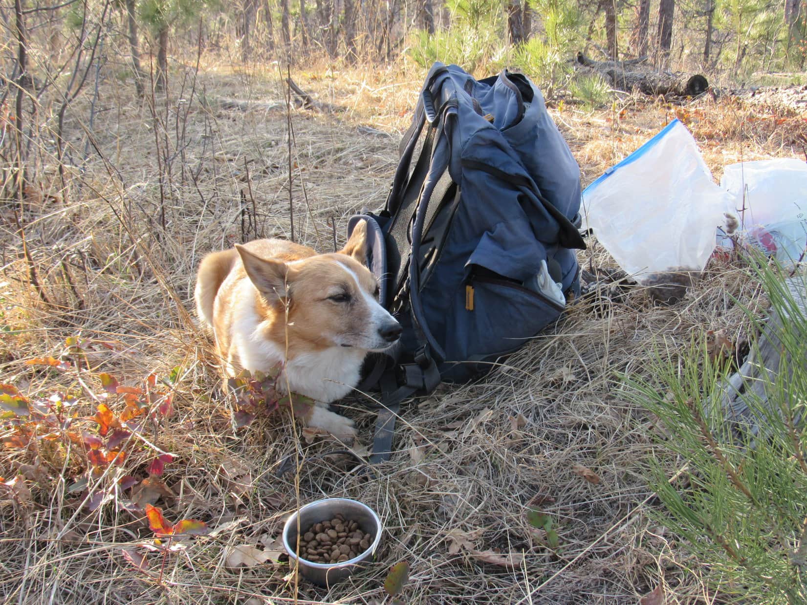
Lupe was ready for a break. She wasn’t hungry, even though she hadn’t eaten all day. She just seemed a bit tired, or perhaps just bored? Maybe she was just disappointed that she hadn’t found many squirrels in the forest?


Granite Peak was another unremarkable high point. If it hadn’t been so late in the day, Lupe would have continued another 0.50 mile NW to a sharper edge of the mountain where there might have been some views. A narrow look to the N was the best view from the summit of Granite Peak.

Lupe and SPHP lingered up on Granite Peak for a little while. SPHP ate an apple. It really was a beautiful evening out. The air was cool. Yesterday’s snow squalls had cleared the air, and it was possible to get glimpses at buttes and very distant ridges far out on the prairie beyond the Black Hills to the N and E. Crook Mountain was off to the NW.
It was probably close to 5 miles back to the G6 as the road went. Lupe and SPHP returned to No. 171.1 and followed it all the way. For a while, the high cliffs NW of Deadman Mountain were lit up by sunlight on the E side of Deadman Gulch. SPHP kept busy collecting Lupe Treasures, crushing them in order to be able to carry as many as possible. Lupe sniffed around in the woods near the road.
SPHP thought Lupe would be ready to jump right in the G6, when she reached it at 8:14 PM (45°F). She wasn’t. It was dark out. Nearly a full moon was shining in the clearing. As Lupe stood there sniffing the air in the moonlight, she was transformed into the ferocious and wily were-puppy! The were-puppy attacked SPHP in mock battle, and then raced dizzyingly around and around the G6.
The were-puppy played in the moonlight with great energy and enthusiasm for more than 20 minutes. It refused to be enticed into the G6. Finally it found something valuable. The were-puppy refused to let SPHP see what it was, but was suddenly seized with the desire to carry this glittering prize into the G6. OK, fine, if that’s what it took to get Lupe to jump in.
Pie! Ordinarily, SPHP is fond of pie, almost any kind of pie. Almost, but not quite any kind. In the light in the G6, it turned out the were-puppy’s glittering prize was a big chunk of dried cow pie. Bleh! Well, when in the wild, you have to be realistic and prepared to settle for the kind of pie there is. Blueberry, cherry and apple pie are in short supply in the forest, but cow pies are plentiful.
Very true, but that didn’t change SPHP’s attitude. When the were-puppy finally dropped the precious cow pie, out the window it went. We can do a lot better than that Lupe, there’s Alpo with whipped cream waiting at home!

Note: Lupe Treasures collected on Expedition No. 162 included 43 aluminum cans, 8 plastic bottles, 3 glass bottles, and part of a dried cow pie. (The dried cow pie was unceremoniously re-released to the wild.)
Links:
Next Black Hills Expedition Prior Black Hills Expedition
Want more Lupe adventures? Choose from Lupe’s Black Hills Expeditions Adventure Index or Master Adventure Index. Or subscribe free to new Lupe adventures.