Black Hills, SD Expedition No. 105 – Silver Mountain (11-22-14)

On November 10, 2014, 8″ of new snow fell at Lupe’s house.  The weather turned very cold for more than a week with highs in the 10-12°F range and subzero lows every night.  Another 4″ of snow fell.  Lupe was bored waiting for it all to end.  She stared out the window for hours, repeatedly sighing and putting her head down, then checking again a little bit later to see if anything had changed.  Nope.

Finally it did warm up.  A few days came when the highs got clear up into the 40’s or even 50’s.  The snow started melting fast.  Saturday the 22nd was Lupe’s big chance to get out on an expedition.  The next day it was supposed to turn cold again.  When Lupe realized SPHP was getting the backpack ready to go, she was one enthusiastic Carolina Dog!

By 9:04 AM (43°F), Lupe was eagerly leaping out of the G6.  The G6 was parked at a little side road just W of Boulder Hill Road (USFS Road No. 358) about 0.5 mile N of Hwy 16.  Lupe was about 0.75 miles S of Boulder Hill (5,331 ft.), and 0.5 mile NE of Silver Mountain (5,405 ft.).  Lupe wasn’t going to Boulder Hill today.  Instead, the plan was for her to go to Silver Mountain, and then on to Calumet Ridge (5,601 ft.) another 2.5 miles to the W.

Lupe and SPHP started out heading W on the little unmarked side road.  There was still about 6″ of snow here.  Glimpses of Silver Mountain could be seen between the trees to the SW.  Lupe and SPHP soon left the road to start climbing toward it.

Lupe didn’t have to go too far from the road to leave the forest.  She entered an open area where there was quite a bit of deadfall timber around.  These trees hadn’t been killed by pine bark beetles.  Almost all of Silver Mountain burned in the August, 2002 Battle Creek fire.  Between the snow and the deadfall timber, the going was rather slow.

When Lupe started hearing gunfire off to the W, things got even slower.  Lupe wanted to stop and hide.  She kept begging SPHP to stop, trying to block the way forward by standing on her hind legs and leaning her front paws on SPHP.  It took some doing, but SPHP finally persuaded her to keep going.  Lupe soon reached the top of a little ridge.  Ahead was a small snowy valley.  Silver Mountain loomed just beyond it.

Lupe sits on a stump up on the first little ridge she reached on her way up Silver Mountain. Photo looks SW at Silver Mountain.

To avoid losing too much elevation, Lupe and SPHP went W along the ridgeline for a little way.  Near the upper end of the small snowy valley, Lupe turned SW again to head directly for Silver Mountain.  She lost a little elevation traversing the valley, but once across started regaining it quickly.

A band of live pines that had escaped the 2002 Battle Creek fire was still standing on the upper NE slopes of Silver Mountain.  As Lupe got closer, SPHP realized the trees were swaying in the wind.  It wasn’t windy at all down where Lupe and SPHP were, but apparently a strong wind had kicked up out of the SW.  The higher Lupe climbed, the less protection the mountain gave her.  By the time Lupe was out on the open ground up above the band of trees, the wind was just a gale.  The strongest gusts were enough to make SPHP stumble on the rocky ground.

There were two separate rock formations up ahead in the summit area.  One was to the E, and the other to the W.  Lupe and SPHP were coming up between them.  The E rock formation looked to be the highest.  SPHP hoped it was.  The W formation looked harder to climb.  SPHP didn’t want to have to waste time searching around for an easy way up to the top in this hurricane.  No way Lupe would want to either.

Lupe and SPHP headed for the E rock formation.  Very close to it, Lupe passed by a crude 4-sided structure made out of small logs.  It was too poorly built to have ever been a real cabin.  It looked more like an elaborate kid’s fort.  Lupe didn’t even bother investigating it.  Gunfire was still continuing sporadically to the W.  She stuck close to SPHP.

Approaching the E rock formation from the NW.

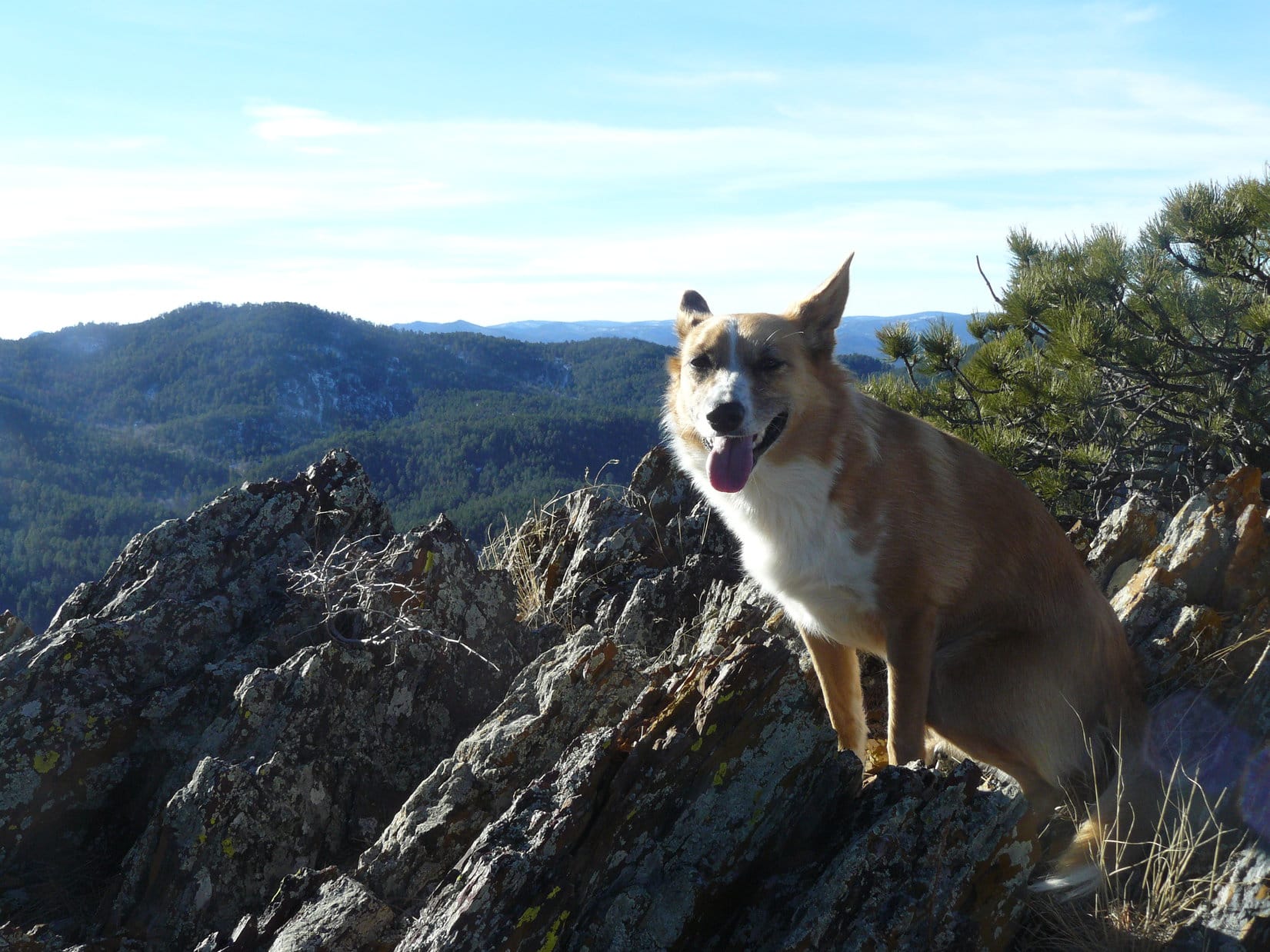
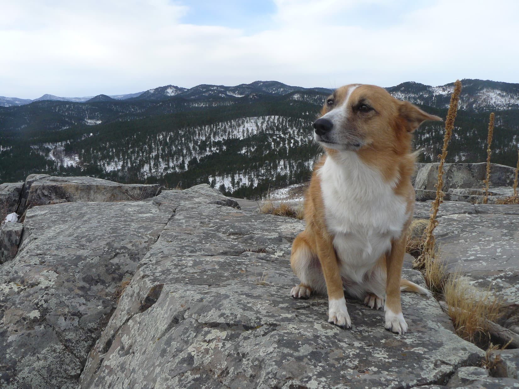
The E rock formation proved to be an easy little scramble.  The wind was very strong, though.  It really felt cold up on top.  Even Lupe was shivering a little.  SPHP sat down on the highest rocks and faced NE away from the wind.  Lupe curled up on SPHP’s lap.  She huddled together with SPHP in SPHP’s jacket to warm up.  Protected from the wind in the jacket, snuggled up with SPHP, Lupe seemed happy and reassured.  She was content to lay there warming up and gazing at the view.

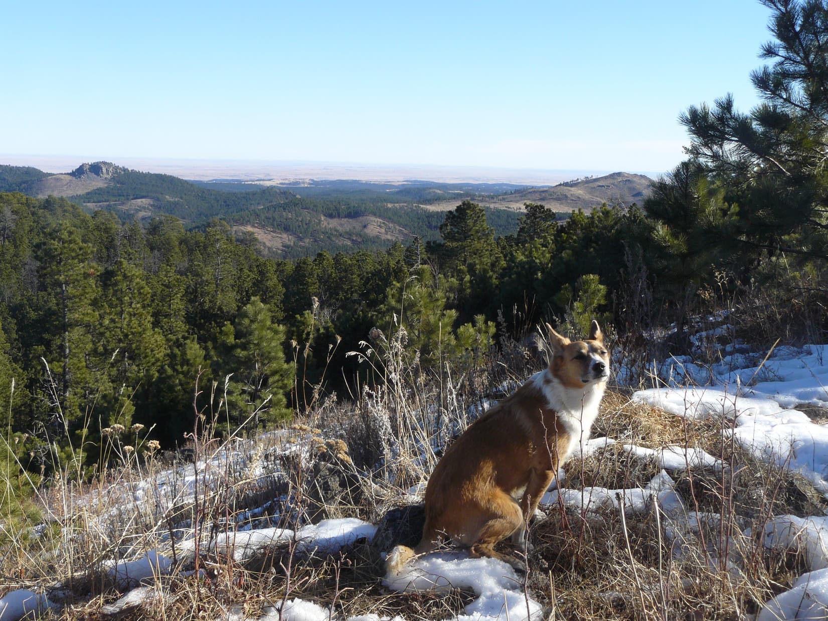
There were a few low bushes at the top of the E rock formation, but no trees to block the views in any direction.  Lupe and SPHP could see way out onto the plains E of the Black Hills.  Boulder Hill was off to the NNE.  Harney Peak (7,242 ft.) was off to the SW.  Calumet Ridge, Lupe’s next peakbagging goal of the day, was off to the W.

Lupe on top of Silver Mountain. Photo looks SW toward Harney Peak. Hwy 16 is seen below.
St. Elmo Peak (6,458 ft.) is the high point on the horizon on the R.

Lupe on Silver Mountain, 11-22-14One good thing.  It was easy to see from here that the W rock formation wasn’t as high as the E one.  Lupe wouldn’t have to climb it.  Lupe was already on the true summit of Silver Mountain!

Looking toward the W rock formation from the E one. The E rock formation where Lupe is was clearly higher. Lupe wouldn't have to bother climbing the W one. She already had her peakbagging success! Calumet Ridge is seen in the distance. Photo looks W.
Looking toward the W rock formation from the E one. The E rock formation where Lupe is was clearly higher. Lupe wouldn’t have to bother climbing the W one. She already had her peakbagging success! Calumet Ridge is seen in the distance. Photo looks W.

The views were great, but there was no sense staying up in the cold wind all day.  Besides, Lupe still had her Calumet Ridge peakbagging goal ahead of her.  Lupe and SPHP climbed down to the saddle area between the E and W rock formations.  A little W of the “fort” there was a big rock.  SPHP got Lupe up on it for a photo of Boulder Hill behind her.  Lupe was having to look directly into the fierce SW wind.  She refused to open her eyes.  Oh, well!

Lupe kept her eyes shut facing into the strong SW wind. Boulder Hill is the highest point seen beyond her R of Center. Photo looks NNE.

Lupe and SPHP went over close to the W rock formation, and then began following it NW down the ridgeline.  Lupe was on her way to Calumet Ridge.  She lost considerable elevation coming down Silver Mountain.  She was on exposed ground all the way, but the wind gradually diminished as she lost elevation.

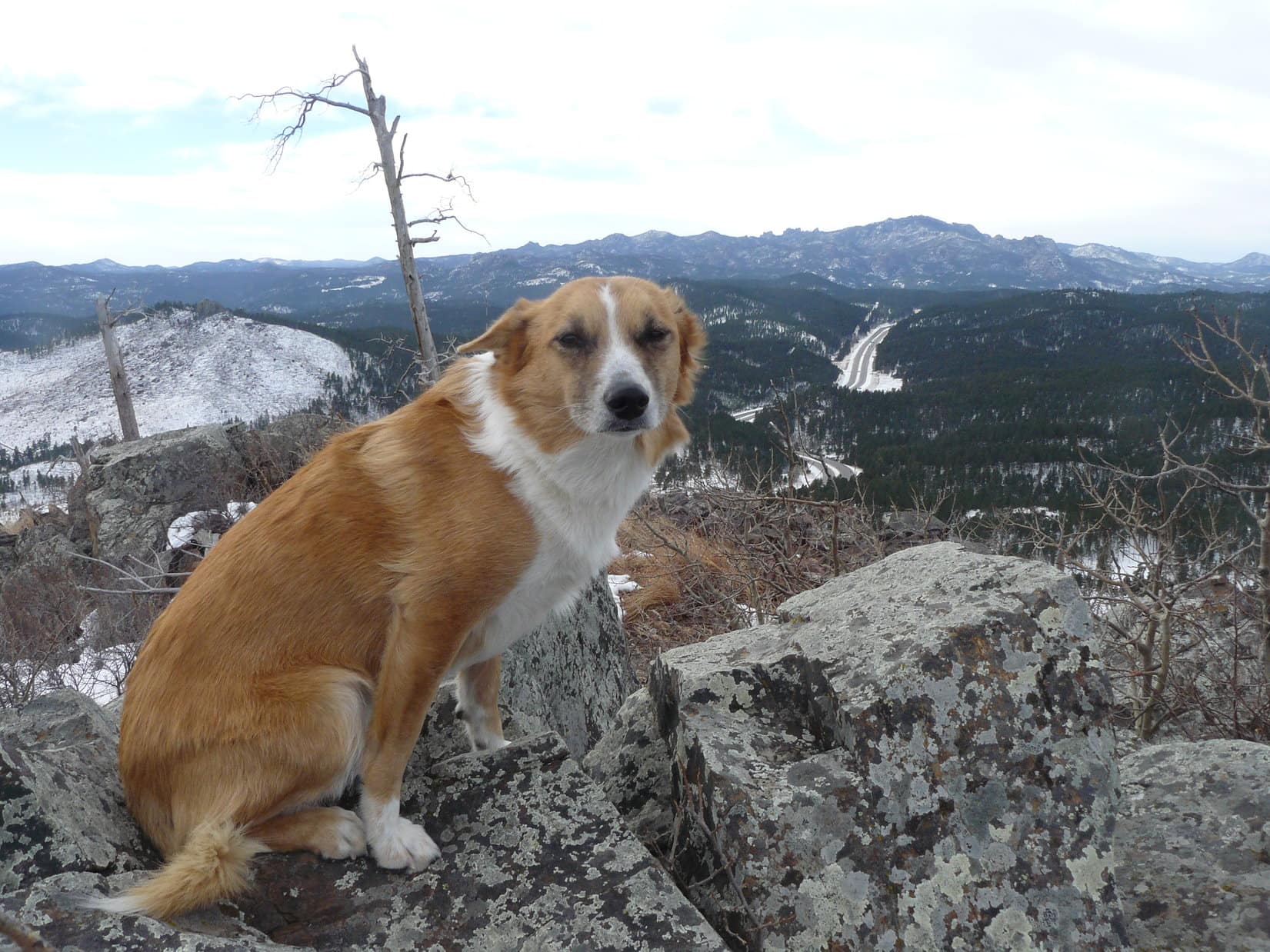
Beyond the end of the W rock formation at the top of the mountain, Lupe passed by a series of other lower rock outcroppings along the way.  The last of the large rock formations was fairly flat, but still high enough to offer some views.  Lupe could still see Calumet Ridge and Mount Warner (5,889 ft.).

Calumet Ridge is seen beyond Lupe. Photo looks W from the NW slope of Silver Mountain.
Mount Warner is the high point at the center. Photo looks WSW.

As Lupe continued NW losing elevation, the wind was weaker.  That was a good thing, except that she could hear the gunfire coming from the W even better now.  Lupe started becoming more and more anxious again.

Part of the burn area NW of Silver Mountain. Photo looks NW.

Lupe made it beyond the burn area NW of Silver Mountain.  She entered the forest again heading W.  She came to a hillside where she could see USFS Road No. 366 just below.  No. 366 went N/S, and Lupe would have to cross it to continue on to Calumet Ridge.  Lupe was just E of the saddle at the highest point on the road.

But Lupe wasn’t going any farther.  She was a nervous wreck.  Volleys of 10 shots or more kept coming.  She was much closer to them now than at Silver Mountain.  Gunfire was heard to the W, SW and NW.  At first SPHP had thought hunters were the source.  The truth was, people were just out for some target practice, which is why the gunfire went on and on.  It sounded like a war was in progress.

For a few minutes, SPHP stopped and looked at the maps.  There was certainly time for Lupe to get to Calumet Ridge, and it was a very nice day out of the wind.  SPHP ate some carrot sticks and pondered.  Lupe wanted to hide right here until the coast was clear.  The problem was, the coast wasn’t going to clear until it got too dark for target practice.

Lupe normally loves all of her Black Hills explorations, but she wasn’t having any fun now.  She was convinced there was mortal danger all around.  Her worries were unfounded, but there was no way to convincingly convey that to her.  No reason to make her suffer.  Time to turn around.  Lupe would make it to Calumet Ridge another day, when target practice wasn’t in such vogue.

Lupe wasn’t relieved of her fears until she was back over to the E side of the NW ridge coming down from Silver Mountain.  When she reached the G6 (12:09 PM, 50°F), she hopped right in ASAP!  Turns out there are worse things than being bored – like fearing for your life!

It had been a very short Black Hills expedition, barely 3 hours, but Lupe did climb Silver Mountain.  About half an hour after Lupe got home, Guille showed up unexpectedly.  She brought a lot of food with her, including a beautiful big ham.  Lupe and SPHP gorged on ham.  Life was good.

SPHP was certain Lupe was completely stuffed when she started taking pieces of ham out to the back yard to bury them for future feasts.  Carolina Dogs think ahead, you know!
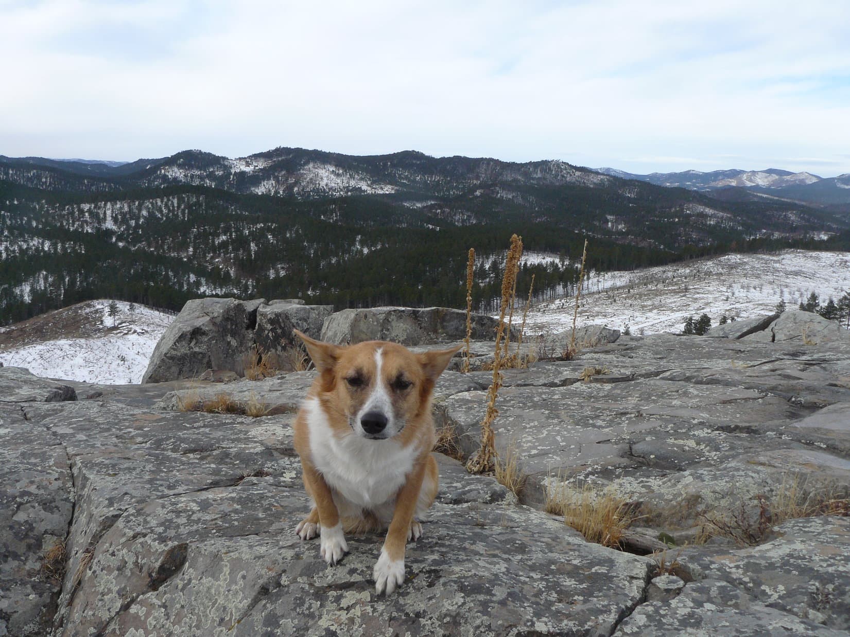
Calumet Ridge from the NW slopes of Silver Mountain, 11-22-14

Links:

Next Black Hills Expedition               Prior Black Hills Expedition

Want more Lupe adventures?  Choose from Lupe’s Black Hills Expeditions Adventure Index or Master Adventure Index.  Or subscribe free to new Lupe adventures.

Black Hills, SD Expedition No. 201 – Summits on the Air! (Silver Mountain, 4-22-17)

Start 9:16 AM, 48°F, Boulder Hill Road (USFS Road No. 358) 0.5 mile N of Hwy 16.

Note: Summits on the Air is an awards scheme for radio amateurs that encourages portable operation in mountainous areas.  A point system awards points for both transmitting (“activating”) from a mountain or picking up the signal (“chasing”).

Joe & cousin Dusty were in town!  That meant one thing – time for some Summits on the Air action!  Lupe was all for it.  She and Dusty arrived at the top of Silver Mountain around 10 AM.  It was a beautiful day to be on the mountain.

Lupe hadn’t been on Silver Mountain in more than 2 years. Although the views are excellent, Silver Mountain is not one of Lupe’s favorites. Target practice gunfire can usually be heard off to the W, which makes her nervous. To Lupe’s dismay, the guns were blazing away again today. Boulder Hill (5,331 ft.) is in view on the L. Photo looks NE.
Cousin Dusty just below the summit. The distant gunfire didn’t bother Dusty at all. She paid not the slightest attention to it.
Dusty lives in Arvada, Colorado, but was up in South Dakota for a weekend visit. Dusty really likes exploring the Black Hills with Lupe.

Joe had posted notification on the Summits on the Air website that AA0Q (his call letters) would “activate” (start transmitting from) Silver Mountain at 11:00 AM.  With an hour to go, he had plenty of time to set up his antenna and portable Ham radio.

Preparations to start transmitting from Silver Mountain included setting up this 16 or 17′ long antenna with four lateral wires at the very summit. Photo looks NE.

Joe said he liked the layout on Silver Mountain (5,405 ft.).  The forest had burned years ago, so there were no big trees around to obstruct the views in any direction.  The mountain sloped away fairly steeply on most sides with nothing any higher for at least a couple of miles in any direction.

Although Silver Mountain was a good physical setup for Ham radio transmissions, Joe wasn’t at all certain how well things were going to work out.  The 11 year sunspot cycle hits its low in just a couple more years, and atmospheric conditions are usually best for amateur radio band transmissions when sunspot activity is high, not low.

As it got close to 11 AM, everything was ready to go.  The antenna and portable radio were all set up.  SPHP was trained to keep a simple log of Joe’s contacts.  Lupe and Dusty were prepared to ward off any intruders.

At 10:55 AM, Joe started transmitting in Morse code, receiving a first response almost instantly.  That contact “spotted” AA0Q on SOTA’s website confirming contact with Joe.  Silver Mountain was on the air!

An immediate explosion of activity came from dozens of “chasers” all trying to make contact at the same time.  AA0Q was overwhelmed by the response, as usual.  Joe did his best to make rapid contact with as many of the chasers as possible, but it was impossible to respond to more than a fraction.

AA0Q hard at it shortly after “activating” Silver Mountain. Photo looks SE.
Dusty relaxes nearby while Joe works the Ham radio. Response from the chasers, as usual, was initially overwhelming.

Atmospheric conditions were changing rapidly.  Joe and the chasers often exchanged signal strength information, which varied wildly over the span of only a few minutes.  Of course, part of the variation was due to the different locations of the chasers.  Successful contacts were made with operators in Arizona, California, Pennsylvania, the Carolinas and several other states.

With chasers lined up in droves trying to get through, each contact had to be brief.

So, Uncle Joe, how is it going? Heard anything from anyone on Squirrel Mountain, yet? Lupe checks on AA0Q’s SOTA progress. Photo looks E.
This photo shows the overall setup. The rocky summit ridge wasn’t the best for comfort, but AA0Q managed pretty well. Photo looks NNE.
AA0Q’s portable radio in use on Silver Mountain.

For the first 10 or 15 minutes, conditions gradually improved.  Signals were getting a little stronger on average, despite bouncing around.  Later on, conditions deteriorated.  At times the “bands” were down for a minute or two.  AA0Q got a chance to shift to a more comfortable position.

As time went by, the bands went down intermittently, giving Joe a chance to shift to a more comfortable position. Photo looks SSW.

By 11:30 AM, 35 minutes after Joe started transmitting, it was over.  The bands were consistently weak.  The chasers had either made contact with AA0Q, or given up by now.  Even when conditions improved momentarily, no one was left still trying to make contact.  Evidently it was time to take down the antenna and put the radio away.

Joe at the top of Silver Mountain shortly before taking the antenna down. Photo looks NNE.
Silver Mountain was the 3rd Black Hills peak AA0Q has activated. In July, 2016, Lupe and SPHP had accompanied Joe & Dusty to Custer Peak and Boulder Hill.

AA0Q had made 27 contacts in 35 minutes, so Joe was pleased with the overall results.  Despite spotty atmospheric conditions, Silver Mountain had been a successful Summits on the Air outing.  There always seem to be way more chasers than it’s possible to make contact with right after activating a peak, but Joe had done all he could.

Lupe got a pat from AA0Q for her guide services.

Lupe earns a pat from AA0Q for her Black Hills peak guide services. Photo looks NE.

Once the radio equipment was put away, it was time for a final look around at the views, followed by a short exploration of Silver Mountain’s summit area.  Of course, the most impressive view was toward Black Elk Peak (7,231 ft.), the highest mountain in South Dakota.

Black Elk Peak (7,231 ft.) (R of Center) from Silver Mountain. Hwy 16 is seen below. Photo looks SW.

Silver Mountain’s summit area features two ridges running roughly N/S.  The E ridge where Joe had set up the radio equipment is the highest.  However, only a short distance to the W is an even rockier and more interesting ridge.  The W ridge is only slightly lower than the E one.

The slightly lower, but more dramatic W ridge. Photo looks NW.

Between the two ridges, at the base of the E one, is one of many Dingo outposts Lupe has discovered scattered throughout the Black Hills.

Joe inspects Lupe’s Silver Mountain Dingo outpost. Joe was pretty certain it didn’t meet current building codes, but adventurous American Dingoes don’t give two hoots about that. Boulder Hill is in view beyond it. Photo looks NNE.

Joe was intrigued by the W ridge.  He got up on top for a few minutes for a look around.  Lupe and Dusty stayed below.

Joe got up on the W ridge for a look around. Slightly lower, Lupe is partially hidden among the small trees on the L, while Dusty sniffs around in the foreground. Photo looks W.

With Silver Mountain’s summit area explored, everyone headed back to the G6.  There was still tons of time left in the day.  Joe wanted to go climb Boulder Hill (5,331 ft.) again.  Everyone piled into the G6.  Joe drove 0.5 mile N to the start of the access road only 0.25 mile SW of the summit.

An easy trek along the access road led to a scenic path that winds up the large rock formation at the top of the mountain.  Soon Lupe was at the summit with a great view looking back at Silver Mountain (5,405 ft.).

Silver Mountain (Center) from Boulder Hill. Photo looks SSW.

Joe has liked Boulder Hill ever since first climbing it with Lupe, Dusty and SPHP exactly one year ago on 4-22-16.  In fact, he liked it so much that first time, everyone had come back to make a second ascent the very next day!  On the 4th of July, Joe had even done a Summits on the Air activation of Boulder Hill.

Today’s Expedition No. 201 was Joe and Dusty’s 4th time up on Boulder Hill with Lupe and SPHP.  Good times!

Joe on Boulder Hill near the area where he’d done a Summits on the Air activation of the peak on 7-4-16. Back then his antenna had been propped up in the big pine tree seen directly beyond him. Photo looks NW.
Joe & Dusty together with Lupe on top of Boulder Hill for the 4th time. The first time up for Joe and Dusty had been exactly one year ago! Photo looks SE.

No Summits on the Air activation of Boulder Hill was planned for today.  This was a pleasure excursion, just to see the views.

Silver Mountain (L). Photo looks SSW.
Silver Mountain with a little help from the telephoto lens. The more dramatic, rocky W ridge is seen to the R of the true summit. Photo looks SSW.

After lingering at the top of the mountain for 15 minutes, everyone started back down.  Time to head back to Lupe’s grandma’s house for food, fun and games.  Lupe and Dusty looked forward to an afternoon of squeaker ball, tennis ball and flying disc action in grandma’s front yard.  (End 2:00 PM, 62°F)

Joe (lower R) starts the trek down. Photo looks S.
Lupe’s cousin Dusty on Boulder Hill. Photo looks E.

Links:

Next Black Hills Expedition                   Prior Black Hills Expedition

Summits on the Air official website

Expedition No. 174(a) – Summits on the Air!  (Custer Peak, 7-2-16)

Expedition No. 174(b) – Summits on the Air!  (Boulder Hill, 7-4-16)

Want more Lupe adventures?  Check out her Black Hills, SD & WY Expeditions Adventure Index, Master Adventure Index, or subscribe free to new Lupe adventures!

Black Hills, SD Expedition No. 108 – Calumet Ridge & Silver Mountain (12-11-14)

Record setting warmth in December in the Black Hills region meant it was expedition time for Lupe!  When it hit an unbelievable 70°F+, SPHP planned to take Lupe to Cicero Peak (6,166 ft.) the very next day.  Unfortunately, when morning came, SPHP got off to a late start – too late to justify the travel time.  It might be extraordinarily warm out, but that didn’t do a thing to boost the limited number of daylight hours.

Since Calumet Ridge (5,601 ft.) was closer, and Lupe had never been there before either, Calumet Ridge became Lupe’s primary peakbagging goal for the day.  Expedition No. 108 started at a little side road just off USFS Road No. 358 (Boulder Hill Road).  Lupe was less than 0.5 mile S of Boulder Hill (5,331 ft.) and a mile N of Hwy 16, as she left the G6 at 9:43 AM (57°F) following the little side road W.

There was still ice on the road, and snow in the shadier parts of the forest.  The road skirted to the N of Silver Mountain (5,405 ft.), which Lupe had climbed for the first time only a few weeks earlier on Expedition No. 105.  Years ago, the Ponderosa pine forest on Silver Mountain burned almost completely in a devastating wildfire.  In less than a mile, the road Lupe was following turned WSW and entered the burn area.

The road disappeared completely in the grass as Lupe headed up onto a barren ridge sweeping down to the NW from Silver Mountain.  Lupe followed the ridge a little way, and then turned W heading back into the forest.  She soon crossed USFS Road No. 366 at the saddle marking the high point on the road.  Lupe and SPHP continued W of No. 366, climbing two forested ridges separated by a snowy little valley that drained to the N.

From the second ridge, Lupe saw another larger valley to the W.  There was some open ground down there and a road.  Lupe and SPHP headed down into the valley, but as Lupe neared the road, a Jeep came along and parked in the open part of the valley a bit to the S.  A man with a rifle got out of the Jeep.  SPHP realized he intended to do some target practice.

Lupe has never liked gunfire, and she wasn’t going to like this.  SPHP hurried NW to reach the road and start heading N.  When the man opened fire, Lupe was greatly alarmed.  She instantly started begging SPHP to stop and hide.  It was all SPHP could do to persuade her to keep going.  Fortunately, it wasn’t far to a jeep trail that left the main road to climb NW up a little side valley.  Lupe relaxed a little, as the sound of gunfire became less distinct and more intermittent.

The jeep trail split after about 0.25 mile.  Lupe and SPHP took the branch that curved W.  It started climbing more quickly as it bent around to the S.  Lupe arrived up on a little ridge, where SPHP thought there might be some views, but all that could be seen were nearby low forested hills.  Lupe was now up on the E slopes of Calumet Ridge, still about 400 feet below and 0.5 mile SE of the summit.

Very conveniently, Lupe found another jeep trail nearby that went NW.  This jeep trail was icy, and gained elevation at a steady moderately steep pace.  Lupe and SPHP soon reached the top of the ridge at a broad, flat saddle area S of the summit.  The jeep trail continued on down the other side of Calumet Ridge.

Lupe and SPHP turned N.  Lupe found the summit of Calumet Ridge at a rock outcropping in a shady forested area.  She perched up on the highest boulder to claim her Calumet Ridge peakbagging success!

Lupe claims her peakbagging success on the summit boulder near the N end of Calumet Ridge!

There really weren’t any views from the forested summit, but a little exploring around revealed that there was a good viewpoint not too far to the E.  From there, Lupe enjoyed a wide open view off to the N and E.  She could see Boulder Hill and Silver Mountain, and far beyond them out onto the plains of western South Dakota.

Boulder Hill (L) and Silver Mountain (R) from Calumet Ridge. They are both about 2.5 miles away. Photo looks ESE.

There was another viewpoint, too.  This one was at some big rocks a very short distance NW of the summit.  From here, there was a narrow view to the NW toward Sheridan Lake and the central Black Hills.

A glimpse of Sheridan Lake to the NW from Calumet Ridge.
Sheridan Lake
Sheridan Lake

Lupe and SPHP took a little break at the summit.  That meant Taste of the Wild for Lupe, and an apple for SPHP.  Now what?  SPHP checked the maps.  The highest parts of Calumet Ridge extend for about 0.5 mile running NNW/SSE.  Lupe was near the N end where the 5,601 ft. summit was shown.  However, the topo map also showed a very small area enclosed by a 5,600 ft. contour toward the middle of the S end of the ridge.

Well, Lupe had better check that S summit out, too!  It was so close in elevation to the N summit, that it was even possible it might actually be a bit higher.  In any case, to be certain Lupe had really visited the true summit, she needed to visit the S one, too.  Lupe and SPHP headed S, and started following a dirt road that winds partway along the ridge.

S of the saddle where Lupe had first reached the ridgeline, the dirt road brought Lupe to a big open pit toward the E side of the ridge.  Lupe sniffed around exploring the pit.  Although the Black Hills are full of old dig sites from the gold rush days in the late 1800’s, this pit was too large and too new to date back anywhere close to that long ago.  SPHP could discern no particular reason why the pit was here, but there it was.

Lupe investigates the open pit on Calumet Ridge.

The dirt road eventually disappeared as Lupe and SPHP continued SSE along the ridge.  Lupe arrived at a high spot on the W side of the ridge where there was a rock outcropping with a clear view toward Mount Warner (5,889 ft.) to the SW.  Lupe could see Harney Peak (7,242 ft.), too.

Someone had left a white metal chair up here, positioned to take advantage of the view.  Sadly, Lupe also noticed an old dilapidated couch fallen down below the viewpoint.  It must have served the same purpose once upon a time.  People and their trash!  Although they like to claim everything is sacred – in practice, nothing really is.

Lupe at the viewpoint on the way to the S summit of Calumet Ridge. Photo looks SW toward Mt. Warner (R) in the foreground, and more distant Harney Peak (L) on the far horizon.

It wasn’t much farther to the S summit.  The S summit was comprised of a large rock formation, surrounded by cliffs on most sides.  However, at the N end from which Lupe approached, it was only 12-15 feet up to the top, and it wasn’t quite a cliff.  It looked possible to scramble up, without too much difficulty, using rocks and trees for support.

The S summit of Calumet Ridge. Photo looks S at the N end of the summit block where Lupe would scramble up to the top.

The short scramble up to the top of the S summit was scarier than the photo shows.  You sure wouldn’t want to have small children attempt it.  However, between the rocks and trees, there were plenty of good handholds and footholds.  There must have been adequate pawholds, too.  Lupe and SPHP were soon up on the S summit of Calumet Ridge.

The summit area was the size of a modest room in a house.  There were trees and grass growing up there, and enough room to walk around a bit.  The best views were off to the SE toward Silver Mountain, and the SW toward Mount Warner.

Lupe up on the S summit of Calumet Ridge. Silver Mountain is seen 2.5 miles to the SE.
Silver Mountain using the telephoto lens from the S summit of Calumet Ridge.
Looking SW toward Mount Warner (L).

Since the N and S summits of Calumet Ridge weren’t in view from one another due to the forest, it wasn’t possible to form any firm opinion on which might actually be higher.  In any case, Lupe had visited both.

Lupe and SPHP returned NNW to the broad saddle area where Lupe had first reached the ridgeline.  Instead of going SE back down the way she had come up, Lupe took the jeep trail down the W side of the mountain.  The road started off heading W, but soon made a sharp turn back to the SE.  Someone was using a chainsaw in the forest a little way below the road.  He didn’t see Lupe go by when she passed his truck parked in the middle of the road, but she saw him.

The road dropped rather steeply along much of its length.  Lupe and SPHP soon arrived down in a valley just W of a saddle area S of Calumet Ridge.  SPHP briefly considered having Lupe go on to make an attempt at climbing Samelius (5,856 ft.) and Hardesty (5,562 ft.) Peaks, located close to each other more than 2 miles to the SW.  Lupe could probably climb both of them before sunset, but then there would be a long trek back to the G6 in the dark.  Samelius and Hardesty would have to wait for another day.

Lupe turned E and went over the saddle.  Almost immediately, she started hearing gunfire again.  It was distant, but still made her nervous.  She made persistent efforts to persuade SPHP to stop and hide.  SPHP stopped to pet and console her.  SPHP assured Lupe she wasn’t going to get shot, if she stayed close.  Lupe wasn’t entirely convinced.  She stuck to SPHP like glue, but still campaigned for taking shelter.  SPHP had to stop several times to boost her spirits.

The area E of the saddle was a maze of little roads among low, mostly forested hills.  To stay as far as possible from the gunfire, Lupe and SPHP wandered in a generally SE direction, sometimes on the roads, and sometimes just in the forest.  Lupe came to a field where traffic noise from Hwy 16 could be heard not that far off to the S.  Part of the field extended up into a little valley to the NE.  Lupe and SPHP went that way, re-entering the forest at the end of the field.

Lupe passed a number of interesting plants like these while wandering the forests SE of Calumet Ridge.

Lupe reached USFS Road No. 366 again, a little S of the saddle where she had crossed it going W earlier in the day.  This time she crossed it heading E.  Although she hadn’t gone on to climb Samelius and Hardesty Peaks, she now headed for Silver Mountain.  This would be Lupe’s 2nd ascent of Silver Mountain in just a few weeks.  Lupe and SPHP hoped to see a dramatic sunset up there.

Lupe arrived at the top of Silver Mountain about half an hour before sunset.  With the forest completely burned off the top of Silver Mountain, Lupe and SPHP enjoyed 360° views.  Lupe wasn’t actually too interested in the views.  Target practice was still going on off to the NW toward Calumet Ridge.  She huddled under SPHP’s jacket, which made her feel safer.

Nervous Lupe up on Silver Mountain. Photo looks SW toward Harney Peak.

Together Lupe and SPHP watched the sunset, but it never really developed much color.  Once it became clear that the show was over, Lupe and SPHP started down the steep N slope of Silver Mountain.

Lupe ready to follow SPHP down off Silver Mountain.

There was a lot of dead timber on the N slope, and despite two days of very warm weather, there was still some snow, too.  It was slow going coming down the mountain.  Target practice continued off to the W until it was so dark stars were starting to come out.

By the time Lupe reached a road down below, twilight had faded to darkness.  The road was icy and slick.  SPHP didn’t recognize the place and turned the wrong direction.  After about 10 minutes, SPHP realized the error and turned around.  The road led Lupe all the way back to the G6.  Lupe arrived at 5:31 PM.  It was still a crazy 57°F out!

Lupe had a mostly fun day going to Calumet Ridge.  There was too much target practice going on in the area to the E of Calumet Ridge, though.  It had basically gone on all day long.  Lupe and SPHP both agree that more remote locations are more to their liking.

Lupe on Calumet Ridge, 12-11-14.

As for Cicero, Samelius and Hardesty Peaks, which Lupe never made it to this day – Lupe did go on to climb all three and more before the end of 2014.  But those Lupe adventures are the subjects of other posts.

Links:

Next Black Hills Expedition               Prior Black Hills Expedition

Want more Lupe adventures?  Choose from Lupe’s Black Hills Expeditions Adventure Index or Master Adventure Index.  Or subscribe free to new Lupe adventures.