Black Hills, SD Expedition No. 90 – South Castle Rock, Castle Rock, Nipple Butte, Flag Mountain & Peak 6962 (5-24-14)

In early May of 2014, SPHP discovered Peakbagger.com, “an online resource for summit-focused hikers, climbers, and mountain lovers”.  User accounts are free, and it seemed like it might be fun to record a few statistics on Lupe’s expeditions and explorations there.  So, on 5-12-14, SPHP created an account for Lupe.

Using Peakbagger.com was fun!  Almost instantly, Lupe and SPHP were hooked!  Lupe started climbing as many mountains as possible on Peakbagger’s list of Black Hills 6500-foot Peaks.  Some of them Lupe had been to before, of course, but the list contained many peaks she had never climbed.

For Black Hills, SD Expedition No. 90, SPHP was excited to have 5 peaks along the E escarpment of the limestone plateau high country of the western Black Hills lined up for Lupe to climb.  All 5 peaks were on the Black Hills 6500-foot Peaks list.  They were strung out along a N/S line W of Reynolds Prairie.  Lupe would start from the S end climbing South Castle Rock (6,840 ft.) first.

Almost 2 miles NW of Deerfield Reservoir on W Deerfield Road, is a R turn on County Road No. 306 to Reynolds Prairie.  No. 306 winds NE up a hill for more than a mile before turning N and leveling out.  Right there, on the W side of No. 306, is a L turn on a side road going up a little hill.  The side road is USFS Road No. 189.1D.  SPHP parked the G6 at the top of the first short rise (9:57 AM, 67°F).

Lupe was starting out her ambitious day of peakbagging about 0.75 mile SSE of South Castle Rock.  She began following No. 189.1D N across a green field, but soon left the road as it angled NW.  Lupe continued N, gradually going uphill.  The sun felt hot out in the open field.  Lupe and SPHP were both glad to reach the shade of the forest, although the climb became increasingly steep.

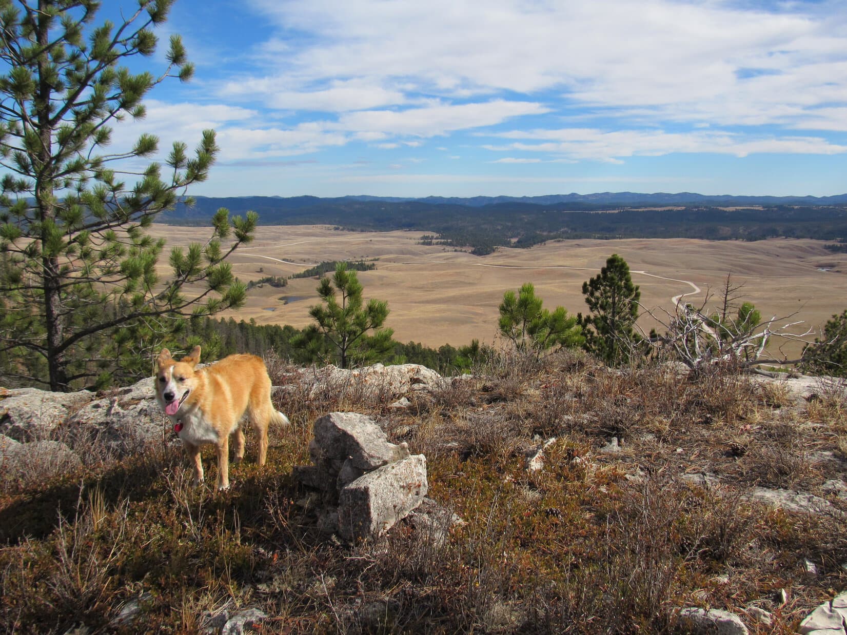
Before long, Lupe reached the first significant limestone outcropping.  Lupe and SPHP went out to the SE end of it, where there were great open views from the NE around to the S.

Parts of Deerfield Lake are in view from the first big limestone outcropping going up South Castle Rock from the S. The S end of Reynolds Prairie is seen on the L. Photo looks SE.
The E end of Castle Rock (6,783 ft.) is the forested ridge with the many beetle-killed trees on the L. The N end of Reynolds Prairie is seen on the R. Photo looks N.
County Road No. 306 winds across Reynolds Prairie. Part of Deerfield Lake is seen on the R. Photo looks E.

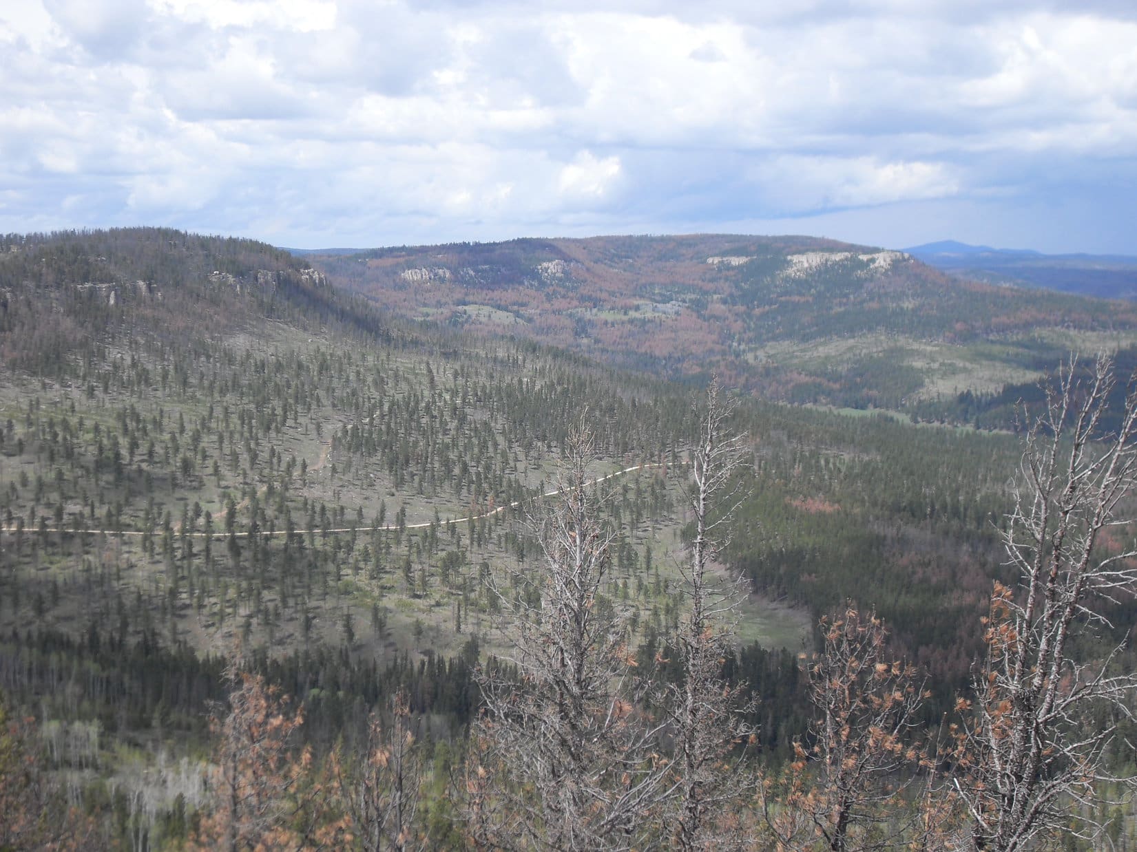
From the SE viewpoint, Lupe continued climbing N up South Castle Rock.  She quickly reached a high point in the forest, but it was a false summit.  The topo map showed that the true summit was just a little bit higher and farther N.  There were many trees killed by pine bark beetles.  The deadfall timber made progress getting to the true summit rather slow.

The true summit proved to be located up on a limestone cap surrounded by small cliffs in every direction.  Lupe and SPHP scouted around looking for a way up.  The only easy way up was from the SW, where Lupe and SPHP were able to make it up to the top.  The summit area was flat and forested.  The highest point was located toward the N end.  Lupe posed for her South Castle Rock (6,840 ft.) summit photo next to SPHP’s backpack.

Lupe claims her first peakbagging success of the day at the summit of South Castle Rock! Photo looks WSW.

With the all views blocked by pines, Lupe didn’t linger very long on South Castle Rock.  Lupe and SPHP climbed back down using the same SW route.  Lupe then went around the W side of the summit escarpment heading N to her next peakbagging goal, Castle Rock (6,783 ft.).

Looking back at the N end of the low limestone cliffs below the summit of South Castle Rock. Photo looks S.

Castle Rock is slightly lower than South Castle Rock, and less than 0.25 mile farther N.  It didn’t take Lupe long to reach the W end of the main Castle Rock ridge, which extends out to the ESE.  Lupe and SPHP went all the way out to the E end looking for the highest point.  Somewhere along the way, Lupe must have gone over the true summit, but exactly where was never clear.  Near the E end, she posed for a couple of photos.

Happy Lupe on Castle Rock. Photo looks SW toward South Castle Rock.
Lupe looks a little less friendly here, but it was partly due to the sun making her squint. Lupe's next two peakbagging goals are in view behind her. Nipple Butte (6,800 ft.) is closest with Flag Mountain (6,937 ft.) beyond it. Photo looks N.
Lupe looks a little less friendly here, but it was partly due to the sun making her squint. Lupe’s next two peakbagging goals are in view behind her. Nipple Butte (6,800 ft.), capped with white limestone, is closest with Flag Mountain (6,937 ft.) beyond it. Photo looks N.

Lupe was off to a great start with 2 of her peakbagging goals already accomplished!  Lupe and SPHP returned to the W end of the main Castle Rock ridge.  Nipple Butte (6,800 ft.), over 0.5 mile N, was Lupe’s next stop.  Lupe and SPHP started going N following a somewhat lower and much skinnier ridge.

The N ridge wasn’t as heavily forested.  The views were actually better here than they were from up on the higher E ridge.  However, as Lupe proceeded N, it soon became apparent she wasn’t going to find any safe way down.  She reached a crevasse in the limestone that prevented her from going any farther N.

So Lupe and SPHP had to backtrack almost all the way to the S end of the N ridge again, before finding a steep route down off the E side.  Lupe lost 150 feet of elevation before turning N again.  While SPHP plodded along gradually regaining elevation, the American Dingo roamed the forest.  She eventually reached the saddle to Nipple Butte and started up the S slope.  The climb quickly became steep and very rocky.

Looking up the steep, rocky S slope of Nipple Butte. Photo looks N.

Lupe climbed up the broken limestone.  She got very high, but near the top it became clear that there were deep fissures in the limestone.  The fissures divided the summit area into several different rock islands in the sky.  The highest one was farther N.  There was no way for Lupe to get over to it from here.

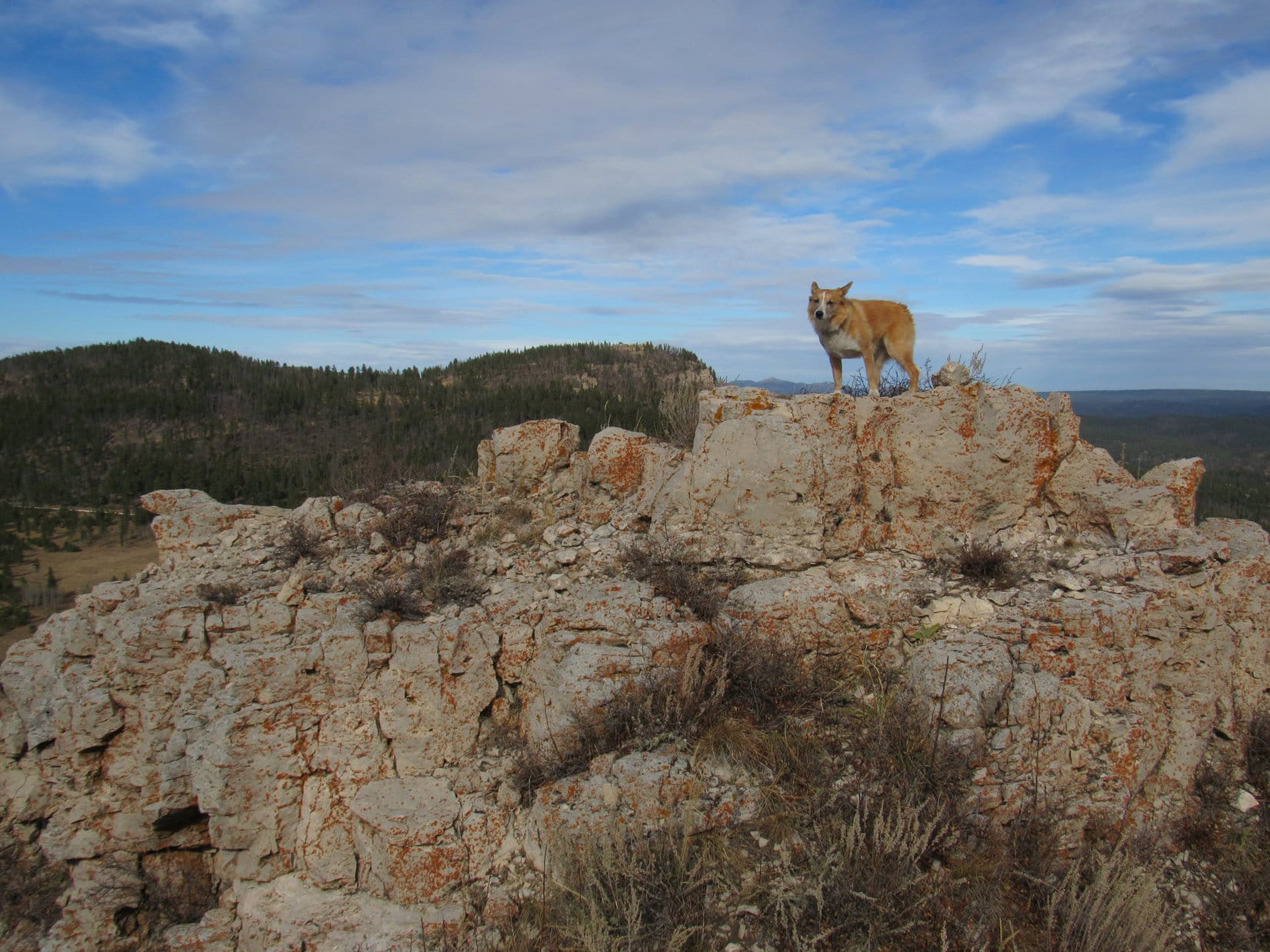
Lupe and SPHP went back down.  Lupe circled around the W side of the mountain looking for another route up.  She found a steep approach from the WNW.  Lupe climbed until she reached a small grassy area between limestone outcroppings.  Once again, she was almost at the top of Nipple Butte.  The summit was now just to the S, above a 6 or 7 foot high wall of limestone.

SPHP had to lift Lupe to help her get up on the limestone platform.  She was nervous about it, but got up there OK.  SPHP climbed up next.  The limestone platform wasn’t very big.  There were sheer drops all around.  They weren’t tremendously high drops, but falling off wouldn’t have been healthy at all.  A 2 or 3 foot high chunk of limestone rested on the platform.  This was the true summit!

Lupe on Nipple Butte with the boulder that is the true summit seen right behind her. Photo looks SW.
Reynolds Prairie from Nipple Butte. Photo looks E.

Nipple Butte was a real island in the sky!  Being up there was a little like being on a cloud.  No trees blocked the views.  Lupe could see in every direction.  Lupe and SPHP relaxed for a while, just taking it all in.

Flag Mountain (6,937 ft.) (Center), another mile N, was Lupe's next destination. USFS Road No. 189 is seen below. Photo looks N from Nipple Butte.
Flag Mountain (6,937 ft.) (Center), another mile N, was Lupe’s next destination. USFS Road No. 189 is seen below. Photo looks N from Nipple Butte.
Castle Rock. Photo looks S.
The S end of Reynolds Prairie (L) from Nipple Butte. Photo looks SSE.

When it was time to leave, SPHP carefully crawled off the N edge of the summit area first.  Lupe didn’t know how to get down!  It looked scary to the 2 year old Carolina Dog.  She didn’t really trust SPHP to help her either.  She stood up on top trying to figure out what to do.

Lupe looked happy enough, but she was more than a little worried about how she was going to get down off Nipple Butte.

SPHP finally managed to grab Lupe’s front legs and pull her near the edge.  Lupe was alarmed, but SPHP got a secure hold on her and helped her safely off Nipple Butte.  The Carolina Dog was greatly relieved!  Lupe and SPHP made the steep descent down the WNW slope.

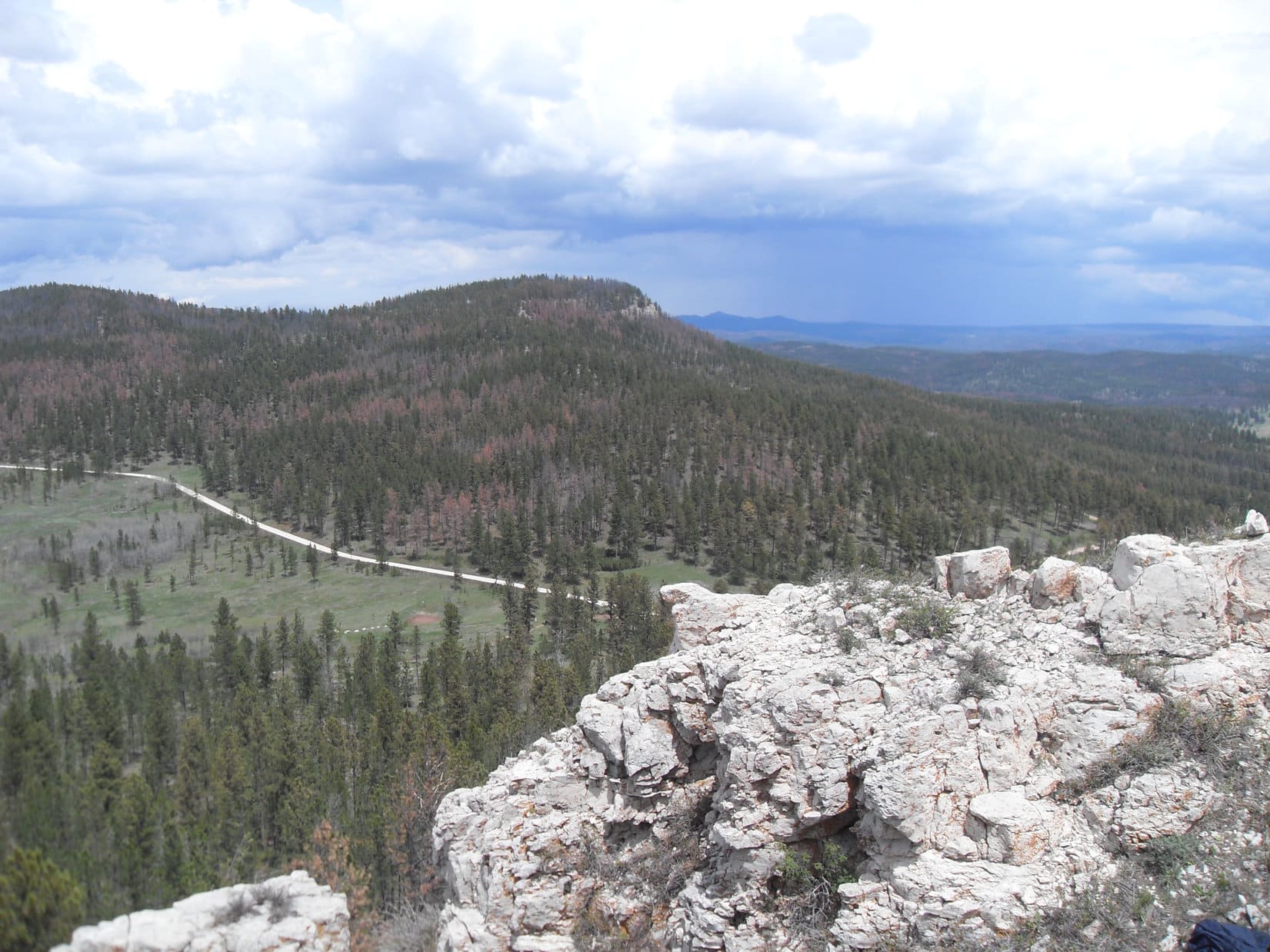
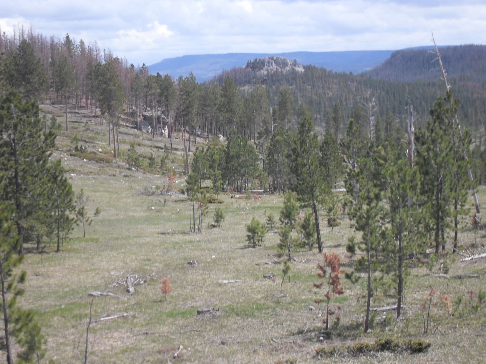
Once completely down off Nipple Butte, Lupe headed N across USFS Road No. 189.  She began climbing the S ridge going up Flag Mountain (6,937 ft.).  By now it was afternoon.  Despite the shady protection of the forest, the heat forced frequent stops for water.  Lupe didn’t reach the rough road to the top of Flag Mountain until she was already quite close to the summit.  She followed the road the rest of the way to the rock stairs up to the remnants of the old lookout tower.

Lupe near the remnants of the old lookout tower on Flag Mountain. Photo looks E.

Remnants of the old lookout tower on Flag Mountain, 5-24-16Not much could be seen to the W, but in every other direction Flag Mountain featured impressive views.  Lupe felt more secure here than at Nipple Butte, too!

Lupe's final peakbagging goal of the day was Peak 6962, the ridge on the L. White Tail Peak (6,962 ft.) is the far ridge on the R. Photo looks N.
Lupe’s final peakbagging goal of the day was Peak 6962, the ridge on the L. White Tail Peak (6,962 ft.) is the far ridge on the R. Photo looks N.
Lupe feeling safe and secure in the remnant of the old lookout tower on Flag Mountain. Photo looks E.
Another look at Peak 6962 (L) and White Tail Peak (Center) from Flag Mountain. The gravel road is USFS Road No. 599. Photo looks N.

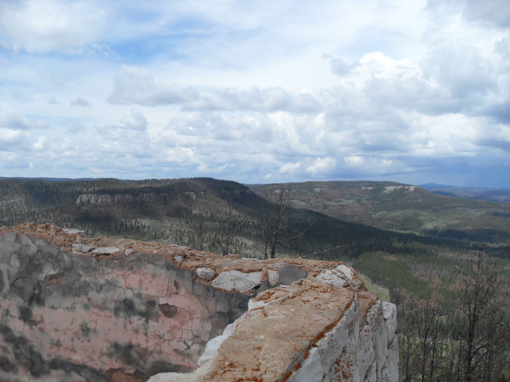
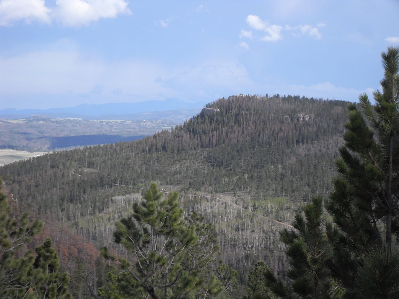
The afternoon was wearing on, but Lupe had only one more peakbagging goal left.  Peak 6962 was more than 1.5 miles to the NNW.  Staying on high ground, Lupe would have to go twice that far to get there.  Instead of taking the road, Lupe and SPHP left the remains of the Flag Mountain lookout tower going W along the ridge.

The ridge didn’t stay level for very far.  Lupe went down into the forest.  She briefly came to the road near the N end of a sharp bend.  Five ATV’s roared on by heading up.  Lupe continued W beyond the road and back into the forest.  Lupe and SPHP tried to stay on high ground as much as possible, as the terrain went up and down over a series of small rises and intervening saddles.  Nipple Butte, now to the SE, came into view at one point.

Nipple Butte (Center) viewed from the NW as Lupe was heading for Peak 6962.

Lupe had to go almost a mile W before the terrain allowed her to start turning N.  She eventually came quite close to USFS Road No. 189 again, but she stayed on a slightly higher ridge to the E of it.  When Lupe finally reached a point about a mile SW of Peak 6962, she was able to turn NE and follow another ridge toward the summit.

There had been quite a lot of deadfall timber to contend with on the way from Flag Mountain, but this last stretch going NE to Peak 6962 was simply terrible.  Dead trees had tumbled over everywhere, sometimes stacking several high.  To make matters worse, an old barbed wire fence followed the same ridgeline Lupe was trying to follow.  Along most of the route, the fence had collapsed under the weight of the many trees that had fallen across it.

SPHP was constantly worried that Lupe would get ripped up by the dangerous barbed wire.  The deadfall and terrain forced Lupe and SPHP back and forth across the fence line many times.  It was a struggle to make any progress through the seemingly endless obstacles.  Getting to Peak 6962 was taking a very long time.  The area felt very isolated and remote.  Protected by the shattered forest, Peak 6962 must not have many visitors these days!

Lupe gradually got closer to Peak 6962.  She started coming to a few places along the ridge where there were views of Flag Mountain off to the SE.  She also started seeing an abundance of beautifully blooming crocuses.  SPHP dubbed the area “Perfect Crocus Ridge”.

Finally, Lupe reached the area where the summit of Peak 6962 was supposed to be.  The topo map showed a couple of areas within 6960 foot contours.  Lupe arrived at the S one first.  The topo map was right.  The top of Peak 6962 was quite flat.  Both of the 6960 foot contours were contained within a 6940 foot contour covering a much larger area.  Lupe found no obvious summit.

There were no views either.  Forest was all around.  Even near the steep E edge of the mountain, the were enough trees still standing to quite effectively hide the view.  Lupe and SPHP trudged on to the N, to check out the terrain over there.  SPHP was hoping to find a view of White Tail Peak (6,962 ft.) to the N.  There really wasn’t one.  If anything, the forest was even thicker here.  The terrain here didn’t seem any higher than back to the S, either.

Lupe was tired from leaping over all the countless dead trees on the ground.  The Carolina Dog wanted to stop for a rest.  SPHP was tired, too.  SPHP sat on the ground.  Lupe had some water and curled up.  SPHP considered what to do next.  From Flag Mountain, SPHP had seen some big cliffs at the very end of a long ridge protruding S from the E edge of Peak 6962.  SPHP was certain those cliffs would provide some great views, but going there would add another 0.5 mile one way.

SPHP decided against it.  It was just too much work going through all the deadfall.  Maybe another time, if there ever was another time.

After 10 minutes, Lupe was ready to go again.  The highest spot on the mountain had seemed to be within the area contained within the S 6960 foot contour.  Lupe and SPHP went back there for Lupe’s Peak 6962 summit photos.  The forest badly damaged by pine bark beetles wasn’t very pretty, but there was a beautiful green carpet of kinnikinnick.

Lupe smiling on the lovely green carpet of kinnikinnick at the summit of Peak 6962. Note the semi-transparent white object to her R. Photo looks ENE.
This photo documents the existence of a genuine fire-breathing American Dingo on Peak 6962! Note the smoke coming out of her nose!

It was time to leave Peak 6962.  The shortest route back to a road was to head SW back along Perfect Crocus Ridge.  To avoid the worst of the deadfall timber, Lupe and SPHP tried staying below the ridgeline by going through a lower field to the SE.  For a little while, this worked well.  Lupe could run around without having to constantly be leaping over dead trees.  After a while, though, the terrain forced Lupe up and over to the NW side of the ridge.

Flag Mountain from Perfect Crocus Ridge. Photo looks SE.

Staying off the top of the ridge helped more than SPHP initially realized.  Lupe came to a clearing in the forest.  Down a grassy slope to the SW was a good gravel road.  Lupe was already almost back to USFS Road No. 189!  SPHP stopped to look at the maps.  After marching along all day through the forest, SPHP was tired of dealing with all the deadfall.  Lupe was going to stick to the roads on the way back to the G6!

The quickest way back was to just follow No. 189 SE to Reynolds Prairie.  Too easy and dull!  A more interesting route was to take No. 189 only 0.5 mile S to USFS Road No. 239.  No. 239 went S through Horsethief Creek valley for 3 miles to W Deerfield Road down in the valley of the North Fork of Castle Creek.

Since it was already getting late in the day and SPHP was already fairly tired, naturally SPHP chose a third route, the longest possible one.  Lupe would go W on No. 189 for nearly 2 miles to USFS Road No. 129 before taking it S through Hughes Draw down to the North Fork of Castle Creek.  Lupe and SPHP headed on down to No. 189 and turned NW.

Gradually, it began to dawn on SPHP that going NW was a big mistake.  The sun was getting low, Lupe was heading away from the G6, and this route added at least another 5 miles to the trek back.  No matter how interesting this route might be, it was going to get dark.  It was really too late in the day for such silliness!  SPHP was regretting the decision to go NW when a road going S into a shallow valley appeared a short distance ahead.

A marker at the start of the road said this was No. 129.1B.  A quick check of the maps showed it was a shortcut down to No. 129 and No. 129.1A on the way to the North Fork of Castle Creek.  Good!  Lupe and SPHP immediately turned S on No. 129.1B.

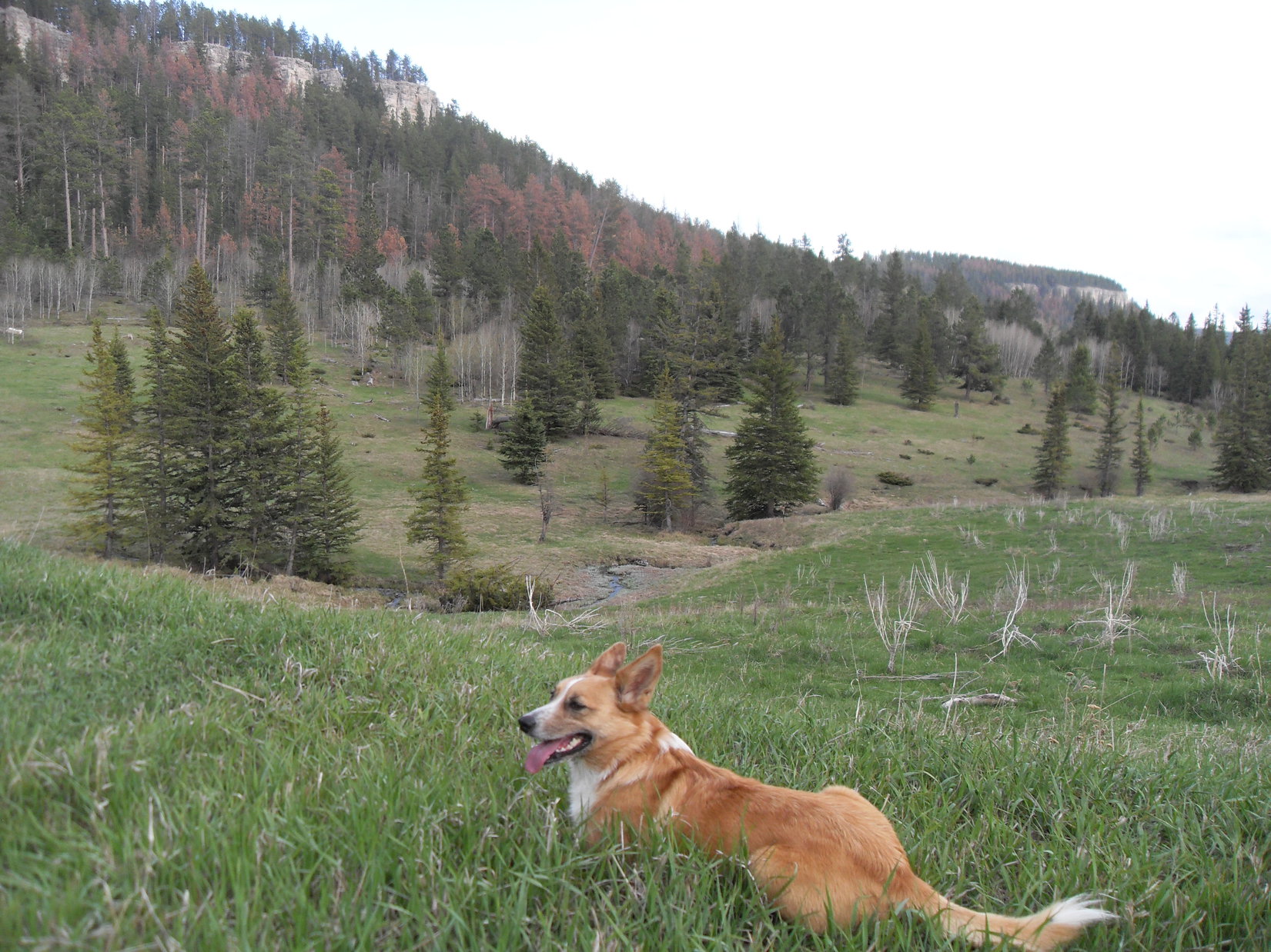
The little valley No. 129.1B went down was very inviting.  Beyond a grove of aspen trees, Lupe and SPHP heard frogs croaking.  Lupe ran ahead to investigate.  She found a pond where she got a huge drink.  SPHP had completely run out of water more than a mile back.

The frog pond near USFS Road No. 129.1B where Lupe got a huge drink of water. The frogs did not resume croaking until Lupe left.

SPHP made good progress hiking down No. 129.1B.  There was open ground on both sides of the road.  Lupe had a blast racing back and forth across the valley.  She hadn’t had an opportunity to run like this all day.  She was having a great time.  Despite all the hours that had gone by, Lupe was still full of energy.

No. 129.1B reached an intersection with No. 129.  Two springs (Lyons Spring on the USFS map) combined to form a small creek, presumably Lyons Creek.  Instead of following No. 129 SE, Lupe went W a short distance to take No. 129.1A going S.

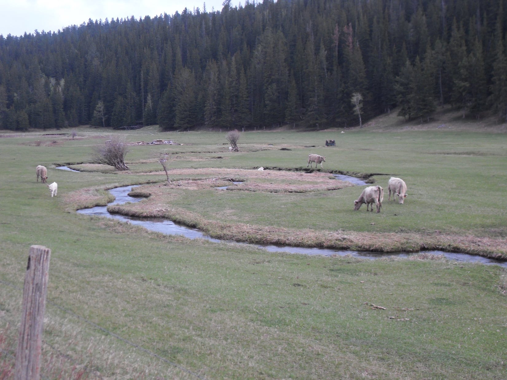
No. 129.1A was a decent road, but did not lose elevation as quickly as Lyons Creek did.  At first, Lupe was able to easily run down to the creek to get drinks of water.  Pretty soon, however, the road was well above creek level.  Lupe frequently saw deer down in the meadows by the creek below.

Lupe rests on the green grass above Lyons Creek. Photo looks SE.
USFS Road No. 129.1A. Photo looks S.

Lupe finally reached W Deerfield Road down by the North Fork of Castle Creek.  Lupe couldn’t resist getting in this much larger creek for another big drink.

Getting a drink from the North Fork of Castle Creek.

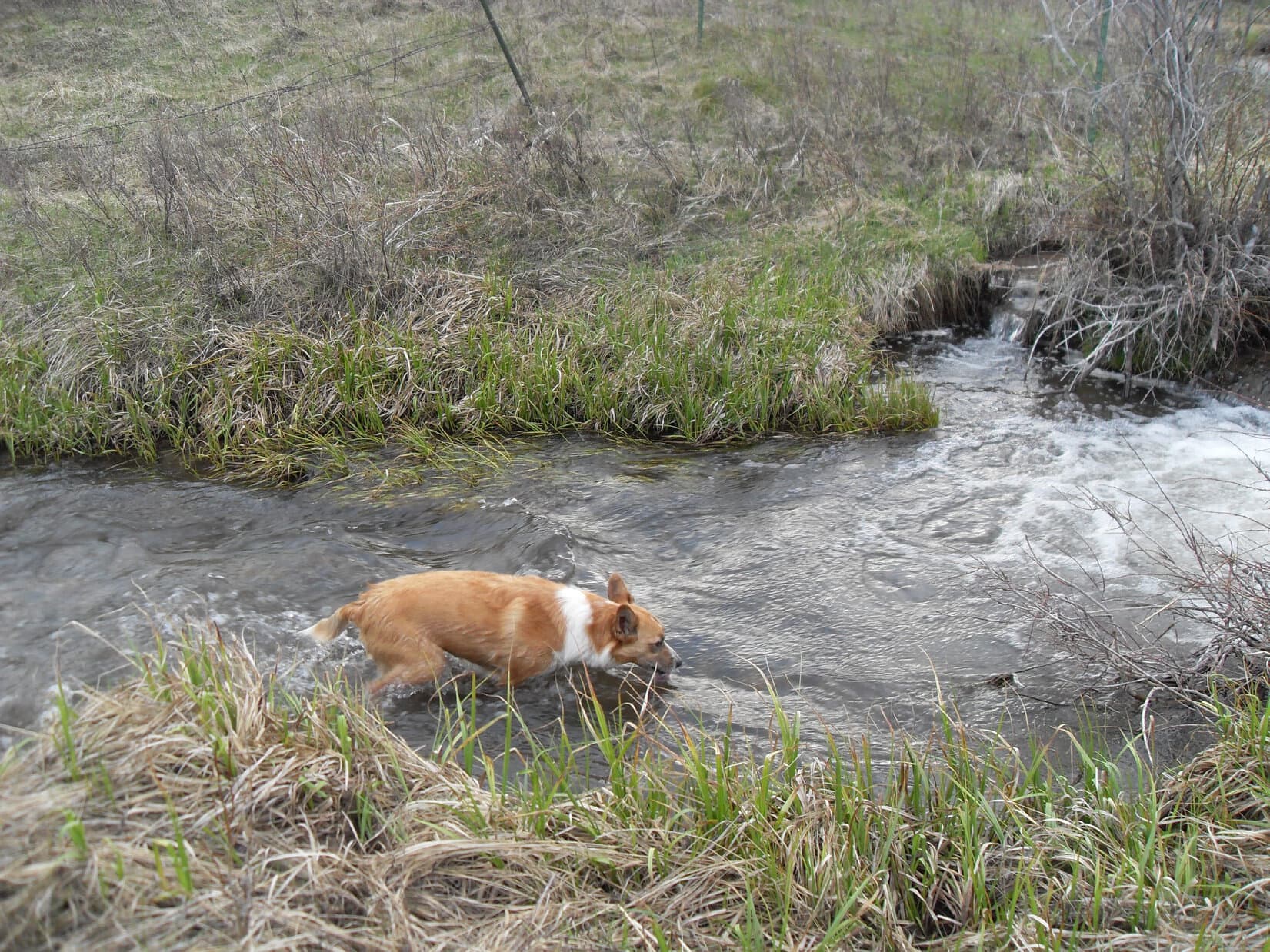
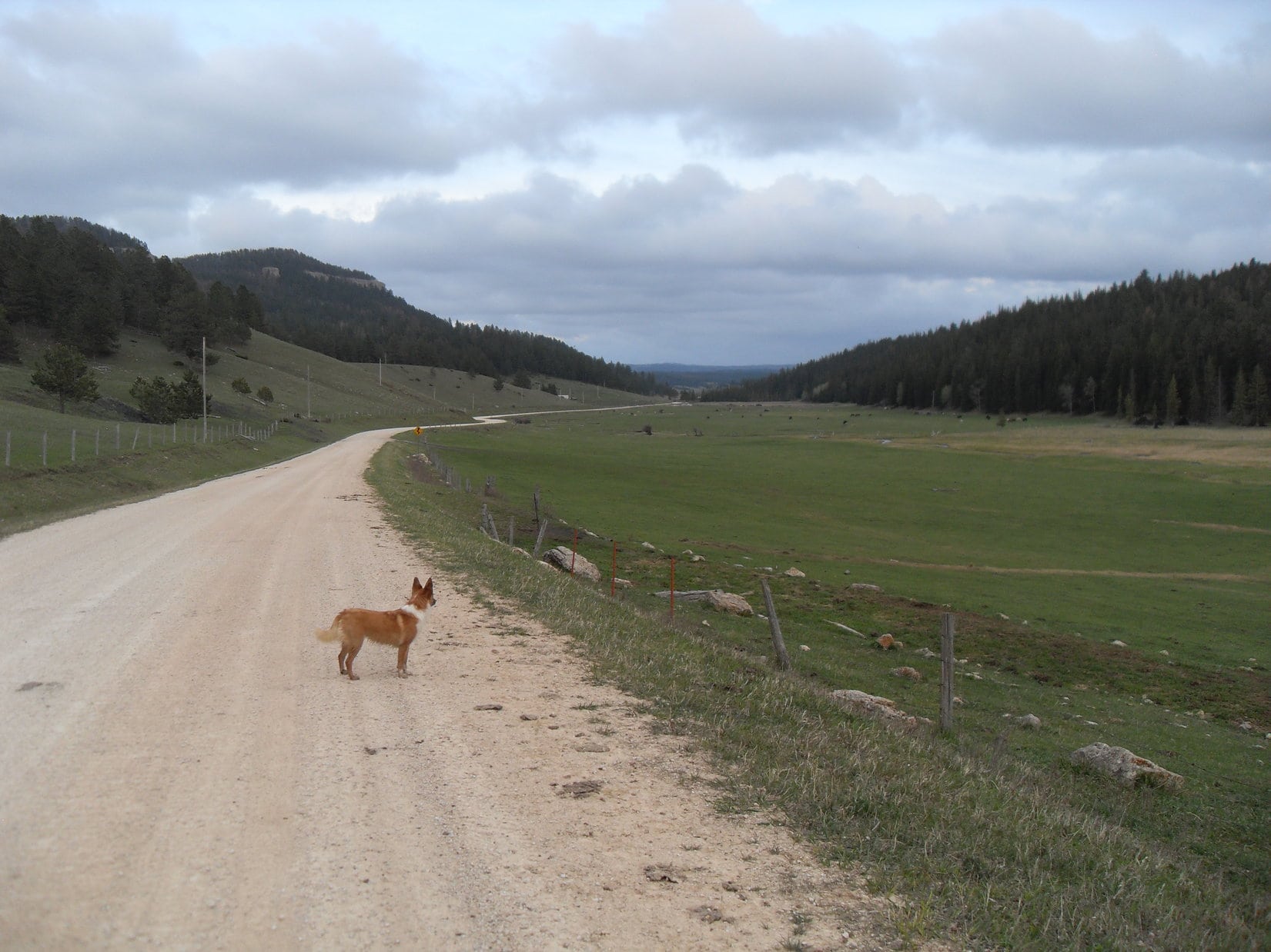
Lupe was still at least 3 miles NW of the junction with County Road No. 306 to Reynolds Prairie.  The G6 was another 1.25 miles beyond that.  Lupe and SPHP followed W Deerfield Road SE.  Cows were in the fields nearby.  Lupe was very interested.  Although the temptation was huge, she was a very good American Dingo and didn’t bark.

At 9:01 PM (55°F), Lupe finally reached the G6 again.  Light was still fading from the sky.  Lupe had been gone over 11 hours, but she did reach all 5 of her peakbagging goals!  Although she had just completed her 90th Black Hills, SD Expedition, Lupe’s peakbagging days were just beginning.

Lupe on W Deerfield Road in the valley of the North Fork of Castle Creek. Photo looks SE.
Some of the very tempting cows Lupe didn't bark at.
Some of the very tempting cows Lupe didn’t bark at.

Links:

Next Black Hills Expedition                       Prior Black Hills Expedition

Black Hills, SD Expedition No. 133 – South Castle Rock, Castle Rock, Nipple Butte, Flag Mountain & Peak 6962 (6-13-15)

Want more Lupe adventures?  Choose from Lupe’s Black Hills Expeditions Adventure Index or Master Adventure Index.  Or subscribe free to new Lupe adventures.

Black Hills, SD Expedition No. 212 – South Castle Rock, Castle Rock, Nipple Butte & Flag Mountain (10-22-17)

Start – 10:28 AM, 46°F, at the first pullout along West Deerfield Road near Castle Creek W of the intersection with Deerfield Road (County Road No. 306)

Fall colors were over and done with.  Sad, but the glories of autumn fade quickly.  Nothing new about that.  Lupe was still enthused!  This bright, comfortably cool day in late October was made to order for a continuation of the Carolina Dog’s recent tour of some of the highest peaks of the Black Hills along the E edge of the western limestone plateau.

Today, Lupe would visit 4 such peaks.  She’d been to all of them before more than once, but it had been well over two years since her most recent visit and would be fun to see them again.  Besides, SPHP had promised Loop she would get to explore a whole new canyon on the way back at the end of the day.

Something old, something new, that’s what we’re gonna do!

If that’s supposed to be poetry, SPHP, don’t quit the day job.

Hah, too late, I already have!

My, what a big deficit you’re running, SPHP!

Never mind that, the better to go adventuring with you, my dear Dingo!

Loopster was totally in favor of that.  She started off with a quick look at pretty Castle Creek, which somehow always has good flow even during seasonally dry periods like this.  Then the American Dingo crossed West Deerfield Road and began the climb toward her first peakbagging objective, South Castle Rock (6,840 ft.).

Expedition No. 212 begins with a quick look at Castle Creek. Photo looks NNW.
Looking NW up the Castle Creek valley after crossing West Deerfield Road.

A short climb through a pine forest brought Loop to a grassy field.  The upper S face of South Castle Rock was already in view.  This was going to be a nice, easy stroll most of the way.  Lupe headed N through the field, passed through another forested stretch, and was soon back out in the open again.  The only short steepish part of the whole climb was up in the trees directly ahead.

After a short climb through a pine forest, Loop reaches a grassy field. The upper S face of South Castle Rock is already in view in the distance. Photo looks N.
Getting closer! Lupe squints in the bright morning sunshine. Photo looks N.
The only steep part of the climb up South Castle Rock is in the trees ahead. Photo looks NNW.

The best views from South Castle Rock aren’t from the summit, but from limestone cliffs high up on the far S ridge.  That was right on Lupe’s way to the summit, so she went there first.  She had a great panoramic view to the S and E from here.  To the N, Loop could see the end of nearby Castle Rock’s E ridge.

From limestone cliffs along South Castle Rock’s far S ridge, Lupe had sweeping views to the S & E. Photo looks SE past Deerfield Reservoir.
The end of Castle Rock’s E ridge is seen on the R. South Castle Rock and Castle Rock are different parts of the same mountain. Photo looks N.
At the edge of South Castle Rock’s S ridge. Photo looks N.

South Castle Rock has two high points.  Being slightly higher, the N high point is the actual summit.  From the cliffs along the S ridge, Lupe circled well W of the S high point before turning N again.

The summit wasn’t far off, but the discouraging sight of all the deadfall timber Lupe had to traverse to get to there made SPHP realize the Komperdell trekking poles generously gifted by Jobe Wymore had been forgotten in the G6.  Doh!  SPHP had used them for the first time a week ago on Expedition No. 211.  The poles had been quite useful for nagivating deadfall then, and would have been handy to have here.  Oh, well!

After circling around the S high point, the sight of all the deadfall on the way to the true summit made SPHP realize the Komperdell trekking poles had been forgotten in the G6. They would have been mighty handy to have here! Photo looks N.

The true summit of South Castle Rock (6,840 ft.) sits at the N end of a fairly large limestone cap surrounded by low cliffs.  Getting through the deadfall to reach the cap was the hard part.  That done, Lupe circled to the SW where the cliffs were lowest.  One mighty, unassisted, clawing leap, and she was on top!

At the highest point at the N end, someone had built a cairn since Lupe was last here.  Trees hid the views in most directions, but Loop did have a tremendous view of Reynolds Prairie to the E.  She also had a clear view of Castle Rock’s E ridge to the NE.

Lupe arrives at the S end of South Castle Rock’s limestone cap. She was able to leap on top from a point farther W (L). Photo looks NW.
At the summit. Someone had built the small cairn next to her since the last time Lupe was here in June, 2015. Although forest hides the views in most directions, Lupe could see much of Reynolds Prairie to the E. Photo looks E.
The slightly lower summit of Castle Rock (6,783 ft.) is on the ridge seen beyond Lupe. That’s where she was heading next. Photo looks NE.

After a short break near the cairn, Lupe left South Castle Rock’s limestone cap at the same SW point where she’d leapt up.  Less than a 0.25 mile trek brought her to Castle Rock’s E ridge.

The E ridge was 200 feet wide and rounded, sloping down toward cliffs on both sides.  The top was nearly level along most of its length.  Lupe followed the ridge ESE all the way to where the ground started dropping toward the cliffs at the far end.  The true summit seemed to be here near the ESE end, but it was hard to tell for certain.  Having traveled the whole length of the ridge, Loop must have been at the actual high point somewhere along the way.

The apparent summit of Castle Rock (6,783 ft.) was forested and clogged with deadfall, but Lupe had great views from the cliffs along the edges of the ridge in every direction except back to the W.

At the summit of Castle Rock as near as SPHP could determine. A glimpse of the N end of Reynolds Prairie is seen below. Photo looks NE.
South Castle Rock as seen from Castle Rock. The summit is on the R. Photo looks SW.
Looking SE from Castle Rock’s E ridge. Parts of Deerfield Reservoir are seen beyond Reynolds Prairie. The distant high ridge on the R is Green Mountain (7,166 ft.).
Nipple Butte (6,810 ft.) (L) and Flag Mountain (6,937 ft.) (Center), Lupe’s 2 remaining peakbagging destinations for the day, from Castle Rock’s E ridge. Photo looks N.

After visiting Castle Rock’s summit on the E ridge, Lupe headed back W.  Although the mountain’s long, skinny N ridge is somewhat lower, she went out onto it.  A big, flat, barren area at the southern end of the N ridge provides good views to the W and NE.  This area is Lupe and SPHP’s favorite part of Castle Mountain.  Despite the openness, the whole place has a secluded, tucked-away feel.

Loop on the big barren area near the S end of Castle Peak’s long, skinny N ridge. This is a favorite spot! Flag Mountain is seen beyond Nipple Butte on the R. Photo looks N.
An expansive view of the N end of Reynolds Prairie. Photo looks NE.
Looking W from Castle Peak’s N ridge. SPHP promised Lupe she would get to explore this big canyon on the way back to the G6 later on.
Flag Mountain is partially hidden by Nipple Butte on the L. Custer Peak (6,804 ft.) is the distant high point on the R. Photo looks N with help from the telephoto lens.

The easy way off Castle Rock’s N ridge is found on the E side almost at the S end.  Lupe followed an animal trail down there.  She lost elevation traveling N well below Castle Rock’s N ridge where the slope wasn’t too bad.  This was a forested area full of long grass hiding an annoying amount of deadfall timber.  SPHP was soon wishing for those Komperdell trekking poles again.

Nipple Butte (6,810 ft.), Lupe’s next destination, was 0.5 mile away.  The deadfall didn’t let up until she reached the saddle leading to Nipple Butte from Castle Rock.  Once she traversed the saddle, the climb steepened quickly.  Lupe was approaching from the S, but the best way up is a chute on the WNW side of the mountain, so she circled around to the W as she went higher.

The top of Nipple Butte is a ragged, rugged chunk of limestone with lots of broken rock below on most of the surrounding slopes.  Of all the peaks Lupe was visiting on Expedition No. 212, Nipple Butte was the only one that was at all scrambly.  The Carolina Dog got a bit too high, too soon, reaching the rocky slopes while she was still SW of the summit.

Loop reaches the rocky zone while still SW of Nipple Butte’s summit. Photo looks NE.

It would have been faster, if Loop and SPHP had circled around farther to the W before getting so high, but it didn’t really matter.  Lupe crossed a slope of broken limestone scree, and reached the chute on the WNW side of the mountain.

At the start of the steep chute up to the summit area. This chute is on the WNW side of Nipple Butte. Photo looks NE.

The chute was steep, but not long.  Lupe was at the top in no time.  Before going to Nipple Butte’s true summit, she got up on the high point N of the upper end of the chute.

On Nipple Butte’s N high point. Flag Mountain is in view at Center. Photo looks N.

From the top of the chute, a six foot high wall of limestone was all Lupe had to get up to reach the summit.  The six feet were simply too high and vertical for her to manage on her own.  However, there were a couple of rocks SPHP could stand on from which she could be boosted to the top.

Meekly, the American Dingo lifted one of her front paws.  She needed help and was ready for assistance.  SPHP picked her up, stepped into position, and lifted her to the small limestone platform at the top of Nipple Butte.  SPHP then scrambled up after her.

A single chunk of limestone 1.5 feet higher than the rest of the summit platform is the true summit.  It was large enough for Lupe to stand on.  So easy, yet dramatic.  She’d made it!  There Lupe stood, on the tiny absolute top of Nipple Butte (6,810 ft.) with 360° views!

Oh, yeah!  Nice work, Loop.  Photo time!

Loop at the summit of Nipple Butte. Photo looks SW.
Most of the summit platform is in view here. Photo looks SW.
Oh, so beautiful, Looper! If your big soft Dingo ears were any larger, you look like you could use ’em to take off and fly away. Don’t try it, though!
Looking SW. The summit rock is now in the foreground on the R.
Next to the summit rock. Still looking SW.
The N end of Reynolds Prairie. The N high point of Nipple Butte, which Lupe was on earlier is seen on the L. Photo looks NE.
Flag Mountain (6,937 ft.) (R) from Nipple Butte. USFS Road No. 189 is in view. Photo looks N.
The middle of Reynolds Prairie. Photo looks E.

Lupe and SPHP sat together up on Nipple Butte for a little while.  The sense of space and airiness from the tiny platform is among the best on offer anywhere in the Black Hills.

When the time came to go, SPHP climbed down first.  The American Dingo remained on top for one last photo atop the summit rock.

The summit as seen from Nipple Butte’s N high point. The 6′ high limestone wall SPHP boosted Loop up is at Center. The vegetated area below is the top of the chute Lupe climbed to get here. The forested ridge on the L is Castle Rock. Photo looks S.
The S end of Reynolds Prairie, bits of Deerfield Reservoir, and the distant high ridge of Green Mountain (R) from Nipple Butte. Photo looks SSE.

One more peak to go!  SPHP helped Loopster off the summit platform.  Puppy, ho!  Back down the steep WNW chute to broken limestone scree leading to scattered boulders, and finishing it all off with the usual deadfall infested trek in the forest.

Heading down the WNW slope. Photo looks W.

Lupe reached USFS Road No. 189 at the saddle leading to Flag Mountain.  Half a mile NW of here a spur road leaves No. 189.  The spur winds 0.75 mile NE almost to the top of Flag Mountain.

Nah, not that way!  Instead, Loop crossed No. 189 heading N.  Traveling directly up Flag Mountain’s S ridge would be shorter and more fun.  An hour after leaving Nipple Butte, the Carolina Dog was standing in the remnant of the old fire lookout tower on Flag Mountain (6,937 ft.).

Lupe in the remnant of the old fire lookout tower on Flag Mountain. Photo looks E.
Perched up on the wall, feeling good about her 4th successful ascent of the day!
Looking S back where Lupe had come from. Nipple Butte is seen in front of Castle Rock (Center).
Looking W along Flag Mountain’s summit ridge.
Near the remnant of the fire lookout tower. Photo looks E.
Another look from a bit farther W.

Flag Mountain was the highest of any of the peaks Lupe climbed today.  The views were grand, though this much larger summit area did not give quite the same feeling of exposure and airiness she’d had up on Nipple Butte.

Early in the day, there had only been a light NW breeze.  By the time Lupe reached Nipple Butte, the wind had switched to the SW and picked up to about 15 mph.  The same SW wind was still blowing up here.  With the sun now noticeably progressing toward the horizon, the breeze felt a bit chilly.

Lupe and SPHP lingered up on Flag Mountain anyway.  This was warm compared to what would likely be coming before too long.  Who knew how many more weeks it would be before cold and snow would take over up in this western high country?

Lupe lingers on Flag Mountain. Who knew how much longer it would be until snow and cold would take over in this western Black Hills high country? Reynolds Prairie is on the L. Both Nipple Butte and Castle Rock are on the R. Photo looks SSE.
White Tail Peak (6,962 ft.) is the long ridge at Center. Lupe had enjoyed some fabulous views from there only 3 weeks ago on Expedition No. 209. The more distant mountain on the R is Terry Peak (7,064 ft.). Photo looks N.
From the wall of the old lookout tower, Peak 6962 (Center) is in view. Photo looks NNW.
Black Elk Peak (7,231 ft.) is the high point on the far horizon at Center. As the highest mountain in South Dakota and the Black Hills, many of Lupe’s expeditions feature a view of Black Elk Peak from one direction or another. Photo looks SE.

With 4 successful ascents, Lupe had completed all of her peakbagging objectives for Expedition No. 212.  The time had come for SPHP to honor the promise to let her roam some never before explored territory in the big canyon W of South Castle Rock, Castle Rock and Nipple Butte.

Final moments up on Flag Mountain’s summit ridge before descent. Photo looks NE.

Lupe left Flag Mountain traveling W.  She ultimately took a route down similar to her path up, following the S ridge much of the way.   An early turn to the SW served as shortcut to USFS Road No. 189.

Once across No. 189, the American Dingo began her explorations of the big canyon traveling SSW.  It was downhill from here all the way to West Deerfield Road.

NNW of Nipple Butte looking forward to starting the long trek down the big canyon. Photo looks SSE.

Lupe saw lots of deer.  She got muddy paws and drank from a small stream, a tiny tributary of Horsethief Creek, itself no great torrent.  Looper was one busy Carolina Dog the whole way, free to run and play.

In the upper part of the canyon W of Nipple Butte. This seldom, if ever, used road went most of the way down the canyon. Photo looks SSW.
Miss Muddy Paws after a drink from the tiny stream. The road was reduced to a single track trail here. Photo looks S.
Somewhere W of Castle Rock or South Castle Rock. The faint road is back. Looking S.
Near Horsethief Creek in the lower end of the canyon, now more of a wide valley. Photo looks NNE.

The sun was close to setting by the time Lupe neared West Deerfield Road.  The G6 was a only short walk SE along the road.  Expedition No. 212’s adventures were almost complete.  Behind Loop, the top of South Castle Peak still glowed in the last light of day.

South Castle Rock glows in the last light of another great day spent in Lupe’s Black Hills. Photo looks NNE.

That glow was gone before Lupe even got to the G6 (6:01 PM, 36°F).  Expedition No. 212 might be officially over, but Lupe’s fun wasn’t.  She was back early enough so twilight would last a long time.

For nearly an hour on the ride home, a frantic American Dingo watched for deer, cows and horses to bark at.  Many decibels provided near constant earsplitting proof of the success of this project.  No doubt a hugely satisfying encore to a splendid day!

South Castle Rock.

Links:

Next Black Hills Expedition                   Prior Black Hills Expedition

Want more Lupe adventures?  Check out her Black Hills, SD & WY Expeditions Adventure Index, Master Adventure Index, or subscribe free to new Lupe adventures!

Black Hills, SD Expedition No. 133 – South Castle Rock, Castle Rock, Nipple Butte, Flag Mountain & Peak 6962 (6-13-15)

Lupe continued her peakbagging along the E edge of the limestone plateau country in the western Black Hills on Expedition No. 133, but somewhat farther N than on Expedition No. 132.  It was 9:57 AM and 69°F under mostly clear skies when SPHP parked the G6 at the first pullout along Castle Creek beyond the intersection of Deerfield and South Rochford roads.  Lupe immediately crossed the road and started heading NE up through forests and meadows toward the S end of South Castle Rock.

Lupe at the start of the day near Castle Creek.

South Castle Rock (6,840 ft.) was Lupe’s first peakbagging goal of the day and the one that would require the most elevation gain since Lupe started from down by Castle Creek.  The other four peakbagging points were all at similar elevations along the E edge of the limestone plateau country.  Some elevation had to be lost between each of the peaks, but not nearly as much as Lupe would gain just getting to South Castle Rock.

Lupe approaches South Castle Rock from the SSW.

Lupe had done essentially this same peakbagging trek once before on Expedition No. 90 on 5-24-14, so SPHP knew pretty much what to expect.  The best views from South Castle Rock are not at the summit, but from the limestone cliffs at the SE end of the mountain.  Lupe stopped here first for some photos.  There were beautiful views of the E edge of the limestone plateau country to the S and Reynolds Prairie to the E.  Parts of Deerfield Lake were visible too.  Heading N through the forest, Lupe also got her picture taken on the highest boulder at a false summit a short distance S of the true summit.

Lupe at the cliffs at the S end of South Castle Rock. Green Mountain is the highest ridge in the distance above her head. The lower ridge just to the left is Copper Mountain where Lupe was on Expedition No. 132.
Lupe at the cliffs at the S end of South Castle Rock. Green Mountain (7,164 ft.) is the highest ridge in the distance above her head. The lower ridge just to the left is Copper Mountain (6,920 ft.) where Lupe was on Expedition No. 132.  A small section of Deerfield Lake is visible.
Another view of Lupe at the cliffs at the S end of South Castle Rock.
Another view of Lupe at the cliffs at the S end of South Castle Rock.  She hasn’t moved from where she was in the previous photo.
Lupe still near the S end of South Castle Rock. This photo looks N towards the ridge that is Castle Rock.
This photo shows some of the S end of Reynolds Prairie and a bit more of Deerfield Lake.
At the false summit S of the true summit of South Castle Rock.

The true summit of South Castle Rock is on top of a large section of limestone sitting mostly 10-20 feet above the surrounding area.  The best way up and down is from the SW.  The whole area is forested, including the summit.  Due to the trees, there really aren’t any great views from the summit of South Castle Rock. SPHP did take one photo of Lupe on the summit with nearby Castle Rock in the background.  Castle Rock (6,783 ft.) and South Castle Rock are all basically part of the same mountain.  South Castle Rock is actually the highest point on the mountain.  Lupe lost a little elevation on the way to Castle Rock.

Here Lupe is actually on the flat true summit area of South Castle Rock. Photo looks N at Castle Rock.
Lupe on the true summit of South Castle Rock. Photo looks N at Castle Rock.

The summit of Castle Rock is with 100 feet of the E end of the ridge.  The summit is forested, but there are some good views near the edges of the ridge.  Lupe posed for a few photos, including one looking N towards her next two objectives, Nipple Butte (6,800 ft.) and Flag Mountain.  After the photo session, Lupe headed back W along the Castle Rock ridge.  When she got to the main N/S ridge line coming from South Castle Rock, she turned N onto a ridge SPHP dubbed “Skinny Ridge”.

Lupe at the E end of Castle Rock less than 100' E of the actual summit. Photo looks E towards Reynolds Prairie.
Lupe at the E end of Castle Rock less than 100′ E of the actual summit. Photo looks SSE towards Reynolds Prairie and Deerfield Lake.
South Castle Rock from the N rim of Castle Rock. The true summit of South Castle Rock is toward the right of this photo. Better views are attainable, however, from the cliffs toward the left edge.
South Castle Rock from the S rim of Castle Rock. The true summit of South Castle Rock is seen at the right of this photo. Better views are attainable, however, from the cliffs toward the very left edge.
Nipple Butte and Flag Mountain beyond are Lupe's next peakbagging goals. Photo looks N from the N rim of Castle Rock.
Nipple Butte (left center) and Flag Mountain (center) beyond are Lupe’s next peakbagging goals. Photo looks N from the N rim of Castle Rock.  The road is USFS Road No. 189.

Skinny Ridge heads N from the main portion of Castle Rock.  It is not all that skinny until it reaches its N end, but is skinnier than the main E/W ridge of Castle Rock.  Skinny Ridge is actually broad and flat.  There will be some really great views of the huge valley to the W of Castle Rock from Skinny Ridge someday when the dead pine trees along the ridge finally fall over.  On Lupe’s prior adventure here on Black Hills, SD Expedition No. 90, SPHP had learned that following Skinny Ridge to the N eventually leads to a dead end with cliffs on all sides.  The easiest way around Skinny Ridge is to descend to the E near the start (S end) of the ridge.

Lupe on Skinny Ridge which projects N from Castle Rock. Nipple Butte is seen in front of Flag Mountain.

So Lupe headed N on the way to Nipple Butte below and to the E of Skinny Ridge.  Lupe started encountering some large yellow flowers in this area that were attracting bumblebees.  There was a fair amount of deadfall timber in this area, but it wasn’t too bad.  When Lupe got past the N end of Skinny Ridge, she went on up to the saddle between Castle Rock and Nipple Butte.  She gained some elevation approaching Nipple Butte from the S.  The easiest route to the summit, however, is on the WNW slope.  Lupe swung around to the W side of the mountain before making the final ascent.

Lupe among the pretty yellow flowers N of Castle Mountain.
Lupe among the pretty yellow flowers N of Castle Mountain and Skinny Ridge.
Don't sniff too closely - those flowers are full of bumblebees!
Don’t sniff too closely – those flowers are full of bumblebees!

A short steep scramble is required to get up to the summit of Nipple Butte.  No equipment at all is required to reach the top.  The platform at the top of Nipple Butte is not very large.  There was a small area Lupe and SPHP could walk around on, but cliffs were never more than a few feet away.  The cliffs aren’t all that tall, but they are still cliffs.  One limestone boulder at the very top with orange lichens growing on it is presumably the nipple of Nipple Butte.  There aren’t any trees up on top of Nipple Butte, so there were great views in every direction.

Lupe on the W side approach to the top of Nipple Butte.
Lupe stands on the nipple at Nipple Butte.
N end of Reynolds Prairie from Nipple Butte.
Happy Carolina Dog on Nipple Butte. Photo looks SW.
Looking S at Castle Rock from Nipple Butte.
Looking N at Flag Mountain from Nipple Butte.
Looking N at Flag Mountain from Nipple Butte.  Flag Mountain was Lupe’s 4th and next peakbagging objective of the day.
Another look N at Flag Mountain from Nipple Butte.
Another look N at Flag Mountain from Nipple Butte.  The road is USFS Road No. 189.
Lupe and the nipple on Nipple Butte.
"OK SPHP, so how do I get down, without having to trust you not to be a total klutz and dropping me over the cliff?" Lupe actually made it down just fine after some hesitation. She took a route down by the bushes in the center of the photo.
“OK SPHP, so how do I get down, without having to trust you not to be a total klutz and dropping me over the cliff?” Lupe actually made it down just fine after some hesitation. She took a route down by the bushes in the center of the photo.

Lupe and SPHP stayed on Nipple Butte for a while to enjoy the scenes.  Lupe had some Taste of the Wild and SPHP had an apple.  When it was time to leave, Lupe was a bit concerned about how to get down.  SPHP had lifted her up a 6 foot wall of rock so she could get up on top, but Lupe wouldn’t let SPHP help her down.  Lupe finally took an alternate route down through some bushes that worked just fine.  After a trek down the NW slope of Nipple Butte, Lupe came to a little side road leading to USFS Road No. 189.  There was a great mud puddle along the side road and Lupe made use of it.

Exiting the mud puddle NW of Nipple Butte after a big drink of mineral water and a mud bath.

From the mud puddle, Lupe followed the side road to USFS Road No. 189, which she simply crossed heading N.  Lupe climbed up the ridge continuing N through the forest towards Flag Mountain (6,937 ft.).  When she drew near the access road, she turned more to the NNE to stay in the forest.  (One can drive to the summit of Flag Mountain via an access road off USFS Road No. 189.)  Very near the top, Lupe got on the access road for the final stretch.

Flag Mountain features great views to the N, E and S, plus the remains of the foundation of an old lookout tower.  From Flag Mountain, Lupe could get her first glimpse of Peak 6962 and Whitetail Peak to the N.  Peak 6962 was Lupe’s 5th and final peakbagging goal of the day.  White Tail Peak (6,962 ft.) is also along the E edge of the limestone plateau country, but it was just too far away to be included in Expedition No. 133’s day hike.

Lupe on the ruins of the lookout tower at Flag Mountain. Photo looks N towards Peak 6962 (left ridge) and Whitetail Peak (center ridge).
Lupe on the ruins of the lookout tower at Flag Mountain. Photo looks N towards Peak 6962 (left ridge) and White Tail Peak (center ridge).  Peak 6962 was Lupe’s 5th and final peakbagging goal for Black Hills, SD Expedition No. 133.  The road seen below is USFS Road No. 599.
Nipple Butte & Castle Rock from Flag Mountain. Photo looks S.
Lupe is almost camouflaged to blend in with the ruins of the Flag Mountain lookout tower foundation. She is on the wall just above the backpack.
Whitetail Peak from Flag Mountain. Whitetail Peak will be a future peakbagging goal for Lupe. She has already been there twice before, but it has been over 2 years since she was last there.
White Tail Peak from Flag Mountain. White Tail Peak will be a future peakbagging goal for Lupe. She has already been there twice before, but it has been over 2 years since she was last there.
Instead of going down to the Flag Mountain access road (yes you can just drive here!), Lupe left headed W along this rocky ridge.
Instead of going down to the Flag Mountain access road (yes, you can just drive here!), Lupe left headed W along this rocky ridge.

From Flag Mountain, Lupe headed W along the ridges.  She crossed the access road to Flag Mountain, but did not follow it.  Lupe and SPHP just went through the forest trying to stay on the high ground, while circling around the W end of the canyon between Flag Mountain and Peak 6962.  This involved some up and down as various high and low points along the way were reached.  Lupe did follow a very short section of USFS Road No. 189 just before heading N and then NE along the ridge to Peak 6962.

SPHP has no idea what kind of plant this is. It was full of bumblebees and looked like it was flourishing.
SPHP has no idea what kind of plant this is. It was full of bumblebees and looked like it was flourishing.  Lupe came across it W of Flag Mountain.

SPHP considers Peak 6962 the most annoying peakbagging mountain in the Black Hills.  It really shouldn’t be annoying at all.  It is up at the edge of the limestone plateau high country that SPHP finds so appealing.  The terrain undulates a bit, but there really isn’t much elevation gain or loss along the ridge extending out to the SW from the summit.  This ridge is only a little over a mile long from USFS Road No. 189.  There ought to be great views from Peak 6962 looking E and N towards Whitetail Peak.  What should be a pleasant easy stroll through the forest along a high ridge with some views to a summit with great views isn’t that way at all.

The main culprit is the mountain pine beetle, which has decimated the forest in the area of Peak 6962.  SPHP remembered that Lupe’s last trek to Peak 6962 back on Expedition No. 90 on 5-24-14 featured an annoying amount of deadfall timber.  Over a year’s time gone by had only made matters worse, as more dead trees have fallen.  It was a very slow march along the ridge on the way to Peak 6962 through all the deadfall timber.  Lupe could sometimes use the fallen tree trunks as highways, but the prevailing NW winds had pushed most of the trees over at a 90° angle to the direction Lupe and SPHP needed to go.

Just to make things more aggravating, for the first half of the way along the ridge, there is an utterly useless barbed wire fence that has been broken down in countless places as trees fell on it.  SPHP constantly worried that Lupe might get cut by the barbed wire.  The best route forward seemed to zigzag repeatedly across the fence line.  Despite the number of trees that have fallen, there are still enough dead and living trees still standing to block the views both on the way to Peak 6962 and at the summit.  Perhaps there are views at the cliffs at the very S end of the mountain back towards Flag Mountain, but SPHP didn’t consider it worth the struggle to get there.

Nipple Butte from W of Flag Mountain.

On Expedition No. 90, Lupe had come to an area along the ridge SW of Peak 6920 where there had been a large number of crocus flowers blooming.  They were in such gloriously beautiful condition, SPHP had named the area “Perfect Crocus Ridge”.  Sadly, there were no crocuses at all on this journey, although there were a few nice dark purple flowers here and there.  What was flourishing among all the deadfall timber were low-lying scratchy juniper bushes.

Lupe and SPHP finally reached the summit of Peak 6962.  The area was so flat, it was hard to tell where the exact summit might be.  It all looked pretty much the same.  Lupe and SPHP stopped here for a bit of a break after the battle with the deadfall timber, barbed wire fence and scratchy juniper bushes.  Lupe had some more Taste of the Wild.  SPHP ate the 2nd and final apple.  SPHP was certain the forest looked worse now than in May 2014.

Wow, this view was worth more than a mile scrambling over and around deadfall timber, barbed wire and scratchy juniper bushes! Lupe at the summit of Peak 6962. Successful completion of her 5th peakbagging goal of the day!

After the break, even though more than a year ago Lupe and SPHP had explored some distance to the N along the E edge of Peak 6962 and found no decent viewpoints towards White Tail Peak, SPHP decided to try it again.  The results were the same.  There were a few places along the E edge of Peak 6962 with partial views to the E, but no views at towards White Tail Peak.  On the way back to USFS Road No. 189, SPHP tried leading Lupe a bit to the N of the SW ridge to avoid the worst of the deadfall timber.  This helped some and also helped avoid the broken barbed wire fence.  It didn’t seem to take quite as long getting back to USFS Road No. 189 as the journey to Peak 6962.

Flag Mountain (L) from the high ridges SW of Peak 6962.

Once back to USFS Road No. 189, Lupe and SPHP started following it back towards Flag Mountain.  The almost totally clear skies of the morning had given way to overcast conditions as the day wore on.  It began to rain.  It rained hard enough for Lupe and SPHP to take cover under a big pine tree.  It didn’t last long.  After 5 minutes the rain was almost over and Lupe continued on.  At a bend in the road, Lupe and SPHP left No. 189 to follow a high ridge to the SW and then S.  There was a fence along this area too, but there was little deadfall timber and the fence was in good condition.

Soon the ridge ended and Lupe and SPHP went down through the forest to reach USFS Road No. 239.  For a short distance No. 239 climbed and reached a high spot with a very nice view to the S.  From then on it lost elevation slowly and steadily.  Both Lupe and SPHP liked the secluded valley that No. 239 descended into.  There were lots of deer and some squirrels and chipmunks around.  Birds were singing and a hawk kept flying around screeching.  Everything was lush and green.

The view S from the high point along USFS Road No. 239.

No. 239 went almost straight S for 2 miles and then curved to the E.  The road, which had been very good, deteriorated after reaching a wide, flat turn around spot.  The road did go on, however, and Lupe and SPHP continued to follow it.  The road  became a wide grassy trail and started heading NNE.  It looked like it might climb up a valley just W of Castle Rock. The road lost elevation though, so Lupe kept on.  Before long, the road became a mud hole at a spring.  Here Lupe and SPHP left the remnant of No. 239 to head E down to the floor of the valley.

At the bottom a small creek was flowing, which was probably Horsethief Creek.  There was a rock wall on the E side of the creek.  There was also a green grassy remnant of a road which followed the creek S again.  This road was marked by orange diamond-shaped signs on trees or posts.  In many places, the road was so close to the creek that it was rather boggy.  There wasn’t the least sign for a considerable distance that any vehicles ever actually use this grassy road.  Lupe and SPHP followed the creek and the orange diamond grassy road the rest of the way back to the road where the G6 was parked.  The G6 was in view as soon as the gravel road was reached.

Lupe along Horsethief Creek.
This part of the grassy orange diamond road was filled with wild irises.
Sunset back at the G6 near Castle Creek 6-13-15.

It was 8:22 PM and 60°F when Lupe reached the G6.  She hopped right in.  This time it was SPHP’s turn to linger outside.  There was some promise of a nice sunset developing up Castle Creek valley to the NW.  It was a gorgeous evening.  SPHP took a photo looking NW up Castle Creek valley.  The sunset hadn’t quite peaked yet.  SPHP drove to a high point not far away just off South Rochford Road, but the sunset couldn’t be seen from there.  So it was back to the original pullout along Castle Creek one more time for a final photo.  Then it was time to head home.   A happy dingo hung its head out the window sniffing the breeze for miles.

Black Hills, SD Expedition of 6-13-15 draws to a close.

Links:

Next Black Hills Expedition                     Prior Black Hills Expedition

Want more Lupe adventures?  Choose from Lupe’s Black Hills Expeditions Adventure Index or Master Adventure Index.  Or subscribe free to new Lupe adventures.