Black Hills, SD Expedition No. 299 – Eleven Hour Gulch (3-28-22)

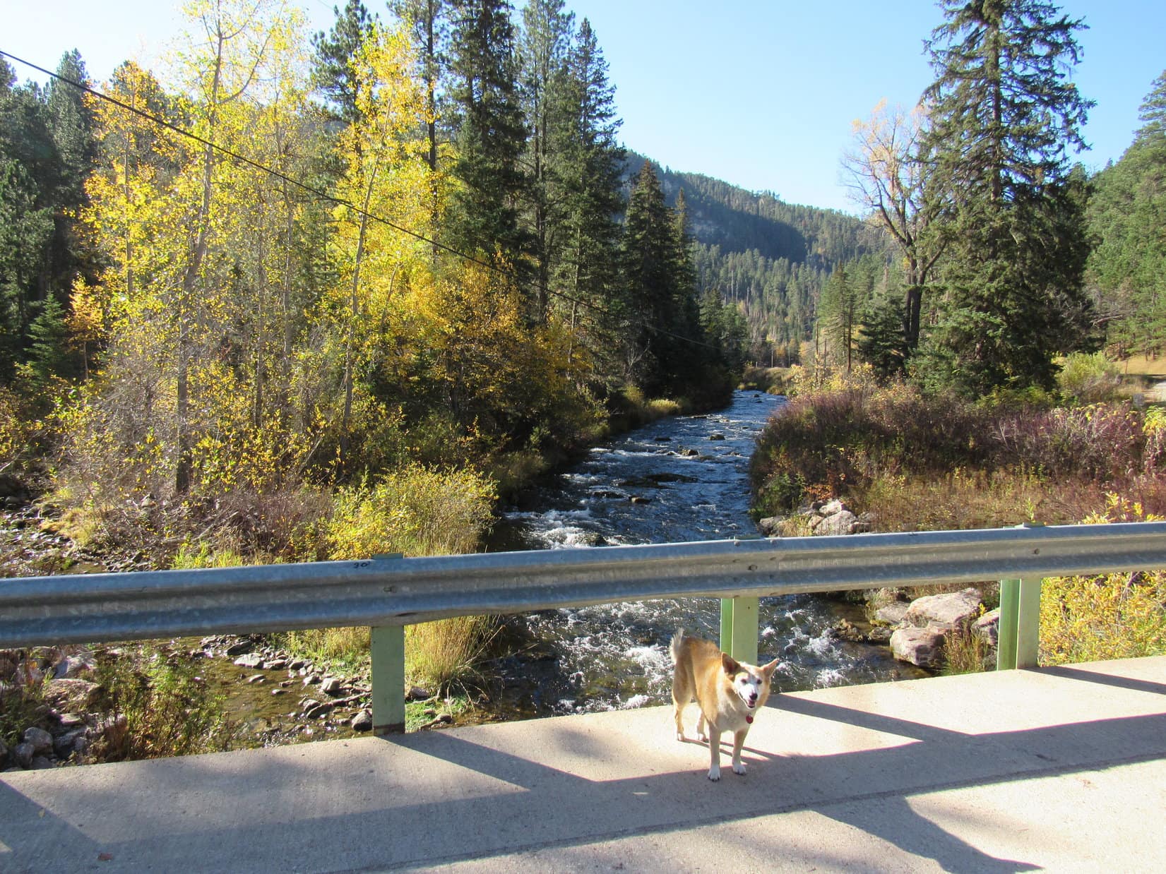
8:59 AM, 42ºF, Hwy 14A in Spearfish Canyon

That must be it, Loop!  I’ll find a place to turn around.

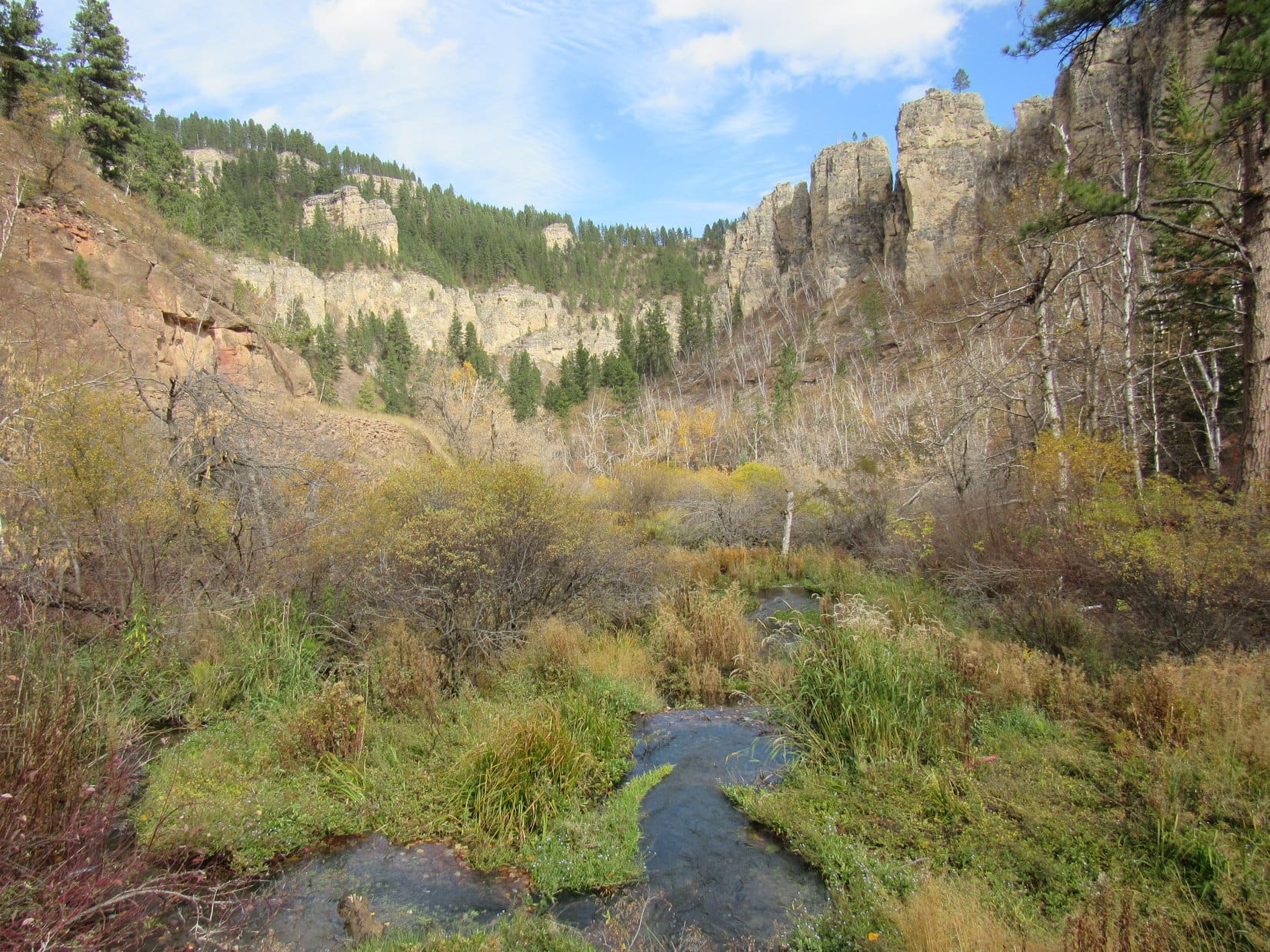
A mile up Spearfish Canyon from the old brick power plant on Spearfish Creek near the new Devil’s Bathtub trailhead, driving slowly, SPHP had seen a narrow crack in the limestone cliff off to the R.  That crack was the entrance to locally famous Eleven Hour Gulch, which neither Lupe nor SPHP had ever been to before.

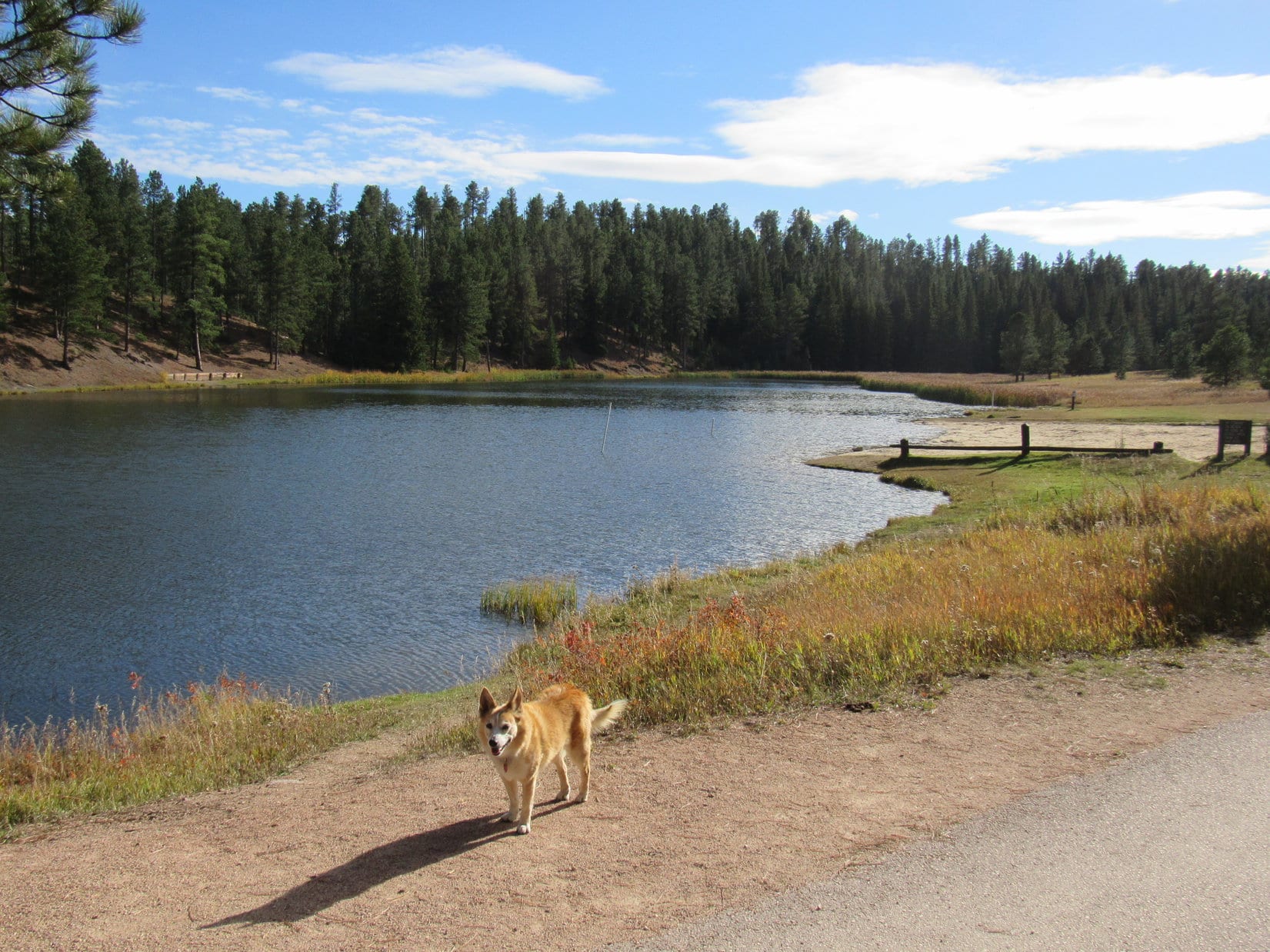
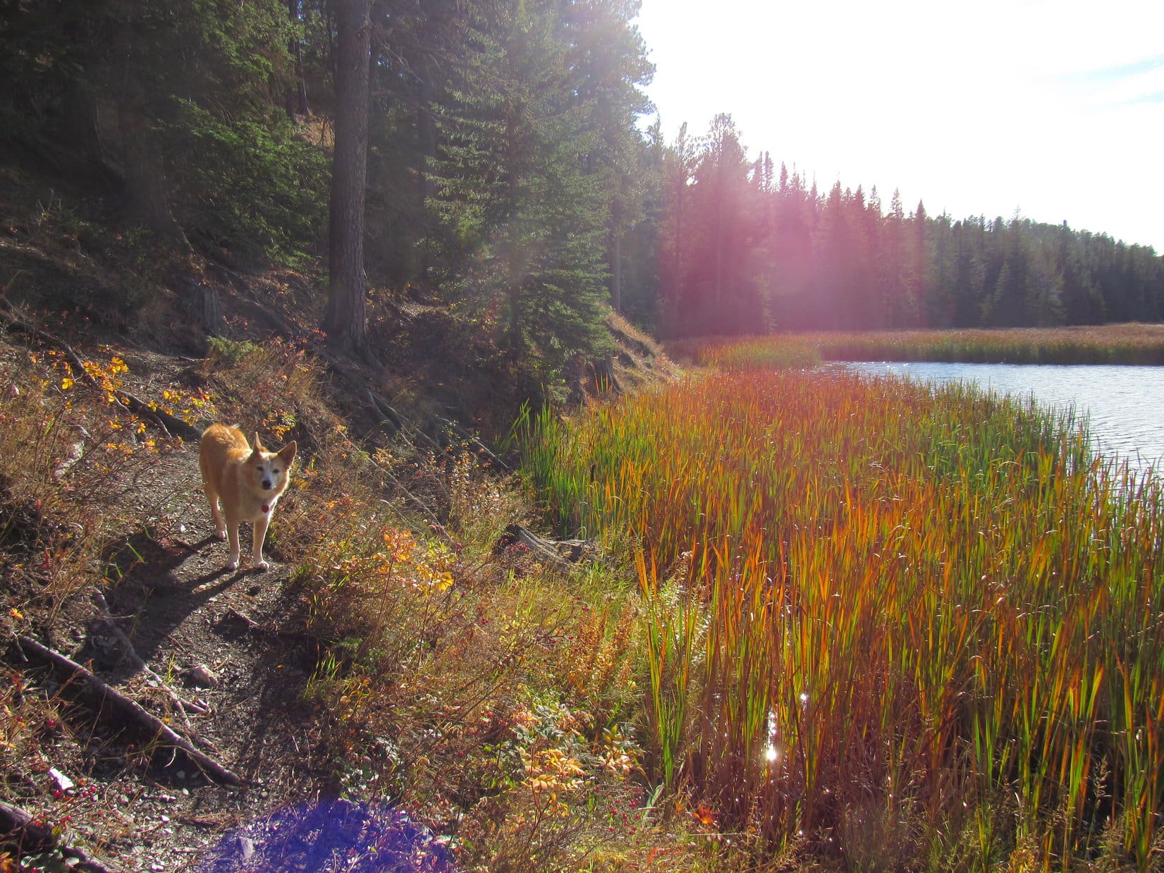
Turning around, SPHP parked at a small paved pullout on the creek side of Hwy 14A less than 200 feet down the canyon from the crack.  Leaping out of the RAV4, Lupe discovered a cute memorial to Les Benth attached to an old tree stump next to the pullout.

By the Les Benth memorial at the pullout near Eleven Hour Gulch.

Venturing down the steep bank next to the pullout, Lupe had a quick drink from lovely Spearfish Creek, which had excellent flow this fine morning, prior to returning to Hwy 14A.

Spearfish Creek.

So, we’re not climbing any Lists of John peaks today, SPHP?

Nope.  Well, maybe one, if we have time, Loop.  Instead, we’re going to check out Eleven Hour Gulch, although this might not be the best time of year for it.  Most of the pictures I’ve seen online have been taken during the winter when it looks like there are some awesome frozen waterfalls.

Might not be much left of them by now, SPHP.  Already almost April!

Yeah, I know it, but no time like the present.  Let’s have a look, shall we?

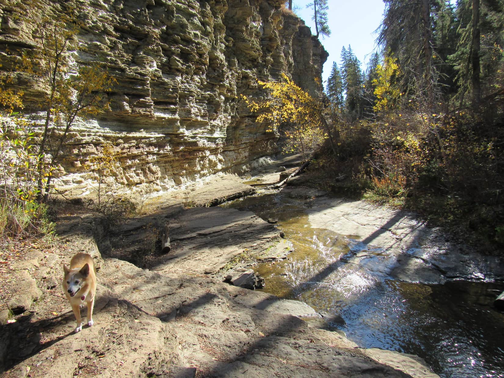
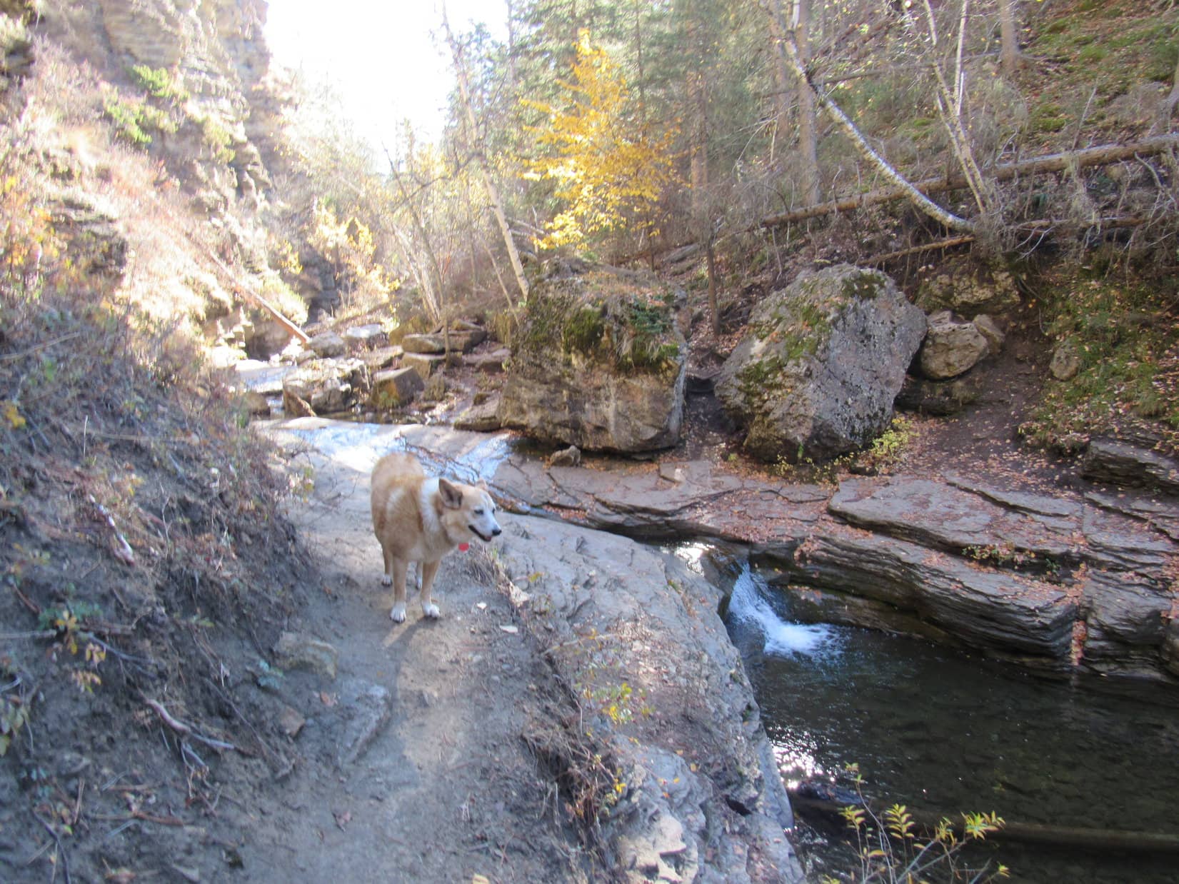
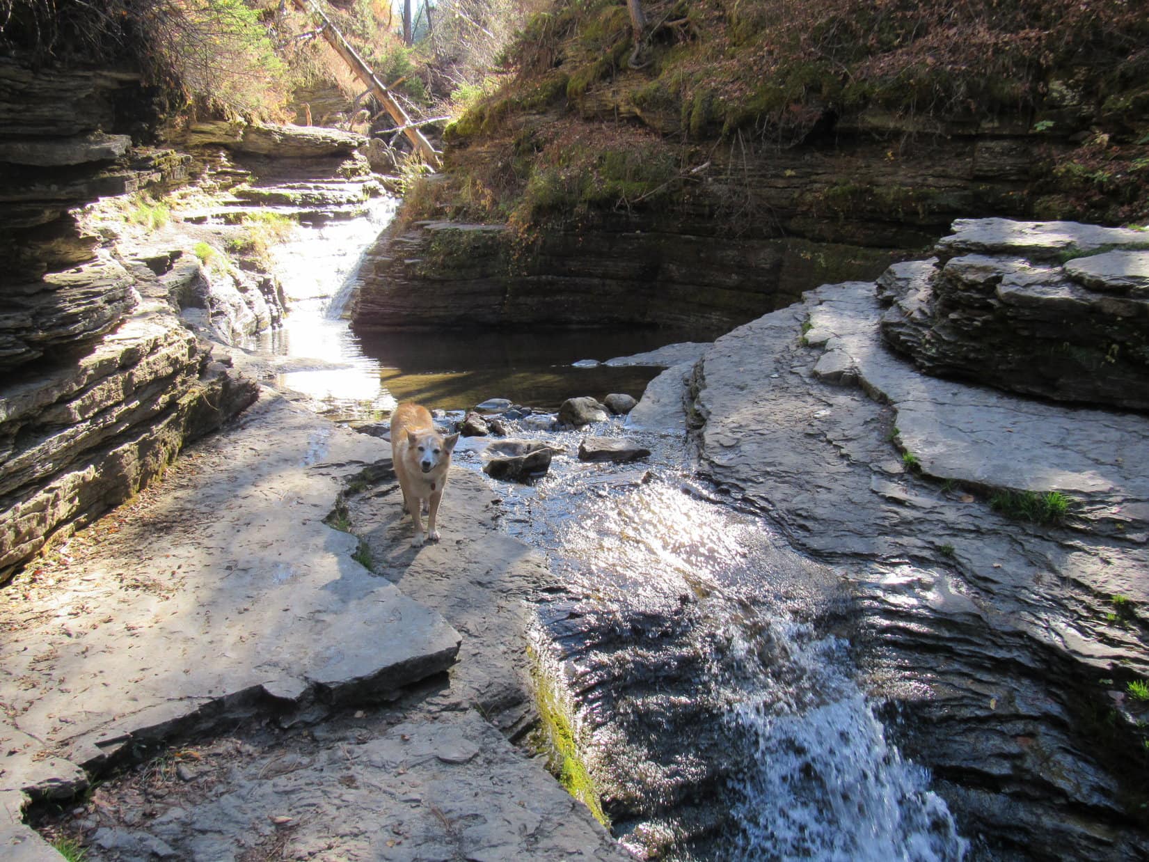
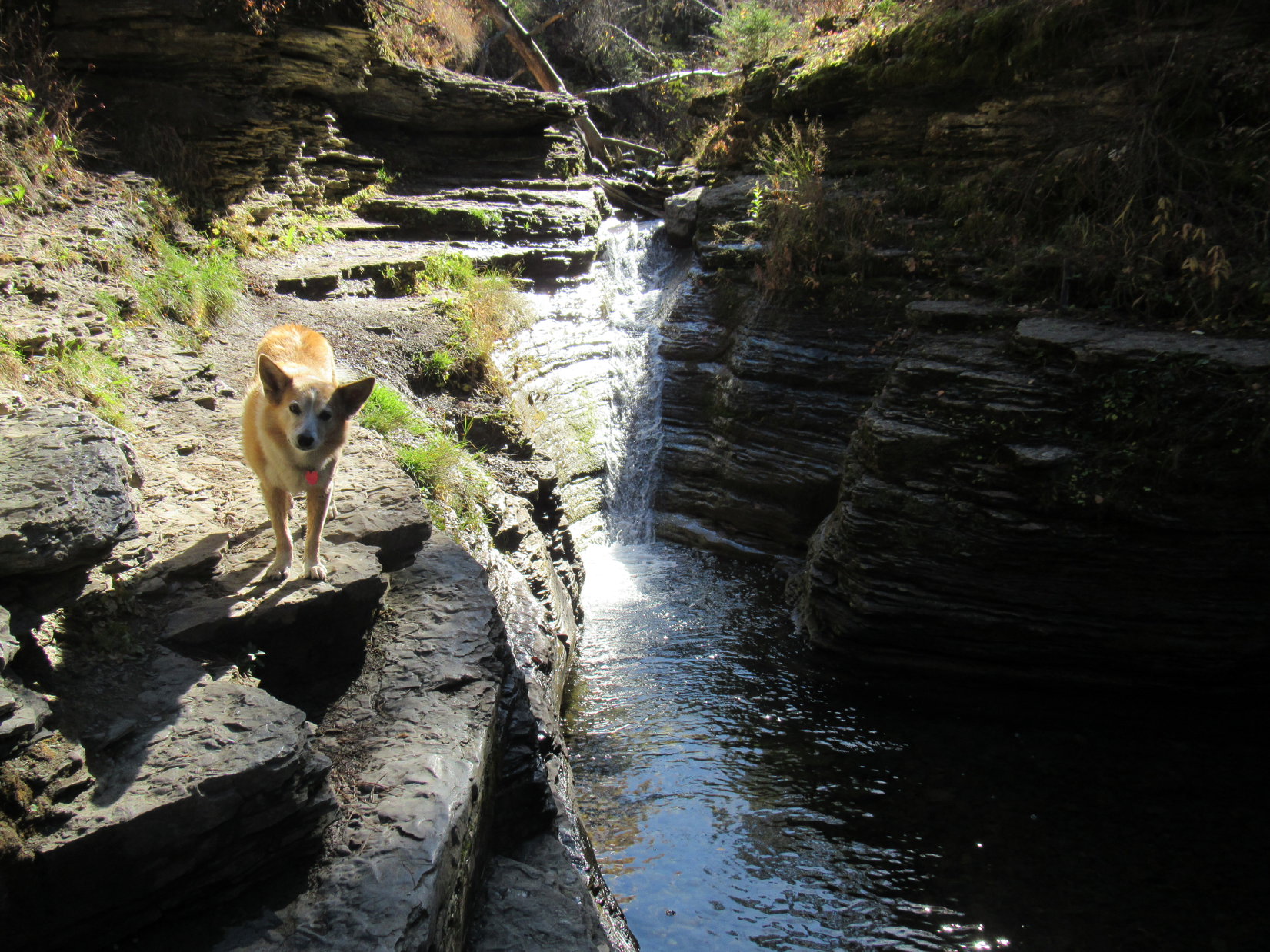
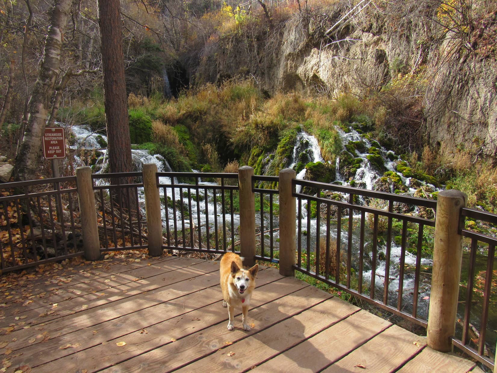
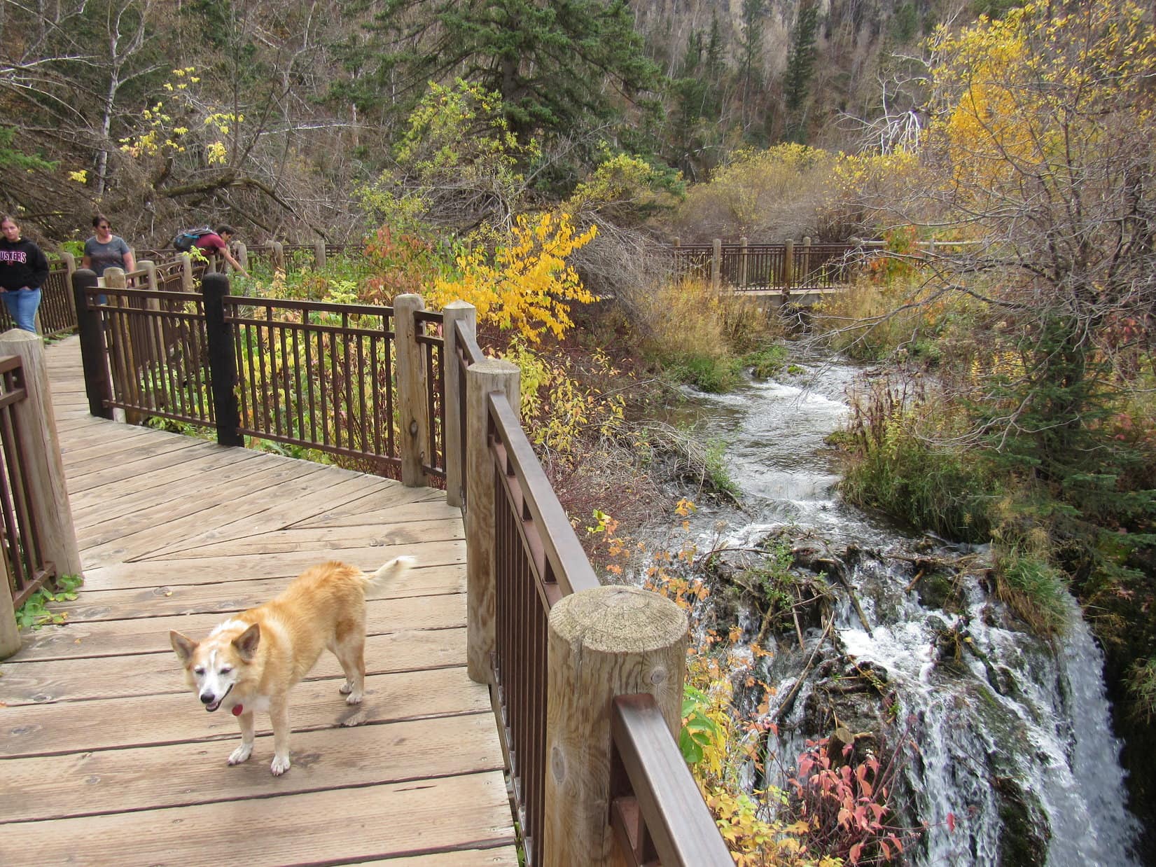
Crossing Hwy 14A, Lupe followed the road up to a trail that went past a few trees hiding a narrow gap between vertical limestone walls.  The Carolina Dog had barely entered Eleven Hour Gulch when a remnant of a frozen waterfall came into sight ahead.

The entrance to Eleven Hour Gulch (Center) is on the other side of Hwy 14A. Photo looks up canyon from the pullout where the RAV4 was parked.
By the entrance. Photo looks NW.
Entering Eleven Hour Gulch. Photo looks NW.

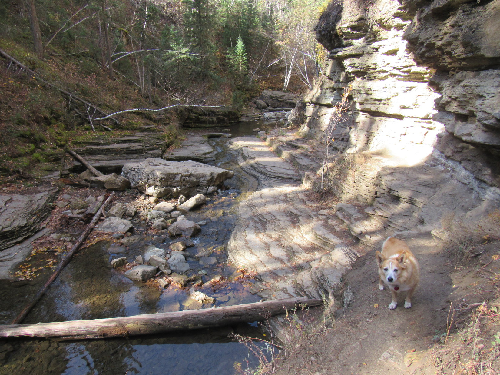
A small stream running down the gulch presented no big problems, but in the recesses of this narrow slot canyon where the sun rarely shines, quite a bit of ice was mixed in among the jumble of rocks that led up to the frozen waterfall.

The sheets of ice were hard, wet, and super slick, making what should have been an easy little scramble much trickier than it otherwise would have been.  Even Lupe with her 4 on the floor could scarcely maintain traction, but exercising a bit of caution, the American Dingo made it up to the base of the frozen waterfall.

Even this late in the season after a dry winter, it was pretty impressive!

Scrambling up to the frozen waterfall.
Almost there! Photo looks NW.
Hwy 14A from Eleven Hour Gulch. Photo looks SE.
The frozen waterfall.

Wow!  This is awesome, SPHP!  We’ve never seen anything quite like this anywhere else in the Black Hills.

I have to agree, Loop.  Really different!  And so close to the highway, too!

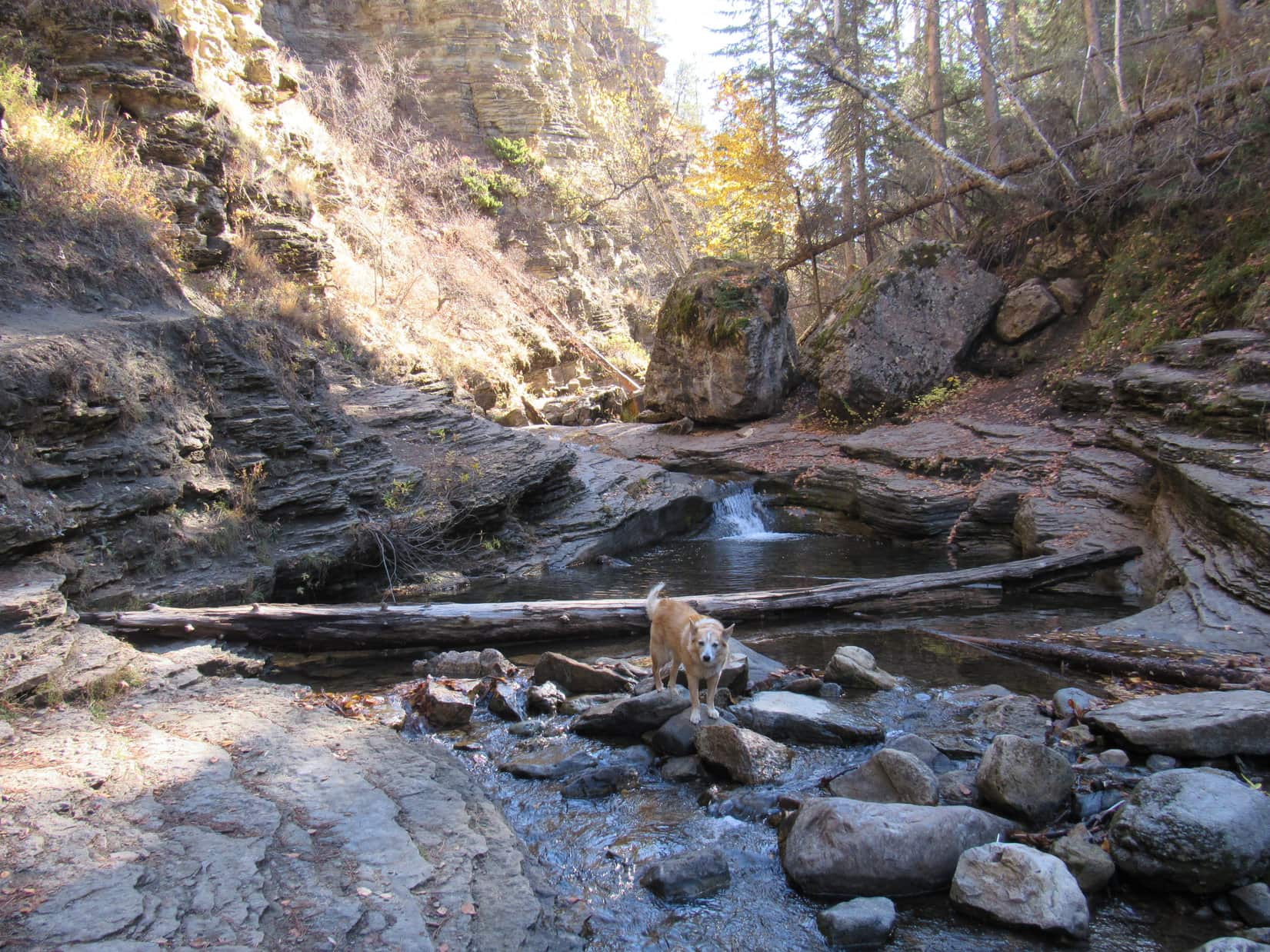
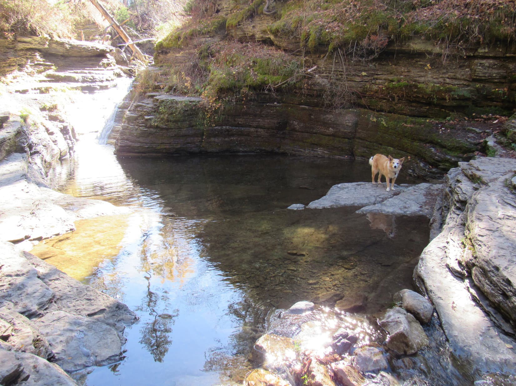
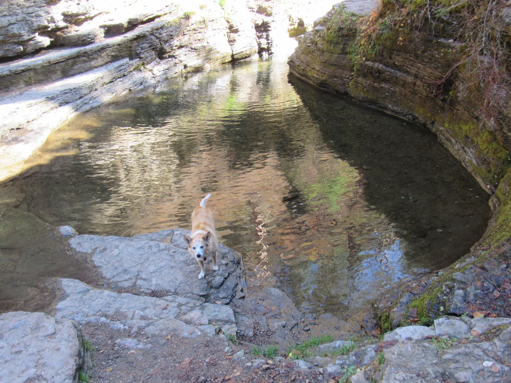
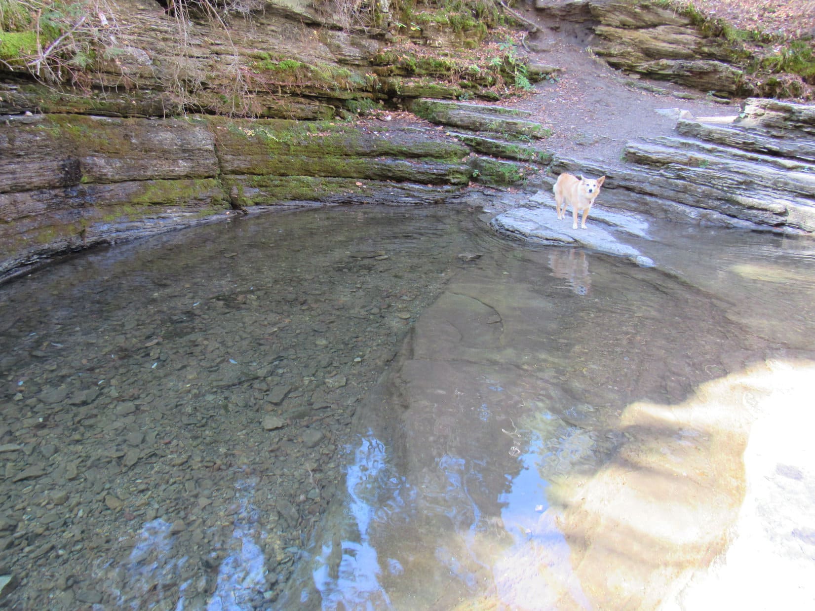
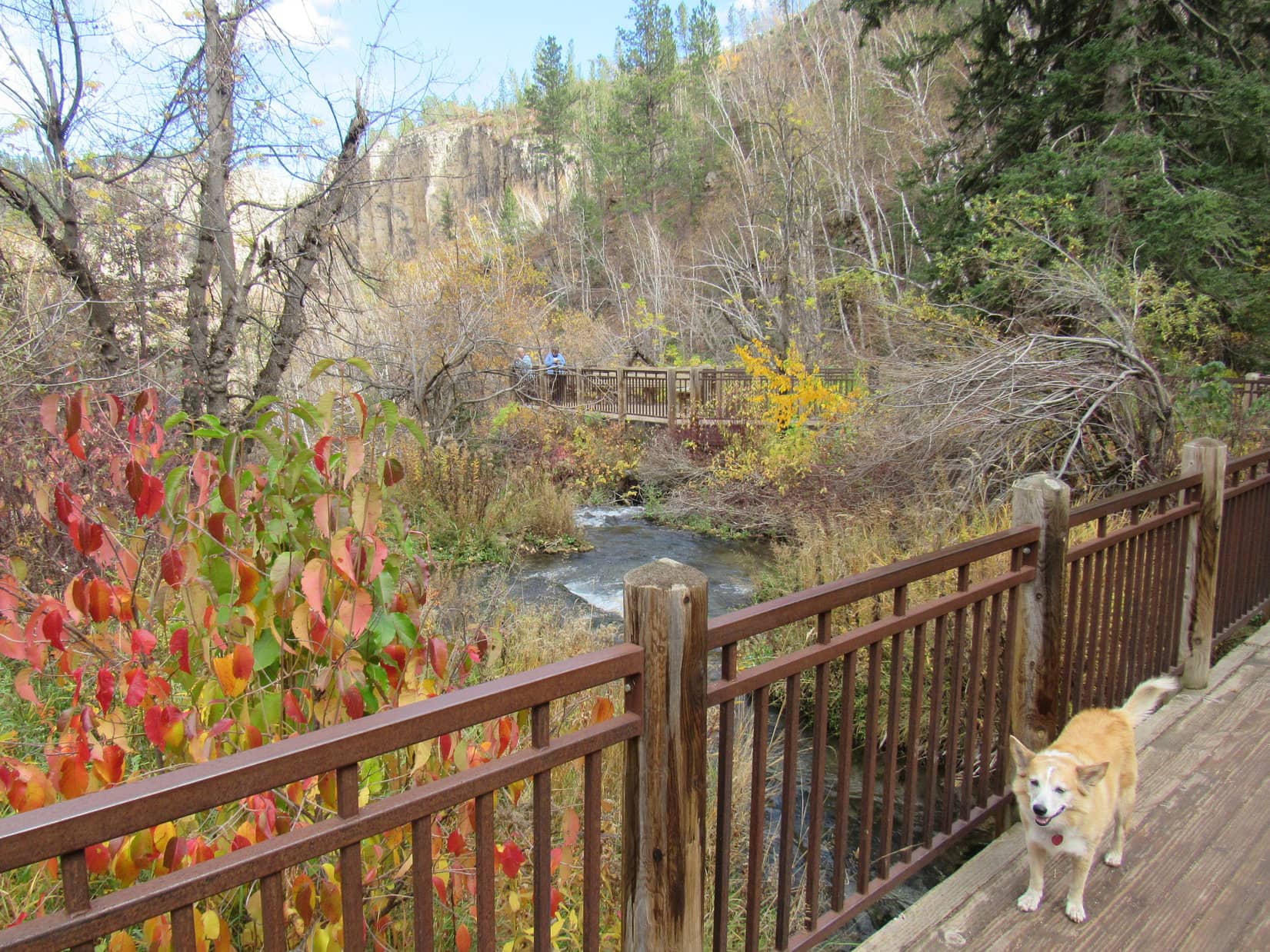
The narrow canyon extended a little beyond the frozen waterfall to a pool of water at the base of a 10 foot drop where a crude wooden ladder led to an as yet unseen upper region.  SPHP boosted Lupe nearly to the top of the ladder, where she was able to scramble the rest of the way up to the hidden territory above.

Approaching the ladder beyond the frozen waterfall. Photo looks NW.
Boosted to the top of the ladder.
The frozen waterfall from above the ladder. Photo looks ESE.

The upper canyon angled slightly toward the R, revealing a massive ice plug beneath a huge boulder lodged between the canyon walls only a short distance ahead.  Exploring all the way to the ice plug, daylight could be seen above it from beneath the boulder.

Approaching the ice plug.
At the base of the ice plug.

Guess this is it, Loopster.  We aren’t going to be able to get past this.

Wonder how far up Eleven Hour Gulch we could go once the ice melts?  Don’t you, SPHP?

I do!  We’re going to find out, too, Loop!

We are?  How, SPHP?  You just said yourself that we can’t go any farther.

You’ll see soon enough, Looper.  C’mon, let’s head back.

Mystified by SPHP’s cryptic answer, Lupe turned and started back down to the scenic frozen waterfall.

Starting back. Photo looks S.
Still above the ladder. Photo looks SE.
Approaching the frozen waterfall again. Photo looks ESE.
Above the ladder (unseen) about to descend to the base of the frozen waterfall.
Exiting Eleven Hour Gulch. Photo looks SSE.

10:04 AM, 54ºF, Hwy 14A, back at the RAV4 – Leaving the pullout, SPHP turned the RAV4 around, driving farther up Spearfish Canyon.

Eleven Hour Gulch was very cool, SPHP, but isn’t very well named.  Only took us an hour to explore it!  Maybe we can come back sometime in the winter?  Really would be a wonderland then, and maybe a little safer with some snow over the ice to provide better traction.

Think you’re right about that, Loop.  Explains why I’ve seen only winter photos online.  We got just a taste of what Eleven Hour Gulch would be like then this morning, but you’re wrong about Eleven Hour Gulch only taking us an hour to explore.  We’ve only seen the short lower gulch so far, no doubt the heart of its scenic splendor, but we’re just getting started.

We are, SPHP?

Yup.  We’re going to explore the upper gulch next!  All the way back down to the ice plug, if possible.  You’re going to be an Eleven Hour Gulch expert, Looper, by the time we’re done today!

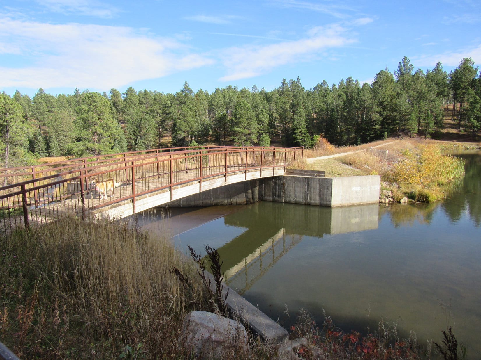
11:20 AM, 64ºF, junction of Tinton Road and USFS Road No. 134.2L – Odd.  For some reason, USFS Road No. 222 going W past Roughlock Falls from Savoy was closed, forcing a huge detour.  A lovely scenic drive, but it had taken an entire hour to get into position to explore the upper reaches of Eleven Hour Gulch.  After parking the RAV4, SPHP checked the map.

At the start of USFS Road No. 134.2L. Tinton Road (No. 134) (L). Photo looks SW.

Hmm.  Guess I could have driven a little farther, Looper, we actually want USFS Road No. 222.2F.  Ought to be just up the hill.

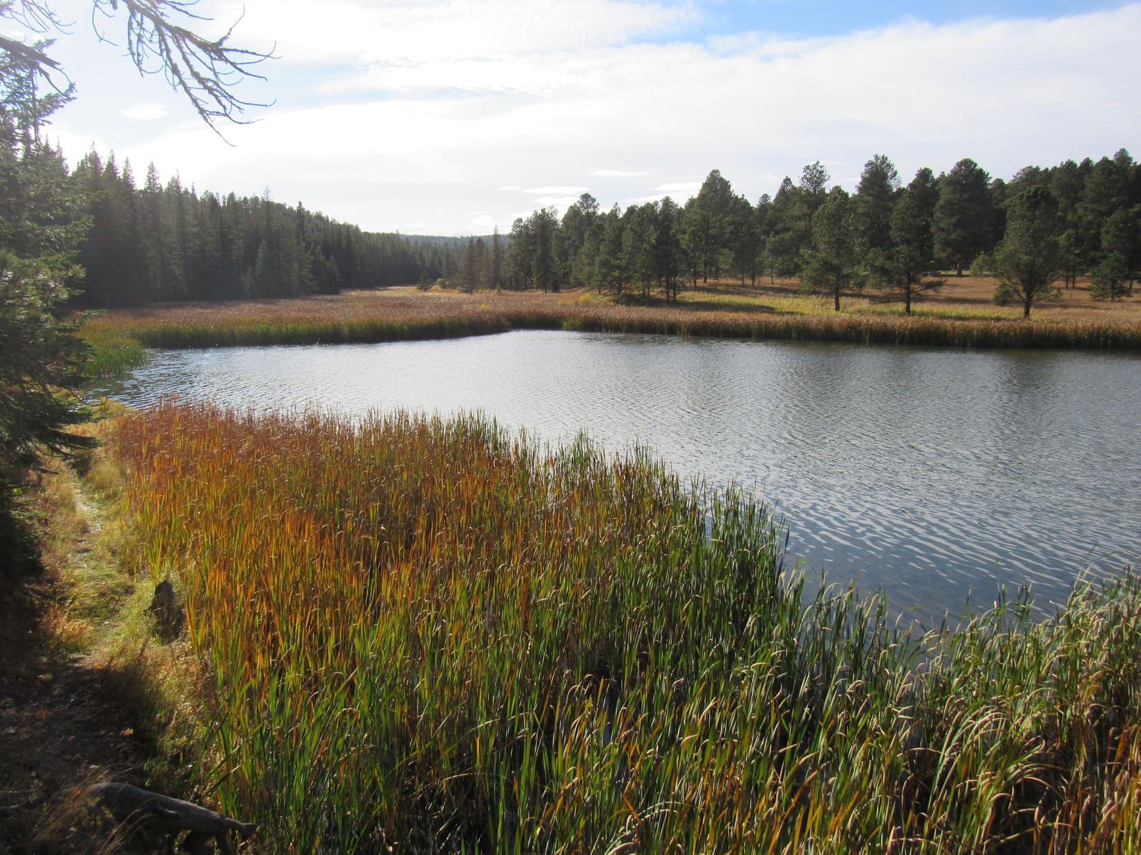
Taking a primitive road paralleling Tinton Road NNE for 0.1 mile, Lupe quickly reached the top of a rise where they merged.  On the other side of Tinton Road, several inches of slushy snow were melting away in a big open flat region.  USFS Road No. 222.2F left Tinton Road here, angling sharply back to the S.

Instead of taking No. 222.2F, which was mucky, Lupe followed a drier open corridor that went SSW through the forest.  This corridor was quite scenic.  Lupe stuck with it a little way, but soon returned to No. 222.2F near an open gate.

Taking the primitive road NNE from the RAV4 to the top of the rise. Photo looks NNE.
Start of USFS Road No. 222.2F where it leaves Tinton Road. Photo looks S.
On the beautiful path through the forest. Photo looks SSW.
By the open gate back at USFS Road No. 222.2F. Photo looks S.

Following No. 222.2F S from the gate, the road wasn’t as soft as it had been back at the start.  Going gradually downhill, Lupe soon came to a fork.  No. 222.2F climbed slightly as it veered off toward the SE, but Loop stuck with the other branch of the fork, which continued SSW, still going downhill.  Before long, this more primitive road bottomed out.  SPHP had another look at the map.

At the clearing where the primitive road bottoms out. Photo looks S.

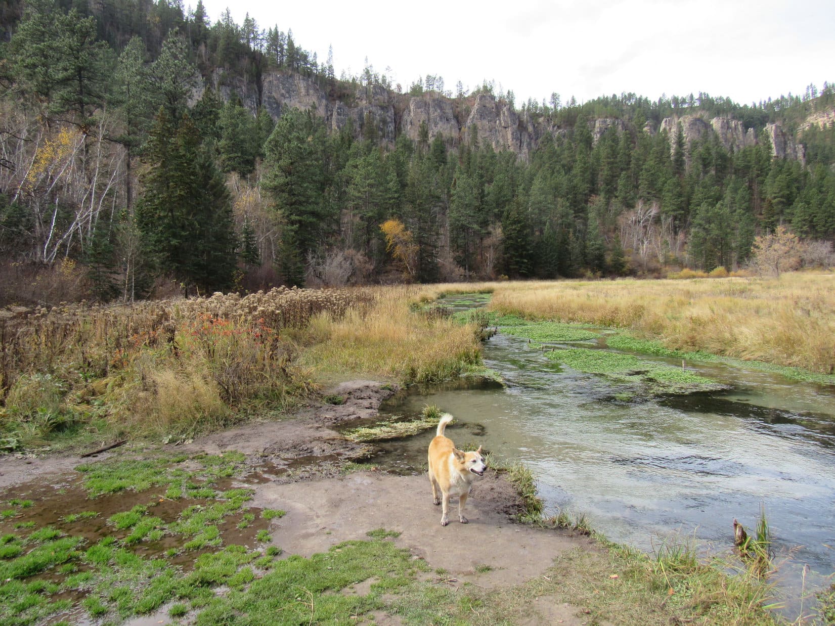
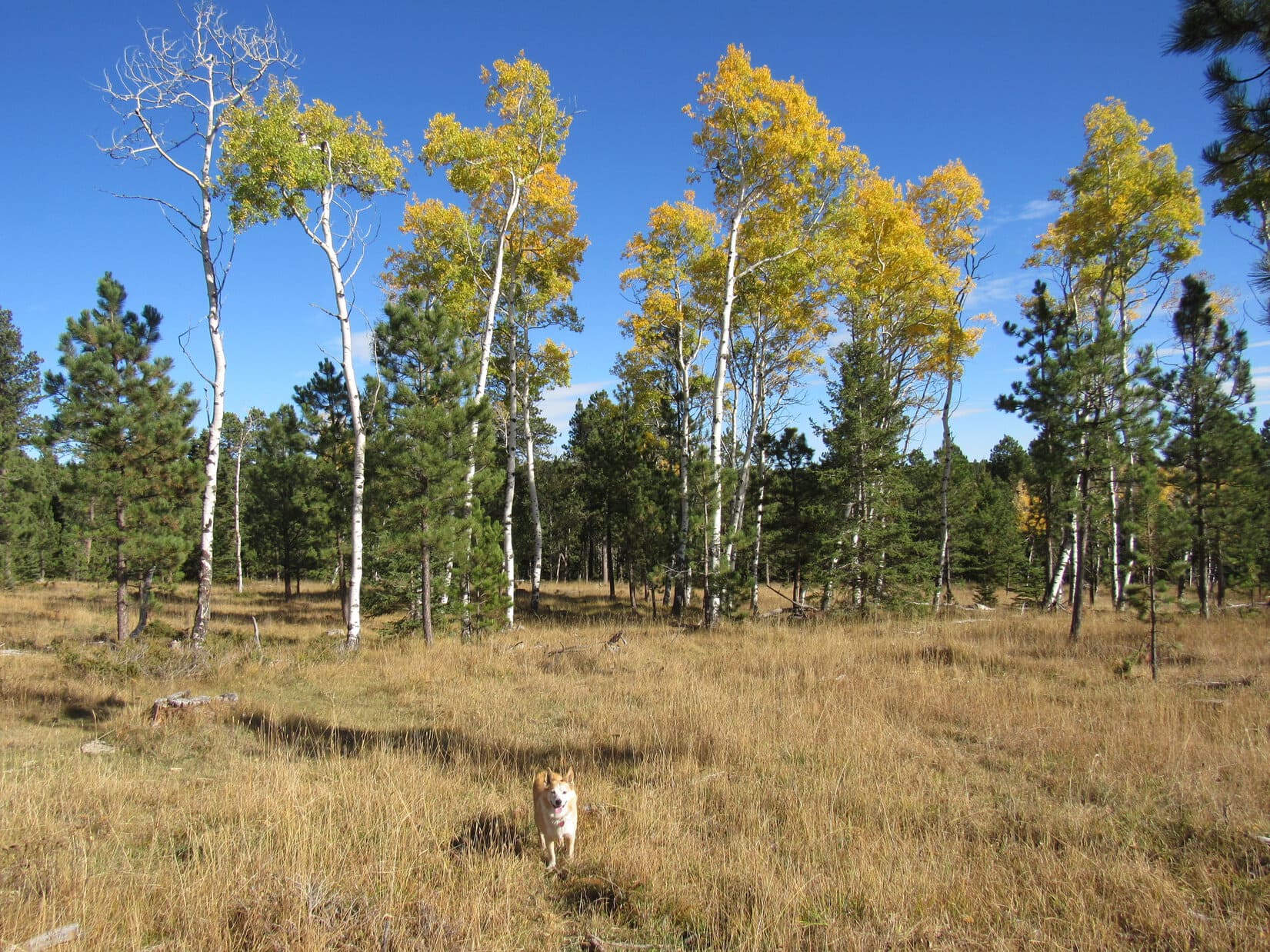
Loopster needed to turn SE here to get back to No. 222.2F.  Leaving the primitive road, she gained just a little elevation following a faint trail through a forest of young aspens.  By the time she reached a field at the end of the aspens, the terrain was sloping gently downhill.  Terry Peak (7,064 ft.) was visible on the horizon.

Exploring the aspen forest. Photo looks SE.
Entering the field. Terry Peak (Center) on the horizon. Photo looks SE.

OK, Loop!  We’re now in the uppermost reaches of the Eleven Hour Gulch drainage.

Wow!  This could hardly be any more different from the low end, SPHP.

That was for sure!  USFS Road No. 222.2F was off toward the L side of the field along the base of a pine-covered hill.  Angling toward it, Lupe was soon trotting easily down No. 222.2F again.

Glancing back at the aspen forest after reaching USFS Road No. 222.2F again. Photo looks NW.
Following No. 222.2F down the valley. Photo looks SE.

Continuing down the valley, more and more large patches of snow were seen melting away among the trees on the N slopes.  Lupe finally came to a big patch right on the road.  The snow was only a few inches deep, but that was plenty to frolic on while cooling off.

Snow on the N slopes. Photo looks SE.
Enjoying the snow. Photo looks WNW.

Following No. 222.2F for another 0.67 mile, Lupe came to a fork.  Signage indicated that both branches were part of Loop D of the Big Hill cross country ski trail system.

At the fork. Photo looks SE.
By the “D Loop” sign.

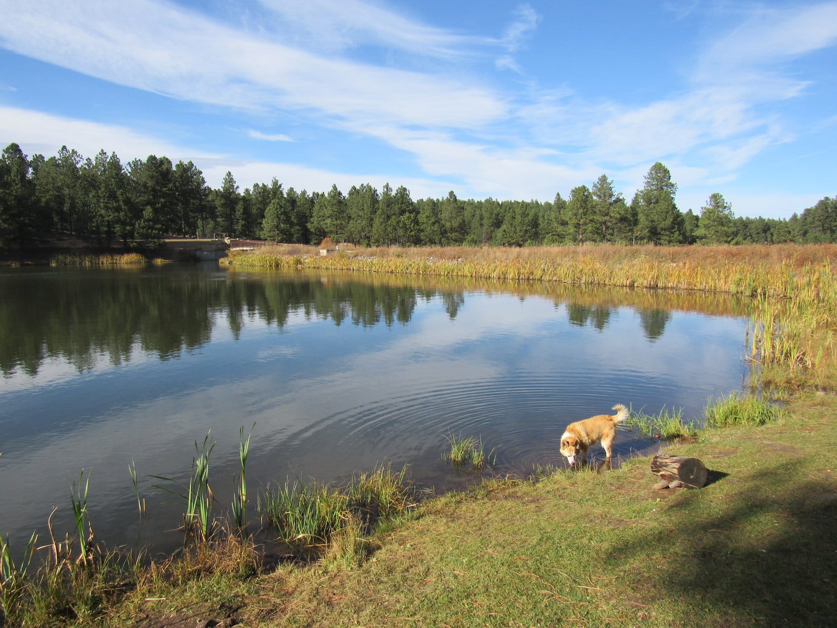
Going uphill, USFS Road No. 222.2I curved off to the S (R) here.  Lupe stuck with No. 222.2F, which went NE (L), continuing down the valley.  A tiny creek soon appeared next to the road.

Continuing down the valley, still on USFS Road No. 222.2F. Photo looks NE.
Wading in the tiny stream.

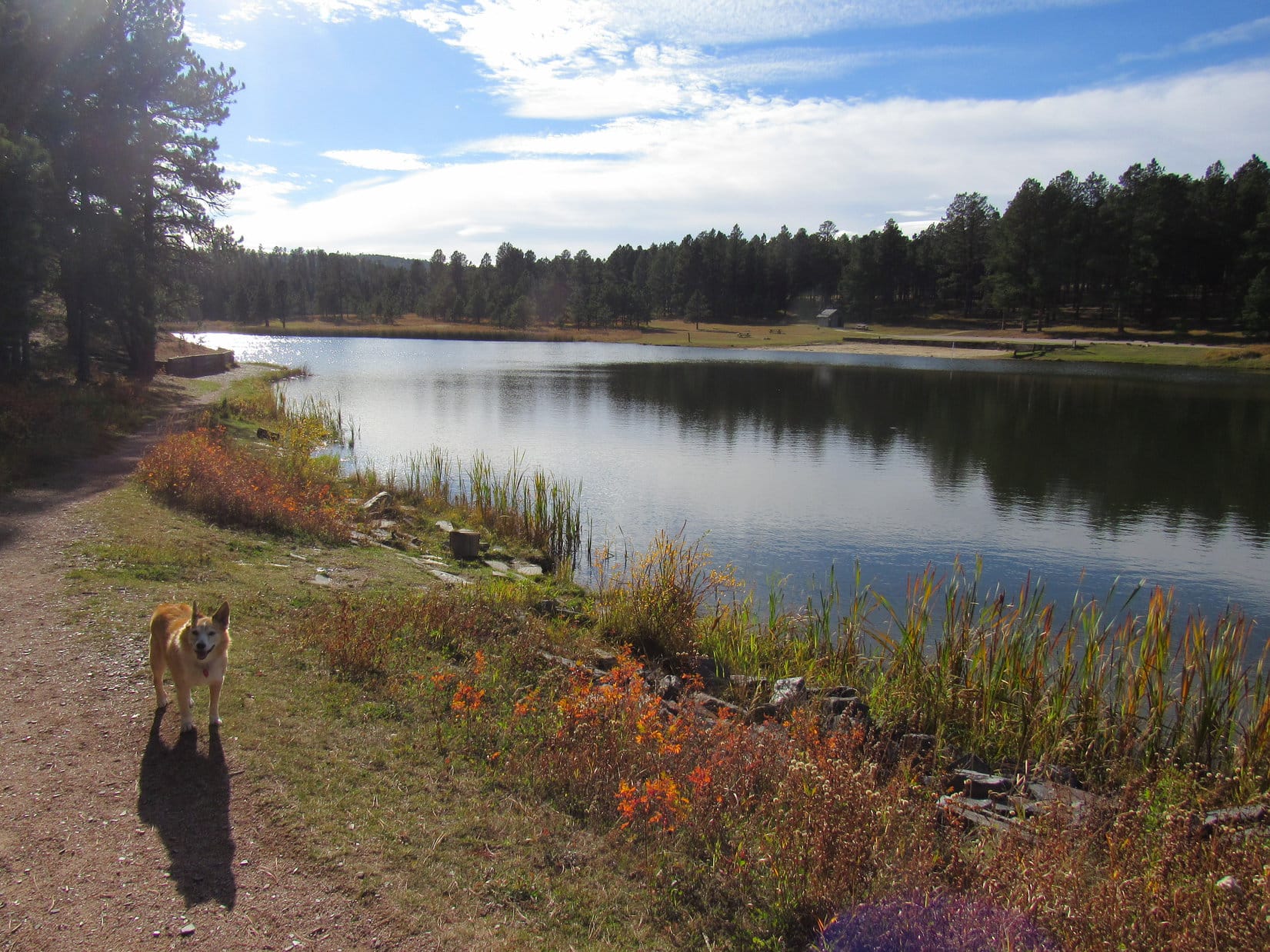
The downhill trek was super easy.  Didn’t take long to go another 0.6 mile from the fork where Lupe had reached Loop D.  At a slight bend in the road, the Carolina Dog came to a clearing where there was another junction.  A map posted here showed that the trailhead for the Big Hill trail system was off to the NW.

The Big Hill trailhead might actually have been a closer starting point.  Loop A came down to this junction through another part of the upper Eleven Hour Gulch drainage, but SPHP hadn’t known how easy these cross country ski trails were to follow.

Maybe Lupe could do some exploring that way during the return trip?  For the time being, though, she just needed to keep following USFS Road No. 222.2F down the valley.

At the junction of Loops A, C & D of the Big Hill trail system. Photo looks ENE.
By the Big Hill Trails map.

No. 222.2F headed ESE from this junction.  According to the Big Hill Trail map, this stretch of the road was considered part of both Loops C and D.  They parted ways only 0.33 mile ahead.  There was a second map at this next junction, basically the same as the first one, except for the location of the “You Are Here” star.

This time, it was USFS Road No. 222.2F that veered off to the R (SE), now only part of Loop D again beyond this point.  Looper finally left it here, taking No. 222.2L instead, which went straight ahead as part of Loop C.

Snow-covered USFS Road No. 222.2F (Loop D) goes off to the R here. Lupe continued straight on No. 222.2L (Loop C). Photo looks ESE.

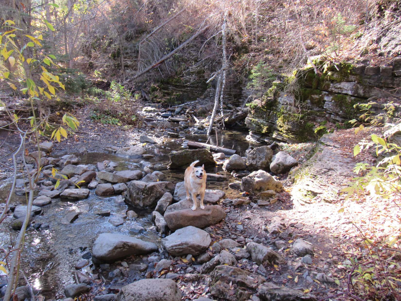
No. 222.2L continued ESE for a little way before curving NE.  The valley was narrower here, and no longer quite as shallow as before.  Lupe soon came to a sign that wasn’t at any junction.

Always nice to know you’re on the right track!

After snaking SE for a bit, a good 0.75 mile from where Lupe had left Loop D, No. 222.2L bottomed out at a clearing.  Turning N, the road started uphill.

Continuing down USFS Road No. 222.2L (Loop C). Photo looks E.
At the clearing where the USFS Road No. 222.2L bottoms out. Photo looks SE.

Alrighty, Loopster!  This is where things get interesting.  No roads or trails the rest of the way!  Let’s hope we can do this.

Abandoning the road, Lupe entered the Eleven Hour Gulch wilderness.

Entering the wild, seldom seen part of Eleven Hour Gulch. Photo looks SSE.

Lupe had already gone a good 3 miles since leaving the RAV4.  According to the topo map, the wild upper reaches of Eleven Hour Gulch went on for another 0.67 of a mile.  Whether the American Dingo would come to impassable drops or other obstacles was a complete unknown.

Started out alright, but Eleven Hour Gulch soon narrowed after a turn to the W.  Lupe came to a couple of feet of snow in this region.  There were sudden drops, but only minor ones.  Plenty of trees, rocks, and bushes to wind through.  Progress was now very slow, but there was always a way through it all.

Exploring part of the snowy stretch. Photo looks WSW.

The snowy stretch wasn’t very long.  Most of the snow vanished once Eleven Hour Gulch turned SW.  A fair amount of deadfall was the main obstacle here.  Sort of a mess, but it was still possible to make progress.

Plenty of obstacles, but nothing too terrible so far.

Loopster was more than halfway down the wild, upper section of Eleven Hour Gulch when the canyon curved SE.  At this point, the valley became absolutely choked with large deadfall full of branches.  No way through!  Practically impossible.

The sides of the canyon were quite steep here, but staying toward the L, even SPHP was able to climb above the horrendous deadfall.  Traversing the slope above the worst of it for several hundred feet, Lupe managed to get by.  Returning to the valley floor, there was still some deadfall to contend with, along with some ice, but it was nothing compared to what she’d just circumvented.

Past the worst of the deadfall. Photo looks SSE.

Near the end, in an area full of brush, an odd sight appeared ahead.  In the middle of seemingly nowhere, Lupe discovered a lamp post.

Why is this here, SPHP?

Beats me, Looper!  Incredibly strange!

The lamp post was straight and tall.  Looked to be in good condition, but did it work?  Who knew?  Seemed unlikely, to say the least.  What would be the point, anyway?

Even before reaching the lamp post, a faint use trail had been detectable in some spots.  It now became more distinct, winding among big rock formations.  And then, suddenly, there it was!

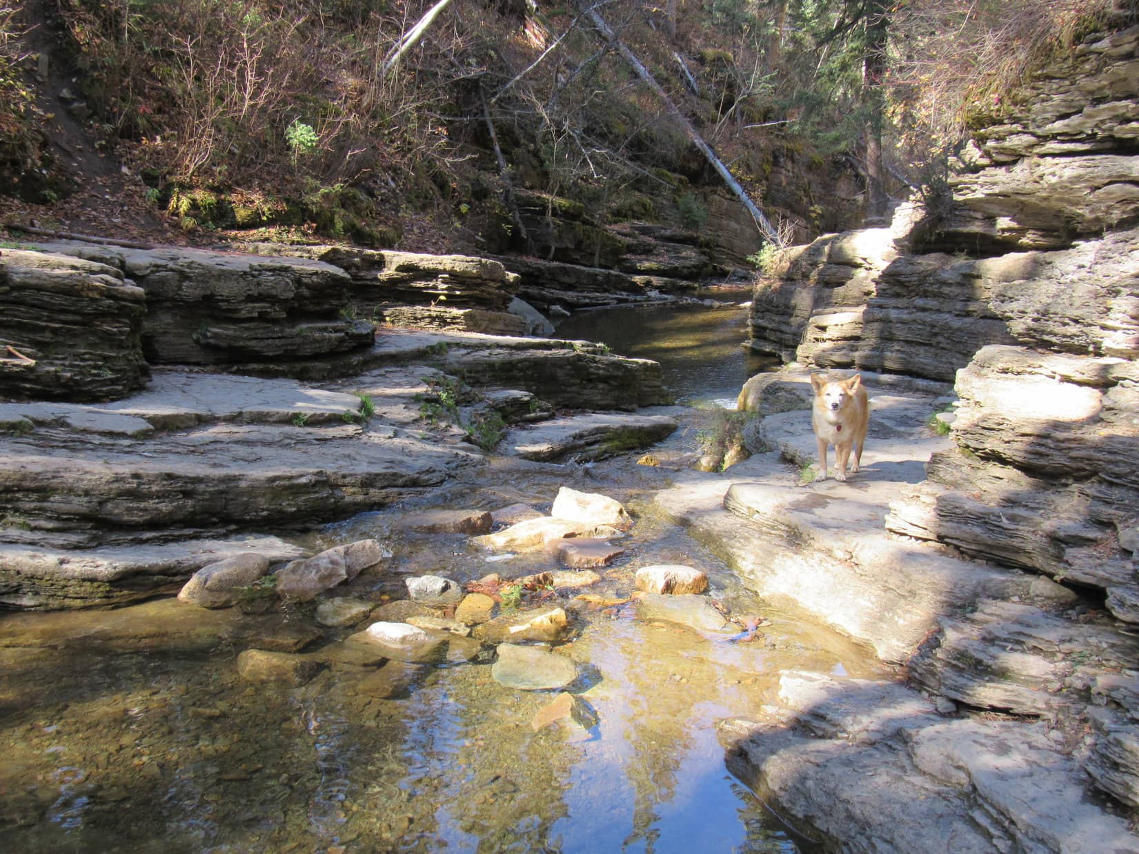
A frozen waterfall was directly ahead.  Not the tall, skinny waterfall Lupe had seen before down in the lower part of Eleven Hour Gulch.  This frozen waterfall was wider, but shorter.  It dropped down to the boulder Lupe had seen the ice plug beneath at the upper end of the lower gulch.

How about that! Made it all the way to the lower gulch! Photo looks SE.

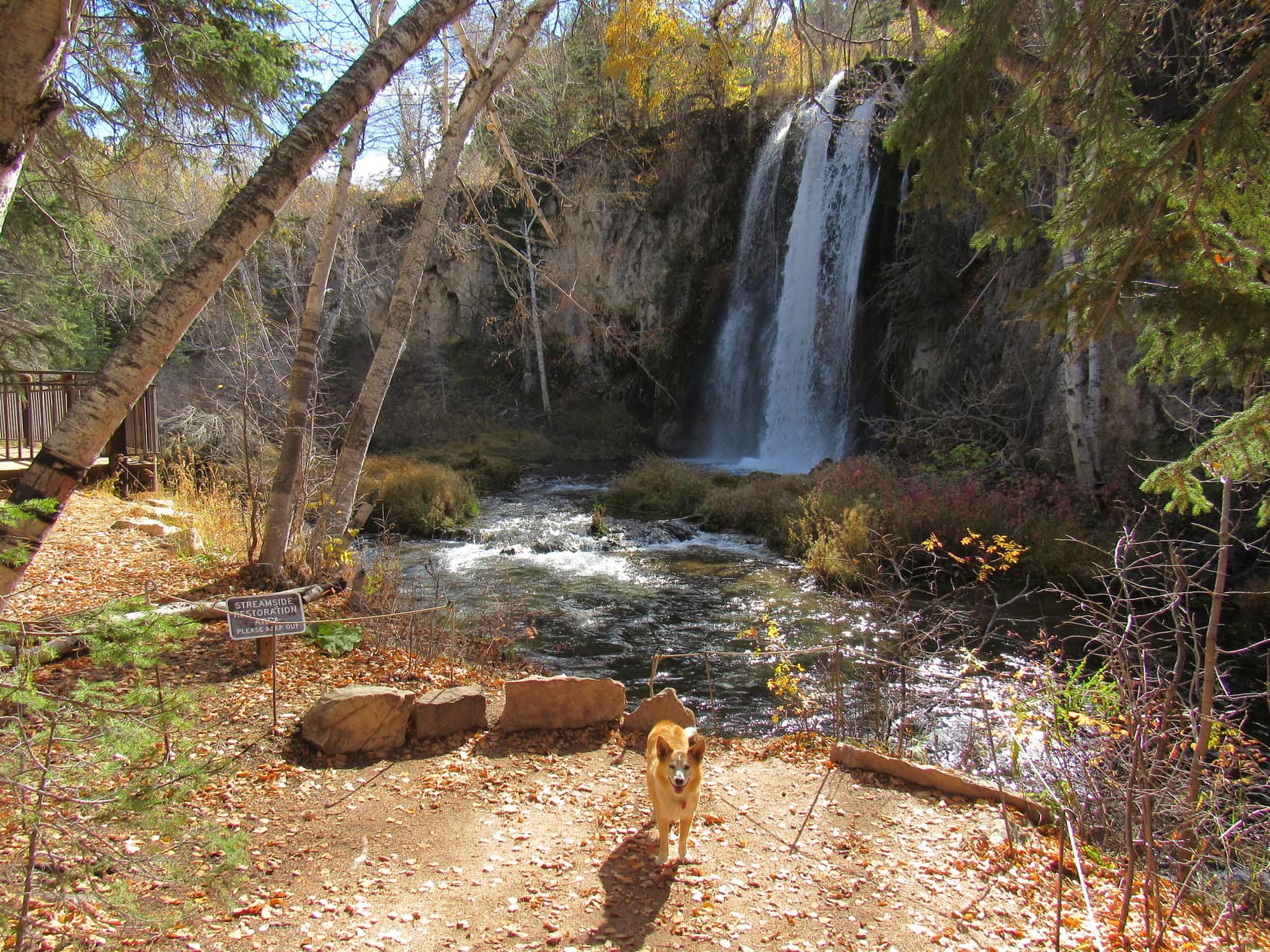
2:44 PM, overlooking the lower, more famous end of Eleven Hour Gulch

This is it, SPHP!  We’ve made it to the lower end of Eleven Hour Gulch!  I can see the top of the tall frozen waterfall from here.  That makes it about time for a chocolate coconut bar, doesn’t it?

Yup!  Let’s go take a look at the tall frozen waterfall first, Loop, see what the lower gulch looks like from above.  Then we’ll split a chocolate coconut bar, and you can have some Taste of the Wild, too.

Crossing the upper frozen waterfall, which extends down to the ice plug beneath the boulder seen at lower L.
Lupe over on the other side, standing where she was about to enjoy a rest break.
Looking down on the same frozen waterfall Lupe had seen earlier. Photo looks SE.
The tall frozen waterfall from the break spot. Photo looks SE.
Relaxing after successfully exploring Eleven Hour Gulch.

Lupe’s Eleven Hour Gulch break spot was certainly unique.  Where else can you see a frozen waterfall in the Black Hills?  Maybe a few places along some creeks in the winter, but none as impressive at this one.

Wonder how many Dingoes have even been here, SPHP?

You mean up here looking down on the lower part of the gulch, Looper?  Hard to say.  Might not be all that difficult to get here from below once all the ice melts.  Or maybe it isn’t that easy?  Who knows?  One thing for sure, there can’t be too many Dingoes that have ever explored the entire length of Eleven Hour Gulch!

After a leisurely rest break, the American Dingo had a little more to do here before starting back up the gulch.  Loopster posed for a photo on the upper frozen waterfall prior to having another good look at the tall one.  Sniffing around in the forest, she went far enough to look down on Hwy 14A and Spearfish Creek in Spearfish Canyon.

Not every day that you get to stand on a frozen waterfall! Photo looks NW.
Eleven Hour Gulch. Wonder how big this frozen waterfall gets in the winter?
Spearfish Canyon from Eleven Hour Gulch. Photo looks E.
Looking down on Hwy 14A and Spearfish Creek. Photo looks E.
The upstream view. Photo looks S.

45 minutes after reaching the lower gulch overlook, Lupe started back up Eleven Hour Gulch.  Her return route was exactly the same all the way back to the clearing at the bend in the road where all the Big Hill Loop trails met.  At that point she left USFS Road No. 222.2F to explore parts of Loop A and Loop B.

By a little ice-filled cave and trench as Lupe starts back up upper Eleven Hour Gulch.
Enjoying the tiny stream near USFS Road No. 222.2F again. Photo looks NW.
Setting off to explore parts of Big Hill Trails Loop A and Loop B. Photo looks NW

The sun was sinking, but it was a beautiful evening.  After leaving Loop A, Loop B eventually topped out at a flat region 0.33 mile SE of where the RAV4 was parked.  Lupe stuck with it only until the trail curved NE and started downhill.

Exploring Loop A. Photo looks NW.
Crossing a minor ice floe. Photo looks WNW.
Signage along Loop B. Photo looks N.
A beautiful evening on Loop B. Photo looks W.

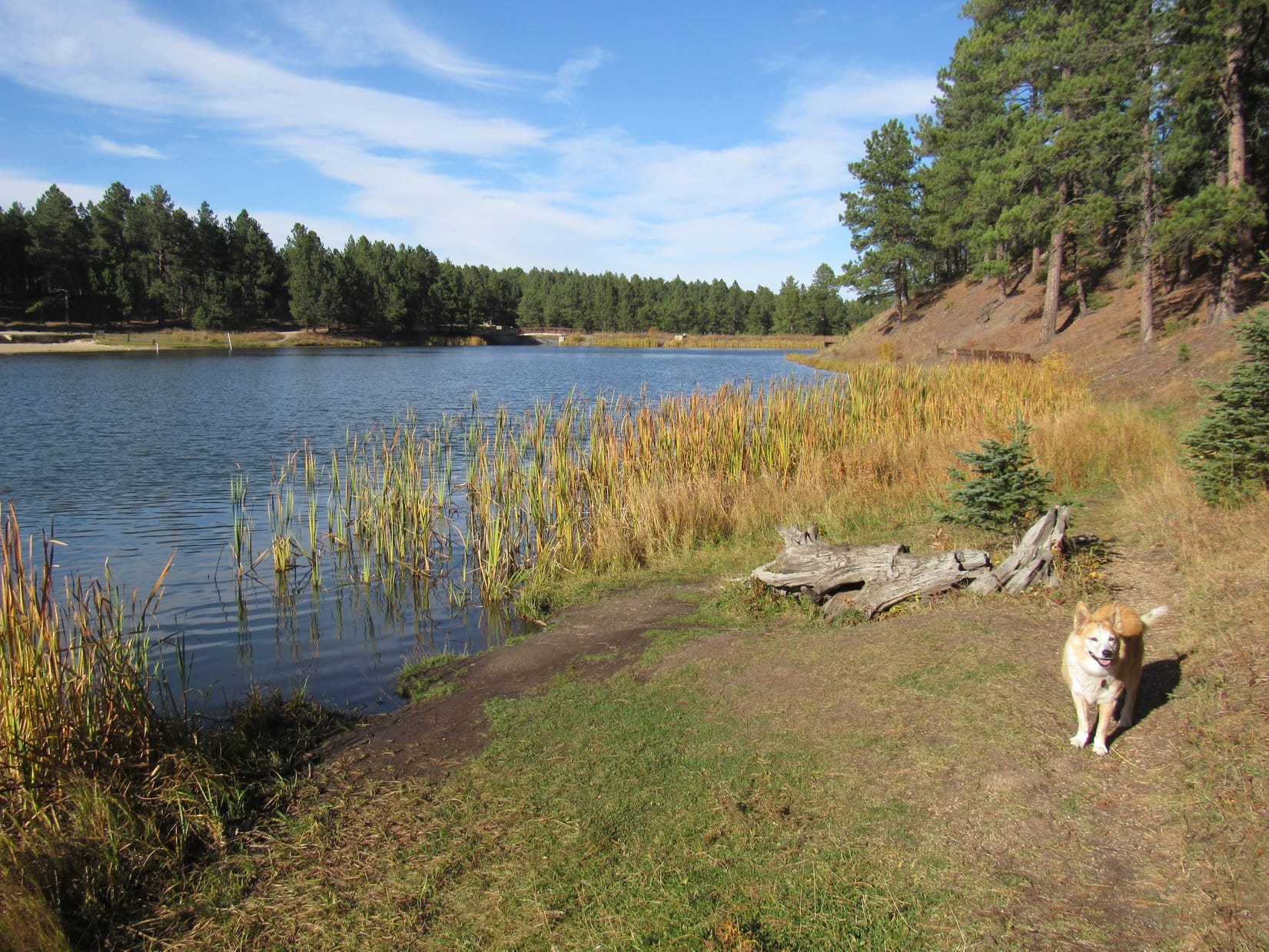
6:24 PM, 63ºF, junction of Tinton Road and USFS Road No. 134.2L – Rather than taking USFS Road No. 222.2F when she finally came across it again, Lupe continued off-trail straight for the RAV4.  The gently rolling, thinly forested terrain was fun and easy to explore, but the American Dingo’s wonderful Eleven Hour Gulch adventure was now just about over.  Nothing left but the beautiful drive home.

Well, wha’dya think, Loop?  Made a day of it, didn’t we?

I had a great time, SPHP!  Kind of a different Black Hills Expedition since we didn’t climb any peaks today, but we sure saw some unusual sights in the narrow slot canyon of the lower gulch.  Eleven Hour Gulch is a Black Hills treasure hidden right off the highway!

Satisfied then, Loopster?  Not feeling cheated, are you?  Even counting driving time between the lower and upper gulches, Eleven Hour Gulch only took us a little shy of 9.5 hours.  You didn’t get your full 11 hours in.

Oh, but I will, SPHP!  Didn’t you say we could come back to the lower gulch sometime in the winter when it’s all snowy and the frozen waterfall is at its most glorious?  We’ll finish our 11 hours then!

Sounds like a plan, sweet puppy!

Good!  Let’s go home then, SPHP!  I’m famished and ready for dinner.

Eleven Hour Gulch, Black Hills of South Dakota, 3-28-21

Lupe treasures collected – 4 plastic bottles, 4 aluminum cans

Links:

Next Black Hills Expedition                      Prior Black Hills Expedition

Want more Lupe adventures?  Check out Lupe’s Black Hills, SD & WY Expeditions Adventure Index, Master Adventure Index, or subscribe free to new Lupe adventures!

Black Hills, SD Expedition No. 279 – Devils Bathtub, Spearfish Falls, Roughlock Falls & Roubaix Lake (10-11-21)

10:13 AM, 56ºF – A gorgeous morning, comfortably cool and clear as a bell!  Lupe paused on the Cleopatra Place bridge for a look at Spearfish Creek.  SPHP was surprised by how much water there was even after a summer of drought.  Squaw Creek, a tributary joining in immediately upstream of the bridge, was another matter.  Squaw Creek did look low.  Not a bad thing, since it would have to be rock-hopped a bunch of times on the way to the Devils Bathtub.

Spearfish Creek from the Cleopatra Place bridge. Squaw Creek visible at lower L.

The Carolina Dog had attempted to visit the Devils Bathtub a couple of times in recent years, but had never made it all the way there.  The first time, SPHP thought she had, and didn’t figure out until later that the Devils Bathtub actually must have been farther up Squaw Creek.  The second time, ice and snow had made the rock-hopping so treacherous that SPHP had given up on it.  Lupe wound up climbing Spearfish Peak (5,800 ft.) and Little Crow Peak (5,885 ft.) instead.

Third time a charm?  Hopefully!  Lupe continued on across the Cleopatra Place bridge.  The Devils Bathtub trail, which goes up the Squaw Creek canyon, started just off to the R.  The Carolina Dog quickly arrived at the first and only bridge over the little creek.

On the first (and last) bridge over Squaw Creek.

Although the Devils Bathtub trail would cross Squaw Creek numerous times, right after the bridge it stayed on the SW side of the creek for a while.  Even here near the start, the canyon Lupe was venturing into was fairly narrow and steep-sided.  The entire canyon was full of trees and bushes sporting fall colors.  Loop enjoyed prowling among dead leaves and mossy stones looking for squirrels.

Among the leaves and mossy stones.

It didn’t take too long to get to the first stream ford, a crossing forced by a pinch point where Squaw Creek flowed right next to a wall of rock.  With the water so low this time of year, the ford was an easy rock-hop for SPHP.  Lupe didn’t bother rock-hopping, she just waded on through.

At the first ford.

As Loop continued up the canyon, the cliffs forcing many of the stream crossings became taller and more impressive.  In some places the trail was braided, with viable paths on both sides of Squaw Creek.  None of the frequent fords presented any real difficulties.  Slick, damp stones were the biggest worry for SPHP.  Lupe didn’t worry at all.

The rock walls forcing the stream crossings kept getting taller.
Father upstream at another ford. One of many.

Less than a mile from the start, the canyon narrowed some more.  Lupe reached a spot where Squaw Creek flowed over bedrock at the base of a long cliff.  Hugging the cliff, the Devils Bathtub trail went over shelves of solid rock right next to the stream.

Approaching the start of the continuous rock wall on the NE side of Squaw Creek.
The Devils Bathtub trail goes over these shelves of bedrock along the base of the cliff.

Lupe soon came to a series of waterfalls plunging into pools several feet deep.  Between these pools Squaw Creek raced through narrow chutes carved into the bedrock.  The overall effect was very beautiful.  In lots of places Lupe could leap over Squaw Creek in a single bound.  Even SPHP could just step across.

It didn’t take long to reach the large pool SPHP had mistakenly taken for the Devils Bathtub during Lupe’s first attempt to find it 2 years ago.

Continuing upstream along the cliffs.
On a midstream rock.
Looking downstream.
As far as Lupe had made it on her first attempt to find the Devils Bathtub back in 2019. She’d turned around here when SPHP mistook this pool for the real deal.

A little bit of scrambling around on the rocks had been required shortly before reaching this point.  Somewhat more challenging scrambling was required to go any further.  Nothing too daunting, but Lupe did have to traverse short stretches on narrow ledges 15 or 20 feet above the creek.

Up on a ledge above the Fake Devils Bathtub (L). Photo looks downstream.
Continuing past Fake Devils Bathtub (R).
Just past the Fake Devils Bathtub near the small waterfall that pours into it.

As it turned out, Lupe had almost made it to the real Devils Bathtub two years ago.  Only a few hundred feet upstream of the Fake Devils Bathtub, there it was!

On the ledges approaching the real Devils Bathtub, the upper pool seen here.

Trotting along narrow ledges with complete confidence, Lupe arrived in jig time.  SPHP, on the other paw, crept cautiously along the skinniest parts, but even that delayed arrival only momentarily.

At the Devils Bathtub. The official one!

Congratulations, Loopster, you made it!

So this is the Devils Bathtub, SPHP?  The real one?

Yes, the official one!  No doubt about it this time.

I’m not seeing any devils.  Can’t sniff them, either.  Are they invisible?

Hmm.  Well, I’m not sure, maybe so?  Or maybe it isn’t bath time?  I hear they like to play dirty tricks, so they probably don’t bathe very often.  Maybe just on Saturday nights?

Saturday night doesn’t make much sense to me, SPHP.  I doubt the devils dress up and go to church on Sunday morning!

Good point, Looper.  I really don’t know.  Anyway, this is a beautiful spot, isn’t it?  Let’s have a look around.

The Devils Bathtub wasn’t very big, so the “tour” didn’t take long at all.

Except close to the waterfall that raced down a slippery chute shaped like a waterslide into the Devils Bathtub, most of the pool wasn’t all that deep, just a few feet.  That was plenty deep for a Carolina Dog, though.  Lupe was not inclined to take a bath.  She waded along the edge of the shallow downstream outlet getting her paws wet, but otherwise did not go in.  SPHP avoided the water completely.  July or August was really the time to be here.

The water was cold and clear.  SPHP looked for fish, but they seemed to be just as scarce as devils.

Not all that much to the Devils Bathtub, is there, SPHP?

No, but it’s a scenic spot at the end of a nice hike, and quite a popular place to cool off in the summer.

I suppose its more exciting when the dirty devils show up.  Want to go up by the waterfall, SPHP?

Sure!

To get to the waterfall meant scrambling up on another narrow ledge, but it was no big deal and gave a different perspective.

On the ledge leading to the waterfall that feeds the Devils Bathtub.
Looking down the waterslide chute.

Neither Lupe nor SPHP was inclined to test the waterslide concept.  Might not be as smooth and as slippery a ride as it looked, and it was October, after all.  Would have been an exceedingly brisk experience.

Are we going any farther up the canyon, SPHP?  Looks like we could!

No, think this is it, Loop.  I went up there once a long time ago, before you were even around.  Don’t really remember too much about it.  There was a big old mine high on a steep hillside, the Cleopatra Mine, if memory serves, but the structure was crumbling away and dangerous even back then.  From what I can remember, the Devils Bathtub is the last of these scenic larger pools along Squaw Creek.

If we aren’t going any farther then, SPHP, why don’t we relax right here for a while?  Maybe we’ll get to see a devil!

Fine with me, but do you actually want to see a devil?  They’re evil you know.  Might be pretty dangerous if one comes along.

Oh, don’t worry about that, SPHP!  I’ll bite any devils that try to give us a hard time.

That’s why I always travel with a Carolina Dog!  You’re the best, Loopster!

A chocolate coconut bar, the American Dingo’s portion instantly inhaled, was shared at a sunny spot overlooking the Devils Bathtub.  Sadly, not a single devil turned up for Lupe to do battle with before it was time to start back down the canyon.

At the outlet from the Devils Bathtub, ready to head back to the RAV4.

12:10 PM, 61ºF, Devils Bathtub trailhead along Hwy 14A, Spearfish Canyon –  The return trek was just as gorgeous as the journey to the Devils Bathtub had been, but seemed to go even faster.  It was barely even lunchtime when Lupe arrived back at the RAV4.

What now, SPHP?  We aren’t done for the day already are we?

Oh, no!  Want to visit Spearfish Falls and Roughlock Falls while we’re in the area?  The trailheads aren’t that far away, just a few miles up Spearfish Canyon at Savoy.

The American Dingo was fine with that.  SPHP was soon parking the RAV4 at the Latchstring Restaurant.  The restaurant grounds bordered Spearfish Falls, but to actually get a good look, it was necessary to take a short trail down to the bottom of Spearfish Canyon.

A huge bald eagle was sitting on a stump out in front of the restaurant.  Before hitting the trail, Lupe went over to take a look at it.

Checking out the bald eagle in front of the Latchstring Restaurant in Spearfish Canyon.

Although a handsome specimen, the eagle proved none too lively, sitting completely motionless on its stump.  The action-oriented Carolina Dog quickly lost interest.  Heading over to the Spearfish Falls trail, she started the short journey down to the canyon floor.

The Spearfish Falls trail leaves the Latchstring Restaurant grounds just ahead on the L.
Sign at the trailhead.
View from a bench along the descent to the canyon floor.

The sign posted at the trailhead claimed that the Spearfish Falls trail was moderate difficulty and 1.5 miles round trip.  Both were exaggerations.  The wide, well-beaten path was mighty easy for Lupe, and it hardly seemed possible that it could have been 0.75 mile one way to the falls.  Once down to the canyon floor, a short trek brought Lupe to a bridge over Spearfish Creek.  The falls were only a little farther.

Spearfish Falls.
Spearfish Falls is on Little Spearfish Creek, which joins Spearfish Creek at the base of the falls. Got that?

Spearfish Falls may well be the tallest and most impressive waterfall in the entire Black Hills region.  Certainly worth the minor effort required to go see it!  Even at SPHP’s relaxed pace, the round trip took just a half an hour.

Next up was Roughlock Falls, only a mile away on USFS Road No. 222, which took off from Hwy 14A over by the Latchstring Inn across from the restaurant.  The Carolina Dog still had plenty of time left in the day, though.  Instead of driving all the way, SPHP merely moved the RAV4 over to the Roughlock Falls trailhead just past the inn.

The Roughlock Falls trail was broad and smooth.  Most of it was flat, or nearly so.  Super easy!  It went up the scenic side canyon carved by Little Spearfish Creek.  The trail generally wasn’t all that close to the creek, but shortly after Lupe set out, there was an opportunity to head down to it.

Little Spearfish Creek was cold, clear, and several feet deep.  Below the surface, dark green plants swayed in a swift current.  Small trout darted from one hiding spot to the next.

By Little Spearfish Creek. Photo looks upstream.
Same spot, looking toward the limestone cliffs across the creek. Photo looks N.

A mile went by fast.  Loop was soon standing on the boardwalk next to the cascades below Roughlock Falls.  From down here there was a great view of the cascades, but only a glimpse of the main waterfall could be seen at the far end of a narrow gorge.

On the lower boardwalk with a view of the cascades below Roughlock Falls.

For the best views of Roughlock Falls itself, Looper needed to get to the upper viewing platforms.  Crossing a nice bridge over Little Spearfish Creek, a short stroll along a sidewalk quickly brought her to the first of the upper viewpoints.

Looking downstream from the bridge over Little Spearfish Creek.
Roughlock Falls from the first upper viewpoint.

To get to the final viewpoint, Lupe crossed another bridge just upstream of the falls.  This viewpoint overlooked the brink of the falls.

Crossing Little Spearfish Creek again, this time just upstream of the falls.
Near the brink.

After enjoying Roughlock Falls from all these different vantage points, Loopster completed her tour by wandering through the picnic ground immediately upstream.

Little Spearfish Creek from the Roughlock Falls picnic area.

It was mid-afternoon when Lupe got back to the RAV4.  The sky had been clouding up on the way to Roughlock Falls, but it was getting sunnier again now.  The Carolina Dog had completed everything planned in the Spearfish Canyon area for today, so what now?  Tomorrow snow was in the forecast.  It would be a shame to just go home instead of enjoying what remained of this beautiful day.

This Black Hills Expedition seemed to be all about water.  Since Lupe had never been to Roubaix Lake before, SPHP decided a relaxing drive through the central hills to go see it might be just the ticket.

On the way, a stop was made up on Minnesota Ridge (6,240 ft.).  Lupe enjoyed a short romp looking for squirrels while SPHP had a look at the fall colors.

Enjoying a romp on Minnesota Ridge.
Fall colors.

Then it was on to Roubaix Lake!

Roubaix Lake wasn’t very big, sort of a glorified pond, but it did feature a campground with a sandy beach, plus a trail that went about halfway around the lake.

Arriving at Roubaix Lake, which is just a mile off Hwy 385 in the central Black Hills.

The trail started at a bridge over the outlet for Middle Box Elder Creek.  After crossing both the bridge and the dam, the trail headed SW right along the shoreline.

On the bridge over the outlet for Middle Box Elder Creek. Photo looks SE.
Along the SE shore after crossing the dam. Photo looks W.
Getting a drink not far from the dam. Photo looks N.

Middle Box Elder Creek enters Roubaix Lake over at the far SW end.  The trail began to fade away as Lupe drew near.  This part of the lake looked very shallow, full of mud and thick stands of tall reeds.  Late afternoon sunlight highlighted the reeds’ colors, making them glow.

By the colorful, glowing reeds. Photo looks SW.
SW end of Roubaix Lake. Photo looks W.

The trail went on, but appeared destined to disappear entirely.  Probably about time to call it a day by now, anyway.  A squirrel provided several minutes of excitement on the way back to the RAV4.

Black Hills, SD Expedition No. 279 had been a success!  Getting all the way to the Devils Bathtub for time ever had been the main objective, and Lupe had made it.  Third time had been a charm!  Really hadn’t been hard at all.  Spearfish Falls, Roughlock Falls, and Roubaix Lake were all just icing on the cake.

A lovely Black Hills autumn day, but tomorrow, a first taste of winter!

Roubaix Lake, Black Hills, SD 10-11-21

Links:

Next Black Hills Expedition                  Prior Black Hills Expedition

Black Hills, SD Expedition No. 251 – Bridal Veil Falls, the Devils Bathtub trail, Spearfish Falls & Roughlock Falls (10-17-19)

Want more Lupe adventures?  Check out Lupe’s Black Hills, SD & WY Expeditions Adventure Index, Master Adventure Index, or subscribe free to new Lupe adventures!

Black Hills, SD Expedition No. 251 – Bridal Veil Falls, the Devil’s Bathtub trail, Spearfish Falls & Roughlock Falls (10-17-19)

Should have had a plan B!  Yesterday evening a landowner had refused Lupe permission to cross their property this morning to access a mountain that would have been a fun trek.  SPHP was welcome, but no pesky Dingoes allowed!  Heh.  No dice!  If the Dingo couldn’t, SPHP wouldn’t.

Hence the sudden need for a Plan B.  Plenty of options to choose from in the Black Hills, perhaps too many.  None seemed to stand out as the thing to do.  Better decide soon, though.  The morning was shooting by.  Lupe wasn’t going to be happy if SPHP let indecisiveness waste away this beautiful day for her first Black Hills Expedition of the fall season.

Under the circumstances, maybe something quick and easy was called for?  Lupe didn’t always have to climb a mountain, did she?  How about a scenic drive up Spearfish Canyon?  Loopster had never been to the Devil’s Bathtub, a lovely remote swimming hole beneath a waterfall hidden up a side canyon.  SPHP had thought about taking her there many times, but it was best visited in the hot summer months when the cool, clear water would be refreshing, not frigid.

The Devil’s Bathtub would still be a beautiful short trek, though, and the Carolina Dog wasn’t much into swimming, anyway.  Lupe would have plenty of time to visit the 3 best waterfalls in Spearfish Canyon today, too.  Why not?  SPHP felt kind of lazy.  So be it!  Lupe was in for an easy day touring the watery wonders of Spearfish Canyon.  She was all for it, desperately eager to get going right this very minute!

Coming up Spearfish Canyon on Hwy 14A, Lupe’s first stop was at Bridal Veil Falls.  (11:41 AM, 55ºF)  Bridal Veil Falls was conveniently right next to the highway.  Maybe a bit too conveniently?  SPHP was surprised by the number of people milling about.  Lupe had to wait for a turn on the viewing platform.

At Bridal Veil Falls just off Hwy 14A in Spearfish Canyon.
Bridal Veil Falls.

Bridal Veil Falls was lovely, but the American Dingo was soon ready for more action than simply hanging around a viewing platform next to the highway provided.  Only a couple miles farther up Spearfish Canyon was a turn onto Cleopatra Place, which used to be where to park to get to the Devil’s Bathtub.  However, Lupe arrived to find that parking along Cleopatra Place was now prohibited.

No problem!  0.25 mile farther up Spearfish Canyon a new parking area right along Hwy 14A now serves as the Devil’s Bathtub trailhead.  The new parking lot was on the L (E) just before the old Homestake Mining Company Hydroelectric Plant No. 2.  Since the historic old building was so close by, Lupe went to see it.

Loop by Spearfish Creek near Hydroelectric Plant No. 2.
Homestake Mining Company Hydroelectric Plant No. 2 is just upstream of the new parking lot serving as the Devil’s Bathtub trailhead.

It doesn’t take an American Dingo long to look at an old building, either!  Not overly impressed, Lupe returned to the trailhead, then followed a muddy path near Spearfish Creek down to the Cleopatra Place bridge.

There’s the Cleopatra Place bridge now! It’s not far from the new trailhead at all.
SPHP says you used to be able to park right here, but not any more! Loop about to cross the Cleopatra Place bridge.
Spearfish Creek. Photo looks upstream from the Cleopatra Place bridge.

Once over the Cleopatra Place bridge, Lupe followed a broad trail near Squaw Creek, a small stream that joins Spearfish Creek just upstream of the bridge.  This was the start of the unmaintained trail that goes to the Devil’s Bathtub.  The trail quickly led to a ford of Squaw Creek.

Ordinarily Squaw Creek wouldn’t have much flow this late in the year, but 2019 has been unusually wet in the Black Hills.  Squaw Creek was looking surprisingly healthy.  With snow still lingering from a recent early snowstorm, SPHP wasn’t eager to get cold, wet feet fording the stream.  That might easily have been the end of Looper’s Devil’s Bathtub aspirations right then and there, but glancing upstream from the ford, a footbridge was in sight.

The primitive trail to the Devil’s Bathtub quickly led to this ford of Squaw Creek. Fortunately, a footbridge is in sight a little farther upstream.
On the footbridge over Squaw Creek.

Beyond the footbridge, a braided trail led through the forest up Squaw Creek canyon.  Lupe had a great time sniffing and exploring!  However, the canyon wasn’t terribly wide.  Squaw Creek meandered from side to side, forcing additional stream crossings at frequent intervals.  No more footbridges, either – the first one was the only one.

For SPHP all the stream crossings were rock hops.  With the water level as high as it was, they were trickier than expected.  Many rocks were wet and slippery.  Snow or ice clung to some.  SPHP had forgotten the trekking poles back at the G6, and was soon wishing they had been brought along.  In summer, fording the little stream would have been simply refreshing and not an issue.  Now it was a bigger deal.

Of course, Lupe had no problems crossing Squaw Creek.  She bounded over rocks, or splashed through shallow spots as she pleased.

Squaw Creek crossing No. 2. Plenty of big rocks in the stream made this one easy.
Even though it was a warm day for mid-October, in some places a fair amount of snow was on or near the trail.
Logs formed a crude bridge at crossing No. 3. The logs were slick, but still served the purpose.
On a snowy log at crossing No. 4.
Crossing No. 5.

The 6th crossing of Squaw Creek was more problematic than any of the prior ones.  Initially it didn’t appear possible without resorting to simply fording the stream.  Still hoping not to get wet feet, SPHP scrambled up a steep, snowy slope following footprints left by others in an attempt to avoid this ford completely.

The path dead-ended well above stream level.  Well, phooey!  SPHP was forced to retreat.  However, during the slippery descent it turned out to be possible to get at least a little farther upstream.

It was enough.  The creek was easier to cross here.

Loop close to where she managed to cross Squaw Creek for a 6th time.

Lupe had now reached the base of a dramatic horizontally-layered cliff.  She stood on a ledge of bedrock next to Squaw Creek.  The overall effect was very cool.  What a scenic spot!

Between Squaw Creek and the towering horizontally-layered cliff.
What a cool spot!

Not much farther to the Devil’s Bathtub now, Looper!

How do you know that, SPHP?

I’ve been there, years before you were even born, sweet Dingo!  All we have to do now is follow along the base of this cliff.  Somewhere not too far past it we’ll come to the Devil’s Bathtub.  Don’t remember exactly how much farther it is.  Not too far, though.  I’ll know it when I see it.  We’ll take a break when we get there.

Sounds great!  This place is awesome!  Let’s keep going!

Lupe continued upstream following shelves of bedrock along the base of the cliff.  Once or twice when Squaw Creek came right up against the cliff, she briefly leapt over to the other side in a single bound.  This whole stretch was gorgeous and fun!

Following the cliff upstream.
Temporarily forced over to the R side of Squaw Creek. Photo looks upstream.
Looking downstream.
Another look downstream from slightly farther on.

The trek along the base of the cliff wasn’t long.  A couple hundred yards, maybe?  After rounding a corner, Lupe could see a series of pools in Squaw Creek ahead.  The largest pool with a small waterfall plunging into it was hidden beyond a big snow-covered boulder at the upper end.  The Devil’s Bathtub!

Approaching the snow-covered boulder.
The waterfall and large pool beyond the boulder.
Lupe above the little waterfall.
Closeup of the waterfall.

Or was it?

Above the little waterfall, Squaw Creek spilled from a shallow pool down a  channel worn smooth – a natural waterslide.  SPHP joined Lupe above the waterfall for a look around.  Beyond the waterslide and upper pool Squaw Creek came down a straight, narrow valley strewn with rocks.  No more stunning cliffs in sight or big pools of water.  No trail evident, and all the tracks in the snow seemed to stop here.

Huh.

Huh, what?  Is this it, SPHP?  Have we reached the Devil’s Bathtub?

I’m not sure Loop.  Maybe.

I thought you said you’d been here before, and would recognize it?

Yeah, I thought I would.

So, what’s the problem?

Well, this Devil’s Bathtub doesn’t look quite right to me – at least not the way I remember it.  Everything else seems fine, but the waterfall isn’t as high or steep as I recall.  Not that it was all that high to begin with, it wasn’t.  The bathtub below the falls seems to be shaped differently, too.

Maybe it has changed over the years?

I suppose, but isn’t that rather unlikely?  It’s carved into bedrock!  More likely my memory is faulty.  Sometimes things get built up in one’s mind over time beyond what they ever really were.  I’ve had that happen before.  I don’t remember the Devil’s Bathtub being too far past the awesome cliffs.  From what we can see, it doesn’t look like there is anything promising nearby upstream from here.  Judging from the tracks in the snow, no one else has been venturing any farther than this in the past few days, either.  Maybe this really is the Devil’s Bathtub?

So what now?  Want to keep going farther, just to be sure?  I’m game!

Hah!  I knew you would be, Loopster!  Makes sense, but I don’t know.  If I’m wrong, we won’t find anything no matter how far we go.  Then you might not have time to visit Spearfish Falls and Roughlock Falls today.  This is a gorgeous spot!  Let’s ponder the situation while we take a break.

Lupe was fine with that.

At the upper end of the chute above the waterfall.
Overlooking the Devil’s Bathtub candidate from the break area.
Closeup from the brink of the waterfall.

Voices!  No sooner had the break begun than a family of five appeared downstream.  Lupe and SPHP relaxed listening to the soothing sound of the water while watching them scramble by up past the falls.  They went on past the waterslide, disappearing beyond the upper pool, but were soon back.  After a few minutes, SPHP asked the wife if this was really the Devil’s Bathtub, or not?  We were going to ask you, came the reply!  They’d never been here before, but thought that it was.

A bit later, another group of 7 or 8 people came along.  They didn’t go any farther than Lupe had, either.  Everyone thought this beautiful spot was the Devil’s Bathtub, but no one was completely certain.  A pleasant half hour shot by.

This has been fun, but it’s decision time, Loop.  Keep going or return to the G6?

Lupe didn’t say.  As usual, the Carolina Dog was ready for anything.

Alrighty then, Loopster.  Tell ya what.  I’m feeling a bit lazy.  Mind if we just go back to the G6 to continue your Spearfish Canyon waterfall tour?  This might well be the Devil’s Bathtub.  If not, it’s been a very similar experience to the one I dimly remember.  Promise I’ll try to research it online after we get home.  Should have done that to begin with, but I thought I knew what I was doing.  If it turns out this isn’t really it, we’ll come back someday.  The old Cleopatra mine is on a steep hillside farther up this canyon.  Maybe we can check it out, too, then?

Seems silly to leave without knowing for certain if we made it to the Devil’s Bathtub or not SPHP, but if you promise to bring me back again sometime if we didn’t, that’s fine.

It’s a deal!  Onward!  Puppy, ho!

Lupe at the start of the path back.

The trek back to the G6 went faster than going up Squaw Creek had.  SPHP was better at the rock hop crossings, and staying on the most direct route.  Lupe explored and sniffed as she had earlier, still enjoying this most natural and remote trail of the day.  However, she made it back to the G6 so fast (2:20 PM, 70ºF), that it again raised doubts in SPHP’s mind whether Looper had actually made it to the Devil’s Bathtub.

No time to worry about that now, though!  The American Dingo was already on to the next great thing!  Spearfish Falls was next up.  Five miles farther up Spearfish Canyon, SPHP parked the G6 at the Latchstring Inn Restaurant(2:30 PM, 69ºF)  Spearfish Falls was down in the lower canyon the restaurant overlooked.  In fact, Lupe could look down on the falls from an observation deck at the S end of the restaurant grounds.

Out in front of the Latchstring Inn Restaurant at Savoy in Spearfish Canyon.
Looking down from the brink of Spearfish Falls (R).

The view from above was nice, but the falls were better seen from down below.  The Spearfish Falls trail used to make a loop down to the falls from either end of the restaurant grounds.  That had changed.  Now the trail is only accessible from the opposite N end of the Latchstring Inn Restaurant property.

This close up of the posted trail map was taken near the S falls overlook. The trail to the falls starts from N of the restaurant as shown, not at the red “You are Here” star.
At the start of the Spearfish Falls Trail just N of the Latchstring Inn Restaurant.

The Spearfish Falls trail started out as a broad path which switch-backed down to the lower canyon floor.  Once it leveled out, the trail meandered a bit before quickly leading to a sturdy footbridge over Spearfish Creek.

A few minutes going down gentle switchbacks brought Lupe to the lower canyon floor.
On the Spearfish Falls trail at Savoy.
The excellent footbridge over Spearfish Creek.
Looking up Spearfish Creek from the bridge.

Beyond the bridge was a short stroll through a park-like forest.  A terrific view of Spearfish Falls was just ahead.

In the forest beyond the bridge.
Spearfish Falls comes into sight.
Lupe at Spearfish Falls.

Spearfish Falls was impressive!  The beautiful falls had excellent flow, and had to be one of the very tallest in the entire Black Hills.  A large viewing deck provided a fantastic look at it.

Wow, Spearfish Falls is really worth seeing isn’t it? So easy to get to, too!
Look up above and you can see the roof of the Latchstring Inn Restaurant. It’s just that close!
One of the biggest and best waterfalls in the whole Black Hills!

After spending a little time appreciating Spearfish Falls, Lupe headed back along the trail.  This time she saw several deer along the way.  Soon, though, she was back at the start.

On the way back, Lupe was excited to see several deer just around this bend.

One more waterfall to go!  Roughlock Falls was only a mile away up the side canyon of Little Spearfish Creek, the same creek that Spearfish Falls was on.

SPHP could have driven USFS Road No. 222 to the Roughlock Falls picnic ground which was practically right at the falls.  However, a scenic trail also went to Roughlock Falls from the Spearfish Canyon Lodge located right across Hwy 14A from the Latchstring Inn Restaurant.  More fun to do that!

The Spearfish Canyon Lodge is right across Hwy 14A from the Latchstring Inn Restaurant.

After crossing the highway, Lupe went past the Spearfish Canyon Lodge then through a large parking lot to a smaller one.  She picked up the trail here at a short bridge over Little Spearfish Creek.  Once over the creek, the Roughlock Falls trail followed it upstream.  A trail map showed that Lupe could have accessed the trail from right in front of the Spearfish Canyon Lodge.  Oh, well!

Roughlock Falls trail map.

The popular trail was sort of icy, but otherwise easy.  By now, the sun was getting low.  Most of the trail was shady, but S facing canyon walls were still in brilliant sunshine.

The Roughlock Falls trail was a bit icy.
The trail went past this pond created by a small dam on Little Spearfish Creek.
Loop a bit off trail next to Little Spearfish Creek.
Little Spearfish Creek canyon. USFS Road No. 222 is on the R. The Roughlock Falls trail on the L.
Exploring the trail.

One measly mile didn’t take long.  Soon Lupe was on the boardwalk leading to the lower Roughlock Falls observation deck.

Looking back from the boardwalk leading to the lower falls observation point.
Roughlock Falls from the lower observation deck.

After seeing Roughlock Falls from down here, Lupe continued on up to the picnic area above the falls.

Little Spearfish Creek up at the Roughlock Falls picnic area.
Hey, isn’t this where I gave my famous Lupeo & Xochiet performance some years back? … Yes, it is Loop!
The Roughlock Falls picnic area is one of the prettiest in the Black Hills.

Upon completing her quick tour of the picnic area, Lupe checked out the views from the upper observation decks overlooking Roughlock Falls.

The upper observation decks next to the picnic ground are as close to Roughlock Falls as it’s possible to get these days. Wading up Little Spearfish Creek right into the falls is no longer permitted.
On the brink of Roughlock Falls.
Another perspective.
Roughlock Falls.
Looking down on the lower cascade. The lower observation deck is in sight, too.
Hard to say which I like better, Roughlock Falls or Spearfish Falls. They are both wonderful!

Lupe had about seen what there was to see at Roughlock Falls.  Time to head back.  The American Dingo returned to the lower observation deck for a final look before departing.

Heading back down.
Limestone cliffs overlooking the trail.
Final look at Roughlock Falls from the lower observation deck.

All that remained to complete the day was the pleasant, easy trek back to the G6.  Lupe enjoyed every minute of it.

Back on the Roughlock Falls trail.
Glancing up at the towering cliffs.
Well, that’s about it for Expedition No. 251! No mountains climbed, but hope you enjoyed this watery tour of Spearfish Canyon. I sure did!

10-17-19, 5:13 PM – A happy Carolina Dog arrived at the G6 ready to go home.  Black Hills, SD Expedition No. 251 had been a complete success!  Or had it?

10 days later, SPHP searched online for images of the Devil’s Bathtub.  Plenty of photos of the spot Lupe had reached appeared.  Then, Bingo!  SPHP recognized it in an instant.  The Devil’s Bathtub!  There it was, just as SPHP remembered it.  The American Dingo hadn’t gone far enough on Expedition No. 251 to reach the true Devil’s Bathtub after all.

How much farther was it?  Only 10 minutes according to one account.  So Lupe will be going back to the Devil’s Bathtub trail again someday.  After all, SPHP promised.  But that’s another expedition and adventure!

Devil’s Bathtub trail, Black Hills of South Dakota, 10-17-19

Links:

Next Black Hills Expedition                 Prior Black Hills Expedition

Want more Lupe adventures?  Check out Lupe’s Black Hills, SD & WY Expeditions Adventure Index, Master Adventure Index, or subscribe free to new Lupe adventures!