Black Hills, SD Expedition No. 173 – Strawberry Ridge, Sugarloaf Mountain & Woodville Hills (5-21-16)

Lupe had been revved up for a couple of days.  SPHP had promised to take her on one of her Black Hills expeditions this morning, yet she almost didn’t get to go.  Lupe was up early, but the morning sky was totally overcast.  Low clouds socked in the nearby hills.  It looked like rain and fog were in Lupe’s immediate future, not fun in the sun.

SPHP was hoping for rain, actually.   May, normally one of the wettest months of the year in the Black Hills, had hardly seen 0.25″ so far, and the month was already 2/3 over.  Moisture is almost always good news in the Black Hills, and it was really needed now.

Rain didn’t come.  A light mist fell, but it didn’t amount to anything.  After a couple of hours, the clouds seemed to be lifting.  SPHP checked the forecast.  Clouds and wind, but only a 20% chance of rain.  Well Loopster, looks like you win!  We may as well try it, although we may not see much if the skies don’t clear up any more than this.

Lupe was thrilled!  She wasn’t worried about clouds.  If she just got to run around sniffing in the forest, that was fine with her.  She could still look for squirrels!

Lupe’s first peakbagging goal of the day was an easy one.  SPHP parked the G6 near the start of Gilt Edge Road, just off Hwy 385 S of Lead/Deadwood (9:44 AM, 58°F).  The top of Strawberry Ridge (5,890 ft.) was only 0.2 mile N.  Lupe charged into the forest, excited to be underway.

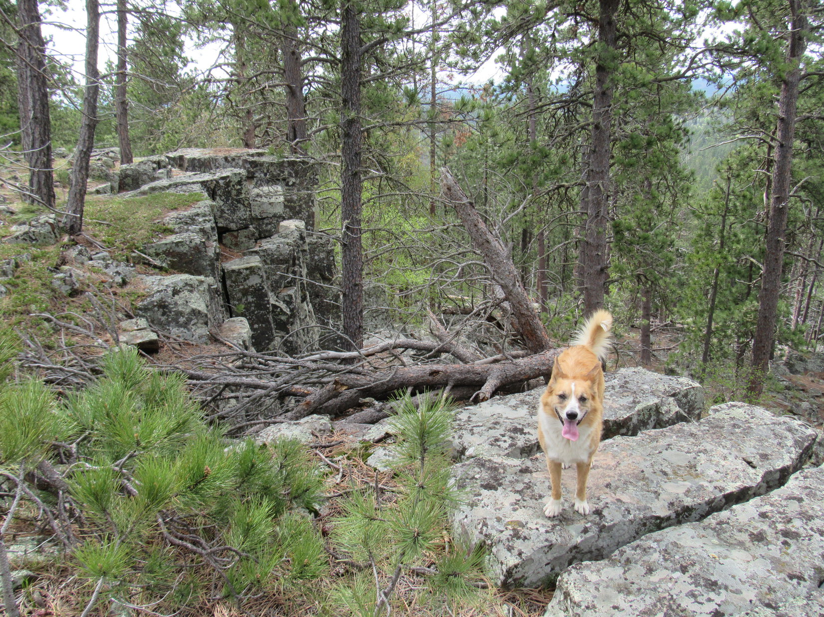
SPHP trudged up the hill.  The slope was moderate, until Lupe arrived at the base of a rocky ridge with a line of small cliffs facing SW.  Lupe and SPHP went around the S end of the rocks, and easily got up on top.

Lupe up on the rocky ridgeline along the SW edge of the Strawberry Ridge summit area. Photo looks NW.

The Strawberry Ridge summit area was large and flat.  Nothing stood out as the absolute high point.  The most interesting part of the mountain was the line of small cliffs to the SW.  Forest hid the views in every direction.

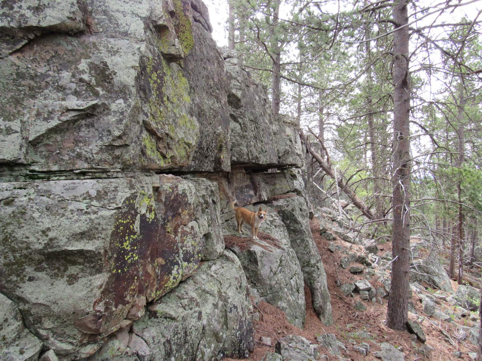
Following the edge of the cliffs NW a little way, Lupe came to a small opening where Custer Peak (6,804 ft.) could be seen off to the SSW.  That was about it for views.  At least the clouds had lifted quite a bit by now.  Although hazy ill-defined clouds still dominated the sky, they weren’t nearly so low as earlier in the day.  At times, the sun even came out.

Custer Peak from Strawberry Ridge. Photo looks SSW using the telephoto lens.

Lupe and SPHP looked around for the highest spot on Strawberry Ridge, but it really was all about the same elevation.  SPHP finally chose a spot for Lupe’s summit photo.  She grinned cheerily for the camera.  Then she went and explored some of the interesting rocks along the line of small cliffs.

Lupe grins at the summit of Strawberry Ridge (5,890 ft.). It was getting warm out, which kept her panting, which made her look so happy. She actually was happy, though, too! Photo looks NNW.
Lupe grins at the summit of Strawberry Ridge (5,890 ft.). It was getting warm out, which kept her panting and made her look happy. She actually was happy, though, too! Photo looks NNW.
Near the edge of the SW cliffs. Photo looks SSE.
Exploring the low cliffs. Photo looks SSE.
Starting down the mountain. Photo looks N.

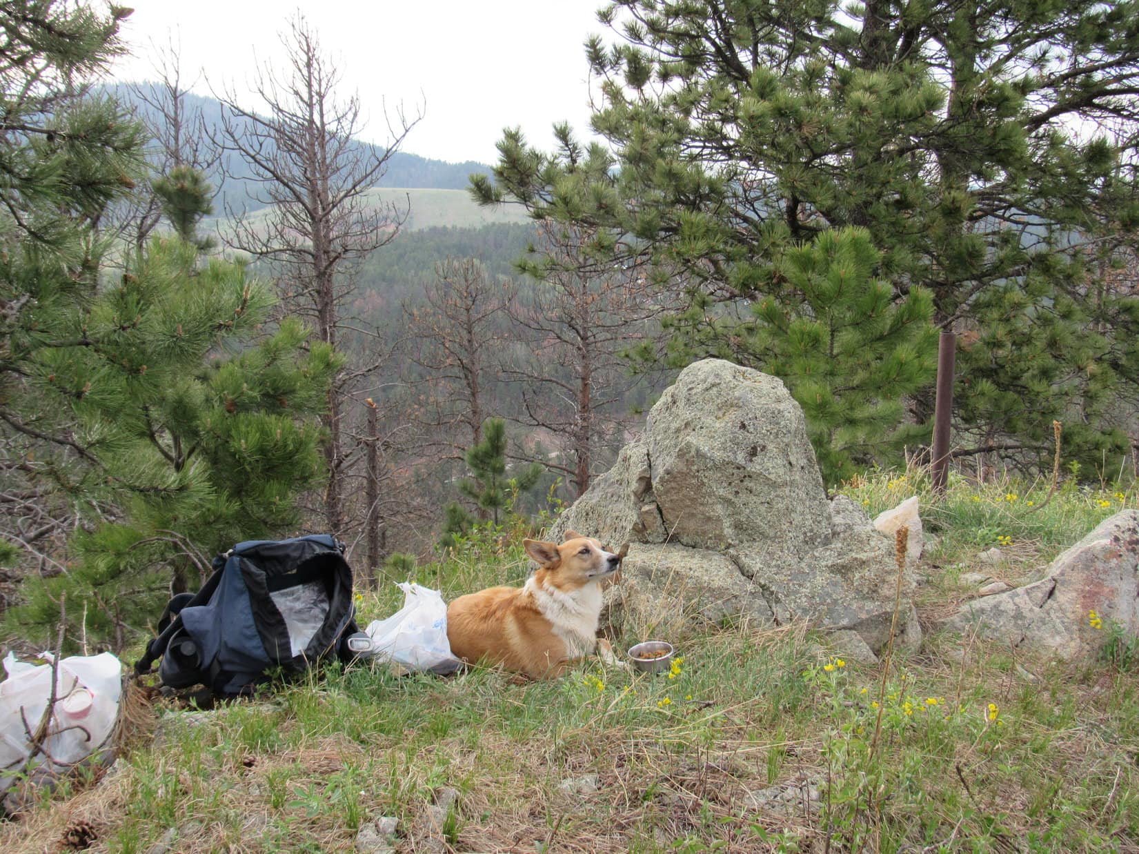
After exploring Strawberry Ridge, the short march back to the G6 was uneventful except that Lupe found a squirrel to bark at, and SPHP found the first Lupe Treasure of the day.  A big black tarp had been abandoned in the forest near Gilt Edge Road.  SPHP managed to get it stuffed into the trunk of the G6 (10:24 AM, 62°F).

For a moment, Lupe was reluctant to hop into the G6.  She was worried that Strawberry Mountain was going to be it for the day.  Why, the day was hardly getting started.  She didn’t want to go home yet!  SPHP persuaded her there was more fun in store.  Lupe leaped in.  She mostly enjoyed the ride to the next stop, but whined a little when there weren’t enough cows, horses or deer to bark at along the way.

SPHP parked the G6 at the Sugarloaf trailhead of the Mickelson Trail along Hwy 85 SW of Lead (10:37 AM, 66°F).   Lupe wasn’t going to take the Mickelson Trail, however.  She had another peakbagging goal nearby, and the trail didn’t go to it.  Lupe was going to climb Sugarloaf Mountain (6,037 ft.).

Sugarloaf Mountain was only 0.33 mile SW of the trailhead, but SPHP didn’t know how to get to it.  A private home blocked the way through the valley E of the mountain.  Lupe and SPHP tried finding a way past the private property by following Whitetail Creek upstream along Hwy 85.  The creek was pretty, but due to its proximity to the highway, there were a lot of Lupe Treasures along it.

Whitetail Creek next to Hwy 85. Photo looks W.

The exploration up Whitetail Creek was a failure.  Lupe kept coming to more private property along the creek.  It didn’t look like there was any access to Sugarloaf Mountain from here.  Lupe had to turn around and go back.

SPHP finally found a way up onto a ridge E of Sugarloaf Mountain.  Lupe never got to the top of the ridge, but followed it S until she could cross the valley to the W.  Down in the upper reaches of the valley, Lupe came to a tiny stream flowing over an abandoned road.  The stream was full of silt and mud.  Lupe laid right down in it to cool off.  A two-toned American Dingo emerged from the mud.

Lupe emerges from the muddy little stream E of Sugarloaf Mountain. The American Dingo seemed proud of her new two-toned look!

Lupe seemed quite pleased with her new two-toned look!  Or maybe it was just that the cool mud felt good.  It was getting warmer and sunnier out.  The air was very humid.  As Lupe headed NW up out of the valley toward Sugarloaf Mountain, SPHP started sweating.  SPHP stopped to put on sunscreen, as much for the breather as for protection from the sun.

While Lupe climbed Sugarloaf Mountain, SPHP started thinking about how it was getting to that time of year when Lupe needs to be exploring higher mountains than the Black Hills.  Heat always saps SPHP’s energy.  Lupe isn’t immune either.  Climbing mountains in the heat is even worse wearing a fur coat!

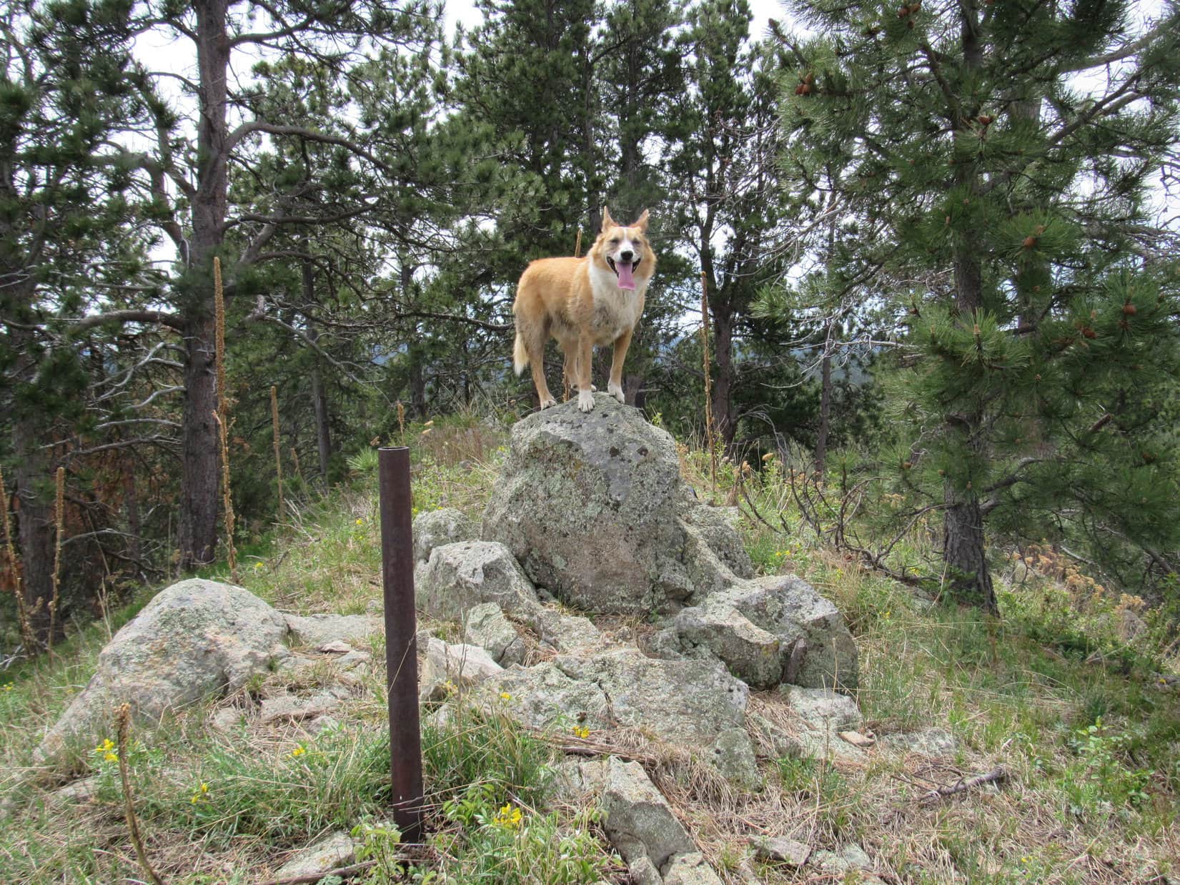
The Carolina Dog soon arrived at the top of Sugarloaf Mountain (6,037 ft.).  The summit area was a narrow ridge maybe 50 feet long running N/S.  A big rock toward the N end was clearly the highest point on the mountain.  A few feet N of it, a 3″ diameter pipe stuck up several feet out of the ground.  Lupe hopped up on the summit rock to complete her ascent.

Lupe on the summit of Sugarloaf Mountain (6,037 ft.). Photo looks S.
Looking N.

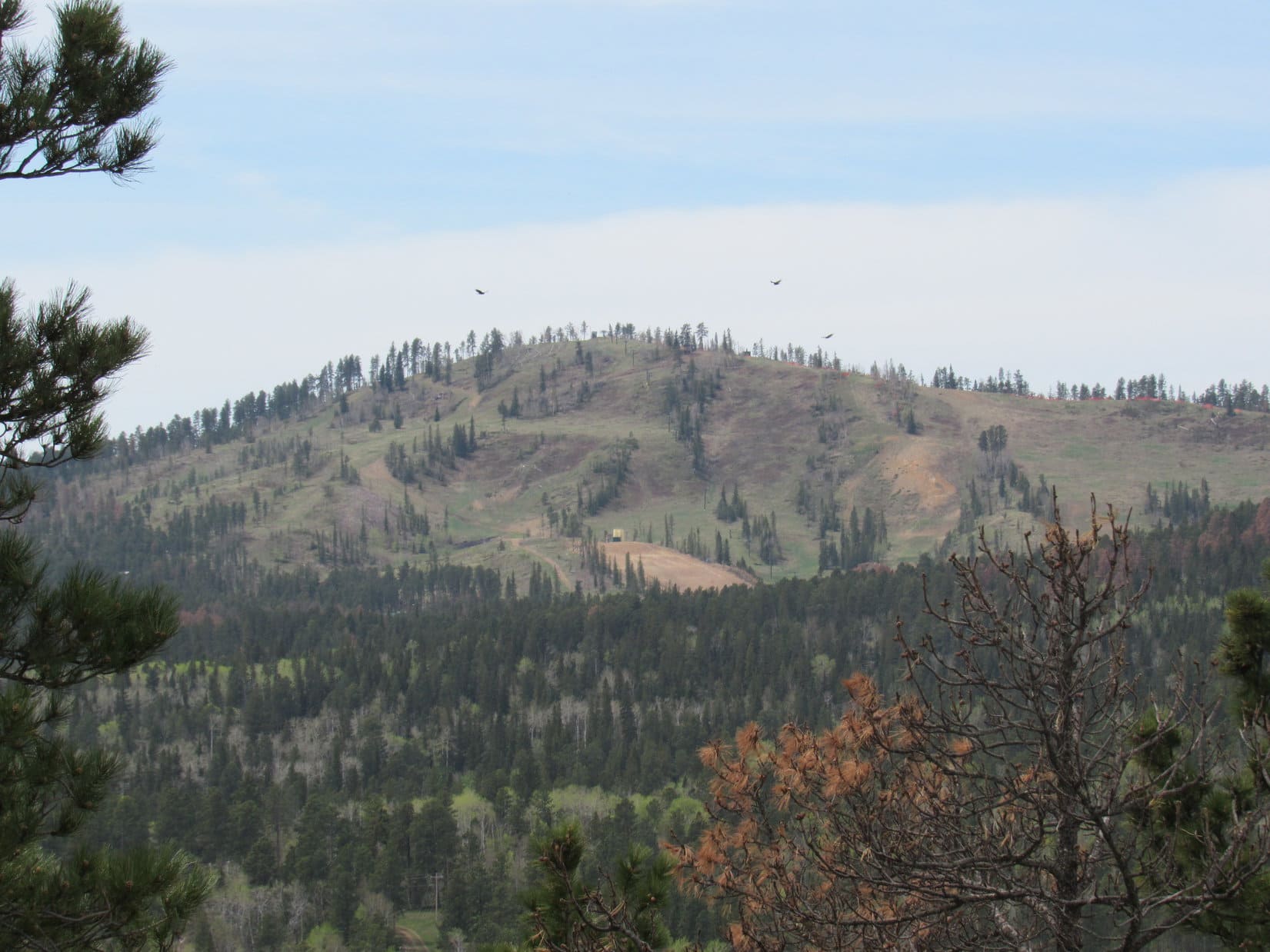
Sugarloaf Mountain was forested, but there were several places along the narrow summit ridge where it was possible to get a distant view.  Lupe could see Terry Peak (7,064 ft.) and Deer Mountain (6,652 ft.) to the W.  To the NE was the town of Lead.

The snow was all gone from the ski runs on Terry Peak (7,064 ft.) Photo looks W.
The town of Lead, SD was in view to the NE. Photo taken with telephoto lens.
Big birds were circling near Deer Mountain (6,652 ft.). Photo looks SW using the telephoto lens.
The old Homestake Gold mine in Lead, SD could be seen from Sugarloaf Mountain. The former mine now serves as a physics underground research facility. Photo looks NE using the telephoto lens.

After a lengthy rest break on Sugarloaf Mountain, Lupe and SPHP headed S down off the mountain.  Lupe was on her way to her last peakbagging goal of the day, the highpoint of Woodville Hills (6,280 ft.).  The journey started out well.  As expected, Lupe came to a gravel pit shown on the maps while still coming down Sugarloaf.  The gravel pit had a number of very small ponds along the E side of it.  Frogs were croaking away, but stopped abruptly when Lupe drew near.

S of the gravel pit, Lupe found a road.  Lupe and SPHP started following it SW, but came to a No Trespassing sign.  A big house could be seen off to the W, a short distance ahead.  Lupe and SPHP went S to avoid it, but came to a big housing subdivision at the W end of Ruby Flats.  The housing subdivision was quite new.  Many of the lots were undeveloped, although beautiful new homes were scattered around, too.

Lupe and SPHP passed through the subdivision on paved streets named Rubys Way and Outlaw Pass.  Outlaw Pass seemed appropriate enough, but no one stopped outlaws Lupe or SPHP.  Lupe made it through the subdivision without incident, and returned to the forest heading SE.  It wasn’t too far to a new obstacle – a deep gash in the land.

The gash was man-made.  Lupe and SPHP followed the gash to the S from up above.  At the S end, Lupe went down an embankment to arrive at a rough road that came through the gash.  Lupe needed to continue SE, but a log entrance across the rough road was marked with a “private property, no trespassing” sign in that direction.  Reluctantly, Lupe and SPHP turned N going through the gash.

Lupe in the gash. Photo looks N.

Lupe had hardly started on the way N, when an ATV suddenly appeared at the N end of the gash and came toward her.  Lupe and SPHP got off the rough road to let the ATV go by, but the driver stopped to chat.  The couple in the ATV turned out to be the owners of the private property to the S.  They quickly informed SPHP that the rough road was part of Old Rail Road, and wasn’t part of their property.  No problem going S following the road.

That was good news!  As soon as the ATV roared off, Lupe and SPHP turned around and headed S again.  A small pond was down below the W bank of Old Rail Road just beyond the log entrance.  Frogs croaked in the pond as Lupe passed by above.  Old Rail Road stayed almost level as it wound its way around to the E and then S again.  Lupe was now making good progress toward Woodville Hills.

Lupe on Old Rail Road on her way to Woodville Hills. Photo looks ESE.

After more than 0.25 mile on Old Rail Road, other roads started coming in from the W.  Old Rail Road got bigger and turned to gravel.  Lupe started passing by homes on large forested lots.  Old Rail Road led to a valley where it intersected Englewood Road near Aqueduct Creek.  The Mickelson Trail ran through the valley paralleling the creek.  Lupe and SPHP paused at the Englewood trailhead for a short break.

Lupe cools her paws off in Aqueduct Creek shortly after her break at the Englewood trail head of the Mickelson Trail. Photo looks SSW.

After the brief break at the trailhead, Lupe continued S a short way upstream near Aqueduct Creek.  While SPHP gathered a few Lupe Treasures along the bank, Lupe cooled her paws off in the stream.

Brownsville Road intersects Englewood Road just S of the Englewood trailhead.  Lupe could have followed Brownsville Road 1.5 miles around to the S end of the Woodville Hills ridge to a point not far from the summit, but the wide gravel road was a rather dull option.  Instead, Lupe left Aqueduct Creek, and crossed over to the E side of Brownsville Road.  Lupe and SPHP disappeared into the forest.

The Woodville Hills ridge is all forested, and runs for more than a mile in a NNW/SSE direction.  Lupe and SPHP made a steep climb up onto a secondary ridge protruding out to the W.  Lupe followed the secondary ridge E toward the main ridge.  She came to an interesting big rock formation of fairly sharp rocks along the way.  Lupe and SPHP skirted around to the S of it.

Lupe sits at the base of the big sharp rock formation first encountered on her way to the main Woodville Hills ridge. This photo was actually taken on her return trip from the summit, when she passed by it again. Photo looks E.

Beyond the sharp rock formation, Lupe still had to keep climbing to the E in order to get up onto the main ridge.  She reached it not too far from its N end.  The true summit of Woodville Hills was still a mile or more to the S.

Shortly after starting S on the main ridge, Lupe found an abandoned fort.  She promptly took possession of it, proudly proclaiming it Fort Dingo!

Lupe establishes Fort Dingo in the Woodville Hills! Photo looks NE.

Lupe and SPHP expanded American Dingo territory exploring the Woodville Hills ridgeline to the S.  Lupe came to a series of minor high points along the way.  She climbed most of them.  Although there was elevation loss between each high point, overall Lupe was still clearly gaining elevation.

Yellow flowers like these were common along the Woodville Hills ridgeline.
Lupe on a high point that SPHP initially thought might be the true summit of Woodville Hills. As it turned out, the true summit was still a little farther S. Photo looks SW.

Lupe finally reached the true summit of Woodville Hills (6,280 ft.) very close to the S end of the ridge.  SPHP had hoped there would be a good view of Custer Peak (6,804 ft.), but the Woodville Hills summit was buried in the forest like the rest of the ridgeline.  There really wasn’t much of a view in any direction.

Lupe reaches the true summit of Woodville Hills! Photo looks S.
Looking N at Lupe on the true summit.

Lupe and SPHP explored a bit farther S along the ridgeline.  Lupe had hardly left the true summit, when she arrived at a dirt road that came up from the E.  Clearly, Lupe hadn’t taken the easiest route to the summit, but SPHP remained convinced her route had been more interesting.

Nearby, a narrow gap in the trees offered a still hazy look at Custer Peak.  Brownsville Road could be glimpsed through the forest down below to the S.  Lupe’s explorations of the Woodville Hills were now complete.  It was time to turn around.  Lupe returned to the summit briefly, before pressing on to the N.

A short distance from the true summit of Woodville Hills was a small gap in the trees offering this view of Custer Peak. Photo taken with the telephoto lens looking SE.
A short distance from the true summit of Woodville Hills was a small gap in the trees offering this hazy view of Custer Peak. Photo taken with the telephoto lens looking SE.

For the most part, Lupe’s return route was the same.  She returned to Fort Dingo, she followed Old Rail Road again, and passed through the new subdivision at the W end of Ruby Flats.  Lupe even returned to make a second ascent of Sugarloaf Mountain.

Lupe relaxes on her 2nd ascent of Sugarloaf Mountain. Photo looks N.

However, the last part of Lupe’s journey back to the G6 was different.  Lupe followed a dirt road S of the summit around the E side of Sugarloaf Mountain.  SPHP expected it to descend down into the valley to the E, but it did not.  Instead it curled around the N side of the mountain, dropping steeply, before finally coming out between a couple of cabins at the NE end of the White Tail Court Resort along Hwy 85.

From the White Tail Court Resort, it was only 0.25 mile back to the G6 parked at the Sugarloaf trailhead of the Mickelson Trail.   It took Lupe and SPHP quite a long time to get there, though.  Along the way, SPHP collected the great majority of the Lupe Treasures found during the day between Hwy 85 and Whitetail Creek.

There were more Lupe Treasures available than SPHP was able to carry, but  Lupe was satisfied.  Once she got back to the G6 (7:34 PM, 57°F), she didn’t want to go back for more.  She had accomplished all three of her peakbagging goals, established Fort Dingo in the Woodville Hills, and been on top of Sugarloaf Mountain twice.  That was enough!  She hopped in the G6.  The next treasures she wanted to see were a nice bowl of Alpo and a soft bed at home.

Lupe on Sugarloaf Mountain, 5-21-16Lupe Treasures collected: 11 plastic bottles, 19 glass bottles, 34 aluminum cans, a large black tarp, a baby’s sweater, and miscellaneous trash.

Links:

Next Black Hills Expedition                       Prior Black Hills Expedition

Want more Lupe adventures?  Choose from Lupe’s Black Hills Expeditions Adventure Index or Master Adventure Index.  Or subscribe free to new Lupe adventures.

Sugarloaf Mountain, Wyoming (8-11-15)

SPHP only heard Lupe stir once during the night.  Even so, when SPHP woke up around 6:00 AM, Lupe was already wide awake.  The 3rd day of Lupe’s 2015 Dingo Vacation had dawned.  Lupe was hungry!  She hadn’t had anything to eat the previous evening after her long trek up Medicine Bow Peak (12,013 ft.).  SPHP gave her Taste of the Wild and Alpo for breakfast.

After climbing two big mountains, Laramie Peak (10,272 ft.) and Medicine Bow Peak, on the prior two days, SPHP wasn’t really all that raring to go, even if Lupe was.  SPHP wasn’t sure what to do this morning, but at least for a little while, it wasn’t going to be anything too strenuous.  After Lupe had eaten, SPHP drove to Snowy Range Pass.  There was a round rock observation platform there.  Lupe checked it out.

Lupe visits Snowy Range Pass. Medicine Bow Peak (L) and Sugarloaf Mountain (R) in the background.
Lupe visits Snowy Range Pass. Medicine Bow Peak (L) and Sugarloaf Mountain (R) in the background.  Lupe had climbed Medicine Bow Peak the day before.
Lupe checks out the cool round rock Snowy Range Pass observation platform near Hwy 130.

Looking back at Medicine Bow Peak (L) and Sugarloaf Mountain (R) from the Snowy Range observation platform.
Looking NW back at Medicine Bow Peak (Center) and Sugarloaf Mountain (R) from the Snowy Range Pass observation platform.

To the S of the observation platform was a broad plain dotted with rock outcroppings and clumps of pines.  A big pond or small lake could be seen out there.  This area is known as Libby Flats.  Beyond Libby Flats were mountains in Colorado in the distance.

Libby Flats as seen from the Snowy Range Pass observation platform.

A footpath led from near the round rock observation platform toward another smaller pond down the hill to the E.  Lupe wanted to check that out, too.  She raced down to the small pond and then came running back with her report.  She liked it.  SPHP promised her she could come back, but now SPHP was hungry.

Lupe and the Snowy Range Pass observation platform from the footpath to the small pond.

After SPHP had eaten at the nearby Mirror Lake picnic ground, Lupe and SPHP returned to Snowy Range Pass.  A trek to both the small nearby pond and the more distant bigger pond was on the agenda now.  Despite the Carolina Dog’s enthusiasm, SPHP was feeling none too energetic.  Libby Flats sounded good – especially the “flats” part.

Libby Flats proved to be a fun time.  It was easy strolling around the various low rock formations and wandering the meadows between the clumps of forest.  Lupe went to both of the ponds.  Near the N shore of the larger pond, Lupe and SPHP watched clouds, listened to birds sing, insects hum and the breeze blow.  SPHP dozed off for a while.  The ever-faithful Lupe snoozed next to SPHP.

Lupe explores Libby Flats.

Flowers at Libby Flats 8-11-15

Lupe near the NW end of the big pond on Libby Flats.
Lupe near the NW shore of the big pond on Libby Flats.
American Dingo at Libby Flats S of Snowy Range Pass in Wyoming.
A very busy American Dingo at Libby Flats S of Snowy Range Pass in Wyoming.

SPHP woke up feeling considerably recovered – still no where near 100%, but definitely better.  Lupe sprang to life.  What to do with all this newfound energy?  SPHP had a plan – it was time to climb Sugarloaf Mountain (11,300 ft.)!  Lupe had more fun exploring Libby Flats on the way back to the G6 at Snowy Range Pass.  From there, it was only a short drive to the trailhead near Lewis Lake.

Lupe about to set off from Lewis Lake to climb Sugarloaf Mountain (L). Medicine Bow Peak at (R).
Lupe about to set off from Lewis Lake to climb Sugarloaf Mountain (L). Medicine Bow Peak is seen on the (R).

Lupe set off on the trail that goes between Lewis and Libby Lakes at 3:08 PM.  The sky had clouded up to a considerable extent during the nap, and it was a pleasant 61°F out.  The trail went along the S shore of Lewis Lake, and then headed up to the pass between Sugarloaf Mountain and Medicine Bow Peak.

Flowers along the trail near Lewis Lake.

Flowers near Lewis Lake 8-11-15Shortly before reaching the junction at the pass where the Lakes Trail meets the Medicine Bow Trail, Lupe and SPHP left the trail from Lewis Lake and started climbing SE towards Sugarloaf Mountain.  Lupe reached the top of a small ridge.  SPHP sat down on a big rock to study Sugarloaf Mountain for a few minutes.

The N face looked too steep to seriously consider.  From perhaps 50 to 75 feet below the summit, a long ridge swept down towards the SW.  Most of the ridge looked too steep for SPHP to climb up, too.

However, partway down the ridge there were two large white boulders sitting up on top right at the edge of the ridge.  They were larger than any of the other boulders in view on the ridgeline.  There were two clumps of greenery – bushes and small trees – near the top of the ridge too.  One clump was closer to the summit than the two big white boulders, and the other was farther down the ridge.

It looked like it might be possible to scramble up onto the ridge at either of the clumps of greenery.  Lupe and SPHP headed across the small valley toward the base of the ridge below the clump of greenery closest to the summit.  Lupe had to cross a boulder field just to get to the base of the ridge.  The boulder field extended all the way up to the greenery.

Lupe is great at picking her way through boulder fields.  She is fast, too.  Lupe had plenty of time to strike dramatic poses and survey the surroundings from various big boulders, while SPHP slowly climbed the ridge.  SPHP eventually reached the greenery and arrived up on the ridgeline.  The hardest part of climbing Sugarloaf Mountain was done.

Off to the S and E, a long line of showers could be seen about 10 miles away.  What had been an increasingly overcast day was now starting to look like rain.  Still, SPHP figured the showers would probably move away off to the E.  SPHP turned and looked up the length of the ridgeline toward the summit.  A cairn was on a big rock nearby.  It seemed unnecessary.  The way up was pretty obvious – a continuous scramble through boulders all the way.

Looking NE from the highest big patch of greenery on the ridge that sweeps down to the SW from the summit of Sugarloaf Mountain.

The boulder field up the SW ridge really wasn’t bad at all.  Soon Lupe reached some green mossy areas between the boulders.  Most of the way SPHP was able to avoid the boulders and just walk normally along the mossy areas up to the top of the ridge.  There the mossy areas ended.  The last 50 to 75 feet up really was just a scramble up the big pile of boulders leading to the summit.  Soon Lupe was there – on top of Sugarloaf Mountain!

Lupe on Sugarloaf Mountain. The curved loose rock wall is just behind her.
Lupe on Sugarloaf Mountain. Part of the “Great Wall of Sugarloaf” is just behind her.  Browns Peak is on the right.

At the top of Sugarloaf Mountain was a little curved wall built of loose rock that someone had built up there.  It was rather cool.  SPHP dubbed it the “Great Wall of Sugarloaf”.  The summit area was narrow in the NW/SE direction, but quite long in the SW/NE direction.  There was plenty of room to walk around and enjoy the fabulous views.

Looking N from Sugarloaf Mountain. Browns Peak is on the (R). Of the 3 largest lakes on the (L) side of the photo, Klondike Lake is the closest and South Gap Lake is the most distant.
Looking N from Sugarloaf Mountain. Browns Peak (11,722 ft.) is on the (R). Of the 3 largest lakes on the (L) side of the photo, Klondike Lake is the closest and South Gap Lake is the most distant.
Looking W towards Medicine Bow Peak from Sugarloaf Mountain. Lupe had been up on Medicine Bow Peak less than 24 hours earlier!

Less than a minute before Lupe reached the top of Sugarloaf Mountain, it had started to sprinkle.  It sprinkled on and off while Lupe was on the summit.  There was an E breeze up on Sugarloaf.  Oddly and unexpectedly, the line of showers to the E & S was getting closer instead of moving farther away.  Lupe and SPHP were having fun up on Sugarloaf when suddenly the sprinkles turned to rain.  The rocks were getting wet and slippery fast.  Even though Lupe had only been up on the summit for 10 or 15 minutes, it was time to head down.

By the time Lupe and SPHP were back down to the top of the SW ridge below the summit, the rain had stopped.  It was back to just sprinkling intermittently again.  SPHP wished Lupe had been able to spend more time up on the summit.  However, since she was already on her way down, there was no sense in going back up.  The rain could start in again any time.

Lupe had a blast on the way back to the G6.  So did SPHP.  It was fun scrambling around on the rocks.  It sprinkled now and then, but it didn’t really rain.  Sugarloaf Mountain had been just the right difficulty and height to make it challenging enough to be fun, but not another long exhausting trip.

Lupe reached the G6 at 6:57 PM.  Inside the G6 she had another good meal of Alpo and Taste of the Wild.  Within just a few minutes it started raining again – this time harder and more steadily.  Nice and dry, and with a full belly, the Carolina Dog zonked out for a good long snooze on her pile of pillows and blankets.Lupe on Sugarloaf Mountain 8-11-15

Links:

Next Adventure                        Prior Adventure

Want more Lupe adventures?  Choose from Lupe’s 2015 Wyoming, Colorado & Utah Adventure IndexDingo Vacations Adventure Index or Master Adventure Index.  Or subscribe free to new Lupe adventures.