Black Hills, SD Expedition No. 306 – Peak 6200, Peak 5960 & The Needles (11-2-22)

After passing Rochford Road on the L, SPHP started watching for Terry Summit Road on the R, as the descent on Hwy 85/Alt 14 to Cheyenne Crossing began.  USFS Road No. 549 was supposed to be on the L only 0.2 mile past Terry Summit Road, and sure enough, there it was.

Parked at the start of USFS Road No. 549. Hwy 85/Alt 14 (R). Photo looks WSW.

9:19 AM, 53°F, start of USFS Road No. 549 along Hwy 85/Alt 14

No sign, but this must be it, Loopster!  You ready?

Absolutely, SPHP!  I can hardly wait!  Seems like forever since it’s been just you and me on a Black Hills expedition.

Way too much truth to that.  The last alone together expedition in the hills had been way back on April 8th, nearly 7 months ago!  About time for that to change.

Alrighty, then!  Onward!  Puppy, ho!

Lupe headed for a nearby gate across No. 549.  There was a bit of snow on the ground as she followed the road W after going under the gate.  The snow was a little surprising given how unseasonably warm virtually the entire month of October had been, but Lupe was happy to see it.

At the closed gate across USFS Road No. 549. Photo looks WSW.
Beyond the gate, heading W on No. 549. Photo looks W.

The road soon climbed onto a ridge, where it flattened out and promptly curved SSE, entering a meadow of tall, dry, yellow grass.  There was a glimpse of Terry Peak (7,064 ft.) back to the N from here.

Terry Peak (R of Center) from the grassy ridge. Photo looks N.

SPHP was more interested in the view toward the SW, where the ridge broadened out in a mix of pines, aspens, bushes, and meadow.

Looks interesting!  Are we going that way, SPHP?

Maybe, Loop.  Thought the road was supposed to go this way, but it doesn’t seem to.  Let me check the map.

The interesting territory SW of the road. Photo looks SW.

Heh, we’re already a little off course, Looper.  No. 549 should have gone right over this ridge.  Think we took a wrong turn as soon as we got up here back at the sharp bend.  Appears we’re on No. 549.1C now.

Want to go back to No. 549, SPHP?  Won’t take but a minute or two.

Nah.  This is OK.  More fun wandering off-road, anyway.  We can visit HP6280 along the way, which is a actually bit higher than the mountain we’re trying to get to.  Maybe we’ll see our objective from there?

Exactly where are we trying to get to, SPHP?  You haven’t said.

We’re on our way to Peak 6200, Loop.  It’s a Lists of John peak with over 300 feet of prominence.  Have several of them that you haven’t been to on our list today, if we have time.  The first two should be pretty easy.  Neither one is much of a climb, although there’s some up and down on the way to this first one.

Leaving No. 549.1C, Lupe roamed SSW through the easy territory up on the ridge.  She soon spotted a small rocky rise off to the NW.  Going over to check it out, the view wasn’t all that dramatic, just some forested ridges that weren’t any higher.  If Peak 6200 was in sight, it didn’t really stand out.

Continuing SW to HP6280, there was scarcely any view at all from there.

Up on the little rocky rise. Photo looks NW.
At HP6280. Not much to see from here, either. Photo looks SW.

As yet unseen, or at least unnoticed, Peak 6200 was now only a mile plus W as the crow flies.  Heading in that general direction, Lupe gradually lost elevation.  Shortly before beginning a steeper descent, she came to another decent view of Terry Peak.

Exploring W of HP6280. Photo looks W.
Terry Peak (Center) again. Photo looks N.

Beyond this viewpoint, the terrain dropped steadily as Lupe continued W, but it was all pretty easy.  A pine-forested slope at first, by the time the Carolina Dog was getting close to the saddle leading to Peak 6200, there were sizeable clearings of tall, yellow grass again.

Starting a steeper descent. Photo looks WSW.
Near the bottom, approaching the saddle leading to Peak 6200. Photo looks W.

Having lost over 350 feet of elevation, Loop finally arrived at the saddle leading to Peak 6200.  Broad and quite flat, the saddle was half meadow surrounded by pines.  A grassy lane wide enough to have once been a USFS Road left it heading WNW.  A check of the map showed that this was likely USFS Road No. 549’s old route, although there was no sign of any recent use.

At the saddle leading to Peak 6200. The old USFS Road No. 549 route is beyond Lupe. Photo looks WNW.

Following the grassy lane, it started uphill again.  Before long, it curved SSW, just like USFS Road No. 549 would have.  Loop should have already passed No. 549.1A on the R, but SPHP hadn’t noticed it.  Still, it was now clear that the Carolina Dog really was back on No. 549.

W of the saddle where No. 549 turned SSW. Photo looks SSW.

Got any preference, Loop?  The road is going to make a big detour around the S end of this next ridge before turning N for Peak 6200.  Ought to be a super easy route. Alternatively, we can leave the road here and just climb NW directly to the summit.

How much distance do we save leaving the road, SPHP?

Oh, about 0.75 mile, I’d say.

Let’s just head straight for the mountain then, SPHP.  If you like, we can take the road on the way back.

Sounds like a plan, Loopster!

Abandoning No. 549, the American Dingo headed WNW into the woods.

Leaving USFS Road No. 549. Photo looks WNW.

Got a little steep, but nothing out of the ordinary.  Loopster sniffed her way through a pine forest containing quite a few white-barked aspens, already leafless and naked in early November.

Exploring the mixed pine and aspen forest. Photo looks NW.

The steepest section came just before reaching a clearing up on another saddle.  Still unseen, Peak 6200’s summit was now only 100 feet higher, and 0.15 mile farther NW.  Didn’t take long to get there.

At the little clearing on the saddle SE of Peak 6200’s summit. Photo looks NNW.

10:47 AM, 57ºF, Peak 6200 – The wind was 15-20 mph out of the SW when Lupe arrived at what seemed to be the highest point of a large nearly flat region.  Not so breezy at ground level, but conditions in the swaying treetops were clearly different.

A skinny, 2-foot high rotting tree stump appeared to be the true summit of Peak 6200.  Not very exciting, but at least there was a decent glimpse of Terry Peak (7,064 ft.) again between the trees.  No views in any other direction.

At Peak 6200’s true summit, to the extent it could be determined. Terry Peak (R of Center) in the background. Photo looks NNE.

Congratulations on your successful ascent of Peak 6200, Loopster!  May I shake your paw?

Of course you can, SPHP.  This was so easy!  Hardly worthy of a chocolate coconut bar, but let’s have one anyway!

Bad news on that front, Loopster.  I forgot to bring any, but you can have some Taste of the Wild and water.  Let’s go over closer to the view of Terry Peak, and find a spot to relax for a few minutes.

No chocolate coconut bars, SPHP?  You’re slipping!

Sitting in the cool breeze on what would otherwise have been a pleasant day, a short rest break was taken on a log offering a slightly better view of Terry Peak.  Lupe did have some Taste of the Wild, but she really wasn’t all that hungry yet.

Not much to Peak 6200!  Think I’m ready to move on, SPHP.

Oh, we’re not quite done with Peak 6200 yet, Loop.  We’ve been to where Lists of John shows the true summit, but there a couple more small 6,200 foot contours a bit farther N on the topo map that we ought to check out before departing.

Fine with me, SPHP, but let’s get at it then.

The next high point farther N was only a few hundred feet away, and didn’t seem to be quite as high as where Lupe had just been.  Several big trees were here, but not much in the way of views.

At the next high point farther N. Photo looks N.

The map actually seemed to indicate this middle high point ought to be a little farther W, but a quick reconnaissance was conclusive.  Nothing any higher over that way, so it was on to the last summit candidate to the N.  More of a dip led to it, followed by a bigger rise, too.  A roomy elevated platform above some limestone outcroppings proved to be the top.

On the far N high point. Photo looks N.
Peak 6200’s N summit region. Photo looks SE.

With its bit of relief, this N high point was definitely the most interesting of the 3, but it was hard to say if it was any higher, since neither of the others were visible from here.  At first, SPHP thought this might actually be Peak 6200’s true summit, but later revised that opinion.

From the N high point, the others weren’t visible due to the forest. Photo looks S.

Well, shucks, Loop.  Thought we might get a view of Spearfish Canyon near Cheyenne Crossing from here.  No such luck!

Onward then, SPHP!  We’ve got more mountains to climb!

Heading S again, there actually was a view of Deer Mountain (6,652 ft.) from an opening near the N high point.  Lupe paused for a look, before continuing back to Peak 6200’s S high point, which SPHP suspected really was the true summit.

About to leave Peak 6200’s N summit. Photo looks N.
Deer Mountain (Center) from near Peak 6200’s N high point. Photo looks ENE.

During the return, the American Dingo actually did take the long way around on USFS Road No. 549, exploring new territory.  In fact, although hard to follow in a few sections rapidly reverting back to nature, Lupe stuck with the road all the way back to the RAV4.

Looking for USFS Road No. 549 a little W of the saddle SE of Peak 6200. Photo looks SSE.
Found it! On No. 549 SSE of Peak 6200.
Approaching No. 549’s southernmost point. Photo looks SE.

12:20 PM, 62ºF, back at the RAV4

Well, that was fun!  What’s next, SPHP?  Another Lists of John peak?

Yup!  Peak 5960.  Going to be a bit of a drive, though, it’s pretty remote.

That’s OK, SPHP.  Hoping this next one will have a bit more in the way of views, though.

Not sure that’s going to be the case, Looper, but we’ll know soon enough.  Should actually be even easier than Peak 6200 was.

I’ve got nothing against easy, SPHP.  Drive on!

SPHP didn’t drive far.  It was only 2 miles down to Cheyenne Crossing, where SPHP thought Loop might like a drink out of Spearfish Creek.  Stopping at the general store, it turned out to be closed.  Apparently there had been a fire, although most of the building appeared to be undamaged.

Spearfish Creek was scenic, but Lupe wasn’t thirsty.

By the Cheyenne Crossing store at the junction of Hwys 85 & Alt 14 in Spearfish Canyon. Peak 6122 (Center). Photo looks NW.
Spearfish Creek near the Hwy 85 bridge at Cheyenne Crossing. Photo looks SW.

1:55 PM, 61ºF, junction of Higgins Gulch Road & USFS Road No. 214.1B

Remembering that USFS Road No. 222 had been closed last spring, SPHP had taken the long way around to get here.  Probably didn’t matter at all, since Peak 5960 was only about a mile away, and likely to be about it for the day.  Although it was comfortably warm for an early November day, a 20 mph W wind could still be heard in the treetops as Lupe set out along No. 214.1B.

About to leave for Peak 5960 from the start of USFS Road No. 214.1B. Photo looks SW.

Lupe’s ascent was only going to involve 200 feet of elevation gain over the course of the entire mile with scarcely a dip along the way, about as easy as it could possibly get.  Starting out heading SW, the stroll along No. 214.1B was a pleasant one with open forest on both sides of the road.

The steepest part of the entire ascent, which didn’t amount to much, led to a flat region where Lupe passed a bottle stuck upside down on a tree branch as No. 214.1B curved WNW.  A little farther on, the road more or less ended at the edge of a big field.

The “big climb” along USFS Road No. 214.1B. Daunting! Photo looks W.
Near the upside down bottle (R) where the road curved WNW. Photo looks WNW.
Approaching the field at the end of USFS Road No. 214.1B. Photo looks NW.

After crossing the field, Lupe continued roaming WNW through open forest, slowly gaining elevation again.

Exploring super easy terrain beyond the field. Photo looks NW.

Before long, the American Dingo reached an enormous flat region.  This was location of the SE 5960 foot contour.  However, a partial view of the NW 5960 foot region confirmed that it was definitely a bit higher.  Loop continued toward it.

2:34 PM, 60ºF –  A stump toward the SW edge of another huge flat region seemed to be the true summit of Peak 5960.  Similarly high ground was visible to the SSW, the direction of Old Baldy Mountain (6,096 ft.), but once again, nothing really stood out.  A glimpse of more distant ridges to the NW completed the scenic wonders visible from Peak 5960.

Peak 5960 summit. Photo looks N.
View to the SSW. Old Baldy Mountain (Center) in the distance?

Congratulations, Loopster, on your second Lists of John peak of the day!

Certainly easy enough to get here, but it’s not exactly Everest, is it, SPHP?

Uh, no.  You do realize, Loop, that we visit these Lists of John peaks simply because they provide destinations we’ve never been to before.  Mere 300+ foot prominence peaks aren’t all necessarily going to be the site of scenic splendors.  We’ve got to take ’em as we find them.

Oh, I know, SPHP!  Each one is unique, and we always have fun exploring, no matter how they turn out.

That’s the spirit, Looper!  Besides, we ought to appreciate each one.  One of these days before too long, we’re going to run out of Lists of John peaks in the Black Hills.  You’ll have been to every one not on private property.

What will we do then, SPHP?  Our Black Hills expeditions won’t be over will they?  Say it isn’t so!

Of course, not!  We’ll always have something we can do in the Black Hills.  There’s tons of places we’ve never been to before.  We can explore ridges and valleys that aren’t necessarily peakbagging objectives like we used to in the old days, or revisit favorite places we haven’t been to in years.  We could do 3,000 Black Hills expeditions instead of just 300, and still never see it all!

3,000 expeditions, SPHP?  Don’t go loony tunes on me!  We would certainly have seen all the big Black Hills highlights long before then.

Yeah, but we’ll never get tired of the Black Hills, will we, Loop?

No, we won’t, SPHP.  Good point!  So, what’s left for today, anyway?  Are we done, or do we still have another Lists of John peak to go?

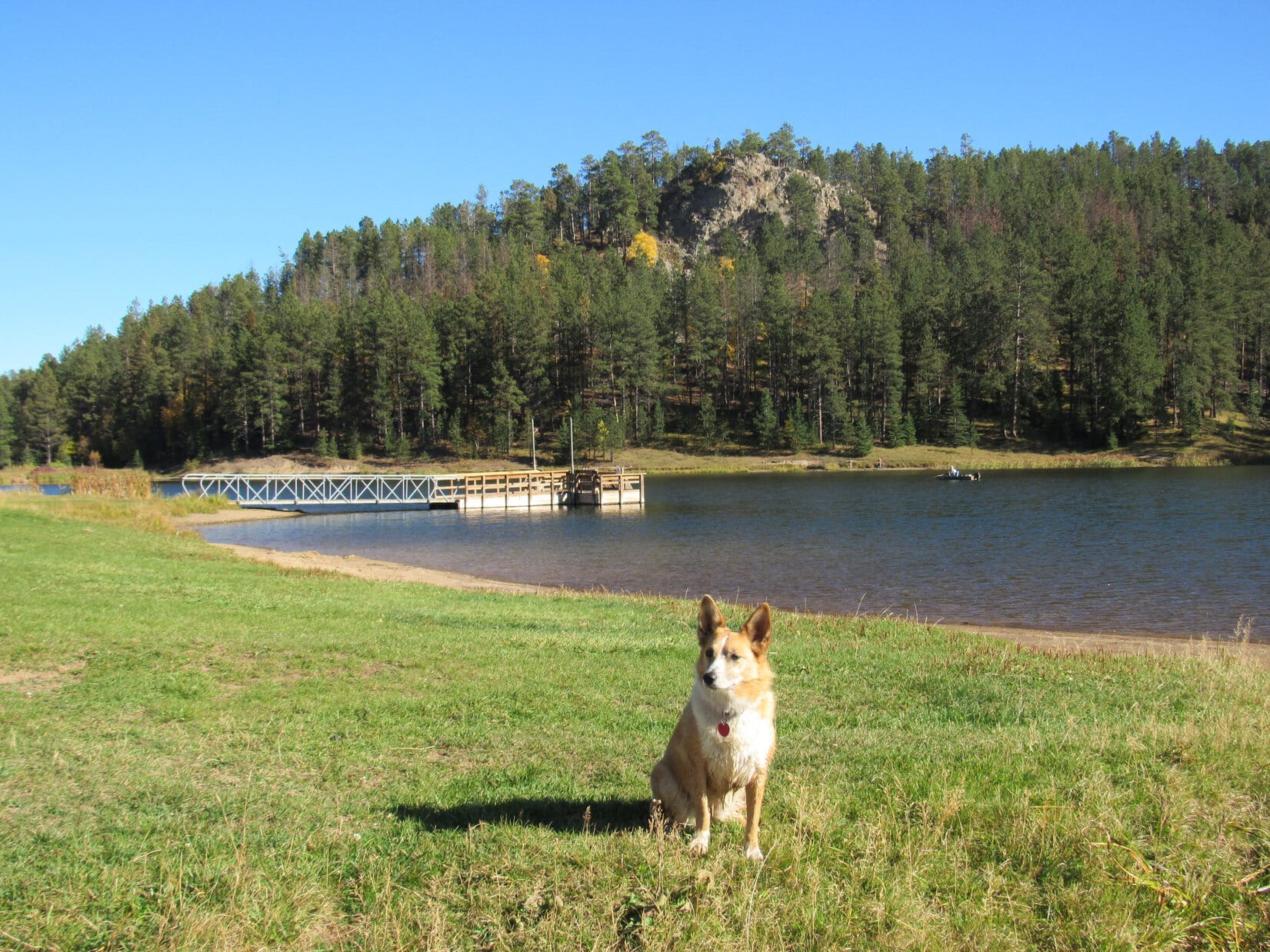
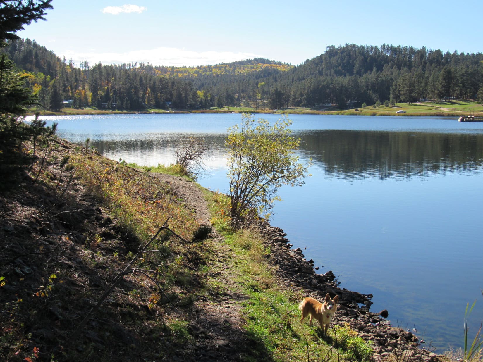
Had another one in mind, Loop, but it’s too far away and getting too late in the day.  However, we still have time enough for a couple of other options.  Iron Creek Lake is only a couple of miles SE of here.

A stroll along the lake shore sounds nice, SPHP.  What’s the other choice?

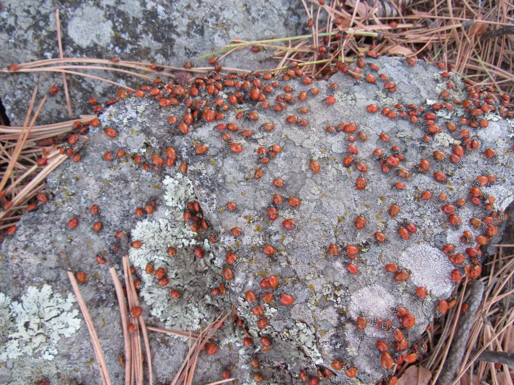
The Needles (5,880 ft.) is NNW.  We were there once long ago.  It’s a more dramatic summit than our Lists of John peaks have been today.  Last time we were there, ladybugs were holding a big convention on the summit.  There are some cool rock formations close to the top, and we saw a terrific sunset, too!

Want to do that, SPHP?  Sounds pretty spiffy!

We won’t get back before dark, though, Loop.  You OK with that?  Should be close to a full moon.

A moonlit return?  Even better, SPHP!

A spur of the moment decision, but The Needles was next.  After a short break on Peak 5960, Lupe headed N.

Black Hills Expedition No. 306 isn’t over yet! C’mon! On to The Needles! Photo looks N.

Going to The Needles meant crossing the Beaver Creek valley.  The initial plan was to continue N from Peak 5960 far enough to reach USFS Road No. 222.1C, then follow it W down a side drainage into the main valley.  However, Loopster soon discovered a grassy lane near Point5806 that took a more direct route lower.

Eh, why not?

Starting down into the Beaver Creek valley. Photo looks WSW.

The grassy lane went only partway down into the valley, but that was OK.  Lupe enjoyed exploring NW through the forest the rest of the way.  Soon enough, she reached USFS Road No. 222.1C, already way down on the E side of the valley.

Exploring the forest during the descent. Photo looks NNE.
Along USFS Road No. 222.1C in the Beaver Creek valley. Photo looks NNW.

Following No. 222.1C N, it wasn’t far to where the road curved E up the drainage Lupe was originally supposed to have come down.  From here, a fainter road continued NNW.  Taking it, this road soon faded away, but not until the American Dingo was getting close to Beaver Creek.

On the fainter, unmarked road continuing farther down the Beaver Creek valley. Photo looks NNW.
Crossing Beaver Creek. Photo looks S.

Lupe waded Beaver Creek, while SPHP easily rock-hopped it.  Once on the W bank, the journey N continued another 0.25 mile down the valley.  A couple of ponds down along the creek came into sight off to the NE about the time a gentle side valley appeared to the NW.

W of Beaver Creek. Photo looks NNW.

Heading up this side valley, Loop soon ran into USFS Road No. 222.1R, which went up over a saddle into Saffron Gulch.  Curving E around the uppermost reaches of the gulch, the road turned N, went past a big rock formation, and climbed to a flat region where a forested hill 0.25 mile NNE was partially obscured by trees.

USFS Road No. 222.1R on the way to Saffron Gulch. Photo looks NW.
Passing a rock formation near the uppermost reaches of Saffron Gulch. Photo looks N.

That’s it, Looper!  The Needles!

Leave the road, SPHP?

Yup, head right for that hill.

About to leave USFS Road No. 222.1R for The Needles (Center). Photo looks NNE.

Didn’t take long to get there!  The final push to the summit was a short, steep climb up a boulder-strewn slope.  No wondering where the exact true summit was here!  Lupe reached a lofty little perch above a rock bearing a “Needles” survey benchmark.

Approaching The Needles. Photo looks N.
Scrambling up the S slope. Photo looks N.
The Needles summit. Survey BM seen below Lupe. Photo looks SSW.
“Needles” survey benchmark.

4:19 PM, 55ºF, The Needles (5,880 ft.) – Some places stick in your mind.  It had been over 6 years since Lupe had first been to The Needles in late September, 2016, but this summit still seemed so familiar.  The highest rock, which had been crowded by the branches of a nearby tree, was even more encroached upon by them now.  Loopster still got up on it, though, with a little help from SPHP.

On the true summit! Photo looks N.

I don’t know why, but I like this place.  Remember the ladybugs, Loop?  None here now, but there were thousands of them last time we were here.

You’re an odd one, SPHP.  Sentimental about an insect swarm?

Ladybugs are cool!  Colorful red shells with black spots, and they never hurt anything.

Aphids aren’t so fond of them, SPHP.  Ladybugs eat aphids.

Their tough luck.  Ladybugs have to eat something.

After congratulating Lupe on her final ascent of the day, a break was taken below the summit, facing SSW where Cement Ridge (6,674 ft.) was visible on the horizon just across the Wyoming border.  Getting late enough so that the day was cooling off.  The wind that had been blowing all day seemed slightly diminished.

The break area below the summit. Cement Ridge (L). Photo looks SW.
Cement Ridge on the horizon from The Needles. The lookout tower is beyond Lupe, the true summit toward the L. Photo looks SSW.

Recalling the amazing sunset last time Lupe was here, some time was spent just enjoying the quiet solitude while waiting to see if another one would develop.  In the meantime, Loop polished off the rest of the Taste of the Wild.  To the SE was a distant view of Terry Peak, and NE a limited one of the prairie beyond the Black Hills, but pines blocked the line of sight in most directions.

Terry Peak (Center) with help from the telephoto lens. Photo looks SE.

The cluster of unusual rock formations that The Needles is named after was WSW, a little lower than the break spot.  Lupe went down there to sniff and play among these rocks, most scenic feature of the mountain.

Down by the big rock formation The Needles is named after. Photo looks WSW.
Looking back toward the summit (R), which is hidden in the pines. Photo looks ENE.
View from the narrow end of the formation. Photo looks ENE.

5:20 PM, The Needles –  An hour had slipped by up on The Needles.  As the sun sank behind a bank of clouds, hopes for another dramatic sunset were dashed.  For the last time, the American Dingo returned briefly to the summit before starting down the mountain.

Back on top! Photo looks NNE.
About to start down from the break spot. Photo looks NNE.
Leaving The Needles. Photo looks N.

During the return, Lupe saw 4 whitetails near the upper end of Saffron Gulch, as light began to fade.  After crossing Beaver Creek, she returned to USFS Road No. 222.1C, this time taking it E up the side canyon.  By the time the road topped out near a junction with USFS Road No. 130, it was dark, a few stars twinkling in the eternal night of space.

While Lupe trotted along USFS Road No. 130, a huge, pale, orange-tinted moon rose in the E.  Snow early on, exploring 2 new Lists of John peaks, the wind in the trees, a spur of the moment return to the remote, lonely spires of The Needles by way of the quiet Beaver Creek valley, and now this dark moonlit journey on an improbably warm November evening.

It had been a great day!  (End 6:58 PM, 46ºF)

At The Needles, Black Hills of South Dakota, 11-2-22

Links:

Next Black Hills Expedition              Prior Black Hills Expedition

Black Hills, SD Expedition No. 175 – Citadel Rock, Beartown Hill, Iron Creek Lake & The Needles (9-28-16)

Lupe’s GPS track – Peak 6200 Ascent

Lupe’s GPS track – Peak 5960 & The Needles

Want more Lupe adventures?  Check out Lupe’s Black Hills, SD & WY Expeditions Adventure Index, Master Adventure Index, or subscribe free to new Lupe adventures!

Black Hills, SD Expedition No. 175 – Citadel Rock, Beartown Hill, Iron Creek Lake & The Needles (9-28-16)

SPHP parked the G6 at the intersection of USFS Roads No. 134 and No. 626.1F (9:08 AM, 64°F).  Lupe leaped out.  She seemed surprised.  Yeah, Loop, it has been a while, but summer is over.  It’s time to resume your Black Hills expeditions again!  Lupe was all in favor of that.  Soon she was running through the forest sniffing madly, while SPHP struck out along No. 626.1F.

The road went NW a short distance before turning SSW.  Near the turn was a big mud puddle off the W side of the road.  The leaves of the aspen trees beyond the puddle were turning yellow, contrasting nicely with the green pines, murky brown water of the puddle, and clear blue skies.  Come on over here, Loopster!  Fall colors are going to be near their peak today.  Let’s get a picture.

Lupe at the first big mud puddle she reached along USFS Road No. 626.1F. Lupe would see plenty of golden aspens this day, since fall colors were near their height in the Black Hills.

Lupe passed more mud puddles as she continued SSW along USFS Road No. 626.1F.  The puddles were of little interest for her, except as occasional sources of mineral water.  Lupe was far more interested in trees, specifically the exciting possibility that they might contain squirrels!  She dashed through the forest, frequently stopping to check out the most promising prospects.

Lupe engages in one of her favorite pastimes, checking trees for squirrels.

In addition to her squirrel objectives, Lupe also had several peakbagging objectives for the day.  The first one was Citadel Rock (5,480 ft.), located over 2.5 miles SW of the G6.  Lupe’s route, though, was going to be circuitous and considerably longer.

Lupe followed USFS Road No. 626.1F for a couple of miles to an intersection with No. 626.1 at a point a mile E of Citadel Rock.  Instead of immediately turning W, Lupe and SPHP followed No. 626.1 going NW to No. 626.1A.  No. 626.1A subsequently went W, and then SW, to No. 626.1C.

No. 626.1C wasn’t really even a road any more.  It was overgrown with weeds, and blocked at many points by mounds of dirt and rock that had scooped up out of the roadbed for that very purpose.  Lupe and SPHP finally got a glimpse of Citadel Rock high above while heading S up a valley on No. 626.1C.  The road passed to the W of Citadel Rock before curling E and climbing to the top of a ridge.

From the ridge it was possible to get the first halfway decent look at Citadel Rock, which was now 0.25 mile N.

Citadel Rock juts up above the trees. Photo looks NNW.

A single track trail led NNW through the forest following the ridgeline toward Citadel Rock.  Lupe soon reached the base of the rock formation.

Lupe reaches the base of Citadel Rock. Photo looks NW.

Citadel Rock was only about 40 feet higher than the rest of the ridge, but the walls of the rock formation were nearly vertical.  Although experienced rock climbers would have no problem reaching the top, Lupe could only get part way up the S face.

Lupe and SPHP went counterclockwise around the base of Citadel Rock looking for an easier way up.

Looking up at Citadel Rock from the ESE.
Below the N face.
The N face of Citadel Rock was even higher and more vertical than the S face.

There was no route up from the E.  As Lupe proceeded around the shady N face, it began to dawn on SPHP that maybe there wasn’t a way up for the American Dingo.  The N face was even more vertical than the S face had been.

By the time Lupe was around to the SW face, things were looking better.  However, after some initial investigation, SPHP didn’t think Lupe could get up from here either.

The W face.
The SW face. At first SPHP thought Lupe might be able to climb up the steep slope seen on the R and find a route to the top, but further investigation proved discouraging.

Lupe went clear around Citadel Rock, but found no safe way up for a Carolina Dog.

To SPHP, it seemed just ridiculous.  Lupe had found a way up many a towering, impressive peak on her Summer of 2016 Dingo Vacation.  In fact, she had ultimately succeeded in reaching the top of every peak she attempted.  Now, here, back in the Black Hills of South Dakota, there was no way up to the top of the very first little peak she tried!

Back at the S face of Citadel Rock, Lupe and SPHP made one last attempt to find a way up.  She could get higher here than anywhere else, but there simply wasn’t a reasonably safe route to the top.

Lupe stands as high up on Citadel Rock as she was going to get. Photo looks WNW.

Well, Loopster, looks like you are either going to have to sprout wings or leave this one to the rock climbers.  Although SPHP was a bit disappointed, Lupe took it all in stride.  She took a break, enjoying Taste of the Wild, water, and half of SPHP’s chocolate coconut granola bar.

Lupe was more interested in what was going on in the forest than in reaching the top of Citadel Rock.
Loop relaxes after circumnavigating Citadel Rock. She didn’t get to the top, but was in fine spirits nevertheless.

Lupe had a couple more peakbagging goals for the day after Citadel Rock, but they were far enough away so she needed to return to the G6 to get closer to them.  Lupe and SPHP gave up on Citadel Rock, and followed the trail along the ridge back to the S.  Instead of returning to the G6 the way she had come, Lupe continued S up onto a larger ridge before turning E.

A single track trail wound along the bigger ridge past scenic aspens before continuing on down to USFS Road No. 626.1F.  Lupe reached the road well S of its junction with No. 626.1 where she had left it earlier.

Colorful aspens decorated the big ridge S of Citadel Rock. Photo looks SE.

Fall colors SE of Citadel Rock, 9-28-16

Loop on her way down to USFS Road No. 626.1F again. Terry Peak (7,064 ft.) is seen in the distance on the R. Photo looks SE.

Lupe followed USFS Road No. 626.1F all the way back to the G6 (1:48 PM, 72°F).  Despite failure at Citadel Rock, Lupe still had two more peakbagging goals – Beartown Hill and The Needles.  After a short drive, she would start first for Beartown Hill from the intersection of USFS Roads No. 222 and No. 222.1N (2:16 PM, 72°F).

Getting to the top of Beartown Hill (5,880 ft.) took hardly any time at all.  Lupe gained only a little elevation from where she started.  She followed USFS Road No. 222.1N less than 0.25 mile NE to reach two high points a little E of the road that appeared to be candidates for the true summit of Beartown Hill.  The high points were separated by perhaps 400 to 500 feet.  Lupe visited both.

Lupe on the first high point that was a candidate for the true summit of Beartown Hill. Photo looks NE.
Lupe at the second candidate for the true summit of Beartown Hill. The summit area was so large and flat that it hardly seemed like Lupe was on a mountain at all. Photo looks N.

Well, that was easy.  Too easy, actually!  The summit area on Beartown Hill was so flat and wide it hardly seemed like Lupe was even on a mountain.  At least going to Citadel Rock had involved some elevation gain, even though Lupe hadn’t been able to reach the top.  Now, here she was at the top of Beartown Hill with virtually no effort.  So far, Lupe had enjoyed nice outings in the woods, but as a peakbagging day, the results were not inspiring.

Only one peakbagging goal remained – The Needles (5,880 ft.).  In the Black Hills of South Dakota, the area normally referred to by locals and tourists alike as “The Needles” is in the southern Black Hills in NW Custer State Park.  That area includes the Cathedral Spires (6,840 ft.) as well as other granite spires commonly viewed from along The Needles Highway (Hwy 87).  The Needles in Custer State Park are a rather famous tourist attraction.

However, The Needles that Lupe intended to climb this day, was in the far NW part of the Black Hills of South Dakota.  In fact, SPHP had never even heard of this The Needles before noticing it labeled on an old USFS map.  Was it another grouping of granite spires?  Was it just another mountain?  SPHP had no idea, but Lupe was going to find out.  This The Needles was located about 2 miles NNE of Beartown Hill.

From the second high point on Beartown Hill, Lupe and SPHP returned to USFS Road No. 222.1N.  Quite encouragingly, the road continued NNE in the general direction of The Needles.  As Lupe followed the road, SPHP was hoping it might continue all the way to The Needles.  No such luck.  The road soon reached a dead end.

Lupe left the road, temporarily turning NNW to stay up on a ridge, which hopefully would eventually lead to The Needles.  At first, the terrain along the ridge seemed encouraging, but after 0.25 mile or so, Lupe came to a dense part of the forest.  Ahead to the N, the ridge seemed to end, dropping steadily down a forested slope as far as SPHP could see.  Other ridges and valleys were partially in view to the NW and NE.

SPHP consulted the maps.  To get to The Needles, Lupe needed to stay up on the ridge, although she would have to drop temporarily down into a couple of saddles along the way.  Although the topo map made the ridge look like an easy thing to follow, in the real world, the terrain seemed confusing and more complicated.  Already, SPHP wasn’t quite sure Lupe was even on the right ridge.

Staring down the densely forested slope, SPHP lost confidence.  There weren’t many landmarks around.  It looked like it would be easy to get turned around and lost in this territory.  If it had been earlier in the day, that wouldn’t have been too big a deal, but it was already close to mid-afternoon.  Lupe waited expectantly, wondering what the hold up was, while SPHP pondered.

SPHP wasn’t at all confident that Lupe would even be able to climb The Needles, assuming she could find them.  She certainly couldn’t climb any of the vertical granite spires called The Needles in Custer State Park.  Maybe it didn’t make any sense to continue.  On the other hand, if Lupe didn’t climb The Needles, Expedition No. 175 was going to be pretty much a complete peakbagging dud, however much Lupe enjoyed her romp in the woods.

Sigh.  We better turn back Loopster, I don’t like the looks of this, not this late in the day.  How would you like to go see Iron Creek Lake instead?  Lupe barked enthusiastically.  She was fine with Iron Creek Lake or wherever, as long as SPHP started moving again.  Lupe wanted action, not all this indecisive dawdling around!  Lupe and SPHP turned around and headed back to the G6 (3:20 PM, 72°F).

A short drive brought Lupe to Iron Creek Lake, a small lake hidden at the end of a gravel road (3:36 PM, 70°F).  There were cabins on private property around the W end of the lake.  Along the N shore was a store (closed for the season), a boat launch, small beach and a dock.  The lake looked great to Lupe!  She was thirsty.  Lupe immediately ran down to Iron Creek Lake for a big thirst-quenching drink.

Lupe dashed down to Iron Creek Lake for a drink. Photo looks SW.
Iron Creek Lake. Photo looks SW.

Although Iron Creek Lake looked like it might be quite a busy place in the summer, it was pretty quiet this time of year.  A few people were fishing along the shore, and one was fishing from a small boat trolling slowly around the lake.  Other than that, no one seemed to be around.

The little lake was quite beautiful, sparkling in the sunlight.  A path led around the E end of the lake.  Lupe and SPHP took a pleasant stroll not only around the E end, but clear around the lake.  The people Lupe passed by were having some luck catching rainbow trout.  Lupe saw a few ducks fly off, and even saw a family of ducklings paddle away.

Lupe on the N shore of Iron Creek Lake. Photo looks E.
Lupe along the E end of the N shore. Cattails grew in profusion around much of the lake. Photo looks WSW.
Lupe stands on the dam at the E end of Iron Creek Lake. There are no natural lakes in the Black Hills. Photo looks WNW.
Looking WNW from the SE corner of Iron Creek Lake.
Looking W.
Looking W.
Ducklings on Iron Creek Lake.

Although Lupe and SPHP were in no hurry, it took less than 40 minutes to stroll all the way around Iron Creek Lake (4:14 PM, 70°F).  By then, SPHP had a new idea.  Maybe Lupe could still climb The Needles?  Although The Needles was 2 miles N of Beartown Hill, there was another possible approach from a much closer starting point.  USFS Road No. 130 passed only a little over 0.5 mile to the E of it.

Earlier, SPHP had rejected the notion of climbing The Needles from the E.  The topo map showed Lupe would have to leave the road, drop down into Beaver Creek canyon and find a way across the creek, before even attempting to ascend The Needles.  SPHP had thought that the E side of the canyon might be a cliff from the close spacing of the contour lines on the topo map, or that Beaver Creek might be difficult to cross.

What if these obstacles really weren’t that bad?  It was now pretty late in the day, but why not at least take a look?  Lupe and SPHP left Iron Creek Lake (4:14 PM, 69°F) determined to at least drive far enough along USFS Road No. 130 to see if there was any realistic possibility of climbing The Needles from the E.

Initially, the drive N along USFS Road No. 130 was not encouraging.  Although the road was on high ground E of Beaver Creek canyon, the forest hid any views to the W.  SPHP parked the G6 briefly at a junction with USFS Road No. 222.1D, intending to follow it W at least far enough get a view of the canyon.  Lupe, however, refused to budge from the G6.

SPHP reviewed the maps again.  Maybe the Carolina Dog was right.  Another mile N, and USFS Road No. 130 would be at its closest point directly E of The Needles.  SPHP got back in the G6.  OK, we’ll try it your way, Loop!  Lupe grinned, but said nothing as SPHP started driving slowly N again.

After going more than 0.75 mile, two hills close together could be glimpsed off to the W.  The view didn’t improve much as SPHP continued driving N.  At 1.25 miles, SPHP parked the G6 along USFS Road No. 130 at a point already a little N of the two hills.  Lupe again refused to leave the G6, preferring to wait until SPHP returned with a quick scouting report.

Loopster, come on out!  This must be it.  That highest hill toward the W has to be The Needles.  Let’s see if we can get there.  Lupe wasn’t sure this was a good idea, but with a little coaxing, she hopped out of the G6.  It was already 4:50 PM (69°F).  Rough terrain and lack of daylight might prove an insurmountable combination of obstacles.  Lupe and SPHP struck off to the W through the forest, regardless.

Almost immediately, the ground started falling off more and more steeply.  Lupe descended rapidly into the Beaver Creek canyon.  SPHP hoped she wouldn’t cliff out, and she didn’t.  After losing nearly 200 feet of elevation, a creek bed of light gray rocks appeared below.  It was totally dry.  Lupe and SPHP were soon down there, following the creek bed N.

The creek bed was rough terrain full of stones.  The canyon made a sharp turn to the W, after Lupe had followed it only a few hundred feet N.  If anything, the creek bed was even rockier after turning W.  Lupe and SPHP abandoned the creek bed and scrambled up the opposite bank.  Lupe headed SW through forested territory full of brambles, gaining elevation as she went.

For a while, SPHP wasn’t certain if Lupe had crossed Beaver Creek, or if she had only made it over a dried up tributary in a side canyon.  As Lupe continued gaining elevation steadily, though, it slowly became apparent that she actually was across Beaver Creek.  That was encouraging!

Lupe soon got more good news.  She got out of the worst of the brambles, and reached the top of a low forested ridge.  The two hills to the W were in view again, closer than before.  The S hill was lower than the N one, but they weren’t too far apart.  The ridge Lupe was on rose toward the SW.  A check of the topo map showed that Lupe should probably follow this ridge toward the lower hill.

The ridge went SW farther than SPHP expected.  Finally, Lupe found a saddle leading W toward the two hills.  Lupe crossed the saddle and started climbing.  Near the top, the climb up the S hill was tougher than expected.  A combination of large boulders and deadfall timber made the going very slow.

By the time Lupe reached the top of the S hill, it was decision time.  The N hill wasn’t far away, but the sun was low in the sky.  Clearly, going on to climb the N hill meant Lupe wouldn’t be able to get back to the G6 before dark.

Nope!  No way Lupe was turning back!  As long as Lupe could get halfway back before dark, SPHP was confident the terrain was distinctive enough so that Lupe wouldn’t get lost.  Lupe and SPHP hurried down into a shallow saddle leading to the N hill.  Soon Lupe was gaining elevation again.  The climb was moderately steep, but without all the big boulders and deadfall that had slowed her down on the S hill.

It looked like Lupe didn’t have far to go to reach the top of the N hill.  What would she find there?  Would she be able to reach the summit?  Was this hill really The Needles?

The sun was sinking, as Lupe reached a collection of medium-sized stones at the top of a very small summit area.  And sure enough, there it was!  A survey benchmark saying “Needles” was affixed to a rock next to the highest rocks on the mountain.  Lupe had her first notable peakbagging success of the day!

The Needles survey benchmark. Finding this benchmark up at the top of the N hill confirmed that Lupe had really found and climbed The Needles, despite failure earlier in the day. Suddenly Lupe's peakbagging efforts on Expedition No. 175 finally seemed successful and worthwhile.
The Needles survey benchmark. Finding this benchmark up at the top of the N hill confirmed that Lupe had really found and climbed The Needles, despite failure earlier in the day. Suddenly Lupe’s peakbagging efforts on Expedition No. 175 finally seemed successful and worthwhile.
Lupe up on top of The Needles! Photo looks N.
Lupe up on top of The Needles (5,880 ft.)! Photo looks N.
Looking SW from The Needles summit. The small granite spires on the R likely gave the mountain its name, although they are tiny compared to the famous Needles in Custer State Park.

Lupe and SPHP stayed up on The Needles as long as the sun remained above the horizon.  The mountain wasn’t particularly high or prominent.  The views were nice, but not particularly impressive.  Yet it was still fun to be here, up on a seldom visited remote outpost of the northern Black Hills – a remote outpost that had almost eluded Lupe on this beautiful early autumn day.

Ladybugs were having a major convention up on The Needles when Lupe came along.
Lupe at the summit. The survey benchmark is in view below and to the R of her. Photo looks SSW.
Lupe in the fading light on The Needles. Photo looks NNW.
Looking NE up at the summit.
Lupe just below the highest rock. She looks concerned, because she heard a single gunshot a moment earlier. Photo looks NE.

Before leaving The Needles, Lupe went down near the granite spires that likely gave the mountain its name.  When the sun disappeared from view, it was time to go.  Lupe and SPHP hurried through the darkening forest, bypassing the S hill to the E.

Lupe near the granite spires. Photo looks WSW.

Granite spires of The Needles, 9-28-16

Sunset from The Needles.

Stars were shining by the time Lupe made it back to the low ridge W of Beaver Creek.  It was so dark out, SPHP had to bring out the flashlight.  The batteries were dead!  They had been dying for a long, long time.  SPHP had been carrying spare batteries around for more than 2 years.  Would they work?  They did!

By the light of the little flashlight, Lupe and SPHP scrambled down a steep bank to the dry creek bed of Beaver Creek.  Lupe was somewhere S of where she had crossed it on the way to The Needles.  Climbing up the E side of the canyon, cliffs came into view above.  Fortunately, there was a narrow passage between them.  Lupe made it above the cliffs.  The steep slope began leveling out.

Lupe and SPHP plunged E through the inky forest for a long way after the ground was almost level.  Sooner or later Lupe had to come to USFS Road No. 130, no matter where she had crossed Beaver Creek.  SPHP looked to the Big Dipper in the night sky to stay oriented.  Suddenly the road appeared only a few feet away.

In darkness and silence, Lupe and SPHP enjoyed a surprisingly long march N beneath the faint glow of the Milky Way.  When Lupe finally reached the G6, her Black Hills Expedition No. 175 adventures were over.  (8:32 PM, 57°F)Sunset at The Needles, 9-28-16

Links:

Next Black Hills Expedition                      Prior Black Hills Expedition

Want more Lupe adventures?  Choose from Lupe’s Black Hills Expeditions Adventure Index or Master Adventure Index.  Or subscribe free to new Lupe adventures.