Black Hills, SD Expedition No. 309 – Thrall Mountain (12-11-14)

11:02 AM, 53ºF, Rapid Creek trailhead of Centennial Trail No. 89

Hurry up, SPHP!  It’s a gorgeous day!

That’s why we’re here, Looper.  Last nice day before your birthday.

My birthday is coming?  When?

In only 3 more days, Loop.  Supposed to be a snowstorm, though, so we won’t be doing anything in the Black Hills then.  Today will have to suffice as your birthday adventure served up a bit early, I’m afraid.

Better late than never, SPHP!  And better early than late!

Ready to set out on a pre-birthday adventure! Peak 5040 (R of Center). Photo looks SE.

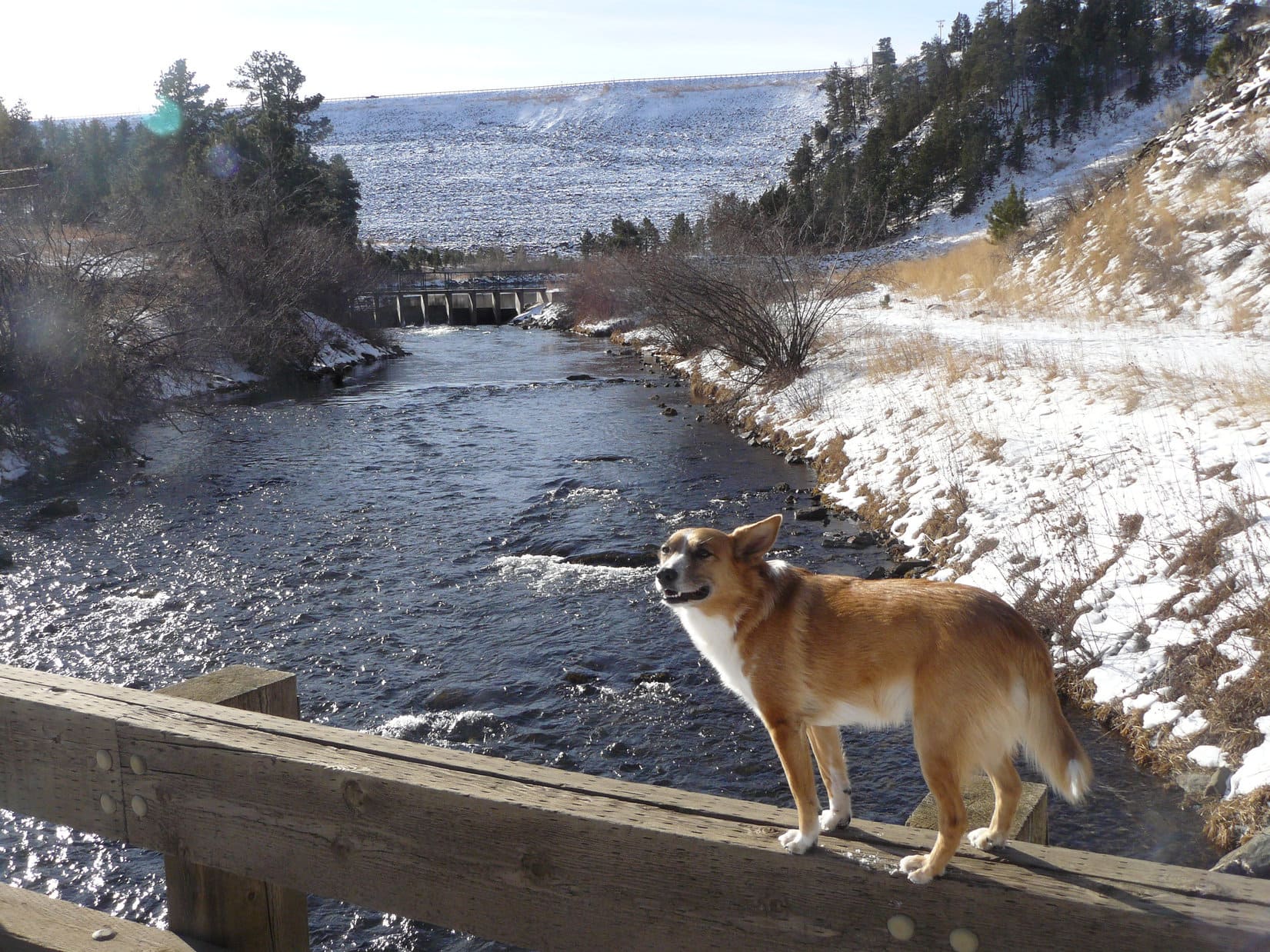
As soon as SPHP was ready, Lupe set out on Centennial Trail No. 89, which began flat as a pancake running SE parallel to Rapid Creek, but a little way from it.  At first, tall dry grass and bushes hid the stream, but 5 minutes was all it took to reach a bridge.

Following Centennial Trail No. 89 through the tall grass. Photo looks SE.
At the bridge. Photo looks SE.

After crossing the spiffy bridge over Rapid Creek, even more bushes lined the trail, which still bore a skiff of snow along in here.

Beyond the bridge. Peak 5040 (R). Photo looks ESE.

5 minutes from the first bridge, a second one appeared.  After crossing it, too, the Tamarack trailhead was only a short distance farther.  From the trailhead, Centennial Trail No. 89 ran E along a barbed wire fence for a little way.  After passing an old cabin to the S, the trail went through the fence, then turned SE again.  A steady climb through pine forest ensued.

Crossing the second bridge over Rapid Creek. Photo looks SE.
Going through the fence E of the Tamarack trailhead. Photo looks S.

After gaining 120 feet of elevation, Centennial Trail No. 89 leveled out at a small clearing where there was a junction with USFS Road No. 165.1A.

At the junction with USFS Road No. 165.1A. Photo looks E.

Taking the road ENE (L), it almost immediately curved S, and began a steady descent.  Another road junction was soon in sight.  Toward the R, Centennial Trail No. 89 continued S, following USFS Road No. 165.1D up Tamarack Gulch.

Approaching the next junction. USFS Road No. 165.1D and Centennial Trail No. 89 go R. No. 165.1A veers off to the L. Photo looks S.

Don’t go that way, Loop!  Go L instead.

We’re leaving Centennial Trail No. 89, SPHP?  Where are we off to then?

Thought it might be fun to climb Thrall Mountain (5,091 ft.), Loop.  Kind of a favorite spot, and we haven’t been there in a long, long time.

Oh, that sounds good, SPHP!

That’s what I like about you, Looper!  You’re never picky as long as we’re going somewhere.

Sticking with USFS Road No. 165.1A, Lupe turned L at the junction, soon passing the remains of an ancient cabin on the L.  Beyond it, the road curved SE and began climbing steadily up a fairly narrow valley.

Heading up the valley. Photo looks SE.

After nearly 0.5 mile, No. 165.1A finally topped out at a lumpy spot.  This was Pass 4780.  A junction with USFS Road No. 722.1B was just beyond this high point.

At Pass 4780. Photo looks NE.

Which way now, SPHP?  L or R?

Thrall Mountain is R, Looper, but we’ve got plenty of time.  Peak 5040 is only 0.25 mile N, and we’ve never been there before.  Might have a decent view of Thrall from up there, or even catch a glimpse of Pactola Reservoir.  Want to climb Peak 5040?

Fine with me, SPHP!  Exploring is fun!  L then?

Yup!

No 722.1B wound around a bunch on the way up Peak 5040.  No distant views present until the American Dingo reached a break in the forest where a power line running E/W crossed the upper S slope.  The top of Thrall Mountain was visible from here, but Lupe wasn’t high enough to see much more than that.

Thrall Mountain (L of Center) from Peak 5040‘s upper S slope. Photo looks E.

No. 722.1B continued N beyond the power line.  Although almost certain the forest was going to block any better views, SPHP figured Lupe might as well finish her Peak 5040 ascent.  Didn’t take long to reach the road’s high point.  Leaving the road, a short climb WSW got Loopster to the summit.

As expected, no views.  After standing on the highest rock formations, it was time for a break.

Peak 5040 summit. Photo looks E.

Pleasant enough, but Peak 5040 isn’t honestly all that scintillating, SPHP.

They can’t all be magnificent, Looper.  Nice, quiet spot, though.  How about we share a chocolate coconut bar?  Would that be scintillating enough?

A vast improvement, I’m sure.  Bring it on, SPHP!

After supplementing the chocolate coconut bar with a little Taste of the Wild and water, the Carolina Dog was ready to move on.  Rather than immediately returning to the road the way she came up, Lupe sniffed SW through the forest for a little way.

Turning S, Loop soon came to the power line again.  A bit farther W now than she had been earlier, there actually was a view of Pactola Reservoir from here, as well as another glimpse of Thrall Mountain.

Pactola Reservoir (Center). Photo looks W.
Thrall Mountain (R of Center) again. Photo looks E.

Continuing to explore S, Lupe eventually rejoined USFS Road No. 722.1B.  Following it back to Pass 4780, this time she continued ESE down a long valley.  Crusty old snow lingering on the shaded road crunched loudly beneath SPHP’s boots.

USFS Road No. 722.1B ESE of Pass 4780. Photo looks E.

0.5 mile from Pass 4780, the valley opened up.  The road bottomed out amid a sunlit meadow bordered by stands of leafless aspens.

This is a pretty spot, SPHP!  Very secluded.

Yes, it is, Loopster.  Seems familiar, too.  Almost certain I remember being here with you late on a snowy winter afternoon.  We were on our way back from Thrall Mountain.  Such a long time ago, almost like a dream!

Crossing the low spot, USFS Road No. 722.1B started uphill again, first curving N then switchbacking sharply S before resuming a SE course.  After a steeper, steady climb, the road turned NE and promptly leveled out.  A side road took off to the N, and another power line running N/S was visible a little farther E.  SPHP checked the map.

Alrighty, Loop!  This must be Pass 4730.  We need to take No. 722.1C now.  That’s the road going N.

At Pass 4730. USFS Road No. 722.1C goes L (N) from here. No. 722.1B continues R (SE). Photo looks NE.

Abandoning USFS Road No. 722.1B, Lupe followed No. 722.1C 0.2 mile N to Pass 4850.  The power line she’d seen at Pass 4730 crossed this pass just a little E of the road.  Going over to it, Lupe enjoyed a better view of Thrall Mountain (5,091 ft.) than the one she’d had from Peak 5040.

Thrall Mountain (R of Center) from Pass 4850. Photo looks NE.

Returning to No. 722.1C, Lupe continued N into the next valley, passing under the power line coming E from Peak 5040 on the way.  Quickly looping S back to it again, the road turned E following the power line right-of-way, which now provided a direct route to the base of Thrall Mountain’s S slope.

After passing a faint remnant of USFS Road No. 722.1D, which curved off to the NW, Lupe began angling NE, starting her ascent.

Thrall Mountain (Center) from the power line right-of-way. Photo looks ENE.
Following USFS Road No. 722.1C. Photo looks E.
Starting up Thrall Mountain’s lower S slope. Photo looks ENE.

Thrall Mountain’s S slope was nearly all forested.  A fairly gentle grade soon became quite steep as Lupe climbed among scattered rocks and deadfall.  Higher up, there was less deadfall, but more rock.  Loop came to a boulder field, but by then she was already getting close to the top.

High on the S slope. Photo looks N.

2:08 PM, 52ºF, Thrall Mountain (5,091 ft.) – Lupe reached the summit region on a ridge a little bit E of the true summit.  SPHP was gazing NNE toward Turkey Ridge and Prehistoric Ridge, when the American Dingo made a quiet announcement.

SPHP!

Hmm?  What is it, Loop?

We’re not alone!

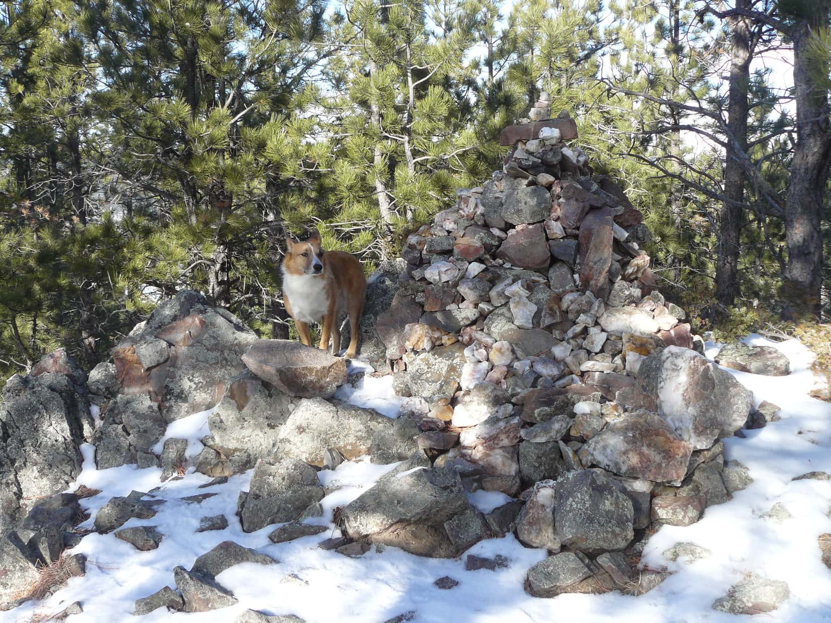
What?  Not alone?  Unheard of!  That was the last thing SPHP expected.  At least, not on a Black Hills peak without a road or maintained trail to the top.  Thrall Mountain had neither, yet glancing W toward the true summit, SPHP saw that Lupe was right.  Someone was sitting there next to a huge cairn!

So Loopster met Donovan.  Turned out that meeting him wasn’t quite as enormous a coincidence as SPHP first thought.  Donovan had lived in the nearby Johnson Siding region since 1995.  He’d lost track of exactly how many times he’d climbed Thrall Mountain, but was pretty certain this was somewhere around his 1,100th ascent!

Lupe with Donovan, King of Thrall Mountain!

Donovan was friendly and most gracious.  SPHP enjoyed a nice 10 or 15 minute chat with him.  Having been up here so many times, Donovan said he usually didn’t stay long.  He’d been about ready to start back down when Lupe showed up.  Before departing, Donovan mentioned a registry hidden within the cairn, then he was on his way.

Thrall Mountain’s summit region. Cairn (R). Photo looks W.
On the cairn, with one end of the white registry tube visible inside. Photo looks E.

Did you hear that, SPHP?  Donovan has been up here 1,100 times!

Yes, I did.  Simply amazing!  Another 1,097 ascents of Thrall Mountain, and you’ll have caught up with him, Loop.  Provided, of course, that he never comes back, which seems like a decidedly poor bet.

Oh, I’m not doing that, SPHP!  Nothing against Thrall Mountain, it’s lovely, but I’m not climbing any mountain 1,100 times.  I don’t mind coming back to favorite places now and then, but I’d usually rather explore new ones.

Good!  I feel the same way.  Unless I really ace a creative writing course, I suspect 1,097 repeats wouldn’t make for a very spell-binding blog, anyway, so that’s probably for the best, Loopster.

Unsurprisingly, the registry tube contained a big notebook chock full of entries, no doubt nearly all by Donovan.  Nevertheless, after reading a few, SPHP entered Lupe’s name, temporarily breaking the pattern.

You know what, SPHP?  I bet Donovan built this huge cairn all by himself!  All he would have had to do would have been to put a rock in his pocket every time he comes up here, and add it to the collection.

I bet you’re right, Loop!  Most of these cairn rocks don’t look like anything naturally up here already.  Who else would have built it?  Building it this big would have been quite a project for anyone who hadn’t been here 1,100 times, which includes everyone in the whole world other than Donovan.

Yes, it’s an impressive cairn, but I still like your method better, SPHP.

Huh?  What are you talking about, Loop?  I almost never build cairns, and rarely tote any rocks.  Seems like work.  Unnecessary work, at that!

I’m not talking about rocks, SPHP, or even cairns.  I’m talking about what you actually do bring up mountains.  In fact, I’m really hoping you’ve brought another one up this mountain!

Oh, I get it, sly Dingo!  Hint, hint, aye?

Evidently, time for another break, or at least, another chocolate coconut bar!  Pines blocked the views in almost every direction, but exploring a little way down the S slope, there was a decent place to sit with a nice view of Black Elk Peak (7,231 ft.) on the horizon.

Black Elk Peak (Center). Photo looks SSW.

The chocolate coconut bar vanished.  Lupe lingered, enjoying the view.  Mid-afternoon, but the December sun was already low.  SPHP wanted to check out another favorite Thrall Mountain viewpoint, a ridge of big rocks over-looking a steep, extensive boulder field on the upper NNW slope.  After returning to the summit cairn, Lupe headed that way.

Back at the summit. Photo looks SE.
On the ridge of big rocks. Photo looks NNW.
Alone on the N ridge. Photo looks NNW.

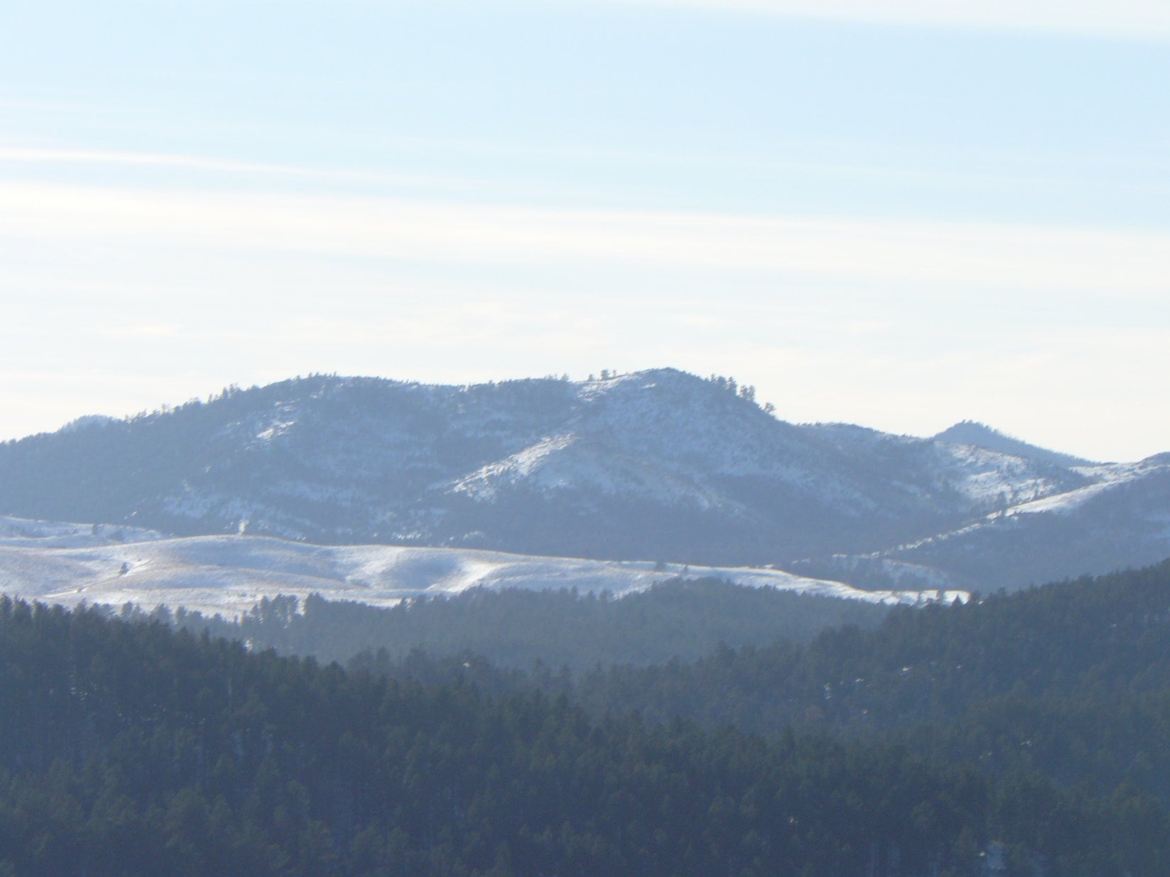
The views were much more open here, a sweeping panorama to the N and W.  Hat Mountain (4,883 ft.) wasn’t very high or big, but it’s circular shape made it easy to pick out.  A bit farther E, Norris Peak (4,982 ft.) stood out a lot more.

Overlooking the steep boulder field. Photo looks NNW.
Rounded little Hat Mountain perceptible R of Center. Norris Peak by Lupe’s ears. Photo looks N.

Custer Peak (6,804 ft.) was discernable on the far NW horizon.  Much closer, many other peaks were visible among the rumpled forested hills to the W and NW, but with the exception of Perrin Mountain (5,212 ft.), few were as readily identifiable.  Still, it was a pretty scene, and Lupe was having fun scrambling around on the big rocks.

Perrin Mountain (R) with Custer Peak (far R) faintly on the horizon. Photo looks WNW.
Having a good time! Perrin Mountain (R of Center). Photo looks WNW.

3:28 PM, Thrall Mountain – How times flies!  Hat Mountain, Norris Peak, Perrin Mountain, Lupe had been to all of them, but years ago now.  Good to see them again, if only from a distance.  Now Lupe sat in the slanting rays of what passed for late afternoon sun in December, the magnificent cairn built by Donovan behind her.

By the mighty cairn Donovan built on Thrall Mountain over 27 years. Photo looks N.

You’re beautiful Lupe, and I love you!  Guess this is about it for your last adventure while you’re still 11.  Did you enjoy coming to Thrall Mountain?

Oh, yes!  Of course, I did, SPHP!  We even met the King of Thrall Mountain.  That doesn’t happen every day.

Lupe hadn’t made it very far down the S slope when SPHP noticed both New Year’s Eve Peak (6,046 ft.) and Scruton Mountain (5,922 ft.) in a gap in the trees.

New Year’s Eve Peak (L) and Scruton Mountain (R) in the gap. Photo looks SW.

Your birthday, Christmas, then weather permitting, New Year’s Eve Peak, Loop!  Won’t be long before we’re way over there!  2023 will be upon us!

Don’t rush it, SPHP!  Every day is precious.  Let’s enjoy them all while 2022 is still here!

With the exception of skipping Peak 5040, the American Dingo’s return route was the same.  Following these seldom visited old USFS roads as light faded, it was up and down the long quiet valleys, and over all the minor passes.  Evening gloam grew.  The brightest stars twinkled.  It was all wonderful, every moment alone together, as always.  (4:59 PM, 38ºF)

On Thrall Mountain, Black Hills of South Dakota 12-11-22

Links:

Next Black Hills Expedition                         Prior Black Hills Expedition

Lupe’s Thrall Mountain GPS Track (12-11-22)

Lupe’s 12th Birthday! (12-14-22)

Black Hills, SD Expedition No. 113 – The Search for Thrall Mountain (1-1-15)

Black Hills, SD Expedition No. 114 – Thrall Mountain (1-10-15)

Want more Lupe adventures?  Check out Lupe’s Black Hills, SD & WY Expeditions Adventure Index, Master Adventure Index, or subscribe free to new Lupe adventures!

Black Hills, SD Expedition No. 114 – Thrall Mountain (1-10-15)

January 10, 2015, 10:32 AM, 32°F.  The first day since New Year’s Day 2015 that wasn’t too cold or windy.  SPHP parked the G6 at the Pactola Reservoir overlook next to Hwy 385 at the N end of the dam.  This time Lupe wasn’t fooling around.  She was going to climb Thrall Mountain (5,091 ft.)!

Back on New Year’s Day, SPHP had parked the G6 at the visitor center at the S end of the Pactola Reservoir dam.  From there, Lupe and SPHP had gone on a round about route on the way to Thrall Mountain.  Due to navigation errors made by SPHP, Lupe’s route had been so round about that she hadn’t even seen Thrall Mountain all day, much less climbed it, even though it was only a little over 2 miles away from Pactola Reservoir.

On the way back to the G6, though, Lupe and SPHP had scouted out a much more direct route to Thrall Mountain from Pactola.  Now Lupe was going to take that direct route back to a point only a mile or so from the mountain.  From there, Lupe would find and climb Thrall Mountain before doing anything else.  If there was additional time left for roaming around exploring, she could do it after claiming her peakbagging success.

Lupe returned to Pactola Reservoir on 1-10-15. This time she would start her trek toward Thrall Mountain from this viewpoint at the N end of the dam, instead of the visitor center at the S end.

Across Hwy 385 from the viewpoint at the N end of the dam, is a road that winds down below the dam to the Rapid Creek trailhead of Centennial Trail No. 89.  If it hadn’t been so icy and snow-packed, SPHP would have just driven down to the TH.  Instead, Lupe and SPHP went down the road on paw and foot.  Just before reaching the TH, the road crossed Rapid Creek.

Lupe poses on the railing of the bridge over Rapid Creek below Pactola Reservoir dam.

From the Rapid Creek trailhead, Lupe and SPHP followed Centennial Trail No. 89 heading ESE through the big flat meadow below the dam.  Rapid Creek meanders through the meadow, and the trail had several nice footbridges crossing it.  Lupe and SPHP paused on each bridge to see if there were any trout down in the creek, but saw none.

It didn’t take long to reach the Tamarack Gulch trailhead at the SE end of the meadow.  Lupe and SPHP continued SE.  Centennial Trail No. 89 climbed a little hill, and reached USFS Road No. 772.1B, a road Lupe had been on back on New Year’s Day.  For a short distance, Centennial Trail No. 89 followed this road, but soon left it to continue S up a side road.  Lupe left Centennial Trail No. 89 staying on No. 772.1B, which turned E.

Lupe and SPHP were now retracing the route Lupe had scouted out before on New Year’s Day.  The snowy road made a long gradual climb up a valley.  When it reached a saddle, there was a junction with another road coming in from the N.  Lupe stayed on USFS Road No. 772.1B.  She followed it down into a snowy little valley where SPHP had taken her picture on Expedition No. 113, and on up to another higher saddle at the upper end of Powerhouse Gulch.

At the saddle was an intersection with another road.  SPHP hadn’t seen any marker the last time Lupe was here, but this time saw one identifying the side road as USFS Road No. 772.1C.  In a sunny spot where there was no snow, Lupe and SPHP took a brief break.  SPHP wanted to check the maps.

No. 772.1C was the right road to take.  It would lead Lupe out of the upper end of Powerhouse Gulch over a saddle, and down into a smaller valley SW of Thrall Mountain.  Lupe and SPHP set out on No. 772.1C.  It climbed NW, turned N and soon reached the saddle.  From the saddle, Lupe finally got to see Thrall Mountain, now less than a mile away to the NE.

No. 772.1C started down the N side of the saddle, passed under a power line, made a loop to the N, and then returned S to follow the power line E.  As the road drew near Thrall Mountain, it started gaining elevation again.  Lupe passed an unmarked minor road that headed off to the NW, but didn’t take it.  Near the road’s highest point along the power line, Lupe left No. 772.1C to start climbing toward Thrall Mountain from the SSW.

Lupe on USFS Road No. 772.1C SW of Thrall Mountain. The power line can be seen overhead. This snowy scene was pretty typical along the remote USFS roads Lupe traveled this day. Photo looks E.

The climb grew progressively steeper.  Snowy boulder fields forced Lupe around to the SSE side of the mountain.  Lupe and SPHP had to climb up through a short section of boulders, but made it without mishap.  Lupe was now almost at the top of Thrall Mountain.  Just short of the summit, Lupe reached the E viewpoint, one of three good viewpoints on or near the summit of Thrall Mountain.

From the E viewpoint, Lupe and SPHP could see Turkey Ridge and Prehistoric Ridge to the NE.  To the E, Rapid City could be seen on the edge of the Black Hills.  Beyond the town, the yellow plains of western South Dakota stretched to the far horizon.  Lupe and SPHP also saw human tracks in the snow!  By not reaching Thrall Mountain on New Year’s Day, someone else had beaten Lupe to becoming the first one to climb Thrall Mountain in 2015.

The summit was just 10’s of feet away.  Lupe and SPHP strolled over to the summit to claim her Thrall Mountain peakbagging success!  Whoever beat Lupe to the summit in 2015 was no longer around.  Years ago, there had only been a very small cairn on top of Thrall Mountain.  Now the cairn is easily 4 feet high.  It is comprised of many small rocks.  SPHP wanted Lupe to pose for a couple of photos at the cairn.

Normally Lupe is very cooperative, but coming up the mountain, Lupe had heard gunfire to the S.  Gunshots continued to be heard occasionally from that direction.  Lupe hates even the faint sound of gunfire.  She stuck to SPHP like glue.  Finally, the worried Carolina Dog relaxed enough for a couple of quick photos.

Lupe reaches the summit cairn on Thrall Mountain to claim her peakbagging success. Someone else had already beat her to the top of the mountain in 2015, as evidenced by human tracks Lupe and SPHP saw in the snow.
This was actually Lupe's 2nd successful summit of Thrall Mountain. The first time she was here was way back on Black Hills, SD Expedition No. 38 on 12-8-12, over two years earlier.
This was actually Lupe’s 2nd successful summit of Thrall Mountain. The first time she was here was way back on Black Hills, SD Expedition No. 38 on 12-8-12, over two years earlier.

Lupe and SPHP left the summit to return to the Prehistoric Ridge viewpoint.  There were still gunshots going on to the S.  Lupe put her paw down.  She refused to leave SPHP’s side for another photo.  It was simply too dangerous!

Prehistoric Ridge (the largest line of limestone bluffs farthest away) and Turkey Ridge (a much smaller ridge of reddish stone just in front of the right side of Prehistoric Ridge) from Thrall Mountain. The ridge names are private names assigned by SPHP. Photo looks NE.
Looking W at the Thrall Mountain summit from the Prehistoric Ridge (E) viewpoint.

Lupe and SPHP returned to the summit.  Lupe was very nervous due to the gunfire.  SPHP found a dry spot to sit down.  Lupe snuggled right up, looking for reassurance.  Together Lupe and SPHP stayed there for a while looking out at the view of Harney Peak (7,242 ft.) to the S.  SPHP chatted with Lupe and stroked her, while she gave SPHP a good licking.  SPHP ate an apple.

The best views to the S from Thrall Mountain are obtained just S of the summit.  SPHP took one photo looking SW at Peak 5800.  On a couple of prior occasions, (Expedition No. 77 on 2-16-13, and Expedition No. 80 on 3-23-14) Lupe and SPHP had gotten close enough to Peak 5800 to think about climbing it, but hadn’t actually done so.  Seeing Peak 5800 from Thrall Mountain, SPHP resolved that Lupe would climb it someday.  (Note:  Lupe did eventually climb Peak 5800 on Expedition No. 150 on New Year’s Day 2016!)

Peak 5800 from Thrall Mountain with a bit of telephoto lens assistance.

One of the best views from Thrall Mountain is from a rocky ledge located on a slightly lower ridge a short distance NW of the summit.  From the rocky ledge is a view to the NW toward nearby Johnson Siding, and the hills beyond all the way to Custer Peak (6,804 ft.).  Lupe was still a bit nervous, but she got up on the rocky ledge despite it all.

A still somewhat nervous American Dingo scans the NW horizon from the rocky ledge a short distance NW of the summit of Thrall Mountain.
Lupe on the rocky ledge. Photo looks WNW.

By now, Lupe and SPHP had visited all three of the best viewpoints on Thrall Mountain.  Lupe finally had her 2015 Thrall Mountain peakbagging success!  It was time to move on.

Lupe and SPHP went back down the mountain pretty much the same way they had come up.  While still near the top of the mountain, Lupe stepped on a cactus.  There was a brief intermission while SPHP pulled a few small cactus spines out of her paw.  Fortunately, she seemed none the worse for the wear.

Lupe returned to USFS Road No. 722.1B at the upper end of Powerhouse Gulch via No. 722.1C.  Lupe and SPHP could have just returned to the G6, but there were still at least a couple of extra hours of daylight left for exploring around, if Lupe wanted to.  She did!  Lupe and SPHP went SE a little way into Powerhouse Gulch to a side road that SPHP had by now figured out was USFS Road No. 722.1.  This was the road Lupe and SPHP should have taken on New Year’s Day to get from Gold Standard Gulch to Powerhouse Gulch.

Lupe and SPHP explored No. 722.1 heading SW.  Lupe passed by a junction with No. 722.1E, she reached a high ridge where she could look back at Thrall Mountain, she went on to Gold Standard Gulch and Centennial Trail No. 89 again.  Just roaming around exploring the back roads without any goal in mind was rather fun.  Of course, the sun eventually sank toward the SW horizon.  Time to start heading back to the G6.

The sun was down, but it was still somewhat light out when Lupe reached the G6 at 4:48 PM (27°F).  Black Hills, SD Expedition No. 114 to Thrall Mountain was over, but Lupe’s fun wasn’t!  Back at home, SPHP gave Lupe a big ham bone left over from a Christmas ham Guille had bought.  There was still plenty of good ham, fat and gristle attached to it.  Lupe’s eyes grew big as she gingerly accepted this treasure.

For several hours, Lupe gnawed energetically away on the precious ham bone.  She stripped it of every shred of ham, fat and gristle.  Her gnawing fangs reduced most of the ham bone itself to rubble.  She ate almost the entire bone.  During this time of Carolina Dog bliss, Lupe growled if SPHP got too close.  She still loved SPHP, but some things are just sacred, ya know!?

Links:

Next Black Hills Expedition              Prior Black Hills Expedition

Want more Lupe adventures?  Choose from Lupe’s Black Hills Expeditions Adventure Index or Master Adventure Index.  Or subscribe free to new Lupe adventures.

Black Hills, SD Expedition No. 113 – The Search for Thrall Mountain (1-1-15)

Lupe was very surprised – and enthusiastic, when on the very first day of 2015, SPHP suggested another Black Hills, SD Expedition.  Just yesterday, Lupe and SPHP had gone on Black Hills, SD Expedition No. 112 to New Year’s Eve Peak (6,046 ft.), Lupe’s last expedition of 2014.

However, the weather was cooperative, and SPHP figured nothing helps break the sadness of the passing of another year like a good start to the next one.  So, on New Year’s Day 2015, at 11:02 AM (38°F), SPHP parked the G6 at the Pactola Reservoir Visitor Center along Hwy 385 near the S end of the dam.

Lupe arrives at Pactola Reservoir to start out New Year 2015 right with one of her Black Hills, SD Expeditions. Pactola Reservoir is the largest lake in the Black Hills.

Lupe at Pactola Lake, 1-1-15Lupe’s peakbagging goal for the day was Thrall Mountain (5,091 ft.).  Thrall Mountain didn’t seem like a very ambitious goal, since it lies just a little over 2 miles E of Pactola near Johnson Siding.  Even on a short winter day, Lupe should have plenty of time to romp in the snow, and still make her goal.

Lupe and SPHP started out crossing Hwy 385 to the E.  Right away, Lupe turned S to climb a forested ridge, which soon ended near McGurdy Gulch.  Lupe and SPHP came down off the ridge to follow USFS Road No. 165.1B heading SE up McGurdy Gulch to a saddle at the highest point on the road.  From there, Lupe left the road and turned NE, still climbing through a snowy forest to reach a couple of minor high points of similar elevation.

Wandering NE, Lupe and SPHP came to a Centennial Trail No. 89 marker.  With the trail hidden under up to 6″ of trackless snow, if it hadn’t been for the marker, SPHP wouldn’t have known the trail was there.  Lupe and SPHP were somewhere in the saddle area between Tamarack Gulch to the N, and Gold Standard Gulch to the SE.  Thrall Mountain was still close to 2 miles to the NE.

Lupe and SPHP crossed Centennial Trail No. 89 intending to continue NE, but soon steep terrain in that direction forced Lupe more to the E in order to stay on relatively high ground.  The going was somewhat slow in the snowy forest for SPHP, so when Lupe came to a road heading ESE, Lupe and SPHP took it, even though it was losing elevation slowly.

SPHP didn’t immediately realize the road was USFS Road No. 727.1A.  It was taking Lupe down into Gold Standard Gulch.  It wasn’t until a little later on when SPHP noticed another Centennial Trail No. 89 marker off in the forest about 25 feet S of the road, that SPHP realized Lupe was in Gold Standard Gulch.

Lupe was actually not far from where she needed to go to reach Thrall Mountain.  She just needed to get across the ridge to the NE and over to the upper end of Powerhouse Gulch, which wouldn’t have been hard to do.  However, SPHP made a major mistake and did not check the maps.  Lupe and SPHP continued on down Gold Standard Gulch, which gradually turned more to the S, taking Lupe farther away from Thrall Mountain.

When Prairie Creek entered Gold Standard Gulch from a side valley, the going got tougher.  The road forded Prairie Creek 4 or 5 times.  Prairie Creek isn’t very big, just a few feet wide and only a foot or two deep most places.  Ordinarily, crossing it is easy, but the creek was lightly frozen over.  It wasn’t possible to see where or how deep the water was, and the banks were slippery and hidden by snow.

The ice over Prairie Creek barely supported Lupe’s weight.  At one of the crossings, she almost got dunked twice before she could leap to safety, as the ice cracked and sank beneath her.  SPHP had to search for particularly narrow sections of the creek in order to cross without getting wet.  Tromping through the snow with soaking wet feet wouldn’t have been a good thing in January.

When Prairie Creek reached Brush Creek at USFS Road No. 772.2, SPHP finally checked the maps.  A lot of time had gone by, and Lupe was still nearly 2 miles away from Thrall Mountain, which was now almost due N.  Lupe was hardly any closer to Thrall Mountain than she had been at the very start of the expedition at the Pactola Reservoir Visitor Center!  SPHP now realized what an error it had been to follow Gold Standard Gulch so far.  Lupe and SPHP went E a short distance toward gentler terrain before leaving the road to turn N.

Lupe and SPHP wandered NNE through the forest.  Along the way, Lupe came to a couple of unidentified minor roads which she followed for short stretches before they turned off in wrong directions.  The terrain wasn’t very steep, and Lupe had fun roaming the snow-filled forest.  Lupe and SPHP crossed another mysterious snowy road (probably No. 772.1E) to reach the top of a small ridge.  On the other side, the land dropped off steeply.  There was a view to the NE.  Nothing in that direction looked high enough to be Thrall Mountain.

Lupe and SPHP followed the small ridge NW.  Occasionally there was a glimpse through the trees of a high point to the N that barely stuck up over some intervening hills.  That high point was probably Thrall Mountain, but it was hard to tell for certain.  The ridge ended.  Lupe and SPHP had to backtrack a little bit, and turn SW to start dropping down into a draw.  The draw led Lupe NW and then N, losing elevation the whole way.

Down in the draw, there were faint signs of an old abandoned road.  A tangle of dead trees greeted Lupe at the lower end of the draw.  Once past the tangle, the faint road continued until it met up with a better road in a much larger valley the draw fed into.  Time for a break.  Lupe and SPHP shared a chocolate granola bar.  It only made Lupe realize how famished she was.  She followed up the granola bar by devouring most of the Taste of the Wild supply.

SPHP checked the maps.  This big valley was almost certainly Powerhouse Gulch.  In that case, the better road Lupe had just found here was USFS Road No. 772.1.  Lupe and SPHP followed the road NW.  Pretty soon No. 772.1 turned S at an intersection with USFS Road No. 772.1B.  Although No. 772.1 was unmarked at this intersection, there was a marker for No. 772.1B, which continued NW up Powerhouse Gulch.

Lupe was now only 1 mile S of Thrall Mountain!  However, there was a new problem.  The sun, seen only as a faint glow in the overcast sky, was getting lower.  Sunset was at most 2 hours, more likely just 1.5 hours, away.  Although SPHP was confident that there was still plenty of time for Lupe to find and climb Thrall Mountain, it would almost certainly get very dark well before she could get back to the G6, even by the most direct route.

SPHP checked the maps again.  Although they showed No. 772.1B going NW up Powerhouse Gulch, and then continuing on to Tamarack Gulch not too far from Pactola Reservoir, SPHP and Lupe had never been on this road before.  Lots of minor roads in the Black Hills aren’t really as shown on the maps.  It’s not uncommon for them to dead end, be blocked or nearly impassable due to deadfall timber, or have lots of confusing side roads.

There was no sense starting New Year 2015 off by getting lost on a cold, dark winter night.  Expedition No. 112 was just going to have to be chalked up as an exploratory one.  Lupe had gotten close, but she wasn’t going to get to climb Thrall Mountain today after all.  Lupe and SPHP continued NW on up Powerhouse Gulch on USFS Road No. 772.1B.

As it turned out, it was a good decision.  In daylight, Lupe and SPHP didn’t get off on No. 772.1C by mistake where No. 772.1B unexpectedly dropped over an embankment at the intersection, which would have been very easy to do in the dark.  Even with the advantage of daylight, a little farther on SPHP managed to lead Lupe onto a side road.  It eventually dead ended high up on a steep rocky slope.  In the light, it was easy to go back and find the right road.

Lupe on USFS Road No. 772.1B, already W of Powerhouse Gulch on her way back to the G6. There were no other tracks in the snow.

Up ahead, the Pactola Reservoir dam came into view.  Lupe and SPHP crossed Centennial Trail No. 89 again, not far from the Tamarack Gulch trailhead.  Lupe pressed on to McGurdy Gulch road, this time farther N than where she had reached it early in the day.  Soon she was climbing up the S end of Pactola Reservoir dam.  She reached Hwy 385 at the top of the dam.  The Pactola Reservoir Visitor Center and the G6 were in view right across the road.

The sun was just setting.  A small break in the clouds allowed the colored rays of sunset to burst through for just a few minutes.  The first day of 2015 was ending.  From a peakbagging standpoint, Lupe’s first expedition of 2015 was a failure.  She never even really saw Thrall Mountain.

Lupe returns to the Pactola Reservoir Visitor Center just in time for sunset on New Year's Day 2015. The beautiful sunset lasted only a few minutes.
Lupe returns to the Pactola Reservoir Visitor Center just in time for sunset on New Year’s Day 2015. The beautiful sunset lasted only a few minutes.

But Lupe had a wonderful day roaming the Black Hills.  She explored many pretty places in the quiet snowy woods she had never been to before, some of which she might never see again.  Best of all, Lupe and SPHP had spent the day together, doing what American Dingoes love to do.  And, of course, Lupe would return to climb Thrall Mountain another day!

Pactola Reservoir and Scruton Mountain (5,922 feet - the highest point just L of the center of photo). The Seth Bullock Lookout Tower is on Scruton Mountain.
Pactola Reservoir and Scruton Mountain (5,922 feet) – the highest point just L of the center of photo). The Seth Bullock Lookout Tower is on Scruton Mountain.

Links:

Next Black Hills Expedition                Prior Black Hills Expedition

Want more Lupe adventures?  Choose from Lupe’s Black Hills Expeditions Adventure Index or Master Adventure Index.  Or subscribe free to new Lupe adventures.