Buffalo Peak & Twin Peaks in the Laramie Mountains of Wyoming (6-12-17 & 6-13-17)

Part 2 of Day 5, plus Day 6 of Lupe’s 2017 Dingo Vacation to the Laramie Range, Wyoming & Beyond!

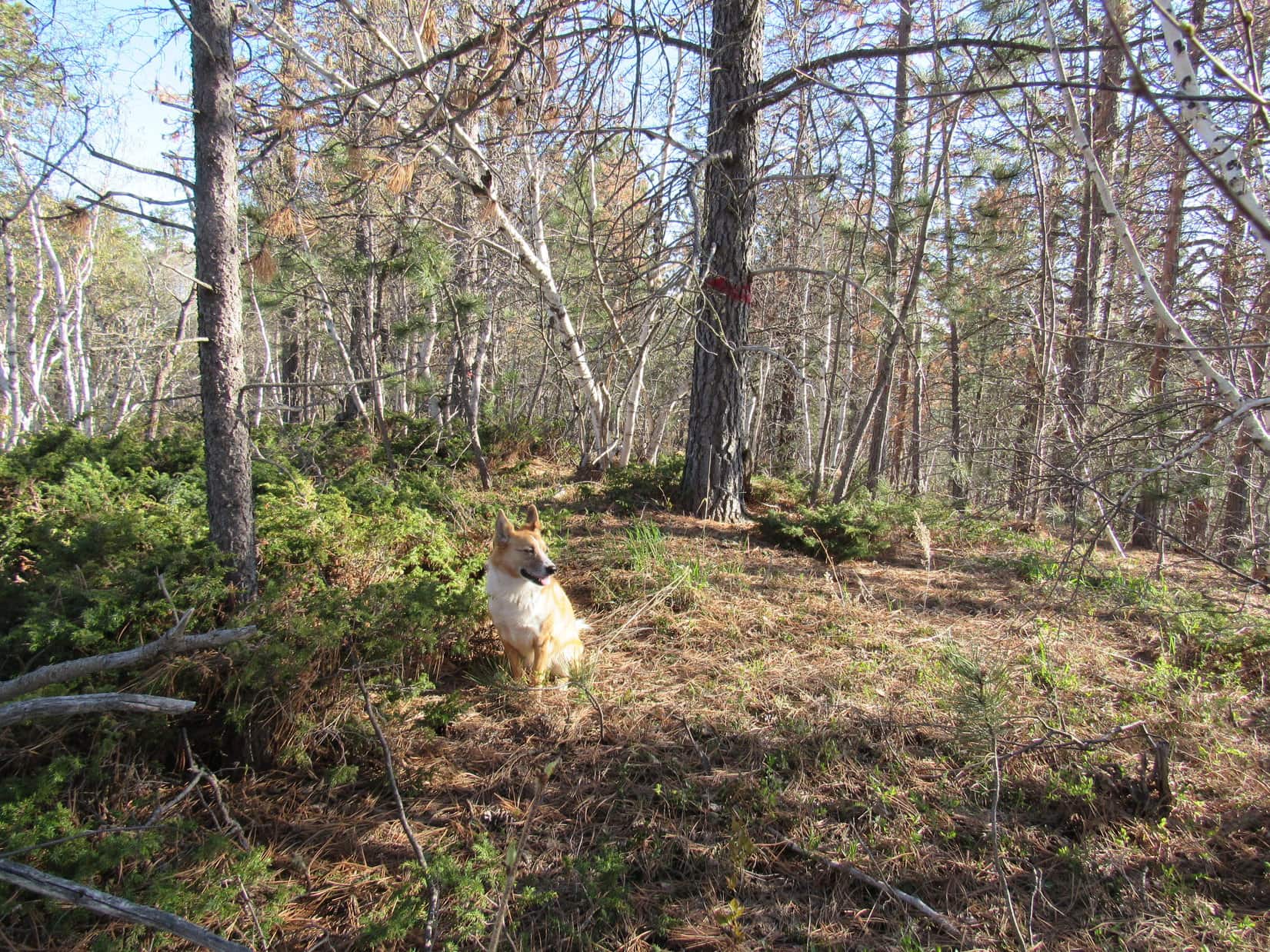
Reluctantly, Lupe left the huge old squirrel tree at the edge of the beautiful green glade.  She quickly forgot about squirrels, sniffing her way NNE.  The Carolina Dog came to a burned forest, passed through it, and entered another section of live forest where she crossed a dirt road. By the time she reached the W side of the Meadow Creek valley, Loop was back in burned out forest again.

Lupe reaches the burned out forest in the Meadow Creek valley on her way to Buffalo Peak. Photo looks N.

After having a great time climbing nearby Squaw Mountain (9,313 ft.) earlier in the day, Loop was on her way to Buffalo Peak (9,387 ft.).  The summit was now less than a mile to the NE.  Unfortunately, the weather was deteriorating.  Clouds were moving in.  A sudden wind arose, and distant thunder could be heard.  Better take cover, but where?

Glancing around, SPHP spotted a square recess in a big rock formation.  The opening appeared to have a bit of an overhang.  The recess was 70 feet higher up a moderately steep slope to the SW.  Lupe could hide out there until this squall passed.

No other option was readily available.  Loop and SPHP climbed the slope up to the square recess.  The opening was large enough to accommodate both Lupe and SPHP, with sufficient overhanging rock to provide decent protection from rain or hail.  Sweet!

Lupe at the square recess in the rock where she would take shelter from the storm. Photo looks W.

While the American Dingo watched from the safety of the square recess in the rock, storm clouds swept across the sky from the SE.  Only a small patch of blue sky remained to the N.  Lupe saw a single bolt of lightning miles to the E.  An eerie, angry buzzing or humming sound filled the whole valley.  The peculiar noise went on and on.

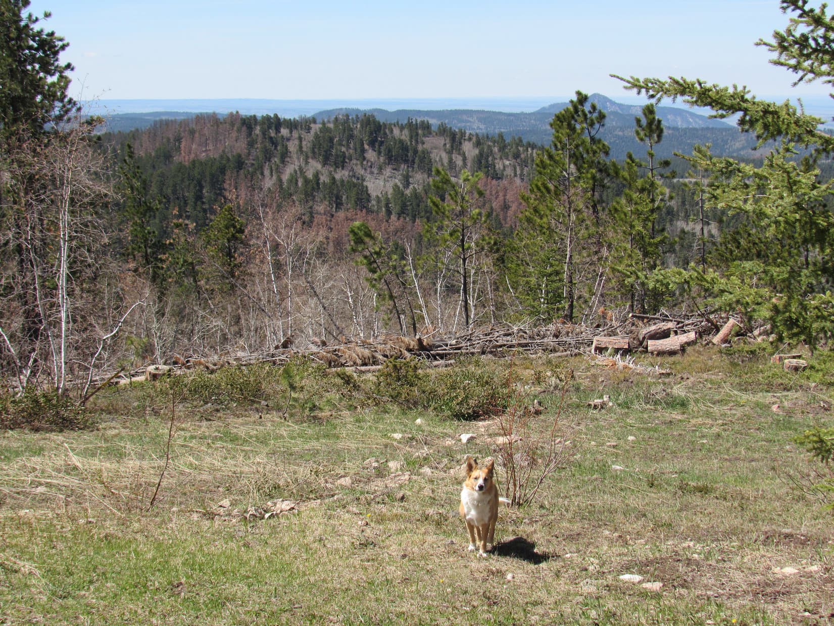
The wind blowing among the dead trees must be making that strange sound!  From here, Lupe could see nothing but burnt forest in Meadow Creek valley.  On the other side of the valley, the entire SW face of Buffalo Peak had burned, too.

Thunder rumbled constantly.  While Lupe waited for the storm to hit, SPHP had plenty of time to check maps and study the SW face of Buffalo Peak.  The plan had been to go N up the Meadow Creek valley, gradually turning NE.  When Lupe got high enough she would turn SE, approaching the mountain from the NW.  The topo map seemed to suggest this would be the easiest way up.

However, the SW face of Buffalo Peak didn’t look all that bad.  It appeared Lupe might be able to go right on up a long, wide slope between two large rock ridges.  Above this wide chute, she would need to turn E to reach the top of the mountain, but that looked feasible from down here, too.

From her square recess in the rocks, Lupe could see the whole SW face of Buffalo Peak. SPHP thought she could probably climb the mountain from this direction, instead of circling around to the NW as originally planned. Photo looks NE.

After a huge, suspenseful buildup, nothing happened.  No hail, no rain – not even a drop.  The distant thunder and the odd buzzing sound both faded away as storm clouds sailed off to the NW.  Blue skies returned.  Buffalo Peak was in sunshine.  More than 40 minutes had gone by.  This was her chance!  Lupe had better get going!

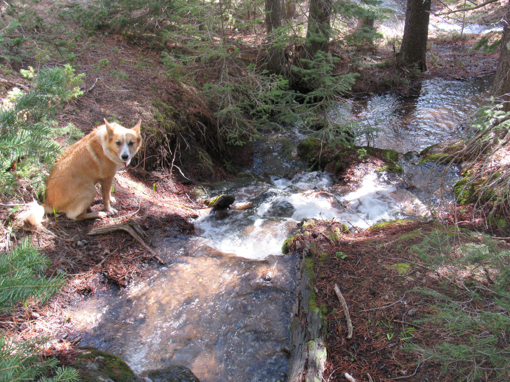
The American Dingo headed NE down into the valley.  She crossed Meadow Creek, which was only a small stream.  Soon she reached the base of the long slope up the SW face of Buffalo Peak.  Even from here, it didn’t look bad.

Lupe began climbing.  The long chute was very wide, bordered by large rock formations on both sides.  At first, Looper encountered quite a lot of deadfall timber.  Higher up, less deadfall existed.  The slope was steep, but not at all scary.  Lupe traversed a mix of bare ground, scattered yellow flowers, and numerous small to medium-sized loose rocks.

The American Dingo made great progress, especially after SPHP got above the worst of the deadfall.  Lupe made it up to the top of the long chute.  She now needed to angle more to the E.  What appeared to be Buffalo Peak’s summit was still a good 300 feet higher.  Getting up there looked somewhat more complicated from here than it had appeared from below.  However, Lupe was able to gain elevation traveling ENE below a high ridge of rock.

Lupe near the upper end of the long steep slope she climbed from the SW. From here, she gained elevation traveling ENE (R) through more complicated rocky terrain than expected. Photo looks N.

Shortly after reaching the upper end of the SW chute, it became clear another squall was on the way.  More clouds were approaching rapidly, blown in on a strong SE breeze.  No lightning was seen, but initially faint thunder grew steadily louder.  Time to seek refuge again!

A great many large rocks were in the area, but places to hide beneath an overhang were scarce.  Lupe and SPHP scouted out possibilities with increasing urgency.  A couple of tight spots were all that could be found.  SPHP stuffed the backpack beneath a small overhang.  Loop and SPHP jammed together into a different barely large enough space under a big rock nearby.

As another squall approached, Lupe and SPHP searched for a place to take shelter. Lupe and SPHP wound up jammed together in the small space under the rock seen to the L of Lupe. Photo looks SSE.

Wind blew.  Thunder rumbled, but no lighting was seen.  A series of threatening clouds raced by.  From the cramped space, SPHP had a glimpse of wild-looking clouds and blue sky far to the S.

Ho hum.  Dullsville.  Lupe had gotten used to this routine.  She dozed on SPHP’s lap, waiting for the squall to pass.

In cramped quarters under a large rock, Lupe dozes on SPHP’s lap, while waiting for the storm to pass.

Eventually, the distant blue sky to the S appeared to be heading this way.  Once again, not a drop of rain, despite all the sound and fury!  When thunder could no longer be heard, and sunshine reached Squaw Mountain 1.5 miles away, Lupe and SPHP clambered out from under the boulder.

With skies starting to clear again, Lupe emerged from beneath the boulder she’s standing on to resume her ascent of Buffalo Peak. Photo looks NE.

Another 30 minutes had been lost.  The summit of Buffalo Peak was still 200 feet higher.  Lupe resumed her ascent.

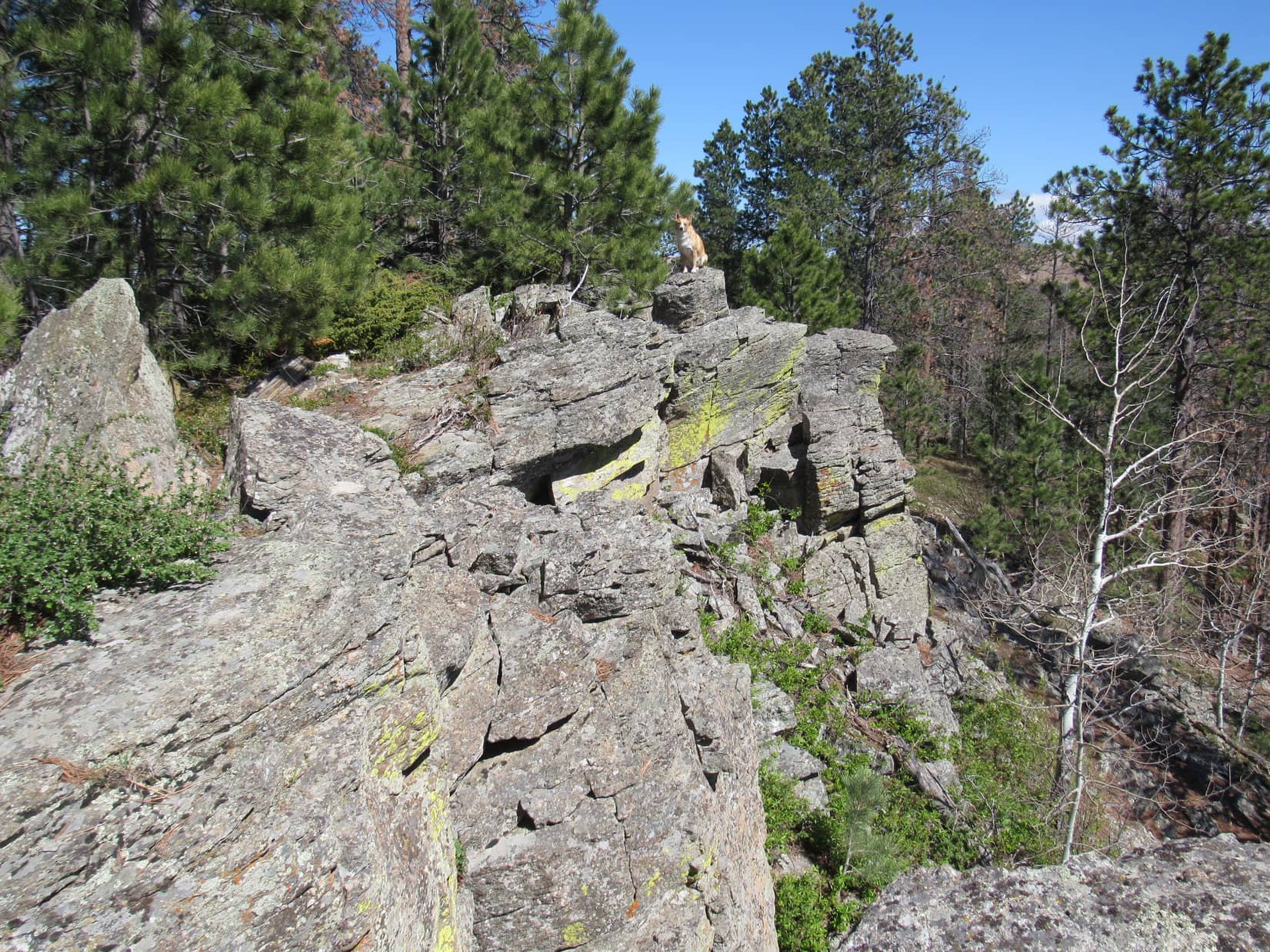
Within 10 minutes, the American Dingo had scrambled up enough boulders to reach a large amphitheater where the ground sloped toward the NW.  The amphitheater contained burnt trees, quite a few large low rocks, and a fair amount of bare earth with little vegetation.  Around the perimeter were 3 large ridges of rock, with openings to the SW and NW.

Lupe reaches the amphitheater near the top of Buffalo Peak. The true summit is unseen a short distance beyond the high rocks on the L. Photo looks N.

Of the 3 high points on the rocky ridges around the amphitheater, the lowest was clearly the one to the SW.  From below, the one to the SE had appeared to be the mountain’s summit.  However, from the amphitheater it looked fairly certain the large ridge to the N was actually highest.

Lupe went to check out the SE ridge first, in case part of it was hidden from view.  The possibility that the true summit was over here hadn’t been completely ruled out yet.  As soon as Loop got up on top, though, it was clear this was not the true summit.  Nevertheless, the views were awesome!

Loop reaches the top of Buffalo Peak’s SE high point. This turned out not to be the true summit. Photo looks NE.
Retreating clouds make for a dramatic scene from Buffalo Peak’s SE high point. Photo looks NNE.
Squaw Mountain (9,313 ft.) (Center) is the high burnt ridge to the R of Lupe. The much more distant high point seen above her rump is Warbonnet Peak (9,414 ft.). Photo looks SE.
The lower SW ridge is in view on the R. The territory Lupe had come up through to reach the amphitheater from the SW is seen on the R. Photo looks SW.
The summit of Buffalo Peak as seen from the SE high point. Photo looks NNW.

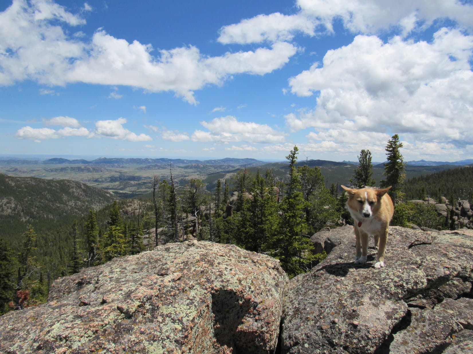
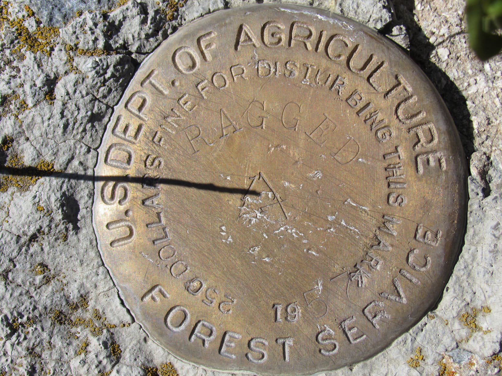
From the high point on the SE ridge, the true summit of Buffalo Peak was clearly seen off to the NNW.  Lupe had to get over there to claim her peakbagging success.  Off Lupe went.  A scramble up from the SE was easily accomplished.  The mighty Carolina Dog stood at the very top of Buffalo Peak (9,387 ft.)!

Loop stands on the true summit of Buffalo Peak. Photo looks NW.
Lupe’s odd summit stance makes the situation look much more precarious than it actually was.
Looking N from the true summit.
Buffalo Peak’s SE high point is seen beyond Lupe. Squaw Mountain is the long, high burnt ridge even farther away. The plastic jar by the summit rock on the R contained a registry. Photo looks SSE.

A plastic jar tucked next to the two highest rocks on the mountain contained a registry.  Six people ranging from 10 to 64 years old had made the trek up Buffalo Peak and started the registry on Memorial Day, 2013.  Since then, only one other person had signed in on 7-12-16.  Naturally, Lupe’s name got added.

The Buffalo Peak registry had gotten off to a good start on Memorial Day, 2013, but had seen little use since then.

It was a good thing Lupe made it to the top of Buffalo Peak when she did.  Before long, the weather was deteriorating again.  The entire sky grew dark.  Distant peaks disappeared in a soft, gray haze.  Nearby peaks could still be seen clearly, except when wisps of fog streamed by on the relentless SE breeze.  Thunder roared threats from afar.

SPHP started down first.  At the top of Buffalo Peak, Lupe stood alone in the wind waiting for the signal to come.

Alone on Buffalo Peak waiting for the signal to follow SPHP down. Photo looks NW.

The signal was given.  Lupe bounded down.  Now it was a race against the storm!  She scrambled down to the amphitheater of dead trees, crossed it heading S, and started descending the mountain’s SW slope.  Loop hadn’t lost much elevation before it was necessary to hide again.

Another overhanging rock was found to squeeze in beneath.  This time there was room for the backpack, too.  Lupe and SPHP waited.  No blue sky could be seen, only a light band of weird yellow sky on the SW horizon.  The wind picked up. Sprinkles of rain dashed against the rocks.

Under the rock, waiting out the latest storm threat on the descent.

Thunder echoed closer than before, but Lupe remained calm.  She dozed while SPHP stroked her warm fur and soft ears.  It rained harder.  Water began dripping into Lupe’s refuge, ultimately becoming a steady stream.  The Carolina Dog curled up on SPHP’s lap, comfortable and dry, while SPHP sat on increasingly muddy ground.

Half an hour passed with no changes.  How long was this going to go on?  The Carolina Dog might be fine here, but SPHP was not looking forward to a long night crammed under a rock.  That was what it would come down to if the storm didn’t let up.  Getting drenched didn’t seem like a good plan either.  Better stay as dry as possible.  No reasonable choice other than to wait it out.

An hour went by.  It began to hail.  Nothing major.  Pea-sized hailstones ricocheted off nearby rocks.  A few struck stinging glancing blows, but did no real damage.  Fun, fun!

After 10 minutes, the hail let up.  It had been the storm’s last hurrah.  A SE breeze remained, but now the sky was clearing again.  Not a moment too soon, either.  The sun was getting low.  Better make tracks.  Lupe and SPHP set off down Buffalo Peak, retracing the Carolina Dog’s earlier route up.

A profusion of yellow wildflowers like these grew on the slopes of Buffalo Peak.

The sun was still up when Lupe reached the top of the long, wide SW chute leading down to the Meadow Creek valley.  By the time she reached the worst of the deadfall timber at the lower end of the slope, sunlight remained only high up on Squaw Mountain.

The sun was still up as Lupe began her descent of the wide, SW chute leading to the Meadow Creek valley. Photo looks SW.

Puppy, ho!  Onward!  No time to lose.  Lupe crossed Meadow Creek again, and turned S.  As twilight weakened, she passed through the burnt forest and reached the live forest.  A dark, shady gloom prevailed.  Lupe kept going.  Across the dirt road, out of the gloom, and into another burnt forest.

Little light remained by the time Lupe made it back to the gnarled old squirrel tree.  The tent and sleeping bags hung in it were only slightly damp.  At least that had worked.  In almost total darkness, SPHP pitched Lupe’s “tiny house” beneath a starry sky.  What a day it had been!  Sweet success!  Lupe had managed to climb both Squaw Mountain (9,313 ft.) and Buffalo Peak (9,387 ft.).

Once safely inside her “tiny house”, Lupe was ravenous.  She gobbled down her Alpo, before curling up on her red sleeping bag.  In no time, she was out like a light.  (End of Day 5)

It was a cold night.  The wind blew for hours, yet the American Dingo hardly stirred.  When she did, SPHP kept wrapping the red sleeping bag over her for warmth.  She must have snoozed well, much better than SPHP.  When dawn arrived, Loopster was ready for action.  She demanded to be let out!

No problem.  Loop wouldn’t run off, not with a giant squirrel tree right outside.  SPHP unzipped the tent door.  Out she went.  An excited yipping and yapping commenced immediately.  The squirrel tree hadn’t failed her.  An annoyed squirrel scolded the Carolina Dog for rudely breaking the early peace and tranquility of the new day.  The scolding only egged her on.

The excitement finally died down and became an occasional thing.  SPHP dozed fitfully for another 2 hours, checking on Looper every so often.  She was always there, waiting and watching beneath the huge squirrel tree.

The sun was well up by the time SPHP managed to spring back to life.  A stroll out in the sunny green glade to take off the morning chill was in order.  The warm sunlight felt good.

Lupe next to her “tiny house” at the edge of the green glade. The huge squirrel tree is beyond her. Photo looks N.
In the warm sunshine of the green glade. Photo looks S.

The original plan had been for Lupe to climb Buffalo Peak today, but she’d already done it.  Fortunately, there was something else fun to do on the way back to the G6.  Looper could climb Twin Peaks (9,280 ft.) again.  Twin Peaks was the mountain Lupe had climbed a year ago where she’d first spotted Squaw Mountain and Buffalo Peak.

Lupe stood guard at the base of the squirrel tree while SPHP packed everything up.  When all was ready, Loop had to leave the squirrels in peace.  She didn’t mind.  By now she was ready for more exploring.  She crossed the green glade heading S and entered the forest.

Back in the forest.

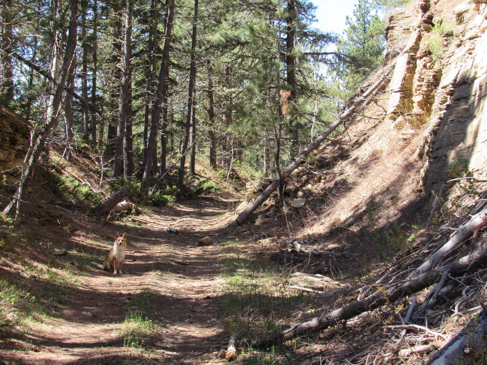
It was 2 miles back to the minor pass S of the big rock formation close to where Lupe had left Twin Peaks Trail No. 618 yesterday.  On the way, Loop stayed W of the route she had taken to Squaw Mountain.  Much of the time she was in forest, but a brighter, more open forest than she’d been in before.

Loop made it back to the minor pass.  SPHP ditched the tent and sleeping bags near some rocks.  The Twin Peaks summit was only 0.5 mile S from here.  Lupe crossed Twin Peaks Trail No. 618 and took off into the forest again, starting her ascent. At first, she had only the forest and deadfall timber to contend with.  Higher up, she reached rock formations, much steeper ground, and even some snow.

On the way up Twin Peaks, Lupe reaches rockier territory and even some snow. Photo looks SSW.

The Carolina Dog came to a rocky high point SPHP recognized from last year.  As she continued higher, the mountain seemed more and more familiar.  For the most part, Lupe took a more direct route straight up from the N this time.  She didn’t scramble up onto the same NW ridge she had approached from last year until very near the summit.

On the way up the N slope, the NW ridge protected Loopster from the weather.  Upon attaining the summit, however, she was exposed to the full force of a gale blowing out of the SW.  Puffy white clouds floated swiftly by.  The sky was mostly blue, and the day sunny, but it wasn’t warm or relaxing up here.

Lupe detested the wind.  She stood on the summit long enough for a short photo session.  After that, SPHP could gaze at the views without her.  Loop hid down in a grassy slot between some of the highest rocks where she was at least partly sheltered from the relentless, stiff breeze.  The American Dingo had some sense, even if SPHP did not.

Lupe stands on the tip top rock on Twin Peaks (9,280 ft.) again for the first time in a year and 12 days. It was windy! Squaw Mountain (9,313 ft.), which Lupe had climbed yesterday is seen on the L. Photo looks NE.
Part of Squaw Mountain (Center) is seen near Lupe’s forehead. Buffalo Peak (9,387 ft.) is the barren rounded peak a little to the L. Photo looks NE.
Laramie Peak (10,272 ft.) (Center) is the most distant high point. Warbonnet Peak (9,414 ft.) is the highest point closer by on the R. Photo looks SE.
A Carolina Dog leans into the stiff SW gale up on the summit of Twin Peaks. Photo looks E.
Loopster takes shelter from the roaring SW wind in the slot between Twin Peak’s summit rocks. The open end of the slot faces W, so the protection wasn’t perfect, but it was a lot better than standing up on top of these same rocks. Photo looks E.

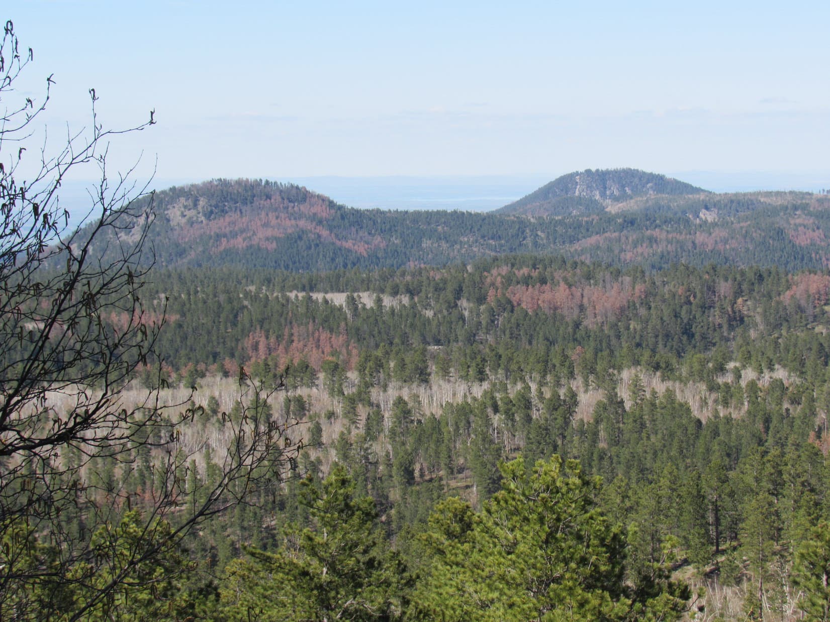
The views from Twin Peaks were fabulous!  Seeing them again was great fun, especially looking over at Squaw Mountain and Buffalo Peak now that Lupe had been to both.  While Lupe hid out, SPHP endured the gale a little longer.

Looking W. The very last part of Lupe’s ascent was from this direction.
It was especially fun seeing Buffalo Peak (L) and Squaw Mountain (R) from Twin Peaks again now that Lupe had climbed both! Photo looks NE.
The valley Lupe would travel through on her way back to the Twin Peaks trailhead is seen below. Squaw Mountain is on the L. Photo looks ENE.
Buck Peak (9,061 ft.) is the conical mountain at Center. Photo looks NNW.

It was a shame it was so windy up on Twin Peaks, but SPHP was glad Lupe had returned.  Still, 20 minutes of this gale, and even SPHP was ready to retreat.  Lupe was more than happy to start the descent.  She definitely preferred roaming the forest to the conditions at the top.

Heading down the N slope of Twin Peaks. Lupe much preferred the forest where she was sheltered from the wind. Finding hidden snowbanks like this one was an added bonus!

Looper returned to the minor pass N of Twin Peaks.  SPHP retrieved the tent and sleeping bags.  Together, Lupe and SPHP started E back down Twin Peaks Trail No. 618.

At 2:19 PM, Loop arrived back at the trailhead.  After a bite to eat, both Lupe and SPHP were overcome with weariness.  Adventuring can take it out of you!  Nothing wrong with taking a nap, is there?

Naptime lasted nearly 3 hours.  When she awoke, Lupe’s adventures in the Laramie Mountains were about over for now.  During the last 6 days, she’d had peakbagging successes and failures, spent countless hours sniffing and exploring, seen many beautiful things, and even faced some dangers.  As wonderful as it had all been, the moment had come to move on.

On the way back to Douglas, Lupe rode with her head out the window of the G6, barking vigorously and happily at everything she saw along the way.  SPHP stopped at several scenic spots. The SW wind still blew hard, but that didn’t detract from the beautiful western scenery.

Near Bear Rock along Cold Springs Road, Lupe faces into the sun and SW wind. Photo looks NE.
Lupe on her way back to Douglas, WY. She’s leaving behind adventures in some truly beautiful territory. Bear Rock (L), Squaw Mountain (Center) and Buffalo Peak (R). Photo looks SW.
Bear Rock seen through the telephoto lens. Photo looks SW.
A pronghorn antelope dashes away across the rolling high plains. Lupe loves watching antelope run!
Lupe stopped by the fancy entrance to the gorgeous Powderhorn Ranch. Buffalo Peak (Center) is in the distance. Photo looks SW.
The Powderhorn Ranch SW of Douglas, WY. Buffalo Peak (L) in the distance. Photo looks SW with help from the telephoto lens.

Upon reaching Douglas, WY, Lupe and SPHP headed W on I-25.  A side trip S to Ayer’s Natural Bridge ended in disappointment.  A sign said the park closes at 5 PM, and it was more than an hour later than that.  Didn’t matter.  The sign also said no pets allowed.  Oh, well.

Lupe was happy anyway, barking at the buffalo she saw from the G6 in a big field along the gravel road.

Buffalo near the road to Ayer’s Natural Bridge.

Back at I-25, SPHP drove W.  Bright-eyed Lupe rode up even with the dash, comfy on her pile of pillows and blankets.  With the Laramie Mountains to the S, and high plains to the N, the sinking sun shone upon her eager face.  Loop was on the road to adventure once more!  Tomorrow she’d be in unexplored territory beyond the Laramie Range.

Links:

Next Adventure                      Prior Adventure

Part 1: Squaw Mountain, Laramie Range, Wyoming (6-12-17)

Twin Peaks, Laramie Mountains, Wyoming (6-1-16)

Want more Lupe adventures?  Choose from Lupe’s 2017 Laramie Range, Wyoming & Beyond Adventure IndexDingo Vacations Adventure Index or Master Adventure Index.  Or subscribe free to new Lupe adventures.

Twin Peaks, Laramie Mountains, Wyoming (6-1-16)

Morning!  (5:57 AM, 30°F)  SPHP opened the door of the G6 to let Lupe out, and grabbed the boots left outside on the ground the previous evening in the hopes that they would dry out a little.  SPHP’s boots had been soaking wet after spending much of the previous day hiking through snow drifts with Lupe on her fabulous day trip to Warbonnet Peak (9,414 ft.) and back.

Well, that didn’t work.  The boots weren’t dry.  They weren’t soaking wet, either.  Instead, they were frozen stiff.  It was chilly out.  Outside, there was frost on the picnic table.  SPHP turned on the engine to warm things up, with the blower blasting the boots with hot air to thaw them out.  Lupe hopped back into the G6 to bask in the warmth.

SPHP studied the maps.  SPHP hoped Lupe would be able to climb two more mountains today.  The original plan had been to go for Buffalo Peak (9,387 ft.) and then Squaw Mountain (9,313 ft.), which were 4 or 5 miles N of the Campbell Creek campground where Lupe and SPHP had spent the night.  The Peakbagger.com topo map showed a 4WD USFS Road No. 664 leaving Cold Spring Road (County Road No. 24), and leading after a few miles to a trail going between the two mountains.

However, SPHP had acquired a new map yesterday.  The forest service personnel who had been reinstalling the campground sign (washed away by floods a few weeks ago), gave SPHP a “Motor Vehicle Use Map” for the Medicine Bow National Forest.  It didn’t show the road and trail leading between Buffalo Peak and Squaw Mountain at all.  It did show something interesting, though.  There was a trailhead along Cold Spring Road, and a Twin Peaks trail No. 618 leading right to Twin Peaks (9,280 ft.).

The Peakbagger.com topo map also showed Trail No. 618, but did not agree with the Motor Vehicle Use Map.  The Peakbagger.com map showed Trail No. 618 passing 0.5 mile N of the Twin Peaks summit.

By the time SPHP’s boots had thawed out enough to become sopping wet again, and pliable enough to put on, Lupe had new plan for the day.  She was going to find the Twin Peaks trailhead, and take Trail No. 618 to Twin Peaks.  If there was enough time left in the day after that, she would try for Squaw Mountain.

After breakfast, Lupe and SPHP left Campbell Creek campground.  SPHP drove N on Cold Spring Road.  Three miles N of the campground, SPHP saw a big empty parking lot next to the forest a little uphill and W of the road.  There was no sign along the road, but SPHP turned in and parked anyway (8:25 AM).

A small wooden sign, in deteriorating condition, still said clearly “Twin Peaks Trail No. 618”.  The sign was next to an old jeep or ATV trail heading W from the parking lot.  There was absolutely no other information around.  This is it, Loop!  Let’s get going!

The old jeep trail went gradually up and over a low part of a ridge coming down from the SW.  On the other side, a little over 0.5 mile from the trailhead, Lupe reached Roaring Fork Creek.  Snow was still melting up in the mountains, so Roaring Fork Creek was living up to its name.  The creek wasn’t terribly large, but big enough so that SPHP started wondering how much of a problem creek crossings were going to be on Trail No. 618.

SPHP needn’t have worried.  Trail No. 618 never did cross Roaring Fork Creek even once, although it did cross a few much smaller tributaries, most of which were clearly seasonal in nature.  None of the tributaries presented any problem.

Lupe trotted along Trail No. 618, sniffing here and there, and making occasional short forays into the forest to investigate points of interest to American Dingoes.  The trail went W following the S side of the creek upstream, most of the time well above it.  About where the trail had reached Roaring Fork Creek, the valley had narrowed and the forest had become denser.  Lupe and SPHP enjoyed a shady trek, with the pleasant sound of water tumbling over rocks below.

Gradually, the trail became steeper.  About 0.75 mile after reaching Roaring Fork Creek, Lupe came to an intersection.  It was unmarked, of course.  Here, the old jeep trail veered to the SW (L) and started climbing steeply.  To the R, a single track trail led down a hill toward the creek.

Decision time.  Which way Lupe?  The Carolina Dog made no response.  Instead, she looked expectantly up at SPHP.  We better check the maps.  Hang on a few minutes.  SPHP already knew what they would show.  The old jeep trail to the L looked like it was heading in the direction shown on the Motor Vehicle Use Map directly to Twin Peaks.  The single track trail continuing up Roaring Fork Creek was the route shown on the Peakbagger.com topo map.  Depending on which map one looked at, both were supposedly Trail No. 618.

Yep, that was what the maps showed alright.  The Motor Vehicle Use Map showed almost no details.  It was impossible to know if the jeep trail actually went up to the top of Twin Peaks or not.  SPHP suspected it wouldn’t, although it must end somewhere not too far from the summit.

The Peakbagger.com map showed the Roaring Fork Creek route would ultimately leave Lupe facing at least 0.5 mile of off-trail bushwhacking going up the N slope of Twin Peaks.  On the other hand, if Twin Peaks proved impossible to climb, Lupe’s alternative peak, Squaw Mountain, would be much closer.

SPHP pondered for 10 minutes.  Lupe took the single track trail near Roaring Fork Creek.

After going a little way on the single track trail, Lupe reached a barbed wire fence across it.  A yellow sign said “Please Close The Gate”.  The sign must not have been very effective.  Sterner measures had been put in place.  There was no gate.  Only a fence.  It ended at a rock formation a foot to the L of the trail.  Lupe and SPHP climbed over the rocks to get by.

A little farther on, a more serious situation developed.  The trail came to a marshy area with lots of little streams running through it.  Crossing the area wasn’t a problem, but following the trail was.  SPHP lost it completely.

Lupe near one of the tributaries of Roaring Fork Creek. SPHP lost Trail No. 618 in this area, but Lupe soon found it again a little farther upstream.

Lupe soon found the trail again a little farther upstream, but from here on, the trail seemed to be seldom used.  Most of the time it wasn’t hard to follow, but every so often, it faded away.  SPHP lost the trail completely several times, but Lupe always came across it again.

Trail No. 618 eventually began to climb well above the level of Roaring Fork Creek.  The trail and creek started to diverge.  The trail turned more to the WSW, while the creek angled NW.

For a long way up the creek valley, the only really view had been N toward Squaw Mountain on the opposite side of the valley.  However, as Lupe continued gaining elevation, she now started seeing occasional glimpses of a high point to the S.  A long, moderately steep, forested slope led up toward it.  That high point had to be some part of Twin Peaks.

Lupe and SPHP took a break.  SPHP needed to check the topo map to determine where Lupe should leave the trail.  She would have to go S to start the climb up Twin Peaks.  The topo map showed that Lupe was approaching a saddle in the trail.  To the N of it were some contours indicating minor high points.  The trail’s high point should be a good place to turn S.

The trail leveled out slowly as it approached the saddle.  Some fairly impressive rock outcroppings began appearing on the N side of the trail.  Lupe reached the saddle.

Lupe nears the saddle area where she would have to leave Trail No. 618 to climb S up Twin Peaks. These rock formations a short distance N of the trail helped confirm Lupe’s location. Photo looks NNW.

Lupe and SPHP went a little farther W on the trail.  It started losing elevation at a pretty good clip.  Yes, Lupe had made it to the saddle.  No doubt about it.  Lupe and SPHP went back to the trail’s high point.  It was time for Lupe to leave Trail No. 618.  SPHP took one more look at the topo map.  Lupe would be climbing the N slopes of Twin Peaks.  The map seemed to indicate the climb would be easiest going around toward the NE side of the mountain.

Lupe and SPHP left Trail No. 618 going S.  The ground was almost level close to the trail, but Lupe soon reached the beginning of the long slope upward.  Nothing but forest could be seen above.  Just like yesterday, during Lupe’s trip to Warbonnet Peak, this forest with a N exposure was full of snow.  The snow was stacked in drifts 2 to 4 feet high.  The long struggle up the mountain began.

SPHP tried to angle toward the SE to get over to the NE slope of the mountain, as suggested by the topo map.  The terrain didn’t want to cooperate.  The easiest way up kept looking like it was farther to the W, where Lupe would be going up the NW side of the mountain.  Lupe and SPHP made forays to the E where possible, but the terrain always soon started looking easier back toward the W.

Lupe was having a great time.  The snow wasn’t a problem for her.  SPHP made fewer attempts to go E, gradually giving in to the terrain.  Lupe was destined to climb Twin Peaks from the NW.

Lupe climbed and climbed.  Finally, she came to a more level area in the forest.  A quick stroll led her to a rock formation.  Now she could get a look at what was ahead.

Lupe reaches the first real viewpoint on her way up Twin Peaks from the NW. Photo looks SE toward the summit. Although hidden by trees in this photo, there was some very deep snow just to the L of the rocky ridge seen beyond Lupe on the R. Photo looks SE.

From the rocks, Lupe could see the summit of Twin Peaks ahead.  The rest of the climb to the top didn’t look terribly long, but it was steeper than before.  A rough, stony ridge rose from the NW almost to the top of the mountain, before turning E to the summit.  Lupe could try to follow that ridge.  Climbing directly up the steep, snowy, forested N slope was the other option.

After a short break, Lupe and SPHP left the rock formation.  Lupe lost a little elevation crossing a shallow saddle.  Lupe and SPHP stayed in the forest a little to the E of the rough, stony ridge.  The slope kept getting steeper and steeper, the higher Lupe went.

SPHP decided Lupe should try to get up on the rough, stony ridge.  Deep snowdrifts were in the shade of the NE side of the ridge.  Lupe and SPHP had to climb up over them to reach the ridgeline.  Lupe made it first.  SPHP followed.

SPHP wondered if the ridge would be too rough to follow.  If Lupe had gotten on it a little lower down, it looked like it would have been.  From where Lupe reached it, however, the ridge wasn’t hard to follow.  There was little or no snow on the ridgeline.  Lupe began to make rapid progress.

Soon there were cliffs to the SW.  Their height increased as Lupe climbed.  A huge view opened up to the S.  The ridge turned E.  Lupe was nearing the summit.  Instead of staying up on the highest rocks, Lupe and SPHP traversed ledges slightly below and to the S of them.  The ledges were 5 or 6 feet wide, and seemed safer than the rocks above, despite the cliffs along the edge.

Lupe and SPHP proceeded carefully.  Just short of the summit was a gap in the rocks.  Beyond the gap was a wall of rock that looked like a potential problem.  SPHP could get up it, but how was Lupe going to get up there?

SPHP told Lupe to wait, and went closer to get a better look.  Suddenly, a Carolina Dog appeared above!  Lupe had found a way up on her own.  She knew what she was doing.  Now it was SPHP turn.  SPHP had to pass through a crack between two big rocks.  The L boulder moved slightly as soon as SPHP touched it!  It wasn’t completely stable.  That was unnerving!

SPHP pushed gently on the boulder again.  Yes, it did move, and quite easily.  It rocked back and forth.  More force didn’t make it move any farther, though.  It wasn’t going to fall, its range of motion was quite limited.  SPHP joined Lupe on top of Twin Peaks (9,280 ft.)!

Lupe reaches the top of Twin Peaks (9,290 ft.)! Squaw Mountain is on the L. Photo looks NE.
Lupe reaches the top of Twin Peaks (9,280 ft.)! Squaw Mountain is on the L. Photo looks NE.

Right away, it was apparent that Lupe was at the true summit of Twin Peaks.  The summit area was quite small, with cliffs to the N and S.  The last part of Lupe’s climb had been from the W along the narrow rocky ridge and ledges.  To the E, rocks went another 10 feet farther before reaching a drop off.

Lucky, Lupe!  Purely by accident, Lupe and SPHP had come up the NW spine of the mountain.  From the top, it looked like the only possible route Lupe and SPHP could have managed.  Lupe had made it, though!  Now she had fabulous 360° views, and a chance to rest while enjoying her peakbagging success.

Buffalo Peak (9,387 ft.) (L of Center) and Squaw Mountain (9,313 ft.) (forested ridge with a high point near Lupe's head) were originally supposed to be Lupe's peakbagging goals this day. Photo looks NNE from Twin Peaks.
Buffalo Peak (9,387 ft.) (L of Center) and Squaw Mountain (9,313 ft.) (forested ridge with a high point near Lupe’s head) were originally supposed to be Lupe’s peakbagging goals this day. Photo looks NNE from Twin Peaks.
Looking SE from Twin Peaks toward territory familiar to Lupe! Laramie Peak (10,272 ft.) is seen on the far horizon on the R. Closer and farther to the R is Warbonnet Peak (9,414 ft.), where Lupe and SPHP had been the day before. High Point 9310 is on the far R.

"Laramie

"<yoastmark

"<yoastmark

Maybe Lupe didn’t like being up on the exposed rocks of the small summit area, or maybe she was simply ready for a break.  After SPHP took a few photos of her on the summit, she went down to rest in a slot below the highest rocks.

The slot was a couple of feet wide and deep, 4 or 5 feet long, and protected by rock on three sides.  The only opening was toward the W.  There was a little grass for Lupe to lay down on, and a bit of shade.  Lupe tried to close her eyes and rest, but a fly kept harassing her.

While Lupe snapped at the bothersome fly, SPHP tried to identify some of the surrounding mountains.

Buffalo Peak looked like a forest fire had swept over it. Photo looks NNE using the telephoto lens.
Buffalo Peak (9,387 ft.) looked like a forest fire had swept over it. Photo looks NNE using the telephoto lens.
The high point on the R may be Buck Peak (9,061 ft.). Photo looks NNW.
The conical mountain on the R may be Gunnysack (9,061 ft.). Photo looks NW using the telephoto lens.
Lupe tries to rest in the safety of her slot in the rocks. Photo looks W at the rough, rocky ridge Lupe navigated on the way up. Sometimes she was up on top, but this high up she mostly followed rock ledges a bit lower down on the L (S).

One of the mysteries of Twin Peaks was why it was even called Twin Peaks.  Lupe was clearly at the highest point on the mountain, with unobstructed views in every direction.  Yet there didn’t seem to be any other similar peak nearby to be its “twin”.  There were some lower ridges of rounded rocks a little way E of the summit, but they were close enough so it was hard to consider them a separate peak.

Looking at the E end of the summit area from the top. The lower ridges topped with rounded rocks seemed too close to be the "twin" of Twin Peaks.
Looking at the E end of the summit area from the top. The lower ridges topped with rounded rocks seemed too close to be the “twin” of Twin Peaks.

SPHP decided High Point 9225 to the SE had to be the twin, but it didn’t look like one at all, at least not from here.  High Point 9225 was a much longer, flatter, broader ridge.  It didn’t resemble the true summit where Lupe was one bit.

High Point 9225, seen as the long flat ridge going all the way across this photo in the foreground, didn't look like a twin of Twin Peaks at all. Maybe it does from a different angle. Photo looks SE.
High Point 9225, seen as the long flat ridge going all the way across this photo in the foreground, didn’t look like a twin of Twin Peaks at all. Maybe it does from a different angle. Photo looks SE.

Lupe and SPHP remained up on Twin Peaks for around 45 minutes.  As lovely as the views were, the time came to think about moving on.  Squaw Mountain (9,313 ft.) was next!  Climbing Squaw Mountain didn’t look hard at all, but would take hours.  Lupe and SPHP took a last look around from Twin Peaks, before starting a careful descent.

Looking WSW from Twin Peaks. Photo taken using the telephoto lens.
Lupe stands at the summit of Twin Peaks, just above the slot in the rocks where she’d taken her rest break. Photo looks E.
The American Dingo of Twin Peaks! Photo looks E.

At first, Lupe and SPHP retraced her route up on the way down.  The narrow, rocky ridge presented no other obvious options.  Eventually, though, Lupe got back down to more forgiving terrain.

SPHP had seen some open ground way down in the valley to the NW of Twin Peaks.  It was W and NW of the saddle where Lupe had left Trail No. 618.  SPHP suspected this open ground might lead far enough N to take Lupe around to the NW end of Squaw Mountain.  After Lupe passed by the rock formation where she had gotten her first good look at the summit of Twin Peaks from the NW, Lupe and SPHP continued down trying to stay toward the NW.

Somehow, it didn’t work.  Much to SPHP’s surprise, Lupe arrived at Trail No. 618 again right back at the top of the saddle.  Lupe needed to go N from here to get to the W end of Squaw Mountain.  However, the big rock formation N of the trail hadn’t gone anywhere.  To get around it, Lupe could either go W or E.

SPHP decided Lupe should try going E.  The plan was to turn N, and eventually NW going up the Roaring Fork Creek valley.  Based on what had been seen from up on Twin Peaks, Lupe ought to find open ground somewhere W of Squaw Mountain.

Working her way around to the N side of the big rock formation, Lupe gained a little elevation, and ran into more snow.  Not as much snow as on the N slope of Twin Peaks, but enough to slow SPHP down.  Deadfall timber was abundant, too.  Progress wasn’t as fast as SPHP had hoped.

The dense forest went on and on.  Lupe did not come to open ground, even though she was getting closer and closer to the W end of Squaw Mountain.  Now gradually losing elevation, the American Dingo came upon a series of small bright green openings in the forest.  These bright green areas were swampy, full of shallow standing water and trickling little streams.  The green openings were beautiful, but crossing them took time, as SPHP tried to avoid the wettest spots.

In the end, Lupe reached a final bright green marsh, somewhat bigger than the others.  She had made it back to Roaring Fork Creek, but much farther upstream than before.  The creek flowed E in the forest a little beyond the N edge of the marsh.  Lupe went to the far NW end.

Lupe was now just S of the far W end of Squaw Mountain.  It had taken longer to get here than SPHP had expected.  Lupe hadn’t come to any easy open ground.  Beyond the marsh, a damp, dank forest continued for who knew how much farther?

There were still hours of daylight left.  SPHP had no doubt Lupe would be able to get to the summit of Squaw Mountain before dark.  That wasn’t good enough, though.  Lupe and SPHP weren’t at all equipped to spend a night on the mountain.  Lupe would need enough daylight to find her way back to the trail through miles of trackless forest before dark.  She wouldn’t have that much time.

Lupe stood on a rotting log at the edge of the forest.  She was at her point of farthest advance.  SPHP stared deeper into the forest, wistfully.  Maybe Lupe would come back again some day to climb Squaw Mountain.  Or maybe this was it, her only chance, a moment passing into history.  Sorry, Lupe, we aren’t going to make it this time.

Lupe at her point of farthest advance on her way to Squaw Mountain. She is just S of the W end of it here. Photo looks NW into the damp, dank forest she would have had to travel through to continue. Photo looks NW.

When Lupe reached the G6 again, it was 5:27 PM (65°F).  Soon Lupe and SPHP were heading N on Cold Spring Road.  Lupe’s trip to the Laramie Mountains was ending, but Lupe and SPHP were still having fun.  The drive to Douglas was absolutely gorgeous.  Mile after mile of unspoiled classic western scenery.

Pronghorn antelope and cows caught Lupe’s attention.  Barkfest was on!  Lupe sped past them all having the time of her life.  In the rear view mirror, Squaw Mountain and Buffalo Peak loomed impressively high and blue.

Maybe some day.

Links:

                   Next Dingo Vacation                     Prior Adventure

                 This Dingo Vacation                           Prior Dingo Vacation

Squaw Mountain, Laramie Range, Wyoming (6-12-17)

Buffalo Peak & Twin Peaks in the Laramie Range of Wyoming (6-12-17 & 6-13-17)

Want more Lupe adventures?  Choose from Lupe’s 2016 Laramie Mountains, WY Adventure IndexDingo Vacations Adventure Index or Master Adventure Index.  Or subscribe free to new Lupe adventures.

Black Hills, SD Expedition No. 172 – Elk Mountain, Ragged Top Mountain & Twin Peaks (5-14-16)

A little downstream (N) of the sign for the cabin community of Elmore in Spearfish Canyon, SPHP stopped the G6 on a small pullout next to Hwy 14A.  USFS Road No. 215.1 was supposed to be around here somewhere.  Finding it was critical to Lupe being able to complete her peakbagging goals for the day.

SPHP checked the maps again.  Either No. 215.1 wasn’t much farther ahead, or SPHP had already missed it.  Let’s go a little farther Loop, if we don’t see it, we will have to turn around and make another pass.

The G6 had hardly gotten going back on Hwy 14A again, when a street sign saying Annie Creek Road appeared on the R next to a very rocky side road.  That was it!  Very carefully, SPHP crawled the G6 up the first little hill.  This wasn’t G6 territory!  As soon as the terrain flattened out, the G6 got parked along a wide spot in the dirt road (10:33 AM, 41°F).

Lupe and SPHP started off heading N on Annie Creek Road.  It was narrow, kind of rocky, but almost level.  An easy hike to start the day!  Last weekend, Lupe had found a similar road leading out of Spearfish Canyon farther N on her way to Little Crow Peak (5,885 ft.).  That road had been steep for over a mile, though.  This was a piece of cake!

The thick haze that had persisted all day on Expedition No. 171 was gone.  The air was a crisp, crystalline blue.  Not a cloud was in the sky.  Lupe and SPHP were both in high spirits, making good progress along the road.  The first point of interest came as the road angled NE.  A cold, clear rivulet poured down the steep hillside SE of the road between mossy banks.

The mossy-banked rivulet next to Annie Creek Road. Lupe wasn’t thirsty yet.

Lupe wasn’t thirsty yet, so she just went on.  She was surprised when a big mud puddle covering most of the road turned out to have a thin coat of ice.  Lupe passed several big iced-over puddles.  Near one of them, SPHP spotted a Lupe Treasure.  The aluminum beer can turned out to be heavy.  It was full of ice, too.  SPHP decided to move it from the ditch into a sunnier spot where the ice would melt.  Lupe could claim her treasure on the way back to the G6 at the end of the day.

Annie Creek could now be heard down in the deep forested valley to the NW.  Lupe was more than 1.5 miles from the G6 by the time the road curved N, and went over a high embankment above Annie Creek.  Lupe saw Annie Creek, which had surprisingly good flow, but did not leave the road to run down to it.

The road divided on the NW side of the creek.  The main road went NE following Annie Creek upstream.  A lesser, but still good road went W.  The topo map showed that this road would gain elevation slowly while working around the W end of a big hill to the N.  Eventually, it would turn E, arriving after 2 miles at a point less than 0.5 mile S of Lupe’s first peakbagging goal, Elk Mountain (6,422 ft.).  Lupe and SPHP left the main road heading W on the lesser road.

Lupe on the lesser road after leaving Annie Creek Road. Photo looks W.

Everything was going great!  It was all so easy.  The lesser road started curving around to the NW.  Suddenly it ended.

Lupe reaches the sudden end of the lesser road. Photo looks NW.

Looking down into the steep ravine ahead, it was possible to see a couple of big old cement foundations and some collapsed timbers.  The road didn’t use to end here, there must have been some kind of trestle bridging the gap.  Trees kind of hid the other side, but it did look like the road still continued NW on the other side of the gap.

Going down the S end of the gap seemed easy enough, but climbing up the N end looked pretty steep.  It didn’t appear too bad, though.  Lupe and SPHP went down into the gap to get a closer look.

Lupe on one of the cement foundations down in the gap. Photo looks N up the steep slope Lupe would have to climb to get to where the road would continue NW.
Looking WNW from the bottom of the gap.

Lupe and SPHP climbed up the steep N side of the gap.  It wasn’t too bad going up, and less than a 50 foot climb, but SPHP hoped there weren’t any more gaps in the road ahead.  SPHP didn’t relish the prospect of going back down this way, if Lupe had to turn around.

The road did continue NW from the N side of the gap, but the view wasn’t entirely encouraging.  This part of the road was full of rocks and boulders that had fallen down the steep slope to the NE.  Trees were growing on the old roadbed.  It didn’t look like this part of the road got used at all any more.

The road continued on N of the gap, but didn't look very encouraging. Photo looks NW.
The road continued on N of the gap, but didn’t look very encouraging. Photo looks NW.

Lupe didn’t have to go very far N before SPHP’s fears were confirmed.  Another gap was dead ahead.  This one was even bigger, steeper, deeper and wider.  One look at it, and SPHP knew Lupe couldn’t continue on this way.

The 2nd, even bigger gap wasn’t far N of the 1st one. No way Lupe and SPHP could get across this one!

SPHP didn’t want to back down that N slope of the 1st gap, but crossing the 2nd gap wasn’t an option at all.  Lupe and SPHP had to turn around.  SPHP searched the steep slope to the NE.  Was there a way up there?  It was the only other possibility.

The NE slope was steepest down right next to the road where part of the hillside had been carved out during road construction.  About 50 feet up, the slope wasn’t quite as steep.  Only one spot offered a possible reasonable route up.  From the very top of the steepest part of the bank, a fallen tree slanted down at an angle for about 30 feet.  The upper end of the trunk was wedged against a big living pine.  The lower end was firmly wedged between big rocks.  This tree trunk looked very stable, and getting to the lower end of it appeared relatively easy.

So, Lupe and SPHP tried going up the steep NE slope using the fallen tree for support.  No problems!  It worked just fine.  SPHP still had to crawl up the higher slope for quite some distance.  Very gradually, it became less steep.  Near the top, SPHP was able to walk again.  After gaining 200-300 feet of elevation, the ground finally leveled out.  Whew!  Lupe and SPHP took a breather at a rock outcropping at the edge of the slope.

Lupe at the rest point after climbing up the long steep slope unseen just beyond the edge of the rocks behind her. SPHP was quite glad to reach this point. Photo looks WSW.

Lupe had some Taste of the Wild and water.  SPHP checked the topo map.  From here Lupe needed to keep climbing while following the sweep of the ridge.  However, it wouldn’t be nearly as steep from here on.

SPHP had not planned for Lupe to ever be on this ridge, but now she was.  Everything went fine, though.  At first Lupe went SE climbing the now gently sloping ridge.  Before long, the ridge turned NE.  Lupe continued gaining a little elevation.  Somewhere far below to the SE was Annie Creek.  Lupe was so high above it, SPHP couldn’t even hear the creek.

Close to a mile from where Lupe and SPHP had reached the top of the steep slope, Lupe could see a huge pile of mine tailings up ahead.  It looked like a completely barren mountain.

Lupe draws near a mountain of mine tailings up ahead. Photo looks NE.

Lupe reached a dirt road as she got closer to the mine tailings.  Lupe followed the dirt road N.  The top of Elk Mountain was now in view up ahead.

The top of Elk Mountain came into view. Photo looks N.

The dirt road quickly dead-ended.  Lupe continued NNE through the forest.  Elk Mountain looked like it would be easiest to climb from the E.  Lupe reached a fence at the edge of the mining property.  She stayed W of it, still trying to head NNE.  A constant sound of machinery in operation was getting louder and louder.

A big area covered with a black liner came into view.  A small pond of water was at the lower end.  Trucks could now be heard.  The mine was definitely in operation.  Lupe and SPHP stayed away from it in the forest.  Lupe had to cross a little valley to get to where she could start climbing Elk Mountain.  There were a few unmarked roads along in here, but Lupe didn’t follow any of them very far.  She climbed Elk Mountain (6,422 ft.) from the S and then E.

Lupe at the summit of Elk Mountain. Photo looks SE toward the mine and Terry Peak (7,064 ft.) in the distance.

Although SPHP’s old USFS map showed Elk Mountain to be in the Black Hills National Forest with private property nearby, there were plenty of signs of human habitation near the top.  At the summit, a tall post stuck up out of a small pile of rocks.  Nearby was a short building with windows.  The building was shaped like it might house a hot tub.  SPHP peered inside.

Lupe near the strange little building on Elk Mountain. SPHP thought it might contain a hot tub, but it didn’t. It appeared to be a child’s playhouse. Photo looks SSW.

There was no hot tub.  The strange little building appeared to be a child’s playhouse.  In a way, it was sort of a glorified tree fort with the lofty summit of Elk Mountain substituting in lieu of a treetop.  Sadly, it looked like no child had played here in a long time.

Lupe and SPHP took another rest break up on Elk Mountain.  SPHP had an apple.  Lupe had Taste of the Wild.  Water for all, of course.  Lupe shared a peanut butter granola bar with SPHP.  American Dingoes love granola bars!

There were clear views toward the S.  The most impressive view was SE toward the nearby mine.  Terry Peak (7,064 ft.) and Deer Mountain (6,652 ft.) were both in view farther off in the same direction.  Trees blocked most of the views to the N and W, although it was possible to get a glimpse of Cement Ridge (6,674 ft.) in Wyoming to the W.

The mine was kind of pretty in a devastated human way from the top of Elk Mountain. Terry Peak (L) and Deer Mountain (6,652 ft.)(Center) were in clear view beyond it. Photo looks SE.
The mine was kind of pretty in a devastated by humans way from the top of Elk Mountain. Terry Peak (L) and Deer Mountain (6,652 ft.) (Center) were in clear view beyond it. Photo looks SE.

Lupe’s next peakbagging goal, Ragged Top Mountain, was about a mile away to the NW as the crow flies.  Lupe and SPHP had to go farther than that to get there.  Lupe went down the NE slope of Elk Mountain.  On the way she spotted the greatest hoard ever of Lupe Treasures!  It was a veritable aluminum mine!  SPHP left the vast glittering riches where they were.

Ragged Top Mountain (6,200 ft.) has two high points of nearly equal elevation. The E high point is seen here from Elk Mountain. Photo looks NW.
Ragged Top Mountain (6,200 ft.) (L) has two high points of nearly equal elevation. The E high point is seen here from Elk Mountain. Photo looks NW.

Farther down the mountain, Lupe came to a road.  She followed it NW down to Preston, where there were a couple of decaying buildings.  From Preston, Lupe and SPHP headed back into the forest, and up the SE ridge to the top of Ragged Top Mountain (6,200 ft.).

A forlorn old building at Preston, SE of Ragged Top Mountain. Photo looks N.

Ragged Top Mountain has two highpoints, both areas enclosed by the 6,200 foot contour.  The topo map showed the E high point had a much larger area enclosed by the contour.  SPHP consequently expected the true summit would probably be found here.  Lupe reached the E high point first.  She found a ridge of rock that dropped steeply off to the S.

Lupe on top of the E high point of Ragged Top Mountain. This might have been the true summit. Photo looks ESE.

Lupe on the E high point of Ragged Top Mountain, 5-14-16

Lupe on another high rock, though not the highest one, in the area of the E high point on Ragged Top Mountain. Photo looks WNW.

SPHP had caught a glimpse of the W high point from Elk Mountain.  It looked far more rugged, or perhaps “ragged” than the E part of Ragged Top Mountain.  After visiting the E high point, Lupe and SPHP enjoyed an easy stroll most of the way over to the W high point.

Actually getting to the top of the W high point involved a steeper, more peak-like climb.  It was still an easy scramble, but left both Lupe and SPHP more impressed with the W high point than the E one.  The W summit also featured a rock ledge dropping steeply off to the S.  However, the W high point had superior open views from the SE around to the W.  Right away, Lupe found a survey benchmark on a rock next to the very highest one.

This survey benchmark saying "Ragged" was located up on the W high point of Ragged Top Mountain. The W high point was certainly more impressive and a better viewpoint than the E one. However, even after Lupe visited both, SPHP remained uncertain which high point is actually the true summit.
This survey benchmark saying “Ragged” was located up on the W high point of Ragged Top Mountain. The W high point was certainly more impressive, and a better viewpoint than the E one. However, even after Lupe visited both, SPHP remained uncertain which high point is actually the true summit.
Lupe on the W high point of Ragged Top Mountain. The survey benchmark is underneath her just in front of her rear paws. Cement Ridge in Wyoming is seen in the distance on the L. Photo looks W.
Lupe on the W high point of Ragged Top Mountain. The survey benchmark is underneath her just in front of her rear paws. Cement Ridge (6,674 ft.)  in Wyoming is seen on the horizon on the L. Photo looks W.
Elk Mountain (Center) and more distant Terry Peak (L of Center) from the W high point of Ragged Top. Photo looks SE.
Forest generally hid the views to the N, but SPHP caught this glimpse between the trees of Crow Peak (5,787 ft.) (L) W of Spearfish, SD. Photo looks N.
Forest generally hid the views to the N, but SPHP caught this glimpse between the trees of Crow Peak (5,787 ft.) (L) W of Spearfish, SD. Photo looks N.  Taken with the telephoto lens.
Lupe tried to get comfortable here while taking a rest break up on the W high point. It was rather rocky, though, and not entirely suited to Lupe's purpose. Photo looks W.
Lupe tried to get comfortable here while taking a rest break up on the W high point. It was rather rocky, though, and not entirely suited to Lupe’s purpose. Photo looks W.

The views were so nice, the sky so clear, and the temperature so pleasant, that Lupe and SPHP spent quite a while relaxing up on the W high point.  Lupe had her Taste of the Wild, and part of another peanut butter granola bar.  SPHP polished off the orange.  Lupe tried to doze in the sun, but didn’t look too comfortable on the rocks.

Eventually, it was time to press on toward Twin Peaks (6,000 ft.), Lupe’s final peakbagging goal of the day.  On the way down the W high point of Ragged Top, there was a spot where SPHP could see the two peaks Lupe had climbed a week ago on Black Hills, SD Expedition No. 171 – Little Crow Peak (5,885 ft.) and Spearfish Peak (5,800 ft.).

Lupe lingers up on the W high point of Ragged Top Mountain. Photo looks WSW.
Little Crow Peak (5,885 ft.) (L) and Spearfish Peak (5,800 ft.) (R) from Ragged Top. Photo looks N using the telephoto lens.

Lupe and SPHP returned briefly to the E high point of Ragged Top Mountain.  From there, Lupe continued E to the edge of the high ground.  Twin Peaks is about 1.5 miles NE of Ragged Top as the crow flies.  SPHP wanted to get an idea what it looked like before leaving Ragged Top, but forest partially blocked the view.

Located at the N end of a ridge almost as high, Twin Peaks didn’t really stand out.  SPHP checked the topo map pretty carefully, comparing it to what could be seen of the view.  SPHP still wasn’t entirely certain which forested bump out there was Twin Peaks.  Well, Lupe, it isn’t that far away, and the intervening ground isn’t all that rugged.  We may as well just head NE.  We will find it!

After a little trek N along the E edge of Ragged Top, Lupe headed E down into the forest.  Reaching the valley floor, she crossed the road in the grassy field N of Preston.  Lupe went ENE up the next forested ridge and crossed it, too.  Down into another small valley, which had to have been Long Valley, and up the next ridge.  A road led E to a better dirt road where Lupe turned N.  Twin Peaks could now be seen up ahead.  Even this close, it wasn’t very impressive, just a comparatively small hill on the ridge.

Lupe came to the S peak first.  The top was covered with low bushes.

Lupe reaches the top of the S peak of Twin Peaks. Photo looks N.

There wasn’t much to see on the S peak.  Lupe paused there only long enough for her summit photo before continuing on to the N peak, which was only a few minutes hike away.  The N peak was more interesting, and definitely a little higher than the S peak.  This was the true summit of Twin Peaks (6,000 ft.).

The views would have been better from the N peak, but it was buried in a dense forest.  Once again, Lupe remained only long enough for her summit photo and a few minutes of sniffing around.  SPHP had seen a rather nice view back to the S toward Elk Mountain while walking up the S peak.  Lupe and SPHP went back there for another look.

Lupe on top of the N peak and true summit of Twin Peaks (6,000 ft.). Photo looks S.
Elk Mountain (R) from the upper slopes of the S peak of Twin Peaks. Photo looks S.

Lupe had now achieved all of her peakbagging goals for the day.  It was already early evening, but the sun would still be up for a while longer.  It was time for Lupe to start back toward the G6.  Lupe and SPHP went S from Twin Peaks, and got on the dirt road heading that direction.  Lupe started regaining elevation slowly, but steadily.

Off to the NE, there was a view of a big hill that SPHP had earlier thought might be Twin Peaks.  Now SPHP knew it wasn’t.  Lupe and SPHP stopped briefly to take a photo of it.  A check of the maps later revealed it had to be Richmond Hill (6,040 ft.).  Lupe had never been there.  Maybe she will some day!

Richmond Hill (6,040 ft.) from near the road S of Twin Peaks. Photo looks NE.

The sun was getting sort of low, but it looked like Lupe should have time to return to the top of Elk Mountain one more time.  SPHP hoped the road Lupe was on would eventually turn SW toward Elk Mountain, but it didn’t.  Instead the road came to a high point where it turned sharply E.

Well, E was no help at all.  Lupe and SPHP left the road going WSW toward Elk Mountain.  Lupe lost quite a bit of elevation again crossing a valley.  On the other side of the valley, she started regaining it.  Lupe and SPHP climbed up the ENE side of Elk Mountain, making it to the top for the 2nd time.  The views were even prettier in the evening light.

Lupe returns to the summit of Elk Mountain. The views were even prettier in the evening light. Photo looks SSW.
Lupe near day's end on Elk Mountain. Photo looks SSE at some of the nearby mine tailings, which resembled ancient pyramids.
Lupe near day’s end on Elk Mountain. Photo looks SSE at some of the nearby mine tailings, which resembled ancient pyramids.

Lupe and SPHP couldn’t stay very long.  The sun was getting low, and Lupe had to find a new route back to the G6!  There was no way she was going back by way of the steep terrain she had to climb on her way to Elk Mountain the first time.  There was one more thing to do, though, first.

On the way down Elk Mountain, Lupe and SPHP stopped by the big hoard of Lupe Treasures!  SPHP stuffed three plastic grocery bags full of them.  Five times the amount SPHP could carry had to be left behind, but there wasn’t any choice.  One of the bags got stuffed in the backpack.  SPHP found a stick to use as a handle for carrying the other two.

By the time Lupe was down in forest W of the big mining operation again, a fiery orange sun was glowing on the horizon.  Lupe reached the road N of the Annie Creek valley as twilight was already starting to fade.  SPHP hoped the road would take Lupe down into Annie Creek valley, but didn’t bother to check the maps when the road forked.

One branch of the road went E.  The other went S.  SPHP took the road S, since it was the most direct route to Annie Creek.  Wrong move!  After losing modest elevation, the road dead-ended at the edge of a steep slope.  Annie Creek could be heard, but not seen far below.

SPHP scouted around.  There was a glimpse of Annie Creek Road down below!  It wasn’t far away, but a lot of elevation had to be lost to get to it.  The forested slope was steep, but looked reasonable.  Lupe and SPHP started down, hoping cliffs weren’t hidden below.

The slope got steeper, but Lupe didn’t come to any cliffs.  SPHP did have to go ever more slowly and carefully.  Lupe wandered this way and that.  She had no problems traversing this kind of stuff.  She was having a good time sniffing around.  Meanwhile, twilight was fading fast.  With each step, SPHP sent little showers of rocks cascading down the mountain.  The terrain forced SPHP toward a steep ravine.

Suddenly, one of the sacks full of Lupe Treasures caught on something, ripping loose from the stick.  Lupe Treasures spilled out as the sack tumbled 20 feet down before coming to rest.  Just lovely!  SPHP went carefully down to the damaged sack, gathering the Lupe Treasures back up again.  The loose sack was too badly damaged to be used now.

SPHP pulled the sack in the backpack out, and attached it to the stick.  All the Lupe Treasures from the damaged sack went directly in the backpack.  By the time SPHP had gathered up all the scattered Lupe Treasures, it was dark enough to have to use a flashlight.  Lupe and SPHP resumed the steep trek down.  SPHP had to stay in the ravine navigating through loose rocks, juniper bushes, trees and occasional deadfall.

In the darkness, Lupe trotted easily back and forth across the ravine, her tail waving happily, as if to show SPHP how to do it.  SPHP couldn’t.  Advantage, Carolina Dog!  Finally, however, the ravine got a little less steep.  Looking down, SPHP saw Lupe standing on Annie Creek Road.  Sweet!  SPHP joined her in just a couple of minutes.

The rest of the way back was easy, or should have been.  All Lupe and SPHP had to do was follow nearly level Annie Creek Road the entire way.  However, carting all of the Lupe Treasures, while holding the flashlight, plus trying to keep the camera from swaying wildly on its strap with each step, took both of SPHP’s hands.

Thoughtlessly, SPHP rubbed an itchy right eye with a finger, cleverly placing three molecules of sunscreen in the eye.  The result was a stinging sensation, and subsequent release of a cascade of tears from the offended right eye which insisted on closing tight.  One-eyed SPHP lost all depth perception of the faintly lit road.  It didn’t help that the left eye wanted to close in sympathy with the right one, too.

Lupe trotted happily on ahead in the darkness.  SPHP trudged slowly along Annie Creek Road, weeping from the right eye and trying to avoid the big mud puddles, while still managing to hang on to everything.  When Lupe found the aluminum can that had been full of ice where SPHP had left it to melt in the morning, SPHP stopped to add it to Lupe’s Treasure collection.

Unfortunately, draining the water out of the can released a ghastly, putrid odor.  As Uncle Peanut used to say, it was “enough to gag a maggot”.  SPHP almost abandoned the can right then and there, but thought better of it and managed to stuff it in one of the sacks on the stick.  Yuck!  SPHP didn’t like the idea of putting it in the G6, even in the trunk.

Lupe and SPHP continued on in the darkness – Lupe sniffing along as happy as ever; SPHP carting a clanking collection of dreadfully stinking Lupe Treasures, weeping from one eye, and trying not to stumble on rocks on the road due to a lack of depth perception.

When Lupe raced ahead, SPHP knew it was finally over.  She had seen the G6 (10:02 PM, 32°F).  SPHP was busy loading all the gear into the G6, and Lupe’s stinking treasure hoard into the trunk, when suddenly an owl hooted close by.  Lupe reacted like she had seen (or heard) a ghost, immediately leaping into the safety of the G6.  To SPHP, though, the owl just seemed to be laughing.

Lupe on the W high point of Ragged Top Mountain.

Lupe Treasures collected: 2 glass bottles, 2 plastic bottles & 204 aluminum cans.

Links:

Next Black Hills Expedition                       Prior Black Hills Expedition

Want more Lupe adventures?  Choose from Lupe’s Black Hills Expeditions Adventure Index or Master Adventure Index.  Or subscribe free to new Lupe adventures.