Black Hills, WY Expedition No. 255: Missouri Buttes & A Visit With Dave Covill, Lead Director of the Highpointers Foundation (5-27-20)

5-25-20 –  Lucky Dingo!  You’ve been granted a reprieve.

I have?  That’s good!  A reprieve from what, SPHP?

All this endless boredom laying around.  Apparently you’ve served your 6 month sentence.  Adventure is heading your way!  Remember Dave Covill and your Mighty Dingo Missile Launch?

How could I ever forget that?  I was sore for a week!

You’re lucky you weren’t crippled for life!  Anyway, Dave is coming up from Colorado in a couple of days to climb Devils Tower (5,112 ft.).  Says here he might have time to meet with us.

Devils Tower!  That’s straight up and down!  No one can climb that!

Actually, it is possible with the right equipment and skills, Loop.

Or a helicopter!

Hah!  Yeah, that’s the only way we’d ever get up there!  Don’t worry, we aren’t going to try to keep up with Dave.  Last year his first little starter peak was Aconcagua (22,841 ft.), the high point of South America!

5-27-20, 12:45 PM, Wyoming Hwy 24 – We’re almost there, SPHP!  There’s Devils Tower and the Missouri Buttes (5,374 ft.), too.  Can we stop and take a look from here?

Sure thing, Loopster!

Great to be back in Wyoming! There’s Devils Tower (R), and Missouri Buttes (L). Photo looks NNW.

At 1:02 PM, Lupe arrived at the Devils Tower Trading Post.  Dave was supposed to meet her here once he finished his final training session with his guide.

Dave won’t be free for another hour yet, so let’s have a look around! Photo looks WNW.
Mr. Covill’s been training on Devils Tower yesterday afternoon, and again today. Maybe he’s somewhere on the lower part right now?
I don’t see him, though. Maybe he’s already down, or on another side of the mountain?
The entrance to America’s first national monument is right next to the trading post and the Devils Tower KOA campground.
This sign at the KOA depicts an Indian legend about how Devils Tower came to be.

Dave finally showed up a little before 2:30 PM.  He was pleased with how quickly he had bonded with his guide, and the quality of training.  Despite Dave’s decades of peakbagging experience, Devils Tower was a tough and unique challenge!  One of his knees was scraped up and swollen, but he still intended to climb the mountain tomorrow.

Dave Covill, Lead Director of the Highpointers Foundation with Loop at the trading post.

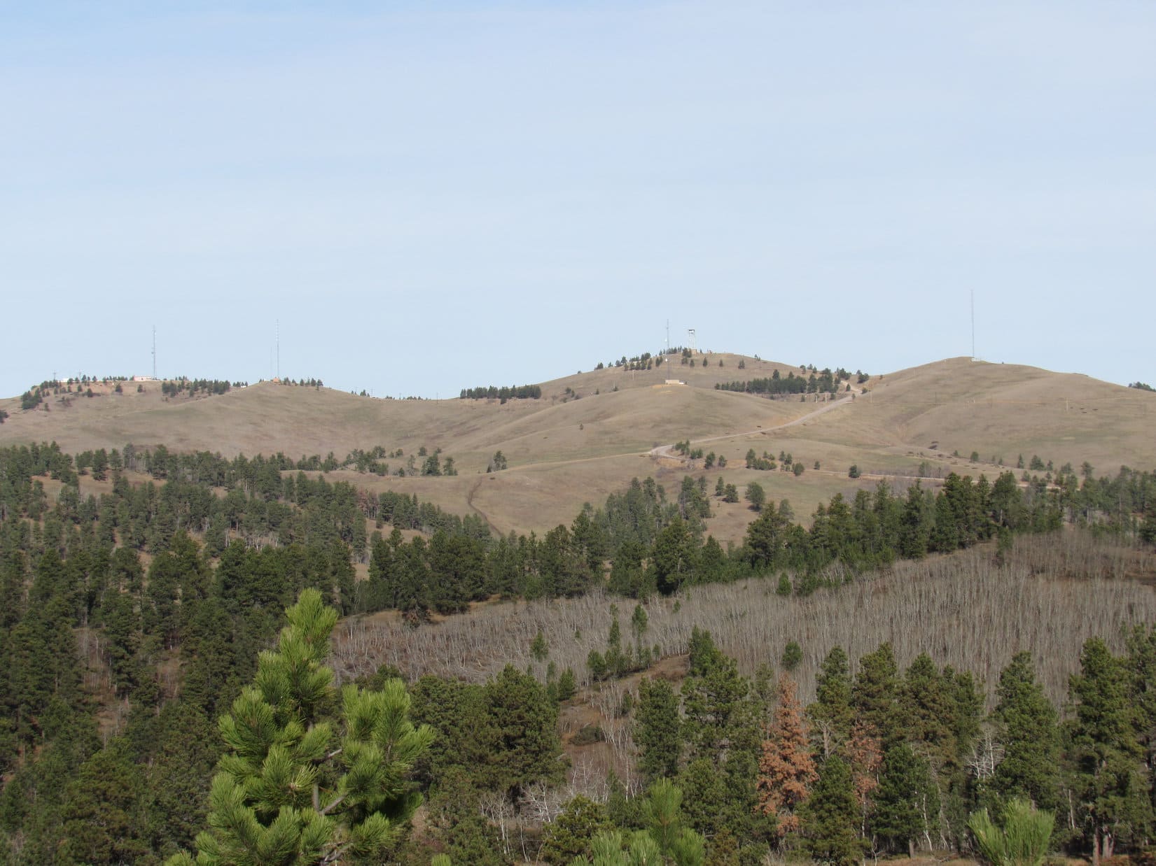
Dave had a few hours to burn with Lupe, so what to do?  Two options!  First was a visit to Warren Peaks (6,650 ft.), the high point of the Bear Lodge mountains.  Warren Peaks was easy.  A USFS road went all the way to the fire lookout tower on top, so it was just a drive up.  The other option was to climb Missouri Buttes, which would take a few hours.

After a very early start on the long drive up from Colorado yesterday morning followed by two rigorous training sessions on Devils Tower, and faced with the prospect of climbing it tomorrow, Warren Peaks sounded like the sensible choice to Dave.  He jumped in the G6 with Lupe and SPHP.

On the way to Warren Peaks, SPHP naturally asked about Dave’s trip to Aconcagua, and also his return to Alaska in August, 2019 for a second attempt on Mount Isto (8,976 ft.), the high point of the Brooks Range.  Both were gripping tales.

(Dave’s Aconcagua trip report, Greg Slayden’s Mount Isto trip report.  Their mutual friend Edward Earl had drowned in the Jago River during a first trip to Mount Isto in June, 2015.)

Shortly before reaching Warren Peaks, SPHP parked on a hill expecting a view of Devils Tower, but only the Missouri Buttes were in sight.

Warren Peaks area. Missouri Buttes (L of Center) in the distance. Photo looks NW.

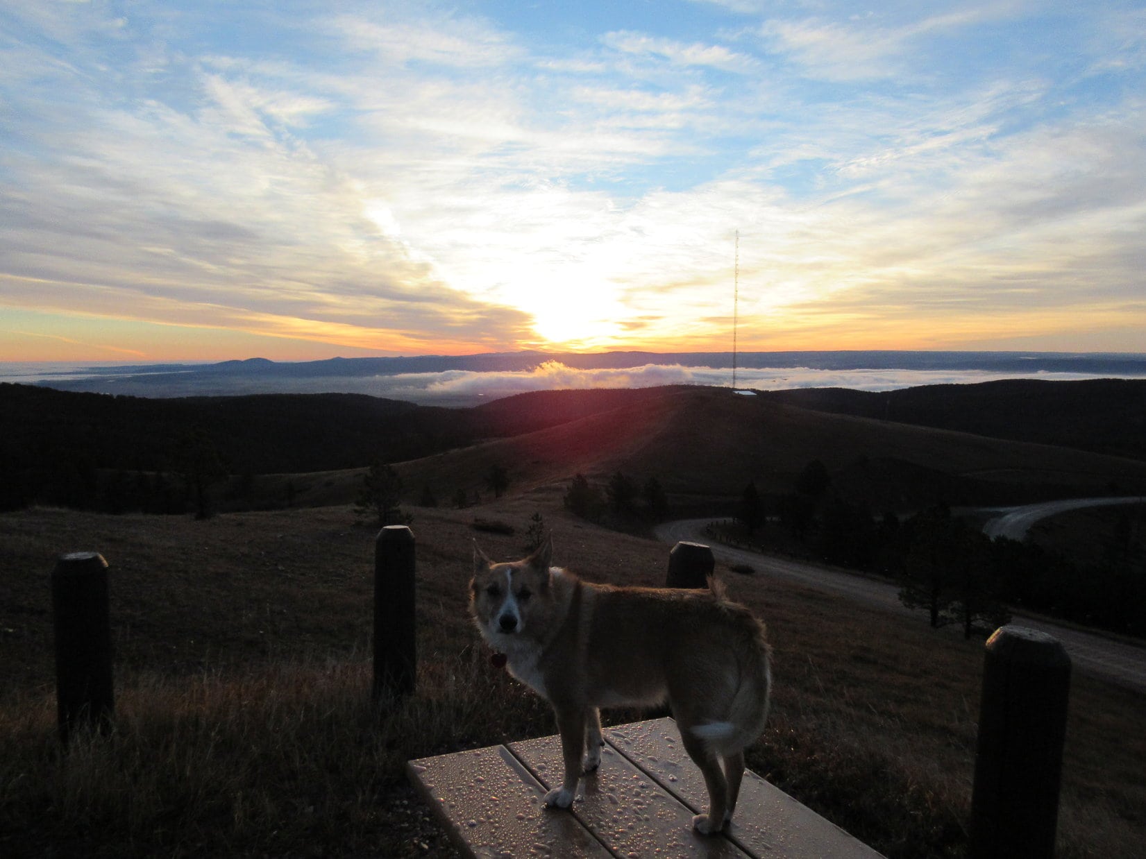
It was surprisingly cool up at Warren Peaks.  A massive cloud hung over the region hiding the view of the Black Hills way over in South Dakota.  Dave climbed the fire lookout tower as far as it was possible to go, but access to the platform around the ranger’s quarters was locked.  Not to be outdone, even Lupe climbed the tower, which she doesn’t normally like to do.

Dave and Lupe near the Warren Peaks lookout tower.
The Black Hills of South Dakota were hidden by a cloud. Photo looks SE.

During the return to Devils Tower, SPHP took the paved roads, a longer route, so Dave could get a look at the town of Sundance.

Shhh!  Quit talking, SPHP.

Hmm?  What, Loop?

Be quiet!  You’ve put Dave to sleep.

Oh!  Umm, yeah.  I often have that affect on people, don’t I, Looper?  Guess I’ve got quite a soothing personality.

I suppose that’s one way of putting it.

Back at Devils Tower, Dave introduced Lupe and SPHP to a couple of climbing guides he’d met who happened to come along, then he had other business to attend to.  The first of 3 more friends that were going to climb Devils Tower with him was due in this evening.  So that was it for now, although Dave said he might be free again in a couple of days.

5-27-20, 4:50 PM, Devils Tower Trading Post

Fun seeing Dave again, wasn’t it, SPHP?

Sure was, Loopster.  Mighty nice of him to want to include us in his plans.

So what now?  Are we just going home?

Oh, I don’t know.  Not even 5:00 PM yet.  We still have permission from the Nuckolls to climb Missouri Buttes.  I think there’s still time.  Want to do that?

Absolutely!  Let’s go for it!

From Devils Tower, the entrance to the Nuckolls Ranch was a few miles N on Hwy 24, then another mile N and 4 miles W on Barlow Canyon Road.

At the turn off Barlow Canyon Road into the Nuckolls Ranch. Photo looks SW.
Of the 4 main Missouri Buttes, the 2 highest are on the privately owned Nuckolls Ranch.

As instructed while getting permission from Will Nuckolls to enter the ranch in order to visit the Missouri Buttes, SPHP drove S past 2 homes and a number of outbuildings, ultimately parking the G6 beyond them nearly 1.5 miles S of Barlow Canyon Road.

A pickup truck full of Nuckolls driven by family matriarch, Thea Nuckolls, appeared within minutes.  Lupe was several hours later than SPHP had told them to expect her, but that wasn’t a problem.  A friendly conversation, and they were on their way.

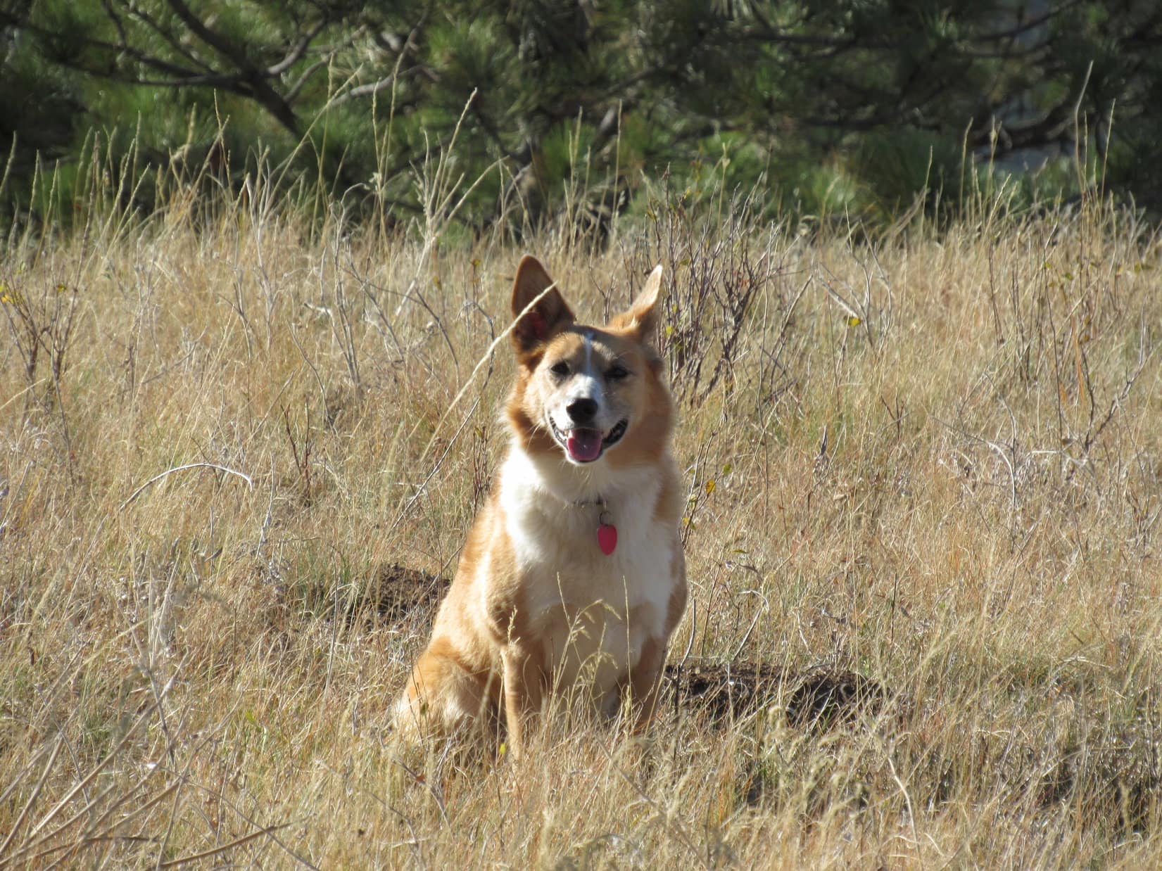
Lupe was too!  She struck out for the Missouri Buttes following a dirt ranch road S.

Come on! The NE Missouri Butte is only 1.5 miles away!

The road curved slightly to the R as it went up a mostly forested valley.  Lupe quickly came to an old water tank.  The main road curved sharply R (NW) here, but the Carolina Dog continued SSW past the water tank a short distance into a more open part of the valley.  Within a few hundred feet, the valley branched.  Loop took the R (SW) branch instead of going straight ahead.

We’re not far beyond the water tank now. The valley divides here. We’ll take the branch to the R. Photo looks SSW.

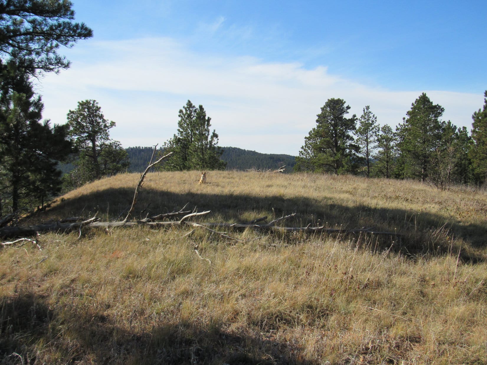
After just a few minutes, Lupe turned S entering the forest and starting to climb.  The remnant of a road curved L around to a clearing on the E side of hill.  This looked like a good spot to leave the valley.  A quick romp up the hill got Looper up to a narrow, gently rounded ridge.

Starting up the hill. Photo looks SW.
Up on the ridgeline. Photo looks SSW.
View from the ridge. Photo looks E.

Following the ridgeline SSW, the Carolina Dog continued to gain a little elevation.  However, that didn’t last long.  The ridge soon leveled out as it widened out.  Lupe passed through an open forest.  A few minutes got her beyond the pines.  She was now on a broad plateau with a fenced field just ahead.  Well beyond the field stood the NW Missouri Butte (5,374 ft.), the highest one of all.

Thar she blows! That’s the NW Missouri Butte, our primary objective! Photo looks SW.

Without entering the big field, Lupe followed the fence line L (SE).  Along the way she went through another section of open woods.  Almost at the end, she crossed a little ravine before ducking under a fence.  Loopster wasn’t far at all from the NE Missouri Butte (5,212 ft.) now.

Approaching the NE Missouri Butte. Photo looks S.

Since it was getting late in the day, and climbing the higher NW butte was top priority, Lupe turned WSW heading for it instead.

Heading for the NW butte (R). Photo looks WSW.
We’re almost there! Photo looks WSW.

Lupe soon reached a stock pond at the base of the NW Missouri Butte.  Looking at the mountain from here, a large patch of orange lichens was visible near the top of the N face.

By the stock pond just N of the NW Missouri Butte. Photo looks W.
NW Missouri Butte from the pond. Photo looks S.

The American Dingo had been here once before.  In November 2016, back when J.W. Nuckolls was still alive, he had told SPHP the best way up the mountain.

The gist of it is this:  Climb the talus slope to the base of the rock wall on the N face just below the orange lichens.  From there go L (E) following a steep ramp of vegetation higher.  At the top of the ramp, a short trail wraps around to the E side where it goes 40 or 50 feet to a spot where it’s easy to clamber up onto the lower E end of the summit.  A short walk through junipers and cacti goes past a small tower to the true summit near the W end.

N face of the NW Butte. Best route – get as close to the orange lichens (Center) as possible, then follow the vegetation steeply up to the L. Photo looks S with help from the telephoto lens.
The NE Missouri Butte (R) from above the pond. Photo looks E.

Part of the talus could be avoided by staying to the NW close to a fence line, so that’s what Lupe did.  As it turned out, she could have avoided even more talus if she’d actually crossed the fence.  Not really a big deal, though, either way.  Soon the Carolina Dog was on the rocks.

Here we go! We’ll head toward the L from here, climbing all the way. Photo looks SSE.

Even though SPHP knew the best route, Lupe didn’t go quite far enough L (E) to come up below the orange lichens.  She wound up in a wide NW chute that was so steep SPHP almost felt compelled to retreat to correct the error.

In a steep, rocky chute on the NW flank. That’s the summit just above! Photo looks S.

Certainly not the best route, but the super steep part at the uppermost end of the chute went only 10 or 15 feet higher.  Without assistance, the Carolina Dog quickly scrambled to the top.  She’d come up right at the true summit rock!

Whew! That last bit was a little scary! Lupe at the true summit of the highest (NW) Missouri Butte. Photo looks NE.

A Missouri Butte survey benchmark No. 2 was visible along the W edge 10 or 15 feet from the true summit.

The survey benchmark is the bright spot near the big rock at far L. Photo looks NW.
Survey benchmark No. 2. No attempt was made to find any others.
Loopster at the true summit of Missouri Buttes. Photo looks NW.

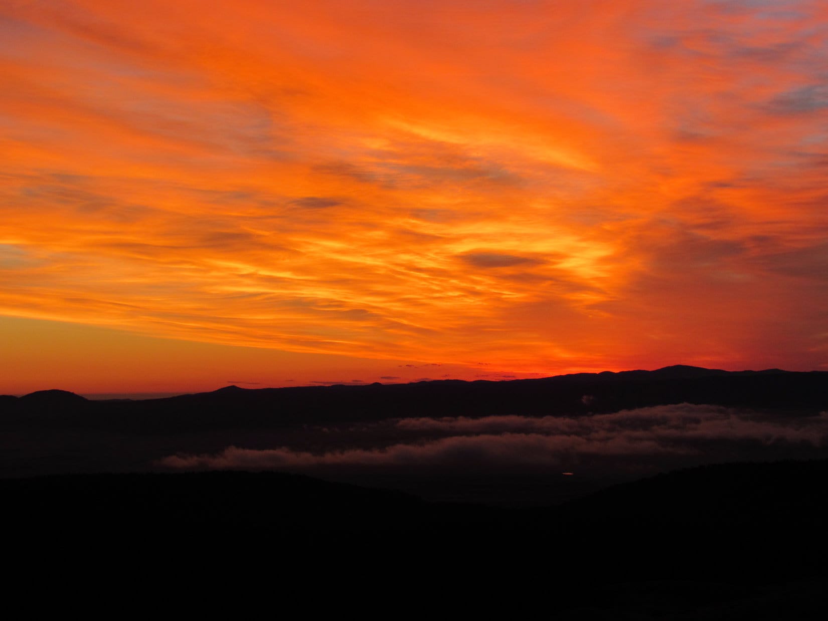
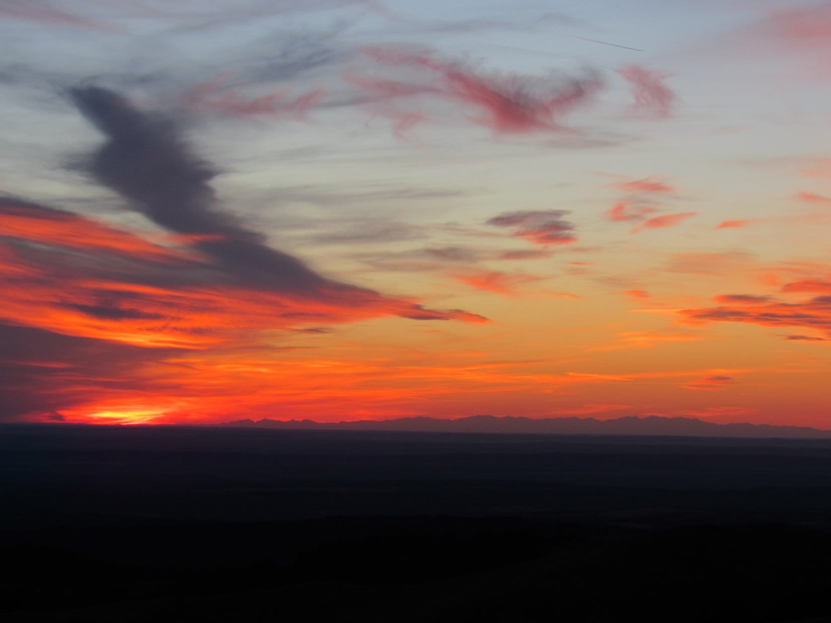
5-27-20, 6:54 PM, 57ºF – Such a gorgeous evening!  The views from the NW Missouri Butte were tremendous.  Off to the W, Lupe could see a huge expanse of flatlands dotted with ponds gleaming in the sunlight.  To the N were pine-covered ridges, but nothing nearly as high as where the Carolina Dog was now.

Just as in 2016, the summit region harbored lots of cacti.  Lupe was aware of it, and didn’t want to move around much.  Between all the rocks and cacti, she had a hard time finding a comfortable spot, but did finally settle down for a while.  A light breeze blew out of the W.  Loop and SPHP shared several small chocolate coconut granola bars.

Taking it easy on Missouri Buttes. Photo looks NNW.

A pleasant half hour drifted by.  Unfortunately, the sun wouldn’t be up an awful lot longer.  Since Loopster still hoped to climb the NE Missouri Butte, it was time to get going.  Lupe returned briefly to the summit rock.

A shame Dave was too tired to join us here. I think he might have liked Missouri Buttes! Final moments on the summit rock. Photo looks ENE.

The NW butte’s summit region was a fairly large area.  Juniper bushes hid the views to the E and S from the true summit.  Before departing, it would be fun to see the two lowest Missouri Buttes and Missouri Butte Lake, which were all toward the S.  Due to all the cacti, SPHP carried Lupe more than 100 feet to the lower SW edge.

Missouri Butte Lake. Photo looks SW.
The 2 lowest Missouri Buttes. SE Butte (L) and SW Butte (R). Both are over 5,000 ft. Photo looks S.
Loop near the SW end of the summit region. Photo looks NNE back toward the top.

After a good look around from the SW end, SPHP subsequently had to cart the American Dingo back up to the summit.

Enjoying a few more moments at the top while SPHP takes a breather. Photo looks ENE.

No more dilly-dallying!  SPHP lugged the Carolina Dog to the E end of the summit.  This was even farther, a good 200 or 300 feet.  The view to the SE was certainly worth it!  Devils Tower (5,112 ft.) was in sight.  Lupe got to see the top of Devils Tower before Dave Covill did, albeit from more than 3.5 miles away.

The NE Missouri Butte (5,212 ft.) was also in sight much closer at paw.  Might still be time enough to climb it, if Loop hurried!

NE Missouri Butte (L) and Devil’s Tower (R). Photo looks ESE.
Devils Tower. The high point on the horizon is Warren Peaks. Photo looks SE.
Lupe could see the top of Devils Tower without having to scale that scary overgrown tree stump!
Lovely, but we better get with it and hurry over to the NE Missouri Butte! Photo looks E.

During the descent, Lupe took the slightly longer, but much safer route originally recommended by Mr. Nuckolls.

Loopster where the faint trail reaches the E end of the summit region. The trail extends toward the camera. Photo looks S.
At the NE pass. Photo looks NW.
The N face from the pass. Photo looks WSW.
Coming down the steep ramp. Photo looks ENE.
Descending the talus slope. Photo looks NE.

It took a while to get down.  By the time Lupe was approaching the W end of the NE Missouri Butte, the sun was on the horizon.

Approaching the NE Missouri Butte. Photo looks E.
Looking back. The NW Missouri Butte at sunset. Photo looks W.
Sunset in Wyoming.

The climb up the W end of the NE Butte was fairly steep, but nothing like the NW Butte had been.  Just a matter of how quickly SPHP could do it.  Once the terrain began to level out, Lupe roamed E in open forest.  The true summit was one of a couple of good-sized rocks near the far E end.  Light was fading fast by the time the Carolina Dog got there.

SPHP was glad to see that the old thin cross that had been here during Lupe’s first ascent more than 3.5 years ago was still standing.  Of course, the big attraction was the view of Devils Tower, which was 0.5 mile closer here than back at the NW Butte.

At the first of the two highest rocks. Photo looks SSE.
We’re 0.5 mile closer to Devils Tower (L) here. Photo looks SSE.
Made it just in time! The camera is still doing a good job of brightening the scene up in low light conditions. Photo looks SE.
Sweet view of Devils Tower! Hope you’ve enjoyed this tour of the Missouri Buttes!

Sadly, 5 minutes at the top was it.  Getting pretty dark now.  Lupe left the summit of the NE Butte.  The flashlight had to come out before she was even completely down off the mountain.  As stars began twinkling in the evening sky, Loop and SPHP headed back to the G6.  Between seeing Dave Covill and visiting the Missouri Buttes, it had been a memorable day!  (10:06 PM, 44ºF)

5-31-20, 8:52 AM, 68ºF, Sylvan Lake in Custer State Park, SD – Turned out the fun Dave Covill had initiated wasn’t over!  After a successful ascent of Devils Tower with 3 of his buddies, Dave came down to the Black Hills in South Dakota.  As Lead Director of the Highpointers Foundation, he had business to attend to inspecting the installation of a beautiful bench along Trail No. 4 in the the Black Elk Wilderness.  Dave kindly invited Lupe and SPHP to come along.

The plan was to go from Sylvan Lake up Trail No. 9, which went past an older, similar bench also provided by the Highpointers Foundation.  From there Lupe would get to summit Black Elk Peak (7,242 ft.) before making a loop back along Trail No. 4.

Dave Covill and Lupe at the first bench along Trail No. 9.
Black Elk Peak (R of Center in the distance) from the viewpoint close to the first bench. Photo looks NE.
At the only creek crossing along Trail No. 9.

Everything went as planned.  An hour later Lupe was approaching the old fire lookout tower on Black Elk Peak, the highest mountain in South Dakota.  The Highpointers Foundation had helped pay for restoration work, including new windows in the top of the tower.

Practically to the top now! Those are the Cathedral Spires (6,840 ft.) (L) and Little Devils Tower (6,960 ft.) is the big knob seen just L of my head. Photo looks SSW.
Approaching the old fire lookout tower on Black Elk Peak. Photo looks N.
On the rock wall around the lookout tower’s viewing deck. Photo looks W.

Dave maintained that the highest natural point on Black Elk Peak was just outside the N wall of the lookout tower.  Since the Highpointers Foundation is dedicated to education, support, and conservation of the highest point in each of the 50 U.S. states, Lupe figured Dave ought to know.  The Carolina Dog made the little scramble up to it.

Looper at South Dakota’s natural high point.

Black Elk Peak wasn’t crowded, but it was busy.  A nice 25 minute stay, and it was time to let others enjoy a bit more serenity.  Besides, Dave needed to get over to that new bench along Trail No. 4!

As South Dakota’s high point, Black Elk Peak is one of the most popular hikes in the Black Hills! Guess we’re about to head out again now. Photo looks SSE.
Heading down the metal stairway that used to freak Lupe out. After 9 ascents, she’s fine with it now. Photo looks SE.

Trail No. 4 passes between the Cathedral Spires (6840 ft.) and Little Devils Tower (6,960 ft.).  At a point with a view of Black Elk Peak a mile to the N, Lupe came to the beautiful new bench donated by the Maura and Karen Raffensperger families and the Highpointers Foundation in memory of Grace Underwood Raffensperger.  Many years ago, Grace had homesteaded in the Black Hills.

Lupe tests out the lovely new Grace Raffensperger bench along Trail No. 4.
The Cathedral Spires are this close to the Raffensperger bench!

5-31-20, 1:12 PM, 80ºF, Sylvan Lake – Back at Sylvan Lake, it was time for good-byes.  Dave had to hit the road home to Colorado, and was soon on his way.

Last day of May already!  Thanks to Dave’s visit, Lupe had finally gotten her 2020 mountain adventures off to a good, but much delayed start.  With June just hours away, the Carolina Dog once again had high hopes for a spectacular Summer of 2020!

With Dave Covill at the Raffensperger bench along Trail No. 4, Black Elk Wilderness, South Dakota 5-31-20
Dave Covill (L) on Devils Tower 5-29-20 with friends Justin Schaffer (L), Stephen Henry (R) in back, and Sheryl Lampert in front. Guide Lansdon Alcorn (far R). Missouri Buttes in the distance.

Links:

Next Black Hills Expedition                 Prior Black Hills Adventure

Black Hills, SD Expedition No. 181 – Missouri Buttes, WY (11-6-16)

Highpointers Foundation

Nuckolls Ranch on Facebook

Devils Tower National Monument

The Legend of Devils Tower

Climb Devils Tower!Devils Tower Lodge

Want more Lupe adventures?  Check out Lupe’s Black Hills, SD & WY Expeditions Adventure Index, Master Adventure Index, or subscribe free to new Lupe adventures!

Black Hills, WY Expedition No. 180 – Warren Peaks, Bull Hill, Ragged Top & Lone Tree Hill (10-30-16)

Fog!  Must be just a ground fog, though.  Stars could still be seen above.  With any luck at all, we’ll drive out of it, Loop.  Lupe whined.  She couldn’t see them, but she could smell ’em.  Cows were hidden out there in the foggy darkness!  The Carolina Dog barked, leaping from window to window trying to catch sight of them.

On the way up to Warren Peaks, the G6 did emerge from the fog.  Lupe was going to get to see sunrise from the highest point in the Bear Lodge Mountains after all!

Sunrise from Warren Peaks. The dark outline of the Black Hills in South Dakota is on the horizon. Photo looks ESE.

It was cool and a bit windy when Lupe arrived up on Warren Peaks (6,650 ft.) (7:18 AM, 38°F).  For almost the end of October, conditions were actually exceptionally nice.  Off to the ENE, Lupe could see a thin layer of very low clouds.  That had to be part of the fog she’d gone through to get here.  To the W, the Bear Lodge Mountains were acting like a dam, holding back a sea of more substantial low clouds.

Very low, thin clouds were in view to the ENE. They were part of the ground fog Lupe had traveled through to get here. Photo looks ENE.
Lupe on the highest rocks on the mountain near the Warren Peaks fire lookout tower.

Lupe and SPHP watched the sunrise develop.  Just for fun, Lupe took a little stroll down to a slightly lower hill SE of the fire tower.

The Warren Peaks fire tower from the barren hill to the SE.

Lupe returned to the summit of Warren Peaks.  Sunrise was taking longer than anticipated.  The sun was above the horizon, but obscured by clouds.  SPHP was still interested in watching the display, but Lupe was ready for action!

The sun was up, but obscured by clouds.
Lupe on a picnic table waiting for SPHP to lose interest in the sunrise. It was time to get going!

This was Lupe’s third expedition in a row to the Bear Lodge Mountains in NE Wyoming.  Once again, she had 3 peakbagging goals for the day.  The first one was Bull Hill, only a mile N of Warren Peaks.

The big rounded partly bare hill seen beyond Lupe is Bull Hill, Lupe’s first peakbagging goal on Expedition No. 180. This photo was taken a week before when Lupe visited Warren Peaks on Expedition No. 179. Photo looks N from Warren Peaks.

When SPHP finally quit dawdling watching the sunrise, Lupe and SPHP drove N on USFS Road No. 838.  Before going to Bull Hill, SPHP wanted to check out a viewpoint a short distance NW of Warren Peaks, the same viewpoint where Lupe had seen Devils Tower and Missouri Buttes in twilight at the end of the day on Expedition No. 179.  Now that it was morning, maybe it would be possible to get a clearer view?  (7:49 AM, 38°F)

Heh.  No view at all.  The white sea of low clouds trapped to the W of the Bear Lodge Mountains blanketed all of the territory in that direction.  Lupe and SPHP went on.  SPHP parked the G6 near the intersection of USFS Roads No. 838 and No. 847 (8:06 AM, 38°F).

Getting to Bull Hill (6,394 ft.) was easy.  Lupe trotted E down USFS Road No. 847 to a side road with a Bull Hill Road sign.  She followed Bull Hill Road around the N side of a forested ridge, then SE up the Whitetail Creek valley.  Bull Hill Road curved E, going up and over a saddle.  At the saddle, Lupe was directly S of Bull Hill.  She left the road, climbing up a pasture to the open forest at the top of the mountain.

Lupe on Bull Hill. The fire tower on Warren Peaks is seen in the distance. The cairn and pipe next to Lupe were a little W of the highest point on Bull Hill. Photo looks S.
Lupe stands near the highest point on Bull Hill. Photo looks ENE.

Lupe and SPHP explored the top of Bull Hill.  Toward the E was a nice view of Crow Peak (5,787 ft.) in South Dakota, but Lupe had just seen essentially the same view from even higher Warren Peaks.  After a short stay on Bull Hill, Lupe headed back to the G6 (9:31 AM, 45°F).

Lupe’s next peakbagging goal, Ragged Top, was back to the S a few miles, not really all that far away.  After a short drive, SPHP parked the G6 at the intersection of USFS Road No. 838 and an unmarked road on the E side of No. 838.  (This intersection is a few hundred feet N of the start of No. 838.1B on the W side of No. 838, and marked as 6,374 ft. elevation on the Peakbagger.com topo map.)

To get to Ragged Top (6,260 ft.), Lupe didn’t really have to gain any elevation at all.  In fact, she would lose a little on the way there.  Ragged Top is the high point at the SW end of a mile long ridge.  The G6 was already parked near the higher NE end of the ridge.  Lupe cut through the forest on the W side of USFS Road No. 838 to reach No. 838.1B.  She followed the road SW toward Ragged Top.

Lupe on USFS Road No. 838.1B on her way to Ragged Top. Photo looks SW.

USFS Road No. 838.1B ended at a meadow at a high point.  Lupe was more than half way to Ragged Top, but would have to do some bushwhacking from here.  American Dingoes are great at bushwhacking!  Lupe descended into a saddle leading to a lower forested hill along the ridge.

Lupe in the meadow where USFS Road No. 838.1B ended. She was a little over halfway to Ragged Top here. Next she had to descend into the saddle leading to the forested hill seen beyond her. That hill was part of the main ridgeline leading to Ragged Top, and where she would encounter the first significant rock outcroppings on the way. Photo looks SW.

The saddle area was forested, too.  What’s more, the forest floor was densely carpeted with low juniper bushes.  Lupe found easier traveling over less vegetated ground along the SE side of the ridge.  When Lupe climbed up the forested hill on the SW side of the saddle, she reached the first significant rock outcroppings.

Lupe on the first significant rock outcropping she encountered on her way to Ragged Top. Photo looks SW.

From here on, the now undulating ridge to Ragged Top was much narrower than before.  Lupe passed by, or went over, several more rock formations along the way.  The last part of the ridge turned S as Lupe approached the final high point – the small summit known as Ragged Top.  Soon Lupe was surveying the situation from the top of Ragged Top.

Lupe surveys the world from the top of Ragged Top! Photo looks N.
Lupe on Ragged Top. Photo looks NE.

The best views were actually from rocks farther S where the ridge ended.  Lupe could see both Inyan Kara (6,360 ft.) and Sundance Mountain (5,824 ft.) beyond a bank of clouds sneaking out to the E from the sea of clouds to the W.

Inyan Kara (Center - on the horizon) from a bit S of the Ragged Top summit. Photo looks S.
Inyan Kara (Center – on the horizon) from a bit S of the Ragged Top summit. Photo looks S.
Sundance Mountain (L just beyond the clouds). Photo looks SE.

Lupe was still at the S viewpoint, when a sudden loud explosion echoed up from the valley below!  Gunfire!  Lupe ran to SPHP.  That was it for the photo session.  More gunfire rang out every few minutes.  No way Lupe was letting SPHP get more than a foot away.  The final photo of the Ragged Top summit, taken from the S, had to be Lupe-less.

S face of the Ragged Top summit. There was supposed to be a courageous Carolina Dog poised dramatically atop the highest rocks, but loud gunfire put an end to that notion. Photo looks N.

Lupe had made it to Ragged Top, but she didn’t want to be there now!  With gunfire going on sporadically, all she wanted to do was hide.  Time to get the Carolina Dog out of here!  SPHP led the way back to the G6.

When Lupe reached the forested saddle again, she decided to slink along hidden pathways between the low juniper bushes that dominated the forest floor.  In this manner, she slunk along all by herself clear up to the edge of the meadow where USFS Road No. 838.1B had ended.  As far as the American Dingo was concerned, her slinking worked just fine!  Lupe didn’t get shot.  Not even once.

At the meadow, Lupe and SPHP took a break.  Lupe curled up on SPHP’s lap, so SPHP could pet her and hold her.  This was most reassuring.  It certainly helped that the gunfire stopped, too.  Lupe and SPHP shared a chocolate coconut granola bar.  Things were looking up!  Things were also looking like a mess.  SPHP noticed Lupe treasures scattered along the edge of the forest.

Cleanup ensued.  As Lupe and SPHP continued back to the G6, more Lupe treasures were encountered, this time in the form of empty shotgun shells.  By the time Lupe was back at the G6 (12:07 PM, 55°F), she had two grocery sacks full of treasures.

Warren Peaks from near USFS Road No. 838.1B on the way back to the G6. Photo looks N.

Lupe had one more peakbagging goal for Expedition No. 180, but it was a long way N from here.  On the way, Lupe and SPHP stopped again (12:15 PM, 55°F) at the viewpoint NW of Warren Peaks where she had seen Devils Tower (5,112 ft.) and Missouri Buttes (5,374 ft.) a week ago.

The clouds were gone!  Devils Tower and Missouri Buttes were in view to the NW.  The air was rather hazy, but it was much easier to see them now than at sundown last week.

Devils Tower and Missouri Buttes from the viewpoint NW of Warren Peaks. Photo looks NW using the telephoto lens.

Lupe had a great time in the G6 traveling N to start her journey to her 3rd and final peakbagging goal of the day.  She rode with her head out the window, with the wind in her face.  She saw lots of deer in the forest, plus cows to bark at near Hwy 24.

When SPHP finally parked the G6 (1:17 PM, 61°F) again, Lupe recognized this place.  She had been here before.  She was at the intersection of Planting Spring Road (USFS Road No. 881.1) and USFS Road No. 830.  Two weeks ago on Expedition No. 178, she had stumbled onto this junction on her way to Bald Mountain (4,800 ft.).  Now it was the starting point for her journey to Lone Tree Hill (4,600 ft.).

The first part of Lupe’s route to Lone Tree Hill she had already been on before.  Lupe and SPHP set out going WNW on USFS Road No. 881.1.  Almost right away, Lupe passed by a rather elaborate tent and camper setup on the N side of the road.  Several guys planning on going deer hunting occupied the camp.

Once past the hunters, Lupe had a blast running around in the woods along No. 881.1.  She made good time to the intersection with USFS Road No. 881.1A, which leads to Bald Mountain.  Lupe did not take the turn to Bald Mountain, staying instead on No. 881.1.  The road quickly turned N.

No. 881.1 eventually angled NW for a while.  When it finally turned W, Lupe could see sky between trees at the far end of a slight rise ahead.  Lupe was about to reach the W edge of the large flat ridge she had been traveling along.  Lone Tree Hill (4,600 ft.) was supposed to be off to the NW beyond the edge of the ridge.  Would she be able to see it?

The Peakbagger.com topo map showed No. 881.1 ending (near elevation 4,768 ft.) before reaching the edge of the ridge.  The road didn’t actually end.  Instead, it curved SW on its way down to a somewhat lower area.  Lupe and SPHP left the road going W through the forest, and up the slight rise.

Lupe reaches the W edge of the big, relatively flat ridge she had been traveling. This photo looks SW, the only direction with a relatively clear view. Devils Tower is seen faintly on the horizon above Lupe’s ear. Missouri Buttes are on the R.

Lupe arrived at the edge of a N/S running line of small cliffs.  There weren’t any discernable breaks in the cliff line.  Due to the forest, the only relatively clear view was off toward the SW, where Lupe could see Devils Tower and Missouri Buttes on the far horizon.

It was hard to see between the trees, but there did seem to be a large hill off to the NW where Lone Tree Hill should be.  That had to be it!  Lone Tree Hill appeared to be poorly named.  Although some of the slopes below the line of rock at the summit were bare or sparsely forested, there were plenty of trees on Lone Tree Hill.

Aptly named or not, from a distance Lone Tree Hill looked like an easy climb.  There was one problem, though.  Lone Tree Hill stood off by itself a mile NW of the ridge Lupe was on.  How could Lupe get safely down off these cliffs to cross the low ground between here and there?

The topo map showed only one semi-promising route nearby.  A ravine to the NE trended W to the lower ground Lupe needed to reach.  SPHP hesitated.  No. 881.1 had turned SW where Lupe had left it, heading down toward lower territory, too.  Maybe the road would take Lupe safely down below the cliffs?  That might be a lot easier than bushwhacking through a steep ravine!

Lupe and SPHP left the cliff edge to return to No. 881.1.  Once there, Lupe followed it SW.  The road lost some elevation, but then started to level out and turn S.  It looked like it was going to continue S, staying above a band of cliffs.  Hmmm.  Not good.  Lupe left the road briefly, entering a small ravine leading W.  No dice.  The ravine quickly cliffed out.  The drop was only 15 or 20 feet.  Didn’t matter, it may as well have been 10 times that much.

OK.  The ravine to the NE really was the only reasonable possibility.  Of course, there must be other routes, but they would all be significantly longer.  Lupe had made good time getting to the cliffs.  Even so, it was late enough in the day so the amount of time left before sunset was something to keep in mind.  The afternoon was clouding up.  It wouldn’t be a good idea to still be wandering around in a trackless forest trying to find and bushwhack back up a steep ravine after dark, especially with no moon or stars to help stay oriented.

Better get a move on!  Lupe and SPHP headed back up the road.  Lupe regained all her lost elevation, before leaving the road again to go try the ravine to the NE.  The ravine started out fine.  Gradually, Lupe lost elevation again.  She found an animal trail to follow.  Rock formations appeared on the slopes of the ravine, but Lupe didn’t come to any cliffs on the way W.

The NE ravine route worked!  Lupe lost over 400 feet of elevation.  She found herself safely down in a tall grove of white-barked aspens where the ground leveled out.  She was actually having a great time exploring this remote forest.  SPHP was confident Lupe was going to successfully climb Lone Tree Hill now!

Lupe had been going W down the ravine.  Now it was time to turn NW.  The tall aspens gave way to a forest of scrub oak.  Lupe romped around among fallen leaves looking for squirrels in the oak trees.  She found several squirrels, much to her delight and the squirrels’ annoyance.  Sometimes scrub oaks grow in dense clusters, but this forest was more open than that.  It wasn’t hard to move around.  Lupe was making great progress again.

Exploring the scrub oak forest.

Lupe turned N upon reaching a long saddle leading to Lone Tree Hill’s S Ridge.  By climbing the S ridge, Lupe could get to the lower E end of Lone Tree Hill’s summit ridge.  As Lupe progressed along the saddle, she encountered areas of open ground interspersed between stands of forest.

Lupe was making progress! As she got to the saddle leading to Lone Tree Hill’s S ridge, she came to this view of Lone Tree Hill up ahead. Photo looks NNW.

Lupe reached the S ridge.  Her climb up Lone Tree Hill was about to begin in earnest.  She immediately encountered a new obstacle.  The scrub oak forest was now behind her, and the S ridge leading up was all pine forest.  At least it had been.  The pine forest was devastated!

A tangle of dead trees, most laying perpendicular to Lupe’s route, was blocking the way forward.  It looked like a tornado had hit this place!  The trunks of many trees had simply snapped.

As Lupe started her climb up the S ridge, her route was blocked by a devastated pine forest.

Progress became excruciatingly slow, as Lupe and SPHP struggled over, under, and around the deadfall timber.  Fortunately, the S ridge wasn’t very long.  Lupe only had to gain 200 feet of elevation to reach the lower E end of Lone Tree Hill’s summit ridge.  This was taking forever, though!  SPHP started to worry about how much time was going by.

Slowly, ever so slowly, Lupe and SPHP picked a way up through the shattered forest.  “Lone Tree” Hill, indeed!  If, only!  That “Lone Tree” term had been used rather loosely, hadn’t it?  As in, “Lone Tree” means less than 10,000 trees.  Silly SPHP had been expecting like, maybe, one tree – perhaps a few more, if one counted little trees springing up around the big one.  Not this!  Who had named this place, anyway?  Must have been an Indian 300 years ago.  The name hadn’t been justified in at least that long.

As Lupe starting getting close to the E ridge, the deadfall gradually diminished.  Then, finally, she was out of it.  Hallelujah!  Lupe reached the lower E end of Lone Tree Hill’s summit ridge.  The top of the mountain was in view not too far to the W.

Lupe reaches the lower E section of Lone Tree Hill's main E/W trending summit ridge. The top of the mountain is in view to the W. Photo looks W.
Lupe reaches the lower E section of Lone Tree Hill’s main E/W trending summit ridge. The top of the mountain is in view to the W. Photo looks W.
Getting closer! There was actually a fair amount of deadfall timber near the top of Lone Tree Hill, but nothing like what Lupe had already come through on the S ridge.

Lupe started making good progress again.  She headed for the higher W portion of Lone Tree Hill’s summit ridge.  Near the top, she encountered more deadfall timber.  The deadfall slowed SPHP down, but not Lupe.  Lupe went straight to the top of the mountain.  She had made it!  Lupe stood on the summit of Lone Tree Hill.

Lupe reaches the summit of Lone Tree Hill! Photo looks SE in the direction she came from to get here. The ravine she came down along the distant ridge is a bit hard to see from this angle, but is almost directly above her. Just to the L of that ravine is the part of the big flat ridge where the Peakbagger.com topo map shows High Point 4801.
Looking S from the true summit.

The true summit of Lone Tree Hill was a bit W of where Lupe had come up.  The mountain featured a band of rock and very small cliffs along the S edge of the summit ridge.  Views toward the S were generally quite good.  By moving around the summit, it was possible to see a long way in almost any direction.

The S edge of the summit ridge featured a band of very small orange-yellow cliffs. Photo looks ESE toward High Point 4801 (R).
The top of Lone Tree Hill had some deadfall timber, but it wasn’t too bad. Photo looks E.

The far W end of the summit ridge was a bit lower than the rest of it, but had hardly any trees.  Lupe had a 270° panoramic view from here!  It was a great place to take a break, and celebrate Lupe’s final peakbagging success of the day.

Lupe reaches the far W end of the Lone Tree Hill summit ridge. She had 270° panoramic views from here. Missouri Buttes are on the far horizon directly above Lupe. The top of Devils Tower pokes above the forested ridge on the L. Photo looks SW.
Looking SSW.
Looking SSW.
Looking NW.
Looking NW.

Lupe and SPHP shared water and chocolate coconut granola bars.  Lupe had her Taste of the Wild.  SPHP consumed an apple.  The sun was getting lower, but Lupe would have time to get back to the road before dark.  Actually, it was getting hard to even tell where the sun was.  The sky, which had been at least partly sunny and blue in the morning, was now a boring, indistinct, gray smudge in almost every direction.

Lupe lingered on Lone Tree Hill as long as possible.  Best to enjoy the moment!  Lone Tree Hill was the type of small peakbagging objective that Lupe might well never ever return to again.  It was sort of far from home, sort of hard to get to, and there are higher and more dramatic places to go.

Yet, being on Lone Tree Hill was great!  The sweeping views of the wide open spaces, forested hills, and long dark ridges of remote NE Wyoming were wonderful.  And even if the pine trees weren’t alone on Lone Tree Hill, Lupe and SPHP were.  The solitude and serenity was unbroken, except by the distant mooing of cattle and occasional twittering of small birds.  Lone Tree Hill was good for the spirit.

As it always does, the time came to start for home.  No devastated S ridge for Lupe this time, though!  It would be much easier to head right on down the mostly barren S slope of the mountain from the W end of the summit ridge.  Lupe was ready.  The return trip was something to look forward to, too!

Lupe starts down Lone Tree Hill, eager for more adventures on the long way back to the G6.

The busy American Dingo made the most of the return trip.  She stopped frequently on her way down the mountain to scan the scene below.  She streaked across meadows, sniffed around in forests, barked at squirrels, saw some deer, found and climbed back up the ravine onto the big ridge, ultimately returning to USFS Road No. 881.1.  She traveled the road in fading light, as the forest darkened and grew more mysterious around her.

Lupe on her way back from Lone Tree Hill. Photo looks N.

The deer hunters were in their big tent, talking and laughing, when Lupe passed by again.  Brightly glowing light escaped the tent at various openings.  Smoke drifted out a black smokestack.  Sounded like good times going on inside.

The hunters didn’t see the American Dingo trot by.  She was almost to the G6 (6:09 PM, 54°F), her day’s adventures nearly over, destined for a long ride home to a late Alpo dinner, warm bed, and sweet dreams of a day spent alive and free in the Bear Lodge Mountains of Wyoming.

Lupe on the way back, in the scrub oak forest SE of Lone Tree Hill.
In the scrub oak forest SE of Lone Tree Hill.

Note:  Lupe treasures gathered on Black Hills, WY Expedition No. 180 included 19 aluminum cans, 9 plastic bottles, 3 glass bottles, 48 shotgun shells.

Links:

Next Black Hills Expedition                 Prior Black Hills Expedition

Want more Lupe adventures?  Choose from Lupe’s Black Hills Expeditions Adventure Index or Master Adventure Index.  Or subscribe free to new Lupe adventures.

Black Hills, WY Expedition No. 179 – Warren Peaks, Black Hills, Sherrard Hill & Cook Lake (10-23-16)

Hah!  How’s this for peakbagging the easy way, Loop?  SPHP turned off the engine.  The G6 was parked at the base of the Warren Peaks fire lookout tower (8:23 AM, 38°F).  Lupe was already at the top of the mountain.  Feels like cheating, doesn’t it?  We didn’t have to do a thing.  Come on, Looper, lets take a look around!  Lupe was out of the G6 like a shot.

Lupe arrives at the base of the Warren Peaks, WY fire lookout tower.
Lupe near the Warren Peaks fire lookout tower. Photo looks WNW.

A light S breeze was blowing.  Clear skies and another unseasonably warm October day.  The panoramic views were terrific.  The Warren Peaks (6,656 ft.) fire lookout tower is atop the highest point in the Bear Lodge Mountains in NE Wyoming.  Lupe gazed out over miles and miles of high prairie far beyond the mountains.

When the light is right and the air is clear, you can see all the way to the Bighorn Mountains from here Loop!  The light wasn’t right.  A bit of haze was in the air.  Oh, well.

Looking SSW from Warren Peaks, the highest mountain in the Bear Lodge Mountains. The tower on the L is on High Point 6532.

Although Lupe was back to continue her peakbagging adventures in the Bear Lodge Mountains, Warren Peaks (6,656 ft.) wasn’t really one of her prime peakbagging goals for Expedition No. 179.  Lupe had been here twice before.  Warren Peaks was just a great viewpoint from which to start the day, conveniently located on the way to other objectives she’d never been to before.

Before leaving this terrific vantage point, SPHP stared off to the N trying to pick out Vision Peak (4,812 ft.) or Bald Mountain (4,800 ft.), where Lupe had been adventuring a week ago.  Nothing really stood out that SPHP could positively identify.  Neither did any of today’s objectives.  Most of the Bear Lodge Mountains just aren’t that rugged.

The big rounded hill seen beyond Lupe is Bull Hill. Photo looks N.
Bull Hill with a little help from the telephoto lens. Studying this photo after the fact, SPHP is 98.43% certain that Bald Mountain, where Lupe had been a week ago, is at the far L end of the most distant dark ridge seen on the R. (Not the faint ridge on the horizon.) Photo looks N.

Lupe and SPHP left Warren Peaks headed N on USFS Road No. 838.  At 9:04 AM (39°F), Lupe was leaping out of the G6 again, this time at the junction of USFS Roads No. 849 and 849.1A.  Lupe had two peakbagging objectives nearby.  They were two summits called the Black Hills.  (Not to be confused with the entire Black Hills range, which is hard not to do, since the identical names make it plenty confusing.)

Lupe set off for the Black Hills (East) (5,229 ft.) summit first, climbing toward the S in territory W of the N ridge.  At first, she encountered thickets of brush and small trees in a forest of mixed pine and aspen.  As Lupe gained elevation, the pines prevailed and most of the smaller stuff disappeared.  The terrain was unusually lumpy.  Lupe went up a series of small rises separated by little ravines or low spots.  Deer seemed to like this area, and Lupe saw quite a few of them.

The Black Hills (East) summit ridge runs roughly NW/SE.  Lupe reached a lower part of the ridgeline a bit WNW of a protruding rock outcropping of yellowish tan limestone, or perhaps sandstone.  This rock formation proved to be quite level on top, and runs the entire length of the summit ridge, which was hundreds of feet long.  Toward the SW, the rocks form a line of small cliffs.

Lupe sits on the yellowish tan limestone or sandstone rock outcropping at the NW end of the Black Hills (East) summit ridge.

From the NW end of the Black Hills (East) summit ridge, Lupe could see Black Hills (West) (5,323 ft.).  Black Hills (West) is almost 100 feet higher than Black Hills (East).  Lupe would be going over there next, but not until she finished exploring Black Hills (East).

Looking W toward the Black Hills (West) summit from the NW end of the Black Hills (East) summit ridge.

Lupe and SPHP traveled SE along the entire length of the Black Hills (East) summit ridge, staying near the line of cliffs.  Forest effectively hid the views in every direction, other than SW from the cliffs.  Even looking SW, higher forested ridges only a mile or two away were as far as Lupe could see.

Lupe at another viewpoint along the cliffs. Black Hills (West) is in view on the R. The scene seen here is typical of the only semi-distant views available from Black Hills (East). Photo looks W.

Close to the SE end of the Black Hills E summit ridge, a small pine tree was perched near the edge of the cliffs.  Ponderosa pines can grow in some of the most amazing places.  The little tree looked like it was growing straight out of the rocks!

Lupe near the SE end of the Black Hills (East) summit ridge. A small pine tree was growing right out of the rocks at the edge of the cliffs. Photo looks S.

The Black Hills (East) summit ridge was long, on the order of 800 feet long.  Having traveled the entire length of the ridge near the cliffs, it was time for Lupe to look for the true summit.  Since the entire area was quite flat, there wasn’t going to be any one easily identifiable point.

The summit ridge of Black Hills (East) was quite level and all forested. Parts of it were quite park-like as seen here. Photo looks WSW.

Although there was only a slight elevation difference, the highest area Lupe could find on Black Hills (East) seemed to be back closer to the middle of the summit ridge.  A somewhat elevated area was 50 to 100 feet NE of the cliffs.  This high ground was covered by a dense thicket of scrub oak trees.  Lupe had no views at all from here!

Lupe in the scrub oak thicket at the true summit (as near as she could find one) of Black Hills (East).

Having achieved her first peakbagging success of the day at Black Hills (East), it was time for Lupe to head for Black Hills (West).  To get there, she first had to go back down to the G6.

Lupe roughly retraced the same route she had taken up.  The many deer held Lupe’s attention much of the time, but she also found an interesting column of rock out in the middle of the forest.  Strangely enough, someone had drawn an odd face on it.

Lupe at a big column of rock she discovered going back down Black Hills (East). Although the column of rock was in an unlikely spot for visitors out in the middle of the forest, someone had drawn an odd face on it (seen right above Lupe in white).

Lupe reached the G6 at 10:36 AM.  She was surprised and puzzled when SPHP went right on by it.  However, her next peakbagging goal, Black Hills (West) was not far away.

Lupe and SPHP crossed USFS Road No. 849 and went down to Blacktail Creek.  Lupe reached the tiny creek near a tiny waterfall.  Of course, she paused for a not-so-tiny drink from the creek as she crossed it, prior to beginning her climb up Black Hills (West).

Near the tiny waterfall on Blacktail Creek.

Lupe’s path up Black Hills (West) was very direct.  She simply followed the long NE ridge, staying on the ridgeline a little above the cliffs to the SE.  Lupe’s entire climb was steadily up at a moderate pace.  As Lupe neared the summit, she found a big grassy meadow at the top of the mountain.  SPHP hoped the views would be better here than from Black Hills (East).

Lupe on top of Black Hills (West). Photo looks SSW.
The summit of Black Hills (West) was a grassy meadow. Photo looks SSW.

Unfortunately, the views from Black Hills (West) were rather disappointing.  The mountain wasn’t quite high enough for a good look at the most interesting sight.  Off to the WNW, Lupe had only a partial view of the Missouri Buttes (5,374 ft.) and top of Devils Tower (5,112 ft.).

Black Hills (West) wasn’t quite high enough for a good look at Missouri Buttes and Devils Tower. Photo looks WNW.
Missouri Buttes (R) and the top of Devils Tower (L) from Black Hills (West). Photo looks WNW using the telephoto lens.

Lupe and SPHP wandered around the Black Hills (West) summit area for a little while, seeing what could be seen, before taking a break.  After the break, it was photo op time for Lupe before beginning the descent.

The Black Hills (West) summit as seen from the SW.
Lupe relaxes during her break time. She looks a bit serious here.
The Black Hills (West) summit. Photo looks SW.
A happy Carolina Dog on the summit of Black Hills (West) having a good time in the Bear Lodge Mountains of NE Wyoming.

Lupe and SPHP returned to the G6 (12:01 PM) going back down the NE ridge of Black Hills (West).  Lupe had one more peakbagging goal for Expedition No. 179, Sherrard Hill.  Sherrard Hill (5,385 ft.) is a little higher than Black Hills (West).  SPHP had hopes that Lupe might find better views from Sherrard Hill than either of the two Black Hills summits had on offer.

SPHP drove a couple miles NNW on USFS Road No. 849 to its junction with USFS Road No. 860.1, before parking the G6 (12:09 PM, 57°F).  Lupe would start her trek to Sherrard Hill from here.

Much of Lupe’s journey to Sherrard Hill followed USFS Roads.  She started out going S on No. 860.1, which soon crossed Blacktail Creek.  Lupe came to many forks in the road.  At the first one, Lupe stayed to the R, avoiding side road No. 860.1A.  At the next junction, where an unmarked road to the L went down to a bridge across Hershey Creek, she stayed to the R again on a road marked as Trail No. 1042.

A week ago when Lupe had been to the Bear Lodge Mountains on Expedition No. 178, there had still been some fall colors on display. By Expedition No. 179, however, nearly all of the trees were bare. There were a few exceptions, however. Lupe saw these red berries and yellow leaves while following USFS Road No. 860.1 on the way to Sherrard Hill.

At a third junction, Lupe stayed to the R again, now following USFS Road No. 860.1F.

Lupe reaches USFS Road No. 860.1F, which was closed to motor vehicles. Photo looks S.

While on No. 860.1F, Lupe and SPHP kept hearing geese.  Finally, a flock of them flew by almost right overhead.  The geese were so high, Lupe didn’t pay much attention to them.

Geese flew by almost right overhead. Photo looks, umm, up using the telephoto lens.

As Lupe got closer to Sherrard Hill, she kept coming to more forks in the road.  She avoided taking USFS Roads No. 860.1R (to the R) or No. 860.1J (to the L).  The road she was on eventually turned W going up a valley.  When Lupe reached a saddle at the upper end of the valley, SPHP was pretty certain Sherrard Hill was the wooded hill immediately to the S.

Lupe stuck with the road she was on as it circled around to the NW side of Sherrard Hill.  She passed by USFS Road No. 860.1G on the way.  By now, the road Lupe was following had leveled out.  Lupe and SPHP turned SE and started climbing.

The climb up Sherrard Hill (5,385 ft.) was along quite a gentle slope.  The hill was heavily forested all the way up.  The summit area was large, and all heavily forested, too.  Lupe and SPHP went all the way to the SE end of the summit area.  There was little to be seen, but forest anywhere.

The top of Sherrard Hill. There was little to be seen except for the forest. Photo looks N.

Well, that was it.  None of Lupe’s 3 main peakbagging objectives of the day had provided much in the way of views, and Sherrard Hill, the highest of them all, had no views at all.  Sometimes that’s just the way it is in the mountains.

Lupe and SPHP took a short break for chocolate coconut granola bars and water at the SE end of the summit area.  Then Lupe got to explore the Sherrard Hill summit looking for the highest point.  Just like on Black Hills (East), the top of the mountain was so flat, it was hard to pin down an exact location of the true summit.  Once again, it appeared to be in a thick grove of scrub oaks.

Lupe among the scrub oaks at the true summit of Sherrard Hill. Photo looks E.
Lupe exploring the summit area on Sherrard Hill. Photo looks NNE.

Before completely abandoning Sherrard Hill to return to the G6, Lupe and SPHP wandered over to a slightly lower part of the mountain protruding to the W from the N end of the summit area.  From here, Lupe did catch a couple of glimpses of Missouri Buttes, but never had a really good look.

Lupe and SPHP continued NW to High Point 5255, but other than a ranch house to the W, there was nothing to see there either.  OK, that was it.  Time to give up and go back to the G6.  Lupe had a great time on the way back.  She saw many deer, and several squirrels.

On the way back to the G6 from Sherrard Hill, Lupe saw many deer in the woods. This one was out in the open near Hershey Creek.

When Lupe arrived at the G6 again (3:43 PM, 57°F), it was only a little over 2 hours until sundown.  Time enough to do something, but not go off climbing another mountain.  Since Lupe had never seen Cook Lake before, why not go see the little lake?

The Cook Lake Recreation Area features a campground, picnic area, loop trail around the lake, and another loop trail N of the lake called the Cliff Swallow trail.  Lupe arrived at Cook Lake (4:16 PM, 53°F) too late to both spend time at the lake and take the Cliff Swallow trail.  Since the main purpose was to see Cook Lake, Lupe stuck to the lakeshore trail.

Lupe arrives at Cook Lake, the only lake in the Bear Lodge Mountains. Photo looks S.
Lupe on her way around Cook Lake. Photo looks SE.
Looking NE toward the dam.
Nearing the S end of the lake. Photo looks SE.
Cook Lake from the S shore. Photo looks N.
Looking NNW.
Lupe on the lakeshore trail. Photo looks NW.
On the dock.
On the dock.

Although there had been a few people around when Lupe first arrived at Cook Lake, by the time Lupe completed her investigations along the shore (5:09 PM, 51°F), things were pretty quiet.  The lakeshore trail had been a relaxing way to end the day.

Lupe’s Black Hills, WY Expedition No. 179 wasn’t quite over yet, though.  On the way back home, while still in the Bear Lodge Mountains, Lupe made two more quick stops.  First, Lupe and SPHP took a short stroll from USFS Road No. 838 to a high point NW of Warren Peaks.  SPHP wanted to find out if Lupe could see Devil’s Tower and Warren Peaks from here.

She could!  The sun was low in the sky, and the light was weak, but there they were!  What’s more, Lupe could also see the outline of the Bighorn Mountains far to the W!

From a high point NW of Warren Peaks, not far from USFS Road No. 838, Lupe could see the Missouri Buttes and Devils Tower in the fading light. Photo looks NW.
Lupe could also see the faint outline of the Bighorn Mountains on the far W horizon.

Lupe’s final stop was back up on Warren Peaks (6,650 ft.).  The sun had either just set, or was hidden by clouds near the horizon.  Lupe went over to the highest rocks on the mountain a few feet W of the fire lookout tower.

And so, Black Hills, WY Expedition No. 179 ended with Lupe standing atop the highest point in the Bear Lodge Mountains for the second time today, admiring the colorful sunset and distant outline of the lofty peaks of the glorious Bighorn Mountains.

Lupe at the highest point on Warren Peaks at sunset, her 2nd time here during Expedition No. 179. Photo looks WSW.
Bighorn Mountains from Warren Peaks.

Links:

Next Black Hills Adventure                    Prior Black Hills Adventure

Want more Lupe adventures?  Choose from Lupe’s Black Hills Expeditions Adventure Index or Master Adventure Index.  Or subscribe free to new Lupe adventures.

Warren Peaks, WY (7-15-14) & Porphyry Peak, MT (7-16-14)

SPHP came to at 6:15 AM on July 15, 2014.  A very late beginning for Lupe’s 2014 Dingo Vacation to the Canadian Rockies!  Despite the occasion, SPHP just felt lazy and spent another half an hour summoning the energy to roll out of bed.  In truth, SPHP felt somewhat unprepared.  Other than go to the Canadian Rockies, SPHP really didn’t have any specific idea what was going to happen over the next few weeks.  Unlike SPHP, Lupe was bright-eyed, expectant and ready for action!

Lupe waits in the G6 for SPHP to get a move on! Dingo vacations are supposed to get off to an early start!
Lupe getting bored waiting in the G6 for SPHP to get a move on! Dingo vacations are supposed to get off to an early start!

The house and yard were in as good shape as they were going to be, and the G6 was half packed the previous evening.  At 8:00 AM, Lupe got her heartworm medicine.  At 9:40 AM the G6 was finally rolling out of the driveway.  It was hazy out and a rather cool day for mid-July.  Lupe and SPHP headed W on I-90.  All day it felt like weather was building up farther to the W where Lupe was going.

Now we're talking! Lupe arrives at the lookout tower on Warren Peaks.
Now we’re talking! Lupe arrives at the lookout tower on Warren Peaks.

Lupe’s first stop was a little side trip up to Warren Peaks (6,650 ft.) in the Bear Lodge mountains in NE Wyoming.  Warren Peaks became Lupe’s first peakbagging success of her 2014 Dingo Vacation to the Canadian Rockies & Beartooths.  It didn’t seem like much of an achievement, since a road goes all the way up to the lookout tower and SPHP just drove the G6 up there.  Still, the view was pretty, and just being up there further lifted SPHP’s rising enthusiasm for the glorious days ahead that were now just beginning.

Lupe's first peakbagging success of her 2014 Dingo Vacation to the Canadian Rockies and Beartooths was Warren Peaks in NE, Wyoming.
Lupe’s first peakbagging success of her 2014 Dingo Vacation to the Canadian Rockies and Beartooths was Warren Peaks in NE, Wyoming.
View to the SSW of Warren Peaks in the Bear Lodge Mountains of NE Wyoming.

It had only been 62°F at Warren Peaks at 11:35 AM, but it was 81°F by the time Lupe reached the Powder River two hours later.  Things cooled off again just E of the Bighorn Mountains where Lupe encountered the first rain shower of the day.  The rain was harder and steadier in Montana.  At Billings, MT, SPHP was glad to leave I-90 and all its road construction.  Lupe headed N on Hwy 3 to Lavina and turned W on Hwy 12 following the Musselshell River.

W of Harlowton, Hwy 12 goes up into the Little Belt Mountains.  Neither Lupe nor SPHP had ever been to the Little Belts before.  Lupe saw lots of pretty country on this day’s drive, but other than the glorious Bighorn Mountains which Lupe didn’t enter, the Little Belt Mountains were the best.  The Little Belts were gently rolling and forested with meadows in the valleys.  They were quite beautiful and sparsely populated.  Lupe and SPHP turned N on Hwy 89 just N of White Sulphur Springs, and went as far as a big parking pullout up at King’s Hill Pass (7,393 ft. elevation).

By the time Lupe reached King’s Hill Pass, the sun was close to setting.  SPHP parked the G6.  For 45 minutes Lupe got to romp around in the wet woods while SPHP explored a bit too.  It felt good to be out of the G6 and moving, but with all the clouds around, darkness started coming on fast.  Soon after retiring to the G6 for the night, rain and fog rolled in.

By morning on July 16th, the skies were clear.  The first order of business was for Lupe to climb Porphyry Peak (8,192 ft.), which was a couple of miles W of Hwy 89 at King’s Hill Pass according to the map.  Lupe and SPHP started up a road that skirted the S side of the King’s Hill Campground.  Lupe dashed around in and out of the wet forest, very pleased with the way this day was starting out.  Soon she was a very soggy doggie, but it didn’t bother her in the least.

Soggy doggie Lupe up on Porphyry Peak on the morning of 7-16-14
Soggy doggie Lupe up on Porphyry Peak on the morning of 7-16-14.  Porphyry Peak was Lupe’s 2nd peakbagging success of this American dingo vacation.

The road wound around all the way up to the summit of Porphyry Peak where there was a lookout tower plus a couple of ski lifts and a few other facilities connected with the Showdown Montana Ski area.  A sign at the bottom of the lookout tower said to shout for permission to climb the tower.  SPHP shouted, but there was no answer.  The tower went unclimbed by Lupe and SPHP.  The views were pretty nice even without climbing the lookout tower.  After wandering around the top of the mountain by the ski lifts where the views were best, Lupe and SPHP headed back down to the G6.

The ranger tower on Porphyry Peak, MT
Lupe on Porphyry Peak where the Showdown Montana ski area is located.

From King’s Hill Pass, Hwy 89 lost elevation for many miles.  It was a pretty drive, and SPHP was convinced the Little Belt Mountains are the most scenic route through this part of Montana.  Near the bottom of the range was a picnic area close to a little creek.  SPHP stopped there long enough for Lupe to sniff around a bit and get a drink.  Then it was back in the G6 and onward to Great Falls, MT.

The Little Belt Mountains in Montana looking NNE from Porphyry Peak.
The wet, green forest on Porphyry Peak.

W of Great Falls, the air was no longer clear and clean.  The mountains farther W were in a haze, which eventually proved to be smoke.  SPHP stayed on Hwy 89 all the way through Choteau and Browning to St. Mary just E of Glacier National Park.  It was all new territory to both Lupe and SPHP.  Lupe happily barked at cows and horses along the way.  In Choteau was a pretty neat statue of a dinosaur.  Later on, SPHP regretted not stopping there to get a picture of Lupe next to the dinosaur.

A soggy Lupe in the G6 ready to leave Porphyry Peak, MT for more dingo adventures in Canada.
A soggy Lupe in the G6 ready to leave King’s Hill Pass, MT for more dingo adventures in Canada.

From St. Mary, SPHP took Hwy 2 N to Hwy 12, which led Lupe to the Canadian border.  At the drive up window, there was no one else in line to get into Canada.  SPHP presented a U.S. passport and the Canadian border agent asked a bunch of standard questions.

SPHP must have been somehow suspicious, or perhaps it was just a dull, boring day on the border.  SPHP was asked to park the G6 and go inside the main building while Lupe waited in the car.  There SPHP presented the exact same passport, different Canadian border patrol personnel asked the exact same questions, and SPHP gave the exact same answers.  Somehow this cleared up all difficulties or misunderstandings, whatever they may have been, and Lupe was free to proceed into beautiful Canada!  Her 2nd Canadian Rockies adventure was now truly underway!

Links:

Next Adventure

Want more Lupe adventures?  Choose from Lupe’s 2014 Canadian Rockies & Beartooths Adventure IndexDingo Vacations Adventure Index or Master Adventure Index.  Or subscribe free to new Lupe adventures.