
A forecast high near 50°F in the Black Hills was only supposed to last one day before colder temperatures returned. Lupe and SPHP were going to make good use of the opportunity. Lupe realized what was up. She followed SPHP around impatiently, urging action at the soonest possible moment. Lupe couldn’t wait for her next Black Hills, SD Expedition to begin!
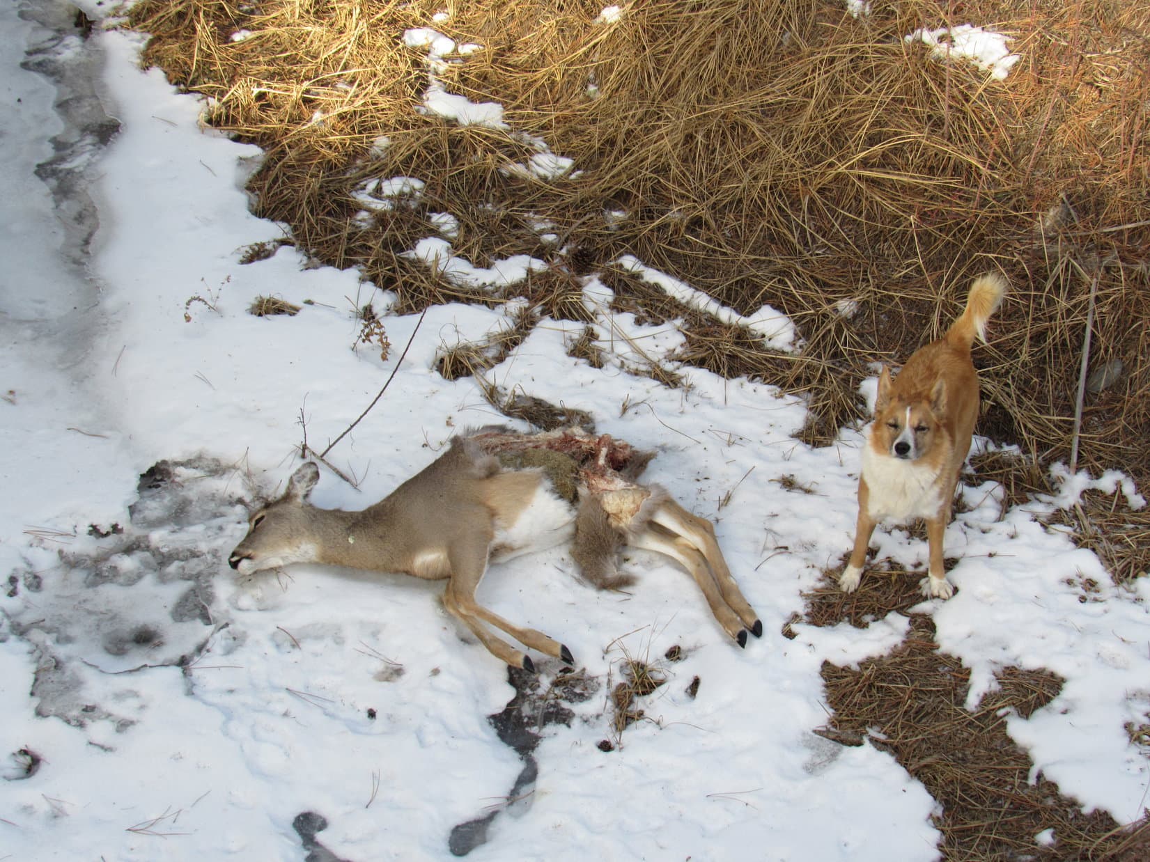
At 8:47 AM (35°F), SPHP parked the G6 just off Hwy 44W about 1/8 mile SE of USFS Road No. 167 (the road to Placerville Camp). Lupe and SPHP marched along a fence line outside of a big open field to get to No. 167. When Lupe reached the road, she made a sad discovery.
A small deer was laying dead and frozen on the ice over Deer Creek. Its hind quarters were badly damaged. Perhaps the poor deer had been hit by a car on Hwy 44, and had managed to drag itself only this far before succumbing to the traumatic injury.

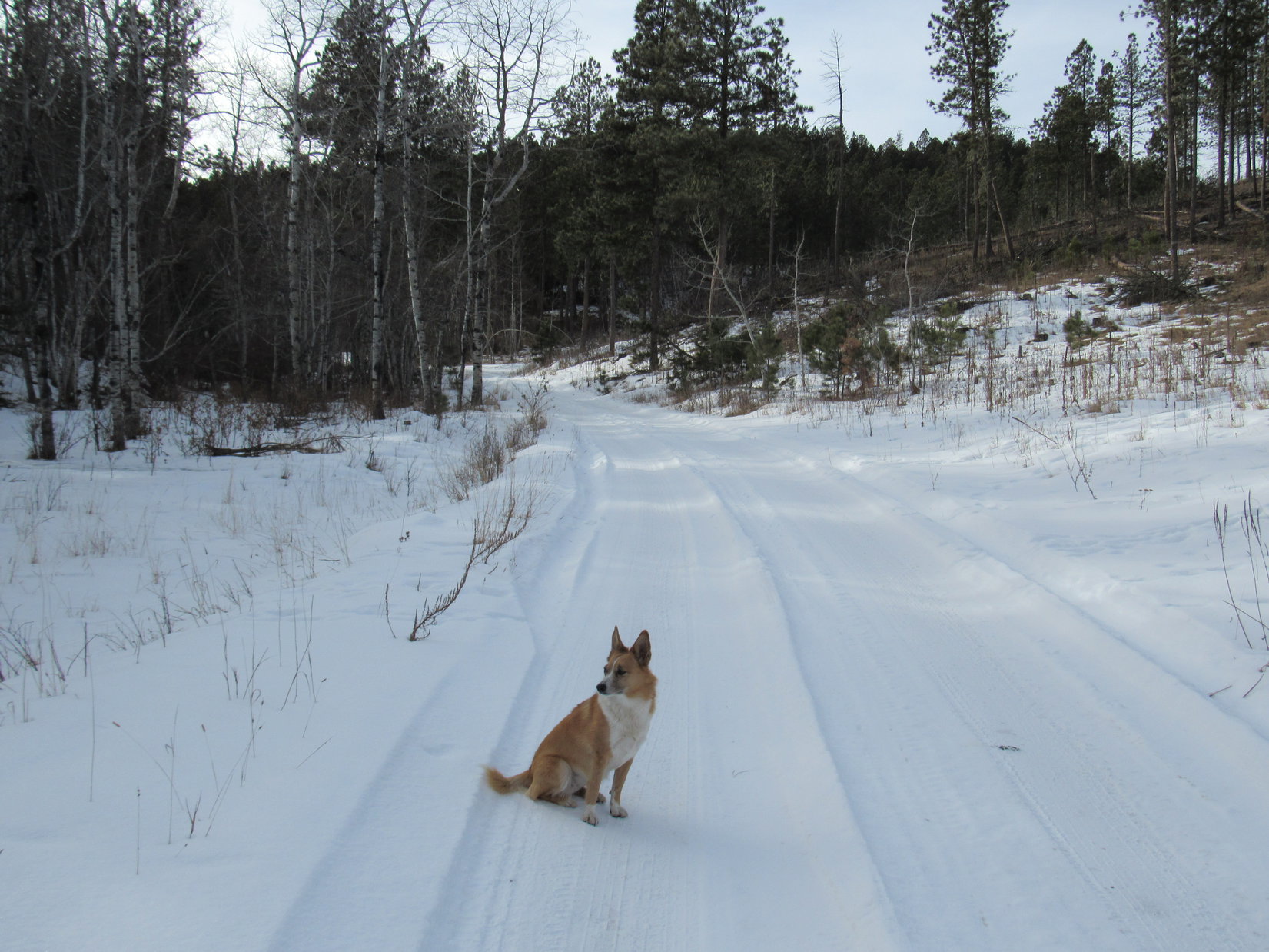
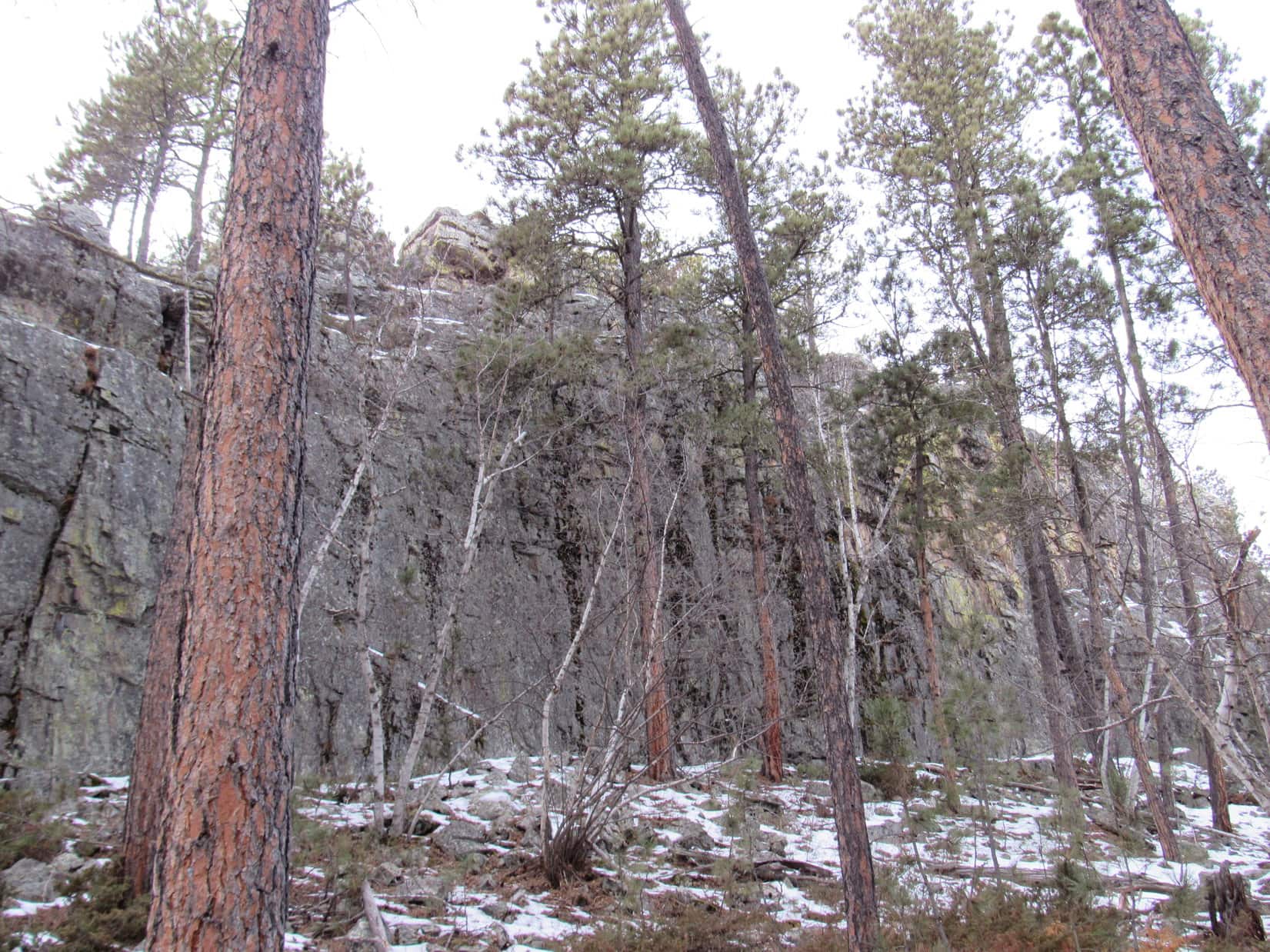
Lupe’s first peakbagging goal of the day was Perrin Mountain (5,212 ft.). Although SPHP originally had another route in mind, it looked pretty easy and enticing to just start up the N ridge.

There were a couple of high points along the easiest route up to Perrin Mountain from the N. The topo map showed a NW/SE running ridge at the first one, with the highest point at the NW end. When Lupe got up there, it looked like just another spot in the forest. There were a few rocks about a foot high around, but that was about it.
Peering SE through the forest, though, it looked like there might be something more interesting over there. Lupe and SPHP followed the short ridge to its SE end, where there was a large blocky rock formation. In fact, the rock formation at the SE end of the ridge is almost certainly a little higher than the map’s supposed highest point to the NW. Lupe and SPHP explored around to the SE end of the rocks, by going around the N side.


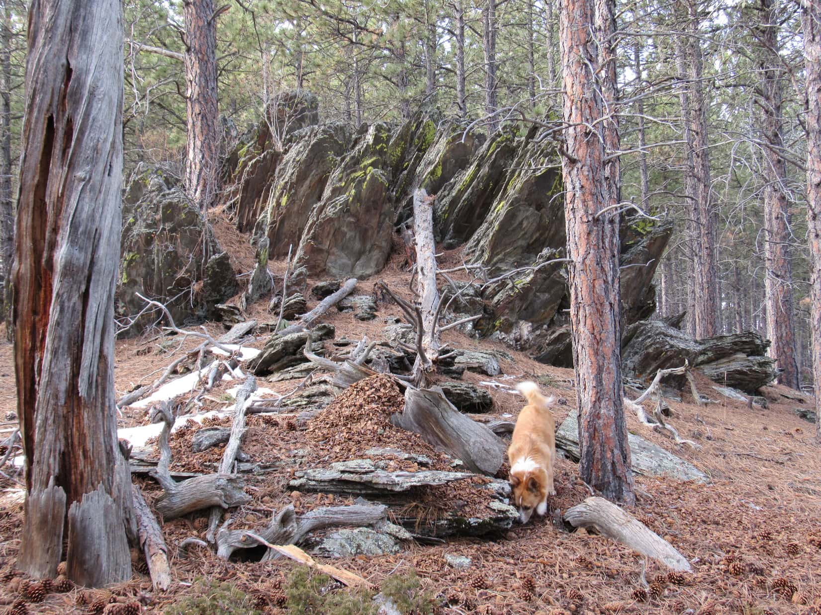
The second high point on the way to Perrin Mountain was about 0.25 mile SW of the first one. There were some interesting rock formations on the way to the second high point, but nothing too spectacular at the top.

Lupe went a little farther SW from the second high point, losing some elevation. Shortly after she started climbing up to the main Perrin Mountain ridge, she came to a snowy little road. It headed SE toward the summit, but didn’t go all the way there. At the end of the road, Lupe and SPHP were surprised to see a Subaru. Someone was inside it, too. Whoever it was, had car camped overnight.
That really was pretty extraordinary. In all of Lupe’s Black Hills, SD Expeditions, this was the first time she had come to anyone camped anywhere outside of a designated campground in the national forest. Since the person didn’t seem to be entirely up yet, Lupe and SPHP didn’t stop to chat, even though it would have been interesting to know more about the hardy soul who chose to car camp in January.
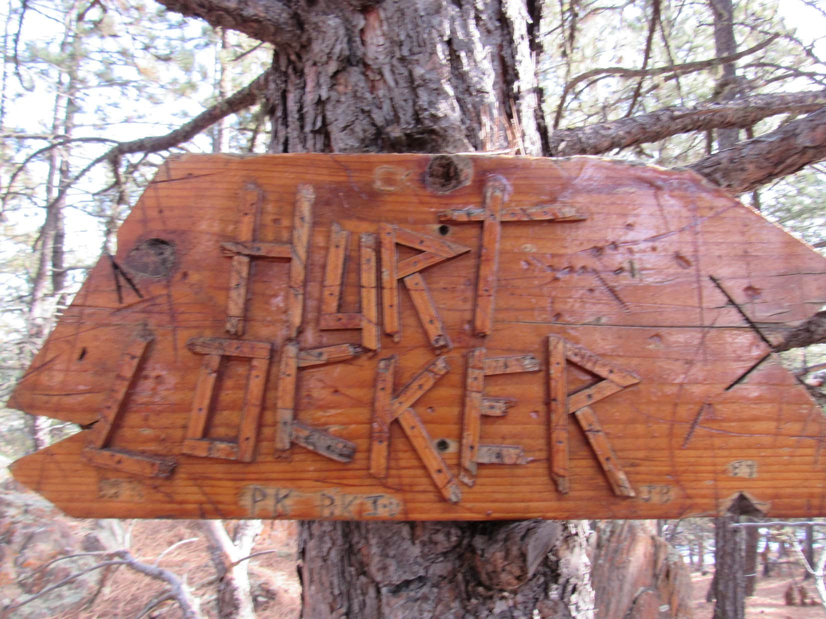
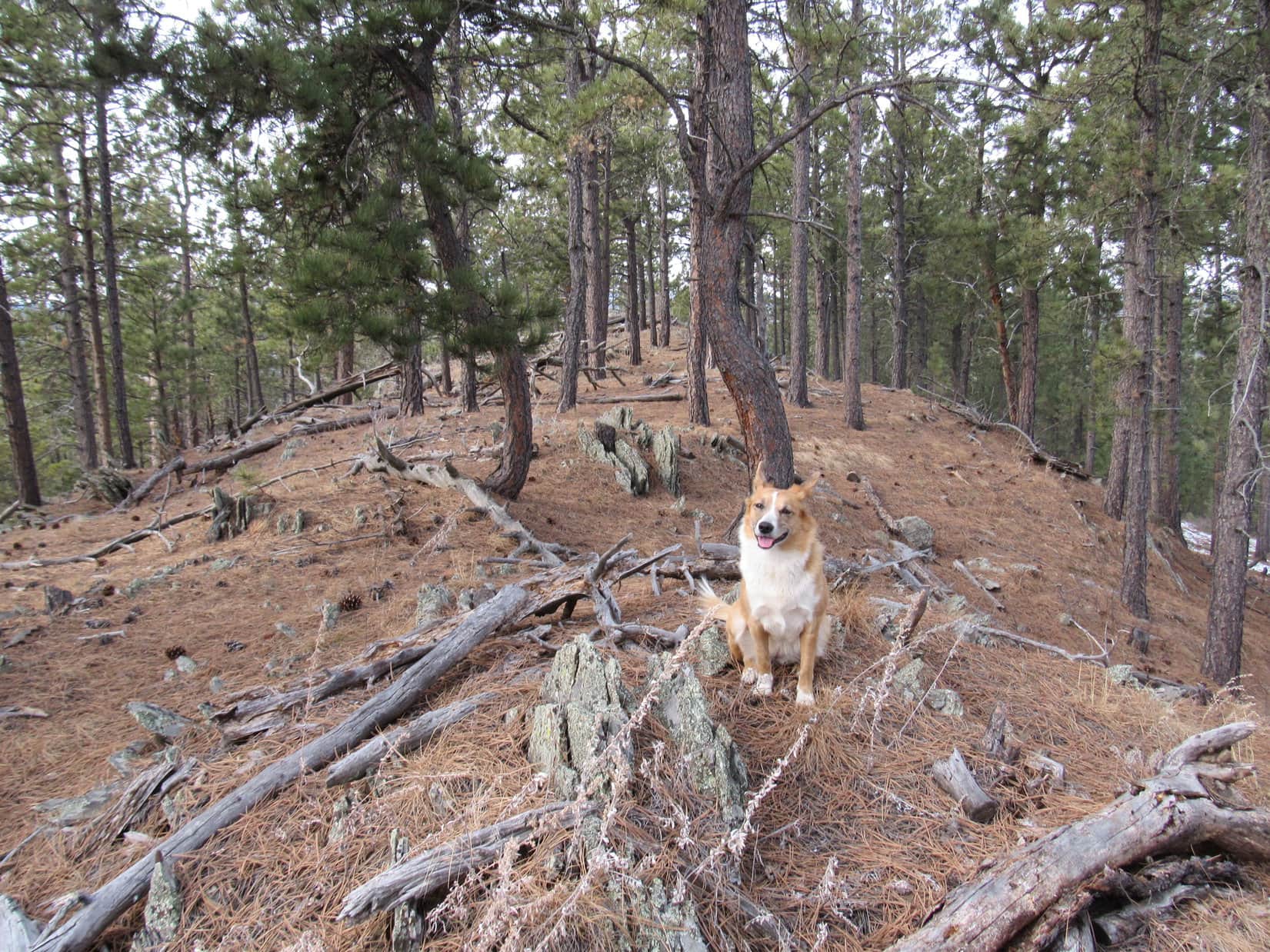
SPHP was surprised when Lupe found a trail leading from the end of the road to the top of Perrin Mountain. The faint trail looked like it didn’t get much use these days, but wasn’t hard to follow. The trail went all the way up to the summit. Actually, it went to a sign nailed to a tree just SE of the summit. The sign had the cryptic message “Hurt Locker”. If Lupe knew what the sign meant, she wasn’t saying. SPHP could divine no relevant meaning, since there was no locker of any sort in sight.
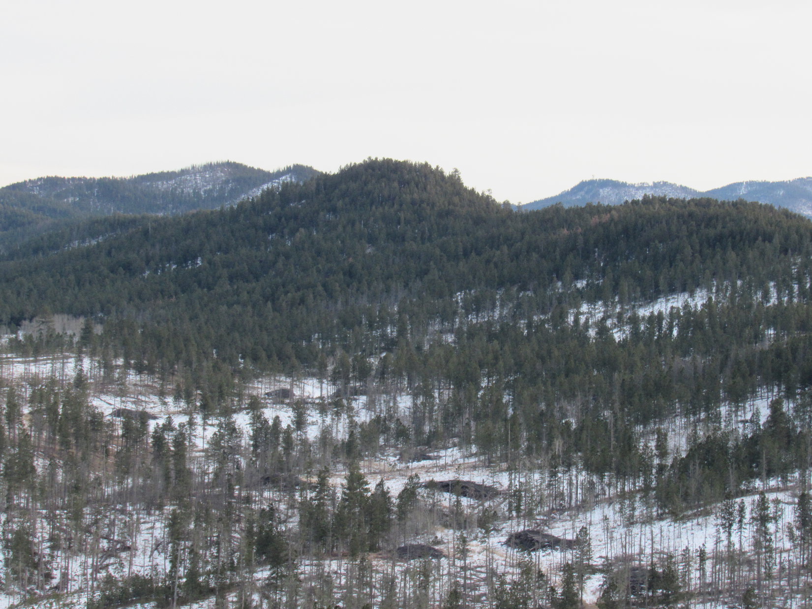
The summit of Perrin Mountain was maybe 25 feet NW of the odd Hurt Locker sign. There were a few rocks a couple of feet high there, but nothing more dramatic than that. The forest blocked the view in every direction.
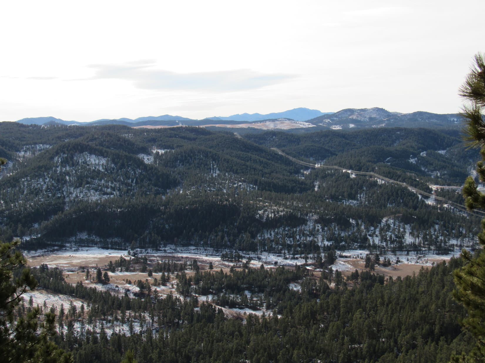
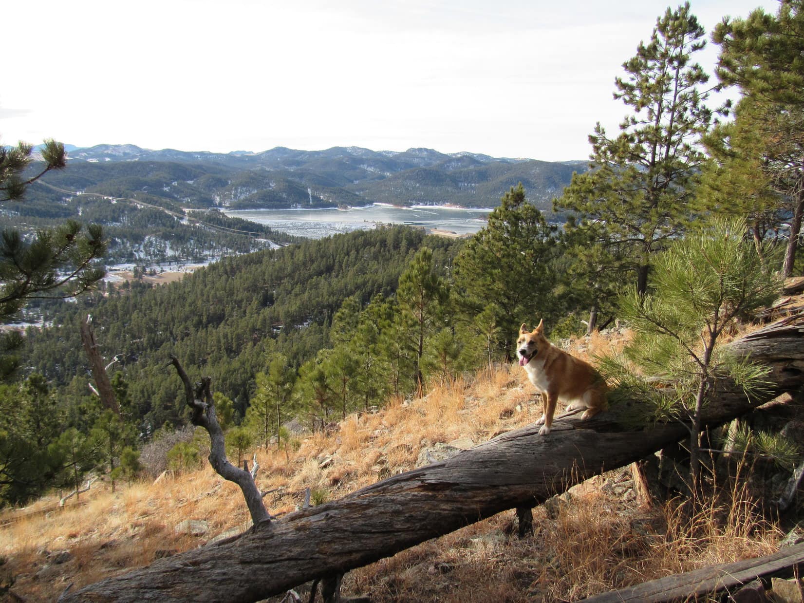
Perrin Mountain is less than a mile NE of Pactola Reservoir, the largest lake in the Black Hills. It was rather disappointing that there weren’t any clear views of the reservoir from the summit, or on the way to it. However, the trail continued SE on past the Hurt Locker sign. Although it was losing elevation along the way, maybe there would be a viewpoint from somewhere in that direction?
Lupe and SPHP followed the trail all the way down to where it ended, which wasn’t far from the summit. There were a couple of viewpoints along the trail, not wide open views, but better than anywhere else Lupe had found on Perrin Mountain. To the S, it was possible to see the large flat meadow Rapid Creek flows through E of the dam. To the SW, there was one spot with a pretty good look at part of Pactola Reservoir and the dam.
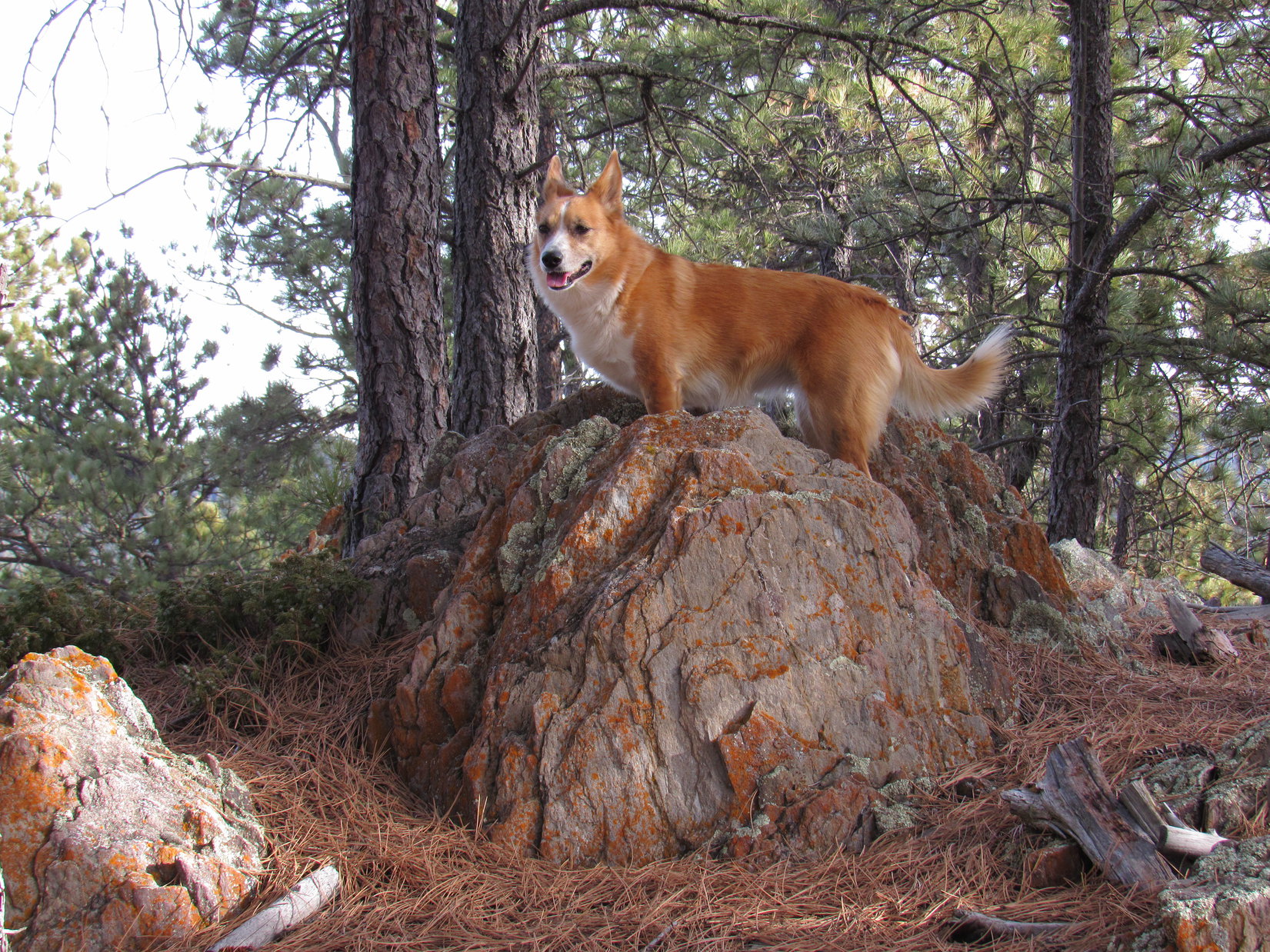
Lupe and SPHP climbed back up the trail heading NW to return to the summit. Lupe posed for another photo there, before starting on the way back to the G6.
There were other routes Lupe could have taken back to the G6, but the way Lupe had come up Perrin Mountain had been pretty cool. It was a nice, easy bit of wandering in the forest on ridges and saddles between high points. SPHP thought it might be fun to chat with the Subaru person on the way back, but by the time Lupe and SPHP got back to the little road, the Subaru was gone.
Lupe returned to both of the high points N of Perrin Mountain on her return to the G6. The only memorable event of the return trip was when she spotted a squirrel on her way from the second high point back to the first. The squirrel eluded her near an interesting rock outcropping, but Lupe didn’t give up easily. She sniffed around there for a while trying to figure out where that squirrel had disappeared to. SPHP finally made her move on before she had time to resolve the mystery.

By 12:01 PM (50°F), Lupe was back at the G6. There were a number of Lupe treasures scattered around, so SPHP picked most of them up for disposal later. With this much time left in the day, Lupe had at least one more peakbagging goal ahead of her. First though, Lupe and SPHP went to see if it would be possible to get a photo of Perrin Mountain from Pactola Reservoir.
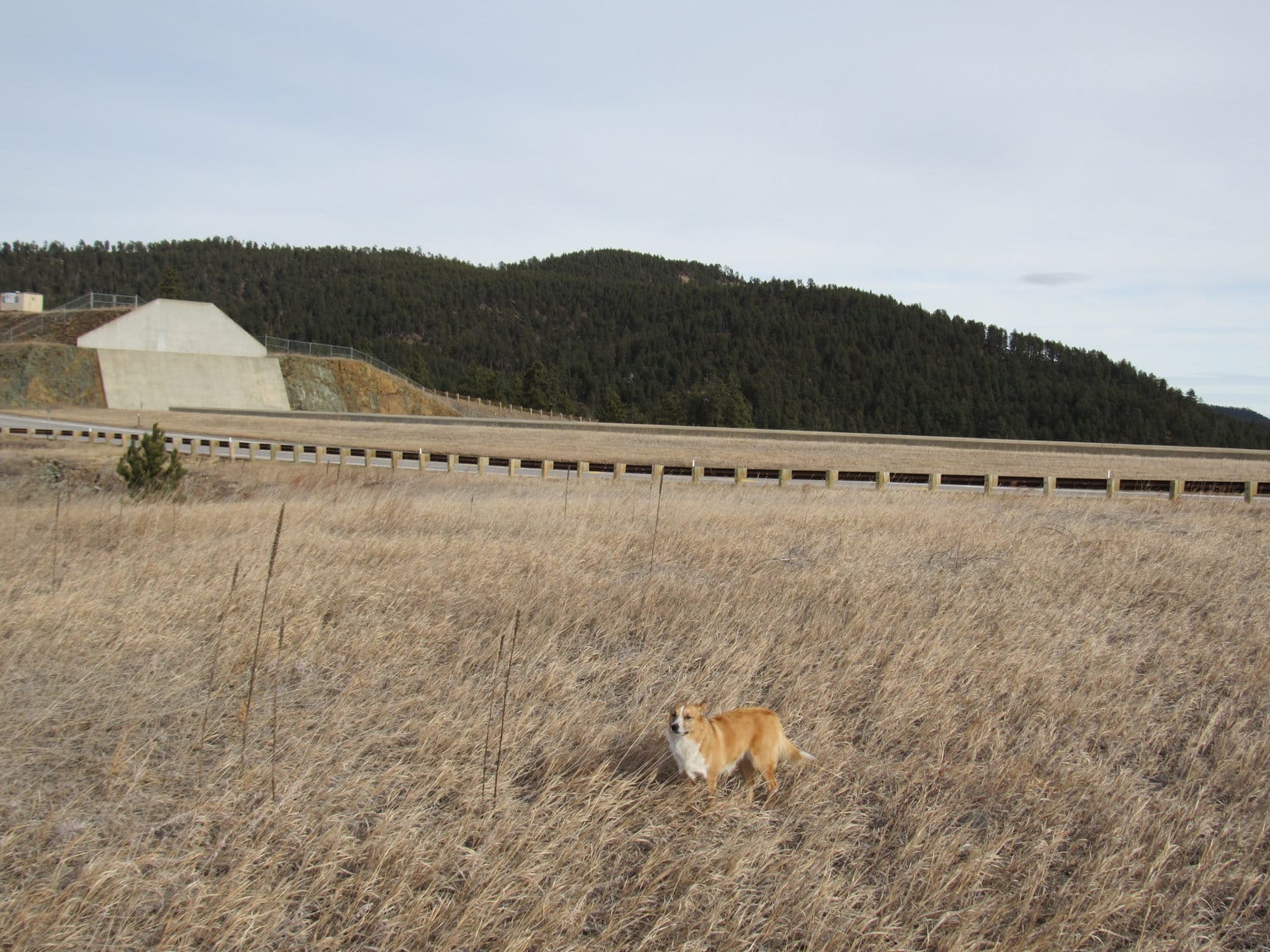
SPHP parked the G6 at the viewpoint at the N end of the dam near the spillway. The view of Perrin Mountain from near the spillway was none too impressive. It was a good thing Lupe went there, though. The place was kind of a mess. There were Lupe treasures all over the place. SPHP filled 5 plastic grocery bags full of them.

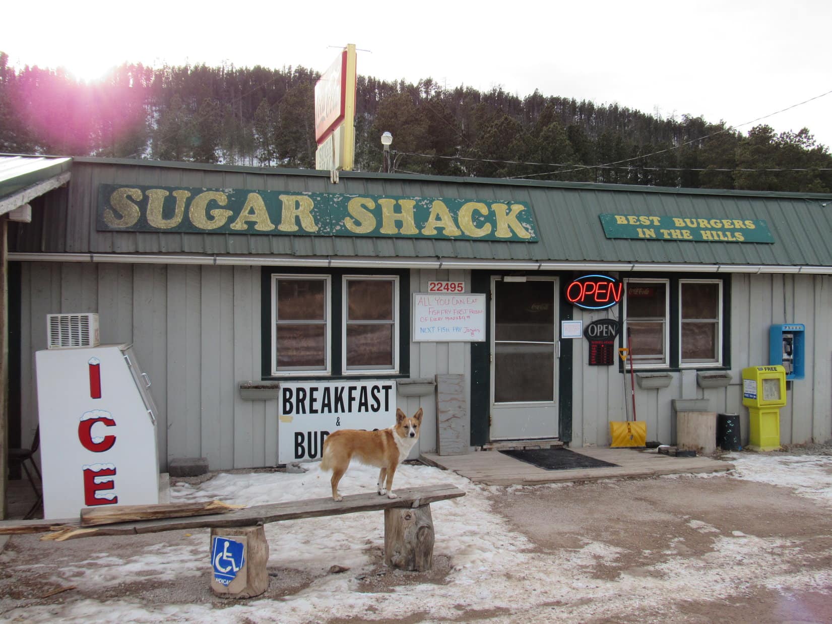
When SPHP was done collecting Lupe treasures at Pactola, Lupe and SPHP drove N on Hwy 385. SPHP turned W on Broad Gulch Road (USFS Road No. 676) about 0.5 mile S of the Sugar Shack. There was a place to park the G6 on the left, right after crossing a cattle guard close to Hwy 385.
At 12:53 PM (50°F), Lupe set out on her second peakbagging quest of the day. Her new goal was Merritt Peak (5,556 ft.). The first part of the journey was just a walk up snowy Broad Gulch Road. Lupe followed the road until it reached its highest point at a saddle.
Lupe and SPHP left Broad Gulch Road at the saddle, heading E into the forest. Surprisingly, there was a trail going this way, too. The trail went to the N end of the long ridge of which Merritt Peak is a part. It then turned and followed the ridge line S. Lupe and SPHP stayed on the trail all the way to Merritt Peak. The trail didn’t go quite all the way up to the top, instead passing just to the E of the summit.
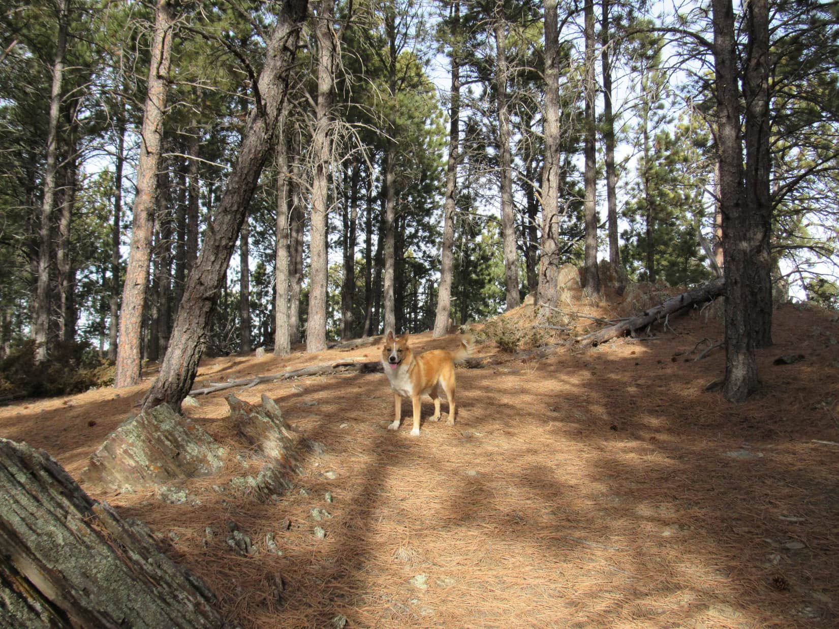
The trail appeared to continue on to the S, but Lupe and SPHP left it to climb the remaining short distance up to the top of Merritt Peak. The summit proved to be a ridge a few hundred feet long, and quite flat. There were small rock outcroppings scattered along the ridge. It was hard to tell which rock might be the highest point on the mountain. There were lots of possible candidates, none much higher than any of the others.
Merritt Peak was pretty heavily forested, but here and there it was possible to get a little bit of a view off into the distance in one direction or another. Enough could be seen between the trees so that it did seem like Lupe was up on a mountain, and not just in a thick forest. Lupe and SPHP came up near the S end of the ridge, so Lupe explored that end of the mountain first.


The N end of Merritt Peak was a bit rockier than the S end. Custer Peak (6,804 ft.) could be seen in the distance to the NNW. Minnesota Ridge was off to the NW. It was time to take a short break. Lupe was hearing gunfire off to the N, and was getting a little scared. She was hungry, too. She ate some Taste of the Wild. Whenever she heard the guns, though, she wanted to be right next to SPHP.
SPHP shared a jacket with Lupe. She was trembling a little bit, probably due to the gunfire, but the light N breeze was a bit cool, too.


Lupe had now achieved two peakbagging goals so far on Expedition No. 152. Both Perrin Mountain and Merritt Peak had turned out to be pretty fun, easy peaks. Originally, SPHP had a third possible peakbagging goal in mind for Lupe, but it was probably too late in the day to attempt that one.
However, there was another mountain pretty close by that Lupe might still have time to climb. Pilot Knob (5,440 ft.) was less than 3 miles N of Merritt Peak. SPHP knew the top of Pilot Knob was pretty rocky looking, maybe Lupe wouldn’t be able to climb it at all? In any case, there was enough daylight left to find out. Lupe would make an attempt on Pilot Knob.
After the break up on Merritt Peak, Lupe and SPHP went back down to the trail and headed N. Lupe didn’t turn W to go back to Broad Gulch Road when the trail did. Instead she continued N through the forest. Eventually she wound up down on Broad Gulch Road again, anyway. When she reached the G6, it was 2:43 PM (50°F).
On her way to the Pilot Knob trailhead of Centennial Trail No. 89, Lupe stopped by for a photo op at the Sugar Shack.
Despite having a Pilot Knob trailhead, Centennial Trail No. 89 does not actually go to Pilot Knob. The trail stays about a mile E of it. Lupe and SPHP started for Pilot Knob on Centennial Trail No. 89, but eventually had to leave it to turn W near Boodleman Spring.
Lupe and SPHP wandered through the forest in the general direction of Pilot Knob. There was a maze of little roads going this way and that. Lupe and SPHP took them when they seemed to be going the right direction. Often they weren’t. As Lupe got closer to Pilot Knob, the ground got steeper.
What Lupe found approaching the summit from the E was surprising. SPHP had expected the top of Pilot Knob to be rocky, but the E face was a vertical cliff. It looked like the rock had been sliced with a knife. There was no way Lupe and SPHP could go up the E face of the mountain! Would there be another way?
Since Lupe reached Pilot Knob near the SE end of the mountain, Lupe and SPHP went around the S end over to the W side. The wall of rock really wasn’t terribly thick, so it wasn’t very far to get over there. Most of the W face of Pilot Knob was every bit as high and vertical as the E face had been, but at the SW corner there was an area of broken rock that didn’t look too bad.
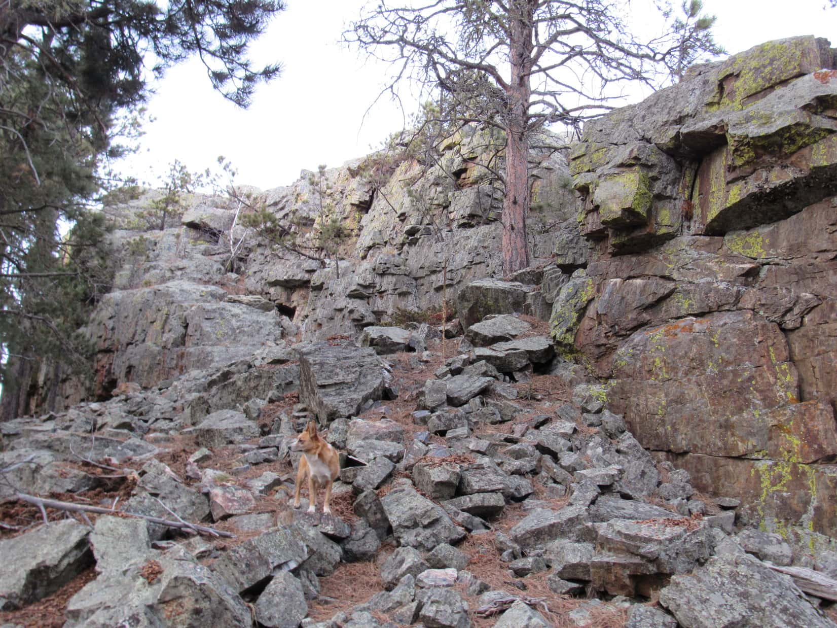
Lupe and SPHP started climbing. There was some snow and ice in the shady spots, so it was slick in some places. Lupe and SPHP succeeded in getting up on the very S end of the ridge. SPHP abandoned the backpack at a cleft in the rock. The ridge was only 10 or 12 feet wide at the S end, with sheer drops to the E and W, but there were good hand and foot holds. Lupe seemed to have no trouble at all. SPHP climbed slowly and deliberately.
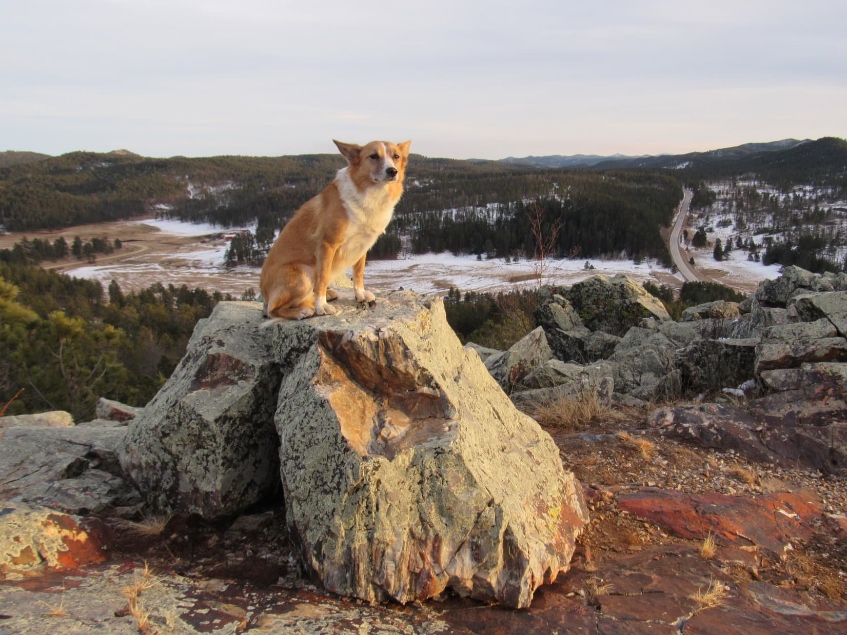
The solid rock ridge got wider and higher as Lupe climbed toward the N. The E & W cliffs got taller, too, but there was more space to stay away from them. The easiest way up proved to be along the E side of a rock wall up on the ridge. If the climb had been much more challenging, SPHP would have just given up on it. As it was, it was a pretty fun little Class 3 scramble. Lupe and SPHP made it to the summit to claim Lupe’s third peakbagging success of the day!
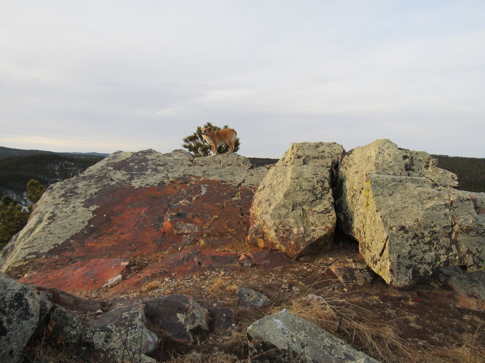
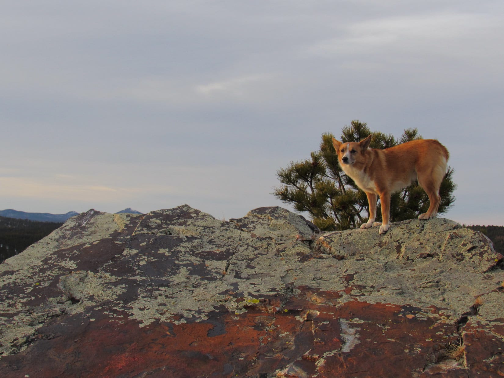
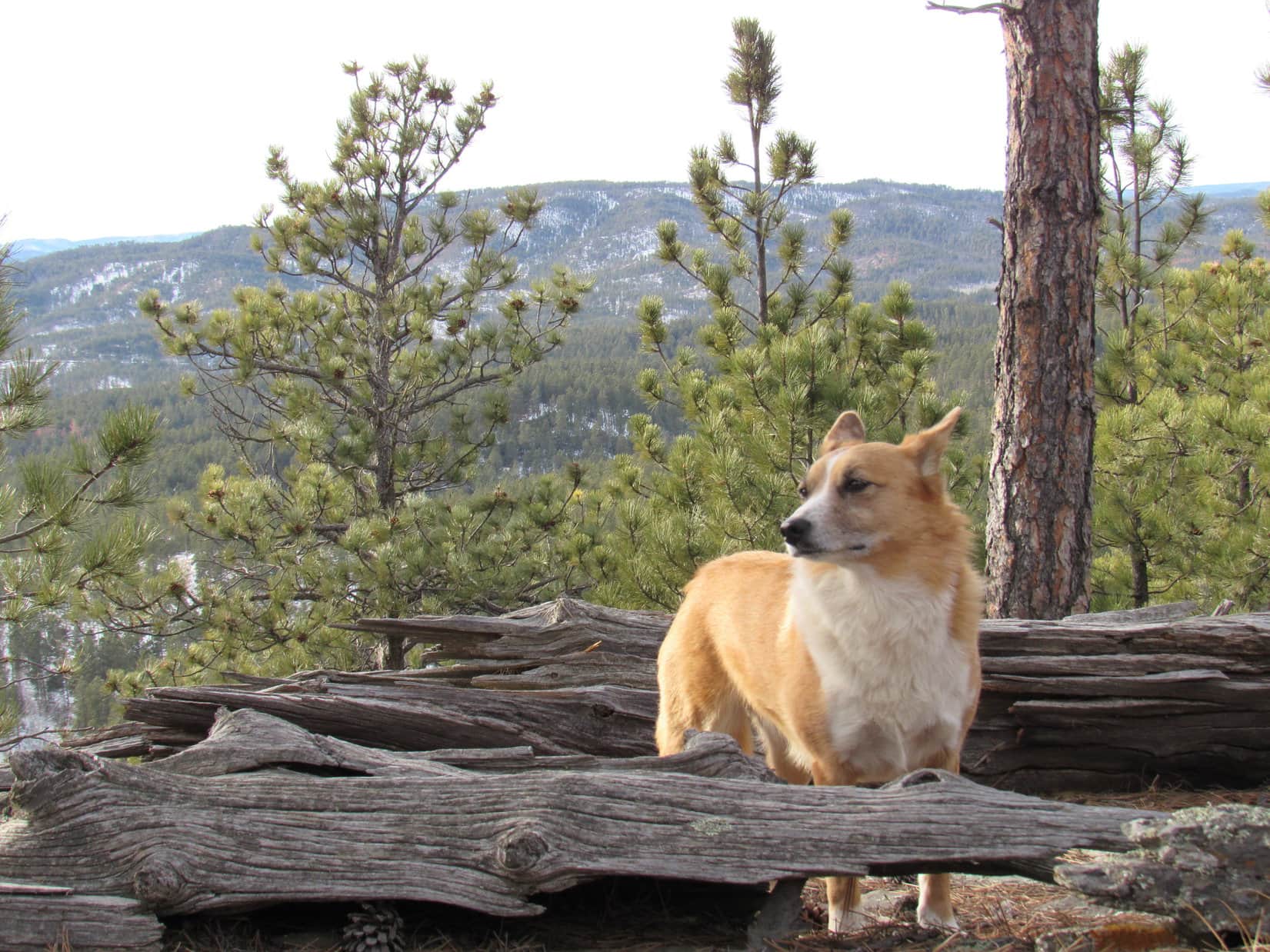
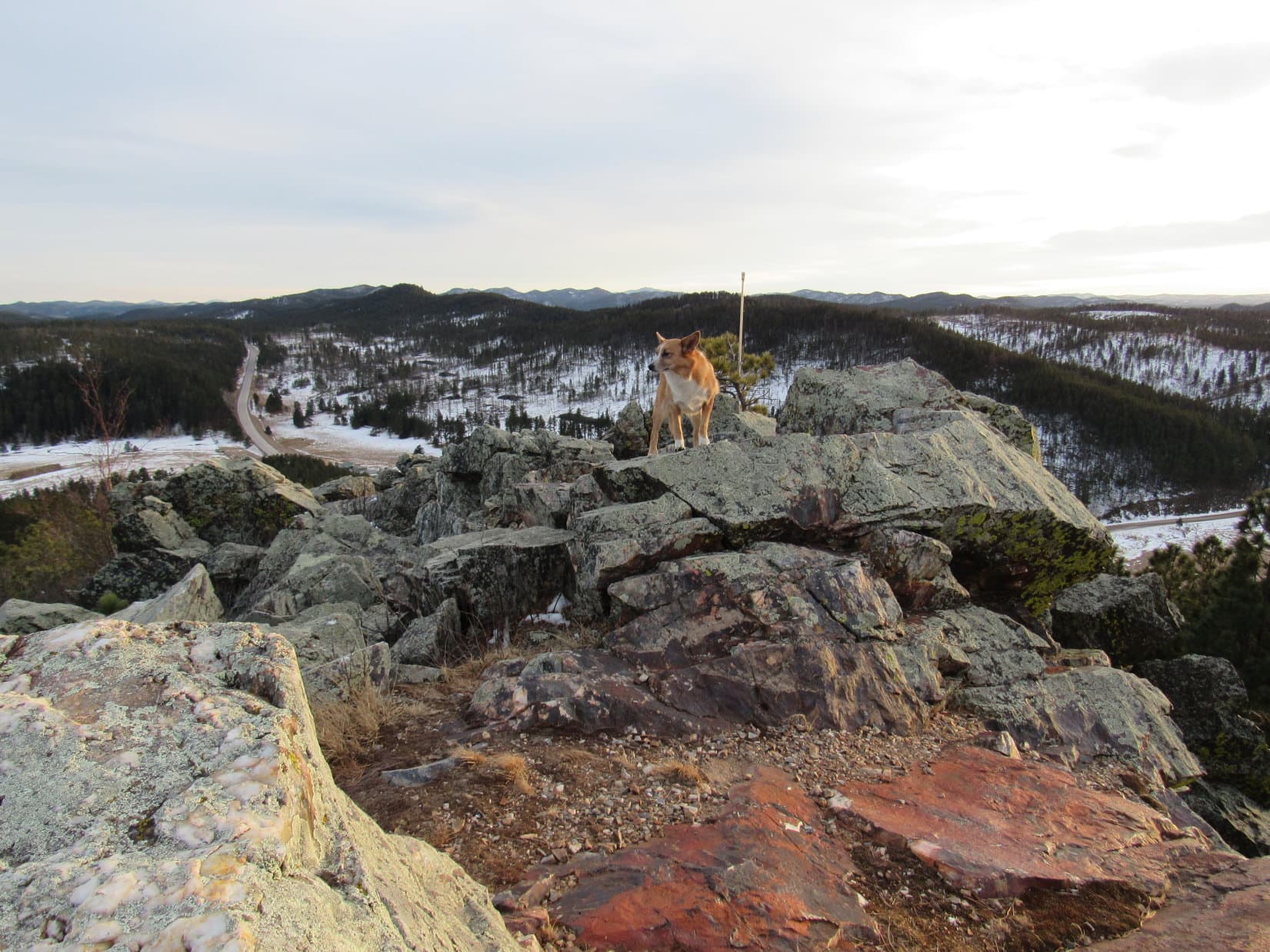
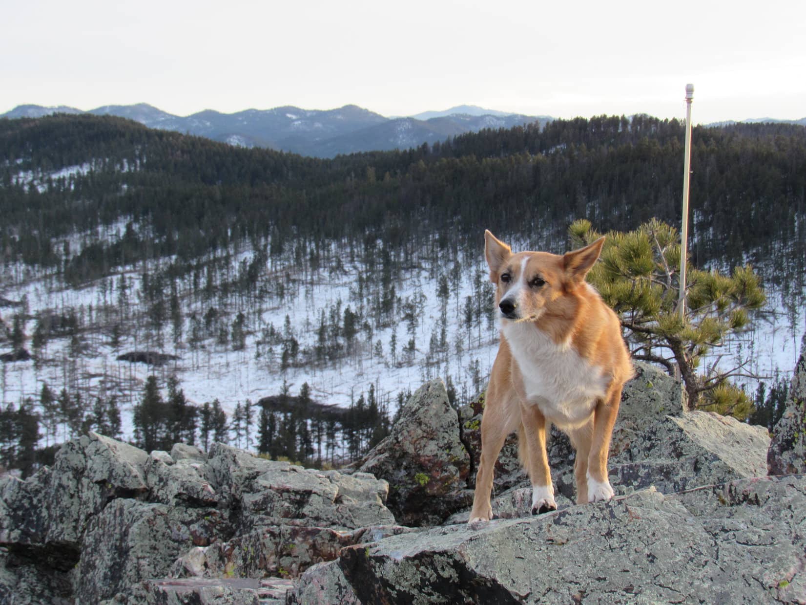
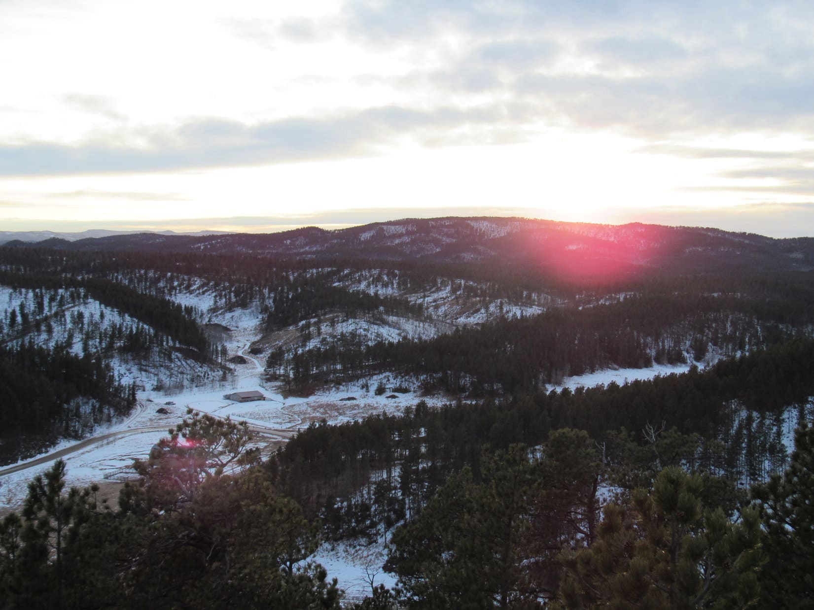
Since Pilot Knob was so rocky, there were unobstructed 360° views from the top. The views were the best of the day! SPHP was loving it, but Lupe wasn’t. Somewhere there was construction going on not too far away, with a lot of banging going on. There was also a considerable amount of gunfire off to the W. Someone must have been doing some target practice, since it went on and on.
SPHP persuaded Lupe to get up on some of the rocks for photos, but the gunfire made her quite nervous. Mostly she just wanted to lay right on SPHP’s lap being petted. That was OK! Pilot Knob was a great place to sit and take in the views. Lupe and SPHP stayed up there at least half an hour gazing at the pretty world. Pilot Knob turned out to be a great way to end a successful day of peakbagging!
The sun was very low on the horizon. SPHP considered staying for the sunset, but there were quite a few clouds off to the W. Maybe the sun was just going to sink into the clouds without putting on a show. Since it was a bit tricky getting up here, perhaps it was best for Lupe to get down off the rocky summit while the light was still good. Still, Lupe and SPHP would have stayed up there, if the sunset had been more promising.
Getting down was slow, but really no problem. SPHP retrieved the backpack. Lupe and SPHP circled around the mountaintop to the W and N, just to see what it all looked like. The W face was even more impressive than the E face. There might be an easy way up at the N end of the mountain, but SPHP had doubts it was any easier than Lupe’s route had been.

As Lupe and SPHP left Pilot Knob behind, heading E again through the forest, the clouds to the W developed a rosy glow. What little Lupe could see of the sunset looked pretty. It was better than most, but wasn’t particularly brilliant. In 10 or 15 minutes, it was all over. The rosy glow faded from the sky.
Expedition No. 152 ended like so many others, with another march through darkening forests and fields back to the G6. It had been a fun day. Three peaks climbed. All different, but each one a good time in its own way.
Lupe was already back on Centennial Trail No. 89 not far from the G6, when she heard them. The wild dogs, the coyotes, were howling out there somewhere to the S. Several times, Lupe stopped and stood still with her ears straight up listening. She made no sound. SPHP wondered what she was thinking.
At 5:38 PM (38°F), Lupe was back at the G6. After eating snow all day, she wanted water. When she’d had enough, she hesitated just a moment before getting in the G6. SPHP asked if she wanted to stay out and live with the coyotes? In January? At the very thought, the Carolina Dog jumped up into the G6. Maybe another time. Tonight – Alpo, a soft bed and warm blankie!
Links:
Next Black Hills Expedition Prior Black Hills Expedition
Want more Lupe adventures? Choose from Lupe’s Black Hills Expeditions Adventure Index or Master Adventure Index. Or subscribe free to new Lupe adventures.